

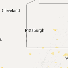
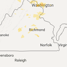
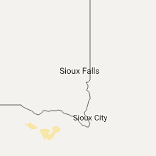
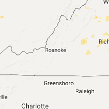
Hail Map for Monday, August 15, 2016

Number of Impacted Households on 8/15/2016
0
Impacted by 1" or Larger Hail
0
Impacted by 1.75" or Larger Hail
0
Impacted by 2.5" or Larger Hail
Square Miles of Populated Area Impacted on 8/15/2016
0
Impacted by 1" or Larger Hail
0
Impacted by 1.75" or Larger Hail
0
Impacted by 2.5" or Larger Hail


Cities Most Affected by Hail Storms of 8/15/2016
| Hail Size | Demographics of Zip Codes Affected | ||||||
|---|---|---|---|---|---|---|---|
| City | Count | Average | Largest | Pop Density | House Value | Income | Age |
Hail and Wind Damage Spotted on 8/15/2016
Filter by Report Type:Hail ReportsWind Reports
States Impacted
Virginia, Utah, West Virginia, Tennessee, South Dakota, Maryland, Kentucky, Ohio, Indiana, Georgia, NebraskaVirginia
| Local Time | Report Details |
|---|---|
| 1:45 PM EDT | Several trees down on norway avenue in city of roanoke county VA, 3.3 miles W of Roanoke, VA |
| 1:53 PM EDT | Seven trees down in the western portion of the city of roanoke...time estimated from radar in city of roanoke county VA, 3 miles WNW of Roanoke, VA |
| 3:04 PM EDT | Wires down near the intersection of honeysuckle avenue and senedo roa in shenandoah county VA, 70.4 miles E of Elkins, WV |
| 3:30 PM EDT | Numerous trees dow in scott county VA, 20.2 miles W of Bristol, TN |
| 3:53 PM EDT | Tree down blocking roadway near the intersection of rocky lane and redmon lan in warren county VA, 87.1 miles E of Elkins, WV |
| 5:02 PM EDT | Tree down blocking elvan road near kalb school lan in loudoun county VA, 56.9 miles W of Baltimore, MD |
| 6:09 PM EDT | Tree down on lucks road at valentine drive in spotsylvania county VA, 36.5 miles N of Richmond, VA |
| 6:10 PM EDT | Tree down blocking stonehouse mountain road in the 13000 bloc in culpeper county VA, 73.6 miles NNW of Richmond, VA |
| 6:18 PM EDT | Tree down on belmont road at day dream court in spotsylvania county VA, 43.7 miles NNW of Richmond, VA |
| 6:27 PM EDT | Tree down on gatwood at edenton road in spotsylvania county VA, 39.8 miles N of Richmond, VA |
| 6:31 PM EDT | Tree down on partlow road at duerson lane in spotsylvania county VA, 41.1 miles N of Richmond, VA |
| 6:32 PM EDT | Ten inch in diameter tree down blocking the roadway near the intersection of mount zion church road and carter lan in culpeper county VA, 73.6 miles NNW of Richmond, VA |
| 6:36 PM EDT | Tree down on deerskin drive at buckskin lane in spotsylvania county VA, 52.4 miles N of Richmond, VA |
| 6:37 PM EDT | One tree down near the intersection of power dam road and scenic river driv in franklin county VA, 19.8 miles SSE of Roanoke, VA |
| 6:47 PM EDT | Twenty inch in diameter tree uprooted along chestnut fork roa in culpeper county VA, 71.8 miles NNW of Richmond, VA |
| 6:58 PM EDT | Tree down on mansfield street at first street in spotsylvania county VA, 54 miles NNE of Richmond, VA |
| 6:59 PM EDT | One tree down near the intersection of jerusalem church road and pattie road and manteo road in buckingham county VA, 54.7 miles W of Richmond, VA |
| 6:59 PM EDT | One tree down near the intersection of jerusalem church road and pattie road and manteo road in buckingham county VA, 53.7 miles WNW of Richmond, VA |
| 7:15 PM EDT | Multiple trees down including one on a house near the intersection of warrenton road and route in stafford county VA, 57.2 miles N of Richmond, VA |
| 7:15 PM EDT | Tree down in the 600 block of perry driv in stafford county VA, 57.6 miles NNE of Richmond, VA |
| 7:20 PM EDT | Tree down in the 200 block of cranes corner roa in stafford county VA, 60.9 miles N of Richmond, VA |
| 7:20 PM EDT | Tree down near the intersection of kellogg mill road and ramoth church roa in stafford county VA, 64 miles N of Richmond, VA |
| 7:20 PM EDT | Tree down on cruiser driv in stafford county VA, 66.9 miles NNE of Richmond, VA |
| 7:38 PM EDT | Tree down on joplin road at mawazi road in prince william county VA, 66.2 miles SW of Baltimore, MD |
| 7:47 PM EDT | Tree down on wires on cronin drive in prince william county VA, 56.1 miles SW of Baltimore, MD |
| 7:54 PM EDT | Tree down on house on hoffman drive in prince william county VA, 58.3 miles SW of Baltimore, MD |
| 7:54 PM EDT | Tree down on cavalier drive at smoketown road in prince william county VA, 57.1 miles SW of Baltimore, MD |
| 8:34 PM EDT | One tree down on bishop creek roa in buckingham county VA, 45.8 miles W of Richmond, VA |
Utah
| Local Time | Report Details |
|---|---|
| 11:50 AM MDT | Diddle knoll sensor dpg27 in tooele county UT, 67 miles W of Salt Lake City, UT |
| 2:25 PM MDT | Simpson springs dpg21 in tooele county UT, 80.2 miles SW of Salt Lake City, UT |
| 3:10 PM MDT | English village sensor dpg07 in tooele county UT, 57.5 miles SW of Salt Lake City, UT |
West Virginia
| Local Time | Report Details |
|---|---|
| 2:40 PM EDT | Trees reported down along us 250. time estimated from rada in taylor county WV, 33.3 miles NNW of Elkins, WV |
| 4:40 PM EDT | Wires down in the 200 block of east liberty stree in jefferson county WV, 67 miles W of Baltimore, MD |
| 4:40 PM EDT | Tree down near the intersection of mcdonald street and west third avenu in jefferson county WV, 67.6 miles W of Baltimore, MD |
| 4:42 PM EDT | Tree down near the intersection of willow spring drive and prospect avenu in jefferson county WV, 66.5 miles W of Baltimore, MD |
| 4:44 PM EDT | Wires down in the 300 block of old shennandale roa in jefferson county WV, 67.2 miles W of Baltimore, MD |
| 4:53 PM EDT | Wires down in the 500 block of fillmore stree in jefferson county WV, 60.6 miles W of Baltimore, MD |
| 4:57 PM EDT | Wires down near the intersection of harpers ferry road and sandy hook roa in washington county MD, 60.1 miles W of Baltimore, MD |
| 5:23 PM EDT | One tree down in wililamso in mingo county WV, 58.2 miles SW of Charleston, WV |
Tennessee
| Local Time | Report Details |
|---|---|
| 2:50 PM EDT | Few trees dow in washington county TN, 25.2 miles WSW of Bristol, TN |
| 3:00 PM EDT | Few trees dow in hawkins county TN, 27.5 miles W of Bristol, TN |
| 3:00 PM EDT | Roof blown off a barn on hog hollow roa in washington county TN, 19.1 miles SW of Bristol, TN |
South Dakota
| Local Time | Report Details |
|---|---|
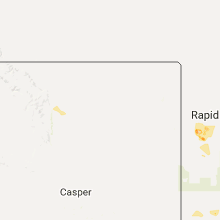
| 2:25 PM MDT | Quarter sized hail reported near Custer, SD, 23 miles SW of Rapid City, SD |
| 3:12 PM MDT | Quarter sized hail reported near Rapid City, SD, 16 miles W of Rapid City, SD |
| 3:25 PM MDT | Quarter sized hail reported near Rapid City, SD, 13.8 miles WSW of Rapid City, SD |
| 5:30 PM MDT | Quarter sized hail reported near Hot Springs, SD, 44.8 miles SSW of Rapid City, SD |
| 7:32 PM CDT | Half Dollar sized hail reported near Bowdle, SD, 61.1 miles W of Aberdeen, SD, slightly smaller than ping pong ball... radar estimated time. |
| 9:23 PM CDT | Also observed nickle sized hail at 9:27 p in walworth county SD, 75.5 miles W of Aberdeen, SD |
Maryland
| Local Time | Report Details |
|---|---|
| 4:48 PM EDT | Tree down in the 600 block of petersville roa in frederick county MD, 54.7 miles W of Baltimore, MD |
| 4:53 PM EDT | Wires down in the 1300 block of rosemont driv in frederick county MD, 54.8 miles W of Baltimore, MD |
| 4:55 PM EDT | Tree down in the 3500 block of south mountain roa in frederick county MD, 56.9 miles W of Baltimore, MD |
| 5:35 PM EDT | Storm damage reported in montgomery county MD, 31.3 miles WSW of Baltimore, MD |
| 5:51 PM EDT | Multiple trees down in the olney and sandy spring areas...including one onto a hous in montgomery county MD, 26.1 miles WSW of Baltimore, MD |
| 5:54 PM EDT | Tree down near the intersection of olney laytonsville road and brookeville roa in montgomery county MD, 27.9 miles WSW of Baltimore, MD |
| 5:55 PM EDT | Tree down in the 17600 block of norwood roa in montgomery county MD, 24.6 miles WSW of Baltimore, MD |
| 6:00 PM EDT | Tree onto house in the 8500 block of flower avenu in montgomery county MD, 29 miles SW of Baltimore, MD |
| 6:00 PM EDT | Quarter sized hail reported near Ashton, MD, 23.9 miles WSW of Baltimore, MD |
| 6:00 PM EDT | Multiple trees down on both avenleigh drive and cliftonbrook lane in montgomery county MD, 23.9 miles WSW of Baltimore, MD |
| 6:09 PM EDT | Multiple trees down on wires in the burtonsville are in montgomery county MD, 21.2 miles SW of Baltimore, MD |
| 6:13 PM EDT | Multiple trees down on wire in prince georges county MD, 18.8 miles SW of Baltimore, MD |
| 6:20 PM EDT | Multiple trees down on the south side of columbi in howard county MD, 15.9 miles WSW of Baltimore, MD |
| 6:25 PM EDT | Multiple trees and wires dow in prince georges county MD, 29.2 miles SW of Baltimore, MD |
| 6:34 PM EDT | Storm damage reported in anne arundel county MD, 10.8 miles SSW of Baltimore, MD |
| 6:36 PM EDT | Trees down on wires on amberton driv in howard county MD, 10.2 miles SW of Baltimore, MD |
| 7:05 PM EDT | Storm damage reported in anne arundel county MD, 16.3 miles SSE of Baltimore, MD |
| 8:30 PM EDT | Several trees down along livingston road...including one onto a hous in prince georges county MD, 46.8 miles SSW of Baltimore, MD |
Kentucky
| Local Time | Report Details |
|---|---|
| 5:10 PM EDT | Tree down...around 4 inches in diameter in pike county KY, 70.3 miles SW of Charleston, WV |
Ohio
| Local Time | Report Details |
|---|---|
| 5:34 PM EDT | Tree knocked down near summerville lane. time estimated from rada in butler county OH, 20.3 miles N of Cincinnati, OH |
| 5:35 PM EDT | Tree knocked down and blocking sheffield roa in hamilton county OH, 11.3 miles N of Cincinnati, OH |
Indiana
| Local Time | Report Details |
|---|---|
| 5:54 PM EDT | Multiple reports of wind damage in the area of county road 150 north and county road 600 east. time approx and based on rada in hendricks county IN, 13.9 miles W of Indianapolis, IN |
| 6:00 PM EDT | Three foot diameter live tree uprooted in the area of warren lane and hammons driv in hendricks county IN, 15 miles WNW of Indianapolis, IN |
| 6:00 PM EDT | Tree limbs up to about 1.5 inche down. traffic light down. picnic tables overturned. time approx and based on rada in hendricks county IN, 14 miles WNW of Indianapolis, IN |
| 6:00 PM EDT | Tree limbs 6 to 8 inches in diameter blown down. time approx and based on rada in hendricks county IN, 16.5 miles WNW of Indianapolis, IN |
| 6:08 PM EDT | Trees and tree limbs down. one tree is on roadwa in hendricks county IN, 15.7 miles WNW of Indianapolis, IN |
| 6:10 PM EDT | Storm debris west of the brownsburg lowes...which is located on northfield drive 1 mile west of state road 26 in hendricks county IN, 15 miles WNW of Indianapolis, IN |
| 6:15 PM EDT | Several large trees down along north county road 650 east. bean field flattene in hendricks county IN, 17 miles WNW of Indianapolis, IN |
| 6:20 PM EDT | Storm damage. time approx and based on rada in boone county IN, 16.1 miles NW of Indianapolis, IN |
| 6:22 PM EDT | Tree limbs up to 6 inches in diameter blown down in vicinity of 700 east and 550 south. time approx and based on rada in boone county IN, 16.1 miles NW of Indianapolis, IN |
| 6:24 PM EDT | Significant debris and structural damage in area of county road 400 south and 800 eas in boone county IN, 19 miles NW of Indianapolis, IN |
| 6:24 PM EDT | Road closed by fallen tree. power out in area. time approx and based on rada in boone county IN, 17.3 miles NNW of Indianapolis, IN |
| 6:25 PM EDT | Dhs relayed report from fire marshall of strong rotation and debris in the air at state road 136 and state road 267 that lasted about 1 minute moving north. winds estim in hendricks county IN, 13.7 miles WNW of Indianapolis, IN |
| 6:42 PM EDT | Considerable debris in hendricks county IN, 12.3 miles WNW of Indianapolis, IN |
| 6:49 PM EDT | Many tree limbs down and at least one tree at 700 east and 550 south in boone county IN, 16.1 miles NW of Indianapolis, IN |
| 8:00 PM EDT | Barn and crop damage near 1350n and 100e. video of tornado touching down. time is approximate and may need to be adjusted in howard county IN, 51.1 miles NNE of Indianapolis, IN |
Georgia
| Local Time | Report Details |
|---|---|
| 7:12 PM EDT | Tree down in morven on hwy 76 in brooks county GA, 54.8 miles SW of Douglas, GA |
| 7:15 PM EDT | Tree down on power line resulting in a power outage to 54 customers along gin street on the west site of morven. reported on georgia power outage map in brooks county GA, 55.2 miles SW of Douglas, GA |
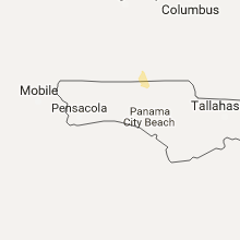
| 7:35 PM EDT | Tree down near intersection of kennedy hill road and coffee road in brooks county GA, 52.3 miles NE of Tallahassee, FL |
Nebraska
| Local Time | Report Details |
|---|---|
| 9:15 PM MDT | Storm damage reported in box butte county NE, 44 miles ENE of Scottsbluff, NE |
| 11:40 PM MDT | Quarter sized hail reported near Ogallala, NE, 49.9 miles W of North Platte, NE, law enforcement reported dime to quarter size hail and high winds. parts of ogallala without power |
Connect with Interactive Hail Maps