

Hail Map for Thursday, August 16, 2018

Number of Impacted Households on 8/16/2018
0
Impacted by 1" or Larger Hail
0
Impacted by 1.75" or Larger Hail
0
Impacted by 2.5" or Larger Hail
Square Miles of Populated Area Impacted on 8/16/2018
0
Impacted by 1" or Larger Hail
0
Impacted by 1.75" or Larger Hail
0
Impacted by 2.5" or Larger Hail


Cities Most Affected by Hail Storms of 8/16/2018
| Hail Size | Demographics of Zip Codes Affected | ||||||
|---|---|---|---|---|---|---|---|
| City | Count | Average | Largest | Pop Density | House Value | Income | Age |
| Cedar Point, KS | 2 | 1.88 | 2.00 | 2 | $31k | $33.6k | 49.8 |
| Leon, KS | 1 | 1.75 | 1.75 | 8 | $61k | $44.6k | 42.5 |
| Athens, IL | 1 | 1.75 | 1.75 | 55 | $101k | $47.6k | 37.4 |
| Americus, KS | 1 | 1.75 | 1.75 | 16 | $60k | $38.9k | 39.7 |
Hail and Wind Damage Spotted on 8/16/2018
Filter by Report Type:Hail ReportsWind Reports
States Impacted
Wisconsin, Tennessee, Oklahoma, Mississippi, Florida, Kansas, Alabama, Georgia, Maryland, Missouri, Arkansas, New Mexico, IllinoisWisconsin
| Local Time | Report Details |
|---|---|
| 2:30 PM CDT | Quarter sized hail reported near Waupun, WI, 57.1 miles NE of Madison, WI |
| 2:40 PM CDT | Delayed report: several large trees reported down near the intersection of county roads m and t. reported by off-duty nws employee from nws gr in fond du lac county WI, 58.1 miles NE of Madison, WI |
Tennessee
| Local Time | Report Details |
|---|---|
| 2:40 PM CDT | Tree down in the roadway at 1108 trammel lane. further north in lebanon... several awnings and coverings reportedly damaged at the wilson county fairground in wilson county TN, 31.5 miles E of Nashville, TN |
| 3:44 PM CDT | A couple of trees and a power line down on old spencer road and another tree down on bradley wyatt roa in bledsoe county TN, 39.8 miles NNE of Chattanooga, TN |
| 5:45 PM EDT | A couple of trees down in spring city in rhea county TN, 51.1 miles NNE of Chattanooga, TN |
| 8:42 PM CDT | Small tree and some branches down in estill springs. time estimated from rada in franklin county TN, 50.5 miles WNW of Chattanooga, TN |
Oklahoma
| Local Time | Report Details |
|---|---|
| 3:05 PM CDT | Storm damage reported in payne county OK, 50.8 miles NNE of Oklahoma City, OK |
| 3:15 PM CDT | Social media video showing 6-8 inch diameter tree limb snapped from tree. time estimated from rada in payne county OK, 51.9 miles NNE of Oklahoma City, OK |
| 3:20 PM CDT | 6 to 8 inch limb down. time estimated from rada in payne county OK, 50.7 miles NNE of Oklahoma City, OK |
| 3:30 PM CDT | Tree limb down on a car. time estimated from rada in payne county OK, 51.9 miles NNE of Oklahoma City, OK |
| 3:30 PM CDT | Tree down on a power line. time estimated from rada in payne county OK, 51.6 miles NNE of Oklahoma City, OK |
| 3:30 PM CDT | Quarter sized hail reported near Blackwell, OK, 61.2 miles S of Wichita, KS, nickel to quarter sized hail. |
| 3:40 PM CDT | Large tree blown down on vehicle near 41st and union. via social medi in tulsa county OK, 4.8 miles S of Tulsa, OK |
| 3:50 PM CDT | Awning blown off building... tree limbs down near highway 412 and main. via media vide in tulsa county OK, 6.6 miles W of Tulsa, OK |
| 4:03 PM CDT | Small airplane flipped over at riverside airport in jenks. via video and social medi in tulsa county OK, 7.7 miles S of Tulsa, OK |
| 4:10 PM CDT | Estimated 60 mph gusts and pea hail near 33rd west ave and w. 42nd street east of berryhill in tulsa county OK, 4.8 miles S of Tulsa, OK |
| 4:14 PM CDT | Quarter sized hail reported near Tulsa, OK, 6.9 miles S of Tulsa, OK, quarter size hail with 55 mph estimated wind gust at us-75 and 81st street. via local media. |
| 4:40 PM CDT | Large tree limb blown down in glenpool. via social medi in tulsa county OK, 13.1 miles S of Tulsa, OK |
| 4:45 PM CDT | Large tree limb downe in rogers county OK, 13.6 miles NE of Tulsa, OK |
Mississippi
| Local Time | Report Details |
|---|---|
| 3:10 PM CDT | Tree down on a powerline off of hwy 15 in mabe in oktibbeha county MS, 17 miles WNW of Starkville, MS |
| 4:30 PM CDT | Multiple power lines down on hwy 49 in richland. hwy 49 sb is shut down. power lines and a tree down at old hwy 49 and southgate driv in rankin county MS, 6.2 miles S of Jackson, MS |
| 5:35 PM CDT | A few trees down around stringer rd and frank speed r in covington county MS, 63.6 miles SE of Jackson, MS |
Florida
| Local Time | Report Details |
|---|---|
| 4:12 PM EDT | Large tree branches down on sw 45 blvd. time estimated from rada in alachua county FL, 68.4 miles SW of Jacksonville, FL |
| 5:10 PM EDT | 911 call center passed on a report of a tree down near county road 250 and 153rd road south of live oak. time estimated using radar dat in suwannee county FL, 74.1 miles E of Tallahassee, FL |
| 5:19 PM EDT | Tree down across sw 29th terrace in alachua county FL, 65.1 miles SW of Jacksonville, FL |
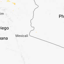
Kansas
| Local Time | Report Details |
|---|---|
| 3:53 PM CDT | Quarter sized hail reported near Baldwin City, KS, 43.9 miles WSW of Kansas City, MO |
| 3:53 PM CDT | Quarter sized hail reported near Baldwin City, KS, 43.2 miles WSW of Kansas City, MO |
| 4:20 PM CDT | Half Dollar sized hail reported near Paola, KS, 36.5 miles SSW of Kansas City, MO |
| 4:31 PM CDT | Half Dollar sized hail reported near Osage City, KS, 57.7 miles SE of Manhattan, KS |
| 4:31 PM CDT | Storm damage reported in osage county KS, 57.7 miles SE of Manhattan, KS |
| 4:48 PM CDT | Quarter sized hail reported near Louisburg, KS, 38.4 miles S of Kansas City, MO |
| 4:50 PM CDT | Quarter sized hail reported near Williamsburg, KS, 54.3 miles N of Chanute, KS |
| 4:52 PM CDT | Quarter sized hail reported near Waverly, KS, 42.5 miles NNW of Chanute, KS |
| 4:55 PM CDT | Quarter sized hail reported near Louisburg, KS, 39.9 miles S of Kansas City, MO, mostly pea hail but had some quarters mixed in. |
| 5:02 PM CDT | Rural fire department reports an estimated 60 mph wind at highway 166 and highway 7 in montgomery county KS, 49.5 miles SSW of Chanute, KS |
| 5:13 PM CDT | Report of 60 mph winds at the junction of highways 160 and 7 in montgomery county KS, 35.2 miles SSW of Chanute, KS |
| 5:28 PM CDT | Fire spotters report 60 mph winds on the rim dik in montgomery county KS, 34.7 miles SSW of Chanute, KS |
| 5:30 PM CDT | Corrects previous tstm wnd dmg report from garnett. tree down that has taken power poles dow in anderson county KS, 42.8 miles NNE of Chanute, KS |
| 5:30 PM CDT | Corrects previous tstm wnd dmg report from garnett. tree down that has taken power poles dow in anderson county KS, 42.8 miles NNE of Chanute, KS |
| 5:30 PM CDT | Tree down blocking part of 59 highwa in anderson county KS, 46.8 miles NNE of Chanute, KS |
| 5:31 PM CDT | Public report via dispatch of a power pole and tree down on sunflower near libert in montgomery county KS, 36.9 miles SSW of Chanute, KS |
| 5:35 PM CDT | Mesonet station k689... 1 e garnet in anderson county KS, 43.1 miles NNE of Chanute, KS |
| 5:43 PM CDT | Report of a downed tree on liberty by pizza hut in cherryval in montgomery county KS, 28.9 miles S of Chanute, KS |
| 6:00 PM CDT | Golf Ball sized hail reported near Leon, KS, 31.1 miles E of Wichita, KS |
| 6:13 PM CDT | Storm damage reported in greenwood county KS, 46.9 miles WNW of Chanute, KS |
| 6:14 PM CDT | Storm damage reported in butler county KS, 36.6 miles E of Wichita, KS |
| 6:26 PM CDT | Storm damage reported in allen county KS, 22.5 miles NE of Chanute, KS |
| 6:55 PM CDT | Media station reported 66mph wind gust. time estimated from rada in bourbon county KS, 44.6 miles ENE of Chanute, KS |
| 6:58 PM CDT | Corrects previous tstm wnd gst report from 3 s hammond. spotter measured wind gust of 59mp in bourbon county KS, 43.6 miles ENE of Chanute, KS |
| 6:58 PM CDT | Large limbs reported down in the town of humboldt. equipment will be required to move the in allen county KS, 8.8 miles N of Chanute, KS |
| 7:10 PM CDT | Quarter sized hail reported near El Dorado, KS, 22 miles ENE of Wichita, KS, spotter reports quarter sized hail on the highway east of towanda. |
| 7:12 PM CDT | Quarter sized hail reported near Fort Scott, KS, 42 miles ENE of Chanute, KS, spotter reported 1.00" hail in fort scott... ks. |
| 7:21 PM CDT | Spotter measured wind gust of 59mp in bourbon county KS, 43.6 miles ENE of Chanute, KS |
| 7:24 PM CDT | Quarter sized hail reported near Geneseo, KS, 68.1 miles ESE of Hays, KS, kwch reports quarter sized hail. |
| 8:15 PM CDT | Hen Egg sized hail reported near Cedar Point, KS, 48.5 miles NE of Wichita, KS, public report via twitter of at least 2 inch sized hail. |
| 8:36 PM CDT | Golf Ball sized hail reported near Cedar Point, KS, 47.4 miles NE of Wichita, KS |
| 9:24 PM CDT | Quarter sized hail reported near Emporia, KS, 53.1 miles SSE of Manhattan, KS |
| 9:30 PM CDT | Golf Ball sized hail reported near Americus, KS, 50.9 miles SSE of Manhattan, KS, social media post via wibw tv. time estimated from radar data. |
| 9:32 PM CDT | Half Dollar sized hail reported near Americus, KS, 48.9 miles SSE of Manhattan, KS |
Alabama
| Local Time | Report Details |
|---|---|
| 4:46 PM CDT | Trees down along cr-99 in franklin county... al. time estimated from rada in franklin county AL, 21 miles SSE of Florence, AL |
| 5:13 PM CDT | Trees down along hwy 20 near town creek... blocking lanes of traffic. time estimated from rada in lawrence county AL, 16.2 miles ESE of Florence, AL |
| 6:09 PM CDT | Multiple trees down on danville road and hwy 36. time estimated from rada in morgan county AL, 42.4 miles SE of Florence, AL |
| 7:25 PM CDT | *** 12 inj *** blount county ema and blount county 911 reported a large tent collapsed at an event at traditions park near hayden. up to 150 people in the tent with 12 in blount county AL, 23.4 miles N of Birmingham, AL |
Georgia
| Local Time | Report Details |
|---|---|
| 6:20 PM EDT | Several trees down over the southern part of the county in walker county GA, 8.1 miles S of Chattanooga, TN |
Maryland
| Local Time | Report Details |
|---|---|
| 7:00 PM EDT | Several branches dow in allegany county MD, 77.6 miles NE of Elkins, WV |
Missouri
| Local Time | Report Details |
|---|---|
| 6:30 PM CDT | Quarter sized hail reported near Higginsville, MO, 47 miles E of Kansas City, MO |
| 6:30 PM CDT | Storm damage reported in lafayette county MO, 47 miles E of Kansas City, MO |
| 6:30 PM CDT | Quarter sized hail reported near Granby, MO, 55.6 miles WSW of Springfield, MO, public report via social media of 1.00" hail. |
| 7:30 PM CDT | Spotter report of wind gust up 60mph in nevad in vernon county MO, 62.4 miles E of Chanute, KS |
| 8:25 PM CDT | Power reported out in moberl in randolph county MO, 30.7 miles N of Columbia, MO |
| 8:25 PM CDT | Half Dollar sized hail reported near Moberly, MO, 30.7 miles N of Columbia, MO |
| 11:37 PM CDT | Quarter sized hail reported near Eminence, MO, 34.8 miles S of Salem, MO |
Arkansas
| Local Time | Report Details |
|---|---|
| 7:07 PM CDT | Tree down on co. line rd on the pope... johnson county lin in pope county AR, 64.4 miles E of Fort Smith, AR |
| 7:09 PM CDT | Quarter sized hail reported near Decatur, AR, 66 miles N of Fort Smith, AR |
| 7:45 PM CDT | Trees down on cabin creek road in the town of lama in johnson county AR, 58.3 miles E of Fort Smith, AR |
| 7:46 PM CDT | Quarter sized hail reported near Lamar, AR, 58.3 miles E of Fort Smith, AR, quarter sized hail was seen in the town of lamar. |
| 10:35 PM CDT | Wind damage on highway 412 near turner and crossover road. estimated 60-70mph wind in washington county AR, 57.9 miles NNE of Fort Smith, AR |
New Mexico
| Local Time | Report Details |
|---|---|
| 7:00 PM MDT | Storm damage reported in de baca county NM, 54.3 miles SSW of Tucumcari, NM |
Illinois
| Local Time | Report Details |
|---|---|
| 9:18 PM CDT | Golf Ball sized hail reported near Athens, IL, 54 miles S of Peoria, IL |
| 10:40 PM CDT | A few trees blown down in springfield near intersection of lincoln and washington streets and north grant and shenandoah street in sangamon county IL, 63 miles S of Peoria, IL |
| 1:45 AM CDT | Flag pole and 6 inch diameter tree limbs blown dow in champaign county IL, 43.8 miles N of Mattoon, IL |
Connect with Interactive Hail Maps