

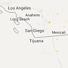
Hail Map for Thursday, August 6, 2015

Number of Impacted Households on 8/6/2015
0
Impacted by 1" or Larger Hail
0
Impacted by 1.75" or Larger Hail
0
Impacted by 2.5" or Larger Hail
Square Miles of Populated Area Impacted on 8/6/2015
0
Impacted by 1" or Larger Hail
0
Impacted by 1.75" or Larger Hail
0
Impacted by 2.5" or Larger Hail


Hail and Wind Damage Spotted on 8/6/2015
Filter by Report Type:Hail ReportsWind Reports
States Impacted
Nebraska, North Dakota, Kansas, South Carolina, Georgia, North Carolina, South Dakota, Arizona, Minnesota, Nevada, Alabama, Utah, California, MissouriNebraska
| Local Time | Report Details |
|---|---|
| 7:05 AM CDT | Quarter sized hail reported near Thedford, NE, 58.3 miles N of North Platte, NE |
| 7:09 AM CDT | Storm damage reported in thomas county NE, 59.1 miles N of North Platte, NE |
| 11:00 AM CDT | Quarter sized hail reported near Alma, NE, 78.7 miles N of Hays, KS, up to quarter size hail...winds up to around 40 mph |
North Dakota
| Local Time | Report Details |
|---|---|
| 8:10 AM CDT | Quarter sized hail reported near Kintyre, ND, 48.4 miles SE of Bismarck, ND, 60 mph winds accompanied the hail along with very heavy rain. |
Kansas
| Local Time | Report Details |
|---|---|
| 10:50 AM CDT | Ping Pong Ball sized hail reported near Almena, KS, 78.2 miles NNW of Hays, KS, relayed via social media. |
| 11:16 AM CDT | Quarter sized hail reported near Phillipsburg, KS, 68.3 miles N of Hays, KS, quarter hail and also strong winds...unknown speed |
| 11:32 AM CDT | Golf Ball sized hail reported near Agra, KS, 65.1 miles N of Hays, KS, up to golf ball size hail. distance north of town radar-estimated. |
| 11:42 AM CDT | Quarter sized hail reported near Agra, KS, 62.4 miles N of Hays, KS, up to quarter size hail in town |
| 11:53 AM CDT | Quarter sized hail reported near Kensington, KS, 64.1 miles NNE of Hays, KS, quarter hail |
| 2:20 AM MDT | Quarter sized hail reported near Sharon Springs, KS, 58.6 miles SW of Colby, KS |
South Carolina
| Local Time | Report Details |
|---|---|
| 2:13 PM EDT | A tree down on wood forest driv in york county SC, 21.5 miles SW of Charlotte, NC |
| 2:15 PM EDT | Trees down off hwy 107 in oconee county SC, 29.5 miles W of Greenville, SC |
| 2:53 PM EDT | Media reported tree down across marshwood dr in the stono ferry area. time estimated based on rada in charleston county SC, 31.9 miles SSW of Charleston, SC |
| 2:56 PM EDT | Dot reported trees down on 9th street in winnsbor in fairfield county SC, 61.2 miles SSW of Charlotte, NC |
| 3:08 PM EDT | Tree down on property about 2 miles from the intersection of bohicket rd and river rd. time estimated based on rada in charleston county SC, 40.5 miles SSW of Charleston, SC |
| 3:10 PM EDT | Tree down on mary murray dr at cleveland st. time estimated based on rada in charleston county SC, 27.6 miles S of Charleston, SC |
| 3:10 PM EDT | Tree down across mary murry dr near 10th ave. time estimated based on rada in charleston county SC, 27.5 miles S of Charleston, SC |
| 3:12 PM EDT | Newberry electric coop reported power outages in the kinards are in newberry county SC, 56.1 miles ESE of Greenville, SC |
| 3:13 PM EDT | Schp reported tree down at duncan rd and hunts bridge rd. time estimated from radar in greenville county SC, 9 miles ENE of Greenville, SC |
| 3:13 PM EDT | A tree down along whitehorse road and another tree down along the swamp rabbit trai in greenville county SC, 11.4 miles E of Greenville, SC |
| 3:18 PM EDT | Social media report of a tree down on walt miller street at johnnie dodds blvd. time estimated based on rada in charleston county SC, 27.6 miles SSE of Charleston, SC |
| 3:20 PM EDT | Schp reports tree down at hwy 101 and marah ln. time estimated from rada in greenville county SC, 21.2 miles ENE of Greenville, SC |
| 3:20 PM EDT | Schp reports tree down on hwy 101 and w gap creek rd. time estimated from radar in greenville county SC, 22.1 miles ENE of Greenville, SC |
| 3:25 PM EDT | Social media report of at least two trees down in the blue ridge communit in greenville county SC, 22.7 miles ENE of Greenville, SC |
| 3:37 PM EDT | Schp reports tree down at duval rd and i385 in greenville county SC, 14.4 miles E of Greenville, SC |
| 3:38 PM EDT | Schp reports tree down at jordan rd and sloan rd in spartanburg county SC, 27.6 miles ENE of Greenville, SC |
| 3:38 PM EDT | Schp reports tree down at gap creek rd and country club r in greenville county SC, 23.9 miles ENE of Greenville, SC |
| 4:00 PM EDT | Highway patrol reports at least three trees down in the converse communit in spartanburg county SC, 44.6 miles ENE of Greenville, SC |
| 4:09 PM EDT | Numerous trees down and some structural damage around broome high school which is on the south side of the converse area. many trees are clipped off halfway up and gene in spartanburg county SC, 44.4 miles ENE of Greenville, SC |
| 4:20 PM EDT | Highway patrol reported trees down at winnsboro rd. and lorick r in richland county SC, 70.9 miles NE of Augusta, GA |
| 4:20 PM EDT | A tree and power line dow in union county SC, 52.3 miles E of Greenville, SC |
| 4:33 PM EDT | A limb fell on a power line in the watts mills area and 2 trees down in another nearby fire distric in laurens county SC, 40.2 miles ESE of Greenville, SC |
| 4:40 PM EDT | A tree and power line dow in union county SC, 48.4 miles SW of Charlotte, NC |
| 4:40 PM EDT | Tree in the roadway on commerce drive. county communications center reports many more trees down across cherokee count in cherokee county SC, 43.9 miles W of Charlotte, NC |
| 4:44 PM EDT | A picture posted on a media facebook page indicated a large tree on flat rock road near the intersection with audobon road. time was determined using radar dat in anderson county SC, 33.8 miles S of Greenville, SC |
| 4:45 PM EDT | Dispatch reported trees down on highway 378 about 4 miles east of mccormic in mccormick county SC, 33.5 miles NNW of Augusta, GA |
| 4:55 PM EDT | Highway patrol reports a tree down at belton highway and serena cir and another down nearby at highway 252 and jule martin r in anderson county SC, 24.2 miles S of Greenville, SC |
| 4:55 PM EDT | Numerous trees down from near westminister eastward to near the lake. a tree fell on a residents shed. there may be other structures damaged. radar base velocity showed in oconee county SC, 24.2 miles WSW of Greenville, SC |
| 4:55 PM EDT | Highway patrol reported trees down on oneil court at trenholm roa in richland county SC, 71.7 miles NE of Augusta, GA |
| 5:00 PM EDT | A picture and post on local media facebook page indicated a buckled dock on lake hartwell. a couple of boats were push ashor in oconee county SC, 24.2 miles SW of Greenville, SC |
| 5:04 PM EDT | Power outage reported via social medi in richland county SC, 75.4 miles S of Charlotte, NC |
| 5:04 PM EDT | Tree in roadway faraway road and brookfield height roa in richland county SC, 72.3 miles NE of Augusta, GA |
| 5:10 PM EDT | Highway patrol reported a tree down at brattonsville rd and mcconnells highwa in york county SC, 30.9 miles SW of Charlotte, NC |
| 5:12 PM EDT | Dispatch reported a tree down 2 miles west of batesburg-leesvill in saluda county SC, 37.4 miles NE of Augusta, GA |
| 5:15 PM EDT | A tree down along chester highway in the vicinity of mcconnell in york county SC, 32.9 miles SW of Charlotte, NC |
| 5:19 PM EDT | Highway patrol reported trees down on daniel avenue about 1 mile outside of war in saluda county SC, 30.5 miles NNE of Augusta, GA |
| 5:21 PM EDT | Multiple trees down chatsworth road... castleton lane and exeter lane. time estimated by rada in richland county SC, 72.2 miles NE of Augusta, GA |
| 5:30 PM EDT | Sce&g reported over 600 power outages from thunderstorms near higgin in saluda county SC, 46.7 miles NNE of Augusta, GA |
| 5:33 PM EDT | Highway patrol reported trees down on mount calvary road at market roa in aiken county SC, 26.5 miles NE of Augusta, GA |
| 5:36 PM EDT | Sheriff reported trees down and power outages north and northeast of saluda to the newberry county lin in saluda county SC, 47.6 miles NNE of Augusta, GA |
| 5:48 PM EDT | Sheriff reported trees and powerlines down on highway 76 between little mountain and prosperit in newberry county SC, 58.2 miles NNE of Augusta, GA |
| 5:48 PM EDT | Sheriff reported trees down east of jackso in aiken county SC, 20.3 miles ESE of Augusta, GA |
| 5:54 PM EDT | Sheriff reported trees down along the northern end of aiken count in aiken county SC, 29.2 miles ENE of Augusta, GA |
| 5:54 PM EDT | Trees in roadway i20 eb between us 378 and us1. time estimated by rada in lexington county SC, 58.2 miles NE of Augusta, GA |
| 6:05 PM EDT | 2 trees in roadway us 178 south of pelion. time estimated by rada in lexington county SC, 46.9 miles ENE of Augusta, GA |
| 6:06 PM EDT | Sce&g reported powerlines down and outages between dixiana and gaston on busbee roa in lexington county SC, 56.9 miles ENE of Augusta, GA |
| 6:24 PM EDT | Dispatch reported powerlines down in snellin in barnwell county SC, 34.1 miles ESE of Augusta, GA |
| 6:28 PM EDT | Highway patrol reported trees down at pine plain road and gus sturkie roa in lexington county SC, 57.2 miles ENE of Augusta, GA |
| 6:36 PM EDT | Dispatch reported powerlines down in springfiel in orangeburg county SC, 40.2 miles E of Augusta, GA |
| 6:53 PM EDT | Dispatch reported multiple trees down around saint matthew in calhoun county SC, 55.5 miles NW of Charleston, SC |
| 6:54 PM EDT | Dispatch reported a couple of trees down between north and neese in orangeburg county SC, 50.3 miles E of Augusta, GA |
| 7:01 PM EDT | Highway patrol reported trees down on cameron road at us 17 in calhoun county SC, 48.1 miles WNW of Charleston, SC |
| 7:01 PM EDT | Dispatch reported multiple trees down around fort mott in calhoun county SC, 54.2 miles NW of Charleston, SC |
| 7:12 PM EDT | Dispatch reported trees and power outages in camde in kershaw county SC, 68.3 miles S of Charlotte, NC |
| 7:24 PM EDT | Dispatch reported trees and powerlines down in cassat in kershaw county SC, 63.6 miles SSE of Charlotte, NC |
Georgia
| Local Time | Report Details |
|---|---|
| 2:38 PM EDT | A tree was blown down on declaration ct in mcdonoug in henry county GA, 22.7 miles SSE of Atlanta, GA |
| 2:56 PM EDT | A tree was blown down on old snapping shoals r in henry county GA, 31.4 miles SE of Atlanta, GA |
| 2:56 PM EDT | Several trees were blown down on river rd and jackson lake road...one on a power lin in henry county GA, 31.4 miles SE of Atlanta, GA |
| 3:05 PM EDT | Several trees down in and around the town of dasher. this is about two miles east of interstate 7 in lowndes county GA, 56.5 miles SSW of Douglas, GA |
| 3:07 PM EDT | A tree was blown down on campbell r in newton county GA, 38.9 miles SE of Atlanta, GA |
| 3:18 PM EDT | A tree was blown down on county rd 21 in newton county GA, 40.4 miles ESE of Atlanta, GA |
| 3:18 PM EDT | A tree was blown down on mill pond r in newton county GA, 42.3 miles ESE of Atlanta, GA |
| 3:22 PM EDT | Trees and powerlines down northeast of russell. units in route at the time of call. exact location not yet confirmed in barrow county GA, 44.2 miles ENE of Atlanta, GA |
| 3:44 PM EDT | A tree was blown down in commerc in jackson county GA, 61.9 miles ENE of Atlanta, GA |
| 3:44 PM EDT | Power lines were downed in the vicinity of hwy 441 at hwy 33 in jackson county GA, 62.2 miles ENE of Atlanta, GA |
| 3:49 PM EDT | A large tree was blown down on hull rd near harve mathis r in clarke county GA, 64.7 miles ENE of Atlanta, GA |
| 3:57 PM EDT | At least 5 trees were downed in and near danielsville including on friendship church rd and on highway 2 in madison county GA, 60.4 miles SW of Greenville, SC |
| 4:08 PM EDT | 2 trees down near carnesvill in franklin county GA, 47.9 miles SW of Greenville, SC |
| 4:08 PM EDT | Ham operator reported measured wind gust to 55 mph. damage to radio tower and limbs down on several tree in houston county GA, 86.5 miles SSE of Atlanta, GA |
| 4:11 PM EDT | Several trees were blown down in and around tignall including on pecan grove rd...independence rd...and euel saggus r in wilkes county GA, 51.6 miles WNW of Augusta, GA |
| 4:20 PM EDT | 3 trees down and one power line down to the north and west side of hartwel in hart county GA, 37.8 miles SSW of Greenville, SC |
| 4:29 PM EDT | A tree was blown down onto a powerline on fulton mill rd between dove dr and shelly d in bibb county GA, 78.2 miles SSE of Atlanta, GA |
| 4:30 PM EDT | Tree crushed vehicle on hollis road. report via social media in bibb county GA, 77.9 miles SSE of Atlanta, GA |
| 4:33 PM EDT | 911 call center received report of several trees down on i-16 near mile marker 1 in twiggs county GA, 86.7 miles SE of Atlanta, GA |
| 4:34 PM EDT | A tree was blown down on highway 1 in hancock county GA, 63.5 miles W of Augusta, GA |
| 4:35 PM EDT | Several trees and powerlines down on wimbish road. report was received via social media in bibb county GA, 72.9 miles SE of Atlanta, GA |
| 4:38 PM EDT | A tree was blown down on powell church r in talbot county GA, 51.1 miles E of Auburn, AL |
| 4:40 PM EDT | 911 call center received reports of numerous trees down in various locations across southwestern jones county including cary road...hwy 80 near turkey creek...horseshoe in jones county GA, 76.7 miles SE of Atlanta, GA |
| 4:48 PM EDT | Trees down along the lincolnton highway and fish dam roa in mcduffie county GA, 28.5 miles WNW of Augusta, GA |
| 4:55 PM EDT | 911 call center received report of at least 1 tree down on zollie lavender road...papermill road...hwy 112...hwy 57...riley road...allen street...church street...and as in wilkinson county GA, 85.7 miles SE of Atlanta, GA |
| 5:00 PM EDT | Trees were blown down on highway 199 near i-16 and on mayberry r in laurens county GA, 68.5 miles N of Douglas, GA |
| 5:04 PM EDT | A tree was blown down on south peachtree rd in brewto in laurens county GA, 74.8 miles N of Douglas, GA |
| 5:05 PM EDT | Emergency manager reported several trees and powerlines down across coopers and pancras across the southern portion of baldwin count in baldwin county GA, 82.8 miles SE of Atlanta, GA |
| 5:12 PM EDT | Dispatch reported a tree down in sardi in burke county GA, 36.6 miles SSE of Augusta, GA |
| 5:13 PM EDT | A tree was blown onto highway 15 sout in johnson county GA, 70.4 miles SW of Augusta, GA |
| 5:21 PM EDT | Washington county 911 reported numerous trees and power lines down in the warthen... sandersvillle... and tennille area in washington county GA, 59.3 miles SW of Augusta, GA |
| 5:42 PM EDT | Jenkins county fire and rescue reports trees and power lines down on perkins-greenfork road. time estimated from rada in jenkins county GA, 39.5 miles S of Augusta, GA |
| 5:42 PM EDT | Trees down in parking lot. 5010 steiner wa in columbia county GA, 13 miles W of Augusta, GA |
| 5:45 PM EDT | Numerous trees and powerlines were blown down across the county. many areas of the county are without powe in emanuel county GA, 64 miles SSW of Augusta, GA |
| 5:58 PM EDT | A tree was blown down on north main street in wadle in jefferson county GA, 48.7 miles SSW of Augusta, GA |
| 6:13 PM EDT | Tree down on hwy 80 at the intersection of aaron station rd. time estimated based on rada in bulloch county GA, 61.8 miles WNW of Savannah, GA |
| 6:34 PM EDT | Tree down on stoopto r in screven county GA, 54.1 miles SSE of Augusta, GA |
| 6:37 PM EDT | Power lines downed onto a structure in the 100 block of montgomery dr. time estimated based on rada in bulloch county GA, 48.8 miles NW of Savannah, GA |
| 8:12 PM EDT | A large tree was blown down on morningside drive in columbu in muscogee county GA, 33.2 miles E of Auburn, AL |
| 8:13 PM EDT | Observer at columbus airport reports wind gusts over 60 kts recorded on the elevated airport tower equipment in muscogee county GA, 32.2 miles E of Auburn, AL |
| 8:15 PM EDT | A tree was downed on notnomis roa in heard county GA, 49.4 miles WSW of Atlanta, GA |
North Carolina
| Local Time | Report Details |
|---|---|
| 2:40 PM EDT | A few trees down in the western part of union county. one near waxhaw and the other two or three fell closer to monroe. also a report of some brief urban flooding in mo in union county NC, 18.9 miles SSE of Charlotte, NC |
| 3:37 PM EDT | Tree down on bell simmons rd in randolph county NC, 63.7 miles ENE of Charlotte, NC |
| 3:37 PM EDT | Tree down at old cox rd and old nc hwy 1 in randolph county NC, 63.6 miles WSW of Raleigh, NC |
| 3:37 PM EDT | Tree down on ross harri in randolph county NC, 64 miles W of Raleigh, NC |
| 3:38 PM EDT | Tree down on southmont d in randolph county NC, 64 miles ENE of Charlotte, NC |
| 3:39 PM EDT | Tree down on staleys farm r in randolph county NC, 65.4 miles W of Raleigh, NC |
| 3:39 PM EDT | Tree down on old nc hwy 1 in randolph county NC, 62.4 miles WSW of Raleigh, NC |
| 3:39 PM EDT | Tree on a powerline on erect r in randolph county NC, 58.1 miles WSW of Raleigh, NC |
| 3:39 PM EDT | Tree on a powerline at kemp mill rd and old nc hwy 1 in randolph county NC, 61 miles W of Raleigh, NC |
| 3:41 PM EDT | Tree down at hinshaw town rd and nc hwy 4 in randolph county NC, 59.2 miles W of Raleigh, NC |
| 3:42 PM EDT | Tree on a powerline on holly spring r in randolph county NC, 58 miles W of Raleigh, NC |
| 3:42 PM EDT | Numerous trees down at the nc zoological par in randolph county NC, 63.9 miles W of Raleigh, NC |
| 3:48 PM EDT | Tree down on nc hwy 2 in randolph county NC, 55.7 miles W of Raleigh, NC |
| 3:57 PM EDT | Tree down on kildee church r in randolph county NC, 52.3 miles W of Raleigh, NC |
| 4:05 PM EDT | Tree on a powerline on old coleridge rd near siler cit in chatham county NC, 51.3 miles W of Raleigh, NC |
| 4:35 PM EDT | Tree down on red hill road west of albertso in duplin county NC, 60.6 miles N of Wilmington, NC |
| 4:56 PM EDT | Wind gust to 50 knots measured by nws equipmen in amz130 county NC, 61.1 miles S of Virginia Beach, VA |
| 5:15 PM EDT | The henderson awos...khnz...reported a peak wind of 53 knots...61 mph...in association with a passing thunderstorm at 515 pm ed in granville county NC, 40.1 miles N of Raleigh, NC |
| 5:20 PM EDT | Quarter sized hail reported near Harrells, NC, 40.5 miles NW of Wilmington, NC, report of quarter to half dollar size hail. |
| 7:46 PM EDT | Tree down at old hollow rd and stanleyville dr in forsyth county NC, 74.6 miles NNE of Charlotte, NC |
| 7:46 PM EDT | Tree down on a house on old rural hall rd in forsyth county NC, 74.1 miles NNE of Charlotte, NC |
| 7:53 PM EDT | A tree fell on a vehicle on dippen r in forsyth county NC, 73.9 miles NNE of Charlotte, NC |
South Dakota
| Local Time | Report Details |
|---|---|
| 3:10 PM CDT | Quarter sized hail reported near Hazel, SD, 76.3 miles SE of Aberdeen, SD |
| 3:10 PM CDT | Quarter sized hail reported near Hazel, SD, 74.8 miles SE of Aberdeen, SD, largest stones were quarter sized. |
| 3:11 PM CDT | Quarter sized hail reported near Watertown, SD, 73.3 miles SE of Aberdeen, SD, mping report. |
| 4:09 PM CDT | Deck furniture blown across yard...time estimated from radar in gregory county SD, 56.4 miles NW of Oneill, NE |
| 6:44 PM CDT | Golf Ball sized hail reported near Volga, SD, 54.3 miles N of Sioux Falls, SD, 50mph winds |
| 6:50 PM CDT | Hourly gust observation...time estimated from radar in brookings county SD, 54.3 miles N of Sioux Falls, SD |
| 6:55 PM CDT | Five minute gust observation...time estimated from radar in brookings county SD, 54.3 miles N of Sioux Falls, SD |
| 7:02 PM CDT | Storm damage reported in brookings county SD, 52.3 miles N of Sioux Falls, SD |
| 7:04 PM CDT | 2 trailer homes overturned in brookings county SD, 49.5 miles N of Sioux Falls, SD |
| 7:04 PM CDT | 3 inch diameter tree branches down...social media report...time estimated from radar in brookings county SD, 48.8 miles N of Sioux Falls, SD |
| 7:05 PM CDT | Power lines down in brookings county SD, 48.7 miles N of Sioux Falls, SD |
| 7:05 PM CDT | Siding and shingles torn off house in brookings county SD, 49.5 miles N of Sioux Falls, SD |
| 7:13 PM CDT | Trees snapped...social media report...time estimated in brookings county SD, 50.9 miles N of Sioux Falls, SD |
| 7:13 PM CDT | Storm damage reported in brookings county SD, 52.3 miles N of Sioux Falls, SD |
| 7:57 PM CDT | Storm damage reported in moody county SD, 34.8 miles N of Sioux Falls, SD |
Arizona
| Local Time | Report Details |
|---|---|
| 1:41 PM MST | 3 semi trucks blown over on i-10 between milposts 20 and 23 in la paz county AZ, 56.7 miles S of Lake Havasu City, AZ |
| 1:42 PM MST | And measured 0.5 in. of rain fallen in 30 minutes in la paz county AZ, 43 miles SSE of Lake Havasu City, AZ |
| 2:13 PM MST | Storm damage reported in la paz county AZ, 43.6 miles SSE of Lake Havasu City, AZ |
| 7:33 PM MST | Mesonet station mesquite 23 ese /qtwa3/ in mohave county AZ, 37.4 miles SSW of Saint George, UT |
Minnesota
| Local Time | Report Details |
|---|---|
| 4:20 PM CDT | Ping Pong Ball sized hail reported near Brooten, MN, 39.7 miles NE of Montevideo, MN, mostly nickel and quarter sized. |
| 4:58 PM CDT | Small branches and other debris possible tornado related in kandiyohi county MN, 39.3 miles NE of Montevideo, MN |
| 5:11 PM CDT | Trees down and took down a grain bi in douglas county MN, 74.5 miles SE of Fargo, ND |
| 5:22 PM CDT | Barn and silo blown down in yellow medicine county MN, 31.9 miles WSW of Montevideo, MN |
| 5:30 PM CDT | Two silos damaged...pole barn doors blown off...time estimated from radar in lincoln county MN, 32.3 miles SW of Montevideo, MN |
| 8:20 PM CDT | Quarter sized hail reported near Mankato, MN, 68 miles SSW of Minneapolis, MN |
Nevada
| Local Time | Report Details |
|---|---|
| 3:15 PM PDT | Storm damage reported in nye county NV, 72.9 miles NW of Las Vegas, NV |
| 3:45 PM PDT | Climax mine mesonet site on the nevada national security site measured a gust of 58 mph from convective activit in nye county NV, 89.1 miles NW of Las Vegas, NV |
| 6:15 PM PDT | Awos station boulder city airport /bvu/ in clark county NV, 21.9 miles SE of Las Vegas, NV |
| 8:36 PM PDT | Station av049 reported a gust to 63 mph at 836p in lincoln county NV, 38.2 miles WNW of Saint George, UT |
Alabama
| Local Time | Report Details |
|---|---|
| 5:46 PM CDT | Tree down on plant rd in talladega county AL, 36.1 miles ESE of Birmingham, AL |
| 6:24 PM CDT | Tree down next to the bowden grove bpatist church. time estimated from rada in clay county AL, 53.6 miles NNW of Auburn, AL |
| 6:31 PM CDT | Tree down across highway 9 near the barfield school. also another tree down in linevill in clay county AL, 53.7 miles NNW of Auburn, AL |
| 7:37 PM CDT | One tree down partially blocking roadway on sweet william ln. winds estimated 40-50 mp in elmore county AL, 52.4 miles W of Auburn, AL |
| 8:40 PM CDT | Several tree tops snapped and one tree down along avalon drive. possible tornado. time estimated from rada in russell county AL, 30.7 miles SE of Auburn, AL |
| 8:50 PM CDT | One large tree down across hwy 165 near the intersection with 101st airborne division rd. time estimated from rada in russell county AL, 33.1 miles SE of Auburn, AL |
| 10:38 PM CDT | *** 4 inj *** damage to the walmart and hibbett sports buildings in troy. extent of damage unknown at this time. four minor injuries known at this time. updated for inj in pike county AL, 63.3 miles SSW of Auburn, AL |
Utah
| Local Time | Report Details |
|---|---|
| 5:20 PM MDT | Barn destroyed. time estimated in box elder county UT, 69.2 miles NNW of Salt Lake City, UT |
| 10:04 PM MDT | White reef wrru1 raws station 3440 f in washington county UT, 13.6 miles NE of Saint George, UT |
California
| Local Time | Report Details |
|---|---|
| 8:00 PM PDT | Multiple injuries at a mobile home park where several outdoor workers were tossed by the wind. elsewhere in the thermal area... 15 powerpoles downed (exact location unkn in riverside county CA, 43.9 miles SSE of Yucca Valley, CA |
| 8:12 PM PDT | Power pole fell onto vehicle near 70th and pierce street in riverside county CA, 43.4 miles SSE of Yucca Valley, CA |
| 8:15 PM PDT | 2 large palm trees fell onto the road at 77th and harrison. time is approximat in riverside county CA, 47 miles SSE of Yucca Valley, CA |
Missouri
| Local Time | Report Details |
|---|---|
| 5:17 AM CDT | Large tree enough to block traffic and need a chainsaw down across larue st at catalina dr in reeds spring. time based on rada in stone county MO, 32 miles S of Springfield, MO |
Connect with Interactive Hail Maps