

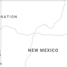
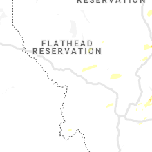
Hail Map for Sunday, July 14, 2019

Number of Impacted Households on 7/14/2019
0
Impacted by 1" or Larger Hail
0
Impacted by 1.75" or Larger Hail
0
Impacted by 2.5" or Larger Hail
Square Miles of Populated Area Impacted on 7/14/2019
0
Impacted by 1" or Larger Hail
0
Impacted by 1.75" or Larger Hail
0
Impacted by 2.5" or Larger Hail


Cities Most Affected by Hail Storms of 7/14/2019
| Hail Size | Demographics of Zip Codes Affected | ||||||
|---|---|---|---|---|---|---|---|
| City | Count | Average | Largest | Pop Density | House Value | Income | Age |
| Rapid City, SD | 4 | 1.81 | 2.00 | 111 | $119k | $47.4k | 44.3 |
| Manderson, SD | 2 | 1.75 | 1.75 | 0 | $65k | $13.5k | 22.4 |
| Lake Park, MN | 1 | 2.00 | 2.00 | 21 | $95k | $40.2k | 47.0 |
| Alliance, NE | 1 | 1.75 | 1.75 | 10 | $73k | $39.4k | 40.8 |
| Sturgis, SD | 1 | 1.75 | 1.75 | 15 | $79k | $34.9k | 44.7 |
Hail and Wind Damage Spotted on 7/14/2019
Filter by Report Type:Hail ReportsWind Reports
States Impacted
North Dakota, Louisiana, Mississippi, West Virginia, South Dakota, Virginia, Minnesota, Idaho, Montana, Illinois, Alabama, Ohio, Nebraska, KentuckyNorth Dakota
| Local Time | Report Details |
|---|---|
| 7:37 AM CDT | Quarter sized hail reported near Sarles, ND, 59.6 miles N of Devils Lake, ND, time estimated on radar. |
| 4:53 PM CDT | A few large 3-5 inch tree branches broken dow in richland county ND, 42.6 miles S of Fargo, ND |
| 11:35 PM MDT | Cannonball creek raws located just west of the nd/mt borde in slope county ND, 87.5 miles E of Miles City, MT |
| 11:45 PM MDT | Late repor in billings county ND, 87.5 miles S of Williston, ND |
| 12:04 AM MDT | Dickinson airport measured wind gus in stark county ND, 95.9 miles W of Bismarck, ND |
| 12:14 AM MDT | Davis instrument measured wind gus in stark county ND, 94.4 miles SSE of Williston, ND |
| 12:20 AM MDT | Davis weather instrument measured wind gus in dunn county ND, 75.9 miles SSE of Williston, ND |
| 12:25 AM MDT | North dakota dot weather observatio in stark county ND, 84.1 miles W of Bismarck, ND |
| 12:55 AM MDT | North dakota dot site weather observatio in mercer county ND, 69.5 miles WNW of Bismarck, ND |
| 2:02 AM CDT | Glen ullin airport weather observatio in morton county ND, 51.3 miles W of Bismarck, ND |
Louisiana
| Local Time | Report Details |
|---|---|
| 10:13 AM CDT | Tree down blocking college st in jackson just north of la-10 in east feliciana county LA, 64.8 miles NE of Lafayette, LA |
| 10:18 AM CDT | A few trees down in zachar in east baton rouge county LA, 60 miles ENE of Lafayette, LA |
| 10:26 AM CDT | Scattered tree damage across lsu campus. relayed via social medi in east baton rouge county LA, 53.8 miles ENE of Lafayette, LA |
| 10:41 AM CDT | Large tree down along essen between the 10/12 spli in east baton rouge county LA, 57.8 miles ENE of Lafayette, LA |
| 10:41 AM CDT | Trees down on highland between siegen and bluebonne in east baton rouge county LA, 59 miles ENE of Lafayette, LA |
Mississippi
| Local Time | Report Details |
|---|---|
| 11:33 AM CDT | Trees down on nursery driv in lamar county MS, 72.3 miles SSE of Jackson, MS |
| 11:34 AM CDT | Trees down on courtland driv in lamar county MS, 80.7 miles SE of Jackson, MS |
| 11:42 AM CDT | Trees down on beechwood driv in lamar county MS, 83.5 miles SE of Jackson, MS |
| 11:42 AM CDT | Trees down on highway 11 near purvi in lamar county MS, 86.2 miles WNW of Mobile, AL |
| 12:12 PM CDT | Trees down on walters road near macedonia roa in forrest county MS, 82.5 miles NW of Mobile, AL |
| 12:16 PM CDT | Power line dow in franklin county MS, 73.3 miles SSW of Jackson, MS |
West Virginia
| Local Time | Report Details |
|---|---|
| 2:35 PM EDT | Several trees reported down in the northern sections of vienna. time estimated from rada in wood county WV, 67.8 miles N of Charleston, WV |
South Dakota
| Local Time | Report Details |
|---|---|
| 1:26 PM MDT | Quarter sized hail reported near Rapid City, SD, 0.8 miles NW of Rapid City, SD |
| 1:28 PM MDT | Golf Ball sized hail reported near Rapid City, SD, 2.1 miles WSW of Rapid City, SD |
| 1:29 PM MDT | Hen Egg sized hail reported near Rapid City, SD, 2.8 miles WSW of Rapid City, SD |
| 1:33 PM MDT | Golf Ball sized hail reported near Rapid City, SD, 2.6 miles WSW of Rapid City, SD |
| 1:35 PM MDT | Ping Pong Ball sized hail reported near Rapid City, SD, 1.3 miles SE of Rapid City, SD |
| 1:37 PM MDT | Quarter sized hail reported near Rapid City, SD, 0.6 miles E of Rapid City, SD |
| 1:39 PM MDT | Golf Ball sized hail reported near Rapid City, SD, 4.9 miles WSW of Rapid City, SD |
| 1:40 PM MDT | Half Dollar sized hail reported near Rapid City, SD, 2.2 miles S of Rapid City, SD |
| 1:45 PM MDT | Ping Pong Ball sized hail reported near Rapid City, SD, 2.8 miles WSW of Rapid City, SD |
| 2:26 PM MDT | Quarter sized hail reported near Hermosa, SD, 11.9 miles S of Rapid City, SD |
| 3:32 PM MDT | Golf Ball sized hail reported near Sturgis, SD, 21.7 miles NW of Rapid City, SD |
| 4:58 PM MDT | Quarter sized hail reported near Rapid City, SD, 5.1 miles E of Rapid City, SD |
| 5:00 PM MDT | Quarter sized hail reported near Rapid City, SD, 3.4 miles ESE of Rapid City, SD |
| 7:00 PM CDT | Quarter sized hail reported near Winner, SD, 44.9 miles NNE of Valentine, NE |
| 6:07 PM MDT | Golf Ball sized hail reported near Manderson, SD, 67.2 miles SE of Rapid City, SD |
| 6:20 PM MDT | Golf Ball sized hail reported near Manderson, SD, 69.5 miles SSE of Rapid City, SD |
| 11:54 PM MDT | Storm damage reported in harding county SD, 106 miles N of Rapid City, SD |
Virginia
| Local Time | Report Details |
|---|---|
| 4:50 PM EDT | A tree was down along the 11000 block of fort turley trai in rockingham county VA, 57.2 miles ESE of Elkins, WV |
| 4:53 PM EDT | A tree was down along woodlands church road and wengers mill roa in rockingham county VA, 58.8 miles ESE of Elkins, WV |
| 5:34 PM EDT | A tree was down along north street in elkto in rockingham county VA, 75.6 miles ESE of Elkins, WV |
| 7:29 PM EDT | Large trees down near the intersection of three notched road and old three notched roa in albemarle county VA, 67.6 miles NW of Richmond, VA |
| 7:33 PM EDT | Tree on powerlines on dry bridge roa in albemarle county VA, 65.1 miles NW of Richmond, VA |
| 7:36 PM EDT | Downed tree near the intersection of ivy road and morgantown roa in albemarle county VA, 64.6 miles NW of Richmond, VA |
Minnesota
| Local Time | Report Details |
|---|---|
| 4:40 PM CDT | Peak winds measured at the mndot rwis along i-9 in wilkin county MN, 34.6 miles SE of Fargo, ND |
| 5:10 PM CDT | Reports of numerous large trees down and power lines down around tow in otter tail county MN, 53.3 miles SE of Fargo, ND |
| 5:12 PM CDT | Trees broken down at bois de sioux golf course. reports and photos posted via social medi in wilkin county MN, 42.2 miles SSE of Fargo, ND |
| 5:12 PM CDT | Quarter sized hail reported near Hackensack, MN, 43 miles SSE of Bemidji, MN, a lot of pea size hail and several quarter size hail stones. |
| 5:20 PM CDT | Police officer reports tree limbs and power lines down in fergus falls. officer has received 2 separate reports of rotation with this stor in otter tail county MN, 53.3 miles SE of Fargo, ND |
| 5:20 PM CDT | Storm damage reported in otter tail county MN, 56.4 miles SE of Fargo, ND |
| 5:27 PM CDT | Half Dollar sized hail reported near Hawley, MN, 20.5 miles ESE of Fargo, ND, hail slightly larger that quarters. |
| 5:38 PM CDT | Hen Egg sized hail reported near Lake Park, MN, 33.8 miles E of Fargo, ND, report and photo posted via social media. time estimated based on radar. |
| 5:44 PM CDT | A few large 3-5 inch diameter tree branches and limbs broken down. nearby wind sensor reported sustained winds at 42 mp in otter tail county MN, 59.1 miles SE of Fargo, ND |
| 5:54 PM CDT | Quarter sized hail reported near Audubon, MN, 38.1 miles E of Fargo, ND, lots of dime ot quarter sized hail. |
| 6:06 PM CDT | Downed powerlines due to wind in this are in crow wing county MN, 63.7 miles SE of Bemidji, MN |
| 7:30 PM CDT | Spotter reports wind gust of 73mph at approximately 7:30p in morrison county MN, 80.4 miles NNW of Minneapolis, MN |
| 7:43 PM CDT | Law enforcement reported that power lines and trees were down in the city of aitkin due to high wind in aitkin county MN, 78.6 miles WSW of Duluth, MN |
Idaho
| Local Time | Report Details |
|---|---|
| 3:47 PM MDT | Quarter sized hail reported near Inkom, ID, 50.2 miles SSW of Idaho Falls, ID, quarter size hail found on west portneuf road by off duty nws employee. time of occurrence estimated from radar. |
| 3:49 PM MDT | Quarter sized hail reported near Inkom, ID, 50.4 miles SSW of Idaho Falls, ID, quarter size hail found on north indian creek road by off duty nws employee. time of occurrence estimated from radar. |
Montana
| Local Time | Report Details |
|---|---|
| 4:04 PM MDT | Ping Pong Ball sized hail reported near Helmville, MT, 52 miles E of Missoula, MT |
| 4:22 PM MDT | Quarter sized hail reported near Great Falls, MT, 9.2 miles W of Great Falls, MT, ground covered with quarter size hail in the sun prairie area. |
| 4:24 PM MDT | Storm damage reported in cascade county MT, 10 miles WNW of Great Falls, MT |
| 4:27 PM MDT | Tree limbs about 3 inches in diameter are down around the sw part of tow in cascade county MT, 2 miles SW of Great Falls, MT |
| 4:30 PM MDT | 61 mph wind gusts reported by the asos at nws great fall in cascade county MT, 5.1 miles SW of Great Falls, MT |
| 4:30 PM MDT | Power lines down blocking south bound lane of interstate-15 at mile marker 281.6. hwy patrol and fire dept. on scene. detour at vaughn frontage roa in cascade county MT, 3.8 miles WNW of Great Falls, MT |
| 4:30 PM MDT | Storm damage reported in park county MT, 11.3 miles E of Bozeman, MT |
| 4:35 PM MDT | Quarter sized hail reported near Great Falls, MT, 2.4 miles NNE of Great Falls, MT, a range of dime to quarter size hail dropped over the area... gusty winds nearing 50 mph... small branches and outdoor furniture all blown around. |
| 4:35 PM MDT | Hail and wind damage reported on 39th ave ne... damage to fencing... patio furniture... and house gutters. estimated nickle to quarter size hail with winds gusting over in cascade county MT, 2.3 miles N of Great Falls, MT |
| 4:39 PM MDT | Quarter sized hail reported near Black Eagle, MT, 2 miles NE of Great Falls, MT, lt. mackey called in to pass on that malmstrom weather received a report of 1 inch hail in black eagle... mt. |
| 4:40 PM MDT | A 3 to 4 inch diameter limb fell into the stree in cascade county MT, 2.2 miles E of Great Falls, MT |
| 5:00 PM MDT | Power is out... storm bearing down from the wes in cascade county MT, 17.2 miles SW of Great Falls, MT |
| 5:05 PM MDT | Quarter sized hail reported near Highwood, MT, 28 miles ENE of Great Falls, MT, report relayed via nwschat. |
| 5:11 PM MDT | Storm damage reported in park county MT, 28.3 miles E of Bozeman, MT |
| 5:36 PM MDT | Awos station k1lm lim in fergus county MT, 86.3 miles NW of Billings, MT |
| 5:40 PM MDT | Quarter sized hail reported near Hobson, MT, 76.1 miles ESE of Great Falls, MT, hail started out at pea sized when the wind and rain started around 520 pm... but the rain became heavy by 540 pm with quarter size hail stones. |
| 5:45 PM MDT | Storm damage reported in wheatland county MT, 86.4 miles NW of Billings, MT |
| 5:55 PM MDT | Asos station klwt lewistown aso in fergus county MT, 92.4 miles ESE of Great Falls, MT |
| 6:05 PM MDT | Half Dollar sized hail reported near Columbus, MT, 37.3 miles WSW of Billings, MT, hailing at time of report. mostly quarters. |
| 6:15 PM MDT | Quarter sized hail reported near Columbus, MT, 32 miles WSW of Billings, MT, quarter-sized hail. |
| 6:22 PM MDT | Awos station k1nm novembe in fergus county MT, 92.3 miles NNW of Billings, MT |
| 6:45 PM MDT | Storm damage reported in big horn county MT, 77.7 miles SE of Billings, MT |
| 7:00 PM MDT | Quarter sized hail reported near Billings, MT, 9 miles W of Billings, MT |
| 7:03 PM MDT | Storm damage reported in petroleum county MT, 92.6 miles N of Billings, MT |
| 7:06 PM MDT | Power lines down. between highway 200 with intersection with road 244 a roof was rip off. trees were downed by wind. time estimated from rada in petroleum county MT, 84.3 miles N of Billings, MT |
| 7:15 PM MDT | Storm damage reported in yellowstone county MT, 6.1 miles ENE of Billings, MT |
| 7:30 PM MDT | Measured at the winnett handar ggwwt in petroleum county MT, 85 miles N of Billings, MT |
| 7:40 PM MDT | Measured at lufborough hill mdt site mtluf in garfield county MT, 88.5 miles SSW of Glasgow, MT |
| 7:50 PM MDT | Measured at south sawmill creek raws ssmm8 in garfield county MT, 60.4 miles SW of Glasgow, MT |
| 8:40 PM MDT | Measured at king coulee raws site kigm8 in valley county MT, 32.6 miles SSW of Glasgow, MT |
| 9:00 PM MDT | Storm damage reported in rosebud county MT, 35.4 miles NW of Miles City, MT |
| 9:15 PM MDT | Storm damage reported in rosebud county MT, 35.4 miles NW of Miles City, MT |
| 9:20 PM MDT | Trees down. smashed fence. damage to street light. power outag in custer county MT, 0.5 miles S of Miles City, MT |
| 9:20 PM MDT | Measured at st marie marco site 07mt in valley county MT, 15 miles NNE of Glasgow, MT |
| 9:22 PM MDT | Storm damage reported in custer county MT, 2.5 miles NW of Miles City, MT |
| 9:42 PM MDT | Storm damage reported in prairie county MT, 42.5 miles NNE of Miles City, MT |
| 9:53 PM MDT | Measured at lindsay divide mdt site mtlnd in dawson county MT, 65.9 miles NNE of Miles City, MT |
| 10:17 PM MDT | Measured at glendive asos kgdv in dawson county MT, 70.5 miles NE of Miles City, MT |
| 11:00 PM MDT | Storm damage reported in fallon county MT, 71.2 miles ESE of Miles City, MT |
| 11:08 PM MDT | Beaver hill mdot obs site in roosevelt county MT, 83.7 miles ENE of Miles City, MT |
| 12:00 AM MDT | Quarter sized hail reported near Broadus, MT, 67.6 miles S of Miles City, MT |
| 2:00 AM MDT | Quarter sized hail reported near Broadus, MT, 70 miles SSE of Miles City, MT, hail persisted for about 10 minutes until 210 am. |
Illinois
| Local Time | Report Details |
|---|---|
| 5:26 PM CDT | Storm damage reported in champaign county IL, 38.9 miles N of Mattoon, IL |
| 5:28 PM CDT | Storm damage reported in champaign county IL, 38.9 miles N of Mattoon, IL |
| 5:30 PM CDT | Tree branches up to 3 inches in diameter reported down... as well as siding damage to a buildin in champaign county IL, 38.9 miles N of Mattoon, IL |
| 7:59 PM CDT | Tree reported down on 2 cars. time estimated by rada in tazewell county IL, 13.7 miles SSW of Peoria, IL |
Alabama
| Local Time | Report Details |
|---|---|
| 5:37 PM CDT | Several trees down and minor roof damage near connection roa in macon county AL, 13 miles WSW of Auburn, AL |
Ohio
| Local Time | Report Details |
|---|---|
| 6:56 PM EDT | Tree fell on power lines on clark station road. time estimated from rada in darke county OH, 65.4 miles N of Cincinnati, OH |
Nebraska
| Local Time | Report Details |
|---|---|
| 5:58 PM CDT | Storm damage reported in todd county SD, 24.9 miles N of Valentine, NE |
| 5:25 PM MDT | Golf Ball sized hail reported near Alliance, NE, 55.2 miles ENE of Scottsbluff, NE, estimated time of report. |
| 5:40 PM MDT | Ping Pong Ball sized hail reported near Lakeside, NE, 78.2 miles ENE of Scottsbluff, NE, most stones were dime to quarter size... though a few were as large as ping pong ball. |
Kentucky
| Local Time | Report Details |
|---|---|
| 9:33 PM EDT | Tree down on power lines at broosk ln and cincinnati road. time estimated from rada in scott county KY, 52.3 miles S of Cincinnati, OH |
| 9:45 PM EDT | Reports of transformer fires around georgetown. placement for lsr estimated based on where storms were concentrated at time. unsure of whether cause was wind or continu in scott county KY, 48.7 miles NW of Irvine, KY |
Connect with Interactive Hail Maps