

Hail Map for Monday, June 24, 2019

Number of Impacted Households on 6/24/2019
0
Impacted by 1" or Larger Hail
0
Impacted by 1.75" or Larger Hail
0
Impacted by 2.5" or Larger Hail
Square Miles of Populated Area Impacted on 6/24/2019
0
Impacted by 1" or Larger Hail
0
Impacted by 1.75" or Larger Hail
0
Impacted by 2.5" or Larger Hail


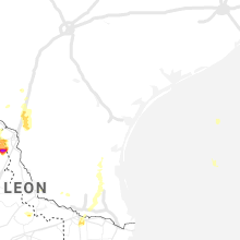


Cities Most Affected by Hail Storms of 6/24/2019
| Hail Size | Demographics of Zip Codes Affected | ||||||
|---|---|---|---|---|---|---|---|
| City | Count | Average | Largest | Pop Density | House Value | Income | Age |
| Lubbock, TX | 3 | 2.08 | 2.75 | 641 | $64k | $35.6k | 31.1 |
| Idalou, TX | 1 | 3.00 | 3.00 | 24 | $64k | $34.7k | 39.8 |
| Wilson, TX | 1 | 3.00 | 3.00 | 4 | $36k | $30.3k | 37.5 |
| Slaton, TX | 1 | 2.75 | 2.75 | 40 | $47k | $27.9k | 37.9 |
| Odonnell, TX | 1 | 2.75 | 2.75 | 2 | $26k | $27.7k | 39.6 |
| Petersburg, TX | 1 | 2.75 | 2.75 | 2 | $35k | $30.6k | 38.7 |
| San Angelo, TX | 1 | 1.75 | 1.75 | 106 | $58k | $35.3k | 35.4 |
| Sterling City, TX | 1 | 1.75 | 1.75 | 0 | $53k | $35.3k | 41.8 |
| Tahoka, TX | 1 | 1.75 | 1.75 | 2 | $42k | $25.9k | 39.2 |
| Big Spring, TX | 1 | 1.75 | 1.75 | 32 | $39k | $30.5k | 38.4 |
Hail and Wind Damage Spotted on 6/24/2019
Filter by Report Type:Hail ReportsWind Reports
States Impacted
Texas, Tennessee, Virginia, Iowa, Kentucky, Ohio, Wisconsin, Florida, Minnesota, West Virginia, South Dakota, Georgia, Illinois, Pennsylvania, Alabama, North Carolina, South Carolina, NebraskaTexas
| Local Time | Report Details |
|---|---|
| 7:59 AM CDT | Small shed turned on its roof and trees and fences damaged in bruceville in mclennan county TX, 32.6 miles ENE of Killeen, TX |
| 5:01 PM CDT | Ping Pong Ball sized hail reported near Paint Rock, TX, 77.1 miles SSW of Abilene, TX |
| 5:12 PM CDT | Golf Ball sized hail reported near Sterling City, TX, 81.5 miles E of Odessa, TX, the sterling county sheriffs office reported golf ball size hail. |
| 5:19 PM CDT | Ping Pong Ball sized hail reported near Sterling City, TX, 81.5 miles E of Odessa, TX |
| 5:46 PM CDT | Golf Ball sized hail reported near Big Spring, TX, 60.3 miles ENE of Odessa, TX |
| 5:54 PM CDT | Quarter sized hail reported near Big Spring, TX, 62.2 miles ENE of Odessa, TX |
| 6:00 PM CDT | Quarter sized hail reported near Big Spring, TX, 67.1 miles ENE of Odessa, TX |
| 6:23 PM CDT | Quarter sized hail reported near San Angelo, TX, 77.3 miles SW of Abilene, TX |
| 6:25 PM CDT | Baseball sized hail reported near Odonnell, TX, 34.6 miles S of Lubbock, TX |
| 6:28 PM CDT | Quarter sized hail reported near San Angelo, TX, 77.6 miles SW of Abilene, TX |
| 6:34 PM CDT | Quarter sized hail reported near Knickerbocker, TX, 90.3 miles SSW of Abilene, TX |
| 6:38 PM CDT | Quarter sized hail reported near Christoval, TX, 101.4 miles SSW of Abilene, TX |
| 6:39 PM CDT | Quarter sized hail reported near Christoval, TX, 100.6 miles SSW of Abilene, TX |
| 6:40 PM CDT | Baseball sized hail reported near , , 20.7 miles NNE of Laredo, TX, coop observer reported an estimated 2.75" hail n of webb... tx on i-35 between mile marker 22 and 27. |
| 6:45 PM CDT | Quarter sized hail reported near San Angelo, TX, 79.3 miles SSW of Abilene, TX |
| 6:50 PM CDT | Ping Pong Ball sized hail reported near Lubbock, TX, 7.4 miles SW of Lubbock, TX |
| 6:50 PM CDT | Ping Pong Ball sized hail reported near Lubbock, TX, 8.7 miles SW of Lubbock, TX |
| 6:50 PM CDT | Golf Ball sized hail reported near San Angelo, TX, 76.4 miles SW of Abilene, TX, photo received via tweetdeck. |
| 6:55 PM CDT | Half Dollar sized hail reported near Lubbock, TX, 8.3 miles SW of Lubbock, TX, slightly larger than half dollar hail near quincy and 82nd street in lubbock |
| 6:58 PM CDT | Half Dollar sized hail reported near Lubbock, TX, 1.6 miles WSW of Lubbock, TX, reported on the 5500 block of 100th st. in lubbock. |
| 6:58 PM CDT | Golf Ball sized hail reported near Tahoka, TX, 30 miles S of Lubbock, TX |
| 7:01 PM CDT | Ping Pong Ball sized hail reported near Lubbock, TX, 8.7 miles SW of Lubbock, TX |
| 7:02 PM CDT | Golf Ball sized hail reported near Lubbock, TX, 8.9 miles W of Lubbock, TX, golfball size hail reported by nws employee at milwaukee and 43rd. |
| 7:14 PM CDT | Quarter sized hail reported near Lubbock, TX, 3.3 miles WNW of Lubbock, TX, hail ranging from dime to slightly larger than quarter at erskine and north loop 289 in lubbock |
| 7:15 PM CDT | Quarter sized hail reported near Gail, TX, 61.4 miles SSE of Lubbock, TX, mostly nickel size with a few quarters mixed. |
| 7:20 PM CDT | Half Dollar sized hail reported near Lubbock, TX, 6 miles W of Lubbock, TX, quarter to half dollar size hail measured at 4th street and milwaukee avenue |
| 7:20 PM CDT | Tea Cup sized hail reported near Wilson, TX, 20.1 miles SSE of Lubbock, TX, large hail noted on social media. |
| 7:21 PM CDT | Quarter sized hail reported near Lubbock, TX, 0.9 miles SSW of Lubbock, TX, one inch hail at carpenter wells residence hall |
| 7:22 PM CDT | Ping Pong Ball sized hail reported near Lubbock, TX, 1.6 miles WSW of Lubbock, TX, klbb observer reports ping pong size hail at the airport. |
| 7:25 PM CDT | Unanchored trailer home rolled over at intersection of fm 2812 and fm 493. family inside but no details on any casualtie in hidalgo county TX, 46.4 miles NW of Brownsville, TX |
| 7:25 PM CDT | Quarter sized hail reported near Lubbock, TX, 4.3 miles S of Lubbock, TX, hail near south loop 289 and avenue u |
| 7:30 PM CDT | One tree blown down in donna on cummings road. time estimate in hidalgo county TX, 37.2 miles WNW of Brownsville, TX |
| 7:30 PM CDT | Ping Pong Ball sized hail reported near Lubbock, TX, 7.7 miles SW of Lubbock, TX, ping pong size hail near 98th street and chicago in lubbock. |
| 7:32 PM CDT | Quarter sized hail reported near Lubbock, TX, 1.6 miles WSW of Lubbock, TX, quarter size hail reported at 62nd st and knoxville. |
| 7:35 PM CDT | Ping Pong Ball sized hail reported near Lubbock, TX, 9.5 miles ESE of Lubbock, TX |
| 7:39 PM CDT | Baseball sized hail reported near Slaton, TX, 16.3 miles SE of Lubbock, TX, baseball size hail at slaton airport. |
| 7:45 PM CDT | Golf Ball sized hail reported near Lubbock, TX, 7.9 miles S of Lubbock, TX |
| 7:45 PM CDT | Quarter sized hail reported near Lubbock, TX, 1.6 miles WSW of Lubbock, TX, quarter size hail reported at quaker and 114th st. |
| 7:55 PM CDT | Baseball sized hail reported near Lubbock, TX, 5.4 miles SSE of Lubbock, TX, picture via social media |
| 7:59 PM CDT | Tea Cup sized hail reported near Idalou, TX, 12.3 miles NE of Lubbock, TX |
| 8:01 PM CDT | Quarter sized hail reported near Lubbock, TX, 4.3 miles WSW of Lubbock, TX, quarter size hail at 34th and slide via social media |
| 8:26 PM CDT | Destroyed wind turbine relayed through social media. time estimated from radar... peak wind on lowest scan 80 mp in hale county TX, 26.7 miles NNE of Lubbock, TX |
| 8:33 PM CDT | Baseball sized hail reported near Petersburg, TX, 24.2 miles NE of Lubbock, TX |
| 8:40 PM CDT | Quarter sized hail reported near Talpa, TX, 46.4 miles S of Abilene, TX |
Tennessee
| Local Time | Report Details |
|---|---|
| 1:07 PM CDT | Tree down on turkey creek road (hwy 263) in smith county TN, 47.7 miles ENE of Nashville, TN |
| 1:09 PM CDT | Trees down on hwy 85 west of kempville in smith county TN, 51.2 miles ENE of Nashville, TN |
| 2:00 PM CDT | Tree down at 235 poplar springs road in overton county TN, 74.9 miles E of Nashville, TN |
| 3:57 PM EDT | Report of power line down in red ban in hamilton county TN, 3.1 miles N of Chattanooga, TN |
| 4:03 PM EDT | Several trees down in the county from earlier thunderstorms. time estimated by rada in hamilton county TN, 9.4 miles NNE of Chattanooga, TN |
| 5:00 PM EDT | Facebook report and photo of a tree on top of two vehicles and a mobile home. no injuries reporte in union county TN, 21.1 miles NNE of Knoxville, TN |
| 5:00 PM EDT | Tree down along i-40 from social media post. time estimate in roane county TN, 33.5 miles W of Knoxville, TN |
| 5:00 PM EDT | Large tree down along lake city highway between rocky top and clinton. time estimated by rada in anderson county TN, 18.9 miles NW of Knoxville, TN |
| 5:15 PM EDT | Multiple trees down near clinto in anderson county TN, 15.2 miles NW of Knoxville, TN |
| 5:20 PM EDT | Trees down in knoxville. one fell on a vehicl in knox county TN, 3.4 miles WSW of Knoxville, TN |
| 5:27 PM EDT | Few trees down along state highway 33. time estimated by rada in claiborne county TN, 39.3 miles NE of Knoxville, TN |
| 5:30 PM EDT | Tree down on a car on webb d in loudon county TN, 24.6 miles WSW of Knoxville, TN |
| 5:30 PM EDT | Tree down on marble bluff and hwy 7 in loudon county TN, 32.6 miles WSW of Knoxville, TN |
| 5:40 PM EDT | Tree down on power lines near robinson rd and middlebrook pike. time of occurrence based on rada in knox county TN, 7.9 miles W of Knoxville, TN |
| 5:42 PM EDT | Multiple trees down across many roads... mainly across the northern end of the county. dispatch encourages motorists to not travel unless necessary while dispatch crews in bradley county TN, 25.7 miles ENE of Chattanooga, TN |
| 5:45 PM EDT | Tree down across riverview rd in lenoir cit in loudon county TN, 23.7 miles WSW of Knoxville, TN |
| 5:47 PM EDT | 2 trees down. 1 along hwy 31 and 1 in sneedville. time estimated by rada in hancock county TN, 50.4 miles NE of Knoxville, TN |
| 5:50 PM EDT | Tree down on a house near alcoa. time estimated by radar outflo in blount county TN, 12.7 miles SSW of Knoxville, TN |
| 5:58 PM EDT | Time estimated by radar. trees and power lines down across the county... especially the northern end of the count in sevier county TN, 16.3 miles E of Knoxville, TN |
| 6:00 PM EDT | Time estimated by radar. tree down in blain in grainger county TN, 18.9 miles NE of Knoxville, TN |
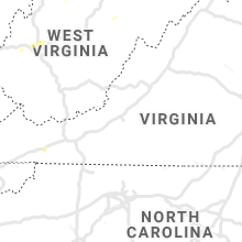
Virginia
| Local Time | Report Details |
|---|---|
| 2:31 PM EDT | Tree down on the 4300 block of leaksville roa in page county VA, 74 miles ESE of Elkins, WV |
| 3:22 PM EDT | Tree down on the 3600 block of grove hill river roa in page county VA, 73 miles ESE of Elkins, WV |
| 3:36 PM EDT | Trees down on duet roa in madison county VA, 75.1 miles NNW of Richmond, VA |
| 3:41 PM EDT | Trees down on hebron valley roa in madison county VA, 71.3 miles NNW of Richmond, VA |
| 3:55 PM EDT | Trees down on ruth road. in madison county VA, 70.4 miles NNW of Richmond, VA |
| 5:35 PM EDT | Tree down on mine road near campbell driv in spotsylvania county VA, 52.2 miles N of Richmond, VA |
| 6:27 PM EDT | Power pole down near the intersection of back street and patricia lane. time estimated from rada in caroline county VA, 52.4 miles NNE of Richmond, VA |
| 6:30 PM EDT | Tree down on camden road. time estimated from rada in caroline county VA, 51.5 miles NNE of Richmond, VA |
| 10:17 PM EDT | Thunderstorm winds blew down a tree at the 14400 block of virgil h. goode highwa in franklin county VA, 12.5 miles S of Roanoke, VA |
| 10:42 PM EDT | Tree blown down on big island road near coltons mill roa in bedford county VA, 29.5 miles ENE of Roanoke, VA |
| 10:44 PM EDT | Thunderstorm winds blew down a tree near the intersection of lost mountain road and burnt chimney roa in franklin county VA, 16 miles SE of Roanoke, VA |
Iowa
| Local Time | Report Details |
|---|---|
| 1:42 PM CDT | Quarter sized hail reported near , , 29.3 miles ESE of Sioux Falls, SD, a few quarter-sized hailstones with very little wind. |
| 2:28 PM CDT | Branches 2 to 3 inches in diameter blown down. bush uproote in linn county IA, 5.6 miles NNW of Cedar Rapids, IA |
Kentucky
| Local Time | Report Details |
|---|---|
| 2:47 PM EDT | A tree was blown down on hoys fork roa in estill county KY, 3.3 miles WSW of Irvine, KY |
| 3:38 PM EDT | A tree was reported down onto clay hill roa in pulaski county KY, 52.8 miles SSW of Irvine, KY |
| 3:39 PM EDT | A tree was blown down onto omega park roa in pulaski county KY, 56.9 miles SSW of Irvine, KY |
| 4:03 PM EDT | Damage to barn and outbuilding on colonel road just south of i-75 exit 95. public report relayed by medi in madison county KY, 21.2 miles WNW of Irvine, KY |
| 4:05 PM EDT | Tree were blown dow in laurel county KY, 36.1 miles SSW of Irvine, KY |
| 4:25 PM EDT | A tree was blow down onto a hom in owsley county KY, 25.4 miles SSE of Irvine, KY |
| 4:47 PM EDT | Agriculture buildings damaged. numerous trees downe in mason county KY, 42.2 miles SE of Cincinnati, OH |
| 4:57 PM EDT | Storm damage reported in breathitt county KY, 34 miles ESE of Irvine, KY |
| 5:04 PM EDT | Trees down on hwy 30 eas in breathitt county KY, 41.5 miles E of Irvine, KY |
| 5:10 PM EDT | Several large limbs were knocked dow in mason county KY, 44 miles SE of Cincinnati, OH |
| 5:14 PM EDT | Powerlines were reported to have been blown dow in magoffin county KY, 46.8 miles E of Irvine, KY |
| 5:22 PM EDT | A tree was blown down onto the moutain parkway and struck a vehicle that had stopped due to the heavy rain and strong winds. no injuries occurre in floyd county KY, 56.7 miles E of Irvine, KY |
| 5:35 PM EDT | A tree was blown down along little paint creek roa in floyd county KY, 64.4 miles E of Irvine, KY |
| 5:36 PM EDT | A tree was blown onto a powerline with the tree starting to smok in johnson county KY, 61.4 miles ENE of Irvine, KY |
| 5:36 PM EDT | A tree was uprooted along ky 321 with the tree pullling gas lines out of the groun in floyd county KY, 65.5 miles E of Irvine, KY |
| 5:36 PM EDT | A tree was blown down along ky 321 near the combs airpor in johnson county KY, 65.5 miles E of Irvine, KY |
| 5:38 PM EDT | A large limb was blown down. this is a report shared via twitter with pictur in floyd county KY, 66.1 miles E of Irvine, KY |
| 5:38 PM EDT | A tree was blown down on ky route 338 in johnson county KY, 65.2 miles ENE of Irvine, KY |
| 5:43 PM EDT | A tree was blown down and powerlines were also blown dow in floyd county KY, 63.8 miles E of Irvine, KY |
| 5:44 PM EDT | Multiple trees and power lines down reported by wayne 911. time estimated from rada in martin county KY, 53.5 miles SW of Charleston, WV |
| 5:51 PM EDT | A tree was reported to have been blown down onto us 2 in floyd county KY, 68.5 miles E of Irvine, KY |
| 5:55 PM EDT | Trees were reported to have been blown down onto blacklog roa in martin county KY, 58.2 miles SW of Charleston, WV |
| 6:11 PM EDT | A tree was blown dow in pike county KY, 58.9 miles SW of Charleston, WV |
| 6:19 PM EDT | A tree was blown down next to the vf in pike county KY, 53.4 miles NNW of Bristol, TN |
| 6:30 PM EDT | A tree was blown dow in pike county KY, 49.3 miles N of Bristol, TN |
| 6:33 PM EDT | A tree was blown dow in pike county KY, 61 miles SSW of Charleston, WV |
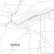
Ohio
| Local Time | Report Details |
|---|---|
| 3:12 PM EDT | Three trees were knocked down outside of waverly. time estimate in pike county OH, 56.8 miles S of Columbus, OH |
| 3:22 PM EDT | A couple of large limbs knocked dow in fairfield county OH, 33.3 miles SE of Columbus, OH |
| 3:23 PM EDT | Tree down across vigo road. time estimate in ross county OH, 51.6 miles SSE of Columbus, OH |
| 3:25 PM EDT | Tree down on limerick road. time estimate in ross county OH, 56 miles SSE of Columbus, OH |
| 3:37 PM EDT | Trees and power lines reported down along garrett ridge. time estimated from rada in vinton county OH, 49.6 miles SSE of Columbus, OH |
| 3:37 PM EDT | Trees and power lines reported down along pretty run rd. time estimated from rada in vinton county OH, 49.2 miles SSE of Columbus, OH |
| 3:37 PM EDT | Trees and power lines reported down along clark road. time estimated from rada in vinton county OH, 53.3 miles SSE of Columbus, OH |
| 3:55 PM EDT | Numerous trees reported downed in the southeast and eastern portion of the count in fairfield county OH, 30.8 miles ESE of Columbus, OH |
| 4:07 PM EDT | Several trees downe in hocking county OH, 48.9 miles SE of Columbus, OH |
| 4:11 PM EDT | 911 reports widespread tree and power line damage throughout perry county. time estimated from rada in perry county OH, 45.6 miles ESE of Columbus, OH |
| 4:11 PM EDT | Trees and power lines down. time estimated from rada in perry county OH, 48.4 miles ESE of Columbus, OH |
| 4:19 PM EDT | Trees and power lines down. time estimated from rada in perry county OH, 50.4 miles ESE of Columbus, OH |
| 4:30 PM EDT | Fire department reported numerous trees down between gratiot and zanesville in muskingum county OH, 48.5 miles E of Columbus, OH |
| 4:32 PM EDT | Large branches broken in town in muskingum county OH, 52.7 miles E of Columbus, OH |
| 4:35 PM EDT | Trees down along route 60 at olde falls road in muskingum county OH, 51.2 miles E of Columbus, OH |
| 4:36 PM EDT | Limbs down in muskingum county OH, 55.4 miles E of Columbus, OH |
| 4:37 PM EDT | Multiple trees down along north river road west in muskingum county OH, 53.4 miles E of Columbus, OH |
| 4:40 PM EDT | Multiple trees and power lines down reported in and around mcconnelsville. time estimated from rada in morgan county OH, 65.5 miles ESE of Columbus, OH |
| 4:40 PM EDT | Trees and power lines down... rt. 60 blocked to traffic. time estimated from rada in morgan county OH, 63.4 miles ESE of Columbus, OH |
| 4:45 PM EDT | Trees down... tree on power line... reported from 911. time estimated from rada in morgan county OH, 60.8 miles ESE of Columbus, OH |
| 4:51 PM EDT | Trees down in muskingum county OH, 60 miles E of Columbus, OH |
| 4:54 PM EDT | Trees down in guernsey county OH, 71.8 miles E of Columbus, OH |
| 5:05 PM EDT | Widespread trees and power lines down around intersection of state route 541 and state route 9 in coshocton county OH, 70.6 miles ENE of Columbus, OH |
| 5:08 PM EDT | Trees down in guernsey county OH, 77.1 miles E of Columbus, OH |
| 5:15 PM EDT | Trees down in guernsey county OH, 81.1 miles WSW of Pittsburgh, PA |
| 5:17 PM EDT | Numerous trees down in tuscarawas county OH, 77.3 miles ENE of Columbus, OH |
| 5:19 PM EDT | Several large tree limbs dow in brown county OH, 43.8 miles SE of Cincinnati, OH |
| 5:20 PM EDT | Trees down in guernsey county OH, 70.2 miles WSW of Pittsburgh, PA |
| 5:23 PM EDT | Trees down in guernsey county OH, 74.8 miles WSW of Pittsburgh, PA |
| 5:27 PM EDT | Trees down in harrison county OH, 69 miles WSW of Pittsburgh, PA |
| 5:31 PM EDT | Multiple trees down in belmont county OH, 69.3 miles WSW of Pittsburgh, PA |
| 5:34 PM EDT | Windows were blown out of the senior center in hillsboro. other large branches were knocked dow in highland county OH, 48.5 miles E of Cincinnati, OH |
| 5:36 PM EDT | Trees onto a hous in belmont county OH, 62.8 miles WSW of Pittsburgh, PA |
| 5:39 PM EDT | Trees down in harrison county OH, 63.5 miles W of Pittsburgh, PA |
| 5:42 PM EDT | Trees and power lines down on mt hope rd in belmont county OH, 58.6 miles WSW of Pittsburgh, PA |
| 5:44 PM EDT | Trees down in harrison county OH, 55.9 miles WSW of Pittsburgh, PA |
| 5:44 PM EDT | Trees down in harrison county OH, 57.7 miles W of Pittsburgh, PA |
| 5:53 PM EDT | Tree down on car in jefferson county OH, 49 miles WSW of Pittsburgh, PA |
| 5:55 PM EDT | Trees down in harrison county OH, 53.1 miles W of Pittsburgh, PA |
| 6:02 PM EDT | Trees down in carroll county OH, 57.6 miles W of Pittsburgh, PA |
| 6:02 PM EDT | Trees down in carroll county OH, 51.3 miles W of Pittsburgh, PA |
| 6:02 PM EDT | Trees down in jefferson county OH, 37.8 miles W of Pittsburgh, PA |
| 6:05 PM EDT | Two trees down on red oak drive. 1 tree took down power lines and the other tree crushed a swimming poo in jefferson county OH, 34.7 miles W of Pittsburgh, PA |
| 6:08 PM EDT | A tree was knocked down onto a house east of lytha in pike county OH, 60.6 miles S of Columbus, OH |
| 6:11 PM EDT | Numerous trees were knocked down on long fork roa in pike county OH, 63.8 miles S of Columbus, OH |
| 6:12 PM EDT | Trees down in carroll county OH, 55.1 miles W of Pittsburgh, PA |
| 6:12 PM EDT | Large branches and power outages along sdunset blv in jefferson county OH, 34.7 miles W of Pittsburgh, PA |
| 6:22 PM EDT | Several large trees were knocked down west of jaspe in pike county OH, 63 miles S of Columbus, OH |
| 6:30 PM EDT | Trees were reported down throughout the count in ross county OH, 47.8 miles S of Columbus, OH |
| 6:45 PM EDT | Two trees down and a power line down reported along limerick road. time estimated from rada in jackson county OH, 58.2 miles SSE of Columbus, OH |
Wisconsin
| Local Time | Report Details |
|---|---|
| 2:22 PM CDT | Quarter sized hail reported near Madison, WI, 6.3 miles W of Madison, WI |
| 4:30 PM CDT | Sporadic reports of branches/tree limbs down and small power outages throughout the county. occurred approximately between 430 pm and 500 p in brown county WI, 0.5 miles ESE of Green Bay, WI |
| 5:48 PM CDT | Quarter sized hail reported near Racine, WI, 59 miles N of Chicago, IL, report relayed via social media. |
Florida
| Local Time | Report Details |
|---|---|
| 3:42 PM EDT | Quarter sized hail reported near Miami, FL, 9 miles N of Miami, FL, public reported relayed via cbs4 of quarter sized hail in the west little river area of miami-dade county... near the intersection of nw 22nd ave and nw 95th street. ti |
| 3:05 PM CDT | Multiple trees and power lines down around the city of bonifa in holmes county FL, 49.6 miles NE of Miramar Beach, FL |
| 3:31 PM CDT | Trees down on the west side of railroad street in cottondal in jackson county FL, 65.1 miles ENE of Miramar Beach, FL |
| 3:45 PM CDT | Tree down along highway 69 off of highway 231 heading towards greenwoo in jackson county FL, 65.4 miles WNW of Tallahassee, FL |
| 3:51 PM CDT | Asos station kmai marianna reported a wind gust of 60 mp in jackson county FL, 59.9 miles WNW of Tallahassee, FL |
| 3:54 PM CDT | Trees down on poplar springs roa in jackson county FL, 57.2 miles WNW of Tallahassee, FL |
| 3:55 PM CDT | Tree laying on a power line on sylvania plantation roa in jackson county FL, 56.6 miles WNW of Tallahassee, FL |
| 3:59 PM CDT | Trees down on douglas pond roa in jackson county FL, 54.9 miles WNW of Tallahassee, FL |
| 4:05 PM CDT | Report of trees down between mariana and grand ridg in jackson county FL, 53 miles WNW of Tallahassee, FL |
| 4:07 PM CDT | West florida electric coop reported quite a few trees down around the grand ridge area on their facebook pag in jackson county FL, 47.8 miles WNW of Tallahassee, FL |
| 4:15 PM CDT | Report of trees down on birchwood rd in the grand ridge are in jackson county FL, 47.9 miles WNW of Tallahassee, FL |
| 7:47 PM EDT | Fallen trees or limbs resulted in a power outage along ne shrine club road via duke energy websit in madison county FL, 53.9 miles E of Tallahassee, FL |
| 7:50 PM EDT | A few trees were down in north madison count in madison county FL, 56.6 miles ENE of Tallahassee, FL |
| 8:20 PM EDT | A few trees were down in southern madison count in madison county FL, 50.3 miles E of Tallahassee, FL |
Minnesota
| Local Time | Report Details |
|---|---|
| 2:57 PM CDT | Half Dollar sized hail reported near Ellsworth, MN, 33.7 miles E of Sioux Falls, SD, time estimated based on radar. |
| 6:02 PM CDT | Quarter sized hail reported near Sabin, MN, 9.1 miles SE of Fargo, ND, viewer sent in picture of 1 inch hail in sabin. time estimated from radar. |
| 6:03 PM CDT | Ping Pong Ball sized hail reported near Sabin, MN, 9.1 miles SE of Fargo, ND, photo of 1.5 inch hail sent in by viewer from south side of sabin. time estimated by radar. |
West Virginia
| Local Time | Report Details |
|---|---|
| 3:58 PM EDT | Metro 911 reports trees down in the pickens road area of nitr in putnam county WV, 11.3 miles WNW of Charleston, WV |
| 4:10 PM EDT | 911 reports trees down in cross lanes area... debris in road along big tyler r in kanawha county WV, 8.6 miles WNW of Charleston, WV |
| 4:10 PM EDT | Metro 911 reports trees down in the pickens road area of nitr in kanawha county WV, 11.6 miles W of Charleston, WV |
| 4:16 PM EDT | Metro 911 reports several trees and power poles down in the martins branch area. time estimated from rada in kanawha county WV, 7.1 miles NNW of Charleston, WV |
| 4:19 PM EDT | Trees and power poles reported down with lines on a car. time estimated from rada in kanawha county WV, 5.5 miles N of Charleston, WV |
| 4:30 PM EDT | Metro 911 reports several trees and power poles down in the martins branch are in kanawha county WV, 7.8 miles NNW of Charleston, WV |
| 4:30 PM EDT | Metro 911 reports several trees and power poles down in the martins branch are in kanawha county WV, 5.2 miles WSW of Charleston, WV |
| 4:30 PM EDT | Ping Pong Ball sized hail reported near Elkview, WV, 14.2 miles NNE of Charleston, WV, 1.5 inch hail report via social media. |
| 5:50 PM EDT | Trees down in wetzel county WV, 70.5 miles SW of Pittsburgh, PA |
| 6:12 PM EDT | Trees down in brooke county WV, 37.3 miles WSW of Pittsburgh, PA |
| 6:14 PM EDT | Trees and power lines down. time estimated from rada in mingo county WV, 44 miles SW of Charleston, WV |
| 6:14 PM EDT | Trees and power lines down. time estimated by rada in mingo county WV, 54.8 miles SW of Charleston, WV |
| 6:15 PM EDT | Trees down in brooke county WV, 32.5 miles WSW of Pittsburgh, PA |
| 6:15 PM EDT | Trees down in brooke county WV, 34.1 miles WSW of Pittsburgh, PA |
| 6:30 PM EDT | 911 reports tree down in the barboursville are in cabell county WV, 35.5 miles W of Charleston, WV |
| 6:30 PM EDT | 911 reports tree down in the walkersville area. time estimated from rada in lewis county WV, 33.4 miles W of Elkins, WV |
| 7:00 PM EDT | Multiple trees reported down in the oakwood road area off us 11 in kanawha county WV, 1.5 miles NNW of Charleston, WV |
| 7:01 PM EDT | Power lines blown down onto car in south hills in kanawha county WV, 0.7 miles S of Charleston, WV |
| 7:15 PM EDT | 911 reports two trees down in the junior area. time estimated from rada in barbour county WV, 6.9 miles NW of Elkins, WV |
| 7:15 PM EDT | 911 reports multiple trees down. time estimated from rada in clay county WV, 23.2 miles ENE of Charleston, WV |
| 7:20 PM EDT | 911 reports multiple trees down and power lines down throughout the area. time estimated from rada in clay county WV, 35.5 miles ENE of Charleston, WV |
| 7:25 PM EDT | Multiple trees and power lines down reported by 911 along allegheny mountain toward harman. time estimated from rada in randolph county WV, 9.9 miles E of Elkins, WV |
| 8:15 PM EDT | Multiple trees down reported by 911. time estimated from rada in braxton county WV, 46.7 miles ENE of Charleston, WV |
| 8:27 PM EDT | 911 reports two trees down. time estimated from rada in braxton county WV, 51.8 miles ENE of Charleston, WV |
| 8:46 PM EDT | Multiple trees reported down and over the road on king schoolhouse rd. time estimated from rada in upshur county WV, 20.1 miles WNW of Elkins, WV |
South Dakota
| Local Time | Report Details |
|---|---|
| 3:06 PM CDT | Quarter sized hail reported near Fulton, SD, 63.3 miles WNW of Sioux Falls, SD, time estimated based on radar. |
| 3:32 PM MDT | Quarter sized hail reported near Nemo, SD, 16.1 miles WNW of Rapid City, SD, quarter sized or slightly larger. time estimated from radar. |
Georgia
| Local Time | Report Details |
|---|---|
| 5:20 PM EDT | Tree down on parkside circl in seminole county GA, 43.3 miles NW of Tallahassee, FL |
| 5:30 PM EDT | Report of tree damage via facebook in recovery... g in decatur county GA, 34.2 miles NW of Tallahassee, FL |
| 5:40 PM EDT | Irrigation pivot turned over between camilla and pebble cit in mitchell county GA, 55.8 miles N of Tallahassee, FL |
| 5:44 PM EDT | A tree was reported down near pleasant union roa in cherokee county GA, 44 miles N of Atlanta, GA |
| 5:52 PM EDT | Tree and power lines reported down at the intersection of lucky st and waleska r in cherokee county GA, 35 miles N of Atlanta, GA |
| 5:55 PM EDT | Several trees down near the sale city baptist churc in mitchell county GA, 58.6 miles NNE of Tallahassee, FL |
| 5:55 PM EDT | Tree down near intersection of highway 93 and highway 3 in mitchell county GA, 56.4 miles NNE of Tallahassee, FL |
| 5:57 PM EDT | Several trees down in the south side of decatur county in g in decatur county GA, 22.1 miles NNW of Tallahassee, FL |
| 6:00 PM EDT | A tree was reported down in the 1500 block of buchanan highwa in paulding county GA, 23.1 miles WNW of Atlanta, GA |
| 6:05 PM EDT | Tree down on ball ground rd near the intersection with dawson creek d in cherokee county GA, 38.2 miles N of Atlanta, GA |
| 6:06 PM EDT | A tree was reported down on lovvorn road near the intersection of burwell mt zion roa in carroll county GA, 47.9 miles WSW of Atlanta, GA |
| 6:09 PM EDT | Tree reported down at the intersection of cumming hwy and county line r in cherokee county GA, 34.7 miles NNE of Atlanta, GA |
| 6:10 PM EDT | A tree was reported down in the 100 block of tyus carrollton roa in carroll county GA, 44 miles WSW of Atlanta, GA |
| 6:11 PM EDT | Tree reported down near the intersection of hwy 92 and woodstock square av in cherokee county GA, 25.1 miles NNW of Atlanta, GA |
| 6:13 PM EDT | Report of trees down near rossman dairy r in colquitt county GA, 60.2 miles NNE of Tallahassee, FL |
| 6:16 PM EDT | A tree was reported down on ashworth driv in forsyth county GA, 34.5 miles NNE of Atlanta, GA |
| 6:18 PM EDT | A tree was reported down janton way near riley roa in forsyth county GA, 42.2 miles NNE of Atlanta, GA |
| 6:19 PM EDT | A tree was reported down on settingdown road near ga 40 in forsyth county GA, 40.8 miles NNE of Atlanta, GA |
| 6:20 PM EDT | A tree was reported down on lovvorn road near the intersection of burwell mt zion roa in carroll county GA, 47.9 miles WSW of Atlanta, GA |
| 6:20 PM EDT | Tree blown down on woodlore dr near due west rd in cobb county GA, 24.8 miles NW of Atlanta, GA |
| 6:22 PM EDT | A tree was reported down on tolbert street near cherokee chase driv in forsyth county GA, 34.1 miles NNE of Atlanta, GA |
| 6:23 PM EDT | A tree was reported down near the intersection of highway 166 and highway 6 in carroll county GA, 36.4 miles WSW of Atlanta, GA |
| 6:24 PM EDT | A tree was reported down on lillie lane near john burruss roa in forsyth county GA, 39.8 miles NNE of Atlanta, GA |
| 6:25 PM EDT | Tree reported down at the intersection of banks mill rd and post r in douglas county GA, 27.5 miles WSW of Atlanta, GA |
| 6:25 PM EDT | Multiple reports of trees down near kennesaw st university... around and north of the i-75 and i-575 exchange in cobb county GA, 22 miles NNW of Atlanta, GA |
| 6:27 PM EDT | Multiple reports of trees down around marietta including one that fell on a house on maple ave and another which fell on a vehicle on n. marietta pkwy. no injuries repo in cobb county GA, 17.5 miles NNW of Atlanta, GA |
| 6:29 PM EDT | A tree was reported down in the 100 block of tyus carrollton roa in carroll county GA, 44 miles WSW of Atlanta, GA |
| 6:36 PM EDT | A tree was reported down near the intersection of post road and jenkins roa in douglas county GA, 27.7 miles WSW of Atlanta, GA |
| 6:42 PM EDT | Tree reported down at the intersection of oak hill rd and wildeoak trai in douglas county GA, 18.6 miles WSW of Atlanta, GA |
| 6:48 PM EDT | A tree was reported down in the 4400 block of jones bridge circle nw in peachtree corner in gwinnett county GA, 18.8 miles NNE of Atlanta, GA |
| 6:50 PM EDT | Tree down on riverside parkway and bob white rd in cobb county GA, 10.3 miles W of Atlanta, GA |
| 6:52 PM EDT | A tree was reported down near the intersection of whitehead road and sugar ridge drive n in gwinnett county GA, 31.2 miles NE of Atlanta, GA |
| 6:55 PM EDT | Scattered trees down across thomas count in thomas county GA, 36.2 miles NE of Tallahassee, FL |
| 6:56 PM EDT | Two trees reported down near the intersection of cascade-palmetto hwy and main s in fulton county GA, 21.6 miles SW of Atlanta, GA |
| 6:58 PM EDT | Tree reported down at the intersection of bart johnson rd and goldmist dr n in gwinnett county GA, 35.1 miles NE of Atlanta, GA |
| 7:05 PM EDT | A tree and power lines were reported down in the 2700 block of kimmeridge drive near thompson avenu in fulton county GA, 5.8 miles SW of Atlanta, GA |
| 7:09 PM EDT | Tree and power lines reported down at the intersection of hwy 34 and ridgeway r in heard county GA, 45.5 miles NNE of Auburn, AL |
| 7:12 PM EDT | Several trees down along hwy 34 near the intersection with hwy 21 in heard county GA, 47.4 miles NNE of Auburn, AL |
| 7:12 PM EDT | A tree was reported down in the 200 block of killian hill road s in gwinnett county GA, 18 miles ENE of Atlanta, GA |
| 7:17 PM EDT | Several trees reported down on hwy 100 near the intersection with old corinth r in heard county GA, 48.1 miles SW of Atlanta, GA |
| 7:18 PM EDT | A tree was reported down in the 4300 block of shiloh hills drive s in gwinnett county GA, 19.1 miles ENE of Atlanta, GA |
| 7:20 PM EDT | Reports of trees down and power poles snapped in brooks count in brooks county GA, 51.8 miles NE of Tallahassee, FL |
| 7:22 PM EDT | A tree was reported on a building in the 3400 block of stillwood drive s in gwinnett county GA, 21.2 miles ENE of Atlanta, GA |
| 7:23 PM EDT | A tree was reported down near in the 2400 block of hurndon road s in gwinnett county GA, 23.2 miles ENE of Atlanta, GA |
| 7:23 PM EDT | Tree reported down at the intersection of harbin rd and indian shoals rd s in gwinnett county GA, 35.7 miles ENE of Atlanta, GA |
| 7:25 PM EDT | A tree was reported down near the intersection of lake carlton road and midway roa in gwinnett county GA, 26.9 miles ENE of Atlanta, GA |
| 7:30 PM EDT | Tree reported down at the intersection of camp mitchell rd and ozora r in gwinnett county GA, 28.8 miles ENE of Atlanta, GA |
| 7:40 PM EDT | Tree fell on a car on old clyattville nankin roa in lowndes county GA, 56.8 miles ENE of Tallahassee, FL |
| 7:42 PM EDT | Tree reported down at the intersection of palmetto rd and arrowood r in fayette county GA, 21.5 miles SW of Atlanta, GA |
| 7:50 PM EDT | Large tree reported down in the road on sandy creek rd between sams dr and flat creek r in fayette county GA, 20.2 miles SSW of Atlanta, GA |
| 7:54 PM EDT | Trees down in the lake park are in lowndes county GA, 59.7 miles SSW of Douglas, GA |
| 8:00 PM EDT | Power line down at withers road and highway 84 in stockto in lanier county GA, 40 miles SSW of Douglas, GA |
| 8:00 PM EDT | Power lines were blown down per rea crew. time of damage was based on rada in echols county GA, 47.5 miles SSW of Douglas, GA |
| 8:10 PM EDT | A tree was reported down on new hope roa in henry county GA, 30.9 miles SE of Atlanta, GA |
| 8:19 PM EDT | Report of a tree down on new hope rd via twitter in henry county GA, 31.3 miles SE of Atlanta, GA |
| 8:44 PM EDT | Report of a large oak tree blown down on mill pond rd about 1 mile off of ga hwy 11 in newton county GA, 42.1 miles ESE of Atlanta, GA |
| 9:50 PM EDT | Columbia county dispatch reported downed trees and power lines in multiple locations around the count in columbia county GA, 16.2 miles WNW of Augusta, GA |
Illinois
| Local Time | Report Details |
|---|---|
| 4:30 PM CDT | 4.8 miles ne sterling. damage to a a pine tree. public report via wqa in lee county IL, 77.8 miles N of Peoria, IL |
Pennsylvania
| Local Time | Report Details |
|---|---|
| 6:08 PM EDT | Trees down along route 68. time is based on security camer in butler county PA, 24.9 miles NNW of Pittsburgh, PA |
| 6:35 PM EDT | Numerous trees down blocking maxwell roa in washington county PA, 22.8 miles W of Pittsburgh, PA |
| 6:36 PM EDT | Trees down in beaver county PA, 27.3 miles WNW of Pittsburgh, PA |
| 6:44 PM EDT | Trees down in allegheny county PA, 12.5 miles WNW of Pittsburgh, PA |
| 6:46 PM EDT | Storm damage reported in beaver county PA, 20.7 miles NW of Pittsburgh, PA |
| 6:47 PM EDT | Large tree onto a house in beaver county PA, 23.9 miles NW of Pittsburgh, PA |
| 6:55 PM EDT | Trees down in washington county PA, 13 miles SW of Pittsburgh, PA |
| 7:01 PM EDT | Trees down in allegheny county PA, 17.4 miles NNW of Pittsburgh, PA |
| 11:08 PM UTC | Trees down along route 68. time is based on security camera. time correcte in butler county PA, 24.9 miles NNW of Pittsburgh, PA |
Alabama
| Local Time | Report Details |
|---|---|
| 5:08 PM CDT | Three trees down along county road 5 in randolph county AL, 58.9 miles N of Auburn, AL |
| 5:10 PM CDT | Large tree branch dow in randolph county AL, 57.8 miles N of Auburn, AL |
North Carolina
| Local Time | Report Details |
|---|---|
| 7:12 PM EDT | Tree down in roadway in the 1000 block of roaring fork road... near intersection with bryan davis road. time from rada in ashe county NC, 32.3 miles E of Bristol, TN |
| 7:46 PM EDT | One tree down on u.s. 74 west of the nantahala outdoor cente in swain county NC, 47.3 miles SSE of Knoxville, TN |
| 8:50 PM EDT | Multiple trees down in the maiden area. also...a tree toppled onto house on buffalo shoals road in lincolnto in lincoln county NC, 29.3 miles NW of Charlotte, NC |
| 9:10 PM EDT | Multiple trees blown down on east mombo roa in iredell county NC, 32.7 miles N of Charlotte, NC |
| 9:20 PM EDT | Tree down on a home on picwyck drive in iredell county NC, 26.3 miles N of Charlotte, NC |
| 9:25 PM EDT | *** 1 inj *** amateur radio reported a fireworks tent blown down by the winds at the signal hill mall shopping center lot on signal hill drive. the owner/occupant was h in iredell county NC, 39.1 miles N of Charlotte, NC |
| 9:35 PM EDT | Partial roofing of house blown off on springway lan in rowan county NC, 37 miles N of Charlotte, NC |
South Carolina
| Local Time | Report Details |
|---|---|
| 8:15 PM EDT | Several trees blown down across fairview road and cash roa in cherokee county SC, 51.7 miles W of Charlotte, NC |
| 8:18 PM EDT | Multiple trees blown down on goldmine roa in cherokee county SC, 45.5 miles WSW of Charlotte, NC |
| 8:45 PM EDT | Large tree and power lines blown down on roper mountain extension near pelham roa in greenville county SC, 13.1 miles E of Greenville, SC |
| 8:54 PM EDT | Schp reported a tree down at neely ferry rd and ekom beach rd in laurens county SC, 38.1 miles SE of Greenville, SC |
| 8:58 PM EDT | Schp reported a tree down at mt zion dr and north blackstock rd in spartanburg county SC, 33.8 miles ENE of Greenville, SC |
| 9:07 PM EDT | Schp reported a tree down at mt lebanon rd and olin smith rd in abbeville county SC, 37.1 miles SSE of Greenville, SC |
| 9:08 PM EDT | Schp reported a tree down at ekom beach rd and poplar springs rd in laurens county SC, 38.4 miles SE of Greenville, SC |
| 9:17 PM EDT | Schp reported a tree down at highway 560 and garlington rd in laurens county SC, 51.6 miles SE of Greenville, SC |
| 9:18 PM EDT | Schp reported a tree down at barrel stave rd and highway 56 in laurens county SC, 47.6 miles ESE of Greenville, SC |
| 9:30 PM EDT | Schp reported a tree blown over on toad hawkins rd near holland boozer r in newberry county SC, 51.8 miles NNE of Augusta, GA |
| 9:30 PM EDT | Schp reported a tree blown over on glenn st near sc39 in newberry county SC, 56.5 miles NNE of Augusta, GA |
| 9:45 PM EDT | Schp reported a tree down at >old furnace rd and peachtree rd in spartanburg county SC, 40.2 miles ENE of Greenville, SC |
| 9:55 PM EDT | Schp reported a tree down at pelham rd and meadow wood dr in greenville county SC, 17.8 miles E of Greenville, SC |
| 9:57 PM EDT | Schp reported a tree down at sam langley rd and east old mill rd in greenville county SC, 17.1 miles NE of Greenville, SC |
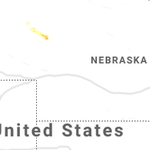
Nebraska
| Local Time | Report Details |
|---|---|
| 12:47 AM CDT | Storm damage reported in custer county NE, 61.4 miles ENE of North Platte, NE |
| 1:35 AM CDT | Storm damage reported in valley county NE, 57.5 miles NNW of Grand Island, NE |
Connect with Interactive Hail Maps