

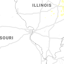
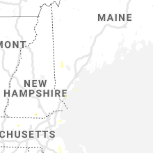
Hail Map for Sunday, June 30, 2019

Number of Impacted Households on 6/30/2019
0
Impacted by 1" or Larger Hail
0
Impacted by 1.75" or Larger Hail
0
Impacted by 2.5" or Larger Hail
Square Miles of Populated Area Impacted on 6/30/2019
0
Impacted by 1" or Larger Hail
0
Impacted by 1.75" or Larger Hail
0
Impacted by 2.5" or Larger Hail


Cities Most Affected by Hail Storms of 6/30/2019
| Hail Size | Demographics of Zip Codes Affected | ||||||
|---|---|---|---|---|---|---|---|
| City | Count | Average | Largest | Pop Density | House Value | Income | Age |
| Remer, MN | 3 | 2.08 | 2.75 | 6 | $93k | $28.3k | 51.7 |
| Burke, SD | 1 | 1.75 | 1.75 | 2 | $42k | $22.3k | 46.6 |
| Kyle, SD | 1 | 1.75 | 1.75 | 0 | $27k | $23.9k | 24.1 |
| Winner, SD | 1 | 1.75 | 1.75 | 4 | $55k | $29.0k | 45.4 |
| Haxtun, CO | 1 | 1.75 | 1.75 | 3 | $78k | $32.3k | 46.3 |
| Henning, IL | 1 | 1.75 | 1.75 | 0 | $35k | $40.3k | 38.4 |
Hail and Wind Damage Spotted on 6/30/2019
Filter by Report Type:Hail ReportsWind Reports
States Impacted
Minnesota, Wisconsin, New York, Connecticut, Kentucky, Illinois, Massachusetts, New Hampshire, Wyoming, Maine, Rhode Island, Virginia, Indiana, Iowa, North Carolina, South Dakota, Texas, Montana, Colorado, NebraskaMinnesota
| Local Time | Report Details |
|---|---|
| 7:02 AM CDT | Quarter sized hail reported near Deer River, MN, 51.9 miles E of Bemidji, MN, time estimated by radar. |
| 8:01 AM CDT | Baseball sized hail reported near Remer, MN, 51.8 miles ESE of Bemidji, MN, time estimated by radar. |
| 8:05 AM CDT | Ping Pong Ball sized hail reported near Remer, MN, 54.6 miles ESE of Bemidji, MN |
| 8:05 AM CDT | Golf Ball sized hail reported near Remer, MN, 54.6 miles ESE of Bemidji, MN, corrects previous hail report from 1 se remer. received pictures of larger hailstones from spotter than what was previously reported. |
| 8:09 AM CDT | Quarter sized hail reported near Sebeka, MN, 58.3 miles S of Bemidji, MN, photograph and confirmation of hail size via social media. |
| 8:10 AM CDT | Golf Ball sized hail reported near Remer, MN, 55.8 miles ESE of Bemidji, MN |
| 9:31 AM CDT | Uprooted trees blown over road. time estimated by rada in aitkin county MN, 71.1 miles WSW of Duluth, MN |
| 10:20 AM CDT | Trees down over the road. delayed report... time estimate in mille lacs county MN, 86.2 miles NNW of Minneapolis, MN |
| 10:21 AM CDT | Broken tree limbs blown onto road. time estimated by rada in pine county MN, 49.2 miles SW of Duluth, MN |
| 11:20 AM CDT | Tree down near 525th and fairfield ave. time estimate in chisago county MN, 52.4 miles NNE of Minneapolis, MN |
| 11:22 AM CDT | Pea-sized hail. torrential rainfal in stearns county MN, 65.3 miles NW of Minneapolis, MN |
| 3:05 PM CDT | Half Dollar sized hail reported near Brewster, MN, 69.1 miles ENE of Sioux Falls, SD |
| 3:10 PM CDT | Quarter sized hail reported near Alden, MN, 41.5 miles NNW of Mason City, IA, time estimated from radar. |
| 3:14 PM CDT | Storm damage reported in mower county MN, 32.7 miles NNE of Mason City, IA |
| 3:18 PM CDT | Damage to outbuilding paneling and framing. relayed via broadcast media. time estimated based on rada in mower county MN, 30.2 miles NNE of Mason City, IA |
| 3:28 PM CDT | Tree blown dow in mower county MN, 28.3 miles NNE of Mason City, IA |
| 3:29 PM CDT | Relayed via spotter of trees and power lines down in mabel. time estimated based on rada in fillmore county MN, 32.9 miles SW of La Crosse, WI |
| 10:45 PM CDT | Asos station krwf redwood falls a in redwood county MN, 41.9 miles SE of Montevideo, MN |
| 11:30 PM CDT | Numerous trees down on houses and vehicles. power lines dow in mcleod county MN, 45.8 miles WSW of Minneapolis, MN |
| 11:33 PM CDT | Tree fell on powerlines on meadowbrook lane... power outages reported in town. time estimated from rada in sibley county MN, 47.5 miles WSW of Minneapolis, MN |
| 11:35 PM CDT | Large tree branches dow in sibley county MN, 47.5 miles WSW of Minneapolis, MN |
| 11:38 PM CDT | Two foot diameter tree dow in mcleod county MN, 38.6 miles W of Minneapolis, MN |
| 11:45 PM CDT | Tree down on a vehicl in carver county MN, 35 miles WSW of Minneapolis, MN |
| 11:55 PM CDT | Trees down over cr 5 in carver county MN, 26.8 miles SW of Minneapolis, MN |
Wisconsin
| Local Time | Report Details |
|---|---|
| 9:25 AM CDT | 2-3 trees down. delayed report. time estimate in wood county WI, 76.4 miles ENE of La Crosse, WI |
| 10:20 AM CDT | Corrects previous tstm wnd dmg report from lake delton. scattered trees down with some being larg in sauk county WI, 40.8 miles NNW of Madison, WI |
| 10:25 AM CDT | Wind branches down. estimated 50-60mph gust in marquette county WI, 44.9 miles N of Madison, WI |
| 10:30 AM CDT | Scattered trees down with a few large tree in columbia county WI, 22.6 miles NW of Madison, WI |
| 10:30 AM CDT | Scattered trees down with a few large tree in sauk county WI, 33.3 miles NNW of Madison, WI |
| 10:40 AM CDT | Corrects previous tstm wnd dmg report from montello. scattered trees down throughout the count in marquette county WI, 49.6 miles N of Madison, WI |
| 10:40 AM CDT | Widespread trees down with some being larg in columbia county WI, 32.5 miles N of Madison, WI |
| 10:50 AM CDT | Widespread tress dow in columbia county WI, 29.7 miles N of Madison, WI |
| 11:00 AM CDT | Scattered trees dow in columbia county WI, 21.9 miles N of Madison, WI |
| 11:16 AM CDT | Scattered trees down with some being larg in sauk county WI, 40.8 miles NNW of Madison, WI |
| 11:25 AM CDT | Two young trees snapped at their bas in dodge county WI, 40.4 miles ENE of Madison, WI |
| 11:30 AM CDT | Hwy 26 large tree down blocking roa in dodge county WI, 41.3 miles NE of Madison, WI |
| 11:35 AM CDT | Trees down across the are in dodge county WI, 45.8 miles NE of Madison, WI |
| 11:35 AM CDT | Trees dow in dane county WI, 11.7 miles NE of Madison, WI |
| 11:40 AM CDT | Corrects previous tstm wnd gst report from 1 ssw watertow in jefferson county WI, 34 miles ENE of Madison, WI |
| 11:42 AM CDT | Siding blown off of a house in ashippu in dodge county WI, 44.8 miles ENE of Madison, WI |
| 11:45 AM CDT | Widespread wind damage throughout the county particularly in the ixonia are in jefferson county WI, 40.6 miles E of Madison, WI |
| 11:55 AM CDT | Two large tree branches dow in waukesha county WI, 43.5 miles E of Madison, WI |
| 12:00 PM CDT | Widespread wind damage in waukesha county especially in the oconomowoc are in waukesha county WI, 45.4 miles E of Madison, WI |
| 12:00 PM CDT | Large tree branch dow in washington county WI, 54.1 miles ENE of Madison, WI |
| 12:25 PM CDT | Tree damage throughout the county. delavan is one hard hit are in walworth county WI, 49.1 miles SE of Madison, WI |
| 12:25 PM CDT | Tree damage throughout the county. fontana is one of the hard hit area in walworth county WI, 55 miles SE of Madison, WI |
| 12:28 PM CDT | Large branches snapped of in waukesha county WI, 46.6 miles E of Madison, WI |
| 12:30 PM CDT | Large tree dow in waukesha county WI, 55.9 miles E of Madison, WI |
| 12:40 PM CDT | Large tree limbs down. estimated 60 mph gust in walworth county WI, 58.7 miles NW of Chicago, IL |
| 12:50 PM CDT | Several tree branches dow in kenosha county WI, 56.8 miles NNW of Chicago, IL |
| 12:53 PM CDT | Wind damaged a transformer in the area near ridgeview drive and county road in walworth county WI, 55.9 miles NW of Chicago, IL |
| 1:03 PM CDT | Trees down across the roa in kenosha county WI, 52.1 miles NNW of Chicago, IL |
| 1:03 PM CDT | Numerous large trees uprooted and snapped in half. numerous power lines dow in kenosha county WI, 53.3 miles NNW of Chicago, IL |
| 4:11 PM CDT | Tree down on highway 171. time estimated based on rada in crawford county WI, 37.7 miles SSE of La Crosse, WI |
| 5:35 PM CDT | Trees dow in lafayette county WI, 53.1 miles WSW of Madison, WI |
| 5:35 PM CDT | Measured gust by the platteville awo in grant county WI, 60 miles WSW of Madison, WI |
| 5:38 PM CDT | Several trees and power lines down across the county. hardest hit areas across southern half of county. 20...000 residents without power. cuba city hit particularly har in grant county WI, 61.2 miles WSW of Madison, WI |
| 5:54 PM CDT | Trees dow in lafayette county WI, 60.8 miles SW of Madison, WI |
New York
| Local Time | Report Details |
|---|---|
| 12:53 PM EDT | Trees down route 20 in greene county NY, 32.7 miles SSW of Schenectady, NY |
| 1:05 PM EDT | Trees and wires down on traver rd causing power outage in dutchess county NY, 71.5 miles N of Brooklyn, NY |
| 1:19 PM EDT | Quarter sized hail reported near Lagrangeville, NY, 68 miles NNE of Brooklyn, NY |
| 1:50 PM EDT | Quarter sized hail reported near Brewster, NY, 55 miles NNE of Brooklyn, NY |
| 2:32 PM EDT | Trees and power lines dow in suffolk county NY, 36.1 miles ENE of Brooklyn, NY |
| 2:35 PM EDT | Multiple trees and wires down from northport to commac in suffolk county NY, 38.6 miles ENE of Brooklyn, NY |
| 2:40 PM EDT | Large tree down on ketay drive n in suffolk county NY, 37.5 miles ENE of Brooklyn, NY |
| 2:40 PM EDT | Large tree down on bogart street between evergreen avenue and depot road in suffolk county NY, 32.1 miles ENE of Brooklyn, NY |
| 2:40 PM EDT | Trees down on elder drive and cottonwood drive in suffolk county NY, 38.6 miles ENE of Brooklyn, NY |
| 2:40 PM EDT | Multiple large trees down on rhoda avenue in suffolk county NY, 42.5 miles ENE of Brooklyn, NY |
| 2:40 PM EDT | Trees down on kenneth avenue in suffolk county NY, 33.1 miles ENE of Brooklyn, NY |
| 2:45 PM EDT | Multiple trees down on soma lane in suffolk county NY, 38.6 miles ENE of Brooklyn, NY |
| 2:45 PM EDT | Multiple trees down on yates avenue in suffolk county NY, 38.6 miles ENE of Brooklyn, NY |
| 2:45 PM EDT | Downed trees and power lines on townline road in suffolk county NY, 41.9 miles ENE of Brooklyn, NY |
| 2:45 PM EDT | Large tree branches dow in suffolk county NY, 53.7 miles ENE of Brooklyn, NY |
| 2:45 PM EDT | Large tree branches dow in suffolk county NY, 56.6 miles ENE of Brooklyn, NY |
| 2:46 PM EDT | Storm damage reported in suffolk county NY, 48 miles ENE of Brooklyn, NY |
| 2:47 PM EDT | Storm damage reported in suffolk county NY, 39 miles E of Brooklyn, NY |
| 2:48 PM EDT | Large tree limbs and branches down on oakland street in suffolk county NY, 39.6 miles E of Brooklyn, NY |
| 2:48 PM EDT | 22 inch diameter tree snapped about 25 ft above the ground on sunny lane in suffolk county NY, 39 miles E of Brooklyn, NY |
| 2:48 PM EDT | Trees down on stanwich road in suffolk county NY, 42.5 miles ENE of Brooklyn, NY |
| 2:50 PM EDT | Quarter sized hail reported near Islip, NY, 40.6 miles E of Brooklyn, NY |
| 2:50 PM EDT | Multiple trees and wires down from around the bay shore area east through oakdal in suffolk county NY, 40.5 miles E of Brooklyn, NY |
| 2:50 PM EDT | Large tree down into home on alkier stree in suffolk county NY, 39.3 miles E of Brooklyn, NY |
| 2:50 PM EDT | Downed tree on ny 231 northbound in the area of hunter avenue. right lane close in suffolk county NY, 34.7 miles E of Brooklyn, NY |
| 2:50 PM EDT | Large tree down on sylvan roa in suffolk county NY, 35.3 miles E of Brooklyn, NY |
| 2:50 PM EDT | Large tree down at sayville middle school in suffolk county NY, 47.4 miles E of Brooklyn, NY |
| 2:52 PM EDT | Tree down blocking craig road near connectquot avenu in suffolk county NY, 43.3 miles E of Brooklyn, NY |
| 2:55 PM EDT | Large tree down on locust avenue and brooktreet court in suffolk county NY, 46 miles E of Brooklyn, NY |
| 2:55 PM EDT | Tree down in front of islip town hall on nassau avenue in suffolk county NY, 40.5 miles E of Brooklyn, NY |
| 2:55 PM EDT | Downed tree on northern state parkway westbound between exit 43- commack road and exit 42n-ny23 in suffolk county NY, 33.1 miles ENE of Brooklyn, NY |
| 2:55 PM EDT | A thunderstorm wind gust of 53 knots was measured (anemometer height of 19 ft) in anz345 county NY, 44.8 miles E of Brooklyn, NY |
| 2:56 PM EDT | Large tree branches down on vail street near route 11 in suffolk county NY, 40.5 miles E of Brooklyn, NY |
| 2:56 PM EDT | Trees and power lines down on campbell lane in suffolk county NY, 42.1 miles E of Brooklyn, NY |
| 3:00 PM EDT | Large tree down on wensley lane in suffolk county NY, 42.1 miles E of Brooklyn, NY |
| 3:05 PM EDT | Trees down on elder drive and cottonwood drive in suffolk county NY, 38.6 miles ENE of Brooklyn, NY |
| 3:10 PM EDT | Downed tree on ny 231 northbound in the area of hunter avenue. right lane close in suffolk county NY, 34.7 miles E of Brooklyn, NY |
| 3:30 PM EDT | Multiple large trees down on rhoda avenue in suffolk county NY, 42.5 miles ENE of Brooklyn, NY |
| 3:30 PM EDT | Large tree down on sylvan roa in suffolk county NY, 35.3 miles E of Brooklyn, NY |
| 3:45 PM EDT | Downed trees and power lines on townline road in suffolk county NY, 41.9 miles ENE of Brooklyn, NY |
| 3:50 PM EDT | Large tree down at sayville middle school in suffolk county NY, 47.4 miles E of Brooklyn, NY |
| 4:43 PM EDT | Wires brought down on west neck road in suffolk county NY, 70.8 miles SW of Providence, RI |
Connecticut
| Local Time | Report Details |
|---|---|
| 1:10 PM EDT | Large branch from fallen tree impaled into the ground on king steet in the glenbrook section of stamford in fairfield county CT, 35.7 miles NE of Brooklyn, NY |
| 1:55 PM EDT | Quarter sized hail reported near Danbury, CT, 55.9 miles NNE of Brooklyn, NY |
| 2:10 PM EDT | Multiple trees fell knocking down power lines and transforme in fairfield county CT, 40.6 miles NE of Brooklyn, NY |
| 2:10 PM EDT | Trees down on styles lane in fairfield county CT, 40.6 miles NE of Brooklyn, NY |
| 2:10 PM EDT | Large branch from fallen tree impaled into the ground on king steet in the glenbrook section of stamford in fairfield county CT, 35.7 miles NE of Brooklyn, NY |
| 2:20 PM EDT | *** 1 fatal *** fallen tree into a car resulted in a fatality and another person having to be extracted from the car in the mill plain section of fairfiel in fairfield county CT, 49.2 miles NE of Brooklyn, NY |
| 2:22 PM EDT | Tree down on i-95 south between exits 14 and 13. the road is close in fairfield county CT, 36.4 miles NE of Brooklyn, NY |
| 2:22 PM EDT | Norwalk lighthouse in anz335 county CT, 41.7 miles NE of Brooklyn, NY |
| 2:22 PM EDT | Tree down on i-95 south between exits 14 and 13. the road is close in fairfield county CT, 37.7 miles NE of Brooklyn, NY |
| 2:25 PM EDT | Multiple trees down on duck pond road in fairfield county CT, 44.7 miles NE of Brooklyn, NY |
| 2:29 PM EDT | A thunderstorm wind gust of 53 knots (61 mph) was reporte in anz335 county CT, 43 miles NE of Brooklyn, NY |
| 2:30 PM EDT | Power lines down on sound beach avenue in fairfield county CT, 30 miles NE of Brooklyn, NY |
| 3:18 PM EDT | Downed tree on stage coach road in durham in middlesex county CT, 73.5 miles WSW of Providence, RI |
| 4:12 PM EDT | Downed branches weighing on wires on windy hill drive in middlesex county CT, 66 miles SW of Providence, RI |
Kentucky
| Local Time | Report Details |
|---|---|
| 1:35 PM EDT | Utility lines were blown down onto us 421. the blown down lines resulted in a 3 car pileup on us 42 in leslie county KY, 51.9 miles SE of Irvine, KY |
| 5:44 PM EDT | Tree down in the 1100 block of kirksville r in garrard county KY, 30 miles WSW of Irvine, KY |
| 6:20 PM EDT | Trees down on troy pik in woodford county KY, 46.3 miles WNW of Irvine, KY |
| 8:05 PM EDT | Tree down on quail run rd and garrett r in meade county KY, 25.3 miles W of Louisville, KY |
| 8:15 PM EDT | Multiple trees were blown dow in laurel county KY, 43.7 miles S of Irvine, KY |
| 8:15 PM EDT | Multiple trees were blown dow in laurel county KY, 47.3 miles S of Irvine, KY |
| 7:37 PM CDT | Trees down around stephensbur in breckinridge county KY, 44.7 miles W of Louisville, KY |
| 7:40 PM CDT | Tree on house in cloverport with electric lines downed as a resul in breckinridge county KY, 51.1 miles WSW of Louisville, KY |
| 7:41 PM CDT | Tree down in the 200 block of 7th s in breckinridge county KY, 51.1 miles WSW of Louisville, KY |
| 7:41 PM CDT | Large cedar tree down on hwy 60 near ky 14 in breckinridge county KY, 51.5 miles E of Evansville, IN |
| 8:04 PM CDT | Trees down around mcquady. st. marys church road and ky 10 in breckinridge county KY, 47.9 miles WSW of Louisville, KY |
| 8:05 PM CDT | Report of trees and power lines down scattered across town. time estimated by rada in daviess county KY, 28.5 miles ESE of Evansville, IN |
| 8:10 PM CDT | Tree down on zion church roa in ohio county KY, 47.3 miles ESE of Evansville, IN |
| 8:23 PM CDT | Grayson county dispatch reports a tree down on claggett road. county highway department had to be called to remove i in grayson county KY, 49.2 miles SW of Louisville, KY |
| 8:27 PM CDT | Tree down on ky 1414 near hartford... k in ohio county KY, 47.2 miles SE of Evansville, IN |
Illinois
| Local Time | Report Details |
|---|---|
| 12:40 PM CDT | Public reports multiple trees downed in vicinity of meridian road and west state. relayed via broadcast media. time estimated by rada in winnebago county IL, 55.8 miles SSE of Madison, WI |
| 12:50 PM CDT | Public reports tree downed near baxter road and il-251. relayed via broadcast medi in winnebago county IL, 64.4 miles SSE of Madison, WI |
| 12:50 PM CDT | Public reports several trees downed along il-2 between kennedy hill road and prairie road between byron and rockford. relayed via media. time estimated by rada in ogle county IL, 62.4 miles S of Madison, WI |
| 1:00 PM CDT | Numerous large branches downed. damage to siding. time estimated by rada in mchenry county IL, 48.9 miles NW of Chicago, IL |
| 1:00 PM CDT | Asos rf in winnebago county IL, 62 miles SSE of Madison, WI |
| 1:10 PM CDT | Tree branch downed on to road in island lake are in lake county IL, 39.6 miles NW of Chicago, IL |
| 1:15 PM CDT | Minor damage to trees in orego in ogle county IL, 72.7 miles S of Madison, WI |
| 1:15 PM CDT | Numerous tree branches downed in antioch. time estimated by rada in lake county IL, 46.9 miles NNW of Chicago, IL |
| 1:15 PM CDT | Numerous tree branches downed... some about 4 inch in diameter. time estimated by rada in lake county IL, 46 miles NNW of Chicago, IL |
| 1:20 PM CDT | Photo shared via social media of large tree branch downed on to power lines. time estimated via rada in mchenry county IL, 38.9 miles NW of Chicago, IL |
| 1:20 PM CDT | Numerous large branches downed near us-12 and lakeshore drive in wauconda. one branch about 8-in diameter. time estimated by rada in lake county IL, 36 miles NW of Chicago, IL |
| 1:20 PM CDT | Powerlines and trees downed blocking roads in north barrington and wauconda area in lake county IL, 35.4 miles NW of Chicago, IL |
| 1:25 PM CDT | Tree down on main street and dundee. time estimated by rada in lake county IL, 32.7 miles NW of Chicago, IL |
| 1:30 PM CDT | Delayed report... received via social media... of multiple large tree limbs down. time estimated via rada in kendall county IL, 49.4 miles WSW of Chicago, IL |
| 1:34 PM CDT | Video and detailed description showing two well-defined gustnados at the corner of scott and dauberman roads. debris was blown over 3/4 of a mile to the sout in kane county IL, 46.8 miles W of Chicago, IL |
| 1:35 PM CDT | Numerous tree branches downed in vicinity of palatine road and il-53. max diameter at least 6-in. relayed via social media. time estimated by rada in cook county IL, 24.5 miles NW of Chicago, IL |
| 1:35 PM CDT | Picture shared via social media of large commercial sign blown down on to a ca in cook county IL, 20.6 miles WNW of Chicago, IL |
| 1:40 PM CDT | Multiple large branches downe in dupage county IL, 26.7 miles W of Chicago, IL |
| 1:45 PM CDT | Deerpath road in north aurora blocked by large downed tree. time estimated by rada in kane county IL, 38.4 miles W of Chicago, IL |
| 1:50 PM CDT | Glen ellyn pd reports via social media power lines and trees downed near st charles and crescent. time estimated by rada in dupage county IL, 20.5 miles W of Chicago, IL |
| 1:50 PM CDT | Multiple 4 in diameter branches downed. relayed via spotter network. time estimated by rada in dupage county IL, 18.5 miles W of Chicago, IL |
| 2:00 PM CDT | Time estimated by rada in will county IL, 37 miles WSW of Chicago, IL |
| 2:00 PM CDT | Report to social media of a tree uprooted near eola road in aurora. time estimated by rada in dupage county IL, 33.4 miles WSW of Chicago, IL |
| 2:12 PM CDT | Three large tree limbs down. limb diameters range from 6 inches to one foot. time estimated based on rada in kendall county IL, 39.8 miles SW of Chicago, IL |
| 2:12 PM CDT | Photos of several large (up to 6 inch diameter) tree limbs snapped. time estimated based on radar signature in dupage county IL, 27.8 miles WSW of Chicago, IL |
| 2:13 PM CDT | Large portion of tree downed on electrical wires... snapping top portion of adjacent pole. time estimated on rada in la salle county IL, 64 miles NNE of Peoria, IL |
| 2:20 PM CDT | Top of large tree blown of in will county IL, 35.3 miles WSW of Chicago, IL |
| 2:25 PM CDT | Report of numerous trees down in morris relayed by grundy county so. time estimated based on rada in grundy county IL, 54.5 miles SW of Chicago, IL |
| 2:27 PM CDT | Wilmington so reports widespread tree damage across the town of wilmington. route 102 is blocked by large trees across the roadwa in will county IL, 48.1 miles SSW of Chicago, IL |
| 2:30 PM CDT | Winds estimated greater than 60 mph near us-52 in manhatta in will county IL, 36.4 miles SSW of Chicago, IL |
| 2:35 PM CDT | Delayed report of many 4-inch tree limbs down throughout the town... with a few limbs larger than 8 inches down as well. a couple 6-inch trees uprooted and a 2 ft. diam in will county IL, 37 miles SSW of Chicago, IL |
| 2:40 PM CDT | Relayed via the livingston county so: widespread tree damage in and around streator. awnings and limbs on houses and cars throughout the area. time estimated based on r in la salle county IL, 50.3 miles NE of Peoria, IL |
| 2:45 PM CDT | 65 mph wind gust estimated. small branches downe in will county IL, 36.7 miles SSW of Chicago, IL |
| 2:50 PM CDT | Semi rolled on i-57 near mile marker 32 in kankakee county IL, 45.2 miles SSW of Chicago, IL |
| 2:50 PM CDT | Report to social media of multiple large trees uprooted at kankakee sportsman club. time estimated by rada in kankakee county IL, 49.1 miles SSW of Chicago, IL |
| 2:51 PM CDT | Weatherbu in kankakee county IL, 53.7 miles S of Chicago, IL |
| 2:53 PM CDT | Storm damage reported in kankakee county IL, 45.1 miles SSW of Chicago, IL |
| 2:55 PM CDT | Tree reported down into pool. estimated 50 mph wind in marshall county IL, 31.2 miles NNE of Peoria, IL |
| 2:55 PM CDT | Multiple large branches downed in manteno. 6 to 12 inches diamete in kankakee county IL, 44.9 miles SSW of Chicago, IL |
| 3:00 PM CDT | Power lines downed and shingles off roof north of grant park. also 30 foot tree snappe in kankakee county IL, 43.2 miles S of Chicago, IL |
| 3:00 PM CDT | Kankakee emergency management reports numerous trees down in the momence area including trees downed on to residences. time estimated by rada in kankakee county IL, 50 miles S of Chicago, IL |
| 3:00 PM CDT | Powerlines down in odel in livingston county IL, 59.9 miles ENE of Peoria, IL |
| 3:15 PM CDT | Quarter sized hail reported near Hoopeston, IL, 77.8 miles NNE of Mattoon, IL |
| 3:20 PM CDT | Livingston so reports numerous powerlines down throughout pontiac. time estimated based on rada in livingston county IL, 51.9 miles ENE of Peoria, IL |
| 3:22 PM CDT | Iroquois county so reports a brick wall collapsed and took down a powerlin in iroquois county IL, 63.8 miles S of Chicago, IL |
| 3:30 PM CDT | Powerlines down in fairbury. relayed by livingston s in livingston county IL, 56.7 miles E of Peoria, IL |
| 3:45 PM CDT | Golf Ball sized hail reported near Henning, IL, 67.5 miles NNE of Mattoon, IL |
| 3:45 PM CDT | Treehouse blown over in vermilion county IL, 67.5 miles NNE of Mattoon, IL |
| 3:52 PM CDT | Iroquois county so reports powerlines down near church and bunker street in iroquois county IL, 72.8 miles S of Chicago, IL |
| 3:55 PM CDT | Large limbs and power lines downed in 700 block of south stree in vermilion county IL, 60.7 miles NE of Mattoon, IL |
| 4:00 PM CDT | Several tree branches dow in champaign county IL, 57.6 miles NNE of Mattoon, IL |
| 4:00 PM CDT | Small plane flipped over at rantoul airpor in champaign county IL, 57.1 miles NNE of Mattoon, IL |
| 4:15 PM CDT | Storm damage reported in champaign county IL, 38.9 miles N of Mattoon, IL |
| 4:15 PM CDT | Traffic signal reported downed on prospect ave just north of i-7 in champaign county IL, 43.8 miles N of Mattoon, IL |
| 4:16 PM CDT | Tree snapped at the bas in champaign county IL, 35.6 miles N of Mattoon, IL |
| 4:16 PM CDT | Large tree branch dow in champaign county IL, 37.6 miles NNE of Mattoon, IL |
| 4:18 PM CDT | Storm damage reported in champaign county IL, 43.3 miles NNE of Mattoon, IL |
| 4:20 PM CDT | Numerous trees reported down throughout champaign/urban in champaign county IL, 43.8 miles N of Mattoon, IL |
| 4:20 PM CDT | Power outages across the area due to downed tree in champaign county IL, 44.2 miles NNE of Mattoon, IL |
| 4:25 PM CDT | Tree reported down on university ave. damaged a street light in process of fallin in champaign county IL, 43.8 miles N of Mattoon, IL |
| 4:25 PM CDT | Large tree branch dow in champaign county IL, 32.6 miles N of Mattoon, IL |
| 4:29 PM CDT | Storm damage reported in champaign county IL, 38.9 miles N of Mattoon, IL |
| 4:35 PM CDT | Tree down from outflow boundary in douglas county IL, 22.6 miles NNE of Mattoon, IL |
| 4:40 PM CDT | Large limbs and power lines reported down in tow in vermilion county IL, 41.8 miles NE of Mattoon, IL |
| 4:58 PM CDT | Storm damage reported in macon county IL, 33.5 miles NW of Mattoon, IL |
| 5:00 PM CDT | 12 power poles reported down on us 36 between shaw road and coffee pot circl in macon county IL, 30.3 miles NW of Mattoon, IL |
| 5:00 PM CDT | Tree reported down on main street. time estimated by rada in douglas county IL, 14.3 miles NNE of Mattoon, IL |
| 5:20 PM CDT | Large tree uprooted along county road 1800e. time estimate in coles county IL, 13.7 miles E of Mattoon, IL |
| 5:24 PM CDT | Trees down and power lines down throughout the town. reported by county emergency management and storm spotte in coles county IL, 10.5 miles E of Mattoon, IL |
| 5:24 PM CDT | Trees down and power lines down throughout the town. reported by county emergency management and storm spotte in coles county IL, 0.3 miles ESE of Mattoon, IL |
| 5:29 PM CDT | Half Dollar sized hail reported near Mattoon, IL, 5.7 miles E of Mattoon, IL, report from public relayed by broadcast media through social media. |
| 5:45 PM CDT | Trees and power lines blown down over all of the northern one half of the county. reported by the county sheriff at 619p in crawford county IL, 37.6 miles SE of Mattoon, IL |
| 5:47 PM CDT | Large tree limb down... 9-12 inch in diamete in jo daviess county IL, 69.5 miles SW of Madison, WI |
| 6:03 PM CDT | 8 inch diameter wind in jo daviess county IL, 67.4 miles SW of Madison, WI |
| 6:14 PM CDT | Storm damage reported in jo daviess county IL, 56 miles SW of Madison, WI |
| 6:20 PM CDT | Delayed report from social media. time estimated from radar. shed flipped and destroyed on simmons stree in jo daviess county IL, 58.9 miles SSW of Madison, WI |
| 6:32 PM CDT | Delayed repor in carroll county IL, 73.7 miles SSW of Madison, WI |
| 6:32 PM CDT | Trees and power lines dow in carroll county IL, 73.7 miles SSW of Madison, WI |
| 6:32 PM CDT | Trees and power lines dow in carroll county IL, 78 miles SSW of Madison, WI |
| 6:44 PM CDT | Trees and power lines down. delayed repor in carroll county IL, 70.9 miles SSW of Madison, WI |
| 6:44 PM CDT | 2 to 3 inch tree limbs down and the power is out. time estimated using rada in rock island county IL, 66 miles ESE of Cedar Rapids, IA |
| 6:45 PM CDT | Large tree branches dow in lawrence county IL, 48.7 miles N of Evansville, IN |
| 6:50 PM CDT | 6 inch tree limb down... report via twitter... time estimated from rada in stephenson county IL, 54.3 miles SSW of Madison, WI |
| 6:57 PM CDT | 3 to 6 inch tree limbs dow in carroll county IL, 66.2 miles SSW of Madison, WI |
| 7:00 PM CDT | Tree blown onto a hous in clay county IL, 59.8 miles SSW of Mattoon, IL |
| 7:05 PM CDT | Trees blown down... including one on a hous in wabash county IL, 32.6 miles NNW of Evansville, IN |
| 7:22 PM CDT | Handheld anemomete in henry county IL, 62.1 miles NNW of Peoria, IL |
| 7:24 PM CDT | Large tree uprooted. photo via twitte in warren county IL, 58.4 miles WNW of Peoria, IL |
| 7:26 PM CDT | Several small tree branches approx 3 inch diameter down. power lines dow in henry county IL, 52.8 miles NW of Peoria, IL |
| 7:26 PM CDT | Corrects previous tstm wnd dmg report from 1 ssw galva. tree snapped off at the base and power lines down near this locatio in henry county IL, 39.5 miles NW of Peoria, IL |
| 7:40 PM CDT | Small shed overturne in knox county IL, 45.2 miles WNW of Peoria, IL |
| 7:42 PM CDT | Tree snapped off at the base and power lines down near this locatio in henry county IL, 39.5 miles NW of Peoria, IL |
| 7:44 PM CDT | Several 3 inch diameter tree limbs downed from outflow ahead of main storm in knox county IL, 43.5 miles WNW of Peoria, IL |
| 7:48 PM CDT | Time of the event was estimated using radar. power line down in granville and tree down across the road on highway 26 near hennepi in putnam county IL, 43.4 miles NNE of Peoria, IL |
| 7:50 PM CDT | Tree limbs blown down. estimated 60+ mph. from spotte in marshall county IL, 31.2 miles NNE of Peoria, IL |
| 7:54 PM CDT | Power lines down in the la harpe area. time estimated by radar. report via wge in hancock county IL, 41.2 miles ENE of Kahoka, MO |
| 8:05 PM CDT | Report of 60 mph winds along outflow boundary as it moved through tow in white county IL, 41.3 miles W of Evansville, IN |
| 8:15 PM CDT | Power line snapped in town. 24 inch diameter tree reported on niles/partridge streets. power pole down 1200n prairie/dee mac road in woodford county IL, 13.7 miles ENE of Peoria, IL |
| 8:20 PM CDT | House damaged by pergola around high/8th stree in woodford county IL, 21.7 miles ENE of Peoria, IL |
| 8:20 PM CDT | Report of multiple trees down in harrisbur in saline county IL, 55.3 miles WSW of Evansville, IN |
| 8:20 PM CDT | Tree down on hwy 13 blocking one lane of the roa in gallatin county IL, 37.4 miles WSW of Evansville, IN |
| 8:25 PM CDT | Power line reported down. power is out in area. time estimated by rada in tazewell county IL, 4.2 miles ESE of Peoria, IL |
| 8:30 PM CDT | Storm damage reported in tazewell county IL, 8.4 miles SE of Peoria, IL |
| 8:30 PM CDT | Small 2-3inch diameter branches reported down... with estimated 50-55mph wind in tazewell county IL, 9.2 miles SE of Peoria, IL |
| 9:15 PM CDT | Large tree downed on power line in logan county IL, 39.1 miles SSE of Peoria, IL |
Massachusetts
| Local Time | Report Details |
|---|---|
| 1:45 PM EDT | Quarter sized hail reported near Shrewsbury, MA, 36.5 miles NNW of Providence, RI |
| 2:15 PM EDT | Tree down on rte 495 ramp at woburn street in middlesex county MA, 50.6 miles N of Providence, RI |
| 2:25 PM EDT | Trees and wiers down on great pond street in essex county MA, 62.3 miles NNE of Providence, RI |
| 2:48 PM EDT | Large tree branch down on scott street... and large branch down on house on surry drive in middlesex county MA, 41.2 miles NNE of Providence, RI |
| 2:51 PM EDT | Tree down on osborne street in middlesex county MA, 44 miles NNE of Providence, RI |
| 2:54 PM EDT | Tree down on grapevine road at rte 128 blocking 2 lanes in essex county MA, 58.7 miles NNE of Providence, RI |
| 3:00 PM EDT | Tree down on clarendon street in suffolk county MA, 38.5 miles NNE of Providence, RI |
| 3:44 PM EDT | Quarter sized hail reported near Halifax, MA, 30 miles ENE of Providence, RI |
New Hampshire
| Local Time | Report Details |
|---|---|
| 1:50 PM EDT | Trees down on power lines. penny size hail als in hillsborough county NH, 63.9 miles N of Providence, RI |
| 3:00 PM EDT | Tree down. time estimated based on rada in rockingham county NH, 51.7 miles SSW of Portland, ME |
Wyoming
| Local Time | Report Details |
|---|---|
| 12:21 PM MDT | Quarter sized hail reported near Newcastle, WY, 53.7 miles W of Rapid City, SD |
| 12:32 PM MDT | Quarter sized hail reported near Newcastle, WY, 54.3 miles SE of Gillette, WY |
Maine
| Local Time | Report Details |
|---|---|
| 2:50 PM EDT | Trees down on wires on chases pond road in york county ME, 38 miles SSW of Portland, ME |
Rhode Island
| Local Time | Report Details |
|---|---|
| 3:25 PM EDT | Quarter sized hail reported near Cranston, RI, 5.1 miles SW of Providence, RI, amateur radio |
| 3:27 PM EDT | Quarter sized hail reported near Warwick, RI, 8.6 miles S of Providence, RI, amateur radio |
| 3:36 PM EDT | Trees and wires down on greenwood ave and commonweath ave. tree down on ives road in kent county RI, 8.6 miles S of Providence, RI |
| 3:36 PM EDT | Half Dollar sized hail reported near Warwick, RI, 8.6 miles S of Providence, RI |
| 3:54 PM EDT | Trees and wires down on rte 1 between hampton way and tower hill road in washington county RI, 28.1 miles SSW of Providence, RI |
Virginia
| Local Time | Report Details |
|---|---|
| 3:40 PM EDT | Trees downed onto powerlines along baltimore road. numerous power outages reported in the are in dinwiddie county VA, 26.8 miles S of Richmond, VA |
| 4:21 PM EDT | Corrects previous tstm wnd dmg report from 4 wsw penns store. small limbs down... split part of power line cable. time estimated by rada in patrick county VA, 49.5 miles SSW of Roanoke, VA |
Indiana
| Local Time | Report Details |
|---|---|
| 4:20 PM EDT | Tree down along sr 62 and sr 35 in jefferson county IN, 50.2 miles NNE of Louisville, KY |
| 3:30 PM CDT | Public reports 60 mph wind gust. relayed by media. time estimated by rada in newton county IN, 75.3 miles S of Chicago, IL |
| 3:56 PM CDT | Trees and limbs down. report relayed by broadcast media. time estimated based on rada in newton county IN, 75.3 miles S of Chicago, IL |
| 5:00 PM EDT | Power outage. minor tree damage. report via faceboo in bartholomew county IN, 46.7 miles SSE of Indianapolis, IN |
| 5:04 PM EDT | Power lines down along nabb new washington r in clark county IN, 40.4 miles NNE of Louisville, KY |
| 4:05 PM CDT | Measured at the kentland municipal airpor in newton county IN, 78.3 miles S of Chicago, IL |
| 5:10 PM EDT | Trees down throughout scott county... i in scott county IN, 48.6 miles N of Louisville, KY |
| 5:10 PM EDT | Utility lines were blow down near st. vincent williamsport hospital on ross avenue just east of the hospital. time is estimated from rada in warren county IN, 70.9 miles WNW of Indianapolis, IN |
| 5:15 PM EDT | Storm damage reported in warren county IN, 66.1 miles NW of Indianapolis, IN |
| 5:17 PM EDT | Time estimated from radar. tree blown down on state road 28 in warren county on the west end of tow in warren county IN, 69.4 miles WNW of Indianapolis, IN |
| 5:20 PM EDT | Relayed via medi in benton county IN, 84.5 miles S of Chicago, IL |
| 5:23 PM EDT | Tree blown down at state road 28 and rupert road. time estimated from rada in fountain county IN, 66 miles WNW of Indianapolis, IN |
| 5:24 PM EDT | Per tippecanoe sheriffs office... morehouse road between 250 w and 500 n closed due to downed power poles & lines... about 3-4 miles from wlfi to the west. relayed by w in tippecanoe county IN, 66.3 miles NW of Indianapolis, IN |
| 5:27 PM EDT | Quarter sized hail reported near Bloomington, IN, 40.9 miles SSW of Indianapolis, IN |
| 5:29 PM EDT | Numerous limbs down throughout the are in fountain county IN, 69.4 miles NE of Mattoon, IL |
| 5:35 PM EDT | Live 6-inch diameter trees uprooted on curry pike road. exact location not available. time roughly estimated from radar. report received at 1840 local tim in monroe county IN, 48.4 miles SSW of Indianapolis, IN |
| 5:41 PM EDT | Measured at wlfi. blowing dust from worked fields west of town filling the air. thick dusty haze. small healthy limbs and leaves flying through the air off large pin oa in tippecanoe county IN, 62.9 miles NW of Indianapolis, IN |
| 5:42 PM EDT | Reported as being near attic in fountain county IN, 68.6 miles WNW of Indianapolis, IN |
| 5:42 PM EDT | Quarter sized hail reported near Nashville, IN, 43.2 miles SSW of Indianapolis, IN, location estimated. caller reported hail in western brown county. |
| 5:50 PM EDT | Trees reported down all along us 40 near putnamville. report via faceboo in putnam county IN, 40.7 miles WSW of Indianapolis, IN |
| 6:00 PM EDT | One-inch tree limb blown down with estimated 60 mph wind gust. time approximat in tippecanoe county IN, 51.4 miles NW of Indianapolis, IN |
| 6:00 PM EDT | Time approximat in tippecanoe county IN, 51.4 miles NW of Indianapolis, IN |
| 6:11 PM EDT | Corrects previous tstm wnd gst report from 3 wsw whitehal in monroe county IN, 49.4 miles SSW of Indianapolis, IN |
| 6:20 PM EDT | Located on south martin road. location on the road not available. large tree or tree limb on the road. time approximat in parke county IN, 49.2 miles W of Indianapolis, IN |
| 7:15 PM EDT | Approximate locatio in daviess county IN, 51.8 miles NNE of Evansville, IN |
| 7:18 PM EDT | Tree down on borden r in washington county IN, 45.1 miles NNW of Louisville, KY |
| 7:20 PM EDT | Several trees and utility lines down throughout knox county in the bicknell... bruceville... edwardsport... and vincennes areas. time closely approximate in knox county IN, 59.9 miles NNE of Evansville, IN |
| 7:27 PM EDT | Trees down along hancock chapel r in harrison county IN, 35 miles NW of Louisville, KY |
| 7:28 PM EDT | Trees down in orleans along hwy 33 in orange county IN, 60.4 miles NW of Louisville, KY |
| 7:33 PM EDT | Several trees and utility lines down throughout knox county in the bicknell... bruceville... edwardsport... and vincennes areas. time closely approximate in knox county IN, 54.7 miles N of Evansville, IN |
| 7:33 PM EDT | Several trees and utility lines down throughout knox co in the bicknell... bruceville... edwardsport... and vincennes areas. time closely approximate in knox county IN, 57.1 miles NNE of Evansville, IN |
| 7:36 PM EDT | Several trees and utility lines down throughout knox county in the bicknell... bruceville... edwardsport... and vincennes areas. time closely approximate in knox county IN, 48.6 miles N of Evansville, IN |
| 7:37 PM EDT | Trees down along lake rd and hwy 33 in harrison county IN, 22.6 miles WNW of Louisville, KY |
| 7:37 PM EDT | Storm damage reported in dubois county IN, 43.3 miles NE of Evansville, IN |
| 7:43 PM EDT | Trees down in paoli... i in orange county IN, 56.9 miles NW of Louisville, KY |
| 7:45 PM EDT | Power lines down along jasper dubois roa in dubois county IN, 50.3 miles NE of Evansville, IN |
| 8:00 PM EDT | Trees and power lines down in taswell... i in crawford county IN, 52.1 miles WNW of Louisville, KY |
| 8:01 PM EDT | Power outages in leavenworth north of hwy 6 in crawford county IN, 37.5 miles WNW of Louisville, KY |
| 7:25 PM CDT | Numerous trees down around perry county... i in perry county IN, 50.2 miles W of Louisville, KY |
| 7:35 PM CDT | Large tree limbs down on east side of evansville in vanderburgh county IN, 1.3 miles E of Evansville, IN |
| 7:40 PM CDT | Widespread power outages in tell city... i in perry county IN, 43.9 miles E of Evansville, IN |
| 7:45 PM CDT | Tree down near buente and st. wendel road intersectio in vanderburgh county IN, 9.2 miles NW of Evansville, IN |
| 7:59 PM CDT | Report of 595 customers without power in vanderburgh count in vanderburgh county IN, 0.4 miles WNW of Evansville, IN |
Iowa
| Local Time | Report Details |
|---|---|
| 3:48 PM CDT | Trees blown dow in mitchell county IA, 22.7 miles ENE of Mason City, IA |
| 3:50 PM CDT | Tree blown dow in howard county IA, 53.2 miles SW of La Crosse, WI |
| 3:53 PM CDT | Mping report 31 miles north of frederika... ia... of downed trees and a roof blown off of unknown building typ in howard county IA, 47.2 miles ENE of Mason City, IA |
| 4:05 PM CDT | Shingles blown of in chickasaw county IA, 34.2 miles E of Mason City, IA |
| 4:05 PM CDT | Tree branch snapped in new hampton. time estimated based on radar and arrival of storm outflo in chickasaw county IA, 45.5 miles E of Mason City, IA |
| 4:14 PM CDT | Personal weather station. report via wfo des moine in chickasaw county IA, 53.3 miles ESE of Mason City, IA |
| 4:15 PM CDT | Large tree snapped in calmar. reported via social media. time estimated based on rada in winneshiek county IA, 52.7 miles SW of La Crosse, WI |
| 4:24 PM CDT | Trees blown down in monon in clayton county IA, 53.1 miles S of La Crosse, WI |
| 4:29 PM CDT | Tree down on highway 76 between effigy mounds and marquette. relayed via ia dot. time estimated based on rada in clayton county IA, 51.4 miles S of La Crosse, WI |
| 4:37 PM CDT | Severe roof damage to a large metal building. boards driven into a nearby shed. report received via social media. time estimated based on rada in fayette county IA, 61.3 miles N of Cedar Rapids, IA |
| 4:38 PM CDT | Lots of trees blown down across the entire county. too many reports to relay specific location in winneshiek county IA, 44 miles SW of La Crosse, WI |
| 4:40 PM CDT | Lots of trees and power lines down across the northern part of the county. too many reports to relay specific location in allamakee county IA, 39.2 miles SSW of La Crosse, WI |
| 4:40 PM CDT | Reports of some trees... branches... and power lines down in at least four communities across the county including randali in fayette county IA, 62.7 miles N of Cedar Rapids, IA |
| 4:41 PM CDT | Trees down 1 mile south of gunder. relayed via broadcast medi in clayton county IA, 60.3 miles SSW of La Crosse, WI |
| 4:43 PM CDT | Report of a large tree branch down on a hom in floyd county IA, 31.9 miles E of Mason City, IA |
| 4:44 PM CDT | Tree limb blown down on a hous in floyd county IA, 32.7 miles E of Mason City, IA |
| 4:46 PM CDT | Trees blown down near garnavill in clayton county IA, 65.1 miles S of La Crosse, WI |
| 4:52 PM CDT | Numerous branches and power lines down... especially on northeast side of tow in fayette county IA, 50.1 miles NNW of Cedar Rapids, IA |
| 4:52 PM CDT | Storm damage reported in buchanan county IA, 46.1 miles NNW of Cedar Rapids, IA |
| 4:55 PM CDT | Tree snapped from estimated 60 mph wind gust. report via wfo davenpor in clayton county IA, 48.9 miles N of Cedar Rapids, IA |
| 4:56 PM CDT | 12-24 inch tree snapped 3 feet above the ground. relayed via dvn. time estimated based on rada in fayette county IA, 46.3 miles N of Cedar Rapids, IA |
| 5:00 PM CDT | Large 30-40 foot cedar trees snapped approx 2-3 foot from base of tree. also small outbuilding destroyed. reported at 2214 108th st hazelton... i in buchanan county IA, 45.9 miles N of Cedar Rapids, IA |
| 5:01 PM CDT | Reported numerous trees down in edgewoo in delaware county IA, 47.9 miles NNE of Cedar Rapids, IA |
| 5:02 PM CDT | Corrects previous tstm wnd dmg report from 1 s hazleton. large tree limb down in fontana park. two foot diameter tree down in the park with numerous other trees dow in buchanan county IA, 44.7 miles NNW of Cedar Rapids, IA |
| 5:07 PM CDT | Numerous trees down in town... time estimated from rada in delaware county IA, 42.1 miles N of Cedar Rapids, IA |
| 5:10 PM CDT | Tree limbs and utility lines dow in buchanan county IA, 37.3 miles NNW of Cedar Rapids, IA |
| 5:10 PM CDT | Corrects previous tstm wnd dmg report from independence. numerous reports of branches down some as large as 5 inches in diameter. a couple reports of trees about 12 to in buchanan county IA, 35.8 miles NNW of Cedar Rapids, IA |
| 5:10 PM CDT | Delayed report via social media. time estimated from radar. trees dow in buchanan county IA, 36.2 miles NNW of Cedar Rapids, IA |
| 5:11 PM CDT | Roof blow off a house in tow in delaware county IA, 40.5 miles NNE of Cedar Rapids, IA |
| 5:17 PM CDT | Storm damage reported in dubuque county IA, 49 miles NE of Cedar Rapids, IA |
| 5:17 PM CDT | Tree limbs down in tow in dubuque county IA, 49 miles NE of Cedar Rapids, IA |
| 5:18 PM CDT | Large tree down blocking rural road north of masonvill in delaware county IA, 36.4 miles N of Cedar Rapids, IA |
| 5:30 PM CDT | Numerous tree limbs down. some 4 inche in dubuque county IA, 53.4 miles NE of Cedar Rapids, IA |
| 5:40 PM CDT | 1 tree uprooted and across road near 27240 183rd ave. time estimated from rada in scott county IA, 61.5 miles ESE of Cedar Rapids, IA |
| 5:41 PM CDT | *** 1 inj *** delayed report from social media. time estimated from radar. scanner reports of a barn rolling over trapping a perso in dubuque county IA, 54.9 miles ENE of Cedar Rapids, IA |
| 5:42 PM CDT | Power lines down between luxemburg and holy cros in dubuque county IA, 53.9 miles NE of Cedar Rapids, IA |
| 5:42 PM CDT | Two sheds blown over in town. time estimated using rada in jackson county IA, 54.2 miles ENE of Cedar Rapids, IA |
| 5:43 PM CDT | Numerous reports of branches down some as large as 5 inches in diameter. a couple reports of trees about 12 to 24 inches in diameter snapped off 3 feet off the groun in buchanan county IA, 35.8 miles NNW of Cedar Rapids, IA |
| 5:44 PM CDT | Storm damage reported in dubuque county IA, 57.5 miles ENE of Cedar Rapids, IA |
| 5:45 PM CDT | Storm damage reported in linn county IA, 7.8 miles NE of Cedar Rapids, IA |
| 5:49 PM CDT | Numerous tree limbs some 4 inches in diamete in linn county IA, 1.9 miles WSW of Cedar Rapids, IA |
| 5:54 PM CDT | Roofs ripped off multiple buildings in tow in jones county IA, 27.5 miles E of Cedar Rapids, IA |
| 5:56 PM CDT | Numerous tree branches down... time estimated from rada in jones county IA, 37.3 miles E of Cedar Rapids, IA |
| 6:02 PM CDT | Trees down on highway 52 near bellevu in jackson county IA, 67 miles ENE of Cedar Rapids, IA |
| 6:04 PM CDT | Measured at rwis iado in jackson county IA, 51.6 miles E of Cedar Rapids, IA |
| 6:05 PM CDT | Located on the hill in tow in jackson county IA, 66.8 miles ENE of Cedar Rapids, IA |
| 6:08 PM CDT | Numerous tree damage in tow in cedar county IA, 31.5 miles ESE of Cedar Rapids, IA |
| 6:08 PM CDT | Numerous tree limbs down and small debris in the air. most limbs were 2 to 4 inches in diamete in jackson county IA, 52 miles E of Cedar Rapids, IA |
| 6:10 PM CDT | 5 minutes of 50 to 60 mph wind in cedar county IA, 39.5 miles E of Cedar Rapids, IA |
| 6:11 PM CDT | Storm damage reported in clinton county IA, 76.7 miles E of Cedar Rapids, IA |
| 6:13 PM CDT | Widespread thunderstorm wind damage across jones county with numerous tree downs and limbs throught the county. a roof blown off a shed in oli in jones county IA, 30.8 miles NE of Cedar Rapids, IA |
| 6:16 PM CDT | Delayed report from social media. time estimated from radar. considerable trees down with highway 136 closed. power ou in clinton county IA, 62 miles E of Cedar Rapids, IA |
| 6:20 PM CDT | Iadot site (rcii4 in linn county IA, 3.2 miles S of Cedar Rapids, IA |
| 6:22 PM CDT | Storm damage reported in scott county IA, 47 miles ESE of Cedar Rapids, IA |
| 6:32 PM CDT | Storm damage reported in scott county IA, 57.5 miles ESE of Cedar Rapids, IA |
| 6:36 PM CDT | Corrects previous tstm wnd dmg report from 1 n park view. fence ripped out and patio thrown into a pool. reported at 18360 272nd in scott county IA, 61.5 miles ESE of Cedar Rapids, IA |
| 6:37 PM CDT | 3 inch diameter tree limbs dow in scott county IA, 61.8 miles ESE of Cedar Rapids, IA |
| 6:38 PM CDT | Large tree branch down on house at 1624 west columbia av in scott county IA, 62.8 miles ESE of Cedar Rapids, IA |
| 6:40 PM CDT | 10 to 12 inch tree broken off above the base and it fell onto a home. time of the event estimating using rada in scott county IA, 62 miles ESE of Cedar Rapids, IA |
| 6:43 PM CDT | Several tree limbs and power lines down throughout the town. time estimated from rada in muscatine county IA, 49.5 miles SE of Cedar Rapids, IA |
| 6:44 PM CDT | Numerous tree limbs down 2 to 4 inches in diameter. one dented a ca in muscatine county IA, 49.8 miles SE of Cedar Rapids, IA |
| 6:45 PM CDT | 8-10 inch diameter branches down; 1.7 inches of rai in scott county IA, 63.1 miles ESE of Cedar Rapids, IA |
| 6:45 PM CDT | Shed los in scott county IA, 57.2 miles SE of Cedar Rapids, IA |
| 6:45 PM CDT | 2-3 inch tree limbs down; time estimated by spotte in scott county IA, 67.6 miles ESE of Cedar Rapids, IA |
| 6:48 PM CDT | Lost 8-inch diameter tre in scott county IA, 57.9 miles SE of Cedar Rapids, IA |
| 7:39 PM CDT | Storm damage reported in des moines county IA, 40.1 miles NE of Kahoka, MO |
North Carolina
| Local Time | Report Details |
|---|---|
| 5:23 PM EDT | A large tree snapped off and fell on power lines and a car at beechridge rd and breeze r in wake county NC, 1.7 miles NNW of Raleigh, NC |
| 5:23 PM EDT | Multiple trees and power lines down on white oak rd off anderson d in wake county NC, 1.7 miles N of Raleigh, NC |
| 5:23 PM EDT | Tree and power lines down on a car with a victim inside at e drewry ln and anderson d in wake county NC, 2.5 miles NNE of Raleigh, NC |
| 5:31 PM EDT | Two large trees down along poole rd near the intersection with beverly dr. one tree was approximately 3 feet in diameter and uprooted alongside the westbound side of th in wake county NC, 3.1 miles ESE of Raleigh, NC |
| 5:31 PM EDT | A tree two feet in diameter was uprooted and fell on a home at beverly dr and bromley st. another tree two and a half feet in diameter is blocking bromley st near bever in wake county NC, 2.6 miles ESE of Raleigh, NC |
| 5:52 PM EDT | Trees were reported down on power lines along old us highway 70 near pine hollow roa in johnston county NC, 11.3 miles SE of Raleigh, NC |
| 6:20 PM EDT | Trees down on whitehat road near the perquimans river. report via social media. time estimated from rada in perquimans county NC, 44.5 miles SSW of Virginia Beach, VA |
| 6:33 PM EDT | Tree down at w jones st and brooklyn ave in ramseu in randolph county NC, 57.3 miles W of Raleigh, NC |
| 6:41 PM EDT | Trees were reported down on power lines near buffalo ford road and mill creek roa in randolph county NC, 56.5 miles W of Raleigh, NC |
| 7:08 PM EDT | Tree and utility lines down on vance st in lexingto in davidson county NC, 53 miles NE of Charlotte, NC |
| 8:27 PM EDT | Report of trees and part of a fence blown down on mingus roa in mecklenburg county NC, 6.5 miles NNW of Charlotte, NC |
South Dakota
| Local Time | Report Details |
|---|---|
| 4:27 PM CDT | Golf Ball sized hail reported near Burke, SD, 65.5 miles NNW of Oneill, NE |
| 4:10 PM MDT | Golf Ball sized hail reported near Kyle, SD, 59.1 miles ESE of Rapid City, SD |
| 5:34 PM CDT | Quarter sized hail reported near Platte, SD, 72.6 miles NNW of Oneill, NE |
| 4:36 PM MDT | Storm damage reported in jackson county SD, 67 miles ESE of Rapid City, SD |
| 4:46 PM MDT | Quarter sized hail reported near Wanblee, SD, 75.1 miles ESE of Rapid City, SD |
| 5:08 PM MDT | Storm damage reported in jackson county SD, 75.3 miles NW of Valentine, NE |
| 6:20 PM CDT | Quarter sized hail reported near Dallas, SD, 62 miles ENE of Valentine, NE |
| 5:25 PM MDT | Quarter sized hail reported near Kadoka, SD, 67.9 miles SW of Pierre, SD |
| 6:26 PM CDT | Quarter sized hail reported near Dallas, SD, 62.3 miles NE of Valentine, NE |
| 6:30 PM CDT | Large shed was damaged... lifted off it's foundation by wind in tripp county SD, 61.2 miles ENE of Valentine, NE |
| 6:46 PM CDT | Quarter sized hail reported near Gregory, SD, 71.7 miles NE of Valentine, NE |
| 7:08 PM CDT | Quarter sized hail reported near Parmelee, SD, 39.1 miles NW of Valentine, NE |
| 7:15 PM CDT | Quarter sized hail reported near Wood, SD, 42 miles N of Valentine, NE |
| 7:27 PM CDT | Storm damage reported in tripp county SD, 34.4 miles NE of Valentine, NE |
| 7:34 PM CDT | Quarter sized hail reported near Wood, SD, 42.9 miles NNE of Valentine, NE |
| 7:58 PM CDT | Golf Ball sized hail reported near Winner, SD, 38.3 miles NNE of Valentine, NE |
| 8:00 PM CDT | Quarter sized hail reported near Winner, SD, 33.6 miles NE of Valentine, NE |
| 8:22 PM CDT | Storm damage reported in tripp county SD, 50.6 miles NE of Valentine, NE |
| 8:30 PM CDT | Quarter sized hail reported near Brandt, SD, 48.9 miles WSW of Montevideo, MN, estimated winds of 40 to 60 mph. |
| 9:35 PM CDT | Storm damage reported in gregory county SD, 63 miles ENE of Valentine, NE |
Texas
| Local Time | Report Details |
|---|---|
| 5:42 PM CDT | Measured on the west texas mesonet in mccame in upton county TX, 51 miles S of Odessa, TX |
Montana
| Local Time | Report Details |
|---|---|
| 5:05 PM MDT | Heavy rain in sweet grass county MT, 57.2 miles ENE of Bozeman, MT |
| 5:31 PM MDT | Half Dollar sized hail reported near Big Timber, MT, 60.3 miles W of Billings, MT |
| 5:40 PM MDT | Quarter sized hail reported near Big Timber, MT, 54.3 miles WNW of Billings, MT |
| 5:43 PM MDT | Quarter sized hail reported near Reed Point, MT, 51.8 miles W of Billings, MT |
| 6:10 PM MDT | Strong winds lasted 2-3 minutes in stillwater county MT, 44.2 miles W of Billings, MT |
| 7:30 PM MDT | Quarter sized hail reported near Broadus, MT, 71.1 miles N of Gillette, WY |
Colorado
| Local Time | Report Details |
|---|---|
| 6:07 PM MDT | Quarter sized hail reported near Otis, CO, 25.2 miles NW of Yuma, CO |
| 6:39 PM MDT | Golf Ball sized hail reported near Haxtun, CO, 28.9 miles N of Yuma, CO |
| 7:02 PM MDT | Fencing structure destroyed along with branches down. wind gusts estimated at 70 to 80 mp in weld county CO, 40.9 miles NE of Denver, CO |
| 7:20 PM MDT | Quarter sized hail reported near Haxtun, CO, 33.9 miles N of Yuma, CO |
Nebraska
| Local Time | Report Details |
|---|---|
| 7:08 PM MDT | Quarter sized hail reported near Whitman, NE, 64.5 miles WSW of Valentine, NE, ranged from dime to quarter size. time estimated from radar. |
| 9:38 PM MDT | 12 inch diameter tree blown down and power outages reported in the are in cheyenne county NE, 51.8 miles SE of Scottsbluff, NE |
| 10:12 PM MDT | Tree limbs were being blown across the highwa in morrill county NE, 19.6 miles SE of Scottsbluff, NE |
Connect with Interactive Hail Maps