

Hail Map for Tuesday, September 10, 2019

Number of Impacted Households on 9/10/2019
0
Impacted by 1" or Larger Hail
0
Impacted by 1.75" or Larger Hail
0
Impacted by 2.5" or Larger Hail
Square Miles of Populated Area Impacted on 9/10/2019
0
Impacted by 1" or Larger Hail
0
Impacted by 1.75" or Larger Hail
0
Impacted by 2.5" or Larger Hail


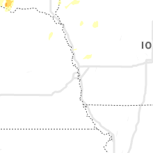


Cities Most Affected by Hail Storms of 9/10/2019
| Hail Size | Demographics of Zip Codes Affected | ||||||
|---|---|---|---|---|---|---|---|
| City | Count | Average | Largest | Pop Density | House Value | Income | Age |
| Fort Laramie, WY | 3 | 3.67 | 4.25 | 1 | $57k | $26.9k | 52.0 |
| Glendo, WY | 2 | 2.25 | 2.75 | 0 | $80k | $23.0k | 52.4 |
| Guernsey, WY | 2 | 1.75 | 1.75 | 0 | $68k | $31.9k | 46.2 |
| Greeley, CO | 2 | 1.75 | 1.75 | 437 | $114k | $28.7k | 25.3 |
| Gill, CO | 1 | 2.00 | 2.00 | 24 | $111k | $43.1k | 36.7 |
Hail and Wind Damage Spotted on 9/10/2019
Filter by Report Type:Hail ReportsWind Reports
States Impacted
Utah, Georgia, Nebraska, Texas, Alabama, Wyoming, South Dakota, Virginia, Tennessee, Idaho, Michigan, South Carolina, ColoradoUtah
| Local Time | Report Details |
|---|---|
| 12:02 PM MDT | Asos station kcny canyonlands field airpor in grand county UT, 67.2 miles WSW of Grand Junction, CO |
| 2:10 PM MDT | Quarter sized hail reported near Smithfield, UT, 74.7 miles N of Salt Lake City, UT, hail report in smithfield. |
| 2:10 PM MDT | Quarter sized hail reported near Logan, UT, 68.5 miles N of Salt Lake City, UT, hail measured on utah state university campus. |
| 2:16 PM MDT | Quarter sized hail reported near Smithfield, UT, 74.7 miles N of Salt Lake City, UT, hail measured in smithfield. |
| 2:20 PM MDT | Half Dollar sized hail reported near Logan, UT, 69.1 miles N of Salt Lake City, UT, measured hail near logan. |
Georgia
| Local Time | Report Details |
|---|---|
| 3:20 PM EDT | A traffic light was damaged near the intersection of s. houston rd and brookwood dr south of warner robins... g in houston county GA, 89.1 miles NNW of Douglas, GA |
| 5:18 PM EDT | Recieved a report of damage along club dr ne including trees down and roof damage. time is estimated from rada in fulton county GA, 8.1 miles NNE of Atlanta, GA |
| 5:30 PM EDT | Tree down on vehicles near the intersection of mcmillan st. nw and 8th st n in fulton county GA, 2.2 miles NNW of Atlanta, GA |
| 6:12 PM EDT | A tree was reported down along i-75 in butts county GA, 37.6 miles SSE of Atlanta, GA |
| 6:14 PM EDT | A tree was reported down near the intersection of chuli rd and locust grove rd. time is estimated from rada in spalding county GA, 33.5 miles SSE of Atlanta, GA |
| 6:20 PM EDT | Sheriff office reported large limbs down in dearin in mcduffie county GA, 24.4 miles W of Augusta, GA |
| 6:24 PM EDT | A tree was reported down on powerlines near the intersection of coan and seabolt rd. time is estimated by rada in henry county GA, 30.9 miles SE of Atlanta, GA |
| 6:28 PM EDT | A tree was reported down on the intersection of coan and old jackson rd. time is estimated by rada in henry county GA, 27.8 miles SSE of Atlanta, GA |
| 7:34 PM EDT | Quarter sized hail reported near Carrollton, GA, 37.1 miles WSW of Atlanta, GA, the public reported one inch hail near clem. |
| 7:35 PM EDT | 911 center reports 3 trees down along highway 101 near crider creek roa in paulding county GA, 34.2 miles W of Atlanta, GA |
| 7:49 PM EDT | 991 center reports one tree down on powerlines at intersection of east candler st and rome s in carroll county GA, 40.6 miles WSW of Atlanta, GA |
| 7:50 PM EDT | 911 center reports a tree down on a house at the intersection of 1st st and avenue in carroll county GA, 41.9 miles WSW of Atlanta, GA |
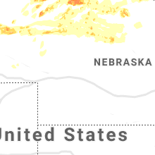
Nebraska
| Local Time | Report Details |
|---|---|
| 1:44 PM MDT | Quarter sized hail reported near , , 83.7 miles W of Valentine, NE, most of the hail was dime to nickel size... though the observer reported a few stones to the size of quarters. |
| 2:33 PM MDT | Quarter sized hail reported near Merriman, NE, 58.8 miles W of Valentine, NE |
| 3:43 PM MDT | Half Dollar sized hail reported near Gordon, NE, 74 miles W of Valentine, NE |
| 4:42 PM MDT | Quarter sized hail reported near Kilgore, NE, 21.3 miles WNW of Valentine, NE |
| 6:00 PM CDT | Quarter sized hail reported near Crookston, NE, 13.5 miles WNW of Valentine, NE, most hailstones were nickel size or smaller... but a few were at least quarter in size. |
| 6:23 PM CDT | Ping Pong Ball sized hail reported near Valentine, NE, 1.1 miles N of Valentine, NE |
| 6:23 PM CDT | Peak gust in squall was 82 mph at kvt in cherry county NE, 0.3 miles S of Valentine, NE |
| 6:25 PM CDT | Half Dollar sized hail reported near Valentine, NE, 0.3 miles S of Valentine, NE, via social media |
| 6:27 PM CDT | Debris on the ground in cherry county NE, 2.1 miles E of Valentine, NE |
| 5:31 PM MDT | Estimated 50-60 mph in cherry county NE, 67.2 miles W of Valentine, NE |
| 7:11 PM CDT | Storm damage reported in cherry county NE, 15.8 miles ENE of Valentine, NE |
| 7:17 PM MDT | Quarter sized hail reported near Hemingford, NE, 39.3 miles NE of Scottsbluff, NE, quarter sized hail observed by public. reported via social media |
| 9:09 PM MDT | Quarter sized hail reported near Mullen, NE, 54.4 miles SW of Valentine, NE |
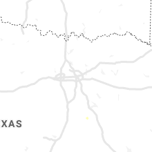
Texas
| Local Time | Report Details |
|---|---|
| 3:00 PM CDT | Reports of trees down near the 600 block of old phelps road. time estimated based off of rada in walker county TX, 65.4 miles SW of Lufkin, TX |
| 3:15 PM CDT | Report of power lines down near old colony rd and wanza rd. time based on rada in walker county TX, 63.6 miles SW of Lufkin, TX |
| 3:30 PM CDT | Power lines nearly blown over... fences and a shed blown down... parts of metal roof panels blown of in caldwell county TX, 54 miles ENE of San Antonio, TX |
| 4:25 PM CDT | Construction scaffolding collapsed onto parked vehicles near the 100 park apartments at century square. time estimated off of rada in brazos county TX, 83.4 miles NW of Houston, TX |
| 4:30 PM CDT | Snapped tree and downed branches reported near hwy 60 in west college statio in brazos county TX, 83.2 miles NW of Houston, TX |
| 4:30 PM CDT | Damage to a large shed like structure near sebesta ln. time estimated based on rada in brazos county TX, 74.6 miles NW of Houston, TX |
| 4:38 PM CDT | Pole line knocked down to a 45 degree angle with the wires saggin in brazos county TX, 75.5 miles NW of Houston, TX |
Alabama
| Local Time | Report Details |
|---|---|
| 3:00 PM CDT | Corrects previous tstm wnd dmg report from 6 ssw hillsboro. report of damage to a building in mount hope area. time estimated by rada in lawrence county AL, 30.8 miles ESE of Florence, AL |
| 3:00 PM CDT | Report of roof damage to a barn and houses in the area along cr 309. time estimated by rada in lawrence county AL, 30.7 miles SE of Florence, AL |
| 3:55 PM CDT | Bradford pear trees knocked down near cr 134 at cr 71 in dekalb county AL, 33.1 miles SW of Chattanooga, TN |
| 4:25 PM CDT | Corrects previous tstm wnd dmg report from 5 s moores mill. numerous reports of trees and power lines in north through south huntsville... including the moores mill are in madison county AL, 64.6 miles E of Florence, AL |
| 4:26 PM CDT | Trees and power lines down on baywood drive and johnson drive. time estimated by rada in madison county AL, 61.7 miles E of Florence, AL |
| 4:26 PM CDT | Trees down at the 4400 block of millvale drive. time estimated by rada in madison county AL, 60 miles E of Florence, AL |
| 4:26 PM CDT | A tree down on normandale road. time estimated by rada in madison county AL, 62.3 miles E of Florence, AL |
| 4:29 PM CDT | Powerline snapped on helena drive nw with transformers hanging off the groun in madison county AL, 65.7 miles E of Florence, AL |
| 4:29 PM CDT | Trees down along blue spring road at winchester road. time estimated by rada in madison county AL, 61.2 miles E of Florence, AL |
| 4:37 PM CDT | Large tree down on car and carport on lakeview drive. time estimated by rada in madison county AL, 61.7 miles E of Florence, AL |
| 4:45 PM CDT | A tree and power line knocked down in cheroke in colbert county AL, 17 miles W of Florence, AL |
| 5:10 PM CDT | Numerous reports of trees and power lines in north through south huntsville... including the moores mill are in madison county AL, 64.6 miles E of Florence, AL |
Wyoming
| Local Time | Report Details |
|---|---|
| 2:10 PM MDT | Ping Pong Ball sized hail reported near Glendo, WY, 70.4 miles ESE of Casper, WY, reports in glendo of 1 to 1 1/2 inch diameter hail. |
| 2:15 PM MDT | Baseball sized hail reported near Glendo, WY, 70.4 miles ESE of Casper, WY, hail up to baseball size in glendo. |
| 3:05 PM MDT | Golf Ball sized hail reported near Guernsey, WY, 62.2 miles WNW of Scottsbluff, NE |
| 3:14 PM MDT | Golf Ball sized hail reported near Guernsey, WY, 61.9 miles WNW of Scottsbluff, NE, golf ball hail measured over hail core area. this is a corrected location |
| 3:14 PM MDT | Golf Ball sized hail reported near Glendo, WY, 70.4 miles ESE of Casper, WY, golf ball hail measured |
| 3:40 PM MDT | Grapefruit sized hail reported near Fort Laramie, WY, 56.3 miles NW of Scottsbluff, NE |
| 3:55 PM MDT | Grapefruit sized hail reported near Fort Laramie, WY, 49.3 miles NW of Scottsbluff, NE, multiple hail stones between 4 and 4 3/8 inches measured |
| 4:20 PM MDT | Half Dollar sized hail reported near Weston, WY, 30.7 miles N of Gillette, WY |
| 4:28 PM MDT | Tennis Ball sized hail reported near Fort Laramie, WY, 47 miles NW of Scottsbluff, NE, hail up to tennis ball size on us highway 85. |
| 5:48 PM MDT | Quarter sized hail reported near Yoder, WY, 31.7 miles W of Scottsbluff, NE, quarter sized hail reported by emergency management while mobile |
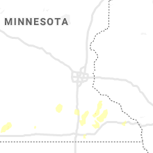
South Dakota
| Local Time | Report Details |
|---|---|
| 2:20 PM MDT | Half Dollar sized hail reported near Martin, SD, 53.7 miles WNW of Valentine, NE |
| 2:30 PM MDT | Quarter sized hail reported near Martin, SD, 55.5 miles WNW of Valentine, NE |
| 4:10 PM CDT | Quarter sized hail reported near Saint Francis, SD, 37 miles NW of Valentine, NE |
| 4:25 PM CDT | Tree damage from winds... dime sized hail... water running over road in todd county SD, 28.9 miles NNW of Valentine, NE |
| 5:15 PM CDT | Quarter sized hail reported near Colome, SD, 50.2 miles ENE of Valentine, NE |
| 5:35 PM CDT | Quarter sized hail reported near Winner, SD, 44.4 miles NNE of Valentine, NE |
| 5:35 PM CDT | Storm damage reported in tripp county SD, 44.4 miles NNE of Valentine, NE |
| 6:00 PM CDT | Quarter sized hail reported near Winner, SD, 48.9 miles NE of Valentine, NE |
| 6:10 PM CDT | Quarter sized hail reported near Gregory, SD, 70.2 miles SE of Pierre, SD |
| 7:26 PM CDT | Report via sd rwis statio in charles mix county SD, 68.7 miles NNW of Oneill, NE |
| 8:09 PM CDT | Quarter sized hail reported near Platte, SD, 65.1 miles N of Oneill, NE |
| 8:28 PM CDT | Quarter sized hail reported near Avon, SD, 49.6 miles NE of Oneill, NE |
| 8:32 PM CDT | Storm damage reported in aurora county SD, 74.8 miles N of Oneill, NE |
| 8:46 PM CDT | Several small tree limbs dow in aurora county SD, 78.9 miles N of Oneill, NE |
| 8:52 PM CDT | Storm damage reported in aurora county SD, 78.9 miles N of Oneill, NE |
| 10:54 PM CDT | Storm damage reported in mccook county SD, 28.1 miles W of Sioux Falls, SD |
| 10:55 PM CDT | Storm damage reported in mccook county SD, 28.1 miles W of Sioux Falls, SD |
| 11:17 PM CDT | Steel barn blown down debris blown long distance multiple spruce trees down other damage south of houses east side of roa in lincoln county SD, 8.3 miles WSW of Sioux Falls, SD |
| 11:23 PM CDT | Report from mping: 1-inch tree limbs broken; shingles blown of in lincoln county SD, 4.3 miles SSW of Sioux Falls, SD |
| 11:28 PM CDT | Limb damage on medium sized ash tree... would estimate 70 mph win in lincoln county SD, 4 miles SSE of Sioux Falls, SD |
| 11:30 PM CDT | Recorded by sdsu mesone in lincoln county SD, 3.5 miles SSE of Sioux Falls, SD |
| 11:31 PM CDT | 60 to 70 mph winds.. in minnehaha county SD, 3.5 miles SSE of Sioux Falls, SD |
| 11:31 PM CDT | Trees uprooted or snapped; roof blown of in minnehaha county SD, 1.1 miles ESE of Sioux Falls, SD |
| 11:32 PM CDT | Storm damage reported in minnehaha county SD, 6 miles WSW of Sioux Falls, SD |
| 11:45 PM CDT | Structural collapse with people trapped insid in minnehaha county SD, 2 miles W of Sioux Falls, SD |
| 11:47 PM CDT | Tree limbs dow in minnehaha county SD, 3.5 miles SSE of Sioux Falls, SD |
| 12:55 AM CDT | 1-inch tree limbs broken; shingles blown of in union county SD, 54.9 miles S of Sioux Falls, SD |
Virginia
| Local Time | Report Details |
|---|---|
| 5:12 PM EDT | Tree down on hickman cemetery road near the fairlawn wal mar in pulaski county VA, 36.8 miles WSW of Roanoke, VA |
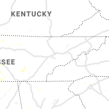
Tennessee
| Local Time | Report Details |
|---|---|
| 4:42 PM CDT | Trees and power lines down near i-65 and franklin r in davidson county TN, 0.2 miles NNW of Nashville, TN |
| 4:56 PM CDT | Tree down near hadley and 16th in davidson county TN, 9.6 miles NE of Nashville, TN |
| 5:15 PM CDT | At least 5 trees snapped at or adjacent to old hickory country clu in davidson county TN, 10.9 miles ENE of Nashville, TN |
| 5:17 PM CDT | Trees were down on sullenger bend road. a power pole was broken on edde bend road. time estimated by rada in moore county TN, 59 miles W of Chattanooga, TN |
| 5:20 PM CDT | Trees were knocked down on harry hill road... pleasant hill road... and griffin road. time estimated by rada in moore county TN, 60.7 miles WNW of Chattanooga, TN |
| 5:23 PM CDT | Quarter sized hail reported near Hendersonville, TN, 14 miles NE of Nashville, TN, quarter size hail reported one mile north of hendersonville. |
| 5:24 PM CDT | Tree downed down the street from crieve hall elementary schoo in davidson county TN, 6.4 miles SSE of Nashville, TN |
| 5:25 PM CDT | Corrects previous tstm wnd dmg report from 5 s lynchburg. trees were knocked down on preston ridge road and wet prong road. time estimated by rada in moore county TN, 61.1 miles W of Chattanooga, TN |
| 5:25 PM CDT | Trees were knocked down on preston ridge road. time estimated by rada in moore county TN, 61.1 miles W of Chattanooga, TN |
| 5:25 PM CDT | Corrects previous tstm wnd dmg report from 5 s lynchburg. trees were knocked down on preston ridge road and wet prong road. time estimated by rada in moore county TN, 61.1 miles W of Chattanooga, TN |
| 5:33 PM CDT | Several reports of trees being knocked down throughout moore county were received. some of these were blocking roads. time estimated by radar... but may need adjustment in moore county TN, 63.1 miles WNW of Chattanooga, TN |
| 5:36 PM CDT | A tree was knocked down on wiggins road. time estimated by rada in moore county TN, 62.9 miles WNW of Chattanooga, TN |
| 5:38 PM CDT | Trees were knocked down on spankhem road. time estimated by rada in moore county TN, 61.6 miles SSE of Nashville, TN |
| 5:41 PM CDT | Trees were knocked down on finney and county line roads. time estimated by rada in moore county TN, 62.4 miles WNW of Chattanooga, TN |
| 5:42 PM CDT | Tree downed down the street from crieve hall elementary schoo in davidson county TN, 6.4 miles SSE of Nashville, TN |
| 5:43 PM CDT | A tree was down on wiggins avenu in moore county TN, 62.9 miles WNW of Chattanooga, TN |
| 5:43 PM CDT | Trees were knocked down on cumberland springs road. time estimated by rada in moore county TN, 59.6 miles WNW of Chattanooga, TN |
| 5:43 PM CDT | A power pole was broken on blackburn hollow road. trees were knocked down on rutledge road. time estimated by rada in moore county TN, 61.3 miles SSE of Nashville, TN |
| 5:44 PM CDT | Trees were knocked down on riddle road. time estimated by rada in moore county TN, 61.1 miles SSE of Nashville, TN |
| 7:10 PM EDT | Several trees were downe in rhea county TN, 51.1 miles NNE of Chattanooga, TN |
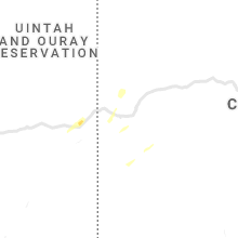
Idaho
| Local Time | Report Details |
|---|---|
| 4:25 PM MDT | Half Dollar sized hail reported near Malta, ID, 65.3 miles SE of Twin Falls, ID |
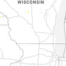
Michigan
| Local Time | Report Details |
|---|---|
| 6:28 PM EDT | Quarter sized hail reported near Mount Pleasant, MI, 65.4 miles NW of Flint, MI |
| 6:36 PM EDT | Trees downed near m-20 and coleman rd. time estimated via rada in midland county MI, 61.5 miles NW of Flint, MI |
| 6:42 PM EDT | Half Dollar sized hail reported near Saint Louis, MI, 55.6 miles NW of Flint, MI, half dollar sized hail reported via social media photo. time estimated via radar. |
| 6:44 PM EDT | Trees downed near coleman rd at midland-gladwin county line. time estimated via rada in gladwin county MI, 72 miles NW of Flint, MI |
| 7:29 PM EDT | Trees and wires downed at currie pkwy and isabella. time estimated via rada in midland county MI, 50.8 miles NW of Flint, MI |
| 7:29 PM EDT | Trees and wires down on 1000 block of w wheeler st. time estimated via rada in midland county MI, 51.6 miles NNW of Flint, MI |
| 7:29 PM EDT | Trees and wires downed at haley and bayliss. time estimated via rada in midland county MI, 49.9 miles NNW of Flint, MI |
| 7:29 PM EDT | Large tree downed at swede and haley rd. time estimated via rada in midland county MI, 49.7 miles NNW of Flint, MI |
| 7:30 PM EDT | Trees and lines downed. time estimated via rada in saginaw county MI, 33.8 miles NNW of Flint, MI |
| 8:24 PM EDT | Two power poles downed in a field. time estimated via rada in tuscola county MI, 33.2 miles N of Flint, MI |
| 8:24 PM EDT | Trees and wires downed at dixon and kirk road. time estimated via rada in tuscola county MI, 32.3 miles NNE of Flint, MI |
| 8:29 PM EDT | Trees and wires downed at m-81 and bradleyville rd. time estimated via rada in tuscola county MI, 30.5 miles N of Flint, MI |
| 8:32 PM EDT | Large tree downed with wires. numerous power outage in tuscola county MI, 36.3 miles NNE of Flint, MI |
South Carolina
| Local Time | Report Details |
|---|---|
| 6:45 PM EDT | Schp reported a tree down at glassy mountain church rd and rhymes ln in pickens county SC, 5.9 miles NNW of Greenville, SC |
| 6:45 PM EDT | 911 call center reported trees and/or utility lines downed east of picken in pickens county SC, 6.4 miles NNW of Greenville, SC |
Colorado
| Local Time | Report Details |
|---|---|
| 5:50 PM MDT | Quarter sized hail reported near Longmont, CO, 29.1 miles N of Denver, CO |
| 6:00 PM MDT | Quarter sized hail reported near Greeley, CO, 46.4 miles NNE of Denver, CO, report from mping: quarter (1.00 in.). |
| 6:07 PM MDT | Quarter sized hail reported near Greeley, CO, 49.7 miles NNE of Denver, CO |
| 6:08 PM MDT | Quarter sized hail reported near Greeley, CO, 45.7 miles NNE of Denver, CO |
| 6:24 PM MDT | Golf Ball sized hail reported near Greeley, CO, 53 miles NNE of Denver, CO |
| 6:26 PM MDT | Quarter sized hail reported near Gill, CO, 56.4 miles NNE of Denver, CO |
| 6:30 PM MDT | Golf Ball sized hail reported near Greeley, CO, 54.3 miles NNE of Denver, CO |
| 6:30 PM MDT | Hen Egg sized hail reported near Gill, CO, 55.4 miles NNE of Denver, CO |
| 6:36 PM MDT | Quarter sized hail reported near Gill, CO, 59.3 miles NNE of Denver, CO, report from mping: quarter (1.00 in.). |
Connect with Interactive Hail Maps