

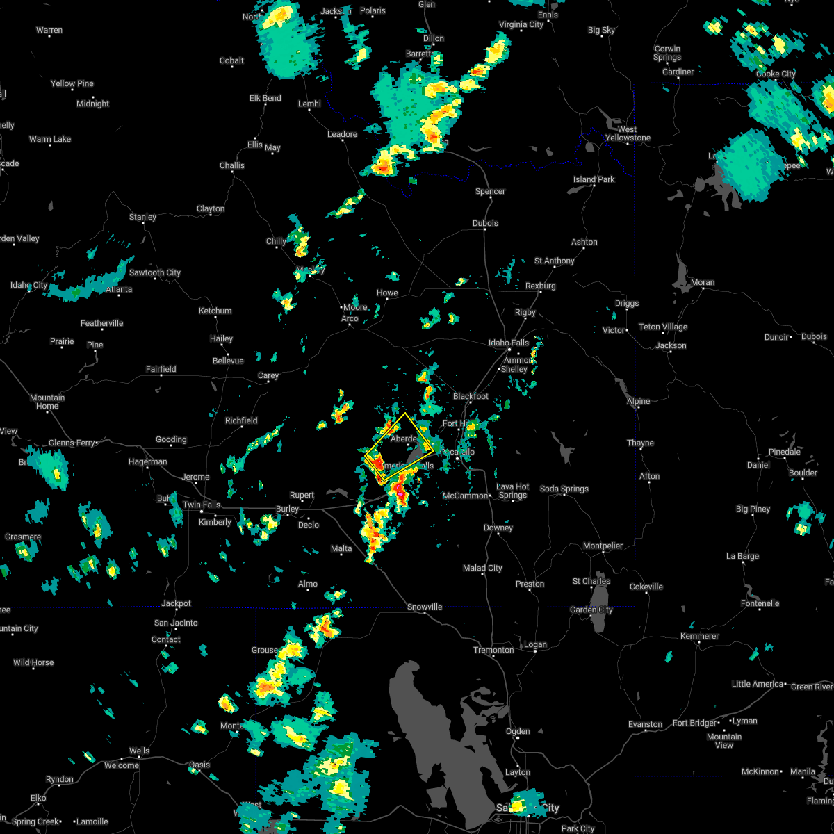
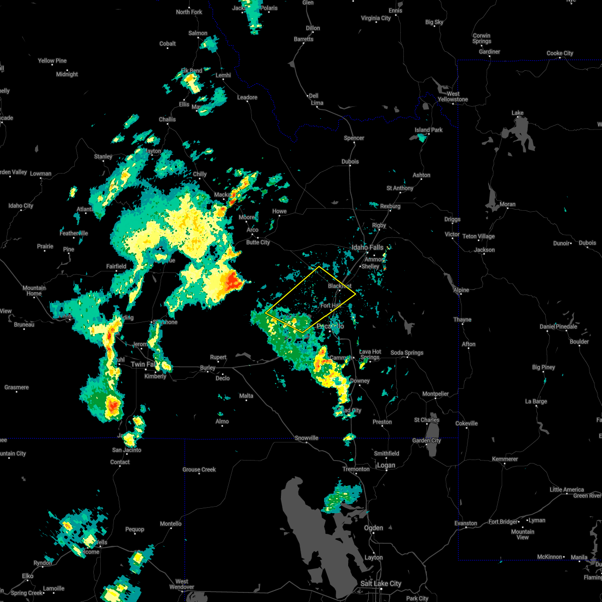
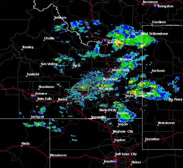
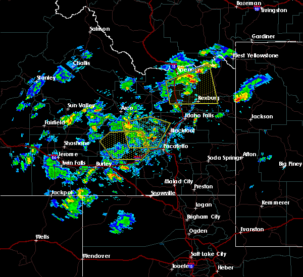
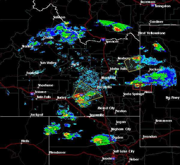
Hail Map for Aberdeen, ID
The Aberdeen, ID area has had 3 reports of on-the-ground hail by trained spotters, and has been under severe weather warnings 2 times during the past 12 months. Doppler radar has detected hail at or near Aberdeen, ID on 7 occasions, including 1 occasion during the past year.
| Name: | Aberdeen, ID |
| Where Located: | 55.2 miles SW of Idaho Falls, ID |
| Map: | Google Map for Aberdeen, ID |
| Population: | 1994 |
| Housing Units: | 667 |
| More Info: | Search Google for Aberdeen, ID |
0
The Top Recent Hail Date for Aberdeen, ID is Thursday, May 25, 2023 (5th out of 7)
Hail and Wind Damage Spotted near Aberdeen, ID
| Date / Time | Report Details |
|---|---|
| 5/24/2023 5:57 PM MDT |
 At 556 pm mdt, a severe thunderstorm was located 8 miles southwest of aberdeen, or 9 miles northwest of american falls, moving northeast at 25 mph (radar indicated). Hazards include 60 mph wind gusts and quarter size hail. Hail damage to vehicles is expected. expect wind damage to roofs, siding, and trees. locations impacted include, aberdeen. hail threat, radar indicated max hail size, 1. 00 in wind threat, radar indicated max wind gust, 60 mph. At 556 pm mdt, a severe thunderstorm was located 8 miles southwest of aberdeen, or 9 miles northwest of american falls, moving northeast at 25 mph (radar indicated). Hazards include 60 mph wind gusts and quarter size hail. Hail damage to vehicles is expected. expect wind damage to roofs, siding, and trees. locations impacted include, aberdeen. hail threat, radar indicated max hail size, 1. 00 in wind threat, radar indicated max wind gust, 60 mph.
|
| 5/24/2023 5:44 PM MDT |
 At 543 pm mdt, a severe thunderstorm was located 10 miles northwest of neeley, moving northeast at 25 mph (radar indicated). Hazards include 60 mph wind gusts and half dollar size hail. Hail damage to vehicles is expected. Expect wind damage to roofs, siding, and trees. At 543 pm mdt, a severe thunderstorm was located 10 miles northwest of neeley, moving northeast at 25 mph (radar indicated). Hazards include 60 mph wind gusts and half dollar size hail. Hail damage to vehicles is expected. Expect wind damage to roofs, siding, and trees.
|
| 5/23/2023 5:22 PM MDT | Power outage 222 customers impacte in bingham county ID, 7.4 miles SW of Aberdeen, ID |
| 9/21/2022 7:00 PM MDT |
 At 659 pm mdt, a severe thunderstorm was located near fort hall bannock peak, or 10 miles southeast of american falls, moving northeast at 35 mph (radar indicated). Hazards include 60 mph wind gusts and nickel size hail. expect damage to roofs, siding, and trees At 659 pm mdt, a severe thunderstorm was located near fort hall bannock peak, or 10 miles southeast of american falls, moving northeast at 35 mph (radar indicated). Hazards include 60 mph wind gusts and nickel size hail. expect damage to roofs, siding, and trees
|
| 7/13/2022 3:44 PM MDT |
 At 343 pm mdt, a severe thunderstorm was located near aberdeen, or 9 miles west of american falls reservoir, moving northeast at 30 mph (radar indicated). Hazards include 60 mph wind gusts. Expect damage to roofs, siding, and trees. locations impacted include, american falls reservoir and aberdeen. hail threat, radar indicated max hail size, <. 75 in wind threat, radar indicated max wind gust, 60 mph. At 343 pm mdt, a severe thunderstorm was located near aberdeen, or 9 miles west of american falls reservoir, moving northeast at 30 mph (radar indicated). Hazards include 60 mph wind gusts. Expect damage to roofs, siding, and trees. locations impacted include, american falls reservoir and aberdeen. hail threat, radar indicated max hail size, <. 75 in wind threat, radar indicated max wind gust, 60 mph.
|
| 7/13/2022 3:32 PM MDT |
 At 331 pm mdt, a severe thunderstorm was located 10 miles northwest of american falls, moving northeast at 30 mph (radar indicated). Hazards include 60 mph wind gusts. expect damage to roofs, siding, and trees At 331 pm mdt, a severe thunderstorm was located 10 miles northwest of american falls, moving northeast at 30 mph (radar indicated). Hazards include 60 mph wind gusts. expect damage to roofs, siding, and trees
|
| 7/13/2022 3:05 PM MDT |
 At 305 pm mdt, severe thunderstorms were located along a line extending from 17 miles northeast of minidoka to near lake walcott to 6 miles southeast of almo, moving east at 30 mph (radar indicated). Hazards include 60 mph wind gusts. expect damage to roofs, siding, and trees At 305 pm mdt, severe thunderstorms were located along a line extending from 17 miles northeast of minidoka to near lake walcott to 6 miles southeast of almo, moving east at 30 mph (radar indicated). Hazards include 60 mph wind gusts. expect damage to roofs, siding, and trees
|
| 5/26/2022 4:53 PM MDT |
 At 453 pm mdt, a severe thunderstorm was located near cold water rest area, or 10 miles southwest of neeley, moving northeast at 45 mph (radar indicated). Hazards include 60 mph wind gusts and penny size hail. expect damage to roofs, siding, and trees At 453 pm mdt, a severe thunderstorm was located near cold water rest area, or 10 miles southwest of neeley, moving northeast at 45 mph (radar indicated). Hazards include 60 mph wind gusts and penny size hail. expect damage to roofs, siding, and trees
|
| 5/2/2022 6:18 PM MDT |
 At 617 pm mdt, severe thunderstorms were located along a line extending from 7 miles southwest of northwest inl to near rockford to near fort hall bannock peak, moving northeast at 40 mph (radar indicated). Hazards include 60 mph wind gusts. Expect damage to roofs, siding, and trees. locations impacted include, idaho falls, pocatello, blackfoot, american falls, arco, american falls reservoir, terreton, goshen, chubbuck, shelley, aberdeen, roberts, firth, mud lake, atomic city, rose, southeast inl, southwest inl, fort hall bannock creek lodge and pingree. hail threat, radar indicated max hail size, <. 75 in wind threat, radar indicated max wind gust, 60 mph. At 617 pm mdt, severe thunderstorms were located along a line extending from 7 miles southwest of northwest inl to near rockford to near fort hall bannock peak, moving northeast at 40 mph (radar indicated). Hazards include 60 mph wind gusts. Expect damage to roofs, siding, and trees. locations impacted include, idaho falls, pocatello, blackfoot, american falls, arco, american falls reservoir, terreton, goshen, chubbuck, shelley, aberdeen, roberts, firth, mud lake, atomic city, rose, southeast inl, southwest inl, fort hall bannock creek lodge and pingree. hail threat, radar indicated max hail size, <. 75 in wind threat, radar indicated max wind gust, 60 mph.
|
| 5/2/2022 5:59 PM MDT |
 At 559 pm mdt, severe thunderstorms were located along a line extending from 12 miles southwest of northwest inl to near pingree to near fort hall bannock peak, moving east at 40 mph (radar indicated). Hazards include 70 mph wind gusts and penny size hail. Expect considerable tree damage. Damage is likely to mobile homes, roofs, and outbuildings. At 559 pm mdt, severe thunderstorms were located along a line extending from 12 miles southwest of northwest inl to near pingree to near fort hall bannock peak, moving east at 40 mph (radar indicated). Hazards include 70 mph wind gusts and penny size hail. Expect considerable tree damage. Damage is likely to mobile homes, roofs, and outbuildings.
|
| 5/2/2022 5:48 PM MDT |
 At 547 pm mdt, severe thunderstorms were located along a line extending from near darlington to 7 miles northwest of central inl to 9 miles northwest of springfield to rockland, moving east at 40 mph (radar indicated). Hazards include 70 mph wind gusts and penny size hail. Expect considerable tree damage. damage is likely to mobile homes, roofs, and outbuildings. locations impacted include, pocatello, american falls, arco, mackay, lake walcott, american falls reservoir, grouse, neeley, chubbuck, aberdeen, rockland, minidoka, atomic city, darlington, southeast inl, southwest inl, fort hall bannock creek lodge, pingree, pocatello airport and cold water rest area. thunderstorm damage threat, considerable hail threat, radar indicated max hail size, 0. 75 in wind threat, observed max wind gust, 70 mph. At 547 pm mdt, severe thunderstorms were located along a line extending from near darlington to 7 miles northwest of central inl to 9 miles northwest of springfield to rockland, moving east at 40 mph (radar indicated). Hazards include 70 mph wind gusts and penny size hail. Expect considerable tree damage. damage is likely to mobile homes, roofs, and outbuildings. locations impacted include, pocatello, american falls, arco, mackay, lake walcott, american falls reservoir, grouse, neeley, chubbuck, aberdeen, rockland, minidoka, atomic city, darlington, southeast inl, southwest inl, fort hall bannock creek lodge, pingree, pocatello airport and cold water rest area. thunderstorm damage threat, considerable hail threat, radar indicated max hail size, 0. 75 in wind threat, observed max wind gust, 70 mph.
|
| 5/2/2022 5:33 PM MDT |
 At 533 pm mdt, severe thunderstorms were located along a line extending from near darlington to 7 miles northwest of southwest inl to 13 miles west of springfield to near rockland, moving east at 40 mph (radar indicated). Hazards include 70 mph wind gusts and penny size hail. Expect considerable tree damage. Damage is likely to mobile homes, roofs, and outbuildings. At 533 pm mdt, severe thunderstorms were located along a line extending from near darlington to 7 miles northwest of southwest inl to 13 miles west of springfield to near rockland, moving east at 40 mph (radar indicated). Hazards include 70 mph wind gusts and penny size hail. Expect considerable tree damage. Damage is likely to mobile homes, roofs, and outbuildings.
|
| 8/5/2021 5:51 PM MDT | Thunderstorm winds knocked out power to residents west of aberdeen and springfield/id-3 in bingham county ID, 9 miles SE of Aberdeen, ID |
| 8/2/2021 7:14 PM MDT |
 At 711 pm mdt, a severe thunderstorm was located near portneuf gap, or 9 miles southeast of pocatello, moving southeast at 25 mph (radar indicated up to 60 mph. recorded observation of 49 mph). Hazards include gusts of 45 mph with gusts up to 60 mph wind. Expect damage to roofs, siding, and trees. Locations impacted include, pocatello, blackfoot, american falls, american falls reservoir, chubbuck, firth, fort hall buffalo lodge, rose, fort hall eagle lodge, fort hall lincoln creek lodge, fort hall townsite, fort hall bannock creek lodge, pocatello airport, fort hall putnam lodge, groveland, wapello and trail creek campground. At 711 pm mdt, a severe thunderstorm was located near portneuf gap, or 9 miles southeast of pocatello, moving southeast at 25 mph (radar indicated up to 60 mph. recorded observation of 49 mph). Hazards include gusts of 45 mph with gusts up to 60 mph wind. Expect damage to roofs, siding, and trees. Locations impacted include, pocatello, blackfoot, american falls, american falls reservoir, chubbuck, firth, fort hall buffalo lodge, rose, fort hall eagle lodge, fort hall lincoln creek lodge, fort hall townsite, fort hall bannock creek lodge, pocatello airport, fort hall putnam lodge, groveland, wapello and trail creek campground.
|
| 8/2/2021 6:54 PM MDT |
 At 654 pm mdt, a severe thunderstorm was located over pocatello airport, or near pocatello, moving southeast at 55 mph (radar indicated). Hazards include 60 mph wind gusts. expect damage to roofs, siding, and trees At 654 pm mdt, a severe thunderstorm was located over pocatello airport, or near pocatello, moving southeast at 55 mph (radar indicated). Hazards include 60 mph wind gusts. expect damage to roofs, siding, and trees
|
| 7/17/2021 4:03 PM MDT |
 At 402 pm mdt, a severe thunderstorm was located near springfield, or 9 miles northeast of american falls reservoir, moving north at 15 mph (radar indicated). Hazards include 60 mph wind gusts. Expect damage to roofs, siding, and trees. Locations impacted include, western pocatello, american falls, american falls reservoir, chubbuck, aberdeen, fort hall buffalo lodge, fort hall eagle lodge, fort hall townsite, springfield, rockford, moreland, pingree, pocatello airport and sterling. At 402 pm mdt, a severe thunderstorm was located near springfield, or 9 miles northeast of american falls reservoir, moving north at 15 mph (radar indicated). Hazards include 60 mph wind gusts. Expect damage to roofs, siding, and trees. Locations impacted include, western pocatello, american falls, american falls reservoir, chubbuck, aberdeen, fort hall buffalo lodge, fort hall eagle lodge, fort hall townsite, springfield, rockford, moreland, pingree, pocatello airport and sterling.
|
| 7/17/2021 3:42 PM MDT |
 At 341 pm mdt, a severe thunderstorm was located over northeastern american falls reservoir, moving north at 25 mph (radar indicated). Hazards include 60 mph wind gusts. expect damage to roofs, siding, and trees At 341 pm mdt, a severe thunderstorm was located over northeastern american falls reservoir, moving north at 25 mph (radar indicated). Hazards include 60 mph wind gusts. expect damage to roofs, siding, and trees
|
| 5/16/2021 6:54 PM MDT |
 At 652 pm mdt, very strong winds associated with thunderstorm outflows were located along a line extending from near chubbuck to 10 miles southwest of burley, moving north at 35 mph (trained weather spotters). Hazards include 60 mph wind gusts. Expect damage to roofs, siding, and trees. Blowing dust may suddenly reduce visibility to near zero. At 652 pm mdt, very strong winds associated with thunderstorm outflows were located along a line extending from near chubbuck to 10 miles southwest of burley, moving north at 35 mph (trained weather spotters). Hazards include 60 mph wind gusts. Expect damage to roofs, siding, and trees. Blowing dust may suddenly reduce visibility to near zero.
|
| 8/25/2020 9:12 PM MDT |
 The severe thunderstorm warning for northwestern bannock, northeastern power and southwestern bingham counties will expire at 915 pm mdt, the storms which prompted the warning have weakened below severe limits, and no longer pose an immediate threat to life or property. therefore, the warning will be allowed to expire. however gusty winds, small hail and frequent lightning are still possible with these thunderstorms. The severe thunderstorm warning for northwestern bannock, northeastern power and southwestern bingham counties will expire at 915 pm mdt, the storms which prompted the warning have weakened below severe limits, and no longer pose an immediate threat to life or property. therefore, the warning will be allowed to expire. however gusty winds, small hail and frequent lightning are still possible with these thunderstorms.
|
| 8/25/2020 8:50 PM MDT |
 At 850 pm mdt, severe thunderstorms were located along a line extending from 8 miles northwest of aberdeen to american falls reservoir, moving northeast at 40 mph (radar indicated). Hazards include 60 mph wind gusts and penny size hail. expect damage to roofs, siding, and trees At 850 pm mdt, severe thunderstorms were located along a line extending from 8 miles northwest of aberdeen to american falls reservoir, moving northeast at 40 mph (radar indicated). Hazards include 60 mph wind gusts and penny size hail. expect damage to roofs, siding, and trees
|
| 8/25/2020 4:57 PM MDT |
 The severe thunderstorm warning for northwestern bannock, northern power and southwestern bingham counties will expire at 500 pm mdt, the storms which prompted the warning have weakened below severe limits, and no longer pose an immediate threat to life or property. therefore, the warning will be allowed to expire. however gusty winds are still possible with these thunderstorms. the line of thunderstorms can still re-strengthen and will bear watching as it progresses to the northeast. The severe thunderstorm warning for northwestern bannock, northern power and southwestern bingham counties will expire at 500 pm mdt, the storms which prompted the warning have weakened below severe limits, and no longer pose an immediate threat to life or property. therefore, the warning will be allowed to expire. however gusty winds are still possible with these thunderstorms. the line of thunderstorms can still re-strengthen and will bear watching as it progresses to the northeast.
|
| 8/25/2020 4:37 PM MDT |
 At 437 pm mdt, severe thunderstorms were located along a line extending from 9 miles northwest of aberdeen to near american falls reservoir, moving northeast at 45 mph (radar indicated). Hazards include 60 mph wind gusts. expect damage to roofs, siding, and trees At 437 pm mdt, severe thunderstorms were located along a line extending from 9 miles northwest of aberdeen to near american falls reservoir, moving northeast at 45 mph (radar indicated). Hazards include 60 mph wind gusts. expect damage to roofs, siding, and trees
|
| 8/5/2020 6:03 PM MDT |
 At 602 pm mdt, a severe thunderstorm capable of producing a tornado was located near neeley, moving north at 10 mph (weather spotters reported funnel cloud). Hazards include tornado. Flying debris will be dangerous to those caught without shelter. mobile homes will be damaged or destroyed. damage to roofs, windows, and vehicles will occur. tree damage is likely. this dangerous storm will be near, american falls around 625 pm mdt. Other locations impacted by this tornadic thunderstorm include massacre rocks. At 602 pm mdt, a severe thunderstorm capable of producing a tornado was located near neeley, moving north at 10 mph (weather spotters reported funnel cloud). Hazards include tornado. Flying debris will be dangerous to those caught without shelter. mobile homes will be damaged or destroyed. damage to roofs, windows, and vehicles will occur. tree damage is likely. this dangerous storm will be near, american falls around 625 pm mdt. Other locations impacted by this tornadic thunderstorm include massacre rocks.
|
| 5/30/2020 7:36 PM MDT |
 At 736 pm mdt, a severe thunderstorm was located over neeley, moving north at 25 mph (radar indicated). Hazards include 60 mph wind gusts. expect damage to roofs, siding, and trees At 736 pm mdt, a severe thunderstorm was located over neeley, moving north at 25 mph (radar indicated). Hazards include 60 mph wind gusts. expect damage to roofs, siding, and trees
|
| 4/30/2020 6:25 PM MDT |
 At 624 pm mdt, severe thunderstorms were located along a line extending from near aberdeen to near rockland to 18 miles southeast of cold water rest area, moving east at 40 mph (radar indicated). Hazards include 60 mph wind gusts and up to nickel size hail. Expect damage to roofs, siding, and trees. Locations impacted include, pocatello, american falls, mccammon, american falls reservoir, neeley, chubbuck, aberdeen, inkom, rockland, fort hall bannock creek lodge, pocatello airport, fort hall putnam lodge, cold water rest area, fort hall buffalo lodge, fort hall bannock peak, portneuf gap, fort hall townsite, massacre rocks, mink creek pass and hawkins reservoir. At 624 pm mdt, severe thunderstorms were located along a line extending from near aberdeen to near rockland to 18 miles southeast of cold water rest area, moving east at 40 mph (radar indicated). Hazards include 60 mph wind gusts and up to nickel size hail. Expect damage to roofs, siding, and trees. Locations impacted include, pocatello, american falls, mccammon, american falls reservoir, neeley, chubbuck, aberdeen, inkom, rockland, fort hall bannock creek lodge, pocatello airport, fort hall putnam lodge, cold water rest area, fort hall buffalo lodge, fort hall bannock peak, portneuf gap, fort hall townsite, massacre rocks, mink creek pass and hawkins reservoir.
|
| 4/30/2020 5:59 PM MDT |
 At 558 pm mdt, severe thunderstorms were located along a line extending from 10 miles northeast of minidoka to near lake walcott to near malta, moving east at 45 mph (radar indicated). Hazards include 60 mph wind gusts and nickel size hail. expect damage to roofs, siding, and trees At 558 pm mdt, severe thunderstorms were located along a line extending from 10 miles northeast of minidoka to near lake walcott to near malta, moving east at 45 mph (radar indicated). Hazards include 60 mph wind gusts and nickel size hail. expect damage to roofs, siding, and trees
|
| 10/19/2019 3:27 PM MDT |
 At 325 pm mdt, severe thunderstorms were located along a line extending from 15 miles southwest of atomic city to 6 miles north of cold water rest area, moving east at 45 mph (radar indicated). Hazards include 60 mph wind gusts. expect damage to roofs, siding, and trees At 325 pm mdt, severe thunderstorms were located along a line extending from 15 miles southwest of atomic city to 6 miles north of cold water rest area, moving east at 45 mph (radar indicated). Hazards include 60 mph wind gusts. expect damage to roofs, siding, and trees
|
| 6/6/2019 7:48 PM MDT |
 At 747 pm mdt, severe thunderstorms were located along a line extending from near taber to near fort hall eagle lodge to near portneuf gap, moving northeast at 40 mph (radar indicated). Hazards include 60 mph wind gusts. Expect damage to roofs, siding, and trees. Locations impacted include, pocatello, blackfoot, american falls reservoir, chubbuck, aberdeen, firth, rose, fort hall bannock creek lodge, pingree, pocatello airport, fort hall putnam lodge, fort hall buffalo lodge, fort hall eagle lodge, fort hall lincoln creek lodge, taber, portneuf gap, fort hall townsite, springfield, rockford and moreland. At 747 pm mdt, severe thunderstorms were located along a line extending from near taber to near fort hall eagle lodge to near portneuf gap, moving northeast at 40 mph (radar indicated). Hazards include 60 mph wind gusts. Expect damage to roofs, siding, and trees. Locations impacted include, pocatello, blackfoot, american falls reservoir, chubbuck, aberdeen, firth, rose, fort hall bannock creek lodge, pingree, pocatello airport, fort hall putnam lodge, fort hall buffalo lodge, fort hall eagle lodge, fort hall lincoln creek lodge, taber, portneuf gap, fort hall townsite, springfield, rockford and moreland.
|
| 6/6/2019 7:40 PM MDT |
 At 738 pm mdt, severe thunderstorms were located along a line extending from 10 miles southwest of taber to near fort hall buffalo lodge to 6 miles west of portneuf gap, moving northeast at 30 mph (radar indicated. winds of 52 mph were reported at the pocatello regional airport). Hazards include 60 mph wind gusts. Expect damage to roofs, siding, and trees. Locations impacted include, pocatello, blackfoot, american falls reservoir, chubbuck, aberdeen, firth, rose, fort hall bannock creek lodge, pingree, pocatello airport, fort hall putnam lodge, fort hall buffalo lodge, fort hall eagle lodge, fort hall lincoln creek lodge, taber, portneuf gap, fort hall townsite, springfield, rockford and moreland. At 738 pm mdt, severe thunderstorms were located along a line extending from 10 miles southwest of taber to near fort hall buffalo lodge to 6 miles west of portneuf gap, moving northeast at 30 mph (radar indicated. winds of 52 mph were reported at the pocatello regional airport). Hazards include 60 mph wind gusts. Expect damage to roofs, siding, and trees. Locations impacted include, pocatello, blackfoot, american falls reservoir, chubbuck, aberdeen, firth, rose, fort hall bannock creek lodge, pingree, pocatello airport, fort hall putnam lodge, fort hall buffalo lodge, fort hall eagle lodge, fort hall lincoln creek lodge, taber, portneuf gap, fort hall townsite, springfield, rockford and moreland.
|
| 6/6/2019 7:23 PM MDT |
 The severe thunderstorm warning for west central bannock, central power, east central cassia and southwestern bingham counties will expire at 730 pm mdt, the storm which prompted the warning is moving out of the area. therefore, the warning will be allowed to expire. a severe thunderstorm watch remains in effect until 1100 pm mdt for southeastern idaho. remember, a new severe thunderstorm warning has been issued as these storms move off to the northeast. The severe thunderstorm warning for west central bannock, central power, east central cassia and southwestern bingham counties will expire at 730 pm mdt, the storm which prompted the warning is moving out of the area. therefore, the warning will be allowed to expire. a severe thunderstorm watch remains in effect until 1100 pm mdt for southeastern idaho. remember, a new severe thunderstorm warning has been issued as these storms move off to the northeast.
|
| 6/6/2019 7:22 PM MDT |
 At 721 pm mdt, severe thunderstorms were located along a line extending from 11 miles northwest of aberdeen to american falls reservoir to near fort hall bannock peak, moving northeast at 45 mph (radar indicated). Hazards include 60 mph wind gusts. expect damage to roofs, siding, and trees At 721 pm mdt, severe thunderstorms were located along a line extending from 11 miles northwest of aberdeen to american falls reservoir to near fort hall bannock peak, moving northeast at 45 mph (radar indicated). Hazards include 60 mph wind gusts. expect damage to roofs, siding, and trees
|
| 6/6/2019 7:10 PM MDT |
 At 708 pm mdt, a severe thunderstorm was located over neeley to near rockland, moving northeast at 40 mph (radar indicated). Hazards include 60 mph wind gusts. Expect damage to roofs, siding, and trees. Locations impacted include, american falls, neeley, american falls reservoir, aberdeen, rockland, fort hall bannock peak, fort hall bannock creek lodge and massacre rocks. At 708 pm mdt, a severe thunderstorm was located over neeley to near rockland, moving northeast at 40 mph (radar indicated). Hazards include 60 mph wind gusts. Expect damage to roofs, siding, and trees. Locations impacted include, american falls, neeley, american falls reservoir, aberdeen, rockland, fort hall bannock peak, fort hall bannock creek lodge and massacre rocks.
|
| 6/6/2019 6:56 PM MDT |
 At 655 pm mdt, a severe thunderstorm was located over the cold water rest area or 10 miles southwest of neeley, moving northeast at 35 mph (radar indicated). Hazards include 60 mph wind gusts. Expect damage to roofs, siding, and trees. Locations impacted include, american falls, neeley, american falls reservoir, aberdeen, rockland, fort hall bannock peak, cold water rest area, fort hall bannock creek lodge and massacre rocks. At 655 pm mdt, a severe thunderstorm was located over the cold water rest area or 10 miles southwest of neeley, moving northeast at 35 mph (radar indicated). Hazards include 60 mph wind gusts. Expect damage to roofs, siding, and trees. Locations impacted include, american falls, neeley, american falls reservoir, aberdeen, rockland, fort hall bannock peak, cold water rest area, fort hall bannock creek lodge and massacre rocks.
|
| 6/6/2019 6:45 PM MDT |
 At 645 pm mdt, a severe thunderstorm was located near cold water rest area or 16 miles southwest of neeley, moving northeast at 40 mph (radar indicated). Hazards include 60 mph wind gusts. expect damage to roofs, siding, and trees At 645 pm mdt, a severe thunderstorm was located near cold water rest area or 16 miles southwest of neeley, moving northeast at 40 mph (radar indicated). Hazards include 60 mph wind gusts. expect damage to roofs, siding, and trees
|
| 6/6/2019 4:11 PM MDT |
 At 410 pm mdt, a severe thunderstorm was located 8 miles northwest of springfield or 16 miles north of american falls reservoir, moving northeast at 40 mph. other storms near taber and west of aberdeen may become severe at any time (radar indicated). Hazards include 60 mph wind gusts and quarter size hail. Hail damage to vehicles is expected. expect wind damage to roofs, siding, and trees. Locations impacted include, western american falls reservoir, aberdeen, atomic city, springfield, rockford, moreland, pingree, central inl, taber, southwest inl, sterling and big southern butte. At 410 pm mdt, a severe thunderstorm was located 8 miles northwest of springfield or 16 miles north of american falls reservoir, moving northeast at 40 mph. other storms near taber and west of aberdeen may become severe at any time (radar indicated). Hazards include 60 mph wind gusts and quarter size hail. Hail damage to vehicles is expected. expect wind damage to roofs, siding, and trees. Locations impacted include, western american falls reservoir, aberdeen, atomic city, springfield, rockford, moreland, pingree, central inl, taber, southwest inl, sterling and big southern butte.
|
| 6/6/2019 3:58 PM MDT |
 At 356 pm mdt, a severe thunderstorm was located 7 miles north of aberdeen or 11 miles northwest of american falls reservoir, moving northeast at 50 mph. a second severe storm was located just north of springfield (radar indicated). Hazards include 60 mph wind gusts and quarter size hail. Hail damage to vehicles is expected. Expect wind damage to roofs, siding, and trees. At 356 pm mdt, a severe thunderstorm was located 7 miles north of aberdeen or 11 miles northwest of american falls reservoir, moving northeast at 50 mph. a second severe storm was located just north of springfield (radar indicated). Hazards include 60 mph wind gusts and quarter size hail. Hail damage to vehicles is expected. Expect wind damage to roofs, siding, and trees.
|
| 6/6/2019 3:47 PM MDT |
 At 346 pm mdt, a severe thunderstorm was located 9 miles west of springfield or 13 miles northwest of american falls reservoir, moving northeast at 45 mph. a second severe storm was located just southwest of aberdeen (radar indicated). Hazards include 60 mph wind gusts and half dollar size hail. Hail damage to vehicles is expected. expect wind damage to roofs, siding, and trees. Locations impacted include, western american falls reservoir, aberdeen, springfield, sterling and pilar butte. At 346 pm mdt, a severe thunderstorm was located 9 miles west of springfield or 13 miles northwest of american falls reservoir, moving northeast at 45 mph. a second severe storm was located just southwest of aberdeen (radar indicated). Hazards include 60 mph wind gusts and half dollar size hail. Hail damage to vehicles is expected. expect wind damage to roofs, siding, and trees. Locations impacted include, western american falls reservoir, aberdeen, springfield, sterling and pilar butte.
|
| 6/6/2019 3:32 PM MDT |
 At 331 pm mdt, a severe thunderstorm was located 7 miles west of aberdeen or 12 miles northwest of american falls, moving northeast at 45 mph. another severe storm is located northwest of neeley, also moving northeast at 45 mph (radar indicated). Hazards include 60 mph wind gusts and half dollar size hail. Hail damage to vehicles is expected. expect wind damage to roofs, siding, and trees. Locations impacted include, western american falls reservoir, aberdeen, springfield, massacre rocks, sterling and pilar butte. At 331 pm mdt, a severe thunderstorm was located 7 miles west of aberdeen or 12 miles northwest of american falls, moving northeast at 45 mph. another severe storm is located northwest of neeley, also moving northeast at 45 mph (radar indicated). Hazards include 60 mph wind gusts and half dollar size hail. Hail damage to vehicles is expected. expect wind damage to roofs, siding, and trees. Locations impacted include, western american falls reservoir, aberdeen, springfield, massacre rocks, sterling and pilar butte.
|
| 6/6/2019 3:17 PM MDT |
 At 316 pm mdt, a severe thunderstorm was located 11 miles north of cold water rest area or 11 miles west of neeley, moving northeast at 45 mph. a second severe thunderstorm was located just west of the cold water rest area (radar indicated). Hazards include 60 mph wind gusts and half dollar size hail. Hail damage to vehicles is expected. Expect wind damage to roofs, siding, and trees. At 316 pm mdt, a severe thunderstorm was located 11 miles north of cold water rest area or 11 miles west of neeley, moving northeast at 45 mph. a second severe thunderstorm was located just west of the cold water rest area (radar indicated). Hazards include 60 mph wind gusts and half dollar size hail. Hail damage to vehicles is expected. Expect wind damage to roofs, siding, and trees.
|
| 5/26/2019 1:15 PM MDT | Quarter sized hail reported 0.4 miles S of Aberdeen, ID, time estimated from radar. photo sent in on social media. |
| 5/31/2018 3:47 PM MDT | Mesonet station cyfi1... 17 w aberdeen. wind gust occurred as a tornadic supercell thunderstorm passed nearby the sit in power county ID, 17.6 miles E of Aberdeen, ID |
| 5/31/2018 3:15 PM MDT | Ksfx dopplar radar showed a tornadic vortex signature that passed approximately 2 miles north of crystal raw in power county ID, 17.4 miles E of Aberdeen, ID |
| 5/20/2018 3:42 PM MDT |
 The severe thunderstorm warning for east central blaine, northwestern power and southwestern bingham counties will expire at 345 pm mdt, the storm which prompted the warning has moved out of the area. therefore the warning will be allowed to expire. The severe thunderstorm warning for east central blaine, northwestern power and southwestern bingham counties will expire at 345 pm mdt, the storm which prompted the warning has moved out of the area. therefore the warning will be allowed to expire.
|
| 5/20/2018 3:40 PM MDT |
 At 339 pm mdt, a severe thunderstorm was located near aberdeen or 11 miles northwest of american falls reservoir, moving northeast at 20 mph (radar indicated). Hazards include quarter size hail and very heavy rainfall. damage to vehicles is expected At 339 pm mdt, a severe thunderstorm was located near aberdeen or 11 miles northwest of american falls reservoir, moving northeast at 20 mph (radar indicated). Hazards include quarter size hail and very heavy rainfall. damage to vehicles is expected
|
| 5/20/2018 3:23 PM MDT |
 At 323 pm mdt, a severe thunderstorm was located 8 miles west of aberdeen or 14 miles west of american falls reservoir, moving north at 15 mph (radar indicated). Hazards include quarter size hail and very heavy rain. Damage to vehicles is expected. This severe thunderstorm will remain over mainly rural areas of east central blaine, northwestern power and southwestern bingham counties. At 323 pm mdt, a severe thunderstorm was located 8 miles west of aberdeen or 14 miles west of american falls reservoir, moving north at 15 mph (radar indicated). Hazards include quarter size hail and very heavy rain. Damage to vehicles is expected. This severe thunderstorm will remain over mainly rural areas of east central blaine, northwestern power and southwestern bingham counties.
|
| 5/20/2018 3:01 PM MDT |
 At 301 pm mdt, a severe thunderstorm was located 11 miles southwest of aberdeen or 11 miles northwest of american falls, moving north at 15 mph (radar indicated). Hazards include quarter size hail and very heavy rainfall. Damage to vehicles is expected. This severe thunderstorm will remain over mainly rural areas of east central blaine, northwestern power and southwestern bingham counties. At 301 pm mdt, a severe thunderstorm was located 11 miles southwest of aberdeen or 11 miles northwest of american falls, moving north at 15 mph (radar indicated). Hazards include quarter size hail and very heavy rainfall. Damage to vehicles is expected. This severe thunderstorm will remain over mainly rural areas of east central blaine, northwestern power and southwestern bingham counties.
|
| 5/17/2018 5:21 PM MDT |
 At 520 pm mdt, a severe thunderstorm was located over fort hall bannock peak or 13 miles southeast of neeley, moving north at 25 mph (radar indicated). Hazards include 60 mph wind gusts and quarter size hail. Hail damage to vehicles is expected. Expect wind damage to roofs, siding, and trees. At 520 pm mdt, a severe thunderstorm was located over fort hall bannock peak or 13 miles southeast of neeley, moving north at 25 mph (radar indicated). Hazards include 60 mph wind gusts and quarter size hail. Hail damage to vehicles is expected. Expect wind damage to roofs, siding, and trees.
|
| 5/16/2018 3:27 PM MDT |
 At 326 pm mdt, a severe thunderstorm was located over southwestern american falls reservoir, moving northeast at 30 mph. this storm has a history of producing dime to nickel size hail (radar indicated). Hazards include quarter size hail. damage to vehicles is expected At 326 pm mdt, a severe thunderstorm was located over southwestern american falls reservoir, moving northeast at 30 mph. this storm has a history of producing dime to nickel size hail (radar indicated). Hazards include quarter size hail. damage to vehicles is expected
|
| 6/28/2017 3:14 PM MDT | Ping Pong Ball sized hail reported 3.9 miles S of Aberdeen, ID, hail slightly smaller than golf ball size reported just north of aberdeen via social media. time estimated based on radar. |
| 6/28/2017 10:21 AM MDT |
 The severe thunderstorm warning for southeastern blaine, northwestern power and southwestern bingham counties will expire at 430 pm mdt, the severe thunderstorm which prompted the warning has weakened. moved out of the warned area. therefore, the warning will be allowed to expire. The severe thunderstorm warning for southeastern blaine, northwestern power and southwestern bingham counties will expire at 430 pm mdt, the severe thunderstorm which prompted the warning has weakened. moved out of the warned area. therefore, the warning will be allowed to expire.
|
| 6/28/2017 10:08 AM MDT |
 At 407 pm mdt, a severe thunderstorm was located 8 miles west of aberdeen or 13 miles west of american falls reservoir, moving east at 30 mph (radar indicated). Hazards include quarter size hail. Damage to vehicles is expected. Locations impacted include, aberdeen. At 407 pm mdt, a severe thunderstorm was located 8 miles west of aberdeen or 13 miles west of american falls reservoir, moving east at 30 mph (radar indicated). Hazards include quarter size hail. Damage to vehicles is expected. Locations impacted include, aberdeen.
|
| 6/28/2017 9:52 AM MDT |
 At 351 pm mdt, a severe thunderstorm was located 16 miles west of aberdeen or 20 miles northwest of american falls, moving east at 30 mph (radar indicated). Hazards include quarter size hail. damage to vehicles is expected At 351 pm mdt, a severe thunderstorm was located 16 miles west of aberdeen or 20 miles northwest of american falls, moving east at 30 mph (radar indicated). Hazards include quarter size hail. damage to vehicles is expected
|
| 5/6/2017 4:40 PM MDT |
 The severe thunderstorm warning for northwestern bannock, northeastern power and southwestern bingham counties will expire at 445 pm mdt, the storm which prompted the warning has moved out of the area. therefore the warning will be allowed to expire. The severe thunderstorm warning for northwestern bannock, northeastern power and southwestern bingham counties will expire at 445 pm mdt, the storm which prompted the warning has moved out of the area. therefore the warning will be allowed to expire.
|
| 5/6/2017 4:22 PM MDT |
 At 421 pm mdt, doppler radar indicated a severe thunderstorm capable of producing damaging winds in excess of 60 mph. this storm was located near american falls reservoir, moving north at 25 mph. at 419 pm mdt, a wind gust to 50 mph was observed at pocatello regional airport. locations impacted include, american falls reservoir, aberdeen, pingree, springfield, pocatello airport and sterling. At 421 pm mdt, doppler radar indicated a severe thunderstorm capable of producing damaging winds in excess of 60 mph. this storm was located near american falls reservoir, moving north at 25 mph. at 419 pm mdt, a wind gust to 50 mph was observed at pocatello regional airport. locations impacted include, american falls reservoir, aberdeen, pingree, springfield, pocatello airport and sterling.
|
| 5/6/2017 4:08 PM MDT |
 At 407 pm mdt, doppler radar indicated a severe thunderstorm capable of producing damaging winds in excess of 60 mph. this storm was located near fort hall bannock creek lodge, or 8 miles east of american falls, and moving north at 25 mph. At 407 pm mdt, doppler radar indicated a severe thunderstorm capable of producing damaging winds in excess of 60 mph. this storm was located near fort hall bannock creek lodge, or 8 miles east of american falls, and moving north at 25 mph.
|
| 10/30/2016 8:35 PM MDT |
 At 835 pm mdt, doppler radar indicated severe thunderstorms capable of producing damaging winds in excess of 60 mph. these storms were located along a line extending from 6 miles southeast of southeast inl to 6 miles north of pocatello airport, moving northeast at 40 mph. locations impacted include, idaho falls, pocatello, blackfoot, american falls, american falls reservoir, neeley, chubbuck, shelley, aberdeen, roberts, firth, atomic city, fort hall buffalo lodge, springfield, fort hall lincoln creek lodge, taber, rockford, pingree, fort hall putnam lodge and rose. At 835 pm mdt, doppler radar indicated severe thunderstorms capable of producing damaging winds in excess of 60 mph. these storms were located along a line extending from 6 miles southeast of southeast inl to 6 miles north of pocatello airport, moving northeast at 40 mph. locations impacted include, idaho falls, pocatello, blackfoot, american falls, american falls reservoir, neeley, chubbuck, shelley, aberdeen, roberts, firth, atomic city, fort hall buffalo lodge, springfield, fort hall lincoln creek lodge, taber, rockford, pingree, fort hall putnam lodge and rose.
|
| 10/30/2016 8:12 PM MDT |
 At 812 pm mdt, doppler radar indicated a line of severe thunderstorms capable of producing damaging winds in excess of 60 mph. these storms were located along a line extending from near atomic city to near aberdeen, and moving northeast at 40 mph. At 812 pm mdt, doppler radar indicated a line of severe thunderstorms capable of producing damaging winds in excess of 60 mph. these storms were located along a line extending from near atomic city to near aberdeen, and moving northeast at 40 mph.
|
| 10/30/2016 7:53 PM MDT |
 At 752 pm mdt, doppler radar indicated severe thunderstorms capable of producing damaging winds in excess of 60 mph. these storms were located along a line extending from 13 miles east of craters of the moon to 17 miles west of aberdeen to 8 miles northwest of cold water rest area, moving northeast at 50 mph. locations impacted include, american falls, lake walcott, american falls reservoir, neeley, aberdeen, atomic city, southwest inl, fort hall buffalo lodge, springfield, monteview, taber, rockford, pingree, pocatello airport, northwest inl, fort hall townsite, central inl, southeast inl, moreland and fort hall eagle lodge. At 752 pm mdt, doppler radar indicated severe thunderstorms capable of producing damaging winds in excess of 60 mph. these storms were located along a line extending from 13 miles east of craters of the moon to 17 miles west of aberdeen to 8 miles northwest of cold water rest area, moving northeast at 50 mph. locations impacted include, american falls, lake walcott, american falls reservoir, neeley, aberdeen, atomic city, southwest inl, fort hall buffalo lodge, springfield, monteview, taber, rockford, pingree, pocatello airport, northwest inl, fort hall townsite, central inl, southeast inl, moreland and fort hall eagle lodge.
|
| 10/30/2016 7:31 PM MDT |
 At 730 pm mdt, doppler radar indicated a line of severe thunderstorms capable of producing damaging winds in excess of 60 mph. these storms were located along a line extending from 12 miles south of craters of the moon to 11 miles northeast of minidoka to near lake walcott, and moving northeast at 65 mph. At 730 pm mdt, doppler radar indicated a line of severe thunderstorms capable of producing damaging winds in excess of 60 mph. these storms were located along a line extending from 12 miles south of craters of the moon to 11 miles northeast of minidoka to near lake walcott, and moving northeast at 65 mph.
|
| 9/13/2016 9:57 PM MDT |
 The severe thunderstorm warning for eastern lincoln, northeastern cassia, southeastern custer, southwestern bingham, northwestern power, blaine, northwestern bannock, southwestern butte and minidoka counties will expire at 1000 pm mdt, the storms which prompted the warning have weakened. therefore the warning will be allowed to expire. however, wind over 40mph are still possible. The severe thunderstorm warning for eastern lincoln, northeastern cassia, southeastern custer, southwestern bingham, northwestern power, blaine, northwestern bannock, southwestern butte and minidoka counties will expire at 1000 pm mdt, the storms which prompted the warning have weakened. therefore the warning will be allowed to expire. however, wind over 40mph are still possible.
|
| 9/13/2016 9:28 PM MDT |
 At 926 pm mdt, doppler radar and mesonet observations indicated outflow winds producing damaging winds in excess of 60 mph. these storms were located along a line extending from near gannett to near lake walcott, and moving northeast at 35 mph. At 926 pm mdt, doppler radar and mesonet observations indicated outflow winds producing damaging winds in excess of 60 mph. these storms were located along a line extending from near gannett to near lake walcott, and moving northeast at 35 mph.
|
| 9/1/2016 3:39 PM MDT |
 The national weather service in pocatello has issued a * severe thunderstorm warning for. southwestern bingham county in southeastern idaho. northeastern power county in southeastern idaho. northwestern bannock county in southeastern idaho. Until 430 pm mdt. The national weather service in pocatello has issued a * severe thunderstorm warning for. southwestern bingham county in southeastern idaho. northeastern power county in southeastern idaho. northwestern bannock county in southeastern idaho. Until 430 pm mdt.
|
| 8/6/2016 3:06 PM MDT |
 At 305 pm mdt, doppler radar indicated a severe thunderstorm capable of producing quarter size hail and damaging winds in excess of 60 mph. this storm was located over american falls, and moving northeast at 30 mph. At 305 pm mdt, doppler radar indicated a severe thunderstorm capable of producing quarter size hail and damaging winds in excess of 60 mph. this storm was located over american falls, and moving northeast at 30 mph.
|
| 7/9/2016 7:51 PM MDT |
 At 750 pm mdt, doppler radar indicated a severe thunderstorm capable of producing damaging winds in excess of 60 mph. this storm was located over northwestern american falls reservoir, and moving north at 25 mph. At 750 pm mdt, doppler radar indicated a severe thunderstorm capable of producing damaging winds in excess of 60 mph. this storm was located over northwestern american falls reservoir, and moving north at 25 mph.
|
| 6/30/2016 4:23 PM MDT |
 The severe thunderstorm warning for western bingham, northern power, east central blaine, northwestern bannock, southeastern butte and western bonneville counties will expire at 430 pm mdt, storms and outflow winds have weakened and therefore the warning will expire. gusts of 40 to 50 mph are ongoing with some blowing dust possible. The severe thunderstorm warning for western bingham, northern power, east central blaine, northwestern bannock, southeastern butte and western bonneville counties will expire at 430 pm mdt, storms and outflow winds have weakened and therefore the warning will expire. gusts of 40 to 50 mph are ongoing with some blowing dust possible.
|
| 6/30/2016 4:06 PM MDT |
 At 404 pm mdt, doppler radar and mesonet observations indicated severe thunderstorms capable of producing damaging winds in excess of 60 mph. the leading edge of these outflow winds were located along a line extending from 9 miles southeast of southeast inl to 11 miles southwest of taber to 24 miles northwest of aberdeen, moving southeast at 25 mph. locations impacted include, blackfoot, american falls reservoir, aberdeen, firth, atomic city, southwest inl, fort hall buffalo lodge, springfield, central inl, taber, rockford, moreland, pingree, rose, fort hall eagle lodge, groveland, big southern butte, wapello, coxs well airport and sterling. At 404 pm mdt, doppler radar and mesonet observations indicated severe thunderstorms capable of producing damaging winds in excess of 60 mph. the leading edge of these outflow winds were located along a line extending from 9 miles southeast of southeast inl to 11 miles southwest of taber to 24 miles northwest of aberdeen, moving southeast at 25 mph. locations impacted include, blackfoot, american falls reservoir, aberdeen, firth, atomic city, southwest inl, fort hall buffalo lodge, springfield, central inl, taber, rockford, moreland, pingree, rose, fort hall eagle lodge, groveland, big southern butte, wapello, coxs well airport and sterling.
|
| 6/30/2016 3:42 PM MDT |
 At 340 pm mdt, doppler radar indicated a line of severe thunderstorms capable of producing damaging winds in excess of 60 mph. the leading edge of outflow winds from these storms was located along a line extending from near southeast inl to 9 miles southwest of atomic city to 16 miles southeast of craters of the moon, and moving southeast at 35 mph. these storms have a history of producing 60 mph winds and minor wind damage in arco. At 340 pm mdt, doppler radar indicated a line of severe thunderstorms capable of producing damaging winds in excess of 60 mph. the leading edge of outflow winds from these storms was located along a line extending from near southeast inl to 9 miles southwest of atomic city to 16 miles southeast of craters of the moon, and moving southeast at 35 mph. these storms have a history of producing 60 mph winds and minor wind damage in arco.
|
| 5/14/2016 4:00 PM MDT | Storm damage reported in bingham county ID, 0.3 miles NNE of Aberdeen, ID |
| 8/29/2015 5:06 PM MDT |
 At 503 pm mdt, doppler radar indicated a severe thunderstorm capable of producing damaging winds in excess of 60 mph. this storm was located near aberdeen, or 9 miles northwest of american falls reservoir. this storm is moving northeast at 30 mph. At 503 pm mdt, doppler radar indicated a severe thunderstorm capable of producing damaging winds in excess of 60 mph. this storm was located near aberdeen, or 9 miles northwest of american falls reservoir. this storm is moving northeast at 30 mph.
|
| 8/14/2015 6:23 PM MDT |
 At 622 pm mdt, doppler radar indicated a severe thunderstorm capable of producing damaging winds in excess of 60 mph. this storm was located 13 miles northwest of aberdeen, or 18 miles northwest of american falls reservoir. this storm was nearly stationary, but strong winds continue to move through the rockford and moreland area. locations impacted include, american falls reservoir, aberdeen, atomic city, taber, rockford, moreland, pingree, springfield, big southern butte, east butte and sterling. At 622 pm mdt, doppler radar indicated a severe thunderstorm capable of producing damaging winds in excess of 60 mph. this storm was located 13 miles northwest of aberdeen, or 18 miles northwest of american falls reservoir. this storm was nearly stationary, but strong winds continue to move through the rockford and moreland area. locations impacted include, american falls reservoir, aberdeen, atomic city, taber, rockford, moreland, pingree, springfield, big southern butte, east butte and sterling.
|
| 8/14/2015 5:58 PM MDT |
 At 557 pm mdt, doppler radar indicated a severe thunderstorm capable of producing damaging winds in excess of 60 mph. this storm was located 13 miles northwest of aberdeen, or 18 miles northwest of american falls reservoir. this storm was nearly stationary. At 557 pm mdt, doppler radar indicated a severe thunderstorm capable of producing damaging winds in excess of 60 mph. this storm was located 13 miles northwest of aberdeen, or 18 miles northwest of american falls reservoir. this storm was nearly stationary.
|
| 8/14/2015 5:52 PM MDT |
 At 551 pm mdt, doppler radar indicated a severe thunderstorm capable of producing damaging winds in excess of 60 mph. this storm was located 13 miles west of aberdeen, or 17 miles northwest of american falls, moving northeast at 35 mph. locations impacted include, american falls, neeley, western american falls reservoir, aberdeen, coxs well airport, bear trap airport and pilar butte. At 551 pm mdt, doppler radar indicated a severe thunderstorm capable of producing damaging winds in excess of 60 mph. this storm was located 13 miles west of aberdeen, or 17 miles northwest of american falls, moving northeast at 35 mph. locations impacted include, american falls, neeley, western american falls reservoir, aberdeen, coxs well airport, bear trap airport and pilar butte.
|
| 8/14/2015 5:23 PM MDT |
 At 520 pm mdt, doppler radar indicated a severe thunderstorm capable of producing damaging winds in excess of 60 mph. this storm was located near minidoka, or 10 miles north of lake walcott, and moving northeast at 35 mph. At 520 pm mdt, doppler radar indicated a severe thunderstorm capable of producing damaging winds in excess of 60 mph. this storm was located near minidoka, or 10 miles north of lake walcott, and moving northeast at 35 mph.
|
| 8/5/2015 2:26 PM MDT |
 At 225 pm mdt, doppler radar indicated a line of severe thunderstorms capable of producing damaging winds in excess of 60 mph. these storms were located along a line extending from 6 miles south of southeast inl to near rose to near fort hall townsite, moving northeast at 55 mph. in addition, at 310pm, 64 mph winds were reported at the taber inl site. . locations impacted include, idaho falls, western pocatello, blackfoot, american falls reservoir, goshen, chubbuck, ammon, shelley, aberdeen, firth, atomic city, fort hall buffalo lodge, springfield, fort hall lincoln creek lodge, taber, rockford, pingree, fort hall putnam lodge, rose and pocatello airport. At 225 pm mdt, doppler radar indicated a line of severe thunderstorms capable of producing damaging winds in excess of 60 mph. these storms were located along a line extending from 6 miles south of southeast inl to near rose to near fort hall townsite, moving northeast at 55 mph. in addition, at 310pm, 64 mph winds were reported at the taber inl site. . locations impacted include, idaho falls, western pocatello, blackfoot, american falls reservoir, goshen, chubbuck, ammon, shelley, aberdeen, firth, atomic city, fort hall buffalo lodge, springfield, fort hall lincoln creek lodge, taber, rockford, pingree, fort hall putnam lodge, rose and pocatello airport.
|
| 8/5/2015 2:18 PM MDT |
 At 216 pm mdt, doppler radar indicated a line of severe thunderstorms capable of producing damaging winds in excess up to 70 mph. these storms were located along a line extending from near atomic city to near moreland to near pocatello airport, moving northeast at 55 mph. in addition, at 3pm, 63 mph winds were reported on top of big southern butte. winds across the valley floor are ranging 45 to 55mph. locations impacted include, idaho falls, western pocatello, blackfoot, american falls reservoir, goshen, chubbuck, ammon, shelley, aberdeen, firth, atomic city, fort hall buffalo lodge, springfield, fort hall lincoln creek lodge, taber, rockford, pingree, fort hall putnam lodge, rose and pocatello airport. At 216 pm mdt, doppler radar indicated a line of severe thunderstorms capable of producing damaging winds in excess up to 70 mph. these storms were located along a line extending from near atomic city to near moreland to near pocatello airport, moving northeast at 55 mph. in addition, at 3pm, 63 mph winds were reported on top of big southern butte. winds across the valley floor are ranging 45 to 55mph. locations impacted include, idaho falls, western pocatello, blackfoot, american falls reservoir, goshen, chubbuck, ammon, shelley, aberdeen, firth, atomic city, fort hall buffalo lodge, springfield, fort hall lincoln creek lodge, taber, rockford, pingree, fort hall putnam lodge, rose and pocatello airport.
|
| 8/5/2015 1:57 PM MDT |
 At 156 pm mdt, doppler radar indicated a line of severe thunderstorms capable of producing winds in excess of 70 mph. these storms were located along a line extending from 8 miles south of southwest inl to near springfield to near american falls, and moving east at 55 mph. At 156 pm mdt, doppler radar indicated a line of severe thunderstorms capable of producing winds in excess of 70 mph. these storms were located along a line extending from 8 miles south of southwest inl to near springfield to near american falls, and moving east at 55 mph.
|
| 8/5/2015 1:44 PM MDT |
 A severe thunderstorm warning remains in effect until 200 pm mdt for bingham. southwestern jefferson. northwestern bannock. southeastern blaine. northeastern cassia. southeastern butte. western bonneville. power and eastern minidoka counties. at 143 pm mdt. Doppler radar indicated a line of severe thunderstorms capable of producing destructive winds in excess of 70. A severe thunderstorm warning remains in effect until 200 pm mdt for bingham. southwestern jefferson. northwestern bannock. southeastern blaine. northeastern cassia. southeastern butte. western bonneville. power and eastern minidoka counties. at 143 pm mdt. Doppler radar indicated a line of severe thunderstorms capable of producing destructive winds in excess of 70.
|
| 8/5/2015 1:44 PM MDT |
 At 143 pm mdt, doppler radar indicated a line of severe thunderstorms capable of producing destructive winds in excess of 70 mph. these storms were located along a line extending from 18 miles south of southwest inl to 9 miles west of springfield to 10 miles north of cold water rest area, moving east at 50 mph. locations impacted include, pocatello, blackfoot, american falls, lake walcott, american falls reservoir, neeley, chubbuck, aberdeen, rockland, minidoka, atomic city, fort hall buffalo lodge, springfield, fort hall bannock peak, rockford, pingree, fort hall bannock creek lodge and rose. At 143 pm mdt, doppler radar indicated a line of severe thunderstorms capable of producing destructive winds in excess of 70 mph. these storms were located along a line extending from 18 miles south of southwest inl to 9 miles west of springfield to 10 miles north of cold water rest area, moving east at 50 mph. locations impacted include, pocatello, blackfoot, american falls, lake walcott, american falls reservoir, neeley, chubbuck, aberdeen, rockland, minidoka, atomic city, fort hall buffalo lodge, springfield, fort hall bannock peak, rockford, pingree, fort hall bannock creek lodge and rose.
|
| 8/5/2015 1:30 PM MDT |
 At 129 pm mdt, doppler radar indicated a line of severe thunderstorms capable of producing winds in excess of 70 mph. these storms were located along a line extending from 19 miles southeast of craters of the moon to 14 miles northwest of aberdeen to near lake walcott, moving northeast at 45 mph. locations impacted include, pocatello, blackfoot, rupert, american falls, lake walcott, american falls reservoir, neeley, chubbuck, aberdeen, rockland, minidoka, atomic city, fort hall buffalo lodge, springfield, fort hall bannock peak, taber, rockford, pingree, fort hall bannock creek lodge and rose. At 129 pm mdt, doppler radar indicated a line of severe thunderstorms capable of producing winds in excess of 70 mph. these storms were located along a line extending from 19 miles southeast of craters of the moon to 14 miles northwest of aberdeen to near lake walcott, moving northeast at 45 mph. locations impacted include, pocatello, blackfoot, rupert, american falls, lake walcott, american falls reservoir, neeley, chubbuck, aberdeen, rockland, minidoka, atomic city, fort hall buffalo lodge, springfield, fort hall bannock peak, taber, rockford, pingree, fort hall bannock creek lodge and rose.
|
| 8/5/2015 1:16 PM MDT |
 At 115 pm mdt, doppler radar indicated a line of severe thunderstorms capable of producing damaging winds in excess of 60 mph. these storms were located along a line extending from 20 miles south of craters of the moon to 18 miles northeast of minidoka to 6 miles west of lake walcott, and moving northeast at 45 mph. At 115 pm mdt, doppler radar indicated a line of severe thunderstorms capable of producing damaging winds in excess of 60 mph. these storms were located along a line extending from 20 miles south of craters of the moon to 18 miles northeast of minidoka to 6 miles west of lake walcott, and moving northeast at 45 mph.
|
| 6/15/2015 6:54 PM MDT |
 At 652 pm mdt, doppler radar indicated a severe thunderstorm capable of producing half dollar size hail and damaging winds in excess of 60 mph. this storm was located from over pocatello west southwest to near american falls, moving northeast at 45 mph. one inch hail has occurred at the pocatello airport! locations impacted include, pocatello, blackfoot, american falls, chubbuck, aberdeen, fort hall buffalo lodge, springfield, fort hall lincoln creek lodge, fort hall, taber, rockford, fort hall putnam lodge, fort hall bannock creek lodge, rose, fort hall eagle lodge and groveland. At 652 pm mdt, doppler radar indicated a severe thunderstorm capable of producing half dollar size hail and damaging winds in excess of 60 mph. this storm was located from over pocatello west southwest to near american falls, moving northeast at 45 mph. one inch hail has occurred at the pocatello airport! locations impacted include, pocatello, blackfoot, american falls, chubbuck, aberdeen, fort hall buffalo lodge, springfield, fort hall lincoln creek lodge, fort hall, taber, rockford, fort hall putnam lodge, fort hall bannock creek lodge, rose, fort hall eagle lodge and groveland.
|
| 6/15/2015 6:42 PM MDT |
 At 641 pm mdt, doppler radar indicated a severe thunderstorm capable of producing half dollar size hail and damaging winds in excess of 60 mph. this storm was located near fort hall bannock creek lodge, or over the arbon valley, and moving northeast at 45 mph. At 641 pm mdt, doppler radar indicated a severe thunderstorm capable of producing half dollar size hail and damaging winds in excess of 60 mph. this storm was located near fort hall bannock creek lodge, or over the arbon valley, and moving northeast at 45 mph.
|
| 6/15/2015 6:41 PM MDT |
 The severe thunderstorm warning for southwestern bingham, bannock, southeastern blaine, northwestern caribou, western bonneville and northern power counties will expire at 645 pm mdt, the storms which prompted the warning have moved out of the area. therefore the warning will be allowed to expire. The severe thunderstorm warning for southwestern bingham, bannock, southeastern blaine, northwestern caribou, western bonneville and northern power counties will expire at 645 pm mdt, the storms which prompted the warning have moved out of the area. therefore the warning will be allowed to expire.
|
| 6/15/2015 6:17 PM MDT |
 At 617 pm mdt, doppler radar indicated a line of severe thunderstorms capable of producing half dollar size hail. these storms were located along a line extending from 9 miles northwest of springfield to near lava hot springs, moving northeast at 20 mph. locations impacted include, pocatello, blackfoot, mccammon, lava hot springs, chesterfield reservoir, american falls reservoir, chubbuck, aberdeen, inkom, arimo, fort hall buffalo lodge, chesterfield, springfield, fort hall lincoln creek lodge, taber, rockford, pingree, fort hall putnam lodge, fort hall bannock creek lodge and rose. At 617 pm mdt, doppler radar indicated a line of severe thunderstorms capable of producing half dollar size hail. these storms were located along a line extending from 9 miles northwest of springfield to near lava hot springs, moving northeast at 20 mph. locations impacted include, pocatello, blackfoot, mccammon, lava hot springs, chesterfield reservoir, american falls reservoir, chubbuck, aberdeen, inkom, arimo, fort hall buffalo lodge, chesterfield, springfield, fort hall lincoln creek lodge, taber, rockford, pingree, fort hall putnam lodge, fort hall bannock creek lodge and rose.
|
| 6/15/2015 5:45 PM MDT |
 At 543 pm mdt, doppler radar indicated a line of severe thunderstorms capable of producing half dollar size hail. these storms were located along a line extending from 12 miles west of aberdeen to 8 miles west of virginia. these storms were moving northeast at 15 mph. At 543 pm mdt, doppler radar indicated a line of severe thunderstorms capable of producing half dollar size hail. these storms were located along a line extending from 12 miles west of aberdeen to 8 miles west of virginia. these storms were moving northeast at 15 mph.
|
| 6/15/2015 5:39 PM MDT | Quarter sized hail reported 0.3 miles NNE of Aberdeen, ID, marble to quarter-size hail... covering ground... and falling at time of report along with heavy rain. |
| 6/15/2015 5:24 PM MDT |
 At 500 pm mdt, doppler radar indicated a severe thunderstorm capable of producing half dollar size hail and damaging winds in excess of 60 mph. this storm was located near cold water rest area, or 12 miles east of lake walcott. this storm was moving northeast at 20 mph. At 500 pm mdt, doppler radar indicated a severe thunderstorm capable of producing half dollar size hail and damaging winds in excess of 60 mph. this storm was located near cold water rest area, or 12 miles east of lake walcott. this storm was moving northeast at 20 mph.
|
| 6/15/2015 5:01 PM MDT |
 The national weather service in pocatello has issued a * severe thunderstorm warning for. southwestern bingham county in southeastern idaho. west central bannock county in southeastern idaho. southeastern blaine county in central idaho. Northeastern cassia county in southeastern idaho. The national weather service in pocatello has issued a * severe thunderstorm warning for. southwestern bingham county in southeastern idaho. west central bannock county in southeastern idaho. southeastern blaine county in central idaho. Northeastern cassia county in southeastern idaho.
|
| 5/31/2015 7:21 PM MDT | The severe thunderstorm warning for southwestern bingham, northwestern bannock and northwestern power counties will expire at 730 pm mdt, the storm which prompted the warning has weakened below severe limits, and no longer poses an immediate threat to life or property. therefore the warning will be allowed to expire. however small. |
| 5/31/2015 6:46 PM MDT | At 645 pm mdt, doppler radar indicated a severe thunderstorm capable of producing quarter size hail and damaging winds in excess of 60 mph. this storm was located 9 miles west of aberdeen, or 14 miles west of american falls reservoir, and moving northeast at 20 mph. if you are on american falls reservoir, head to shelter now!. |
| 6/12/2014 8:20 PM MDT | Recorded by aberdeen weather station operated by inl. wind recorded at approximately 50 feet above groun in bingham county ID, 1.5 miles SW of Aberdeen, ID |
| 7/15/2013 3:50 PM MDT | 67 mph wind gusts with 43 mph sustained winds at time of gust in bingham county ID, 0.3 miles NNE of Aberdeen, ID |
| 1/1/0001 12:00 AM | Storm damage reported in power county ID, 17.6 miles E of Aberdeen, ID |
Hail Maps for Aberdeen, ID


Connect with Interactive Hail Maps