

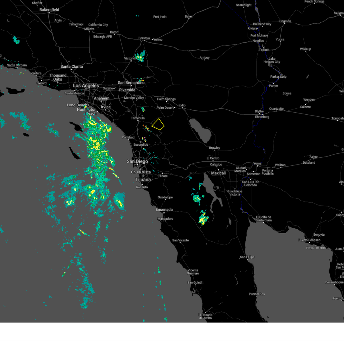
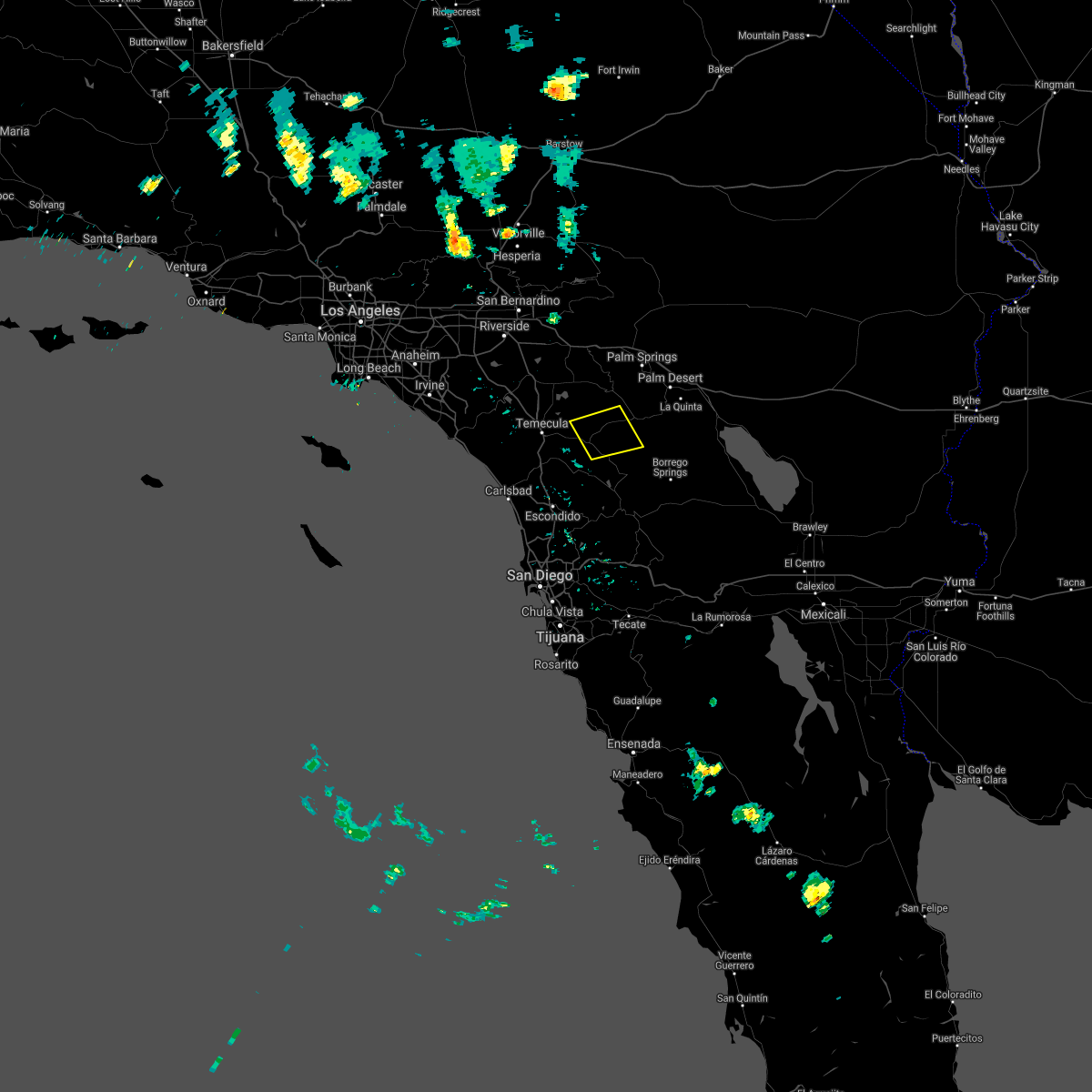
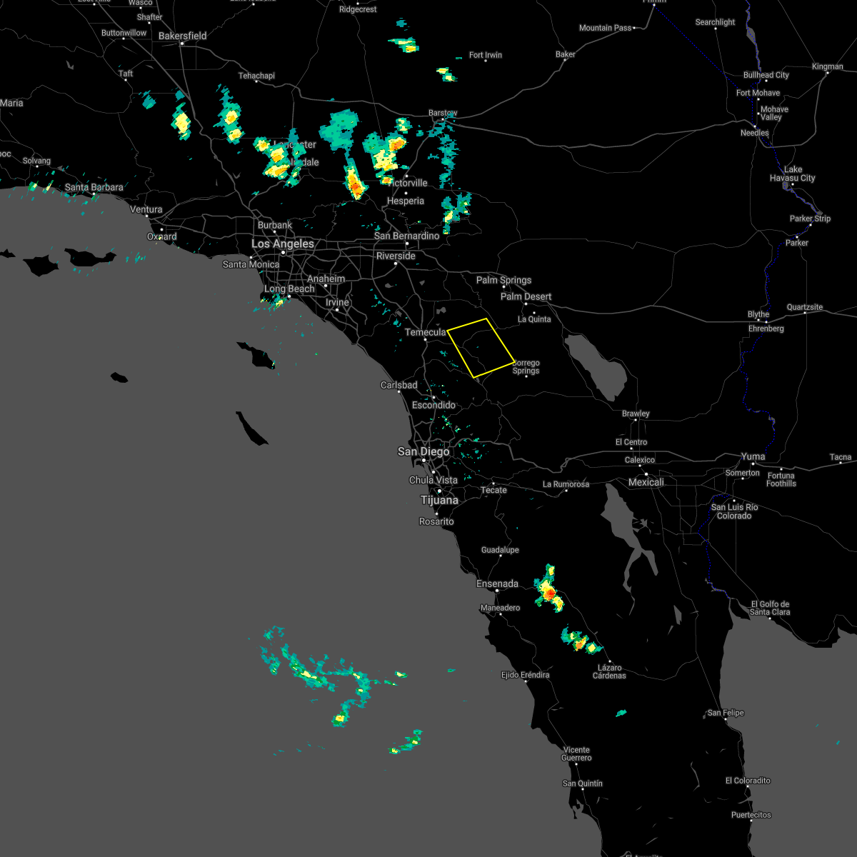
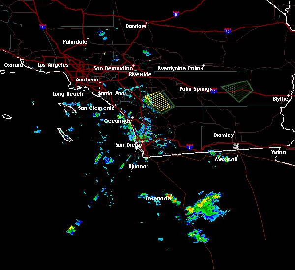
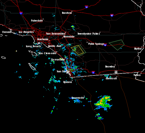
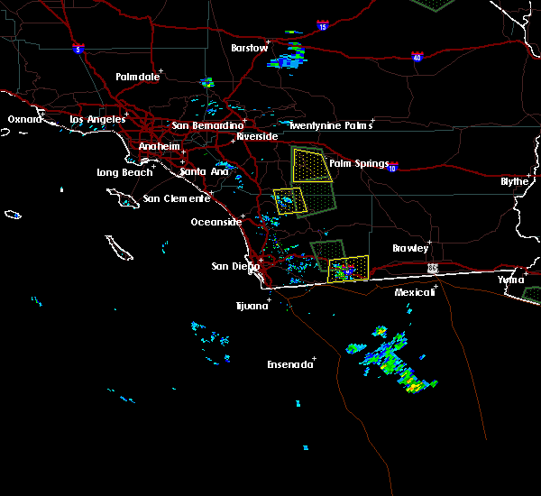
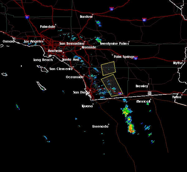
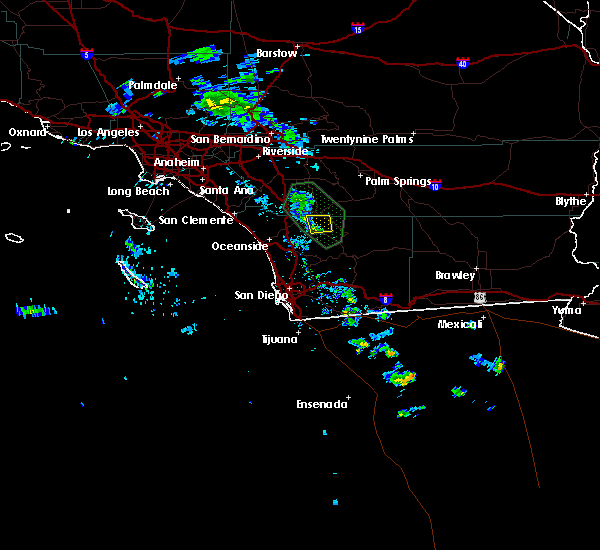
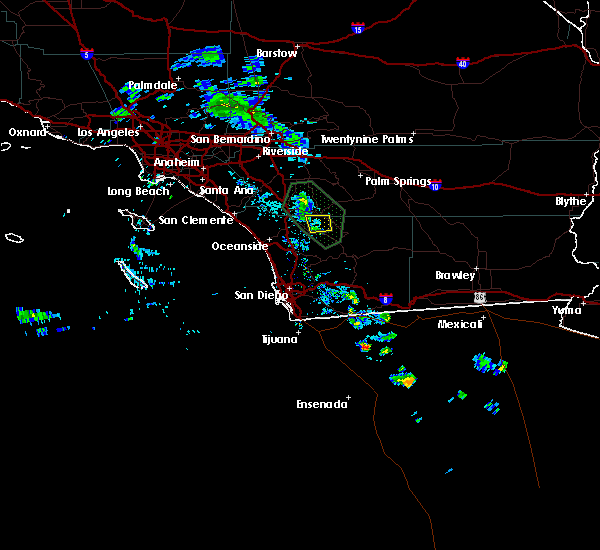
Hail Map for Aguanga, CA
The Aguanga, CA area has had 1 report of on-the-ground hail by trained spotters, and has been under severe weather warnings 1 time during the past 12 months. Doppler radar has detected hail at or near Aguanga, CA on 2 occasions.
| Name: | Aguanga, CA |
| Where Located: | 52.5 miles SSW of Yucca Valley, CA |
| Map: | Google Map for Aguanga, CA |
| Population: | 1128 |
| Housing Units: | 984 |
| More Info: | Search Google for Aguanga, CA |
0
The Top Recent Hail Date for Aguanga, CA is Tuesday, September 13, 2011 (2nd out of 2)

Hail and Wind Damage Spotted near Aguanga, CA
| Date / Time | Report Details |
|---|---|
| 8/16/2023 4:31 PM PDT |
 At 430 pm pdt, a severe thunderstorm was located near hwy 79 between warner springs and oak grove, or 10 miles south of anza, moving northwest at 10 mph (radar indicated). Hazards include 60 mph wind gusts and nickel size hail. expect damage to roofs, siding, and trees At 430 pm pdt, a severe thunderstorm was located near hwy 79 between warner springs and oak grove, or 10 miles south of anza, moving northwest at 10 mph (radar indicated). Hazards include 60 mph wind gusts and nickel size hail. expect damage to roofs, siding, and trees
|
| 9/24/2021 1:24 PM PDT | Quarter sized hail reported 10 miles NW of Aguanga, CA |
| 8/15/2020 3:04 PM PDT |
 At 303 pm pdt, a severe thunderstorm was located near anza, and is nearly stationary (radar indicated). Hazards include 60 mph wind gusts. Expect damage to roofs, siding, and trees. Locations impacted include, anza, aguanga, hwy 79 between oak grove and aguanga, hwy 79 between warner springs and oak grove, cahuilla indian reservation, oak grove and sage. At 303 pm pdt, a severe thunderstorm was located near anza, and is nearly stationary (radar indicated). Hazards include 60 mph wind gusts. Expect damage to roofs, siding, and trees. Locations impacted include, anza, aguanga, hwy 79 between oak grove and aguanga, hwy 79 between warner springs and oak grove, cahuilla indian reservation, oak grove and sage.
|
| 8/15/2020 2:24 PM PDT |
 At 223 pm pdt, a severe thunderstorm was located near hwy 79 between warner springs and oak grove, or 8 miles south of anza, and is nearly stationary (radar indicated). Hazards include 70 mph wind gusts and nickel size hail. Expect considerable tree damage. Damage is likely to mobile homes, roofs, and outbuildings. At 223 pm pdt, a severe thunderstorm was located near hwy 79 between warner springs and oak grove, or 8 miles south of anza, and is nearly stationary (radar indicated). Hazards include 70 mph wind gusts and nickel size hail. Expect considerable tree damage. Damage is likely to mobile homes, roofs, and outbuildings.
|
| 9/5/2019 2:50 PM PDT | Spotter reports branches down... dead tree down. estimated gusts to 35 mp in san diego county CA, 10.7 miles WNW of Aguanga, CA |
| 9/4/2019 4:09 PM PDT |
 The severe thunderstorm warning for riverside and north central san diego counties will expire at 415 pm pdt, the storm which prompted the warning has weakened below severe limits, and has moved out of the warned area. therefore, the warning will be allowed to expire. The severe thunderstorm warning for riverside and north central san diego counties will expire at 415 pm pdt, the storm which prompted the warning has weakened below severe limits, and has moved out of the warned area. therefore, the warning will be allowed to expire.
|
| 9/4/2019 3:50 PM PDT |
 At 349 pm pdt, a severe thunderstorm was located near hwy 79 between oak grove and aguanga, or 7 miles southwest of anza, moving northwest at 10 mph (radar indicated). Hazards include 60 mph wind gusts. the storm has weakened in the last half hour but strong winds are still possible. Expect damage to roofs, siding, and trees. Locations impacted include, temecula, anza, aguanga, hwy 79 between oak grove and aguanga, hwy 79 between warner springs and oak grove, palomar mountain, oak grove, sage, lake skinner recreation area and cahuilla indian reservation. At 349 pm pdt, a severe thunderstorm was located near hwy 79 between oak grove and aguanga, or 7 miles southwest of anza, moving northwest at 10 mph (radar indicated). Hazards include 60 mph wind gusts. the storm has weakened in the last half hour but strong winds are still possible. Expect damage to roofs, siding, and trees. Locations impacted include, temecula, anza, aguanga, hwy 79 between oak grove and aguanga, hwy 79 between warner springs and oak grove, palomar mountain, oak grove, sage, lake skinner recreation area and cahuilla indian reservation.
|
| 9/4/2019 3:19 PM PDT |
 The national weather service in san diego has issued a * severe thunderstorm warning for. riverside county in southern california. north central san diego county in southwestern california. until 415 pm pdt. At 318 pm pdt, a severe thunderstorm was located near hwy 79. The national weather service in san diego has issued a * severe thunderstorm warning for. riverside county in southern california. north central san diego county in southwestern california. until 415 pm pdt. At 318 pm pdt, a severe thunderstorm was located near hwy 79.
|
| 8/15/2018 3:37 PM PDT |
 At 337 pm pdt, a severe thunderstorm was located over palomar mountain state park, or 12 miles northeast of valley center. this storm is nearly stationary (radar indicated). Hazards include 60 mph wind gusts and nickel size hail. expect damage to roofs, siding, and trees At 337 pm pdt, a severe thunderstorm was located over palomar mountain state park, or 12 miles northeast of valley center. this storm is nearly stationary (radar indicated). Hazards include 60 mph wind gusts and nickel size hail. expect damage to roofs, siding, and trees
|
| 8/15/2018 2:32 PM PDT |
 At 231 pm pdt, a severe thunderstorm was located near hwy 79 between warner springs and oak grove, or 12 miles south of anza, and is nearly stationary (radar indicated). Hazards include 60 mph wind gusts and penny size hail. Expect damage to roofs, siding, and trees. Locations impacted include, southeastern anza, warner springs, hwy 79 between warner springs and oak grove, lake henshaw, hwy 74 between anza and palm desert, s7 - east grade rd, hwy 79 between oak grove and aguanga, borrego palm canyon, hwy 79 between santa ysabel and warner springs, aguanga, hwy s2 between hwy 79 and hwy 78, cahuilla indian reservation, oak grove, los coyotes indian reservation and santa rosa mountain. At 231 pm pdt, a severe thunderstorm was located near hwy 79 between warner springs and oak grove, or 12 miles south of anza, and is nearly stationary (radar indicated). Hazards include 60 mph wind gusts and penny size hail. Expect damage to roofs, siding, and trees. Locations impacted include, southeastern anza, warner springs, hwy 79 between warner springs and oak grove, lake henshaw, hwy 74 between anza and palm desert, s7 - east grade rd, hwy 79 between oak grove and aguanga, borrego palm canyon, hwy 79 between santa ysabel and warner springs, aguanga, hwy s2 between hwy 79 and hwy 78, cahuilla indian reservation, oak grove, los coyotes indian reservation and santa rosa mountain.
|
| 8/15/2018 2:09 PM PDT |
 At 208 pm pdt, a severe thunderstorm was located near hwy 79 between warner springs and oak grove, or 12 miles south of anza. this storm was nearly stationary (radar indicated). Hazards include 60 mph wind gusts and penny size hail. expect damage to roofs, siding, and trees At 208 pm pdt, a severe thunderstorm was located near hwy 79 between warner springs and oak grove, or 12 miles south of anza. this storm was nearly stationary (radar indicated). Hazards include 60 mph wind gusts and penny size hail. expect damage to roofs, siding, and trees
|
| 8/2/2017 1:36 PM PDT |
 At 134 pm pdt, a severe thunderstorm remained over palomar mountain state park, and is nearly stationary (radar indicated). Hazards include 60 mph wind gusts and penny size hail. Expect damage to power lines and trees. Locations impacted include, palomar mountain state park, palomar mountain, hwy 79 between oak grove and aguanga, oak grove, pauma valley, la jolla indian reservation and pauma indian reservation. At 134 pm pdt, a severe thunderstorm remained over palomar mountain state park, and is nearly stationary (radar indicated). Hazards include 60 mph wind gusts and penny size hail. Expect damage to power lines and trees. Locations impacted include, palomar mountain state park, palomar mountain, hwy 79 between oak grove and aguanga, oak grove, pauma valley, la jolla indian reservation and pauma indian reservation.
|
| 8/2/2017 1:21 PM PDT |
 At 119 pm pdt, a severe thunderstorm was located over palomar mountain state park, and is nearly stationary (radar indicated). Hazards include 60 mph wind gusts and quarter size hail. expect damage to power lines and trees At 119 pm pdt, a severe thunderstorm was located over palomar mountain state park, and is nearly stationary (radar indicated). Hazards include 60 mph wind gusts and quarter size hail. expect damage to power lines and trees
|
| 3/7/2016 7:58 AM PST |
 The national weather service in san diego has issued a * severe thunderstorm warning for. eastern orange county in southwestern california. san bernardino county in southern california. riverside county in southern california. Northwestern san diego county in southwestern california. The national weather service in san diego has issued a * severe thunderstorm warning for. eastern orange county in southwestern california. san bernardino county in southern california. riverside county in southern california. Northwestern san diego county in southwestern california.
|
| 3/7/2016 7:43 AM PST |
 At 740 am pst, doppler radar indicated a line of severe thunderstorms capable of producing damaging wind gusts of 45 to 60 mph over eastern orange county. this line of storms was located near canyon lake, moving east at 30 mph. the storms will progress eastward over the next hour, impacting the inland empire and northwest san diego county. locations impacted include but are not limited to, riverside, san bernardino, oceanside, ontario, irvine, moreno valley, corona, rialto, tustin, chino, redlands. At 740 am pst, doppler radar indicated a line of severe thunderstorms capable of producing damaging wind gusts of 45 to 60 mph over eastern orange county. this line of storms was located near canyon lake, moving east at 30 mph. the storms will progress eastward over the next hour, impacting the inland empire and northwest san diego county. locations impacted include but are not limited to, riverside, san bernardino, oceanside, ontario, irvine, moreno valley, corona, rialto, tustin, chino, redlands.
|
| 3/7/2016 7:10 AM PST |
 At 706 am pst, doppler radar indicated a line of severe thunderstorms capable of producing damaging wind gusts of 45 to 60 mph moving through central orange county. this line of storms was located near el toro, moving east at 35 mph. the stroms will progress eastward over the next hour, impacting the inland empire and northwest san diego county. locations impacted include, santa ana, anaheim, riverside, huntington beach, san bernardino, oceanside, ontario, irvine, fontana, orange, rancho cucamonga, corona, costa mesa, mission viejo, rialto. At 706 am pst, doppler radar indicated a line of severe thunderstorms capable of producing damaging wind gusts of 45 to 60 mph moving through central orange county. this line of storms was located near el toro, moving east at 35 mph. the stroms will progress eastward over the next hour, impacting the inland empire and northwest san diego county. locations impacted include, santa ana, anaheim, riverside, huntington beach, san bernardino, oceanside, ontario, irvine, fontana, orange, rancho cucamonga, corona, costa mesa, mission viejo, rialto.
|
| 3/7/2016 6:36 AM PST |
 At 635 am pst, doppler radar indicated a line of severe thunderstorms capable of producing damaging wind gusts of 45 to 60 mph approaching the orange county coast. the leading edge of the storms was located 5 miles southwest of seal beach, and moving east at 35 mph. At 635 am pst, doppler radar indicated a line of severe thunderstorms capable of producing damaging wind gusts of 45 to 60 mph approaching the orange county coast. the leading edge of the storms was located 5 miles southwest of seal beach, and moving east at 35 mph.
|
| 1/6/2016 1:24 PM PST |
 At 118 pm pst, doppler radar indicated a severe thunderstorm capable of producing damaging winds in excess of 60 mph. this storm was located near fallbrook, moving northeast at 20 mph. this severe storm will impact wildomar. another severe storm is producing a waterspout west of carlsbad. this storm will reach the immediate coast between encinitas and oceanside by 140 pm. locations impacted include, oceanside, vista, carlsbad, encinitas, temecula, san marcos, san clemente, san juan capistrano, fallbrook, wildomar, solana beach, camp pendleton south, canyon lake, camp pendleton north, lakeland village, murrieta, valley center, lake san marcos, hidden meadows and bonsall. At 118 pm pst, doppler radar indicated a severe thunderstorm capable of producing damaging winds in excess of 60 mph. this storm was located near fallbrook, moving northeast at 20 mph. this severe storm will impact wildomar. another severe storm is producing a waterspout west of carlsbad. this storm will reach the immediate coast between encinitas and oceanside by 140 pm. locations impacted include, oceanside, vista, carlsbad, encinitas, temecula, san marcos, san clemente, san juan capistrano, fallbrook, wildomar, solana beach, camp pendleton south, canyon lake, camp pendleton north, lakeland village, murrieta, valley center, lake san marcos, hidden meadows and bonsall.
|
| 1/6/2016 1:04 PM PST |
 At 100 pm pst, doppler radar indicated a cluster of severe thunderstorms capable of producing damaging winds in excess of 60 mph. one storm was located over northeastern camp pendleton, and moving northeast at 25 mph. another storm is moving towards fallbrook. a third cell is over open water moving towards oceanside. the potential for a waterspout or brief tornado is possible given the unstable environment. hail is possible with these storms. At 100 pm pst, doppler radar indicated a cluster of severe thunderstorms capable of producing damaging winds in excess of 60 mph. one storm was located over northeastern camp pendleton, and moving northeast at 25 mph. another storm is moving towards fallbrook. a third cell is over open water moving towards oceanside. the potential for a waterspout or brief tornado is possible given the unstable environment. hail is possible with these storms.
|
| 9/9/2015 2:23 PM PDT |
 The severe thunderstorm warning for riverside county will expire at 230 pm pdt, the storms which prompted the warning have moved out of the area. therefore the warning will be allowed to expire. The severe thunderstorm warning for riverside county will expire at 230 pm pdt, the storms which prompted the warning have moved out of the area. therefore the warning will be allowed to expire.
|
| 9/9/2015 2:03 PM PDT |
 At 154 pm pdt, doppler radar continued to indicate a cluster of severe thunderstorms capable of producing quarter size hail and damaging winds in excess of 60 mph. these storms were along a line from stretching from wildomar to san jacinto. these storms were moving slowly north northwest at 5 to 10 mph. locations impacted include, hemet, sun city, east hemet, valle vista, idyllwild-pine cove and winchester. At 154 pm pdt, doppler radar continued to indicate a cluster of severe thunderstorms capable of producing quarter size hail and damaging winds in excess of 60 mph. these storms were along a line from stretching from wildomar to san jacinto. these storms were moving slowly north northwest at 5 to 10 mph. locations impacted include, hemet, sun city, east hemet, valle vista, idyllwild-pine cove and winchester.
|
| 9/9/2015 1:30 PM PDT |
 At 128 pm pdt, doppler radar indicated a cluster of severe thunderstorms capable of producing quarter size hail and damaging winds in excess of 60 mph. these storms were located 15 miles east of temecula and were moving north northwest at 5 mph. At 128 pm pdt, doppler radar indicated a cluster of severe thunderstorms capable of producing quarter size hail and damaging winds in excess of 60 mph. these storms were located 15 miles east of temecula and were moving north northwest at 5 mph.
|
| 6/30/2015 2:27 PM PDT |
 At 226 pm pdt, doppler radar indicated a severe thunderstorm capable of producing damaging winds to 60 mph. this storm was located over rainbow and temecula, and was moving west at 15 mph. additional storm formation is likely through 300 pm. locations impacted include, temecula, fallbrook, murrieta and rainbow. At 226 pm pdt, doppler radar indicated a severe thunderstorm capable of producing damaging winds to 60 mph. this storm was located over rainbow and temecula, and was moving west at 15 mph. additional storm formation is likely through 300 pm. locations impacted include, temecula, fallbrook, murrieta and rainbow.
|
| 6/30/2015 2:01 PM PDT |
 At 154 pm pdt, doppler radar indicated a severe thunderstorm capable of producing damaging winds to 60 mph. this storm was located 15 miles east of temecula and rainbow, and moving west at 20 mph. At 154 pm pdt, doppler radar indicated a severe thunderstorm capable of producing damaging winds to 60 mph. this storm was located 15 miles east of temecula and rainbow, and moving west at 20 mph.
|
| 6/30/2015 2:00 PM PDT |
 At 154 pm pdt, doppler radar indicated a severe thunderstorm capable of producing damaging winds to 60 mph. this storm was located 15 miles east of temecula and rainbow, and moving east at 20 mph. At 154 pm pdt, doppler radar indicated a severe thunderstorm capable of producing damaging winds to 60 mph. this storm was located 15 miles east of temecula and rainbow, and moving east at 20 mph.
|
Hail Maps for Aguanga, CA


Connect with Interactive Hail Maps