

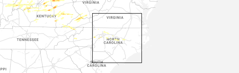
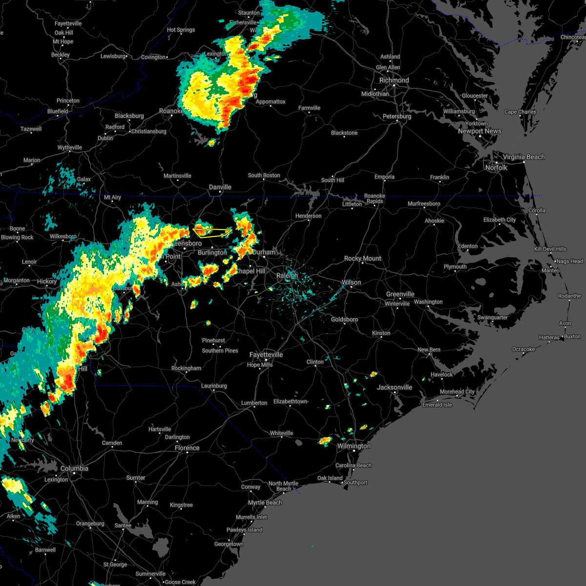
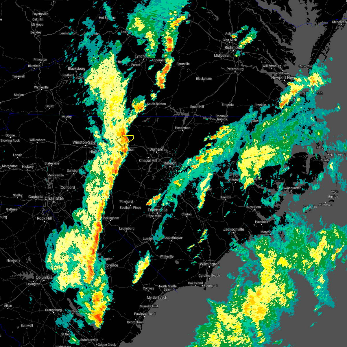
Hail Map for Altamahaw, NC
The Altamahaw, NC area has had 0 reports of on-the-ground hail by trained spotters, and has been under severe weather warnings 22 times during the past 12 months. Doppler radar has detected hail at or near Altamahaw, NC on 46 occasions.
| Name: | Altamahaw, NC |
| Where Located: | 55.4 miles WNW of Raleigh, NC |
| Map: | Google Map for Altamahaw, NC |
| Population: | 347 |
| Housing Units: | 177 |
| More Info: | Search Google for Altamahaw, NC |
5
The Top Recent Hail Date for Altamahaw, NC is Thursday, May 19, 2022 (7th out of 46)
Hail and Wind Damage Spotted near Altamahaw, NC
| Date / Time | Report Details |
|---|---|
| 4/11/2024 9:44 PM EDT |
 the severe thunderstorm warning has been cancelled and is no longer in effect the severe thunderstorm warning has been cancelled and is no longer in effect
|
| 4/11/2024 9:37 PM EDT |
 At 937 pm edt, severe thunderstorms were located along a line extending from oregon hill to near camp springs to near mcleansville, moving northeast at 45 mph (radar indicated). Hazards include 60 mph wind gusts. Expect damage to roofs, siding, and trees. Locations impacted include, mcleansville, lake cammack park & marina, altamahaw-ossipee, union ridge, altamahaw, lake burlington, and monticello. At 937 pm edt, severe thunderstorms were located along a line extending from oregon hill to near camp springs to near mcleansville, moving northeast at 45 mph (radar indicated). Hazards include 60 mph wind gusts. Expect damage to roofs, siding, and trees. Locations impacted include, mcleansville, lake cammack park & marina, altamahaw-ossipee, union ridge, altamahaw, lake burlington, and monticello.
|
| 4/11/2024 9:28 PM EDT |
 Svrrah the national weather service in raleigh has issued a * severe thunderstorm warning for, northwestern alamance county in central north carolina, northeastern guilford county in central north carolina, * until 1015 pm edt. * at 927 pm edt, severe thunderstorms were located along a line extending from wentworth to 6 miles southeast of monroeton to near greensboro, moving northeast at 45 mph (radar indicated). Hazards include 60 mph wind gusts. expect damage to roofs, siding, and trees Svrrah the national weather service in raleigh has issued a * severe thunderstorm warning for, northwestern alamance county in central north carolina, northeastern guilford county in central north carolina, * until 1015 pm edt. * at 927 pm edt, severe thunderstorms were located along a line extending from wentworth to 6 miles southeast of monroeton to near greensboro, moving northeast at 45 mph (radar indicated). Hazards include 60 mph wind gusts. expect damage to roofs, siding, and trees
|
| 2/28/2024 5:32 PM EST |
 At 532 pm est, severe thunderstorms were located along a line extending from 7 miles north of elon to near mcleansville to 8 miles southeast of greensboro to near thomasville to near lexington, moving east at 55 mph (radar indicated). Hazards include 60 mph wind gusts. Expect damage to roofs, siding, and trees. Locations impacted include, greensboro, high point, burlington, lexington, graham, randleman, thomasville, mebane, elon, and linwood. At 532 pm est, severe thunderstorms were located along a line extending from 7 miles north of elon to near mcleansville to 8 miles southeast of greensboro to near thomasville to near lexington, moving east at 55 mph (radar indicated). Hazards include 60 mph wind gusts. Expect damage to roofs, siding, and trees. Locations impacted include, greensboro, high point, burlington, lexington, graham, randleman, thomasville, mebane, elon, and linwood.
|
| 2/28/2024 5:12 PM EST |
 Svrrah the national weather service in raleigh has issued a * severe thunderstorm warning for, alamance county in central north carolina, central davidson county in central north carolina, northern randolph county in central north carolina, guilford county in central north carolina, * until 600 pm est. * at 512 pm est, severe thunderstorms were located along a line extending from near monroeton to near greensboro to near high point to 7 miles north of lexington to 6 miles east of mocksville, moving east at 45 mph (radar indicated). Hazards include 60 mph wind gusts. expect damage to roofs, siding, and trees Svrrah the national weather service in raleigh has issued a * severe thunderstorm warning for, alamance county in central north carolina, central davidson county in central north carolina, northern randolph county in central north carolina, guilford county in central north carolina, * until 600 pm est. * at 512 pm est, severe thunderstorms were located along a line extending from near monroeton to near greensboro to near high point to 7 miles north of lexington to 6 miles east of mocksville, moving east at 45 mph (radar indicated). Hazards include 60 mph wind gusts. expect damage to roofs, siding, and trees
|
| 1/9/2024 3:50 PM EST |
 At 349 pm est, severe thunderstorms were located along a line extending from 9 miles south of bethany to near greensboro to 6 miles northwest of randleman, moving northeast at 60 mph (radar indicated). Hazards include 60 mph wind gusts. expect damage to roofs, siding, and trees At 349 pm est, severe thunderstorms were located along a line extending from 9 miles south of bethany to near greensboro to 6 miles northwest of randleman, moving northeast at 60 mph (radar indicated). Hazards include 60 mph wind gusts. expect damage to roofs, siding, and trees
|
| 1/9/2024 3:09 PM EST |
 At 308 pm est, severe thunderstorms were located along a line extending from near ringgold to near jericho to 9 miles south of elon, moving northeast at 40 mph (radar indicated). Hazards include 60 mph wind gusts. expect damage to roofs, siding, and trees At 308 pm est, severe thunderstorms were located along a line extending from near ringgold to near jericho to 9 miles south of elon, moving northeast at 40 mph (radar indicated). Hazards include 60 mph wind gusts. expect damage to roofs, siding, and trees
|
| 1/9/2024 2:31 PM EST |
 At 230 pm est, severe thunderstorms were located along a line extending from bethany to near greensboro to near high point, moving northeast at 45 mph (radar indicated). Hazards include 60 mph wind gusts. expect damage to roofs, siding, and trees At 230 pm est, severe thunderstorms were located along a line extending from bethany to near greensboro to near high point, moving northeast at 45 mph (radar indicated). Hazards include 60 mph wind gusts. expect damage to roofs, siding, and trees
|
| 8/7/2023 6:48 PM EDT |
 At 648 pm edt, severe thunderstorms were located along a line extending from near mebane to near goldston, moving east at 50 mph (radar indicated). Hazards include 70 mph wind gusts. Expect considerable tree damage. damage is likely to mobile homes, roofs, and outbuildings. Locations impacted include, chapel hill, burlington, sanford, graham, hillsborough, pittsboro, siler city, carrboro, mebane and goldston. At 648 pm edt, severe thunderstorms were located along a line extending from near mebane to near goldston, moving east at 50 mph (radar indicated). Hazards include 70 mph wind gusts. Expect considerable tree damage. damage is likely to mobile homes, roofs, and outbuildings. Locations impacted include, chapel hill, burlington, sanford, graham, hillsborough, pittsboro, siler city, carrboro, mebane and goldston.
|
| 8/7/2023 6:34 PM EDT |
 At 634 pm edt, severe thunderstorms were located along a line extending from graham to 12 miles southwest of goldston, moving east at 50 mph (radar indicated). Hazards include 70 mph wind gusts. Expect considerable tree damage. damage is likely to mobile homes, roofs, and outbuildings. Locations impacted include, chapel hill, burlington, sanford, graham, hillsborough, pittsboro, siler city, north carolina zoo, carrboro and mebane. At 634 pm edt, severe thunderstorms were located along a line extending from graham to 12 miles southwest of goldston, moving east at 50 mph (radar indicated). Hazards include 70 mph wind gusts. Expect considerable tree damage. damage is likely to mobile homes, roofs, and outbuildings. Locations impacted include, chapel hill, burlington, sanford, graham, hillsborough, pittsboro, siler city, north carolina zoo, carrboro and mebane.
|
| 8/7/2023 6:24 PM EDT |
 At 623 pm edt, severe thunderstorms were located along a line extending from near greensboro to 7 miles west of seagrove, moving east at 50 mph (radar indicated). Hazards include 70 mph wind gusts. Expect considerable tree damage. Damage is likely to mobile homes, roofs, and outbuildings. At 623 pm edt, severe thunderstorms were located along a line extending from near greensboro to 7 miles west of seagrove, moving east at 50 mph (radar indicated). Hazards include 70 mph wind gusts. Expect considerable tree damage. Damage is likely to mobile homes, roofs, and outbuildings.
|
| 7/29/2023 8:04 PM EDT |
 At 803 pm edt, severe thunderstorms were located along a line extending from near camp springs to near mcleansville, moving east at 25 mph (radar indicated). Hazards include 60 mph wind gusts and quarter size hail. Hail damage to vehicles is expected. expect wind damage to roofs, siding, and trees. locations impacted include, greensboro, burlington, mcleansville, gibsonville, lake cammack park & marina, altamahaw-ossipee, glen raven, union ridge, lake townsend marina and altamahaw. hail threat, radar indicated max hail size, 1. 00 in wind threat, radar indicated max wind gust, 60 mph. At 803 pm edt, severe thunderstorms were located along a line extending from near camp springs to near mcleansville, moving east at 25 mph (radar indicated). Hazards include 60 mph wind gusts and quarter size hail. Hail damage to vehicles is expected. expect wind damage to roofs, siding, and trees. locations impacted include, greensboro, burlington, mcleansville, gibsonville, lake cammack park & marina, altamahaw-ossipee, glen raven, union ridge, lake townsend marina and altamahaw. hail threat, radar indicated max hail size, 1. 00 in wind threat, radar indicated max wind gust, 60 mph.
|
| 7/29/2023 7:53 PM EDT |
 At 753 pm edt, severe thunderstorms were located along a line extending from near reidsville to 6 miles northwest of mcleansville, moving southeast at 25 mph (radar indicated). Hazards include 60 mph wind gusts and quarter size hail. Hail damage to vehicles is expected. expect wind damage to roofs, siding, and trees. locations impacted include, greensboro, burlington, mcleansville, gibsonville, haw river state park, lake jeanette marina, lake burlington, monticello, lake cammack park & marina and altamahaw-ossipee. hail threat, radar indicated max hail size, 1. 00 in wind threat, radar indicated max wind gust, 60 mph. At 753 pm edt, severe thunderstorms were located along a line extending from near reidsville to 6 miles northwest of mcleansville, moving southeast at 25 mph (radar indicated). Hazards include 60 mph wind gusts and quarter size hail. Hail damage to vehicles is expected. expect wind damage to roofs, siding, and trees. locations impacted include, greensboro, burlington, mcleansville, gibsonville, haw river state park, lake jeanette marina, lake burlington, monticello, lake cammack park & marina and altamahaw-ossipee. hail threat, radar indicated max hail size, 1. 00 in wind threat, radar indicated max wind gust, 60 mph.
|
| 7/29/2023 7:38 PM EDT |
 At 738 pm edt, severe thunderstorms were located along a line extending from reidsville to near monroeton, moving east at 20 mph (radar indicated). Hazards include 60 mph wind gusts and quarter size hail. Hail damage to vehicles is expected. expect wind damage to roofs, siding, and trees. locations impacted include, greensboro, burlington, mcleansville, summerfield, gibsonville, stokesdale, haw river state park, lake jeanette marina, lake burlington and monticello. hail threat, radar indicated max hail size, 1. 00 in wind threat, radar indicated max wind gust, 60 mph. At 738 pm edt, severe thunderstorms were located along a line extending from reidsville to near monroeton, moving east at 20 mph (radar indicated). Hazards include 60 mph wind gusts and quarter size hail. Hail damage to vehicles is expected. expect wind damage to roofs, siding, and trees. locations impacted include, greensboro, burlington, mcleansville, summerfield, gibsonville, stokesdale, haw river state park, lake jeanette marina, lake burlington and monticello. hail threat, radar indicated max hail size, 1. 00 in wind threat, radar indicated max wind gust, 60 mph.
|
| 7/29/2023 7:25 PM EDT |
 At 724 pm edt, severe thunderstorms were located along a line extending from wentworth to near bethany, moving southeast at 20 mph (radar indicated). Hazards include 60 mph wind gusts and quarter size hail. Hail damage to vehicles is expected. Expect wind damage to roofs, siding, and trees. At 724 pm edt, severe thunderstorms were located along a line extending from wentworth to near bethany, moving southeast at 20 mph (radar indicated). Hazards include 60 mph wind gusts and quarter size hail. Hail damage to vehicles is expected. Expect wind damage to roofs, siding, and trees.
|
| 7/9/2023 12:31 PM EDT |
 At 1229 pm edt, a cluster of severe thunderstorms were located along a line extending from person county to randolph county moving east at 40 mph (radar indicated). Hazards include 60 mph wind gusts and quarter size hail heavy rainf and minor flooding. Hail damage to vehicles is expected. Expect wind damage to roofs, siding, and trees. At 1229 pm edt, a cluster of severe thunderstorms were located along a line extending from person county to randolph county moving east at 40 mph (radar indicated). Hazards include 60 mph wind gusts and quarter size hail heavy rainf and minor flooding. Hail damage to vehicles is expected. Expect wind damage to roofs, siding, and trees.
|
| 7/9/2023 12:13 PM EDT |
 At 1213 pm edt, a severe thunderstorm capable of producing a tornado was located over burlington, moving east at 35 mph (radar indicated rotation). Hazards include tornado. Flying debris will be dangerous to those caught without shelter. mobile homes will be damaged or destroyed. damage to roofs, windows, and vehicles will occur. tree damage is likely. This tornadic thunderstorm will remain over mainly rural areas of northern alamance county, including the following locations, lake cammack park & marina, altamahaw-ossipee, glen raven, union ridge and altamahaw. At 1213 pm edt, a severe thunderstorm capable of producing a tornado was located over burlington, moving east at 35 mph (radar indicated rotation). Hazards include tornado. Flying debris will be dangerous to those caught without shelter. mobile homes will be damaged or destroyed. damage to roofs, windows, and vehicles will occur. tree damage is likely. This tornadic thunderstorm will remain over mainly rural areas of northern alamance county, including the following locations, lake cammack park & marina, altamahaw-ossipee, glen raven, union ridge and altamahaw.
|
| 7/9/2023 11:57 AM EDT |
 At 1157 am edt, a severe thunderstorm capable of producing a tornado was located near elon, or 7 miles northwest of burlington, moving east at 35 mph (radar indicated rotation). Hazards include tornado. Flying debris will be dangerous to those caught without shelter. mobile homes will be damaged or destroyed. damage to roofs, windows, and vehicles will occur. tree damage is likely. this dangerous storm will be near, burlington around 1210 pm edt. graham around 1215 pm edt. Other locations impacted by this tornadic thunderstorm include lake cammack park & marina, altamahaw-ossipee, glen raven, lake guilford mackintosh marina and union ridge. At 1157 am edt, a severe thunderstorm capable of producing a tornado was located near elon, or 7 miles northwest of burlington, moving east at 35 mph (radar indicated rotation). Hazards include tornado. Flying debris will be dangerous to those caught without shelter. mobile homes will be damaged or destroyed. damage to roofs, windows, and vehicles will occur. tree damage is likely. this dangerous storm will be near, burlington around 1210 pm edt. graham around 1215 pm edt. Other locations impacted by this tornadic thunderstorm include lake cammack park & marina, altamahaw-ossipee, glen raven, lake guilford mackintosh marina and union ridge.
|
| 7/9/2023 11:47 AM EDT |
 At 1147 am edt, severe thunderstorms were located along a line extending from near monroeton to near mcleansville to 8 miles east of high point to 8 miles south of thomasville to near spencer, moving east at 40 mph (radar indicated). Hazards include 60 mph wind gusts and quarter size hail. Hail damage to vehicles is expected. Expect wind damage to roofs, siding, and trees. At 1147 am edt, severe thunderstorms were located along a line extending from near monroeton to near mcleansville to 8 miles east of high point to 8 miles south of thomasville to near spencer, moving east at 40 mph (radar indicated). Hazards include 60 mph wind gusts and quarter size hail. Hail damage to vehicles is expected. Expect wind damage to roofs, siding, and trees.
|
| 7/1/2023 4:15 PM EDT |
 At 415 pm edt, severe thunderstorms were located along a line extending from yanceyville to 6 miles north of burlington to near mcleansville, moving southeast at 25 mph (radar indicated). Hazards include 60 mph wind gusts and nickel size hail. expect damage to roofs, siding, and trees At 415 pm edt, severe thunderstorms were located along a line extending from yanceyville to 6 miles north of burlington to near mcleansville, moving southeast at 25 mph (radar indicated). Hazards include 60 mph wind gusts and nickel size hail. expect damage to roofs, siding, and trees
|
| 4/22/2023 10:04 AM EDT |
 At 1004 am edt, severe thunderstorms were located along a line extending from near jericho to near graham to 7 miles west of siler city, moving northeast at 50 mph (radar indicated). Hazards include 60 mph wind gusts and quarter size hail. Hail damage to vehicles is expected. expect wind damage to roofs, siding, and trees. locations impacted include, burlington, graham, siler city, mebane, elon, gibsonville, liberty, haw river, ramseur and swepsonville. hail threat, radar indicated max hail size, 1. 00 in wind threat, radar indicated max wind gust, 60 mph. At 1004 am edt, severe thunderstorms were located along a line extending from near jericho to near graham to 7 miles west of siler city, moving northeast at 50 mph (radar indicated). Hazards include 60 mph wind gusts and quarter size hail. Hail damage to vehicles is expected. expect wind damage to roofs, siding, and trees. locations impacted include, burlington, graham, siler city, mebane, elon, gibsonville, liberty, haw river, ramseur and swepsonville. hail threat, radar indicated max hail size, 1. 00 in wind threat, radar indicated max wind gust, 60 mph.
|
| 4/22/2023 9:29 AM EDT |
 At 928 am edt, severe thunderstorms were located along a line extending from near monroeton to randleman to near biscoe, moving northeast at 60 mph (radar indicated). Hazards include 60 mph wind gusts and quarter size hail. Hail damage to vehicles is expected. Expect wind damage to roofs, siding, and trees. At 928 am edt, severe thunderstorms were located along a line extending from near monroeton to randleman to near biscoe, moving northeast at 60 mph (radar indicated). Hazards include 60 mph wind gusts and quarter size hail. Hail damage to vehicles is expected. Expect wind damage to roofs, siding, and trees.
|
| 1/12/2023 7:50 PM EST |
 At 750 pm est, severe thunderstorms were located along a line extending from near jericho to near randleman, moving east at 60 mph (radar indicated). Hazards include 60 mph wind gusts. Expect damage to roofs, siding, and trees. locations impacted include, burlington, asheboro, graham, roxboro, hillsborough, randleman, mebane, elon, mcleansville and concord. hail threat, radar indicated max hail size, <. 75 in wind threat, radar indicated max wind gust, 60 mph. At 750 pm est, severe thunderstorms were located along a line extending from near jericho to near randleman, moving east at 60 mph (radar indicated). Hazards include 60 mph wind gusts. Expect damage to roofs, siding, and trees. locations impacted include, burlington, asheboro, graham, roxboro, hillsborough, randleman, mebane, elon, mcleansville and concord. hail threat, radar indicated max hail size, <. 75 in wind threat, radar indicated max wind gust, 60 mph.
|
| 1/12/2023 7:31 PM EST |
 At 730 pm est, severe thunderstorms were located along a line extending from near monroeton to 10 miles south of thomasville, moving east at 60 mph (radar indicated). Hazards include 60 mph wind gusts. expect damage to roofs, siding, and trees At 730 pm est, severe thunderstorms were located along a line extending from near monroeton to 10 miles south of thomasville, moving east at 60 mph (radar indicated). Hazards include 60 mph wind gusts. expect damage to roofs, siding, and trees
|
| 11/11/2022 8:56 AM EST |
 The tornado warning for alamance county will expire at 900 am est, the storm which prompted the warning has weakened below severe limits, and no longer appears capable of producing a tornado. therefore, the warning will be allowed to expire. a tornado watch remains in effect until 300 pm est for central north carolina. to report severe weather, contact your nearest law enforcement agency. they will relay your report to the national weather service raleigh. The tornado warning for alamance county will expire at 900 am est, the storm which prompted the warning has weakened below severe limits, and no longer appears capable of producing a tornado. therefore, the warning will be allowed to expire. a tornado watch remains in effect until 300 pm est for central north carolina. to report severe weather, contact your nearest law enforcement agency. they will relay your report to the national weather service raleigh.
|
| 11/11/2022 8:45 AM EST |
 At 844 am est, a severe thunderstorm capable of producing a tornado was located near graham, moving north at 30 mph (radar indicated rotation). Hazards include tornado. Flying debris will be dangerous to those caught without shelter. mobile homes will be damaged or destroyed. damage to roofs, windows, and vehicles will occur. tree damage is likely. this dangerous storm will be near, graham, mebane and elon around 855 am est. burlington around 900 am est. Other locations impacted by this tornadic thunderstorm include lake cammack park & marina, altamahaw-ossipee, glen raven, lake mackintosh marina and union ridge. At 844 am est, a severe thunderstorm capable of producing a tornado was located near graham, moving north at 30 mph (radar indicated rotation). Hazards include tornado. Flying debris will be dangerous to those caught without shelter. mobile homes will be damaged or destroyed. damage to roofs, windows, and vehicles will occur. tree damage is likely. this dangerous storm will be near, graham, mebane and elon around 855 am est. burlington around 900 am est. Other locations impacted by this tornadic thunderstorm include lake cammack park & marina, altamahaw-ossipee, glen raven, lake mackintosh marina and union ridge.
|
| 11/11/2022 8:39 AM EST |
 At 839 am est, a severe thunderstorm capable of producing a tornado was located near graham, moving north at 25 mph (radar indicated rotation). Hazards include tornado. Flying debris will be dangerous to those caught without shelter. mobile homes will be damaged or destroyed. damage to roofs, windows, and vehicles will occur. tree damage is likely. this dangerous storm will be near, graham and elon around 855 am est. mebane around 900 am est. burlington around 905 am est. Other locations impacted by this tornadic thunderstorm include lake cammack park & marina, altamahaw-ossipee, glen raven, lake mackintosh marina and union ridge. At 839 am est, a severe thunderstorm capable of producing a tornado was located near graham, moving north at 25 mph (radar indicated rotation). Hazards include tornado. Flying debris will be dangerous to those caught without shelter. mobile homes will be damaged or destroyed. damage to roofs, windows, and vehicles will occur. tree damage is likely. this dangerous storm will be near, graham and elon around 855 am est. mebane around 900 am est. burlington around 905 am est. Other locations impacted by this tornadic thunderstorm include lake cammack park & marina, altamahaw-ossipee, glen raven, lake mackintosh marina and union ridge.
|
| 11/11/2022 8:27 AM EST |
 At 827 am est, a severe thunderstorm capable of producing a tornado was located 11 miles north of siler city, moving north at 50 mph (radar indicated rotation). Hazards include tornado. Flying debris will be dangerous to those caught without shelter. mobile homes will be damaged or destroyed. damage to roofs, windows, and vehicles will occur. tree damage is likely. this dangerous storm will be near, graham, mebane and elon around 845 am est. burlington around 850 am est. Other locations impacted by this tornadic thunderstorm include snow camp, alamance, lake burlington, sutphin and haw river. At 827 am est, a severe thunderstorm capable of producing a tornado was located 11 miles north of siler city, moving north at 50 mph (radar indicated rotation). Hazards include tornado. Flying debris will be dangerous to those caught without shelter. mobile homes will be damaged or destroyed. damage to roofs, windows, and vehicles will occur. tree damage is likely. this dangerous storm will be near, graham, mebane and elon around 845 am est. burlington around 850 am est. Other locations impacted by this tornadic thunderstorm include snow camp, alamance, lake burlington, sutphin and haw river.
|
| 7/25/2022 6:09 PM EDT |
 At 608 pm edt, a severe thunderstorm was located over burlington, moving east at 35 mph (radar indicated). Hazards include 60 mph wind gusts. Expect damage to roofs, siding, and trees. locations impacted include, chapel hill, burlington, graham, hillsborough, carrboro, mebane, elon, mcleansville, gibsonville and pleasant garden. hail threat, radar indicated max hail size, <. 75 in wind threat, radar indicated max wind gust, 60 mph. At 608 pm edt, a severe thunderstorm was located over burlington, moving east at 35 mph (radar indicated). Hazards include 60 mph wind gusts. Expect damage to roofs, siding, and trees. locations impacted include, chapel hill, burlington, graham, hillsborough, carrboro, mebane, elon, mcleansville, gibsonville and pleasant garden. hail threat, radar indicated max hail size, <. 75 in wind threat, radar indicated max wind gust, 60 mph.
|
| 7/25/2022 5:48 PM EDT |
 At 548 pm edt, a severe thunderstorm was located near mcleansville, or 8 miles southeast of greensboro, moving east at 45 mph (radar indicated). Hazards include 60 mph wind gusts. expect damage to roofs, siding, and trees At 548 pm edt, a severe thunderstorm was located near mcleansville, or 8 miles southeast of greensboro, moving east at 45 mph (radar indicated). Hazards include 60 mph wind gusts. expect damage to roofs, siding, and trees
|
| 7/21/2022 1:40 PM EDT |
 The severe thunderstorm warning for northwestern alamance, northwestern randolph and guilford counties will expire at 145 pm edt, the storms which prompted the warning have weakened below severe limits, and no longer pose an immediate threat to life or property. therefore, the warning will be allowed to expire. however gusty winds and heavy rain are still possible with these thunderstorms. a severe thunderstorm watch remains in effect until 800 pm edt for central north carolina. The severe thunderstorm warning for northwestern alamance, northwestern randolph and guilford counties will expire at 145 pm edt, the storms which prompted the warning have weakened below severe limits, and no longer pose an immediate threat to life or property. therefore, the warning will be allowed to expire. however gusty winds and heavy rain are still possible with these thunderstorms. a severe thunderstorm watch remains in effect until 800 pm edt for central north carolina.
|
| 7/21/2022 1:27 PM EDT |
 At 126 pm edt, severe thunderstorms were located along a line extending from monroeton to near mcleansville to 6 miles south of greensboro to 7 miles southeast of thomasville, moving east at 30 mph (radar indicated). Hazards include 60 mph wind gusts and nickel size hail. Expect damage to roofs, siding, and trees. locations impacted include, greensboro, high point, randleman, mcleansville, archdale, summerfield, trinity, gibsonville, pleasant garden and jamestown. hail threat, radar indicated max hail size, 0. 88 in wind threat, radar indicated max wind gust, 60 mph. At 126 pm edt, severe thunderstorms were located along a line extending from monroeton to near mcleansville to 6 miles south of greensboro to 7 miles southeast of thomasville, moving east at 30 mph (radar indicated). Hazards include 60 mph wind gusts and nickel size hail. Expect damage to roofs, siding, and trees. locations impacted include, greensboro, high point, randleman, mcleansville, archdale, summerfield, trinity, gibsonville, pleasant garden and jamestown. hail threat, radar indicated max hail size, 0. 88 in wind threat, radar indicated max wind gust, 60 mph.
|
| 7/21/2022 1:14 PM EDT |
 At 114 pm edt, severe thunderstorms were located along a line extending from near monroeton to near greensboro to near high point to 6 miles south of thomasville, moving northeast at 25 mph (radar indicated). Hazards include 60 mph wind gusts and nickel size hail. Expect damage to roofs, siding, and trees. locations impacted include, greensboro, high point, randleman, thomasville, mcleansville, archdale, summerfield, trinity, gibsonville and pleasant garden. hail threat, radar indicated max hail size, 0. 88 in wind threat, radar indicated max wind gust, 60 mph. At 114 pm edt, severe thunderstorms were located along a line extending from near monroeton to near greensboro to near high point to 6 miles south of thomasville, moving northeast at 25 mph (radar indicated). Hazards include 60 mph wind gusts and nickel size hail. Expect damage to roofs, siding, and trees. locations impacted include, greensboro, high point, randleman, thomasville, mcleansville, archdale, summerfield, trinity, gibsonville and pleasant garden. hail threat, radar indicated max hail size, 0. 88 in wind threat, radar indicated max wind gust, 60 mph.
|
| 7/21/2022 1:01 PM EDT |
 At 101 pm edt, severe thunderstorms were located along a line extending from 8 miles south of bethany to near greensboro to near high point to 8 miles southeast of lexington, moving northeast at 30 mph (radar indicated). Hazards include 60 mph wind gusts and nickel size hail. expect damage to roofs, siding, and trees At 101 pm edt, severe thunderstorms were located along a line extending from 8 miles south of bethany to near greensboro to near high point to 8 miles southeast of lexington, moving northeast at 30 mph (radar indicated). Hazards include 60 mph wind gusts and nickel size hail. expect damage to roofs, siding, and trees
|
| 7/5/2022 6:39 PM EDT |
 At 639 pm edt, severe thunderstorms were located along a line extending from near clemmons to near kernersville to greensboro, moving east at 30 mph (greensboro airport reported a wind gust of 61 mph). Hazards include 60 mph wind gusts. expect damage to roofs, siding, and trees At 639 pm edt, severe thunderstorms were located along a line extending from near clemmons to near kernersville to greensboro, moving east at 30 mph (greensboro airport reported a wind gust of 61 mph). Hazards include 60 mph wind gusts. expect damage to roofs, siding, and trees
|
| 7/5/2022 5:40 PM EDT |
 At 539 pm edt, a severe thunderstorm was located near yanceyville, moving southeast at 35 mph (radar indicated). Hazards include 60 mph wind gusts. expect damage to roofs, siding, and trees At 539 pm edt, a severe thunderstorm was located near yanceyville, moving southeast at 35 mph (radar indicated). Hazards include 60 mph wind gusts. expect damage to roofs, siding, and trees
|
| 6/17/2022 5:39 PM EDT |
 At 539 pm edt, severe thunderstorms were located along a line extending from near mebane to 12 miles northwest of siler city to 8 miles northwest of asheboro to near high rock lake, moving east at 40 mph (radar indicated). Hazards include 70 mph wind gusts and quarter size hail. Hail damage to vehicles is expected. expect considerable tree damage. wind damage is also likely to mobile homes, roofs, and outbuildings. locations impacted include, greensboro, high point, burlington, lexington, graham, randleman, thomasville, mebane, elon and linwood. thunderstorm damage threat, considerable hail threat, radar indicated max hail size, 1. 00 in wind threat, radar indicated max wind gust, 70 mph. At 539 pm edt, severe thunderstorms were located along a line extending from near mebane to 12 miles northwest of siler city to 8 miles northwest of asheboro to near high rock lake, moving east at 40 mph (radar indicated). Hazards include 70 mph wind gusts and quarter size hail. Hail damage to vehicles is expected. expect considerable tree damage. wind damage is also likely to mobile homes, roofs, and outbuildings. locations impacted include, greensboro, high point, burlington, lexington, graham, randleman, thomasville, mebane, elon and linwood. thunderstorm damage threat, considerable hail threat, radar indicated max hail size, 1. 00 in wind threat, radar indicated max wind gust, 70 mph.
|
| 6/17/2022 5:24 PM EDT |
 At 524 pm edt, severe thunderstorms were located along a line extending from near jericho to 11 miles south of mcleansville to near thomasville to near spencer, moving east at 40 mph (radar indicated). Hazards include 70 mph wind gusts and quarter size hail. Hail damage to vehicles is expected. expect considerable tree damage. wind damage is also likely to mobile homes, roofs, and outbuildings. locations impacted include, greensboro, high point, burlington, lexington, graham, randleman, thomasville, mebane, elon and linwood. thunderstorm damage threat, considerable hail threat, radar indicated max hail size, 1. 00 in wind threat, radar indicated max wind gust, 70 mph. At 524 pm edt, severe thunderstorms were located along a line extending from near jericho to 11 miles south of mcleansville to near thomasville to near spencer, moving east at 40 mph (radar indicated). Hazards include 70 mph wind gusts and quarter size hail. Hail damage to vehicles is expected. expect considerable tree damage. wind damage is also likely to mobile homes, roofs, and outbuildings. locations impacted include, greensboro, high point, burlington, lexington, graham, randleman, thomasville, mebane, elon and linwood. thunderstorm damage threat, considerable hail threat, radar indicated max hail size, 1. 00 in wind threat, radar indicated max wind gust, 70 mph.
|
| 6/17/2022 5:18 PM EDT |
 At 518 pm edt, severe thunderstorms were located along a line extending from near jericho to 10 miles southeast of greensboro to near thomasville to near cooleemee, moving east at 45 mph (radar indicated). Hazards include 70 mph wind gusts and quarter size hail. Hail damage to vehicles is expected. expect considerable tree damage. wind damage is also likely to mobile homes, roofs, and outbuildings. locations impacted include, greensboro, winston-salem, high point, burlington, lexington, graham, randleman, thomasville, kernersville and clemmons. thunderstorm damage threat, considerable hail threat, radar indicated max hail size, 1. 00 in wind threat, radar indicated max wind gust, 70 mph. At 518 pm edt, severe thunderstorms were located along a line extending from near jericho to 10 miles southeast of greensboro to near thomasville to near cooleemee, moving east at 45 mph (radar indicated). Hazards include 70 mph wind gusts and quarter size hail. Hail damage to vehicles is expected. expect considerable tree damage. wind damage is also likely to mobile homes, roofs, and outbuildings. locations impacted include, greensboro, winston-salem, high point, burlington, lexington, graham, randleman, thomasville, kernersville and clemmons. thunderstorm damage threat, considerable hail threat, radar indicated max hail size, 1. 00 in wind threat, radar indicated max wind gust, 70 mph.
|
| 6/17/2022 5:09 PM EDT |
 At 508 pm edt, severe thunderstorms were located along a line extending from camp springs to near greensboro to near thomasville to cooleemee, moving east at 50 mph (radar indicated. at 505 pm, numerous trees down were reported north of high point). Hazards include 60 mph wind gusts and quarter size hail. Hail damage to vehicles is expected. expect wind damage to roofs, siding, and trees. locations impacted include, greensboro, winston-salem, high point, burlington, lexington, graham, randleman, thomasville, kernersville and clemmons. hail threat, radar indicated max hail size, 1. 00 in wind threat, radar indicated max wind gust, 60 mph. At 508 pm edt, severe thunderstorms were located along a line extending from camp springs to near greensboro to near thomasville to cooleemee, moving east at 50 mph (radar indicated. at 505 pm, numerous trees down were reported north of high point). Hazards include 60 mph wind gusts and quarter size hail. Hail damage to vehicles is expected. expect wind damage to roofs, siding, and trees. locations impacted include, greensboro, winston-salem, high point, burlington, lexington, graham, randleman, thomasville, kernersville and clemmons. hail threat, radar indicated max hail size, 1. 00 in wind threat, radar indicated max wind gust, 60 mph.
|
| 6/17/2022 4:53 PM EDT |
 At 453 pm edt, severe thunderstorms were located along a line extending from reidsville to near greensboro to 6 miles southeast of clemmons to 8 miles southeast of harmony, moving southeast at 40 mph (radar indicated). Hazards include 60 mph wind gusts and quarter size hail. Hail damage to vehicles is expected. Expect wind damage to roofs, siding, and trees. At 453 pm edt, severe thunderstorms were located along a line extending from reidsville to near greensboro to 6 miles southeast of clemmons to 8 miles southeast of harmony, moving southeast at 40 mph (radar indicated). Hazards include 60 mph wind gusts and quarter size hail. Hail damage to vehicles is expected. Expect wind damage to roofs, siding, and trees.
|
| 6/16/2022 4:08 PM EDT |
 At 406 pm edt, severe thunderstorms were located along a line extending from hightowers to near high point, moving southeast at 20 mph. strongest winds will be from monticello, mcleansville, oak forest and pleasant garden (radar indicated). Hazards include 70 mph wind gusts and nickel size hail. Expect considerable tree damage. damage is likely to mobile homes, roofs, and outbuildings. locations impacted include, greensboro, high point, burlington, graham, mebane, elon, mcleansville, gibsonville, pleasant garden and jamestown. thunderstorm damage threat, considerable hail threat, radar indicated max hail size, 0. 88 in wind threat, radar indicated max wind gust, 70 mph. At 406 pm edt, severe thunderstorms were located along a line extending from hightowers to near high point, moving southeast at 20 mph. strongest winds will be from monticello, mcleansville, oak forest and pleasant garden (radar indicated). Hazards include 70 mph wind gusts and nickel size hail. Expect considerable tree damage. damage is likely to mobile homes, roofs, and outbuildings. locations impacted include, greensboro, high point, burlington, graham, mebane, elon, mcleansville, gibsonville, pleasant garden and jamestown. thunderstorm damage threat, considerable hail threat, radar indicated max hail size, 0. 88 in wind threat, radar indicated max wind gust, 70 mph.
|
| 6/16/2022 3:40 PM EDT |
 At 340 pm edt, severe thunderstorms were located along a line extending from yanceyville to near high point, moving southeast at 20 mph (radar indicated). Hazards include 60 mph wind gusts and nickel size hail. expect damage to roofs, siding, and trees At 340 pm edt, severe thunderstorms were located along a line extending from yanceyville to near high point, moving southeast at 20 mph (radar indicated). Hazards include 60 mph wind gusts and nickel size hail. expect damage to roofs, siding, and trees
|
| 5/27/2022 7:46 AM EDT |
 At 746 am edt, severe thunderstorms were located along a line extending from mcleansville to 9 miles east of randleman to north carolina zoo, moving northeast at 25 mph (radar indicated). Hazards include 60 mph wind gusts. expect damage to roofs, siding, and trees At 746 am edt, severe thunderstorms were located along a line extending from mcleansville to 9 miles east of randleman to north carolina zoo, moving northeast at 25 mph (radar indicated). Hazards include 60 mph wind gusts. expect damage to roofs, siding, and trees
|
| 5/23/2022 3:13 PM EDT |
 At 312 pm edt, a severe thunderstorm was located near mebane, or near graham, moving east at 20 mph (radar indicated). Hazards include 60 mph wind gusts and quarter size hail. Hail damage to vehicles is expected. expect wind damage to roofs, siding, and trees. this severe thunderstorm will be near, mebane around 315 pm edt. hillsborough around 340 pm edt. Other locations impacted by this severe thunderstorm include carr, efland, alamance, eno river state park and lake burlington. At 312 pm edt, a severe thunderstorm was located near mebane, or near graham, moving east at 20 mph (radar indicated). Hazards include 60 mph wind gusts and quarter size hail. Hail damage to vehicles is expected. expect wind damage to roofs, siding, and trees. this severe thunderstorm will be near, mebane around 315 pm edt. hillsborough around 340 pm edt. Other locations impacted by this severe thunderstorm include carr, efland, alamance, eno river state park and lake burlington.
|
| 5/19/2022 10:23 PM EDT |
 At 1023 pm edt, a severe thunderstorm was located near graham, moving southeast at 30 mph (radar indicated). Hazards include 60 mph wind gusts and quarter size hail. Hail damage to vehicles is expected. expect wind damage to roofs, siding, and trees. locations impacted include, burlington, graham, mebane, elon, gibsonville, haw river, swepsonville, alamance, carr and lake burlington. hail threat, radar indicated max hail size, 1. 00 in wind threat, radar indicated max wind gust, 60 mph. At 1023 pm edt, a severe thunderstorm was located near graham, moving southeast at 30 mph (radar indicated). Hazards include 60 mph wind gusts and quarter size hail. Hail damage to vehicles is expected. expect wind damage to roofs, siding, and trees. locations impacted include, burlington, graham, mebane, elon, gibsonville, haw river, swepsonville, alamance, carr and lake burlington. hail threat, radar indicated max hail size, 1. 00 in wind threat, radar indicated max wind gust, 60 mph.
|
| 5/19/2022 10:04 PM EDT |
 At 1004 pm edt, a severe thunderstorm was located 7 miles south of camp springs, moving east at 25 mph (radar indicated). Hazards include 60 mph wind gusts and penny size hail. expect damage to roofs, siding, and trees At 1004 pm edt, a severe thunderstorm was located 7 miles south of camp springs, moving east at 25 mph (radar indicated). Hazards include 60 mph wind gusts and penny size hail. expect damage to roofs, siding, and trees
|
| 5/6/2022 9:36 PM EDT |
 At 936 pm edt, a severe thunderstorm was located near camp springs, moving northeast at 45 mph (radar indicated). Hazards include 60 mph wind gusts and quarter size hail. Hail damage to vehicles is expected. expect wind damage to roofs, siding, and trees. locations impacted include, lake cammack park & marina, altamahaw-ossipee, haw river state park, union ridge, lake townsend marina, altamahaw, lake burlington, monticello and lake townsend. hail threat, radar indicated max hail size, 1. 00 in wind threat, radar indicated max wind gust, 60 mph. At 936 pm edt, a severe thunderstorm was located near camp springs, moving northeast at 45 mph (radar indicated). Hazards include 60 mph wind gusts and quarter size hail. Hail damage to vehicles is expected. expect wind damage to roofs, siding, and trees. locations impacted include, lake cammack park & marina, altamahaw-ossipee, haw river state park, union ridge, lake townsend marina, altamahaw, lake burlington, monticello and lake townsend. hail threat, radar indicated max hail size, 1. 00 in wind threat, radar indicated max wind gust, 60 mph.
|
| 5/6/2022 9:32 PM EDT |
 At 932 pm edt, a severe thunderstorm was located 7 miles southwest of camp springs, moving northeast at 45 mph (radar indicated). Hazards include 60 mph wind gusts and quarter size hail. Hail damage to vehicles is expected. expect wind damage to roofs, siding, and trees. locations impacted include, greensboro, burlington, mcleansville, elon, summerfield, gibsonville, haw river state park, lake jeanette marina, lake burlington and monticello. hail threat, radar indicated max hail size, 1. 00 in wind threat, radar indicated max wind gust, 60 mph. At 932 pm edt, a severe thunderstorm was located 7 miles southwest of camp springs, moving northeast at 45 mph (radar indicated). Hazards include 60 mph wind gusts and quarter size hail. Hail damage to vehicles is expected. expect wind damage to roofs, siding, and trees. locations impacted include, greensboro, burlington, mcleansville, elon, summerfield, gibsonville, haw river state park, lake jeanette marina, lake burlington and monticello. hail threat, radar indicated max hail size, 1. 00 in wind threat, radar indicated max wind gust, 60 mph.
|
| 5/6/2022 9:27 PM EDT |
 At 927 pm edt, a severe thunderstorm was located near mcleansville, or 11 miles northeast of greensboro, moving northeast at 50 mph (radar indicated). Hazards include 60 mph wind gusts and quarter size hail. Hail damage to vehicles is expected. expect wind damage to roofs, siding, and trees. locations impacted include, greensboro, burlington, mcleansville, elon, summerfield, gibsonville, pleasant garden, haw river state park, lake guilford mackintosh marina and forest oaks. hail threat, radar indicated max hail size, 1. 00 in wind threat, radar indicated max wind gust, 60 mph. At 927 pm edt, a severe thunderstorm was located near mcleansville, or 11 miles northeast of greensboro, moving northeast at 50 mph (radar indicated). Hazards include 60 mph wind gusts and quarter size hail. Hail damage to vehicles is expected. expect wind damage to roofs, siding, and trees. locations impacted include, greensboro, burlington, mcleansville, elon, summerfield, gibsonville, pleasant garden, haw river state park, lake guilford mackintosh marina and forest oaks. hail threat, radar indicated max hail size, 1. 00 in wind threat, radar indicated max wind gust, 60 mph.
|
| 5/6/2022 9:14 PM EDT |
 At 914 pm edt, a severe thunderstorm was located over greensboro, moving northeast at 45 mph (radar indicated). Hazards include 60 mph wind gusts and quarter size hail. Hail damage to vehicles is expected. Expect wind damage to roofs, siding, and trees. At 914 pm edt, a severe thunderstorm was located over greensboro, moving northeast at 45 mph (radar indicated). Hazards include 60 mph wind gusts and quarter size hail. Hail damage to vehicles is expected. Expect wind damage to roofs, siding, and trees.
|
| 5/1/2022 4:52 PM EDT |
 At 452 pm edt, a severe thunderstorm was located near elon, or near burlington, moving northeast at 20 mph (radar indicated). Hazards include 60 mph wind gusts and quarter size hail. Hail damage to vehicles is expected. Expect wind damage to roofs, siding, and trees. At 452 pm edt, a severe thunderstorm was located near elon, or near burlington, moving northeast at 20 mph (radar indicated). Hazards include 60 mph wind gusts and quarter size hail. Hail damage to vehicles is expected. Expect wind damage to roofs, siding, and trees.
|
| 5/1/2022 3:20 PM EDT |
 At 320 pm edt, a severe thunderstorm was located 7 miles southwest of camp springs, moving east at 25 mph (radar indicated). Hazards include 60 mph wind gusts and quarter size hail. Hail damage to vehicles is expected. Expect wind damage to roofs, siding, and trees. At 320 pm edt, a severe thunderstorm was located 7 miles southwest of camp springs, moving east at 25 mph (radar indicated). Hazards include 60 mph wind gusts and quarter size hail. Hail damage to vehicles is expected. Expect wind damage to roofs, siding, and trees.
|
| 4/26/2022 3:12 PM EDT |
 The severe thunderstorm warning for alamance, moore, western orange, east central anson, eastern montgomery, northern richmond, eastern randolph, southeastern guilford, west central lee and western chatham counties will expire at 315 pm edt, the storms which prompted the warning have moved east and new warnings have been issued to include areas farther east. therefore, the original warning will be allowed to expire. The severe thunderstorm warning for alamance, moore, western orange, east central anson, eastern montgomery, northern richmond, eastern randolph, southeastern guilford, west central lee and western chatham counties will expire at 315 pm edt, the storms which prompted the warning have moved east and new warnings have been issued to include areas farther east. therefore, the original warning will be allowed to expire.
|
| 4/26/2022 2:44 PM EDT |
 At 243 pm edt, severe thunderstorms were located along a line extending from near burlington to 6 miles east of north carolina zoo to 11 miles southeast of biscoe, moving northeast at 35 mph (radar indicated). Hazards include 60 mph wind gusts and quarter size hail. Hail damage to vehicles is expected. expect wind damage to roofs, siding, and trees. these severe storms will be near, burlington and elon around 250 pm edt. graham around 250 pm edt. mebane around 255 pm edt. siler city and pinehurst around 300 pm edt. southern pines around 305 pm edt. carthage around 310 pm edt. other locations impacted by these severe thunderstorms include franklinville, snow camp, pinebluff, alamance and candor. hail threat, radar indicated max hail size, 1. 00 in wind threat, radar indicated max wind gust, 60 mph. At 243 pm edt, severe thunderstorms were located along a line extending from near burlington to 6 miles east of north carolina zoo to 11 miles southeast of biscoe, moving northeast at 35 mph (radar indicated). Hazards include 60 mph wind gusts and quarter size hail. Hail damage to vehicles is expected. expect wind damage to roofs, siding, and trees. these severe storms will be near, burlington and elon around 250 pm edt. graham around 250 pm edt. mebane around 255 pm edt. siler city and pinehurst around 300 pm edt. southern pines around 305 pm edt. carthage around 310 pm edt. other locations impacted by these severe thunderstorms include franklinville, snow camp, pinebluff, alamance and candor. hail threat, radar indicated max hail size, 1. 00 in wind threat, radar indicated max wind gust, 60 mph.
|
| 4/26/2022 2:16 PM EDT |
 At 215 pm edt, severe thunderstorms were located along a line extending from 10 miles south of mcleansville to 6 miles west of seagrove to 9 miles east of ansonville, moving northeast at 35 mph (radar indicated). Hazards include 60 mph wind gusts and quarter size hail. Hail damage to vehicles is expected. expect wind damage to roofs, siding, and trees. severe thunderstorms will be near, seagrove around 225 pm edt. north carolina zoo and mcleansville around 230 pm edt. elon around 240 pm edt. burlington and graham around 250 pm edt. siler city, pinehurst and mebane around 300 pm edt. southern pines around 305 pm edt. hillsborough around 310 pm edt. carthage around 315 pm edt. other locations impacted by these severe thunderstorms include steeds, alamance, harpers crossroads, covington and pekin. hail threat, radar indicated max hail size, 1. 00 in wind threat, radar indicated max wind gust, 60 mph. At 215 pm edt, severe thunderstorms were located along a line extending from 10 miles south of mcleansville to 6 miles west of seagrove to 9 miles east of ansonville, moving northeast at 35 mph (radar indicated). Hazards include 60 mph wind gusts and quarter size hail. Hail damage to vehicles is expected. expect wind damage to roofs, siding, and trees. severe thunderstorms will be near, seagrove around 225 pm edt. north carolina zoo and mcleansville around 230 pm edt. elon around 240 pm edt. burlington and graham around 250 pm edt. siler city, pinehurst and mebane around 300 pm edt. southern pines around 305 pm edt. hillsborough around 310 pm edt. carthage around 315 pm edt. other locations impacted by these severe thunderstorms include steeds, alamance, harpers crossroads, covington and pekin. hail threat, radar indicated max hail size, 1. 00 in wind threat, radar indicated max wind gust, 60 mph.
|
| 12/11/2021 6:44 PM EST |
 At 642 pm est, a severe thunderstorm was located near mebane, or 7 miles northeast of graham, moving east at 40 mph (radar indicated). Hazards include 60 mph wind gusts. expect damage to roofs, siding, and trees At 642 pm est, a severe thunderstorm was located near mebane, or 7 miles northeast of graham, moving east at 40 mph (radar indicated). Hazards include 60 mph wind gusts. expect damage to roofs, siding, and trees
|
| 12/11/2021 6:23 PM EST |
 At 622 pm est, a severe thunderstorm was located near burlington, moving east at 50 mph (radar indicated). Hazards include 60 mph wind gusts. Expect damage to roofs, siding, and trees. locations impacted include, burlington, graham, mebane, elon, gibsonville, haw river, lake cammack park & marina, altamahaw-ossipee, glen raven and union ridge. hail threat, radar indicated max hail size, <. 75 in wind threat, radar indicated max wind gust, 60 mph. At 622 pm est, a severe thunderstorm was located near burlington, moving east at 50 mph (radar indicated). Hazards include 60 mph wind gusts. Expect damage to roofs, siding, and trees. locations impacted include, burlington, graham, mebane, elon, gibsonville, haw river, lake cammack park & marina, altamahaw-ossipee, glen raven and union ridge. hail threat, radar indicated max hail size, <. 75 in wind threat, radar indicated max wind gust, 60 mph.
|
| 12/11/2021 6:05 PM EST |
 At 604 pm est, a severe thunderstorm was located near mcleansville, or 10 miles northeast of greensboro, moving east at 45 mph (radar indicated). Hazards include 60 mph wind gusts. expect damage to roofs, siding, and trees At 604 pm est, a severe thunderstorm was located near mcleansville, or 10 miles northeast of greensboro, moving east at 45 mph (radar indicated). Hazards include 60 mph wind gusts. expect damage to roofs, siding, and trees
|
| 10/25/2021 7:42 PM EDT |
 At 742 pm edt, a severe thunderstorm was located 7 miles north of elon, or 7 miles south of camp springs, moving east at 40 mph (radar indicated). Hazards include 60 mph wind gusts. expect damage to roofs, siding, and trees At 742 pm edt, a severe thunderstorm was located 7 miles north of elon, or 7 miles south of camp springs, moving east at 40 mph (radar indicated). Hazards include 60 mph wind gusts. expect damage to roofs, siding, and trees
|
| 8/14/2021 5:19 PM EDT |
 At 518 pm edt, a severe thunderstorm was located 7 miles southeast of graham, moving north at 10 mph (radar indicated). Hazards include 60 mph wind gusts and penny size hail. expect damage to roofs, siding, and trees At 518 pm edt, a severe thunderstorm was located 7 miles southeast of graham, moving north at 10 mph (radar indicated). Hazards include 60 mph wind gusts and penny size hail. expect damage to roofs, siding, and trees
|
| 7/17/2021 5:38 PM EDT |
 At 537 pm edt, a severe thunderstorm was located over jericho, moving northeast at 35 mph (radar indicated. at 455 pm, law enforcement reported several trees and power lines down in portions of guilford county). Hazards include 60 mph wind gusts and penny size hail. Expect damage to roofs, siding, and trees. Locations impacted include, burlington, graham, hillsborough, mebane, haw river, lake cammack park & marina, carr, altamahaw-ossipee, glen raven and union ridge. At 537 pm edt, a severe thunderstorm was located over jericho, moving northeast at 35 mph (radar indicated. at 455 pm, law enforcement reported several trees and power lines down in portions of guilford county). Hazards include 60 mph wind gusts and penny size hail. Expect damage to roofs, siding, and trees. Locations impacted include, burlington, graham, hillsborough, mebane, haw river, lake cammack park & marina, carr, altamahaw-ossipee, glen raven and union ridge.
|
| 7/17/2021 5:21 PM EDT |
 At 520 pm edt, a severe thunderstorm was located near camp springs, moving east at 35 mph (radar indicated). Hazards include 60 mph wind gusts and penny size hail. expect damage to roofs, siding, and trees At 520 pm edt, a severe thunderstorm was located near camp springs, moving east at 35 mph (radar indicated). Hazards include 60 mph wind gusts and penny size hail. expect damage to roofs, siding, and trees
|
| 5/29/2021 3:25 PM EDT |
 At 324 pm edt, a severe thunderstorm was located 8 miles south of greensboro, moving east at 25 mph (radar indicated). Hazards include ping pong ball size hail and 60 mph wind gusts. People and animals outdoors will be injured. expect hail damage to roofs, siding, windows, and vehicles. Expect wind damage to roofs, siding, and trees. At 324 pm edt, a severe thunderstorm was located 8 miles south of greensboro, moving east at 25 mph (radar indicated). Hazards include ping pong ball size hail and 60 mph wind gusts. People and animals outdoors will be injured. expect hail damage to roofs, siding, windows, and vehicles. Expect wind damage to roofs, siding, and trees.
|
| 5/29/2021 3:11 PM EDT |
 At 310 pm edt, a cluster of severe thunderstorms were located along a line extending from near high point to near greensboro, moving east at 15 mph (radar indicated). Hazards include 60 mph wind gusts. Expect damage to roofs, siding, and trees. Locations impacted include, greensboro, high point, burlington, graham, randleman, elon, mcleansville, archdale, trinity and gibsonville. At 310 pm edt, a cluster of severe thunderstorms were located along a line extending from near high point to near greensboro, moving east at 15 mph (radar indicated). Hazards include 60 mph wind gusts. Expect damage to roofs, siding, and trees. Locations impacted include, greensboro, high point, burlington, graham, randleman, elon, mcleansville, archdale, trinity and gibsonville.
|
| 5/29/2021 2:54 PM EDT |
 At 254 pm edt, severe thunderstorms were located along a line extending from near greensboro to near high point, moving east at 15 mph (radar indicated). Hazards include 60 mph wind gusts. Expect damage to roofs, siding, and trees. Locations impacted include, greensboro, high point, burlington, asheboro, graham, randleman, elon, mcleansville, archdale and summerfield. At 254 pm edt, severe thunderstorms were located along a line extending from near greensboro to near high point, moving east at 15 mph (radar indicated). Hazards include 60 mph wind gusts. Expect damage to roofs, siding, and trees. Locations impacted include, greensboro, high point, burlington, asheboro, graham, randleman, elon, mcleansville, archdale and summerfield.
|
| 5/29/2021 2:34 PM EDT |
 At 234 pm edt, a cluster of severe thunderstorms were located along a line extending from 6 miles west of greensboro to thomasville, moving east at 15 mph (radar indicated). Hazards include 60 mph wind gusts. expect damage to roofs, siding, and trees At 234 pm edt, a cluster of severe thunderstorms were located along a line extending from 6 miles west of greensboro to thomasville, moving east at 15 mph (radar indicated). Hazards include 60 mph wind gusts. expect damage to roofs, siding, and trees
|
| 5/4/2021 3:38 PM EDT |
 At 337 pm edt, a severe thunderstorm was located 8 miles southeast of monroeton, or 8 miles southwest of camp springs, moving east at 30 mph (radar indicated). Hazards include 60 mph wind gusts and nickel size hail. Expect damage to roofs, siding, and trees. Locations impacted include, lake cammack park & marina, lake burlington, union ridge, altamahaw and altamahaw-ossipee. At 337 pm edt, a severe thunderstorm was located 8 miles southeast of monroeton, or 8 miles southwest of camp springs, moving east at 30 mph (radar indicated). Hazards include 60 mph wind gusts and nickel size hail. Expect damage to roofs, siding, and trees. Locations impacted include, lake cammack park & marina, lake burlington, union ridge, altamahaw and altamahaw-ossipee.
|
| 5/4/2021 3:27 PM EDT |
 At 326 pm edt, a severe thunderstorm was located near monroeton, or 9 miles south of reidsville, moving east at 30 mph (radar indicated). Hazards include 60 mph wind gusts and nickel size hail. Expect damage to roofs, siding, and trees. Locations impacted include, burlington, mebane, mcleansville, gibsonville, haw river state park, lake burlington, monticello, lake cammack park & marina, altamahaw-ossipee and glen raven. At 326 pm edt, a severe thunderstorm was located near monroeton, or 9 miles south of reidsville, moving east at 30 mph (radar indicated). Hazards include 60 mph wind gusts and nickel size hail. Expect damage to roofs, siding, and trees. Locations impacted include, burlington, mebane, mcleansville, gibsonville, haw river state park, lake burlington, monticello, lake cammack park & marina, altamahaw-ossipee and glen raven.
|
| 5/4/2021 3:19 PM EDT |
 At 318 pm edt, a severe thunderstorm was located near monroeton, or 8 miles north of greensboro, moving east at 30 mph (radar indicated). Hazards include 60 mph wind gusts and penny size hail. expect damage to roofs, siding, and trees At 318 pm edt, a severe thunderstorm was located near monroeton, or 8 miles north of greensboro, moving east at 30 mph (radar indicated). Hazards include 60 mph wind gusts and penny size hail. expect damage to roofs, siding, and trees
|
| 3/25/2021 8:15 PM EDT |
 At 814 pm edt, a severe thunderstorm was located one mile northwest of elon, moving east northeast at 25 mph (radar indicated). Hazards include 60 mph wind gusts. Expect damage to roofs, siding, and trees. Locations impacted include, burlington, graham, mebane, elon, gibsonville, haw river, swepsonville, alamance, lake cammack park & marina and altamahaw-ossipee. At 814 pm edt, a severe thunderstorm was located one mile northwest of elon, moving east northeast at 25 mph (radar indicated). Hazards include 60 mph wind gusts. Expect damage to roofs, siding, and trees. Locations impacted include, burlington, graham, mebane, elon, gibsonville, haw river, swepsonville, alamance, lake cammack park & marina and altamahaw-ossipee.
|
| 3/25/2021 7:54 PM EDT |
 At 754 pm edt, a severe thunderstorm was located over mcleansville, or 9 miles east of greensboro, moving east at 25 mph (radar indicated). Hazards include 60 mph wind gusts. expect damage to roofs, siding, and trees At 754 pm edt, a severe thunderstorm was located over mcleansville, or 9 miles east of greensboro, moving east at 25 mph (radar indicated). Hazards include 60 mph wind gusts. expect damage to roofs, siding, and trees
|
| 3/18/2021 6:12 PM EDT |
 The severe thunderstorm warning for alamance, eastern randolph, southeastern guilford and northwestern chatham counties will expire at 615 pm edt, the storms which prompted the warning have weakened across randolph, guilford, and chatham counties. therefore, the warning will be allowed to expire. a severe thunderstorm warning still remains in effect for alamance county. a tornado watch remains in effect until 900 pm edt for central north carolina. The severe thunderstorm warning for alamance, eastern randolph, southeastern guilford and northwestern chatham counties will expire at 615 pm edt, the storms which prompted the warning have weakened across randolph, guilford, and chatham counties. therefore, the warning will be allowed to expire. a severe thunderstorm warning still remains in effect for alamance county. a tornado watch remains in effect until 900 pm edt for central north carolina.
|
| 3/18/2021 5:44 PM EDT |
 At 544 pm edt, severe thunderstorms were located along a line extending from burlington to 6 miles southeast of randleman, moving northeast at 50 mph (radar indicated). Hazards include 60 mph wind gusts and quarter size hail. Hail damage to vehicles is expected. expect wind damage to roofs, siding, and trees. Locations impacted include, burlington, asheboro, graham, randleman, mebane, elon, mcleansville, gibsonville, pleasant garden and liberty. At 544 pm edt, severe thunderstorms were located along a line extending from burlington to 6 miles southeast of randleman, moving northeast at 50 mph (radar indicated). Hazards include 60 mph wind gusts and quarter size hail. Hail damage to vehicles is expected. expect wind damage to roofs, siding, and trees. Locations impacted include, burlington, asheboro, graham, randleman, mebane, elon, mcleansville, gibsonville, pleasant garden and liberty.
|
| 3/18/2021 5:43 PM EDT |
 At 543 pm edt, a severe thunderstorm capable of producing a tornado was located over elon, or over burlington, moving east at 40 mph (radar indicated rotation). Hazards include tornado and quarter size hail. Flying debris will be dangerous to those caught without shelter. mobile homes will be damaged or destroyed. damage to roofs, windows, and vehicles will occur. tree damage is likely. this dangerous storm will be near, graham around 555 pm edt. mebane around 600 pm edt. Other locations impacted by this tornadic thunderstorm include lake cammack park & marina, altamahaw-ossipee, glen raven, lake mackintosh marina and lake guilford mackintosh marina. At 543 pm edt, a severe thunderstorm capable of producing a tornado was located over elon, or over burlington, moving east at 40 mph (radar indicated rotation). Hazards include tornado and quarter size hail. Flying debris will be dangerous to those caught without shelter. mobile homes will be damaged or destroyed. damage to roofs, windows, and vehicles will occur. tree damage is likely. this dangerous storm will be near, graham around 555 pm edt. mebane around 600 pm edt. Other locations impacted by this tornadic thunderstorm include lake cammack park & marina, altamahaw-ossipee, glen raven, lake mackintosh marina and lake guilford mackintosh marina.
|
| 3/18/2021 5:34 PM EDT |
 At 534 pm edt, a severe thunderstorm capable of producing a tornado was located near mcleansville, or 8 miles west of burlington, moving northeast at 35 mph (radar indicated rotation). Hazards include tornado. Flying debris will be dangerous to those caught without shelter. mobile homes will be damaged or destroyed. damage to roofs, windows, and vehicles will occur. tree damage is likely. this dangerous storm will be near, elon around 545 pm edt. burlington around 550 pm edt. graham around 555 pm edt. mebane around 600 pm edt. Other locations impacted by this tornadic thunderstorm include lake guilford mackintosh marina, forest oaks, alamance, lake burlington and haw river. At 534 pm edt, a severe thunderstorm capable of producing a tornado was located near mcleansville, or 8 miles west of burlington, moving northeast at 35 mph (radar indicated rotation). Hazards include tornado. Flying debris will be dangerous to those caught without shelter. mobile homes will be damaged or destroyed. damage to roofs, windows, and vehicles will occur. tree damage is likely. this dangerous storm will be near, elon around 545 pm edt. burlington around 550 pm edt. graham around 555 pm edt. mebane around 600 pm edt. Other locations impacted by this tornadic thunderstorm include lake guilford mackintosh marina, forest oaks, alamance, lake burlington and haw river.
|
| 3/18/2021 5:13 PM EDT |
 At 513 pm edt, severe thunderstorms were located along a line extending from near randleman to 11 miles east of high rock lake, moving northeast at 55 mph (radar indicated). Hazards include 60 mph wind gusts and quarter size hail. Hail damage to vehicles is expected. Expect wind damage to roofs, siding, and trees. At 513 pm edt, severe thunderstorms were located along a line extending from near randleman to 11 miles east of high rock lake, moving northeast at 55 mph (radar indicated). Hazards include 60 mph wind gusts and quarter size hail. Hail damage to vehicles is expected. Expect wind damage to roofs, siding, and trees.
|
| 10/29/2020 10:41 PM EDT |
 The tornado warning for northwestern alamance and east central guilford counties will expire at 1045 pm edt, the storm which prompted the warning has weakened below severe limits, and no longer appears capable of producing a tornado. therefore, the warning will be allowed to expire. however, this storm will be closely monitored for signs of restrengthening. The tornado warning for northwestern alamance and east central guilford counties will expire at 1045 pm edt, the storm which prompted the warning has weakened below severe limits, and no longer appears capable of producing a tornado. therefore, the warning will be allowed to expire. however, this storm will be closely monitored for signs of restrengthening.
|
| 10/29/2020 10:30 PM EDT |
 At 1030 pm edt, a severe squall line capable of producing both tornadoes and extensive straight line wind damage was located over elon, or near burlington, moving east at 40 mph (radar indicated rotation). Hazards include tornado. Flying debris will be dangerous to those caught without shelter. mobile homes will be damaged or destroyed. damage to roofs, windows, and vehicles will occur. tree damage is likely. these dangerous storms will be near, burlington around 1040 pm edt. graham around 1045 pm edt. Other locations impacted by this tornadic thunderstorm include altamahaw-ossipee, glen raven, lake mackintosh marina, lake guilford mackintosh marina and altamahaw. At 1030 pm edt, a severe squall line capable of producing both tornadoes and extensive straight line wind damage was located over elon, or near burlington, moving east at 40 mph (radar indicated rotation). Hazards include tornado. Flying debris will be dangerous to those caught without shelter. mobile homes will be damaged or destroyed. damage to roofs, windows, and vehicles will occur. tree damage is likely. these dangerous storms will be near, burlington around 1040 pm edt. graham around 1045 pm edt. Other locations impacted by this tornadic thunderstorm include altamahaw-ossipee, glen raven, lake mackintosh marina, lake guilford mackintosh marina and altamahaw.
|
| 10/29/2020 10:19 PM EDT |
 At 1018 pm edt, severe thunderstorms capable of producing both tornadoes and extensive straight line wind damage were located over mcleansville, or 8 miles east of greensboro, moving east at 35 mph (radar indicated rotation). Hazards include tornado. Flying debris will be dangerous to those caught without shelter. mobile homes will be damaged or destroyed. damage to roofs, windows, and vehicles will occur. tree damage is likely. these dangerous storms will be near, elon around 1035 pm edt. burlington and graham around 1045 pm edt. Other locations impacted by this tornadic thunderstorm include altamahaw-ossipee, glen raven, lake mackintosh marina, lake guilford mackintosh marina and altamahaw. At 1018 pm edt, severe thunderstorms capable of producing both tornadoes and extensive straight line wind damage were located over mcleansville, or 8 miles east of greensboro, moving east at 35 mph (radar indicated rotation). Hazards include tornado. Flying debris will be dangerous to those caught without shelter. mobile homes will be damaged or destroyed. damage to roofs, windows, and vehicles will occur. tree damage is likely. these dangerous storms will be near, elon around 1035 pm edt. burlington and graham around 1045 pm edt. Other locations impacted by this tornadic thunderstorm include altamahaw-ossipee, glen raven, lake mackintosh marina, lake guilford mackintosh marina and altamahaw.
|
| 9/29/2020 5:22 PM EDT |
 At 521 pm edt, a severe thunderstorm was located near camp springs, moving northeast at 35 mph (radar indicated). Hazards include 60 mph wind gusts. Expect damage to roofs, siding, and trees. Locations impacted include, burlington, gibsonville, lake cammack park & marina, altamahaw-ossipee, union ridge, altamahaw and lake burlington. At 521 pm edt, a severe thunderstorm was located near camp springs, moving northeast at 35 mph (radar indicated). Hazards include 60 mph wind gusts. Expect damage to roofs, siding, and trees. Locations impacted include, burlington, gibsonville, lake cammack park & marina, altamahaw-ossipee, union ridge, altamahaw and lake burlington.
|
| 9/29/2020 4:56 PM EDT |
 At 456 pm edt, a severe thunderstorm was located near greensboro, moving east at 30 mph (radar indicated). Hazards include 60 mph wind gusts and quarter size hail. Hail damage to vehicles is expected. Expect wind damage to roofs, siding, and trees. At 456 pm edt, a severe thunderstorm was located near greensboro, moving east at 30 mph (radar indicated). Hazards include 60 mph wind gusts and quarter size hail. Hail damage to vehicles is expected. Expect wind damage to roofs, siding, and trees.
|
| 8/31/2020 5:52 PM EDT |
 The severe thunderstorm warning for northern alamance and northeastern guilford counties will expire at 600 pm edt, the storm which prompted the warning has weakened below severe limits, and no longer poses an immediate threat to life or property. therefore, the warning will be allowed to expire. however, gusty winds and heavy rain are still possible with this thunderstorm as it crosses alamance county. The severe thunderstorm warning for northern alamance and northeastern guilford counties will expire at 600 pm edt, the storm which prompted the warning has weakened below severe limits, and no longer poses an immediate threat to life or property. therefore, the warning will be allowed to expire. however, gusty winds and heavy rain are still possible with this thunderstorm as it crosses alamance county.
|
| 8/31/2020 5:42 PM EDT |
 At 541 pm edt, a severe thunderstorm was located over mcleansville, or 9 miles west of burlington, moving east at 20 mph (radar indicated). Hazards include 60 mph wind gusts and penny size hail. Expect damage to roofs, siding, and trees. Locations impacted include, burlington, graham, mcleansville, elon, gibsonville, haw river, swepsonville, alamance, lake guilford mackintosh marina and lake cammack park & marina. At 541 pm edt, a severe thunderstorm was located over mcleansville, or 9 miles west of burlington, moving east at 20 mph (radar indicated). Hazards include 60 mph wind gusts and penny size hail. Expect damage to roofs, siding, and trees. Locations impacted include, burlington, graham, mcleansville, elon, gibsonville, haw river, swepsonville, alamance, lake guilford mackintosh marina and lake cammack park & marina.
|
| 8/31/2020 5:22 PM EDT |
 At 521 pm edt, a severe thunderstorm was located over mcleansville, or 8 miles east of greensboro, moving east at 30 mph (radar indicated). Hazards include 60 mph wind gusts and penny size hail. expect damage to roofs, siding, and trees At 521 pm edt, a severe thunderstorm was located over mcleansville, or 8 miles east of greensboro, moving east at 30 mph (radar indicated). Hazards include 60 mph wind gusts and penny size hail. expect damage to roofs, siding, and trees
|
| 7/23/2020 4:01 PM EDT |
 At 400 pm edt, a severe thunderstorm was located 8 miles south of greensboro, moving east at 30 mph (radar indicated). Hazards include 60 mph wind gusts. Expect damage to roofs, siding, and trees. Locations impacted include, greensboro, high point, burlington, graham, mebane, elon, mcleansville, gibsonville, pleasant garden and liberty. At 400 pm edt, a severe thunderstorm was located 8 miles south of greensboro, moving east at 30 mph (radar indicated). Hazards include 60 mph wind gusts. Expect damage to roofs, siding, and trees. Locations impacted include, greensboro, high point, burlington, graham, mebane, elon, mcleansville, gibsonville, pleasant garden and liberty.
|
| 7/23/2020 3:38 PM EDT |
 At 337 pm edt, a severe thunderstorm was located over mcleansville, or 8 miles east of greensboro, moving east at 30 mph. another thunderstorm capable of producing damaging winds is located over jamestown (radar indicated). Hazards include 60 mph wind gusts. Expect damage to roofs, siding, and trees. Locations impacted include, greensboro, high point, burlington, graham, mebane, elon, mcleansville, archdale, summerfield and gibsonville. At 337 pm edt, a severe thunderstorm was located over mcleansville, or 8 miles east of greensboro, moving east at 30 mph. another thunderstorm capable of producing damaging winds is located over jamestown (radar indicated). Hazards include 60 mph wind gusts. Expect damage to roofs, siding, and trees. Locations impacted include, greensboro, high point, burlington, graham, mebane, elon, mcleansville, archdale, summerfield and gibsonville.
|
| 7/23/2020 3:19 PM EDT |
 At 318 pm edt, a severe thunderstorm was located over greensboro, moving east at 30 mph (radar indicated). Hazards include 60 mph wind gusts. expect damage to roofs, siding, and trees At 318 pm edt, a severe thunderstorm was located over greensboro, moving east at 30 mph (radar indicated). Hazards include 60 mph wind gusts. expect damage to roofs, siding, and trees
|
| 7/17/2020 5:05 PM EDT |
 At 505 pm edt, a severe thunderstorm was located near burlington, moving northeast at 10 mph (radar indicated). Hazards include 60 mph wind gusts and quarter size hail. Hail damage to vehicles is expected. expect wind damage to roofs, siding, and trees. Locations impacted include, burlington, graham, mebane, elon, gibsonville, haw river, swepsonville, lake burlington, lake cammack park & marina and altamahaw-ossipee. At 505 pm edt, a severe thunderstorm was located near burlington, moving northeast at 10 mph (radar indicated). Hazards include 60 mph wind gusts and quarter size hail. Hail damage to vehicles is expected. expect wind damage to roofs, siding, and trees. Locations impacted include, burlington, graham, mebane, elon, gibsonville, haw river, swepsonville, lake burlington, lake cammack park & marina and altamahaw-ossipee.
|
| 7/17/2020 4:54 PM EDT |
 At 454 pm edt, a severe thunderstorm was located near burlington, moving north at 15 mph (radar indicated). Hazards include 60 mph wind gusts and quarter size hail. Hail damage to vehicles is expected. Expect wind damage to roofs, siding, and trees. At 454 pm edt, a severe thunderstorm was located near burlington, moving north at 15 mph (radar indicated). Hazards include 60 mph wind gusts and quarter size hail. Hail damage to vehicles is expected. Expect wind damage to roofs, siding, and trees.
|
| 6/11/2020 6:21 PM EDT |
 The severe thunderstorm warning for northern alamance and northeastern guilford counties will expire at 630 pm edt, the storm which prompted the warning has weakened below severe limits, and no longer poses an immediate threat to life or property. therefore, the warning will be allowed to expire. however heavy rain is still possible with this thunderstorm. additional storms may develop through this evening. to report severe weather, contact your nearest law enforcement agency. they will relay your report to the national weather service raleigh. The severe thunderstorm warning for northern alamance and northeastern guilford counties will expire at 630 pm edt, the storm which prompted the warning has weakened below severe limits, and no longer poses an immediate threat to life or property. therefore, the warning will be allowed to expire. however heavy rain is still possible with this thunderstorm. additional storms may develop through this evening. to report severe weather, contact your nearest law enforcement agency. they will relay your report to the national weather service raleigh.
|
| 6/11/2020 5:58 PM EDT |
 At 558 pm edt, a severe thunderstorm was located near camp springs, moving northeast at 10 mph (radar indicated). Hazards include 60 mph wind gusts. Expect damage to roofs, siding, and trees. Locations impacted include, greensboro, burlington, graham, mcleansville, elon, gibsonville, haw river, alamance, lake guilford mackintosh marina and lake burlington. At 558 pm edt, a severe thunderstorm was located near camp springs, moving northeast at 10 mph (radar indicated). Hazards include 60 mph wind gusts. Expect damage to roofs, siding, and trees. Locations impacted include, greensboro, burlington, graham, mcleansville, elon, gibsonville, haw river, alamance, lake guilford mackintosh marina and lake burlington.
|
| 6/11/2020 5:42 PM EDT |
 At 541 pm edt, a severe thunderstorm was located near camp springs, moving northeast at 10 mph (radar indicated). Hazards include 60 mph wind gusts and nickel size hail. expect damage to roofs, siding, and trees At 541 pm edt, a severe thunderstorm was located near camp springs, moving northeast at 10 mph (radar indicated). Hazards include 60 mph wind gusts and nickel size hail. expect damage to roofs, siding, and trees
|
| 4/13/2020 6:55 AM EDT |
 At 655 am edt, severe thunderstorms were located along a line extending from 7 miles southwest of virgilina to 9 miles northeast of siler city, moving northeast at 45 mph (radar indicated). Hazards include 60 mph wind gusts. Expect damage to roofs, siding, and trees. Locations impacted include, raleigh, durham, chapel hill, burlington, asheboro, graham, oxford, roxboro, hillsborough and creedmoor. At 655 am edt, severe thunderstorms were located along a line extending from 7 miles southwest of virgilina to 9 miles northeast of siler city, moving northeast at 45 mph (radar indicated). Hazards include 60 mph wind gusts. Expect damage to roofs, siding, and trees. Locations impacted include, raleigh, durham, chapel hill, burlington, asheboro, graham, oxford, roxboro, hillsborough and creedmoor.
|
| 4/13/2020 6:19 AM EDT |
 At 619 am edt, severe thunderstorms were located along a line extending from milton to north carolina zoo, moving northeast at 60 mph (radar indicated). Hazards include 60 mph wind gusts. expect damage to roofs, siding, and trees At 619 am edt, severe thunderstorms were located along a line extending from milton to north carolina zoo, moving northeast at 60 mph (radar indicated). Hazards include 60 mph wind gusts. expect damage to roofs, siding, and trees
|
| 4/13/2020 5:59 AM EDT |
 At 559 am edt, severe thunderstorms were located along a line extending from 7 miles southwest of camp springs to near randleman to 8 miles west of seagrove, moving east at 45 mph (radar indicated). Hazards include 60 mph wind gusts. Expect damage to roofs, siding, and trees. Locations impacted include, greensboro, high point, burlington, asheboro, graham, randleman, siler city, north carolina zoo, thomasville and mebane. At 559 am edt, severe thunderstorms were located along a line extending from 7 miles southwest of camp springs to near randleman to 8 miles west of seagrove, moving east at 45 mph (radar indicated). Hazards include 60 mph wind gusts. Expect damage to roofs, siding, and trees. Locations impacted include, greensboro, high point, burlington, asheboro, graham, randleman, siler city, north carolina zoo, thomasville and mebane.
|
| 4/13/2020 5:28 AM EDT |
 At 527 am edt, severe thunderstorms were located along a line extending from 7 miles southwest of bethany to 11 miles east of high rock lake, moving northeast at 55 mph (radar indicated). Hazards include 60 mph wind gusts. expect damage to roofs, siding, and trees At 527 am edt, severe thunderstorms were located along a line extending from 7 miles southwest of bethany to 11 miles east of high rock lake, moving northeast at 55 mph (radar indicated). Hazards include 60 mph wind gusts. expect damage to roofs, siding, and trees
|
| 4/8/2020 7:24 PM EDT |
 The severe thunderstorm warning for alamance, person, orange, northwestern granville, eastern guilford and northwestern durham counties will expire at 730 pm edt, the storms which prompted the warning have moved out of the area. therefore, the warning will be allowed to expire. The severe thunderstorm warning for alamance, person, orange, northwestern granville, eastern guilford and northwestern durham counties will expire at 730 pm edt, the storms which prompted the warning have moved out of the area. therefore, the warning will be allowed to expire.
|
| 4/8/2020 6:39 PM EDT |
 At 638 pm edt, severe thunderstorms were located along a line extending from near semora to near jericho to near mcleansville, moving southeast at 35 mph (radar indicated). Hazards include 60 mph wind gusts and quarter size hail. Hail damage to vehicles is expected. Expect wind damage to roofs, siding, and trees. At 638 pm edt, severe thunderstorms were located along a line extending from near semora to near jericho to near mcleansville, moving southeast at 35 mph (radar indicated). Hazards include 60 mph wind gusts and quarter size hail. Hail damage to vehicles is expected. Expect wind damage to roofs, siding, and trees.
|
| 2/6/2020 12:27 PM EST |
 At 1227 pm est, severe thunderstorms were located along a line extending from near mcleansville to near asheboro to 9 miles west of seagrove, moving east at 55 mph (radar indicated). Hazards include 60 mph wind gusts. expect damage to roofs, siding, and trees At 1227 pm est, severe thunderstorms were located along a line extending from near mcleansville to near asheboro to 9 miles west of seagrove, moving east at 55 mph (radar indicated). Hazards include 60 mph wind gusts. expect damage to roofs, siding, and trees
|
| 1/11/2020 11:40 PM EST |
 At 1140 pm est, severe thunderstorms were located along a line extending from near elmo to near hillsborough to near goldston, moving northeast at 70 mph (radar indicated). Hazards include 60 mph wind gusts. Expect damage to roofs, siding, and trees. Locations impacted include, durham, chapel hill, burlington, graham, roxboro, hillsborough, pittsboro, siler city, carrboro and mebane. At 1140 pm est, severe thunderstorms were located along a line extending from near elmo to near hillsborough to near goldston, moving northeast at 70 mph (radar indicated). Hazards include 60 mph wind gusts. Expect damage to roofs, siding, and trees. Locations impacted include, durham, chapel hill, burlington, graham, roxboro, hillsborough, pittsboro, siler city, carrboro and mebane.
|
| 1/11/2020 11:11 PM EST |
 At 1111 pm est, severe thunderstorms were located along a line extending from mayfield to 11 miles south of mcleansville to near biscoe, moving northeast at 60 mph (radar indicated). Hazards include 60 mph wind gusts. expect damage to roofs, siding, and trees At 1111 pm est, severe thunderstorms were located along a line extending from mayfield to 11 miles south of mcleansville to near biscoe, moving northeast at 60 mph (radar indicated). Hazards include 60 mph wind gusts. expect damage to roofs, siding, and trees
|
| 10/31/2019 6:24 PM EDT |
 At 623 pm edt, a severe thunderstorm beginning to show signs of rotation was located near greensboro, moving northeast at 45 mph (radar indicated). Hazards include 60 mph wind gusts. Expect damage to roofs, siding, and trees. locations impacted include, greensboro, burlington, asheboro, graham, randleman, mebane, elon, mcleansville, summerfield and gibsonville. A tornado watch remains in effect until 1100 pm edt for central north carolina. At 623 pm edt, a severe thunderstorm beginning to show signs of rotation was located near greensboro, moving northeast at 45 mph (radar indicated). Hazards include 60 mph wind gusts. Expect damage to roofs, siding, and trees. locations impacted include, greensboro, burlington, asheboro, graham, randleman, mebane, elon, mcleansville, summerfield and gibsonville. A tornado watch remains in effect until 1100 pm edt for central north carolina.
|
| 10/31/2019 6:14 PM EDT |
 At 614 pm edt, a severe thunderstorm was located near greensboro, moving east at 45 mph (radar indicated). Hazards include 60 mph wind gusts. expect damage to roofs, siding, and trees At 614 pm edt, a severe thunderstorm was located near greensboro, moving east at 45 mph (radar indicated). Hazards include 60 mph wind gusts. expect damage to roofs, siding, and trees
|
| 8/22/2019 5:20 PM EDT |
 At 519 pm edt, severe thunderstorms were located along a line extending from near jericho to 7 miles south of mcleansville to near randleman to near lexington, moving east at 20 mph. while the overall intensity of the line of storms has weakened, wind gusts capable of sporadic tree damage are still likely (radar indicated). Hazards include 60 mph wind gusts. Expect damage to roofs, siding, and trees. Locations impacted include, high point, burlington, asheboro, graham, randleman, thomasville, mebane, elon, archdale and trinity. At 519 pm edt, severe thunderstorms were located along a line extending from near jericho to 7 miles south of mcleansville to near randleman to near lexington, moving east at 20 mph. while the overall intensity of the line of storms has weakened, wind gusts capable of sporadic tree damage are still likely (radar indicated). Hazards include 60 mph wind gusts. Expect damage to roofs, siding, and trees. Locations impacted include, high point, burlington, asheboro, graham, randleman, thomasville, mebane, elon, archdale and trinity.
|
| 8/22/2019 4:50 PM EDT |
 A severe thunderstorm warning remains in effect until 600 pm edt for alamance. northern davidson. northern randolph and southeastern guilford counties. At 450 pm edt, severe thunderstorms were located along a line extending from near monroeton to near greensboro to near thomasville to near lexington, moving east at 20 mph. A severe thunderstorm warning remains in effect until 600 pm edt for alamance. northern davidson. northern randolph and southeastern guilford counties. At 450 pm edt, severe thunderstorms were located along a line extending from near monroeton to near greensboro to near thomasville to near lexington, moving east at 20 mph.
|
| 8/22/2019 4:39 PM EDT |
 The national weather service in raleigh has issued a * severe thunderstorm warning for. alamance county in central north carolina. northern davidson county in central north carolina. northern randolph county in central north carolina. Southeastern guilford county in central north carolina. The national weather service in raleigh has issued a * severe thunderstorm warning for. alamance county in central north carolina. northern davidson county in central north carolina. northern randolph county in central north carolina. Southeastern guilford county in central north carolina.
|
| 8/21/2019 6:26 PM EDT |
 At 625 pm edt, severe thunderstorms were located along a line extending from near prospect hill to near mcleansville to 7 miles east of thomasville, moving east at 50 mph (law enforcement). Hazards include 60 mph wind gusts. Expect damage to roofs, siding, and trees. Locations impacted include, greensboro, high point, burlington, asheboro, graham, randleman, thomasville, elon, mcleansville and archdale. At 625 pm edt, severe thunderstorms were located along a line extending from near prospect hill to near mcleansville to 7 miles east of thomasville, moving east at 50 mph (law enforcement). Hazards include 60 mph wind gusts. Expect damage to roofs, siding, and trees. Locations impacted include, greensboro, high point, burlington, asheboro, graham, randleman, thomasville, elon, mcleansville and archdale.
|
| 8/21/2019 6:07 PM EDT |
 At 607 pm edt, severe thunderstorms were located along a line extending from near jericho to 6 miles north of greensboro to near thomasville, moving east at 35 mph (law enforcement). Hazards include 60 mph wind gusts. Expect damage to roofs, siding, and trees. Locations impacted include, greensboro, high point, burlington, asheboro, graham, randleman, thomasville, elon, mcleansville and archdale. At 607 pm edt, severe thunderstorms were located along a line extending from near jericho to 6 miles north of greensboro to near thomasville, moving east at 35 mph (law enforcement). Hazards include 60 mph wind gusts. Expect damage to roofs, siding, and trees. Locations impacted include, greensboro, high point, burlington, asheboro, graham, randleman, thomasville, elon, mcleansville and archdale.
|
| 8/21/2019 5:43 PM EDT |
 The national weather service in raleigh has issued a * severe thunderstorm warning for. northern alamance county in central north carolina. east central davidson county in central north carolina. northern randolph county in central north carolina. Guilford county in central north carolina. The national weather service in raleigh has issued a * severe thunderstorm warning for. northern alamance county in central north carolina. east central davidson county in central north carolina. northern randolph county in central north carolina. Guilford county in central north carolina.
|
| 8/7/2019 1:06 PM EDT |
 At 106 pm edt, severe thunderstorms were located along a line extending from near prospect hill to near graham to near asheboro, moving east at 30 mph (radar indicated). Hazards include 60 mph wind gusts. Expect damage to roofs, siding, and trees. Locations impacted include, chapel hill, burlington, asheboro, graham, hillsborough, randleman, pittsboro, siler city, north carolina zoo and carrboro. At 106 pm edt, severe thunderstorms were located along a line extending from near prospect hill to near graham to near asheboro, moving east at 30 mph (radar indicated). Hazards include 60 mph wind gusts. Expect damage to roofs, siding, and trees. Locations impacted include, chapel hill, burlington, asheboro, graham, hillsborough, randleman, pittsboro, siler city, north carolina zoo and carrboro.
|
| 8/7/2019 12:45 PM EDT |
 At 1245 pm edt, severe thunderstorms were located along a line extending from near burlington to 11 miles southwest of asheboro, moving east at 20 mph (radar indicated). Hazards include 60 mph wind gusts. expect damage to roofs, siding, and trees At 1245 pm edt, severe thunderstorms were located along a line extending from near burlington to 11 miles southwest of asheboro, moving east at 20 mph (radar indicated). Hazards include 60 mph wind gusts. expect damage to roofs, siding, and trees
|
| 7/18/2019 7:26 PM EDT |
 The severe thunderstorm warning for northwestern alamance county will expire at 730 pm edt, the storm which prompted the warning has weakened below severe limits, and no longer poses an immediate threat to life or property. therefore the warning will be allowed to expire. The severe thunderstorm warning for northwestern alamance county will expire at 730 pm edt, the storm which prompted the warning has weakened below severe limits, and no longer poses an immediate threat to life or property. therefore the warning will be allowed to expire.
|
| 7/18/2019 7:11 PM EDT |
 At 709 pm edt, a severe thunderstorm was located over burlington, moving east at 30 mph (radar indicated). Hazards include 60 mph wind gusts. Expect damage to roofs, siding, and trees. Locations impacted include, burlington, graham, elon college, gibsonville, haw river, alamance, lake burlington, lake cammack park & marina, altamahaw-ossipee and glen raven. At 709 pm edt, a severe thunderstorm was located over burlington, moving east at 30 mph (radar indicated). Hazards include 60 mph wind gusts. Expect damage to roofs, siding, and trees. Locations impacted include, burlington, graham, elon college, gibsonville, haw river, alamance, lake burlington, lake cammack park & marina, altamahaw-ossipee and glen raven.
|
| 7/18/2019 6:57 PM EDT |
 At 657 pm edt, a severe thunderstorm was located near mcleansville, or 10 miles southwest of camp springs, moving east at 25 mph (radar indicated). Hazards include 60 mph wind gusts. Expect damage to roofs, siding, and trees. Locations impacted include, burlington, graham, mcleansville, elon college, gibsonville, haw river, alamance, lake guilford mackintosh marina, lake burlington and monticello. At 657 pm edt, a severe thunderstorm was located near mcleansville, or 10 miles southwest of camp springs, moving east at 25 mph (radar indicated). Hazards include 60 mph wind gusts. Expect damage to roofs, siding, and trees. Locations impacted include, burlington, graham, mcleansville, elon college, gibsonville, haw river, alamance, lake guilford mackintosh marina, lake burlington and monticello.
|
| 7/18/2019 6:40 PM EDT |
 At 639 pm edt, a severe thunderstorm was located near monroeton, or 8 miles northeast of greensboro, moving east at 25 mph (radar indicated). Hazards include 60 mph wind gusts. expect damage to roofs, siding, and trees At 639 pm edt, a severe thunderstorm was located near monroeton, or 8 miles northeast of greensboro, moving east at 25 mph (radar indicated). Hazards include 60 mph wind gusts. expect damage to roofs, siding, and trees
|
| 6/20/2019 2:33 PM EDT |
 At 232 pm edt, severe thunderstorms were located along a line extending from near elmo to yanceyville to near high point, moving east at 45 mph (law enforcement). Hazards include 60 mph wind gusts, heavy rainfall, and quarter size hail. this storm has a history of producing wind damage across the western piedmont of nc. Hail damage to vehicles is expected. Expect wind damage to roofs, siding, and trees. At 232 pm edt, severe thunderstorms were located along a line extending from near elmo to yanceyville to near high point, moving east at 45 mph (law enforcement). Hazards include 60 mph wind gusts, heavy rainfall, and quarter size hail. this storm has a history of producing wind damage across the western piedmont of nc. Hail damage to vehicles is expected. Expect wind damage to roofs, siding, and trees.
|
| 5/31/2019 5:31 PM EDT |
 At 530 pm edt, a severe thunderstorm was located over elon college, or near burlington, moving east at 40 mph (radar indicated). Hazards include 60 mph wind gusts and half dollar size hail. Hail damage to vehicles is expected. Expect wind damage to roofs, siding, and trees. At 530 pm edt, a severe thunderstorm was located over elon college, or near burlington, moving east at 40 mph (radar indicated). Hazards include 60 mph wind gusts and half dollar size hail. Hail damage to vehicles is expected. Expect wind damage to roofs, siding, and trees.
|
| 5/31/2019 5:22 PM EDT |
 At 521 pm edt, a severe thunderstorm capable of producing a tornado was located over mcleansville, or 9 miles west of burlington, moving east at 30 mph. a storm spotter at 5:15 pm edt observed a rotating wall cloud just north of i-85/40 near mile marker 132 (radar indicated rotation). Hazards include tornado and ping pong ball size hail. Flying debris will be dangerous to those caught without shelter. mobile homes will be damaged or destroyed. damage to roofs, windows, and vehicles will occur. tree damage is likely. Locations impacted include, burlington, graham, mcleansville, elon college, gibsonville, haw river, swepsonville, alamance, lake guilford mackintosh marina and lake burlington. At 521 pm edt, a severe thunderstorm capable of producing a tornado was located over mcleansville, or 9 miles west of burlington, moving east at 30 mph. a storm spotter at 5:15 pm edt observed a rotating wall cloud just north of i-85/40 near mile marker 132 (radar indicated rotation). Hazards include tornado and ping pong ball size hail. Flying debris will be dangerous to those caught without shelter. mobile homes will be damaged or destroyed. damage to roofs, windows, and vehicles will occur. tree damage is likely. Locations impacted include, burlington, graham, mcleansville, elon college, gibsonville, haw river, swepsonville, alamance, lake guilford mackintosh marina and lake burlington.
|
| 5/31/2019 5:09 PM EDT |
 At 509 pm edt, a severe thunderstorm capable of producing a tornado was located near mcleansville, or near greensboro, moving east at 30 mph (radar indicated rotation). Hazards include tornado and ping pong ball size hail. Flying debris will be dangerous to those caught without shelter. mobile homes will be damaged or destroyed. damage to roofs, windows, and vehicles will occur. Tree damage is likely. At 509 pm edt, a severe thunderstorm capable of producing a tornado was located near mcleansville, or near greensboro, moving east at 30 mph (radar indicated rotation). Hazards include tornado and ping pong ball size hail. Flying debris will be dangerous to those caught without shelter. mobile homes will be damaged or destroyed. damage to roofs, windows, and vehicles will occur. Tree damage is likely.
|
| 4/19/2019 3:47 PM EDT |
 At 347 pm edt, severe thunderstorms were located along a line extending from near hightowers to 7 miles west of carthage, moving northeast at 30 mph (radar indicated). Hazards include 60 mph wind gusts. expect damage to roofs, siding, and trees At 347 pm edt, severe thunderstorms were located along a line extending from near hightowers to 7 miles west of carthage, moving northeast at 30 mph (radar indicated). Hazards include 60 mph wind gusts. expect damage to roofs, siding, and trees
|
| 4/19/2019 3:24 PM EDT |
 At 323 pm edt, a severe thunderstorm capable of producing a tornado was located near burlington, moving northeast at 45 mph (radar indicated rotation). Hazards include tornado and quarter size hail. Flying debris will be dangerous to those caught without shelter. mobile homes will be damaged or destroyed. damage to roofs, windows, and vehicles will occur. tree damage is likely. Locations impacted include, burlington, graham, elon college, gibsonville, haw river, swepsonville, alamance, lake burlington, lake cammack park & marina and altamahaw-ossipee. At 323 pm edt, a severe thunderstorm capable of producing a tornado was located near burlington, moving northeast at 45 mph (radar indicated rotation). Hazards include tornado and quarter size hail. Flying debris will be dangerous to those caught without shelter. mobile homes will be damaged or destroyed. damage to roofs, windows, and vehicles will occur. tree damage is likely. Locations impacted include, burlington, graham, elon college, gibsonville, haw river, swepsonville, alamance, lake burlington, lake cammack park & marina and altamahaw-ossipee.
|
| 4/19/2019 3:14 PM EDT |
 At 314 pm edt, a severe thunderstorm capable of producing a tornado was located 11 miles south of elon college, or 12 miles southwest of burlington, moving north at 40 mph (radar indicated rotation). Hazards include tornado and quarter size hail. Flying debris will be dangerous to those caught without shelter. mobile homes will be damaged or destroyed. damage to roofs, windows, and vehicles will occur. Tree damage is likely. At 314 pm edt, a severe thunderstorm capable of producing a tornado was located 11 miles south of elon college, or 12 miles southwest of burlington, moving north at 40 mph (radar indicated rotation). Hazards include tornado and quarter size hail. Flying debris will be dangerous to those caught without shelter. mobile homes will be damaged or destroyed. damage to roofs, windows, and vehicles will occur. Tree damage is likely.
|
| 4/12/2019 4:03 PM EDT |
 At 402 pm edt, severe thunderstorms showing signs of rotation were located along a line extending from 6 miles northeast of mcleansville through elon college to 13 miles southwest of burlington, moving northeast at 30 mph (emergency management). Hazards include 60 mph wind gusts and nickel size hail. Expect damage to roofs, siding, and trees. Locations impacted include, burlington, graham, mebane, elon college, gibsonville, haw river, swepsonville, alamance, lake burlington and lake cammack park & marina. At 402 pm edt, severe thunderstorms showing signs of rotation were located along a line extending from 6 miles northeast of mcleansville through elon college to 13 miles southwest of burlington, moving northeast at 30 mph (emergency management). Hazards include 60 mph wind gusts and nickel size hail. Expect damage to roofs, siding, and trees. Locations impacted include, burlington, graham, mebane, elon college, gibsonville, haw river, swepsonville, alamance, lake burlington and lake cammack park & marina.
|
| 4/12/2019 3:48 PM EDT |
 At 347 pm edt, severe thunderstorms with a history of producing wind damage and exhibiting weak rotation were located along a line extending from near mcleansville through 6 miles southwest of elon college to 8 miles east of randleman, moving northeast at 35 mph (emergency management). Hazards include 60 mph wind gusts, heavy rainfall, and nickel size hail. expect damage to roofs, siding, and trees At 347 pm edt, severe thunderstorms with a history of producing wind damage and exhibiting weak rotation were located along a line extending from near mcleansville through 6 miles southwest of elon college to 8 miles east of randleman, moving northeast at 35 mph (emergency management). Hazards include 60 mph wind gusts, heavy rainfall, and nickel size hail. expect damage to roofs, siding, and trees
|
| 10/11/2018 4:58 PM EDT |
 The severe thunderstorm warning for alamance. orange and chatham counties will expire at 500 pm edt. the gusty winds which prompted the warning have moved southeast out of the area. therefore the warning will be allowed to expire. however gusty winds are still possible over the next few hours. A tornado watch remains in effect until 900 pm edt for central north. The severe thunderstorm warning for alamance. orange and chatham counties will expire at 500 pm edt. the gusty winds which prompted the warning have moved southeast out of the area. therefore the warning will be allowed to expire. however gusty winds are still possible over the next few hours. A tornado watch remains in effect until 900 pm edt for central north.
|
| 10/11/2018 4:35 PM EDT |
 At 431 pm edt, a line of damaging winds mixing south along the western side of michael were located along a line extending from 6 miles west of rougemont through hillsborough to 9 miles west of carrboro to near siler city, moving east at 20 mph. extensive wind damage has been reported, and a short lived tornado spin up can`t be ruled out (radar indicated and emergency management reported). Hazards include 60 mph wind gusts. Expect damage to roofs, siding, and trees. locations impacted include, chapel hill, burlington, graham, hillsborough, pittsboro, siler city, carrboro, mebane, goldston and elon college. A tornado watch remains in effect until 900 pm edt for central north carolina. At 431 pm edt, a line of damaging winds mixing south along the western side of michael were located along a line extending from 6 miles west of rougemont through hillsborough to 9 miles west of carrboro to near siler city, moving east at 20 mph. extensive wind damage has been reported, and a short lived tornado spin up can`t be ruled out (radar indicated and emergency management reported). Hazards include 60 mph wind gusts. Expect damage to roofs, siding, and trees. locations impacted include, chapel hill, burlington, graham, hillsborough, pittsboro, siler city, carrboro, mebane, goldston and elon college. A tornado watch remains in effect until 900 pm edt for central north carolina.
|
| 10/11/2018 4:21 PM EDT |
 At 418 pm edt,a line of damaging winds mixing south along the western side of michael were located along a line extending from 7 miles west through 9 miles east of goldston to sanford to 8 miles east of southern pines, moving southeast at 50 mph. this line of winds has a history of producing structural damage. a quick and short lived spinup also can`t be ruled out (radar indicated and em reported damage within siler city). Hazards include 60 mph wind gusts. Expect damage to roofs, siding, and trees. locations impacted include, chapel hill, burlington, asheboro, graham, hillsborough, pittsboro, siler city, north carolina zoo, carrboro and mebane. A tornado watch remains in effect until 900 pm edt for central north carolina. At 418 pm edt,a line of damaging winds mixing south along the western side of michael were located along a line extending from 7 miles west through 9 miles east of goldston to sanford to 8 miles east of southern pines, moving southeast at 50 mph. this line of winds has a history of producing structural damage. a quick and short lived spinup also can`t be ruled out (radar indicated and em reported damage within siler city). Hazards include 60 mph wind gusts. Expect damage to roofs, siding, and trees. locations impacted include, chapel hill, burlington, asheboro, graham, hillsborough, pittsboro, siler city, north carolina zoo, carrboro and mebane. A tornado watch remains in effect until 900 pm edt for central north carolina.
|
| 10/11/2018 3:56 PM EDT |
 At 353 pm edt, a line of damaging winds mixing south along the western side of michael were located along a line extending from 6 miles north of burlington through 13 miles northwest of pittsboro to near siler city to near carthage, moving southeast at 50 mph. a quick and short lived tornado spinup also can`t be ruled out (radar indicated). Hazards include 60 mph wind gusts. expect damage to roofs, siding, and trees At 353 pm edt, a line of damaging winds mixing south along the western side of michael were located along a line extending from 6 miles north of burlington through 13 miles northwest of pittsboro to near siler city to near carthage, moving southeast at 50 mph. a quick and short lived tornado spinup also can`t be ruled out (radar indicated). Hazards include 60 mph wind gusts. expect damage to roofs, siding, and trees
|
| 9/26/2018 6:49 PM EDT |
 At 648 pm edt, a severe thunderstorm was located 11 miles south of graham, moving east at 30 mph (radar indicated). Hazards include 60 mph wind gusts. Expect damage to roofs, siding, and trees. Locations impacted include, burlington, asheboro, graham, siler city, north carolina zoo, mebane, seagrove, elon college, gibsonville and liberty. At 648 pm edt, a severe thunderstorm was located 11 miles south of graham, moving east at 30 mph (radar indicated). Hazards include 60 mph wind gusts. Expect damage to roofs, siding, and trees. Locations impacted include, burlington, asheboro, graham, siler city, north carolina zoo, mebane, seagrove, elon college, gibsonville and liberty.
|
| 9/26/2018 6:36 PM EDT |
 At 636 pm edt, a severe thunderstorm was located 12 miles north of siler city, moving east at 20 mph (radar indicated). Hazards include 60 mph wind gusts. Expect damage to roofs, siding, and trees. Locations impacted include, greensboro, burlington, asheboro, graham, randleman, siler city, north carolina zoo, mebane, seagrove and mcleansville. At 636 pm edt, a severe thunderstorm was located 12 miles north of siler city, moving east at 20 mph (radar indicated). Hazards include 60 mph wind gusts. Expect damage to roofs, siding, and trees. Locations impacted include, greensboro, burlington, asheboro, graham, randleman, siler city, north carolina zoo, mebane, seagrove and mcleansville.
|
| 9/26/2018 6:17 PM EDT |
 At 617 pm edt, a severe thunderstorm was located 9 miles northeast of randleman, moving east at 20 mph (radar indicated). Hazards include 60 mph wind gusts. expect damage to roofs, siding, and trees At 617 pm edt, a severe thunderstorm was located 9 miles northeast of randleman, moving east at 20 mph (radar indicated). Hazards include 60 mph wind gusts. expect damage to roofs, siding, and trees
|
| 9/1/2018 5:41 PM EDT |
 At 540 pm edt, severe thunderstorms were located along a line extending from near camp springs to 6 miles south of elon college, moving east at 10 mph (radar indicated). Hazards include 60 mph wind gusts. Expect damage to roofs, siding, and trees. Locations impacted include, greensboro, burlington, graham, mebane, mcleansville, elon college, gibsonville, haw river, swepsonville and alamance. At 540 pm edt, severe thunderstorms were located along a line extending from near camp springs to 6 miles south of elon college, moving east at 10 mph (radar indicated). Hazards include 60 mph wind gusts. Expect damage to roofs, siding, and trees. Locations impacted include, greensboro, burlington, graham, mebane, mcleansville, elon college, gibsonville, haw river, swepsonville and alamance.
|
| 9/1/2018 5:15 PM EDT |
 At 514 pm edt, severe thunderstorms were located along a line extending from near camp springs to mcleansville, and are nearly stationary (radar indicated). Hazards include 60 mph wind gusts. expect damage to roofs, siding, and trees At 514 pm edt, severe thunderstorms were located along a line extending from near camp springs to mcleansville, and are nearly stationary (radar indicated). Hazards include 60 mph wind gusts. expect damage to roofs, siding, and trees
|
| 8/7/2018 10:11 PM EDT |
 At 1009 pm edt, a severe thunderstorm was located over asheboro, moving east at 30 mph. another severe thunderstorm was located 4 miles west of randleman moving east at 30 mph (radar indicated). Hazards include 60 mph wind gusts. expect damage to trees At 1009 pm edt, a severe thunderstorm was located over asheboro, moving east at 30 mph. another severe thunderstorm was located 4 miles west of randleman moving east at 30 mph (radar indicated). Hazards include 60 mph wind gusts. expect damage to trees
|
| 7/22/2018 8:12 PM EDT |
 At 812 pm edt, severe thunderstorms were located along a line extending from near siler city to near mcleansville to 6 miles east of kernersville, moving northwest at 20 mph (radar indicated). Hazards include 60 mph wind gusts and penny size hail. Expect damage to roofs, siding, and trees. Locations impacted include, greensboro, high point, burlington, graham, siler city, kernersville, mcleansville, elon college, summerfield and gibsonville. At 812 pm edt, severe thunderstorms were located along a line extending from near siler city to near mcleansville to 6 miles east of kernersville, moving northwest at 20 mph (radar indicated). Hazards include 60 mph wind gusts and penny size hail. Expect damage to roofs, siding, and trees. Locations impacted include, greensboro, high point, burlington, graham, siler city, kernersville, mcleansville, elon college, summerfield and gibsonville.
|
| 7/22/2018 7:49 PM EDT |
 A severe thunderstorm warning remains in effect until 830 pm edt for alamance. northern randolph. guilford and northwestern chatham counties. At 749 pm edt, severe thunderstorms were located along a line extending from 9 miles west of carrboro to near siler city to near high point, moving northwest at 15 mph. A severe thunderstorm warning remains in effect until 830 pm edt for alamance. northern randolph. guilford and northwestern chatham counties. At 749 pm edt, severe thunderstorms were located along a line extending from 9 miles west of carrboro to near siler city to near high point, moving northwest at 15 mph.
|
| 7/22/2018 7:38 PM EDT |
 At 737 pm edt, severe thunderstorms were located along a line extending from near carrboro to siler city to near randleman, moving northwest at 15 mph (radar indicated). Hazards include 60 mph wind gusts and penny size hail. Expect damage to roofs, siding, and trees. Locations impacted include, greensboro, high point, burlington, asheboro, graham, hillsborough, randleman, siler city, carrboro and mebane. At 737 pm edt, severe thunderstorms were located along a line extending from near carrboro to siler city to near randleman, moving northwest at 15 mph (radar indicated). Hazards include 60 mph wind gusts and penny size hail. Expect damage to roofs, siding, and trees. Locations impacted include, greensboro, high point, burlington, asheboro, graham, hillsborough, randleman, siler city, carrboro and mebane.
|
| 7/22/2018 7:18 PM EDT |
 At 717 pm edt, severe thunderstorms were located along a line extending from 6 miles northeast of pittsboro to asheboro, moving northwest at 15 mph (radar indicated). Hazards include 60 mph wind gusts and quarter size hail. Hail damage to vehicles is expected. Expect wind damage to roofs, siding, and trees. At 717 pm edt, severe thunderstorms were located along a line extending from 6 miles northeast of pittsboro to asheboro, moving northwest at 15 mph (radar indicated). Hazards include 60 mph wind gusts and quarter size hail. Hail damage to vehicles is expected. Expect wind damage to roofs, siding, and trees.
|
| 7/6/2018 3:47 PM EDT |
 At 346 pm edt, severe thunderstorms were located along a line extending from near baynes to 7 miles southwest of jericho to near elon college, moving east at 10 mph (radar indicated). Hazards include 60 mph wind gusts and nickel size hail. Expect damage to roofs, siding, and trees. Locations impacted include, burlington, graham, mebane, elon college, gibsonville, haw river, swepsonville, alamance, lake burlington and lake cammack park & marina. At 346 pm edt, severe thunderstorms were located along a line extending from near baynes to 7 miles southwest of jericho to near elon college, moving east at 10 mph (radar indicated). Hazards include 60 mph wind gusts and nickel size hail. Expect damage to roofs, siding, and trees. Locations impacted include, burlington, graham, mebane, elon college, gibsonville, haw river, swepsonville, alamance, lake burlington and lake cammack park & marina.
|
| 7/6/2018 3:18 PM EDT |
 At 318 pm edt, severe thunderstorms were located along a line extending from 7 miles south of camp springs to mcleansville to 10 miles southeast of greensboro, and are nearly stationary (radar indicated). Hazards include 60 mph wind gusts and quarter size hail. Hail damage to vehicles is expected. Expect wind damage to roofs, siding, and trees. At 318 pm edt, severe thunderstorms were located along a line extending from 7 miles south of camp springs to mcleansville to 10 miles southeast of greensboro, and are nearly stationary (radar indicated). Hazards include 60 mph wind gusts and quarter size hail. Hail damage to vehicles is expected. Expect wind damage to roofs, siding, and trees.
|
| 5/21/2018 5:16 PM EDT |
 At 515 pm edt, a severe thunderstorm was located near camp springs, moving north at 10 mph (radar indicated). Hazards include 60 mph wind gusts and penny size hail. Expect damage to roofs, siding, and trees. Locations impacted include, lake cammack park & marina, lake burlington, union ridge, altamahaw-ossipee and altamahaw. At 515 pm edt, a severe thunderstorm was located near camp springs, moving north at 10 mph (radar indicated). Hazards include 60 mph wind gusts and penny size hail. Expect damage to roofs, siding, and trees. Locations impacted include, lake cammack park & marina, lake burlington, union ridge, altamahaw-ossipee and altamahaw.
|
| 5/21/2018 5:04 PM EDT |
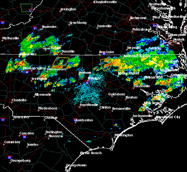 At 504 pm edt, a severe thunderstorm was located near camp springs, moving north at 10 mph (radar indicated). Hazards include 60 mph wind gusts and penny size hail. expect damage to roofs, siding, and trees At 504 pm edt, a severe thunderstorm was located near camp springs, moving north at 10 mph (radar indicated). Hazards include 60 mph wind gusts and penny size hail. expect damage to roofs, siding, and trees
|
| 4/15/2018 5:52 PM EDT |
 At 551 pm edt, severe thunderstorms were located along a line extending from near jericho to near goldston, moving east at 30 mph (radar indicated). Hazards include 60 mph wind gusts and quarter size hail. Hail damage to vehicles is expected. expect wind damage to roofs, siding, and trees. locations impacted include, chapel hill, burlington, graham, hillsborough, pittsboro, siler city, carrboro, mebane, goldston and elon college. A tornado watch remains in effect until 1100 pm edt for central north carolina. At 551 pm edt, severe thunderstorms were located along a line extending from near jericho to near goldston, moving east at 30 mph (radar indicated). Hazards include 60 mph wind gusts and quarter size hail. Hail damage to vehicles is expected. expect wind damage to roofs, siding, and trees. locations impacted include, chapel hill, burlington, graham, hillsborough, pittsboro, siler city, carrboro, mebane, goldston and elon college. A tornado watch remains in effect until 1100 pm edt for central north carolina.
|
| 4/15/2018 5:25 PM EDT |
 At 524 pm edt, severe thunderstorms were located along a line extending from 7 miles southeast of monroeton to 11 miles east of seagrove, moving east at 30 mph (radar indicated). Hazards include 60 mph wind gusts and quarter size hail. Hail damage to vehicles is expected. Expect wind damage to roofs, siding, and trees. At 524 pm edt, severe thunderstorms were located along a line extending from 7 miles southeast of monroeton to 11 miles east of seagrove, moving east at 30 mph (radar indicated). Hazards include 60 mph wind gusts and quarter size hail. Hail damage to vehicles is expected. Expect wind damage to roofs, siding, and trees.
|
| 7/13/2017 6:04 PM EDT |
 At 546 pm edt, severe thunderstorms were located along a line extending from near mcleansville to near elon college to near jericho, moving east at 15 mph (radar indicated). Hazards include 60 mph wind gusts. Expect damage to roofs, siding, and trees. Locations impacted include, greensboro, burlington, graham, mebane, mcleansville, elon college, gibsonville, pleasant garden, haw river and swepsonville. At 546 pm edt, severe thunderstorms were located along a line extending from near mcleansville to near elon college to near jericho, moving east at 15 mph (radar indicated). Hazards include 60 mph wind gusts. Expect damage to roofs, siding, and trees. Locations impacted include, greensboro, burlington, graham, mebane, mcleansville, elon college, gibsonville, pleasant garden, haw river and swepsonville.
|
| 7/13/2017 5:46 PM EDT |
 At 546 pm edt, severe thunderstorms were located along a line extending from near mcleansville to near elon college to near jericho, moving east at 15 mph (radar indicated). Hazards include 60 mph wind gusts. Expect damage to roofs, siding, and trees. Locations impacted include, greensboro, burlington, graham, mebane, mcleansville, elon college, gibsonville, pleasant garden, haw river and swepsonville. At 546 pm edt, severe thunderstorms were located along a line extending from near mcleansville to near elon college to near jericho, moving east at 15 mph (radar indicated). Hazards include 60 mph wind gusts. Expect damage to roofs, siding, and trees. Locations impacted include, greensboro, burlington, graham, mebane, mcleansville, elon college, gibsonville, pleasant garden, haw river and swepsonville.
|
| 7/13/2017 5:19 PM EDT |
 At 518 pm edt, severe thunderstorms were located along a line extending from near mcleansville to 7 miles northwest of elon college to near camp springs, moving east at 15 mph (radar indicated). Hazards include 60 mph wind gusts. expect damage to roofs, siding, and trees At 518 pm edt, severe thunderstorms were located along a line extending from near mcleansville to 7 miles northwest of elon college to near camp springs, moving east at 15 mph (radar indicated). Hazards include 60 mph wind gusts. expect damage to roofs, siding, and trees
|
| 6/24/2017 2:03 AM EDT |
 At 202 am edt, severe thunderstorms were located along a line extending from 7 miles south of jericho to 9 miles northwest of siler city to 9 miles south of plyler, moving northeast at 60 mph (radar indicated). Hazards include 60 mph wind gusts. Expect damage to roofs, siding, and trees. Locations impacted include, burlington, asheboro, albemarle, graham, hillsborough, randleman, pittsboro, troy, carthage and siler city. At 202 am edt, severe thunderstorms were located along a line extending from 7 miles south of jericho to 9 miles northwest of siler city to 9 miles south of plyler, moving northeast at 60 mph (radar indicated). Hazards include 60 mph wind gusts. Expect damage to roofs, siding, and trees. Locations impacted include, burlington, asheboro, albemarle, graham, hillsborough, randleman, pittsboro, troy, carthage and siler city.
|
| 6/24/2017 1:46 AM EDT |
 At 146 am edt, severe thunderstorms were located along a line extending from near mcleansville to near asheboro to 9 miles south of plyler, moving northeast at 60 mph (radar indicated). Hazards include 60 mph wind gusts. expect damage to roofs, siding, and trees At 146 am edt, severe thunderstorms were located along a line extending from near mcleansville to near asheboro to 9 miles south of plyler, moving northeast at 60 mph (radar indicated). Hazards include 60 mph wind gusts. expect damage to roofs, siding, and trees
|
| 6/19/2017 12:15 AM EDT |
 At 1158 pm edt, a severe thunderstorm was located near greensboro, moving northeast at 35 mph (radar indicated). Hazards include 60 mph wind gusts. expect damage to roofs, siding, and trees At 1158 pm edt, a severe thunderstorm was located near greensboro, moving northeast at 35 mph (radar indicated). Hazards include 60 mph wind gusts. expect damage to roofs, siding, and trees
|
| 6/18/2017 11:59 PM EDT |
 At 1158 pm edt, a severe thunderstorm was located near greensboro, moving northeast at 35 mph (radar indicated). Hazards include 60 mph wind gusts. expect damage to roofs, siding, and trees At 1158 pm edt, a severe thunderstorm was located near greensboro, moving northeast at 35 mph (radar indicated). Hazards include 60 mph wind gusts. expect damage to roofs, siding, and trees
|
| 5/31/2017 7:50 PM EDT |
 At 749 pm edt, a severe thunderstorm was located near camp springs, moving southeast at 30 mph (radar indicated). Hazards include 60 mph wind gusts and quarter size hail. Hail damage to vehicles is expected. expect wind damage to roofs, siding, and trees. Locations impacted include, mebane, haw river, lake cammack park & marina, altamahaw-ossipee, union ridge, altamahaw and lake burlington. At 749 pm edt, a severe thunderstorm was located near camp springs, moving southeast at 30 mph (radar indicated). Hazards include 60 mph wind gusts and quarter size hail. Hail damage to vehicles is expected. expect wind damage to roofs, siding, and trees. Locations impacted include, mebane, haw river, lake cammack park & marina, altamahaw-ossipee, union ridge, altamahaw and lake burlington.
|
| 5/31/2017 7:39 PM EDT |
 At 739 pm edt, a severe thunderstorm was located 7 miles northwest of elon college, or 8 miles southwest of camp springs, moving southeast at 35 mph (radar indicated). Hazards include 60 mph wind gusts and quarter size hail. Hail damage to vehicles is expected. expect wind damage to roofs, siding, and trees. Locations impacted include, burlington, graham, mebane, gibsonville, haw river, lake burlington, monticello, lake cammack park & marina, altamahaw-ossipee and glen raven. At 739 pm edt, a severe thunderstorm was located 7 miles northwest of elon college, or 8 miles southwest of camp springs, moving southeast at 35 mph (radar indicated). Hazards include 60 mph wind gusts and quarter size hail. Hail damage to vehicles is expected. expect wind damage to roofs, siding, and trees. Locations impacted include, burlington, graham, mebane, gibsonville, haw river, lake burlington, monticello, lake cammack park & marina, altamahaw-ossipee and glen raven.
|
| 5/31/2017 7:23 PM EDT |
 At 722 pm edt, a severe thunderstorm was located over monroeton, or near reidsville, moving southeast at 35 mph (radar indicated). Hazards include 70 mph wind gusts and half dollar size hail. Hail damage to vehicles is expected. expect considerable tree damage. Wind damage is also likely to mobile homes, roofs, and outbuildings. At 722 pm edt, a severe thunderstorm was located over monroeton, or near reidsville, moving southeast at 35 mph (radar indicated). Hazards include 70 mph wind gusts and half dollar size hail. Hail damage to vehicles is expected. expect considerable tree damage. Wind damage is also likely to mobile homes, roofs, and outbuildings.
|
| 5/19/2017 5:14 PM EDT |
 At 510 pm edt, severe thunderstorms were located along a line extending from near mebane to near graham, north of interstate 40/85, moving east at 10 mph. the most intense storm along the line was located between carr and efland. those in that area should prepare immediately for damaging wind gusts in excess of 60 mph (radar indicated). Hazards include 60 mph wind gusts and penny size hail. Expect damage to roofs, siding, and trees. Locations impacted include, burlington, graham, hillsborough, mebane, elon college, gibsonville, haw river, swepsonville, alamance and carr. At 510 pm edt, severe thunderstorms were located along a line extending from near mebane to near graham, north of interstate 40/85, moving east at 10 mph. the most intense storm along the line was located between carr and efland. those in that area should prepare immediately for damaging wind gusts in excess of 60 mph (radar indicated). Hazards include 60 mph wind gusts and penny size hail. Expect damage to roofs, siding, and trees. Locations impacted include, burlington, graham, hillsborough, mebane, elon college, gibsonville, haw river, swepsonville, alamance and carr.
|
| 5/19/2017 4:52 PM EDT |
 At 451 pm edt, severe thunderstorms were located along a line extending from baynes to near burlington to near elon college, moving east at 25 mph (radar indicated). Hazards include 60 mph wind gusts and quarter size hail. Hail damage to vehicles is possible. Expect wind damage to ees and possible damage to roofs and siding. At 451 pm edt, severe thunderstorms were located along a line extending from baynes to near burlington to near elon college, moving east at 25 mph (radar indicated). Hazards include 60 mph wind gusts and quarter size hail. Hail damage to vehicles is possible. Expect wind damage to ees and possible damage to roofs and siding.
|
| 5/5/2017 3:32 AM EDT |
 At 331 am edt, severe thunderstorms were located along a line extending from near greensboro to 8 miles south of mcleansville to near asheboro, moving northeast at 50 mph (radar indicated). Hazards include 60 mph wind gusts. expect damage to roofs, siding, and trees At 331 am edt, severe thunderstorms were located along a line extending from near greensboro to 8 miles south of mcleansville to near asheboro, moving northeast at 50 mph (radar indicated). Hazards include 60 mph wind gusts. expect damage to roofs, siding, and trees
|
| 4/6/2017 6:12 AM EDT |
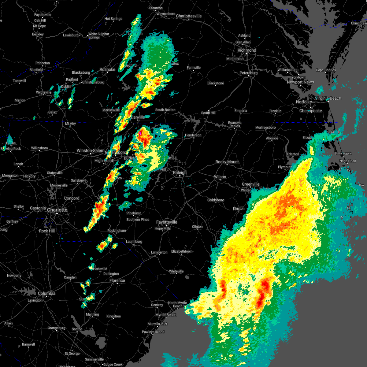 The severe thunderstorm warning for northwestern alamance county will expire at 615 am edt, the storm which prompted the warning has moved northeast into caswell county. as a result, the warning for alamance county will be allowed to expire at 615 am edt. The severe thunderstorm warning for northwestern alamance county will expire at 615 am edt, the storm which prompted the warning has moved northeast into caswell county. as a result, the warning for alamance county will be allowed to expire at 615 am edt.
|
| 4/6/2017 6:07 AM EDT |
 At 606 am edt, a severe thunderstorm was located near camp springs, moving northeast at 65 mph (radar indicated). Hazards include quarter size hail. Damage to vehicles is expected. Locations impacted include, lake cammack park & marina, altamahaw-ossipee, lake burlington, union ridge and altamahaw. At 606 am edt, a severe thunderstorm was located near camp springs, moving northeast at 65 mph (radar indicated). Hazards include quarter size hail. Damage to vehicles is expected. Locations impacted include, lake cammack park & marina, altamahaw-ossipee, lake burlington, union ridge and altamahaw.
|
| 4/6/2017 6:00 AM EDT |
 At 559 am edt, a severe thunderstorm was located near elon college, or near burlington, moving northeast at 75 mph (radar indicated). Hazards include quarter size hail. Damage to vehicles is possible. Locations impacted include, burlington, graham, mcleansville, elon college, gibsonville, haw river, alamance, lake guilford mackintosh marina, lake burlington and lake cammack park & marina. At 559 am edt, a severe thunderstorm was located near elon college, or near burlington, moving northeast at 75 mph (radar indicated). Hazards include quarter size hail. Damage to vehicles is possible. Locations impacted include, burlington, graham, mcleansville, elon college, gibsonville, haw river, alamance, lake guilford mackintosh marina, lake burlington and lake cammack park & marina.
|
| 4/6/2017 5:49 AM EDT |
 At 548 am edt, a severe thunderstorm was located 8 miles south of mcleansville, or 11 miles southeast of greensboro, moving northeast at 65 mph (radar indicated). Hazards include quarter size hail. Damage to vehicles is possible. Locations impacted include, greensboro, burlington, graham, mcleansville, elon college, gibsonville, pleasant garden, haw river, alamance and lake guilford mackintosh marina. At 548 am edt, a severe thunderstorm was located 8 miles south of mcleansville, or 11 miles southeast of greensboro, moving northeast at 65 mph (radar indicated). Hazards include quarter size hail. Damage to vehicles is possible. Locations impacted include, greensboro, burlington, graham, mcleansville, elon college, gibsonville, pleasant garden, haw river, alamance and lake guilford mackintosh marina.
|
| 4/6/2017 5:40 AM EDT |
 At 540 am edt, a severe thunderstorm was located 7 miles northeast of randleman, moving northeast at 80 mph (radar indicated). Hazards include penny to quarter size hail. Damage to vehicles is possible. Locations impacted include, greensboro, burlington, asheboro, graham, randleman, north carolina zoo, mcleansville, elon college, gibsonville and pleasant garden. At 540 am edt, a severe thunderstorm was located 7 miles northeast of randleman, moving northeast at 80 mph (radar indicated). Hazards include penny to quarter size hail. Damage to vehicles is possible. Locations impacted include, greensboro, burlington, asheboro, graham, randleman, north carolina zoo, mcleansville, elon college, gibsonville and pleasant garden.
|
| 4/6/2017 5:26 AM EDT |
 At 526 am edt, a severe thunderstorm was located near asheboro, moving northeast at 85 mph (radar indicated). Hazards include penny to quarter size hail. damage to vehicles is possible At 526 am edt, a severe thunderstorm was located near asheboro, moving northeast at 85 mph (radar indicated). Hazards include penny to quarter size hail. damage to vehicles is possible
|
| 4/3/2017 6:25 PM EDT |
 The severe thunderstorm warning for alamance and western chatham counties will expire at 630 pm edt, the storms which prompted the warning have moved out of the area. therefore the warning will be allowed to expire. however gusty winds and heavy rain are still possible with these thunderstorms. a severe thunderstorm watch remains in effect until 1000 pm edt for central north carolina. to report severe weather, contact your nearest law enforcement agency. they will relay your report to the national weather service raleigh. remember, a severe thunderstorm warning still remains in effect for eastern chatham county until 700 pm. The severe thunderstorm warning for alamance and western chatham counties will expire at 630 pm edt, the storms which prompted the warning have moved out of the area. therefore the warning will be allowed to expire. however gusty winds and heavy rain are still possible with these thunderstorms. a severe thunderstorm watch remains in effect until 1000 pm edt for central north carolina. to report severe weather, contact your nearest law enforcement agency. they will relay your report to the national weather service raleigh. remember, a severe thunderstorm warning still remains in effect for eastern chatham county until 700 pm.
|
| 4/3/2017 6:01 PM EDT |
 At 600 pm edt, severe thunderstorms were located along a line extending from near camp springs to 10 miles south of siler city, moving east at 45 mph (radar indicated). Hazards include 60 mph wind gusts. Expect damage to roofs, siding, and trees. Locations impacted include, burlington, graham, siler city, mebane, goldston, elon college, gibsonville, haw river, swepsonville and alamance. At 600 pm edt, severe thunderstorms were located along a line extending from near camp springs to 10 miles south of siler city, moving east at 45 mph (radar indicated). Hazards include 60 mph wind gusts. Expect damage to roofs, siding, and trees. Locations impacted include, burlington, graham, siler city, mebane, goldston, elon college, gibsonville, haw river, swepsonville and alamance.
|
| 4/3/2017 5:44 PM EDT |
 At 544 pm edt, severe thunderstorms were located along a line extending from near mcleansville to near seagrove, moving east at 45 mph (radar indicated). Hazards include 60 mph wind gusts. expect damage to roofs, siding, and trees At 544 pm edt, severe thunderstorms were located along a line extending from near mcleansville to near seagrove, moving east at 45 mph (radar indicated). Hazards include 60 mph wind gusts. expect damage to roofs, siding, and trees
|
| 9/28/2016 6:07 PM EDT |
 At 605 pm edt, a severe thunderstorm was located over burlington, moving east at 30 mph. another severe thunderstorm was located over saxapahaw, moving north at 30 mph (trained weather spotters). Hazards include ping pong ball size hail. People and animals outdoors will be injured. expect damage to roofs, siding, windows, and vehicles. locations impacted include, burlington, graham, mebane, elon college, gibsonville, haw river, swepsonville, alamance, lake mackintosh marina and union ridge. A severe thunderstorm watch remains in effect until 1000 pm edt for central north carolina. At 605 pm edt, a severe thunderstorm was located over burlington, moving east at 30 mph. another severe thunderstorm was located over saxapahaw, moving north at 30 mph (trained weather spotters). Hazards include ping pong ball size hail. People and animals outdoors will be injured. expect damage to roofs, siding, windows, and vehicles. locations impacted include, burlington, graham, mebane, elon college, gibsonville, haw river, swepsonville, alamance, lake mackintosh marina and union ridge. A severe thunderstorm watch remains in effect until 1000 pm edt for central north carolina.
|
| 9/28/2016 5:48 PM EDT |
 At 548 pm edt, a severe thunderstorm was located over elon college, or near burlington, moving northeastr at 35 mph (trained weather spotters). Hazards include golf ball size hail. People and animals outdoors will be injured. Expect damage to roofs, siding, windows, and vehicles. At 548 pm edt, a severe thunderstorm was located over elon college, or near burlington, moving northeastr at 35 mph (trained weather spotters). Hazards include golf ball size hail. People and animals outdoors will be injured. Expect damage to roofs, siding, windows, and vehicles.
|
| 7/15/2016 6:26 PM EDT |
 At 625 pm edt, a severe thunderstorm was located near elon univerity, or 10 miles west of burlington, moving east at 35 mph (radar indicated). Hazards include 60 mph wind gusts. Expect damage to roofs. siding. And trees. At 625 pm edt, a severe thunderstorm was located near elon univerity, or 10 miles west of burlington, moving east at 35 mph (radar indicated). Hazards include 60 mph wind gusts. Expect damage to roofs. siding. And trees.
|
| 7/8/2016 7:42 PM EDT |
 At 741 pm edt, severe thunderstorms were located along a line extending from near burlington to near durham, moving east at 65 mph (radar indicated). Hazards include 60 mph wind gusts and quarter size hail. Hail damage to vehicles is expected. Expect wind damage to roofs, siding, and trees. At 741 pm edt, severe thunderstorms were located along a line extending from near burlington to near durham, moving east at 65 mph (radar indicated). Hazards include 60 mph wind gusts and quarter size hail. Hail damage to vehicles is expected. Expect wind damage to roofs, siding, and trees.
|
| 7/8/2016 7:30 PM EDT |
 At 730 pm edt, severe thunderstorms were located along a line extending from near kernersville to near rougemont, moving south at 25 mph (radar indicated). Hazards include 60 mph wind gusts and quarter size hail. Hail damage to vehicles is expected. expect wind damage to roofs, siding, and trees. locations impacted include, greensboro, high point, chapel hill, burlington, graham, hillsborough, carrboro, mebane, mcleansville and elon college. A severe thunderstorm watch remains in effect until midnight edt for central north carolina. At 730 pm edt, severe thunderstorms were located along a line extending from near kernersville to near rougemont, moving south at 25 mph (radar indicated). Hazards include 60 mph wind gusts and quarter size hail. Hail damage to vehicles is expected. expect wind damage to roofs, siding, and trees. locations impacted include, greensboro, high point, chapel hill, burlington, graham, hillsborough, carrboro, mebane, mcleansville and elon college. A severe thunderstorm watch remains in effect until midnight edt for central north carolina.
|
| 7/8/2016 7:08 PM EDT |
 At 708 pm edt, severe thunderstorms were located along a line extending from near kernersville to near rougemont, moving south at 25 mph (radar indicated). Hazards include 60 mph wind gusts and quarter size hail. Hail damage to vehicles is expected. expect wind damage to roofs, siding, and trees. locations impacted include, greensboro, high point, chapel hill, burlington, graham, hillsborough, carrboro, mebane, mcleansville and elon college. A severe thunderstorm watch remains in effect until midnight edt for central north carolina. At 708 pm edt, severe thunderstorms were located along a line extending from near kernersville to near rougemont, moving south at 25 mph (radar indicated). Hazards include 60 mph wind gusts and quarter size hail. Hail damage to vehicles is expected. expect wind damage to roofs, siding, and trees. locations impacted include, greensboro, high point, chapel hill, burlington, graham, hillsborough, carrboro, mebane, mcleansville and elon college. A severe thunderstorm watch remains in effect until midnight edt for central north carolina.
|
| 7/8/2016 6:47 PM EDT |
 At 646 pm edt, severe thunderstorms were located along a line extending from walnut cove to near roxboro, moving south at 25 mph (radar indicated). Hazards include 60 mph wind gusts and quarter size hail. Hail damage to vehicles is expected. Expect wind damage to roofs, siding, and trees. At 646 pm edt, severe thunderstorms were located along a line extending from walnut cove to near roxboro, moving south at 25 mph (radar indicated). Hazards include 60 mph wind gusts and quarter size hail. Hail damage to vehicles is expected. Expect wind damage to roofs, siding, and trees.
|
| 6/29/2016 6:08 PM EDT |
 At 607 pm edt, a severe thunderstorm was located near camp springs, moving southeast at 15 mph (radar indicated). Hazards include 60 mph wind gusts and quarter size hail. Hail damage to vehicles is expected. expect wind damage to roofs, siding, and trees. Locations impacted include, burlington, graham, hillsborough, mebane, gibsonville, haw river, swepsonville, union ridge, altamahaw and altamahaw-ossipee. At 607 pm edt, a severe thunderstorm was located near camp springs, moving southeast at 15 mph (radar indicated). Hazards include 60 mph wind gusts and quarter size hail. Hail damage to vehicles is expected. expect wind damage to roofs, siding, and trees. Locations impacted include, burlington, graham, hillsborough, mebane, gibsonville, haw river, swepsonville, union ridge, altamahaw and altamahaw-ossipee.
|
| 6/29/2016 5:53 PM EDT |
 At 553 pm edt, a severe thunderstorm was located over camp springs, moving southeast at 20 mph (radar indicated). Hazards include 60 mph wind gusts and quarter size hail. Hail damage to vehicles is expected. Expect wind damage to roofs, siding, and trees. At 553 pm edt, a severe thunderstorm was located over camp springs, moving southeast at 20 mph (radar indicated). Hazards include 60 mph wind gusts and quarter size hail. Hail damage to vehicles is expected. Expect wind damage to roofs, siding, and trees.
|
| 6/24/2016 8:58 PM EDT |
 At 856 pm edt, a severe thunderstorm was located north of elon college, or northwest of burlington near glen raven, moving southeast at 25 mph (radar indicated). Hazards include 60 mph wind gusts and quarter size hail. Expect some wind damage to roofs. siding. and trees. Locations impacted include, burlington, graham, mebane, elon college, gibsonville, haw river, alamance, and altamahaw. At 856 pm edt, a severe thunderstorm was located north of elon college, or northwest of burlington near glen raven, moving southeast at 25 mph (radar indicated). Hazards include 60 mph wind gusts and quarter size hail. Expect some wind damage to roofs. siding. and trees. Locations impacted include, burlington, graham, mebane, elon college, gibsonville, haw river, alamance, and altamahaw.
|
| 6/24/2016 8:38 PM EDT |
 At 837 pm edt, a severe thunderstorm was located near camp springs, moving southeast at 20 mph (radar indicated). Hazards include 60 mph wind gusts and quarter size hail. Expect some wind damage to roofs. siding. And trees. At 837 pm edt, a severe thunderstorm was located near camp springs, moving southeast at 20 mph (radar indicated). Hazards include 60 mph wind gusts and quarter size hail. Expect some wind damage to roofs. siding. And trees.
|
| 6/23/2016 5:08 PM EDT |
 At 507 pm edt, a severe thunderstorm was located over graham, moving east at 30 mph (radar indicated). Hazards include 60 mph wind gusts and quarter size hail. Hail damage to vehicles is expected. Expect wind damage to roofs, siding, and trees. At 507 pm edt, a severe thunderstorm was located over graham, moving east at 30 mph (radar indicated). Hazards include 60 mph wind gusts and quarter size hail. Hail damage to vehicles is expected. Expect wind damage to roofs, siding, and trees.
|
| 5/12/2016 7:54 PM EDT |
 At 754 pm edt, a severe thunderstorm was located near elon college, or 7 miles northwest of burlington, moving northeast at 15 mph (radar indicated). Hazards include 60 mph wind gusts. Expect damage to roofs. siding. and trees. Locations impacted include, altamahaw-ossipee, union ridge, lake burlington, lake cammack park & marina and altamahaw. At 754 pm edt, a severe thunderstorm was located near elon college, or 7 miles northwest of burlington, moving northeast at 15 mph (radar indicated). Hazards include 60 mph wind gusts. Expect damage to roofs. siding. and trees. Locations impacted include, altamahaw-ossipee, union ridge, lake burlington, lake cammack park & marina and altamahaw.
|
| 5/12/2016 7:42 PM EDT |
 At 742 pm edt, a severe thunderstorm was located near camp springs, moving northeast at 20 mph (radar indicated). Hazards include 60 mph wind gusts. Expect damage to roofs. siding. and trees. Locations impacted include, burlington, mcleansville, gibsonville, altamahaw-ossipee, glen raven, lake burlington, union ridge, lake cammack park & marina, monticello and altamahaw. At 742 pm edt, a severe thunderstorm was located near camp springs, moving northeast at 20 mph (radar indicated). Hazards include 60 mph wind gusts. Expect damage to roofs. siding. and trees. Locations impacted include, burlington, mcleansville, gibsonville, altamahaw-ossipee, glen raven, lake burlington, union ridge, lake cammack park & marina, monticello and altamahaw.
|
| 5/12/2016 7:21 PM EDT |
 At 721 pm edt, a severe thunderstorm was located over mcleansville, or 9 miles west of burlington, moving north at 15 mph (radar indicated). Hazards include 60 mph wind gusts and nickel size hail. Expect damage to roofs. siding. and trees. Locations impacted include, burlington, mcleansville, elon college, gibsonville, alamance, lake guilford mackintosh marina, lake mackintosh marina, union ridge, monticello and altamahaw. At 721 pm edt, a severe thunderstorm was located over mcleansville, or 9 miles west of burlington, moving north at 15 mph (radar indicated). Hazards include 60 mph wind gusts and nickel size hail. Expect damage to roofs. siding. and trees. Locations impacted include, burlington, mcleansville, elon college, gibsonville, alamance, lake guilford mackintosh marina, lake mackintosh marina, union ridge, monticello and altamahaw.
|
| 5/12/2016 7:07 PM EDT |
 At 707 pm edt, a severe thunderstorm was located near mcleansville, or 11 miles east of greensboro, moving north at 20 mph (radar indicated). Hazards include 60 mph wind gusts and nickel size hail. Expect damage to roofs. siding. And trees. At 707 pm edt, a severe thunderstorm was located near mcleansville, or 11 miles east of greensboro, moving north at 20 mph (radar indicated). Hazards include 60 mph wind gusts and nickel size hail. Expect damage to roofs. siding. And trees.
|
| 5/2/2016 5:33 PM EDT |
 At 533 pm edt, a severe thunderstorm was located near baynes, or near jericho, moving northeast at 35 mph (radar indicated). Hazards include 60 mph wind gusts and quarter size hail. Hail damage to vehicles is expected. expect wind damage to roofs, siding, and trees. Locations impacted include, burlington, graham, mebane, haw river, altamahaw-ossipee, glen raven, lake burlington, union ridge, lake cammack park & marina and altamahaw. At 533 pm edt, a severe thunderstorm was located near baynes, or near jericho, moving northeast at 35 mph (radar indicated). Hazards include 60 mph wind gusts and quarter size hail. Hail damage to vehicles is expected. expect wind damage to roofs, siding, and trees. Locations impacted include, burlington, graham, mebane, haw river, altamahaw-ossipee, glen raven, lake burlington, union ridge, lake cammack park & marina and altamahaw.
|
| 5/2/2016 5:20 PM EDT |
 At 519 pm edt, severe thunderstorms were located along a line extending from near monroeton to near mebane, moving northeast at 45 mph (radar indicated). Hazards include 60 mph wind gusts and quarter size hail. Hail damage to vehicles is expected. expect wind damage to roofs, siding, and trees. Locations impacted include, greensboro, burlington, graham, mebane, mcleansville, elon college, gibsonville, haw river, swepsonville and alamance. At 519 pm edt, severe thunderstorms were located along a line extending from near monroeton to near mebane, moving northeast at 45 mph (radar indicated). Hazards include 60 mph wind gusts and quarter size hail. Hail damage to vehicles is expected. expect wind damage to roofs, siding, and trees. Locations impacted include, greensboro, burlington, graham, mebane, mcleansville, elon college, gibsonville, haw river, swepsonville and alamance.
|
| 5/2/2016 5:10 PM EDT |
 At 509 pm edt, severe thunderstorms were located along a line extending from 7 miles northwest of greensboro to near graham, moving northeast at 45 mph (radar indicated). Hazards include 60 mph wind gusts and quarter size hail. Hail damage to vehicles is expected. Expect wind damage to roofs, siding, and trees. At 509 pm edt, severe thunderstorms were located along a line extending from 7 miles northwest of greensboro to near graham, moving northeast at 45 mph (radar indicated). Hazards include 60 mph wind gusts and quarter size hail. Hail damage to vehicles is expected. Expect wind damage to roofs, siding, and trees.
|
| 4/28/2016 6:25 PM EDT |
 At 624 pm edt, a severe thunderstorm was located over burlington, moving east at 25 mph (radar indicated). Hazards include 60 mph wind gusts and quarter size hail. Hail damage to vehicles is expected. expect wind damage to roofs, siding, and trees. Locations impacted include, burlington, graham, mebane, mcleansville, elon college, gibsonville, haw river, swepsonville, alamance and lake guilford mackintosh marina. At 624 pm edt, a severe thunderstorm was located over burlington, moving east at 25 mph (radar indicated). Hazards include 60 mph wind gusts and quarter size hail. Hail damage to vehicles is expected. expect wind damage to roofs, siding, and trees. Locations impacted include, burlington, graham, mebane, mcleansville, elon college, gibsonville, haw river, swepsonville, alamance and lake guilford mackintosh marina.
|
| 4/28/2016 6:09 PM EDT |
 At 608 pm edt, a severe thunderstorm was located near elon college, or near burlington, moving east at 20 mph (radar indicated). Hazards include 60 mph wind gusts and quarter size hail. Hail damage to vehicles is expected. expect wind damage to roofs, siding, and trees. Locations impacted include, greensboro, burlington, graham, mebane, mcleansville, elon college, summerfield, gibsonville, stokesdale and haw river. At 608 pm edt, a severe thunderstorm was located near elon college, or near burlington, moving east at 20 mph (radar indicated). Hazards include 60 mph wind gusts and quarter size hail. Hail damage to vehicles is expected. expect wind damage to roofs, siding, and trees. Locations impacted include, greensboro, burlington, graham, mebane, mcleansville, elon college, summerfield, gibsonville, stokesdale and haw river.
|
| 4/28/2016 6:01 PM EDT |
 At 559 pm edt, a severe thunderstorm was located near elon college, or 8 miles northwest of burlington, moving east at 25 mph (radar indicated). Hazards include 60 mph wind gusts and quarter size hail. Hail damage to vehicles is expected. expect wind damage to roofs, siding, and trees. Locations impacted include, greensboro, high point, burlington, graham, mebane, mcleansville, elon college, summerfield, gibsonville and stokesdale. At 559 pm edt, a severe thunderstorm was located near elon college, or 8 miles northwest of burlington, moving east at 25 mph (radar indicated). Hazards include 60 mph wind gusts and quarter size hail. Hail damage to vehicles is expected. expect wind damage to roofs, siding, and trees. Locations impacted include, greensboro, high point, burlington, graham, mebane, mcleansville, elon college, summerfield, gibsonville and stokesdale.
|
| 4/28/2016 5:48 PM EDT |
 At 547 pm edt, a severe thunderstorm was located near mcleansville, or 10 miles northeast of greensboro, moving east at 30 mph (radar indicated). Hazards include 60 mph wind gusts and quarter size hail. Hail damage to vehicles is expected. expect wind damage to roofs, siding, and trees. Locations impacted include, greensboro, high point, burlington, graham, kernersville, mebane, mcleansville, elon college, summerfield and gibsonville. At 547 pm edt, a severe thunderstorm was located near mcleansville, or 10 miles northeast of greensboro, moving east at 30 mph (radar indicated). Hazards include 60 mph wind gusts and quarter size hail. Hail damage to vehicles is expected. expect wind damage to roofs, siding, and trees. Locations impacted include, greensboro, high point, burlington, graham, kernersville, mebane, mcleansville, elon college, summerfield and gibsonville.
|
| 4/28/2016 5:35 PM EDT |
 At 535 pm edt, severe thunderstorms were located along a line extending from near jericho to near monroeton to near kernersville, moving east at 25 mph (radar indicated). Hazards include 60 mph wind gusts and half dollar size hail. Hail damage to vehicles is expected. Expect wind damage to roofs, siding, and trees. At 535 pm edt, severe thunderstorms were located along a line extending from near jericho to near monroeton to near kernersville, moving east at 25 mph (radar indicated). Hazards include 60 mph wind gusts and half dollar size hail. Hail damage to vehicles is expected. Expect wind damage to roofs, siding, and trees.
|
| 2/24/2016 3:16 PM EST |
 At 313 pm est, doppler radar continued to indicate a line of discrete supercell thunderstorms capable of producing large damaging hail up to golf ball size and destructive winds in excess of 70 mph. these storms were located along a line extending from near altamahaw to alamance to coleridge, moving northeast at 55 mph. locations impacted include, burlington, graham, siler city, north carolina zoo, mebane, goldston, seagrove, mcleansville, elon college and gibsonville. not all locations within the line of storms will experience severe weather. instead, concentrated swaths of damaging winds and hail up to the size of golfballs will accompany the individual supercell thunderstorms. a tornado watch remains in effect until 700 pm est for central north carolina. At 313 pm est, doppler radar continued to indicate a line of discrete supercell thunderstorms capable of producing large damaging hail up to golf ball size and destructive winds in excess of 70 mph. these storms were located along a line extending from near altamahaw to alamance to coleridge, moving northeast at 55 mph. locations impacted include, burlington, graham, siler city, north carolina zoo, mebane, goldston, seagrove, mcleansville, elon college and gibsonville. not all locations within the line of storms will experience severe weather. instead, concentrated swaths of damaging winds and hail up to the size of golfballs will accompany the individual supercell thunderstorms. a tornado watch remains in effect until 700 pm est for central north carolina.
|
| 2/24/2016 2:44 PM EST |
 At 244 pm est, doppler radar indicated a line of severe thunderstorms capable of producing damaging winds in excess of 58 mph. these storms were located along a line extending from near reidsville to near seagrove, and moving east at 25 mph. At 244 pm est, doppler radar indicated a line of severe thunderstorms capable of producing damaging winds in excess of 58 mph. these storms were located along a line extending from near reidsville to near seagrove, and moving east at 25 mph.
|
| 8/11/2015 6:10 PM EDT |
 The severe thunderstorm warning for southwestern person, northern orange and northern alamance counties will expire at 615 pm edt, the storm which prompted the warning has weakened below severe limits, and no longer poses an immediate threat to life or property. therefore the warning will be allowed to expire. however, a strong storm continues in western alamance county and another warning may be needed shortly. The severe thunderstorm warning for southwestern person, northern orange and northern alamance counties will expire at 615 pm edt, the storm which prompted the warning has weakened below severe limits, and no longer poses an immediate threat to life or property. therefore the warning will be allowed to expire. however, a strong storm continues in western alamance county and another warning may be needed shortly.
|
| 8/11/2015 5:35 PM EDT |
 At 532 pm edt, doppler radar continued to indicate a severe thunderstorm capable of producing destructive winds in excess of 70 mph. this storm was located near prospect hill, moving southeast at 35 mph. locations impacted include, burlington, graham, roxboro, hillsborough, mebane, elon college, gibsonville, haw river, swepsonville and alamance. At 532 pm edt, doppler radar continued to indicate a severe thunderstorm capable of producing destructive winds in excess of 70 mph. this storm was located near prospect hill, moving southeast at 35 mph. locations impacted include, burlington, graham, roxboro, hillsborough, mebane, elon college, gibsonville, haw river, swepsonville and alamance.
|
| 8/11/2015 5:16 PM EDT |
 At 515 pm edt, doppler radar indicated a severe thunderstorm capable of producing damaging winds in excess of 58 mph. this storm was located over jericho, and moving southeast at 25 mph. At 515 pm edt, doppler radar indicated a severe thunderstorm capable of producing damaging winds in excess of 58 mph. this storm was located over jericho, and moving southeast at 25 mph.
|
| 8/5/2015 10:30 PM EDT |
 At 1030 pm edt, doppler radar continued to indicate a severe thunderstorm capable of producing damaging winds to near 58 mph. this storm was located 7 miles south of elon college, or 7 miles southwest of burlington, moving northeast at 30 mph. locations impacted include, burlington, graham, mebane, mcleansville, elon college, gibsonville, liberty, haw river, swepsonville and alamance. At 1030 pm edt, doppler radar continued to indicate a severe thunderstorm capable of producing damaging winds to near 58 mph. this storm was located 7 miles south of elon college, or 7 miles southwest of burlington, moving northeast at 30 mph. locations impacted include, burlington, graham, mebane, mcleansville, elon college, gibsonville, liberty, haw river, swepsonville and alamance.
|
| 8/5/2015 10:12 PM EDT |
 The national weather service in raleigh has issued a * severe thunderstorm warning for. eastern guilford county in central north carolina. alamance county in central north carolina. northeastern randolph county in central north carolina. Until 1100 pm edt. The national weather service in raleigh has issued a * severe thunderstorm warning for. eastern guilford county in central north carolina. alamance county in central north carolina. northeastern randolph county in central north carolina. Until 1100 pm edt.
|
| 8/5/2015 10:12 PM EDT |
 At 1011 pm edt, doppler radar indicated a severe thunderstorm capable of producing damaging winds in excess of 58 mph. this storm was located 10 miles south of mcleansville, or 13 miles southwest of burlington, and moving northeast at 25 mph. At 1011 pm edt, doppler radar indicated a severe thunderstorm capable of producing damaging winds in excess of 58 mph. this storm was located 10 miles south of mcleansville, or 13 miles southwest of burlington, and moving northeast at 25 mph.
|
| 7/13/2015 9:18 PM EDT |
 At 914 pm edt, doppler radar indicated a line of severe thunderstorms producing widespread wind damage. the line of severe storms extended from greensboro and high point to yanceyville, moving east at 50 mph. wind gusts to 74 mph were reported earlier in greensboro. numerous trees and power lines have been downed. these storms will affect elon, burlington and snow camp before 930 pm. At 914 pm edt, doppler radar indicated a line of severe thunderstorms producing widespread wind damage. the line of severe storms extended from greensboro and high point to yanceyville, moving east at 50 mph. wind gusts to 74 mph were reported earlier in greensboro. numerous trees and power lines have been downed. these storms will affect elon, burlington and snow camp before 930 pm.
|
| 7/13/2015 9:06 PM EDT |
 At 905 pm edt, doppler radar continued to indicate a severe thunderstorm capable of producing damaging winds to 65 mph. there have been reports of numerous trees and power lines down across the triad region. the wind gusted to 74 mph at the piedmont triad airport with these storms. locations impacted include, greensboro, high point, burlington, graham, mebane, mcleansville, elon college, summerfield, gibsonville and pleasant garden. At 905 pm edt, doppler radar continued to indicate a severe thunderstorm capable of producing damaging winds to 65 mph. there have been reports of numerous trees and power lines down across the triad region. the wind gusted to 74 mph at the piedmont triad airport with these storms. locations impacted include, greensboro, high point, burlington, graham, mebane, mcleansville, elon college, summerfield, gibsonville and pleasant garden.
|
| 7/13/2015 8:32 PM EDT |
 At 831 pm edt, doppler radar continued to indicate a severe thunderstorm capable of producing destructive winds to 70 mph. this storm was located over the pti airport or near greensboro, moving east at 30 mph. locations impacted include, greensboro, high point, burlington, graham, mebane, mcleansville, elon college, summerfield, gibsonville and stokesdale. At 831 pm edt, doppler radar continued to indicate a severe thunderstorm capable of producing destructive winds to 70 mph. this storm was located over the pti airport or near greensboro, moving east at 30 mph. locations impacted include, greensboro, high point, burlington, graham, mebane, mcleansville, elon college, summerfield, gibsonville and stokesdale.
|
| 7/13/2015 8:05 PM EDT |
 At 804 pm edt, doppler radar indicated a severe thunderstorm capable of producing quarter size hail and damaging winds in excess of 58 mph. this storm was located from gibsonville to near elon college, or 8 miles northwest of burlington, and moving east at 25 mph. an additional cluster of severe thunderstorms was 10 miles west of the pti airport moving into guilford county from the west. At 804 pm edt, doppler radar indicated a severe thunderstorm capable of producing quarter size hail and damaging winds in excess of 58 mph. this storm was located from gibsonville to near elon college, or 8 miles northwest of burlington, and moving east at 25 mph. an additional cluster of severe thunderstorms was 10 miles west of the pti airport moving into guilford county from the west.
|
| 7/1/2015 8:06 PM EDT |
 At 805 pm edt, doppler radar continued to indicate a broken line of severe thunderstorms capable of producing quarter size hail and damaging winds in excess of 58 mph. these storms were located along a line extending from 6 miles south of monroeton to 8 miles east of asheboro to 7 miles west of north carolina zoo, moving east at 20 mph. locations impacted include, greensboro, burlington, asheboro, graham, randleman, siler city, north carolina zoo, mebane, seagrove and mcleansville. At 805 pm edt, doppler radar continued to indicate a broken line of severe thunderstorms capable of producing quarter size hail and damaging winds in excess of 58 mph. these storms were located along a line extending from 6 miles south of monroeton to 8 miles east of asheboro to 7 miles west of north carolina zoo, moving east at 20 mph. locations impacted include, greensboro, burlington, asheboro, graham, randleman, siler city, north carolina zoo, mebane, seagrove and mcleansville.
|
| 7/1/2015 7:50 PM EDT |
 At 749 pm edt, doppler radar indicated a line of severe thunderstorms capable of producing quarter size hail and damaging winds in excess of 58 mph. these storms were located along a line extending from near greensboro to near randleman to 10 miles southwest of asheboro, and moving east at 25 mph. At 749 pm edt, doppler radar indicated a line of severe thunderstorms capable of producing quarter size hail and damaging winds in excess of 58 mph. these storms were located along a line extending from near greensboro to near randleman to 10 miles southwest of asheboro, and moving east at 25 mph.
|
| 6/30/2015 6:33 PM EDT |
 At 632 pm edt, doppler radar continued to indicate a severe thunderstorm capable of producing damaging winds in excess of 58 mph. this storm was located near jericho, moving northeast at 35 mph. locations impacted include, burlington, graham, mebane, elon college, gibsonville, haw river, alamance, lake mackintosh marina, union ridge and altamahaw. At 632 pm edt, doppler radar continued to indicate a severe thunderstorm capable of producing damaging winds in excess of 58 mph. this storm was located near jericho, moving northeast at 35 mph. locations impacted include, burlington, graham, mebane, elon college, gibsonville, haw river, alamance, lake mackintosh marina, union ridge and altamahaw.
|
| 6/30/2015 6:11 PM EDT |
 At 610 pm edt, doppler radar continued to indicate a line of severe thunderstorms capable of producing damaging winds in excess of 58 mph. these storms were located along a line extending from near monroeton to 7 miles south of burlington, moving northeast at 35 mph. these storms have a history of producing wind damage. locations impacted include, greensboro, burlington, graham, mebane, mcleansville, elon college, gibsonville, pleasant garden, haw river and swepsonville. At 610 pm edt, doppler radar continued to indicate a line of severe thunderstorms capable of producing damaging winds in excess of 58 mph. these storms were located along a line extending from near monroeton to 7 miles south of burlington, moving northeast at 35 mph. these storms have a history of producing wind damage. locations impacted include, greensboro, burlington, graham, mebane, mcleansville, elon college, gibsonville, pleasant garden, haw river and swepsonville.
|
| 6/30/2015 5:47 PM EDT |
 At 547 pm edt, doppler radar indicated a severe thunderstorm capable of producing damaging winds in excess of 58 mph. this storm was located near greensboro, and moving northeast at 40 mph. At 547 pm edt, doppler radar indicated a severe thunderstorm capable of producing damaging winds in excess of 58 mph. this storm was located near greensboro, and moving northeast at 40 mph.
|
| 6/20/2015 7:21 PM EDT |
 The severe thunderstorm warning for orange, northeastern guilford and alamance counties will expire at 730 pm edt, the storm which prompted the warning has moved out of the area. therefore the warning will be allowed to expire. The severe thunderstorm warning for orange, northeastern guilford and alamance counties will expire at 730 pm edt, the storm which prompted the warning has moved out of the area. therefore the warning will be allowed to expire.
|
| 6/20/2015 6:59 PM EDT |
 At 659 pm edt, doppler radar continued to indicate a severe thunderstorm capable of producing damaging winds in excess of 58 mph. this storm was located near prospect hill, moving northeast at 55 mph. locations impacted include, burlington, graham, hillsborough, mebane, elon college, gibsonville, haw river, swepsonville, union ridge and cane creek reservoir. At 659 pm edt, doppler radar continued to indicate a severe thunderstorm capable of producing damaging winds in excess of 58 mph. this storm was located near prospect hill, moving northeast at 55 mph. locations impacted include, burlington, graham, hillsborough, mebane, elon college, gibsonville, haw river, swepsonville, union ridge and cane creek reservoir.
|
| 6/20/2015 6:48 PM EDT |
 At 648 pm edt, doppler radar indicated a severe thunderstorm capable of producing damaging winds in excess of 58 mph. this storm was located over mebane, or near graham, and moving northeast at 60 mph. At 648 pm edt, doppler radar indicated a severe thunderstorm capable of producing damaging winds in excess of 58 mph. this storm was located over mebane, or near graham, and moving northeast at 60 mph.
|
| 7/28/2013 11:05 PM EDT | Trees and powerlines down at the intersection of pagetown road and altamahaw union ridge road. time estimated by rada in alamance county NC, 2.5 miles WSW of Altamahaw, NC |
| 6/13/2013 4:36 PM EDT | Multiple trees down in caswell county NC, 5.5 miles S of Altamahaw, NC |
| 4/19/2013 3:58 PM EDT | Trees down around cherry grov in caswell county NC, 8.4 miles SSW of Altamahaw, NC |
| 4/18/2013 3:58 PM EDT | Trees down around cherry grov in caswell county NC, 8.4 miles SSW of Altamahaw, NC |
Hail Maps for Altamahaw, NC


Connect with Interactive Hail Maps