

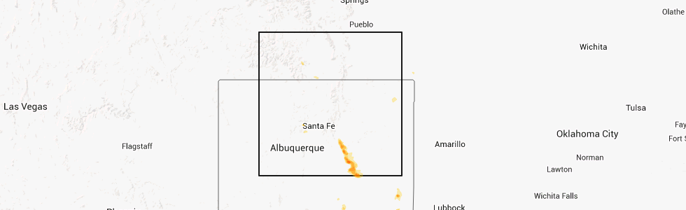
Hail Map for Antonito, CO
The Antonito, CO area has had 1 report of on-the-ground hail by trained spotters, and has been under severe weather warnings 0 times during the past 12 months. Doppler radar has detected hail at or near Antonito, CO on 3 occasions.
| Name: | Antonito, CO |
| Where Located: | 51.8 miles NNW of Taos, NM |
| Map: | Google Map for Antonito, CO |
| Population: | 781 |
| Housing Units: | 407 |
| More Info: | Search Google for Antonito, CO |
5
The Top Recent Hail Date for Antonito, CO is Saturday, July 19, 2014 (1st out of 3)
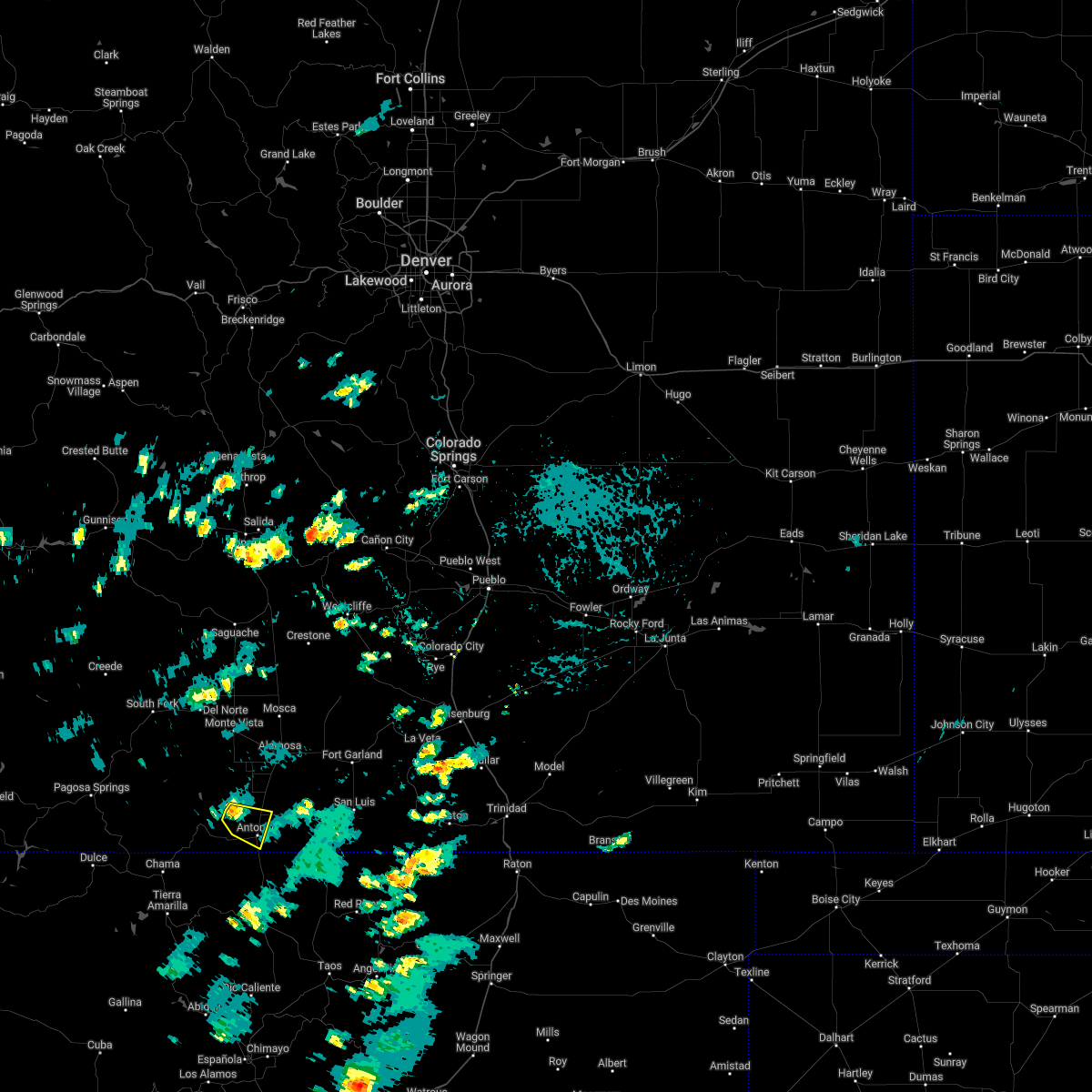
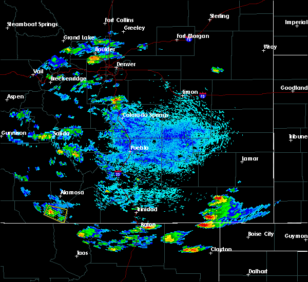
Hail and Wind Damage Spotted near Antonito, CO
| Date / Time | Report Details |
|---|---|
| 7/1/2022 1:17 PM MDT |
 At 117 pm mdt, a severe thunderstorm was located near capulin, or 24 miles southwest of alamosa, moving east at 10 mph. other strong thunderstorms were developing farther east, from the romeo to conejos areas, and could become severe (radar indicated). Hazards include 60 mph wind gusts and quarter size hail. Hail damage to vehicles is expected. Expect wind damage to roofs, siding, and trees. At 117 pm mdt, a severe thunderstorm was located near capulin, or 24 miles southwest of alamosa, moving east at 10 mph. other strong thunderstorms were developing farther east, from the romeo to conejos areas, and could become severe (radar indicated). Hazards include 60 mph wind gusts and quarter size hail. Hail damage to vehicles is expected. Expect wind damage to roofs, siding, and trees.
|
| 8/13/2017 2:29 PM MDT |
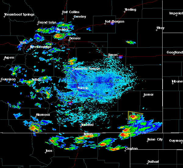 At 227 pm mdt, a severe thunderstorm was located over manassa, or 21 miles south of alamosa, moving southeast at 25 mph (radar indicated). Hazards include 60 mph wind gusts and quarter size hail. Hail damage to vehicles is expected. expect wind damage to roofs, siding, and trees. Locations impacted include, manassa, antonito, and romeo. At 227 pm mdt, a severe thunderstorm was located over manassa, or 21 miles south of alamosa, moving southeast at 25 mph (radar indicated). Hazards include 60 mph wind gusts and quarter size hail. Hail damage to vehicles is expected. expect wind damage to roofs, siding, and trees. Locations impacted include, manassa, antonito, and romeo.
|
| 8/13/2017 2:16 PM MDT |
 At 215 pm mdt, a severe thunderstorm was located over romeo, or 20 miles southwest of alamosa, moving east at 25 mph (radar indicated). Hazards include 60 mph wind gusts and quarter size hail. Hail damage to vehicles is expected. Expect wind damage to roofs, siding, and trees. At 215 pm mdt, a severe thunderstorm was located over romeo, or 20 miles southwest of alamosa, moving east at 25 mph (radar indicated). Hazards include 60 mph wind gusts and quarter size hail. Hail damage to vehicles is expected. Expect wind damage to roofs, siding, and trees.
|
| 7/31/2014 2:43 PM MDT | Half Dollar sized hail reported 4.9 miles NNE of Antonito, CO |
Hail Maps for Antonito, CO


Connect with Interactive Hail Maps