

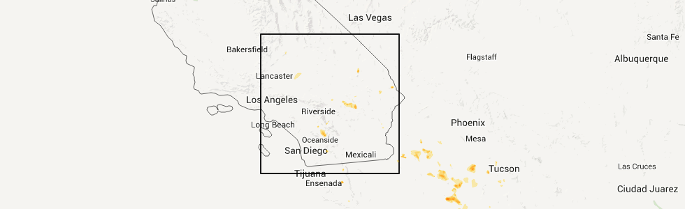
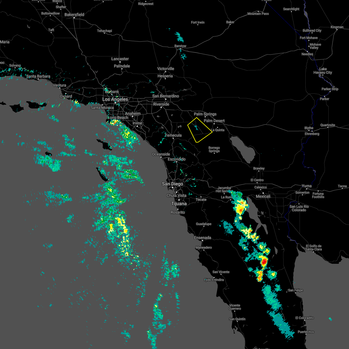
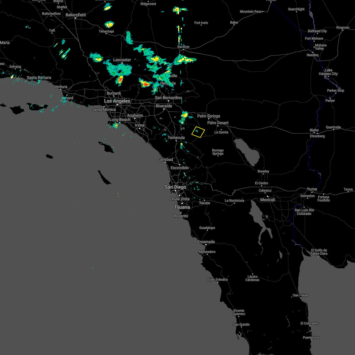
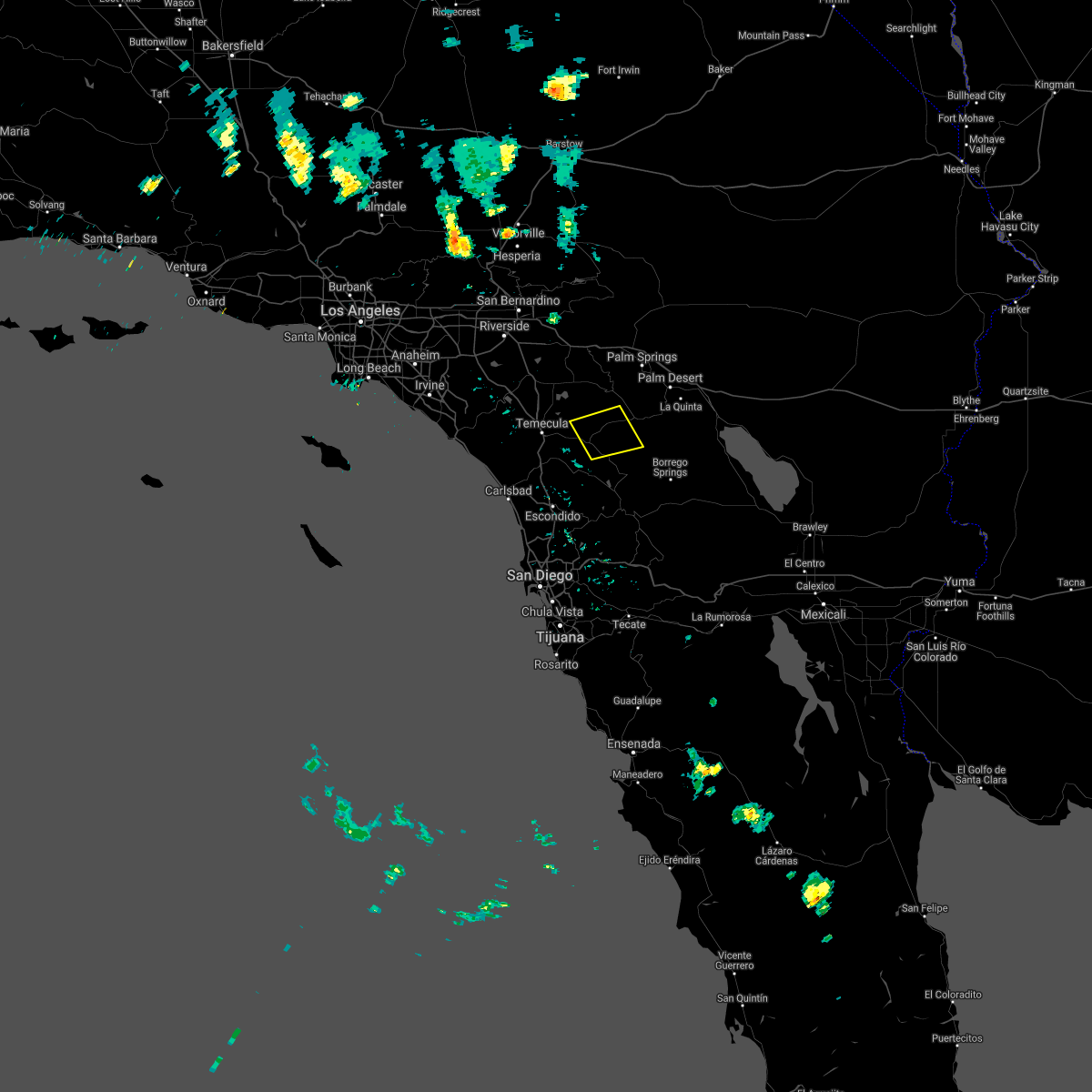
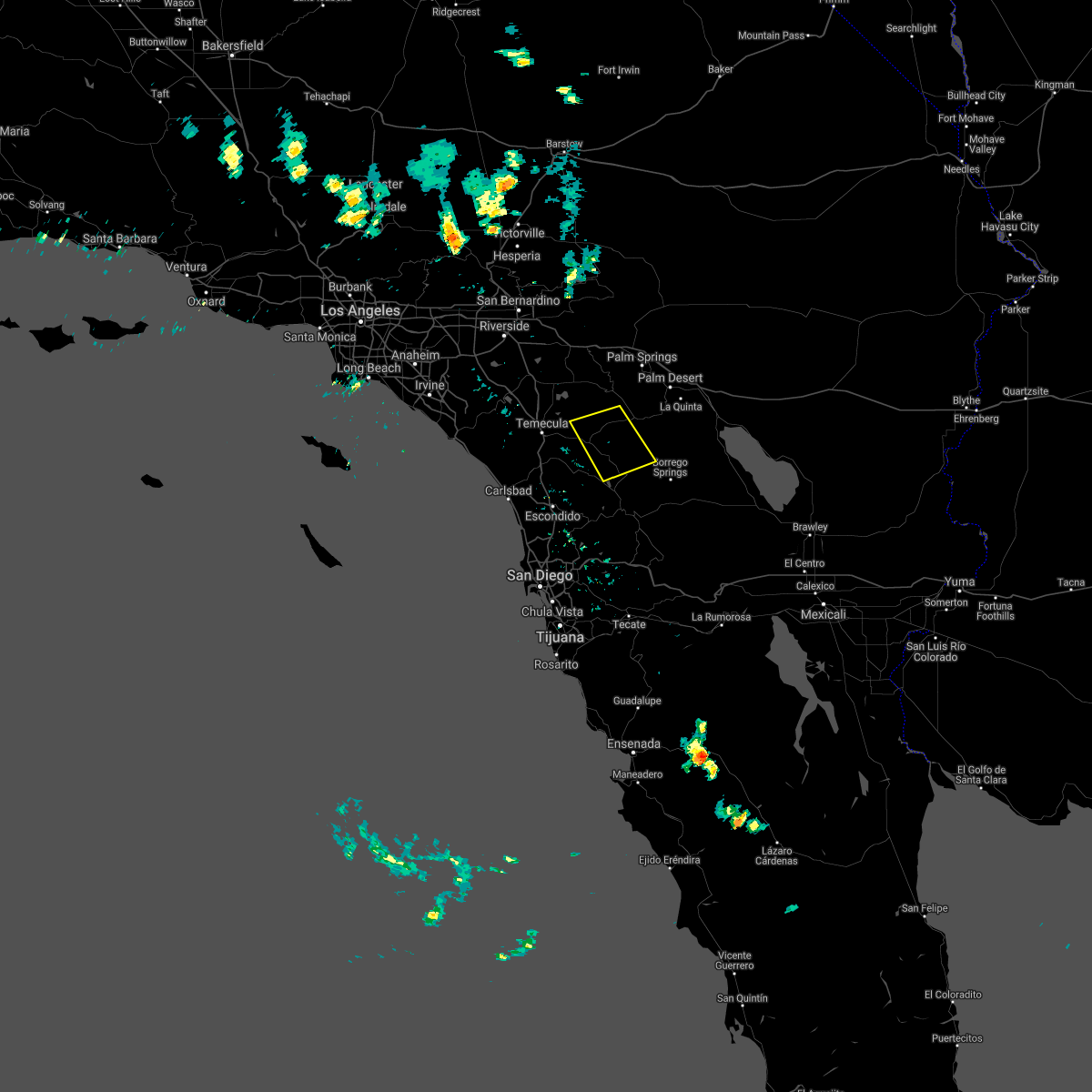
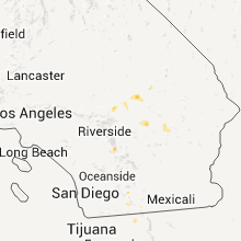
Hail Map for Anza, CA
The Anza, CA area has had 0 reports of on-the-ground hail by trained spotters, and has been under severe weather warnings 0 times during the past 12 months. Doppler radar has detected hail at or near Anza, CA on 5 occasions.
| Name: | Anza, CA |
| Where Located: | 41.2 miles SSW of Yucca Valley, CA |
| Map: | Google Map for Anza, CA |
| Population: | 3014 |
| Housing Units: | 1508 |
| More Info: | Search Google for Anza, CA |
5
The Top Recent Hail Date for Anza, CA is Saturday, August 27, 2011 (1st out of 5)
Hail and Wind Damage Spotted near Anza, CA
| Date / Time | Report Details |
|---|---|
| 7/30/2021 3:17 PM PDT |
 At 316 pm pdt, a severe thunderstorm was located near hwy 74 between mountain center and anza, or near anza, moving southeast at 5 mph (radar indicated). Hazards include 60 mph wind gusts and quarter size hail. Hail damage to vehicles is expected. Expect wind damage to roofs, siding, and trees. At 316 pm pdt, a severe thunderstorm was located near hwy 74 between mountain center and anza, or near anza, moving southeast at 5 mph (radar indicated). Hazards include 60 mph wind gusts and quarter size hail. Hail damage to vehicles is expected. Expect wind damage to roofs, siding, and trees.
|
| 8/18/2020 3:12 PM PDT |
 At 311 pm pdt, a severe thunderstorm was located near mountain center, or near anza, and is nearly stationary (radar indicated). Hazards include 70 mph wind gusts and nickel size hail. Expect considerable tree damage. Damage is likely to mobile homes, roofs, and outbuildings. At 311 pm pdt, a severe thunderstorm was located near mountain center, or near anza, and is nearly stationary (radar indicated). Hazards include 70 mph wind gusts and nickel size hail. Expect considerable tree damage. Damage is likely to mobile homes, roofs, and outbuildings.
|
| 8/15/2020 3:04 PM PDT |
 At 303 pm pdt, a severe thunderstorm was located near anza, and is nearly stationary (radar indicated). Hazards include 60 mph wind gusts. Expect damage to roofs, siding, and trees. Locations impacted include, anza, aguanga, hwy 79 between oak grove and aguanga, hwy 79 between warner springs and oak grove, cahuilla indian reservation, oak grove and sage. At 303 pm pdt, a severe thunderstorm was located near anza, and is nearly stationary (radar indicated). Hazards include 60 mph wind gusts. Expect damage to roofs, siding, and trees. Locations impacted include, anza, aguanga, hwy 79 between oak grove and aguanga, hwy 79 between warner springs and oak grove, cahuilla indian reservation, oak grove and sage.
|
| 8/15/2020 2:24 PM PDT |
 At 223 pm pdt, a severe thunderstorm was located near hwy 79 between warner springs and oak grove, or 8 miles south of anza, and is nearly stationary (radar indicated). Hazards include 70 mph wind gusts and nickel size hail. Expect considerable tree damage. Damage is likely to mobile homes, roofs, and outbuildings. At 223 pm pdt, a severe thunderstorm was located near hwy 79 between warner springs and oak grove, or 8 miles south of anza, and is nearly stationary (radar indicated). Hazards include 70 mph wind gusts and nickel size hail. Expect considerable tree damage. Damage is likely to mobile homes, roofs, and outbuildings.
|
| 9/4/2019 4:09 PM PDT |
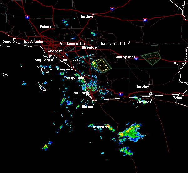 The severe thunderstorm warning for riverside and north central san diego counties will expire at 415 pm pdt, the storm which prompted the warning has weakened below severe limits, and has moved out of the warned area. therefore, the warning will be allowed to expire. The severe thunderstorm warning for riverside and north central san diego counties will expire at 415 pm pdt, the storm which prompted the warning has weakened below severe limits, and has moved out of the warned area. therefore, the warning will be allowed to expire.
|
| 9/4/2019 3:50 PM PDT |
 At 349 pm pdt, a severe thunderstorm was located near hwy 79 between oak grove and aguanga, or 7 miles southwest of anza, moving northwest at 10 mph (radar indicated). Hazards include 60 mph wind gusts. the storm has weakened in the last half hour but strong winds are still possible. Expect damage to roofs, siding, and trees. Locations impacted include, temecula, anza, aguanga, hwy 79 between oak grove and aguanga, hwy 79 between warner springs and oak grove, palomar mountain, oak grove, sage, lake skinner recreation area and cahuilla indian reservation. At 349 pm pdt, a severe thunderstorm was located near hwy 79 between oak grove and aguanga, or 7 miles southwest of anza, moving northwest at 10 mph (radar indicated). Hazards include 60 mph wind gusts. the storm has weakened in the last half hour but strong winds are still possible. Expect damage to roofs, siding, and trees. Locations impacted include, temecula, anza, aguanga, hwy 79 between oak grove and aguanga, hwy 79 between warner springs and oak grove, palomar mountain, oak grove, sage, lake skinner recreation area and cahuilla indian reservation.
|
| 9/4/2019 3:19 PM PDT |
 The national weather service in san diego has issued a * severe thunderstorm warning for. riverside county in southern california. north central san diego county in southwestern california. until 415 pm pdt. At 318 pm pdt, a severe thunderstorm was located near hwy 79. The national weather service in san diego has issued a * severe thunderstorm warning for. riverside county in southern california. north central san diego county in southwestern california. until 415 pm pdt. At 318 pm pdt, a severe thunderstorm was located near hwy 79.
|
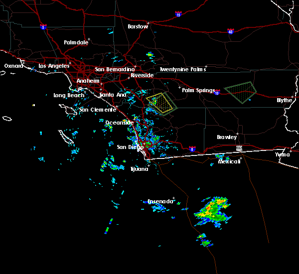
| 9/2/2019 3:21 PM PDT |
 The severe thunderstorm warning for riverside county will expire at 330 pm pdt, the storm which prompted the warning has weakened below severe limits, and no longer poses an immediate threat to life or property. therefore, the warning will be allowed to expire. a flash flood warning remains in effect for much of the area, with rainfall runoff expected to continue. The severe thunderstorm warning for riverside county will expire at 330 pm pdt, the storm which prompted the warning has weakened below severe limits, and no longer poses an immediate threat to life or property. therefore, the warning will be allowed to expire. a flash flood warning remains in effect for much of the area, with rainfall runoff expected to continue.
|
| 9/2/2019 2:54 PM PDT |
 At 252 pm pdt, a severe thunderstorm was located over hwy 74 between mountain center and anza, or near anza, and is nearly stationary (radar indicated). Hazards include 60 mph wind gusts and nickel size hail. Expect damage to roofs, siding, and trees. Locations impacted include, anza, hwy 74 between mountain center and anza, mountain center, hwy 74 between anza and palm desert, lake hemet and cahuilla indian reservation. At 252 pm pdt, a severe thunderstorm was located over hwy 74 between mountain center and anza, or near anza, and is nearly stationary (radar indicated). Hazards include 60 mph wind gusts and nickel size hail. Expect damage to roofs, siding, and trees. Locations impacted include, anza, hwy 74 between mountain center and anza, mountain center, hwy 74 between anza and palm desert, lake hemet and cahuilla indian reservation.
|
| 9/2/2019 2:25 PM PDT |
 At 224 pm pdt, a severe thunderstorm was located over hwy 74 between mountain center and anza, or near anza, and is nearly stationary (radar indicated). Hazards include 60 mph wind gusts and quarter size hail. Hail damage to vehicles is expected. Expect wind damage to roofs, siding, and trees. At 224 pm pdt, a severe thunderstorm was located over hwy 74 between mountain center and anza, or near anza, and is nearly stationary (radar indicated). Hazards include 60 mph wind gusts and quarter size hail. Hail damage to vehicles is expected. Expect wind damage to roofs, siding, and trees.
|
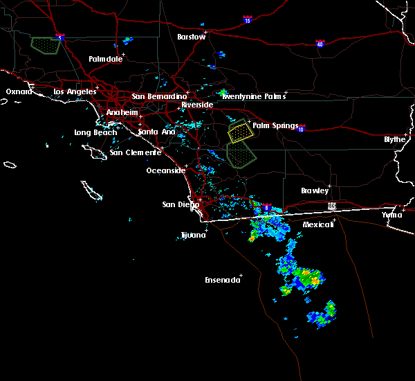
| 8/15/2018 3:54 PM PDT |
 The severe thunderstorm warning for riverside county will expire at 400 pm pdt, the severe thunderstorm which prompted the warning has weakened. while scattered thunderstorms were continuing as of 350 pm, they will likely remain below severe limits between 400 pm and 430 pm. therefore, the warning will be allowed to expire. The severe thunderstorm warning for riverside county will expire at 400 pm pdt, the severe thunderstorm which prompted the warning has weakened. while scattered thunderstorms were continuing as of 350 pm, they will likely remain below severe limits between 400 pm and 430 pm. therefore, the warning will be allowed to expire.
|
| 8/15/2018 3:34 PM PDT |
 At 331 pm pdt, thunderstorms were along a line from just east of idyllwild southeast to pinyon pines, along highway 74. thunderstorms had weakened somewhat since 315 pm but could still restrengthen before 400 pm (radar indicated). Hazards include 60 mph wind gusts and quarter size hail. Hail damage to vehicles is expected. expect wind damage to roofs, siding, and trees. Locations impacted include, idyllwild-pine cove, anza, highway 243 between banning and idyllwild, mt san jacinto state park, highway 74 between anza and palm desert, highway 74 between mountain center and anza, mountain center, lake hemet, cahuilla indian reservation and santa rosa mountain. At 331 pm pdt, thunderstorms were along a line from just east of idyllwild southeast to pinyon pines, along highway 74. thunderstorms had weakened somewhat since 315 pm but could still restrengthen before 400 pm (radar indicated). Hazards include 60 mph wind gusts and quarter size hail. Hail damage to vehicles is expected. expect wind damage to roofs, siding, and trees. Locations impacted include, idyllwild-pine cove, anza, highway 243 between banning and idyllwild, mt san jacinto state park, highway 74 between anza and palm desert, highway 74 between mountain center and anza, mountain center, lake hemet, cahuilla indian reservation and santa rosa mountain.
|
| 8/15/2018 2:59 PM PDT |
 At 258 pm pdt, a severe thunderstorm was located over hwy 74 between mountain center and anza and nearly stationary (radar indicated). Hazards include 60 mph wind gusts and quarter size hail. Hail damage to vehicles is expected. Expect wind damage to roofs, siding, and trees. At 258 pm pdt, a severe thunderstorm was located over hwy 74 between mountain center and anza and nearly stationary (radar indicated). Hazards include 60 mph wind gusts and quarter size hail. Hail damage to vehicles is expected. Expect wind damage to roofs, siding, and trees.
|
| 8/15/2018 2:32 PM PDT |
 At 231 pm pdt, a severe thunderstorm was located near hwy 79 between warner springs and oak grove, or 12 miles south of anza, and is nearly stationary (radar indicated). Hazards include 60 mph wind gusts and penny size hail. Expect damage to roofs, siding, and trees. Locations impacted include, southeastern anza, warner springs, hwy 79 between warner springs and oak grove, lake henshaw, hwy 74 between anza and palm desert, s7 - east grade rd, hwy 79 between oak grove and aguanga, borrego palm canyon, hwy 79 between santa ysabel and warner springs, aguanga, hwy s2 between hwy 79 and hwy 78, cahuilla indian reservation, oak grove, los coyotes indian reservation and santa rosa mountain. At 231 pm pdt, a severe thunderstorm was located near hwy 79 between warner springs and oak grove, or 12 miles south of anza, and is nearly stationary (radar indicated). Hazards include 60 mph wind gusts and penny size hail. Expect damage to roofs, siding, and trees. Locations impacted include, southeastern anza, warner springs, hwy 79 between warner springs and oak grove, lake henshaw, hwy 74 between anza and palm desert, s7 - east grade rd, hwy 79 between oak grove and aguanga, borrego palm canyon, hwy 79 between santa ysabel and warner springs, aguanga, hwy s2 between hwy 79 and hwy 78, cahuilla indian reservation, oak grove, los coyotes indian reservation and santa rosa mountain.
|
| 8/15/2018 2:09 PM PDT |
 At 208 pm pdt, a severe thunderstorm was located near hwy 79 between warner springs and oak grove, or 12 miles south of anza. this storm was nearly stationary (radar indicated). Hazards include 60 mph wind gusts and penny size hail. expect damage to roofs, siding, and trees At 208 pm pdt, a severe thunderstorm was located near hwy 79 between warner springs and oak grove, or 12 miles south of anza. this storm was nearly stationary (radar indicated). Hazards include 60 mph wind gusts and penny size hail. expect damage to roofs, siding, and trees
|
| 9/9/2015 2:23 PM PDT |
 The severe thunderstorm warning for riverside county will expire at 230 pm pdt, the storms which prompted the warning have moved out of the area. therefore the warning will be allowed to expire. The severe thunderstorm warning for riverside county will expire at 230 pm pdt, the storms which prompted the warning have moved out of the area. therefore the warning will be allowed to expire.
|
| 9/9/2015 2:03 PM PDT |
 At 154 pm pdt, doppler radar continued to indicate a cluster of severe thunderstorms capable of producing quarter size hail and damaging winds in excess of 60 mph. these storms were along a line from stretching from wildomar to san jacinto. these storms were moving slowly north northwest at 5 to 10 mph. locations impacted include, hemet, sun city, east hemet, valle vista, idyllwild-pine cove and winchester. At 154 pm pdt, doppler radar continued to indicate a cluster of severe thunderstorms capable of producing quarter size hail and damaging winds in excess of 60 mph. these storms were along a line from stretching from wildomar to san jacinto. these storms were moving slowly north northwest at 5 to 10 mph. locations impacted include, hemet, sun city, east hemet, valle vista, idyllwild-pine cove and winchester.
|
| 9/9/2015 1:30 PM PDT |
 At 128 pm pdt, doppler radar indicated a cluster of severe thunderstorms capable of producing quarter size hail and damaging winds in excess of 60 mph. these storms were located 15 miles east of temecula and were moving north northwest at 5 mph. At 128 pm pdt, doppler radar indicated a cluster of severe thunderstorms capable of producing quarter size hail and damaging winds in excess of 60 mph. these storms were located 15 miles east of temecula and were moving north northwest at 5 mph.
|
Hail Maps for Anza, CA


Connect with Interactive Hail Maps