

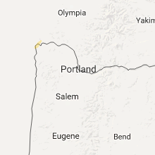
Hail Map for Astoria, OR
The Astoria, OR area has had 0 reports of on-the-ground hail by trained spotters, and has been under severe weather warnings 0 times during the past 12 months. Doppler radar has detected hail at or near Astoria, OR on 1 occasion.
| Name: | Astoria, OR |
| Where Located: | 70.9 miles NW of Portland, OR |
| Map: | Google Map for Astoria, OR |
| Population: | 9477 |
| Housing Units: | 4980 |
| More Info: | Search Google for Astoria, OR |
0
The Top Recent Hail Date for Astoria, OR is Friday, October 14, 2016 (1st out of 1)

Hail and Wind Damage Spotted near Astoria, OR
| Date / Time | Report Details |
|---|---|
| 9/25/2023 6:02 PM PDT | Report from mping: 1-inch tree limbs broken; shingles blown of in clatsop county OR, 2.9 miles E of Astoria, OR |
| 11/14/2017 6:30 AM PST |
 At 630 am pst, a severe thunderstorm was located near cannon beach, moving northeast at 40 mph (radar indicated). Hazards include 60 mph wind gusts and quarter size hail. Hail damage to vehicles is expected. Expect wind damage to roofs, siding, and trees. At 630 am pst, a severe thunderstorm was located near cannon beach, moving northeast at 40 mph (radar indicated). Hazards include 60 mph wind gusts and quarter size hail. Hail damage to vehicles is expected. Expect wind damage to roofs, siding, and trees.
|
| 9/18/2017 4:35 PM PDT |
 At 433 pm pdt, a severe thunderstorm was located near hammond town, or near warrenton, moving northeast at 20 mph (radar indicated). Hazards include 60 mph wind gusts and quarter size hail. Hail damage to vehicles is expected. expect wind damage to roofs, siding, and trees. locations impacted include, astoria, warrenton, hammond town, hammond, chinook, megler and knappton. this includes the following highways in washington, u. s. highway 101 between mile markers 1 and 5. state route 4 near mile marker 7. in oregon this includes u. s. Highway 101 between mile markers 1 and 3. At 433 pm pdt, a severe thunderstorm was located near hammond town, or near warrenton, moving northeast at 20 mph (radar indicated). Hazards include 60 mph wind gusts and quarter size hail. Hail damage to vehicles is expected. expect wind damage to roofs, siding, and trees. locations impacted include, astoria, warrenton, hammond town, hammond, chinook, megler and knappton. this includes the following highways in washington, u. s. highway 101 between mile markers 1 and 5. state route 4 near mile marker 7. in oregon this includes u. s. Highway 101 between mile markers 1 and 3.
|
| 9/18/2017 4:15 PM PDT |
 At 414 pm pdt, a severe thunderstorm was located near hammond town, or near warrenton, moving northeast at 20 mph (radar indicated). Hazards include 60 mph wind gusts and quarter size hail. Hail damage to vehicles is expected. Expect wind damage to roofs, siding, and trees. At 414 pm pdt, a severe thunderstorm was located near hammond town, or near warrenton, moving northeast at 20 mph (radar indicated). Hazards include 60 mph wind gusts and quarter size hail. Hail damage to vehicles is expected. Expect wind damage to roofs, siding, and trees.
|
| 5/4/2017 2:35 PM PDT |
 At 234 pm pdt, doppler radar indicated a severe thunderstorm capable of producing quarter size hail. this storm was located near knappa, or 7 miles south of grays river, moving north at 35 mph. locations impacted include, astoria, grays river, skamokawa, knappa, rosburg, naselle, svenson, klaskanine summit, olney, altoona, necanicum, pillar rock, deep river and saddle mountain. in washington this includes state route 4 between mile markers 5 and 29. this includes the following highways in oregon, u.s. highway 26 west of portland between mile markers 8 and 16. u.s. highway 30 west of portland between mile markers 77 and 96. At 234 pm pdt, doppler radar indicated a severe thunderstorm capable of producing quarter size hail. this storm was located near knappa, or 7 miles south of grays river, moving north at 35 mph. locations impacted include, astoria, grays river, skamokawa, knappa, rosburg, naselle, svenson, klaskanine summit, olney, altoona, necanicum, pillar rock, deep river and saddle mountain. in washington this includes state route 4 between mile markers 5 and 29. this includes the following highways in oregon, u.s. highway 26 west of portland between mile markers 8 and 16. u.s. highway 30 west of portland between mile markers 77 and 96.
|
| 5/4/2017 2:04 PM PDT |
 At 203 pm pdt, doppler radar indicated a severe thunderstorm capable of producing quarter size hail. this storm was located 8 miles north of elsie, or 8 miles west of jewell, and moving north at 35 mph. At 203 pm pdt, doppler radar indicated a severe thunderstorm capable of producing quarter size hail. this storm was located 8 miles north of elsie, or 8 miles west of jewell, and moving north at 35 mph.
|
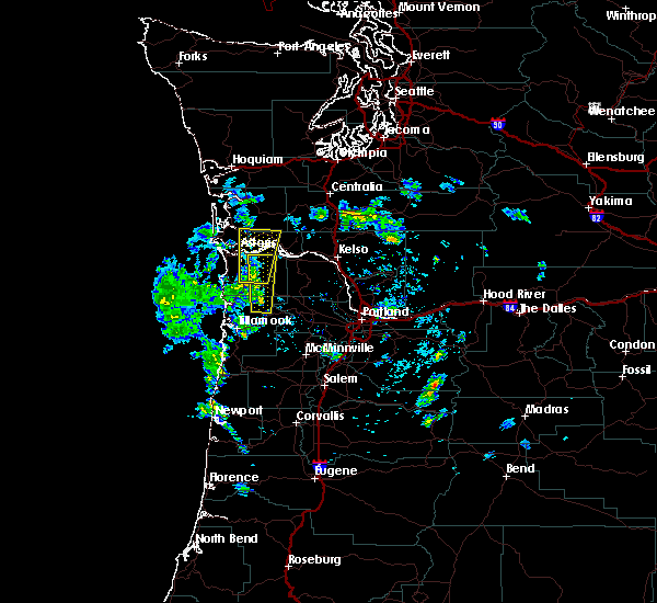
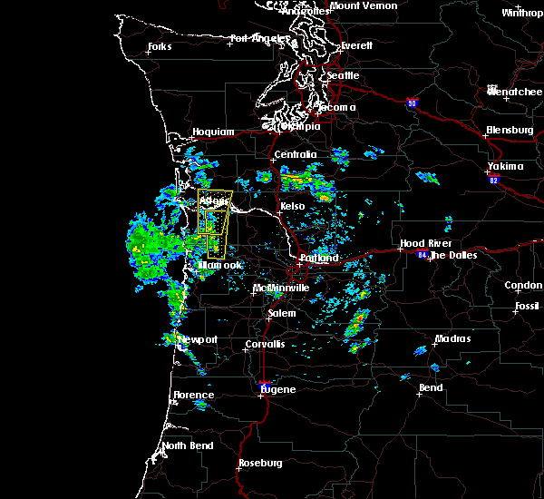
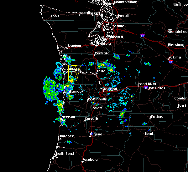
| 10/14/2016 11:36 AM PDT |
 At 1136 am pdt, doppler radar indicated a severe thunderstorm capable of producing destructive winds in excess of 70 mph. this storm was located near grays river, moving northeast at 65 mph. penny size hail may also accompany the damaging winds. locations impacted include, astoria, warrenton, grays river, frances, naselle, hammond town, rosburg, lebam, deep river, megler, pillar rock, altoona, knappton, hammond and chinook. this includes the following highways in washington, u. s. highway 101 between mile markers 1 and 7. state route 4 between mile markers 4 and 28. state route 6 between mile markers 15 and 20. this includes the following highways in oregon, u.s. highway 30 west of portland between mile markers 89 and 99. u.s. highway 101 between mile markers 1 and 15. At 1136 am pdt, doppler radar indicated a severe thunderstorm capable of producing destructive winds in excess of 70 mph. this storm was located near grays river, moving northeast at 65 mph. penny size hail may also accompany the damaging winds. locations impacted include, astoria, warrenton, grays river, frances, naselle, hammond town, rosburg, lebam, deep river, megler, pillar rock, altoona, knappton, hammond and chinook. this includes the following highways in washington, u. s. highway 101 between mile markers 1 and 7. state route 4 between mile markers 4 and 28. state route 6 between mile markers 15 and 20. this includes the following highways in oregon, u.s. highway 30 west of portland between mile markers 89 and 99. u.s. highway 101 between mile markers 1 and 15.
|
| 10/14/2016 11:11 AM PDT |
 At 1110 am pdt, doppler radar indicated a severe thunderstorm capable of producing destructive winds in excess of 70 mph. a tornado is also possible wit this storm. this storm was located near warrenton, and moving northeast at 65 mph. penny size hail may also accompany the damaging winds. At 1110 am pdt, doppler radar indicated a severe thunderstorm capable of producing destructive winds in excess of 70 mph. a tornado is also possible wit this storm. this storm was located near warrenton, and moving northeast at 65 mph. penny size hail may also accompany the damaging winds.
|
| 10/14/2016 10:32 AM PDT | Sustained 35 to 40 mph. gust 60 mp in clatsop county OR, 2.9 miles E of Astoria, OR |
| 1/1/0001 12:00 AM | Storm damage reported in clatsop county OR, 1.9 miles E of Astoria, OR |
| 1/1/0001 12:00 AM | Storm damage reported in clatsop county OR, 1.9 miles E of Astoria, OR |
Hail Maps for Astoria, OR
Connect with Interactive Hail Maps