

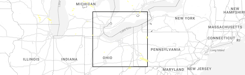
Hail Map for Atwater, OH
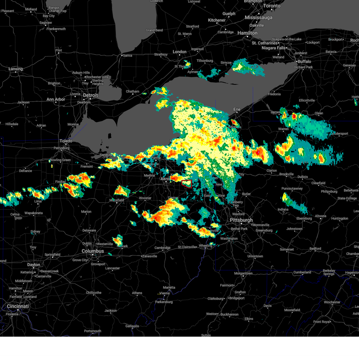
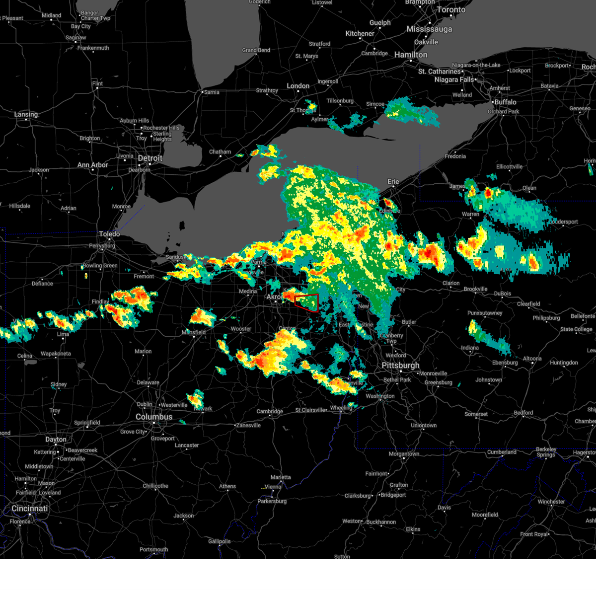
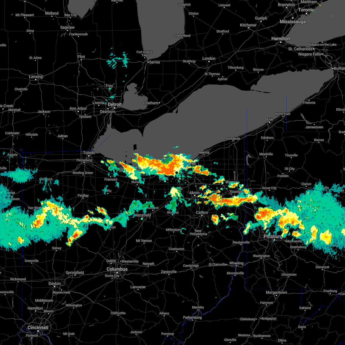
The Atwater, OH area has had 3 reports of on-the-ground hail by trained spotters, and has been under severe weather warnings 10 times during the past 12 months. Doppler radar has detected hail at or near Atwater, OH on 22 occasions, including 2 occasions during the past year.
| Name: | Atwater, OH |
| Where Located: | 43 miles SE of Cleveland, OH |
| Map: | Google Map for Atwater, OH |
| Population: | 758 |
| Housing Units: | 299 |
| More Info: | Search Google for Atwater, OH |
0
The Top Recent Hail Date for Atwater, OH is Thursday, August 24, 2023 (10th out of 22)
Hail and Wind Damage Spotted near Atwater, OH
| Date / Time | Report Details |
|---|---|
| 3/14/2024 10:22 PM EDT |
 The storm which prompted the warning has weakened below severe limits, and no longer poses an immediate threat to life or property. therefore, the warning will be allowed to expire. a tornado watch remains in effect until midnight edt for northeastern ohio. to report severe weather, contact your nearest law enforcement agency. they will relay your report to the national weather service cleveland. The storm which prompted the warning has weakened below severe limits, and no longer poses an immediate threat to life or property. therefore, the warning will be allowed to expire. a tornado watch remains in effect until midnight edt for northeastern ohio. to report severe weather, contact your nearest law enforcement agency. they will relay your report to the national weather service cleveland.
|
| 3/14/2024 10:10 PM EDT |
 At 1010 pm edt, a severe thunderstorm was located over mogadore, or 8 miles southeast of akron, moving east at 55 mph (radar indicated). Hazards include 60 mph wind gusts and quarter size hail. Minor damage to vehicles is possible. expect damage to trees and power lines. Locations impacted include, akron, cuyahoga falls, kent, barberton, green, alliance, tallmadge, mogadore, hartville, norton, brimfield, randolph, munroe falls, lakemore, atwater, edinburg, deerfield, limaville, portage lakes, and uniontown. At 1010 pm edt, a severe thunderstorm was located over mogadore, or 8 miles southeast of akron, moving east at 55 mph (radar indicated). Hazards include 60 mph wind gusts and quarter size hail. Minor damage to vehicles is possible. expect damage to trees and power lines. Locations impacted include, akron, cuyahoga falls, kent, barberton, green, alliance, tallmadge, mogadore, hartville, norton, brimfield, randolph, munroe falls, lakemore, atwater, edinburg, deerfield, limaville, portage lakes, and uniontown.
|
| 3/14/2024 9:52 PM EDT |
 Svrcle the national weather service in cleveland has issued a * severe thunderstorm warning for, southern portage county in northeastern ohio, northeastern stark county in northeastern ohio, southern summit county in northeastern ohio, * until 1030 pm edt. * at 952 pm edt, a severe thunderstorm was located over wadsworth, or 9 miles west of akron, moving east at 50 mph (radar indicated). Hazards include ping pong ball size hail and 60 mph wind gusts. People and animals outdoors will be injured. expect hail damage to roofs, siding, windows, and vehicles. Expect damage to trees and power lines. Svrcle the national weather service in cleveland has issued a * severe thunderstorm warning for, southern portage county in northeastern ohio, northeastern stark county in northeastern ohio, southern summit county in northeastern ohio, * until 1030 pm edt. * at 952 pm edt, a severe thunderstorm was located over wadsworth, or 9 miles west of akron, moving east at 50 mph (radar indicated). Hazards include ping pong ball size hail and 60 mph wind gusts. People and animals outdoors will be injured. expect hail damage to roofs, siding, windows, and vehicles. Expect damage to trees and power lines.
|
| 8/25/2023 12:20 AM EDT |
 At 1219 am edt, severe thunderstorms were located along a line extending from near mantua to lodi, moving southeast at 75 mph (radar indicated). Hazards include 70 mph wind gusts. Expect considerable tree damage. Damage is likely to mobile homes, roofs, and outbuildings. At 1219 am edt, severe thunderstorms were located along a line extending from near mantua to lodi, moving southeast at 75 mph (radar indicated). Hazards include 70 mph wind gusts. Expect considerable tree damage. Damage is likely to mobile homes, roofs, and outbuildings.
|
| 8/12/2023 4:18 PM EDT |
 At 417 pm edt, a severe thunderstorm capable of producing a tornado was located 7 miles southeast of ravenna, moving east at 35 mph (trained weather spotters have reported a rapidly rotating wall cloud southeast of ravenna). Hazards include tornado and golf ball size hail. Flying debris will be dangerous to those caught without shelter. mobile homes will be damaged or destroyed. damage to roofs, windows, and vehicles will occur. tree damage is likely. Locations impacted include, edinburg and deerfield. At 417 pm edt, a severe thunderstorm capable of producing a tornado was located 7 miles southeast of ravenna, moving east at 35 mph (trained weather spotters have reported a rapidly rotating wall cloud southeast of ravenna). Hazards include tornado and golf ball size hail. Flying debris will be dangerous to those caught without shelter. mobile homes will be damaged or destroyed. damage to roofs, windows, and vehicles will occur. tree damage is likely. Locations impacted include, edinburg and deerfield.
|
| 8/12/2023 4:11 PM EDT |
 At 410 pm edt, a severe thunderstorm capable of producing a tornado was located 5 miles south of ravenna and 5 miles east of brimfield, moving east at 35 mph (radar indicated rotation). Hazards include tornado and quarter size hail. Flying debris will be dangerous to those caught without shelter. mobile homes will be damaged or destroyed. damage to roofs, windows, and vehicles will occur. tree damage is likely. Locations impacted include, atwater, edinburg and deerfield. At 410 pm edt, a severe thunderstorm capable of producing a tornado was located 5 miles south of ravenna and 5 miles east of brimfield, moving east at 35 mph (radar indicated rotation). Hazards include tornado and quarter size hail. Flying debris will be dangerous to those caught without shelter. mobile homes will be damaged or destroyed. damage to roofs, windows, and vehicles will occur. tree damage is likely. Locations impacted include, atwater, edinburg and deerfield.
|
| 8/12/2023 4:01 PM EDT |
 At 401 pm edt, a severe thunderstorm capable of producing a tornado was located near mogadore, or 7 miles southwest of ravenna, moving east at 30 mph (radar indicated rotation). Hazards include tornado and golf ball size hail. Flying debris will be dangerous to those caught without shelter. mobile homes will be damaged or destroyed. damage to roofs, windows, and vehicles will occur. Tree damage is likely. At 401 pm edt, a severe thunderstorm capable of producing a tornado was located near mogadore, or 7 miles southwest of ravenna, moving east at 30 mph (radar indicated rotation). Hazards include tornado and golf ball size hail. Flying debris will be dangerous to those caught without shelter. mobile homes will be damaged or destroyed. damage to roofs, windows, and vehicles will occur. Tree damage is likely.
|
| 7/28/2023 2:08 PM EDT |
 At 208 pm edt, severe thunderstorms were located along a line extending from near mogadore to near louisville to dover, moving east at 35 mph (radar indicated). Hazards include 60 mph wind gusts. expect damage to trees and power lines At 208 pm edt, severe thunderstorms were located along a line extending from near mogadore to near louisville to dover, moving east at 35 mph (radar indicated). Hazards include 60 mph wind gusts. expect damage to trees and power lines
|
| 7/20/2023 8:53 PM EDT |
 At 853 pm edt, severe thunderstorms were located along a line extending from near new wilmington to near alliance to near brewster, moving southeast at 55 mph (radar indicated). Hazards include 60 mph wind gusts. Expect damage to trees and power lines. locations impacted include, canton, youngstown, salem, columbiana, boardman, massillon, barberton, green, alliance, niles, north canton, louisville, campbell, hubbard, canfield, sebring, minerva, lordstown, hartville and brewster. hail threat, radar indicated max hail size, <. 75 in wind threat, radar indicated max wind gust, 60 mph. At 853 pm edt, severe thunderstorms were located along a line extending from near new wilmington to near alliance to near brewster, moving southeast at 55 mph (radar indicated). Hazards include 60 mph wind gusts. Expect damage to trees and power lines. locations impacted include, canton, youngstown, salem, columbiana, boardman, massillon, barberton, green, alliance, niles, north canton, louisville, campbell, hubbard, canfield, sebring, minerva, lordstown, hartville and brewster. hail threat, radar indicated max hail size, <. 75 in wind threat, radar indicated max wind gust, 60 mph.
|
| 7/20/2023 8:00 PM EDT |
 At 759 pm edt, severe thunderstorms were located along a line extending from near hubbard to near kent to 6 miles northeast of wadsworth, moving southeast at 40 mph (radar indicated). Hazards include 60 mph wind gusts and quarter size hail. Minor damage to vehicles is possible. Expect damage to trees and power lines. At 759 pm edt, severe thunderstorms were located along a line extending from near hubbard to near kent to 6 miles northeast of wadsworth, moving southeast at 40 mph (radar indicated). Hazards include 60 mph wind gusts and quarter size hail. Minor damage to vehicles is possible. Expect damage to trees and power lines.
|
| 4/1/2023 1:11 PM EDT |
 The severe thunderstorm warning for portage and summit counties will expire at 115 pm edt, the storms which prompted the warning have moved out of the area. therefore, the warning will be allowed to expire. wind gusts in excess of 50 mph will continue for the next several hours and a wind advisory remains in effect until 800 pm edt. a severe thunderstorm watch remains in effect until 600 pm edt for northeastern ohio. The severe thunderstorm warning for portage and summit counties will expire at 115 pm edt, the storms which prompted the warning have moved out of the area. therefore, the warning will be allowed to expire. wind gusts in excess of 50 mph will continue for the next several hours and a wind advisory remains in effect until 800 pm edt. a severe thunderstorm watch remains in effect until 600 pm edt for northeastern ohio.
|
| 4/1/2023 12:33 PM EDT |
 At 1232 pm edt, severe thunderstorms were located along a line extending from near macedonia to wadsworth, moving east at 55 mph (radar indicated. at 1232 pm edt, a trained spotter reported three large trees down with nickel sized hail in richfield). Hazards include 70 mph wind gusts and quarter size hail. Minor damage to vehicles is possible. expect considerable tree damage. wind damage is also likely to mobile homes, roofs, and outbuildings. locations impacted include, akron, ravenna, cuyahoga falls, kent, barberton, green, solon, hudson, twinsburg, tallmadge, streetsboro, macedonia, mogadore, garrettsville, mantua, stow, broadview heights, aurora, new franklin and brecksville. thunderstorm damage threat, considerable hail threat, radar indicated max hail size, 1. 00 in wind threat, radar indicated max wind gust, 70 mph. At 1232 pm edt, severe thunderstorms were located along a line extending from near macedonia to wadsworth, moving east at 55 mph (radar indicated. at 1232 pm edt, a trained spotter reported three large trees down with nickel sized hail in richfield). Hazards include 70 mph wind gusts and quarter size hail. Minor damage to vehicles is possible. expect considerable tree damage. wind damage is also likely to mobile homes, roofs, and outbuildings. locations impacted include, akron, ravenna, cuyahoga falls, kent, barberton, green, solon, hudson, twinsburg, tallmadge, streetsboro, macedonia, mogadore, garrettsville, mantua, stow, broadview heights, aurora, new franklin and brecksville. thunderstorm damage threat, considerable hail threat, radar indicated max hail size, 1. 00 in wind threat, radar indicated max wind gust, 70 mph.
|
| 4/1/2023 12:17 PM EDT |
 At 1216 pm edt, severe thunderstorms were located along a line extending from near south russell to 6 miles southwest of green, moving northeast at 55 mph (radar indicated). Hazards include 60 mph wind gusts and nickel size hail. expect damage to trees and power lines At 1216 pm edt, severe thunderstorms were located along a line extending from near south russell to 6 miles southwest of green, moving northeast at 55 mph (radar indicated). Hazards include 60 mph wind gusts and nickel size hail. expect damage to trees and power lines
|
| 7/1/2022 8:43 PM EDT |
 The severe thunderstorm warning for southeastern portage, western mahoning and eastern stark counties will expire at 845 pm edt, the storms which prompted the warning have moved out of the area. therefore, the warning will be allowed to expire. The severe thunderstorm warning for southeastern portage, western mahoning and eastern stark counties will expire at 845 pm edt, the storms which prompted the warning have moved out of the area. therefore, the warning will be allowed to expire.
|
| 7/1/2022 8:30 PM EDT |
 At 830 pm edt, severe thunderstorms were located along a line extending from near sebring to canton, moving southeast at 25 mph (radar indicated). Hazards include 60 mph wind gusts. Expect damage to trees and power lines. locations impacted include, canton, alliance, north canton, louisville, sebring, minerva, waynesburg, east sparta, atwater, east canton, craig beach, beloit, deerfield, meyers lake, limaville, berlin center, robertsville, maple ridge, maximo and perry heights. hail threat, radar indicated max hail size, <. 75 in wind threat, radar indicated max wind gust, 60 mph. At 830 pm edt, severe thunderstorms were located along a line extending from near sebring to canton, moving southeast at 25 mph (radar indicated). Hazards include 60 mph wind gusts. Expect damage to trees and power lines. locations impacted include, canton, alliance, north canton, louisville, sebring, minerva, waynesburg, east sparta, atwater, east canton, craig beach, beloit, deerfield, meyers lake, limaville, berlin center, robertsville, maple ridge, maximo and perry heights. hail threat, radar indicated max hail size, <. 75 in wind threat, radar indicated max wind gust, 60 mph.
|
| 7/1/2022 8:04 PM EDT |
 At 804 pm edt, severe thunderstorms were located along a line extending from 6 miles south of ravenna to near green, moving southeast at 25 mph (radar indicated). Hazards include 60 mph wind gusts and penny size hail. expect damage to trees and power lines At 804 pm edt, severe thunderstorms were located along a line extending from 6 miles south of ravenna to near green, moving southeast at 25 mph (radar indicated). Hazards include 60 mph wind gusts and penny size hail. expect damage to trees and power lines
|
| 6/1/2022 6:24 PM EDT |
 At 624 pm edt, severe thunderstorms were located along a line extending from near hartville to near louisville to brewster, moving east at 30 mph (radar indicated). Hazards include 60 mph wind gusts and penny size hail. expect damage to trees and power lines At 624 pm edt, severe thunderstorms were located along a line extending from near hartville to near louisville to brewster, moving east at 30 mph (radar indicated). Hazards include 60 mph wind gusts and penny size hail. expect damage to trees and power lines
|
| 10/21/2021 5:07 PM EDT |
 At 507 pm edt, a severe thunderstorm capable of producing a tornado was located over akron, moving east at 40 mph (radar indicated rotation). Hazards include tornado. Flying debris will be dangerous to those caught without shelter. mobile homes will be damaged or destroyed. damage to roofs, windows, and vehicles will occur. tree damage is likely. this dangerous storm will be near, tallmadge and mogadore around 515 pm edt. kent around 520 pm edt. ravenna around 530 pm edt. Other locations impacted by this tornadic thunderstorm include brimfield, atwater, edinburg, randolph, munroe falls, deerfield, lakemore, stow and norton. At 507 pm edt, a severe thunderstorm capable of producing a tornado was located over akron, moving east at 40 mph (radar indicated rotation). Hazards include tornado. Flying debris will be dangerous to those caught without shelter. mobile homes will be damaged or destroyed. damage to roofs, windows, and vehicles will occur. tree damage is likely. this dangerous storm will be near, tallmadge and mogadore around 515 pm edt. kent around 520 pm edt. ravenna around 530 pm edt. Other locations impacted by this tornadic thunderstorm include brimfield, atwater, edinburg, randolph, munroe falls, deerfield, lakemore, stow and norton.
|
| 9/22/2021 3:25 PM EDT |
 At 324 pm edt, a severe thunderstorm was located 9 miles north of sebring, or 11 miles southeast of ravenna, moving northeast at 30 mph (radar indicated). Hazards include 60 mph wind gusts. Expect damage to trees and power lines. Locations impacted include, youngstown, warren, niles, newton falls, lordstown, garrettsville, hilltop, leavittsburg, austintown, girard, mcdonald, atwater, edinburg, windham, craig beach, deerfield, north jackson, wayland, south canal and churchill. At 324 pm edt, a severe thunderstorm was located 9 miles north of sebring, or 11 miles southeast of ravenna, moving northeast at 30 mph (radar indicated). Hazards include 60 mph wind gusts. Expect damage to trees and power lines. Locations impacted include, youngstown, warren, niles, newton falls, lordstown, garrettsville, hilltop, leavittsburg, austintown, girard, mcdonald, atwater, edinburg, windham, craig beach, deerfield, north jackson, wayland, south canal and churchill.
|
| 9/22/2021 3:17 PM EDT |
 At 317 pm edt, a severe thunderstorm was located near alliance, or 13 miles southeast of ravenna, moving northeast at 30 mph (radar indicated). Hazards include 60 mph wind gusts. Expect damage to trees and power lines. Locations impacted include, youngstown, warren, alliance, niles, newton falls, lordstown, hilltop, leavittsburg, austintown, girard, randolph, mcdonald, atwater, edinburg, ellsworth, windham, craig beach, deerfield, limaville and north jackson. At 317 pm edt, a severe thunderstorm was located near alliance, or 13 miles southeast of ravenna, moving northeast at 30 mph (radar indicated). Hazards include 60 mph wind gusts. Expect damage to trees and power lines. Locations impacted include, youngstown, warren, alliance, niles, newton falls, lordstown, hilltop, leavittsburg, austintown, girard, randolph, mcdonald, atwater, edinburg, ellsworth, windham, craig beach, deerfield, limaville and north jackson.
|
| 9/22/2021 2:59 PM EDT |
 At 259 pm edt, a severe thunderstorm was located over louisville, or 8 miles northeast of canton, moving northeast at 35 mph (radar indicated). Hazards include 60 mph wind gusts. expect damage to trees and power lines At 259 pm edt, a severe thunderstorm was located over louisville, or 8 miles northeast of canton, moving northeast at 35 mph (radar indicated). Hazards include 60 mph wind gusts. expect damage to trees and power lines
|
| 9/15/2021 2:11 AM EDT |
 The severe thunderstorm warning for portage, geauga, southeastern cuyahoga, south central lake and northern summit counties will expire at 215 am edt, the storms which prompted the warning have weakened below severe limits, and no longer pose an immediate threat to life or property. therefore, the warning will be allowed to expire. however gusty winds are still possible with these thunderstorms. The severe thunderstorm warning for portage, geauga, southeastern cuyahoga, south central lake and northern summit counties will expire at 215 am edt, the storms which prompted the warning have weakened below severe limits, and no longer pose an immediate threat to life or property. therefore, the warning will be allowed to expire. however gusty winds are still possible with these thunderstorms.
|
| 9/15/2021 2:02 AM EDT |
 At 202 am edt, severe thunderstorms were located along a line extending from near burton to near streetsboro, moving east at 40 mph (radar indicated). Hazards include 60 mph wind gusts. Expect damage to trees and power lines. locations impacted include, akron, ravenna, chardon, cuyahoga falls, kent, solon, hudson, twinsburg, tallmadge, streetsboro, macedonia, south russell, middlefield, garrettsville, burton, mantua, chesterland, stow, aurora and brecksville. hail threat, radar indicated max hail size, <. 75 in wind threat, radar indicated max wind gust, 60 mph. At 202 am edt, severe thunderstorms were located along a line extending from near burton to near streetsboro, moving east at 40 mph (radar indicated). Hazards include 60 mph wind gusts. Expect damage to trees and power lines. locations impacted include, akron, ravenna, chardon, cuyahoga falls, kent, solon, hudson, twinsburg, tallmadge, streetsboro, macedonia, south russell, middlefield, garrettsville, burton, mantua, chesterland, stow, aurora and brecksville. hail threat, radar indicated max hail size, <. 75 in wind threat, radar indicated max wind gust, 60 mph.
|
| 9/15/2021 1:46 AM EDT |
 At 146 am edt, severe thunderstorms were located along a line extending from near south russell to near cuyahoga falls, moving east at 40 mph (radar indicated). Hazards include 60 mph wind gusts and penny size hail. Expect damage to trees and power lines. locations impacted include, cleveland, akron, willowick, ravenna, chardon, parma, cuyahoga falls, euclid, mentor, cleveland heights, strongsville, brunswick, north royalton, kent, solon, willoughby, hudson, twinsburg, eastlake and tallmadge. hail threat, radar indicated max hail size, 0. 75 in wind threat, radar indicated max wind gust, 60 mph. At 146 am edt, severe thunderstorms were located along a line extending from near south russell to near cuyahoga falls, moving east at 40 mph (radar indicated). Hazards include 60 mph wind gusts and penny size hail. Expect damage to trees and power lines. locations impacted include, cleveland, akron, willowick, ravenna, chardon, parma, cuyahoga falls, euclid, mentor, cleveland heights, strongsville, brunswick, north royalton, kent, solon, willoughby, hudson, twinsburg, eastlake and tallmadge. hail threat, radar indicated max hail size, 0. 75 in wind threat, radar indicated max wind gust, 60 mph.
|
| 9/15/2021 1:04 AM EDT |
 At 103 am edt, severe thunderstorms were located along a line extending from near lakewood to grafton, moving east at 40 mph (radar indicated). Hazards include 60 mph wind gusts. expect damage to trees and power lines At 103 am edt, severe thunderstorms were located along a line extending from near lakewood to grafton, moving east at 40 mph (radar indicated). Hazards include 60 mph wind gusts. expect damage to trees and power lines
|
| 8/12/2021 4:52 PM EDT |
 At 452 pm edt, a severe thunderstorm was located near ravenna, moving east at 20 mph (radar indicated). Hazards include 60 mph wind gusts and quarter size hail. Minor damage to vehicles is possible. Expect damage to trees and power lines. At 452 pm edt, a severe thunderstorm was located near ravenna, moving east at 20 mph (radar indicated). Hazards include 60 mph wind gusts and quarter size hail. Minor damage to vehicles is possible. Expect damage to trees and power lines.
|
| 8/12/2021 4:36 PM EDT |
 At 436 pm edt, a severe thunderstorm was located near kent, or 7 miles southwest of ravenna, moving east at 20 mph (radar indicated). Hazards include 60 mph wind gusts and quarter size hail. Minor damage to vehicles is possible. expect damage to trees and power lines. locations impacted include, akron, ravenna, kent, barberton, tallmadge, mogadore, stow, brimfield, randolph, munroe falls, lakemore, atwater, edinburg, brady lake and portage lakes. hail threat, radar indicated max hail size, 1. 00 in wind threat, radar indicated max wind gust, 60 mph. At 436 pm edt, a severe thunderstorm was located near kent, or 7 miles southwest of ravenna, moving east at 20 mph (radar indicated). Hazards include 60 mph wind gusts and quarter size hail. Minor damage to vehicles is possible. expect damage to trees and power lines. locations impacted include, akron, ravenna, kent, barberton, tallmadge, mogadore, stow, brimfield, randolph, munroe falls, lakemore, atwater, edinburg, brady lake and portage lakes. hail threat, radar indicated max hail size, 1. 00 in wind threat, radar indicated max wind gust, 60 mph.
|
| 8/12/2021 4:09 PM EDT |
 At 409 pm edt, a severe thunderstorm was located over akron, moving east at 20 mph (radar indicated). Hazards include 60 mph wind gusts and quarter size hail. Minor damage to vehicles is possible. Expect damage to trees and power lines. At 409 pm edt, a severe thunderstorm was located over akron, moving east at 20 mph (radar indicated). Hazards include 60 mph wind gusts and quarter size hail. Minor damage to vehicles is possible. Expect damage to trees and power lines.
|
| 8/11/2021 6:01 PM EDT |
 At 601 pm edt, a line of severe thunderstorms was located from hudson to massillon, moving east at 45 mph (radar indicated). Hazards include 70 mph wind gusts and penny size hail. Expect considerable tree damage. damage is likely to mobile homes, roofs, and outbuildings. locations impacted include, akron, canton, ravenna, cuyahoga falls, massillon, kent, barberton, green, alliance, hudson, wadsworth, tallmadge, north canton, streetsboro, macedonia, louisville, orrville, rittman, sebring and mogadore. thunderstorm damage threat, considerable hail threat, radar indicated max hail size, 0. 75 in wind threat, radar indicated max wind gust, 70 mph. At 601 pm edt, a line of severe thunderstorms was located from hudson to massillon, moving east at 45 mph (radar indicated). Hazards include 70 mph wind gusts and penny size hail. Expect considerable tree damage. damage is likely to mobile homes, roofs, and outbuildings. locations impacted include, akron, canton, ravenna, cuyahoga falls, massillon, kent, barberton, green, alliance, hudson, wadsworth, tallmadge, north canton, streetsboro, macedonia, louisville, orrville, rittman, sebring and mogadore. thunderstorm damage threat, considerable hail threat, radar indicated max hail size, 0. 75 in wind threat, radar indicated max wind gust, 70 mph.
|
| 8/11/2021 5:36 PM EDT |
 At 535 pm edt, a line of severe thunderstorm was located near brunswick to wooster, moving east at 45 mph (radar indicated). Hazards include 70 mph wind gusts and penny size hail. Expect considerable tree damage. Damage is likely to mobile homes, roofs, and outbuildings. At 535 pm edt, a line of severe thunderstorm was located near brunswick to wooster, moving east at 45 mph (radar indicated). Hazards include 70 mph wind gusts and penny size hail. Expect considerable tree damage. Damage is likely to mobile homes, roofs, and outbuildings.
|
| 8/11/2021 10:56 AM EDT |
 At 1055 am edt, a severe thunderstorm was located near hartville, or near canton, moving east at 40 mph (radar indicated). Hazards include 60 mph wind gusts. expect damage to trees and power lines At 1055 am edt, a severe thunderstorm was located near hartville, or near canton, moving east at 40 mph (radar indicated). Hazards include 60 mph wind gusts. expect damage to trees and power lines
|
| 7/8/2021 3:27 PM EDT |
 At 326 pm edt, severe thunderstorms were located along a line extending from near newton falls to near alliance to near minerva, moving east at 35 mph (radar indicated). Hazards include 60 mph wind gusts. Expect damage to trees and power lines. Locations impacted include, youngstown, warren, salem, columbiana, boardman, alliance, niles, louisville, campbell, hubbard, canfield, newton falls, sebring, lordstown, vienna center, leavittsburg, hilltop, maplewood park, austintown and struthers. At 326 pm edt, severe thunderstorms were located along a line extending from near newton falls to near alliance to near minerva, moving east at 35 mph (radar indicated). Hazards include 60 mph wind gusts. Expect damage to trees and power lines. Locations impacted include, youngstown, warren, salem, columbiana, boardman, alliance, niles, louisville, campbell, hubbard, canfield, newton falls, sebring, lordstown, vienna center, leavittsburg, hilltop, maplewood park, austintown and struthers.
|
| 7/8/2021 3:25 PM EDT | Trees and wires down on petrie roa in portage county OH, 2.6 miles NNE of Atwater, OH |
| 7/8/2021 3:20 PM EDT |
 At 320 pm edt, severe thunderstorms were located along a line extending from 6 miles southwest of newton falls to alliance to near louisville, moving east at 35 mph (radar indicated). Hazards include 60 mph wind gusts. expect damage to trees and power lines At 320 pm edt, severe thunderstorms were located along a line extending from 6 miles southwest of newton falls to alliance to near louisville, moving east at 35 mph (radar indicated). Hazards include 60 mph wind gusts. expect damage to trees and power lines
|
| 6/29/2021 6:42 PM EDT |
 At 641 pm edt, a severe thunderstorm was located 7 miles east of ravenna, moving east at 25 mph (radar indicated). Hazards include 60 mph wind gusts. expect damage to trees and power lines At 641 pm edt, a severe thunderstorm was located 7 miles east of ravenna, moving east at 25 mph (radar indicated). Hazards include 60 mph wind gusts. expect damage to trees and power lines
|
| 6/21/2021 1:14 PM EDT |
 At 114 pm edt, a severe thunderstorm was located 8 miles south of ravenna, moving east at 40 mph (radar indicated). Hazards include 60 mph wind gusts. Expect damage to trees and power lines. Locations impacted include, kent, alliance, tallmadge, sebring, hartville, brimfield, randolph, atwater, edinburg, craig beach, beloit, deerfield, limaville, wayland, berlin center and uniontown. At 114 pm edt, a severe thunderstorm was located 8 miles south of ravenna, moving east at 40 mph (radar indicated). Hazards include 60 mph wind gusts. Expect damage to trees and power lines. Locations impacted include, kent, alliance, tallmadge, sebring, hartville, brimfield, randolph, atwater, edinburg, craig beach, beloit, deerfield, limaville, wayland, berlin center and uniontown.
|
| 6/21/2021 1:09 PM EDT |
 At 109 pm edt, a severe thunderstorm was located near ravenna, moving east at 25 mph (radar indicated). Hazards include 60 mph wind gusts and quarter size hail. Minor damage to vehicles is possible. Expect damage to trees and power lines. At 109 pm edt, a severe thunderstorm was located near ravenna, moving east at 25 mph (radar indicated). Hazards include 60 mph wind gusts and quarter size hail. Minor damage to vehicles is possible. Expect damage to trees and power lines.
|
| 6/21/2021 12:58 PM EDT |
 At 1258 pm edt, a severe thunderstorm was located over mogadore, or near akron, moving east at 40 mph (radar indicated). Hazards include 60 mph wind gusts. Expect damage to trees and power lines. Locations impacted include, akron, ravenna, kent, barberton, green, alliance, tallmadge, sebring, mogadore, hartville, norton, brimfield, randolph, lakemore, atwater, edinburg, craig beach, beloit, deerfield and limaville. At 1258 pm edt, a severe thunderstorm was located over mogadore, or near akron, moving east at 40 mph (radar indicated). Hazards include 60 mph wind gusts. Expect damage to trees and power lines. Locations impacted include, akron, ravenna, kent, barberton, green, alliance, tallmadge, sebring, mogadore, hartville, norton, brimfield, randolph, lakemore, atwater, edinburg, craig beach, beloit, deerfield and limaville.
|
| 6/21/2021 12:43 PM EDT |
 At 1243 pm edt, a severe thunderstorm was located over barberton, or near akron, moving east at 40 mph (radar indicated). Hazards include 60 mph wind gusts. expect damage to trees and power lines At 1243 pm edt, a severe thunderstorm was located over barberton, or near akron, moving east at 40 mph (radar indicated). Hazards include 60 mph wind gusts. expect damage to trees and power lines
|
| 5/26/2021 1:39 PM EDT |
 At 137 pm edt, a severe thunderstorm was located near ravenna, moving east at 40 mph (radar indicated). Hazards include 60 mph wind gusts. Expect damage to trees and power lines. Locations impacted include, ravenna, kent, tallmadge, mogadore, brimfield, randolph, atwater, edinburg, deerfield, brady lake and wayland. At 137 pm edt, a severe thunderstorm was located near ravenna, moving east at 40 mph (radar indicated). Hazards include 60 mph wind gusts. Expect damage to trees and power lines. Locations impacted include, ravenna, kent, tallmadge, mogadore, brimfield, randolph, atwater, edinburg, deerfield, brady lake and wayland.
|
| 5/26/2021 1:14 PM EDT |
 At 114 pm edt, a severe thunderstorm was located over barberton, or 7 miles southwest of akron, moving east at 35 mph (radar indicated). Hazards include 60 mph wind gusts and penny size hail. expect damage to trees and power lines At 114 pm edt, a severe thunderstorm was located over barberton, or 7 miles southwest of akron, moving east at 35 mph (radar indicated). Hazards include 60 mph wind gusts and penny size hail. expect damage to trees and power lines
|
| 11/15/2020 1:49 PM EST |
 A severe thunderstorm warning remains in effect until 200 pm est for eastern portage. eastern geauga and northeastern stark counties. at 148 pm est, severe thunderstorms were located along a line extending from burton to near newcomerstown, moving east at 55 mph. hazard. 70 mph wind gusts. A severe thunderstorm warning remains in effect until 200 pm est for eastern portage. eastern geauga and northeastern stark counties. at 148 pm est, severe thunderstorms were located along a line extending from burton to near newcomerstown, moving east at 55 mph. hazard. 70 mph wind gusts.
|
| 11/15/2020 1:38 PM EST |
 At 137 pm est, severe thunderstorms were located along a line extending from near chesterland to near newcomerstown, moving east at 55 mph (radar indicated). Hazards include 70 mph wind gusts. Expect considerable tree damage. damage is likely to mobile homes, roofs, and outbuildings. Locations impacted include, canton, painesville, ravenna, chardon, fairport harbor, kent, alliance, north canton, streetsboro, louisville, minerva, madison, hartville, middlefield, garrettsville, perry, burton, mantua, waynesburg and east sparta. At 137 pm est, severe thunderstorms were located along a line extending from near chesterland to near newcomerstown, moving east at 55 mph (radar indicated). Hazards include 70 mph wind gusts. Expect considerable tree damage. damage is likely to mobile homes, roofs, and outbuildings. Locations impacted include, canton, painesville, ravenna, chardon, fairport harbor, kent, alliance, north canton, streetsboro, louisville, minerva, madison, hartville, middlefield, garrettsville, perry, burton, mantua, waynesburg and east sparta.
|
| 11/15/2020 1:21 PM EST |
 At 120 pm est, severe thunderstorms were located along a line extending from near highland hills to coshocton, moving east at 55 mph (radar indicated). Hazards include 70 mph wind gusts. Expect considerable tree damage. damage is likely to mobile homes, roofs, and outbuildings. Locations impacted include, akron, canton, painesville, ravenna, chardon, fairport harbor, cuyahoga falls, mentor, massillon, kent, barberton, green, solon, alliance, willoughby, hudson, twinsburg, tallmadge, north canton and streetsboro. At 120 pm est, severe thunderstorms were located along a line extending from near highland hills to coshocton, moving east at 55 mph (radar indicated). Hazards include 70 mph wind gusts. Expect considerable tree damage. damage is likely to mobile homes, roofs, and outbuildings. Locations impacted include, akron, canton, painesville, ravenna, chardon, fairport harbor, cuyahoga falls, mentor, massillon, kent, barberton, green, solon, alliance, willoughby, hudson, twinsburg, tallmadge, north canton and streetsboro.
|
| 11/15/2020 12:58 PM EST |
 At 1258 pm est, severe thunderstorms were located along a line extending from near westlake to 10 miles east of utica, moving east at 55 mph (radar indicated). Hazards include 70 mph wind gusts. Expect considerable tree damage. damage is likely to mobile homes, roofs, and outbuildings. Locations impacted include, cleveland, akron, canton, painesville, willowick, ravenna, chardon, fairport harbor, millersburg, cuyahoga falls, euclid, mentor, cleveland heights, massillon, kent, barberton, green, solon, alliance and willoughby. At 1258 pm est, severe thunderstorms were located along a line extending from near westlake to 10 miles east of utica, moving east at 55 mph (radar indicated). Hazards include 70 mph wind gusts. Expect considerable tree damage. damage is likely to mobile homes, roofs, and outbuildings. Locations impacted include, cleveland, akron, canton, painesville, willowick, ravenna, chardon, fairport harbor, millersburg, cuyahoga falls, euclid, mentor, cleveland heights, massillon, kent, barberton, green, solon, alliance and willoughby.
|
| 11/15/2020 12:51 PM EST |
 At 1251 pm est, severe thunderstorms were located along a line extending from near westlake to 10 miles east of utica, moving east at 55 mph (radar indicated). Hazards include 60 mph wind gusts. expect damage to trees and power lines At 1251 pm est, severe thunderstorms were located along a line extending from near westlake to 10 miles east of utica, moving east at 55 mph (radar indicated). Hazards include 60 mph wind gusts. expect damage to trees and power lines
|
| 8/28/2020 12:07 PM EDT |
 At 1207 pm edt, a severe thunderstorm was located near hartville, or 10 miles northeast of canton, moving east at 20 mph (radar indicated). Hazards include 60 mph wind gusts and quarter size hail. Minor damage to vehicles is possible. expect damage to trees and power lines. Locations impacted include, akron, green, alliance, north canton, louisville, mogadore, hartville, new franklin, randolph, lakemore, atwater, limaville, greentown, portage lakes, maximo and uniontown. At 1207 pm edt, a severe thunderstorm was located near hartville, or 10 miles northeast of canton, moving east at 20 mph (radar indicated). Hazards include 60 mph wind gusts and quarter size hail. Minor damage to vehicles is possible. expect damage to trees and power lines. Locations impacted include, akron, green, alliance, north canton, louisville, mogadore, hartville, new franklin, randolph, lakemore, atwater, limaville, greentown, portage lakes, maximo and uniontown.
|
| 8/28/2020 11:34 AM EDT |
 At 1134 am edt, a severe thunderstorm was located over green, or 7 miles south of akron, moving east at 20 mph (radar indicated). Hazards include 60 mph wind gusts and quarter size hail. Minor damage to vehicles is possible. Expect damage to trees and power lines. At 1134 am edt, a severe thunderstorm was located over green, or 7 miles south of akron, moving east at 20 mph (radar indicated). Hazards include 60 mph wind gusts and quarter size hail. Minor damage to vehicles is possible. Expect damage to trees and power lines.
|
| 8/27/2020 5:28 PM EDT | Numerous trees and power lines dow in portage county OH, 5.9 miles W of Atwater, OH |
| 8/27/2020 5:19 PM EDT | Numerous trees down... including large limbs on a house. time estimated via rada in portage county OH, 5.9 miles W of Atwater, OH |
| 8/27/2020 5:14 PM EDT |
 At 514 pm edt, a severe thunderstorm was located near sebring, or 12 miles northwest of salem, moving southeast at 30 mph (radar indicated). Hazards include 60 mph wind gusts. expect damage to trees and power lines At 514 pm edt, a severe thunderstorm was located near sebring, or 12 miles northwest of salem, moving southeast at 30 mph (radar indicated). Hazards include 60 mph wind gusts. expect damage to trees and power lines
|
| 7/19/2020 6:35 PM EDT |
 At 634 pm edt, severe thunderstorms were located along a line extending from near bristolville to leavittsburg to newton falls to 9 miles north of sebring, moving east at 40 mph (radar indicated). Hazards include 70 mph wind gusts. Expect considerable tree damage. damage is likely to mobile homes, roofs, and outbuildings. Locations impacted include, youngstown, warren, ravenna, columbiana, boardman, niles, campbell, hubbard, canfield, cortland, newton falls, lordstown, garrettsville, vienna center, leavittsburg, hilltop, maplewood park, bristolville, austintown and struthers. At 634 pm edt, severe thunderstorms were located along a line extending from near bristolville to leavittsburg to newton falls to 9 miles north of sebring, moving east at 40 mph (radar indicated). Hazards include 70 mph wind gusts. Expect considerable tree damage. damage is likely to mobile homes, roofs, and outbuildings. Locations impacted include, youngstown, warren, ravenna, columbiana, boardman, niles, campbell, hubbard, canfield, cortland, newton falls, lordstown, garrettsville, vienna center, leavittsburg, hilltop, maplewood park, bristolville, austintown and struthers.
|
| 7/19/2020 6:18 PM EDT |
 At 618 pm edt, severe thunderstorms were located along a line extending from near west farmington to 6 miles east of ravenna to 8 miles northeast of hartville, moving east at 40 mph (radar indicated). Hazards include 60 mph wind gusts. expect damage to trees and power lines At 618 pm edt, severe thunderstorms were located along a line extending from near west farmington to 6 miles east of ravenna to 8 miles northeast of hartville, moving east at 40 mph (radar indicated). Hazards include 60 mph wind gusts. expect damage to trees and power lines
|
| 6/10/2020 9:28 PM EDT |
 The severe thunderstorm warning for southeastern portage and eastern stark counties will expire at 930 pm edt, the storms which prompted the warning have moved out of the area. therefore, the warning will be allowed to expire. a severe thunderstorm watch remains in effect until 100 am edt for northeastern ohio. The severe thunderstorm warning for southeastern portage and eastern stark counties will expire at 930 pm edt, the storms which prompted the warning have moved out of the area. therefore, the warning will be allowed to expire. a severe thunderstorm watch remains in effect until 100 am edt for northeastern ohio.
|
| 6/10/2020 9:06 PM EDT |
 At 905 pm edt, severe thunderstorms were located along a line extending from 6 miles southwest of newton falls to near alliance to near minerva, moving northeast at 65 mph (radar indicated). Hazards include 60 mph wind gusts and nickel size hail. Expect damage to trees and power lines. Locations impacted include, canton, alliance, north canton, louisville, minerva, hartville, waynesburg, randolph, atwater, east canton, deerfield, meyers lake, limaville, greentown, robertsville and maximo. At 905 pm edt, severe thunderstorms were located along a line extending from 6 miles southwest of newton falls to near alliance to near minerva, moving northeast at 65 mph (radar indicated). Hazards include 60 mph wind gusts and nickel size hail. Expect damage to trees and power lines. Locations impacted include, canton, alliance, north canton, louisville, minerva, hartville, waynesburg, randolph, atwater, east canton, deerfield, meyers lake, limaville, greentown, robertsville and maximo.
|
| 6/10/2020 8:27 PM EDT |
 At 827 pm edt, severe thunderstorms were located along a line extending from barberton to near sugarcreek, moving northeast at 45 mph (radar indicated). Hazards include 60 mph wind gusts and nickel size hail. expect damage to trees and power lines At 827 pm edt, severe thunderstorms were located along a line extending from barberton to near sugarcreek, moving northeast at 45 mph (radar indicated). Hazards include 60 mph wind gusts and nickel size hail. expect damage to trees and power lines
|
| 4/8/2020 12:23 AM EDT |
 At 1223 am edt, severe thunderstorms were located along a line extending from farrell to near louisville, moving southeast at 45 mph (radar indicated). Hazards include 70 mph wind gusts and quarter size hail. Minor damage to vehicles is possible. expect considerable tree damage. wind damage is also likely to mobile homes, roofs, and outbuildings. Locations impacted include, youngstown, salem, columbiana, boardman, alliance, niles, campbell, hubbard, canfield, sebring, lordstown, hilltop, maplewood park, austintown, struthers, girard, mcdonald, atwater, poland and ellsworth. At 1223 am edt, severe thunderstorms were located along a line extending from farrell to near louisville, moving southeast at 45 mph (radar indicated). Hazards include 70 mph wind gusts and quarter size hail. Minor damage to vehicles is possible. expect considerable tree damage. wind damage is also likely to mobile homes, roofs, and outbuildings. Locations impacted include, youngstown, salem, columbiana, boardman, alliance, niles, campbell, hubbard, canfield, sebring, lordstown, hilltop, maplewood park, austintown, struthers, girard, mcdonald, atwater, poland and ellsworth.
|
| 4/8/2020 12:15 AM EDT |
 At 1215 am edt, severe thunderstorms were located along a line extending from 7 miles north of sebring to near brewster to near savannah, moving southeast at 70 mph (radar indicated). Hazards include 70 mph wind gusts and quarter size hail. Minor damage to vehicles is possible. expect considerable tree damage. wind damage is also likely to mobile homes, roofs, and outbuildings. Locations impacted include, akron, canton, wooster, salem, millersburg, massillon, barberton, green, alliance, wadsworth, tallmadge, north canton, louisville, orrville, berlin, rittman, sebring, mogadore, walnut creek and minerva. At 1215 am edt, severe thunderstorms were located along a line extending from 7 miles north of sebring to near brewster to near savannah, moving southeast at 70 mph (radar indicated). Hazards include 70 mph wind gusts and quarter size hail. Minor damage to vehicles is possible. expect considerable tree damage. wind damage is also likely to mobile homes, roofs, and outbuildings. Locations impacted include, akron, canton, wooster, salem, millersburg, massillon, barberton, green, alliance, wadsworth, tallmadge, north canton, louisville, orrville, berlin, rittman, sebring, mogadore, walnut creek and minerva.
|
| 4/8/2020 12:11 AM EDT |
 At 1211 am edt, severe thunderstorms were located along a line extending from near sharpsville to near hartville, moving southeast at 40 mph (radar indicated). Hazards include 70 mph wind gusts and quarter size hail. Minor damage to vehicles is possible. expect considerable tree damage. Wind damage is also likely to mobile homes, roofs, and outbuildings. At 1211 am edt, severe thunderstorms were located along a line extending from near sharpsville to near hartville, moving southeast at 40 mph (radar indicated). Hazards include 70 mph wind gusts and quarter size hail. Minor damage to vehicles is possible. expect considerable tree damage. Wind damage is also likely to mobile homes, roofs, and outbuildings.
|
| 4/7/2020 11:38 PM EDT |
 At 1137 pm edt, severe thunderstorms were located along a line extending from solon to 6 miles northwest of lodi to near norwalk, moving southeast at 45 mph (radar indicated). Hazards include 70 mph wind gusts and quarter size hail. Minor damage to vehicles is possible. expect considerable tree damage. Wind damage is also likely to mobile homes, roofs, and outbuildings. At 1137 pm edt, severe thunderstorms were located along a line extending from solon to 6 miles northwest of lodi to near norwalk, moving southeast at 45 mph (radar indicated). Hazards include 70 mph wind gusts and quarter size hail. Minor damage to vehicles is possible. expect considerable tree damage. Wind damage is also likely to mobile homes, roofs, and outbuildings.
|
| 3/28/2020 1:55 PM EDT |
 At 155 pm edt, a severe thunderstorm was located near newton falls, or 11 miles southwest of warren, moving east at 60 mph (radar indicated). Hazards include half dollar size hail. People and animals outdoors will be injured. Expect damage to roofs, siding, windows, and vehicles. At 155 pm edt, a severe thunderstorm was located near newton falls, or 11 miles southwest of warren, moving east at 60 mph (radar indicated). Hazards include half dollar size hail. People and animals outdoors will be injured. Expect damage to roofs, siding, windows, and vehicles.
|
| 3/28/2020 1:28 PM EDT |
 At 127 pm edt, a severe thunderstorm was located over akron, moving east at 65 mph (radar indicated). Hazards include two inch hail. People and animals outdoors will be injured. expect damage to roofs, siding, windows, and vehicles. Locations impacted include, akron, ravenna, cuyahoga falls, kent, hudson, tallmadge, streetsboro, mogadore, stow, brimfield, fairlawn, randolph, munroe falls, richfield, atwater, edinburg, silver lake, deerfield, brady lake and sugar bush knolls. At 127 pm edt, a severe thunderstorm was located over akron, moving east at 65 mph (radar indicated). Hazards include two inch hail. People and animals outdoors will be injured. expect damage to roofs, siding, windows, and vehicles. Locations impacted include, akron, ravenna, cuyahoga falls, kent, hudson, tallmadge, streetsboro, mogadore, stow, brimfield, fairlawn, randolph, munroe falls, richfield, atwater, edinburg, silver lake, deerfield, brady lake and sugar bush knolls.
|
| 3/28/2020 1:17 PM EDT |
 At 116 pm edt, a severe thunderstorm was located near medina, moving east at 70 mph (radar indicated). Hazards include golf ball size hail and 60 mph wind gusts. People and animals outdoors will be injured. expect hail damage to roofs, siding, windows, and vehicles. Expect damage to trees and power lines. At 116 pm edt, a severe thunderstorm was located near medina, moving east at 70 mph (radar indicated). Hazards include golf ball size hail and 60 mph wind gusts. People and animals outdoors will be injured. expect hail damage to roofs, siding, windows, and vehicles. Expect damage to trees and power lines.
|
| 3/28/2020 12:49 PM EDT |
 At 1248 pm edt, severe thunderstorms were located along a line extending from near garrettsville to near ravenna to akron, moving east at 80 mph (radar indicated). Hazards include half dollar size hail. People and animals outdoors will be injured. expect damage to roofs, siding, windows, and vehicles. Locations impacted include, akron, youngstown, warren, ravenna, cuyahoga falls, kent, niles, tallmadge, streetsboro, canfield, cortland, newton falls, mogadore, lordstown, garrettsville, vienna center, leavittsburg, hilltop, austintown and stow. At 1248 pm edt, severe thunderstorms were located along a line extending from near garrettsville to near ravenna to akron, moving east at 80 mph (radar indicated). Hazards include half dollar size hail. People and animals outdoors will be injured. expect damage to roofs, siding, windows, and vehicles. Locations impacted include, akron, youngstown, warren, ravenna, cuyahoga falls, kent, niles, tallmadge, streetsboro, canfield, cortland, newton falls, mogadore, lordstown, garrettsville, vienna center, leavittsburg, hilltop, austintown and stow.
|
| 3/28/2020 12:39 PM EDT |
 At 1239 pm edt, severe thunderstorms were located along a line extending from near streetsboro to near wadsworth, moving east at 65 mph (radar indicated). Hazards include 60 mph wind gusts and half dollar size hail. People and animals outdoors will be injured. expect hail damage to roofs, siding, windows, and vehicles. Expect damage to trees and power lines. At 1239 pm edt, severe thunderstorms were located along a line extending from near streetsboro to near wadsworth, moving east at 65 mph (radar indicated). Hazards include 60 mph wind gusts and half dollar size hail. People and animals outdoors will be injured. expect hail damage to roofs, siding, windows, and vehicles. Expect damage to trees and power lines.
|
| 3/20/2020 12:51 PM EDT |
 At 1251 pm edt, severe thunderstorms were located along a line extending from near canfield to near shreve, moving east at 60 mph (radar indicated). Hazards include 60 mph wind gusts. Expect damage to trees and power lines. Locations impacted include, canton, wooster, massillon, green, alliance, north canton, louisville, orrville, sebring, minerva, hartville, brewster, navarre, dalton, shreve, waynesburg, east sparta, wilmot, mount eaton and new franklin. At 1251 pm edt, severe thunderstorms were located along a line extending from near canfield to near shreve, moving east at 60 mph (radar indicated). Hazards include 60 mph wind gusts. Expect damage to trees and power lines. Locations impacted include, canton, wooster, massillon, green, alliance, north canton, louisville, orrville, sebring, minerva, hartville, brewster, navarre, dalton, shreve, waynesburg, east sparta, wilmot, mount eaton and new franklin.
|
| 3/20/2020 12:42 PM EDT |
 The severe thunderstorm warning for southern portage, northern stark and southeastern summit counties will expire at 1245 pm edt, the storm which prompted the warning has moved out of the area. therefore, the warning will be allowed to expire. The severe thunderstorm warning for southern portage, northern stark and southeastern summit counties will expire at 1245 pm edt, the storm which prompted the warning has moved out of the area. therefore, the warning will be allowed to expire.
|
| 3/20/2020 12:37 PM EDT |
 At 1236 pm edt, severe thunderstorms were located along a line extending from 6 miles north of sebring to near hayesville, moving east at 45 mph (radar indicated). Hazards include 60 mph wind gusts. Expect damage to trees and power lines. Locations impacted include, akron, canton, wooster, massillon, barberton, green, alliance, north canton, louisville, orrville, rittman, sebring, minerva, doylestown, hartville, creston, brewster, navarre, dalton and shreve. At 1236 pm edt, severe thunderstorms were located along a line extending from 6 miles north of sebring to near hayesville, moving east at 45 mph (radar indicated). Hazards include 60 mph wind gusts. Expect damage to trees and power lines. Locations impacted include, akron, canton, wooster, massillon, barberton, green, alliance, north canton, louisville, orrville, rittman, sebring, minerva, doylestown, hartville, creston, brewster, navarre, dalton and shreve.
|
| 3/20/2020 12:21 PM EDT |
 At 1221 pm edt, a severe thunderstorm was located 8 miles south of ravenna, moving east at 55 mph (radar indicated). Hazards include 60 mph wind gusts. Expect damage to trees and power lines. Locations impacted include, akron, ravenna, cuyahoga falls, kent, green, alliance, tallmadge, mogadore, hartville, stow, new franklin, brimfield, randolph, munroe falls, lakemore, atwater, edinburg, silver lake, deerfield and brady lake. At 1221 pm edt, a severe thunderstorm was located 8 miles south of ravenna, moving east at 55 mph (radar indicated). Hazards include 60 mph wind gusts. Expect damage to trees and power lines. Locations impacted include, akron, ravenna, cuyahoga falls, kent, green, alliance, tallmadge, mogadore, hartville, stow, new franklin, brimfield, randolph, munroe falls, lakemore, atwater, edinburg, silver lake, deerfield and brady lake.
|
| 3/20/2020 12:18 PM EDT |
 At 1218 pm edt, severe thunderstorms were located along a line extending from near green to near lexington, moving east-southeast at 45 mph (radar indicated). Hazards include 60 mph wind gusts. expect damage to trees and power lines At 1218 pm edt, severe thunderstorms were located along a line extending from near green to near lexington, moving east-southeast at 45 mph (radar indicated). Hazards include 60 mph wind gusts. expect damage to trees and power lines
|
| 3/20/2020 12:09 PM EDT |
 At 1209 pm edt, a severe thunderstorm was located over mogadore, or near akron, moving east at 65 mph (radar indicated). Hazards include 60 mph wind gusts. expect damage to trees and power lines At 1209 pm edt, a severe thunderstorm was located over mogadore, or near akron, moving east at 65 mph (radar indicated). Hazards include 60 mph wind gusts. expect damage to trees and power lines
|
| 9/13/2019 11:27 PM EDT |
 The severe thunderstorm warning for southern trumbull, southeastern portage and northwestern mahoning counties will expire at 1130 pm edt, the storms which prompted the warning have weakened below severe limits, and no longer pose an immediate threat to life or property. therefore, the warning will be allowed to expire. however small hail, gusty winds and heavy rain are still possible with these thunderstorms. The severe thunderstorm warning for southern trumbull, southeastern portage and northwestern mahoning counties will expire at 1130 pm edt, the storms which prompted the warning have weakened below severe limits, and no longer pose an immediate threat to life or property. therefore, the warning will be allowed to expire. however small hail, gusty winds and heavy rain are still possible with these thunderstorms.
|
| 9/13/2019 11:17 PM EDT |
 A severe thunderstorm warning remains in effect until 1130 pm edt for southern trumbull. southeastern portage and northwestern mahoning counties. At 1116 pm edt, severe thunderstorms were located along a line extending from near cortland to hilltop to 6 miles north of alliance, moving east at 35 mph. A severe thunderstorm warning remains in effect until 1130 pm edt for southern trumbull. southeastern portage and northwestern mahoning counties. At 1116 pm edt, severe thunderstorms were located along a line extending from near cortland to hilltop to 6 miles north of alliance, moving east at 35 mph.
|
| 9/13/2019 10:58 PM EDT |
 At 1058 pm edt, severe thunderstorms were located along a line extending from near west farmington to near newton falls to near hartville, moving east at 30 mph (radar indicated). Hazards include 60 mph wind gusts and penny size hail. expect damage to trees and power lines At 1058 pm edt, severe thunderstorms were located along a line extending from near west farmington to near newton falls to near hartville, moving east at 30 mph (radar indicated). Hazards include 60 mph wind gusts and penny size hail. expect damage to trees and power lines
|
| 8/18/2019 6:45 PM EDT |
 At 645 pm edt, severe thunderstorms were located along a line extending from garrettsville to near newton falls, moving east at 30 mph (radar indicated). Hazards include 60 mph wind gusts and quarter size hail. Minor damage to vehicles is possible. expect damage to trees and power lines. Locations impacted include, garrettsville, atwater, edinburg, windham, hiram, craig beach, deerfield, wayland and south canal. At 645 pm edt, severe thunderstorms were located along a line extending from garrettsville to near newton falls, moving east at 30 mph (radar indicated). Hazards include 60 mph wind gusts and quarter size hail. Minor damage to vehicles is possible. expect damage to trees and power lines. Locations impacted include, garrettsville, atwater, edinburg, windham, hiram, craig beach, deerfield, wayland and south canal.
|
| 8/18/2019 6:29 PM EDT |
 At 629 pm edt, severe thunderstorms were located along a line extending from mantua to 8 miles southeast of ravenna, moving east at 35 mph (radar indicated). Hazards include golf ball size hail and 60 mph wind gusts. People and animals outdoors will be injured. expect hail damage to roofs, siding, windows, and vehicles. expect damage to trees and power lines. Locations impacted include, ravenna, kent, tallmadge, streetsboro, mogadore, garrettsville, mantua, aurora, brimfield, randolph, atwater, edinburg, windham, hiram, craig beach, deerfield, brady lake, sugar bush knolls, wayland and south canal. At 629 pm edt, severe thunderstorms were located along a line extending from mantua to 8 miles southeast of ravenna, moving east at 35 mph (radar indicated). Hazards include golf ball size hail and 60 mph wind gusts. People and animals outdoors will be injured. expect hail damage to roofs, siding, windows, and vehicles. expect damage to trees and power lines. Locations impacted include, ravenna, kent, tallmadge, streetsboro, mogadore, garrettsville, mantua, aurora, brimfield, randolph, atwater, edinburg, windham, hiram, craig beach, deerfield, brady lake, sugar bush knolls, wayland and south canal.
|
| 8/18/2019 6:03 PM EDT |
 At 602 pm edt, severe thunderstorms were located along a line extending from near cuyahoga falls to near mogadore, moving east at 35 mph (radar indicated). Hazards include 60 mph wind gusts and quarter size hail. Minor damage to vehicles is possible. Expect damage to trees and power lines. At 602 pm edt, severe thunderstorms were located along a line extending from near cuyahoga falls to near mogadore, moving east at 35 mph (radar indicated). Hazards include 60 mph wind gusts and quarter size hail. Minor damage to vehicles is possible. Expect damage to trees and power lines.
|
| 8/7/2019 4:27 PM EDT |
 The severe thunderstorm warning for southwestern portage county will expire at 430 pm edt, the storm which prompted the warning has weakened below severe limits, and no longer poses an immediate threat to life or property. therefore, the warning will be allowed to expire. however gusty winds are still possible with this thunderstorm. to report severe weather, contact your nearest law enforcement agency. they will relay your report to the national weather service cleveland. The severe thunderstorm warning for southwestern portage county will expire at 430 pm edt, the storm which prompted the warning has weakened below severe limits, and no longer poses an immediate threat to life or property. therefore, the warning will be allowed to expire. however gusty winds are still possible with this thunderstorm. to report severe weather, contact your nearest law enforcement agency. they will relay your report to the national weather service cleveland.
|
| 8/7/2019 4:20 PM EDT |
 At 420 pm edt, a severe thunderstorm was located near brimfield, or 7 miles southwest of ravenna, moving east at 10 mph (radar indicated). Hazards include 60 mph wind gusts. Expect damage to trees and power lines. Locations impacted include, ravenna, kent, brimfield, randolph and edinburg. At 420 pm edt, a severe thunderstorm was located near brimfield, or 7 miles southwest of ravenna, moving east at 10 mph (radar indicated). Hazards include 60 mph wind gusts. Expect damage to trees and power lines. Locations impacted include, ravenna, kent, brimfield, randolph and edinburg.
|
| 8/7/2019 4:07 PM EDT |
 At 406 pm edt, two severe thunderstorms were located in portage county, one near wyndham and one near kent, moving east at 20 mph (radar indicated). Hazards include 60 mph wind gusts and quarter size hail. Minor damage to vehicles is possible. expect damage to trees and power lines. Locations impacted include, warren, ravenna, kent, tallmadge, streetsboro, newton falls, lordstown, garrettsville, leavittsburg, brimfield, randolph, atwater, edinburg, windham, craig beach, brady lake, wayland, south canal, turnpike interchange and champion heights. At 406 pm edt, two severe thunderstorms were located in portage county, one near wyndham and one near kent, moving east at 20 mph (radar indicated). Hazards include 60 mph wind gusts and quarter size hail. Minor damage to vehicles is possible. expect damage to trees and power lines. Locations impacted include, warren, ravenna, kent, tallmadge, streetsboro, newton falls, lordstown, garrettsville, leavittsburg, brimfield, randolph, atwater, edinburg, windham, craig beach, brady lake, wayland, south canal, turnpike interchange and champion heights.
|
| 8/7/2019 3:46 PM EDT |
 At 346 pm edt, severe thunderstorms were located along a line extending from near garrettsville to tallmadge, moving east at 20 mph (radar indicated). Hazards include 60 mph wind gusts and quarter size hail. Minor damage to vehicles is possible. Expect damage to trees and power lines. At 346 pm edt, severe thunderstorms were located along a line extending from near garrettsville to tallmadge, moving east at 20 mph (radar indicated). Hazards include 60 mph wind gusts and quarter size hail. Minor damage to vehicles is possible. Expect damage to trees and power lines.
|
| 8/6/2019 4:12 PM EDT |
 At 412 pm edt, severe thunderstorms were located along a line extending from near orwell to near newton falls to near ravenna to near mogadore, moving northeast at 30 mph (radar indicated). Hazards include 60 mph wind gusts and penny size hail. expect damage to trees and power lines At 412 pm edt, severe thunderstorms were located along a line extending from near orwell to near newton falls to near ravenna to near mogadore, moving northeast at 30 mph (radar indicated). Hazards include 60 mph wind gusts and penny size hail. expect damage to trees and power lines
|
| 7/30/2019 6:02 PM EDT |
 At 602 pm edt, a severe thunderstorm was located near hartville, or 12 miles south of ravenna, moving east at 15 mph (radar indicated). Hazards include 60 mph wind gusts and quarter size hail. Minor damage to vehicles is possible. Expect damage to trees and power lines. At 602 pm edt, a severe thunderstorm was located near hartville, or 12 miles south of ravenna, moving east at 15 mph (radar indicated). Hazards include 60 mph wind gusts and quarter size hail. Minor damage to vehicles is possible. Expect damage to trees and power lines.
|
| 7/11/2019 1:55 PM EDT |
 At 155 pm edt, a severe thunderstorm was located near newton falls, or 10 miles east of ravenna, moving southeast at 25 mph (radar indicated). Hazards include 60 mph wind gusts and penny size hail. expect damage to trees and power lines At 155 pm edt, a severe thunderstorm was located near newton falls, or 10 miles east of ravenna, moving southeast at 25 mph (radar indicated). Hazards include 60 mph wind gusts and penny size hail. expect damage to trees and power lines
|
| 7/11/2019 1:45 PM EDT |
 At 114 pm edt, a severe thunderstorm was located near kent, or near ravenna, moving east at 15 mph (radar indicated). Hazards include 60 mph wind gusts and quarter size hail. Minor damage to vehicles is possible. Expect damage to trees and power lines. At 114 pm edt, a severe thunderstorm was located near kent, or near ravenna, moving east at 15 mph (radar indicated). Hazards include 60 mph wind gusts and quarter size hail. Minor damage to vehicles is possible. Expect damage to trees and power lines.
|
| 7/11/2019 1:14 PM EDT |
 At 114 pm edt, a severe thunderstorm was located near kent, or near ravenna, moving east at 15 mph (radar indicated). Hazards include 60 mph wind gusts and quarter size hail. Minor damage to vehicles is possible. Expect damage to trees and power lines. At 114 pm edt, a severe thunderstorm was located near kent, or near ravenna, moving east at 15 mph (radar indicated). Hazards include 60 mph wind gusts and quarter size hail. Minor damage to vehicles is possible. Expect damage to trees and power lines.
|
| 7/6/2019 3:54 PM EDT |
 The national weather service in cleveland has issued a * severe thunderstorm warning for. southeastern portage county in northeastern ohio. western mahoning county in northeastern ohio. northeastern stark county in northeastern ohio. Until 500 pm edt. The national weather service in cleveland has issued a * severe thunderstorm warning for. southeastern portage county in northeastern ohio. western mahoning county in northeastern ohio. northeastern stark county in northeastern ohio. Until 500 pm edt.
|
| 6/2/2019 1:09 AM EDT |
 At 1251 am edt, a severe thunderstorm was located 7 miles southeast of ravenna, moving east at 35 mph. another strong storm was located between akron and portage lakes also moving east at 35 mph (radar indicated). Hazards include 60 mph wind gusts and quarter size hail. Minor damage to vehicles is possible. expect damage to trees and power lines. Locations impacted include, akron, cuyahoga falls, kent, barberton, green, tallmadge, mogadore, norton, brimfield, fairlawn, randolph, lakemore, atwater, edinburg, deerfield, limaville, portage lakes, pigeon creek and uniontown. At 1251 am edt, a severe thunderstorm was located 7 miles southeast of ravenna, moving east at 35 mph. another strong storm was located between akron and portage lakes also moving east at 35 mph (radar indicated). Hazards include 60 mph wind gusts and quarter size hail. Minor damage to vehicles is possible. expect damage to trees and power lines. Locations impacted include, akron, cuyahoga falls, kent, barberton, green, tallmadge, mogadore, norton, brimfield, fairlawn, randolph, lakemore, atwater, edinburg, deerfield, limaville, portage lakes, pigeon creek and uniontown.
|
| 6/2/2019 12:52 AM EDT |
 At 1251 am edt, a severe thunderstorm was located 7 miles southeast of ravenna, moving east at 35 mph. another strong storm was located between akron and portage lakes also moving east at 35 mph (radar indicated). Hazards include 60 mph wind gusts and quarter size hail. Minor damage to vehicles is possible. expect damage to trees and power lines. Locations impacted include, akron, cuyahoga falls, kent, barberton, green, tallmadge, mogadore, norton, brimfield, fairlawn, randolph, lakemore, atwater, edinburg, deerfield, limaville, portage lakes, pigeon creek and uniontown. At 1251 am edt, a severe thunderstorm was located 7 miles southeast of ravenna, moving east at 35 mph. another strong storm was located between akron and portage lakes also moving east at 35 mph (radar indicated). Hazards include 60 mph wind gusts and quarter size hail. Minor damage to vehicles is possible. expect damage to trees and power lines. Locations impacted include, akron, cuyahoga falls, kent, barberton, green, tallmadge, mogadore, norton, brimfield, fairlawn, randolph, lakemore, atwater, edinburg, deerfield, limaville, portage lakes, pigeon creek and uniontown.
|
| 6/2/2019 12:32 AM EDT |
 At 1231 am edt, a severe thunderstorm was located near mogadore, or near akron, moving east at 35 mph (radar indicated). Hazards include 60 mph wind gusts and quarter size hail. Minor damage to vehicles is possible. Expect damage to trees and power lines. At 1231 am edt, a severe thunderstorm was located near mogadore, or near akron, moving east at 35 mph (radar indicated). Hazards include 60 mph wind gusts and quarter size hail. Minor damage to vehicles is possible. Expect damage to trees and power lines.
|
| 6/1/2019 7:42 PM EDT |
 The severe thunderstorm warning for southern trumbull, southeastern portage, mahoning and northeastern stark counties will expire at 745 pm edt, the storms which prompted the warning have weakened below severe limits, and have exited the warned area. therefore, the warning will be allowed to expire. a severe thunderstorm watch remains in effect until 1000 pm edt for northeastern ohio. to report severe weather, contact your nearest law enforcement agency. they will relay your report to the national weather service cleveland. The severe thunderstorm warning for southern trumbull, southeastern portage, mahoning and northeastern stark counties will expire at 745 pm edt, the storms which prompted the warning have weakened below severe limits, and have exited the warned area. therefore, the warning will be allowed to expire. a severe thunderstorm watch remains in effect until 1000 pm edt for northeastern ohio. to report severe weather, contact your nearest law enforcement agency. they will relay your report to the national weather service cleveland.
|
| 6/1/2019 7:31 PM EDT |
 At 731 pm edt, severe thunderstorms were located along a line extending from 9 miles northeast of grove city to alliance, moving east at 40 mph (radar indicated). Hazards include 60 mph wind gusts and quarter size hail. Minor damage to vehicles is possible. expect damage to trees and power lines. Locations impacted include, youngstown, warren, salem, columbiana, boardman, alliance, niles, campbell, hubbard, canfield, newton falls, sebring, lordstown, hartville, vienna center, hilltop, maplewood park, austintown, struthers and girard. At 731 pm edt, severe thunderstorms were located along a line extending from 9 miles northeast of grove city to alliance, moving east at 40 mph (radar indicated). Hazards include 60 mph wind gusts and quarter size hail. Minor damage to vehicles is possible. expect damage to trees and power lines. Locations impacted include, youngstown, warren, salem, columbiana, boardman, alliance, niles, campbell, hubbard, canfield, newton falls, sebring, lordstown, hartville, vienna center, hilltop, maplewood park, austintown, struthers and girard.
|
| 6/1/2019 7:19 PM EDT |
 At 643 pm edt, severe thunderstorms were located along a line extending from near greenville to near mogadore, moving east at 40 mph (radar indicated). Hazards include 60 mph wind gusts and quarter size hail. Minor damage to vehicles is possible. Expect damage to trees and power lines. At 643 pm edt, severe thunderstorms were located along a line extending from near greenville to near mogadore, moving east at 40 mph (radar indicated). Hazards include 60 mph wind gusts and quarter size hail. Minor damage to vehicles is possible. Expect damage to trees and power lines.
|
| 6/1/2019 6:43 PM EDT |
 The national weather service in cleveland has issued a * severe thunderstorm warning for. trumbull county in northeastern ohio. portage county in northeastern ohio. mahoning county in northeastern ohio. Northern stark county in northeastern ohio. The national weather service in cleveland has issued a * severe thunderstorm warning for. trumbull county in northeastern ohio. portage county in northeastern ohio. mahoning county in northeastern ohio. Northern stark county in northeastern ohio.
|
| 5/28/2019 6:57 PM EDT |
 The severe thunderstorm warning for southeastern portage county will expire at 700 pm edt, the storm which prompted the warning has weakened below severe limits, and no longer poses an immediate threat to life or property. therefore, the warning will be allowed to expire. a severe thunderstorm watch remains in effect until 800 pm edt for northeastern ohio. The severe thunderstorm warning for southeastern portage county will expire at 700 pm edt, the storm which prompted the warning has weakened below severe limits, and no longer poses an immediate threat to life or property. therefore, the warning will be allowed to expire. a severe thunderstorm watch remains in effect until 800 pm edt for northeastern ohio.
|
| 5/28/2019 6:39 PM EDT |
 At 639 pm edt, a severe thunderstorm was located 7 miles north of sebring, or 13 miles southeast of ravenna, moving east at 40 mph (radar indicated). Hazards include 60 mph wind gusts and quarter size hail. Minor damage to vehicles is possible. expect damage to trees and power lines. Locations impacted include, randolph, atwater and deerfield. At 639 pm edt, a severe thunderstorm was located 7 miles north of sebring, or 13 miles southeast of ravenna, moving east at 40 mph (radar indicated). Hazards include 60 mph wind gusts and quarter size hail. Minor damage to vehicles is possible. expect damage to trees and power lines. Locations impacted include, randolph, atwater and deerfield.
|
| 5/28/2019 6:23 PM EDT |
 At 623 pm edt, a severe thunderstorm was located near ravenna, moving east at 40 mph (radar indicated). Hazards include 60 mph wind gusts and quarter size hail. Minor damage to vehicles is possible. Expect damage to trees and power lines. At 623 pm edt, a severe thunderstorm was located near ravenna, moving east at 40 mph (radar indicated). Hazards include 60 mph wind gusts and quarter size hail. Minor damage to vehicles is possible. Expect damage to trees and power lines.
|
| 5/28/2019 5:13 PM EDT |
 At 513 pm edt, a severe thunderstorm was located over hartville, or 10 miles northeast of canton, moving east at 35 mph (radar indicated). Hazards include 60 mph wind gusts and quarter size hail. Minor damage to vehicles is possible. Expect damage to trees and power lines. At 513 pm edt, a severe thunderstorm was located over hartville, or 10 miles northeast of canton, moving east at 35 mph (radar indicated). Hazards include 60 mph wind gusts and quarter size hail. Minor damage to vehicles is possible. Expect damage to trees and power lines.
|
| 5/28/2019 4:44 PM EDT | Ping Pong Ball sized hail reported 0.5 miles SE of Atwater, OH |
| 5/28/2019 4:28 PM EDT |
 At 427 pm edt, a severe thunderstorm was located 8 miles north of alliance, or 10 miles southeast of ravenna, moving east at 45 mph (radar indicated). Hazards include two inch hail and 60 mph wind gusts. People and animals outdoors will be injured. expect hail damage to roofs, siding, windows, and vehicles. expect damage to trees and power lines. Locations impacted include, alliance, randolph, atwater, edinburg, deerfield and limaville. At 427 pm edt, a severe thunderstorm was located 8 miles north of alliance, or 10 miles southeast of ravenna, moving east at 45 mph (radar indicated). Hazards include two inch hail and 60 mph wind gusts. People and animals outdoors will be injured. expect hail damage to roofs, siding, windows, and vehicles. expect damage to trees and power lines. Locations impacted include, alliance, randolph, atwater, edinburg, deerfield and limaville.
|
| 5/28/2019 4:15 PM EDT |
 At 415 pm edt, a severe thunderstorm was located near mogadore, or 8 miles southwest of ravenna, moving east at 45 mph (radar indicated). Hazards include two inch hail and 60 mph wind gusts. People and animals outdoors will be injured. expect hail damage to roofs, siding, windows, and vehicles. expect damage to trees and power lines. Locations impacted include, akron, ravenna, kent, green, alliance, tallmadge, mogadore, hartville, brimfield, randolph, lakemore, atwater, edinburg, deerfield, limaville and uniontown. At 415 pm edt, a severe thunderstorm was located near mogadore, or 8 miles southwest of ravenna, moving east at 45 mph (radar indicated). Hazards include two inch hail and 60 mph wind gusts. People and animals outdoors will be injured. expect hail damage to roofs, siding, windows, and vehicles. expect damage to trees and power lines. Locations impacted include, akron, ravenna, kent, green, alliance, tallmadge, mogadore, hartville, brimfield, randolph, lakemore, atwater, edinburg, deerfield, limaville and uniontown.
|
| 5/28/2019 4:04 PM EDT |
 At 404 pm edt, a severe thunderstorm was located over tallmadge, or near akron, moving east at 45 mph (radar indicated). Hazards include ping pong ball size hail and 60 mph wind gusts. People and animals outdoors will be injured. expect hail damage to roofs, siding, windows, and vehicles. Expect damage to trees and power lines. At 404 pm edt, a severe thunderstorm was located over tallmadge, or near akron, moving east at 45 mph (radar indicated). Hazards include ping pong ball size hail and 60 mph wind gusts. People and animals outdoors will be injured. expect hail damage to roofs, siding, windows, and vehicles. Expect damage to trees and power lines.
|
| 5/25/2019 6:29 PM EDT |
 At 628 pm edt, a severe thunderstorm was located near sebring, or 11 miles northwest of salem, moving east at 40 mph (radar indicated). Hazards include 60 mph wind gusts and quarter size hail. Minor damage to vehicles is possible. Expect damage to trees and power lines. At 628 pm edt, a severe thunderstorm was located near sebring, or 11 miles northwest of salem, moving east at 40 mph (radar indicated). Hazards include 60 mph wind gusts and quarter size hail. Minor damage to vehicles is possible. Expect damage to trees and power lines.
|
| 5/25/2019 5:16 PM EDT |
 At 515 pm edt, a severe thunderstorm was located over louisville, or near canton, moving east at 45 mph (radar indicated). Hazards include 70 mph wind gusts and half dollar size hail. People and animals outdoors will be injured. expect hail damage to roofs, siding, windows, and vehicles. expect considerable tree damage. wind damage is also likely to mobile homes, roofs, and outbuildings. Locations impacted include, canton, ravenna, massillon, alliance, north canton, louisville, minerva, hartville, garrettsville, brewster, navarre, randolph, atwater, edinburg, windham, east canton, deerfield, meyers lake, hills and dales and limaville. At 515 pm edt, a severe thunderstorm was located over louisville, or near canton, moving east at 45 mph (radar indicated). Hazards include 70 mph wind gusts and half dollar size hail. People and animals outdoors will be injured. expect hail damage to roofs, siding, windows, and vehicles. expect considerable tree damage. wind damage is also likely to mobile homes, roofs, and outbuildings. Locations impacted include, canton, ravenna, massillon, alliance, north canton, louisville, minerva, hartville, garrettsville, brewster, navarre, randolph, atwater, edinburg, windham, east canton, deerfield, meyers lake, hills and dales and limaville.
|
| 5/25/2019 4:55 PM EDT |
 At 455 pm edt, a severe thunderstorm was located over massillon, or 9 miles west of canton, moving east at 30 mph (radar indicated). Hazards include 70 mph wind gusts and half dollar size hail. People and animals outdoors will be injured. expect hail damage to roofs, siding, windows, and vehicles. expect considerable tree damage. Wind damage is also likely to mobile homes, roofs, and outbuildings. At 455 pm edt, a severe thunderstorm was located over massillon, or 9 miles west of canton, moving east at 30 mph (radar indicated). Hazards include 70 mph wind gusts and half dollar size hail. People and animals outdoors will be injured. expect hail damage to roofs, siding, windows, and vehicles. expect considerable tree damage. Wind damage is also likely to mobile homes, roofs, and outbuildings.
|
| 5/25/2019 4:51 PM EDT |
 At 450 pm edt, a severe thunderstorm was located over massillon, or near canton, moving east at 45 mph (radar indicated). Hazards include 70 mph wind gusts and half dollar size hail. People and animals outdoors will be injured. expect hail damage to roofs, siding, windows, and vehicles. expect considerable tree damage. wind damage is also likely to mobile homes, roofs, and outbuildings. Locations impacted include, akron, canton, massillon, green, alliance, tallmadge, north canton, louisville, mogadore, hartville, brewster, navarre, dalton, waynesburg, east sparta, new franklin, brimfield, canal fulton, randolph and lakemore. At 450 pm edt, a severe thunderstorm was located over massillon, or near canton, moving east at 45 mph (radar indicated). Hazards include 70 mph wind gusts and half dollar size hail. People and animals outdoors will be injured. expect hail damage to roofs, siding, windows, and vehicles. expect considerable tree damage. wind damage is also likely to mobile homes, roofs, and outbuildings. Locations impacted include, akron, canton, massillon, green, alliance, tallmadge, north canton, louisville, mogadore, hartville, brewster, navarre, dalton, waynesburg, east sparta, new franklin, brimfield, canal fulton, randolph and lakemore.
|
| 5/25/2019 4:35 PM EDT |
 At 434 pm edt, a severe thunderstorm was located over dalton, or 11 miles east of wooster, moving east at 35 mph (radar indicated). Hazards include 70 mph wind gusts and half dollar size hail. People and animals outdoors will be injured. expect hail damage to roofs, siding, windows, and vehicles. expect considerable tree damage. wind damage is also likely to mobile homes, roofs, and outbuildings. Locations impacted include, akron, canton, wooster, massillon, barberton, green, alliance, tallmadge, north canton, louisville, orrville, rittman, mogadore, doylestown, hartville, brewster, navarre, dalton, waynesburg and east sparta. At 434 pm edt, a severe thunderstorm was located over dalton, or 11 miles east of wooster, moving east at 35 mph (radar indicated). Hazards include 70 mph wind gusts and half dollar size hail. People and animals outdoors will be injured. expect hail damage to roofs, siding, windows, and vehicles. expect considerable tree damage. wind damage is also likely to mobile homes, roofs, and outbuildings. Locations impacted include, akron, canton, wooster, massillon, barberton, green, alliance, tallmadge, north canton, louisville, orrville, rittman, mogadore, doylestown, hartville, brewster, navarre, dalton, waynesburg and east sparta.
|
| 5/25/2019 4:15 PM EDT |
 At 414 pm edt, a severe thunderstorm was located near wooster, moving east at 45 mph (radar indicated). Hazards include 60 mph wind gusts and quarter size hail. Minor damage to vehicles is possible. Expect damage to trees and power lines. At 414 pm edt, a severe thunderstorm was located near wooster, moving east at 45 mph (radar indicated). Hazards include 60 mph wind gusts and quarter size hail. Minor damage to vehicles is possible. Expect damage to trees and power lines.
|
| 5/23/2019 9:18 AM EDT |
 At 917 am edt, severe thunderstorms were located along a line extending from conneaut to near orwell, moving northeast at 65 mph (radar indicated). Hazards include 60 mph wind gusts. Expect damage to trees and power lines. Locations impacted include, canton, youngstown, warren, conneaut, boardman, alliance, niles, louisville, campbell, hubbard, canfield, cortland, newton falls, sebring, minerva, lordstown, north kingsville, kinsman, andover and waynesburg. At 917 am edt, severe thunderstorms were located along a line extending from conneaut to near orwell, moving northeast at 65 mph (radar indicated). Hazards include 60 mph wind gusts. Expect damage to trees and power lines. Locations impacted include, canton, youngstown, warren, conneaut, boardman, alliance, niles, louisville, campbell, hubbard, canfield, cortland, newton falls, sebring, minerva, lordstown, north kingsville, kinsman, andover and waynesburg.
|
| 5/23/2019 9:05 AM EDT |
 At 904 am edt, severe thunderstorms were located along a line extending from near ashtabula to west farmington, moving northeast at 65 mph (radar indicated). Hazards include 60 mph wind gusts. Expect damage to trees and power lines. Locations impacted include, canton, youngstown, warren, ashtabula, conneaut, ravenna, geneva-on-the-lake, boardman, massillon, alliance, niles, north canton, louisville, campbell, hubbard, canfield, cortland, geneva, newton falls and sebring. At 904 am edt, severe thunderstorms were located along a line extending from near ashtabula to west farmington, moving northeast at 65 mph (radar indicated). Hazards include 60 mph wind gusts. Expect damage to trees and power lines. Locations impacted include, canton, youngstown, warren, ashtabula, conneaut, ravenna, geneva-on-the-lake, boardman, massillon, alliance, niles, north canton, louisville, campbell, hubbard, canfield, cortland, geneva, newton falls and sebring.
|
| 5/23/2019 9:00 AM EDT |
 At 900 am edt, severe thunderstorms were located along a line extending from near ashtabula to near west farmington, moving northeast at 65 mph (radar indicated). Hazards include 60 mph wind gusts. Expect damage to trees and power lines. Locations impacted include, canton, youngstown, warren, ashtabula, conneaut, ravenna, geneva-on-the-lake, boardman, massillon, kent, green, alliance, hudson, niles, tallmadge, north canton, streetsboro, louisville, campbell and hubbard. At 900 am edt, severe thunderstorms were located along a line extending from near ashtabula to near west farmington, moving northeast at 65 mph (radar indicated). Hazards include 60 mph wind gusts. Expect damage to trees and power lines. Locations impacted include, canton, youngstown, warren, ashtabula, conneaut, ravenna, geneva-on-the-lake, boardman, massillon, kent, green, alliance, hudson, niles, tallmadge, north canton, streetsboro, louisville, campbell and hubbard.
|
| 5/23/2019 8:38 AM EDT |
 At 837 am edt, severe thunderstorms were located along a line extending from painesville to hudson, moving northeast at 60 mph (radar indicated). Hazards include 60 mph wind gusts. expect damage to trees and power lines At 837 am edt, severe thunderstorms were located along a line extending from painesville to hudson, moving northeast at 60 mph (radar indicated). Hazards include 60 mph wind gusts. expect damage to trees and power lines
|
| 4/14/2019 5:55 PM EDT |
 At 555 pm edt, severe thunderstorms were located along a line extending from middlefield to 6 miles southwest of newton falls, moving northeast at 45 mph (radar indicated). Hazards include 60 mph wind gusts and penny size hail. expect damage to trees and power lines At 555 pm edt, severe thunderstorms were located along a line extending from middlefield to 6 miles southwest of newton falls, moving northeast at 45 mph (radar indicated). Hazards include 60 mph wind gusts and penny size hail. expect damage to trees and power lines
|
| 4/14/2019 5:44 PM EDT |
 At 544 pm edt, a severe thunderstorm capable of producing a tornado was located over ravenna, moving northeast at 55 mph (radar indicated rotation). Hazards include tornado and quarter size hail. Flying debris will be dangerous to those caught without shelter. mobile homes will be damaged or destroyed. damage to roofs, windows, and vehicles will occur. tree damage is likely. Locations impacted include, ravenna, kent, garrettsville, mantua, brimfield, randolph, atwater, edinburg, windham, hiram, deerfield, brady lake and wayland. At 544 pm edt, a severe thunderstorm capable of producing a tornado was located over ravenna, moving northeast at 55 mph (radar indicated rotation). Hazards include tornado and quarter size hail. Flying debris will be dangerous to those caught without shelter. mobile homes will be damaged or destroyed. damage to roofs, windows, and vehicles will occur. tree damage is likely. Locations impacted include, ravenna, kent, garrettsville, mantua, brimfield, randolph, atwater, edinburg, windham, hiram, deerfield, brady lake and wayland.
|
| 4/14/2019 5:26 PM EDT |
 At 526 pm edt, a severe thunderstorm capable of producing a tornado was located near green, or 8 miles southeast of akron, moving northeast at 55 mph (radar indicated rotation). Hazards include tornado and quarter size hail. Flying debris will be dangerous to those caught without shelter. mobile homes will be damaged or destroyed. damage to roofs, windows, and vehicles will occur. Tree damage is likely. At 526 pm edt, a severe thunderstorm capable of producing a tornado was located near green, or 8 miles southeast of akron, moving northeast at 55 mph (radar indicated rotation). Hazards include tornado and quarter size hail. Flying debris will be dangerous to those caught without shelter. mobile homes will be damaged or destroyed. damage to roofs, windows, and vehicles will occur. Tree damage is likely.
|
| 3/14/2019 8:38 PM EDT |
 At 838 pm edt, a severe thunderstorm was located over alliance, or 11 miles west of salem, moving northeast at 60 mph (radar indicated). Hazards include 60 mph wind gusts and quarter size hail. Minor damage to vehicles is possible. expect damage to trees and power lines. Locations impacted include, salem, alliance, sebring, minerva, atwater, ellsworth, craig beach, beloit, deerfield, limaville, north jackson, berlin center, maple ridge, robertsville and greenford. At 838 pm edt, a severe thunderstorm was located over alliance, or 11 miles west of salem, moving northeast at 60 mph (radar indicated). Hazards include 60 mph wind gusts and quarter size hail. Minor damage to vehicles is possible. expect damage to trees and power lines. Locations impacted include, salem, alliance, sebring, minerva, atwater, ellsworth, craig beach, beloit, deerfield, limaville, north jackson, berlin center, maple ridge, robertsville and greenford.
|
| 3/14/2019 8:28 PM EDT |
 At 828 pm edt, a severe thunderstorm capable of producing a tornado was located near louisville, or 9 miles northeast of canton, moving northeast at 60 mph (radar indicated rotation). Hazards include tornado and quarter size hail. Flying debris will be dangerous to those caught without shelter. mobile homes will be damaged or destroyed. damage to roofs, windows, and vehicles will occur. tree damage is likely. this dangerous storm will be near, sebring around 840 pm edt. canfield around 855 pm edt. lordstown around 900 pm edt. Other locations impacted by this tornadic thunderstorm include east canton, north jackson, atwater, limaville, beloit, berlin center, ellsworth, maple ridge, maximo and greenford. At 828 pm edt, a severe thunderstorm capable of producing a tornado was located near louisville, or 9 miles northeast of canton, moving northeast at 60 mph (radar indicated rotation). Hazards include tornado and quarter size hail. Flying debris will be dangerous to those caught without shelter. mobile homes will be damaged or destroyed. damage to roofs, windows, and vehicles will occur. tree damage is likely. this dangerous storm will be near, sebring around 840 pm edt. canfield around 855 pm edt. lordstown around 900 pm edt. Other locations impacted by this tornadic thunderstorm include east canton, north jackson, atwater, limaville, beloit, berlin center, ellsworth, maple ridge, maximo and greenford.
|
| 3/14/2019 8:17 PM EDT |
 At 816 pm edt, a severe thunderstorm was located over navarre, or 7 miles southwest of canton, moving northeast at 60 mph (radar indicated). Hazards include 60 mph wind gusts and quarter size hail. Minor damage to vehicles is possible. Expect damage to trees and power lines. At 816 pm edt, a severe thunderstorm was located over navarre, or 7 miles southwest of canton, moving northeast at 60 mph (radar indicated). Hazards include 60 mph wind gusts and quarter size hail. Minor damage to vehicles is possible. Expect damage to trees and power lines.
|
| 9/21/2018 6:00 PM EDT |
 The national weather service in cleveland has issued a * severe thunderstorm warning for. southern portage county in northeastern ohio. western mahoning county in northeastern ohio. eastern stark county in northeastern ohio. Until 630 pm edt. The national weather service in cleveland has issued a * severe thunderstorm warning for. southern portage county in northeastern ohio. western mahoning county in northeastern ohio. eastern stark county in northeastern ohio. Until 630 pm edt.
|
| 7/5/2018 6:10 PM EDT | Portage county sheriff dispatch reported a tree down on porter road in edinburg townshi in portage county OH, 4.3 miles SSW of Atwater, OH |
| 7/5/2018 6:04 PM EDT |
 The national weather service in cleveland has issued a * severe thunderstorm warning for. southern trumbull county in northeastern ohio. southeastern portage county in northeastern ohio. mahoning county in northeastern ohio. Northeastern stark county in northeastern ohio. The national weather service in cleveland has issued a * severe thunderstorm warning for. southern trumbull county in northeastern ohio. southeastern portage county in northeastern ohio. mahoning county in northeastern ohio. Northeastern stark county in northeastern ohio.
|
| 5/15/2018 10:27 AM EDT |
 At 1027 am edt, severe thunderstorms were located along a line extending from near alliance to near louisville to canton, moving east at 60 mph (radar indicated). Hazards include 60 mph wind gusts and nickel size hail. expect damage to trees and power lines At 1027 am edt, severe thunderstorms were located along a line extending from near alliance to near louisville to canton, moving east at 60 mph (radar indicated). Hazards include 60 mph wind gusts and nickel size hail. expect damage to trees and power lines
|
| 4/15/2018 6:59 PM EDT |
 A tornado warning remains in effect until 715 pm edt for portage and eastern stark counties. at 658 pm edt, a severe thunderstorm capable of producing a tornado was located over mantua, or 9 miles north of ravenna, moving northeast at 25 mph. hazard. Tornado. A tornado warning remains in effect until 715 pm edt for portage and eastern stark counties. at 658 pm edt, a severe thunderstorm capable of producing a tornado was located over mantua, or 9 miles north of ravenna, moving northeast at 25 mph. hazard. Tornado.
|
| 4/15/2018 6:29 PM EDT |
 At 627 pm edt, a severe thunderstorm capable of producing a tornado was located over cuyahoga falls, or near akron, moving northeast at 25 mph. additional storms located along the line in stark county were also capable of producing a tornado (radar indicated rotation). Hazards include tornado. Flying debris will be dangerous to those caught without shelter. mobile homes will be damaged or destroyed. damage to roofs, windows, and vehicles will occur. tree damage is likely. this dangerous storm will be near, kent, hudson and twinsburg around 640 pm edt. streetsboro around 650 pm edt. ravenna around 655 pm edt. mantua around 700 pm edt. garrettsville around 715 pm edt. Other locations impacted by this tornadic thunderstorm include greentown, brimfield, brady lake, windham, atwater, stow, aurora, robertsville, perry heights and sugar bush knolls. At 627 pm edt, a severe thunderstorm capable of producing a tornado was located over cuyahoga falls, or near akron, moving northeast at 25 mph. additional storms located along the line in stark county were also capable of producing a tornado (radar indicated rotation). Hazards include tornado. Flying debris will be dangerous to those caught without shelter. mobile homes will be damaged or destroyed. damage to roofs, windows, and vehicles will occur. tree damage is likely. this dangerous storm will be near, kent, hudson and twinsburg around 640 pm edt. streetsboro around 650 pm edt. ravenna around 655 pm edt. mantua around 700 pm edt. garrettsville around 715 pm edt. Other locations impacted by this tornadic thunderstorm include greentown, brimfield, brady lake, windham, atwater, stow, aurora, robertsville, perry heights and sugar bush knolls.
|
| 11/5/2017 7:42 PM EDT |
 The severe thunderstorm warning for portage and stark counties will expire at 645 pm est, the storm which prompted the warning has moved out of the area. therefore the warning will be allowed to expire. a severe thunderstorm watch remains in effect until 1000 pm est for northeastern ohio. The severe thunderstorm warning for portage and stark counties will expire at 645 pm est, the storm which prompted the warning has moved out of the area. therefore the warning will be allowed to expire. a severe thunderstorm watch remains in effect until 1000 pm est for northeastern ohio.
|
| 11/5/2017 7:25 PM EDT |
 At 625 pm est, a severe thunderstorm was located over garrettsville, or 12 miles northeast of ravenna, moving east at 80 mph. this is a very dangerous storm (radar indicated). Hazards include 80 mph wind gusts. Flying debris will be dangerous to those caught without shelter. mobile homes will be heavily damaged. expect considerable damage to roofs, windows, and vehicles. extensive tree damage and power outages are likely. Locations impacted include, canton, ravenna, kent, alliance, north canton, streetsboro, louisville, minerva, hartville, garrettsville, mantua, waynesburg, east sparta, aurora, brimfield, randolph, atwater, edinburg, windham and east canton. At 625 pm est, a severe thunderstorm was located over garrettsville, or 12 miles northeast of ravenna, moving east at 80 mph. this is a very dangerous storm (radar indicated). Hazards include 80 mph wind gusts. Flying debris will be dangerous to those caught without shelter. mobile homes will be heavily damaged. expect considerable damage to roofs, windows, and vehicles. extensive tree damage and power outages are likely. Locations impacted include, canton, ravenna, kent, alliance, north canton, streetsboro, louisville, minerva, hartville, garrettsville, mantua, waynesburg, east sparta, aurora, brimfield, randolph, atwater, edinburg, windham and east canton.
|
| 11/5/2017 7:20 PM EDT |
 At 620 pm est, a severe thunderstorm was located near mantua, or 10 miles north of ravenna, moving east at 80 mph. this is a very dangerous storm (radar indicated). Hazards include 90 mph wind gusts. You are in a life-threatening situation. flying debris may be deadly to those caught without shelter. mobile homes will be heavily damaged or destroyed. homes and businesses will have substantial roof and window damage. expect extensive tree damage and power outages. locations impacted include, akron, canton, ravenna, cuyahoga falls, massillon, kent, barberton, green, alliance, hudson, twinsburg, tallmadge, north canton, streetsboro, macedonia, louisville, mogadore, minerva, hartville and garrettsville. A tornado watch remains in effect until 700 pm est for northeastern ohio. At 620 pm est, a severe thunderstorm was located near mantua, or 10 miles north of ravenna, moving east at 80 mph. this is a very dangerous storm (radar indicated). Hazards include 90 mph wind gusts. You are in a life-threatening situation. flying debris may be deadly to those caught without shelter. mobile homes will be heavily damaged or destroyed. homes and businesses will have substantial roof and window damage. expect extensive tree damage and power outages. locations impacted include, akron, canton, ravenna, cuyahoga falls, massillon, kent, barberton, green, alliance, hudson, twinsburg, tallmadge, north canton, streetsboro, macedonia, louisville, mogadore, minerva, hartville and garrettsville. A tornado watch remains in effect until 700 pm est for northeastern ohio.
|
| 11/5/2017 7:14 PM EDT |
 At 614 pm est, a severe thunderstorm was located near twinsburg, or 12 miles northwest of ravenna, moving east at 85 mph. this is a very dangerous storm (radar indicated). Hazards include 80 mph wind gusts. Flying debris will be dangerous to those caught without shelter. mobile homes will be heavily damaged. expect considerable damage to roofs, windows, and vehicles. extensive tree damage and power outages are likely. locations impacted include, akron, canton, ravenna, cuyahoga falls, massillon, kent, barberton, green, alliance, hudson, twinsburg, tallmadge, north canton, streetsboro, macedonia, louisville, mogadore, minerva, hartville and garrettsville. A tornado watch remains in effect until 700 pm est for northeastern ohio. At 614 pm est, a severe thunderstorm was located near twinsburg, or 12 miles northwest of ravenna, moving east at 85 mph. this is a very dangerous storm (radar indicated). Hazards include 80 mph wind gusts. Flying debris will be dangerous to those caught without shelter. mobile homes will be heavily damaged. expect considerable damage to roofs, windows, and vehicles. extensive tree damage and power outages are likely. locations impacted include, akron, canton, ravenna, cuyahoga falls, massillon, kent, barberton, green, alliance, hudson, twinsburg, tallmadge, north canton, streetsboro, macedonia, louisville, mogadore, minerva, hartville and garrettsville. A tornado watch remains in effect until 700 pm est for northeastern ohio.
|
| 11/5/2017 7:02 PM EDT |
 At 601 pm est, severe thunderstorms were located along a line extending from cuyahoga falls to near mount eaton, moving northeast at 75 mph (radar indicated). Hazards include 60 mph wind gusts. expect damage to trees and power lines At 601 pm est, severe thunderstorms were located along a line extending from cuyahoga falls to near mount eaton, moving northeast at 75 mph (radar indicated). Hazards include 60 mph wind gusts. expect damage to trees and power lines
|
| 8/4/2017 3:11 PM EDT |
 At 310 pm edt, severe thunderstorms were located along a line extending from near south russell to near mantua to near hartville, moving northeast at 50 mph (radar indicated). Hazards include 60 mph wind gusts. expect damage to trees and power lines At 310 pm edt, severe thunderstorms were located along a line extending from near south russell to near mantua to near hartville, moving northeast at 50 mph (radar indicated). Hazards include 60 mph wind gusts. expect damage to trees and power lines
|
| 7/7/2017 8:58 AM EDT |
 The severe thunderstorm warning for portage and southeastern geauga counties will expire at 900 am edt, the storms which prompted the warning have moved east and are out of the area so the warning will be allowed to expire. The severe thunderstorm warning for portage and southeastern geauga counties will expire at 900 am edt, the storms which prompted the warning have moved east and are out of the area so the warning will be allowed to expire.
|
| 7/7/2017 8:34 AM EDT |
 At 834 am edt, severe thunderstorms were located along a line extending from near middlefield to near ravenna to near hartville to near north canton, moving east at 65 mph (radar indicated). Hazards include 60 mph wind gusts. Expect damage to trees and power lines. Locations impacted include, ravenna, middlefield, garrettsville, mantua, brimfield, randolph, parkman, atwater, edinburg, windham, hiram, deerfield, brady lake and wayland. At 834 am edt, severe thunderstorms were located along a line extending from near middlefield to near ravenna to near hartville to near north canton, moving east at 65 mph (radar indicated). Hazards include 60 mph wind gusts. Expect damage to trees and power lines. Locations impacted include, ravenna, middlefield, garrettsville, mantua, brimfield, randolph, parkman, atwater, edinburg, windham, hiram, deerfield, brady lake and wayland.
|
| 7/7/2017 7:57 AM EDT |
 The national weather service in cleveland has issued a * severe thunderstorm warning for. portage county in northeastern ohio. southern geauga county in northeastern ohio. summit county in northeastern ohio. Until 900 am edt. The national weather service in cleveland has issued a * severe thunderstorm warning for. portage county in northeastern ohio. southern geauga county in northeastern ohio. summit county in northeastern ohio. Until 900 am edt.
|
| 6/18/2017 6:33 PM EDT |
 At 633 pm edt, severe thunderstorms were located along a line extending from warren to 8 miles southwest of newton falls to near hartville, moving east at 30 mph (radar indicated). Hazards include 60 mph wind gusts and quarter size hail. Minor damage to vehicles is possible. Expect damage to trees and power lines. At 633 pm edt, severe thunderstorms were located along a line extending from warren to 8 miles southwest of newton falls to near hartville, moving east at 30 mph (radar indicated). Hazards include 60 mph wind gusts and quarter size hail. Minor damage to vehicles is possible. Expect damage to trees and power lines.
|
| 4/19/2017 7:02 PM EDT |
 At 702 pm edt, a severe thunderstorm was located near ravenna, moving southeast at 25 mph (radar indicated). Hazards include 60 mph wind gusts and quarter size hail. Hail damage to vehicles is expected. Expect wind damage to roofs, siding, and trees. At 702 pm edt, a severe thunderstorm was located near ravenna, moving southeast at 25 mph (radar indicated). Hazards include 60 mph wind gusts and quarter size hail. Hail damage to vehicles is expected. Expect wind damage to roofs, siding, and trees.
|
| 3/1/2017 6:28 AM EST |
 At 628 am est, severe thunderstorms were located along a line extending from 8 miles north of harmonsburg to 7 miles north of alliance, moving east at 55 mph (radar indicated). Hazards include 60 mph wind gusts and quarter size hail. Hail damage to vehicles is expected. expect wind damage to roofs, siding, and trees. Locations impacted include, youngstown, warren, salem, columbiana, boardman, alliance, niles, campbell, hubbard, canfield, cortland, newton falls, sebring, lordstown, hartville, kinsman, vienna center, leavittsburg, hilltop and bristolville. At 628 am est, severe thunderstorms were located along a line extending from 8 miles north of harmonsburg to 7 miles north of alliance, moving east at 55 mph (radar indicated). Hazards include 60 mph wind gusts and quarter size hail. Hail damage to vehicles is expected. expect wind damage to roofs, siding, and trees. Locations impacted include, youngstown, warren, salem, columbiana, boardman, alliance, niles, campbell, hubbard, canfield, cortland, newton falls, sebring, lordstown, hartville, kinsman, vienna center, leavittsburg, hilltop and bristolville.
|
| 3/1/2017 6:05 AM EST |
 At 605 am est, severe thunderstorms were located along a line extending from 6 miles southeast of jefferson to near barberton, moving east at 65 mph (radar indicated). Hazards include 60 mph wind gusts and quarter size hail. Hail damage to vehicles is expected. Expect wind damage to roofs, siding, and trees. At 605 am est, severe thunderstorms were located along a line extending from 6 miles southeast of jefferson to near barberton, moving east at 65 mph (radar indicated). Hazards include 60 mph wind gusts and quarter size hail. Hail damage to vehicles is expected. Expect wind damage to roofs, siding, and trees.
|
| 3/1/2017 4:31 AM EST |
 At 431 am est, a severe thunderstorm was located near newton falls, or 11 miles southwest of warren, moving northeast at 35 mph (radar indicated). Hazards include 60 mph wind gusts. Expect damage to roofs, siding, and trees. Locations impacted include, akron, canton, youngstown, warren, ravenna, columbiana, boardman, kent, green, alliance, niles, tallmadge, north canton, streetsboro, louisville, campbell, hubbard, canfield, cortland and newton falls. At 431 am est, a severe thunderstorm was located near newton falls, or 11 miles southwest of warren, moving northeast at 35 mph (radar indicated). Hazards include 60 mph wind gusts. Expect damage to roofs, siding, and trees. Locations impacted include, akron, canton, youngstown, warren, ravenna, columbiana, boardman, kent, green, alliance, niles, tallmadge, north canton, streetsboro, louisville, campbell, hubbard, canfield, cortland and newton falls.
|
| 3/1/2017 4:01 AM EST |
 At 400 am est, a severe thunderstorm was located near alliance, or 12 miles northeast of canton, moving northeast at 35 mph (radar indicated). Hazards include 60 mph wind gusts. expect damage to roofs, siding, and trees At 400 am est, a severe thunderstorm was located near alliance, or 12 miles northeast of canton, moving northeast at 35 mph (radar indicated). Hazards include 60 mph wind gusts. expect damage to roofs, siding, and trees
|
| 3/1/2017 1:15 AM EST |
 At 115 am est, severe thunderstorms were located along a line extending from norwalk to near medina to rittman to 7 miles west of wooster, moving east at 95 mph (radar indicated). Hazards include 70 mph wind gusts and quarter size hail. Hail damage to vehicles is expected. expect considerable tree damage. Wind damage is also likely to mobile homes, roofs, and outbuildings. At 115 am est, severe thunderstorms were located along a line extending from norwalk to near medina to rittman to 7 miles west of wooster, moving east at 95 mph (radar indicated). Hazards include 70 mph wind gusts and quarter size hail. Hail damage to vehicles is expected. expect considerable tree damage. Wind damage is also likely to mobile homes, roofs, and outbuildings.
|
| 8/28/2016 6:50 PM EDT |
 The severe thunderstorm warning for southwestern mahoning, southeastern portage and eastern stark counties will expire at 700 pm edt, the storms which prompted the warning have weakened below severe limits, and no longer pose an immediate threat to life or property. therefore the warning will be allowed to expire. however gusty winds are still possible with these thunderstorms. The severe thunderstorm warning for southwestern mahoning, southeastern portage and eastern stark counties will expire at 700 pm edt, the storms which prompted the warning have weakened below severe limits, and no longer pose an immediate threat to life or property. therefore the warning will be allowed to expire. however gusty winds are still possible with these thunderstorms.
|
| 8/28/2016 6:36 PM EDT |
 At 635 pm edt, severe thunderstorms were located along a line extending from 6 miles south of ravenna to near hartville to near canton, moving east at 20 mph (radar indicated). Hazards include 60 mph wind gusts. Expect damage to roofs. siding and trees. Locations impacted include, canton, alliance, louisville, sebring, minerva, hartville, waynesburg, randolph, atwater, east canton, beloit, deerfield, limaville, maple ridge, maximo and robertsville. At 635 pm edt, severe thunderstorms were located along a line extending from 6 miles south of ravenna to near hartville to near canton, moving east at 20 mph (radar indicated). Hazards include 60 mph wind gusts. Expect damage to roofs. siding and trees. Locations impacted include, canton, alliance, louisville, sebring, minerva, hartville, waynesburg, randolph, atwater, east canton, beloit, deerfield, limaville, maple ridge, maximo and robertsville.
|
| 8/28/2016 6:18 PM EDT |
 At 618 pm edt, a severe thunderstorm was located near north canton, moving southeast at 30 mph (radar indicated). Hazards include 60 mph wind gusts and quarter size hail. Hail damage to wehicles is expected. Expect damage to roofs, siding and trees. At 618 pm edt, a severe thunderstorm was located near north canton, moving southeast at 30 mph (radar indicated). Hazards include 60 mph wind gusts and quarter size hail. Hail damage to wehicles is expected. Expect damage to roofs, siding and trees.
|
| 8/25/2016 7:52 PM EDT |
 The severe thunderstorm warning for southeastern portage county will expire at 800 pm edt, the storm which prompted the warning has weakened below severe limits and exited the warned area. therefore the warning will be allowed to expire. The severe thunderstorm warning for southeastern portage county will expire at 800 pm edt, the storm which prompted the warning has weakened below severe limits and exited the warned area. therefore the warning will be allowed to expire.
|
| 8/25/2016 7:33 PM EDT |
 At 733 pm edt, a severe thunderstorm was located 9 miles southeast of ravenna, moving southeast at 25 mph (radar indicated). Hazards include 60 mph wind gusts and quarter size hail. Hail damage to vehicles is expected. expect wind damage to roofs, siding and trees. Locations impacted include, atwater, edinburg, craig beach and deerfield. At 733 pm edt, a severe thunderstorm was located 9 miles southeast of ravenna, moving southeast at 25 mph (radar indicated). Hazards include 60 mph wind gusts and quarter size hail. Hail damage to vehicles is expected. expect wind damage to roofs, siding and trees. Locations impacted include, atwater, edinburg, craig beach and deerfield.
|
| 8/25/2016 7:19 PM EDT |
 At 719 pm edt, a severe thunderstorm was located near ravenna, moving southeast at 25 mph (radar indicated). Hazards include 60 mph wind gusts and quarter size hail. Hail damage to vehicles is expected. Expect wind damage to roofs, siding and trees. At 719 pm edt, a severe thunderstorm was located near ravenna, moving southeast at 25 mph (radar indicated). Hazards include 60 mph wind gusts and quarter size hail. Hail damage to vehicles is expected. Expect wind damage to roofs, siding and trees.
|
| 7/24/2016 1:40 PM EDT |
 At 140 pm edt, a severe thunderstorm was located near hartville, or 9 miles south of ravenna, moving east at 40 mph (radar indicated). Hazards include 60 mph wind gusts. Expect damage to roofs. Siding and trees. At 140 pm edt, a severe thunderstorm was located near hartville, or 9 miles south of ravenna, moving east at 40 mph (radar indicated). Hazards include 60 mph wind gusts. Expect damage to roofs. Siding and trees.
|
| 7/22/2016 5:39 PM EDT |
 The severe thunderstorm warning for southeastern summit and southern portage counties will expire at 545 pm edt, the storm which prompted the warning has weakened below severe limits, and no longer pose an immediate threat to life or property. therefore the warning will be allowed to expire. however gusty winds are still possible with this thunderstorm. The severe thunderstorm warning for southeastern summit and southern portage counties will expire at 545 pm edt, the storm which prompted the warning has weakened below severe limits, and no longer pose an immediate threat to life or property. therefore the warning will be allowed to expire. however gusty winds are still possible with this thunderstorm.
|
| 7/22/2016 5:20 PM EDT |
 At 520 pm edt, a severe thunderstorm was located over ravenna, moving southeast at 15 mph (radar indicated). Hazards include 60 mph wind gusts and quarter size hail. Hail damage to vehicles is expected. expect wind damage to roofs, siding and trees. Locations impacted include, akron, ravenna, cuyahoga falls, kent, green, tallmadge, mogadore, stow, brimfield, randolph, munroe falls, lakemore, atwater, edinburg, silver lake, deerfield, brady lake, limaville and uniontown. At 520 pm edt, a severe thunderstorm was located over ravenna, moving southeast at 15 mph (radar indicated). Hazards include 60 mph wind gusts and quarter size hail. Hail damage to vehicles is expected. expect wind damage to roofs, siding and trees. Locations impacted include, akron, ravenna, cuyahoga falls, kent, green, tallmadge, mogadore, stow, brimfield, randolph, munroe falls, lakemore, atwater, edinburg, silver lake, deerfield, brady lake, limaville and uniontown.
|
| 7/22/2016 4:55 PM EDT |
 At 454 pm edt, a severe thunderstorm was located near streetsboro, or near ravenna, moving southeast at 20 mph (radar indicated). Hazards include 60 mph wind gusts and quarter size hail. Hail damage to vehicles is expected. Expect wind damage to roofs, siding and trees. At 454 pm edt, a severe thunderstorm was located near streetsboro, or near ravenna, moving southeast at 20 mph (radar indicated). Hazards include 60 mph wind gusts and quarter size hail. Hail damage to vehicles is expected. Expect wind damage to roofs, siding and trees.
|
| 7/13/2016 11:12 PM EDT | The severe thunderstorm warning for lake. geauga and portage counties will expire at 1115 pm edt. the storms which prompted the warning have moved out of the area. therefore the warning will be allowed to expire. however heavy rain is still possible with these thunderstorms. to report severe weather. Contact your nearest law enforcement. |
| 7/13/2016 10:51 PM EDT |
 At 1049 pm edt, severe thunderstorms were located along a line extending from near mentor to near middlefield to near hartville, moving northeast at 50 mph. there have been reports of wind-related damage in bainbridge in southwest geauga county with these storms (law enforcement). Hazards include 60 mph wind gusts. Expect damage to roofs. siding and trees. Locations impacted include, painesville, ravenna, chardon, fairport harbor, mentor, kent, willoughby, eastlake, streetsboro, south russell, madison, middlefield, garrettsville, perry, burton, mantua, timberlake, lakeline, chesterland and aurora. At 1049 pm edt, severe thunderstorms were located along a line extending from near mentor to near middlefield to near hartville, moving northeast at 50 mph. there have been reports of wind-related damage in bainbridge in southwest geauga county with these storms (law enforcement). Hazards include 60 mph wind gusts. Expect damage to roofs. siding and trees. Locations impacted include, painesville, ravenna, chardon, fairport harbor, mentor, kent, willoughby, eastlake, streetsboro, south russell, madison, middlefield, garrettsville, perry, burton, mantua, timberlake, lakeline, chesterland and aurora.
|
| 7/13/2016 10:16 PM EDT |
 At 1016 pm edt, severe thunderstorms were located along a line extending from near cleveland heights to near massillon, moving southeast at 30 mph (radar indicated). Hazards include 60 mph wind gusts. Expect damage to roofs. Siding and trees. At 1016 pm edt, severe thunderstorms were located along a line extending from near cleveland heights to near massillon, moving southeast at 30 mph (radar indicated). Hazards include 60 mph wind gusts. Expect damage to roofs. Siding and trees.
|
| 6/16/2016 1:58 PM EDT |
 At 156 pm edt, severe thunderstorms were located along a line extending from near tallmadge to near mogadore to near green, moving southeast at 30 mph (radar indicated). Hazards include 60 mph wind gusts and quarter size hail. Hail damage to vehicles is possible. expect wind damage to roofs, siding and trees. Locations impacted include, akron, ravenna, cuyahoga falls, kent, barberton, green, tallmadge, streetsboro, mogadore, stow, norton, brimfield, randolph, munroe falls, lakemore, atwater, silver lake, clinton, brady lake and sugar bush knolls. At 156 pm edt, severe thunderstorms were located along a line extending from near tallmadge to near mogadore to near green, moving southeast at 30 mph (radar indicated). Hazards include 60 mph wind gusts and quarter size hail. Hail damage to vehicles is possible. expect wind damage to roofs, siding and trees. Locations impacted include, akron, ravenna, cuyahoga falls, kent, barberton, green, tallmadge, streetsboro, mogadore, stow, norton, brimfield, randolph, munroe falls, lakemore, atwater, silver lake, clinton, brady lake and sugar bush knolls.
|
| 6/16/2016 1:40 PM EDT |
 At 139 pm edt, severe thunderstorms were located along a line extending from near cuyahoga falls to akron to near barberton, moving southeast at 20 mph (radar indicated). Hazards include 60 mph wind gusts and quarter size hail. Hail damage to vehicles is possible. expect wind damage to roofs, siding and trees. Locations impacted include, akron, ravenna, cuyahoga falls, kent, barberton, green, hudson, tallmadge, streetsboro, mogadore, stow, norton, brimfield, fairlawn, randolph, munroe falls, lakemore, atwater, silver lake and clinton. At 139 pm edt, severe thunderstorms were located along a line extending from near cuyahoga falls to akron to near barberton, moving southeast at 20 mph (radar indicated). Hazards include 60 mph wind gusts and quarter size hail. Hail damage to vehicles is possible. expect wind damage to roofs, siding and trees. Locations impacted include, akron, ravenna, cuyahoga falls, kent, barberton, green, hudson, tallmadge, streetsboro, mogadore, stow, norton, brimfield, fairlawn, randolph, munroe falls, lakemore, atwater, silver lake and clinton.
|
| 6/16/2016 1:26 PM EDT |
 At 126 pm edt, severe thunderstorms were located along a line extending from near hudson to near cuyahoga falls to wadsworth, moving southeast at 30 mph (radar indicated). Hazards include 60 mph wind gusts and quarter size hail. Hail damage to vehicles is possible. expect wind damage to roofs, siding and trees. Locations impacted include, akron, ravenna, cuyahoga falls, kent, barberton, green, solon, hudson, twinsburg, tallmadge, streetsboro, macedonia, mogadore, garrettsville, mantua, stow, broadview heights, aurora, brecksville and norton. At 126 pm edt, severe thunderstorms were located along a line extending from near hudson to near cuyahoga falls to wadsworth, moving southeast at 30 mph (radar indicated). Hazards include 60 mph wind gusts and quarter size hail. Hail damage to vehicles is possible. expect wind damage to roofs, siding and trees. Locations impacted include, akron, ravenna, cuyahoga falls, kent, barberton, green, solon, hudson, twinsburg, tallmadge, streetsboro, macedonia, mogadore, garrettsville, mantua, stow, broadview heights, aurora, brecksville and norton.
|
| 6/16/2016 1:21 PM EDT |
 At 121 pm edt, severe thunderstorms were located along a line extending from near macedonia to near cuyahoga falls to near wadsworth, moving east at 30 mph (radar indicated). Hazards include 60 mph wind gusts and quarter size hail. Hail damage to vehicles is expected. Expect wind damage to roofs, siding and trees. At 121 pm edt, severe thunderstorms were located along a line extending from near macedonia to near cuyahoga falls to near wadsworth, moving east at 30 mph (radar indicated). Hazards include 60 mph wind gusts and quarter size hail. Hail damage to vehicles is expected. Expect wind damage to roofs, siding and trees.
|
| 6/5/2016 3:55 PM EDT |
 At 354 pm edt, severe thunderstorms were located along a line extending from near middlefield to streetsboro to barberton, moving east at 40 mph (radar indicated). Hazards include 60 mph wind gusts and quarter size hail. Hail damage to vehicles is expected. expect wind damage to roofs, siding and trees. Locations impacted include, akron, ravenna, chardon, cuyahoga falls, kent, barberton, hudson, twinsburg, tallmadge, streetsboro, mogadore, south russell, middlefield, garrettsville, burton, mantua, stow, aurora, norton and brimfield. At 354 pm edt, severe thunderstorms were located along a line extending from near middlefield to streetsboro to barberton, moving east at 40 mph (radar indicated). Hazards include 60 mph wind gusts and quarter size hail. Hail damage to vehicles is expected. expect wind damage to roofs, siding and trees. Locations impacted include, akron, ravenna, chardon, cuyahoga falls, kent, barberton, hudson, twinsburg, tallmadge, streetsboro, mogadore, south russell, middlefield, garrettsville, burton, mantua, stow, aurora, norton and brimfield.
|
| 6/5/2016 3:31 PM EDT |
 At 330 pm edt, severe thunderstorms were located along a line extending from near highland hills to near wadsworth, moving east at 45 mph (radar indicated). Hazards include 60 mph wind gusts and quarter size hail. Hail damage to vehicles is expected. Expect wind damage to roofs, siding and trees. At 330 pm edt, severe thunderstorms were located along a line extending from near highland hills to near wadsworth, moving east at 45 mph (radar indicated). Hazards include 60 mph wind gusts and quarter size hail. Hail damage to vehicles is expected. Expect wind damage to roofs, siding and trees.
|
| 7/14/2015 3:14 PM EDT |
 At 313 pm edt, a severe thunderstorm was located near alliance, or 13 miles northwest of salem, moving east at 25 mph (radar indicated). Hazards include 60 mph wind gusts. Expect damage to roofs. siding and trees. Locations impacted include, canton, alliance, louisville, minerva, atwater, east canton, deerfield, limaville, robertsville and maximo. At 313 pm edt, a severe thunderstorm was located near alliance, or 13 miles northwest of salem, moving east at 25 mph (radar indicated). Hazards include 60 mph wind gusts. Expect damage to roofs. siding and trees. Locations impacted include, canton, alliance, louisville, minerva, atwater, east canton, deerfield, limaville, robertsville and maximo.
|
| 7/14/2015 2:54 PM EDT |
 At 253 pm edt, a severe thunderstorm was located near hartville, or 12 miles south of ravenna, moving east at 40 mph (radar indicated). Hazards include 60 mph wind gusts. Expect damage to roofs. Siding and trees. At 253 pm edt, a severe thunderstorm was located near hartville, or 12 miles south of ravenna, moving east at 40 mph (radar indicated). Hazards include 60 mph wind gusts. Expect damage to roofs. Siding and trees.
|
| 7/14/2015 2:36 PM EDT |
 At 236 pm edt, a severe thunderstorm was located near cuyahoga falls, or 8 miles north of akron, moving east at 35 mph (radar indicated). Hazards include 60 mph wind gusts and quarter size hail. Hail damage to vehicles is expected. Expect wind damage to roofs, siding and trees. At 236 pm edt, a severe thunderstorm was located near cuyahoga falls, or 8 miles north of akron, moving east at 35 mph (radar indicated). Hazards include 60 mph wind gusts and quarter size hail. Hail damage to vehicles is expected. Expect wind damage to roofs, siding and trees.
|
| 6/18/2015 6:58 PM EDT | At 657 pm edt, a severe thunderstorm was located near green, or near akron, moving southeast at 35 mph (radar indicated). Hazards include 60 mph wind gusts. Expect damage to roofs. Siding and trees. |
| 6/12/2015 4:41 PM EDT | The severe thunderstorm warning for southeastern summit and portage counties will expire at 445 pm edt, the storm which prompted the warning has moved out of the area. therefore the warning will be allowed to expire. a severe thunderstorm watch remains in effect until 900 pm edt for northeastern ohio. |
| 6/12/2015 4:25 PM EDT |
 At 422 pm edt, severe thunderstorms, located from portage lakes to garrettsville, were moving east at 55 mph (radar indicated). Hazards include 60 mph wind gusts. Expect damage to roofs. siding and trees. Locations impacted include, akron, ravenna, kent, barberton, green, tallmadge, streetsboro, mogadore, garrettsville, mantua, stow, brimfield, randolph, munroe falls, lakemore, atwater, edinburg, windham, hiram and deerfield. At 422 pm edt, severe thunderstorms, located from portage lakes to garrettsville, were moving east at 55 mph (radar indicated). Hazards include 60 mph wind gusts. Expect damage to roofs. siding and trees. Locations impacted include, akron, ravenna, kent, barberton, green, tallmadge, streetsboro, mogadore, garrettsville, mantua, stow, brimfield, randolph, munroe falls, lakemore, atwater, edinburg, windham, hiram and deerfield.
|
| 6/12/2015 3:57 PM EDT |
 At 357 pm edt, a severe thunderstorm was located over cuyahoga falls, or near akron, moving east at 65 mph (radar indicated). Hazards include 60 mph wind gusts. Expect damage to roofs. Siding and trees. At 357 pm edt, a severe thunderstorm was located over cuyahoga falls, or near akron, moving east at 65 mph (radar indicated). Hazards include 60 mph wind gusts. Expect damage to roofs. Siding and trees.
|
| 5/11/2015 7:15 PM EDT | At 713 pm edt, severe thunderstorms were located along a line extending from louisville to minerva, and moving northeast at 40 mph (radar indicated). Hazards include 60 mph wind gusts and quarter size hail. Hail damage to vehicles is expected. Expect wind damage to roofs, siding and trees. |
| 5/14/2014 8:55 PM EDT | Ping Pong Ball sized hail reported 5.9 miles W of Atwater, OH |
| 7/4/2012 12:50 AM EDT | Quarter sized hail reported 0.4 miles NNW of Atwater, OH |
Hail Maps for Atwater, OH


Connect with Interactive Hail Maps