

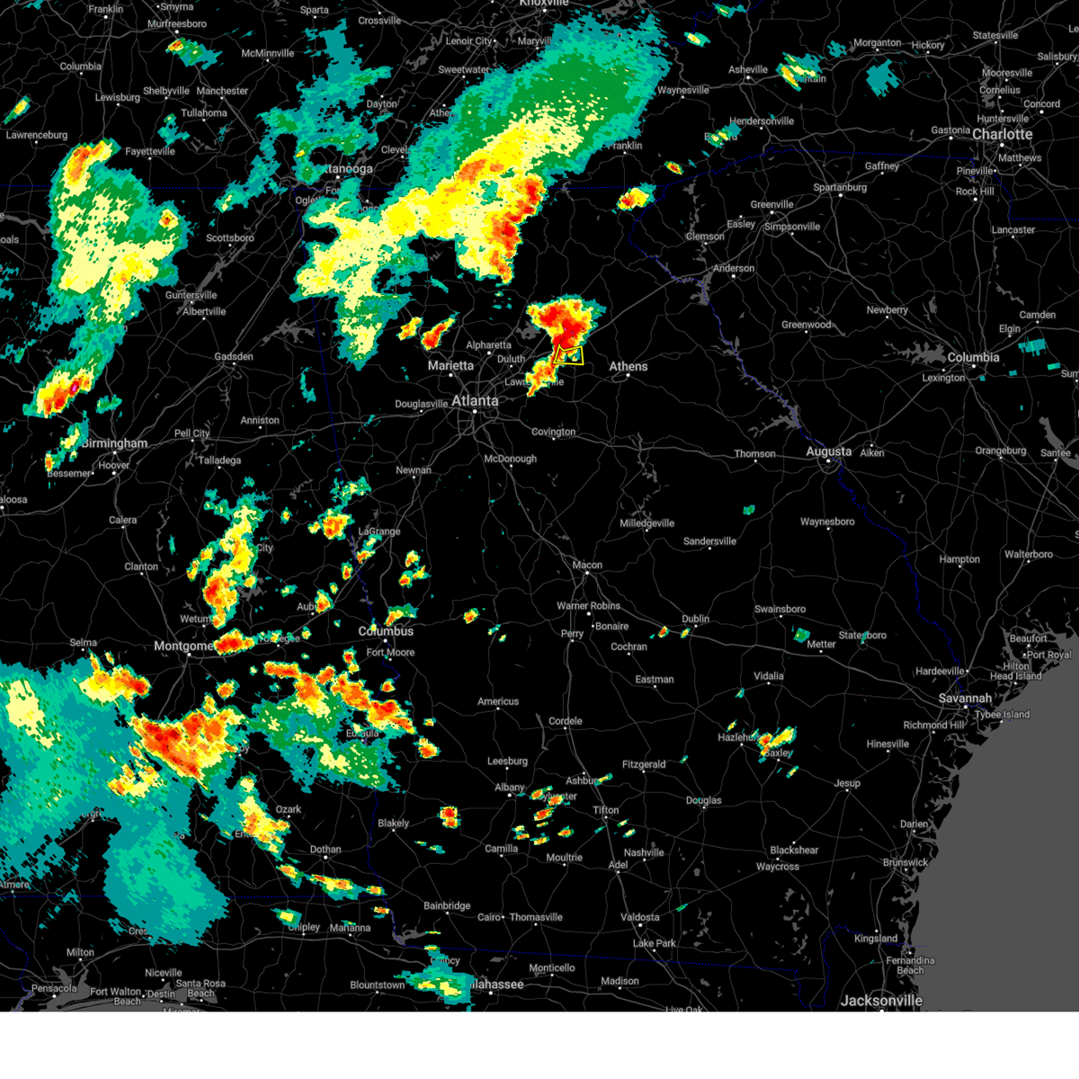
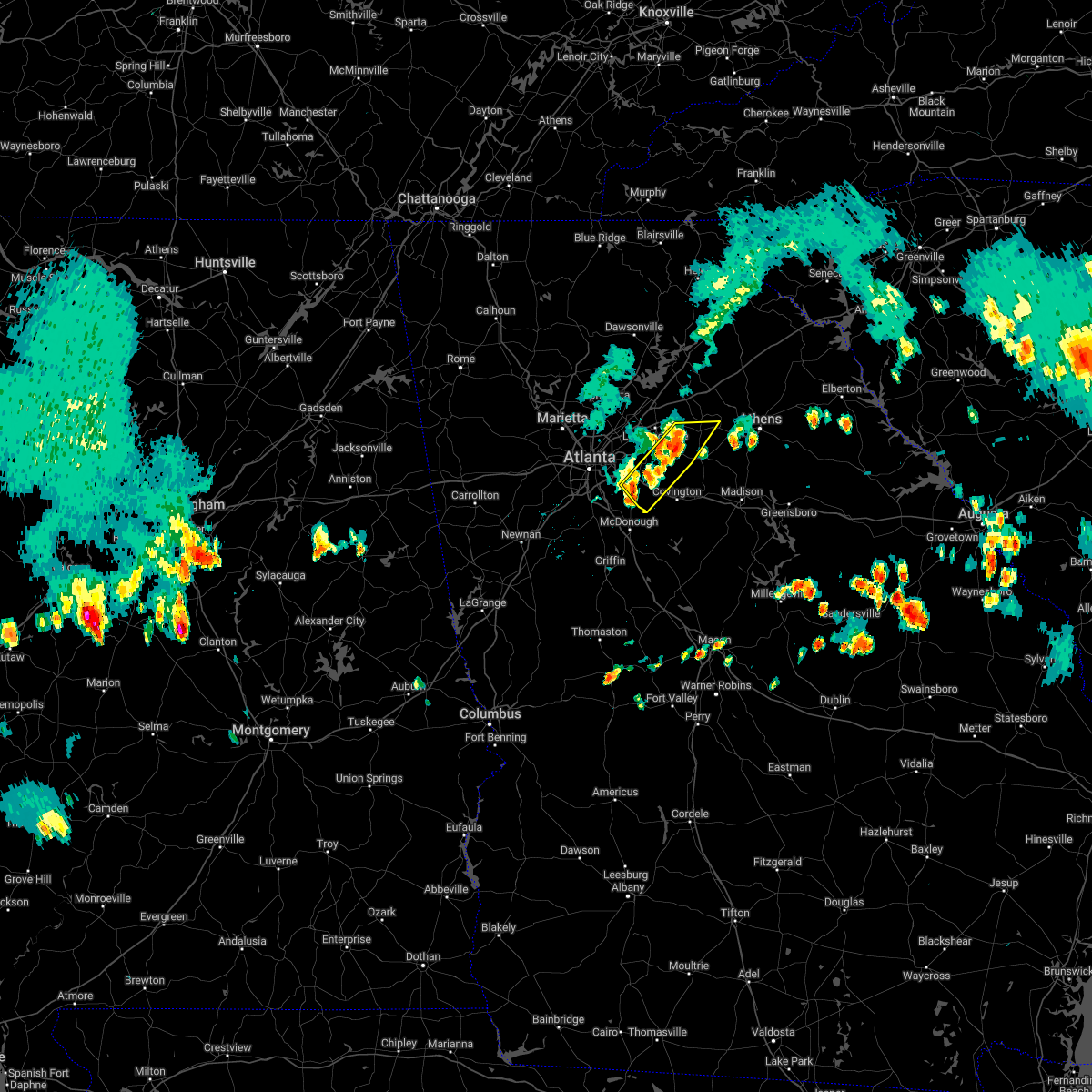
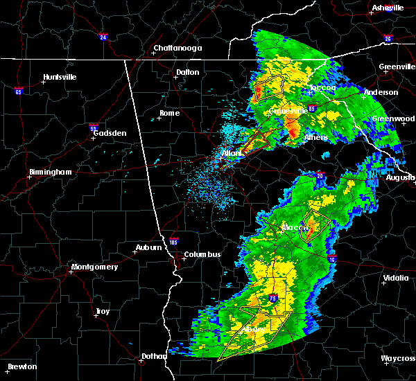
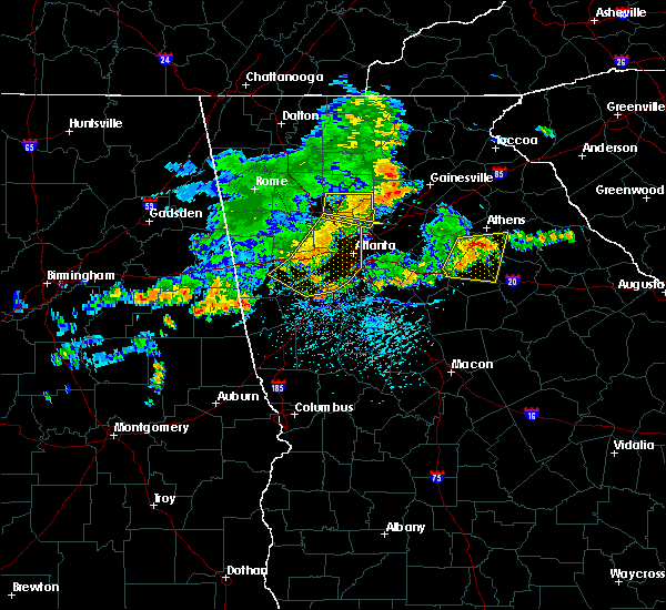
Hail Map for Auburn, GA
The Auburn, GA area has had 3 reports of on-the-ground hail by trained spotters, and has been under severe weather warnings 15 times during the past 12 months. Doppler radar has detected hail at or near Auburn, GA on 18 occasions, including 2 occasions during the past year.
| Name: | Auburn, GA |
| Where Located: | 37 miles ENE of Atlanta, GA |
| Map: | Google Map for Auburn, GA |
| Population: | 6887 |
| Housing Units: | 2543 |
| More Info: | Search Google for Auburn, GA |
1
The Top Recent Hail Date for Auburn, GA is Sunday, August 6, 2023 (7th out of 18)

Hail and Wind Damage Spotted near Auburn, GA
| Date / Time | Report Details |
|---|---|
| 2/28/2024 3:41 PM EST |
 Svrffc the national weather service in peachtree city has issued a * severe thunderstorm warning for, northeastern rockdale county in north central georgia, oconee county in northeastern georgia, barrow county in north central georgia, northwestern morgan county in north central georgia, southeastern gwinnett county in north central georgia, clarke county in northeastern georgia, walton county in north central georgia, southern jackson county in northeastern georgia, northwestern oglethorpe county in northeastern georgia, northeastern newton county in north central georgia, * until 430 pm est. * at 340 pm est, severe thunderstorms were located along a line extending from county line to near loganville to near rosebud, moving east at 45 mph (radar indicated). Hazards include 70 mph wind gusts. Expect considerable tree damage. Damage is likely to mobile homes, roofs, and outbuildings. Svrffc the national weather service in peachtree city has issued a * severe thunderstorm warning for, northeastern rockdale county in north central georgia, oconee county in northeastern georgia, barrow county in north central georgia, northwestern morgan county in north central georgia, southeastern gwinnett county in north central georgia, clarke county in northeastern georgia, walton county in north central georgia, southern jackson county in northeastern georgia, northwestern oglethorpe county in northeastern georgia, northeastern newton county in north central georgia, * until 430 pm est. * at 340 pm est, severe thunderstorms were located along a line extending from county line to near loganville to near rosebud, moving east at 45 mph (radar indicated). Hazards include 70 mph wind gusts. Expect considerable tree damage. Damage is likely to mobile homes, roofs, and outbuildings.
|
| 2/28/2024 3:13 PM EST |
 Svrffc the national weather service in peachtree city has issued a * severe thunderstorm warning for, barrow county in north central georgia, south central forsyth county in north central georgia, gwinnett county in north central georgia, banks county in northeastern georgia, southern hall county in north central georgia, jackson county in northeastern georgia, northeastern fulton county in north central georgia, western madison county in northeastern georgia, * until 345 pm est. * at 313 pm est, severe thunderstorms were located along a line extending from near pinefield crossroads to talmo to peachtree corners, moving east at 50 mph (radar indicated). Hazards include 60 mph wind gusts and penny size hail. expect damage to roofs, siding, and trees Svrffc the national weather service in peachtree city has issued a * severe thunderstorm warning for, barrow county in north central georgia, south central forsyth county in north central georgia, gwinnett county in north central georgia, banks county in northeastern georgia, southern hall county in north central georgia, jackson county in northeastern georgia, northeastern fulton county in north central georgia, western madison county in northeastern georgia, * until 345 pm est. * at 313 pm est, severe thunderstorms were located along a line extending from near pinefield crossroads to talmo to peachtree corners, moving east at 50 mph (radar indicated). Hazards include 60 mph wind gusts and penny size hail. expect damage to roofs, siding, and trees
|
| 8/27/2023 3:26 PM EDT |
 At 326 pm edt, a severe thunderstorm was located over lawrenceville, moving east at 10 mph (radar indicated). Hazards include 60 mph wind gusts. expect damage to roofs, siding, and trees At 326 pm edt, a severe thunderstorm was located over lawrenceville, moving east at 10 mph (radar indicated). Hazards include 60 mph wind gusts. expect damage to roofs, siding, and trees
|
| 8/7/2023 6:35 PM EDT |
 The severe thunderstorm warning for northeastern rockdale, northwestern oconee, barrow, eastern gwinnett, walton and northeastern newton counties will expire at 645 pm edt, the storms which prompted the warning have moved out of the area. therefore, the warning will be allowed to expire. a severe thunderstorm watch remains in effect until 800 pm edt for north central and northeastern georgia. The severe thunderstorm warning for northeastern rockdale, northwestern oconee, barrow, eastern gwinnett, walton and northeastern newton counties will expire at 645 pm edt, the storms which prompted the warning have moved out of the area. therefore, the warning will be allowed to expire. a severe thunderstorm watch remains in effect until 800 pm edt for north central and northeastern georgia.
|
| 8/7/2023 6:07 PM EDT |
 At 607 pm edt, severe thunderstorms were located along a line extending from dacula to near loganville to lakeview estates, moving east at 45 mph (radar indicated). Hazards include 60 mph wind gusts and quarter size hail. Hail damage to vehicles is expected. Expect wind damage to roofs, siding, and trees. At 607 pm edt, severe thunderstorms were located along a line extending from dacula to near loganville to lakeview estates, moving east at 45 mph (radar indicated). Hazards include 60 mph wind gusts and quarter size hail. Hail damage to vehicles is expected. Expect wind damage to roofs, siding, and trees.
|
| 8/7/2023 5:04 PM EDT |
 At 504 pm edt, severe thunderstorms were located along a line extending from near county line to windsor, moving east at 35 mph (radar indicated). Hazards include 60 mph wind gusts and quarter size hail. Hail damage to vehicles is expected. Expect wind damage to roofs, siding, and trees. At 504 pm edt, severe thunderstorms were located along a line extending from near county line to windsor, moving east at 35 mph (radar indicated). Hazards include 60 mph wind gusts and quarter size hail. Hail damage to vehicles is expected. Expect wind damage to roofs, siding, and trees.
|
| 7/20/2023 6:13 PM EDT |
 At 612 pm edt, severe thunderstorms were located along a line extending from near clermont to suwanee, moving southeast at 50 mph (radar indicated). Hazards include 70 mph wind gusts and penny size hail. Expect considerable tree damage. Damage is likely to mobile homes, roofs, and outbuildings. At 612 pm edt, severe thunderstorms were located along a line extending from near clermont to suwanee, moving southeast at 50 mph (radar indicated). Hazards include 70 mph wind gusts and penny size hail. Expect considerable tree damage. Damage is likely to mobile homes, roofs, and outbuildings.
|
| 7/20/2023 6:03 PM EDT |
 At 603 pm edt, severe thunderstorms were located along a line extending from 6 miles northeast of banks crossing to near duluth, moving southeast at 50 mph (trained weather spotters). Hazards include 70 mph wind gusts and penny size hail. Expect considerable tree damage. damage is likely to mobile homes, roofs, and outbuildings. locations impacted include, gainesville, canton, jefferson, commerce, cumming, homer, sugar hill, suwanee, buford, braselton, auburn, flowery branch, dacula, oakwood, lula, maysville, hoschton, clermont, pendergrass and gillsville. thunderstorm damage threat, considerable hail threat, radar indicated max hail size, 0. 75 in wind threat, observed max wind gust, 70 mph. At 603 pm edt, severe thunderstorms were located along a line extending from 6 miles northeast of banks crossing to near duluth, moving southeast at 50 mph (trained weather spotters). Hazards include 70 mph wind gusts and penny size hail. Expect considerable tree damage. damage is likely to mobile homes, roofs, and outbuildings. locations impacted include, gainesville, canton, jefferson, commerce, cumming, homer, sugar hill, suwanee, buford, braselton, auburn, flowery branch, dacula, oakwood, lula, maysville, hoschton, clermont, pendergrass and gillsville. thunderstorm damage threat, considerable hail threat, radar indicated max hail size, 0. 75 in wind threat, observed max wind gust, 70 mph.
|
| 7/20/2023 5:30 PM EDT |
 At 529 pm edt, severe thunderstorms were located along a line extending from mossy creek to buffington, moving southeast at 50 mph (radar indicated). Hazards include 60 mph wind gusts and quarter size hail. Hail damage to vehicles is expected. Expect wind damage to roofs, siding, and trees. At 529 pm edt, severe thunderstorms were located along a line extending from mossy creek to buffington, moving southeast at 50 mph (radar indicated). Hazards include 60 mph wind gusts and quarter size hail. Hail damage to vehicles is expected. Expect wind damage to roofs, siding, and trees.
|
| 7/2/2023 6:54 PM EDT |
 At 654 pm edt, a severe thunderstorm was located over jefferson, moving northeast at 15 mph (radar indicated). Hazards include 60 mph wind gusts. expect damage to roofs, siding, and trees At 654 pm edt, a severe thunderstorm was located over jefferson, moving northeast at 15 mph (radar indicated). Hazards include 60 mph wind gusts. expect damage to roofs, siding, and trees
|
| 7/2/2023 6:44 PM EDT |
 At 644 pm edt, a severe thunderstorm was located over hoschton, or 7 miles north of winder, moving east at 20 mph (radar indicated). Hazards include 60 mph wind gusts and quarter size hail. Hail damage to vehicles is expected. Expect wind damage to roofs, siding, and trees. At 644 pm edt, a severe thunderstorm was located over hoschton, or 7 miles north of winder, moving east at 20 mph (radar indicated). Hazards include 60 mph wind gusts and quarter size hail. Hail damage to vehicles is expected. Expect wind damage to roofs, siding, and trees.
|
| 6/25/2023 5:43 PM EDT |
 At 543 pm edt, severe thunderstorms were located along a line extending from banks crossing to milton, moving southeast at 45 mph (radar indicated). Hazards include 60 mph wind gusts and penny size hail. expect damage to roofs, siding, and trees At 543 pm edt, severe thunderstorms were located along a line extending from banks crossing to milton, moving southeast at 45 mph (radar indicated). Hazards include 60 mph wind gusts and penny size hail. expect damage to roofs, siding, and trees
|
| 6/11/2023 7:50 PM EDT |
 The severe thunderstorm warning for northwestern barrow and northeastern gwinnett counties will expire at 800 pm edt, the storms which prompted the warning have weakened below severe limits, and have exited the warned area. therefore, the warning will be allowed to expire. The severe thunderstorm warning for northwestern barrow and northeastern gwinnett counties will expire at 800 pm edt, the storms which prompted the warning have weakened below severe limits, and have exited the warned area. therefore, the warning will be allowed to expire.
|
| 6/11/2023 7:35 PM EDT |
 At 735 pm edt, severe thunderstorms were located along a line extending from hog mountain to fort yargo state park, moving northeast at 35 mph (radar indicated). Hazards include 60 mph wind gusts and penny size hail. Expect damage to roofs, siding, and trees. locations impacted include, winder, braselton, auburn, carl, russell, fort yargo state park, county line, chateau elan and hog mountain. hail threat, radar indicated max hail size, 0. 75 in wind threat, radar indicated max wind gust, 60 mph. At 735 pm edt, severe thunderstorms were located along a line extending from hog mountain to fort yargo state park, moving northeast at 35 mph (radar indicated). Hazards include 60 mph wind gusts and penny size hail. Expect damage to roofs, siding, and trees. locations impacted include, winder, braselton, auburn, carl, russell, fort yargo state park, county line, chateau elan and hog mountain. hail threat, radar indicated max hail size, 0. 75 in wind threat, radar indicated max wind gust, 60 mph.
|
| 6/11/2023 7:16 PM EDT |
 At 716 pm edt, a severe thunderstorm was located near lilburn, or near lawrenceville, moving northeast at 30 mph (radar indicated). Hazards include 60 mph wind gusts and quarter size hail. Hail damage to vehicles is expected. Expect wind damage to roofs, siding, and trees. At 716 pm edt, a severe thunderstorm was located near lilburn, or near lawrenceville, moving northeast at 30 mph (radar indicated). Hazards include 60 mph wind gusts and quarter size hail. Hail damage to vehicles is expected. Expect wind damage to roofs, siding, and trees.
|
| 3/26/2023 10:19 PM EDT |
 At 1019 pm edt, a severe thunderstorm was located over hog mountain, or 7 miles north of lawrenceville, moving northeast at 30 mph (radar indicated). Hazards include 60 mph wind gusts and quarter size hail. Hail damage to vehicles is expected. Expect wind damage to roofs, siding, and trees. At 1019 pm edt, a severe thunderstorm was located over hog mountain, or 7 miles north of lawrenceville, moving northeast at 30 mph (radar indicated). Hazards include 60 mph wind gusts and quarter size hail. Hail damage to vehicles is expected. Expect wind damage to roofs, siding, and trees.
|
| 1/12/2023 4:07 PM EST |
 At 406 pm est, severe thunderstorms were located along a line extending from near duluth to stone mountain to near panthersville, moving east at 50 mph (radar indicated). Hazards include 60 mph wind gusts. expect damage to roofs, siding, and trees At 406 pm est, severe thunderstorms were located along a line extending from near duluth to stone mountain to near panthersville, moving east at 50 mph (radar indicated). Hazards include 60 mph wind gusts. expect damage to roofs, siding, and trees
|
| 1/12/2023 3:56 PM EST |
 At 356 pm est, severe thunderstorms were located along a line extending from near gainesville to near duluth, moving east at 60 mph (radar indicated). Hazards include 60 mph wind gusts. expect damage to roofs, siding, and trees At 356 pm est, severe thunderstorms were located along a line extending from near gainesville to near duluth, moving east at 60 mph (radar indicated). Hazards include 60 mph wind gusts. expect damage to roofs, siding, and trees
|
| 6/17/2022 6:40 PM EDT |
 The severe thunderstorm warning for rockdale, southern barrow, southeastern dekalb, southeastern gwinnett, northwestern walton and northwestern newton counties will expire at 645 pm edt, the storm which prompted the warning has weakened below severe limits, and no longer poses an immediate threat to life or property. therefore, the warning will be allowed to expire. remember, a severe thunderstorm warning still remains in effect for portions of rockdale county. The severe thunderstorm warning for rockdale, southern barrow, southeastern dekalb, southeastern gwinnett, northwestern walton and northwestern newton counties will expire at 645 pm edt, the storm which prompted the warning has weakened below severe limits, and no longer poses an immediate threat to life or property. therefore, the warning will be allowed to expire. remember, a severe thunderstorm warning still remains in effect for portions of rockdale county.
|
| 6/17/2022 6:19 PM EDT |
 At 619 pm edt, a severe thunderstorm was located over snellville, or near lawrenceville, moving east at 20 mph (radar indicated). Hazards include 60 mph wind gusts and quarter size hail. Hail damage to vehicles is expected. expect wind damage to roofs, siding, and trees. locations impacted include, conyers, winder, snellville, loganville, dacula, grayson, lithonia, walnut grove, bethlehem, between, lakeview estates, georgia international horse park, fort yargo state park, windsor, harbin, nicholasville, arabia mountain, big haynes creek park, rosebud and bold springs. hail threat, radar indicated max hail size, 1. 00 in wind threat, radar indicated max wind gust, 60 mph. At 619 pm edt, a severe thunderstorm was located over snellville, or near lawrenceville, moving east at 20 mph (radar indicated). Hazards include 60 mph wind gusts and quarter size hail. Hail damage to vehicles is expected. expect wind damage to roofs, siding, and trees. locations impacted include, conyers, winder, snellville, loganville, dacula, grayson, lithonia, walnut grove, bethlehem, between, lakeview estates, georgia international horse park, fort yargo state park, windsor, harbin, nicholasville, arabia mountain, big haynes creek park, rosebud and bold springs. hail threat, radar indicated max hail size, 1. 00 in wind threat, radar indicated max wind gust, 60 mph.
|
| 6/17/2022 5:55 PM EDT |
 At 555 pm edt, a severe thunderstorm was located over lilburn, or 9 miles west of lawrenceville, moving east at 20 mph (radar indicated). Hazards include 60 mph wind gusts and quarter size hail. Hail damage to vehicles is expected. Expect wind damage to roofs, siding, and trees. At 555 pm edt, a severe thunderstorm was located over lilburn, or 9 miles west of lawrenceville, moving east at 20 mph (radar indicated). Hazards include 60 mph wind gusts and quarter size hail. Hail damage to vehicles is expected. Expect wind damage to roofs, siding, and trees.
|
| 8/10/2020 3:27 PM EDT |
 At 327 pm edt, severe thunderstorms were located along a line extending from dacula to lilburn to near sandy plains, moving southeast at 40 mph (radar indicated). Hazards include 60 mph wind gusts and nickel size hail. Expect damage to roofs, siding, and trees. Locations impacted include, atlanta, marietta, lawrenceville, decatur, sandy springs, roswell, johns creek, alpharetta, smyrna, dunwoody, milton, kennesaw, duluth, acworth, sugar hill, snellville, suwanee, buford, lilburn and chamblee. At 327 pm edt, severe thunderstorms were located along a line extending from dacula to lilburn to near sandy plains, moving southeast at 40 mph (radar indicated). Hazards include 60 mph wind gusts and nickel size hail. Expect damage to roofs, siding, and trees. Locations impacted include, atlanta, marietta, lawrenceville, decatur, sandy springs, roswell, johns creek, alpharetta, smyrna, dunwoody, milton, kennesaw, duluth, acworth, sugar hill, snellville, suwanee, buford, lilburn and chamblee.
|
| 8/10/2020 2:54 PM EDT |
 At 253 pm edt, severe thunderstorms were located along a line extending from woodstock to cumming and chestatee, moving southeast at 40 mph (radar indicated). Hazards include 60 mph wind gusts and nickel size hail. expect damage to roofs, siding, and trees At 253 pm edt, severe thunderstorms were located along a line extending from woodstock to cumming and chestatee, moving southeast at 40 mph (radar indicated). Hazards include 60 mph wind gusts and nickel size hail. expect damage to roofs, siding, and trees
|
| 7/25/2020 2:44 PM EDT |
 At 244 pm edt, a severe thunderstorm was located near hog mountain, or near lawrenceville, and is nearly stationary (radar indicated). Hazards include 60 mph wind gusts and quarter size hail. Hail damage to vehicles is expected. expect wind damage to roofs, siding, and trees. Locations impacted include, buford, braselton, dacula and hog mountain. At 244 pm edt, a severe thunderstorm was located near hog mountain, or near lawrenceville, and is nearly stationary (radar indicated). Hazards include 60 mph wind gusts and quarter size hail. Hail damage to vehicles is expected. expect wind damage to roofs, siding, and trees. Locations impacted include, buford, braselton, dacula and hog mountain.
|
| 7/25/2020 2:28 PM EDT |
 At 228 pm edt, a severe thunderstorm was located near hog mountain, or near lawrenceville, and is nearly stationary (radar indicated). Hazards include 60 mph wind gusts and quarter size hail. Hail damage to vehicles is expected. Expect wind damage to roofs, siding, and trees. At 228 pm edt, a severe thunderstorm was located near hog mountain, or near lawrenceville, and is nearly stationary (radar indicated). Hazards include 60 mph wind gusts and quarter size hail. Hail damage to vehicles is expected. Expect wind damage to roofs, siding, and trees.
|
| 7/9/2020 6:56 PM EDT |
 At 656 pm edt, a severe thunderstorm was located over lilburn, or 9 miles west of lawrenceville, moving southeast at 15 mph (radar indicated). Hazards include 60 mph wind gusts and nickel size hail. expect damage to roofs, siding, and trees At 656 pm edt, a severe thunderstorm was located over lilburn, or 9 miles west of lawrenceville, moving southeast at 15 mph (radar indicated). Hazards include 60 mph wind gusts and nickel size hail. expect damage to roofs, siding, and trees
|
| 7/8/2020 8:22 PM EDT |
 At 822 pm edt, a severe thunderstorm was located near rest haven, or 9 miles north of lawrenceville, moving southeast at 10 mph (radar indicated). Hazards include 60 mph wind gusts and quarter size hail. Hail damage to vehicles is expected. Expect wind damage to roofs, siding, and trees. At 822 pm edt, a severe thunderstorm was located near rest haven, or 9 miles north of lawrenceville, moving southeast at 10 mph (radar indicated). Hazards include 60 mph wind gusts and quarter size hail. Hail damage to vehicles is expected. Expect wind damage to roofs, siding, and trees.
|
| 6/27/2020 5:00 PM EDT |
 At 459 pm edt, severe thunderstorms were located along a line extending from near lula to near hoschton to near rosebud, moving east at 40 mph (radar indicated). Hazards include 60 mph wind gusts and penny size hail. expect damage to roofs, siding, and trees At 459 pm edt, severe thunderstorms were located along a line extending from near lula to near hoschton to near rosebud, moving east at 40 mph (radar indicated). Hazards include 60 mph wind gusts and penny size hail. expect damage to roofs, siding, and trees
|
| 6/15/2020 4:02 PM EDT |
 At 401 pm edt, a severe thunderstorm was located over harbin, or near lawrenceville, moving southeast at 25 mph (radar indicated). Hazards include 60 mph wind gusts and quarter size hail. Hail damage to vehicles is expected. Expect wind damage to roofs, siding, and trees. At 401 pm edt, a severe thunderstorm was located over harbin, or near lawrenceville, moving southeast at 25 mph (radar indicated). Hazards include 60 mph wind gusts and quarter size hail. Hail damage to vehicles is expected. Expect wind damage to roofs, siding, and trees.
|
| 4/13/2020 2:46 AM EDT |
 At 246 am edt, a severe thunderstorm was located over road atlanta-lanier speedway, or 10 miles south of gainesville, moving east at 85 mph (radar indicated). Hazards include 60 mph wind gusts. Expect damage to roofs, siding, and trees. Locations impacted include, gainesville, lawrenceville, winder, jefferson, commerce, duluth, sugar hill, suwanee, buford, braselton, auburn, flowery branch, dacula, oakwood, maysville, arcade, nicholson, hoschton, pendergrass and carl. At 246 am edt, a severe thunderstorm was located over road atlanta-lanier speedway, or 10 miles south of gainesville, moving east at 85 mph (radar indicated). Hazards include 60 mph wind gusts. Expect damage to roofs, siding, and trees. Locations impacted include, gainesville, lawrenceville, winder, jefferson, commerce, duluth, sugar hill, suwanee, buford, braselton, auburn, flowery branch, dacula, oakwood, maysville, arcade, nicholson, hoschton, pendergrass and carl.
|
| 4/13/2020 2:22 AM EDT |
 At 222 am edt, a severe thunderstorm was located over roswell, or 11 miles northeast of marietta, moving east at 85 mph (radar indicated). Hazards include 60 mph wind gusts. expect damage to roofs, siding, and trees At 222 am edt, a severe thunderstorm was located over roswell, or 11 miles northeast of marietta, moving east at 85 mph (radar indicated). Hazards include 60 mph wind gusts. expect damage to roofs, siding, and trees
|
| 2/6/2020 8:37 AM EST |
 At 836 am est, a severe thunderstorm capable of producing a tornado was located over auburn, or 7 miles northwest of winder, moving northeast at 55 mph (radar indicated rotation). Hazards include tornado. Flying debris will be dangerous to those caught without shelter. mobile homes will be damaged or destroyed. damage to roofs, windows, and vehicles will occur. tree damage is likely. Locations impacted include, winder, jefferson, braselton, auburn, arcade, hoschton, pendergrass, carl, talmo, fort yargo state park, county line, thompsons mill, chateau elan and russell. At 836 am est, a severe thunderstorm capable of producing a tornado was located over auburn, or 7 miles northwest of winder, moving northeast at 55 mph (radar indicated rotation). Hazards include tornado. Flying debris will be dangerous to those caught without shelter. mobile homes will be damaged or destroyed. damage to roofs, windows, and vehicles will occur. tree damage is likely. Locations impacted include, winder, jefferson, braselton, auburn, arcade, hoschton, pendergrass, carl, talmo, fort yargo state park, county line, thompsons mill, chateau elan and russell.
|
| 2/6/2020 8:28 AM EST |
 At 827 am est, a severe thunderstorm capable of producing a tornado was located over lawrenceville, moving northeast at 55 mph (radar indicated rotation). Hazards include tornado. Flying debris will be dangerous to those caught without shelter. mobile homes will be damaged or destroyed. damage to roofs, windows, and vehicles will occur. tree damage is likely. Locations impacted include, lawrenceville, winder, jefferson, buford, braselton, auburn, dacula, grayson, arcade, hoschton, pendergrass, carl, talmo, fort yargo state park, county line, thompsons mill, harbin, chateau elan, russell and road atlanta-lanier speedway. At 827 am est, a severe thunderstorm capable of producing a tornado was located over lawrenceville, moving northeast at 55 mph (radar indicated rotation). Hazards include tornado. Flying debris will be dangerous to those caught without shelter. mobile homes will be damaged or destroyed. damage to roofs, windows, and vehicles will occur. tree damage is likely. Locations impacted include, lawrenceville, winder, jefferson, buford, braselton, auburn, dacula, grayson, arcade, hoschton, pendergrass, carl, talmo, fort yargo state park, county line, thompsons mill, harbin, chateau elan, russell and road atlanta-lanier speedway.
|
| 2/6/2020 8:16 AM EST |
 At 816 am est, a severe thunderstorm capable of producing a tornado was located over mountain park, or 9 miles southwest of lawrenceville, moving northeast at 55 mph (radar indicated rotation). Hazards include tornado. Flying debris will be dangerous to those caught without shelter. mobile homes will be damaged or destroyed. damage to roofs, windows, and vehicles will occur. Tree damage is likely. At 816 am est, a severe thunderstorm capable of producing a tornado was located over mountain park, or 9 miles southwest of lawrenceville, moving northeast at 55 mph (radar indicated rotation). Hazards include tornado. Flying debris will be dangerous to those caught without shelter. mobile homes will be damaged or destroyed. damage to roofs, windows, and vehicles will occur. Tree damage is likely.
|
| 2/6/2020 7:42 AM EST |
 At 742 am est, a severe thunderstorm was located over chamblee, or 8 miles north of decatur, moving northeast at 70 mph (radar indicated). Hazards include 60 mph wind gusts. expect damage to roofs, siding, and trees At 742 am est, a severe thunderstorm was located over chamblee, or 8 miles north of decatur, moving northeast at 70 mph (radar indicated). Hazards include 60 mph wind gusts. expect damage to roofs, siding, and trees
|
| 1/11/2020 6:10 PM EST |
 At 610 pm est, severe thunderstorms were located along a line extending from near raoul to snellville to near mountain park, moving east at 45 mph (radar indicated). Hazards include 60 mph wind gusts. expect damage to roofs, siding, and trees At 610 pm est, severe thunderstorms were located along a line extending from near raoul to snellville to near mountain park, moving east at 45 mph (radar indicated). Hazards include 60 mph wind gusts. expect damage to roofs, siding, and trees
|
| 10/31/2019 1:44 PM EDT |
 At 144 pm edt, a severe thunderstorm was located over lithonia, or near conyers, moving northeast at 60 mph (radar indicated). Hazards include 60 mph wind gusts. expect damage to roofs, siding, and trees At 144 pm edt, a severe thunderstorm was located over lithonia, or near conyers, moving northeast at 60 mph (radar indicated). Hazards include 60 mph wind gusts. expect damage to roofs, siding, and trees
|
| 7/17/2019 4:21 PM EDT |
 At 421 pm edt, a severe thunderstorm was located about 3 miles southeast of snellville, or 9 miles south of lawrenceville, moving east at 25 mph (radar indicated). Hazards include 60 mph wind gusts. expect damage to roofs, siding, and trees At 421 pm edt, a severe thunderstorm was located about 3 miles southeast of snellville, or 9 miles south of lawrenceville, moving east at 25 mph (radar indicated). Hazards include 60 mph wind gusts. expect damage to roofs, siding, and trees
|
| 6/24/2019 7:20 PM EDT |
 At 720 pm edt, a severe thunderstorm was located over lawrenceville, moving east at 35 mph (radar indicated). Hazards include 60 mph wind gusts. Expect damage to roofs, siding, and trees. Locations impacted include, lawrenceville, duluth, sugar hill, snellville, suwanee, buford, lilburn, norcross, clarkston, braselton, stone mountain, flowery branch, dacula, grayson, pine lake, rest haven, tucker, north decatur, mountain park and chestnut mountain. At 720 pm edt, a severe thunderstorm was located over lawrenceville, moving east at 35 mph (radar indicated). Hazards include 60 mph wind gusts. Expect damage to roofs, siding, and trees. Locations impacted include, lawrenceville, duluth, sugar hill, snellville, suwanee, buford, lilburn, norcross, clarkston, braselton, stone mountain, flowery branch, dacula, grayson, pine lake, rest haven, tucker, north decatur, mountain park and chestnut mountain.
|
| 6/23/2019 4:52 PM EDT |
 At 452 pm edt, severe thunderstorms were located along a line extending from bethlehem to good hope to near rutledge, moving east at 25 mph (radar indicated). Hazards include 60 mph wind gusts and quarter size hail. Hail damage to vehicles is expected. expect wind damage to roofs, siding, and trees. Locations impacted include, winder, monroe, madison, auburn, dacula, social circle, statham, bogart, rutledge, north high shoals, bethlehem, bostwick, between, good hope, carl, bishop, fort yargo state park, windsor, harbin and eastville. At 452 pm edt, severe thunderstorms were located along a line extending from bethlehem to good hope to near rutledge, moving east at 25 mph (radar indicated). Hazards include 60 mph wind gusts and quarter size hail. Hail damage to vehicles is expected. expect wind damage to roofs, siding, and trees. Locations impacted include, winder, monroe, madison, auburn, dacula, social circle, statham, bogart, rutledge, north high shoals, bethlehem, bostwick, between, good hope, carl, bishop, fort yargo state park, windsor, harbin and eastville.
|
| 6/23/2019 4:22 PM EDT |
 At 422 pm edt, a severe thunderstorm was located over harbin, or near lawrenceville, moving east at 15 mph (radar indicated). Hazards include 60 mph wind gusts and quarter size hail. Hail damage to vehicles is expected. expect wind damage to roofs, siding, and trees. Locations impacted include, lawrenceville, snellville, loganville, dacula, grayson, between, bold springs, windsor, harbin, nicholasville, youth and rosebud. At 422 pm edt, a severe thunderstorm was located over harbin, or near lawrenceville, moving east at 15 mph (radar indicated). Hazards include 60 mph wind gusts and quarter size hail. Hail damage to vehicles is expected. expect wind damage to roofs, siding, and trees. Locations impacted include, lawrenceville, snellville, loganville, dacula, grayson, between, bold springs, windsor, harbin, nicholasville, youth and rosebud.
|
| 6/23/2019 4:21 PM EDT |
 At 420 pm edt, severe thunderstorms were located along a line extending from near dacula to between to near covington, moving east at 25 mph (radar indicated). Hazards include 60 mph wind gusts and quarter size hail. Hail damage to vehicles is expected. Expect wind damage to roofs, siding, and trees. At 420 pm edt, severe thunderstorms were located along a line extending from near dacula to between to near covington, moving east at 25 mph (radar indicated). Hazards include 60 mph wind gusts and quarter size hail. Hail damage to vehicles is expected. Expect wind damage to roofs, siding, and trees.
|
| 6/23/2019 4:00 PM EDT |
 At 400 pm edt, a severe thunderstorm was located over lawrenceville, moving east at 15 mph (radar indicated). Hazards include 60 mph wind gusts and quarter size hail. Hail damage to vehicles is expected. Expect wind damage to roofs, siding, and trees. At 400 pm edt, a severe thunderstorm was located over lawrenceville, moving east at 15 mph (radar indicated). Hazards include 60 mph wind gusts and quarter size hail. Hail damage to vehicles is expected. Expect wind damage to roofs, siding, and trees.
|
| 6/22/2019 1:50 AM EDT |
 At 150 am edt, severe thunderstorms were located along a line extending from near eastanolee to near suwanee, moving southeast at 45 mph (radar indicated). Hazards include 60 mph wind gusts. Expect damage to roofs, siding, and trees. Locations impacted include, gainesville, cumming, sandy springs, roswell, johns creek, alpharetta, milton, duluth, sugar hill, suwanee, buford, braselton, flowery branch, oakwood, berkeley lake, rest haven, candler, drew, buford dam-lake lanier parks and coal mountain. At 150 am edt, severe thunderstorms were located along a line extending from near eastanolee to near suwanee, moving southeast at 45 mph (radar indicated). Hazards include 60 mph wind gusts. Expect damage to roofs, siding, and trees. Locations impacted include, gainesville, cumming, sandy springs, roswell, johns creek, alpharetta, milton, duluth, sugar hill, suwanee, buford, braselton, flowery branch, oakwood, berkeley lake, rest haven, candler, drew, buford dam-lake lanier parks and coal mountain.
|
| 6/22/2019 1:17 AM EDT |
 At 116 am edt, severe thunderstorms were located along a line extending from near sautee to canton, moving southeast at 45 mph (radar indicated). Hazards include 60 mph wind gusts. expect damage to roofs, siding, and trees At 116 am edt, severe thunderstorms were located along a line extending from near sautee to canton, moving southeast at 45 mph (radar indicated). Hazards include 60 mph wind gusts. expect damage to roofs, siding, and trees
|
| 4/14/2019 1:27 PM EDT |
 The tornado warning for central gwinnett county will expire at 130 pm edt, the storm which prompted the warning has moved out of the area. therefore, the warning will be allowed to expire. a tornado watch remains in effect until 200 pm edt for north central georgia. The tornado warning for central gwinnett county will expire at 130 pm edt, the storm which prompted the warning has moved out of the area. therefore, the warning will be allowed to expire. a tornado watch remains in effect until 200 pm edt for north central georgia.
|
| 4/14/2019 1:19 PM EDT |
 At 119 pm edt, a severe thunderstorm was located over dacula, or near lawrenceville, moving northeast at 40 mph (radar indicated). Hazards include 60 mph wind gusts. expect damage to roofs, siding, and trees At 119 pm edt, a severe thunderstorm was located over dacula, or near lawrenceville, moving northeast at 40 mph (radar indicated). Hazards include 60 mph wind gusts. expect damage to roofs, siding, and trees
|
| 4/14/2019 1:01 PM EDT |
 At 101 pm edt, a severe thunderstorm capable of producing a tornado was located near snellville, or 8 miles southwest of lawrenceville, moving northeast at 50 mph (radar indicated rotation). Hazards include tornado. Flying debris will be dangerous to those caught without shelter. mobile homes will be damaged or destroyed. damage to roofs, windows, and vehicles will occur. Tree damage is likely. At 101 pm edt, a severe thunderstorm capable of producing a tornado was located near snellville, or 8 miles southwest of lawrenceville, moving northeast at 50 mph (radar indicated rotation). Hazards include tornado. Flying debris will be dangerous to those caught without shelter. mobile homes will be damaged or destroyed. damage to roofs, windows, and vehicles will occur. Tree damage is likely.
|
| 4/14/2019 12:54 PM EDT |
 The severe thunderstorm warning for northwestern oconee, barrow, eastern walton and southwestern jackson counties will expire at 100 pm edt, the storms which prompted the warning have weakened below severe limits, and have exited the warned area. therefore, the warning will be allowed to expire. a tornado watch remains in effect until 200 pm edt for north central and northeastern georgia. The severe thunderstorm warning for northwestern oconee, barrow, eastern walton and southwestern jackson counties will expire at 100 pm edt, the storms which prompted the warning have weakened below severe limits, and have exited the warned area. therefore, the warning will be allowed to expire. a tornado watch remains in effect until 200 pm edt for north central and northeastern georgia.
|
| 4/14/2019 12:36 PM EDT |
 At 1236 pm edt, severe thunderstorms were located along a line extending from auburn to bold springs to near jersey, moving northeast at 55 mph (radar indicated). Hazards include 60 mph wind gusts. Expect damage to roofs, siding, and trees. locations impacted include, winder, monroe, jefferson, braselton, auburn, social circle, statham, hoschton, bethlehem, good hope, carl, ebenezer, fort yargo state park, county line, thompsons mill, nicholasville, chateau elan, pannell, campton and russell. Time, mot, loc 1636z 213deg 123kt 3404 8384 3390 8377 3373 8376. At 1236 pm edt, severe thunderstorms were located along a line extending from auburn to bold springs to near jersey, moving northeast at 55 mph (radar indicated). Hazards include 60 mph wind gusts. Expect damage to roofs, siding, and trees. locations impacted include, winder, monroe, jefferson, braselton, auburn, social circle, statham, hoschton, bethlehem, good hope, carl, ebenezer, fort yargo state park, county line, thompsons mill, nicholasville, chateau elan, pannell, campton and russell. Time, mot, loc 1636z 213deg 123kt 3404 8384 3390 8377 3373 8376.
|
| 4/14/2019 12:30 PM EDT |
 At 1230 pm edt, severe thunderstorms were located along a line extending from near grayson to youth to near oxford, moving northeast at 55 mph (radar indicated). Hazards include 60 mph wind gusts. Expect damage to roofs, siding, and trees. Locations impacted include, lawrenceville, winder, monroe, jefferson, snellville, loganville, braselton, auburn, dacula, social circle, grayson, statham, hoschton, walnut grove, bethlehem, between, good hope, carl, jersey and fort yargo state park. At 1230 pm edt, severe thunderstorms were located along a line extending from near grayson to youth to near oxford, moving northeast at 55 mph (radar indicated). Hazards include 60 mph wind gusts. Expect damage to roofs, siding, and trees. Locations impacted include, lawrenceville, winder, monroe, jefferson, snellville, loganville, braselton, auburn, dacula, social circle, grayson, statham, hoschton, walnut grove, bethlehem, between, good hope, carl, jersey and fort yargo state park.
|
| 4/14/2019 12:18 PM EDT |
 At 1218 pm edt, severe thunderstorms were located along a line extending from near rosebud to near georgia international horse park to rocky plains, moving northeast at 55 mph (radar indicated). Hazards include 60 mph wind gusts. expect damage to roofs, siding, and trees At 1218 pm edt, severe thunderstorms were located along a line extending from near rosebud to near georgia international horse park to rocky plains, moving northeast at 55 mph (radar indicated). Hazards include 60 mph wind gusts. expect damage to roofs, siding, and trees
|
| 9/26/2018 5:31 PM EDT |
 At 530 pm edt, a severe thunderstorm was located over thompsons mill, or 9 miles northwest of winder, moving east at 15 mph (radar indicated). Hazards include 60 mph wind gusts. Expect damage to roofs, siding, and trees. Locations impacted include, winder, jefferson, braselton, auburn, hoschton, pendergrass, carl, talmo, candler, county line, thompsons mill, chateau elan, chestnut mountain and road atlanta-lanier speedway. At 530 pm edt, a severe thunderstorm was located over thompsons mill, or 9 miles northwest of winder, moving east at 15 mph (radar indicated). Hazards include 60 mph wind gusts. Expect damage to roofs, siding, and trees. Locations impacted include, winder, jefferson, braselton, auburn, hoschton, pendergrass, carl, talmo, candler, county line, thompsons mill, chateau elan, chestnut mountain and road atlanta-lanier speedway.
|
| 9/26/2018 5:08 PM EDT |
 At 508 pm edt, a severe thunderstorm was located over hog mountain, or 10 miles northeast of lawrenceville, moving east at 15 mph (radar indicated). Hazards include 60 mph wind gusts and quarter size hail. Hail damage to vehicles is expected. Expect wind damage to roofs, siding, and trees. At 508 pm edt, a severe thunderstorm was located over hog mountain, or 10 miles northeast of lawrenceville, moving east at 15 mph (radar indicated). Hazards include 60 mph wind gusts and quarter size hail. Hail damage to vehicles is expected. Expect wind damage to roofs, siding, and trees.
|
| 7/22/2018 6:50 PM EDT |
 At 650 pm edt, a severe thunderstorm was located over auburn, or 7 miles northwest of winder, moving east at 10 mph (radar indicated). Hazards include 60 mph wind gusts and quarter size hail. Hail damage to vehicles is expected. Expect wind damage to roofs, siding, and trees. At 650 pm edt, a severe thunderstorm was located over auburn, or 7 miles northwest of winder, moving east at 10 mph (radar indicated). Hazards include 60 mph wind gusts and quarter size hail. Hail damage to vehicles is expected. Expect wind damage to roofs, siding, and trees.
|
| 7/21/2018 8:22 PM EDT |
 At 822 pm edt, a severe thunderstorm was located near bold springs, or near winder, moving east at 40 mph (radar indicated). Hazards include golf ball size hail and 60 mph wind gusts. People and animals outdoors will be injured. expect hail damage to roofs, siding, windows, and vehicles. Expect wind damage to roofs, siding, and trees. At 822 pm edt, a severe thunderstorm was located near bold springs, or near winder, moving east at 40 mph (radar indicated). Hazards include golf ball size hail and 60 mph wind gusts. People and animals outdoors will be injured. expect hail damage to roofs, siding, windows, and vehicles. Expect wind damage to roofs, siding, and trees.
|
| 7/21/2018 8:19 PM EDT |
 At 819 pm edt, a severe thunderstorm was located near harbin, or near winder, moving east at 40 mph (radar indicated). Hazards include two inch hail and 60 mph wind gusts. People and animals outdoors will be injured. expect hail damage to roofs, siding, windows, and vehicles. expect wind damage to roofs, siding, and trees. Locations impacted include, lawrenceville, auburn, dacula, grayson, carl, county line and harbin. At 819 pm edt, a severe thunderstorm was located near harbin, or near winder, moving east at 40 mph (radar indicated). Hazards include two inch hail and 60 mph wind gusts. People and animals outdoors will be injured. expect hail damage to roofs, siding, windows, and vehicles. expect wind damage to roofs, siding, and trees. Locations impacted include, lawrenceville, auburn, dacula, grayson, carl, county line and harbin.
|
| 7/21/2018 8:04 PM EDT |
 At 804 pm edt, a severe thunderstorm was located over lawrenceville, moving east at 40 mph (radar indicated). Hazards include 60 mph wind gusts and quarter size hail. Hail damage to vehicles is expected. Expect wind damage to roofs, siding, and trees. At 804 pm edt, a severe thunderstorm was located over lawrenceville, moving east at 40 mph (radar indicated). Hazards include 60 mph wind gusts and quarter size hail. Hail damage to vehicles is expected. Expect wind damage to roofs, siding, and trees.
|
| 7/21/2018 6:50 AM EDT |
 At 648 am edt, severe thunderstorms were located along a line extending from near rosebud to near loganville to near fort yargo state park, moving southeast at 45 mph (radar indicated). Hazards include 60 mph wind gusts and quarter size hail. Hail damage to vehicles is expected. expect wind damage to roofs, siding, and trees. Locations impacted include, lawrenceville, winder, monroe, snellville, loganville, auburn, dacula, grayson, walnut grove, bethlehem, between, good hope, carl, jersey, mountain park, fort yargo state park, windsor, harbin, nicholasville and pannell. At 648 am edt, severe thunderstorms were located along a line extending from near rosebud to near loganville to near fort yargo state park, moving southeast at 45 mph (radar indicated). Hazards include 60 mph wind gusts and quarter size hail. Hail damage to vehicles is expected. expect wind damage to roofs, siding, and trees. Locations impacted include, lawrenceville, winder, monroe, snellville, loganville, auburn, dacula, grayson, walnut grove, bethlehem, between, good hope, carl, jersey, mountain park, fort yargo state park, windsor, harbin, nicholasville and pannell.
|
| 7/21/2018 6:25 AM EDT |
 At 625 am edt, severe thunderstorms were located along a line extending from lake lanier islands to suwanee to near berkeley lake, moving southeast at 45 mph (radar indicated). Hazards include 60 mph wind gusts and quarter size hail. Hail damage to vehicles is expected. Expect wind damage to roofs, siding, and trees. At 625 am edt, severe thunderstorms were located along a line extending from lake lanier islands to suwanee to near berkeley lake, moving southeast at 45 mph (radar indicated). Hazards include 60 mph wind gusts and quarter size hail. Hail damage to vehicles is expected. Expect wind damage to roofs, siding, and trees.
|
| 6/1/2018 4:33 PM EDT |
 At 433 pm edt, a severe thunderstorm was located over oakwood, or near gainesville, moving east at 20 mph (radar indicated). Hazards include 60 mph wind gusts and quarter size hail. Hail damage to vehicles is expected. expect wind damage to roofs, siding, and trees. Locations impacted include, gainesville, sugar hill, buford, braselton, flowery branch, oakwood, rest haven, candler, aqualand park, chestnut mountain, road atlanta-lanier speedway, lake lanier islands and buford dam-lake lanier parks. At 433 pm edt, a severe thunderstorm was located over oakwood, or near gainesville, moving east at 20 mph (radar indicated). Hazards include 60 mph wind gusts and quarter size hail. Hail damage to vehicles is expected. expect wind damage to roofs, siding, and trees. Locations impacted include, gainesville, sugar hill, buford, braselton, flowery branch, oakwood, rest haven, candler, aqualand park, chestnut mountain, road atlanta-lanier speedway, lake lanier islands and buford dam-lake lanier parks.
|
| 6/1/2018 4:02 PM EDT |
 At 402 pm edt, a severe thunderstorm was located near coal mountain, or near cumming, moving east at 15 mph (radar indicated). Hazards include 60 mph wind gusts and quarter size hail. Hail damage to vehicles is expected. Expect wind damage to roofs, siding, and trees. At 402 pm edt, a severe thunderstorm was located near coal mountain, or near cumming, moving east at 15 mph (radar indicated). Hazards include 60 mph wind gusts and quarter size hail. Hail damage to vehicles is expected. Expect wind damage to roofs, siding, and trees.
|
| 7/23/2017 7:12 PM EDT |
 At 711 pm edt, a severe thunderstorm was located over auburn, moving east at 10 mph (radar indicated). Hazards include 60 mph wind gusts and quarter size hail. Hail damage to vehicles is expected. Expect wind damage to roofs, siding, and trees. At 711 pm edt, a severe thunderstorm was located over auburn, moving east at 10 mph (radar indicated). Hazards include 60 mph wind gusts and quarter size hail. Hail damage to vehicles is expected. Expect wind damage to roofs, siding, and trees.
|
| 7/7/2017 4:15 PM EDT |
 The national weather service in peachtree city has issued a * severe thunderstorm warning for. north central oconee county in northeastern georgia. barrow county in north central georgia. northwestern clarke county in northeastern georgia. Southern jackson county in northeastern georgia. The national weather service in peachtree city has issued a * severe thunderstorm warning for. north central oconee county in northeastern georgia. barrow county in north central georgia. northwestern clarke county in northeastern georgia. Southern jackson county in northeastern georgia.
|
| 7/1/2017 5:27 PM EDT |
 At 527 pm edt, a severe thunderstorm was located over lawrenceville, moving east at 35 mph (radar indicated). Hazards include 60 mph wind gusts and quarter size hail. Hail damage to vehicles is expected. Expect wind damage to roofs, siding, and trees. At 527 pm edt, a severe thunderstorm was located over lawrenceville, moving east at 35 mph (radar indicated). Hazards include 60 mph wind gusts and quarter size hail. Hail damage to vehicles is expected. Expect wind damage to roofs, siding, and trees.
|
| 6/23/2017 8:50 PM EDT |
 At 849 pm edt, a severe thunderstorm was located near hog mountain, or 11 miles northeast of lawrenceville, moving east at 50 mph (radar indicated). Hazards include 60 mph wind gusts. expect damage to roofs, siding, and trees At 849 pm edt, a severe thunderstorm was located near hog mountain, or 11 miles northeast of lawrenceville, moving east at 50 mph (radar indicated). Hazards include 60 mph wind gusts. expect damage to roofs, siding, and trees
|
| 6/15/2017 5:32 PM EDT |
 At 531 pm edt, a severe thunderstorm was located near hog mountain, or near lawrenceville, and is nearly stationary (radar indicated). Hazards include 60 mph wind gusts. expect damage to roofs, siding, and trees At 531 pm edt, a severe thunderstorm was located near hog mountain, or near lawrenceville, and is nearly stationary (radar indicated). Hazards include 60 mph wind gusts. expect damage to roofs, siding, and trees
|
| 5/12/2017 7:21 PM EDT |
 The severe thunderstorm warning for southwestern barrow and east central gwinnett counties will expire at 730 pm edt, the storm which prompted the warning has weakened below severe limits, and no longer poses an immediate threat to life or property. therefore the warning will be allowed to expire. The severe thunderstorm warning for southwestern barrow and east central gwinnett counties will expire at 730 pm edt, the storm which prompted the warning has weakened below severe limits, and no longer poses an immediate threat to life or property. therefore the warning will be allowed to expire.
|
| 5/12/2017 6:53 PM EDT |
 At 653 pm edt, a severe thunderstorm was located over lawrenceville, moving northeast at 15 mph (radar indicated). Hazards include 60 mph wind gusts and penny size hail. Expect damage to roofs, siding, and trees. Locations impacted include, lawrenceville, auburn, dacula, grayson, carl and harbin. At 653 pm edt, a severe thunderstorm was located over lawrenceville, moving northeast at 15 mph (radar indicated). Hazards include 60 mph wind gusts and penny size hail. Expect damage to roofs, siding, and trees. Locations impacted include, lawrenceville, auburn, dacula, grayson, carl and harbin.
|
| 5/12/2017 6:43 PM EDT |
 At 643 pm edt, a severe thunderstorm was located over grayson, or over lawrenceville, moving northeast at 15 mph (radar indicated). Hazards include 60 mph wind gusts and quarter size hail. Hail damage to vehicles is expected. Expect wind damage to roofs, siding, and trees. At 643 pm edt, a severe thunderstorm was located over grayson, or over lawrenceville, moving northeast at 15 mph (radar indicated). Hazards include 60 mph wind gusts and quarter size hail. Hail damage to vehicles is expected. Expect wind damage to roofs, siding, and trees.
|
| 4/5/2017 11:07 PM EDT | Ping Pong Ball sized hail reported 0.5 miles NNW of Auburn, GA, ping pong ball sized hail reported in auburn ga |
| 4/5/2017 11:06 PM EDT |
 At 1106 pm edt, a severe thunderstorm was located over talmo, or 8 miles southeast of gainesville, moving east at 70 mph (radar indicated). Hazards include 60 mph wind gusts and quarter size hail. Hail damage to vehicles is expected. Expect wind damage to roofs, siding, and trees. At 1106 pm edt, a severe thunderstorm was located over talmo, or 8 miles southeast of gainesville, moving east at 70 mph (radar indicated). Hazards include 60 mph wind gusts and quarter size hail. Hail damage to vehicles is expected. Expect wind damage to roofs, siding, and trees.
|
| 4/5/2017 12:07 PM EDT |
 At 1207 pm edt, severe thunderstorms were located along a line extending from near dacula to gum creek, moving northeast at 65 mph (radar indicated). Hazards include 60 mph wind gusts and half dollar size hail. Hail damage to vehicles is expected. Expect wind damage to roofs, siding, and trees. At 1207 pm edt, severe thunderstorms were located along a line extending from near dacula to gum creek, moving northeast at 65 mph (radar indicated). Hazards include 60 mph wind gusts and half dollar size hail. Hail damage to vehicles is expected. Expect wind damage to roofs, siding, and trees.
|
| 3/30/2017 9:06 PM EDT |
 The severe thunderstorm warning for gwinnett county will expire at 915 pm edt, the storm which prompted the warning has weakened below severe limits, and is exiting the warned area. therefore, the warning will be allowed to expire. however gusty winds over 40 mph are still possible with this thunderstorm. The severe thunderstorm warning for gwinnett county will expire at 915 pm edt, the storm which prompted the warning has weakened below severe limits, and is exiting the warned area. therefore, the warning will be allowed to expire. however gusty winds over 40 mph are still possible with this thunderstorm.
|
| 3/30/2017 8:48 PM EDT |
 At 848 pm edt, a severe thunderstorm was located near snellville, moving north at 40 mph (radar indicated). Hazards include 60 mph wind gusts and penny size hail. Expect damage to roofs, siding, and trees. Locations impacted include, lawrenceville, duluth, sugar hill, snellville, suwanee, buford, lilburn, norcross, dacula, grayson, berkeley lake, tucker, mountain park, harbin, rosebud and hog mountain. At 848 pm edt, a severe thunderstorm was located near snellville, moving north at 40 mph (radar indicated). Hazards include 60 mph wind gusts and penny size hail. Expect damage to roofs, siding, and trees. Locations impacted include, lawrenceville, duluth, sugar hill, snellville, suwanee, buford, lilburn, norcross, dacula, grayson, berkeley lake, tucker, mountain park, harbin, rosebud and hog mountain.
|
| 3/30/2017 8:38 PM EDT |
 At 838 pm edt, a severe thunderstorm was located near mountain park, moving north at 40 mph (radar indicated). Hazards include 60 mph wind gusts and penny size hail. expect damage to roofs, siding, and trees At 838 pm edt, a severe thunderstorm was located near mountain park, moving north at 40 mph (radar indicated). Hazards include 60 mph wind gusts and penny size hail. expect damage to roofs, siding, and trees
|
| 3/21/2017 8:44 PM EDT |
 At 843 pm edt, severe thunderstorms were located extending from demorest to near gainesville to buford, moving east-southeast at 50 mph (radar indicated, plus multiple reports of downed trees and powerlines due to the very strong winds). Hazards include 60 mph wind gusts and penny size hail. expect damage to roofs, siding, and trees At 843 pm edt, severe thunderstorms were located extending from demorest to near gainesville to buford, moving east-southeast at 50 mph (radar indicated, plus multiple reports of downed trees and powerlines due to the very strong winds). Hazards include 60 mph wind gusts and penny size hail. expect damage to roofs, siding, and trees
|
| 3/21/2017 8:10 PM EDT |
 The severe thunderstorm warning for southwestern barrow, east central gwinnett and northwestern walton counties will expire at 815 pm edt, the storm which prompted the warning has moved out of the area. therefore the warning will be allowed to expire. a severe thunderstorm watch remains in effect until 1100 pm edt for north central georgia. remember, a severe thunderstorm warning still remains in effect for northeast portions of walton county. The severe thunderstorm warning for southwestern barrow, east central gwinnett and northwestern walton counties will expire at 815 pm edt, the storm which prompted the warning has moved out of the area. therefore the warning will be allowed to expire. a severe thunderstorm watch remains in effect until 1100 pm edt for north central georgia. remember, a severe thunderstorm warning still remains in effect for northeast portions of walton county.
|
| 3/21/2017 7:48 PM EDT |
 At 748 pm edt, a severe thunderstorm was located over harbin, or near winder, moving east at 30 mph (radar indicated). Hazards include 60 mph wind gusts and quarter size hail. Hail damage to vehicles is expected. expect wind damage to roofs, siding, and trees. Locations impacted include, winder, auburn, dacula, bethlehem, carl, russell, fort yargo state park, bold springs, windsor, harbin, nicholasville and campton. At 748 pm edt, a severe thunderstorm was located over harbin, or near winder, moving east at 30 mph (radar indicated). Hazards include 60 mph wind gusts and quarter size hail. Hail damage to vehicles is expected. expect wind damage to roofs, siding, and trees. Locations impacted include, winder, auburn, dacula, bethlehem, carl, russell, fort yargo state park, bold springs, windsor, harbin, nicholasville and campton.
|
| 3/21/2017 7:33 PM EDT |
 At 732 pm edt, a severe thunderstorm was located over lawrenceville, moving east at 30 mph (radar indicated). Hazards include 60 mph wind gusts and quarter size hail. Hail damage to vehicles is expected. Expect wind damage to roofs, siding, and trees. At 732 pm edt, a severe thunderstorm was located over lawrenceville, moving east at 30 mph (radar indicated). Hazards include 60 mph wind gusts and quarter size hail. Hail damage to vehicles is expected. Expect wind damage to roofs, siding, and trees.
|
| 3/10/2017 3:28 AM EST |
 At 328 am est, a severe thunderstorm was located over lathemtown, or 9 miles east of canton, moving east at 55 mph (radar indicated). Hazards include 60 mph wind gusts and quarter size hail. Hail damage to vehicles is expected. Expect wind damage to roofs, siding, and trees. At 328 am est, a severe thunderstorm was located over lathemtown, or 9 miles east of canton, moving east at 55 mph (radar indicated). Hazards include 60 mph wind gusts and quarter size hail. Hail damage to vehicles is expected. Expect wind damage to roofs, siding, and trees.
|
| 11/30/2016 2:43 PM EST |
 At 242 pm est, a severe thunderstorm capable of producing a tornado was located over harbin, or near winder, moving east at 35 mph (radar indicated rotation). Hazards include tornado. Flying debris will be dangerous to those caught without shelter. mobile homes will be damaged or destroyed. damage to roofs, windows, and vehicles will occur. Tree damage is likely. At 242 pm est, a severe thunderstorm capable of producing a tornado was located over harbin, or near winder, moving east at 35 mph (radar indicated rotation). Hazards include tornado. Flying debris will be dangerous to those caught without shelter. mobile homes will be damaged or destroyed. damage to roofs, windows, and vehicles will occur. Tree damage is likely.
|
| 11/30/2016 2:28 PM EST |
 At 228 pm est, severe thunderstorms were located along a line extending from oscarville to near thompsons mill to grayson, moving northeast at 60 mph (radar indicated). Hazards include 60 mph wind gusts. Expect damage to roofs. siding. And trees. At 228 pm est, severe thunderstorms were located along a line extending from oscarville to near thompsons mill to grayson, moving northeast at 60 mph (radar indicated). Hazards include 60 mph wind gusts. Expect damage to roofs. siding. And trees.
|
| 11/30/2016 2:08 PM EST |
 At 207 pm est, severe thunderstorms were located along a line extending from berkeley lake to lilburn to belvedere park, moving northeast at 60 mph (radar indicated). Hazards include 60 mph wind gusts. Expect damage to roofs. siding. And trees. At 207 pm est, severe thunderstorms were located along a line extending from berkeley lake to lilburn to belvedere park, moving northeast at 60 mph (radar indicated). Hazards include 60 mph wind gusts. Expect damage to roofs. siding. And trees.
|
| 7/21/2016 5:58 PM EDT |
 At 557 pm edt, a severe thunderstorm was located over winder, moving south at 10 mph (radar indicated). Hazards include 60 mph wind gusts and quarter size hail. Hail damage to vehicles is expected. expect wind damage to roofs, siding, and trees. Other locations in the warning include but are not limited to winder, jefferson, auburn, statham, arcade, hoschton, bogart, north high shoals, bethlehem, carl, nicholasville, gratis, campton, county line, russell, bold springs, fort yargo state park and eastville. At 557 pm edt, a severe thunderstorm was located over winder, moving south at 10 mph (radar indicated). Hazards include 60 mph wind gusts and quarter size hail. Hail damage to vehicles is expected. expect wind damage to roofs, siding, and trees. Other locations in the warning include but are not limited to winder, jefferson, auburn, statham, arcade, hoschton, bogart, north high shoals, bethlehem, carl, nicholasville, gratis, campton, county line, russell, bold springs, fort yargo state park and eastville.
|
| 7/21/2016 4:03 PM EDT |
 At 403 pm edt, a severe thunderstorm was located over lawrenceville, moving southeast at 15 mph (radar indicated). Hazards include 60 mph wind gusts and quarter size hail. Hail damage to vehicles is expected. expect wind damage to roofs, siding, and trees. Other locations in the warning include but are not limited to lawrenceville, monroe, snellville, loganville, dacula, grayson, walnut grove, between, nicholasville, bold springs, harbin, rosebud, hog mountain, youth and windsor. At 403 pm edt, a severe thunderstorm was located over lawrenceville, moving southeast at 15 mph (radar indicated). Hazards include 60 mph wind gusts and quarter size hail. Hail damage to vehicles is expected. expect wind damage to roofs, siding, and trees. Other locations in the warning include but are not limited to lawrenceville, monroe, snellville, loganville, dacula, grayson, walnut grove, between, nicholasville, bold springs, harbin, rosebud, hog mountain, youth and windsor.
|
| 7/18/2016 4:25 PM EDT |
 At 424 pm edt, a severe thunderstorm was located near loganville, moving southeast at 10 mph (radar indicated). Hazards include 60 mph wind gusts and quarter size hail. Hail damage to vehicles is expected. expect wind damage to roofs, siding, and trees. Other locations in the warning include but are not limited to lawrenceville, winder, monroe, snellville, loganville, auburn, dacula, grayson, walnut grove, bethlehem, between, carl, jersey, nicholasville, gratis, campton, bold springs, fort yargo state park, big haynes creek park and harbin. At 424 pm edt, a severe thunderstorm was located near loganville, moving southeast at 10 mph (radar indicated). Hazards include 60 mph wind gusts and quarter size hail. Hail damage to vehicles is expected. expect wind damage to roofs, siding, and trees. Other locations in the warning include but are not limited to lawrenceville, winder, monroe, snellville, loganville, auburn, dacula, grayson, walnut grove, bethlehem, between, carl, jersey, nicholasville, gratis, campton, bold springs, fort yargo state park, big haynes creek park and harbin.
|
| 7/11/2016 7:01 PM EDT |
 At 700 pm edt, severe thunderstorms were located along a line extending from tucker to near loganville to near covington, moving northeast at 45 mph (radar indicated). Hazards include 60 mph wind gusts. Expect damage to roofs. siding. and trees. Other locations in the warning include but are not limited to lawrenceville, conyers, winder, monroe, covington, duluth, sugar hill, snellville, suwanee, buford, lilburn, loganville, norcross, clarkston, braselton, auburn, stone mountain, dacula, social circle and grayson. At 700 pm edt, severe thunderstorms were located along a line extending from tucker to near loganville to near covington, moving northeast at 45 mph (radar indicated). Hazards include 60 mph wind gusts. Expect damage to roofs. siding. and trees. Other locations in the warning include but are not limited to lawrenceville, conyers, winder, monroe, covington, duluth, sugar hill, snellville, suwanee, buford, lilburn, loganville, norcross, clarkston, braselton, auburn, stone mountain, dacula, social circle and grayson.
|
| 6/30/2016 2:32 PM EDT |
 At 231 pm edt, a severe thunderstorm was located over lawrenceville, and is nearly stationary (radar indicated). Hazards include 60 mph wind gusts and quarter size hail. Hail damage to vehicles is expected. expect wind damage to roofs, siding, and trees. Other locations in the warning include but are not limited to lawrenceville, sugar hill, suwanee, buford, dacula, grayson, rest haven and hog mountain. At 231 pm edt, a severe thunderstorm was located over lawrenceville, and is nearly stationary (radar indicated). Hazards include 60 mph wind gusts and quarter size hail. Hail damage to vehicles is expected. expect wind damage to roofs, siding, and trees. Other locations in the warning include but are not limited to lawrenceville, sugar hill, suwanee, buford, dacula, grayson, rest haven and hog mountain.
|
| 4/7/2016 12:27 AM EDT |
 At 1226 am edt, severe thunderstorms were located along a line extending from buford to near lithonia to near sunny side, moving east at 50 mph (radar indicated. damaging winds have already been reported with this line). Hazards include 60 mph wind gusts and nickel size hail. Expect damage to roofs. siding. and trees. Other locations in the warning include but are not limited to lawrenceville, mcdonough, conyers, winder, monroe, covington, jefferson, watkinsville, snellville, buford, loganville, braselton, auburn, locust grove, dacula, social circle, grayson, statham, oxford and arcade. At 1226 am edt, severe thunderstorms were located along a line extending from buford to near lithonia to near sunny side, moving east at 50 mph (radar indicated. damaging winds have already been reported with this line). Hazards include 60 mph wind gusts and nickel size hail. Expect damage to roofs. siding. and trees. Other locations in the warning include but are not limited to lawrenceville, mcdonough, conyers, winder, monroe, covington, jefferson, watkinsville, snellville, buford, loganville, braselton, auburn, locust grove, dacula, social circle, grayson, statham, oxford and arcade.
|
| 8/18/2015 6:11 PM EDT |
 The severe thunderstorm warning for northeastern gwinnett and northwestern barrow counties will expire at 615 pm edt, the severe storm which prompted the warning has weakened below severe limits, and no longer pose an immediate threat to life or property. therefore the warning will be allowed to expire. however small. The severe thunderstorm warning for northeastern gwinnett and northwestern barrow counties will expire at 615 pm edt, the severe storm which prompted the warning has weakened below severe limits, and no longer pose an immediate threat to life or property. therefore the warning will be allowed to expire. however small.
|
| 8/18/2015 5:45 PM EDT |
 At 545 pm edt, a severe thunderstorm was located near buford, or 7 miles north of lawrenceville, moving east at 15 mph (radar indicated). Hazards include 60 mph wind gusts and penny size hail. Expect minor damage to roofs. siding and downed trees. Other locations in the warning include but are not limited to buford, braselton, auburn, rest haven, hog mountain, chateau elan and county line. At 545 pm edt, a severe thunderstorm was located near buford, or 7 miles north of lawrenceville, moving east at 15 mph (radar indicated). Hazards include 60 mph wind gusts and penny size hail. Expect minor damage to roofs. siding and downed trees. Other locations in the warning include but are not limited to buford, braselton, auburn, rest haven, hog mountain, chateau elan and county line.
|
| 8/17/2015 8:06 PM EDT |
 At 805 pm edt, severe thunderstorms were located extending from near hoschton to near bethlehem, moving northeast at 30 mph (radar indicated). Hazards include 60 mph wind gusts. Expect damage to roofs. siding and trees. Other locations in the warning include but are not limited to winder, jefferson, braselton, auburn, statham, arcade, nicholson, hoschton, bethlehem, pendergrass, carl, talmo, gratis, apple valley, bear creek reservoir, chateau elan, campton, peach state speedway, county line and russell. At 805 pm edt, severe thunderstorms were located extending from near hoschton to near bethlehem, moving northeast at 30 mph (radar indicated). Hazards include 60 mph wind gusts. Expect damage to roofs. siding and trees. Other locations in the warning include but are not limited to winder, jefferson, braselton, auburn, statham, arcade, nicholson, hoschton, bethlehem, pendergrass, carl, talmo, gratis, apple valley, bear creek reservoir, chateau elan, campton, peach state speedway, county line and russell.
|
| 8/17/2015 7:47 PM EDT |
 At 747 pm edt, severe thunderstorms were located extending from near dacula to near between, moving northeast at 30 mph (radar indicated). Hazards include 60 mph wind gusts. Expect damage to roofs. siding and trees. Other locations in the warning include but are not limited to lawrenceville, winder, monroe, jefferson, braselton, auburn, dacula, statham, arcade, nicholson, hoschton, bethlehem, pendergrass, between, carl, talmo, gratis, bear creek reservoir, chateau elan and campton. At 747 pm edt, severe thunderstorms were located extending from near dacula to near between, moving northeast at 30 mph (radar indicated). Hazards include 60 mph wind gusts. Expect damage to roofs. siding and trees. Other locations in the warning include but are not limited to lawrenceville, winder, monroe, jefferson, braselton, auburn, dacula, statham, arcade, nicholson, hoschton, bethlehem, pendergrass, between, carl, talmo, gratis, bear creek reservoir, chateau elan and campton.
|
| 8/17/2015 7:35 PM EDT |
 At 734 pm edt, severe thunderstorms were located extending from grayson to near between, moving northeast at 30 mph (radar indicated). Hazards include 60 mph wind gusts. Expect damage to roofs. siding and trees. Other locations in the warning include but are not limited to lawrenceville, winder, monroe, jefferson, snellville, loganville, braselton, auburn, dacula, grayson, statham, arcade, nicholson, hoschton, walnut grove, bethlehem, pendergrass, between, carl and talmo. At 734 pm edt, severe thunderstorms were located extending from grayson to near between, moving northeast at 30 mph (radar indicated). Hazards include 60 mph wind gusts. Expect damage to roofs. siding and trees. Other locations in the warning include but are not limited to lawrenceville, winder, monroe, jefferson, snellville, loganville, braselton, auburn, dacula, grayson, statham, arcade, nicholson, hoschton, walnut grove, bethlehem, pendergrass, between, carl and talmo.
|
| 8/10/2015 6:02 PM EDT |
 At 602 pm edt, a severe thunderstorm was located over winder, moving southeast at 20 mph (radar indicated). Hazards include 60 mph wind gusts and nickel size hail. Expect damage to roofs. siding and trees. Other locations in the warning include but are not limited to winder, jefferson, braselton, auburn, statham, arcade, hoschton, bethlehem, carl, russell, fort yargo state park, bear creek reservoir and county line. At 602 pm edt, a severe thunderstorm was located over winder, moving southeast at 20 mph (radar indicated). Hazards include 60 mph wind gusts and nickel size hail. Expect damage to roofs. siding and trees. Other locations in the warning include but are not limited to winder, jefferson, braselton, auburn, statham, arcade, hoschton, bethlehem, carl, russell, fort yargo state park, bear creek reservoir and county line.
|
| 7/14/2015 9:22 PM EDT |
 At 921 pm edt, severe thunderstorms were located extending from near suwanee to lilburn to pine lake to near hapeville to near college park to near fairburn to near chattahoochee hills, moving southeast at 45 mph (radar indicated). Hazards include 60 mph wind gusts and nickel size hail. Expect damage to roofs. siding and trees. Other locations in the warning include but are not limited to atlanta, newnan, lawrenceville, mcdonough, decatur, fayetteville, conyers, winder, monroe, covington, jonesboro, peachtree city, east point, duluth, stockbridge, union city, sugar hill, forest park, snellville and suwanee. At 921 pm edt, severe thunderstorms were located extending from near suwanee to lilburn to pine lake to near hapeville to near college park to near fairburn to near chattahoochee hills, moving southeast at 45 mph (radar indicated). Hazards include 60 mph wind gusts and nickel size hail. Expect damage to roofs. siding and trees. Other locations in the warning include but are not limited to atlanta, newnan, lawrenceville, mcdonough, decatur, fayetteville, conyers, winder, monroe, covington, jonesboro, peachtree city, east point, duluth, stockbridge, union city, sugar hill, forest park, snellville and suwanee.
|
| 7/14/2015 8:12 PM EDT |
 At 811 pm edt, severe thunderstorms were located extending from 9 miles northwest of gainesville to near flowery branch to near free home, moving southeast at 35 mph (radar indicated). Hazards include 60 mph wind gusts. Expect damage to roofs. siding and trees. Other locations in the warning include but are not limited to gainesville, lawrenceville, winder, jefferson, cumming, duluth, sugar hill, suwanee, buford, braselton, auburn, flowery branch, dacula, oakwood, statham, arcade, hoschton, bethlehem, pendergrass and carl. At 811 pm edt, severe thunderstorms were located extending from 9 miles northwest of gainesville to near flowery branch to near free home, moving southeast at 35 mph (radar indicated). Hazards include 60 mph wind gusts. Expect damage to roofs. siding and trees. Other locations in the warning include but are not limited to gainesville, lawrenceville, winder, jefferson, cumming, duluth, sugar hill, suwanee, buford, braselton, auburn, flowery branch, dacula, oakwood, statham, arcade, hoschton, bethlehem, pendergrass and carl.
|
| 6/24/2015 2:14 PM EDT |
 At 214 pm edt, a severe thunderstorm was located over dacula, or 7 miles northeast of lawrenceville, moving southeast at 10 mph (radar indicated). Hazards include 60 mph wind gusts and penny size hail. Expect damage to roofs. siding and trees. Other locations in the warning include but are not limited to winder, loganville, braselton, auburn, dacula, carl, russell, fort yargo state park, harbin, chateau elan, hog mountain and county line. At 214 pm edt, a severe thunderstorm was located over dacula, or 7 miles northeast of lawrenceville, moving southeast at 10 mph (radar indicated). Hazards include 60 mph wind gusts and penny size hail. Expect damage to roofs. siding and trees. Other locations in the warning include but are not limited to winder, loganville, braselton, auburn, dacula, carl, russell, fort yargo state park, harbin, chateau elan, hog mountain and county line.
|
| 5/31/2015 2:18 PM EDT | At 216 pm edt, a severe thunderstorm was located over flowery branch, or 9 miles southwest of gainesville, moving northeast at 10 mph (radar indicated. at 2pm edt penny sized hail was reported near buford). Hazards include 60 mph wind gusts and nickel size hail. Expect damage to roofs. siding and trees. Other locations in the warning include but are not limited to gainesville, sugar hill, suwanee, buford, braselton, flowery branch, oakwood, rest haven, candler, buford dam-lake lanier parks, aqualand park, lake lanier islands, road atlanta-lanier speedway, chestnut mountain and hog mountain. |
| 5/31/2015 1:49 PM EDT | At 148 pm edt, a severe thunderstorm was located over rest haven, or 10 miles east of cumming, moving northeast at 10 mph (radar indicated). Hazards include 60 mph wind gusts... nickel size hail and heavy rain. Expect damage to roofs. siding and trees. Other locations in the warning include but are not limited to gainesville, cumming, sugar hill, suwanee, buford, braselton, flowery branch, oakwood, rest haven, candler, buford dam-lake lanier parks, aqualand park, lake lanier islands, road atlanta-lanier speedway, chestnut mountain, hog mountain and oscarville. |
| 4/20/2015 4:13 PM EDT | At 412 pm edt, a severe thunderstorm was located over carl, or near winder, moving east at 35 mph (radar indicated). Hazards include 60 mph wind gusts and quarter size hail. Hail damage to vehicles is expected. expect wind damage to roofs, siding and trees. other locations in the warning include but are not limited to winder, jefferson, commerce, athens, braselton, auburn, statham, arcade, nicholson, hoschton, bogart, bethlehem, carl, hull, athens-clarke county (balance), beechwood hills, bear creek reservoir, sandy creek recreation area, fort yargo state park and barretts mill. a tornado watch remains in effect until 800 pm edt for northeastern georgia. 1. 00in. |
| 4/20/2015 3:14 PM EDT | At 304 pm edt, a severe thunderstorm capable of producing a tornado was located near auburn, or 8 miles northwest of winder, moving east at 40 mph (radar indicated rotation). Hazards include tornado and golf ball size hail. Flying debris will be dangerous to those caught without shelter. mobile homes will be damaged or destroyed. damage to roofs, windows and vehicles will occur. tree damage is likely. other locations in the warning include but are not limited to winder, jefferson, braselton, auburn, flowery branch, dacula, hoschton, pendergrass, carl, talmo, candler, chateau elan, county line, road atlanta-lanier speedway, thompsons mill, chestnut mountain and hog mountain. Radar indicated. |
| 4/20/2015 3:04 PM EDT | At 304 pm edt, a severe thunderstorm capable of producing a tornado was located near auburn, or 8 miles northwest of winder, moving east at 40 mph (radar indicated rotation). Hazards include tornado and golf ball size hail. Flying debris will be dangerous to those caught without shelter. mobile homes will be damaged or destroyed. damage to roofs, windows and vehicles will occur. tree damage is likely. other locations in the warning include but are not limited to winder, jefferson, braselton, auburn, flowery branch, dacula, hoschton, pendergrass, carl, talmo, candler, chateau elan, county line, road atlanta-lanier speedway, thompsons mill, chestnut mountain and hog mountain. Radar indicated. |
| 4/20/2015 2:54 PM EDT | At 253 pm edt, a severe thunderstorm capable of producing a tornado was located near sugar hill, or near lawrenceville, moving east at 35 mph (radar indicated rotation). Hazards include tornado and golf ball size hail. Flying debris will be dangerous to those caught without shelter. mobile homes will be damaged or destroyed. damage to roofs, windows and vehicles will occur. tree damage is likely. other locations in the warning include but are not limited to winder, jefferson, sugar hill, suwanee, buford, braselton, auburn, flowery branch, dacula, hoschton, pendergrass, carl, talmo, rest haven, candler, chateau elan, county line, road atlanta-lanier speedway, thompsons mill and chestnut mountain. Radar indicated. |
| 4/20/2015 2:44 PM EDT | At 244 pm edt, a severe thunderstorm capable of producing a tornado was located over suwanee, or 7 miles northwest of lawrenceville, moving east at 35 mph (radar indicated rotation). Hazards include tornado and golf ball size hail. Flying debris will be dangerous to those caught without shelter. mobile homes will be damaged or destroyed. damage to roofs, windows and vehicles will occur. tree damage is likely. other locations in the warning include but are not limited to lawrenceville, winder, jefferson, duluth, sugar hill, suwanee, buford, braselton, auburn, flowery branch, dacula, hoschton, pendergrass, carl, talmo, rest haven, candler, chateau elan, county line and fort yargo state park. Radar indicated. |
| 7/17/2013 7:11 PM EDT | Quarter sized hail reported 2 miles W of Auburn, GA, public reported nickel to quarter size hail 2 miles ene of auburn. |
| 7/17/2013 6:50 PM EDT | Quarter sized hail reported 2 miles W of Auburn, GA, public reported nickel to quarter size hail 2 miles ene of auburn. |
| 6/2/2013 4:35 PM EDT | Report relayed via spotter network. measured wind speed of 53.5 mph. 2 large pine tree tops snapped and trash cans blown more than 100 feet down the roa in barrow county GA, 2.5 miles W of Auburn, GA |
| 1/1/0001 12:00 AM | 3 tress dow in barrow county GA, 0.5 miles NNW of Auburn, GA |
| 1/1/0001 12:00 AM | At least 11 trees down in county line are in barrow county GA, 3.5 miles WSW of Auburn, GA |
| 1/1/0001 12:00 AM | Also 4 inch limbs and branches breaking off of trees in barrow county GA, 0.5 miles NNW of Auburn, GA |
Hail Maps for Auburn, GA


Connect with Interactive Hail Maps