

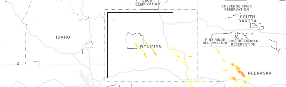
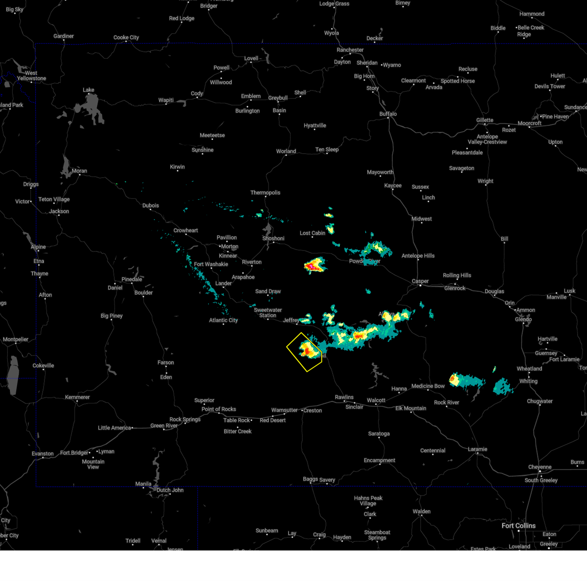
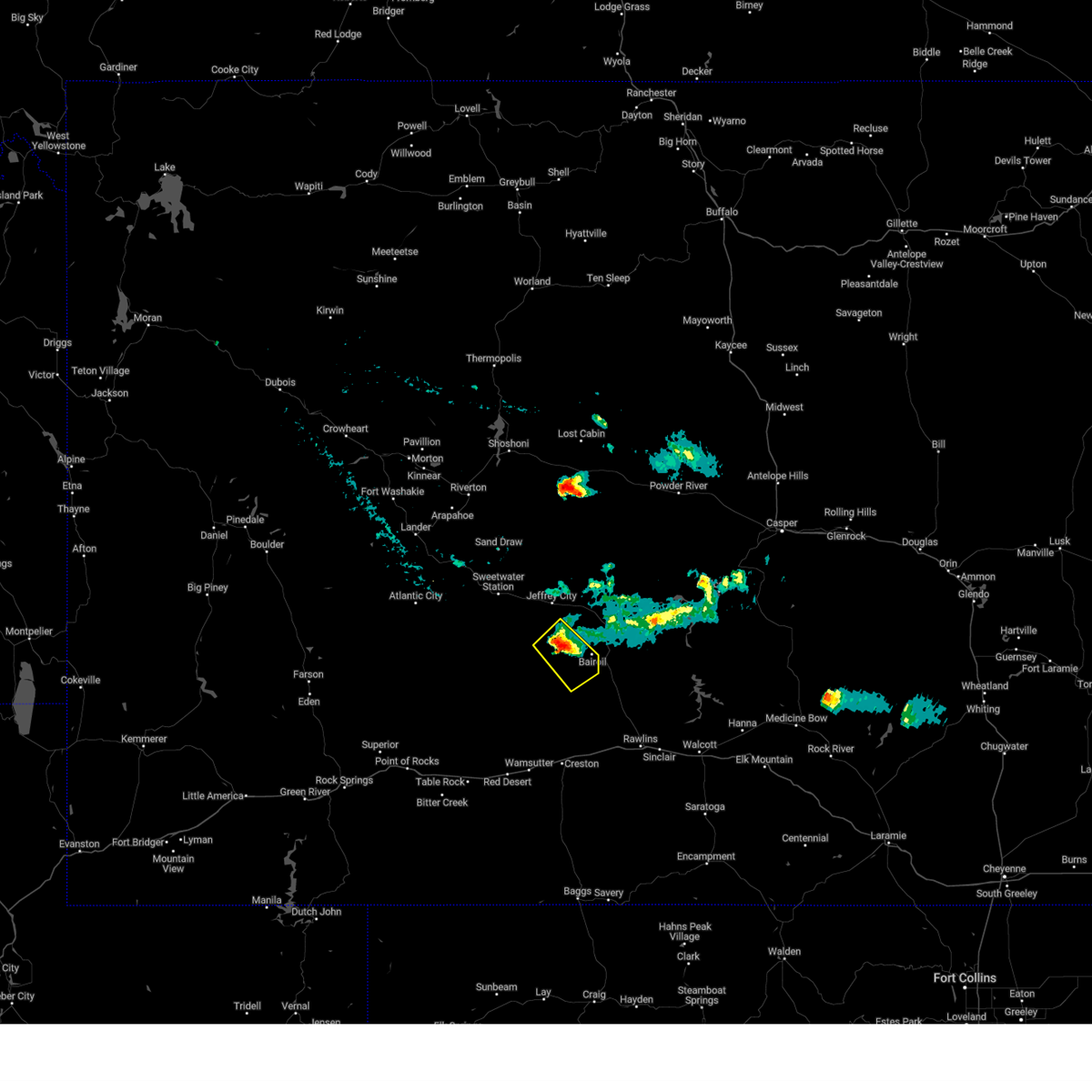
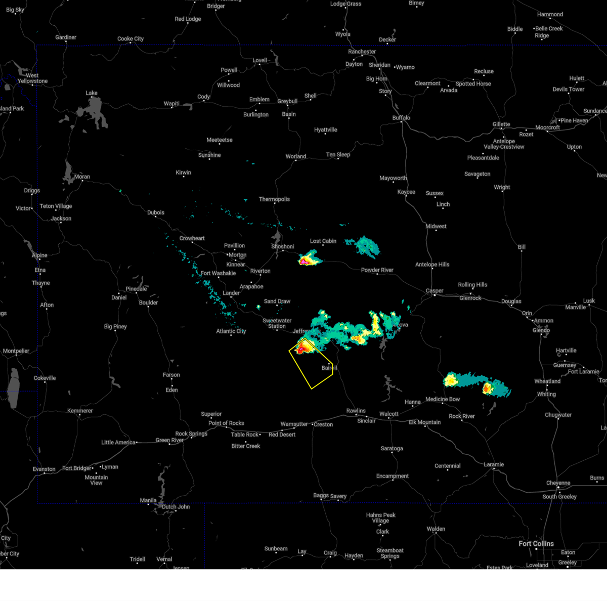
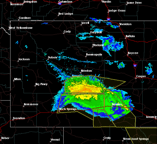
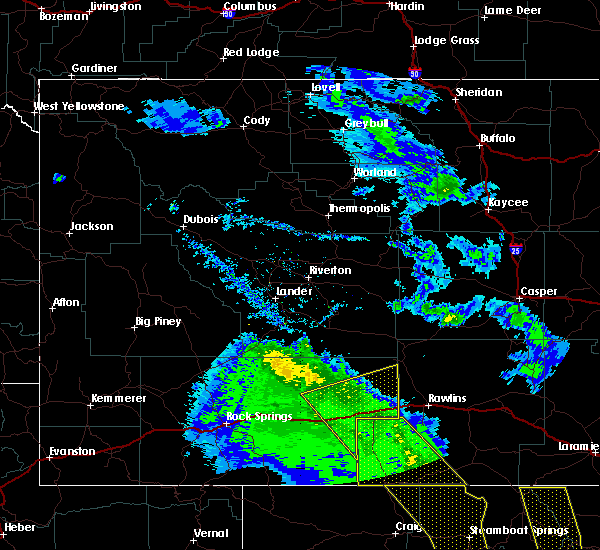
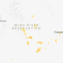
Hail Map for Bairoil, WY
The Bairoil, WY area has had 0 reports of on-the-ground hail by trained spotters, and has been under severe weather warnings 6 times during the past 12 months. Doppler radar has detected hail at or near Bairoil, WY on 7 occasions, including 1 occasion during the past year.
| Name: | Bairoil, WY |
| Where Located: | 68.5 miles SE of Riverton, WY |
| Map: | Google Map for Bairoil, WY |
| Population: | 106 |
| Housing Units: | 68 |
| More Info: | Search Google for Bairoil, WY |
0
The Top Recent Hail Date for Bairoil, WY is Friday, July 14, 2023 (6th out of 7)
Hail and Wind Damage Spotted near Bairoil, WY
| Date / Time | Report Details |
|---|---|
| 7/14/2023 7:43 PM MDT |
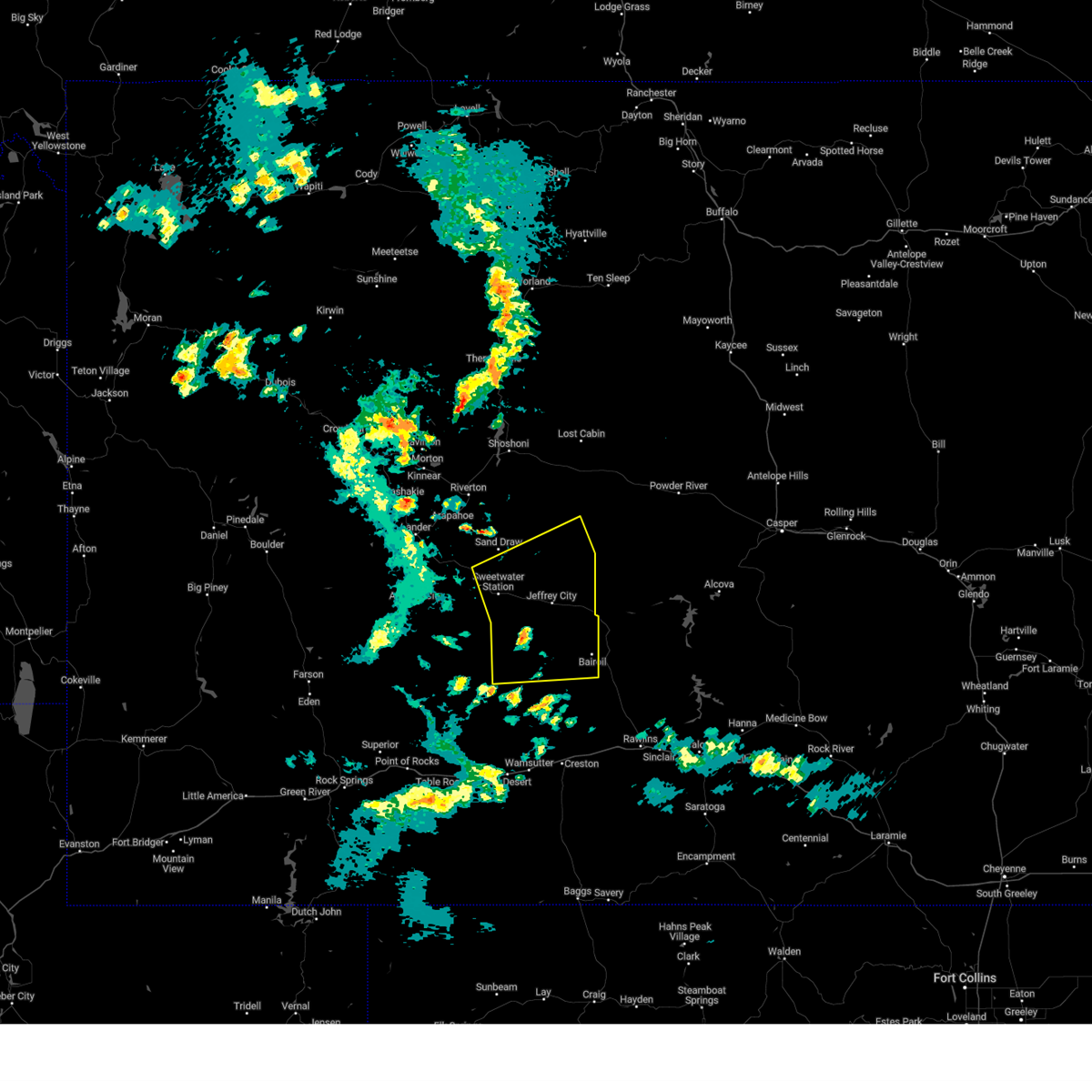
 The severe thunderstorm warning for southeastern fremont and northeastern sweetwater counties will expire at 745 pm mdt, the storm which prompted the warning has weakened below severe limits, and no longer poses an immediate threat to life or property. therefore, the warning will be allowed to expire. The severe thunderstorm warning for southeastern fremont and northeastern sweetwater counties will expire at 745 pm mdt, the storm which prompted the warning has weakened below severe limits, and no longer poses an immediate threat to life or property. therefore, the warning will be allowed to expire.
|
| 7/14/2023 7:32 PM MDT |
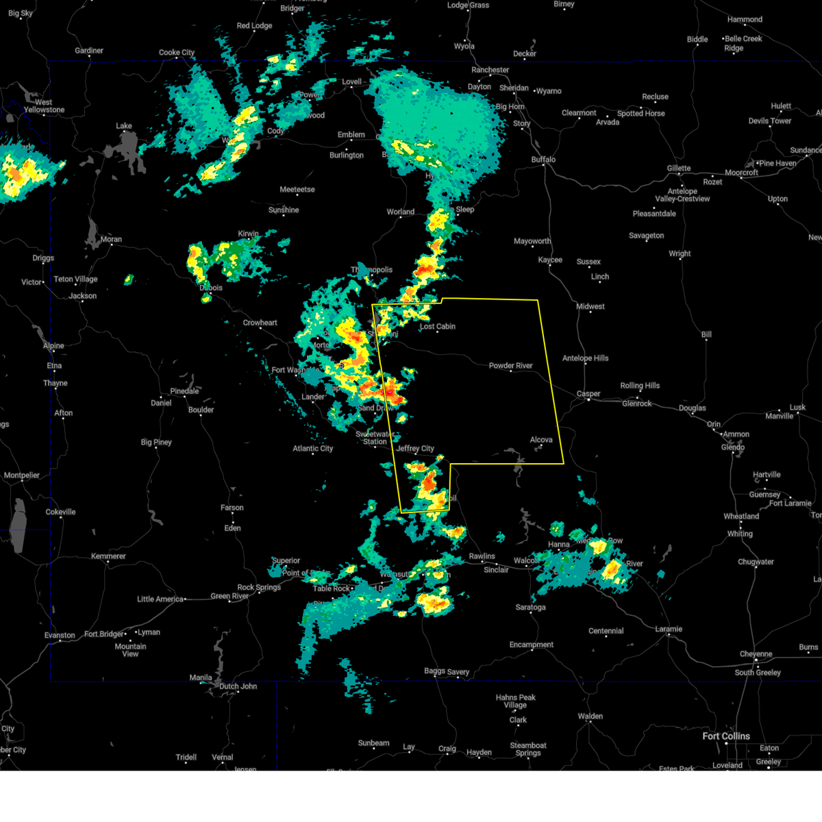
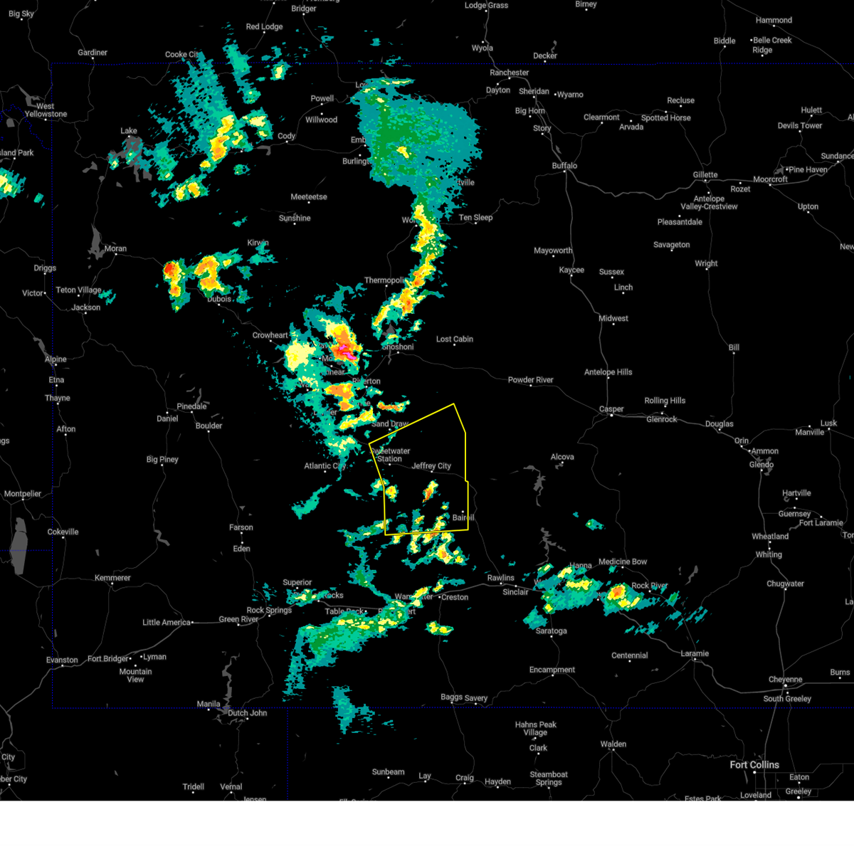
 At 732 pm mdt, a severe thunderstorm was located 8 miles southeast of crooks gap, which is also 17 miles south of jeffrey city, moving southeast at 30 mph (radar indicated). Hazards include 60 mph wind gusts and quarter size hail. Hail damage to vehicles is expected. expect wind damage to roofs, siding, and trees. locations impacted include, bairoil. hail threat, radar indicated max hail size, 1. 00 in wind threat, radar indicated max wind gust, 60 mph. At 732 pm mdt, a severe thunderstorm was located 8 miles southeast of crooks gap, which is also 17 miles south of jeffrey city, moving southeast at 30 mph (radar indicated). Hazards include 60 mph wind gusts and quarter size hail. Hail damage to vehicles is expected. expect wind damage to roofs, siding, and trees. locations impacted include, bairoil. hail threat, radar indicated max hail size, 1. 00 in wind threat, radar indicated max wind gust, 60 mph.
|
| 7/14/2023 7:13 PM MDT |
 At 713 pm mdt, a severe thunderstorm was located over crooks gap, which is also 10 miles south of jeffrey city, moving southeast at 30 mph (radar indicated). Hazards include 60 mph wind gusts and quarter size hail. Hail damage to vehicles is expected. expect wind damage to roofs, siding, and trees. this severe thunderstorm will remain over mainly rural areas of southeastern fremont and northeastern sweetwater counties. hail threat, radar indicated max hail size, 1. 00 in wind threat, radar indicated max wind gust, 60 mph. At 713 pm mdt, a severe thunderstorm was located over crooks gap, which is also 10 miles south of jeffrey city, moving southeast at 30 mph (radar indicated). Hazards include 60 mph wind gusts and quarter size hail. Hail damage to vehicles is expected. expect wind damage to roofs, siding, and trees. this severe thunderstorm will remain over mainly rural areas of southeastern fremont and northeastern sweetwater counties. hail threat, radar indicated max hail size, 1. 00 in wind threat, radar indicated max wind gust, 60 mph.
|
| 7/3/2023 5:14 PM MDT |
 At 511 pm mdt, severe thunderstorms were moving from fremont county into natrona county, moving east at 70 mph (radar indicated). Hazards include 70 mph wind gusts and penny size hail. Expect considerable tree damage. damage is likely to mobile homes, roofs, and outbuildings. severe thunderstorms will be near, split rock around 515 pm mdt. lysite and castle gardens around 525 pm mdt. devil`s gate, lost cabin and cottonwood pass around 530 pm mdt. other locations in the path of these severe thunderstorms include ervay, independence rock and red wall. thunderstorm damage threat, considerable hail threat, radar indicated max hail size, 0. 75 in wind threat, observed max wind gust, 70 mph. At 511 pm mdt, severe thunderstorms were moving from fremont county into natrona county, moving east at 70 mph (radar indicated). Hazards include 70 mph wind gusts and penny size hail. Expect considerable tree damage. damage is likely to mobile homes, roofs, and outbuildings. severe thunderstorms will be near, split rock around 515 pm mdt. lysite and castle gardens around 525 pm mdt. devil`s gate, lost cabin and cottonwood pass around 530 pm mdt. other locations in the path of these severe thunderstorms include ervay, independence rock and red wall. thunderstorm damage threat, considerable hail threat, radar indicated max hail size, 0. 75 in wind threat, observed max wind gust, 70 mph.
|
| 7/3/2023 5:04 PM MDT |
 At 503 pm mdt, severe thunderstorms were moving east across the sweetwater river basin, moving east at 55 mph (public). Hazards include 70 mph wind gusts and penny size hail. Expect considerable tree damage. damage is likely to mobile homes, roofs, and outbuildings. locations impacted include, bairoil, green mountain and split rock. thunderstorm damage threat, considerable hail threat, radar indicated max hail size, 0. 75 in wind threat, observed max wind gust, 70 mph. At 503 pm mdt, severe thunderstorms were moving east across the sweetwater river basin, moving east at 55 mph (public). Hazards include 70 mph wind gusts and penny size hail. Expect considerable tree damage. damage is likely to mobile homes, roofs, and outbuildings. locations impacted include, bairoil, green mountain and split rock. thunderstorm damage threat, considerable hail threat, radar indicated max hail size, 0. 75 in wind threat, observed max wind gust, 70 mph.
|
| 7/3/2023 4:42 PM MDT |
 At 442 pm mdt, severe thunderstorms were located along a line extending from 8 miles southwest of sand draw to 8 miles south of sweetwater station to 17 miles southwest of crooks gap, moving east at 55 mph (radar indicated). Hazards include 60 mph wind gusts. Expect damage to roofs, siding, and trees. severe thunderstorms will be near, crooks gap around 455 pm mdt. jeffrey city around 500 pm mdt. other locations in the path of these severe thunderstorms include bairoil, green mountain and split rock. hail threat, radar indicated max hail size, <. 75 in wind threat, observed max wind gust, 60 mph. At 442 pm mdt, severe thunderstorms were located along a line extending from 8 miles southwest of sand draw to 8 miles south of sweetwater station to 17 miles southwest of crooks gap, moving east at 55 mph (radar indicated). Hazards include 60 mph wind gusts. Expect damage to roofs, siding, and trees. severe thunderstorms will be near, crooks gap around 455 pm mdt. jeffrey city around 500 pm mdt. other locations in the path of these severe thunderstorms include bairoil, green mountain and split rock. hail threat, radar indicated max hail size, <. 75 in wind threat, observed max wind gust, 60 mph.
|
| 6/6/2020 2:51 PM MDT |
 At 250 pm mdt, severe thunderstorms were located along a line extending from 12 miles southeast of oregon buttes to 12 miles north of separation lake, moving northeast at 30 mph (radar indicated). Hazards include 60 mph wind gusts. Expect damage to roofs, siding, and trees. these severe thunderstorms will remain over mainly rural areas of northeastern sweetwater county, including the following locations, southwest wyoming regional airport, reliance, tipton, red desert, point of rocks and sweetwater county fairgrounds. This includes interstate 80 between mile markers 101 and 198. At 250 pm mdt, severe thunderstorms were located along a line extending from 12 miles southeast of oregon buttes to 12 miles north of separation lake, moving northeast at 30 mph (radar indicated). Hazards include 60 mph wind gusts. Expect damage to roofs, siding, and trees. these severe thunderstorms will remain over mainly rural areas of northeastern sweetwater county, including the following locations, southwest wyoming regional airport, reliance, tipton, red desert, point of rocks and sweetwater county fairgrounds. This includes interstate 80 between mile markers 101 and 198.
|
| 6/6/2020 2:10 PM MDT |
 At 206 pm mdt, severe thunderstorms were located along a line extending from 21 miles northwest of wamsutter to near dad, moving northeast at 65 mph. these are very dangerous storms (radar indicated. at 154 pm, bitter creek reported a wind gust of 81 mph. a wind gust of 61 mph was reported at the southwest wyoming regional airport just east of rock springs at 158 pm). Hazards include 60 to 80 mph wind gusts. Flying debris will be dangerous to those caught without shelter. mobile homes will be heavily damaged. expect considerable damage to roofs, windows, and vehicles. extensive tree damage and power outages are likely. severe thunderstorms will be near, creston junction around 220 pm mdt. other locations impacted by these severe thunderstorms include southwest wyoming regional airport, reliance, tipton, red desert, point of rocks and sweetwater county fairgrounds. this includes interstate 80 between mile markers 101 and 198. Time, mot, loc 2006z 178deg 114kt 4195 10815 4125 10772. At 206 pm mdt, severe thunderstorms were located along a line extending from 21 miles northwest of wamsutter to near dad, moving northeast at 65 mph. these are very dangerous storms (radar indicated. at 154 pm, bitter creek reported a wind gust of 81 mph. a wind gust of 61 mph was reported at the southwest wyoming regional airport just east of rock springs at 158 pm). Hazards include 60 to 80 mph wind gusts. Flying debris will be dangerous to those caught without shelter. mobile homes will be heavily damaged. expect considerable damage to roofs, windows, and vehicles. extensive tree damage and power outages are likely. severe thunderstorms will be near, creston junction around 220 pm mdt. other locations impacted by these severe thunderstorms include southwest wyoming regional airport, reliance, tipton, red desert, point of rocks and sweetwater county fairgrounds. this includes interstate 80 between mile markers 101 and 198. Time, mot, loc 2006z 178deg 114kt 4195 10815 4125 10772.
|
| 6/12/2016 3:37 PM MDT |
 At 336 pm mdt, a severe thunderstorm was located over bairoil, which is 22 miles southeast of jeffrey city, moving northeast at 35 mph (radar indicated). Hazards include ping pong ball size hail and 60 mph wind gusts. People and animals outdoors will be injured. expect hail damage to roofs, siding, windows and vehicles. expect wind damage to roofs, siding and trees. This severe thunderstorm will remain over mainly rural areas of northeastern sweetwater county including bairoil. At 336 pm mdt, a severe thunderstorm was located over bairoil, which is 22 miles southeast of jeffrey city, moving northeast at 35 mph (radar indicated). Hazards include ping pong ball size hail and 60 mph wind gusts. People and animals outdoors will be injured. expect hail damage to roofs, siding, windows and vehicles. expect wind damage to roofs, siding and trees. This severe thunderstorm will remain over mainly rural areas of northeastern sweetwater county including bairoil.
|
| 7/11/2012 4:50 PM MDT | Storm damage reported in fremont county WY, 7 miles S of Bairoil, WY |
| 5/18/2012 4:07 PM MDT | Storm damage reported in fremont county WY, 7 miles S of Bairoil, WY |
| 5/18/2012 3:50 PM MDT | Storm damage reported in fremont county WY, 7 miles S of Bairoil, WY |
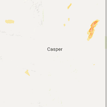
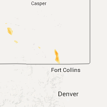
Hail Maps for Bairoil, WY


Connect with Interactive Hail Maps