

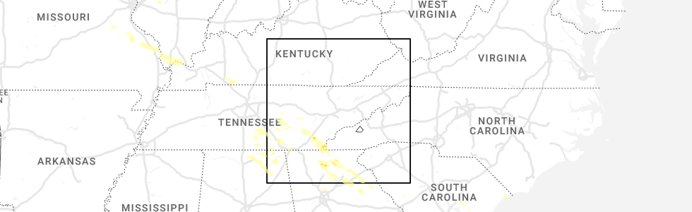
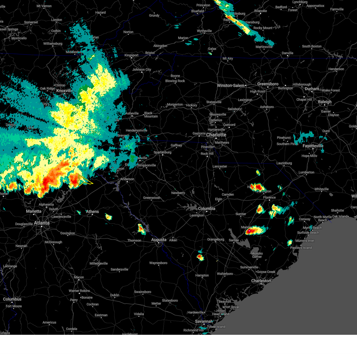
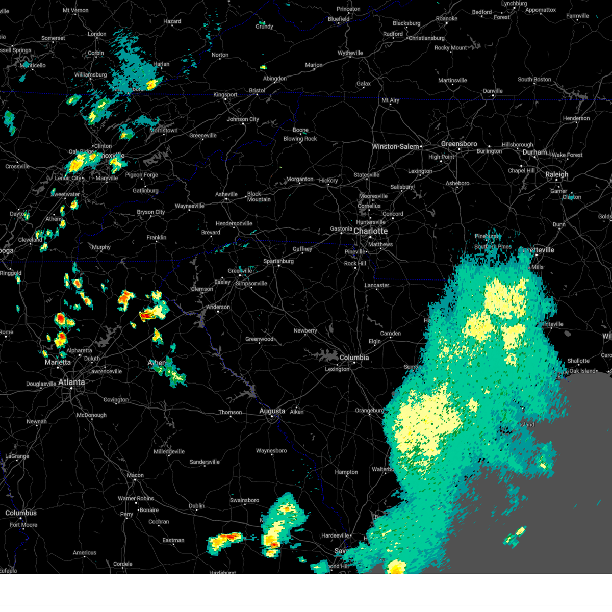
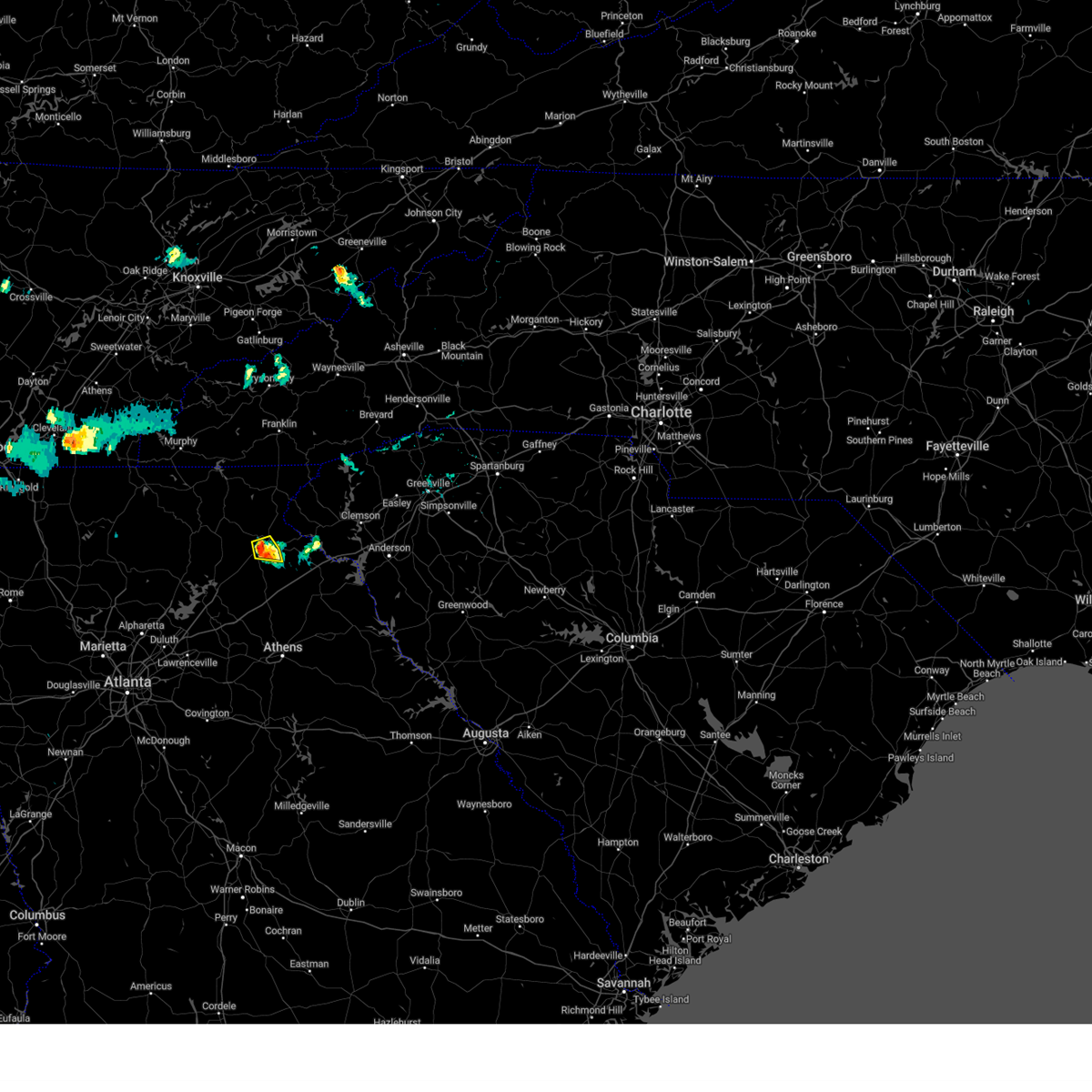
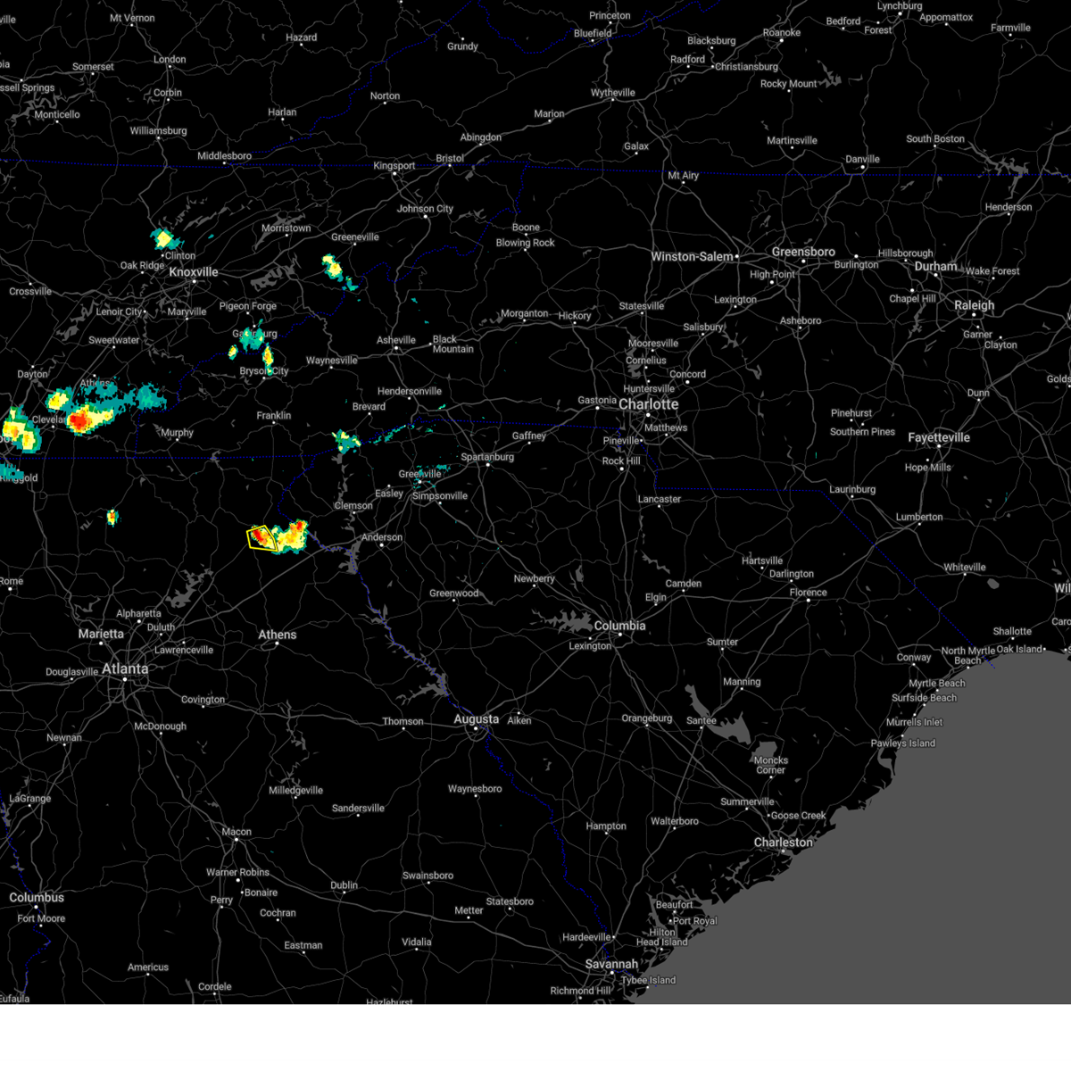
Hail Map for Baldwin, GA
The Baldwin, GA area has had 1 report of on-the-ground hail by trained spotters, and has been under severe weather warnings 22 times during the past 12 months. Doppler radar has detected hail at or near Baldwin, GA on 27 occasions, including 3 occasions during the past year.
| Name: | Baldwin, GA |
| Where Located: | 59.5 miles WSW of Greenville, SC |
| Map: | Google Map for Baldwin, GA |
| Population: | 3279 |
| Housing Units: | 1278 |
| More Info: | Search Google for Baldwin, GA |
3
The Top Recent Hail Date for Baldwin, GA is Thursday, July 20, 2023 (3rd out of 27)
Hail and Wind Damage Spotted near Baldwin, GA
| Date / Time | Report Details |
|---|---|
| 2/28/2024 3:07 PM EST |
 At 307 pm est, severe thunderstorms were located along a line extending from near lula to near gainesville to lake lanier islands, moving east at 50 mph (radar indicated). Hazards include 60 mph wind gusts and quarter size hail. Hail damage to vehicles is expected. expect wind damage to roofs, siding, and trees. Locations impacted include, gainesville, cumming, sugar hill, buford, braselton, flowery branch, oakwood, lula, hoschton, pendergrass, gillsville, talmo, rest haven, candler, buford dam-lake lanier parks, aqualand park, chestnut mountain, oscarville, road atlanta-lanier speedway, and lake lanier islands. At 307 pm est, severe thunderstorms were located along a line extending from near lula to near gainesville to lake lanier islands, moving east at 50 mph (radar indicated). Hazards include 60 mph wind gusts and quarter size hail. Hail damage to vehicles is expected. expect wind damage to roofs, siding, and trees. Locations impacted include, gainesville, cumming, sugar hill, buford, braselton, flowery branch, oakwood, lula, hoschton, pendergrass, gillsville, talmo, rest haven, candler, buford dam-lake lanier parks, aqualand park, chestnut mountain, oscarville, road atlanta-lanier speedway, and lake lanier islands.
|
| 2/28/2024 2:51 PM EST |
 Svrffc the national weather service in peachtree city has issued a * severe thunderstorm warning for, central forsyth county in north central georgia, northeastern gwinnett county in north central georgia, western banks county in northeastern georgia, southeastern dawson county in north central georgia, hall county in north central georgia, northwestern jackson county in northeastern georgia, * until 315 pm est. * at 251 pm est, severe thunderstorms were located along a line extending from near war hill park to near coal mountain to near milton, moving east at 50 mph (radar indicated). Hazards include 60 mph wind gusts and quarter size hail. Hail damage to vehicles is expected. Expect wind damage to roofs, siding, and trees. Svrffc the national weather service in peachtree city has issued a * severe thunderstorm warning for, central forsyth county in north central georgia, northeastern gwinnett county in north central georgia, western banks county in northeastern georgia, southeastern dawson county in north central georgia, hall county in north central georgia, northwestern jackson county in northeastern georgia, * until 315 pm est. * at 251 pm est, severe thunderstorms were located along a line extending from near war hill park to near coal mountain to near milton, moving east at 50 mph (radar indicated). Hazards include 60 mph wind gusts and quarter size hail. Hail damage to vehicles is expected. Expect wind damage to roofs, siding, and trees.
|
| 8/24/2023 4:42 PM EDT |
 At 442 pm edt, severe thunderstorms were located along a line extending from near mossy creek to near raoul to homer to near pinefield crossroads to near carnesville, moving south at 10 mph (radar indicated). Hazards include 60 mph wind gusts. expect damage to roofs, siding, and trees At 442 pm edt, severe thunderstorms were located along a line extending from near mossy creek to near raoul to homer to near pinefield crossroads to near carnesville, moving south at 10 mph (radar indicated). Hazards include 60 mph wind gusts. expect damage to roofs, siding, and trees
|
| 8/7/2023 4:30 PM EDT |
 At 429 pm edt, a severe thunderstorm was located 11 miles northwest of homer, or near alto, moving east at 35 mph (radar indicated). Hazards include 60 mph wind gusts and quarter size hail. Minor hail damage to vehicles is expected. Expect wind damage to trees and power lines. At 429 pm edt, a severe thunderstorm was located 11 miles northwest of homer, or near alto, moving east at 35 mph (radar indicated). Hazards include 60 mph wind gusts and quarter size hail. Minor hail damage to vehicles is expected. Expect wind damage to trees and power lines.
|
| 8/7/2023 4:26 PM EDT |
 At 425 pm edt, a severe thunderstorm was located near clermont, or 10 miles southeast of cleveland, moving east at 40 mph (radar indicated). Hazards include 60 mph wind gusts and half dollar size hail. Hail damage to vehicles is expected. Expect wind damage to roofs, siding, and trees. At 425 pm edt, a severe thunderstorm was located near clermont, or 10 miles southeast of cleveland, moving east at 40 mph (radar indicated). Hazards include 60 mph wind gusts and half dollar size hail. Hail damage to vehicles is expected. Expect wind damage to roofs, siding, and trees.
|
| 7/25/2023 5:37 PM EDT |
 At 537 pm edt, a severe thunderstorm was located over hollingsworth, or 8 miles north of homer, moving south at 5 mph (radar indicated). Hazards include 60 mph wind gusts. expect damage to roofs, siding, and trees At 537 pm edt, a severe thunderstorm was located over hollingsworth, or 8 miles north of homer, moving south at 5 mph (radar indicated). Hazards include 60 mph wind gusts. expect damage to roofs, siding, and trees
|
| 7/20/2023 6:13 PM EDT |
 At 612 pm edt, severe thunderstorms were located along a line extending from near clermont to suwanee, moving southeast at 50 mph (radar indicated). Hazards include 70 mph wind gusts and penny size hail. Expect considerable tree damage. Damage is likely to mobile homes, roofs, and outbuildings. At 612 pm edt, severe thunderstorms were located along a line extending from near clermont to suwanee, moving southeast at 50 mph (radar indicated). Hazards include 70 mph wind gusts and penny size hail. Expect considerable tree damage. Damage is likely to mobile homes, roofs, and outbuildings.
|
| 7/20/2023 6:11 PM EDT |
 The severe thunderstorm warning for southwestern stephens and southwestern habersham counties will expire at 615 pm edt, the storm which prompted the warning has moved out of the area. therefore, the warning will be allowed to expire. a severe thunderstorm watch remains in effect until 1000 pm edt for franklin and hart counties in northeast georgia. The severe thunderstorm warning for southwestern stephens and southwestern habersham counties will expire at 615 pm edt, the storm which prompted the warning has moved out of the area. therefore, the warning will be allowed to expire. a severe thunderstorm watch remains in effect until 1000 pm edt for franklin and hart counties in northeast georgia.
|
| 7/20/2023 6:03 PM EDT |
 At 603 pm edt, severe thunderstorms were located along a line extending from 6 miles northeast of banks crossing to near duluth, moving southeast at 50 mph (trained weather spotters). Hazards include 70 mph wind gusts and penny size hail. Expect considerable tree damage. damage is likely to mobile homes, roofs, and outbuildings. locations impacted include, gainesville, canton, jefferson, commerce, cumming, homer, sugar hill, suwanee, buford, braselton, auburn, flowery branch, dacula, oakwood, lula, maysville, hoschton, clermont, pendergrass and gillsville. thunderstorm damage threat, considerable hail threat, radar indicated max hail size, 0. 75 in wind threat, observed max wind gust, 70 mph. At 603 pm edt, severe thunderstorms were located along a line extending from 6 miles northeast of banks crossing to near duluth, moving southeast at 50 mph (trained weather spotters). Hazards include 70 mph wind gusts and penny size hail. Expect considerable tree damage. damage is likely to mobile homes, roofs, and outbuildings. locations impacted include, gainesville, canton, jefferson, commerce, cumming, homer, sugar hill, suwanee, buford, braselton, auburn, flowery branch, dacula, oakwood, lula, maysville, hoschton, clermont, pendergrass and gillsville. thunderstorm damage threat, considerable hail threat, radar indicated max hail size, 0. 75 in wind threat, observed max wind gust, 70 mph.
|
| 7/20/2023 5:35 PM EDT |
 At 535 pm edt, a severe thunderstorm was located 10 miles southwest of clarkesville, or near alto, moving southeast at 25 mph (radar indicated). Hazards include 60 mph wind gusts and quarter size hail. Minor hail damage to vehicles is expected. Expect wind damage to trees and power lines. At 535 pm edt, a severe thunderstorm was located 10 miles southwest of clarkesville, or near alto, moving southeast at 25 mph (radar indicated). Hazards include 60 mph wind gusts and quarter size hail. Minor hail damage to vehicles is expected. Expect wind damage to trees and power lines.
|
| 7/20/2023 5:30 PM EDT |
 At 529 pm edt, severe thunderstorms were located along a line extending from mossy creek to buffington, moving southeast at 50 mph (radar indicated). Hazards include 60 mph wind gusts and quarter size hail. Hail damage to vehicles is expected. Expect wind damage to roofs, siding, and trees. At 529 pm edt, severe thunderstorms were located along a line extending from mossy creek to buffington, moving southeast at 50 mph (radar indicated). Hazards include 60 mph wind gusts and quarter size hail. Hail damage to vehicles is expected. Expect wind damage to roofs, siding, and trees.
|
| 7/2/2023 7:41 PM EDT |
 The severe thunderstorm warning for banks, northeastern hall and eastern jackson counties will expire at 745 pm edt, the storm which prompted the warning has weakened below severe limits, and has exited the warned area. therefore, the warning will be allowed to expire. however gusty winds are still possible with this thunderstorm. a severe thunderstorm watch remains in effect until 900 pm edt for northeastern georgia. The severe thunderstorm warning for banks, northeastern hall and eastern jackson counties will expire at 745 pm edt, the storm which prompted the warning has weakened below severe limits, and has exited the warned area. therefore, the warning will be allowed to expire. however gusty winds are still possible with this thunderstorm. a severe thunderstorm watch remains in effect until 900 pm edt for northeastern georgia.
|
| 7/2/2023 7:37 PM EDT |
 At 736 pm edt, a severe thunderstorm was located over commerce, moving northeast at 15 mph (radar indicated). Hazards include 60 mph wind gusts. Expect damage to roofs, siding, and trees. locations impacted include, commerce, homer, lula, maysville, nicholson, gillsville, pinefield crossroads, hollingsworth, banks crossing and apple valley. hail threat, radar indicated max hail size, <. 75 in wind threat, radar indicated max wind gust, 60 mph. At 736 pm edt, a severe thunderstorm was located over commerce, moving northeast at 15 mph (radar indicated). Hazards include 60 mph wind gusts. Expect damage to roofs, siding, and trees. locations impacted include, commerce, homer, lula, maysville, nicholson, gillsville, pinefield crossroads, hollingsworth, banks crossing and apple valley. hail threat, radar indicated max hail size, <. 75 in wind threat, radar indicated max wind gust, 60 mph.
|
| 7/2/2023 7:29 PM EDT |
 At 729 pm edt, severe thunderstorms were located along a line extending from 10 miles south of clarkesville to 6 miles northeast of homer to near commerce, moving northeast at 25 mph (radar indicated). Hazards include 60 mph wind gusts and nickel size hail. Expect damage to trees and power lines. locations impacted include, toccoa, hartwell, clarkesville, carnesville, cornelia, baldwin, royston, reed creek, lavonia and gumlog. hail threat, radar indicated max hail size, 0. 88 in wind threat, radar indicated max wind gust, 60 mph. At 729 pm edt, severe thunderstorms were located along a line extending from 10 miles south of clarkesville to 6 miles northeast of homer to near commerce, moving northeast at 25 mph (radar indicated). Hazards include 60 mph wind gusts and nickel size hail. Expect damage to trees and power lines. locations impacted include, toccoa, hartwell, clarkesville, carnesville, cornelia, baldwin, royston, reed creek, lavonia and gumlog. hail threat, radar indicated max hail size, 0. 88 in wind threat, radar indicated max wind gust, 60 mph.
|
| 7/2/2023 7:10 PM EDT |
 At 710 pm edt, severe thunderstorms were located along a line extending from 14 miles northeast of gainesville to near homer to 5 miles northeast of jefferson, moving northeast at 25 mph (radar indicated). Hazards include 60 mph wind gusts and quarter size hail. Minor hail damage to vehicles is expected. Expect wind damage to trees and power lines. At 710 pm edt, severe thunderstorms were located along a line extending from 14 miles northeast of gainesville to near homer to 5 miles northeast of jefferson, moving northeast at 25 mph (radar indicated). Hazards include 60 mph wind gusts and quarter size hail. Minor hail damage to vehicles is expected. Expect wind damage to trees and power lines.
|
| 7/2/2023 6:54 PM EDT |
 At 654 pm edt, a severe thunderstorm was located over jefferson, moving northeast at 15 mph (radar indicated). Hazards include 60 mph wind gusts. expect damage to roofs, siding, and trees At 654 pm edt, a severe thunderstorm was located over jefferson, moving northeast at 15 mph (radar indicated). Hazards include 60 mph wind gusts. expect damage to roofs, siding, and trees
|
| 6/25/2023 5:56 PM EDT |
 The severe thunderstorm warning for northwestern barrow, forsyth, northeastern gwinnett, banks, southeastern dawson, hall and jackson counties will expire at 600 pm edt, the storms which prompted the warning have moved out of the area. therefore, the warning will be allowed to expire. however gusty winds are still possible with these thunderstorms. a severe thunderstorm watch remains in effect until 800 pm edt for north central georgia. remember, a severe thunderstorm warning still remains in effect for barrow, northern gwinnett, southern forsyth, southern banks, southern hall, and jackson counties. The severe thunderstorm warning for northwestern barrow, forsyth, northeastern gwinnett, banks, southeastern dawson, hall and jackson counties will expire at 600 pm edt, the storms which prompted the warning have moved out of the area. therefore, the warning will be allowed to expire. however gusty winds are still possible with these thunderstorms. a severe thunderstorm watch remains in effect until 800 pm edt for north central georgia. remember, a severe thunderstorm warning still remains in effect for barrow, northern gwinnett, southern forsyth, southern banks, southern hall, and jackson counties.
|
| 6/25/2023 5:15 PM EDT |
 At 515 pm edt, severe thunderstorms were located along a line extending from free home to near hollingsworth, moving southeast at 25 mph (radar indicated). Hazards include 60 mph wind gusts. expect damage to roofs, siding, and trees At 515 pm edt, severe thunderstorms were located along a line extending from free home to near hollingsworth, moving southeast at 25 mph (radar indicated). Hazards include 60 mph wind gusts. expect damage to roofs, siding, and trees
|
| 6/11/2023 8:32 PM EDT |
 At 832 pm edt, a severe thunderstorm was located near hollingsworth, or 9 miles south of clarkesville, moving east at 30 mph (radar indicated). Hazards include 60 mph wind gusts and quarter size hail. Hail damage to vehicles is expected. Expect wind damage to roofs, siding, and trees. At 832 pm edt, a severe thunderstorm was located near hollingsworth, or 9 miles south of clarkesville, moving east at 30 mph (radar indicated). Hazards include 60 mph wind gusts and quarter size hail. Hail damage to vehicles is expected. Expect wind damage to roofs, siding, and trees.
|
| 6/5/2023 6:13 PM EDT |
 The severe thunderstorm warning for southwestern stephens and south central habersham counties will expire at 615 pm edt, the storm which prompted the warning has weakened below severe limits, and has exited the warned area. therefore, the warning will be allowed to expire. The severe thunderstorm warning for southwestern stephens and south central habersham counties will expire at 615 pm edt, the storm which prompted the warning has weakened below severe limits, and has exited the warned area. therefore, the warning will be allowed to expire.
|
| 6/5/2023 5:46 PM EDT |
 At 546 pm edt, a severe thunderstorm was located near clarkesville, or near mount airy, and is nearly stationary (radar indicated). Hazards include 60 mph wind gusts and quarter size hail. Minor hail damage to vehicles is expected. Expect wind damage to trees and power lines. At 546 pm edt, a severe thunderstorm was located near clarkesville, or near mount airy, and is nearly stationary (radar indicated). Hazards include 60 mph wind gusts and quarter size hail. Minor hail damage to vehicles is expected. Expect wind damage to trees and power lines.
|
| 3/3/2023 5:14 PM EST |
 At 513 pm est, severe thunderstorms were located along a line extending from 7 miles north of clarkesville georgia to 11 miles north of homer georgia, moving northeast at 70 mph (radar indicated). Hazards include 60 mph wind gusts and penny size hail. expect damage to trees and power lines At 513 pm est, severe thunderstorms were located along a line extending from 7 miles north of clarkesville georgia to 11 miles north of homer georgia, moving northeast at 70 mph (radar indicated). Hazards include 60 mph wind gusts and penny size hail. expect damage to trees and power lines
|
| 3/3/2023 4:46 PM EST |
 At 445 pm est, severe thunderstorms were located along a line extending from 9 miles northeast of hiawassee to 10 miles north of cleveland to 4 miles southwest of dahlonega, moving east at 40 mph (radar indicated). Hazards include 60 mph wind gusts and penny size hail. Expect damage to trees and power lines. Locations impacted include, clayton, clarkesville, cornelia, baldwin, demorest, mount airy, alto, mountain city, tiger and dillard. At 445 pm est, severe thunderstorms were located along a line extending from 9 miles northeast of hiawassee to 10 miles north of cleveland to 4 miles southwest of dahlonega, moving east at 40 mph (radar indicated). Hazards include 60 mph wind gusts and penny size hail. Expect damage to trees and power lines. Locations impacted include, clayton, clarkesville, cornelia, baldwin, demorest, mount airy, alto, mountain city, tiger and dillard.
|
| 3/3/2023 4:18 PM EST |
 At 417 pm est, severe thunderstorms were located along a line extending from 3 miles northwest of hiawassee to 11 miles north of dahlonega to 6 miles west of dawsonville, moving east at 40 mph (radar indicated). Hazards include 60 mph wind gusts. expect damage to trees and power lines At 417 pm est, severe thunderstorms were located along a line extending from 3 miles northwest of hiawassee to 11 miles north of dahlonega to 6 miles west of dawsonville, moving east at 40 mph (radar indicated). Hazards include 60 mph wind gusts. expect damage to trees and power lines
|
| 6/15/2022 9:44 PM EDT |
 At 944 pm edt, a severe thunderstorm was located near clarkesville, moving northwest at 20 mph (radar indicated). Hazards include 60 mph wind gusts and quarter size hail. Minor hail damage to vehicles is expected. expect wind damage to trees and power lines. locations impacted include, clarkesville, cornelia, baldwin, demorest, mount airy, lake burton, hollywood, batesville, seed lake and turnerville. hail threat, radar indicated max hail size, 1. 00 in wind threat, radar indicated max wind gust, 60 mph. At 944 pm edt, a severe thunderstorm was located near clarkesville, moving northwest at 20 mph (radar indicated). Hazards include 60 mph wind gusts and quarter size hail. Minor hail damage to vehicles is expected. expect wind damage to trees and power lines. locations impacted include, clarkesville, cornelia, baldwin, demorest, mount airy, lake burton, hollywood, batesville, seed lake and turnerville. hail threat, radar indicated max hail size, 1. 00 in wind threat, radar indicated max wind gust, 60 mph.
|
| 6/15/2022 9:32 PM EDT |
 At 932 pm edt, severe thunderstorms were located along a line extending from 8 miles northwest of toccoa to 6 miles southeast of clarkesville, moving northwest at 20 mph (radar indicated). Hazards include 60 mph wind gusts and quarter size hail. Minor hail damage to vehicles is expected. Expect wind damage to trees and power lines. At 932 pm edt, severe thunderstorms were located along a line extending from 8 miles northwest of toccoa to 6 miles southeast of clarkesville, moving northwest at 20 mph (radar indicated). Hazards include 60 mph wind gusts and quarter size hail. Minor hail damage to vehicles is expected. Expect wind damage to trees and power lines.
|
| 8/17/2021 11:11 AM EDT |
 The tornado warning for habersham county will expire at 1115 am edt, the tornadic thunderstorm which prompted the warning has weakened. therefore, the warning will be allowed to expire. a tornado watch remains in effect until 100 pm edt for northeastern georgia. a tornado watch also remains in effect until 700 pm edt for northeastern georgia. to report severe weather to the national weather service greenville-spartanburg, call toll free, 1, 800, 2 6 7, 8 1 0 1, or post on our facebook page, or tweet it using hashtag nwsgsp. your message should describe the event and the specific location where it occurred. The tornado warning for habersham county will expire at 1115 am edt, the tornadic thunderstorm which prompted the warning has weakened. therefore, the warning will be allowed to expire. a tornado watch remains in effect until 100 pm edt for northeastern georgia. a tornado watch also remains in effect until 700 pm edt for northeastern georgia. to report severe weather to the national weather service greenville-spartanburg, call toll free, 1, 800, 2 6 7, 8 1 0 1, or post on our facebook page, or tweet it using hashtag nwsgsp. your message should describe the event and the specific location where it occurred.
|
| 8/17/2021 10:54 AM EDT |
 At 1053 am edt, a severe thunderstorm capable of producing a tornado was located 5 miles south of clarkesville, or near mount airy, moving northwest at 30 mph (radar indicated rotation). Hazards include tornado. Flying debris will be dangerous to those caught without shelter. mobile homes will be damaged or destroyed. damage to roofs, windows, and vehicles will occur. tree damage is likely. this dangerous storm will be near, demorest around 1100 am edt. clarkesville around 1110 am edt. Other locations impacted by this tornadic thunderstorm include batesville. At 1053 am edt, a severe thunderstorm capable of producing a tornado was located 5 miles south of clarkesville, or near mount airy, moving northwest at 30 mph (radar indicated rotation). Hazards include tornado. Flying debris will be dangerous to those caught without shelter. mobile homes will be damaged or destroyed. damage to roofs, windows, and vehicles will occur. tree damage is likely. this dangerous storm will be near, demorest around 1100 am edt. clarkesville around 1110 am edt. Other locations impacted by this tornadic thunderstorm include batesville.
|
| 8/17/2021 10:36 AM EDT |
 At 1036 am edt, a severe thunderstorm capable of producing a tornado was located 6 miles north of homer, or 5 miles southeast of baldwin, moving northwest at 35 mph (radar indicated rotation). Hazards include tornado. Flying debris will be dangerous to those caught without shelter. mobile homes will be damaged or destroyed. damage to roofs, windows, and vehicles will occur. tree damage is likely. this dangerous storm will be near, alto around 1040 am edt. cornelia, baldwin and mount airy around 1050 am edt. clarkesville and demorest around 1100 am edt. Other locations impacted by this dangerous thunderstorm include batesville. At 1036 am edt, a severe thunderstorm capable of producing a tornado was located 6 miles north of homer, or 5 miles southeast of baldwin, moving northwest at 35 mph (radar indicated rotation). Hazards include tornado. Flying debris will be dangerous to those caught without shelter. mobile homes will be damaged or destroyed. damage to roofs, windows, and vehicles will occur. tree damage is likely. this dangerous storm will be near, alto around 1040 am edt. cornelia, baldwin and mount airy around 1050 am edt. clarkesville and demorest around 1100 am edt. Other locations impacted by this dangerous thunderstorm include batesville.
|
| 8/17/2021 10:34 AM EDT |
 At 1034 am edt, a confirmed tornado was located over hollingsworth, or 7 miles north of homer, moving north at 45 mph (radar confirmed tornado). Hazards include damaging tornado. Flying debris will be dangerous to those caught without shelter. mobile homes will be damaged or destroyed. damage to roofs, windows, and vehicles will occur. tree damage is likely. Locations impacted include, homer, baldwin, alto, raoul, pinefield crossroads and hollingsworth. At 1034 am edt, a confirmed tornado was located over hollingsworth, or 7 miles north of homer, moving north at 45 mph (radar confirmed tornado). Hazards include damaging tornado. Flying debris will be dangerous to those caught without shelter. mobile homes will be damaged or destroyed. damage to roofs, windows, and vehicles will occur. tree damage is likely. Locations impacted include, homer, baldwin, alto, raoul, pinefield crossroads and hollingsworth.
|
| 8/17/2021 10:26 AM EDT |
 At 1026 am edt, a severe thunderstorm capable of producing a tornado was located over homer, moving north at 45 mph (radar indicated rotation). Hazards include tornado. Flying debris will be dangerous to those caught without shelter. mobile homes will be damaged or destroyed. damage to roofs, windows, and vehicles will occur. Tree damage is likely. At 1026 am edt, a severe thunderstorm capable of producing a tornado was located over homer, moving north at 45 mph (radar indicated rotation). Hazards include tornado. Flying debris will be dangerous to those caught without shelter. mobile homes will be damaged or destroyed. damage to roofs, windows, and vehicles will occur. Tree damage is likely.
|
| 7/27/2020 6:54 PM EDT |
 At 654 pm edt, a severe thunderstorm was located over gillsville, or 9 miles east of gainesville, moving east at 20 mph (radar indicated). Hazards include 60 mph wind gusts and quarter size hail. Hail damage to vehicles is expected. Expect wind damage to roofs, siding, and trees. At 654 pm edt, a severe thunderstorm was located over gillsville, or 9 miles east of gainesville, moving east at 20 mph (radar indicated). Hazards include 60 mph wind gusts and quarter size hail. Hail damage to vehicles is expected. Expect wind damage to roofs, siding, and trees.
|
| 5/5/2020 7:24 PM EDT |
 At 723 pm edt, a severe thunderstorm was located 8 miles south of clarkesville, or near mount airy, moving east at 35 mph (radar indicated). Hazards include 60 mph wind gusts and quarter size hail. Minor hail damage to vehicles is expected. Expect wind damage to trees and power lines. At 723 pm edt, a severe thunderstorm was located 8 miles south of clarkesville, or near mount airy, moving east at 35 mph (radar indicated). Hazards include 60 mph wind gusts and quarter size hail. Minor hail damage to vehicles is expected. Expect wind damage to trees and power lines.
|
| 5/5/2020 7:16 PM EDT |
 At 716 pm edt, a severe thunderstorm was located over raoul, or 7 miles northwest of homer, moving east at 55 mph (radar indicated). Hazards include 60 mph wind gusts and quarter size hail. Hail damage to vehicles is expected. Expect wind damage to roofs, siding, and trees. At 716 pm edt, a severe thunderstorm was located over raoul, or 7 miles northwest of homer, moving east at 55 mph (radar indicated). Hazards include 60 mph wind gusts and quarter size hail. Hail damage to vehicles is expected. Expect wind damage to roofs, siding, and trees.
|
| 5/5/2020 1:52 AM EDT |
 At 150 am edt, severe thunderstorms were located along a line extending from near clayton to 12 miles southwest of walhalla to 7 miles south of toccoa, moving east at 60 mph. another line of strong thunderstorms in oconee county south carolina was being overtaken by the severe thunderstorms moving out of georgia (radar indicated). Hazards include 60 mph wind gusts and quarter size hail. Minor hail damage to vehicles is expected. expect wind damage to trees and power lines. Locations impacted include, toccoa, seneca, hartwell, walhalla, clayton, clarkesville, carnesville, cornelia, baldwin and royston. At 150 am edt, severe thunderstorms were located along a line extending from near clayton to 12 miles southwest of walhalla to 7 miles south of toccoa, moving east at 60 mph. another line of strong thunderstorms in oconee county south carolina was being overtaken by the severe thunderstorms moving out of georgia (radar indicated). Hazards include 60 mph wind gusts and quarter size hail. Minor hail damage to vehicles is expected. expect wind damage to trees and power lines. Locations impacted include, toccoa, seneca, hartwell, walhalla, clayton, clarkesville, carnesville, cornelia, baldwin and royston.
|
| 5/5/2020 1:24 AM EDT |
 At 123 am edt, severe thunderstorms were located along a line extending from 6 miles southwest of hiawassee to near cleveland to 8 miles northeast of gainesville, moving east at 70 mph (radar indicated). Hazards include 60 mph wind gusts and quarter size hail. Minor hail damage to vehicles is expected. Expect wind damage to trees and power lines. At 123 am edt, severe thunderstorms were located along a line extending from 6 miles southwest of hiawassee to near cleveland to 8 miles northeast of gainesville, moving east at 70 mph (radar indicated). Hazards include 60 mph wind gusts and quarter size hail. Minor hail damage to vehicles is expected. Expect wind damage to trees and power lines.
|
| 4/13/2020 3:03 AM EDT |
 At 302 am edt, a severe thunderstorm capable of producing a tornado was located 8 miles southeast of clarkesville, or near mount airy, moving east at 60 mph (radar indicated rotation). Hazards include tornado. Flying debris will be dangerous to those caught without shelter. mobile homes will be damaged or destroyed. damage to roofs, windows, and vehicles will occur. tree damage is likely. this dangerous storm will be near, toccoa around 310 am edt. avalon, martin, tugaloo state park and gumlog around 320 am edt. westminster around 330 am edt. Other locations impacted by this dangerous thunderstorm include eastanolee, oakway and boydville. At 302 am edt, a severe thunderstorm capable of producing a tornado was located 8 miles southeast of clarkesville, or near mount airy, moving east at 60 mph (radar indicated rotation). Hazards include tornado. Flying debris will be dangerous to those caught without shelter. mobile homes will be damaged or destroyed. damage to roofs, windows, and vehicles will occur. tree damage is likely. this dangerous storm will be near, toccoa around 310 am edt. avalon, martin, tugaloo state park and gumlog around 320 am edt. westminster around 330 am edt. Other locations impacted by this dangerous thunderstorm include eastanolee, oakway and boydville.
|
| 4/13/2020 2:55 AM EDT | Trees downed and building damage reporte in habersham county GA, 0.5 miles WSW of Baldwin, GA |
| 4/13/2020 2:42 AM EDT |
 At 242 am edt, a severe thunderstorm was located near lula, or 8 miles northeast of gainesville, moving east at 60 mph (radar indicated). Hazards include 60 mph wind gusts. expect damage to roofs, siding, and trees At 242 am edt, a severe thunderstorm was located near lula, or 8 miles northeast of gainesville, moving east at 60 mph (radar indicated). Hazards include 60 mph wind gusts. expect damage to roofs, siding, and trees
|
| 4/13/2020 2:33 AM EDT |
 At 233 am edt, severe thunderstorms were located along a line extending from 9 miles south of blairsville georgia to 8 miles southeast of dahlonega to 6 miles southeast of cumming, moving east at 50 mph (radar indicated). Hazards include 60 mph wind gusts. expect damage to trees and power lines At 233 am edt, severe thunderstorms were located along a line extending from 9 miles south of blairsville georgia to 8 miles southeast of dahlonega to 6 miles southeast of cumming, moving east at 50 mph (radar indicated). Hazards include 60 mph wind gusts. expect damage to trees and power lines
|
| 2/13/2020 6:46 AM EST |
 At 645 am est, severe thunderstorms were located along a line extending from 11 miles southwest of clayton to 5 miles northwest of clarkesville to 8 miles southeast of cleveland, moving east at 45 mph (radar indicated). Hazards include 60 mph wind gusts. expect damage to trees and power lines At 645 am est, severe thunderstorms were located along a line extending from 11 miles southwest of clayton to 5 miles northwest of clarkesville to 8 miles southeast of cleveland, moving east at 45 mph (radar indicated). Hazards include 60 mph wind gusts. expect damage to trees and power lines
|
| 1/11/2020 6:54 PM EST |
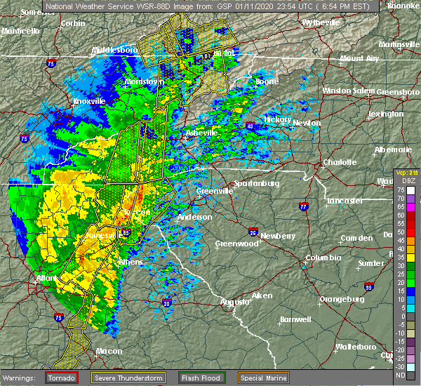 At 653 pm est, severe thunderstorms were located along a line extending from 8 miles south of waynesville to 9 miles west of walhalla, moving northeast at 40 mph (radar indicated). Hazards include 60 mph wind gusts. Expect damage to trees and power lines. locations impacted include, toccoa, mount airy, tallulah falls, tallulah gorge state park, long creek, pine mountain, turnerville, hollywood, boydville and eastanolee. A tornado watch remains in effect until midnight est for northeastern georgia, western north carolina, and upstate south carolina. At 653 pm est, severe thunderstorms were located along a line extending from 8 miles south of waynesville to 9 miles west of walhalla, moving northeast at 40 mph (radar indicated). Hazards include 60 mph wind gusts. Expect damage to trees and power lines. locations impacted include, toccoa, mount airy, tallulah falls, tallulah gorge state park, long creek, pine mountain, turnerville, hollywood, boydville and eastanolee. A tornado watch remains in effect until midnight est for northeastern georgia, western north carolina, and upstate south carolina.
|
| 1/11/2020 6:10 PM EST |
 At 610 pm est, severe thunderstorms were located along a line extending from near raoul to snellville to near mountain park, moving east at 45 mph (radar indicated). Hazards include 60 mph wind gusts. expect damage to roofs, siding, and trees At 610 pm est, severe thunderstorms were located along a line extending from near raoul to snellville to near mountain park, moving east at 45 mph (radar indicated). Hazards include 60 mph wind gusts. expect damage to roofs, siding, and trees
|
| 1/11/2020 5:59 PM EST |
 At 559 pm est, severe thunderstorms were located along a line extending from 11 miles northwest of clayton to 9 miles southeast of cleveland, moving northeast at 40 mph (radar indicated). Hazards include 60 mph wind gusts. expect damage to trees and power lines At 559 pm est, severe thunderstorms were located along a line extending from 11 miles northwest of clayton to 9 miles southeast of cleveland, moving northeast at 40 mph (radar indicated). Hazards include 60 mph wind gusts. expect damage to trees and power lines
|
| 10/31/2019 2:14 PM EDT |
 At 214 pm edt, severe thunderstorms were located along a line extending from 8 miles east of clayton to 6 miles northeast of toccoa to 7 miles northwest of carnesville, moving northeast at 45 mph (radar indicated). Hazards include 60 mph wind gusts. Expect damage to trees and power lines. Locations impacted include, toccoa, seneca, walhalla, clayton, carnesville, cornelia, westminster, lavonia, gumlog and mount airy. At 214 pm edt, severe thunderstorms were located along a line extending from 8 miles east of clayton to 6 miles northeast of toccoa to 7 miles northwest of carnesville, moving northeast at 45 mph (radar indicated). Hazards include 60 mph wind gusts. Expect damage to trees and power lines. Locations impacted include, toccoa, seneca, walhalla, clayton, carnesville, cornelia, westminster, lavonia, gumlog and mount airy.
|
| 10/31/2019 1:56 PM EDT |
 At 155 pm edt, severe thunderstorms were located along a line extending from 7 miles southwest of clayton to near clarkesville to 6 miles west of homer, moving northeast at 50 mph (radar indicated). Hazards include 60 mph wind gusts. expect damage to trees and power lines At 155 pm edt, severe thunderstorms were located along a line extending from 7 miles southwest of clayton to near clarkesville to 6 miles west of homer, moving northeast at 50 mph (radar indicated). Hazards include 60 mph wind gusts. expect damage to trees and power lines
|
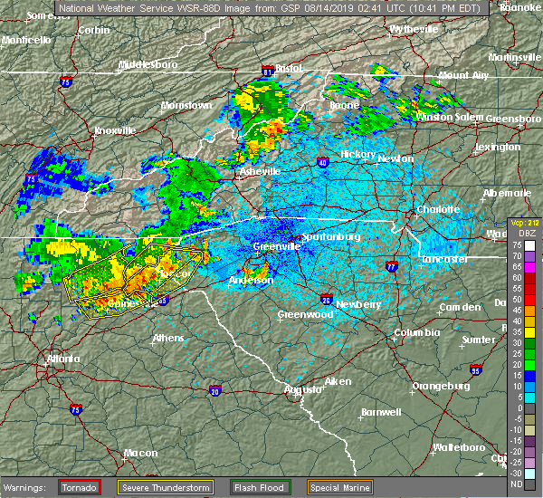
| 8/13/2019 10:49 PM EDT |
 At 1049 pm edt, severe thunderstorms were located along a line extending from near war hill park to near gainesville to raoul, moving southeast at 20 mph (radar indicated). Hazards include 60 mph wind gusts. Expect damage to roofs, siding, and trees. Locations impacted include, gainesville, homer, oakwood, lula, clermont, gillsville, murrayville and hollingsworth. At 1049 pm edt, severe thunderstorms were located along a line extending from near war hill park to near gainesville to raoul, moving southeast at 20 mph (radar indicated). Hazards include 60 mph wind gusts. Expect damage to roofs, siding, and trees. Locations impacted include, gainesville, homer, oakwood, lula, clermont, gillsville, murrayville and hollingsworth.
|
| 8/13/2019 10:41 PM EDT |
 At 1041 pm edt, severe thunderstorms were located along a line extending from 9 miles northwest of walhalla to 10 miles southeast of cleveland, moving east at 20 mph (radar indicated). Hazards include 60 mph wind gusts. expect damage to trees and power lines At 1041 pm edt, severe thunderstorms were located along a line extending from 9 miles northwest of walhalla to 10 miles southeast of cleveland, moving east at 20 mph (radar indicated). Hazards include 60 mph wind gusts. expect damage to trees and power lines
|
| 8/13/2019 10:36 PM EDT |
 At 1035 pm edt, severe thunderstorms were located along a line extending from near silver city to near murrayville to near raoul, moving southeast at 20 mph (radar indicated). Hazards include 60 mph wind gusts. expect damage to roofs, siding, and trees At 1035 pm edt, severe thunderstorms were located along a line extending from near silver city to near murrayville to near raoul, moving southeast at 20 mph (radar indicated). Hazards include 60 mph wind gusts. expect damage to roofs, siding, and trees
|
| 8/13/2019 10:06 PM EDT |
 At 1006 pm edt, severe thunderstorms were located along a line extending from near clayton to 7 miles south of cleveland, moving east at 25 mph (radar indicated). Hazards include 60 mph wind gusts. expect damage to trees and power lines At 1006 pm edt, severe thunderstorms were located along a line extending from near clayton to 7 miles south of cleveland, moving east at 25 mph (radar indicated). Hazards include 60 mph wind gusts. expect damage to trees and power lines
|
| 6/22/2019 1:49 AM EDT |
 At 149 am edt, severe thunderstorms were located along a line extending from 6 miles east of banks crossing to braselton, moving east at 45 mph (radar indicated). Hazards include 60 mph wind gusts. Expect damage to roofs, siding, and trees. Locations impacted include, gainesville, jefferson, commerce, homer, braselton, lula, maysville, hoschton, clermont, pendergrass, gillsville, talmo, peach state speedway, pinefield crossroads, murrayville, apple valley, hollingsworth and banks crossing. At 149 am edt, severe thunderstorms were located along a line extending from 6 miles east of banks crossing to braselton, moving east at 45 mph (radar indicated). Hazards include 60 mph wind gusts. Expect damage to roofs, siding, and trees. Locations impacted include, gainesville, jefferson, commerce, homer, braselton, lula, maysville, hoschton, clermont, pendergrass, gillsville, talmo, peach state speedway, pinefield crossroads, murrayville, apple valley, hollingsworth and banks crossing.
|
| 6/22/2019 1:41 AM EDT |
 The severe thunderstorm warning for franklin, stephens, habersham, rabun, northwestern pickens and oconee counties will expire at 145 am edt, the storm which prompted the warning has moved out of the area. therefore the warning will be allowed to expire. however small hail is still possible with this thunderstorm. a severe thunderstorm watch remains in effect until 500 am edt for northeastern georgia, western north carolina, and upstate south carolina. remember, a severe thunderstorm warning still remains in effect for habersham, stephens, oconee, and hart counties until 245 am. The severe thunderstorm warning for franklin, stephens, habersham, rabun, northwestern pickens and oconee counties will expire at 145 am edt, the storm which prompted the warning has moved out of the area. therefore the warning will be allowed to expire. however small hail is still possible with this thunderstorm. a severe thunderstorm watch remains in effect until 500 am edt for northeastern georgia, western north carolina, and upstate south carolina. remember, a severe thunderstorm warning still remains in effect for habersham, stephens, oconee, and hart counties until 245 am.
|
| 6/22/2019 1:21 AM EDT |
 At 121 am edt, severe thunderstorms were located along a line extending from near baldwin to war hill park, moving southeast at 45 mph (radar indicated). Hazards include 60 mph wind gusts. expect damage to roofs, siding, and trees At 121 am edt, severe thunderstorms were located along a line extending from near baldwin to war hill park, moving southeast at 45 mph (radar indicated). Hazards include 60 mph wind gusts. expect damage to roofs, siding, and trees
|
| 6/22/2019 12:48 AM EDT |
 At 1248 am edt, a severe thunderstorm was located 4 miles east of hiawassee, moving east at 35 mph (radar indicated). Hazards include 60 mph wind gusts and nickel size hail. expect damage to trees and power lines At 1248 am edt, a severe thunderstorm was located 4 miles east of hiawassee, moving east at 35 mph (radar indicated). Hazards include 60 mph wind gusts and nickel size hail. expect damage to trees and power lines
|
| 4/19/2019 6:15 AM EDT |
 At 615 am edt, a severe thunderstorm capable of producing a tornado was located near clarkesville, moving northeast at 45 mph (radar indicated rotation). Hazards include tornado. Flying debris will be dangerous to those caught without shelter. mobile homes will be damaged or destroyed. damage to roofs, windows, and vehicles will occur. tree damage is likely. this dangerous storm will be near, tallulah falls and lake rabun around 630 am edt. Other locations impacted by this dangerous storm include turnerville, hollywood and seed lake. At 615 am edt, a severe thunderstorm capable of producing a tornado was located near clarkesville, moving northeast at 45 mph (radar indicated rotation). Hazards include tornado. Flying debris will be dangerous to those caught without shelter. mobile homes will be damaged or destroyed. damage to roofs, windows, and vehicles will occur. tree damage is likely. this dangerous storm will be near, tallulah falls and lake rabun around 630 am edt. Other locations impacted by this dangerous storm include turnerville, hollywood and seed lake.
|
| 4/19/2019 5:53 AM EDT |
 At 553 am edt, a severe thunderstorm capable of producing a tornado was located 5 miles southwest of clarkesville, or near demorest, moving northeast at 50 mph (radar indicated rotation). Hazards include tornado. Flying debris will be dangerous to those caught without shelter. mobile homes will be damaged or destroyed. damage to roofs, windows, and vehicles will occur. tree damage is likely. this dangerous storm will be near, tallulah falls and lake rabun around 610 am edt. Other locations impacted by this dangerous thunderstorm include hollywood, seed lake, turnerville and raoul. At 553 am edt, a severe thunderstorm capable of producing a tornado was located 5 miles southwest of clarkesville, or near demorest, moving northeast at 50 mph (radar indicated rotation). Hazards include tornado. Flying debris will be dangerous to those caught without shelter. mobile homes will be damaged or destroyed. damage to roofs, windows, and vehicles will occur. tree damage is likely. this dangerous storm will be near, tallulah falls and lake rabun around 610 am edt. Other locations impacted by this dangerous thunderstorm include hollywood, seed lake, turnerville and raoul.
|
| 8/6/2018 5:51 PM EDT |
 At 551 pm edt, severe thunderstorms were located along a line extending from 20 miles west of laurens to 13 miles southeast of anderson to 5 miles south of hartwell to near clarkesville, moving southeast at 25 mph (radar indicated). Hazards include 60 mph wind gusts and quarter size hail. Minor hail damage to vehicles is expected. expect wind damage to trees and power lines. Locations impacted include, toccoa, hartwell, clarkesville, carnesville, belton, cornelia, honea path, baldwin, royston and lavonia. At 551 pm edt, severe thunderstorms were located along a line extending from 20 miles west of laurens to 13 miles southeast of anderson to 5 miles south of hartwell to near clarkesville, moving southeast at 25 mph (radar indicated). Hazards include 60 mph wind gusts and quarter size hail. Minor hail damage to vehicles is expected. expect wind damage to trees and power lines. Locations impacted include, toccoa, hartwell, clarkesville, carnesville, belton, cornelia, honea path, baldwin, royston and lavonia.
|
| 8/6/2018 5:29 PM EDT |
 At 529 pm edt, severe thunderstorms were located along a line extending from 17 miles south of greenville downtown to 10 miles southeast of anderson to 7 miles southeast of toccoa to near clarkesville, moving south at 15 mph (radar indicated). Hazards include 60 mph wind gusts and quarter size hail. Minor hail damage to vehicles is expected. Expect wind damage to trees and power lines. At 529 pm edt, severe thunderstorms were located along a line extending from 17 miles south of greenville downtown to 10 miles southeast of anderson to 7 miles southeast of toccoa to near clarkesville, moving south at 15 mph (radar indicated). Hazards include 60 mph wind gusts and quarter size hail. Minor hail damage to vehicles is expected. Expect wind damage to trees and power lines.
|
| 7/6/2018 3:56 PM EDT |
 The severe thunderstorm warning for western stephens and southeastern habersham counties will expire at 400 pm edt, the storm which prompted the warning has weakened below severe limits, and no longer poses an immediate threat to life or property. therefore the warning will be allowed to expire. however small hail and gusty winds are still possible with this thunderstorm. if you observed large hail or wind damage, please report it to the national weather service greenville-spartanburg by calling toll free, 1, 800, 2 6 7, 8 1 0 1, or by posting on our facebook page, or tweet it using hashtag nwsgsp. your message should describe the event and the specific location where it occurred. The severe thunderstorm warning for western stephens and southeastern habersham counties will expire at 400 pm edt, the storm which prompted the warning has weakened below severe limits, and no longer poses an immediate threat to life or property. therefore the warning will be allowed to expire. however small hail and gusty winds are still possible with this thunderstorm. if you observed large hail or wind damage, please report it to the national weather service greenville-spartanburg by calling toll free, 1, 800, 2 6 7, 8 1 0 1, or by posting on our facebook page, or tweet it using hashtag nwsgsp. your message should describe the event and the specific location where it occurred.
|
| 7/6/2018 3:13 PM EDT |
 At 313 pm edt, a severe thunderstorm was located near toccoa, moving southwest at 5 mph (radar indicated). Hazards include 60 mph wind gusts and quarter size hail. Minor hail damage to vehicles is expected. Expect wind damage to trees and power lines. At 313 pm edt, a severe thunderstorm was located near toccoa, moving southwest at 5 mph (radar indicated). Hazards include 60 mph wind gusts and quarter size hail. Minor hail damage to vehicles is expected. Expect wind damage to trees and power lines.
|
| 6/26/2018 8:33 PM EDT |
 At 833 pm edt, a severe thunderstorm was located 5 miles west of clarkesville, or 4 miles northwest of demorest, moving southeast at 15 mph (radar indicated). Hazards include 60 mph wind gusts and quarter size hail. Minor hail damage to vehicles is expected. expect wind damage to trees and power lines. Locations impacted include, clarkesville, cornelia, baldwin, demorest, mount airy, alto, raoul, hollywood, turnerville and batesville. At 833 pm edt, a severe thunderstorm was located 5 miles west of clarkesville, or 4 miles northwest of demorest, moving southeast at 15 mph (radar indicated). Hazards include 60 mph wind gusts and quarter size hail. Minor hail damage to vehicles is expected. expect wind damage to trees and power lines. Locations impacted include, clarkesville, cornelia, baldwin, demorest, mount airy, alto, raoul, hollywood, turnerville and batesville.
|
| 6/26/2018 8:12 PM EDT |
 At 812 pm edt, a severe thunderstorm was located 6 miles northeast of cleveland, or 4 miles southeast of helen, moving southeast at 15 mph (radar indicated). Hazards include 60 mph wind gusts and quarter size hail. Minor hail damage to vehicles is expected. Expect wind damage to trees and power lines. At 812 pm edt, a severe thunderstorm was located 6 miles northeast of cleveland, or 4 miles southeast of helen, moving southeast at 15 mph (radar indicated). Hazards include 60 mph wind gusts and quarter size hail. Minor hail damage to vehicles is expected. Expect wind damage to trees and power lines.
|
| 6/25/2018 5:13 PM EDT |
 At 512 pm edt, severe thunderstorms were located along a line extending from 12 miles northwest of pickens to 7 miles southwest of walhalla to 6 miles southwest of toccoa, moving southeast at 30 mph (radar indicated). Hazards include 60 mph wind gusts and quarter size hail. Minor hail damage to vehicles is expected. Expect wind damage to trees and power lines. At 512 pm edt, severe thunderstorms were located along a line extending from 12 miles northwest of pickens to 7 miles southwest of walhalla to 6 miles southwest of toccoa, moving southeast at 30 mph (radar indicated). Hazards include 60 mph wind gusts and quarter size hail. Minor hail damage to vehicles is expected. Expect wind damage to trees and power lines.
|
| 6/25/2018 4:56 PM EDT |
 At 456 pm edt, severe thunderstorms were located along a line extending from 8 miles east of clayton to 7 miles southeast of cleveland, moving east at 30 mph (radar indicated). Hazards include 60 mph wind gusts and quarter size hail. Minor hail damage to vehicles is expected. expect wind damage to trees and power lines. Locations impacted include, toccoa, clayton, clarkesville, cornelia, baldwin, demorest, mount airy, alto, mountain city and tiger. At 456 pm edt, severe thunderstorms were located along a line extending from 8 miles east of clayton to 7 miles southeast of cleveland, moving east at 30 mph (radar indicated). Hazards include 60 mph wind gusts and quarter size hail. Minor hail damage to vehicles is expected. expect wind damage to trees and power lines. Locations impacted include, toccoa, clayton, clarkesville, cornelia, baldwin, demorest, mount airy, alto, mountain city and tiger.
|
| 6/25/2018 4:34 PM EDT |
 At 433 pm edt, severe thunderstorms were located along a line extending from 6 miles northwest of clayton to 6 miles east of dahlonega, moving east at 30 mph (radar indicated). Hazards include 60 mph wind gusts and quarter size hail. Minor hail damage to vehicles is expected. Expect wind damage to trees and power lines. At 433 pm edt, severe thunderstorms were located along a line extending from 6 miles northwest of clayton to 6 miles east of dahlonega, moving east at 30 mph (radar indicated). Hazards include 60 mph wind gusts and quarter size hail. Minor hail damage to vehicles is expected. Expect wind damage to trees and power lines.
|
| 6/23/2018 4:15 PM EDT |
 At 414 pm edt, severe thunderstorms were located along a line extending from 3 miles south of franklin to near clayton to 4 miles northeast of clarkesville, moving east at 50 mph (radar indicated). Hazards include 60 mph wind gusts. Expect damage to trees and power lines. Locations impacted include, toccoa, franklin, clayton, clarkesville, cornelia, demorest, mount airy, highlands, mountain city and tiger. At 414 pm edt, severe thunderstorms were located along a line extending from 3 miles south of franklin to near clayton to 4 miles northeast of clarkesville, moving east at 50 mph (radar indicated). Hazards include 60 mph wind gusts. Expect damage to trees and power lines. Locations impacted include, toccoa, franklin, clayton, clarkesville, cornelia, demorest, mount airy, highlands, mountain city and tiger.
|
| 6/23/2018 3:43 PM EDT |
 At 342 pm edt, severe thunderstorms were located along a line extending from 4 miles south of andrews to 6 miles east of blairsville to 8 miles northeast of dahlonega, moving east at 50 mph (radar indicated). Hazards include 60 mph wind gusts. expect damage to trees and power lines At 342 pm edt, severe thunderstorms were located along a line extending from 4 miles south of andrews to 6 miles east of blairsville to 8 miles northeast of dahlonega, moving east at 50 mph (radar indicated). Hazards include 60 mph wind gusts. expect damage to trees and power lines
|
| 5/28/2018 9:59 PM EDT |
 A severe thunderstorm warning remains in effect until 1015 pm edt for banks and northeastern hall counties. at 959 pm edt, severe thunderstorms were located along a line extending from near gainesville to raoul to near pinefield crossroads, moving north at 25 mph. hazard. 60 mph wind gusts. A severe thunderstorm warning remains in effect until 1015 pm edt for banks and northeastern hall counties. at 959 pm edt, severe thunderstorms were located along a line extending from near gainesville to raoul to near pinefield crossroads, moving north at 25 mph. hazard. 60 mph wind gusts.
|
| 5/28/2018 9:52 PM EDT |
 At 952 pm edt, severe thunderstorms were located along a line extending from near gillsville to near raoul to 6 miles southeast of pinefield crossroads, moving northwest at 35 mph (radar indicated). Hazards include 60 mph wind gusts. Expect damage to roofs, siding, and trees. Locations impacted include, gainesville, jefferson, commerce, homer, lula, maysville, pendergrass, gillsville, pinefield crossroads and hollingsworth. At 952 pm edt, severe thunderstorms were located along a line extending from near gillsville to near raoul to 6 miles southeast of pinefield crossroads, moving northwest at 35 mph (radar indicated). Hazards include 60 mph wind gusts. Expect damage to roofs, siding, and trees. Locations impacted include, gainesville, jefferson, commerce, homer, lula, maysville, pendergrass, gillsville, pinefield crossroads and hollingsworth.
|
| 5/28/2018 9:34 PM EDT |
 At 934 pm edt, severe thunderstorms were located along a line extending from near pendergrass to banks crossing to pocataligo, moving north at 25 mph (radar indicated). Hazards include 60 mph wind gusts. expect damage to roofs, siding, and trees At 934 pm edt, severe thunderstorms were located along a line extending from near pendergrass to banks crossing to pocataligo, moving north at 25 mph (radar indicated). Hazards include 60 mph wind gusts. expect damage to roofs, siding, and trees
|
| 3/17/2018 9:36 PM EDT |
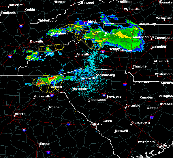 At 936 pm edt, a severe thunderstorm was located 12 miles north of cleveland, or near unicoi state park, moving southeast at 50 mph (radar indicated). Hazards include 60 mph wind gusts and quarter size hail. Minor hail damage to vehicles is expected. Expect wind damage to trees and power lines. At 936 pm edt, a severe thunderstorm was located 12 miles north of cleveland, or near unicoi state park, moving southeast at 50 mph (radar indicated). Hazards include 60 mph wind gusts and quarter size hail. Minor hail damage to vehicles is expected. Expect wind damage to trees and power lines.
|
| 7/19/2017 7:25 PM EDT |
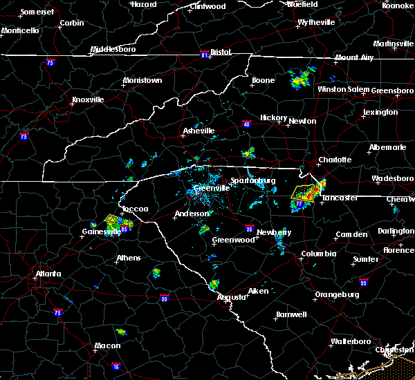 At 724 pm edt, a severe thunderstorm was located 7 miles southwest of toccoa, or 4 miles east of mount airy, moving southwest at 5 mph (radar indicated). Hazards include 60 mph wind gusts and penny size hail. Expect damage to trees and power lines. Locations impacted include, mount airy, boydville and cornelia. At 724 pm edt, a severe thunderstorm was located 7 miles southwest of toccoa, or 4 miles east of mount airy, moving southwest at 5 mph (radar indicated). Hazards include 60 mph wind gusts and penny size hail. Expect damage to trees and power lines. Locations impacted include, mount airy, boydville and cornelia.
|
| 7/19/2017 7:00 PM EDT |
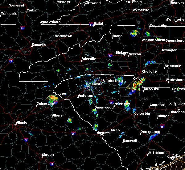 At 700 pm edt, a severe thunderstorm was located 4 miles southwest of toccoa, moving south at 5 mph (radar indicated). Hazards include 60 mph wind gusts and quarter size hail. Minor hail damage to vehicles is expected. Expect wind damage to trees and power lines. At 700 pm edt, a severe thunderstorm was located 4 miles southwest of toccoa, moving south at 5 mph (radar indicated). Hazards include 60 mph wind gusts and quarter size hail. Minor hail damage to vehicles is expected. Expect wind damage to trees and power lines.
|
| 7/5/2017 6:22 PM EDT |
 The severe thunderstorm warning for banks, northeastern hall and north central jackson counties will expire at 630 pm edt, the storms that prompted the warning have weakened below severe limits and no longer poses an immediate threat to life or property. therefore the warning will be allowed to expire. however small hail, gusty winds and heavy rain are still possible with these thunderstorms, especially across banks and northern jackson counties. to report severe weather, contact your nearest law enforcement agency. they will relay your report to the national weather service peachtree city. The severe thunderstorm warning for banks, northeastern hall and north central jackson counties will expire at 630 pm edt, the storms that prompted the warning have weakened below severe limits and no longer poses an immediate threat to life or property. therefore the warning will be allowed to expire. however small hail, gusty winds and heavy rain are still possible with these thunderstorms, especially across banks and northern jackson counties. to report severe weather, contact your nearest law enforcement agency. they will relay your report to the national weather service peachtree city.
|
| 7/5/2017 5:55 PM EDT |
 At 555 pm edt, a severe thunderstorm was located near lula, moving northeast at 25 mph (radar indicated). Hazards include 60 mph wind gusts and quarter size hail. Hail damage to vehicles is expected. Expect wind damage to roofs, siding, and trees. At 555 pm edt, a severe thunderstorm was located near lula, moving northeast at 25 mph (radar indicated). Hazards include 60 mph wind gusts and quarter size hail. Hail damage to vehicles is expected. Expect wind damage to roofs, siding, and trees.
|
| 6/23/2017 8:31 PM EDT |
 At 831 pm edt, severe thunderstorms were located along a line extending from near murrayville to near gainesville to near oakwood, moving northeast at 50 mph (radar indicated). Hazards include 60 mph wind gusts. Expect damage to roofs, siding, and trees. Locations impacted include, gainesville, homer, flowery branch, oakwood, lula, clermont, gillsville, candler, murrayville and hollingsworth. At 831 pm edt, severe thunderstorms were located along a line extending from near murrayville to near gainesville to near oakwood, moving northeast at 50 mph (radar indicated). Hazards include 60 mph wind gusts. Expect damage to roofs, siding, and trees. Locations impacted include, gainesville, homer, flowery branch, oakwood, lula, clermont, gillsville, candler, murrayville and hollingsworth.
|
| 6/23/2017 8:13 PM EDT |
 At 812 pm edt, severe thunderstorms were located along a line extending from near silver city to near chestatee to buford dam-lake lanier parks, moving northeast at 45 mph (radar indicated). Hazards include 60 mph wind gusts. expect damage to roofs, siding, and trees At 812 pm edt, severe thunderstorms were located along a line extending from near silver city to near chestatee to buford dam-lake lanier parks, moving northeast at 45 mph (radar indicated). Hazards include 60 mph wind gusts. expect damage to roofs, siding, and trees
|
| 6/22/2017 8:49 PM EDT |
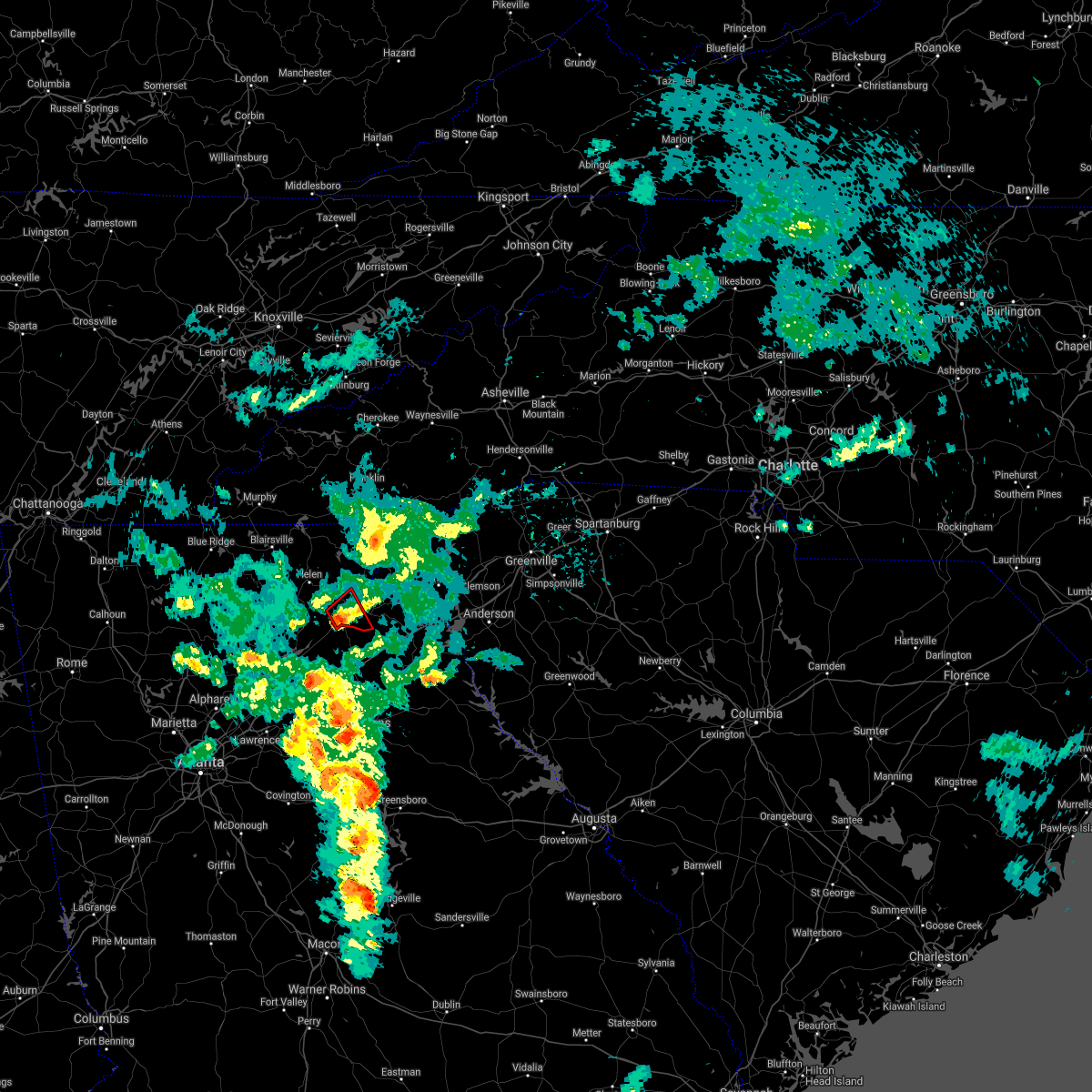 At 848 pm edt, a severe thunderstorm capable of producing a tornado was located 8 miles south of clarkesville, or over baldwin, moving northeast at 15 mph (radar indicated rotation). Hazards include tornado. Flying debris will be dangerous to those caught without shelter. mobile homes will be damaged or destroyed. damage to roofs, windows, and vehicles will occur. tree damage is likely. This dangerous storm will be near, clarkesville, mount airy, cornelia and demorest around 900 pm edt. At 848 pm edt, a severe thunderstorm capable of producing a tornado was located 8 miles south of clarkesville, or over baldwin, moving northeast at 15 mph (radar indicated rotation). Hazards include tornado. Flying debris will be dangerous to those caught without shelter. mobile homes will be damaged or destroyed. damage to roofs, windows, and vehicles will occur. tree damage is likely. This dangerous storm will be near, clarkesville, mount airy, cornelia and demorest around 900 pm edt.
|
| 6/22/2017 8:12 PM EDT |
 At 812 pm edt, a severe thunderstorm capable of producing a tornado was located 11 miles south of cleveland, or 4 miles northwest of lula, moving northeast at 20 mph (radar indicated rotation). Hazards include tornado. Flying debris will be dangerous to those caught without shelter. mobile homes will be damaged or destroyed. damage to roofs, windows, and vehicles will occur. tree damage is likely. this dangerous storm will be near, baldwin and alto around 840 pm edt. cornelia, mount airy and demorest around 850 pm edt. clarkesville around 900 pm edt. Other locations impacted by this dangerous thunderstorm include raoul. At 812 pm edt, a severe thunderstorm capable of producing a tornado was located 11 miles south of cleveland, or 4 miles northwest of lula, moving northeast at 20 mph (radar indicated rotation). Hazards include tornado. Flying debris will be dangerous to those caught without shelter. mobile homes will be damaged or destroyed. damage to roofs, windows, and vehicles will occur. tree damage is likely. this dangerous storm will be near, baldwin and alto around 840 pm edt. cornelia, mount airy and demorest around 850 pm edt. clarkesville around 900 pm edt. Other locations impacted by this dangerous thunderstorm include raoul.
|
| 6/14/2017 5:30 PM EDT |
 At 530 pm edt, a severe thunderstorm was located over hollingsworth, or near homer, and is nearly stationary (radar indicated). Hazards include 60 mph wind gusts. expect damage to roofs, siding, and trees At 530 pm edt, a severe thunderstorm was located over hollingsworth, or near homer, and is nearly stationary (radar indicated). Hazards include 60 mph wind gusts. expect damage to roofs, siding, and trees
|
| 5/28/2017 1:06 AM EDT |
 The severe thunderstorm warning for stephens, habersham, pickens and oconee counties will expire at 115 am edt, the storms which prompted the warning have weakened below severe limits, and have exited the warned area. therefore the warning will be allowed to expire. however gusty winds are still possible with these thunderstorms. a severe thunderstorm watch remains in effect until 200 am edt for western north carolina. a severe thunderstorm watch also remains in effect until 600 am edt for northeastern georgia, and upstate south carolina. The severe thunderstorm warning for stephens, habersham, pickens and oconee counties will expire at 115 am edt, the storms which prompted the warning have weakened below severe limits, and have exited the warned area. therefore the warning will be allowed to expire. however gusty winds are still possible with these thunderstorms. a severe thunderstorm watch remains in effect until 200 am edt for western north carolina. a severe thunderstorm watch also remains in effect until 600 am edt for northeastern georgia, and upstate south carolina.
|
| 5/28/2017 12:46 AM EDT |
 At 1246 am edt, severe thunderstorms were located along a line extending from 8 miles southwest of pickens to 10 miles south of cleveland, moving southeast at 40 mph (radar indicated). Hazards include 60 mph wind gusts and penny size hail. Expect damage to trees and power lines. Locations impacted include, easley, clemson, toccoa, seneca, walhalla, pickens, clarkesville, central, cornelia and liberty. At 1246 am edt, severe thunderstorms were located along a line extending from 8 miles southwest of pickens to 10 miles south of cleveland, moving southeast at 40 mph (radar indicated). Hazards include 60 mph wind gusts and penny size hail. Expect damage to trees and power lines. Locations impacted include, easley, clemson, toccoa, seneca, walhalla, pickens, clarkesville, central, cornelia and liberty.
|
| 5/28/2017 12:11 AM EDT |
 At 1211 am edt, severe thunderstorms were located along a line extending from 19 miles southwest of brevard to 11 miles south of blairsville, moving southeast at 45 mph (radar indicated). Hazards include 60 mph wind gusts and penny size hail. expect damage to trees and power lines At 1211 am edt, severe thunderstorms were located along a line extending from 19 miles southwest of brevard to 11 miles south of blairsville, moving southeast at 45 mph (radar indicated). Hazards include 60 mph wind gusts and penny size hail. expect damage to trees and power lines
|
| 4/27/2017 6:08 PM EDT |
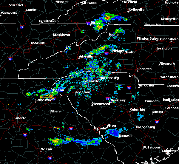 At 545 pm edt, a severe thunderstorm was located over alto, or 8 miles north of homer, moving east at 35 mph (radar indicated). Hazards include 60 mph wind gusts and quarter size hail. Hail damage to vehicles is expected. expect wind damage to roofs, siding, and trees. Locations impacted include, baldwin, raoul and hollingsworth. At 545 pm edt, a severe thunderstorm was located over alto, or 8 miles north of homer, moving east at 35 mph (radar indicated). Hazards include 60 mph wind gusts and quarter size hail. Hail damage to vehicles is expected. expect wind damage to roofs, siding, and trees. Locations impacted include, baldwin, raoul and hollingsworth.
|
| 4/27/2017 5:45 PM EDT |
 At 545 pm edt, a severe thunderstorm was located over alto, or 8 miles north of homer, moving east at 35 mph (radar indicated). Hazards include 60 mph wind gusts and quarter size hail. Hail damage to vehicles is expected. expect wind damage to roofs, siding, and trees. Locations impacted include, baldwin, raoul and hollingsworth. At 545 pm edt, a severe thunderstorm was located over alto, or 8 miles north of homer, moving east at 35 mph (radar indicated). Hazards include 60 mph wind gusts and quarter size hail. Hail damage to vehicles is expected. expect wind damage to roofs, siding, and trees. Locations impacted include, baldwin, raoul and hollingsworth.
|
| 4/27/2017 5:31 PM EDT |
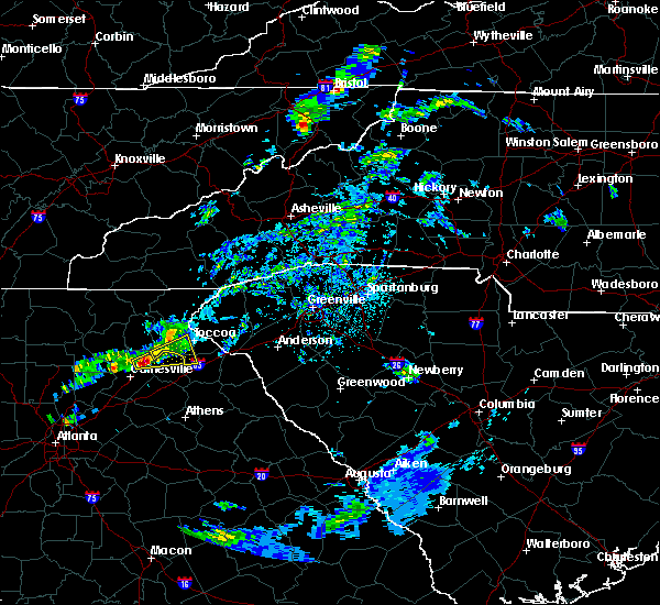 At 530 pm edt, a severe thunderstorm was located 11 miles northeast of gainesville, or near lula, moving east at 30 mph (radar indicated). Hazards include 60 mph wind gusts and quarter size hail. Hail damage to vehicles is expected. Expect wind damage to roofs, siding, and trees. At 530 pm edt, a severe thunderstorm was located 11 miles northeast of gainesville, or near lula, moving east at 30 mph (radar indicated). Hazards include 60 mph wind gusts and quarter size hail. Hail damage to vehicles is expected. Expect wind damage to roofs, siding, and trees.
|
| 4/27/2017 5:27 PM EDT |
 At 527 pm edt, a severe thunderstorm was located near lula, or 9 miles northeast of gainesville, moving east at 30 mph (radar indicated). Hazards include 60 mph wind gusts and quarter size hail. Hail damage to vehicles is expected. Expect wind damage to roofs, siding, and trees. At 527 pm edt, a severe thunderstorm was located near lula, or 9 miles northeast of gainesville, moving east at 30 mph (radar indicated). Hazards include 60 mph wind gusts and quarter size hail. Hail damage to vehicles is expected. Expect wind damage to roofs, siding, and trees.
|
| 4/5/2017 11:31 PM EDT |
 At 1131 pm edt, a severe thunderstorm was located over commerce, moving east at 40 mph (radar indicated). Hazards include tennis ball size hail and 60 mph wind gusts. People and animals outdoors will be injured. expect hail damage to roofs, siding, windows, and vehicles. expect wind damage to roofs, siding, and trees. Locations impacted include, jefferson, commerce, homer, danielsville, lula, maysville, arcade, nicholson, comer, colbert, ila, carlton, gillsville, hull, athens-clarke county, westgate park, diamond hill, smithonia, barretts mill and point peter. At 1131 pm edt, a severe thunderstorm was located over commerce, moving east at 40 mph (radar indicated). Hazards include tennis ball size hail and 60 mph wind gusts. People and animals outdoors will be injured. expect hail damage to roofs, siding, windows, and vehicles. expect wind damage to roofs, siding, and trees. Locations impacted include, jefferson, commerce, homer, danielsville, lula, maysville, arcade, nicholson, comer, colbert, ila, carlton, gillsville, hull, athens-clarke county, westgate park, diamond hill, smithonia, barretts mill and point peter.
|
| 4/5/2017 11:27 PM EDT |
 At 1126 pm edt, a severe thunderstorm was located over apple valley, or over commerce, moving east at 40 mph (radar indicated). Hazards include 60 mph wind gusts and quarter size hail. Hail damage to vehicles is expected. expect wind damage to roofs, siding, and trees. Locations impacted include, jefferson, commerce, homer, danielsville, lula, maysville, arcade, nicholson, comer, colbert, ila, carlton, gillsville, hull, athens-clarke county, westgate park, diamond hill, smithonia, barretts mill and point peter. At 1126 pm edt, a severe thunderstorm was located over apple valley, or over commerce, moving east at 40 mph (radar indicated). Hazards include 60 mph wind gusts and quarter size hail. Hail damage to vehicles is expected. expect wind damage to roofs, siding, and trees. Locations impacted include, jefferson, commerce, homer, danielsville, lula, maysville, arcade, nicholson, comer, colbert, ila, carlton, gillsville, hull, athens-clarke county, westgate park, diamond hill, smithonia, barretts mill and point peter.
|
| 4/5/2017 11:19 PM EDT |
 At 1119 pm edt, severe thunderstorms were located along a line extending from 9 miles south of clarkesville to 4 miles north of commerce to 3 miles south of jefferson, moving northeast at 75 mph (radar indicated). Hazards include 60 mph wind gusts and quarter size hail. Hail damage to vehicles is expected. Expect wind damage to roofs, siding, and trees. At 1119 pm edt, severe thunderstorms were located along a line extending from 9 miles south of clarkesville to 4 miles north of commerce to 3 miles south of jefferson, moving northeast at 75 mph (radar indicated). Hazards include 60 mph wind gusts and quarter size hail. Hail damage to vehicles is expected. Expect wind damage to roofs, siding, and trees.
|
| 4/5/2017 11:06 PM EDT |
 At 1106 pm edt, a severe thunderstorm was located over talmo, or 8 miles southeast of gainesville, moving east at 70 mph (radar indicated). Hazards include 60 mph wind gusts and quarter size hail. Hail damage to vehicles is expected. Expect wind damage to roofs, siding, and trees. At 1106 pm edt, a severe thunderstorm was located over talmo, or 8 miles southeast of gainesville, moving east at 70 mph (radar indicated). Hazards include 60 mph wind gusts and quarter size hail. Hail damage to vehicles is expected. Expect wind damage to roofs, siding, and trees.
|
| 3/21/2017 9:00 PM EDT | Tree and power lines down on apple pie ridge roa in habersham county GA, 0.5 miles WSW of Baldwin, GA |
| 3/21/2017 8:44 PM EDT |
 At 843 pm edt, severe thunderstorms were located extending from demorest to near gainesville to buford, moving east-southeast at 50 mph (radar indicated, plus multiple reports of downed trees and powerlines due to the very strong winds). Hazards include 60 mph wind gusts and penny size hail. expect damage to roofs, siding, and trees At 843 pm edt, severe thunderstorms were located extending from demorest to near gainesville to buford, moving east-southeast at 50 mph (radar indicated, plus multiple reports of downed trees and powerlines due to the very strong winds). Hazards include 60 mph wind gusts and penny size hail. expect damage to roofs, siding, and trees
|
| 3/21/2017 8:44 PM EDT |
 At 844 pm edt, severe thunderstorms were located along a line extending from 4 miles northeast of clayton to 13 miles northwest of toccoa to 7 miles south of clarkesville, moving east at 30 mph (radar indicated). Hazards include 60 mph wind gusts and penny size hail. Expect damage to siding and trees. Locations impacted include, clayton, clarkesville, cornelia, demorest, mount airy, mountain city, tiger, dillard, sky valley and tallulah falls. At 844 pm edt, severe thunderstorms were located along a line extending from 4 miles northeast of clayton to 13 miles northwest of toccoa to 7 miles south of clarkesville, moving east at 30 mph (radar indicated). Hazards include 60 mph wind gusts and penny size hail. Expect damage to siding and trees. Locations impacted include, clayton, clarkesville, cornelia, demorest, mount airy, mountain city, tiger, dillard, sky valley and tallulah falls.
|
| 3/21/2017 8:16 PM EDT |
 At 815 pm edt, severe thunderstorms were located along a line extending from 5 miles northeast of hayesville to 11 miles southeast of hiawassee to near cleveland, moving east at 30 mph (radar indicated). Hazards include 60 mph wind gusts and penny size hail. Expect damage to roofs. Siding and trees. At 815 pm edt, severe thunderstorms were located along a line extending from 5 miles northeast of hayesville to 11 miles southeast of hiawassee to near cleveland, moving east at 30 mph (radar indicated). Hazards include 60 mph wind gusts and penny size hail. Expect damage to roofs. Siding and trees.
|
| 3/21/2017 6:49 PM EDT |
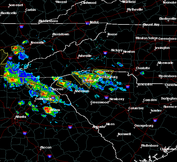 At 649 pm edt, a severe thunderstorm was located 8 miles southwest of clarkesville, or 4 miles northwest of baldwin, moving east at 20 mph (radar indicated). Hazards include quarter size hail. damage to vehicles is expected At 649 pm edt, a severe thunderstorm was located 8 miles southwest of clarkesville, or 4 miles northwest of baldwin, moving east at 20 mph (radar indicated). Hazards include quarter size hail. damage to vehicles is expected
|
| 3/21/2017 5:43 PM EDT |
 At 543 pm edt, a severe thunderstorm was located near mossy creek, or 9 miles southeast of cleveland, and is nearly stationary (radar indicated). Hazards include half dollar size hail. Damage to vehicles is expected. Locations impacted include, lula, clermont and mossy creek. At 543 pm edt, a severe thunderstorm was located near mossy creek, or 9 miles southeast of cleveland, and is nearly stationary (radar indicated). Hazards include half dollar size hail. Damage to vehicles is expected. Locations impacted include, lula, clermont and mossy creek.
|
| 3/21/2017 5:13 PM EDT |
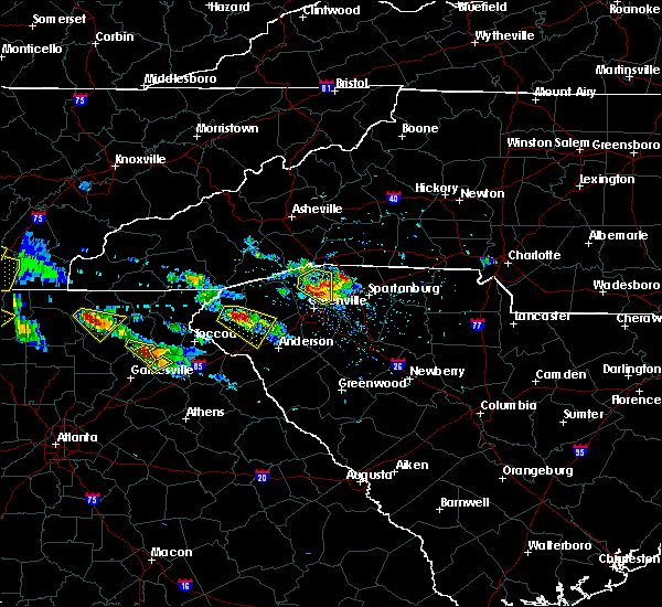 At 513 pm edt, a severe thunderstorm was located near mossy creek, or 7 miles south of cleveland, and is nearly stationary (radar indicated). Hazards include ping pong ball size hail. People and animals outdoors will be injured. Expect damage to roofs, siding, windows, and vehicles. At 513 pm edt, a severe thunderstorm was located near mossy creek, or 7 miles south of cleveland, and is nearly stationary (radar indicated). Hazards include ping pong ball size hail. People and animals outdoors will be injured. Expect damage to roofs, siding, windows, and vehicles.
|
| 3/21/2017 4:11 PM EDT |
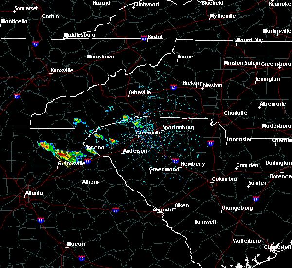 At 411 pm edt, a severe thunderstorm was located near mossy creek, or 9 miles southeast of cleveland, moving southeast at 10 mph (radar indicated). Hazards include ping pong ball size hail and 60 mph wind gusts. People and animals outdoors will be injured. expect hail damage to roofs, siding, windows, and vehicles. expect wind damage to roofs, siding, and trees. Locations impacted include, cleveland, baldwin, lula, clermont, gillsville and mossy creek. At 411 pm edt, a severe thunderstorm was located near mossy creek, or 9 miles southeast of cleveland, moving southeast at 10 mph (radar indicated). Hazards include ping pong ball size hail and 60 mph wind gusts. People and animals outdoors will be injured. expect hail damage to roofs, siding, windows, and vehicles. expect wind damage to roofs, siding, and trees. Locations impacted include, cleveland, baldwin, lula, clermont, gillsville and mossy creek.
|
| 3/21/2017 3:50 PM EDT |
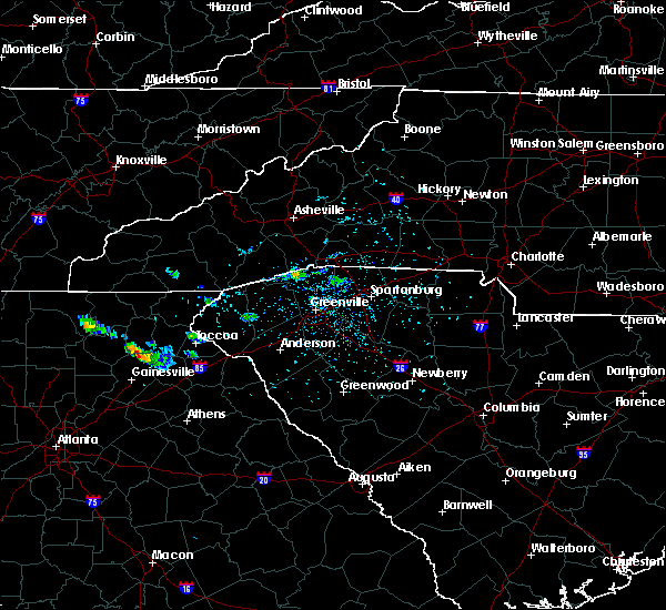 At 350 pm edt, a severe thunderstorm was located over clermont, or near cleveland, moving southeast at 10 mph (radar indicated). Hazards include 60 mph wind gusts and quarter size hail. Hail damage to vehicles is expected. Expect wind damage to roofs, siding, and trees. At 350 pm edt, a severe thunderstorm was located over clermont, or near cleveland, moving southeast at 10 mph (radar indicated). Hazards include 60 mph wind gusts and quarter size hail. Hail damage to vehicles is expected. Expect wind damage to roofs, siding, and trees.
|
| 3/1/2017 5:09 PM EST |
 At 509 pm est, a severe thunderstorm was located 9 miles northwest of homer, or near alto, moving northeast at 65 mph (radar indicated). Hazards include 60 mph wind gusts and penny size hail. Expect damage to roofs. Siding and trees. At 509 pm est, a severe thunderstorm was located 9 miles northwest of homer, or near alto, moving northeast at 65 mph (radar indicated). Hazards include 60 mph wind gusts and penny size hail. Expect damage to roofs. Siding and trees.
|
| 11/30/2016 3:11 PM EST |
 At 311 pm est, severe thunderstorms were located along a line extending from banks crossing to nicholson to near westgate park, moving northeast at 45 mph (radar indicated). Hazards include 60 mph wind gusts. Expect damage to roofs. siding. And trees. At 311 pm est, severe thunderstorms were located along a line extending from banks crossing to nicholson to near westgate park, moving northeast at 45 mph (radar indicated). Hazards include 60 mph wind gusts. Expect damage to roofs. siding. And trees.
|
| 11/30/2016 3:05 PM EST |
 At 305 pm est, severe thunderstorms were located along a line extending from 16 miles west of brevard to 15 miles north of walhalla to 6 miles south of clayton to 6 miles southeast of clarkesville, moving east at 45 mph (radar indicated). Hazards include 60 mph wind gusts. Expect damage to roofs. siding and trees. Locations impacted include, toccoa, clayton, clarkesville, cornelia, mount airy, highlands, mountain city, tiger, avalon and dillard. At 305 pm est, severe thunderstorms were located along a line extending from 16 miles west of brevard to 15 miles north of walhalla to 6 miles south of clayton to 6 miles southeast of clarkesville, moving east at 45 mph (radar indicated). Hazards include 60 mph wind gusts. Expect damage to roofs. siding and trees. Locations impacted include, toccoa, clayton, clarkesville, cornelia, mount airy, highlands, mountain city, tiger, avalon and dillard.
|
| 11/30/2016 2:45 PM EST |
 At 245 pm est, severe thunderstorms were located along a line extending from 13 miles southeast of franklin to near clayton to 14 miles southeast of hiawassee to 9 miles southeast of cleveland, moving east at 25 mph (radar indicated). Hazards include 60 mph wind gusts. Expect damage to roofs. Siding and trees. At 245 pm est, severe thunderstorms were located along a line extending from 13 miles southeast of franklin to near clayton to 14 miles southeast of hiawassee to 9 miles southeast of cleveland, moving east at 25 mph (radar indicated). Hazards include 60 mph wind gusts. Expect damage to roofs. Siding and trees.
|
| 5/11/2016 2:49 PM EDT |
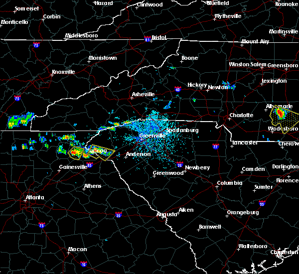 At 249 pm edt, a severe thunderstorm was located near clarkesville, moving southeast at 10 mph (radar indicated). Hazards include 60 mph wind gusts and quarter size hail. Hail damage to vehicles is expected. expect wind damage to roofs, siding and trees. Locations impacted include, clarkesville, cornelia, demorest, mount airy, hollywood, turnerville and baldwin. At 249 pm edt, a severe thunderstorm was located near clarkesville, moving southeast at 10 mph (radar indicated). Hazards include 60 mph wind gusts and quarter size hail. Hail damage to vehicles is expected. expect wind damage to roofs, siding and trees. Locations impacted include, clarkesville, cornelia, demorest, mount airy, hollywood, turnerville and baldwin.
|
| 5/11/2016 2:29 PM EDT |
 At 228 pm edt, a severe thunderstorm was located 4 miles northwest of clarkesville, moving southeast at 10 mph (radar indicated). Hazards include 60 mph wind gusts and quarter size hail. Hail damage to vehicles is expected. Expect wind damage to roofs, siding and trees. At 228 pm edt, a severe thunderstorm was located 4 miles northwest of clarkesville, moving southeast at 10 mph (radar indicated). Hazards include 60 mph wind gusts and quarter size hail. Hail damage to vehicles is expected. Expect wind damage to roofs, siding and trees.
|
| 8/17/2015 8:48 PM EDT |
 At 847 pm edt, severe thunderstorms were located extending from near homer to near ila, moving northeast at 35 mph (radar indicated). Hazards include 60 mph wind gusts. Expect damage to roofs. siding and trees. Other locations in the warning include but are not limited to jefferson, commerce, homer, maysville, arcade, nicholson, ila, gillsville, pinefield crossroads, hollingsworth, apple valley, bear creek reservoir, peach state speedway, banks crossing, pocataligo and vanna. At 847 pm edt, severe thunderstorms were located extending from near homer to near ila, moving northeast at 35 mph (radar indicated). Hazards include 60 mph wind gusts. Expect damage to roofs. siding and trees. Other locations in the warning include but are not limited to jefferson, commerce, homer, maysville, arcade, nicholson, ila, gillsville, pinefield crossroads, hollingsworth, apple valley, bear creek reservoir, peach state speedway, banks crossing, pocataligo and vanna.
|
| 8/17/2015 8:15 PM EDT |
 At 814 pm edt, severe thunderstorms were located extending from pendergrass to arcade, moving northeast at 35 mph. these storms have a history of producing wind damage (radar indicated). Hazards include 60 mph wind gusts. Expect damage to roofs. siding and trees. Other locations in the warning include but are not limited to jefferson, commerce, homer, braselton, statham, maysville, arcade, nicholson, hoschton, bogart, pendergrass, ila, gillsville, talmo, pinefield crossroads, hollingsworth, apple valley, bear creek reservoir, peach state speedway and banks crossing. At 814 pm edt, severe thunderstorms were located extending from pendergrass to arcade, moving northeast at 35 mph. these storms have a history of producing wind damage (radar indicated). Hazards include 60 mph wind gusts. Expect damage to roofs. siding and trees. Other locations in the warning include but are not limited to jefferson, commerce, homer, braselton, statham, maysville, arcade, nicholson, hoschton, bogart, pendergrass, ila, gillsville, talmo, pinefield crossroads, hollingsworth, apple valley, bear creek reservoir, peach state speedway and banks crossing.
|
| 8/10/2015 5:27 PM EDT |
 At 526 pm edt, emergency management reported a line of severe thunderstorms producing damaging winds in excess of 60 mph. these storms were located along a line extending from 6 miles northwest of clayton to 9 miles southwest of toccoa, and moving east at 40 mph. * locations in the warning include, anderson, easley, clemson, toccoa, seneca, hartwell, walhalla, pickens, clayton and clarkesville. At 526 pm edt, emergency management reported a line of severe thunderstorms producing damaging winds in excess of 60 mph. these storms were located along a line extending from 6 miles northwest of clayton to 9 miles southwest of toccoa, and moving east at 40 mph. * locations in the warning include, anderson, easley, clemson, toccoa, seneca, hartwell, walhalla, pickens, clayton and clarkesville.
|
| 8/10/2015 5:21 PM EDT |
 At 521 pm edt, a severe thunderstorm was located near alto, or near homer, moving east at 15 mph (radar indicated). Hazards include 60 mph wind gusts and quarter size hail. Hail damage to vehicles is expected. expect wind damage to roofs, siding and trees. Other locations in the warning include but are not limited to homer, baldwin, alto, gillsville, pinefield crossroads and hollingsworth. At 521 pm edt, a severe thunderstorm was located near alto, or near homer, moving east at 15 mph (radar indicated). Hazards include 60 mph wind gusts and quarter size hail. Hail damage to vehicles is expected. expect wind damage to roofs, siding and trees. Other locations in the warning include but are not limited to homer, baldwin, alto, gillsville, pinefield crossroads and hollingsworth.
|
| 7/14/2015 7:35 PM EDT |
 At 734 pm edt, doppler radar indicated a line of severe thunderstorms with a history of producing damaging winds in excess of 60 mph. these storms were located along a line extending from 6 miles east of clemson to 8 miles east of carnesville to 7 miles west of homer, moving southeast at 25 mph. locations impacted include, anderson, clemson, toccoa, seneca, hartwell, carnesville, homeland park, central, lake hartwell, williamston and cornelia. At 734 pm edt, doppler radar indicated a line of severe thunderstorms with a history of producing damaging winds in excess of 60 mph. these storms were located along a line extending from 6 miles east of clemson to 8 miles east of carnesville to 7 miles west of homer, moving southeast at 25 mph. locations impacted include, anderson, clemson, toccoa, seneca, hartwell, carnesville, homeland park, central, lake hartwell, williamston and cornelia.
|
| 7/14/2015 7:07 PM EDT |
 At 705 pm edt, doppler radar indicated a line of severe thunderstorms with a history of producing damaging winds of up to 70 mph. these storms were located along a line extending from 5 miles northeast of walhalla to 5 miles south of toccoa to 9 miles southwest of clarkesville, moving south at 45 mph. locations impacted include, anderson, clemson, toccoa, seneca, hartwell, walhalla, clarkesville, carnesville, lake keowee, lake hartwell, homeland park and central. At 705 pm edt, doppler radar indicated a line of severe thunderstorms with a history of producing damaging winds of up to 70 mph. these storms were located along a line extending from 5 miles northeast of walhalla to 5 miles south of toccoa to 9 miles southwest of clarkesville, moving south at 45 mph. locations impacted include, anderson, clemson, toccoa, seneca, hartwell, walhalla, clarkesville, carnesville, lake keowee, lake hartwell, homeland park and central.
|
| 7/14/2015 6:48 PM EDT |
 At 646 pm edt, doppler radar indicated a line of severe thunderstorms with a history of producing damaging winds up to 60 mph. these storms were located along a line extending from 17 miles southeast of franklin to 8 miles east of clayton to 8 miles northwest of clarkesville, and moving southeast at 40 mph. At 646 pm edt, doppler radar indicated a line of severe thunderstorms with a history of producing damaging winds up to 60 mph. these storms were located along a line extending from 17 miles southeast of franklin to 8 miles east of clayton to 8 miles northwest of clarkesville, and moving southeast at 40 mph.
|
| 6/24/2015 4:40 PM EDT |
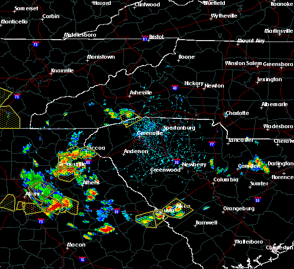 The severe thunderstorm warning for southern habersham county will expire at 445 pm edt, the storm which prompted the warning has weakened below severe limits and exited the warned area. therefore the warning will be allowed to expire. however gusty winds and heavy rain are still possible with this thunderstorm. The severe thunderstorm warning for southern habersham county will expire at 445 pm edt, the storm which prompted the warning has weakened below severe limits and exited the warned area. therefore the warning will be allowed to expire. however gusty winds and heavy rain are still possible with this thunderstorm.
|
| 6/24/2015 4:07 PM EDT |
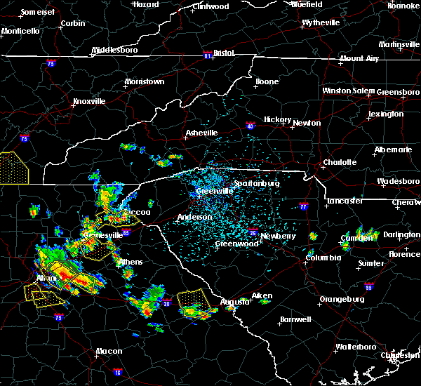 At 407 pm edt, doppler radar indicated a severe thunderstorm capable of producing damaging winds in excess of 60 mph. this storm was located near clarkesville, or over demorest, and moving south at 10 mph. penny size hail may also accompany the damaging winds. At 407 pm edt, doppler radar indicated a severe thunderstorm capable of producing damaging winds in excess of 60 mph. this storm was located near clarkesville, or over demorest, and moving south at 10 mph. penny size hail may also accompany the damaging winds.
|
| 4/20/2015 2:45 PM EDT | At 244 pm edt, a severe thunderstorm was located near lula, or 7 miles northwest of homer, moving east at 45 mph (radar indicated). Hazards include 70 mph wind gusts and quarter size hail. Hail damage to vehicles is expected. expect considerable tree damage. wind damage is also likely to mobile homes, roofs and outbuildings. other locations in the warning include but are not limited to homer, baldwin, lula, gillsville, raoul, pinefield crossroads and hollingsworth. a tornado watch remains in effect until 800 pm edt for northeastern georgia. 1. 00in. |
| 7/16/2012 3:07 PM EDT | Multiple trees and power lines down on willingham s in habersham county GA, 0.5 miles WSW of Baldwin, GA |
| 4/17/2012 7:11 PM EDT | The public relayed a report of a 60 mph gust measured two miles south of baldwin in banks county GA, 2.1 miles NNW of Baldwin, GA |
| 1/1/0001 12:00 AM | Quarter sized hail reported 0.5 miles WSW of Baldwin, GA, hail the size of quarters at the airport. damage to vehicles. |
Hail Maps for Baldwin, GA


Connect with Interactive Hail Maps