

Hail Map for Belk, AL
The Belk, AL area has had 0 reports of on-the-ground hail by trained spotters, and has been under severe weather warnings 25 times during the past 12 months. Doppler radar has detected hail at or near Belk, AL on 57 occasions, including 7 occasions during the past year.
| Name: | Belk, AL |
| Where Located: | 52.3 miles ENE of Starkville, MS |
| Map: | Google Map for Belk, AL |
| Population: | 215 |
| Housing Units: | 106 |
| More Info: | Search Google for Belk, AL |
0
The Top Recent Hail Date for Belk, AL is Saturday, August 12, 2023 (48th out of 57)

Hail and Wind Damage Spotted near Belk, AL
| Date / Time | Report Details |
|---|---|
| 3/15/2024 6:16 AM CDT |
 the severe thunderstorm warning has been cancelled and is no longer in effect the severe thunderstorm warning has been cancelled and is no longer in effect
|
| 3/15/2024 5:46 AM CDT |
 Svrbmx the national weather service in birmingham has issued a * severe thunderstorm warning for, northwestern tuscaloosa county in west central alabama, southern fayette county in west central alabama, * until 645 am cdt. * at 546 am cdt, severe thunderstorms were located along a line extending from bluff to near kennedy, moving east at 30 mph (radar indicated). Hazards include 60 mph wind gusts. expect damage to roofs, siding, and trees Svrbmx the national weather service in birmingham has issued a * severe thunderstorm warning for, northwestern tuscaloosa county in west central alabama, southern fayette county in west central alabama, * until 645 am cdt. * at 546 am cdt, severe thunderstorms were located along a line extending from bluff to near kennedy, moving east at 30 mph (radar indicated). Hazards include 60 mph wind gusts. expect damage to roofs, siding, and trees
|
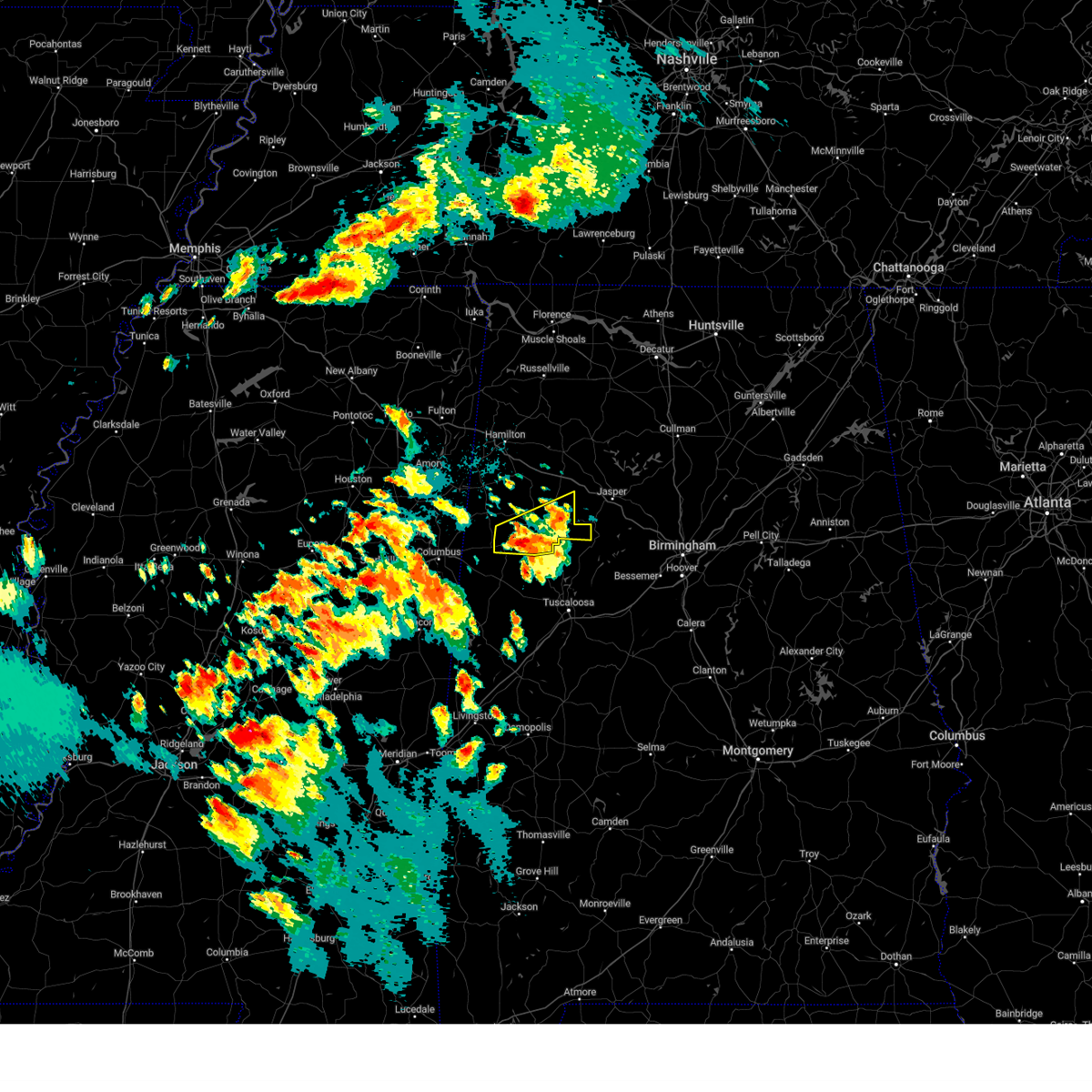
| 8/12/2023 3:53 PM CDT |
 At 353 pm cdt, a severe thunderstorm was located over belk, or near fayette, moving southeast at 20 mph (radar indicated). Hazards include 60 mph wind gusts and penny size hail. Expect damage to roofs, siding, and trees. locations impacted include, fayette, kennedy, belk, crossville, bevill state college fayette, cody, stone wall, richard arthur field and fayette county public lake. hail threat, radar indicated max hail size, 0. 75 in wind threat, radar indicated max wind gust, 60 mph. At 353 pm cdt, a severe thunderstorm was located over belk, or near fayette, moving southeast at 20 mph (radar indicated). Hazards include 60 mph wind gusts and penny size hail. Expect damage to roofs, siding, and trees. locations impacted include, fayette, kennedy, belk, crossville, bevill state college fayette, cody, stone wall, richard arthur field and fayette county public lake. hail threat, radar indicated max hail size, 0. 75 in wind threat, radar indicated max wind gust, 60 mph.
|
| 8/12/2023 3:40 PM CDT |
 At 340 pm cdt, a severe thunderstorm was located near blooming grove, or 7 miles southeast of vernon, moving southeast at 20 mph (radar indicated). Hazards include 60 mph wind gusts and penny size hail. expect damage to roofs, siding, and trees At 340 pm cdt, a severe thunderstorm was located near blooming grove, or 7 miles southeast of vernon, moving southeast at 20 mph (radar indicated). Hazards include 60 mph wind gusts and penny size hail. expect damage to roofs, siding, and trees
|
| 8/7/2023 3:26 PM CDT |
 At 326 pm cdt, severe thunderstorms were located along a line extending from clay to near west jefferson to 6 miles north of samantha, moving southeast at 30 mph (radar indicated). Hazards include 60 mph wind gusts. Expect damage to roofs, siding, and trees. locations impacted include, northern birmingham, trussville, jasper, gardendale, fultondale, fayette, sumiton, cordova, dora, reform, center point, clay, pinson, tarrant, adamsville, warrior, kimberly, graysville, morris and brookside. hail threat, radar indicated max hail size, <. 75 in wind threat, radar indicated max wind gust, 60 mph. At 326 pm cdt, severe thunderstorms were located along a line extending from clay to near west jefferson to 6 miles north of samantha, moving southeast at 30 mph (radar indicated). Hazards include 60 mph wind gusts. Expect damage to roofs, siding, and trees. locations impacted include, northern birmingham, trussville, jasper, gardendale, fultondale, fayette, sumiton, cordova, dora, reform, center point, clay, pinson, tarrant, adamsville, warrior, kimberly, graysville, morris and brookside. hail threat, radar indicated max hail size, <. 75 in wind threat, radar indicated max wind gust, 60 mph.
|
| 8/7/2023 3:07 PM CDT |
 At 307 pm cdt, severe thunderstorms were located along a line extending from near county line to gorgas to 8 miles northeast of ashcraft corner, moving southeast at 30 mph (radar indicated). Hazards include 60 mph wind gusts. Expect damage to roofs, siding, and trees. locations impacted include, northern birmingham, trussville, jasper, gardendale, fultondale, fayette, sumiton, cordova, dora, carbon hill, vernon, reform, millport, center point, clay, pinson, tarrant, adamsville, warrior and kimberly. hail threat, radar indicated max hail size, <. 75 in wind threat, radar indicated max wind gust, 60 mph. At 307 pm cdt, severe thunderstorms were located along a line extending from near county line to gorgas to 8 miles northeast of ashcraft corner, moving southeast at 30 mph (radar indicated). Hazards include 60 mph wind gusts. Expect damage to roofs, siding, and trees. locations impacted include, northern birmingham, trussville, jasper, gardendale, fultondale, fayette, sumiton, cordova, dora, carbon hill, vernon, reform, millport, center point, clay, pinson, tarrant, adamsville, warrior and kimberly. hail threat, radar indicated max hail size, <. 75 in wind threat, radar indicated max wind gust, 60 mph.
|
| 8/7/2023 2:47 PM CDT |
 At 246 pm cdt, severe thunderstorms were located along a line extending from near arkadelphia to oakman to belk, moving southeast at 30 mph (radar indicated). Hazards include 60 mph wind gusts. expect damage to roofs, siding, and trees At 246 pm cdt, severe thunderstorms were located along a line extending from near arkadelphia to oakman to belk, moving southeast at 30 mph (radar indicated). Hazards include 60 mph wind gusts. expect damage to roofs, siding, and trees
|
| 8/6/2023 2:19 PM CDT |
 At 218 pm cdt, severe thunderstorms were located along a line extending from near fayette to near ashcraft corner to near reform, moving east at 25 mph (emergency management). Hazards include 70 mph wind gusts and quarter size hail. Hail damage to vehicles is expected. expect considerable tree damage. wind damage is also likely to mobile homes, roofs, and outbuildings. locations impacted include, fayette, gordo, reform, carrollton, berry, belk, bankston, bull city, samantha, lake lurleen state park, ashcraft corner, boley springs, bankhead lock and dam, binion creek landing, stone wall, whitson, lake tuscaloosa, moores bridge, richard arthur field and windham springs. thunderstorm damage threat, considerable hail threat, radar indicated max hail size, 1. 00 in wind threat, radar indicated max wind gust, 70 mph. At 218 pm cdt, severe thunderstorms were located along a line extending from near fayette to near ashcraft corner to near reform, moving east at 25 mph (emergency management). Hazards include 70 mph wind gusts and quarter size hail. Hail damage to vehicles is expected. expect considerable tree damage. wind damage is also likely to mobile homes, roofs, and outbuildings. locations impacted include, fayette, gordo, reform, carrollton, berry, belk, bankston, bull city, samantha, lake lurleen state park, ashcraft corner, boley springs, bankhead lock and dam, binion creek landing, stone wall, whitson, lake tuscaloosa, moores bridge, richard arthur field and windham springs. thunderstorm damage threat, considerable hail threat, radar indicated max hail size, 1. 00 in wind threat, radar indicated max wind gust, 70 mph.
|
| 8/6/2023 1:53 PM CDT |
 At 153 pm cdt, severe thunderstorms were located along a line extending from near vernon to near millport to 6 miles northwest of carrollton, moving east at 25 mph (radar indicated). Hazards include 60 mph wind gusts and quarter size hail. Hail damage to vehicles is expected. Expect wind damage to roofs, siding, and trees. At 153 pm cdt, severe thunderstorms were located along a line extending from near vernon to near millport to 6 miles northwest of carrollton, moving east at 25 mph (radar indicated). Hazards include 60 mph wind gusts and quarter size hail. Hail damage to vehicles is expected. Expect wind damage to roofs, siding, and trees.
|
| 8/5/2023 9:41 PM CDT |
 At 940 pm cdt, a severe thunderstorm was located over berry, or 11 miles east of fayette, moving east at 15 mph (radar indicated). Hazards include 60 mph wind gusts and quarter size hail. Hail damage to vehicles is expected. expect wind damage to roofs, siding, and trees. locations impacted include, fayette, berry, parrish, oakman, belk, boley springs, bankston, stone wall, whitson, richard arthur field, windham springs, west corona, fayette county public lake, new lexington, bevill state college fayette, fowlers crossroads, wiley, the wye and corona. hail threat, radar indicated max hail size, 1. 00 in wind threat, radar indicated max wind gust, 60 mph. At 940 pm cdt, a severe thunderstorm was located over berry, or 11 miles east of fayette, moving east at 15 mph (radar indicated). Hazards include 60 mph wind gusts and quarter size hail. Hail damage to vehicles is expected. expect wind damage to roofs, siding, and trees. locations impacted include, fayette, berry, parrish, oakman, belk, boley springs, bankston, stone wall, whitson, richard arthur field, windham springs, west corona, fayette county public lake, new lexington, bevill state college fayette, fowlers crossroads, wiley, the wye and corona. hail threat, radar indicated max hail size, 1. 00 in wind threat, radar indicated max wind gust, 60 mph.
|
| 8/5/2023 9:26 PM CDT |
 At 926 pm cdt, a severe thunderstorm was located over bankston, or 7 miles east of fayette, moving east at 15 mph (radar indicated). Hazards include 60 mph wind gusts and quarter size hail. Hail damage to vehicles is expected. Expect wind damage to roofs, siding, and trees. At 926 pm cdt, a severe thunderstorm was located over bankston, or 7 miles east of fayette, moving east at 15 mph (radar indicated). Hazards include 60 mph wind gusts and quarter size hail. Hail damage to vehicles is expected. Expect wind damage to roofs, siding, and trees.
|
| 8/3/2023 3:11 PM CDT |
 At 311 pm cdt, severe thunderstorms were located along a line extending from near vernon to near boley springs, moving southeast at 25 mph (radar indicated). Hazards include 60 mph wind gusts. Expect damage to roofs, siding, and trees. locations impacted include, fayette, vernon, millport, berry, kennedy, belk, ashcraft corner, boley springs, bankston, crossville, cody, stone wall, richard arthur field, lamar county public lake, fayette county public lake, star, hightogy and melborne. hail threat, radar indicated max hail size, <. 75 in wind threat, radar indicated max wind gust, 60 mph. At 311 pm cdt, severe thunderstorms were located along a line extending from near vernon to near boley springs, moving southeast at 25 mph (radar indicated). Hazards include 60 mph wind gusts. Expect damage to roofs, siding, and trees. locations impacted include, fayette, vernon, millport, berry, kennedy, belk, ashcraft corner, boley springs, bankston, crossville, cody, stone wall, richard arthur field, lamar county public lake, fayette county public lake, star, hightogy and melborne. hail threat, radar indicated max hail size, <. 75 in wind threat, radar indicated max wind gust, 60 mph.
|
| 8/3/2023 2:54 PM CDT |
 At 254 pm cdt, severe thunderstorms were located along a line extending from bedford to near boley springs, moving southeast at 30 mph (radar indicated). Hazards include 60 mph wind gusts. Expect damage to roofs, siding, and trees. locations impacted include, fayette, vernon, sulligent, millport, berry, kennedy, belk, bankston, bluff, ashcraft corner, boley springs, blooming grove, lamar county airport, bedford, crossville, cody, stone wall, richard arthur field, fayette county public lake and star. hail threat, radar indicated max hail size, <. 75 in wind threat, radar indicated max wind gust, 60 mph. At 254 pm cdt, severe thunderstorms were located along a line extending from bedford to near boley springs, moving southeast at 30 mph (radar indicated). Hazards include 60 mph wind gusts. Expect damage to roofs, siding, and trees. locations impacted include, fayette, vernon, sulligent, millport, berry, kennedy, belk, bankston, bluff, ashcraft corner, boley springs, blooming grove, lamar county airport, bedford, crossville, cody, stone wall, richard arthur field, fayette county public lake and star. hail threat, radar indicated max hail size, <. 75 in wind threat, radar indicated max wind gust, 60 mph.
|
| 8/3/2023 2:42 PM CDT |
 At 242 pm cdt, severe thunderstorms were located along a line extending from 6 miles northwest of bedford to 7 miles south of kansas, moving southeast at 25 mph (radar indicated). Hazards include 60 mph wind gusts. Expect damage to roofs, siding, and trees. locations impacted include, winfield, fayette, vernon, sulligent, millport, berry, glen allen, kennedy, belk, beaverton, gu- win, bankston, bluff, ashcraft corner, boley springs, blooming grove, lamar county airport, crews, bedford and crossville. hail threat, radar indicated max hail size, <. 75 in wind threat, radar indicated max wind gust, 60 mph. At 242 pm cdt, severe thunderstorms were located along a line extending from 6 miles northwest of bedford to 7 miles south of kansas, moving southeast at 25 mph (radar indicated). Hazards include 60 mph wind gusts. Expect damage to roofs, siding, and trees. locations impacted include, winfield, fayette, vernon, sulligent, millport, berry, glen allen, kennedy, belk, beaverton, gu- win, bankston, bluff, ashcraft corner, boley springs, blooming grove, lamar county airport, crews, bedford and crossville. hail threat, radar indicated max hail size, <. 75 in wind threat, radar indicated max wind gust, 60 mph.
|
| 8/3/2023 2:39 PM CDT |
 At 238 pm cdt, severe thunderstorms were located along a line extending from 7 miles northwest of bedford to 6 miles south of kansas, moving southeast at 25 mph (radar indicated). Hazards include 60 mph wind gusts. Expect damage to roofs, siding, and trees. locations impacted include, winfield, fayette, vernon, sulligent, millport, guin, berry, glen allen, kennedy, belk, beaverton, gu- win, bankston, bluff, ashcraft corner, boley springs, blooming grove, lamar county airport, crews and bedford. hail threat, radar indicated max hail size, <. 75 in wind threat, radar indicated max wind gust, 60 mph. At 238 pm cdt, severe thunderstorms were located along a line extending from 7 miles northwest of bedford to 6 miles south of kansas, moving southeast at 25 mph (radar indicated). Hazards include 60 mph wind gusts. Expect damage to roofs, siding, and trees. locations impacted include, winfield, fayette, vernon, sulligent, millport, guin, berry, glen allen, kennedy, belk, beaverton, gu- win, bankston, bluff, ashcraft corner, boley springs, blooming grove, lamar county airport, crews and bedford. hail threat, radar indicated max hail size, <. 75 in wind threat, radar indicated max wind gust, 60 mph.
|
| 8/3/2023 2:24 PM CDT |
 At 224 pm cdt, severe thunderstorms were located along a line extending from 9 miles southwest of detroit to near eldridge, moving southeast at 25 mph (radar indicated). Hazards include 60 mph wind gusts. expect damage to roofs, siding, and trees At 224 pm cdt, severe thunderstorms were located along a line extending from 9 miles southwest of detroit to near eldridge, moving southeast at 25 mph (radar indicated). Hazards include 60 mph wind gusts. expect damage to roofs, siding, and trees
|
| 7/1/2023 6:36 PM CDT |
 The severe thunderstorm warning for northeastern pickens, southwestern fayette and southeastern lamar counties will expire at 645 pm cdt, the storm which prompted the warning has weakened below severe limits. therefore, the warning will be allowed to expire. however small hail, gusty winds and heavy rain are still possible with this thunderstorm. a severe thunderstorm watch remains in effect until 800 pm cdt for west central alabama. The severe thunderstorm warning for northeastern pickens, southwestern fayette and southeastern lamar counties will expire at 645 pm cdt, the storm which prompted the warning has weakened below severe limits. therefore, the warning will be allowed to expire. however small hail, gusty winds and heavy rain are still possible with this thunderstorm. a severe thunderstorm watch remains in effect until 800 pm cdt for west central alabama.
|
| 7/1/2023 6:18 PM CDT |
 At 618 pm cdt, a severe thunderstorm was located over ashcraft corner, or 9 miles east of millport, moving southeast at 10 mph (radar indicated). Hazards include 60 mph wind gusts and quarter size hail. Hail damage to vehicles is expected. expect wind damage to roofs, siding, and trees. locations impacted include, kennedy, belk and ashcraft corner. hail threat, radar indicated max hail size, 1. 00 in wind threat, radar indicated max wind gust, 60 mph. At 618 pm cdt, a severe thunderstorm was located over ashcraft corner, or 9 miles east of millport, moving southeast at 10 mph (radar indicated). Hazards include 60 mph wind gusts and quarter size hail. Hail damage to vehicles is expected. expect wind damage to roofs, siding, and trees. locations impacted include, kennedy, belk and ashcraft corner. hail threat, radar indicated max hail size, 1. 00 in wind threat, radar indicated max wind gust, 60 mph.
|
| 7/1/2023 6:02 PM CDT |
 At 602 pm cdt, a severe thunderstorm was located over kennedy, or near millport, moving southeast at 10 mph (radar indicated). Hazards include 60 mph wind gusts and quarter size hail. Hail damage to vehicles is expected. Expect wind damage to roofs, siding, and trees. At 602 pm cdt, a severe thunderstorm was located over kennedy, or near millport, moving southeast at 10 mph (radar indicated). Hazards include 60 mph wind gusts and quarter size hail. Hail damage to vehicles is expected. Expect wind damage to roofs, siding, and trees.
|
| 6/18/2023 9:45 PM CDT |
 At 944 pm cdt, a severe thunderstorm was located near fayette, moving east at 40 mph (radar indicated). Hazards include golf ball size hail and 60 mph wind gusts. People and animals outdoors will be injured. expect hail damage to roofs, siding, windows, and vehicles. expect wind damage to roofs, siding, and trees. locations impacted include, fayette, berry, belk, boley springs, bankston, ashcraft corner, bevill state college fayette, stone wall, fowlers crossroads, richard arthur field and fayette county public lake. thunderstorm damage threat, considerable hail threat, radar indicated max hail size, 1. 75 in wind threat, radar indicated max wind gust, 60 mph. At 944 pm cdt, a severe thunderstorm was located near fayette, moving east at 40 mph (radar indicated). Hazards include golf ball size hail and 60 mph wind gusts. People and animals outdoors will be injured. expect hail damage to roofs, siding, windows, and vehicles. expect wind damage to roofs, siding, and trees. locations impacted include, fayette, berry, belk, boley springs, bankston, ashcraft corner, bevill state college fayette, stone wall, fowlers crossroads, richard arthur field and fayette county public lake. thunderstorm damage threat, considerable hail threat, radar indicated max hail size, 1. 75 in wind threat, radar indicated max wind gust, 60 mph.
|
| 6/18/2023 9:37 PM CDT |
 At 937 pm cdt, a severe thunderstorm was located near belk, or near fayette, moving east at 40 mph (radar indicated). Hazards include golf ball size hail and 60 mph wind gusts. People and animals outdoors will be injured. expect hail damage to roofs, siding, windows, and vehicles. expect wind damage to roofs, siding, and trees. locations impacted include, fayette, millport, berry, kennedy, belk, ashcraft corner, boley springs, bankston, cody, stone wall, richard arthur field, fayette county public lake, bevill state college fayette and fowlers crossroads. thunderstorm damage threat, considerable hail threat, radar indicated max hail size, 1. 75 in wind threat, radar indicated max wind gust, 60 mph. At 937 pm cdt, a severe thunderstorm was located near belk, or near fayette, moving east at 40 mph (radar indicated). Hazards include golf ball size hail and 60 mph wind gusts. People and animals outdoors will be injured. expect hail damage to roofs, siding, windows, and vehicles. expect wind damage to roofs, siding, and trees. locations impacted include, fayette, millport, berry, kennedy, belk, ashcraft corner, boley springs, bankston, cody, stone wall, richard arthur field, fayette county public lake, bevill state college fayette and fowlers crossroads. thunderstorm damage threat, considerable hail threat, radar indicated max hail size, 1. 75 in wind threat, radar indicated max wind gust, 60 mph.
|
| 6/18/2023 9:29 PM CDT |
 At 929 pm cdt, a severe thunderstorm was located over belk, or near fayette, moving east at 40 mph (radar indicated). Hazards include ping pong ball size hail and 60 mph wind gusts. People and animals outdoors will be injured. expect hail damage to roofs, siding, windows, and vehicles. expect wind damage to roofs, siding, and trees. locations impacted include, fayette, millport, berry, kennedy, belk, ashcraft corner, boley springs, bankston, cody, stone wall, richard arthur field, fayette county public lake, bevill state college fayette and fowlers crossroads. hail threat, radar indicated max hail size, 1. 50 in wind threat, radar indicated max wind gust, 60 mph. At 929 pm cdt, a severe thunderstorm was located over belk, or near fayette, moving east at 40 mph (radar indicated). Hazards include ping pong ball size hail and 60 mph wind gusts. People and animals outdoors will be injured. expect hail damage to roofs, siding, windows, and vehicles. expect wind damage to roofs, siding, and trees. locations impacted include, fayette, millport, berry, kennedy, belk, ashcraft corner, boley springs, bankston, cody, stone wall, richard arthur field, fayette county public lake, bevill state college fayette and fowlers crossroads. hail threat, radar indicated max hail size, 1. 50 in wind threat, radar indicated max wind gust, 60 mph.
|
| 6/18/2023 9:17 PM CDT |
 At 917 pm cdt, a severe thunderstorm was located near kennedy, or near millport, moving east at 40 mph (radar indicated). Hazards include 60 mph wind gusts and quarter size hail. Hail damage to vehicles is expected. Expect wind damage to roofs, siding, and trees. At 917 pm cdt, a severe thunderstorm was located near kennedy, or near millport, moving east at 40 mph (radar indicated). Hazards include 60 mph wind gusts and quarter size hail. Hail damage to vehicles is expected. Expect wind damage to roofs, siding, and trees.
|
| 6/11/2023 9:40 PM CDT |
 At 940 pm cdt, severe thunderstorms were located along a line extending from near beaverton to lamar county airport to bedford, moving southeast at 50 mph (radar indicated). Hazards include 60 mph wind gusts and nickel size hail. Expect damage to roofs, siding, and trees. locations impacted include, winfield, vernon, sulligent, glen allen, belk, beaverton, gu- win, blooming grove, lamar county airport, crews, bedford, bluff, crossville, cody, bazemore, wayside, lamar county public lake, hubbertville, pine springs and hightogy. hail threat, radar indicated max hail size, 0. 88 in wind threat, radar indicated max wind gust, 60 mph. At 940 pm cdt, severe thunderstorms were located along a line extending from near beaverton to lamar county airport to bedford, moving southeast at 50 mph (radar indicated). Hazards include 60 mph wind gusts and nickel size hail. Expect damage to roofs, siding, and trees. locations impacted include, winfield, vernon, sulligent, glen allen, belk, beaverton, gu- win, blooming grove, lamar county airport, crews, bedford, bluff, crossville, cody, bazemore, wayside, lamar county public lake, hubbertville, pine springs and hightogy. hail threat, radar indicated max hail size, 0. 88 in wind threat, radar indicated max wind gust, 60 mph.
|
| 6/11/2023 9:13 PM CDT |
 At 912 pm cdt, severe thunderstorms were located along a line extending from 6 miles northwest of detroit to near smithville to amory, moving southeast at 50 mph (radar indicated). Hazards include 60 mph wind gusts and nickel size hail. expect damage to roofs, siding, and trees At 912 pm cdt, severe thunderstorms were located along a line extending from 6 miles northwest of detroit to near smithville to amory, moving southeast at 50 mph (radar indicated). Hazards include 60 mph wind gusts and nickel size hail. expect damage to roofs, siding, and trees
|
| 3/3/2023 10:32 AM CST |
 At 1032 am cst, severe thunderstorms were located along a line extending from 6 miles southeast of killen to near belk, moving northeast at 45 mph (radar indicated). Hazards include 60 mph wind gusts. Expect damage to roofs, siding, and trees. locations impacted include, winfield, fayette, millport, guin, brilliant, glen allen, kennedy, belk, gu- win, bluff, ashcraft corner, blooming grove, brinn, lake buttahatchee, crossville, bear creek, twin, tucker, cody and wayside. hail threat, radar indicated max hail size, <. 75 in wind threat, radar indicated max wind gust, 60 mph. At 1032 am cst, severe thunderstorms were located along a line extending from 6 miles southeast of killen to near belk, moving northeast at 45 mph (radar indicated). Hazards include 60 mph wind gusts. Expect damage to roofs, siding, and trees. locations impacted include, winfield, fayette, millport, guin, brilliant, glen allen, kennedy, belk, gu- win, bluff, ashcraft corner, blooming grove, brinn, lake buttahatchee, crossville, bear creek, twin, tucker, cody and wayside. hail threat, radar indicated max hail size, <. 75 in wind threat, radar indicated max wind gust, 60 mph.
|
| 3/3/2023 10:18 AM CST |
 At 1018 am cst, severe thunderstorms were located along a line extending from near muscle shoals to near millport, moving east at 45 mph (radar indicated). Hazards include 60 mph wind gusts. Expect damage to roofs, siding, and trees. locations impacted include, hamilton, winfield, fayette, vernon, sulligent, millport, guin, hackleburg, brilliant, glen allen, kennedy, belk, beaverton, gu- win, weston, bluff, ashcraft corner, blooming grove, lamar county airport and brinn. hail threat, radar indicated max hail size, <. 75 in wind threat, radar indicated max wind gust, 60 mph. At 1018 am cst, severe thunderstorms were located along a line extending from near muscle shoals to near millport, moving east at 45 mph (radar indicated). Hazards include 60 mph wind gusts. Expect damage to roofs, siding, and trees. locations impacted include, hamilton, winfield, fayette, vernon, sulligent, millport, guin, hackleburg, brilliant, glen allen, kennedy, belk, beaverton, gu- win, weston, bluff, ashcraft corner, blooming grove, lamar county airport and brinn. hail threat, radar indicated max hail size, <. 75 in wind threat, radar indicated max wind gust, 60 mph.
|
| 3/3/2023 10:05 AM CST |
 At 1005 am cst, severe thunderstorms were located along a line extending from near tuscumbia to near caledonia, moving east at 45 mph (radar indicated). Hazards include 60 mph wind gusts. Expect damage to roofs, siding, and trees. locations impacted include, hamilton, winfield, fayette, vernon, sulligent, millport, guin, hackleburg, brilliant, glen allen, kennedy, detroit, belk, beaverton, gu-win, bluff, blooming grove, brinn, lake buttahatchee and weston. hail threat, radar indicated max hail size, <. 75 in wind threat, radar indicated max wind gust, 60 mph. At 1005 am cst, severe thunderstorms were located along a line extending from near tuscumbia to near caledonia, moving east at 45 mph (radar indicated). Hazards include 60 mph wind gusts. Expect damage to roofs, siding, and trees. locations impacted include, hamilton, winfield, fayette, vernon, sulligent, millport, guin, hackleburg, brilliant, glen allen, kennedy, detroit, belk, beaverton, gu-win, bluff, blooming grove, brinn, lake buttahatchee and weston. hail threat, radar indicated max hail size, <. 75 in wind threat, radar indicated max wind gust, 60 mph.
|
| 3/3/2023 9:45 AM CST |
 At 944 am cst, severe thunderstorms were located along a line extending from 8 miles east of tishomingo state park to near columbus afb, moving northeast at 55 mph (radar indicated). Hazards include 60 mph wind gusts. Expect damage to roofs, siding, and trees. locations impacted include, hamilton, winfield, fayette, vernon, sulligent, millport, guin, hackleburg, brilliant, glen allen, kennedy, detroit, belk, beaverton, gu-win, bluff, blooming grove, brinn, lake buttahatchee and weston. hail threat, radar indicated max hail size, <. 75 in wind threat, radar indicated max wind gust, 60 mph. At 944 am cst, severe thunderstorms were located along a line extending from 8 miles east of tishomingo state park to near columbus afb, moving northeast at 55 mph (radar indicated). Hazards include 60 mph wind gusts. Expect damage to roofs, siding, and trees. locations impacted include, hamilton, winfield, fayette, vernon, sulligent, millport, guin, hackleburg, brilliant, glen allen, kennedy, detroit, belk, beaverton, gu-win, bluff, blooming grove, brinn, lake buttahatchee and weston. hail threat, radar indicated max hail size, <. 75 in wind threat, radar indicated max wind gust, 60 mph.
|
| 3/3/2023 9:29 AM CST |
 At 928 am cst, severe thunderstorms were located along a line extending from near tishomingo to near tibbee, moving northeast at 55 mph (radar indicated). Hazards include 60 mph wind gusts. expect damage to roofs, siding, and trees At 928 am cst, severe thunderstorms were located along a line extending from near tishomingo to near tibbee, moving northeast at 55 mph (radar indicated). Hazards include 60 mph wind gusts. expect damage to roofs, siding, and trees
|
| 11/29/2022 6:09 PM CST |
 At 609 pm cst, a severe thunderstorm was located near fayette, moving northeast at 40 mph (radar indicated). Hazards include half dollar size hail. damage to vehicles is expected At 609 pm cst, a severe thunderstorm was located near fayette, moving northeast at 40 mph (radar indicated). Hazards include half dollar size hail. damage to vehicles is expected
|
| 10/13/2022 12:24 AM CDT |
 At 1224 am cdt, severe thunderstorms were located along a line extending from near kennedy to near millport to near ethelsville, moving southeast at 50 mph (radar indicated). Hazards include 60 mph wind gusts. Expect damage to roofs, siding, and trees. locations impacted include, fayette, gordo, reform, millport, kennedy, belk, ethelsville, ashcraft corner, cody, north pickens airport, mcshan, shaw, lubbub, hightogy, macedonia, forest and owens. hail threat, radar indicated max hail size, <. 75 in wind threat, radar indicated max wind gust, 60 mph. At 1224 am cdt, severe thunderstorms were located along a line extending from near kennedy to near millport to near ethelsville, moving southeast at 50 mph (radar indicated). Hazards include 60 mph wind gusts. Expect damage to roofs, siding, and trees. locations impacted include, fayette, gordo, reform, millport, kennedy, belk, ethelsville, ashcraft corner, cody, north pickens airport, mcshan, shaw, lubbub, hightogy, macedonia, forest and owens. hail threat, radar indicated max hail size, <. 75 in wind threat, radar indicated max wind gust, 60 mph.
|
| 10/13/2022 12:14 AM CDT |
 At 1213 am cdt, a severe thunderstorm was located near steens, or 7 miles west of millport, moving southeast at 50 mph (radar indicated). Hazards include 60 mph wind gusts. expect damage to roofs, siding, and trees At 1213 am cdt, a severe thunderstorm was located near steens, or 7 miles west of millport, moving southeast at 50 mph (radar indicated). Hazards include 60 mph wind gusts. expect damage to roofs, siding, and trees
|
| 6/17/2022 3:02 PM CDT |
 At 301 pm cdt, severe thunderstorms were located along a line extending from near lake buttahatchee to gu-win to near vernon, moving southeast at 20 mph (radar indicated). Hazards include 60 mph wind gusts and half dollar size hail. Hail damage to vehicles is expected. Expect wind damage to roofs, siding, and trees. At 301 pm cdt, severe thunderstorms were located along a line extending from near lake buttahatchee to gu-win to near vernon, moving southeast at 20 mph (radar indicated). Hazards include 60 mph wind gusts and half dollar size hail. Hail damage to vehicles is expected. Expect wind damage to roofs, siding, and trees.
|
| 5/15/2022 3:16 PM CDT |
 At 316 pm cdt, a severe thunderstorm was located over kennedy, or near millport, moving southeast at 15 mph (radar indicated). Hazards include 60 mph wind gusts and quarter size hail. Hail damage to vehicles is expected. expect wind damage to roofs, siding, and trees. locations impacted include, millport, kennedy, belk, ashcraft corner, blooming grove, crossville, cody and hightogy. hail threat, radar indicated max hail size, 1. 00 in wind threat, radar indicated max wind gust, 60 mph. At 316 pm cdt, a severe thunderstorm was located over kennedy, or near millport, moving southeast at 15 mph (radar indicated). Hazards include 60 mph wind gusts and quarter size hail. Hail damage to vehicles is expected. expect wind damage to roofs, siding, and trees. locations impacted include, millport, kennedy, belk, ashcraft corner, blooming grove, crossville, cody and hightogy. hail threat, radar indicated max hail size, 1. 00 in wind threat, radar indicated max wind gust, 60 mph.
|
| 5/15/2022 2:59 PM CDT |
 At 259 pm cdt, a severe thunderstorm was located near kennedy, or near millport, moving southeast at 15 mph (radar indicated). Hazards include 60 mph wind gusts and quarter size hail. Hail damage to vehicles is expected. Expect wind damage to roofs, siding, and trees. At 259 pm cdt, a severe thunderstorm was located near kennedy, or near millport, moving southeast at 15 mph (radar indicated). Hazards include 60 mph wind gusts and quarter size hail. Hail damage to vehicles is expected. Expect wind damage to roofs, siding, and trees.
|
| 5/2/2022 3:58 PM CDT |
 At 357 pm cdt, severe thunderstorms were located along a line extending from 7 miles south of vernon to 7 miles east of ashcraft corner, moving northeast at 30 mph (radar indicated). Hazards include 60 mph wind gusts and quarter size hail. Hail damage to vehicles is expected. expect wind damage to roofs, siding, and trees. locations impacted include, fayette, vernon, berry, kennedy, belk, bankston, blooming grove, lamar county airport, crossville, cody, stone wall, richard arthur field, fayette county public lake, bevill state college fayette, star and hightogy. hail threat, radar indicated max hail size, 1. 00 in wind threat, radar indicated max wind gust, 60 mph. At 357 pm cdt, severe thunderstorms were located along a line extending from 7 miles south of vernon to 7 miles east of ashcraft corner, moving northeast at 30 mph (radar indicated). Hazards include 60 mph wind gusts and quarter size hail. Hail damage to vehicles is expected. expect wind damage to roofs, siding, and trees. locations impacted include, fayette, vernon, berry, kennedy, belk, bankston, blooming grove, lamar county airport, crossville, cody, stone wall, richard arthur field, fayette county public lake, bevill state college fayette, star and hightogy. hail threat, radar indicated max hail size, 1. 00 in wind threat, radar indicated max wind gust, 60 mph.
|
| 5/2/2022 3:35 PM CDT |
 At 335 pm cdt, severe thunderstorms were located along a line extending from near steens to 6 miles southeast of ashcraft corner, moving northeast at 25 mph (radar indicated). Hazards include 60 mph wind gusts and quarter size hail. Hail damage to vehicles is expected. Expect wind damage to roofs, siding, and trees. At 335 pm cdt, severe thunderstorms were located along a line extending from near steens to 6 miles southeast of ashcraft corner, moving northeast at 25 mph (radar indicated). Hazards include 60 mph wind gusts and quarter size hail. Hail damage to vehicles is expected. Expect wind damage to roofs, siding, and trees.
|
| 4/13/2022 9:47 PM CDT |
 At 946 pm cdt, severe thunderstorms were located along a line extending from near haleyville to near millport, moving east at 45 mph (radar indicated). Hazards include 60 mph wind gusts. expect damage to roofs, siding, and trees At 946 pm cdt, severe thunderstorms were located along a line extending from near haleyville to near millport, moving east at 45 mph (radar indicated). Hazards include 60 mph wind gusts. expect damage to roofs, siding, and trees
|
| 3/30/2022 9:01 PM CDT |
 At 901 pm cdt, severe thunderstorms were located along a line extending from near belk to near mantua, moving northeast at 40 mph (radar indicated). Hazards include 60 mph wind gusts. expect damage to roofs, siding, and trees At 901 pm cdt, severe thunderstorms were located along a line extending from near belk to near mantua, moving northeast at 40 mph (radar indicated). Hazards include 60 mph wind gusts. expect damage to roofs, siding, and trees
|
| 3/30/2022 8:08 PM CDT |
 At 808 pm cdt, severe thunderstorms were located along a line extending from 7 miles southwest of belgreen to near ethelsville, moving northeast at 40 mph (radar indicated). Hazards include 60 mph wind gusts. Expect damage to roofs, siding, and trees. locations impacted include, hamilton, winfield, vernon, sulligent, millport, guin, hackleburg, kennedy, detroit, belk, beaverton, gu- win, weston, bluff, blooming grove, lamar county airport, brinn, crews, bedford and bear creek. hail threat, radar indicated max hail size, <. 75 in wind threat, radar indicated max wind gust, 60 mph. At 808 pm cdt, severe thunderstorms were located along a line extending from 7 miles southwest of belgreen to near ethelsville, moving northeast at 40 mph (radar indicated). Hazards include 60 mph wind gusts. Expect damage to roofs, siding, and trees. locations impacted include, hamilton, winfield, vernon, sulligent, millport, guin, hackleburg, kennedy, detroit, belk, beaverton, gu- win, weston, bluff, blooming grove, lamar county airport, brinn, crews, bedford and bear creek. hail threat, radar indicated max hail size, <. 75 in wind threat, radar indicated max wind gust, 60 mph.
|
| 3/30/2022 7:37 PM CDT |
 At 737 pm cdt, severe thunderstorms were located along a line extending from 6 miles northeast of tremont to near bent oak, moving northeast at 55 mph (radar indicated). Hazards include 60 mph wind gusts. Expect damage to roofs, siding, and trees. locations impacted include, hamilton, winfield, vernon, sulligent, millport, guin, hackleburg, kennedy, detroit, belk, beaverton, gu- win, weston, bluff, blooming grove, lamar county airport, brinn, crews, bedford and bear creek. hail threat, radar indicated max hail size, <. 75 in wind threat, radar indicated max wind gust, 60 mph. At 737 pm cdt, severe thunderstorms were located along a line extending from 6 miles northeast of tremont to near bent oak, moving northeast at 55 mph (radar indicated). Hazards include 60 mph wind gusts. Expect damage to roofs, siding, and trees. locations impacted include, hamilton, winfield, vernon, sulligent, millport, guin, hackleburg, kennedy, detroit, belk, beaverton, gu- win, weston, bluff, blooming grove, lamar county airport, brinn, crews, bedford and bear creek. hail threat, radar indicated max hail size, <. 75 in wind threat, radar indicated max wind gust, 60 mph.
|
| 3/30/2022 7:18 PM CDT |
 At 718 pm cdt, severe thunderstorms were located along a line extending from near smithville to 6 miles southwest of brooksville, moving northeast at 55 mph (radar indicated). Hazards include 60 mph wind gusts. expect damage to roofs, siding, and trees At 718 pm cdt, severe thunderstorms were located along a line extending from near smithville to 6 miles southwest of brooksville, moving northeast at 55 mph (radar indicated). Hazards include 60 mph wind gusts. expect damage to roofs, siding, and trees
|
| 12/29/2021 7:06 PM CST |
 At 706 pm cst, a severe thunderstorm was located over fayette, moving east at 45 mph (radar indicated). Hazards include ping pong ball size hail and 60 mph wind gusts. People and animals outdoors will be injured. expect hail damage to roofs, siding, windows, and vehicles. expect wind damage to roofs, siding, and trees. locations impacted include, fayette, berry, belk, bankston, bluff, bevill state college fayette, hubbertville, fowlers crossroads, richard arthur field and fayette county public lake. hail threat, radar indicated max hail size, 1. 50 in wind threat, radar indicated max wind gust, 60 mph. At 706 pm cst, a severe thunderstorm was located over fayette, moving east at 45 mph (radar indicated). Hazards include ping pong ball size hail and 60 mph wind gusts. People and animals outdoors will be injured. expect hail damage to roofs, siding, windows, and vehicles. expect wind damage to roofs, siding, and trees. locations impacted include, fayette, berry, belk, bankston, bluff, bevill state college fayette, hubbertville, fowlers crossroads, richard arthur field and fayette county public lake. hail threat, radar indicated max hail size, 1. 50 in wind threat, radar indicated max wind gust, 60 mph.
|
| 12/29/2021 7:00 PM CST |
 At 700 pm cst, a severe thunderstorm was located near blooming grove, or near fayette, moving east at 45 mph (radar indicated). Hazards include 60 mph wind gusts and quarter size hail. Hail damage to vehicles is expected. Expect wind damage to roofs, siding, and trees. At 700 pm cst, a severe thunderstorm was located near blooming grove, or near fayette, moving east at 45 mph (radar indicated). Hazards include 60 mph wind gusts and quarter size hail. Hail damage to vehicles is expected. Expect wind damage to roofs, siding, and trees.
|
| 12/6/2021 8:36 AM CST |
 At 834 am cst, severe thunderstorms were located along a line extending from near fayette to near ethelsville to near deerbrook, moving east at 40 mph (radar indicated). Hazards include 60 mph wind gusts. expect damage to roofs, siding, and trees At 834 am cst, severe thunderstorms were located along a line extending from near fayette to near ethelsville to near deerbrook, moving east at 40 mph (radar indicated). Hazards include 60 mph wind gusts. expect damage to roofs, siding, and trees
|
| 6/13/2021 1:06 PM CDT |
 At 106 pm cdt, a severe thunderstorm was located near bankston, or near fayette, moving southeast at 15 mph (radar indicated). Hazards include 60 mph wind gusts. expect damage to roofs, siding, and trees At 106 pm cdt, a severe thunderstorm was located near bankston, or near fayette, moving southeast at 15 mph (radar indicated). Hazards include 60 mph wind gusts. expect damage to roofs, siding, and trees
|
| 5/6/2021 7:11 PM CDT |
 At 710 pm cdt, severe thunderstorms were located along a line extending from near curry to near berry to near kennedy, moving southeast at 40 mph (radar indicated). Hazards include 60 mph wind gusts. Expect damage to roofs, siding, and trees. Locations impacted include, jasper, fayette, sumiton, cordova, dora, carbon hill, millport, berry, parrish, oakman, kennedy, sipsey, kansas, belk, eldridge, curry, smith dam, boley springs, burnwell and beloit. At 710 pm cdt, severe thunderstorms were located along a line extending from near curry to near berry to near kennedy, moving southeast at 40 mph (radar indicated). Hazards include 60 mph wind gusts. Expect damage to roofs, siding, and trees. Locations impacted include, jasper, fayette, sumiton, cordova, dora, carbon hill, millport, berry, parrish, oakman, kennedy, sipsey, kansas, belk, eldridge, curry, smith dam, boley springs, burnwell and beloit.
|
| 5/6/2021 6:27 PM CDT |
 At 626 pm cdt, severe thunderstorms were located along a line extending from near ashridge to near lake buttahatchee to near detroit, moving southeast at 50 mph (radar indicated). Hazards include 60 mph wind gusts. expect damage to roofs, siding, and trees At 626 pm cdt, severe thunderstorms were located along a line extending from near ashridge to near lake buttahatchee to near detroit, moving southeast at 50 mph (radar indicated). Hazards include 60 mph wind gusts. expect damage to roofs, siding, and trees
|
| 3/28/2021 4:43 AM CDT |
 The severe thunderstorm warning for southeastern marion and northwestern fayette counties will expire at 445 am cdt, the storm which prompted the warning has moved out of the area. therefore, the warning will be allowed to expire. a tornado watch remains in effect until 600 am cdt for northwestern and west central alabama. The severe thunderstorm warning for southeastern marion and northwestern fayette counties will expire at 445 am cdt, the storm which prompted the warning has moved out of the area. therefore, the warning will be allowed to expire. a tornado watch remains in effect until 600 am cdt for northwestern and west central alabama.
|
| 3/28/2021 4:36 AM CDT |
 At 435 am cdt, a severe thunderstorm was located near eldridge, or 7 miles southeast of winfield, moving east at 65 mph (radar indicated). Hazards include 70 mph wind gusts and quarter size hail. Hail damage to vehicles is expected. expect considerable tree damage. wind damage is also likely to mobile homes, roofs, and outbuildings. Locations impacted include, winfield, fayette, haleyville, brilliant, glen allen, belk, gu- win, brinn, lake buttahatchee, bluff, tucker, bazemore, wayside, richard arthur field, bevill state college fayette, hubbertville, fowlers crossroads, texas and piney grove. At 435 am cdt, a severe thunderstorm was located near eldridge, or 7 miles southeast of winfield, moving east at 65 mph (radar indicated). Hazards include 70 mph wind gusts and quarter size hail. Hail damage to vehicles is expected. expect considerable tree damage. wind damage is also likely to mobile homes, roofs, and outbuildings. Locations impacted include, winfield, fayette, haleyville, brilliant, glen allen, belk, gu- win, brinn, lake buttahatchee, bluff, tucker, bazemore, wayside, richard arthur field, bevill state college fayette, hubbertville, fowlers crossroads, texas and piney grove.
|
| 3/28/2021 4:25 AM CDT |
 At 425 am cdt, a severe thunderstorm was located over bluff, or 7 miles southwest of winfield, moving east at 65 mph (radar indicated). Hazards include 70 mph wind gusts and quarter size hail. Hail damage to vehicles is expected. expect considerable tree damage. wind damage is also likely to mobile homes, roofs, and outbuildings. Locations impacted include, hamilton, winfield, fayette, haleyville, vernon, sulligent, guin, brilliant, glen allen, belk, beaverton, gu- win, bluff, blooming grove, lamar county airport, brinn, lake buttahatchee, crews, bedford and twin. At 425 am cdt, a severe thunderstorm was located over bluff, or 7 miles southwest of winfield, moving east at 65 mph (radar indicated). Hazards include 70 mph wind gusts and quarter size hail. Hail damage to vehicles is expected. expect considerable tree damage. wind damage is also likely to mobile homes, roofs, and outbuildings. Locations impacted include, hamilton, winfield, fayette, haleyville, vernon, sulligent, guin, brilliant, glen allen, belk, beaverton, gu- win, bluff, blooming grove, lamar county airport, brinn, lake buttahatchee, crews, bedford and twin.
|
| 3/28/2021 4:10 AM CDT |
 At 410 am cdt, a severe thunderstorm was located over bedford, or near vernon, moving east at 65 mph (radar indicated). Hazards include 70 mph wind gusts and quarter size hail. Hail damage to vehicles is expected. expect considerable tree damage. wind damage is also likely to mobile homes, roofs, and outbuildings. Locations impacted include, hamilton, winfield, fayette, haleyville, vernon, sulligent, guin, brilliant, glen allen, detroit, belk, beaverton, gu- win, bluff, blooming grove, lamar county airport, brinn, lake buttahatchee, crews and bedford. At 410 am cdt, a severe thunderstorm was located over bedford, or near vernon, moving east at 65 mph (radar indicated). Hazards include 70 mph wind gusts and quarter size hail. Hail damage to vehicles is expected. expect considerable tree damage. wind damage is also likely to mobile homes, roofs, and outbuildings. Locations impacted include, hamilton, winfield, fayette, haleyville, vernon, sulligent, guin, brilliant, glen allen, detroit, belk, beaverton, gu- win, bluff, blooming grove, lamar county airport, brinn, lake buttahatchee, crews and bedford.
|
| 3/28/2021 3:47 AM CDT |
 At 347 am cdt, a severe thunderstorm was located near west point, moving east at 65 mph (radar indicated). Hazards include 60 mph wind gusts and quarter size hail. Hail damage to vehicles is expected. Expect wind damage to roofs, siding, and trees. At 347 am cdt, a severe thunderstorm was located near west point, moving east at 65 mph (radar indicated). Hazards include 60 mph wind gusts and quarter size hail. Hail damage to vehicles is expected. Expect wind damage to roofs, siding, and trees.
|
| 3/27/2021 6:23 PM CDT |
 At 623 pm cdt, a severe thunderstorm was located near bankston, or near fayette, moving northeast at 40 mph (radar indicated). Hazards include 60 mph wind gusts and quarter size hail. Hail damage to vehicles is expected. expect wind damage to roofs, siding, and trees. Locations impacted include, fayette, berry, belk, bankston, boley springs, bevill state college fayette, stone wall, fowlers crossroads, richard arthur field and fayette county public lake. At 623 pm cdt, a severe thunderstorm was located near bankston, or near fayette, moving northeast at 40 mph (radar indicated). Hazards include 60 mph wind gusts and quarter size hail. Hail damage to vehicles is expected. expect wind damage to roofs, siding, and trees. Locations impacted include, fayette, berry, belk, bankston, boley springs, bevill state college fayette, stone wall, fowlers crossroads, richard arthur field and fayette county public lake.
|
| 3/27/2021 5:59 PM CDT |
 The national weather service in birmingham has issued a * severe thunderstorm warning for. northeastern pickens county in west central alabama. fayette county in west central alabama. until 645 pm cdt. At 559 pm cdt, a severe thunderstorm was located over kennedy, or. The national weather service in birmingham has issued a * severe thunderstorm warning for. northeastern pickens county in west central alabama. fayette county in west central alabama. until 645 pm cdt. At 559 pm cdt, a severe thunderstorm was located over kennedy, or.
|
| 8/28/2020 5:44 PM CDT |
 At 544 pm cdt, severe thunderstorms were located along a line extending from near eldridge to belk, moving east at 45 mph (radar indicated). Hazards include 60 mph wind gusts and penny size hail. Expect damage to roofs, siding, and trees. Locations impacted include, jasper, fayette, carbon hill, berry, belk, bankston, richard arthur field, west corona, fayette county public lake, bevill state college fayette, hubbertville, cedrum area, fowlers crossroads, holly grove, gamble and townley. At 544 pm cdt, severe thunderstorms were located along a line extending from near eldridge to belk, moving east at 45 mph (radar indicated). Hazards include 60 mph wind gusts and penny size hail. Expect damage to roofs, siding, and trees. Locations impacted include, jasper, fayette, carbon hill, berry, belk, bankston, richard arthur field, west corona, fayette county public lake, bevill state college fayette, hubbertville, cedrum area, fowlers crossroads, holly grove, gamble and townley.
|
| 8/28/2020 5:27 PM CDT |
 At 527 pm cdt, severe thunderstorms were located along a line extending from near bluff to near millport, moving east at 40 mph (radar indicated). Hazards include 60 mph wind gusts and penny size hail. expect damage to roofs, siding, and trees At 527 pm cdt, severe thunderstorms were located along a line extending from near bluff to near millport, moving east at 40 mph (radar indicated). Hazards include 60 mph wind gusts and penny size hail. expect damage to roofs, siding, and trees
|
| 8/27/2020 2:51 PM CDT |
 The severe thunderstorm warning for north central tuscaloosa, fayette and southeastern lamar counties will expire at 300 pm cdt, the storms which prompted the warning have weakened below severe limits, and no longer pose an immediate threat to life or property. therefore, the warning will be allowed to expire. however gusty winds are still possible with these thunderstorms. to report severe weather, contact your nearest law enforcement agency. they will relay your report to the national weather service birmingham. The severe thunderstorm warning for north central tuscaloosa, fayette and southeastern lamar counties will expire at 300 pm cdt, the storms which prompted the warning have weakened below severe limits, and no longer pose an immediate threat to life or property. therefore, the warning will be allowed to expire. however gusty winds are still possible with these thunderstorms. to report severe weather, contact your nearest law enforcement agency. they will relay your report to the national weather service birmingham.
|
| 8/27/2020 2:42 PM CDT |
 At 242 pm cdt, severe thunderstorms were located along a line extending from near belk to near fayette to near boley springs, moving north at 45 mph (radar indicated). Hazards include 60 mph wind gusts and penny size hail. Expect damage to roofs, siding, and trees. Locations impacted include, fayette, vernon, millport, berry, kennedy, belk, bankston, boley springs, blooming grove, cody, stone wall, richard arthur field, fayette county public lake, new lexington, bevill state college fayette and wiley. At 242 pm cdt, severe thunderstorms were located along a line extending from near belk to near fayette to near boley springs, moving north at 45 mph (radar indicated). Hazards include 60 mph wind gusts and penny size hail. Expect damage to roofs, siding, and trees. Locations impacted include, fayette, vernon, millport, berry, kennedy, belk, bankston, boley springs, blooming grove, cody, stone wall, richard arthur field, fayette county public lake, new lexington, bevill state college fayette and wiley.
|
| 8/27/2020 2:31 PM CDT |
 At 231 pm cdt, severe thunderstorms were located along a line extending from kennedy to 8 miles southwest of bankston to 7 miles south of boley springs, moving north at 45 mph (radar indicated). Hazards include 60 mph wind gusts and penny size hail. Expect damage to roofs, siding, and trees. Locations impacted include, fayette, vernon, reform, millport, berry, kennedy, belk, ashcraft corner, bankston, boley springs, blooming grove, samantha, binion creek landing, cody, stone wall, moores bridge, richard arthur field, windham springs, fayette county public lake and new lexington. At 231 pm cdt, severe thunderstorms were located along a line extending from kennedy to 8 miles southwest of bankston to 7 miles south of boley springs, moving north at 45 mph (radar indicated). Hazards include 60 mph wind gusts and penny size hail. Expect damage to roofs, siding, and trees. Locations impacted include, fayette, vernon, reform, millport, berry, kennedy, belk, ashcraft corner, bankston, boley springs, blooming grove, samantha, binion creek landing, cody, stone wall, moores bridge, richard arthur field, windham springs, fayette county public lake and new lexington.
|
| 8/27/2020 2:11 PM CDT |
 At 211 pm cdt, severe thunderstorms were located along a line extending from near gordo to near lake lurleen state park to near holt, moving north at 45 mph (radar indicated). Hazards include 60 mph wind gusts and penny size hail. expect damage to roofs, siding, and trees At 211 pm cdt, severe thunderstorms were located along a line extending from near gordo to near lake lurleen state park to near holt, moving north at 45 mph (radar indicated). Hazards include 60 mph wind gusts and penny size hail. expect damage to roofs, siding, and trees
|
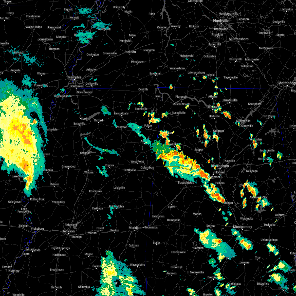
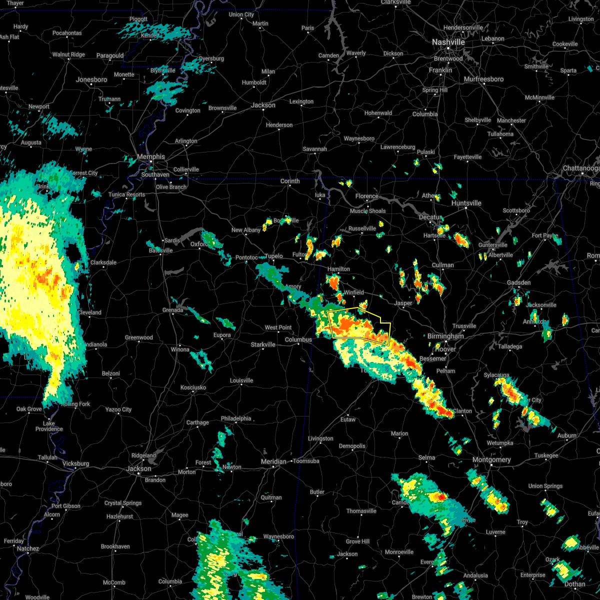
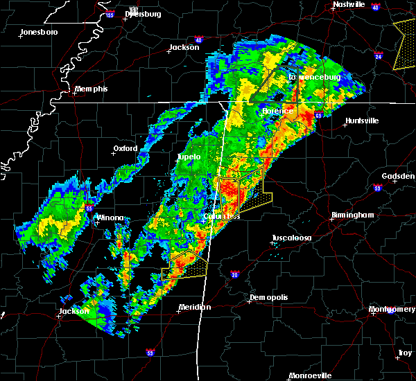
| 7/12/2020 1:28 PM CDT |
 The severe thunderstorm warning for fayette and lamar counties will expire at 130 pm cdt, the storms which prompted the warning have weakened below severe limits, and no longer pose an immediate threat to life or property. therefore, the warning will be allowed to expire. a severe thunderstorm watch remains in effect until 700 pm cdt for central and west central alabama. The severe thunderstorm warning for fayette and lamar counties will expire at 130 pm cdt, the storms which prompted the warning have weakened below severe limits, and no longer pose an immediate threat to life or property. therefore, the warning will be allowed to expire. a severe thunderstorm watch remains in effect until 700 pm cdt for central and west central alabama.
|
| 7/12/2020 12:29 PM CDT |
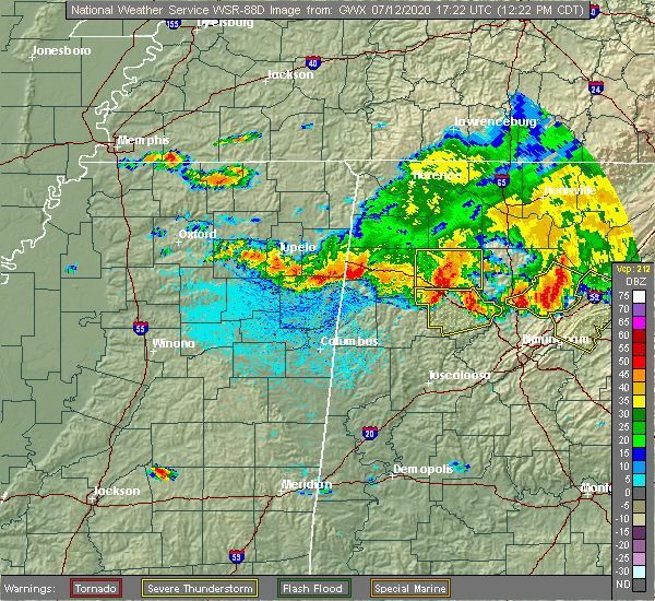 At 1229 pm cdt, severe thunderstorms were located along a line extending from near brilliant to near new wren, moving south at 35 mph (radar indicated). Hazards include 60 mph wind gusts. expect damage to roofs, siding, and trees At 1229 pm cdt, severe thunderstorms were located along a line extending from near brilliant to near new wren, moving south at 35 mph (radar indicated). Hazards include 60 mph wind gusts. expect damage to roofs, siding, and trees
|
| 3/29/2020 2:15 AM CDT |
 At 215 am cdt, severe thunderstorms were located along a line extending from crews to blooming grove to near belk, moving northeast at 75 mph. these are very dangerous storms (trained weather spotters). Hazards include baseball size hail and 70 mph wind gusts. People and animals outdoors will be severely injured. expect shattered windows, extensive damage to roofs, siding, and vehicles. Locations impacted include, winfield, fayette, guin, brilliant, glen allen, belk, gu- win, lake buttahatchee, bluff, twin, tucker, bazemore, wayside, richard arthur field, bevill state college fayette, hubbertville, fowlers crossroads, texas and piney grove. At 215 am cdt, severe thunderstorms were located along a line extending from crews to blooming grove to near belk, moving northeast at 75 mph. these are very dangerous storms (trained weather spotters). Hazards include baseball size hail and 70 mph wind gusts. People and animals outdoors will be severely injured. expect shattered windows, extensive damage to roofs, siding, and vehicles. Locations impacted include, winfield, fayette, guin, brilliant, glen allen, belk, gu- win, lake buttahatchee, bluff, twin, tucker, bazemore, wayside, richard arthur field, bevill state college fayette, hubbertville, fowlers crossroads, texas and piney grove.
|
| 3/29/2020 2:08 AM CDT |
 The national weather service in birmingham has issued a * severe thunderstorm warning for. southeastern marion county in northwestern alabama. northern fayette county in west central alabama. until 300 am cdt. At 208 am cdt, severe thunderstorms were located along a line. The national weather service in birmingham has issued a * severe thunderstorm warning for. southeastern marion county in northwestern alabama. northern fayette county in west central alabama. until 300 am cdt. At 208 am cdt, severe thunderstorms were located along a line.
|
| 3/23/2020 5:08 AM CDT |
 At 508 am cdt, severe thunderstorms were located along a line extending from 6 miles south of eldridge to bankston to near belk, moving east at 50 mph (radar indicated). Hazards include 60 mph wind gusts and quarter size hail. Hail damage to vehicles is expected. Expect wind damage to roofs, siding, and trees. At 508 am cdt, severe thunderstorms were located along a line extending from 6 miles south of eldridge to bankston to near belk, moving east at 50 mph (radar indicated). Hazards include 60 mph wind gusts and quarter size hail. Hail damage to vehicles is expected. Expect wind damage to roofs, siding, and trees.
|
| 1/11/2020 11:27 AM CST |
 At 1127 am cst, severe thunderstorms were located along a line extending from near fayette to near coatopa, moving northeast at 45 mph (radar indicated). Hazards include 60 mph wind gusts. expect damage to roofs, siding, and trees At 1127 am cst, severe thunderstorms were located along a line extending from near fayette to near coatopa, moving northeast at 45 mph (radar indicated). Hazards include 60 mph wind gusts. expect damage to roofs, siding, and trees
|
| 10/26/2019 12:43 PM CDT |
 At 1242 pm cdt, heavy rain and strong winds were located along a line extending from near tishomingo state park to near hackleburg to near gu-win to near fayette, moving northeast at 55 mph (radar indicated). Hazards include 60 mph wind gusts. Expect damage to roofs, siding, and trees. Locations impacted include, hamilton, winfield, fayette, guin, hackleburg, brilliant, glen allen, belk, gu-win, brinn, lake buttahatchee, bear creek, twin, tucker, wayside, richard arthur field, upper bear creek reservoir, piney grove, bazemore and tessner. At 1242 pm cdt, heavy rain and strong winds were located along a line extending from near tishomingo state park to near hackleburg to near gu-win to near fayette, moving northeast at 55 mph (radar indicated). Hazards include 60 mph wind gusts. Expect damage to roofs, siding, and trees. Locations impacted include, hamilton, winfield, fayette, guin, hackleburg, brilliant, glen allen, belk, gu-win, brinn, lake buttahatchee, bear creek, twin, tucker, wayside, richard arthur field, upper bear creek reservoir, piney grove, bazemore and tessner.
|
| 10/26/2019 12:33 PM CDT |
 At 1232 pm cdt, heavy rain showers and strong winds were located along a line extending from near red bay to hamilton to near belk, moving north at 50 mph (radar indicated). Hazards include 60 mph wind gusts. Expect damage to roofs, siding, and trees. Locations impacted include, hamilton, winfield, fayette, guin, hackleburg, brilliant, glen allen, belk, gu-win, bankston, weston, bluff, brinn, lake buttahatchee, bear creek, twin, tucker, stone wall, wayside and richard arthur field. At 1232 pm cdt, heavy rain showers and strong winds were located along a line extending from near red bay to hamilton to near belk, moving north at 50 mph (radar indicated). Hazards include 60 mph wind gusts. Expect damage to roofs, siding, and trees. Locations impacted include, hamilton, winfield, fayette, guin, hackleburg, brilliant, glen allen, belk, gu-win, bankston, weston, bluff, brinn, lake buttahatchee, bear creek, twin, tucker, stone wall, wayside and richard arthur field.
|
| 10/26/2019 12:25 PM CDT |
 At 1225 pm cdt, heavy rain showers with strong winds were located along a line extending from near red bay to near hamilton to blooming grove, moving north at 60 mph (radar indicated). Hazards include 60 mph wind gusts. Expect damage to roofs, siding, and trees. Locations impacted include, hamilton, winfield, fayette, guin, hackleburg, brilliant, glen allen, kennedy, belk, beaverton, gu- win, bankston, weston, bluff, blooming grove, brinn, lake buttahatchee, ashcraft corner, bear creek and twin. At 1225 pm cdt, heavy rain showers with strong winds were located along a line extending from near red bay to near hamilton to blooming grove, moving north at 60 mph (radar indicated). Hazards include 60 mph wind gusts. Expect damage to roofs, siding, and trees. Locations impacted include, hamilton, winfield, fayette, guin, hackleburg, brilliant, glen allen, kennedy, belk, beaverton, gu- win, bankston, weston, bluff, blooming grove, brinn, lake buttahatchee, ashcraft corner, bear creek and twin.
|
| 10/26/2019 12:08 PM CDT |
 At 1207 pm cdt, rain showers with strong winds were located along a line extending from near tremont to near lamar county airport to near millport, moving north at 55 mph (emergency management). Hazards include 60 mph wind gusts. expect damage to roofs, siding, and trees At 1207 pm cdt, rain showers with strong winds were located along a line extending from near tremont to near lamar county airport to near millport, moving north at 55 mph (emergency management). Hazards include 60 mph wind gusts. expect damage to roofs, siding, and trees
|
| 6/22/2019 5:22 PM CDT |
 The national weather service in birmingham has issued a * severe thunderstorm warning for. northeastern pickens county in west central alabama. southwestern fayette county in west central alabama. southern lamar county in west central alabama. Until 545 pm cdt. The national weather service in birmingham has issued a * severe thunderstorm warning for. northeastern pickens county in west central alabama. southwestern fayette county in west central alabama. southern lamar county in west central alabama. Until 545 pm cdt.
|
| 6/20/2019 1:41 AM CDT |
 At 141 am cdt, severe thunderstorms were located along a line extending from near beaverton to kennedy to near aliceville, moving east at 50 mph (radar indicated). Hazards include 60 mph wind gusts and penny size hail. Expect damage to roofs, siding, and trees. Locations impacted include, winfield, fayette, aliceville, vernon, sulligent, gordo, reform, millport, carrollton, pickensville, kennedy, detroit, belk, beaverton, gu- win, ethelsville, mcmullen, benevola, johnston lake and bluff. At 141 am cdt, severe thunderstorms were located along a line extending from near beaverton to kennedy to near aliceville, moving east at 50 mph (radar indicated). Hazards include 60 mph wind gusts and penny size hail. Expect damage to roofs, siding, and trees. Locations impacted include, winfield, fayette, aliceville, vernon, sulligent, gordo, reform, millport, carrollton, pickensville, kennedy, detroit, belk, beaverton, gu- win, ethelsville, mcmullen, benevola, johnston lake and bluff.
|
| 6/20/2019 1:12 AM CDT |
 At 112 am cdt, severe thunderstorms were located along a line extending from 8 miles southeast of amory to near columbus to 7 miles northeast of gholson, moving east at 55 mph (radar indicated). Hazards include 60 mph wind gusts and penny size hail. expect damage to roofs, siding, and trees At 112 am cdt, severe thunderstorms were located along a line extending from 8 miles southeast of amory to near columbus to 7 miles northeast of gholson, moving east at 55 mph (radar indicated). Hazards include 60 mph wind gusts and penny size hail. expect damage to roofs, siding, and trees
|
| 4/18/2019 6:32 PM CDT |
 At 632 pm cdt, severe thunderstorms were located along a line extending from crews to millport, moving east at 40 mph (radar indicated). Hazards include 70 mph wind gusts. Expect considerable tree damage. Damage is likely to mobile homes, roofs, and outbuildings. At 632 pm cdt, severe thunderstorms were located along a line extending from crews to millport, moving east at 40 mph (radar indicated). Hazards include 70 mph wind gusts. Expect considerable tree damage. Damage is likely to mobile homes, roofs, and outbuildings.
|
| 4/6/2019 6:48 PM CDT |
 At 647 pm cdt, severe thunderstorms were located along a line extending from near prairie to waverly to near prairie point, moving northeast at 55 mph (radar indicated). Hazards include 60 mph wind gusts and penny size hail. expect damage to roofs, siding, and trees At 647 pm cdt, severe thunderstorms were located along a line extending from near prairie to waverly to near prairie point, moving northeast at 55 mph (radar indicated). Hazards include 60 mph wind gusts and penny size hail. expect damage to roofs, siding, and trees
|
| 3/14/2019 2:57 PM CDT |
 At 257 pm cdt, a severe thunderstorm was located over fayette, moving east at 50 mph (radar indicated). Hazards include tennis ball size hail and 60 mph wind gusts. People and animals outdoors will be injured. expect hail damage to roofs, siding, windows, and vehicles. expect wind damage to roofs, siding, and trees. locations impacted include, fayette, berry, belk, bankston, boley springs, bevill state college fayette, stone wall, fowlers crossroads, richard arthur field and fayette county public lake. A tornado watch remains in effect until 700 pm cdt for central and west central alabama. At 257 pm cdt, a severe thunderstorm was located over fayette, moving east at 50 mph (radar indicated). Hazards include tennis ball size hail and 60 mph wind gusts. People and animals outdoors will be injured. expect hail damage to roofs, siding, windows, and vehicles. expect wind damage to roofs, siding, and trees. locations impacted include, fayette, berry, belk, bankston, boley springs, bevill state college fayette, stone wall, fowlers crossroads, richard arthur field and fayette county public lake. A tornado watch remains in effect until 700 pm cdt for central and west central alabama.
|
| 3/14/2019 2:51 PM CDT |
 At 251 pm cdt, a severe thunderstorm was located over belk, or 8 miles southwest of fayette, moving east at 50 mph (radar indicated). Hazards include golf ball size hail and 60 mph wind gusts. People and animals outdoors will be injured. expect hail damage to roofs, siding, windows, and vehicles. expect wind damage to roofs, siding, and trees. locations impacted include, fayette, berry, belk, bankston, boley springs, bevill state college fayette, stone wall, fowlers crossroads, richard arthur field and fayette county public lake. A tornado watch remains in effect until 700 pm cdt for central and west central alabama. At 251 pm cdt, a severe thunderstorm was located over belk, or 8 miles southwest of fayette, moving east at 50 mph (radar indicated). Hazards include golf ball size hail and 60 mph wind gusts. People and animals outdoors will be injured. expect hail damage to roofs, siding, windows, and vehicles. expect wind damage to roofs, siding, and trees. locations impacted include, fayette, berry, belk, bankston, boley springs, bevill state college fayette, stone wall, fowlers crossroads, richard arthur field and fayette county public lake. A tornado watch remains in effect until 700 pm cdt for central and west central alabama.
|
| 3/14/2019 2:41 PM CDT |
 At 241 pm cdt, a severe thunderstorm was located over millport, moving east at 50 mph (radar indicated). Hazards include golf ball size hail and 60 mph wind gusts. People and animals outdoors will be injured. expect hail damage to roofs, siding, windows, and vehicles. Expect wind damage to roofs, siding, and trees. At 241 pm cdt, a severe thunderstorm was located over millport, moving east at 50 mph (radar indicated). Hazards include golf ball size hail and 60 mph wind gusts. People and animals outdoors will be injured. expect hail damage to roofs, siding, windows, and vehicles. Expect wind damage to roofs, siding, and trees.
|
| 2/23/2019 5:59 PM CST |
 At 558 pm cst, a tornado producing storm was located near belk, or 7 miles southeast of vernon, moving northeast at 40 mph (radar confirmed tornado). Hazards include damaging tornado. Flying debris will be dangerous to those caught without shelter. mobile homes will be damaged or destroyed. damage to roofs, windows, and vehicles will occur. Tree damage is likely. At 558 pm cst, a tornado producing storm was located near belk, or 7 miles southeast of vernon, moving northeast at 40 mph (radar confirmed tornado). Hazards include damaging tornado. Flying debris will be dangerous to those caught without shelter. mobile homes will be damaged or destroyed. damage to roofs, windows, and vehicles will occur. Tree damage is likely.
|
| 4/14/2018 11:53 AM CDT |
 At 1153 am cdt, severe thunderstorms were located along a line extending from 6 miles northwest of brilliant to near gordo, moving northeast at 55 mph (radar indicated). Hazards include 60 mph wind gusts. expect damage to roofs, siding, and trees At 1153 am cdt, severe thunderstorms were located along a line extending from 6 miles northwest of brilliant to near gordo, moving northeast at 55 mph (radar indicated). Hazards include 60 mph wind gusts. expect damage to roofs, siding, and trees
|
| 4/3/2018 10:28 PM CDT |
 At 1027 pm cdt, severe thunderstorms were located along a line extending from near belk to near glen allen, moving east at 35 mph (radar indicated). Hazards include 60 mph wind gusts and penny size hail. Expect damage to roofs, siding, and trees. Locations impacted include, fayette, berry, glen allen, belk, bankston, boley springs, stone wall, bazemore, richard arthur field, fayette county public lake, bevill state college fayette, hubbertville and fowlers crossroads. At 1027 pm cdt, severe thunderstorms were located along a line extending from near belk to near glen allen, moving east at 35 mph (radar indicated). Hazards include 60 mph wind gusts and penny size hail. Expect damage to roofs, siding, and trees. Locations impacted include, fayette, berry, glen allen, belk, bankston, boley springs, stone wall, bazemore, richard arthur field, fayette county public lake, bevill state college fayette, hubbertville and fowlers crossroads.
|
| 4/3/2018 9:44 PM CDT |
 At 944 pm cdt, severe thunderstorms were located along a line extending from near columbus to 6 miles southeast of hamilton, moving east at 50 mph (radar indicated). Hazards include 60 mph wind gusts. expect damage to roofs, siding, and trees At 944 pm cdt, severe thunderstorms were located along a line extending from near columbus to 6 miles southeast of hamilton, moving east at 50 mph (radar indicated). Hazards include 60 mph wind gusts. expect damage to roofs, siding, and trees
|
| 8/31/2017 4:14 PM CDT |
 At 413 pm cdt, a confirmed large and extremely dangerous tornado was located over fayette, moving northeast at 45 mph. this is a particularly dangerous situation. take cover now! (radar confirmed tornado). Hazards include damaging tornado. You are in a life-threatening situation. flying debris may be deadly to those caught without shelter. mobile homes will be destroyed. considerable damage to homes, businesses, and vehicles is likely and complete destruction is possible. Locations impacted include, fayette, belk, bevill state college fayette and richard arthur field. At 413 pm cdt, a confirmed large and extremely dangerous tornado was located over fayette, moving northeast at 45 mph. this is a particularly dangerous situation. take cover now! (radar confirmed tornado). Hazards include damaging tornado. You are in a life-threatening situation. flying debris may be deadly to those caught without shelter. mobile homes will be destroyed. considerable damage to homes, businesses, and vehicles is likely and complete destruction is possible. Locations impacted include, fayette, belk, bevill state college fayette and richard arthur field.
|
| 8/31/2017 4:01 PM CDT |
 At 400 pm cdt, a confirmed large and extremely dangerous tornado was located near kennedy, or 8 miles southwest of fayette, moving northeast at 45 mph. this is a particularly dangerous situation. take cover now! (radar confirmed tornado). Hazards include damaging tornado. You are in a life-threatening situation. flying debris may be deadly to those caught without shelter. mobile homes will be destroyed. considerable damage to homes, businesses, and vehicles is likely and complete destruction is possible. Locations impacted include, fayette, millport, kennedy, belk, ashcraft corner, cody, bevill state college fayette and richard arthur field. At 400 pm cdt, a confirmed large and extremely dangerous tornado was located near kennedy, or 8 miles southwest of fayette, moving northeast at 45 mph. this is a particularly dangerous situation. take cover now! (radar confirmed tornado). Hazards include damaging tornado. You are in a life-threatening situation. flying debris may be deadly to those caught without shelter. mobile homes will be destroyed. considerable damage to homes, businesses, and vehicles is likely and complete destruction is possible. Locations impacted include, fayette, millport, kennedy, belk, ashcraft corner, cody, bevill state college fayette and richard arthur field.
|
| 8/31/2017 3:48 PM CDT |
 At 348 pm cdt, a confirmed large and extremely dangerous tornado was located near ashcraft corner, or 7 miles north of reform, moving northeast at 45 mph. this is a particularly dangerous situation. take cover now! (radar confirmed tornado). Hazards include damaging tornado. You are in a life-threatening situation. flying debris may be deadly to those caught without shelter. mobile homes will be destroyed. considerable damage to homes, businesses, and vehicles is likely and complete destruction is possible. Locations impacted include, fayette, reform, millport, kennedy, belk, ashcraft corner, cody, bevill state college fayette, stone wall, richard arthur field and fayette county public lake. At 348 pm cdt, a confirmed large and extremely dangerous tornado was located near ashcraft corner, or 7 miles north of reform, moving northeast at 45 mph. this is a particularly dangerous situation. take cover now! (radar confirmed tornado). Hazards include damaging tornado. You are in a life-threatening situation. flying debris may be deadly to those caught without shelter. mobile homes will be destroyed. considerable damage to homes, businesses, and vehicles is likely and complete destruction is possible. Locations impacted include, fayette, reform, millport, kennedy, belk, ashcraft corner, cody, bevill state college fayette, stone wall, richard arthur field and fayette county public lake.
|
| 8/31/2017 3:45 PM CDT |
 At 345 pm cdt, a confirmed tornado was located near reform, moving northeast at 45 mph (radar confirmed tornado). Hazards include damaging tornado. Flying debris will be dangerous to those caught without shelter. mobile homes will be damaged or destroyed. damage to roofs, windows, and vehicles will occur. tree damage is likely. Locations impacted include, fayette, reform, millport, kennedy, belk, ashcraft corner, cody, bevill state college fayette, stone wall, richard arthur field, north pickens airport and fayette county public lake. At 345 pm cdt, a confirmed tornado was located near reform, moving northeast at 45 mph (radar confirmed tornado). Hazards include damaging tornado. Flying debris will be dangerous to those caught without shelter. mobile homes will be damaged or destroyed. damage to roofs, windows, and vehicles will occur. tree damage is likely. Locations impacted include, fayette, reform, millport, kennedy, belk, ashcraft corner, cody, bevill state college fayette, stone wall, richard arthur field, north pickens airport and fayette county public lake.
|
| 8/31/2017 3:38 PM CDT |
 At 338 pm cdt, a severe thunderstorm capable of producing a tornado was located over reform, moving northeast at 40 mph (radar indicated rotation). Hazards include tornado. Flying debris will be dangerous to those caught without shelter. mobile homes will be damaged or destroyed. damage to roofs, windows, and vehicles will occur. Tree damage is likely. At 338 pm cdt, a severe thunderstorm capable of producing a tornado was located over reform, moving northeast at 40 mph (radar indicated rotation). Hazards include tornado. Flying debris will be dangerous to those caught without shelter. mobile homes will be damaged or destroyed. damage to roofs, windows, and vehicles will occur. Tree damage is likely.
|
| 7/6/2017 5:27 PM CDT |
 At 527 pm cdt, severe thunderstorms were located along a line extending from cordova to near bankston to near kennedy, moving east at 25 mph (radar indicated). Hazards include 60 mph wind gusts and penny size hail. Expect damage to roofs, siding, and trees. Locations impacted include, jasper, fayette, sumiton, cordova, dora, berry, parrish, oakman, sipsey, belk, bankston, gorgas steam plant, gorgas, boley springs, rocky hollow, burnwell, beloit, quinton, lynns park and stone wall. At 527 pm cdt, severe thunderstorms were located along a line extending from cordova to near bankston to near kennedy, moving east at 25 mph (radar indicated). Hazards include 60 mph wind gusts and penny size hail. Expect damage to roofs, siding, and trees. Locations impacted include, jasper, fayette, sumiton, cordova, dora, berry, parrish, oakman, sipsey, belk, bankston, gorgas steam plant, gorgas, boley springs, rocky hollow, burnwell, beloit, quinton, lynns park and stone wall.
|
| 7/6/2017 5:11 PM CDT |
 At 511 pm cdt, severe thunderstorms were located along a line extending from near parrish to near bankston to near kennedy, moving east at 20 mph (radar indicated). Hazards include 60 mph wind gusts and penny size hail. expect damage to roofs, siding, and trees At 511 pm cdt, severe thunderstorms were located along a line extending from near parrish to near bankston to near kennedy, moving east at 20 mph (radar indicated). Hazards include 60 mph wind gusts and penny size hail. expect damage to roofs, siding, and trees
|
| 6/23/2017 1:37 PM CDT |
 The severe thunderstorm warning for southeastern marion and northern fayette counties will expire at 145 pm cdt, the storms which prompted the warning have moved out of the area. therefore the warning will be allowed to expire. a tornado watch remains in effect until 800 pm cdt for northwestern, west central alabama. The severe thunderstorm warning for southeastern marion and northern fayette counties will expire at 145 pm cdt, the storms which prompted the warning have moved out of the area. therefore the warning will be allowed to expire. a tornado watch remains in effect until 800 pm cdt for northwestern, west central alabama.
|
| 6/23/2017 1:33 PM CDT |
 At 133 pm cdt, severe thunderstorms were located along a line extending from near haleyville to near lynn to near eldridge to near glen allen, moving northeast at 45 mph (radar indicated). Hazards include 60 mph wind gusts. expect damage to roofs, siding, and trees At 133 pm cdt, severe thunderstorms were located along a line extending from near haleyville to near lynn to near eldridge to near glen allen, moving northeast at 45 mph (radar indicated). Hazards include 60 mph wind gusts. expect damage to roofs, siding, and trees
|
| 6/23/2017 1:28 PM CDT |
 At 128 pm cdt, severe thunderstorms were located along a line extending from near haleyville to near lynn to near eldridge to near glen allen, moving northeast at 45 mph (radar indicated). Hazards include 60 mph wind gusts. Expect damage to roofs, siding, and trees. locations impacted include, winfield, fayette, guin, brilliant, glen allen, belk, gu- win, bluff, twin, tucker, bazemore, wayside, richard arthur field, bevill state college fayette, hubbertville, fowlers crossroads, texas and piney grove. A tornado watch remains in effect until 800 pm cdt for northwestern, west central alabama. At 128 pm cdt, severe thunderstorms were located along a line extending from near haleyville to near lynn to near eldridge to near glen allen, moving northeast at 45 mph (radar indicated). Hazards include 60 mph wind gusts. Expect damage to roofs, siding, and trees. locations impacted include, winfield, fayette, guin, brilliant, glen allen, belk, gu- win, bluff, twin, tucker, bazemore, wayside, richard arthur field, bevill state college fayette, hubbertville, fowlers crossroads, texas and piney grove. A tornado watch remains in effect until 800 pm cdt for northwestern, west central alabama.
|
| 6/23/2017 1:22 PM CDT |
 At 122 pm cdt, severe thunderstorms were located along a line extending from near hackleburg to near lake buttahatchee to near glen allen to near bluff, moving northeast at 50 mph (radar indicated). Hazards include 60 mph wind gusts. Expect damage to roofs, siding, and trees. locations impacted include, winfield, fayette, haleyville, guin, hackleburg, brilliant, glen allen, belk, gu- win, bluff, brinn, lake buttahatchee, bear creek, twin, tucker, wayside, richard arthur field, piney grove, bazemore and tessner. A tornado watch remains in effect until 800 pm cdt for northwestern, west central alabama. At 122 pm cdt, severe thunderstorms were located along a line extending from near hackleburg to near lake buttahatchee to near glen allen to near bluff, moving northeast at 50 mph (radar indicated). Hazards include 60 mph wind gusts. Expect damage to roofs, siding, and trees. locations impacted include, winfield, fayette, haleyville, guin, hackleburg, brilliant, glen allen, belk, gu- win, bluff, brinn, lake buttahatchee, bear creek, twin, tucker, wayside, richard arthur field, piney grove, bazemore and tessner. A tornado watch remains in effect until 800 pm cdt for northwestern, west central alabama.
|
| 6/23/2017 1:16 PM CDT |
 At 115 pm cdt, severe thunderstorms were located along a line extending from near brinn to near brilliant to near bluff to near blooming grove, moving east at 40 mph (radar indicated). Hazards include 60 mph wind gusts. Expect damage to roofs, siding, and trees. locations impacted include, hamilton, winfield, fayette, haleyville, guin, hackleburg, brilliant, glen allen, belk, gu- win, bluff, brinn, lake buttahatchee, bear creek, twin, tucker, wayside, richard arthur field, piney grove and bazemore. A tornado watch remains in effect until 800 pm cdt for northwestern, west central alabama. At 115 pm cdt, severe thunderstorms were located along a line extending from near brinn to near brilliant to near bluff to near blooming grove, moving east at 40 mph (radar indicated). Hazards include 60 mph wind gusts. Expect damage to roofs, siding, and trees. locations impacted include, hamilton, winfield, fayette, haleyville, guin, hackleburg, brilliant, glen allen, belk, gu- win, bluff, brinn, lake buttahatchee, bear creek, twin, tucker, wayside, richard arthur field, piney grove and bazemore. A tornado watch remains in effect until 800 pm cdt for northwestern, west central alabama.
|
| 6/23/2017 12:52 PM CDT |
 At 1251 pm cdt, severe thunderstorms were located along a line extending from 6 miles north of weston to near hamilton to near beaverton to 6 miles east of caledonia, moving northeast at 45 mph (radar indicated). Hazards include 60 mph wind gusts. expect damage to roofs, siding, and trees At 1251 pm cdt, severe thunderstorms were located along a line extending from 6 miles north of weston to near hamilton to near beaverton to 6 miles east of caledonia, moving northeast at 45 mph (radar indicated). Hazards include 60 mph wind gusts. expect damage to roofs, siding, and trees
|
| 5/28/2017 2:03 AM CDT |
 At 203 am cdt, severe thunderstorms were located along a line extending from 8 miles east of caledonia to 7 miles south of eldridge, moving southeast at 50 mph (radar indicated). Hazards include 60 mph wind gusts. Expect damage to roofs, siding, and trees. Locations impacted include, winfield, fayette, vernon, millport, berry, glen allen, kennedy, belk, gu-win, bankston, bluff, ashcraft corner, boley springs, blooming grove, cody, stone wall, wayside, richard arthur field, fayette county public lake and star. At 203 am cdt, severe thunderstorms were located along a line extending from 8 miles east of caledonia to 7 miles south of eldridge, moving southeast at 50 mph (radar indicated). Hazards include 60 mph wind gusts. Expect damage to roofs, siding, and trees. Locations impacted include, winfield, fayette, vernon, millport, berry, glen allen, kennedy, belk, gu-win, bankston, bluff, ashcraft corner, boley springs, blooming grove, cody, stone wall, wayside, richard arthur field, fayette county public lake and star.
|
| 5/28/2017 1:44 AM CDT |
 At 144 am cdt, severe thunderstorms were located along a line extending from 6 miles west of bedford to near winfield, moving southeast at 50 mph (radar indicated). Hazards include 70 mph wind gusts. Expect considerable tree damage. damage is likely to mobile homes, roofs, and outbuildings. Locations impacted include, winfield, fayette, vernon, sulligent, millport, berry, glen allen, kennedy, detroit, belk, beaverton, gu- win, bankston, bluff, ashcraft corner, boley springs, blooming grove, lamar county airport, crews and bedford. At 144 am cdt, severe thunderstorms were located along a line extending from 6 miles west of bedford to near winfield, moving southeast at 50 mph (radar indicated). Hazards include 70 mph wind gusts. Expect considerable tree damage. damage is likely to mobile homes, roofs, and outbuildings. Locations impacted include, winfield, fayette, vernon, sulligent, millport, berry, glen allen, kennedy, detroit, belk, beaverton, gu- win, bankston, bluff, ashcraft corner, boley springs, blooming grove, lamar county airport, crews and bedford.
|
| 5/28/2017 1:24 AM CDT |
 At 124 am cdt, severe thunderstorms were located along a line extending from near amory to near hamilton, moving southeast at 50 mph (radar indicated). Hazards include 70 mph wind gusts. Expect considerable tree damage. damage is likely to mobile homes, roofs, and outbuildings. Locations impacted include, winfield, fayette, vernon, sulligent, millport, berry, glen allen, kennedy, detroit, belk, beaverton, gu- win, bankston, bluff, ashcraft corner, boley springs, blooming grove, lamar county airport, crews and bedford. At 124 am cdt, severe thunderstorms were located along a line extending from near amory to near hamilton, moving southeast at 50 mph (radar indicated). Hazards include 70 mph wind gusts. Expect considerable tree damage. damage is likely to mobile homes, roofs, and outbuildings. Locations impacted include, winfield, fayette, vernon, sulligent, millport, berry, glen allen, kennedy, detroit, belk, beaverton, gu- win, bankston, bluff, ashcraft corner, boley springs, blooming grove, lamar county airport, crews and bedford.
|
| 5/28/2017 1:09 AM CDT |
 At 108 am cdt, severe thunderstorms were located along a line extending from near evergreen to 7 miles north of weston, moving southeast at 50 mph (radar indicated). Hazards include 70 mph wind gusts. Expect considerable tree damage. Damage is likely to mobile homes, roofs, and outbuildings. At 108 am cdt, severe thunderstorms were located along a line extending from near evergreen to 7 miles north of weston, moving southeast at 50 mph (radar indicated). Hazards include 70 mph wind gusts. Expect considerable tree damage. Damage is likely to mobile homes, roofs, and outbuildings.
|
| 4/30/2017 12:12 PM CDT |
 At 1212 pm cdt, severe thunderstorms were located along a line extending from millport to near gordo to near epes, moving northeast at 50 mph (radar indicated). Hazards include 70 mph wind gusts. Expect considerable tree damage. Damage is likely to mobile homes, roofs, and outbuildings. At 1212 pm cdt, severe thunderstorms were located along a line extending from millport to near gordo to near epes, moving northeast at 50 mph (radar indicated). Hazards include 70 mph wind gusts. Expect considerable tree damage. Damage is likely to mobile homes, roofs, and outbuildings.
|
| 3/1/2017 2:35 PM CST |
 At 235 pm cst, severe thunderstorms were located along a line extending from near kansas to near fayette, moving east at 60 mph (radar indicated). Hazards include 60 mph wind gusts and quarter size hail. Hail damage to vehicles is expected. expect wind damage to roofs, siding, and trees. locations impacted include, fayette, berry, belk, bankston, bevill state college fayette, hubbertville, fowlers crossroads and richard arthur field. A tornado watch remains in effect until 600 pm cst for west central alabama. At 235 pm cst, severe thunderstorms were located along a line extending from near kansas to near fayette, moving east at 60 mph (radar indicated). Hazards include 60 mph wind gusts and quarter size hail. Hail damage to vehicles is expected. expect wind damage to roofs, siding, and trees. locations impacted include, fayette, berry, belk, bankston, bevill state college fayette, hubbertville, fowlers crossroads and richard arthur field. A tornado watch remains in effect until 600 pm cst for west central alabama.
|
| 3/1/2017 2:23 PM CST |
 At 222 pm cst, severe thunderstorms were located along a line extending from 6 miles south of glen allen to near belk, moving east at 60 mph (radar indicated). Hazards include 60 mph wind gusts and quarter size hail. Hail damage to vehicles is expected. expect wind damage to roofs, siding, and trees. locations impacted include, fayette, berry, belk, bankston, bevill state college fayette, hubbertville, fowlers crossroads and richard arthur field. A tornado watch remains in effect until 600 pm cst for west central alabama. At 222 pm cst, severe thunderstorms were located along a line extending from 6 miles south of glen allen to near belk, moving east at 60 mph (radar indicated). Hazards include 60 mph wind gusts and quarter size hail. Hail damage to vehicles is expected. expect wind damage to roofs, siding, and trees. locations impacted include, fayette, berry, belk, bankston, bevill state college fayette, hubbertville, fowlers crossroads and richard arthur field. A tornado watch remains in effect until 600 pm cst for west central alabama.
|
| 3/1/2017 2:17 PM CST |
 At 217 pm cst, a severe thunderstorm was located near belk, or near fayette, moving east at 55 mph (radar indicated). Hazards include 60 mph wind gusts and quarter size hail. Hail damage to vehicles is expected. expect wind damage to roofs, siding, and trees. locations impacted include, fayette, vernon, berry, belk, bankston, blooming grove, bluff, cody, richard arthur field, bevill state college fayette, hubbertville, fowlers crossroads and hightogy. A tornado watch remains in effect until 600 pm cst for west central alabama. At 217 pm cst, a severe thunderstorm was located near belk, or near fayette, moving east at 55 mph (radar indicated). Hazards include 60 mph wind gusts and quarter size hail. Hail damage to vehicles is expected. expect wind damage to roofs, siding, and trees. locations impacted include, fayette, vernon, berry, belk, bankston, blooming grove, bluff, cody, richard arthur field, bevill state college fayette, hubbertville, fowlers crossroads and hightogy. A tornado watch remains in effect until 600 pm cst for west central alabama.
|
| 3/1/2017 2:07 PM CST |
 At 207 pm cst, a severe thunderstorm was located near vernon, moving east at 60 mph (radar indicated). Hazards include 60 mph wind gusts and quarter size hail. Hail damage to vehicles is expected. Expect wind damage to roofs, siding, and trees. At 207 pm cst, a severe thunderstorm was located near vernon, moving east at 60 mph (radar indicated). Hazards include 60 mph wind gusts and quarter size hail. Hail damage to vehicles is expected. Expect wind damage to roofs, siding, and trees.
|
| 11/29/2016 7:44 PM CST |
 At 743 pm cst, a severe thunderstorm capable of producing a tornado was located over belk, or near fayette, moving northeast at 45 mph (radar indicated rotation). Hazards include tornado. Flying debris will be dangerous to those caught without shelter. mobile homes will be damaged or destroyed. damage to roofs, windows, and vehicles will occur. tree damage is likely. Locations impacted include, fayette, belk, stone wall, bevill state college fayette, richard arthur field and fayette county public lake. At 743 pm cst, a severe thunderstorm capable of producing a tornado was located over belk, or near fayette, moving northeast at 45 mph (radar indicated rotation). Hazards include tornado. Flying debris will be dangerous to those caught without shelter. mobile homes will be damaged or destroyed. damage to roofs, windows, and vehicles will occur. tree damage is likely. Locations impacted include, fayette, belk, stone wall, bevill state college fayette, richard arthur field and fayette county public lake.
|
| 11/29/2016 7:35 PM CST |
 At 734 pm cst, a confirmed tornado was located over kennedy, or near millport, moving northeast at 40 mph (weather spotters confirmed tornado). Hazards include damaging tornado. Flying debris will be dangerous to those caught without shelter. mobile homes will be damaged or destroyed. damage to roofs, windows, and vehicles will occur. tree damage is likely. Locations impacted include, fayette, millport, kennedy, belk, ashcraft corner, cody, richard arthur field, fayette county public lake, stone wall and bevill state college fayette. At 734 pm cst, a confirmed tornado was located over kennedy, or near millport, moving northeast at 40 mph (weather spotters confirmed tornado). Hazards include damaging tornado. Flying debris will be dangerous to those caught without shelter. mobile homes will be damaged or destroyed. damage to roofs, windows, and vehicles will occur. tree damage is likely. Locations impacted include, fayette, millport, kennedy, belk, ashcraft corner, cody, richard arthur field, fayette county public lake, stone wall and bevill state college fayette.
|
| 11/29/2016 7:22 PM CST |
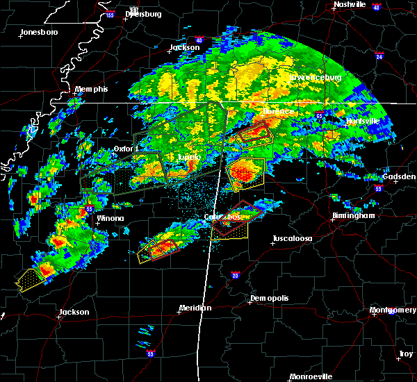 At 722 pm cst, a tornado producing storm was located near millport, moving northeast at 40 mph (radar confirmed tornado). Hazards include damaging tornado. Flying debris will be dangerous to those caught without shelter. mobile homes will be damaged or destroyed. damage to roofs, windows, and vehicles will occur. Tree damage is likely. At 722 pm cst, a tornado producing storm was located near millport, moving northeast at 40 mph (radar confirmed tornado). Hazards include damaging tornado. Flying debris will be dangerous to those caught without shelter. mobile homes will be damaged or destroyed. damage to roofs, windows, and vehicles will occur. Tree damage is likely.
|
| 6/17/2016 2:05 PM CDT |
 At 205 pm cdt, severe thunderstorms were located along a line extending from near guin to near smith dam, moving southeast at 30 mph (radar indicated). Hazards include 60 mph wind gusts and quarter size hail. Hail damage to vehicles is expected. expect wind damage to roofs, siding, and trees. Locations impacted include, jasper, hamilton, winfield, fayette, sumiton, cordova, dora, carbon hill, lynn, arley, guin, berry, double springs, parrish, brilliant, oakman, glen allen, sipsey, west jefferson and kansas. At 205 pm cdt, severe thunderstorms were located along a line extending from near guin to near smith dam, moving southeast at 30 mph (radar indicated). Hazards include 60 mph wind gusts and quarter size hail. Hail damage to vehicles is expected. expect wind damage to roofs, siding, and trees. Locations impacted include, jasper, hamilton, winfield, fayette, sumiton, cordova, dora, carbon hill, lynn, arley, guin, berry, double springs, parrish, brilliant, oakman, glen allen, sipsey, west jefferson and kansas.
|
| 6/17/2016 1:44 PM CDT |
 At 144 pm cdt, severe thunderstorms were located along a line extending from near beaverton to near smith lake, moving south at 25 mph (radar indicated). Hazards include 60 mph wind gusts and quarter size hail. Hail damage to vehicles is expected. Expect wind damage to roofs, siding, and trees. At 144 pm cdt, severe thunderstorms were located along a line extending from near beaverton to near smith lake, moving south at 25 mph (radar indicated). Hazards include 60 mph wind gusts and quarter size hail. Hail damage to vehicles is expected. Expect wind damage to roofs, siding, and trees.
|
| 3/31/2016 7:14 PM CDT |
 At 714 pm cdt, a severe thunderstorm capable of producing a tornado was located near ashcraft corner, or 7 miles south of fayette, moving northeast at 30 mph (radar indicated rotation). Hazards include tornado and golf ball size hail. Flying debris will be dangerous to those caught without shelter. mobile homes will be damaged or destroyed. damage to roofs, windows, and vehicles will occur. tree damage is likely. Locations impacted include, fayette, berry, belk, bankston, boley springs, richard arthur field, fayette county public lake and stone wall. At 714 pm cdt, a severe thunderstorm capable of producing a tornado was located near ashcraft corner, or 7 miles south of fayette, moving northeast at 30 mph (radar indicated rotation). Hazards include tornado and golf ball size hail. Flying debris will be dangerous to those caught without shelter. mobile homes will be damaged or destroyed. damage to roofs, windows, and vehicles will occur. tree damage is likely. Locations impacted include, fayette, berry, belk, bankston, boley springs, richard arthur field, fayette county public lake and stone wall.
|
| 3/31/2016 6:58 PM CDT |
 At 658 pm cdt, a severe thunderstorm capable of producing a tornado was located near kennedy, or near millport, moving northeast at 30 mph (radar indicated rotation). Hazards include tornado and golf ball size hail. Flying debris will be dangerous to those caught without shelter. mobile homes will be damaged or destroyed. damage to roofs, windows, and vehicles will occur. Tree damage is likely. At 658 pm cdt, a severe thunderstorm capable of producing a tornado was located near kennedy, or near millport, moving northeast at 30 mph (radar indicated rotation). Hazards include tornado and golf ball size hail. Flying debris will be dangerous to those caught without shelter. mobile homes will be damaged or destroyed. damage to roofs, windows, and vehicles will occur. Tree damage is likely.
|
| 2/2/2016 5:44 PM CST |
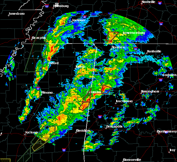 A tornado warning remains in effect until 600 pm cst for southwestern fayette county. at 544 pm cst. a confirmed tornado was located near belk. or near fayette. moving northeast at 45 mph. hazard. damaging tornado. source. Radar confirmed tornado. A tornado warning remains in effect until 600 pm cst for southwestern fayette county. at 544 pm cst. a confirmed tornado was located near belk. or near fayette. moving northeast at 45 mph. hazard. damaging tornado. source. Radar confirmed tornado.
|
| 2/2/2016 5:37 PM CST |
 At 536 pm cst, a severe thunderstorm capable of producing a tornado was located over ashcraft corner, or 9 miles east of millport, moving northeast at 40 mph (radar indicated rotation). Hazards include tornado. Flying debris will be dangerous to those caught without shelter. mobile homes will be damaged or destroyed. damage to roofs, windows and vehicles will occur. tree damage is likely. this dangerous storm will be near, belk around 545 pm cst. fayette and bankston around 600 pm cst. Other locations impacted by this tornadic thunderstorm include stone wall, bevill state college fayette, richard arthur field and fayette county public lake. At 536 pm cst, a severe thunderstorm capable of producing a tornado was located over ashcraft corner, or 9 miles east of millport, moving northeast at 40 mph (radar indicated rotation). Hazards include tornado. Flying debris will be dangerous to those caught without shelter. mobile homes will be damaged or destroyed. damage to roofs, windows and vehicles will occur. tree damage is likely. this dangerous storm will be near, belk around 545 pm cst. fayette and bankston around 600 pm cst. Other locations impacted by this tornadic thunderstorm include stone wall, bevill state college fayette, richard arthur field and fayette county public lake.
|
| 2/2/2016 5:26 PM CST |
 A tornado warning remains in effect until 600 pm cst for northeastern pickens. southwestern fayette and southeastern lamar counties. at 525 pm cst. a severe thunderstorm capable of producing a tornado was located over ashcraft corner. or 9 miles southeast of millport. Moving northeast at 45 mph. A tornado warning remains in effect until 600 pm cst for northeastern pickens. southwestern fayette and southeastern lamar counties. at 525 pm cst. a severe thunderstorm capable of producing a tornado was located over ashcraft corner. or 9 miles southeast of millport. Moving northeast at 45 mph.
|
| 2/2/2016 5:02 PM CST |
 At 501 pm cst, a confirmed large and extremely dangerous tornado was located over carrollton, moving northeast at 45 mph. this is a particularly dangerous situation (weather spotters confirmed tornado). Hazards include damaging tornado. You are in a life threatening situation. flying debris may be deadly to those caught without shelter. mobile homes will be destroyed. considerable damage to homes, businesses and vehicles is likely and complete destruction is possible. the tornado will be near, reform around 515 pm cst. kennedy and ashcraft corner around 530 pm cst. belk around 535 pm cst. fayette and bankston around 550 pm cst. berry around 555 pm cst. Other locations impacted by this tornadic thunderstorm include richard arthur field, fayette county public lake, moores bridge, north pickens airport, stone wall, bevill state college fayette, lubbub, new lexington and cody. At 501 pm cst, a confirmed large and extremely dangerous tornado was located over carrollton, moving northeast at 45 mph. this is a particularly dangerous situation (weather spotters confirmed tornado). Hazards include damaging tornado. You are in a life threatening situation. flying debris may be deadly to those caught without shelter. mobile homes will be destroyed. considerable damage to homes, businesses and vehicles is likely and complete destruction is possible. the tornado will be near, reform around 515 pm cst. kennedy and ashcraft corner around 530 pm cst. belk around 535 pm cst. fayette and bankston around 550 pm cst. berry around 555 pm cst. Other locations impacted by this tornadic thunderstorm include richard arthur field, fayette county public lake, moores bridge, north pickens airport, stone wall, bevill state college fayette, lubbub, new lexington and cody.
|
| 7/14/2015 8:01 PM CDT |
 At 800 pm cdt, severe thunderstorms were located along a line extending from near ashcraft corner to 8 miles south of fayette to 6 miles south of boley springs to 7 miles north of bankhead lock and dam to forestdale to birmingham to margaret, moving southeast at 50 mph (radar indicated). Hazards include 70 mph wind gusts and penny size hail. Expect considerable tree damage. damage is likely to mobile homes, roofs and outbuildings. Locations impacted include, jasper, fayette, sumiton, cordova, dora, vernon, millport, berry, parrish, oakman, kennedy, sipsey, west jefferson, belk, gorgas, boley springs, blooming grove, bankston, quinton and gorgas steam plant. At 800 pm cdt, severe thunderstorms were located along a line extending from near ashcraft corner to 8 miles south of fayette to 6 miles south of boley springs to 7 miles north of bankhead lock and dam to forestdale to birmingham to margaret, moving southeast at 50 mph (radar indicated). Hazards include 70 mph wind gusts and penny size hail. Expect considerable tree damage. damage is likely to mobile homes, roofs and outbuildings. Locations impacted include, jasper, fayette, sumiton, cordova, dora, vernon, millport, berry, parrish, oakman, kennedy, sipsey, west jefferson, belk, gorgas, boley springs, blooming grove, bankston, quinton and gorgas steam plant.
|
| 7/14/2015 7:34 PM CDT |
 At 734 pm cdt, severe thunderstorms were located along a line extending from near vernon to blooming grove to 8 miles north of bankston to 7 miles south of carbon hill to sipsey to near warrior to near nectar, moving southeast at 50 mph (radar indicated). Hazards include 70 mph wind gusts and penny size hail. Expect considerable tree damage. damage is likely to mobile homes, roofs and outbuildings. Locations impacted include, jasper, winfield, fayette, sumiton, cordova, dora, carbon hill, vernon, sulligent, millport, berry, parrish, oakman, glen allen, kennedy, sipsey, west jefferson, detroit, kansas and nauvoo. At 734 pm cdt, severe thunderstorms were located along a line extending from near vernon to blooming grove to 8 miles north of bankston to 7 miles south of carbon hill to sipsey to near warrior to near nectar, moving southeast at 50 mph (radar indicated). Hazards include 70 mph wind gusts and penny size hail. Expect considerable tree damage. damage is likely to mobile homes, roofs and outbuildings. Locations impacted include, jasper, winfield, fayette, sumiton, cordova, dora, carbon hill, vernon, sulligent, millport, berry, parrish, oakman, glen allen, kennedy, sipsey, west jefferson, detroit, kansas and nauvoo.
|
| 7/14/2015 7:10 PM CDT |
 At 709 pm cdt, severe thunderstorms were located along a line extending from 7 miles southeast of amory to near detroit to guin to near glen allen to camp mcdowell to 6 miles southeast of helicon to good hope, moving southeast at 55 mph (radar indicated). Hazards include 70 mph wind gusts and penny size hail. Expect considerable tree damage. Damage is likely to mobile homes, roofs and outbuildings. At 709 pm cdt, severe thunderstorms were located along a line extending from 7 miles southeast of amory to near detroit to guin to near glen allen to camp mcdowell to 6 miles southeast of helicon to good hope, moving southeast at 55 mph (radar indicated). Hazards include 70 mph wind gusts and penny size hail. Expect considerable tree damage. Damage is likely to mobile homes, roofs and outbuildings.
|
| 5/24/2015 3:49 PM CDT | At 349 pm cdt, a severe thunderstorm was located near millport, moving north at 40 mph (radar indicated). Hazards include 60 mph wind gusts and quarter size hail. Hail damage to vehicles is expected. expect wind damage to roofs, siding and trees. Locations impacted include, fayette, vernon, sulligent, gordo, reform, millport, kennedy, belk, ethelsville, blooming grove, lamar county airport, ashcraft corner, bluff, bedford, lubbub, mcshan, melborne, wayside, cody and pine grove. |
| 5/24/2015 3:32 PM CDT | At 332 pm cdt, a severe thunderstorm was located near reform, moving north at 40 mph (radar indicated). Hazards include 60 mph wind gusts and quarter size hail. Hail damage to vehicles is expected. Expect wind damage to roofs, siding and trees. |
| 3/31/2015 5:42 PM CDT | The national weather service in birmingham has issued a * severe thunderstorm warning for. central fayette county in west central alabama. until 615 pm cdt * at 542 pm cdt. a severe thunderstorm was located near fayette. Moving southeast at 20 mph. |
| 3/31/2015 4:51 PM CDT | The national weather service in birmingham has issued a * severe thunderstorm warning for. southeastern lamar county in west central alabama. northwestern tuscaloosa county in west central alabama. northeastern pickens county in west central alabama. Southwestern fayette county in west central alabama. |
| 7/23/2013 12:20 PM CDT | County emergency manager reported trees down near blue ridge cutoff and highway 9 in fayette county AL, 3 miles SW of Belk, AL |
| 7/23/2013 12:20 PM CDT | Emergency manager reported trees down near blue ridge cutoff and hwy 9 in fayette county AL, 3 miles SW of Belk, AL |
| 1/1/0001 12:00 AM | Tree down at county road 4 and county road 159. a car ran into the tre in fayette county AL, 3.8 miles NW of Belk, AL |
| 1/1/0001 12:00 AM | Tree down on hwy 96 in belk. another tree down at county road 4 and county road 159...sw of bel in fayette county AL, 0.3 miles SSW of Belk, AL |
| 1/1/0001 12:00 AM | Tree down on hwy 96 in bel in fayette county AL, 0.3 miles SSW of Belk, AL |
Hail Maps for Belk, AL


Connect with Interactive Hail Maps