

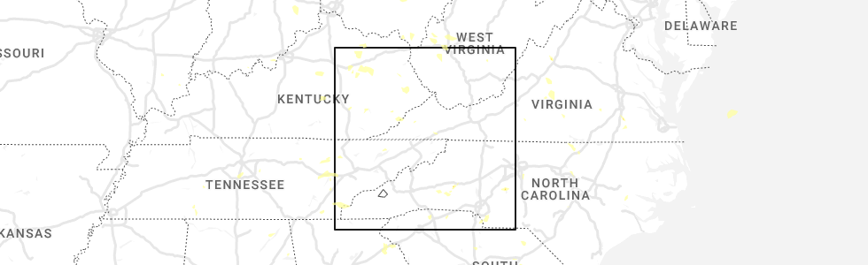
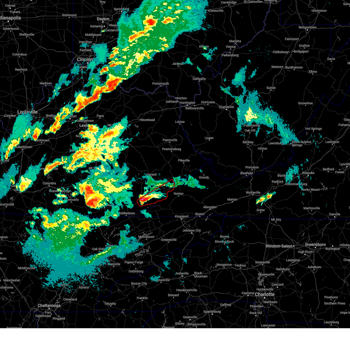
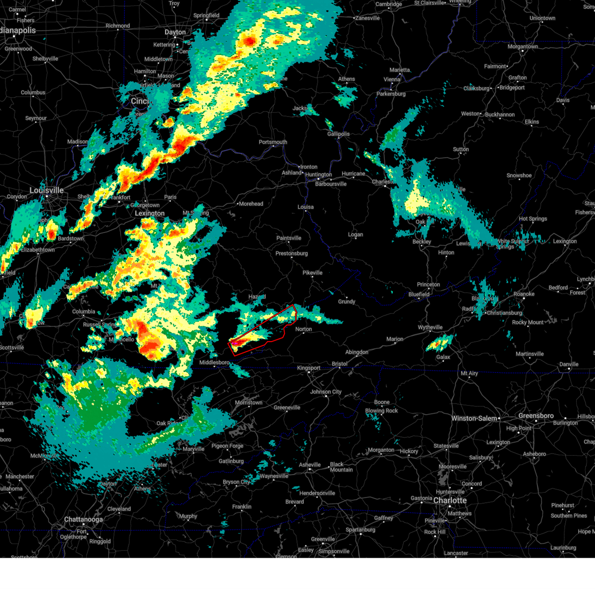
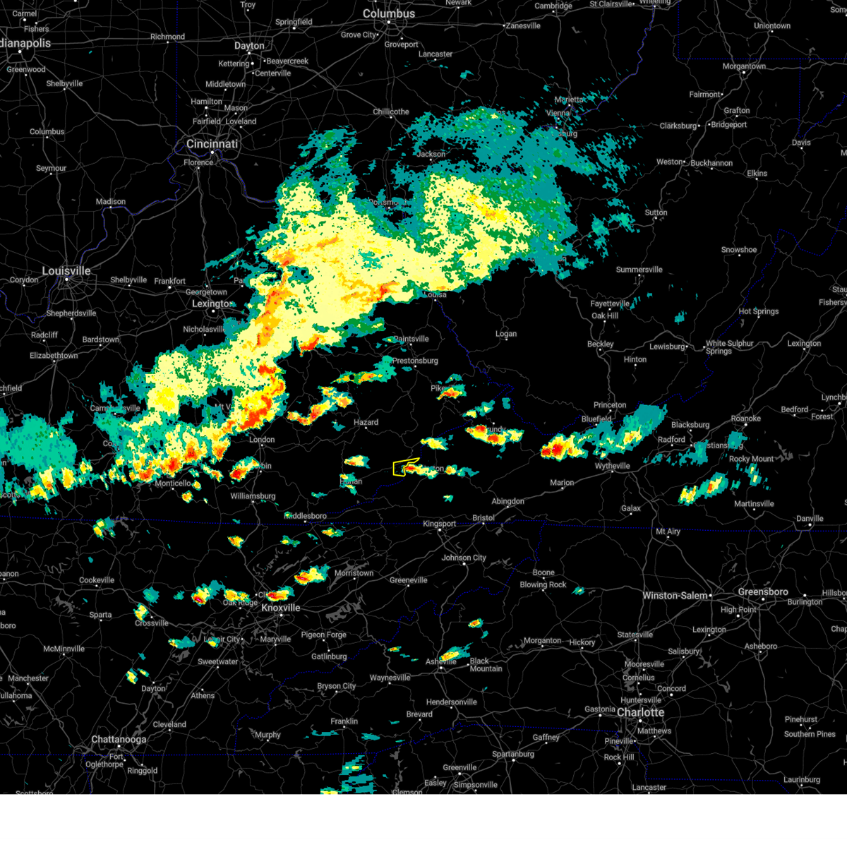
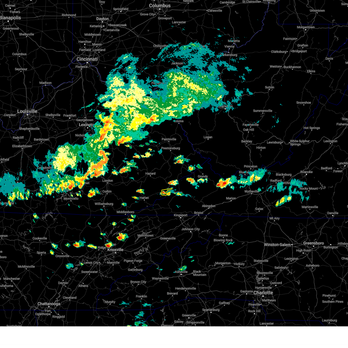
Hail Map for Benham, KY
The Benham, KY area has had 0 reports of on-the-ground hail by trained spotters, and has been under severe weather warnings 18 times during the past 12 months. Doppler radar has detected hail at or near Benham, KY on 17 occasions.
| Name: | Benham, KY |
| Where Located: | 48 miles WNW of Bristol, TN |
| Map: | Google Map for Benham, KY |
| Population: | 500 |
| Housing Units: | 275 |
| More Info: | Search Google for Benham, KY |
0
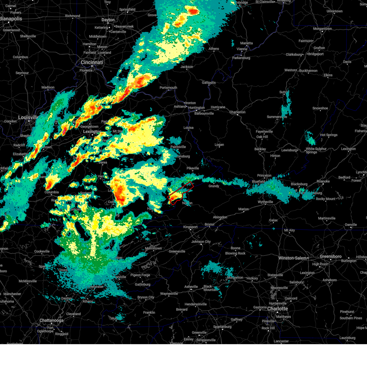
The Top Recent Hail Date for Benham, KY is Wednesday, July 6, 2022 (12th out of 17)
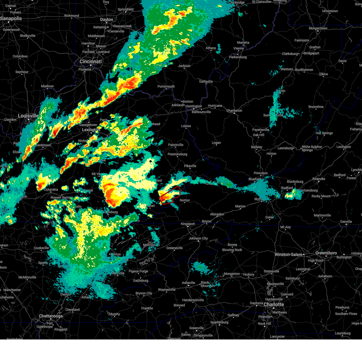
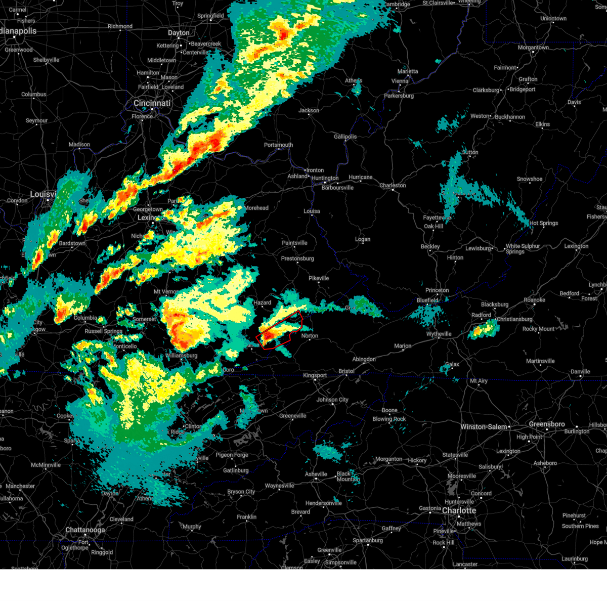
Hail and Wind Damage Spotted near Benham, KY
| Date / Time | Report Details |
|---|---|
| 4/2/2024 7:56 PM EDT |
 Torjkl the national weather service in jackson ky has issued a * tornado warning for, northeastern harlan county in southeastern kentucky, central letcher county in southeastern kentucky, southwestern pike county in southeastern kentucky, * until 845 pm edt. * at 756 pm edt, a severe thunderstorm capable of producing a tornado was located over maggard, or 7 miles southwest of whitesburg, moving northeast at 45 mph (radar indicated rotation). Hazards include tornado and quarter size hail. Flying debris will be dangerous to those caught without shelter. mobile homes will be damaged or destroyed. damage to roofs, windows, and vehicles will occur. tree damage is likely. this dangerous storm will be near, whitesburg around 800 pm edt. mayking around 805 pm edt. fishpond lake around 810 pm edt. jenkins around 815 pm edt. Other locations in the path of this tornadic thunderstorm include shelby gap. Torjkl the national weather service in jackson ky has issued a * tornado warning for, northeastern harlan county in southeastern kentucky, central letcher county in southeastern kentucky, southwestern pike county in southeastern kentucky, * until 845 pm edt. * at 756 pm edt, a severe thunderstorm capable of producing a tornado was located over maggard, or 7 miles southwest of whitesburg, moving northeast at 45 mph (radar indicated rotation). Hazards include tornado and quarter size hail. Flying debris will be dangerous to those caught without shelter. mobile homes will be damaged or destroyed. damage to roofs, windows, and vehicles will occur. tree damage is likely. this dangerous storm will be near, whitesburg around 800 pm edt. mayking around 805 pm edt. fishpond lake around 810 pm edt. jenkins around 815 pm edt. Other locations in the path of this tornadic thunderstorm include shelby gap.
|
| 4/2/2024 7:46 PM EDT |
 At 746 pm edt, a severe thunderstorm capable of producing a tornado was located over cumberland, or 14 miles southwest of whitesburg, moving northeast at 45 mph (radar indicated rotation). Hazards include tornado and quarter size hail. Flying debris will be dangerous to those caught without shelter. mobile homes will be damaged or destroyed. damage to roofs, windows, and vehicles will occur. tree damage is likely. Locations impacted include, whitesburg, cumberland, lynch, benham, winters, millstone, oscaloosa, flint, oven fork, wright, colly, and craftsville. At 746 pm edt, a severe thunderstorm capable of producing a tornado was located over cumberland, or 14 miles southwest of whitesburg, moving northeast at 45 mph (radar indicated rotation). Hazards include tornado and quarter size hail. Flying debris will be dangerous to those caught without shelter. mobile homes will be damaged or destroyed. damage to roofs, windows, and vehicles will occur. tree damage is likely. Locations impacted include, whitesburg, cumberland, lynch, benham, winters, millstone, oscaloosa, flint, oven fork, wright, colly, and craftsville.
|
| 4/2/2024 7:37 PM EDT |
 At 737 pm edt, a severe thunderstorm capable of producing a tornado was located over louellen, or 13 miles northeast of harlan, moving northeast at 50 mph (radar indicated rotation). Hazards include tornado and quarter size hail. Flying debris will be dangerous to those caught without shelter. mobile homes will be damaged or destroyed. damage to roofs, windows, and vehicles will occur. tree damage is likely. Locations impacted include, cumberland, lynch, flint, dongola, whitesburg and colly. At 737 pm edt, a severe thunderstorm capable of producing a tornado was located over louellen, or 13 miles northeast of harlan, moving northeast at 50 mph (radar indicated rotation). Hazards include tornado and quarter size hail. Flying debris will be dangerous to those caught without shelter. mobile homes will be damaged or destroyed. damage to roofs, windows, and vehicles will occur. tree damage is likely. Locations impacted include, cumberland, lynch, flint, dongola, whitesburg and colly.
|
| 4/2/2024 7:19 PM EDT |
 At 718 pm edt, a severe thunderstorm capable of producing a tornado was located over elcomb, or over harlan, moving northeast at 50 mph (radar indicated rotation). Hazards include tornado and ping pong ball size hail. Flying debris will be dangerous to those caught without shelter. mobile homes will be damaged or destroyed. damage to roofs, windows, and vehicles will occur. tree damage is likely. this dangerous storm will be near, evarts around 725 pm edt. colts around 730 pm edt. Other locations in the path of this tornadic thunderstorm include cumberland, benham, lynch and flint. At 718 pm edt, a severe thunderstorm capable of producing a tornado was located over elcomb, or over harlan, moving northeast at 50 mph (radar indicated rotation). Hazards include tornado and ping pong ball size hail. Flying debris will be dangerous to those caught without shelter. mobile homes will be damaged or destroyed. damage to roofs, windows, and vehicles will occur. tree damage is likely. this dangerous storm will be near, evarts around 725 pm edt. colts around 730 pm edt. Other locations in the path of this tornadic thunderstorm include cumberland, benham, lynch and flint.
|
| 4/2/2024 7:19 PM EDT |
 the tornado warning has been cancelled and is no longer in effect the tornado warning has been cancelled and is no longer in effect
|
| 4/2/2024 7:14 PM EDT |
 Torjkl the national weather service in jackson ky has issued a * tornado warning for, harlan county in southeastern kentucky, east central bell county in southeastern kentucky, western letcher county in southeastern kentucky, southeastern perry county in southeastern kentucky, * until 800 pm edt. * at 714 pm edt, a severe thunderstorm capable of producing a tornado was located over kentenia, or near harlan, moving northeast at 50 mph (radar indicated rotation). Hazards include tornado and ping pong ball size hail. Flying debris will be dangerous to those caught without shelter. mobile homes will be damaged or destroyed. damage to roofs, windows, and vehicles will occur. tree damage is likely. this dangerous storm will be near, harlan around 720 pm edt. evarts around 725 pm edt. colts around 730 pm edt. Other locations in the path of this tornadic thunderstorm include totz, cumberland and lynch. Torjkl the national weather service in jackson ky has issued a * tornado warning for, harlan county in southeastern kentucky, east central bell county in southeastern kentucky, western letcher county in southeastern kentucky, southeastern perry county in southeastern kentucky, * until 800 pm edt. * at 714 pm edt, a severe thunderstorm capable of producing a tornado was located over kentenia, or near harlan, moving northeast at 50 mph (radar indicated rotation). Hazards include tornado and ping pong ball size hail. Flying debris will be dangerous to those caught without shelter. mobile homes will be damaged or destroyed. damage to roofs, windows, and vehicles will occur. tree damage is likely. this dangerous storm will be near, harlan around 720 pm edt. evarts around 725 pm edt. colts around 730 pm edt. Other locations in the path of this tornadic thunderstorm include totz, cumberland and lynch.
|
| 3/6/2024 10:07 AM EST |
 Torjkl the national weather service in jackson ky has issued a * this is a test message. tornado warning for, montgomery county in east central kentucky, mccreary county in south central kentucky, rowan county in east central kentucky, morgan county in southeastern kentucky, bath county in east central kentucky, leslie county in southeastern kentucky, estill county in east central kentucky, pulaski county in south central kentucky, rockcastle county in south central kentucky, clay county in southeastern kentucky, elliott county in east central kentucky, wayne county in south central kentucky, harlan county in southeastern kentucky, knox county in southeastern kentucky, owsley county in southeastern kentucky, jackson county in southeastern kentucky, knott county in southeastern kentucky, floyd county in southeastern kentucky, whitley county in south central kentucky, menifee county in east central kentucky, lee county in southeastern kentucky, fleming county in east central kentucky, wolfe county in southeastern kentucky, powell county in east central kentucky, laurel county in south central kentucky, martin county in northeastern kentucky, bell county in southeastern kentucky, johnson county in northeastern kentucky, letcher county in southeastern kentucky, perry county in southeastern kentucky, breathitt county in southeastern kentucky, pike county in southeastern kentucky, magoffin county in southeastern kentucky, * this is a test message. until 1030 am est. * this is a test message. repeat, this is a test tornado warning message. there is no severe weather occuring at this time. this test warning message is part of the annual kentucky tornado drill. if this were an actual severe weather event, you would be given information about the hazard. the national weather service, kentucky emergency management angency, and the kentucky weather preparedness committee, encourges the use of this time to activate and review your severe weather safety plans. repeating, this has been a test tornado warning message for the 2024 kentucky tornado drill. this concludes the test. * this is a test message. Torjkl the national weather service in jackson ky has issued a * this is a test message. tornado warning for, montgomery county in east central kentucky, mccreary county in south central kentucky, rowan county in east central kentucky, morgan county in southeastern kentucky, bath county in east central kentucky, leslie county in southeastern kentucky, estill county in east central kentucky, pulaski county in south central kentucky, rockcastle county in south central kentucky, clay county in southeastern kentucky, elliott county in east central kentucky, wayne county in south central kentucky, harlan county in southeastern kentucky, knox county in southeastern kentucky, owsley county in southeastern kentucky, jackson county in southeastern kentucky, knott county in southeastern kentucky, floyd county in southeastern kentucky, whitley county in south central kentucky, menifee county in east central kentucky, lee county in southeastern kentucky, fleming county in east central kentucky, wolfe county in southeastern kentucky, powell county in east central kentucky, laurel county in south central kentucky, martin county in northeastern kentucky, bell county in southeastern kentucky, johnson county in northeastern kentucky, letcher county in southeastern kentucky, perry county in southeastern kentucky, breathitt county in southeastern kentucky, pike county in southeastern kentucky, magoffin county in southeastern kentucky, * this is a test message. until 1030 am est. * this is a test message. repeat, this is a test tornado warning message. there is no severe weather occuring at this time. this test warning message is part of the annual kentucky tornado drill. if this were an actual severe weather event, you would be given information about the hazard. the national weather service, kentucky emergency management angency, and the kentucky weather preparedness committee, encourges the use of this time to activate and review your severe weather safety plans. repeating, this has been a test tornado warning message for the 2024 kentucky tornado drill. this concludes the test. * this is a test message.
|
| 7/29/2023 4:28 PM EDT |
 The severe thunderstorm warning for northeastern harlan, letcher and southeastern perry counties will expire at 430 pm edt, the storm which prompted the warning has weakened below severe limits, and no longer poses an immediate threat to life or property. therefore, the warning will be allowed to expire. however gusty winds are still possible with this thunderstorm. a severe thunderstorm watch remains in effect until 1000 pm edt for southeastern kentucky. The severe thunderstorm warning for northeastern harlan, letcher and southeastern perry counties will expire at 430 pm edt, the storm which prompted the warning has weakened below severe limits, and no longer poses an immediate threat to life or property. therefore, the warning will be allowed to expire. however gusty winds are still possible with this thunderstorm. a severe thunderstorm watch remains in effect until 1000 pm edt for southeastern kentucky.
|
| 7/29/2023 4:21 PM EDT |
 At 421 pm edt, a severe thunderstorm was located over maggard, or 7 miles south of whitesburg, moving southeast at 30 mph (radar indicated). Hazards include 60 mph wind gusts. Expect damage to roofs, siding, and trees. locations impacted include, whitesburg, cumberland, jenkins, fleming-neon, lynch, benham, winters, horn, oscaloosa, arthur, colly and louellen. hail threat, radar indicated max hail size, <. 75 in wind threat, radar indicated max wind gust, 60 mph. At 421 pm edt, a severe thunderstorm was located over maggard, or 7 miles south of whitesburg, moving southeast at 30 mph (radar indicated). Hazards include 60 mph wind gusts. Expect damage to roofs, siding, and trees. locations impacted include, whitesburg, cumberland, jenkins, fleming-neon, lynch, benham, winters, horn, oscaloosa, arthur, colly and louellen. hail threat, radar indicated max hail size, <. 75 in wind threat, radar indicated max wind gust, 60 mph.
|
| 7/29/2023 4:16 PM EDT |
 At 416 pm edt, a severe thunderstorm was located over maggard, or 7 miles southwest of whitesburg, moving southeast at 25 mph (radar indicated). Hazards include 60 mph wind gusts. Expect damage to roofs, siding, and trees. this severe thunderstorm will remain over mainly rural areas of northeastern harlan, letcher, east central leslie and southeastern perry counties. hail threat, radar indicated max hail size, <. 75 in wind threat, radar indicated max wind gust, 60 mph. At 416 pm edt, a severe thunderstorm was located over maggard, or 7 miles southwest of whitesburg, moving southeast at 25 mph (radar indicated). Hazards include 60 mph wind gusts. Expect damage to roofs, siding, and trees. this severe thunderstorm will remain over mainly rural areas of northeastern harlan, letcher, east central leslie and southeastern perry counties. hail threat, radar indicated max hail size, <. 75 in wind threat, radar indicated max wind gust, 60 mph.
|
| 7/29/2023 4:07 PM EDT |
 At 407 pm edt, a severe thunderstorm was located over kings creek, or 7 miles southwest of whitesburg, moving southeast at 30 mph (radar indicated). Hazards include 60 mph wind gusts. Expect damage to roofs, siding, and trees. this severe storm will be near, maggard around 410 pm edt. hail threat, radar indicated max hail size, <. 75 in wind threat, radar indicated max wind gust, 60 mph. At 407 pm edt, a severe thunderstorm was located over kings creek, or 7 miles southwest of whitesburg, moving southeast at 30 mph (radar indicated). Hazards include 60 mph wind gusts. Expect damage to roofs, siding, and trees. this severe storm will be near, maggard around 410 pm edt. hail threat, radar indicated max hail size, <. 75 in wind threat, radar indicated max wind gust, 60 mph.
|
| 7/29/2023 3:59 PM EDT |
 At 359 pm edt, a severe thunderstorm was located over skyline, or 7 miles west of whitesburg, moving southeast at 30 mph (radar indicated). Hazards include 60 mph wind gusts. Expect damage to roofs, siding, and trees. this severe thunderstorm will be near, kings creek around 405 pm edt. maggard around 410 pm edt. hail threat, radar indicated max hail size, <. 75 in wind threat, radar indicated max wind gust, 60 mph. At 359 pm edt, a severe thunderstorm was located over skyline, or 7 miles west of whitesburg, moving southeast at 30 mph (radar indicated). Hazards include 60 mph wind gusts. Expect damage to roofs, siding, and trees. this severe thunderstorm will be near, kings creek around 405 pm edt. maggard around 410 pm edt. hail threat, radar indicated max hail size, <. 75 in wind threat, radar indicated max wind gust, 60 mph.
|
| 7/29/2023 3:47 PM EDT |
 At 347 pm edt, a severe thunderstorm was located over roxana, or near whitesburg, moving southeast at 25 mph (radar indicated). Hazards include 60 mph wind gusts. Expect damage to roofs, siding, and trees. locations impacted include, premium, oscaloosa, whitesburg, day and eolia. hail threat, radar indicated max hail size, <. 75 in wind threat, radar indicated max wind gust, 60 mph. At 347 pm edt, a severe thunderstorm was located over roxana, or near whitesburg, moving southeast at 25 mph (radar indicated). Hazards include 60 mph wind gusts. Expect damage to roofs, siding, and trees. locations impacted include, premium, oscaloosa, whitesburg, day and eolia. hail threat, radar indicated max hail size, <. 75 in wind threat, radar indicated max wind gust, 60 mph.
|
| 7/29/2023 3:20 PM EDT |
 At 319 pm edt, a severe thunderstorm was located over jeff, or near hazard, moving southeast at 25 mph (radar indicated). Hazards include 60 mph wind gusts. Expect damage to roofs, siding, and trees. this severe thunderstorm will be near, vicco around 325 pm edt. cornettsville around 330 pm edt. red star around 335 pm edt. other locations in the path of this severe thunderstorm include blackey, letcher and roxana. hail threat, radar indicated max hail size, <. 75 in wind threat, radar indicated max wind gust, 60 mph. At 319 pm edt, a severe thunderstorm was located over jeff, or near hazard, moving southeast at 25 mph (radar indicated). Hazards include 60 mph wind gusts. Expect damage to roofs, siding, and trees. this severe thunderstorm will be near, vicco around 325 pm edt. cornettsville around 330 pm edt. red star around 335 pm edt. other locations in the path of this severe thunderstorm include blackey, letcher and roxana. hail threat, radar indicated max hail size, <. 75 in wind threat, radar indicated max wind gust, 60 mph.
|
| 5/16/2023 3:42 PM EDT |
 The severe thunderstorm warning for northeastern harlan and south central letcher counties will expire at 345 pm edt, the storm which prompted the warning has moved out of the area. therefore, the warning will be allowed to expire. a severe thunderstorm watch remains in effect until 800 pm edt for southeastern kentucky. The severe thunderstorm warning for northeastern harlan and south central letcher counties will expire at 345 pm edt, the storm which prompted the warning has moved out of the area. therefore, the warning will be allowed to expire. a severe thunderstorm watch remains in effect until 800 pm edt for southeastern kentucky.
|
| 5/16/2023 3:30 PM EDT |
 At 330 pm edt, a severe thunderstorm was located over lynch, or 10 miles south of whitesburg, moving east at 40 mph (radar indicated). Hazards include 60 mph wind gusts and quarter size hail. Hail damage to vehicles is expected. expect wind damage to roofs, siding, and trees. This severe thunderstorm will remain over mainly rural areas of northeastern harlan and south central letcher counties. At 330 pm edt, a severe thunderstorm was located over lynch, or 10 miles south of whitesburg, moving east at 40 mph (radar indicated). Hazards include 60 mph wind gusts and quarter size hail. Hail damage to vehicles is expected. expect wind damage to roofs, siding, and trees. This severe thunderstorm will remain over mainly rural areas of northeastern harlan and south central letcher counties.
|
| 5/16/2023 3:16 PM EDT |
 At 316 pm edt, a severe thunderstorm was located over clutts, or 14 miles southwest of whitesburg, moving east at 40 mph (radar indicated). Hazards include 60 mph wind gusts and quarter size hail. Hail damage to vehicles is expected. expect wind damage to roofs, siding, and trees. this severe thunderstorm will be near, lynch around 320 pm edt. lewis creek around 325 pm edt. hail threat, radar indicated max hail size, 1. 00 in wind threat, radar indicated max wind gust, 60 mph. At 316 pm edt, a severe thunderstorm was located over clutts, or 14 miles southwest of whitesburg, moving east at 40 mph (radar indicated). Hazards include 60 mph wind gusts and quarter size hail. Hail damage to vehicles is expected. expect wind damage to roofs, siding, and trees. this severe thunderstorm will be near, lynch around 320 pm edt. lewis creek around 325 pm edt. hail threat, radar indicated max hail size, 1. 00 in wind threat, radar indicated max wind gust, 60 mph.
|
| 8/5/2022 5:40 PM EDT |
 At 540 pm edt, a severe thunderstorm was located over lewis creek, or 9 miles south of whitesburg, moving northeast at 40 mph (radar indicated). Hazards include 60 mph wind gusts and penny size hail. Expect damage to roofs, siding, and trees. this severe thunderstorm will be near, eolia around 550 pm edt. whitesburg around 555 pm edt. mayking around 600 pm edt. other locations in the path of this severe thunderstorm include whitaker and jenkins. hail threat, radar indicated max hail size, 0. 75 in wind threat, radar indicated max wind gust, 60 mph. At 540 pm edt, a severe thunderstorm was located over lewis creek, or 9 miles south of whitesburg, moving northeast at 40 mph (radar indicated). Hazards include 60 mph wind gusts and penny size hail. Expect damage to roofs, siding, and trees. this severe thunderstorm will be near, eolia around 550 pm edt. whitesburg around 555 pm edt. mayking around 600 pm edt. other locations in the path of this severe thunderstorm include whitaker and jenkins. hail threat, radar indicated max hail size, 0. 75 in wind threat, radar indicated max wind gust, 60 mph.
|
| 6/22/2022 9:27 PM EDT |
 The severe thunderstorm warning for northeastern harlan, southwestern letcher and southeastern perry counties will expire at 930 pm edt, the storm which prompted the warning has weakened below severe limits, and has exited the warned area. therefore, the warning will be allowed to expire. a severe thunderstorm watch remains in effect until midnight edt for southeastern kentucky. The severe thunderstorm warning for northeastern harlan, southwestern letcher and southeastern perry counties will expire at 930 pm edt, the storm which prompted the warning has weakened below severe limits, and has exited the warned area. therefore, the warning will be allowed to expire. a severe thunderstorm watch remains in effect until midnight edt for southeastern kentucky.
|
| 6/22/2022 9:09 PM EDT |
 At 909 pm edt, a severe thunderstorm was located over gordon, or 14 miles southwest of whitesburg, moving southeast at 30 mph (radar indicated). Hazards include 60 mph wind gusts. Expect damage to roofs, siding, and trees. locations impacted include, benham, lynch, rock house and big black mountain. hail threat, radar indicated max hail size, <. 75 in wind threat, radar indicated max wind gust, 60 mph. At 909 pm edt, a severe thunderstorm was located over gordon, or 14 miles southwest of whitesburg, moving southeast at 30 mph (radar indicated). Hazards include 60 mph wind gusts. Expect damage to roofs, siding, and trees. locations impacted include, benham, lynch, rock house and big black mountain. hail threat, radar indicated max hail size, <. 75 in wind threat, radar indicated max wind gust, 60 mph.
|
| 6/22/2022 8:47 PM EDT |
 At 846 pm edt, a severe thunderstorm was located over slemp, or 11 miles south of hazard, moving southeast at 30 mph (radar indicated). Hazards include 60 mph wind gusts. Expect damage to roofs, siding, and trees. this severe thunderstorm will be near, daisy around 850 pm edt. slemp around 855 pm edt. delphia around 900 pm edt. other locations in the path of this severe thunderstorm include gordon, cumberland and lynch. hail threat, radar indicated max hail size, <. 75 in wind threat, radar indicated max wind gust, 60 mph. At 846 pm edt, a severe thunderstorm was located over slemp, or 11 miles south of hazard, moving southeast at 30 mph (radar indicated). Hazards include 60 mph wind gusts. Expect damage to roofs, siding, and trees. this severe thunderstorm will be near, daisy around 850 pm edt. slemp around 855 pm edt. delphia around 900 pm edt. other locations in the path of this severe thunderstorm include gordon, cumberland and lynch. hail threat, radar indicated max hail size, <. 75 in wind threat, radar indicated max wind gust, 60 mph.
|
| 6/17/2022 2:18 PM EDT |
 At 218 pm edt, a severe thunderstorm was located over lewis creek, or 9 miles south of whitesburg, moving east at 40 mph (radar indicated). Hazards include 60 mph wind gusts and penny size hail. Expect damage to roofs, siding, and trees. locations impacted include, cumberland, evarts, lynch, benham, flint, totz, black bottom, dizney, louellen, clover fork, lewis creek and defeated creek. hail threat, radar indicated max hail size, 0. 75 in wind threat, radar indicated max wind gust, 60 mph. At 218 pm edt, a severe thunderstorm was located over lewis creek, or 9 miles south of whitesburg, moving east at 40 mph (radar indicated). Hazards include 60 mph wind gusts and penny size hail. Expect damage to roofs, siding, and trees. locations impacted include, cumberland, evarts, lynch, benham, flint, totz, black bottom, dizney, louellen, clover fork, lewis creek and defeated creek. hail threat, radar indicated max hail size, 0. 75 in wind threat, radar indicated max wind gust, 60 mph.
|
| 6/17/2022 2:03 PM EDT |
 At 203 pm edt, a severe thunderstorm was located over gordon, or 14 miles southwest of whitesburg, moving east at 45 mph (radar indicated). Hazards include 60 mph wind gusts and penny size hail. expect damage to roofs, siding, and trees At 203 pm edt, a severe thunderstorm was located over gordon, or 14 miles southwest of whitesburg, moving east at 45 mph (radar indicated). Hazards include 60 mph wind gusts and penny size hail. expect damage to roofs, siding, and trees
|
| 6/17/2022 1:38 PM EDT |
 At 137 pm edt, a severe thunderstorm was located over oven fork, or near whitesburg, moving east at 40 mph (radar indicated). Hazards include 60 mph wind gusts and penny size hail. Expect damage to roofs, siding, and trees. this severe thunderstorm will remain over mainly rural areas of northeastern harlan and southern letcher counties. hail threat, radar indicated max hail size, 0. 75 in wind threat, radar indicated max wind gust, 60 mph. At 137 pm edt, a severe thunderstorm was located over oven fork, or near whitesburg, moving east at 40 mph (radar indicated). Hazards include 60 mph wind gusts and penny size hail. Expect damage to roofs, siding, and trees. this severe thunderstorm will remain over mainly rural areas of northeastern harlan and southern letcher counties. hail threat, radar indicated max hail size, 0. 75 in wind threat, radar indicated max wind gust, 60 mph.
|
| 6/17/2022 1:21 PM EDT |
 At 121 pm edt, a severe thunderstorm was located over lilley cornett woods, or 9 miles west of whitesburg, moving east at 40 mph (radar indicated). Hazards include 60 mph wind gusts and penny size hail. Expect damage to roofs, siding, and trees. this severe thunderstorm will be near, flint around 125 pm edt. oscaloosa around 130 pm edt. whitesburg around 135 pm edt. eolia around 140 pm edt. hail threat, radar indicated max hail size, 0. 75 in wind threat, radar indicated max wind gust, 60 mph. At 121 pm edt, a severe thunderstorm was located over lilley cornett woods, or 9 miles west of whitesburg, moving east at 40 mph (radar indicated). Hazards include 60 mph wind gusts and penny size hail. Expect damage to roofs, siding, and trees. this severe thunderstorm will be near, flint around 125 pm edt. oscaloosa around 130 pm edt. whitesburg around 135 pm edt. eolia around 140 pm edt. hail threat, radar indicated max hail size, 0. 75 in wind threat, radar indicated max wind gust, 60 mph.
|
| 1/1/2022 5:43 PM EST |
 At 542 pm est, a severe thunderstorm was located over slemp, or 12 miles southeast of hazard, moving east at 55 mph (radar indicated). Hazards include 60 mph wind gusts. Expect damage to roofs, siding, and trees. locations impacted include, letcher, cumberland, benham, vicco, blackey, big fork, cody, leatherwood, bledsoe, arthur, viper and daley. hail threat, radar indicated max hail size, <. 75 in wind threat, radar indicated max wind gust, 60 mph. At 542 pm est, a severe thunderstorm was located over slemp, or 12 miles southeast of hazard, moving east at 55 mph (radar indicated). Hazards include 60 mph wind gusts. Expect damage to roofs, siding, and trees. locations impacted include, letcher, cumberland, benham, vicco, blackey, big fork, cody, leatherwood, bledsoe, arthur, viper and daley. hail threat, radar indicated max hail size, <. 75 in wind threat, radar indicated max wind gust, 60 mph.
|
| 1/1/2022 5:24 PM EST |
 At 523 pm est, a severe thunderstorm was located over mozelle, or 11 miles south of hyden, moving east at 55 mph (radar indicated). Hazards include 60 mph wind gusts. Expect damage to roofs, siding, and trees. this severe thunderstorm will be near, causey around 530 pm est. big rock around 535 pm est. slemp around 540 pm est. other locations in the path of this severe thunderstorm include daisy, blackey and letcher. hail threat, radar indicated max hail size, <. 75 in wind threat, radar indicated max wind gust, 60 mph. At 523 pm est, a severe thunderstorm was located over mozelle, or 11 miles south of hyden, moving east at 55 mph (radar indicated). Hazards include 60 mph wind gusts. Expect damage to roofs, siding, and trees. this severe thunderstorm will be near, causey around 530 pm est. big rock around 535 pm est. slemp around 540 pm est. other locations in the path of this severe thunderstorm include daisy, blackey and letcher. hail threat, radar indicated max hail size, <. 75 in wind threat, radar indicated max wind gust, 60 mph.
|
| 9/22/2021 10:13 AM EDT |
 At 1013 am edt, severe thunderstorms were located along a line extending from mid to holmes mill, moving northeast at 50 mph (radar indicated). Hazards include 60 mph wind gusts. Expect damage to roofs, siding, and trees. severe thunderstorms will be near, lewis creek around 1025 am edt. maggard around 1030 am edt. other locations in the path of these severe thunderstorms include eolia, jenkins and adamson. hail threat, radar indicated max hail size, <. 75 in wind threat, radar indicated max wind gust, 60 mph. At 1013 am edt, severe thunderstorms were located along a line extending from mid to holmes mill, moving northeast at 50 mph (radar indicated). Hazards include 60 mph wind gusts. Expect damage to roofs, siding, and trees. severe thunderstorms will be near, lewis creek around 1025 am edt. maggard around 1030 am edt. other locations in the path of these severe thunderstorms include eolia, jenkins and adamson. hail threat, radar indicated max hail size, <. 75 in wind threat, radar indicated max wind gust, 60 mph.
|
| 6/21/2021 7:06 PM EDT |
 The severe thunderstorm warning for northeastern harlan and southeastern letcher counties will expire at 715 pm edt, the storm which prompted the warning has moved out of the area. therefore, the warning will be allowed to expire. however gusty winds are still possible with this thunderstorm. a severe thunderstorm watch remains in effect until 900 pm edt for southeastern kentucky. The severe thunderstorm warning for northeastern harlan and southeastern letcher counties will expire at 715 pm edt, the storm which prompted the warning has moved out of the area. therefore, the warning will be allowed to expire. however gusty winds are still possible with this thunderstorm. a severe thunderstorm watch remains in effect until 900 pm edt for southeastern kentucky.
|
| 6/21/2021 6:49 PM EDT |
 At 649 pm edt, a severe thunderstorm was located near big stone gap, or 8 miles west of norton, moving east at 55 mph (radar indicated). Hazards include 60 mph wind gusts. Expect damage to roofs, siding, and trees. This severe thunderstorm will remain over mainly rural areas of northeastern harlan and southeastern letcher counties. At 649 pm edt, a severe thunderstorm was located near big stone gap, or 8 miles west of norton, moving east at 55 mph (radar indicated). Hazards include 60 mph wind gusts. Expect damage to roofs, siding, and trees. This severe thunderstorm will remain over mainly rural areas of northeastern harlan and southeastern letcher counties.
|
| 6/21/2021 6:34 PM EDT |
 At 634 pm edt, a severe thunderstorm was located over closplint, or 16 miles north of jonesville, moving east at 55 mph (radar indicated). Hazards include 60 mph wind gusts. Expect damage to roofs, siding, and trees. This severe thunderstorm will be near, lynch around 640 pm edt. At 634 pm edt, a severe thunderstorm was located over closplint, or 16 miles north of jonesville, moving east at 55 mph (radar indicated). Hazards include 60 mph wind gusts. Expect damage to roofs, siding, and trees. This severe thunderstorm will be near, lynch around 640 pm edt.
|
| 4/25/2020 7:09 PM EDT |
 The severe thunderstorm warning for northeastern harlan, southwestern letcher, southeastern leslie and southeastern perry counties will expire at 715 pm edt, the storm which prompted the warning has weakened below severe limits, and no longer poses an immediate threat to life or property. therefore, the warning will be allowed to expire. The severe thunderstorm warning for northeastern harlan, southwestern letcher, southeastern leslie and southeastern perry counties will expire at 715 pm edt, the storm which prompted the warning has weakened below severe limits, and no longer poses an immediate threat to life or property. therefore, the warning will be allowed to expire.
|
| 4/25/2020 7:02 PM EDT |
 At 701 pm edt, a severe thunderstorm was located over big laurel, or 13 miles northeast of harlan, moving east at 35 mph (radar indicated). Hazards include 60 mph wind gusts and nickel size hail. Expect damage to roofs, siding, and trees. locations impacted include, cumberland, benham, big fork, leatherwood, bluefield, cinda, arthur, big laurel, totz, hallie, kingdom come s. p. And gilley. At 701 pm edt, a severe thunderstorm was located over big laurel, or 13 miles northeast of harlan, moving east at 35 mph (radar indicated). Hazards include 60 mph wind gusts and nickel size hail. Expect damage to roofs, siding, and trees. locations impacted include, cumberland, benham, big fork, leatherwood, bluefield, cinda, arthur, big laurel, totz, hallie, kingdom come s. p. And gilley.
|
| 4/25/2020 6:44 PM EDT |
 At 644 pm edt, a severe thunderstorm was located over warbranch, or 10 miles northwest of harlan, moving east at 35 mph (radar indicated). Hazards include 60 mph wind gusts and quarter size hail. Hail damage to vehicles is expected. Expect wind damage to roofs, siding, and trees. At 644 pm edt, a severe thunderstorm was located over warbranch, or 10 miles northwest of harlan, moving east at 35 mph (radar indicated). Hazards include 60 mph wind gusts and quarter size hail. Hail damage to vehicles is expected. Expect wind damage to roofs, siding, and trees.
|
| 4/9/2020 2:28 AM EDT |
 The severe thunderstorm warning for northeastern harlan, letcher and southeastern perry counties will expire at 230 am edt, the storms which prompted the warning have weakened below severe limits, and have exited the warned area. therefore, the warning will be allowed to expire. The severe thunderstorm warning for northeastern harlan, letcher and southeastern perry counties will expire at 230 am edt, the storms which prompted the warning have weakened below severe limits, and have exited the warned area. therefore, the warning will be allowed to expire.
|
| 4/9/2020 2:14 AM EDT |
 At 213 am edt, severe thunderstorms were located along a line extending from tillie to hiram, moving east at 50 mph (radar indicated). Hazards include 60 mph wind gusts and penny size hail. expect damage to roofs, siding, and trees At 213 am edt, severe thunderstorms were located along a line extending from tillie to hiram, moving east at 50 mph (radar indicated). Hazards include 60 mph wind gusts and penny size hail. expect damage to roofs, siding, and trees
|
| 4/9/2020 1:52 AM EDT |
 At 152 am edt, severe thunderstorms were located along a line extending from hinch to near garden village to democrat to hoskinston, moving southeast at 55 mph (radar indicated). Hazards include 60 mph wind gusts and penny size hail. expect damage to roofs, siding, and trees At 152 am edt, severe thunderstorms were located along a line extending from hinch to near garden village to democrat to hoskinston, moving southeast at 55 mph (radar indicated). Hazards include 60 mph wind gusts and penny size hail. expect damage to roofs, siding, and trees
|
| 6/22/2019 12:17 AM EDT |
 A severe thunderstorm warning remains in effect until 1230 am edt for harlan. letcher. southeastern leslie and southeastern perry counties. at 1215 am edt, severe thunderstorms were located along a line extending from chappell to near jonesville, moving east at 45 mph. hazard. 60 mph wind gusts and penny size hail. A severe thunderstorm warning remains in effect until 1230 am edt for harlan. letcher. southeastern leslie and southeastern perry counties. at 1215 am edt, severe thunderstorms were located along a line extending from chappell to near jonesville, moving east at 45 mph. hazard. 60 mph wind gusts and penny size hail.
|
| 6/22/2019 12:14 AM EDT |
 A severe thunderstorm warning remains in effect until 1230 am edt for harlan. letcher. southern leslie. southeastern perry and south central knott counties. at 1213 am edt, severe thunderstorms were located along a line extending from chappell to near sneedville, moving east at 45 mph. hazard. 60 mph wind gusts and penny size hail. A severe thunderstorm warning remains in effect until 1230 am edt for harlan. letcher. southern leslie. southeastern perry and south central knott counties. at 1213 am edt, severe thunderstorms were located along a line extending from chappell to near sneedville, moving east at 45 mph. hazard. 60 mph wind gusts and penny size hail.
|
| 6/21/2019 11:51 PM EDT |
 The national weather service in jackson ky has issued a * severe thunderstorm warning for. harlan county in southeastern kentucky. northeastern bell county in southeastern kentucky. letcher county in southeastern kentucky. Leslie county in southeastern kentucky. The national weather service in jackson ky has issued a * severe thunderstorm warning for. harlan county in southeastern kentucky. northeastern bell county in southeastern kentucky. letcher county in southeastern kentucky. Leslie county in southeastern kentucky.
|
| 6/21/2019 11:51 PM EDT |
 At 1150 pm edt, severe thunderstorms were located along a line extending from ice cliff to 7 miles south of cubage, moving east at 45 mph (radar indicated). Hazards include 60 mph wind gusts and penny size hail. expect damage to roofs, siding, and trees At 1150 pm edt, severe thunderstorms were located along a line extending from ice cliff to 7 miles south of cubage, moving east at 45 mph (radar indicated). Hazards include 60 mph wind gusts and penny size hail. expect damage to roofs, siding, and trees
|
| 6/3/2018 3:24 PM EDT |
 The severe thunderstorm warning for northeastern harlan and southwestern letcher counties will expire at 330 pm edt, the storm which prompted the warning has weakened below severe limits, and is exiting the warned area. therefore, the warning will be allowed to expire. The severe thunderstorm warning for northeastern harlan and southwestern letcher counties will expire at 330 pm edt, the storm which prompted the warning has weakened below severe limits, and is exiting the warned area. therefore, the warning will be allowed to expire.
|
| 6/3/2018 3:05 PM EDT |
 At 304 pm edt, a severe thunderstorm was located over totz, or 12 miles northeast of harlan, moving southeast at 20 mph (radar indicated). Hazards include 60 mph wind gusts. Expect damage to roofs, siding, and trees. locations impacted include, cumberland, lynch, benham, totz, black bottom, louellen, clover fork, lewis creek, kingdom come s. p. Gilley, highsplint, clutts, big black mountain, partridge, nolansburg, shields, gordon, rock house, holmes mill, and clover. At 304 pm edt, a severe thunderstorm was located over totz, or 12 miles northeast of harlan, moving southeast at 20 mph (radar indicated). Hazards include 60 mph wind gusts. Expect damage to roofs, siding, and trees. locations impacted include, cumberland, lynch, benham, totz, black bottom, louellen, clover fork, lewis creek, kingdom come s. p. Gilley, highsplint, clutts, big black mountain, partridge, nolansburg, shields, gordon, rock house, holmes mill, and clover.
|
| 6/3/2018 2:41 PM EDT |
 The national weather service in jackson ky has issued a * severe thunderstorm warning for. northeastern harlan county in southeastern kentucky. southwestern letcher county in southeastern kentucky. east central leslie county in southeastern kentucky. Southeastern perry county in southeastern kentucky. The national weather service in jackson ky has issued a * severe thunderstorm warning for. northeastern harlan county in southeastern kentucky. southwestern letcher county in southeastern kentucky. east central leslie county in southeastern kentucky. Southeastern perry county in southeastern kentucky.
|
| 4/4/2018 1:38 AM EDT |
 At 137 am edt, severe thunderstorms were located along a line extending from tillie to near pennington gap, moving east at 60 mph (radar indicated). Hazards include 60 mph wind gusts. Expect damage to roofs, siding, and trees. Locations impacted include, whitesburg, letcher, cumberland, jenkins, elkhorn city, evarts, fleming-neon, lynch, benham, blackey, bobs creek, van, dizney, colly, louellen, premium, sergent, gilley, clutts and shields. At 137 am edt, severe thunderstorms were located along a line extending from tillie to near pennington gap, moving east at 60 mph (radar indicated). Hazards include 60 mph wind gusts. Expect damage to roofs, siding, and trees. Locations impacted include, whitesburg, letcher, cumberland, jenkins, elkhorn city, evarts, fleming-neon, lynch, benham, blackey, bobs creek, van, dizney, colly, louellen, premium, sergent, gilley, clutts and shields.
|
| 4/4/2018 1:28 AM EDT |
 At 126 am edt, severe thunderstorms were located along a line extending from ulvah to martins fork lake, moving east at 60 mph (62 mph gust reported at harlan awos). Hazards include 60 mph wind gusts. Expect damage to roofs, siding, and trees. Locations impacted include, whitesburg, harlan, letcher, cumberland, jenkins, loyall, elkhorn city, evarts, fleming-neon, lynch, benham, blackey, big fork, bobs creek, leatherwood, van, dizney, colly, louellen and premium. At 126 am edt, severe thunderstorms were located along a line extending from ulvah to martins fork lake, moving east at 60 mph (62 mph gust reported at harlan awos). Hazards include 60 mph wind gusts. Expect damage to roofs, siding, and trees. Locations impacted include, whitesburg, harlan, letcher, cumberland, jenkins, loyall, elkhorn city, evarts, fleming-neon, lynch, benham, blackey, big fork, bobs creek, leatherwood, van, dizney, colly, louellen and premium.
|
| 4/4/2018 1:14 AM EDT |
 At 114 am edt, severe thunderstorms were located along a line extending from cutshin to near hensley store, moving east at 60 mph (radar indicated). Hazards include 60 mph wind gusts. expect damage to roofs, siding, and trees At 114 am edt, severe thunderstorms were located along a line extending from cutshin to near hensley store, moving east at 60 mph (radar indicated). Hazards include 60 mph wind gusts. expect damage to roofs, siding, and trees
|
| 7/6/2017 7:16 PM EDT |
 At 716 pm edt, severe thunderstorms were located along a line extending from redfox to lynch to near cranks, moving east at 55 mph (radar indicated). Hazards include 60 mph wind gusts. Expect damage to roofs, siding, and trees. Locations impacted include, whitesburg, harlan, letcher, cumberland, evarts, lynch, benham, blackey, bobs creek, van, dizney, colly, louellen, premium, clutts, shields, black mountain, smith, whitco and southdown. At 716 pm edt, severe thunderstorms were located along a line extending from redfox to lynch to near cranks, moving east at 55 mph (radar indicated). Hazards include 60 mph wind gusts. Expect damage to roofs, siding, and trees. Locations impacted include, whitesburg, harlan, letcher, cumberland, evarts, lynch, benham, blackey, bobs creek, van, dizney, colly, louellen, premium, clutts, shields, black mountain, smith, whitco and southdown.
|
| 7/6/2017 7:01 PM EDT |
 At 701 pm edt, severe thunderstorms were located along a line extending from diablock to arthur to mary alice, moving east at 55 mph (radar indicated). Hazards include 60 mph wind gusts and quarter size hail. Hail damage to vehicles is expected. Expect wind damage to roofs, siding, and trees. At 701 pm edt, severe thunderstorms were located along a line extending from diablock to arthur to mary alice, moving east at 55 mph (radar indicated). Hazards include 60 mph wind gusts and quarter size hail. Hail damage to vehicles is expected. Expect wind damage to roofs, siding, and trees.
|
| 5/24/2017 12:39 PM EDT |
 At 1238 pm edt, a severe thunderstorm was located over lenarve, or near harlan, moving northeast at 30 mph (radar indicated). Hazards include 60 mph wind gusts and quarter size hail. Hail damage to vehicles is expected. Expect wind damage to roofs, siding, and trees. At 1238 pm edt, a severe thunderstorm was located over lenarve, or near harlan, moving northeast at 30 mph (radar indicated). Hazards include 60 mph wind gusts and quarter size hail. Hail damage to vehicles is expected. Expect wind damage to roofs, siding, and trees.
|
| 5/4/2017 11:55 PM EDT |
 At 1155 pm edt, severe thunderstorms were located along a line extending from tremont to three point to near jonesville to 6 miles north of rogersville, moving northeast at 45 mph (radar indicated). Hazards include 60 mph wind gusts and penny size hail. Expect damage to roofs, siding, and trees. Locations impacted include, harlan, cumberland, loyall, evarts, lynch, benham, wallins creek, big fork, bobs creek, leatherwood, bledsoe, dizney, louellen, coldiron, gilley, clutts, napier, shields, yeaddiss and black mountain. At 1155 pm edt, severe thunderstorms were located along a line extending from tremont to three point to near jonesville to 6 miles north of rogersville, moving northeast at 45 mph (radar indicated). Hazards include 60 mph wind gusts and penny size hail. Expect damage to roofs, siding, and trees. Locations impacted include, harlan, cumberland, loyall, evarts, lynch, benham, wallins creek, big fork, bobs creek, leatherwood, bledsoe, dizney, louellen, coldiron, gilley, clutts, napier, shields, yeaddiss and black mountain.
|
| 5/4/2017 11:36 PM EDT |
 At 1136 pm edt, severe thunderstorms were located along a line extending from cubage to 7 miles south of hensley store to near sneedville to near russellville, moving northeast at 45 mph (radar indicated). Hazards include 60 mph wind gusts and penny size hail. expect damage to roofs, siding, and trees At 1136 pm edt, severe thunderstorms were located along a line extending from cubage to 7 miles south of hensley store to near sneedville to near russellville, moving northeast at 45 mph (radar indicated). Hazards include 60 mph wind gusts and penny size hail. expect damage to roofs, siding, and trees
|
| 3/1/2017 10:25 AM EST |
 The severe thunderstorm warning for northeastern harlan, letcher, east central leslie, southeastern perry and southern pike counties will expire at 1030 am est, the storms which prompted the warning have weakened below severe limits, and no longer pose an immediate threat to life or property. therefore the warning will be allowed to expire. a severe thunderstorm watch remains in effect until 100 pm est for southeastern kentucky. The severe thunderstorm warning for northeastern harlan, letcher, east central leslie, southeastern perry and southern pike counties will expire at 1030 am est, the storms which prompted the warning have weakened below severe limits, and no longer pose an immediate threat to life or property. therefore the warning will be allowed to expire. a severe thunderstorm watch remains in effect until 100 pm est for southeastern kentucky.
|
| 3/1/2017 10:19 AM EST |
 At 1019 am est, severe thunderstorms were located along a line extending from woodman to breaks interstate to blair, moving east at 55 mph (radar indicated). Hazards include 70 mph wind gusts. Expect considerable tree damage. damage is likely to mobile homes, roofs, and outbuildings. Locations impacted include, whitesburg, letcher, cumberland, jenkins, elkhorn city, fleming-neon, lynch, benham, blackey, big fork, leatherwood, van, jamboree, colly, premium, sergent, gilley, clutts, biggs and yeaddiss. At 1019 am est, severe thunderstorms were located along a line extending from woodman to breaks interstate to blair, moving east at 55 mph (radar indicated). Hazards include 70 mph wind gusts. Expect considerable tree damage. damage is likely to mobile homes, roofs, and outbuildings. Locations impacted include, whitesburg, letcher, cumberland, jenkins, elkhorn city, fleming-neon, lynch, benham, blackey, big fork, leatherwood, van, jamboree, colly, premium, sergent, gilley, clutts, biggs and yeaddiss.
|
| 3/1/2017 10:08 AM EST |
 At 1007 am est, severe thunderstorms were located along a line extending from delbarton to near fishtrap lake to skyline, moving east at 60 mph (radar indicated). Hazards include 70 mph wind gusts. Expect considerable tree damage. damage is likely to mobile homes, roofs, and outbuildings. Locations impacted include, pikeville, hazard, whitesburg, hyden, letcher, bath, cumberland, jenkins, elkhorn city, wheelwright, fleming-neon, lynch, pippa passes, benham, forest hills, vicco, blackey, big fork, cody and premium. At 1007 am est, severe thunderstorms were located along a line extending from delbarton to near fishtrap lake to skyline, moving east at 60 mph (radar indicated). Hazards include 70 mph wind gusts. Expect considerable tree damage. damage is likely to mobile homes, roofs, and outbuildings. Locations impacted include, pikeville, hazard, whitesburg, hyden, letcher, bath, cumberland, jenkins, elkhorn city, wheelwright, fleming-neon, lynch, pippa passes, benham, forest hills, vicco, blackey, big fork, cody and premium.
|
| 3/1/2017 9:56 AM EST |
 At 956 am est, severe thunderstorms were located along a line extending from hatfield station to shelbiana to near slemp, moving east at 60 mph (radar indicated). Hazards include 70 mph wind gusts. Expect considerable tree damage. damage is likely to mobile homes, roofs, and outbuildings. Locations impacted include, pikeville, hazard, whitesburg, hindman, hyden, letcher, bath, cumberland, jenkins, coal run village, elkhorn city, wheelwright, fleming-neon, lynch, pippa passes, benham, forest hills, vicco, warfield and blackey. At 956 am est, severe thunderstorms were located along a line extending from hatfield station to shelbiana to near slemp, moving east at 60 mph (radar indicated). Hazards include 70 mph wind gusts. Expect considerable tree damage. damage is likely to mobile homes, roofs, and outbuildings. Locations impacted include, pikeville, hazard, whitesburg, hindman, hyden, letcher, bath, cumberland, jenkins, coal run village, elkhorn city, wheelwright, fleming-neon, lynch, pippa passes, benham, forest hills, vicco, warfield and blackey.
|
| 3/1/2017 9:25 AM EST |
 At 925 am est, severe thunderstorms were located along a line extending from ulysses to evanston to tanksley, moving east at 60 mph (radar indicated). Hazards include 70 mph wind gusts. Expect considerable tree damage. Damage is likely to mobile homes, roofs, and outbuildings. At 925 am est, severe thunderstorms were located along a line extending from ulysses to evanston to tanksley, moving east at 60 mph (radar indicated). Hazards include 70 mph wind gusts. Expect considerable tree damage. Damage is likely to mobile homes, roofs, and outbuildings.
|
| 8/15/2016 3:35 PM EDT |
 At 334 pm edt, severe thunderstorms were located along a line extending from near lynch to lewis creek to blair to diane, moving north at 40 mph (radar indicated). Hazards include 60 mph wind gusts. Expect damage to roofs. siding. and trees. locations impacted include, letcher, cumberland, lynch, benham, blackey, delphia, partridge, clover fork, arthur, maggard, gilley, shields, roxana, highsplint, defeated creek, diane, ice, holmes mill, kingdom come s. p. And big black mountain. At 334 pm edt, severe thunderstorms were located along a line extending from near lynch to lewis creek to blair to diane, moving north at 40 mph (radar indicated). Hazards include 60 mph wind gusts. Expect damage to roofs. siding. and trees. locations impacted include, letcher, cumberland, lynch, benham, blackey, delphia, partridge, clover fork, arthur, maggard, gilley, shields, roxana, highsplint, defeated creek, diane, ice, holmes mill, kingdom come s. p. And big black mountain.
|
| 8/15/2016 3:13 PM EDT |
 At 312 pm edt, severe thunderstorms were located along a line extending from 8 miles southwest of big stone gap to 6 miles south of clover fork to near pennington gap, moving north at 35 mph (radar indicated). Hazards include 60 mph wind gusts. Expect damage to roofs. siding. And trees. At 312 pm edt, severe thunderstorms were located along a line extending from 8 miles southwest of big stone gap to 6 miles south of clover fork to near pennington gap, moving north at 35 mph (radar indicated). Hazards include 60 mph wind gusts. Expect damage to roofs. siding. And trees.
|
| 5/2/2016 4:09 PM EDT |
 The severe thunderstorm warning for southeastern perry, northeastern harlan and letcher counties will expire at 415 pm edt, the storm which prompted the warning has weakened below severe limits, and no longer pose an immediate threat to life or property. therefore the warning will be allowed to expire. however gusty winds and heavy rain are still possible with this thunderstorm. a severe thunderstorm watch remains in effect until 1000 pm edt for southeastern kentucky. The severe thunderstorm warning for southeastern perry, northeastern harlan and letcher counties will expire at 415 pm edt, the storm which prompted the warning has weakened below severe limits, and no longer pose an immediate threat to life or property. therefore the warning will be allowed to expire. however gusty winds and heavy rain are still possible with this thunderstorm. a severe thunderstorm watch remains in effect until 1000 pm edt for southeastern kentucky.
|
| 5/2/2016 4:03 PM EDT |
 At 403 pm edt, a severe thunderstorm was located over banks, or 13 miles west of whitesburg, moving northeast at 45 mph (radar indicated). Hazards include 60 mph wind gusts and quarter size hail. Hail damage to vehicles is expected. expect wind damage to roofs, siding, and trees. locations impacted include, whitesburg, letcher, cumberland, lynch, benham, blackey, delphia, partridge, carbon glow, gander, maggard, gilley, arminta, colly, roxana, defeated creek, bellcraft, ice, lucastown and kingdom come s. P At 403 pm edt, a severe thunderstorm was located over banks, or 13 miles west of whitesburg, moving northeast at 45 mph (radar indicated). Hazards include 60 mph wind gusts and quarter size hail. Hail damage to vehicles is expected. expect wind damage to roofs, siding, and trees. locations impacted include, whitesburg, letcher, cumberland, lynch, benham, blackey, delphia, partridge, carbon glow, gander, maggard, gilley, arminta, colly, roxana, defeated creek, bellcraft, ice, lucastown and kingdom come s. P
|
| 5/2/2016 3:48 PM EDT |
 At 348 pm edt, a severe thunderstorm was located over big laurel, or 12 miles north of harlan, moving northeast at 45 mph (radar indicated). Hazards include 60 mph wind gusts and quarter size hail. Hail damage to vehicles is expected. Expect wind damage to roofs, siding, and trees. At 348 pm edt, a severe thunderstorm was located over big laurel, or 12 miles north of harlan, moving northeast at 45 mph (radar indicated). Hazards include 60 mph wind gusts and quarter size hail. Hail damage to vehicles is expected. Expect wind damage to roofs, siding, and trees.
|
| 7/14/2015 9:02 PM EDT |
 At 901 pm edt, severe thunderstorms were located along a line extending from day to delphia to near hosea, moving southeast at 35 mph (radar indicated). Hazards include 60 mph wind gusts and penny size hail. Expect damage to roofs. siding and trees. Locations impacted include, harlan, hyden, cumberland, evarts, lynch, benham, daley, wendover, shields, mozelle, kenvir, hoskinston, ages, rex, blackjoe, rhea, leonard, redbud, ten spot and clovertown. At 901 pm edt, severe thunderstorms were located along a line extending from day to delphia to near hosea, moving southeast at 35 mph (radar indicated). Hazards include 60 mph wind gusts and penny size hail. Expect damage to roofs. siding and trees. Locations impacted include, harlan, hyden, cumberland, evarts, lynch, benham, daley, wendover, shields, mozelle, kenvir, hoskinston, ages, rex, blackjoe, rhea, leonard, redbud, ten spot and clovertown.
|
| 7/14/2015 8:54 PM EDT |
 At 853 pm edt, severe thunderstorms were located along a line extending from near partridge to gatun to hinkle to near mchargue, moving southeast at 30 mph (radar indicated). Hazards include 60 mph wind gusts and penny size hail. Expect damage to roofs. Siding and trees. At 853 pm edt, severe thunderstorms were located along a line extending from near partridge to gatun to hinkle to near mchargue, moving southeast at 30 mph (radar indicated). Hazards include 60 mph wind gusts and penny size hail. Expect damage to roofs. Siding and trees.
|
| 7/14/2015 8:50 PM EDT |
 At 849 pm edt, severe thunderstorms were located along a line extending from trammel to near norton to clutts to near viper, moving southeast at 45 mph (radar indicated). Hazards include 60 mph wind gusts. Expect damage to roofs. siding and trees. locations impacted include, whitesburg, cumberland, jenkins, fleming-neon, lynch, benham, blackey, greenleaf, partridge, carbon glow, gander, ehkhorn mine, roxana, defeated creek, speight, cromona, mayking, omaha, big black mountain and premium. this includes the following highways, u. s. highway 23 in letcher county between mile markers 1 and 7. u. s. Highway 23 in pike county between mile markers 0 and 3. At 849 pm edt, severe thunderstorms were located along a line extending from trammel to near norton to clutts to near viper, moving southeast at 45 mph (radar indicated). Hazards include 60 mph wind gusts. Expect damage to roofs. siding and trees. locations impacted include, whitesburg, cumberland, jenkins, fleming-neon, lynch, benham, blackey, greenleaf, partridge, carbon glow, gander, ehkhorn mine, roxana, defeated creek, speight, cromona, mayking, omaha, big black mountain and premium. this includes the following highways, u. s. highway 23 in letcher county between mile markers 1 and 7. u. s. Highway 23 in pike county between mile markers 0 and 3.
|
| 7/14/2015 8:45 PM EDT |
 At 844 pm edt, severe thunderstorms were located along a line extending from elko to daley to enline, moving southeast at 35 mph (radar indicated). Hazards include 60 mph wind gusts and penny size hail. Expect damage to roofs. siding and trees. locations impacted include, harlan, hyden, cumberland, evarts, lynch, benham, daley, wendover, shields, mozelle, kenvir, hoskinston, ages, rex, blackjoe, rhea, panco, leonard, frew and enline. This includes hal rogers parkway between mile markers 32 and 51. At 844 pm edt, severe thunderstorms were located along a line extending from elko to daley to enline, moving southeast at 35 mph (radar indicated). Hazards include 60 mph wind gusts and penny size hail. Expect damage to roofs. siding and trees. locations impacted include, harlan, hyden, cumberland, evarts, lynch, benham, daley, wendover, shields, mozelle, kenvir, hoskinston, ages, rex, blackjoe, rhea, panco, leonard, frew and enline. This includes hal rogers parkway between mile markers 32 and 51.
|
| 7/14/2015 8:27 PM EDT |
 At 827 pm edt, severe thunderstorms were located along a line extending from near davenport to near wise to indian bottom to toulouse, moving southeast at 30 mph (radar indicated). Hazards include 60 mph wind gusts and penny size hail. Expect damage to roofs. siding and trees. Locations impacted include,. At 827 pm edt, severe thunderstorms were located along a line extending from near davenport to near wise to indian bottom to toulouse, moving southeast at 30 mph (radar indicated). Hazards include 60 mph wind gusts and penny size hail. Expect damage to roofs. siding and trees. Locations impacted include,.
|
| 7/14/2015 8:24 PM EDT |
 At 824 pm edt, severe thunderstorms were located along a line extending from diablock to kaliopi to thomas, moving southeast at 35 mph (radar indicated). Hazards include 60 mph wind gusts. Expect damage to roofs. Siding and trees. At 824 pm edt, severe thunderstorms were located along a line extending from diablock to kaliopi to thomas, moving southeast at 35 mph (radar indicated). Hazards include 60 mph wind gusts. Expect damage to roofs. Siding and trees.
|
| 7/14/2015 7:53 PM EDT |
 At 753 pm edt, severe thunderstorms were located along a line extending from near breaks interstate to speight to talcum to turkey, moving southeast at 35 mph (radar indicated). Hazards include 60 mph wind gusts and nickel size hail. Expect damage to roofs. Siding and trees. At 753 pm edt, severe thunderstorms were located along a line extending from near breaks interstate to speight to talcum to turkey, moving southeast at 35 mph (radar indicated). Hazards include 60 mph wind gusts and nickel size hail. Expect damage to roofs. Siding and trees.
|
| 7/14/2015 5:09 AM EDT |
 At 508 am edt, radar indicated a severe thunderstorm located over flint. this storm was nearly stationary. storm hazards include, winds to 60 mph, quarter size hail, locations impacted include, whitesburg, letcher, cumberland, lynch, benham, blackey, partridge, carbon glow, gander, arminta, colly, roxana, defeated creek, bellcraft, mayking, ice, kingdom come s.p, . lilley cornett woods, trailer and premium. At 508 am edt, radar indicated a severe thunderstorm located over flint. this storm was nearly stationary. storm hazards include, winds to 60 mph, quarter size hail, locations impacted include, whitesburg, letcher, cumberland, lynch, benham, blackey, partridge, carbon glow, gander, arminta, colly, roxana, defeated creek, bellcraft, mayking, ice, kingdom come s.p, . lilley cornett woods, trailer and premium.
|
| 7/14/2015 4:56 AM EDT |
 At 456 am edt, radar indicated a severe thunderstorm located over daisy, moving east at 45 mph. storm hazards include, winds to 60 mph, quarter size hail,. At 456 am edt, radar indicated a severe thunderstorm located over daisy, moving east at 45 mph. storm hazards include, winds to 60 mph, quarter size hail,.
|
| 7/13/2015 5:49 PM EDT |
 At 548 pm edt, severe thunderstorms were located along a line extending from near clintwood to near lynch to closplint to flagler to clear creek springs, moving southeast at 45 mph (radar indicated). Hazards include 60 mph wind gusts and nickel size hail. Expect damage to roofs. siding and trees. locations impacted include, harlan, pineville, cumberland, loyall, evarts, lynch, benham, wallins creek, creech, sunshine, smith, calvin, partridge, south wallins, stony fork junction, ponza, tway, shields, spruce pine and grays knob. this includes u. s. Highway 25 east in bell county between mile markers 10 and 15. At 548 pm edt, severe thunderstorms were located along a line extending from near clintwood to near lynch to closplint to flagler to clear creek springs, moving southeast at 45 mph (radar indicated). Hazards include 60 mph wind gusts and nickel size hail. Expect damage to roofs. siding and trees. locations impacted include, harlan, pineville, cumberland, loyall, evarts, lynch, benham, wallins creek, creech, sunshine, smith, calvin, partridge, south wallins, stony fork junction, ponza, tway, shields, spruce pine and grays knob. this includes u. s. Highway 25 east in bell county between mile markers 10 and 15.
|
| 7/13/2015 5:23 PM EDT |
 A severe thunderstorm warning remains in effect until 600 pm edt for letcher. eastern laurel. southeastern perry. southern clay. southern knott. southeastern floyd. northeastern knox. harlan. southwestern pike. leslie and eastern bell counties. at 521 pm edt. Severe thunderstorms were located along a line extending from near shelbiana to amburgey to jeff to near causey to. A severe thunderstorm warning remains in effect until 600 pm edt for letcher. eastern laurel. southeastern perry. southern clay. southern knott. southeastern floyd. northeastern knox. harlan. southwestern pike. leslie and eastern bell counties. at 521 pm edt. Severe thunderstorms were located along a line extending from near shelbiana to amburgey to jeff to near causey to.
|
| 7/13/2015 4:55 PM EDT |
 At 455 pm edt, severe thunderstorms were located along a line extending from near galveston to amburgey to diablock to near causey to cottongin, moving southeast at 45 mph (radar indicated). Hazards include 60 mph wind gusts and penny size hail. Expect damage to roofs. Siding and trees. At 455 pm edt, severe thunderstorms were located along a line extending from near galveston to amburgey to diablock to near causey to cottongin, moving southeast at 45 mph (radar indicated). Hazards include 60 mph wind gusts and penny size hail. Expect damage to roofs. Siding and trees.
|
| 6/21/2015 4:53 PM EDT |
 At 453 pm edt, severe thunderstorms were located along a line extending from near wise to lynch to incline, moving east at 25 mph (radar indicated). Hazards include quarter size hail and 60 mph wind gusts. Hail damage to vehicles is expected. expect wind damage to roofs, siding and trees. locations impacted include, whitesburg, cumberland, lynch, benham, jonesburg, delphia, gano, partridge, clover fork, arthur, big laurel, gilley, shields, rileyville, colly, roxana, highsplint, defeated creek, diane and leonard. this includes u. s. Highway 23 in letcher county near mile marker 1. At 453 pm edt, severe thunderstorms were located along a line extending from near wise to lynch to incline, moving east at 25 mph (radar indicated). Hazards include quarter size hail and 60 mph wind gusts. Hail damage to vehicles is expected. expect wind damage to roofs, siding and trees. locations impacted include, whitesburg, cumberland, lynch, benham, jonesburg, delphia, gano, partridge, clover fork, arthur, big laurel, gilley, shields, rileyville, colly, roxana, highsplint, defeated creek, diane and leonard. this includes u. s. Highway 23 in letcher county near mile marker 1.
|
| 6/21/2015 4:28 PM EDT |
 At 428 pm edt, severe thunderstorms were located along a line extending from near payne gap to linefork to napier, moving east at 35 mph (radar indicated). Hazards include quarter size hail and 60 mph wind gusts. Hail damage to vehicles is expected. Expect wind damage to roofs, siding and trees. At 428 pm edt, severe thunderstorms were located along a line extending from near payne gap to linefork to napier, moving east at 35 mph (radar indicated). Hazards include quarter size hail and 60 mph wind gusts. Hail damage to vehicles is expected. Expect wind damage to roofs, siding and trees.
|
| 6/21/2015 4:17 PM EDT |
 At 417 pm edt, severe thunderstorms were located along a line extending from near partridge to near callaway, moving southeast at 35 mph (radar indicated). Hazards include 60 mph wind gusts. Expect damage to roofs. siding and trees. locations impacted include, whitesburg, harlan, cumberland, jenkins, loyall, evarts, fleming-neon, lynch, benham, vicco, wallins creek, blackey, sunshine, smith, carbon glow, gander, south wallins, ehkhorn mine, wendover and tway. this includes the following highways, u. s. highway 23 in letcher county between mile markers 1 and 7. u. s. Highway 23 in pike county between mile markers 0 and 6. At 417 pm edt, severe thunderstorms were located along a line extending from near partridge to near callaway, moving southeast at 35 mph (radar indicated). Hazards include 60 mph wind gusts. Expect damage to roofs. siding and trees. locations impacted include, whitesburg, harlan, cumberland, jenkins, loyall, evarts, fleming-neon, lynch, benham, vicco, wallins creek, blackey, sunshine, smith, carbon glow, gander, south wallins, ehkhorn mine, wendover and tway. this includes the following highways, u. s. highway 23 in letcher county between mile markers 1 and 7. u. s. Highway 23 in pike county between mile markers 0 and 6.
|
| 6/21/2015 4:02 PM EDT |
 At 401 pm edt, severe thunderstorms were located along a line extending from premium to mills, moving southeast at 35 mph (radar indicated). Hazards include quarter size hail and 60 mph wind gusts. Hail damage to vehicles is expected. Expect wind damage to roofs, siding and trees. At 401 pm edt, severe thunderstorms were located along a line extending from premium to mills, moving southeast at 35 mph (radar indicated). Hazards include quarter size hail and 60 mph wind gusts. Hail damage to vehicles is expected. Expect wind damage to roofs, siding and trees.
|
| 4/25/2015 10:42 PM EDT | At 1042 pm edt, severe thunderstorms were located along a line extending from hightop to near cumberland falls s.p. to near whitley city, moving east at 65 mph (radar indicated). Hazards include 60 mph wind gusts. Expect damage to roofs. Siding and trees. |
Hail Maps for Benham, KY


Connect with Interactive Hail Maps