

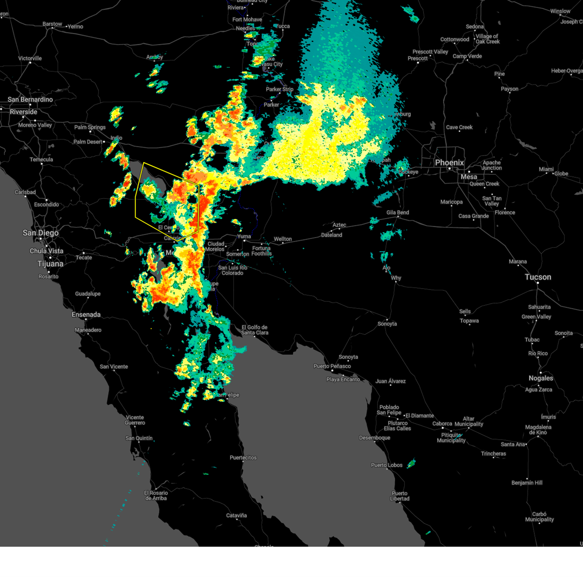
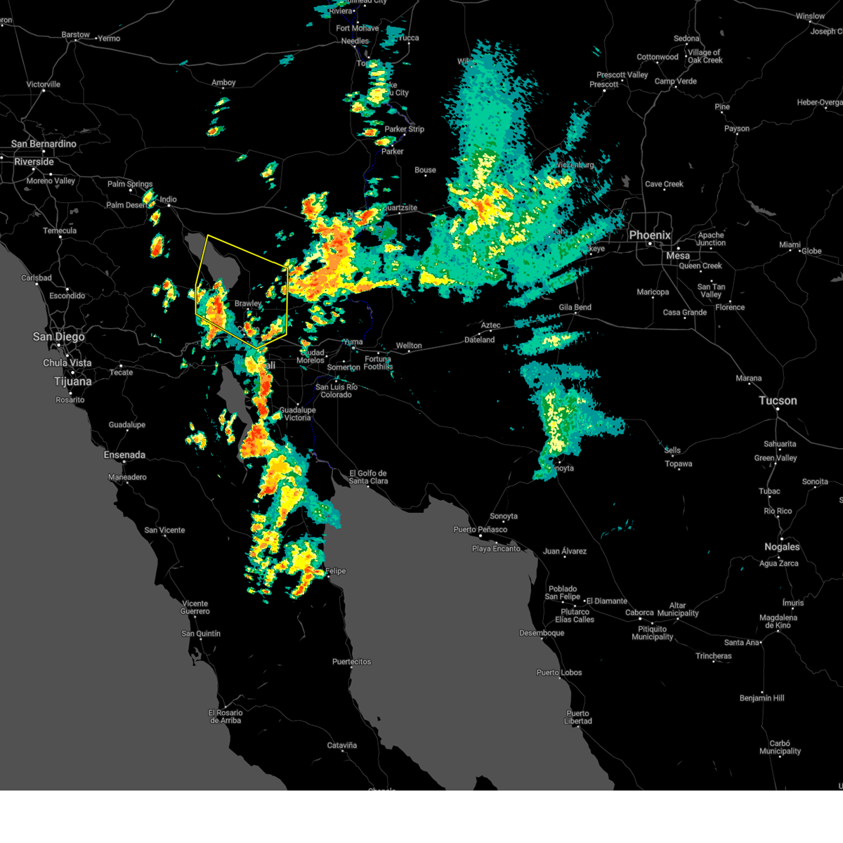
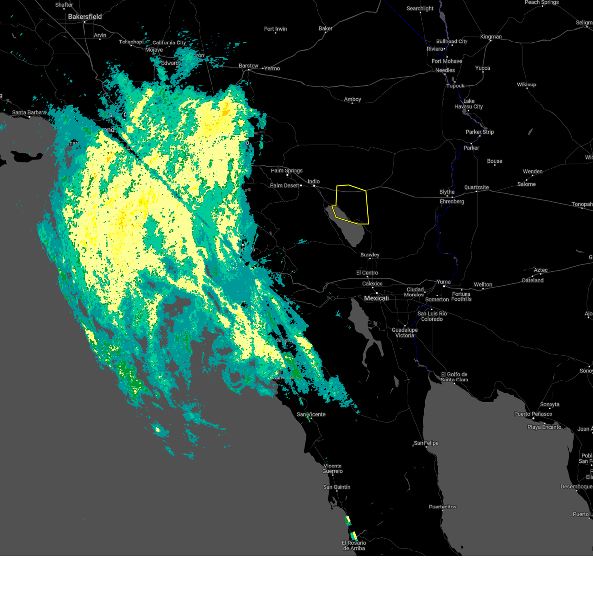
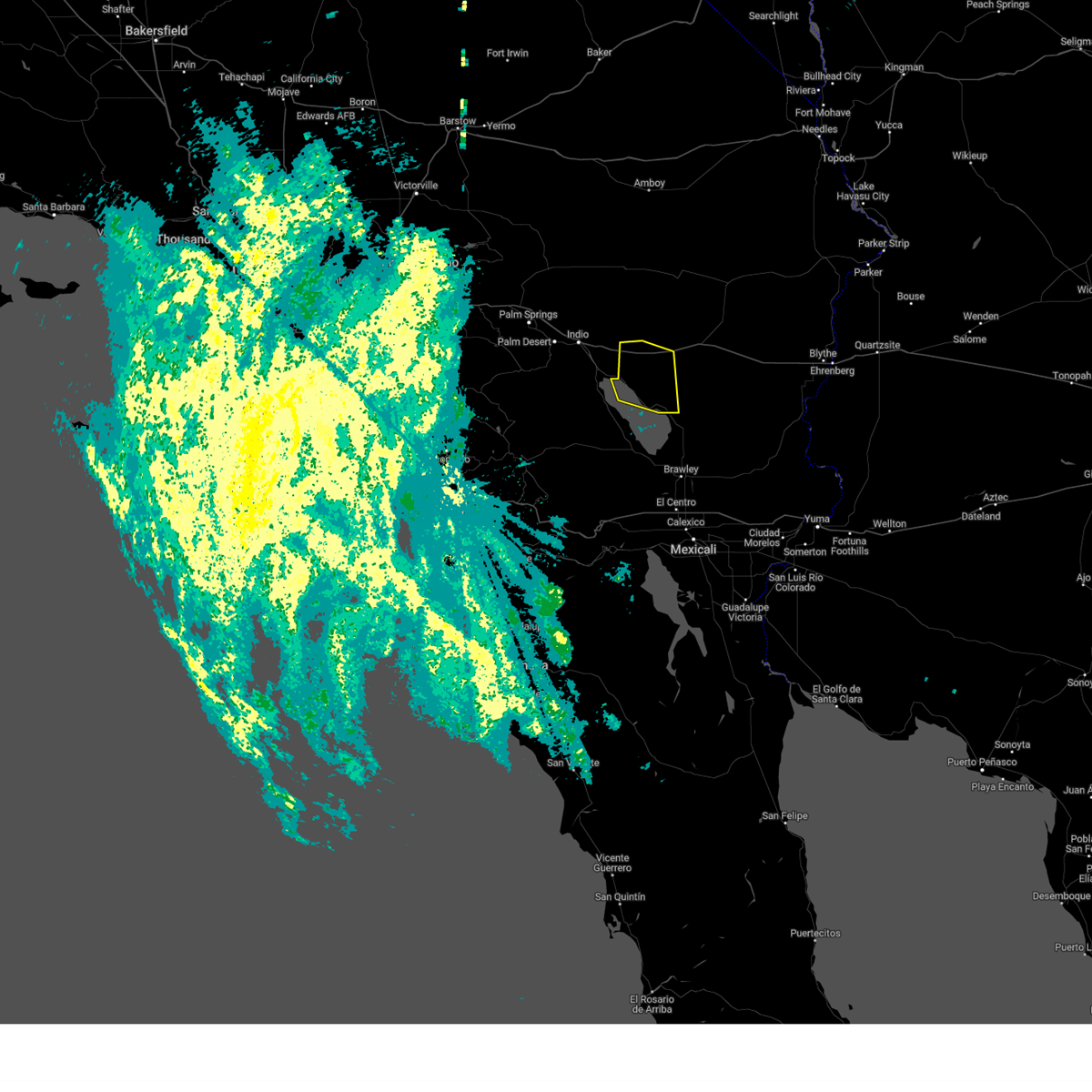
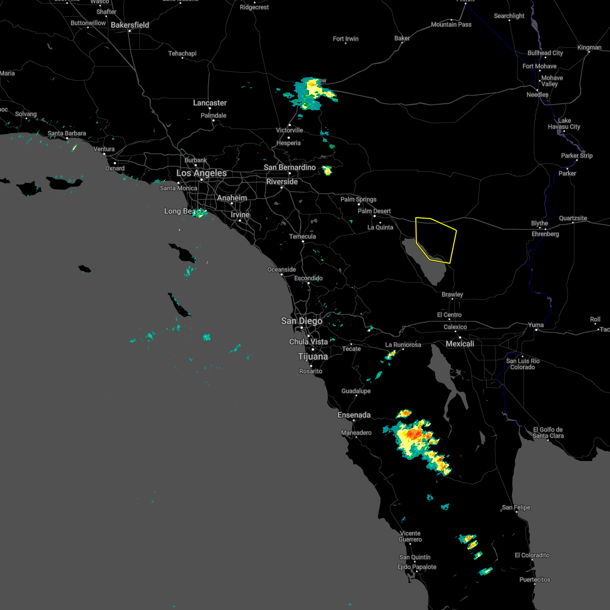
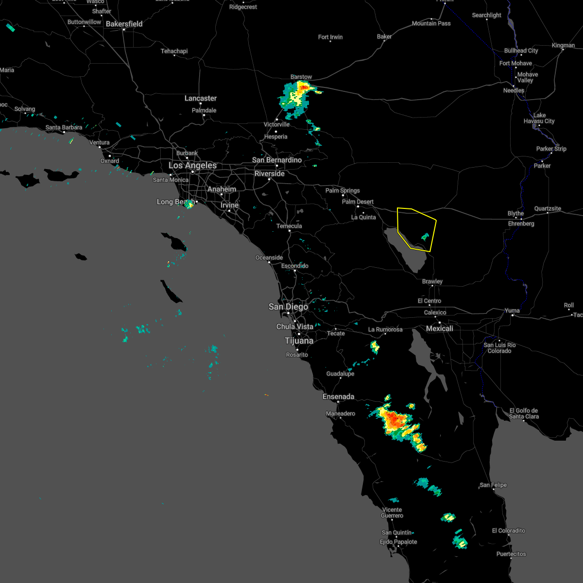
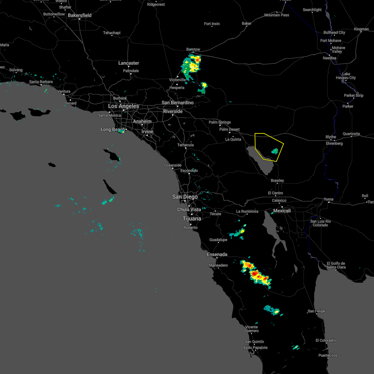
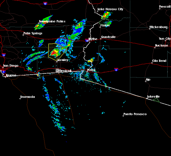
Hail Map for Bombay Beach, CA
The Bombay Beach, CA area has had 0 reports of on-the-ground hail by trained spotters, and has been under severe weather warnings 5 times during the past 12 months. Doppler radar has detected hail at or near Bombay Beach, CA on 3 occasions.
| Name: | Bombay Beach, CA |
| Where Located: | 66.3 miles SE of Yucca Valley, CA |
| Map: | Google Map for Bombay Beach, CA |
| Population: | 295 |
| Housing Units: | 449 |
| More Info: | Search Google for Bombay Beach, CA |
5
The Top Recent Hail Date for Bombay Beach, CA is Saturday, October 15, 2022 (1st out of 3)

Hail and Wind Damage Spotted near Bombay Beach, CA
| Date / Time | Report Details |
|---|---|
| 9/1/2023 2:37 PM PDT |
 The severe thunderstorm warning for western imperial and riverside counties will expire at 245 pm pdt, the storms which prompted the warning have weakened below severe limits, and no longer pose an immediate threat to life or property. therefore, the warning will be allowed to expire. however gusty winds and heavy rain are still possible with these thunderstorms. The severe thunderstorm warning for western imperial and riverside counties will expire at 245 pm pdt, the storms which prompted the warning have weakened below severe limits, and no longer pose an immediate threat to life or property. therefore, the warning will be allowed to expire. however gusty winds and heavy rain are still possible with these thunderstorms.
|
| 9/1/2023 1:50 PM PDT |
 At 150 pm pdt, severe thunderstorms were located along a line extending from 10 miles west of westmorland to near imperial, moving north at 25 mph (radar indicated). Hazards include 60 mph wind gusts and penny size hail. expect damage to roofs, siding, and trees At 150 pm pdt, severe thunderstorms were located along a line extending from 10 miles west of westmorland to near imperial, moving north at 25 mph (radar indicated). Hazards include 60 mph wind gusts and penny size hail. expect damage to roofs, siding, and trees
|
| 8/20/2023 1:42 PM PDT |
 The severe thunderstorm warning for northwestern imperial and riverside counties will expire at 145 pm pdt, the storms which prompted the warning have moved out of the area. therefore, the warning will be allowed to expire. however gusty winds and heavy rain are still possible with these thunderstorms. The severe thunderstorm warning for northwestern imperial and riverside counties will expire at 145 pm pdt, the storms which prompted the warning have moved out of the area. therefore, the warning will be allowed to expire. however gusty winds and heavy rain are still possible with these thunderstorms.
|
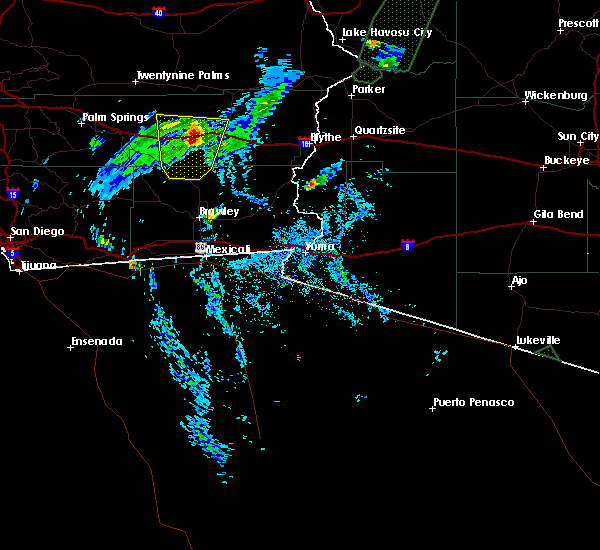
| 8/20/2023 1:16 PM PDT |
 At 116 pm pdt, severe thunderstorms were located along a line extending from near north shore to 6 miles north of bombay beach to 20 miles east of salton city, moving north at 40 mph (radar indicated). Hazards include 60 mph wind gusts. Expect damage to roofs, siding, and trees. locations impacted include, chiriaco summit, north shore, bombay beach, and imperial hot mineral springs. this includes the following highways, ca interstate 10 between mile markers 74 and 93. Ca route 111 between mile markers 50 and 65. At 116 pm pdt, severe thunderstorms were located along a line extending from near north shore to 6 miles north of bombay beach to 20 miles east of salton city, moving north at 40 mph (radar indicated). Hazards include 60 mph wind gusts. Expect damage to roofs, siding, and trees. locations impacted include, chiriaco summit, north shore, bombay beach, and imperial hot mineral springs. this includes the following highways, ca interstate 10 between mile markers 74 and 93. Ca route 111 between mile markers 50 and 65.
|
| 8/20/2023 1:00 PM PDT |
 At 100 pm pdt, severe thunderstorms were located along a line extending from near bombay beach to 16 miles east of salton city to 15 miles north of westmorland, moving north at 40 mph (radar indicated). Hazards include 60 mph wind gusts. expect damage to roofs, siding, and trees At 100 pm pdt, severe thunderstorms were located along a line extending from near bombay beach to 16 miles east of salton city to 15 miles north of westmorland, moving north at 40 mph (radar indicated). Hazards include 60 mph wind gusts. expect damage to roofs, siding, and trees
|
| 8/8/2022 3:26 PM PDT |
 The severe thunderstorm warning for northwestern imperial and riverside counties will expire at 330 pm pdt, the storm which prompted the warning has weakened below severe limits, and no longer poses an immediate threat to life or property. therefore, the warning will be allowed to expire. however gusty winds and heavy rain are still possible with this thunderstorm. to report severe weather, contact your nearest law enforcement agency. they will relay your report to the national weather service phoenix. The severe thunderstorm warning for northwestern imperial and riverside counties will expire at 330 pm pdt, the storm which prompted the warning has weakened below severe limits, and no longer poses an immediate threat to life or property. therefore, the warning will be allowed to expire. however gusty winds and heavy rain are still possible with this thunderstorm. to report severe weather, contact your nearest law enforcement agency. they will relay your report to the national weather service phoenix.
|
| 8/8/2022 3:08 PM PDT |
 At 308 pm pdt, a severe thunderstorm was located 10 miles north of bombay beach, or 10 miles south of chiriaco summit, moving northwest at 5 mph (radar indicated). Hazards include 60 mph wind gusts. Expect damage to roofs, siding, and trees. locations impacted include, chiriaco summit, bombay beach and imperial hot mineral springs. this includes the following highways, ca interstate 10 between mile markers 75 and 88. ca route 111 between mile markers 47 and 65. hail threat, radar indicated max hail size, <. 75 in wind threat, radar indicated max wind gust, 60 mph. At 308 pm pdt, a severe thunderstorm was located 10 miles north of bombay beach, or 10 miles south of chiriaco summit, moving northwest at 5 mph (radar indicated). Hazards include 60 mph wind gusts. Expect damage to roofs, siding, and trees. locations impacted include, chiriaco summit, bombay beach and imperial hot mineral springs. this includes the following highways, ca interstate 10 between mile markers 75 and 88. ca route 111 between mile markers 47 and 65. hail threat, radar indicated max hail size, <. 75 in wind threat, radar indicated max wind gust, 60 mph.
|
| 8/8/2022 2:44 PM PDT |
 At 244 pm pdt, a severe thunderstorm was located 11 miles northeast of bombay beach, or 16 miles southeast of chiriaco summit, moving northwest at 10 mph (radar indicated). Hazards include 60 mph wind gusts. expect damage to roofs, siding, and trees At 244 pm pdt, a severe thunderstorm was located 11 miles northeast of bombay beach, or 16 miles southeast of chiriaco summit, moving northwest at 10 mph (radar indicated). Hazards include 60 mph wind gusts. expect damage to roofs, siding, and trees
|
| 10/3/2018 6:59 PM PDT |
 At 659 pm pdt, a severe thunderstorm was located 7 miles northeast of chiriaco summit, moving north at 60 mph (radar indicated). Hazards include 60 mph wind gusts and quarter size hail. Hail damage to vehicles is expected. expect wind damage to roofs, siding, and trees. locations impacted include, desert center, chiriaco summit, bombay beach, cottonwood visitor and imperial hot mineral springs. this includes the following highways, ca interstate 10 between mile markers 79 and 110. ca route 111 between mile markers 48 and 65. Ca route 177 between mile markers 1 and 10. At 659 pm pdt, a severe thunderstorm was located 7 miles northeast of chiriaco summit, moving north at 60 mph (radar indicated). Hazards include 60 mph wind gusts and quarter size hail. Hail damage to vehicles is expected. expect wind damage to roofs, siding, and trees. locations impacted include, desert center, chiriaco summit, bombay beach, cottonwood visitor and imperial hot mineral springs. this includes the following highways, ca interstate 10 between mile markers 79 and 110. ca route 111 between mile markers 48 and 65. Ca route 177 between mile markers 1 and 10.
|
| 10/3/2018 6:39 PM PDT |
 At 639 pm pdt, a severe thunderstorm was located 8 miles northeast of bombay beach, or 15 miles south of chiriaco summit, moving north at 55 mph (radar indicated). Hazards include 60 mph wind gusts and quarter size hail. Hail damage to vehicles is expected. Expect wind damage to roofs, siding, and trees. At 639 pm pdt, a severe thunderstorm was located 8 miles northeast of bombay beach, or 15 miles south of chiriaco summit, moving north at 55 mph (radar indicated). Hazards include 60 mph wind gusts and quarter size hail. Hail damage to vehicles is expected. Expect wind damage to roofs, siding, and trees.
|
| 10/3/2018 6:18 PM PDT |
 At 618 pm pdt, a severe thunderstorm was located 10 miles southeast of bombay beach, or 17 miles north of brawley, moving north at 30 mph (radar indicated). Hazards include 60 mph wind gusts and penny size hail. expect damage to roofs, siding, and trees At 618 pm pdt, a severe thunderstorm was located 10 miles southeast of bombay beach, or 17 miles north of brawley, moving north at 30 mph (radar indicated). Hazards include 60 mph wind gusts and penny size hail. expect damage to roofs, siding, and trees
|
Hail Maps for Bombay Beach, CA


Connect with Interactive Hail Maps