

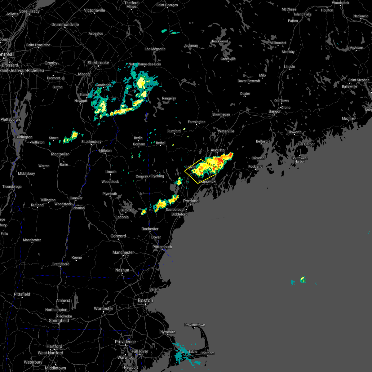
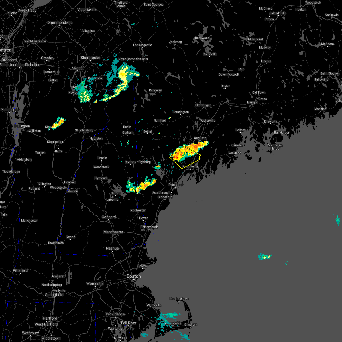
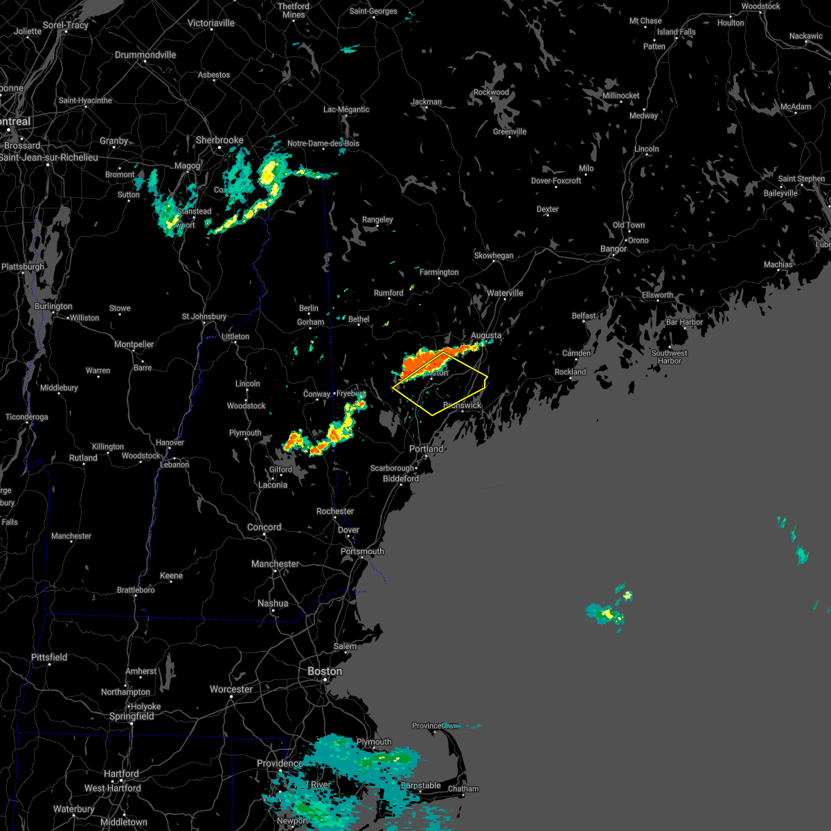
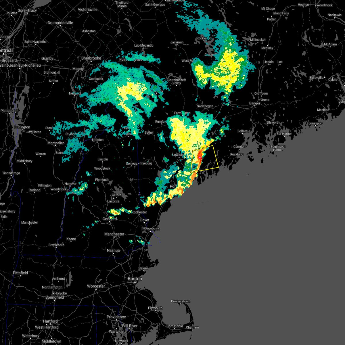
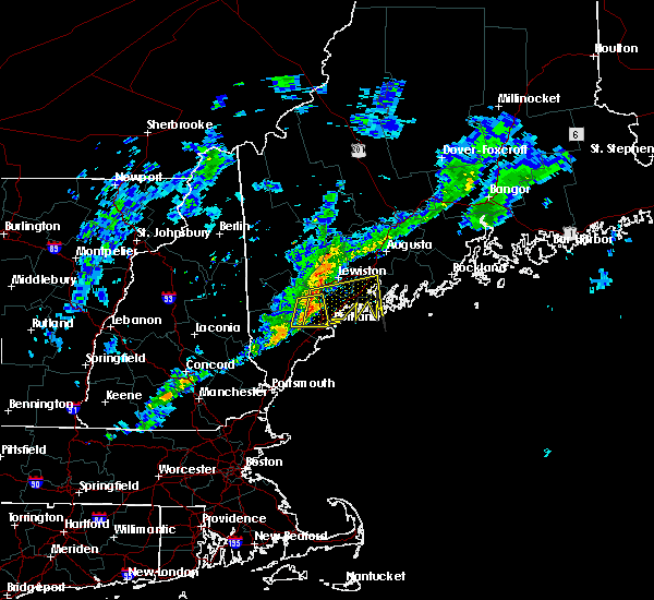
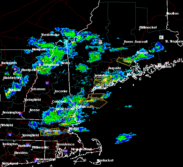
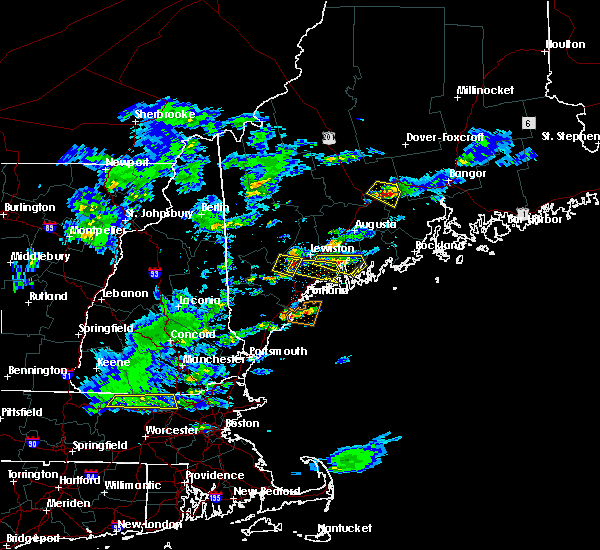
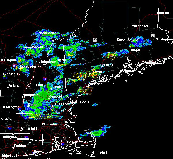
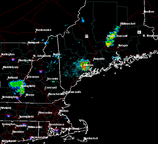
Hail Map for Bowdoinham, ME
The Bowdoinham, ME area has had 1 report of on-the-ground hail by trained spotters, and has been under severe weather warnings 0 times during the past 12 months. Doppler radar has detected hail at or near Bowdoinham, ME on 8 occasions.
| Name: | Bowdoinham, ME |
| Where Located: | 30.8 miles NE of Portland, ME |
| Map: | Google Map for Bowdoinham, ME |
| Population: | 722 |
| Housing Units: | 331 |
| More Info: | Search Google for Bowdoinham, ME |
1
The Top Recent Hail Date for Bowdoinham, ME is Friday, June 17, 2022 (3rd out of 8)

Hail and Wind Damage Spotted near Bowdoinham, ME
| Date / Time | Report Details |
|---|---|
| 7/21/2022 5:24 PM EDT | Route 24 closed due to trees... lines and poles dow in sagadahoc county ME, 1.9 miles WSW of Bowdoinham, ME |
| 7/21/2022 5:24 PM EDT |
 The severe thunderstorm warning for south central kennebec, southeastern oxford, southern androscoggin, southwestern lincoln, central cumberland and sagadahoc counties will expire at 530 pm edt, the storm which prompted the warning has weakened below severe limits, and has exited the warned area. therefore, the warning will be allowed to expire. however small hail and gusty winds are still possible with this thunderstorm. a severe thunderstorm watch remains in effect until 800 pm edt for south central, western and southwestern maine. remember, a severe thunderstorm warning still remains in effect for cumberland and southern androscoggin counties. The severe thunderstorm warning for south central kennebec, southeastern oxford, southern androscoggin, southwestern lincoln, central cumberland and sagadahoc counties will expire at 530 pm edt, the storm which prompted the warning has weakened below severe limits, and has exited the warned area. therefore, the warning will be allowed to expire. however small hail and gusty winds are still possible with this thunderstorm. a severe thunderstorm watch remains in effect until 800 pm edt for south central, western and southwestern maine. remember, a severe thunderstorm warning still remains in effect for cumberland and southern androscoggin counties.
|
| 7/21/2022 4:42 PM EDT |
 At 441 pm edt, a severe thunderstorm was located over gray, or 14 miles east of naples, moving northeast at 50 mph (radar indicated). Hazards include 60 mph wind gusts and quarter size hail. Hail damage to vehicles is expected. Expect wind damage to roofs, siding, and trees. At 441 pm edt, a severe thunderstorm was located over gray, or 14 miles east of naples, moving northeast at 50 mph (radar indicated). Hazards include 60 mph wind gusts and quarter size hail. Hail damage to vehicles is expected. Expect wind damage to roofs, siding, and trees.
|
| 6/13/2022 6:29 PM EDT |
 At 629 pm edt, a severe thunderstorm was located over litchfield, or 8 miles southwest of gardiner, moving southeast at 30 mph (radar indicated). Hazards include 60 mph wind gusts and quarter size hail. Hail damage to vehicles is expected. Expect wind damage to roofs, siding, and trees. At 629 pm edt, a severe thunderstorm was located over litchfield, or 8 miles southwest of gardiner, moving southeast at 30 mph (radar indicated). Hazards include 60 mph wind gusts and quarter size hail. Hail damage to vehicles is expected. Expect wind damage to roofs, siding, and trees.
|
| 9/15/2021 5:14 PM EDT |
 At 514 pm edt, severe thunderstorms were located along a line extending from 6 miles south of livermore falls to near lewiston to near gray to 6 miles northeast of standish, moving east at 45 mph (radar indicated). Hazards include 60 mph wind gusts and nickel size hail. expect damage to roofs, siding, and trees At 514 pm edt, severe thunderstorms were located along a line extending from 6 miles south of livermore falls to near lewiston to near gray to 6 miles northeast of standish, moving east at 45 mph (radar indicated). Hazards include 60 mph wind gusts and nickel size hail. expect damage to roofs, siding, and trees
|
| 9/6/2021 4:45 PM EDT | Trees and powerlines dow in sagadahoc county ME, 2.7 miles ESE of Bowdoinham, ME |
| 9/6/2021 4:33 PM EDT |
 At 433 pm edt, severe thunderstorms were located along a line extending from 6 miles southwest of winthrop to 6 miles northwest of topsham to freeport, moving east at 30 mph (radar indicated). Hazards include 60 mph wind gusts and nickel size hail. expect damage to roofs, siding, and trees At 433 pm edt, severe thunderstorms were located along a line extending from 6 miles southwest of winthrop to 6 miles northwest of topsham to freeport, moving east at 30 mph (radar indicated). Hazards include 60 mph wind gusts and nickel size hail. expect damage to roofs, siding, and trees
|
| 7/6/2021 9:07 PM EDT |
 The severe thunderstorm warning for southwestern kennebec, southeastern androscoggin, northeastern cumberland and northwestern sagadahoc counties will expire at 915 pm edt, the storms which prompted the warning have weakened below severe limits, and no longer pose an immediate threat to life or property. therefore, the warning will be allowed to expire. however gusty winds greater than 40mph are still possible with these thunderstorms. The severe thunderstorm warning for southwestern kennebec, southeastern androscoggin, northeastern cumberland and northwestern sagadahoc counties will expire at 915 pm edt, the storms which prompted the warning have weakened below severe limits, and no longer pose an immediate threat to life or property. therefore, the warning will be allowed to expire. however gusty winds greater than 40mph are still possible with these thunderstorms.
|
| 7/6/2021 8:58 PM EDT |
 At 857 pm edt, severe thunderstorms were located along a line extending from litchfield to 6 miles north of gray, moving southeast at 25 mph (radar indicated). Hazards include 60 mph wind gusts. Expect damage to roofs, siding, and trees. locations impacted include, lewiston, brunswick, topsham, litchfield, lisbon, greene, durham, bowdoin, bowdoinham, leeds, wales, sabattus, minot, richmond, poland and monmouth. this includes the following highways, interstate 295 between mile markers 36 and 46. Interstate 95 between mile markers 74 and 96. At 857 pm edt, severe thunderstorms were located along a line extending from litchfield to 6 miles north of gray, moving southeast at 25 mph (radar indicated). Hazards include 60 mph wind gusts. Expect damage to roofs, siding, and trees. locations impacted include, lewiston, brunswick, topsham, litchfield, lisbon, greene, durham, bowdoin, bowdoinham, leeds, wales, sabattus, minot, richmond, poland and monmouth. this includes the following highways, interstate 295 between mile markers 36 and 46. Interstate 95 between mile markers 74 and 96.
|
| 7/6/2021 8:34 PM EDT |
 At 832 pm edt, severe thunderstorms were located along a line extending from 7 miles northeast of lewiston to 6 miles southwest of mechanic falls, moving southeast at 25 mph (radar indicated). Hazards include 60 mph wind gusts and penny size hail. expect damage to roofs, siding, and trees At 832 pm edt, severe thunderstorms were located along a line extending from 7 miles northeast of lewiston to 6 miles southwest of mechanic falls, moving southeast at 25 mph (radar indicated). Hazards include 60 mph wind gusts and penny size hail. expect damage to roofs, siding, and trees
|
| 3/26/2021 5:43 PM EDT |
 At 542 pm edt, a severe thunderstorm was located near wiscasset, moving east at 55 mph (radar indicated). Hazards include 60 mph wind gusts and penny size hail. Expect damage to roofs, siding, and trees. locations impacted include, brunswick, bath, gardiner, damariscotta, topsham, wiscasset, litchfield, bristol, bremen, woolwich, bowdoin, bowdoinham, chelsea, jefferson, dresden, edgecomb, alna, whitefield, newcastle and pittston. this includes the following highways, interstate 295 between mile markers 31 and 51. Interstate 95 between mile markers 94 and 102. At 542 pm edt, a severe thunderstorm was located near wiscasset, moving east at 55 mph (radar indicated). Hazards include 60 mph wind gusts and penny size hail. Expect damage to roofs, siding, and trees. locations impacted include, brunswick, bath, gardiner, damariscotta, topsham, wiscasset, litchfield, bristol, bremen, woolwich, bowdoin, bowdoinham, chelsea, jefferson, dresden, edgecomb, alna, whitefield, newcastle and pittston. this includes the following highways, interstate 295 between mile markers 31 and 51. Interstate 95 between mile markers 94 and 102.
|
| 3/26/2021 5:22 PM EDT |
 At 522 pm edt, a severe thunderstorm was located near lewiston, moving east at 55 mph (radar indicated). Hazards include 60 mph wind gusts and penny size hail. expect damage to roofs, siding, and trees At 522 pm edt, a severe thunderstorm was located near lewiston, moving east at 55 mph (radar indicated). Hazards include 60 mph wind gusts and penny size hail. expect damage to roofs, siding, and trees
|
| 7/8/2020 6:14 PM EDT |
 At 612 pm edt, severe thunderstorms were located along a line extending from 9 miles northeast of damariscotta to near brunswick to hiram, moving southeast at 50 mph. this line of storms has a history of damaging wind gusts. winds may arrive well before the rain arrives (radar indicated and spotter confirmed). Hazards include 60 mph wind gusts and quarter size hail. Hail damage to vehicles is expected. expect wind damage to roofs, siding, and trees. locations impacted include, portland, south portland, biddeford, brunswick, westbrook, bath, damariscotta, topsham, wiscasset, naples, cumberland, saco, gorham, falmouth, kennebunk, cape elizabeth, buxton, freeport, gray and hollis. this also includes, sebago lake, higgins beach, crescent beach state park, scarborough beach state park, and reid state park. peaks island, long island, cushing island, cousins island, and bailey island. this includes the following highways, interstate 295 between mile markers 1 and 41. Interstate 95 between mile markers 29 and 67. At 612 pm edt, severe thunderstorms were located along a line extending from 9 miles northeast of damariscotta to near brunswick to hiram, moving southeast at 50 mph. this line of storms has a history of damaging wind gusts. winds may arrive well before the rain arrives (radar indicated and spotter confirmed). Hazards include 60 mph wind gusts and quarter size hail. Hail damage to vehicles is expected. expect wind damage to roofs, siding, and trees. locations impacted include, portland, south portland, biddeford, brunswick, westbrook, bath, damariscotta, topsham, wiscasset, naples, cumberland, saco, gorham, falmouth, kennebunk, cape elizabeth, buxton, freeport, gray and hollis. this also includes, sebago lake, higgins beach, crescent beach state park, scarborough beach state park, and reid state park. peaks island, long island, cushing island, cousins island, and bailey island. this includes the following highways, interstate 295 between mile markers 1 and 41. Interstate 95 between mile markers 29 and 67.
|
| 7/8/2020 6:08 PM EDT |
 At 607 pm edt, severe thunderstorms were located along a line extending from 12 miles north of damariscotta to near woolwich, moving southeast at 45 mph (radar indicated). Hazards include 60 mph wind gusts and quarter size hail. Hail damage to vehicles is expected. expect wind damage to roofs, siding, and trees. locations impacted include, brunswick, augusta, bath, rockland, gardiner, damariscotta, lincolnville, topsham, wiscasset, china, litchfield, farmingdale, bristol, liberty, bremen, woolwich, thomaston, palermo, rockport and bowdoin. this includes the following highways, interstate 295 between mile markers 31 and 51. Interstate 95 between mile markers 91 and 105. At 607 pm edt, severe thunderstorms were located along a line extending from 12 miles north of damariscotta to near woolwich, moving southeast at 45 mph (radar indicated). Hazards include 60 mph wind gusts and quarter size hail. Hail damage to vehicles is expected. expect wind damage to roofs, siding, and trees. locations impacted include, brunswick, augusta, bath, rockland, gardiner, damariscotta, lincolnville, topsham, wiscasset, china, litchfield, farmingdale, bristol, liberty, bremen, woolwich, thomaston, palermo, rockport and bowdoin. this includes the following highways, interstate 295 between mile markers 31 and 51. Interstate 95 between mile markers 91 and 105.
|
| 7/8/2020 6:02 PM EDT |
 At 601 pm edt, severe thunderstorms were located along a line extending from 11 miles east of farmingdale to near topsham to near hiram, moving southeast at 45 mph (radar indicated). Hazards include 60 mph wind gusts and quarter size hail. Hail damage to vehicles is expected. Expect wind damage to roofs, siding, and trees. At 601 pm edt, severe thunderstorms were located along a line extending from 11 miles east of farmingdale to near topsham to near hiram, moving southeast at 45 mph (radar indicated). Hazards include 60 mph wind gusts and quarter size hail. Hail damage to vehicles is expected. Expect wind damage to roofs, siding, and trees.
|
| 7/8/2020 5:39 PM EDT |
 At 539 pm edt, severe thunderstorms were located along a line extending from near oakland to near belgrade to near turner, moving southeast at 45 mph (radar indicated). Hazards include 60 mph wind gusts and quarter size hail. Hail damage to vehicles is expected. Expect wind damage to roofs, siding, and trees. At 539 pm edt, severe thunderstorms were located along a line extending from near oakland to near belgrade to near turner, moving southeast at 45 mph (radar indicated). Hazards include 60 mph wind gusts and quarter size hail. Hail damage to vehicles is expected. Expect wind damage to roofs, siding, and trees.
|
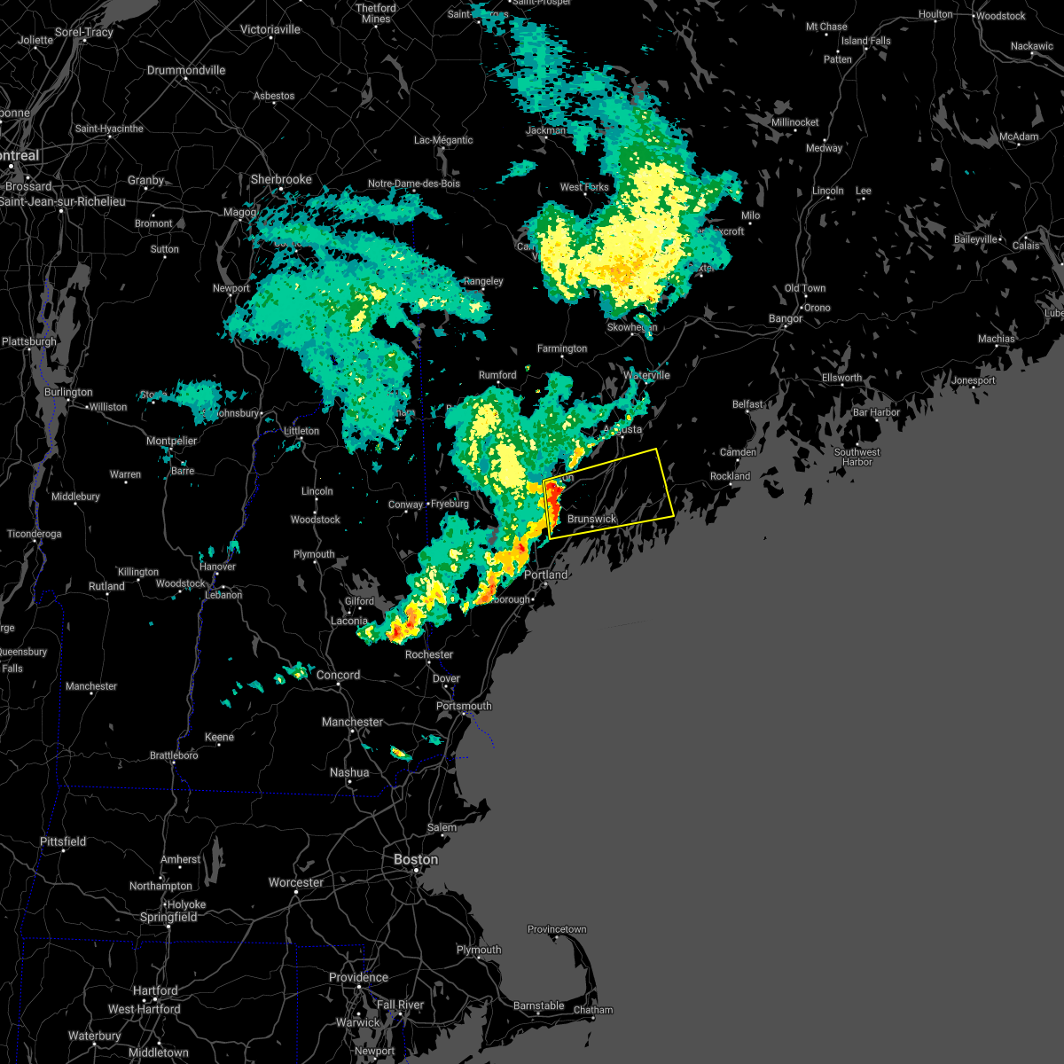
| 6/6/2020 1:15 PM EDT |
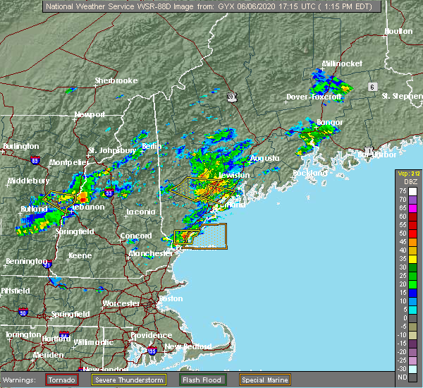 At 115 pm edt, severe thunderstorms were located along a line extending from 7 miles northwest of topsham to near freeport, moving east at 35 mph (radar indicated). Hazards include 60 mph wind gusts and quarter size hail. Hail damage to vehicles is expected. Expect wind damage to roofs, siding, and trees. At 115 pm edt, severe thunderstorms were located along a line extending from 7 miles northwest of topsham to near freeport, moving east at 35 mph (radar indicated). Hazards include 60 mph wind gusts and quarter size hail. Hail damage to vehicles is expected. Expect wind damage to roofs, siding, and trees.
|
| 9/24/2019 2:29 PM EDT |
 At 229 pm edt, a severe thunderstorm was located near litchfield, or 9 miles north of topsham, moving northeast at 20 mph (radar indicated). Hazards include 60 mph wind gusts and quarter size hail. Hail damage to vehicles is expected. Expect wind damage to roofs, siding, and trees. At 229 pm edt, a severe thunderstorm was located near litchfield, or 9 miles north of topsham, moving northeast at 20 mph (radar indicated). Hazards include 60 mph wind gusts and quarter size hail. Hail damage to vehicles is expected. Expect wind damage to roofs, siding, and trees.
|
| 7/31/2019 4:48 PM EDT | Trees on wires on river roa in sagadahoc county ME, 2.6 miles WSW of Bowdoinham, ME |
| 7/31/2019 4:41 PM EDT |
 At 441 pm edt, a severe thunderstorm was located 7 miles southeast of litchfield, or 9 miles northwest of wiscasset, moving east at 25 mph (radar indicated). Hazards include 60 mph wind gusts and quarter size hail. Hail damage to vehicles is expected. Expect wind damage to roofs, siding, and trees. At 441 pm edt, a severe thunderstorm was located 7 miles southeast of litchfield, or 9 miles northwest of wiscasset, moving east at 25 mph (radar indicated). Hazards include 60 mph wind gusts and quarter size hail. Hail damage to vehicles is expected. Expect wind damage to roofs, siding, and trees.
|
| 7/6/2019 4:35 PM EDT |
 At 435 pm edt, a severe thunderstorm was located 7 miles southeast of gardiner, moving east at 25 mph (radar indicated). Hazards include 60 mph wind gusts. Expect damage to roofs, siding, and trees. locations impacted include, lewiston, augusta, gardiner, damariscotta, wiscasset, china, litchfield, farmingdale, bristol, hallowell, woolwich, lisbon, bowdoin, bowdoinham, chelsea, jefferson, dresden, edgecomb, alna and windsor. this includes the following highways, interstate 295 between mile markers 37 and 51. Interstate 95 between mile markers 78 and 105. At 435 pm edt, a severe thunderstorm was located 7 miles southeast of gardiner, moving east at 25 mph (radar indicated). Hazards include 60 mph wind gusts. Expect damage to roofs, siding, and trees. locations impacted include, lewiston, augusta, gardiner, damariscotta, wiscasset, china, litchfield, farmingdale, bristol, hallowell, woolwich, lisbon, bowdoin, bowdoinham, chelsea, jefferson, dresden, edgecomb, alna and windsor. this includes the following highways, interstate 295 between mile markers 37 and 51. Interstate 95 between mile markers 78 and 105.
|
| 7/6/2019 4:21 PM EDT |
 At 420 pm edt, a severe thunderstorm was located over gardiner, moving east at 25 mph (radar indicated). Hazards include 60 mph wind gusts. Expect damage to roofs, siding, and trees. locations impacted include, lewiston, augusta, gardiner, damariscotta, wiscasset, china, litchfield, farmingdale, bristol, manchester, hallowell, winthrop, woolwich, lisbon, greene, bowdoin, bowdoinham, chelsea, jefferson and leeds. this includes the following highways, interstate 295 between mile markers 37 and 51. Interstate 95 between mile markers 78 and 110. At 420 pm edt, a severe thunderstorm was located over gardiner, moving east at 25 mph (radar indicated). Hazards include 60 mph wind gusts. Expect damage to roofs, siding, and trees. locations impacted include, lewiston, augusta, gardiner, damariscotta, wiscasset, china, litchfield, farmingdale, bristol, manchester, hallowell, winthrop, woolwich, lisbon, greene, bowdoin, bowdoinham, chelsea, jefferson and leeds. this includes the following highways, interstate 295 between mile markers 37 and 51. Interstate 95 between mile markers 78 and 110.
|
| 7/6/2019 3:49 PM EDT |
 At 348 pm edt, a severe thunderstorm was located near winthrop, or 10 miles east of turner, moving east at 25 mph (radar indicated). Hazards include 60 mph wind gusts. expect damage to roofs, siding, and trees At 348 pm edt, a severe thunderstorm was located near winthrop, or 10 miles east of turner, moving east at 25 mph (radar indicated). Hazards include 60 mph wind gusts. expect damage to roofs, siding, and trees
|
| 9/3/2018 7:34 PM EDT |
 At 734 pm edt, a severe thunderstorm was located near litchfield, or 9 miles north of topsham, moving east at 35 mph (radar indicated). Hazards include 60 mph wind gusts. Expect damage to roofs, siding, and trees. locations impacted include, lewiston, brunswick, bath, gardiner, topsham, litchfield, farmingdale, lisbon, greene, durham, bowdoin, bowdoinham, chelsea, dresden, wales, monmouth, sabattus, pittston, west gardiner and richmond. this includes the following highways, interstate 295 between mile markers 28 and 51. Interstate 95 between mile markers 78 and 105. At 734 pm edt, a severe thunderstorm was located near litchfield, or 9 miles north of topsham, moving east at 35 mph (radar indicated). Hazards include 60 mph wind gusts. Expect damage to roofs, siding, and trees. locations impacted include, lewiston, brunswick, bath, gardiner, topsham, litchfield, farmingdale, lisbon, greene, durham, bowdoin, bowdoinham, chelsea, dresden, wales, monmouth, sabattus, pittston, west gardiner and richmond. this includes the following highways, interstate 295 between mile markers 28 and 51. Interstate 95 between mile markers 78 and 105.
|
| 9/3/2018 7:03 PM EDT |
 At 702 pm edt, a severe thunderstorm was located 5 miles west of lewiston, moving east at 35 mph. this storm will impact the lewiston and auburn metro (radar indicated). Hazards include 60 mph wind gusts. expect damage to roofs, siding, and trees At 702 pm edt, a severe thunderstorm was located 5 miles west of lewiston, moving east at 35 mph. this storm will impact the lewiston and auburn metro (radar indicated). Hazards include 60 mph wind gusts. expect damage to roofs, siding, and trees
|
| 8/17/2018 11:05 PM EDT |
 At 1104 pm edt, a severe thunderstorm was located near hallowell, or near gardiner, moving northeast at 35 mph (radar indicated). Hazards include 60 mph wind gusts. Expect damage to roofs, siding, and trees. locations impacted include, augusta, waterville, gardiner, oakland, topsham, wiscasset, china, litchfield, belgrade, farmingdale, manchester, hallowell, winthrop, woolwich, bowdoin, bowdoinham, chelsea, jefferson, dresden and alna. this includes the following highways, interstate 295 between mile markers 33 and 51. Interstate 95 between mile markers 91 and 127. At 1104 pm edt, a severe thunderstorm was located near hallowell, or near gardiner, moving northeast at 35 mph (radar indicated). Hazards include 60 mph wind gusts. Expect damage to roofs, siding, and trees. locations impacted include, augusta, waterville, gardiner, oakland, topsham, wiscasset, china, litchfield, belgrade, farmingdale, manchester, hallowell, winthrop, woolwich, bowdoin, bowdoinham, chelsea, jefferson, dresden and alna. this includes the following highways, interstate 295 between mile markers 33 and 51. Interstate 95 between mile markers 91 and 127.
|
| 8/17/2018 10:41 PM EDT |
 At 1041 pm edt, a severe thunderstorm was located 7 miles northeast of lewiston, moving northeast at 35 mph (radar indicated). Hazards include 60 mph wind gusts. expect damage to roofs, siding, and trees At 1041 pm edt, a severe thunderstorm was located 7 miles northeast of lewiston, moving northeast at 35 mph (radar indicated). Hazards include 60 mph wind gusts. expect damage to roofs, siding, and trees
|
| 9/5/2017 5:57 PM EDT |
 The severe thunderstorm warning for southwestern kennebec, southeastern oxford, androscoggin, central cumberland and northwestern sagadahoc counties will expire at 600 pm edt, the storm which prompted the warning has weakened below severe limits, and has exited the warned area. therefore, the warning will be allowed to expire. however heavy rain is still possible with this thunderstorm. The severe thunderstorm warning for southwestern kennebec, southeastern oxford, androscoggin, central cumberland and northwestern sagadahoc counties will expire at 600 pm edt, the storm which prompted the warning has weakened below severe limits, and has exited the warned area. therefore, the warning will be allowed to expire. however heavy rain is still possible with this thunderstorm.
|
| 9/5/2017 5:26 PM EDT |
 At 525 pm edt, a severe thunderstorm was located near lewiston, moving northeast at 30 mph (radar indicated). Hazards include 60 mph wind gusts and quarter size hail. Minor hail damage to vehicles is possible. expect wind damage to roofs, siding, and trees. locations impacted include, lewiston, brunswick, mechanic falls, topsham, turner, freeport, gray, litchfield, manchester, raymond, winthrop, lisbon, greene, durham, casco, bowdoin, bowdoinham, leeds, hebron and new gloucester. this includes the following highways, interstate 295 between mile markers 28 and 40. Interstate 95 between mile markers 63 and 97. At 525 pm edt, a severe thunderstorm was located near lewiston, moving northeast at 30 mph (radar indicated). Hazards include 60 mph wind gusts and quarter size hail. Minor hail damage to vehicles is possible. expect wind damage to roofs, siding, and trees. locations impacted include, lewiston, brunswick, mechanic falls, topsham, turner, freeport, gray, litchfield, manchester, raymond, winthrop, lisbon, greene, durham, casco, bowdoin, bowdoinham, leeds, hebron and new gloucester. this includes the following highways, interstate 295 between mile markers 28 and 40. Interstate 95 between mile markers 63 and 97.
|
| 9/5/2017 5:17 PM EDT |
 At 516 pm edt, a severe thunderstorm was located 7 miles north of gray, or 8 miles south of mechanic falls, moving northeast at 25 mph (radar indicated). Hazards include 60 mph wind gusts and quarter size hail. Minor hail damage to vehicles is possible. Expect wind damage to roofs, siding, and trees. At 516 pm edt, a severe thunderstorm was located 7 miles north of gray, or 8 miles south of mechanic falls, moving northeast at 25 mph (radar indicated). Hazards include 60 mph wind gusts and quarter size hail. Minor hail damage to vehicles is possible. Expect wind damage to roofs, siding, and trees.
|
| 6/1/2017 1:21 PM EDT |
 At 121 pm edt, a severe thunderstorm was located near litchfield, or 7 miles east of lewiston, moving east at 25 mph (radar indicated). Hazards include pea to a large as quarter size hail. Minor damage to vehicles is possible. locations impacted include, lewiston, gardiner, turner, topsham, litchfield, farmingdale, manchester, lisbon, greene, bowdoin, bowdoinham, leeds, wales, monmouth, sabattus, west gardiner, minot and richmond. this includes the following highways, interstate 295 between mile markers 34 and 45, and between mile markers 48 and 51. Interstate 95 between mile markers 80 and 106. At 121 pm edt, a severe thunderstorm was located near litchfield, or 7 miles east of lewiston, moving east at 25 mph (radar indicated). Hazards include pea to a large as quarter size hail. Minor damage to vehicles is possible. locations impacted include, lewiston, gardiner, turner, topsham, litchfield, farmingdale, manchester, lisbon, greene, bowdoin, bowdoinham, leeds, wales, monmouth, sabattus, west gardiner, minot and richmond. this includes the following highways, interstate 295 between mile markers 34 and 45, and between mile markers 48 and 51. Interstate 95 between mile markers 80 and 106.
|
| 6/1/2017 1:04 PM EDT |
 At 103 pm edt, a severe thunderstorm was located near lewiston, moving east at 25 mph (radar indicated). Hazards include 60 mph wind gusts and quarter size hail. Minor hail damage to vehicles is possible. expect wind damage to roofs, siding, and trees. locations impacted include, lewiston, gardiner, turner, topsham, litchfield, farmingdale, manchester, lisbon, greene, bowdoin, bowdoinham, leeds, wales, monmouth, sabattus, west gardiner, minot and richmond. this includes the following highways, interstate 295 between mile markers 34 and 45, and between mile markers 48 and 51. Interstate 95 between mile markers 80 and 106. At 103 pm edt, a severe thunderstorm was located near lewiston, moving east at 25 mph (radar indicated). Hazards include 60 mph wind gusts and quarter size hail. Minor hail damage to vehicles is possible. expect wind damage to roofs, siding, and trees. locations impacted include, lewiston, gardiner, turner, topsham, litchfield, farmingdale, manchester, lisbon, greene, bowdoin, bowdoinham, leeds, wales, monmouth, sabattus, west gardiner, minot and richmond. this includes the following highways, interstate 295 between mile markers 34 and 45, and between mile markers 48 and 51. Interstate 95 between mile markers 80 and 106.
|
| 6/1/2017 12:50 PM EDT |
 At 1248 pm edt, a severe thunderstorm was located near lewiston, moving east at 30 mph (radar indicated). Hazards include 60 mph wind gusts and quarter size hail. Minor hail damage to vehicles is possible. Expect wind damage to roofs, siding, and trees. At 1248 pm edt, a severe thunderstorm was located near lewiston, moving east at 30 mph (radar indicated). Hazards include 60 mph wind gusts and quarter size hail. Minor hail damage to vehicles is possible. Expect wind damage to roofs, siding, and trees.
|
| 9/11/2016 11:20 AM EDT | Large braches down in sagadahoc county ME, 0.8 miles NNE of Bowdoinham, ME |
| 9/11/2016 11:16 AM EDT |
 At 1116 am edt, a severe thunderstorm was located near brunswick, moving east at 40 mph (radar indicated). Hazards include 60 mph wind gusts and penny size hail. Expect damage to roofs. siding. and trees. Locations impacted include, brunswick, bath, topsham, wiscasset, freeport, georgetown, woolwich, harpswell, durham, bowdoin, bowdoinham, arowsic, phippsburg, west bath, westport and southport. At 1116 am edt, a severe thunderstorm was located near brunswick, moving east at 40 mph (radar indicated). Hazards include 60 mph wind gusts and penny size hail. Expect damage to roofs. siding. and trees. Locations impacted include, brunswick, bath, topsham, wiscasset, freeport, georgetown, woolwich, harpswell, durham, bowdoin, bowdoinham, arowsic, phippsburg, west bath, westport and southport.
|
| 9/11/2016 11:01 AM EDT |
 At 1101 am edt, a severe thunderstorm was located near freeport, or 9 miles west of topsham, moving east at 25 mph (radar indicated). Hazards include 60 mph wind gusts and penny size hail. Expect damage to roofs. siding. And trees. At 1101 am edt, a severe thunderstorm was located near freeport, or 9 miles west of topsham, moving east at 25 mph (radar indicated). Hazards include 60 mph wind gusts and penny size hail. Expect damage to roofs. siding. And trees.
|
| 9/11/2016 10:20 AM EDT | Large braches down in sagadahoc county ME, 0.8 miles NNE of Bowdoinham, ME |
| 4/1/2016 5:10 PM EDT | The severe thunderstorm warning for central sagadahoc, southeastern androscoggin and east central cumberland counties will expire at 515 pm edt, the storms which prompted the warning have moved out of the area. therefore the warning will be allowed to expire. |
| 4/1/2016 4:50 PM EDT |
 At 450 pm edt, doppler radar indicated severe thunderstorms capable of producing damaging winds in excess of 60 mph. these storms were located along a line extending from 7 miles southwest of litchfield to 6 miles southeast of yarmouth, moving east at 55 mph. locations impacted include, brunswick, bath, topsham, freeport, woolwich, yarmouth, lisbon, harpswell, durham, bowdoin, bowdoinham, dresden, arowsic, chebeague island, richmond, west bath and sabattus. At 450 pm edt, doppler radar indicated severe thunderstorms capable of producing damaging winds in excess of 60 mph. these storms were located along a line extending from 7 miles southwest of litchfield to 6 miles southeast of yarmouth, moving east at 55 mph. locations impacted include, brunswick, bath, topsham, freeport, woolwich, yarmouth, lisbon, harpswell, durham, bowdoin, bowdoinham, dresden, arowsic, chebeague island, richmond, west bath and sabattus.
|
| 4/1/2016 4:30 PM EDT |
 At 430 pm edt, doppler radar indicated a line of severe thunderstorms capable of producing damaging winds in excess of 60 mph. these storms were located along a line extending from near gray to westbrook, and moving east at 55 mph. At 430 pm edt, doppler radar indicated a line of severe thunderstorms capable of producing damaging winds in excess of 60 mph. these storms were located along a line extending from near gray to westbrook, and moving east at 55 mph.
|
| 3/17/2016 4:28 PM EDT | The severe thunderstorm warning for northern sagadahoc, west central lincoln, southeastern androscoggin and eastern cumberland counties will expire at 430 pm edt, the storms which prompted the warning have weakened below severe limits, and no longer poses an immediate threat to life or property. therefore the warning will be allowed to expire. |
| 3/17/2016 4:20 PM EDT |
 The severe thunderstorm warning for west central sagadahoc, southeastern androscoggin and east central cumberland counties will expire at 430 pm edt, the storm which prompted the warning has moved out of the area. therefore the warning will be allowed to expire. The severe thunderstorm warning for west central sagadahoc, southeastern androscoggin and east central cumberland counties will expire at 430 pm edt, the storm which prompted the warning has moved out of the area. therefore the warning will be allowed to expire.
|
| 3/17/2016 4:06 PM EDT |
 At 405 pm edt, doppler radar indicated a severe thunderstorm capable of producing quarters and damaging winds in excess of 60 mph. this storm was located near topsham, moving east at 25 mph. locations impacted include, brunswick, bath, topsham, freeport, lisbon, harpswell, durham, bowdoin, bowdoinham and pownal. At 405 pm edt, doppler radar indicated a severe thunderstorm capable of producing quarters and damaging winds in excess of 60 mph. this storm was located near topsham, moving east at 25 mph. locations impacted include, brunswick, bath, topsham, freeport, lisbon, harpswell, durham, bowdoin, bowdoinham and pownal.
|
| 3/17/2016 3:45 PM EDT |
 At 344 pm edt, doppler radar indicated a severe thunderstorm capable of producing half dollar size hail and damaging winds in excess of 60 mph. this storm was located 7 miles north of gray, or 8 miles south of mechanic falls, and moving east at 25 mph. At 344 pm edt, doppler radar indicated a severe thunderstorm capable of producing half dollar size hail and damaging winds in excess of 60 mph. this storm was located 7 miles north of gray, or 8 miles south of mechanic falls, and moving east at 25 mph.
|
| 3/17/2016 3:43 PM EDT |
 At 342 pm edt, doppler radar indicated a line of severe thunderstorms capable of producing quarter size hail and damaging winds in excess of 60 mph. these storms were located along a line extending from 7 miles northwest of topsham to 7 miles north of woolwich, and moving east at 20 mph. At 342 pm edt, doppler radar indicated a line of severe thunderstorms capable of producing quarter size hail and damaging winds in excess of 60 mph. these storms were located along a line extending from 7 miles northwest of topsham to 7 miles north of woolwich, and moving east at 20 mph.
|
| 3/17/2016 3:28 PM EDT |
 At 327 pm edt, trained weather spotters reported a severe thunderstorm producing hail in excess of half dollars. damaging winds in excess of 60 mph were also possible. this storm was located near litchfield, or 8 miles north of topsham, moving east at 20 mph. locations impacted include, lewiston, topsham, litchfield, lisbon, greene, durham, bowdoin, bowdoinham, sabattus, richmond and wales. At 327 pm edt, trained weather spotters reported a severe thunderstorm producing hail in excess of half dollars. damaging winds in excess of 60 mph were also possible. this storm was located near litchfield, or 8 miles north of topsham, moving east at 20 mph. locations impacted include, lewiston, topsham, litchfield, lisbon, greene, durham, bowdoin, bowdoinham, sabattus, richmond and wales.
|
| 3/17/2016 3:04 PM EDT |
 At 304 pm edt, doppler radar indicated a severe thunderstorm capable of producing quarter size hail and damaging winds in excess of 60 mph. this storm was located over lewiston, and moving east at 20 mph. At 304 pm edt, doppler radar indicated a severe thunderstorm capable of producing quarter size hail and damaging winds in excess of 60 mph. this storm was located over lewiston, and moving east at 20 mph.
|
| 8/12/2015 8:22 PM EDT |
 At 820 pm edt, the public reported a severe thunderstorm producing damaging winds in excess of 60 mph. this storm was located near litchfield, or 9 miles east of lewiston, moving east at 20 mph. penny size hail may also accompany the damaging winds. this storm has a history of producing wind damage. take cover now. locations impacted include, lewiston, topsham, litchfield, farmingdale, manchester, winthrop, lisbon, greene, durham, bowdoin, bowdoinham, leeds, monmouth, sabattus, wales, west gardiner and richmond. At 820 pm edt, the public reported a severe thunderstorm producing damaging winds in excess of 60 mph. this storm was located near litchfield, or 9 miles east of lewiston, moving east at 20 mph. penny size hail may also accompany the damaging winds. this storm has a history of producing wind damage. take cover now. locations impacted include, lewiston, topsham, litchfield, farmingdale, manchester, winthrop, lisbon, greene, durham, bowdoin, bowdoinham, leeds, monmouth, sabattus, wales, west gardiner and richmond.
|
| 8/12/2015 7:54 PM EDT |
 At 754 pm edt, doppler radar indicated a severe thunderstorm capable of producing quarter size hail and damaging winds in excess of 60 mph. this storm was located over lewiston, and moving east at 20 mph. At 754 pm edt, doppler radar indicated a severe thunderstorm capable of producing quarter size hail and damaging winds in excess of 60 mph. this storm was located over lewiston, and moving east at 20 mph.
|
| 7/29/2015 2:46 PM EDT |
 At 246 pm edt, doppler radar indicated a severe thunderstorm capable of producing large damaging hail up to golf ball size and damaging winds in excess of 60 mph. this storm was located near litchfield, or 8 miles north of topsham, and moving south at 15 mph. At 246 pm edt, doppler radar indicated a severe thunderstorm capable of producing large damaging hail up to golf ball size and damaging winds in excess of 60 mph. this storm was located near litchfield, or 8 miles north of topsham, and moving south at 15 mph.
|
| 7/28/2015 2:58 PM EDT |
 At 258 pm edt, doppler radar indicated a severe thunderstorm capable of producing quarter size hail. this storm was located near litchfield, or 9 miles northeast of lewiston, and moving south at 25 mph. At 258 pm edt, doppler radar indicated a severe thunderstorm capable of producing quarter size hail. this storm was located near litchfield, or 9 miles northeast of lewiston, and moving south at 25 mph.
|
| 1/1/0001 12:00 AM | Quarter sized hail reported 0.8 miles NNE of Bowdoinham, ME, public reports quarter sized hail in bowdoinham. |
Hail Maps for Bowdoinham, ME


Connect with Interactive Hail Maps