

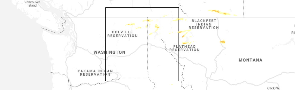
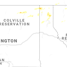
Hail Map for Boyds, WA
The Boyds, WA area has had 0 reports of on-the-ground hail by trained spotters, and has been under severe weather warnings 0 times during the past 12 months. Doppler radar has detected hail at or near Boyds, WA on 2 occasions.
| Name: | Boyds, WA |
| Where Located: | 67.5 miles ENE of Omak, WA |
| Map: | Google Map for Boyds, WA |
| Population: | 34 |
| Housing Units: | 16 |
| More Info: | Search Google for Boyds, WA |
0
The Top Recent Hail Date for Boyds, WA is Wednesday, June 24, 2020 (2nd out of 2)
Hail and Wind Damage Spotted near Boyds, WA
| Date / Time | Report Details |
|---|---|
| 6/24/2020 1:36 PM PDT |
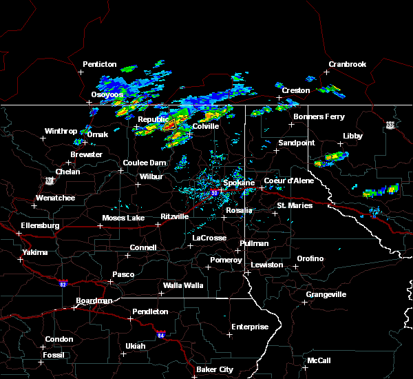 At 136 pm pdt, a severe thunderstorm was located 15 miles northwest of colville, or 66 miles east of omak, moving east at 25 mph (radar indicated). Hazards include ping pong ball size hail. People and animals outdoors will be injured. expect damage to roofs, siding, windows, and vehicles. Locations impacted include, boyds. At 136 pm pdt, a severe thunderstorm was located 15 miles northwest of colville, or 66 miles east of omak, moving east at 25 mph (radar indicated). Hazards include ping pong ball size hail. People and animals outdoors will be injured. expect damage to roofs, siding, windows, and vehicles. Locations impacted include, boyds.
|
| 6/24/2020 1:12 PM PDT |
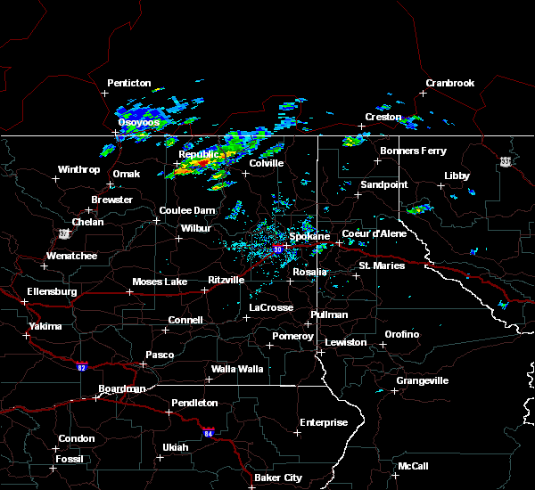 At 111 pm pdt, a severe thunderstorm was located near sherman pass, or 20 miles west of kettle falls, moving east at 25 mph (radar indicated). Hazards include golf ball size hail. People and animals outdoors will be injured. Expect damage to roofs, siding, windows, and vehicles. At 111 pm pdt, a severe thunderstorm was located near sherman pass, or 20 miles west of kettle falls, moving east at 25 mph (radar indicated). Hazards include golf ball size hail. People and animals outdoors will be injured. Expect damage to roofs, siding, windows, and vehicles.
|
| 6/22/2018 1:28 PM PDT |
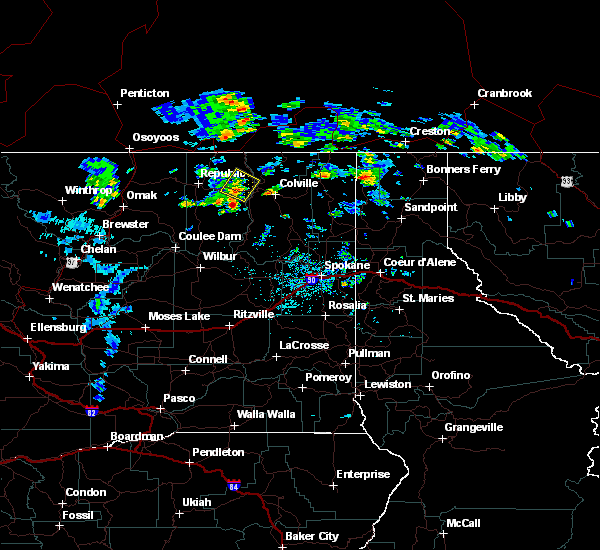 At 127 pm pdt, a severe thunderstorm was located 7 miles east of sherman pass, or 56 miles east of omak, moving northeast at 20 mph (radar indicated). Hazards include half dollar size hail. damage to vehicles is expected At 127 pm pdt, a severe thunderstorm was located 7 miles east of sherman pass, or 56 miles east of omak, moving northeast at 20 mph (radar indicated). Hazards include half dollar size hail. damage to vehicles is expected
|
| 5/29/2015 3:52 PM PDT | At 350 pm pdt, doppler radar indicated a severe thunderstorm capable of producing quarter size hail. this storm was located 13 miles northwest of colville, or 64 miles northwest of priest river, moving east at 15 mph. locations impacted include, kettle falls, marcus, boyds and evans. |
| 5/29/2015 3:33 PM PDT | At 332 pm pdt, doppler radar indicated a severe thunderstorm capable of producing quarter size hail. this storm was located 13 miles east of sherman pass, or 63 miles east of omak, and moving east at 15 mph. |
| 8/4/2013 3:30 PM PDT | 1 tree down across jackknife road. time estimated based on radar and diameter of the tree unknow in ferry county WA, 3.2 miles ENE of Boyds, WA |
| 8/4/2013 3:30 PM PDT | 1 tree down across jackknife road. time estimated based on radar. tree was a spruce and estimated to be one foot in diameter and 60 to 70 feet tal in ferry county WA, 3.2 miles ENE of Boyds, WA |
| 7/20/2012 4:30 PM PDT | Several trees down due to strong wind in ferry county WA, 3 miles E of Boyds, WA |
Hail Maps for Boyds, WA

Connect with Interactive Hail Maps