

Hail Map for Bradford, IA
The Bradford, IA area has had 0 reports of on-the-ground hail by trained spotters, and has been under severe weather warnings 10 times during the past 12 months. Doppler radar has detected hail at or near Bradford, IA on 52 occasions, including 4 occasions during the past year.
| Name: | Bradford, IA |
| Where Located: | 35.4 miles S of Mason City, IA |
| Map: | Google Map for Bradford, IA |
| Population: | 99 |
| Housing Units: | 57 |
| More Info: | Search Google for Bradford, IA |
2
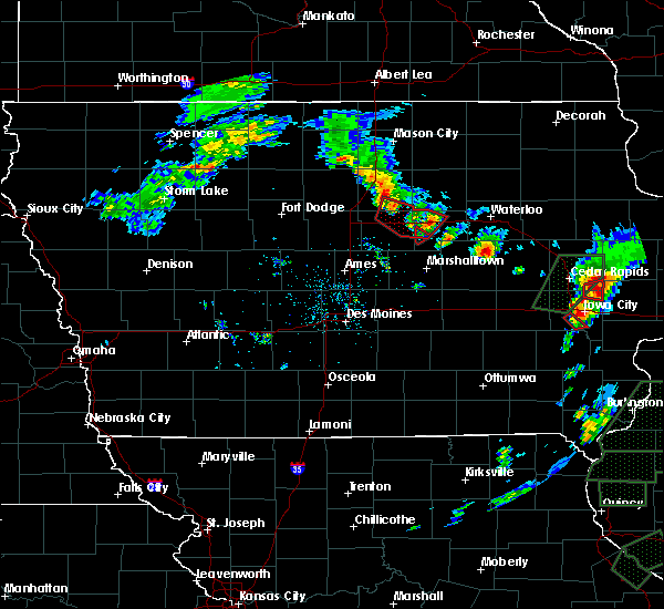
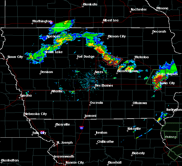
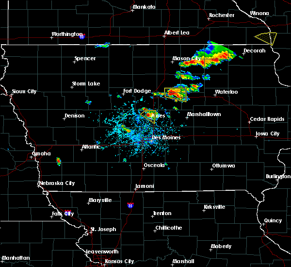
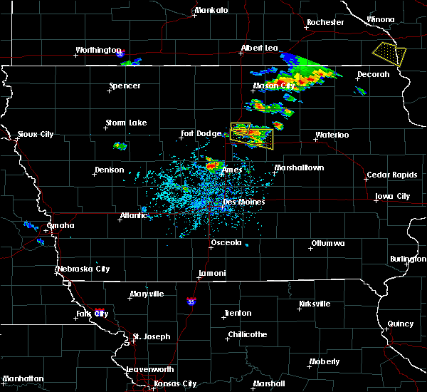
The Top Recent Hail Date for Bradford, IA is Friday, July 28, 2023 (8th out of 52)

Hail and Wind Damage Spotted near Bradford, IA
| Date / Time | Report Details |
|---|---|
| 4/16/2024 12:45 PM CDT |
 The storms which prompted the warning have weakened below severe limits, and no longer pose an immediate threat to life or property. therefore, the warning has been allowed to expire. however, gusty winds are still possible with these thunderstorms. a tornado watch remains in effect until 600 pm cdt for central and north central iowa. The storms which prompted the warning have weakened below severe limits, and no longer pose an immediate threat to life or property. therefore, the warning has been allowed to expire. however, gusty winds are still possible with these thunderstorms. a tornado watch remains in effect until 600 pm cdt for central and north central iowa.
|
| 4/16/2024 12:38 PM CDT |
 At 1238 pm cdt, severe thunderstorms were located along a line extending from goodell to near alden to near hubbard to near state center, moving northeast at 40 mph (radar indicated). Hazards include 60 mph wind gusts. Expect damage to roofs, siding, and trees. locations impacted include, nevada, iowa falls, clarion, eldora, story city, belmond, roland, big wall lake, elm lake, colo, hubbard, alden, zearing, radcliffe, dows, ellsworth, latimer, union, williams, and mccallsburg. This includes interstate 35 between mile markers 115 and 171. At 1238 pm cdt, severe thunderstorms were located along a line extending from goodell to near alden to near hubbard to near state center, moving northeast at 40 mph (radar indicated). Hazards include 60 mph wind gusts. Expect damage to roofs, siding, and trees. locations impacted include, nevada, iowa falls, clarion, eldora, story city, belmond, roland, big wall lake, elm lake, colo, hubbard, alden, zearing, radcliffe, dows, ellsworth, latimer, union, williams, and mccallsburg. This includes interstate 35 between mile markers 115 and 171.
|
| 4/16/2024 12:38 PM CDT |
 the severe thunderstorm warning has been cancelled and is no longer in effect the severe thunderstorm warning has been cancelled and is no longer in effect
|
| 4/16/2024 12:19 PM CDT |
 the severe thunderstorm warning has been cancelled and is no longer in effect the severe thunderstorm warning has been cancelled and is no longer in effect
|
| 4/16/2024 12:19 PM CDT |
 At 1218 pm cdt, severe thunderstorms were located along a line extending from 5 miles west of kanawha to 4 miles southeast of big wall lake to near drake airport to near zearing, moving northeast at 50 mph (radar indicated). Hazards include 60 mph wind gusts. Expect damage to roofs, siding, and trees. locations impacted include, ames, webster city, nevada, iowa falls, clarion, eldora, eagle grove, story city, huxley, belmond, roland, jewell junction, gilbert, elm lake, iowa state center, big wall lake, maxwell, colo, hubbard, and cambridge. This includes interstate 35 between mile markers 98 and 171. At 1218 pm cdt, severe thunderstorms were located along a line extending from 5 miles west of kanawha to 4 miles southeast of big wall lake to near drake airport to near zearing, moving northeast at 50 mph (radar indicated). Hazards include 60 mph wind gusts. Expect damage to roofs, siding, and trees. locations impacted include, ames, webster city, nevada, iowa falls, clarion, eldora, eagle grove, story city, huxley, belmond, roland, jewell junction, gilbert, elm lake, iowa state center, big wall lake, maxwell, colo, hubbard, and cambridge. This includes interstate 35 between mile markers 98 and 171.
|
| 4/16/2024 12:04 PM CDT |
 At 1203 pm cdt, severe thunderstorms were located along a line extending from near hardy to near kamrar to near roland to near nevada, moving northeast at 50 mph (radar indicated). Hazards include 60 mph wind gusts. Expect damage to roofs, siding, and trees. locations impacted include, ames, ankeny, fort dodge, johnston, boone, webster city, nevada, iowa falls, clarion, eldora, eagle grove, story city, polk city, huxley, belmond, slater, roland, jewell junction, gilbert, and elm lake. This includes interstate 35 between mile markers 98 and 171. At 1203 pm cdt, severe thunderstorms were located along a line extending from near hardy to near kamrar to near roland to near nevada, moving northeast at 50 mph (radar indicated). Hazards include 60 mph wind gusts. Expect damage to roofs, siding, and trees. locations impacted include, ames, ankeny, fort dodge, johnston, boone, webster city, nevada, iowa falls, clarion, eldora, eagle grove, story city, polk city, huxley, belmond, slater, roland, jewell junction, gilbert, and elm lake. This includes interstate 35 between mile markers 98 and 171.
|
| 4/16/2024 11:41 AM CDT |
 Svrdmx the national weather service in des moines has issued a * severe thunderstorm warning for, northwestern polk county in central iowa, story county in central iowa, northwestern marshall county in central iowa, hardin county in central iowa, eastern webster county in central iowa, wright county in north central iowa, western franklin county in north central iowa, eastern humboldt county in north central iowa, northeastern boone county in central iowa, hamilton county in central iowa, * until 1245 pm cdt. * at 1140 am cdt, severe thunderstorms were located along a line extending from near lehigh to 6 miles northeast of fraser to near kelley to alleman, moving northeast at 50 mph (radar indicated). Hazards include 60 mph wind gusts with brief tornadoes possible. expect damage to roofs, siding, and trees Svrdmx the national weather service in des moines has issued a * severe thunderstorm warning for, northwestern polk county in central iowa, story county in central iowa, northwestern marshall county in central iowa, hardin county in central iowa, eastern webster county in central iowa, wright county in north central iowa, western franklin county in north central iowa, eastern humboldt county in north central iowa, northeastern boone county in central iowa, hamilton county in central iowa, * until 1245 pm cdt. * at 1140 am cdt, severe thunderstorms were located along a line extending from near lehigh to 6 miles northeast of fraser to near kelley to alleman, moving northeast at 50 mph (radar indicated). Hazards include 60 mph wind gusts with brief tornadoes possible. expect damage to roofs, siding, and trees
|
| 8/11/2023 9:18 PM CDT |
 At 917 pm cdt, a severe thunderstorm was located over meservey, or 15 miles southeast of garner, moving southeast at 45 mph (radar indicated). Hazards include tennis ball size hail. People and animals outdoors will be injured. Expect damage to roofs, siding, windows, and vehicles. At 917 pm cdt, a severe thunderstorm was located over meservey, or 15 miles southeast of garner, moving southeast at 45 mph (radar indicated). Hazards include tennis ball size hail. People and animals outdoors will be injured. Expect damage to roofs, siding, windows, and vehicles.
|
| 7/28/2023 5:47 PM CDT |
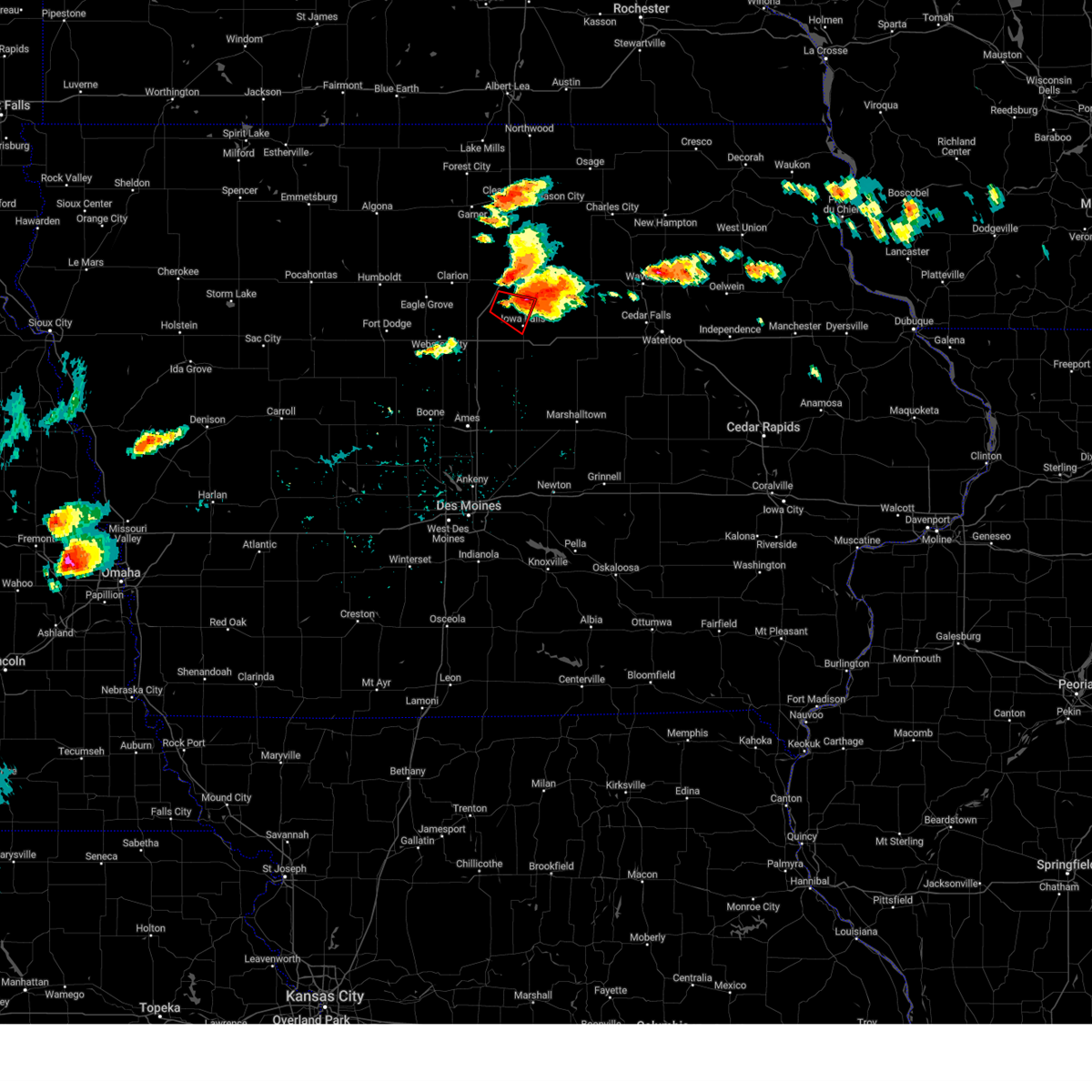 At 547 pm cdt, a confirmed tornado was located near popejoy, or 9 miles northwest of iowa falls, moving southeast at 15 mph (weather spotters confirmed tornado). Hazards include damaging tornado and ping pong ball size hail. Flying debris will be dangerous to those caught without shelter. mobile homes will be damaged or destroyed. damage to roofs, windows, and vehicles will occur. tree damage is likely. the tornado will be near, bradford around 605 pm cdt. Other locations in the path of this tornadic thunderstorm include iowa falls. At 547 pm cdt, a confirmed tornado was located near popejoy, or 9 miles northwest of iowa falls, moving southeast at 15 mph (weather spotters confirmed tornado). Hazards include damaging tornado and ping pong ball size hail. Flying debris will be dangerous to those caught without shelter. mobile homes will be damaged or destroyed. damage to roofs, windows, and vehicles will occur. tree damage is likely. the tornado will be near, bradford around 605 pm cdt. Other locations in the path of this tornadic thunderstorm include iowa falls.
|
| 7/28/2023 5:28 PM CDT |
 At 527 pm cdt, a severe thunderstorm was located 5 miles south of coulter, or 10 miles southwest of hampton, moving east at 15 mph (radar indicated). Hazards include ping pong ball size hail and 60 mph wind gusts. People and animals outdoors will be injured. expect hail damage to roofs, siding, windows, and vehicles. Expect wind damage to roofs, siding, and trees. At 527 pm cdt, a severe thunderstorm was located 5 miles south of coulter, or 10 miles southwest of hampton, moving east at 15 mph (radar indicated). Hazards include ping pong ball size hail and 60 mph wind gusts. People and animals outdoors will be injured. expect hail damage to roofs, siding, windows, and vehicles. Expect wind damage to roofs, siding, and trees.
|
| 4/4/2023 6:39 PM CDT |
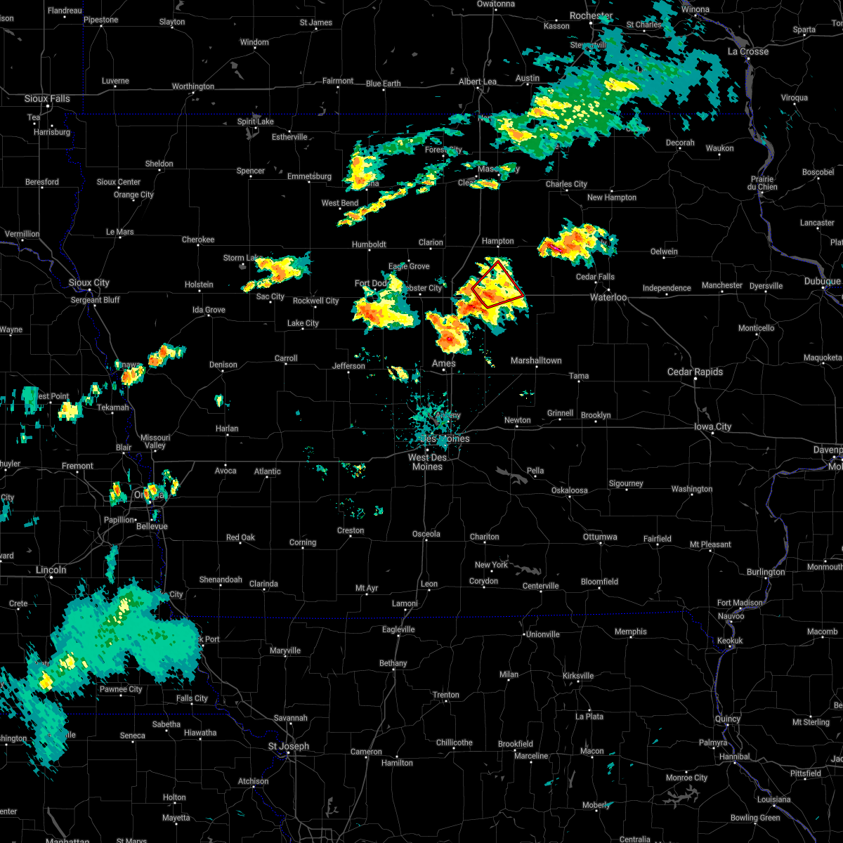
 At 638 pm cdt, a severe thunderstorm was located 6 miles east of geneva, or 11 miles southeast of hampton, moving northeast at 45 mph (radar indicated). Hazards include ping pong ball size hail. People and animals outdoors will be injured. expect damage to roofs, siding, windows, and vehicles. locations impacted include, iowa falls, hampton, ackley, aplington, geneva, bradford, hampton municipal airport and ackley municipal airport. hail threat, radar indicated max hail size, 1. 50 in wind threat, radar indicated max wind gust, <50 mph. At 638 pm cdt, a severe thunderstorm was located 6 miles east of geneva, or 11 miles southeast of hampton, moving northeast at 45 mph (radar indicated). Hazards include ping pong ball size hail. People and animals outdoors will be injured. expect damage to roofs, siding, windows, and vehicles. locations impacted include, iowa falls, hampton, ackley, aplington, geneva, bradford, hampton municipal airport and ackley municipal airport. hail threat, radar indicated max hail size, 1. 50 in wind threat, radar indicated max wind gust, <50 mph.
|
| 4/4/2023 6:19 PM CDT |
 At 618 pm cdt, a severe thunderstorm was located over iowa falls, moving northeast at 50 mph (radar indicated). Hazards include ping pong ball size hail. People and animals outdoors will be injured. expect damage to roofs, siding, windows, and vehicles. locations impacted include, ackley, bradford, ackley municipal airport and geneva. hail threat, radar indicated max hail size, 1. 50 in wind threat, radar indicated max wind gust, <50 mph. At 618 pm cdt, a severe thunderstorm was located over iowa falls, moving northeast at 50 mph (radar indicated). Hazards include ping pong ball size hail. People and animals outdoors will be injured. expect damage to roofs, siding, windows, and vehicles. locations impacted include, ackley, bradford, ackley municipal airport and geneva. hail threat, radar indicated max hail size, 1. 50 in wind threat, radar indicated max wind gust, <50 mph.
|
| 4/4/2023 6:08 PM CDT |
 At 608 pm cdt, a severe thunderstorm was located near buckeye, or 9 miles south of iowa falls, moving northeast at 50 mph (radar indicated). Hazards include quarter size hail. Damage to vehicles is expected. this severe thunderstorm will be near, eldora and owasa around 615 pm cdt. iowa falls and steamboat rock around 620 pm cdt. other locations in the path of this severe thunderstorm include ackley, ackley municipal airport and aplington. hail threat, radar indicated max hail size, 1. 00 in wind threat, radar indicated max wind gust, <50 mph. At 608 pm cdt, a severe thunderstorm was located near buckeye, or 9 miles south of iowa falls, moving northeast at 50 mph (radar indicated). Hazards include quarter size hail. Damage to vehicles is expected. this severe thunderstorm will be near, eldora and owasa around 615 pm cdt. iowa falls and steamboat rock around 620 pm cdt. other locations in the path of this severe thunderstorm include ackley, ackley municipal airport and aplington. hail threat, radar indicated max hail size, 1. 00 in wind threat, radar indicated max wind gust, <50 mph.
|
| 7/5/2022 7:35 PM CDT |
 At 734 pm cdt, severe thunderstorms were located along a line extending from near hampton to iowa falls to near jewell junction to near boone, moving east at 45 mph (radar indicated). Hazards include 60 mph wind gusts. Expect damage to roofs, siding, and trees. locations impacted include, webster city, iowa falls, hampton, clarion, eldora, belmond, ackley, jewell junction, sheffield, rockwell, elm lake, big wall lake, hubbard, alden, stratford, radcliffe, dows, ellsworth, latimer and klemme. hail threat, radar indicated max hail size, <. 75 in wind threat, radar indicated max wind gust, 60 mph. At 734 pm cdt, severe thunderstorms were located along a line extending from near hampton to iowa falls to near jewell junction to near boone, moving east at 45 mph (radar indicated). Hazards include 60 mph wind gusts. Expect damage to roofs, siding, and trees. locations impacted include, webster city, iowa falls, hampton, clarion, eldora, belmond, ackley, jewell junction, sheffield, rockwell, elm lake, big wall lake, hubbard, alden, stratford, radcliffe, dows, ellsworth, latimer and klemme. hail threat, radar indicated max hail size, <. 75 in wind threat, radar indicated max wind gust, 60 mph.
|
| 7/5/2022 7:31 PM CDT |
 At 730 pm cdt, severe thunderstorms were located along a line extending from 7 miles east of sheffield to 11 miles northeast of roland, moving east at 40 mph (radar indicated). Hazards include 60 mph wind gusts. expect damage to roofs, siding, and trees At 730 pm cdt, severe thunderstorms were located along a line extending from 7 miles east of sheffield to 11 miles northeast of roland, moving east at 40 mph (radar indicated). Hazards include 60 mph wind gusts. expect damage to roofs, siding, and trees
|
| 7/5/2022 6:56 PM CDT |
 At 656 pm cdt, severe thunderstorms were located along a line extending from near belmond to 7 miles west of big wall lake to 11 miles southeast of fort dodge to near gowrie, moving east at 45 mph (radar indicated). Hazards include 60 mph wind gusts. expect damage to roofs, siding, and trees At 656 pm cdt, severe thunderstorms were located along a line extending from near belmond to 7 miles west of big wall lake to 11 miles southeast of fort dodge to near gowrie, moving east at 45 mph (radar indicated). Hazards include 60 mph wind gusts. expect damage to roofs, siding, and trees
|
| 6/14/2022 10:55 PM CDT |
 At 1054 pm cdt, a severe thunderstorm was located 7 miles north of ackley, or 11 miles southeast of hampton, moving northeast at 30 mph (radar indicated). Hazards include 60 mph wind gusts and half dollar size hail. Hail damage to vehicles is expected. expect wind damage to roofs, siding, and trees. locations impacted include, aplington, dumont, bristow, allison and allison municipal airport. hail threat, radar indicated max hail size, 1. 25 in wind threat, radar indicated max wind gust, 60 mph. At 1054 pm cdt, a severe thunderstorm was located 7 miles north of ackley, or 11 miles southeast of hampton, moving northeast at 30 mph (radar indicated). Hazards include 60 mph wind gusts and half dollar size hail. Hail damage to vehicles is expected. expect wind damage to roofs, siding, and trees. locations impacted include, aplington, dumont, bristow, allison and allison municipal airport. hail threat, radar indicated max hail size, 1. 25 in wind threat, radar indicated max wind gust, 60 mph.
|
| 6/14/2022 10:38 PM CDT |
 At 1037 pm cdt, a severe thunderstorm was located 7 miles northeast of iowa falls, moving northeast at 35 mph (radar indicated). Hazards include 60 mph wind gusts and half dollar size hail. Hail damage to vehicles is expected. expect wind damage to roofs, siding, and trees. this severe thunderstorm will be near, ackley, geneva and ackley municipal airport around 1045 pm cdt. hansell around 1050 pm cdt. other locations in the path of this severe thunderstorm include aplington, dumont, bristow, allison and allison municipal airport. hail threat, radar indicated max hail size, 1. 25 in wind threat, radar indicated max wind gust, 60 mph. At 1037 pm cdt, a severe thunderstorm was located 7 miles northeast of iowa falls, moving northeast at 35 mph (radar indicated). Hazards include 60 mph wind gusts and half dollar size hail. Hail damage to vehicles is expected. expect wind damage to roofs, siding, and trees. this severe thunderstorm will be near, ackley, geneva and ackley municipal airport around 1045 pm cdt. hansell around 1050 pm cdt. other locations in the path of this severe thunderstorm include aplington, dumont, bristow, allison and allison municipal airport. hail threat, radar indicated max hail size, 1. 25 in wind threat, radar indicated max wind gust, 60 mph.
|
| 6/14/2022 10:17 PM CDT |
 At 1016 pm cdt, a severe thunderstorm was located near iowa falls, moving northeast at 25 mph (radar indicated). Hazards include 60 mph wind gusts and half dollar size hail. Hail damage to vehicles is expected. expect wind damage to roofs, siding, and trees. locations impacted include, bradford, hampton municipal airport, hampton, ackley, geneva and hansell. hail threat, radar indicated max hail size, 1. 25 in wind threat, radar indicated max wind gust, 60 mph. At 1016 pm cdt, a severe thunderstorm was located near iowa falls, moving northeast at 25 mph (radar indicated). Hazards include 60 mph wind gusts and half dollar size hail. Hail damage to vehicles is expected. expect wind damage to roofs, siding, and trees. locations impacted include, bradford, hampton municipal airport, hampton, ackley, geneva and hansell. hail threat, radar indicated max hail size, 1. 25 in wind threat, radar indicated max wind gust, 60 mph.
|
| 6/14/2022 9:58 PM CDT |
 At 958 pm cdt, a severe thunderstorm was located 10 miles west of iowa falls, moving northeast at 35 mph (radar indicated). Hazards include 60 mph wind gusts and half dollar size hail. Hail damage to vehicles is expected. expect wind damage to roofs, siding, and trees. this severe thunderstorm will be near, iowa falls around 1015 pm cdt. other locations in the path of this severe thunderstorm include bradford, hampton municipal airport, hampton, geneva and hansell. this includes interstate 35 between mile markers 138 and 162. hail threat, radar indicated max hail size, 1. 25 in wind threat, radar indicated max wind gust, 60 mph. At 958 pm cdt, a severe thunderstorm was located 10 miles west of iowa falls, moving northeast at 35 mph (radar indicated). Hazards include 60 mph wind gusts and half dollar size hail. Hail damage to vehicles is expected. expect wind damage to roofs, siding, and trees. this severe thunderstorm will be near, iowa falls around 1015 pm cdt. other locations in the path of this severe thunderstorm include bradford, hampton municipal airport, hampton, geneva and hansell. this includes interstate 35 between mile markers 138 and 162. hail threat, radar indicated max hail size, 1. 25 in wind threat, radar indicated max wind gust, 60 mph.
|
| 6/5/2022 4:20 PM CDT |
 At 420 pm cdt, a severe thunderstorm was located near hampton, moving east at 25 mph (radar indicated). Hazards include 60 mph wind gusts and penny size hail. Expect damage to roofs, siding, and trees. this severe thunderstorm will be near, hansell around 430 pm cdt. other locations in the path of this severe thunderstorm include dumont and bristow. hail threat, radar indicated max hail size, 0. 75 in wind threat, radar indicated max wind gust, 60 mph. At 420 pm cdt, a severe thunderstorm was located near hampton, moving east at 25 mph (radar indicated). Hazards include 60 mph wind gusts and penny size hail. Expect damage to roofs, siding, and trees. this severe thunderstorm will be near, hansell around 430 pm cdt. other locations in the path of this severe thunderstorm include dumont and bristow. hail threat, radar indicated max hail size, 0. 75 in wind threat, radar indicated max wind gust, 60 mph.
|
| 5/30/2022 8:51 PM CDT |
 At 851 pm cdt, a severe thunderstorm was located 7 miles southwest of marble rock, or 14 miles northwest of allison, moving northeast at 55 mph (radar indicated). Hazards include 60 mph wind gusts and penny size hail. Expect damage to roofs, siding, and trees. locations impacted include, greene. hail threat, radar indicated max hail size, 0. 75 in wind threat, radar indicated max wind gust, 60 mph. At 851 pm cdt, a severe thunderstorm was located 7 miles southwest of marble rock, or 14 miles northwest of allison, moving northeast at 55 mph (radar indicated). Hazards include 60 mph wind gusts and penny size hail. Expect damage to roofs, siding, and trees. locations impacted include, greene. hail threat, radar indicated max hail size, 0. 75 in wind threat, radar indicated max wind gust, 60 mph.
|
| 5/30/2022 8:36 PM CDT |
 At 835 pm cdt, a severe thunderstorm was located over hampton, moving northeast at 55 mph (radar indicated). Hazards include 60 mph wind gusts and penny size hail. Expect damage to roofs, siding, and trees. this severe thunderstorm will be near, hansell around 840 pm cdt. sheffield around 845 pm cdt. aredale and dougherty around 850 pm cdt. other locations in the path of this severe thunderstorm include greene. this includes interstate 35 between mile markers 138 and 173. hail threat, radar indicated max hail size, 0. 75 in wind threat, radar indicated max wind gust, 60 mph. At 835 pm cdt, a severe thunderstorm was located over hampton, moving northeast at 55 mph (radar indicated). Hazards include 60 mph wind gusts and penny size hail. Expect damage to roofs, siding, and trees. this severe thunderstorm will be near, hansell around 840 pm cdt. sheffield around 845 pm cdt. aredale and dougherty around 850 pm cdt. other locations in the path of this severe thunderstorm include greene. this includes interstate 35 between mile markers 138 and 173. hail threat, radar indicated max hail size, 0. 75 in wind threat, radar indicated max wind gust, 60 mph.
|
| 4/23/2022 6:49 PM CDT |
 At 649 pm cdt, severe thunderstorms were located along a line extending from garner to big wall lake to 7 miles west of jewell junction, moving northeast at 50 mph (radar indicated). Hazards include 60 mph wind gusts. Expect damage to roofs, siding, and trees. severe thunderstorms will be near, ventura, dows, rowan and mcintosh woods state park around 700 pm cdt. clear lake, blairsburg, alexander and clear lake state park around 705 pm cdt. other locations in the path of these severe thunderstorms include mason city municipal airport, latimer, williams, coulter, beeds lake state park, hampton municipal airport, hampton, alden, plymouth, chapin, popejoy, iowa falls municipal airport, iowa falls, sheffield, hansell, rockwell, geneva, bradford and dougherty. This includes interstate 35 between mile markers 138 and 202. At 649 pm cdt, severe thunderstorms were located along a line extending from garner to big wall lake to 7 miles west of jewell junction, moving northeast at 50 mph (radar indicated). Hazards include 60 mph wind gusts. Expect damage to roofs, siding, and trees. severe thunderstorms will be near, ventura, dows, rowan and mcintosh woods state park around 700 pm cdt. clear lake, blairsburg, alexander and clear lake state park around 705 pm cdt. other locations in the path of these severe thunderstorms include mason city municipal airport, latimer, williams, coulter, beeds lake state park, hampton municipal airport, hampton, alden, plymouth, chapin, popejoy, iowa falls municipal airport, iowa falls, sheffield, hansell, rockwell, geneva, bradford and dougherty. This includes interstate 35 between mile markers 138 and 202.
|
| 12/15/2021 6:34 PM CST |
 At 634 pm cst, severe thunderstorms were located along a line extending from near alden to near grundy center, moving east at 85 mph (radar indicated). Hazards include 70 mph wind gusts. Expect considerable tree damage. damage is likely to mobile homes, roofs, and outbuildings. these severe thunderstorms will remain over mainly rural areas of story, marshall, hardin, eastern wright, western franklin, northeastern kossuth, hancock, southeastern boone, eastern hamilton and winnebago counties, including the following locations, wesley, steamboat rock, ferguson, forest city municipal airport, radcliffe, bradford, maxwell, cambridge, melbourne and buffalo center. thunderstorm damage threat, considerable hail threat, radar indicated max hail size, <. 75 in wind threat, radar indicated max wind gust, 70 mph. At 634 pm cst, severe thunderstorms were located along a line extending from near alden to near grundy center, moving east at 85 mph (radar indicated). Hazards include 70 mph wind gusts. Expect considerable tree damage. damage is likely to mobile homes, roofs, and outbuildings. these severe thunderstorms will remain over mainly rural areas of story, marshall, hardin, eastern wright, western franklin, northeastern kossuth, hancock, southeastern boone, eastern hamilton and winnebago counties, including the following locations, wesley, steamboat rock, ferguson, forest city municipal airport, radcliffe, bradford, maxwell, cambridge, melbourne and buffalo center. thunderstorm damage threat, considerable hail threat, radar indicated max hail size, <. 75 in wind threat, radar indicated max wind gust, 70 mph.
|
| 12/15/2021 5:52 PM CST |
 At 552 pm cst, severe thunderstorms were located along a line extending from near swan lake to near slater, moving northeast at 85 mph. these are destructive storms for portions of central and northern iowa (radar indicated). Hazards include 80 mph wind gusts. Flying debris will be dangerous to those caught without shelter. mobile homes will be heavily damaged. expect considerable damage to roofs, windows, and vehicles. extensive tree damage and power outages are likely. severe thunderstorms will be near, slater and iowa state center around 555 pm cst. ames, nevada and huxley around 600 pm cst. other locations in the path of these severe thunderstorms include state center. this includes interstate 35 between mile markers 102 and 178. thunderstorm damage threat, destructive hail threat, radar indicated max hail size, <. 75 in wind threat, radar indicated max wind gust, 80 mph. At 552 pm cst, severe thunderstorms were located along a line extending from near swan lake to near slater, moving northeast at 85 mph. these are destructive storms for portions of central and northern iowa (radar indicated). Hazards include 80 mph wind gusts. Flying debris will be dangerous to those caught without shelter. mobile homes will be heavily damaged. expect considerable damage to roofs, windows, and vehicles. extensive tree damage and power outages are likely. severe thunderstorms will be near, slater and iowa state center around 555 pm cst. ames, nevada and huxley around 600 pm cst. other locations in the path of these severe thunderstorms include state center. this includes interstate 35 between mile markers 102 and 178. thunderstorm damage threat, destructive hail threat, radar indicated max hail size, <. 75 in wind threat, radar indicated max wind gust, 80 mph.
|
| 7/14/2021 4:50 PM CDT |
 At 450 pm cdt, a severe thunderstorm capable of producing a tornado was located near iowa falls, moving northeast at 15 mph (radar indicated rotation). Hazards include tornado. Flying debris will be dangerous to those caught without shelter. mobile homes will be damaged or destroyed. damage to roofs, windows, and vehicles will occur. tree damage is likely. Locations impacted include, iowa falls, alden, bradford, owasa and iowa falls municipal airport. At 450 pm cdt, a severe thunderstorm capable of producing a tornado was located near iowa falls, moving northeast at 15 mph (radar indicated rotation). Hazards include tornado. Flying debris will be dangerous to those caught without shelter. mobile homes will be damaged or destroyed. damage to roofs, windows, and vehicles will occur. tree damage is likely. Locations impacted include, iowa falls, alden, bradford, owasa and iowa falls municipal airport.
|
| 7/14/2021 4:35 PM CDT |
 At 435 pm cdt, a severe thunderstorm capable of producing a tornado was located 9 miles southwest of iowa falls, moving northeast at 30 mph (radar indicated rotation). Hazards include tornado. Flying debris will be dangerous to those caught without shelter. mobile homes will be damaged or destroyed. damage to roofs, windows, and vehicles will occur. Tree damage is likely. At 435 pm cdt, a severe thunderstorm capable of producing a tornado was located 9 miles southwest of iowa falls, moving northeast at 30 mph (radar indicated rotation). Hazards include tornado. Flying debris will be dangerous to those caught without shelter. mobile homes will be damaged or destroyed. damage to roofs, windows, and vehicles will occur. Tree damage is likely.
|
| 7/14/2021 9:06 AM CDT |
 At 905 am cdt, severe thunderstorms were located along a line extending from near rockwell to near aplington, moving east at 30 mph (radar indicated). Hazards include 60 mph wind gusts and nickel size hail. Expect damage to roofs, siding, and trees. locations impacted include, aplington and parkersburg. This includes interstate 35 between mile markers 172 and 193. At 905 am cdt, severe thunderstorms were located along a line extending from near rockwell to near aplington, moving east at 30 mph (radar indicated). Hazards include 60 mph wind gusts and nickel size hail. Expect damage to roofs, siding, and trees. locations impacted include, aplington and parkersburg. This includes interstate 35 between mile markers 172 and 193.
|
| 7/14/2021 8:39 AM CDT |
 At 838 am cdt, severe thunderstorms were located along a line extending from 9 miles south of clear lake to near iowa falls, moving east at 25 mph (radar indicated). Hazards include 60 mph wind gusts and nickel size hail. expect damage to roofs, siding, and trees At 838 am cdt, severe thunderstorms were located along a line extending from 9 miles south of clear lake to near iowa falls, moving east at 25 mph (radar indicated). Hazards include 60 mph wind gusts and nickel size hail. expect damage to roofs, siding, and trees
|
| 9/6/2020 4:21 AM CDT |
 At 407 am cdt, severe thunderstorms were located along a line extending from near rockford to 7 miles northeast of big wall lake, moving southeast at 45 mph (radar indicated). Hazards include 60 mph wind gusts and nickel size hail. Expect damage to roofs, siding, and trees. locations impacted include, iowa falls, hampton, nora springs, sheffield, greene, rockwell, alden, dumont, dows, latimer, coulter, alexander, geneva, swaledale, bristow, rowan, bradford, hansell, chapin and popejoy. This includes interstate 35 between mile markers 152 and 181. At 407 am cdt, severe thunderstorms were located along a line extending from near rockford to 7 miles northeast of big wall lake, moving southeast at 45 mph (radar indicated). Hazards include 60 mph wind gusts and nickel size hail. Expect damage to roofs, siding, and trees. locations impacted include, iowa falls, hampton, nora springs, sheffield, greene, rockwell, alden, dumont, dows, latimer, coulter, alexander, geneva, swaledale, bristow, rowan, bradford, hansell, chapin and popejoy. This includes interstate 35 between mile markers 152 and 181.
|
| 9/6/2020 4:07 AM CDT |
 At 407 am cdt, severe thunderstorms were located along a line extending from near rockford to 7 miles northeast of big wall lake, moving southeast at 45 mph (radar indicated). Hazards include 60 mph wind gusts and nickel size hail. Expect damage to roofs, siding, and trees. locations impacted include, iowa falls, hampton, nora springs, sheffield, greene, rockwell, alden, dumont, dows, latimer, coulter, alexander, geneva, swaledale, bristow, rowan, bradford, hansell, chapin and popejoy. This includes interstate 35 between mile markers 152 and 181. At 407 am cdt, severe thunderstorms were located along a line extending from near rockford to 7 miles northeast of big wall lake, moving southeast at 45 mph (radar indicated). Hazards include 60 mph wind gusts and nickel size hail. Expect damage to roofs, siding, and trees. locations impacted include, iowa falls, hampton, nora springs, sheffield, greene, rockwell, alden, dumont, dows, latimer, coulter, alexander, geneva, swaledale, bristow, rowan, bradford, hansell, chapin and popejoy. This includes interstate 35 between mile markers 152 and 181.
|
| 9/6/2020 3:40 AM CDT |
 At 339 am cdt, severe thunderstorms were located along a line extending from near mason city to 8 miles northwest of clarion, moving southeast at 45 mph (radar indicated). Hazards include 60 mph wind gusts and quarter size hail. Hail damage to vehicles is expected. Expect wind damage to roofs, siding, and trees. At 339 am cdt, severe thunderstorms were located along a line extending from near mason city to 8 miles northwest of clarion, moving southeast at 45 mph (radar indicated). Hazards include 60 mph wind gusts and quarter size hail. Hail damage to vehicles is expected. Expect wind damage to roofs, siding, and trees.
|
| 6/21/2020 9:04 PM CDT |
 At 903 pm cdt, a severe thunderstorm was located near allison, moving northeast at 35 mph (radar indicated). Hazards include 60 mph wind gusts. Expect damage to roofs, siding, and trees. Locations impacted include, hampton, allison, ackley, clarksville, shell rock, greene, aplington, dumont, plainfield, frederika, geneva, bristow, bradford, hansell, hampton municipal airport and allison municipal airport. At 903 pm cdt, a severe thunderstorm was located near allison, moving northeast at 35 mph (radar indicated). Hazards include 60 mph wind gusts. Expect damage to roofs, siding, and trees. Locations impacted include, hampton, allison, ackley, clarksville, shell rock, greene, aplington, dumont, plainfield, frederika, geneva, bristow, bradford, hansell, hampton municipal airport and allison municipal airport.
|
| 6/21/2020 8:48 PM CDT |
 At 847 pm cdt, a severe thunderstorm was located 8 miles east of hampton, moving northeast at 35 mph (radar indicated). Hazards include 60 mph wind gusts and quarter size hail. Hail damage to vehicles is expected. expect wind damage to roofs, siding, and trees. Locations impacted include, hampton, allison, ackley, clarksville, shell rock, greene, aplington, dumont, plainfield, frederika, geneva, bristow, bradford, hansell, aredale, hampton municipal airport and allison municipal airport. At 847 pm cdt, a severe thunderstorm was located 8 miles east of hampton, moving northeast at 35 mph (radar indicated). Hazards include 60 mph wind gusts and quarter size hail. Hail damage to vehicles is expected. expect wind damage to roofs, siding, and trees. Locations impacted include, hampton, allison, ackley, clarksville, shell rock, greene, aplington, dumont, plainfield, frederika, geneva, bristow, bradford, hansell, aredale, hampton municipal airport and allison municipal airport.
|
| 6/21/2020 8:30 PM CDT |
 At 829 pm cdt, a severe thunderstorm was located 7 miles north of iowa falls, moving northeast at 35 mph (radar indicated). Hazards include 60 mph wind gusts and quarter size hail. Hail damage to vehicles is expected. expect wind damage to roofs, siding, and trees. Emergency management reports numerous instances of 60 to 70 mph winds with these storms and trees and powerlines down. At 829 pm cdt, a severe thunderstorm was located 7 miles north of iowa falls, moving northeast at 35 mph (radar indicated). Hazards include 60 mph wind gusts and quarter size hail. Hail damage to vehicles is expected. expect wind damage to roofs, siding, and trees. Emergency management reports numerous instances of 60 to 70 mph winds with these storms and trees and powerlines down.
|
| 6/21/2020 8:09 PM CDT |
 At 808 pm cdt, a severe thunderstorm was located 8 miles southwest of greene, or 8 miles northwest of allison, moving northeast at 35 mph. numerous other strong cells are ongoing within the warned area as well (radar indicated). Hazards include 60 mph wind gusts and quarter size hail. Hail damage to vehicles is expected. expect wind damage to roofs, siding, and trees. Locations impacted include, hampton, greene, dumont, coulter, geneva, bristow, bradford, hansell, chapin, aredale, hampton municipal airport and beeds lake state park. At 808 pm cdt, a severe thunderstorm was located 8 miles southwest of greene, or 8 miles northwest of allison, moving northeast at 35 mph. numerous other strong cells are ongoing within the warned area as well (radar indicated). Hazards include 60 mph wind gusts and quarter size hail. Hail damage to vehicles is expected. expect wind damage to roofs, siding, and trees. Locations impacted include, hampton, greene, dumont, coulter, geneva, bristow, bradford, hansell, chapin, aredale, hampton municipal airport and beeds lake state park.
|
| 6/21/2020 7:38 PM CDT |
 At 738 pm cdt, a severe thunderstorm was located over hampton, moving northeast at 35 mph (radar indicated). Hazards include 60 mph wind gusts and quarter size hail. Hail damage to vehicles is expected. Expect wind damage to roofs, siding, and trees. At 738 pm cdt, a severe thunderstorm was located over hampton, moving northeast at 35 mph (radar indicated). Hazards include 60 mph wind gusts and quarter size hail. Hail damage to vehicles is expected. Expect wind damage to roofs, siding, and trees.
|
| 6/5/2020 3:34 AM CDT |
 At 334 am cdt, severe thunderstorms were located along a line extending from hampton to 9 miles west of iowa falls, moving southeast at 30 mph (radar indicated). Hazards include 60 mph wind gusts and nickel size hail. expect damage to roofs, siding, and trees At 334 am cdt, severe thunderstorms were located along a line extending from hampton to 9 miles west of iowa falls, moving southeast at 30 mph (radar indicated). Hazards include 60 mph wind gusts and nickel size hail. expect damage to roofs, siding, and trees
|
| 5/25/2020 7:02 PM CDT |
 At 702 pm cdt, severe thunderstorms were located along a line extending from 10 miles north of jewell junction to ackley, moving north at 30 mph (radar indicated). Hazards include 60 mph wind gusts. Expect damage to roofs, siding, and trees. locations impacted include, iowa falls, hampton, ackley, big wall lake, alden, dows, latimer, williams, coulter, blairsburg, geneva, bradford, hansell, popejoy, galt, beeds lake state park, iowa falls municipal airport, hampton municipal airport and ackley municipal airport. This includes interstate 35 between mile markers 140 and 167. At 702 pm cdt, severe thunderstorms were located along a line extending from 10 miles north of jewell junction to ackley, moving north at 30 mph (radar indicated). Hazards include 60 mph wind gusts. Expect damage to roofs, siding, and trees. locations impacted include, iowa falls, hampton, ackley, big wall lake, alden, dows, latimer, williams, coulter, blairsburg, geneva, bradford, hansell, popejoy, galt, beeds lake state park, iowa falls municipal airport, hampton municipal airport and ackley municipal airport. This includes interstate 35 between mile markers 140 and 167.
|
| 5/25/2020 6:44 PM CDT |
 At 644 pm cdt, severe thunderstorms were located along a line extending from near jewell junction to 7 miles south of ackley, moving north at 30 mph (radar indicated). Hazards include 60 mph wind gusts. expect damage to roofs, siding, and trees At 644 pm cdt, severe thunderstorms were located along a line extending from near jewell junction to 7 miles south of ackley, moving north at 30 mph (radar indicated). Hazards include 60 mph wind gusts. expect damage to roofs, siding, and trees
|
| 9/9/2019 7:33 PM CDT |
 At 732 pm cdt, a severe thunderstorm was located near allison, moving northeast at 85 mph (trained weather spotters. at 707 pm trained spotters reported 60 mph wind and damage to large tree limbs south of hubbard). Hazards include 60 mph wind gusts. expect damage to roofs, siding, and trees At 732 pm cdt, a severe thunderstorm was located near allison, moving northeast at 85 mph (trained weather spotters. at 707 pm trained spotters reported 60 mph wind and damage to large tree limbs south of hubbard). Hazards include 60 mph wind gusts. expect damage to roofs, siding, and trees
|
| 9/9/2019 6:17 PM CDT |
 At 617 pm cdt, severe thunderstorms were located along a line extending from near hampton to near parkersburg to 6 miles southeast of conrad, moving northeast at 50 mph (radar indicated). Hazards include 60 mph wind gusts and penny size hail. Expect damage to roofs, siding, and trees. Locations impacted include, hampton, eldora, grundy center, allison, parkersburg, reinbeck, ackley, clarksville, shell rock, dike, sheffield, greene, aplington, conrad, gladbrook, wellsburg, dumont, new hartford, albion and union. At 617 pm cdt, severe thunderstorms were located along a line extending from near hampton to near parkersburg to 6 miles southeast of conrad, moving northeast at 50 mph (radar indicated). Hazards include 60 mph wind gusts and penny size hail. Expect damage to roofs, siding, and trees. Locations impacted include, hampton, eldora, grundy center, allison, parkersburg, reinbeck, ackley, clarksville, shell rock, dike, sheffield, greene, aplington, conrad, gladbrook, wellsburg, dumont, new hartford, albion and union.
|
| 9/9/2019 5:53 PM CDT |
 At 553 pm cdt, severe thunderstorms were located along a line extending from 7 miles east of big wall lake to 6 miles east of eldora to 7 miles southeast of state center, moving northeast at 50 mph (radar indicated). Hazards include 60 mph wind gusts and penny size hail. expect damage to roofs, siding, and trees At 553 pm cdt, severe thunderstorms were located along a line extending from 7 miles east of big wall lake to 6 miles east of eldora to 7 miles southeast of state center, moving northeast at 50 mph (radar indicated). Hazards include 60 mph wind gusts and penny size hail. expect damage to roofs, siding, and trees
|
| 8/5/2019 9:05 PM CDT |
 The severe thunderstorm warning for northeastern hardin, east central wright, franklin, northwestern grundy and butler counties will expire at 915 pm cdt, the storms which prompted the warning have moved out of the area. therefore, the warning will be allowed to expire. however gusty winds are still possible with these thunderstorms. a severe thunderstorm watch remains in effect until 1100 pm cdt for central and north central iowa. The severe thunderstorm warning for northeastern hardin, east central wright, franklin, northwestern grundy and butler counties will expire at 915 pm cdt, the storms which prompted the warning have moved out of the area. therefore, the warning will be allowed to expire. however gusty winds are still possible with these thunderstorms. a severe thunderstorm watch remains in effect until 1100 pm cdt for central and north central iowa.
|
| 8/5/2019 8:44 PM CDT |
 At 843 pm cdt, severe thunderstorms were located along a line extending from 10 miles northwest of allison to near ackley to 6 miles north of iowa falls to 11 miles southwest of hampton, moving southeast at 40 mph (radar indicated. the hampton airport reported a 43 mph wind gust at 8:35pm). Hazards include 60 mph wind gusts. Expect damage to roofs, siding, and trees. locations impacted include, iowa falls, hampton, allison, parkersburg, ackley, clarksville, sheffield, aplington, alden, dumont, dows, latimer, coulter, alexander, geneva, bristow, rowan, bradford, hansell and chapin. This includes interstate 35 between mile markers 153 and 175. At 843 pm cdt, severe thunderstorms were located along a line extending from 10 miles northwest of allison to near ackley to 6 miles north of iowa falls to 11 miles southwest of hampton, moving southeast at 40 mph (radar indicated. the hampton airport reported a 43 mph wind gust at 8:35pm). Hazards include 60 mph wind gusts. Expect damage to roofs, siding, and trees. locations impacted include, iowa falls, hampton, allison, parkersburg, ackley, clarksville, sheffield, aplington, alden, dumont, dows, latimer, coulter, alexander, geneva, bristow, rowan, bradford, hansell and chapin. This includes interstate 35 between mile markers 153 and 175.
|
| 8/5/2019 8:30 PM CDT |
 At 829 pm cdt, severe thunderstorms were located along a line extending from near sheffield to near hampton to 12 miles northwest of iowa falls to 8 miles southeast of elm lake, moving southeast at 40 mph (radar indicated). Hazards include 60 mph wind gusts. expect damage to roofs, siding, and trees At 829 pm cdt, severe thunderstorms were located along a line extending from near sheffield to near hampton to 12 miles northwest of iowa falls to 8 miles southeast of elm lake, moving southeast at 40 mph (radar indicated). Hazards include 60 mph wind gusts. expect damage to roofs, siding, and trees
|
| 8/5/2019 8:11 PM CDT |
 At 811 pm cdt, a severe thunderstorm was located 9 miles west of sheffield, or 13 miles northwest of hampton, moving southeast at 35 mph (radar indicated). Hazards include 60 mph wind gusts. a trained weather spotter near meservey estimated wind gusts of 50 mph around 8:07 pm. Expect damage to roofs, siding, and trees. locations impacted include, hampton, belmond, sheffield, rockwell, latimer, thornton, coulter, meservey, alexander, swaledale, goodell, bradford, chapin, beeds lake state park, hampton municipal airport and belmond municipal airport. This includes interstate 35 between mile markers 165 and 184. At 811 pm cdt, a severe thunderstorm was located 9 miles west of sheffield, or 13 miles northwest of hampton, moving southeast at 35 mph (radar indicated). Hazards include 60 mph wind gusts. a trained weather spotter near meservey estimated wind gusts of 50 mph around 8:07 pm. Expect damage to roofs, siding, and trees. locations impacted include, hampton, belmond, sheffield, rockwell, latimer, thornton, coulter, meservey, alexander, swaledale, goodell, bradford, chapin, beeds lake state park, hampton municipal airport and belmond municipal airport. This includes interstate 35 between mile markers 165 and 184.
|
| 8/5/2019 7:56 PM CDT |
 At 755 pm cdt, a severe thunderstorm was located 7 miles northeast of belmond, or 11 miles south of garner, moving southeast at 35 mph (radar indicated). Hazards include 60 mph wind gusts. expect damage to roofs, siding, and trees At 755 pm cdt, a severe thunderstorm was located 7 miles northeast of belmond, or 11 miles south of garner, moving southeast at 35 mph (radar indicated). Hazards include 60 mph wind gusts. expect damage to roofs, siding, and trees
|
| 7/20/2019 11:35 AM CDT |
 At 1131 am cdt, the leading edge of severe winds associated with northern iowa thunderstorms was along a line extending from sheffield to 10 miles south of webster city, moving east at 60 mph (radar indicated. at 1115am 60 mph winds were reported at the clarion airport). Hazards include 60 mph wind gusts. Expect damage to roofs, siding, and trees. severe thunderstorms will be near, sheffield around 1135 am cdt. jewell junction around 1145 am cdt. greene around 1150 am cdt. clarksville around 1200 pm cdt. eldora around 1210 pm cdt. other locations impacted by these severe thunderstorms include steamboat rock, blairsburg, radcliffe, bradford, iowa falls municipal airport, kamrar, wellsburg, geneva, hansell and union. This includes interstate 35 between mile markers 127 and 150, and between mile markers 155 and 172. At 1131 am cdt, the leading edge of severe winds associated with northern iowa thunderstorms was along a line extending from sheffield to 10 miles south of webster city, moving east at 60 mph (radar indicated. at 1115am 60 mph winds were reported at the clarion airport). Hazards include 60 mph wind gusts. Expect damage to roofs, siding, and trees. severe thunderstorms will be near, sheffield around 1135 am cdt. jewell junction around 1145 am cdt. greene around 1150 am cdt. clarksville around 1200 pm cdt. eldora around 1210 pm cdt. other locations impacted by these severe thunderstorms include steamboat rock, blairsburg, radcliffe, bradford, iowa falls municipal airport, kamrar, wellsburg, geneva, hansell and union. This includes interstate 35 between mile markers 127 and 150, and between mile markers 155 and 172.
|
| 7/18/2019 8:45 AM CDT |
 At 844 am cdt, a severe thunderstorm was located near iowa falls, moving northeast at 40 mph (radar indicated). Hazards include 60 mph wind gusts and quarter size hail. Hail damage to vehicles is expected. Expect wind damage to roofs, siding, and trees. At 844 am cdt, a severe thunderstorm was located near iowa falls, moving northeast at 40 mph (radar indicated). Hazards include 60 mph wind gusts and quarter size hail. Hail damage to vehicles is expected. Expect wind damage to roofs, siding, and trees.
|
| 7/17/2019 10:55 AM CDT |
 The severe thunderstorm warning for hardin, southeastern wright, southern franklin and eastern hamilton counties will expire at 1100 am cdt, the storms which prompted the warning have weakened below severe limits, and no longer pose an immediate threat to life or property. therefore, the warning will be allowed to expire. however gusty winds are still possible with these thunderstorms. a severe thunderstorm watch remains in effect until 700 pm cdt for central iowa. The severe thunderstorm warning for hardin, southeastern wright, southern franklin and eastern hamilton counties will expire at 1100 am cdt, the storms which prompted the warning have weakened below severe limits, and no longer pose an immediate threat to life or property. therefore, the warning will be allowed to expire. however gusty winds are still possible with these thunderstorms. a severe thunderstorm watch remains in effect until 700 pm cdt for central iowa.
|
| 7/17/2019 10:46 AM CDT |
 At 1045 am cdt, severe thunderstorms were located along a line extending from 10 miles northwest of iowa falls to 9 miles northeast of jewell junction to near story city, moving east at 45 mph (radar indicated). Hazards include 60 mph wind gusts remain possible. Expect damage to roofs, siding, and trees. locations impacted include, iowa falls, eldora, ackley, hubbard, alden, radcliffe, dows, ellsworth, williams, steamboat rock, new providence, randall, buckeye, bradford, garden city, popejoy, owasa, pine lake state park, iowa falls municipal airport and eldora municipal airport. This includes interstate 35 between mile markers 127 and 145, and between mile markers 153 and 158. At 1045 am cdt, severe thunderstorms were located along a line extending from 10 miles northwest of iowa falls to 9 miles northeast of jewell junction to near story city, moving east at 45 mph (radar indicated). Hazards include 60 mph wind gusts remain possible. Expect damage to roofs, siding, and trees. locations impacted include, iowa falls, eldora, ackley, hubbard, alden, radcliffe, dows, ellsworth, williams, steamboat rock, new providence, randall, buckeye, bradford, garden city, popejoy, owasa, pine lake state park, iowa falls municipal airport and eldora municipal airport. This includes interstate 35 between mile markers 127 and 145, and between mile markers 153 and 158.
|
| 7/17/2019 10:28 AM CDT |
 At 1026 am cdt, severe thunderstorms were located along a line extending from near big wall lake to near webster city to 12 miles north of boone, moving east at 45 mph (radar indicated. recorded gusts to 40 to 45 mph from automated stations). Hazards include 60 mph wind gusts remain possible. Expect damage to roofs, siding, and trees. locations impacted include, webster city, iowa falls, eldora, ackley, jewell junction, big wall lake, hubbard, alden, stratford, radcliffe, dows, ellsworth, stanhope, williams, steamboat rock, new providence, blairsburg, kamrar, randall and woolstock. This includes interstate 35 between mile markers 127 and 158. At 1026 am cdt, severe thunderstorms were located along a line extending from near big wall lake to near webster city to 12 miles north of boone, moving east at 45 mph (radar indicated. recorded gusts to 40 to 45 mph from automated stations). Hazards include 60 mph wind gusts remain possible. Expect damage to roofs, siding, and trees. locations impacted include, webster city, iowa falls, eldora, ackley, jewell junction, big wall lake, hubbard, alden, stratford, radcliffe, dows, ellsworth, stanhope, williams, steamboat rock, new providence, blairsburg, kamrar, randall and woolstock. This includes interstate 35 between mile markers 127 and 158.
|
| 7/17/2019 10:16 AM CDT |
 At 1015 am cdt, severe thunderstorms were located along a line extending from near eagle grove to near webster city to 11 miles east of gowrie, moving east at 45 mph (radar indicated, and automated weather stations). Hazards include 60 mph wind gusts and penny size hail. expect damage to roofs, siding, and trees At 1015 am cdt, severe thunderstorms were located along a line extending from near eagle grove to near webster city to 11 miles east of gowrie, moving east at 45 mph (radar indicated, and automated weather stations). Hazards include 60 mph wind gusts and penny size hail. expect damage to roofs, siding, and trees
|
| 6/27/2019 12:41 PM CDT |
 The severe thunderstorm warning for northern hardin, eastern wright, franklin, southeastern hancock, western grundy, western butler, southern cerro gordo and northeastern hamilton counties will expire at 1245 pm cdt, the storms which prompted the warning have weakened below severe limits, and no longer pose an immediate threat to life or property. therefore, the warning will be allowed to expire. however small hail and gusty winds are still possible with these thunderstorms. a severe thunderstorm watch remains in effect until 700 pm cdt for central and north central iowa. The severe thunderstorm warning for northern hardin, eastern wright, franklin, southeastern hancock, western grundy, western butler, southern cerro gordo and northeastern hamilton counties will expire at 1245 pm cdt, the storms which prompted the warning have weakened below severe limits, and no longer pose an immediate threat to life or property. therefore, the warning will be allowed to expire. however small hail and gusty winds are still possible with these thunderstorms. a severe thunderstorm watch remains in effect until 700 pm cdt for central and north central iowa.
|
| 6/27/2019 12:24 PM CDT |
 At 1223 pm cdt, severe thunderstorms were located along a line extending from near rockwell to 7 miles southeast of big wall lake, moving east at 40 mph (radar indicated). Hazards include 60 mph wind gusts and quarter size hail. Hail damage to vehicles is expected. expect wind damage to roofs, siding, and trees. locations impacted include, iowa falls, hampton, garner, clarion, eldora, belmond, ackley, sheffield, greene, aplington, rockwell, elm lake, big wall lake, alden, wellsburg, dumont, dows, latimer, klemme and thornton. This includes interstate 35 between mile markers 147 and 190. At 1223 pm cdt, severe thunderstorms were located along a line extending from near rockwell to 7 miles southeast of big wall lake, moving east at 40 mph (radar indicated). Hazards include 60 mph wind gusts and quarter size hail. Hail damage to vehicles is expected. expect wind damage to roofs, siding, and trees. locations impacted include, iowa falls, hampton, garner, clarion, eldora, belmond, ackley, sheffield, greene, aplington, rockwell, elm lake, big wall lake, alden, wellsburg, dumont, dows, latimer, klemme and thornton. This includes interstate 35 between mile markers 147 and 190.
|
| 6/27/2019 12:04 PM CDT |
 At 1203 pm cdt, a severe thunderstorm was located 8 miles east of belmond, or 13 miles northwest of hampton, moving east at 50 mph (radar indicated). Hazards include 60 mph wind gusts and quarter size hail. Hail damage to vehicles is expected. Expect wind damage to roofs, siding, and trees. At 1203 pm cdt, a severe thunderstorm was located 8 miles east of belmond, or 13 miles northwest of hampton, moving east at 50 mph (radar indicated). Hazards include 60 mph wind gusts and quarter size hail. Hail damage to vehicles is expected. Expect wind damage to roofs, siding, and trees.
|
| 5/29/2019 8:59 PM CDT |
 At 845 pm cdt, tornado producing storms were located along a line extending from near iowa falls to eldora to 7 miles west of grundy center, moving northeast at 20 mph (law enforcement confirmed tornado two tornadoes. one was just southeast of iowa falls and another likely just north of eldora). Hazards include damaging tornado. Flying debris will be dangerous to those caught without shelter. mobile homes will be damaged or destroyed. damage to roofs, windows, and vehicles will occur. tree damage is likely. these tornadic storms will be near, iowa falls around 855 pm cdt. ackley around 930 pm cdt. Other locations impacted by these tornadic storms include pine lake state park, steamboat rock, bradford, iowa falls municipal airport, owasa, wellsburg, eldora municipal airport and ackley municipal airport. At 845 pm cdt, tornado producing storms were located along a line extending from near iowa falls to eldora to 7 miles west of grundy center, moving northeast at 20 mph (law enforcement confirmed tornado two tornadoes. one was just southeast of iowa falls and another likely just north of eldora). Hazards include damaging tornado. Flying debris will be dangerous to those caught without shelter. mobile homes will be damaged or destroyed. damage to roofs, windows, and vehicles will occur. tree damage is likely. these tornadic storms will be near, iowa falls around 855 pm cdt. ackley around 930 pm cdt. Other locations impacted by these tornadic storms include pine lake state park, steamboat rock, bradford, iowa falls municipal airport, owasa, wellsburg, eldora municipal airport and ackley municipal airport.
|
| 5/29/2019 8:46 PM CDT |
 At 845 pm cdt, tornado producing storms were located along a line extending from near iowa falls to eldora to 7 miles west of grundy center, moving northeast at 20 mph (law enforcement confirmed tornado two tornadoes. one was just southeast of iowa falls and another likely just north of eldora). Hazards include damaging tornado. Flying debris will be dangerous to those caught without shelter. mobile homes will be damaged or destroyed. damage to roofs, windows, and vehicles will occur. tree damage is likely. these tornadic storms will be near, iowa falls around 855 pm cdt. ackley around 930 pm cdt. Other locations impacted by these tornadic storms include pine lake state park, steamboat rock, bradford, iowa falls municipal airport, owasa, wellsburg, eldora municipal airport and ackley municipal airport. At 845 pm cdt, tornado producing storms were located along a line extending from near iowa falls to eldora to 7 miles west of grundy center, moving northeast at 20 mph (law enforcement confirmed tornado two tornadoes. one was just southeast of iowa falls and another likely just north of eldora). Hazards include damaging tornado. Flying debris will be dangerous to those caught without shelter. mobile homes will be damaged or destroyed. damage to roofs, windows, and vehicles will occur. tree damage is likely. these tornadic storms will be near, iowa falls around 855 pm cdt. ackley around 930 pm cdt. Other locations impacted by these tornadic storms include pine lake state park, steamboat rock, bradford, iowa falls municipal airport, owasa, wellsburg, eldora municipal airport and ackley municipal airport.
|
| 5/29/2019 8:42 PM CDT |
 At 841 pm cdt, there were several confirmed tornadoes. one was near iowa falls and another just south of eldora. both of these storms are moving to the north at 15 mph (law enforcement confirmed tornado. at 837pm, law enforcement reported a tornado near the iowa falls airport. law enforcement also reported a tornado near eldora 836pm). Hazards include damaging tornado. Flying debris will be dangerous to those caught without shelter. mobile homes will be damaged or destroyed. damage to roofs, windows, and vehicles will occur. tree damage is likely. the tornado will be near, iowa falls around 850 pm cdt. ackley around 915 pm cdt. Other locations impacted by this tornadic thunderstorm include pine lake state park, steamboat rock, bradford, iowa falls municipal airport, owasa, wellsburg, eldora municipal airport and ackley municipal airport. At 841 pm cdt, there were several confirmed tornadoes. one was near iowa falls and another just south of eldora. both of these storms are moving to the north at 15 mph (law enforcement confirmed tornado. at 837pm, law enforcement reported a tornado near the iowa falls airport. law enforcement also reported a tornado near eldora 836pm). Hazards include damaging tornado. Flying debris will be dangerous to those caught without shelter. mobile homes will be damaged or destroyed. damage to roofs, windows, and vehicles will occur. tree damage is likely. the tornado will be near, iowa falls around 850 pm cdt. ackley around 915 pm cdt. Other locations impacted by this tornadic thunderstorm include pine lake state park, steamboat rock, bradford, iowa falls municipal airport, owasa, wellsburg, eldora municipal airport and ackley municipal airport.
|
| 8/5/2018 11:03 PM CDT |
 At 1103 pm cdt, a severe thunderstorm was located over iowa falls, moving east at 40 mph (radar indicated). Hazards include 60 mph wind gusts. Expect damage to roofs, siding, and trees. Locations impacted include, iowa falls, eldora, ackley, hubbard, alden, radcliffe, steamboat rock, geneva, buckeye, bradford, popejoy, owasa, pine lake state park, iowa falls municipal airport, eldora municipal airport, drake airport and ackley municipal airport. At 1103 pm cdt, a severe thunderstorm was located over iowa falls, moving east at 40 mph (radar indicated). Hazards include 60 mph wind gusts. Expect damage to roofs, siding, and trees. Locations impacted include, iowa falls, eldora, ackley, hubbard, alden, radcliffe, steamboat rock, geneva, buckeye, bradford, popejoy, owasa, pine lake state park, iowa falls municipal airport, eldora municipal airport, drake airport and ackley municipal airport.
|
| 8/5/2018 10:40 PM CDT |
 At 1040 pm cdt, a severe thunderstorm was located 10 miles north of jewell junction, or 11 miles east of webster city, moving east at 40 mph (radar indicated). Hazards include 60 mph wind gusts. expect damage to roofs, siding, and trees At 1040 pm cdt, a severe thunderstorm was located 10 miles north of jewell junction, or 11 miles east of webster city, moving east at 40 mph (radar indicated). Hazards include 60 mph wind gusts. expect damage to roofs, siding, and trees
|
| 8/5/2018 9:58 AM CDT |
 At 957 am cdt, a severe thunderstorm was located near ackley, or 14 miles southwest of allison, moving east at 55 mph (radar indicated). Hazards include 60 mph wind gusts and nickel size hail. Expect damage to roofs, siding, and trees. locations impacted include, iowa falls, hampton, grundy center, parkersburg, reinbeck, ackley, shell rock, dike, aplington, alden, wellsburg, new hartford, williams, steamboat rock, holland, coulter, stout, geneva, bradford and morrison. This includes interstate 35 between mile markers 145 and 148, and between mile markers 156 and 157. At 957 am cdt, a severe thunderstorm was located near ackley, or 14 miles southwest of allison, moving east at 55 mph (radar indicated). Hazards include 60 mph wind gusts and nickel size hail. Expect damage to roofs, siding, and trees. locations impacted include, iowa falls, hampton, grundy center, parkersburg, reinbeck, ackley, shell rock, dike, aplington, alden, wellsburg, new hartford, williams, steamboat rock, holland, coulter, stout, geneva, bradford and morrison. This includes interstate 35 between mile markers 145 and 148, and between mile markers 156 and 157.
|
| 8/5/2018 9:36 AM CDT |
 At 936 am cdt, a severe thunderstorm was located 8 miles northwest of iowa falls, moving east at 55 mph (radar indicated). Hazards include 60 mph wind gusts and quarter size hail. Hail damage to vehicles is expected. Expect wind damage to roofs, siding, and trees. At 936 am cdt, a severe thunderstorm was located 8 miles northwest of iowa falls, moving east at 55 mph (radar indicated). Hazards include 60 mph wind gusts and quarter size hail. Hail damage to vehicles is expected. Expect wind damage to roofs, siding, and trees.
|
| 7/19/2018 4:08 PM CDT |
 The tornado warning for northern hardin and southern franklin counties will expire at 415 pm cdt, the storm which prompted the warning has weakened below severe limits, and no longer appears capable of producing a tornado. therefore, the warning will be allowed to expire. a tornado watch remains in effect until 1000 pm cdt for central iowa. The tornado warning for northern hardin and southern franklin counties will expire at 415 pm cdt, the storm which prompted the warning has weakened below severe limits, and no longer appears capable of producing a tornado. therefore, the warning will be allowed to expire. a tornado watch remains in effect until 1000 pm cdt for central iowa.
|
| 7/19/2018 3:40 PM CDT |
 At 340 pm cdt, a severe thunderstorm capable of producing a tornado was located over iowa falls, moving east at 30 mph (radar indicated rotation). Hazards include tornado. Flying debris will be dangerous to those caught without shelter. mobile homes will be damaged or destroyed. damage to roofs, windows, and vehicles will occur. tree damage is likely. this dangerous storm will be near, ackley around 405 pm cdt. Other locations impacted by this tornadic thunderstorm include geneva, alden, bradford, popejoy, iowa falls municipal airport and ackley municipal airport. At 340 pm cdt, a severe thunderstorm capable of producing a tornado was located over iowa falls, moving east at 30 mph (radar indicated rotation). Hazards include tornado. Flying debris will be dangerous to those caught without shelter. mobile homes will be damaged or destroyed. damage to roofs, windows, and vehicles will occur. tree damage is likely. this dangerous storm will be near, ackley around 405 pm cdt. Other locations impacted by this tornadic thunderstorm include geneva, alden, bradford, popejoy, iowa falls municipal airport and ackley municipal airport.
|
| 7/19/2018 3:24 PM CDT |
 At 324 pm cdt, a severe thunderstorm capable of producing a tornado was located near iowa falls, moving east at 25 mph (radar indicated rotation). Hazards include tornado. Flying debris will be dangerous to those caught without shelter. mobile homes will be damaged or destroyed. damage to roofs, windows, and vehicles will occur. tree damage is likely. this dangerous storm will be near, iowa falls around 340 pm cdt. other locations impacted by this tornadic thunderstorm include buckeye, alden, bradford, popejoy, iowa falls municipal airport and owasa. This includes interstate 35 between mile markers 152 and 155. At 324 pm cdt, a severe thunderstorm capable of producing a tornado was located near iowa falls, moving east at 25 mph (radar indicated rotation). Hazards include tornado. Flying debris will be dangerous to those caught without shelter. mobile homes will be damaged or destroyed. damage to roofs, windows, and vehicles will occur. tree damage is likely. this dangerous storm will be near, iowa falls around 340 pm cdt. other locations impacted by this tornadic thunderstorm include buckeye, alden, bradford, popejoy, iowa falls municipal airport and owasa. This includes interstate 35 between mile markers 152 and 155.
|
| 7/19/2018 3:05 PM CDT |
 At 305 pm cdt, a severe thunderstorm capable of producing a tornado was located 10 miles southeast of big wall lake, or 13 miles east of webster city, moving east at 25 mph (radar indicated rotation). Hazards include tornado. Flying debris will be dangerous to those caught without shelter. mobile homes will be damaged or destroyed. damage to roofs, windows, and vehicles will occur. tree damage is likely. this dangerous storm will be near, iowa falls around 340 pm cdt. other locations impacted by this tornadic thunderstorm include buckeye, williams, alden, bradford, popejoy, iowa falls municipal airport and owasa. This includes interstate 35 between mile markers 140 and 155. At 305 pm cdt, a severe thunderstorm capable of producing a tornado was located 10 miles southeast of big wall lake, or 13 miles east of webster city, moving east at 25 mph (radar indicated rotation). Hazards include tornado. Flying debris will be dangerous to those caught without shelter. mobile homes will be damaged or destroyed. damage to roofs, windows, and vehicles will occur. tree damage is likely. this dangerous storm will be near, iowa falls around 340 pm cdt. other locations impacted by this tornadic thunderstorm include buckeye, williams, alden, bradford, popejoy, iowa falls municipal airport and owasa. This includes interstate 35 between mile markers 140 and 155.
|
| 6/30/2018 3:34 PM CDT |
 At 333 pm cdt, severe thunderstorms were located along a line extending from near mason city to near rockwell to 9 miles west of hampton, moving east at 35 mph (radar indicated). Hazards include 60 mph wind gusts and nickel size hail. Expect damage to roofs, siding, and trees. locations impacted include, mason city, hampton, nora springs, sheffield, rockwell, latimer, thornton, coulter, meservey, alexander, geneva, swaledale, bradford, hansell, chapin, dougherty, burchinal, portland, beeds lake state park and hampton municipal airport. This includes interstate 35 between mile markers 157 and 192. At 333 pm cdt, severe thunderstorms were located along a line extending from near mason city to near rockwell to 9 miles west of hampton, moving east at 35 mph (radar indicated). Hazards include 60 mph wind gusts and nickel size hail. Expect damage to roofs, siding, and trees. locations impacted include, mason city, hampton, nora springs, sheffield, rockwell, latimer, thornton, coulter, meservey, alexander, geneva, swaledale, bradford, hansell, chapin, dougherty, burchinal, portland, beeds lake state park and hampton municipal airport. This includes interstate 35 between mile markers 157 and 192.
|
| 6/30/2018 3:20 PM CDT |
 At 320 pm cdt, severe thunderstorms were located along a line extending from 6 miles southeast of clear lake to 6 miles west of sheffield to 10 miles northeast of big wall lake, moving east at 40 mph (radar indicated). Hazards include 70 mph wind gusts and half dollar size hail. Hail damage to vehicles is expected. expect considerable tree damage. wind damage is also likely to mobile homes, roofs, and outbuildings. locations impacted include, mason city, hampton, nora springs, sheffield, rockwell, big wall lake, dows, klemme, latimer, thornton, coulter, meservey, alexander, geneva, swaledale, rowan, rock falls, goodell, bradford and hansell. This includes interstate 35 between mile markers 157 and 193. At 320 pm cdt, severe thunderstorms were located along a line extending from 6 miles southeast of clear lake to 6 miles west of sheffield to 10 miles northeast of big wall lake, moving east at 40 mph (radar indicated). Hazards include 70 mph wind gusts and half dollar size hail. Hail damage to vehicles is expected. expect considerable tree damage. wind damage is also likely to mobile homes, roofs, and outbuildings. locations impacted include, mason city, hampton, nora springs, sheffield, rockwell, big wall lake, dows, klemme, latimer, thornton, coulter, meservey, alexander, geneva, swaledale, rowan, rock falls, goodell, bradford and hansell. This includes interstate 35 between mile markers 157 and 193.
|
| 6/30/2018 3:07 PM CDT |
 At 306 pm cdt, severe thunderstorms were located along a line extending from near clear lake to 7 miles northeast of belmond to 6 miles southeast of elm lake, moving east at 35 mph. widespread branches and some trees down were reported in goodell with this storm (radar indicated). Hazards include 70 mph wind gusts and ping pong ball size hail. People and animals outdoors will be injured. expect hail damage to roofs, siding, windows, and vehicles. expect considerable tree damage. wind damage is also likely to mobile homes, roofs, and outbuildings. locations impacted include, mason city, hampton, garner, belmond, nora springs, sheffield, rockwell, clear lake, elm lake, big wall lake, mason city municipal airport, ventura, dows, klemme, latimer, thornton, coulter, meservey, alexander and geneva. This includes interstate 35 between mile markers 157 and 194. At 306 pm cdt, severe thunderstorms were located along a line extending from near clear lake to 7 miles northeast of belmond to 6 miles southeast of elm lake, moving east at 35 mph. widespread branches and some trees down were reported in goodell with this storm (radar indicated). Hazards include 70 mph wind gusts and ping pong ball size hail. People and animals outdoors will be injured. expect hail damage to roofs, siding, windows, and vehicles. expect considerable tree damage. wind damage is also likely to mobile homes, roofs, and outbuildings. locations impacted include, mason city, hampton, garner, belmond, nora springs, sheffield, rockwell, clear lake, elm lake, big wall lake, mason city municipal airport, ventura, dows, klemme, latimer, thornton, coulter, meservey, alexander and geneva. This includes interstate 35 between mile markers 157 and 194.
|
| 6/30/2018 3:04 PM CDT |
 At 304 pm cdt, severe thunderstorms were located along a line extending from near garner to 6 miles northeast of belmond to near elm lake, moving east at 35 mph (radar indicated). Hazards include ping pong ball size hail and 60 mph wind gusts. People and animals outdoors will be injured. expect hail damage to roofs, siding, windows, and vehicles. expect wind damage to roofs, siding, and trees. locations impacted include, mason city, hampton, garner, belmond, nora springs, sheffield, rockwell, clear lake, elm lake, big wall lake, mason city municipal airport, ventura, dows, klemme, latimer, thornton, coulter, meservey, alexander and geneva. This includes interstate 35 between mile markers 157 and 194. At 304 pm cdt, severe thunderstorms were located along a line extending from near garner to 6 miles northeast of belmond to near elm lake, moving east at 35 mph (radar indicated). Hazards include ping pong ball size hail and 60 mph wind gusts. People and animals outdoors will be injured. expect hail damage to roofs, siding, windows, and vehicles. expect wind damage to roofs, siding, and trees. locations impacted include, mason city, hampton, garner, belmond, nora springs, sheffield, rockwell, clear lake, elm lake, big wall lake, mason city municipal airport, ventura, dows, klemme, latimer, thornton, coulter, meservey, alexander and geneva. This includes interstate 35 between mile markers 157 and 194.
|
| 6/30/2018 2:55 PM CDT |
 At 254 pm cdt, severe thunderstorms were located along a line extending from near garner to near belmond to elm lake, moving east at 45 mph (radar indicated). Hazards include 60 mph wind gusts and half dollar size hail. Hail damage to vehicles is expected. Expect wind damage to roofs, siding, and trees. At 254 pm cdt, severe thunderstorms were located along a line extending from near garner to near belmond to elm lake, moving east at 45 mph (radar indicated). Hazards include 60 mph wind gusts and half dollar size hail. Hail damage to vehicles is expected. Expect wind damage to roofs, siding, and trees.
|
| 6/18/2018 4:13 PM CDT |
 At 413 pm cdt, a severe thunderstorm was located 10 miles east of big wall lake, or 12 miles northwest of iowa falls, moving east at 15 mph (radar indicated). Hazards include 60 mph wind gusts and quarter size hail. Hail damage to vehicles is expected. Expect wind damage to roofs, siding, and trees. At 413 pm cdt, a severe thunderstorm was located 10 miles east of big wall lake, or 12 miles northwest of iowa falls, moving east at 15 mph (radar indicated). Hazards include 60 mph wind gusts and quarter size hail. Hail damage to vehicles is expected. Expect wind damage to roofs, siding, and trees.
|
| 6/9/2018 7:46 PM CDT |
 At 745 pm cdt, a severe thunderstorm was located near iowa falls, moving east at 25 mph (radar indicated). Hazards include 60 mph wind gusts and quarter size hail. Hail damage to vehicles is expected. Expect wind damage to roofs, siding, and trees. At 745 pm cdt, a severe thunderstorm was located near iowa falls, moving east at 25 mph (radar indicated). Hazards include 60 mph wind gusts and quarter size hail. Hail damage to vehicles is expected. Expect wind damage to roofs, siding, and trees.
|
| 5/25/2018 5:58 PM CDT |
 At 528 pm cdt, a severe thunderstorm was located over iowa falls, moving east at 20 mph (radar indicated). Hazards include 60 mph wind gusts and quarter size hail. Hail damage to vehicles is expected. Expect wind damage to roofs, siding, and trees. At 528 pm cdt, a severe thunderstorm was located over iowa falls, moving east at 20 mph (radar indicated). Hazards include 60 mph wind gusts and quarter size hail. Hail damage to vehicles is expected. Expect wind damage to roofs, siding, and trees.
|
| 5/25/2018 5:35 PM CDT |
 At 534 pm cdt, a severe thunderstorm was located 8 miles northwest of iowa falls, moving east at 15 mph (radar indicated). Hazards include 60 mph wind gusts and quarter size hail. Hail damage to vehicles is expected. expect wind damage to roofs, siding, and trees. locations impacted include, bradford and popejoy. This includes interstate 35 between mile markers 156 and 163. At 534 pm cdt, a severe thunderstorm was located 8 miles northwest of iowa falls, moving east at 15 mph (radar indicated). Hazards include 60 mph wind gusts and quarter size hail. Hail damage to vehicles is expected. expect wind damage to roofs, siding, and trees. locations impacted include, bradford and popejoy. This includes interstate 35 between mile markers 156 and 163.
|
| 5/25/2018 5:28 PM CDT |
 At 528 pm cdt, a severe thunderstorm was located over iowa falls, moving east at 20 mph (radar indicated). Hazards include 60 mph wind gusts and quarter size hail. Hail damage to vehicles is expected. Expect wind damage to roofs, siding, and trees. At 528 pm cdt, a severe thunderstorm was located over iowa falls, moving east at 20 mph (radar indicated). Hazards include 60 mph wind gusts and quarter size hail. Hail damage to vehicles is expected. Expect wind damage to roofs, siding, and trees.
|
| 5/25/2018 5:14 PM CDT |
 At 514 pm cdt, a severe thunderstorm was located 10 miles east of big wall lake, or 11 miles northwest of iowa falls, moving southeast at 15 mph (radar indicated). Hazards include 60 mph wind gusts and quarter size hail. Hail damage to vehicles is expected. expect wind damage to roofs, siding, and trees. locations impacted include, dows, bradford and popejoy. This includes interstate 35 between mile markers 155 and 163. At 514 pm cdt, a severe thunderstorm was located 10 miles east of big wall lake, or 11 miles northwest of iowa falls, moving southeast at 15 mph (radar indicated). Hazards include 60 mph wind gusts and quarter size hail. Hail damage to vehicles is expected. expect wind damage to roofs, siding, and trees. locations impacted include, dows, bradford and popejoy. This includes interstate 35 between mile markers 155 and 163.
|
| 5/25/2018 4:58 PM CDT |
 At 458 pm cdt, a severe thunderstorm was located 7 miles east of big wall lake, or 12 miles southeast of clarion, moving east at 15 mph (radar indicated). Hazards include 60 mph wind gusts and quarter size hail. Hail damage to vehicles is expected. Expect wind damage to roofs, siding, and trees. At 458 pm cdt, a severe thunderstorm was located 7 miles east of big wall lake, or 12 miles southeast of clarion, moving east at 15 mph (radar indicated). Hazards include 60 mph wind gusts and quarter size hail. Hail damage to vehicles is expected. Expect wind damage to roofs, siding, and trees.
|
| 5/1/2018 5:24 PM CDT |
 At 524 pm cdt, a severe thunderstorm was located 9 miles northeast of hampton, moving northeast at 45 mph (radar indicated). Hazards include 60 mph wind gusts and quarter size hail. Hail damage to vehicles is expected. Expect wind damage to roofs, siding, and trees. At 524 pm cdt, a severe thunderstorm was located 9 miles northeast of hampton, moving northeast at 45 mph (radar indicated). Hazards include 60 mph wind gusts and quarter size hail. Hail damage to vehicles is expected. Expect wind damage to roofs, siding, and trees.
|
| 4/18/2018 5:43 AM CDT |
 At 542 am cdt, a severe thunderstorm was located near hampton, moving northeast at 30 mph (trained weather spotters reported quarter sized hail near alden at 5:37 am). Hazards include quarter size hail. damage to vehicles is expected At 542 am cdt, a severe thunderstorm was located near hampton, moving northeast at 30 mph (trained weather spotters reported quarter sized hail near alden at 5:37 am). Hazards include quarter size hail. damage to vehicles is expected
|
| 4/13/2018 8:22 PM CDT |
 At 821 pm cdt, severe thunderstorms were located along a line extending from hampton to ackley to near eldora, moving east at 35 mph (radar indicated. at 815 pm...a 59 mph wind gust was reported at the iowa falls airport). Hazards include 60 mph wind gusts. Expect damage to roofs, siding, and trees. locations impacted include, hampton, ackley, latimer, coulter, alexander, geneva, bradford, hampton municipal airport, beeds lake state park and ackley municipal airport. This includes interstate 35 between mile markers 166 and 176. At 821 pm cdt, severe thunderstorms were located along a line extending from hampton to ackley to near eldora, moving east at 35 mph (radar indicated. at 815 pm...a 59 mph wind gust was reported at the iowa falls airport). Hazards include 60 mph wind gusts. Expect damage to roofs, siding, and trees. locations impacted include, hampton, ackley, latimer, coulter, alexander, geneva, bradford, hampton municipal airport, beeds lake state park and ackley municipal airport. This includes interstate 35 between mile markers 166 and 176.
|
| 4/13/2018 8:11 PM CDT |
 At 751 pm cdt, severe thunderstorms were located along a line extending from 6 miles east of big wall lake to 9 miles northeast of jewell junction to 6 miles east of roland, moving east at 35 mph (radar indicated). Hazards include 60 mph wind gusts. expect damage to roofs, siding, and trees At 751 pm cdt, severe thunderstorms were located along a line extending from 6 miles east of big wall lake to 9 miles northeast of jewell junction to 6 miles east of roland, moving east at 35 mph (radar indicated). Hazards include 60 mph wind gusts. expect damage to roofs, siding, and trees
|
| 4/13/2018 7:52 PM CDT |
 At 751 pm cdt, severe thunderstorms were located along a line extending from 6 miles east of big wall lake to 9 miles northeast of jewell junction to 6 miles east of roland, moving east at 35 mph (radar indicated). Hazards include 60 mph wind gusts. expect damage to roofs, siding, and trees At 751 pm cdt, severe thunderstorms were located along a line extending from 6 miles east of big wall lake to 9 miles northeast of jewell junction to 6 miles east of roland, moving east at 35 mph (radar indicated). Hazards include 60 mph wind gusts. expect damage to roofs, siding, and trees
|
| 7/10/2017 2:30 AM CDT |
 At 229 am cdt, a severe thunderstorm was located near ackley, or 7 miles northeast of iowa falls, moving southeast at 45 mph (radar indicated). Hazards include 60 mph wind gusts and quarter size hail. Hail damage to vehicles is expected. expect wind damage to roofs, siding, and trees. Locations impacted include, iowa falls, hampton, parkersburg, ackley, aplington, alden, dumont, latimer, coulter, geneva, buckeye, bradford, hansell, popejoy, owasa, beeds lake state park, iowa falls municipal airport, hampton municipal airport and ackley municipal airport. At 229 am cdt, a severe thunderstorm was located near ackley, or 7 miles northeast of iowa falls, moving southeast at 45 mph (radar indicated). Hazards include 60 mph wind gusts and quarter size hail. Hail damage to vehicles is expected. expect wind damage to roofs, siding, and trees. Locations impacted include, iowa falls, hampton, parkersburg, ackley, aplington, alden, dumont, latimer, coulter, geneva, buckeye, bradford, hansell, popejoy, owasa, beeds lake state park, iowa falls municipal airport, hampton municipal airport and ackley municipal airport.
|
| 7/10/2017 2:09 AM CDT |
 At 209 am cdt, a severe thunderstorm was located 7 miles west of hampton, moving southeast at 50 mph (trained weather spotters). Hazards include ping pong ball size hail and 60 mph wind gusts. People and animals outdoors will be injured. expect hail damage to roofs, siding, windows, and vehicles. Expect wind damage to roofs, siding, and trees. At 209 am cdt, a severe thunderstorm was located 7 miles west of hampton, moving southeast at 50 mph (trained weather spotters). Hazards include ping pong ball size hail and 60 mph wind gusts. People and animals outdoors will be injured. expect hail damage to roofs, siding, windows, and vehicles. Expect wind damage to roofs, siding, and trees.
|
| 6/29/2017 4:18 PM CDT |
 At 918 pm cdt, severe thunderstorms were located along a line extending from 9 miles east of sheffield to near ackley, moving east at 40 mph (radar indicated). Hazards include 60 mph wind gusts. Expect damage to roofs, siding, and trees. Locations impacted include, hampton, ackley, sheffield, aplington, dumont, geneva, bristow, bradford, hansell, chapin, aredale, beeds lake state park and hampton municipal airport. At 918 pm cdt, severe thunderstorms were located along a line extending from 9 miles east of sheffield to near ackley, moving east at 40 mph (radar indicated). Hazards include 60 mph wind gusts. Expect damage to roofs, siding, and trees. Locations impacted include, hampton, ackley, sheffield, aplington, dumont, geneva, bristow, bradford, hansell, chapin, aredale, beeds lake state park and hampton municipal airport.
|
| 6/29/2017 4:02 PM CDT |
 At 902 pm cdt, severe thunderstorms were located along a line extending from near sheffield to near iowa falls, moving east at 35 mph (emergency management). Hazards include 60 mph wind gusts. expect damage to roofs, siding, and trees At 902 pm cdt, severe thunderstorms were located along a line extending from near sheffield to near iowa falls, moving east at 35 mph (emergency management). Hazards include 60 mph wind gusts. expect damage to roofs, siding, and trees
|
| 6/29/2017 12:56 PM CDT |
 The severe thunderstorm warning for southeastern franklin and southwestern butler counties will expire at 600 pm cdt, the storm which prompted the warning has weakened below severe limits, and no longer poses an immediate threat to life or property. therefore the warning will be allowed to expire. however heavy rain is still possible with this thunderstorm. The severe thunderstorm warning for southeastern franklin and southwestern butler counties will expire at 600 pm cdt, the storm which prompted the warning has weakened below severe limits, and no longer poses an immediate threat to life or property. therefore the warning will be allowed to expire. however heavy rain is still possible with this thunderstorm.
|
| 6/29/2017 12:34 PM CDT |
 At 534 pm cdt, a severe thunderstorm was located 7 miles south of hampton, moving east at 15 mph (radar indicated). Hazards include 60 mph wind gusts and quarter size hail. Hail damage to vehicles is expected. expect wind damage to roofs, siding, and trees. Locations impacted include, hampton, aplington, dumont, geneva, bristow, bradford, hansell and hampton municipal airport. At 534 pm cdt, a severe thunderstorm was located 7 miles south of hampton, moving east at 15 mph (radar indicated). Hazards include 60 mph wind gusts and quarter size hail. Hail damage to vehicles is expected. expect wind damage to roofs, siding, and trees. Locations impacted include, hampton, aplington, dumont, geneva, bristow, bradford, hansell and hampton municipal airport.
|
| 6/29/2017 12:19 PM CDT |
 At 519 pm cdt, a severe thunderstorm was located 7 miles north of iowa falls, moving east at 20 mph (radar indicated). Hazards include two inch hail and 60 mph wind gusts. People and animals outdoors will be injured. expect hail damage to roofs, siding, windows, and vehicles. expect wind damage to roofs, siding, and trees. Locations impacted include, hampton, aplington, dumont, geneva, bristow, bradford, hansell and hampton municipal airport. At 519 pm cdt, a severe thunderstorm was located 7 miles north of iowa falls, moving east at 20 mph (radar indicated). Hazards include two inch hail and 60 mph wind gusts. People and animals outdoors will be injured. expect hail damage to roofs, siding, windows, and vehicles. expect wind damage to roofs, siding, and trees. Locations impacted include, hampton, aplington, dumont, geneva, bristow, bradford, hansell and hampton municipal airport.
|
| 6/29/2017 12:17 PM CDT |
 At 517 pm cdt, a severe thunderstorm was located 7 miles north of iowa falls, moving east at 20 mph (radar indicated). Hazards include two inch hail and 60 mph wind gusts. People and animals outdoors will be injured. expect hail damage to roofs, siding, windows, and vehicles. expect wind damage to roofs, siding, and trees. Locations impacted include, hampton, aplington, dumont, geneva, bristow, bradford, hansell and hampton municipal airport. At 517 pm cdt, a severe thunderstorm was located 7 miles north of iowa falls, moving east at 20 mph (radar indicated). Hazards include two inch hail and 60 mph wind gusts. People and animals outdoors will be injured. expect hail damage to roofs, siding, windows, and vehicles. expect wind damage to roofs, siding, and trees. Locations impacted include, hampton, aplington, dumont, geneva, bristow, bradford, hansell and hampton municipal airport.
|
| 6/29/2017 12:11 PM CDT |
 At 511 pm cdt, a severe thunderstorm was located 7 miles north of iowa falls, moving east at 30 mph (radar indicated). Hazards include 60 mph wind gusts and quarter size hail. Hail damage to vehicles is expected. Expect wind damage to roofs, siding, and trees. At 511 pm cdt, a severe thunderstorm was located 7 miles north of iowa falls, moving east at 30 mph (radar indicated). Hazards include 60 mph wind gusts and quarter size hail. Hail damage to vehicles is expected. Expect wind damage to roofs, siding, and trees.
|
| 6/28/2017 10:49 AM CDT |
 At 349 pm cdt, a severe thunderstorm was located near hampton, moving east at 45 mph (radar indicated). Hazards include ping pong ball size hail and 60 mph wind gusts. People and animals outdoors will be injured. expect hail damage to roofs, siding, windows, and vehicles. Expect wind damage to roofs, siding, and trees. At 349 pm cdt, a severe thunderstorm was located near hampton, moving east at 45 mph (radar indicated). Hazards include ping pong ball size hail and 60 mph wind gusts. People and animals outdoors will be injured. expect hail damage to roofs, siding, windows, and vehicles. Expect wind damage to roofs, siding, and trees.
|
| 6/15/2017 5:38 PM CDT |
 At 537 pm cdt, a severe thunderstorm was located near ackley, or 9 miles northeast of iowa falls, moving southeast at 40 mph (trained weather spotters. at 5:34pm, trained spotters reported half dollar sized hail and 60 mph winds). Hazards include 60 mph wind gusts and half dollar size hail. Hail damage to vehicles is expected. expect wind damage to roofs, siding, and trees. Locations impacted include, hampton, parkersburg, ackley, aplington, wellsburg, geneva, bradford, hampton municipal airport and ackley municipal airport. At 537 pm cdt, a severe thunderstorm was located near ackley, or 9 miles northeast of iowa falls, moving southeast at 40 mph (trained weather spotters. at 5:34pm, trained spotters reported half dollar sized hail and 60 mph winds). Hazards include 60 mph wind gusts and half dollar size hail. Hail damage to vehicles is expected. expect wind damage to roofs, siding, and trees. Locations impacted include, hampton, parkersburg, ackley, aplington, wellsburg, geneva, bradford, hampton municipal airport and ackley municipal airport.
|
| 6/15/2017 5:26 PM CDT |
 At 526 pm cdt, a severe thunderstorm was located 7 miles north of iowa falls, moving southeast at 40 mph (radar indicated). Hazards include 60 mph wind gusts and quarter size hail. Hail damage to vehicles is expected. Expect wind damage to roofs, siding, and trees. At 526 pm cdt, a severe thunderstorm was located 7 miles north of iowa falls, moving southeast at 40 mph (radar indicated). Hazards include 60 mph wind gusts and quarter size hail. Hail damage to vehicles is expected. Expect wind damage to roofs, siding, and trees.
|
| 5/17/2017 5:38 PM CDT |
 At 537 pm cdt, severe thunderstorms were located along a line extending from 12 miles south of britt to 10 miles east of belmond to near ackley, moving northeast at 55 mph (radar indicated). Hazards include 60 mph wind gusts. Expect damage to roofs, siding, and trees. locations impacted include, hampton, clarion, belmond, sheffield, rockwell, elm lake, kanawha, goldfield, dows, klemme, latimer, thornton, corwith, coulter, meservey, alexander, geneva, swaledale, rowan and goodell. this includes interstate 35 between mile markers 154 and 185. A tornado watch remains in effect until 700 pm cdt for north central iowa. At 537 pm cdt, severe thunderstorms were located along a line extending from 12 miles south of britt to 10 miles east of belmond to near ackley, moving northeast at 55 mph (radar indicated). Hazards include 60 mph wind gusts. Expect damage to roofs, siding, and trees. locations impacted include, hampton, clarion, belmond, sheffield, rockwell, elm lake, kanawha, goldfield, dows, klemme, latimer, thornton, corwith, coulter, meservey, alexander, geneva, swaledale, rowan and goodell. this includes interstate 35 between mile markers 154 and 185. A tornado watch remains in effect until 700 pm cdt for north central iowa.
|
| 5/17/2017 5:16 PM CDT |
 At 516 pm cdt, severe thunderstorms were located along a line extending from 7 miles east of dakota city to near big wall lake to 6 miles northwest of eldora, moving northeast at 40 mph (radar indicated). Hazards include 60 mph wind gusts. expect damage to roofs, siding, and trees At 516 pm cdt, severe thunderstorms were located along a line extending from 7 miles east of dakota city to near big wall lake to 6 miles northwest of eldora, moving northeast at 40 mph (radar indicated). Hazards include 60 mph wind gusts. expect damage to roofs, siding, and trees
|
| 5/15/2017 6:27 PM CDT |
 At 627 pm cdt, severe thunderstorms were located along a line extending from near greene to 9 miles east of big wall lake, moving east at 30 mph (radar indicated). Hazards include 60 mph wind gusts and half dollar size hail. Hail damage to vehicles is expected. expect wind damage to roofs, siding, and trees. locations impacted include, hampton, sheffield, greene, rockwell, dumont, dows, latimer, thornton, coulter, meservey, alexander, bradford, hansell, chapin, aredale, dougherty, beeds lake state park and hampton municipal airport. This includes interstate 35 between mile markers 159 and 181. At 627 pm cdt, severe thunderstorms were located along a line extending from near greene to 9 miles east of big wall lake, moving east at 30 mph (radar indicated). Hazards include 60 mph wind gusts and half dollar size hail. Hail damage to vehicles is expected. expect wind damage to roofs, siding, and trees. locations impacted include, hampton, sheffield, greene, rockwell, dumont, dows, latimer, thornton, coulter, meservey, alexander, bradford, hansell, chapin, aredale, dougherty, beeds lake state park and hampton municipal airport. This includes interstate 35 between mile markers 159 and 181.
|
| 5/15/2017 5:58 PM CDT |
 At 558 pm cdt, severe thunderstorms were located along a line extending from 6 miles southwest of marble rock to near big wall lake, moving east at 30 mph (radar indicated). Hazards include ping pong ball size hail and 60 mph wind gusts. People and animals outdoors will be injured. expect hail damage to roofs, siding, windows, and vehicles. Expect wind damage to roofs, siding, and trees. At 558 pm cdt, severe thunderstorms were located along a line extending from 6 miles southwest of marble rock to near big wall lake, moving east at 30 mph (radar indicated). Hazards include ping pong ball size hail and 60 mph wind gusts. People and animals outdoors will be injured. expect hail damage to roofs, siding, windows, and vehicles. Expect wind damage to roofs, siding, and trees.
|
| 5/15/2017 5:37 PM CDT |
 At 536 pm cdt, severe thunderstorms were located along a line extending from near rockford to eagle grove, moving east at 50 mph. at 528 pm cdt a trained spotter reported golf ball sized hail in goldfield (trained weather spotters). Hazards include two inch hail and 60 mph wind gusts. People and animals outdoors will be injured. expect hail damage to roofs, siding, windows, and vehicles. expect wind damage to roofs, siding, and trees. locations impacted include, hampton, clarion, eagle grove, belmond, sheffield, rockwell, big wall lake, elm lake, goldfield, dows, latimer, thornton, coulter, meservey, renwick, thor, alexander, swaledale, rowan and goodell. This includes interstate 35 between mile markers 151 and 188. At 536 pm cdt, severe thunderstorms were located along a line extending from near rockford to eagle grove, moving east at 50 mph. at 528 pm cdt a trained spotter reported golf ball sized hail in goldfield (trained weather spotters). Hazards include two inch hail and 60 mph wind gusts. People and animals outdoors will be injured. expect hail damage to roofs, siding, windows, and vehicles. expect wind damage to roofs, siding, and trees. locations impacted include, hampton, clarion, eagle grove, belmond, sheffield, rockwell, big wall lake, elm lake, goldfield, dows, latimer, thornton, coulter, meservey, renwick, thor, alexander, swaledale, rowan and goodell. This includes interstate 35 between mile markers 151 and 188.
|
| 5/15/2017 5:26 PM CDT |
 At 524 pm cdt, a line of severe thunderstorms was located from near eagle grove to around mason city, moving east at 25 mph. most of the line is producing wind gusts to near 60 mph and quarter sized hail. however, a particularly strong thunderstorm moving from southeastern humboldt into wright county is producing hail up to the size of hen eggs (radar indicated). Hazards include two inch hail and 60 mph wind gusts. People and animals outdoors will be injured. expect hail damage to roofs, siding, windows, and vehicles. expect wind damage to roofs, siding, and trees. locations impacted include, mason city, hampton, clarion, dakota city, humboldt, eagle grove, belmond, sheffield, rockwell, big wall lake, elm lake, mason city municipal airport, kanawha, goldfield, dows, latimer, thornton, coulter, meservey and renwick. This includes interstate 35 between mile markers 151 and 194. At 524 pm cdt, a line of severe thunderstorms was located from near eagle grove to around mason city, moving east at 25 mph. most of the line is producing wind gusts to near 60 mph and quarter sized hail. however, a particularly strong thunderstorm moving from southeastern humboldt into wright county is producing hail up to the size of hen eggs (radar indicated). Hazards include two inch hail and 60 mph wind gusts. People and animals outdoors will be injured. expect hail damage to roofs, siding, windows, and vehicles. expect wind damage to roofs, siding, and trees. locations impacted include, mason city, hampton, clarion, dakota city, humboldt, eagle grove, belmond, sheffield, rockwell, big wall lake, elm lake, mason city municipal airport, kanawha, goldfield, dows, latimer, thornton, coulter, meservey and renwick. This includes interstate 35 between mile markers 151 and 194.
|
| 5/15/2017 5:19 PM CDT |
 At 518 pm cdt, severe thunderstorms were located along a line extending from near mason city to near eagle grove, moving east at 50 mph. this warning replaces severe thunderstorm warnings that were previously in effect (radar indicated). Hazards include 60 mph wind gusts and quarter size hail. Hail damage to vehicles is expected. Expect wind damage to roofs, siding, and trees. At 518 pm cdt, severe thunderstorms were located along a line extending from near mason city to near eagle grove, moving east at 50 mph. this warning replaces severe thunderstorm warnings that were previously in effect (radar indicated). Hazards include 60 mph wind gusts and quarter size hail. Hail damage to vehicles is expected. Expect wind damage to roofs, siding, and trees.
|
| 3/6/2017 6:52 PM CST |
 The severe thunderstorm warning for northern hardin, franklin, southeastern wright and northeastern hamilton counties will expire at 700 pm cst, the storms which prompted the warning have weakened below severe limits, and no longer pose an immediate threat to life or property. therefore the warning will be allowed to expire. however gusty winds are still possible with these thunderstorms. a tornado watch remains in effect until 1000 pm cst for central and north central iowa. The severe thunderstorm warning for northern hardin, franklin, southeastern wright and northeastern hamilton counties will expire at 700 pm cst, the storms which prompted the warning have weakened below severe limits, and no longer pose an immediate threat to life or property. therefore the warning will be allowed to expire. however gusty winds are still possible with these thunderstorms. a tornado watch remains in effect until 1000 pm cst for central and north central iowa.
|
| 3/6/2017 6:33 PM CST |
 At 632 pm cst, severe thunderstorms were located along a line extending from near rockwell to hampton to near iowa falls, moving northeast at 45 mph (radar indicated). Hazards include 60 mph wind gusts and quarter size hail. Hail damage to vehicles is expected. expect wind damage to roofs, siding, and trees. locations impacted include, iowa falls, hampton, ackley, sheffield, alden, dows, latimer, williams, coulter, blairsburg, geneva, bradford, hansell, chapin, popejoy, beeds lake state park, iowa falls municipal airport, hampton municipal airport and ackley municipal airport. this includes interstate 35 between mile markers 141 and 178. A tornado watch remains in effect until 1000 pm cst for central and north central iowa. At 632 pm cst, severe thunderstorms were located along a line extending from near rockwell to hampton to near iowa falls, moving northeast at 45 mph (radar indicated). Hazards include 60 mph wind gusts and quarter size hail. Hail damage to vehicles is expected. expect wind damage to roofs, siding, and trees. locations impacted include, iowa falls, hampton, ackley, sheffield, alden, dows, latimer, williams, coulter, blairsburg, geneva, bradford, hansell, chapin, popejoy, beeds lake state park, iowa falls municipal airport, hampton municipal airport and ackley municipal airport. this includes interstate 35 between mile markers 141 and 178. A tornado watch remains in effect until 1000 pm cst for central and north central iowa.
|
| 3/6/2017 6:09 PM CST |
 At 609 pm cst, severe thunderstorms were located along a line extending from near belmond to 7 miles east of big wall lake to 8 miles north of jewell junction, moving northeast at 45 mph (radar indicated). Hazards include 60 mph wind gusts and quarter size hail. Hail damage to vehicles is expected. Expect wind damage to roofs, siding, and trees. At 609 pm cst, severe thunderstorms were located along a line extending from near belmond to 7 miles east of big wall lake to 8 miles north of jewell junction, moving northeast at 45 mph (radar indicated). Hazards include 60 mph wind gusts and quarter size hail. Hail damage to vehicles is expected. Expect wind damage to roofs, siding, and trees.
|
| 10/25/2016 7:58 PM CDT |
 At 757 pm cdt, a severe thunderstorm was located 8 miles southwest of hampton, moving northeast at 20 mph (radar indicated). Hazards include quarter size hail. damage to vehicles is expected At 757 pm cdt, a severe thunderstorm was located 8 miles southwest of hampton, moving northeast at 20 mph (radar indicated). Hazards include quarter size hail. damage to vehicles is expected
|
| 8/4/2016 5:34 PM CDT |
 At 533 pm cdt, a severe thunderstorm was located over iowa falls, moving east at 35 mph (radar indicated). Hazards include 60 mph wind gusts. Expect damage to roofs. siding. and trees. Locations impacted include, iowa falls, eldora, ackley, alden, steamboat rock, bradford, popejoy, owasa, iowa falls municipal airport, ackley municipal airport and pine lake state park. At 533 pm cdt, a severe thunderstorm was located over iowa falls, moving east at 35 mph (radar indicated). Hazards include 60 mph wind gusts. Expect damage to roofs. siding. and trees. Locations impacted include, iowa falls, eldora, ackley, alden, steamboat rock, bradford, popejoy, owasa, iowa falls municipal airport, ackley municipal airport and pine lake state park.
|
| 8/4/2016 5:05 PM CDT |
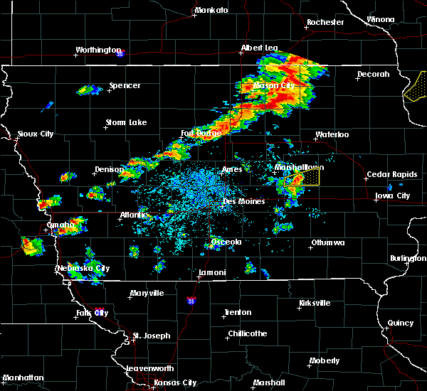 At 505 pm cdt, a severe thunderstorm was located near big wall lake, or 13 miles southeast of clarion, moving east at 40 mph (radar indicated). Hazards include 60 mph wind gusts. Expect damage to roofs. siding. And trees. At 505 pm cdt, a severe thunderstorm was located near big wall lake, or 13 miles southeast of clarion, moving east at 40 mph (radar indicated). Hazards include 60 mph wind gusts. Expect damage to roofs. siding. And trees.
|
| 7/17/2016 11:22 AM CDT |
 At 1121 am cdt, a severe thunderstorm was located near hampton, moving east at 60 mph (radar indicated). Hazards include 60 mph wind gusts and quarter size hail. Hail damage to vehicles is expected. expect wind damage to roofs, siding, and trees. Locations impacted include, hampton, aplington, dumont, latimer, coulter, geneva, bristow, bradford, hansell, chapin, popejoy, aredale, beeds lake state park and hampton municipal airport. At 1121 am cdt, a severe thunderstorm was located near hampton, moving east at 60 mph (radar indicated). Hazards include 60 mph wind gusts and quarter size hail. Hail damage to vehicles is expected. expect wind damage to roofs, siding, and trees. Locations impacted include, hampton, aplington, dumont, latimer, coulter, geneva, bristow, bradford, hansell, chapin, popejoy, aredale, beeds lake state park and hampton municipal airport.
|
| 7/17/2016 11:12 AM CDT |
 At 1112 am cdt, a severe thunderstorm was located near hampton, moving east at 60 mph (radar indicated). Hazards include 60 mph wind gusts and quarter size hail. Hail damage to vehicles is expected. expect wind damage to roofs, siding, and trees. Locations impacted include, hampton, aplington, dumont, dows, latimer, coulter, alexander, geneva, bristow, bradford, hansell, chapin, popejoy, aredale, beeds lake state park and hampton municipal airport. At 1112 am cdt, a severe thunderstorm was located near hampton, moving east at 60 mph (radar indicated). Hazards include 60 mph wind gusts and quarter size hail. Hail damage to vehicles is expected. expect wind damage to roofs, siding, and trees. Locations impacted include, hampton, aplington, dumont, dows, latimer, coulter, alexander, geneva, bristow, bradford, hansell, chapin, popejoy, aredale, beeds lake state park and hampton municipal airport.
|
| 7/17/2016 11:04 AM CDT |
 At 1103 am cdt, a severe thunderstorm was located 11 miles northeast of big wall lake, or 13 miles west of hampton, moving east at 60 mph (radar indicated). Hazards include 60 mph wind gusts and quarter size hail. Hail damage to vehicles is expected. Expect wind damage to roofs, siding, and trees. At 1103 am cdt, a severe thunderstorm was located 11 miles northeast of big wall lake, or 13 miles west of hampton, moving east at 60 mph (radar indicated). Hazards include 60 mph wind gusts and quarter size hail. Hail damage to vehicles is expected. Expect wind damage to roofs, siding, and trees.
|
| 7/17/2016 10:05 AM CDT |
 At 1004 am cdt, a severe thunderstorm was located over hampton, moving east at 35 mph (radar indicated). Hazards include 60 mph wind gusts and half dollar size hail. Hail damage to vehicles is expected. Expect wind damage to roofs, siding, and trees. At 1004 am cdt, a severe thunderstorm was located over hampton, moving east at 35 mph (radar indicated). Hazards include 60 mph wind gusts and half dollar size hail. Hail damage to vehicles is expected. Expect wind damage to roofs, siding, and trees.
|
| 7/17/2016 3:49 AM CDT |
 At 349 am cdt, severe thunderstorms were located along a line extending from 9 miles north of ackley to 6 miles northwest of eldora to near ogden, moving east at 55 mph (radar indicated). Hazards include 60 mph wind gusts. Expect damage to roofs. siding. and trees. Locations impacted include, ames, boone, nevada, iowa falls, hampton, eldora, story city, huxley, ogden, ackley, roland, jewell junction, gilbert, iowa state center, boone speedway, hubbard, dayton, grand junction, alden and stratford. At 349 am cdt, severe thunderstorms were located along a line extending from 9 miles north of ackley to 6 miles northwest of eldora to near ogden, moving east at 55 mph (radar indicated). Hazards include 60 mph wind gusts. Expect damage to roofs. siding. and trees. Locations impacted include, ames, boone, nevada, iowa falls, hampton, eldora, story city, huxley, ogden, ackley, roland, jewell junction, gilbert, iowa state center, boone speedway, hubbard, dayton, grand junction, alden and stratford.
|
| 7/17/2016 3:20 AM CDT |
 At 320 am cdt, severe thunderstorms were located along a line extending from 6 miles east of belmond to near big wall lake to 9 miles southwest of gowrie, moving east at 65 mph (radar indicated). Hazards include 60 mph wind gusts. Expect damage to roofs. siding. And trees. At 320 am cdt, severe thunderstorms were located along a line extending from 6 miles east of belmond to near big wall lake to 9 miles southwest of gowrie, moving east at 65 mph (radar indicated). Hazards include 60 mph wind gusts. Expect damage to roofs. siding. And trees.
|
| 6/22/2015 8:17 AM CDT |
 At 815 am cdt, severe thunderstorms were located along a line extending from near sumner to near waterloo to 8 miles southwest of eldora, moving east at 75 mph (radar indicated. at 809 am the waterloo airport reported 59 mph). Hazards include 60 mph wind gusts. Expect damage to roofs. siding and trees. locations impacted include, waterloo, cedar falls, waverly, iowa falls, eldora, grundy center, allison, evansdale, jesup, la porte city, hudson, sumner, parkersburg, denver, reinbeck, ackley, clarksville, tripoli, shell rock and dike. This includes interstate 380 between mile markers 57 and 73. At 815 am cdt, severe thunderstorms were located along a line extending from near sumner to near waterloo to 8 miles southwest of eldora, moving east at 75 mph (radar indicated. at 809 am the waterloo airport reported 59 mph). Hazards include 60 mph wind gusts. Expect damage to roofs. siding and trees. locations impacted include, waterloo, cedar falls, waverly, iowa falls, eldora, grundy center, allison, evansdale, jesup, la porte city, hudson, sumner, parkersburg, denver, reinbeck, ackley, clarksville, tripoli, shell rock and dike. This includes interstate 380 between mile markers 57 and 73.
|
| 6/22/2015 7:54 AM CDT |
 At 753 am cdt, severe thunderstorms were located along a line extending from 5 miles southwest of nashua to 3 miles south of aplington to 4 miles southwest of jewell junction, moving east at 75 mph (radar indicated). Hazards include 60 mph wind gusts and penny size hail. Expect damage to roofs. Siding and trees. At 753 am cdt, severe thunderstorms were located along a line extending from 5 miles southwest of nashua to 3 miles south of aplington to 4 miles southwest of jewell junction, moving east at 75 mph (radar indicated). Hazards include 60 mph wind gusts and penny size hail. Expect damage to roofs. Siding and trees.
|
| 6/22/2015 7:40 AM CDT |
 At 740 am cdt, severe thunderstorms were located along a line extending from 7 miles west of greene to 3 miles northeast of iowa falls to 7 miles west of jewell junction, moving east at 70 mph (radar indicated). Hazards include 60 mph wind gusts and penny size hail. Expect damage to roofs. siding and trees. locations impacted include, webster city, iowa falls, hampton, clarion, eldora, allison, eagle grove, belmond, parkersburg, ackley, clarksville, jewell junction, sheffield, greene, aplington, elm lake, big wall lake, hubbard, alden and wellsburg. This includes interstate 35 between mile markers 129 and 178. At 740 am cdt, severe thunderstorms were located along a line extending from 7 miles west of greene to 3 miles northeast of iowa falls to 7 miles west of jewell junction, moving east at 70 mph (radar indicated). Hazards include 60 mph wind gusts and penny size hail. Expect damage to roofs. siding and trees. locations impacted include, webster city, iowa falls, hampton, clarion, eldora, allison, eagle grove, belmond, parkersburg, ackley, clarksville, jewell junction, sheffield, greene, aplington, elm lake, big wall lake, hubbard, alden and wellsburg. This includes interstate 35 between mile markers 129 and 178.
|
| 6/22/2015 7:16 AM CDT |
 At 716 am cdt, severe thunderstorms were located along a line extending from 10 miles northeast of belmond to 4 miles west of big wall lake to 7 miles north of gowrie, moving east at 70 mph (radar indicated). Hazards include 60 mph wind gusts and penny size hail. Expect damage to roofs. Siding and trees. At 716 am cdt, severe thunderstorms were located along a line extending from 10 miles northeast of belmond to 4 miles west of big wall lake to 7 miles north of gowrie, moving east at 70 mph (radar indicated). Hazards include 60 mph wind gusts and penny size hail. Expect damage to roofs. Siding and trees.
|
Hail Maps for Bradford, IA


Connect with Interactive Hail Maps