

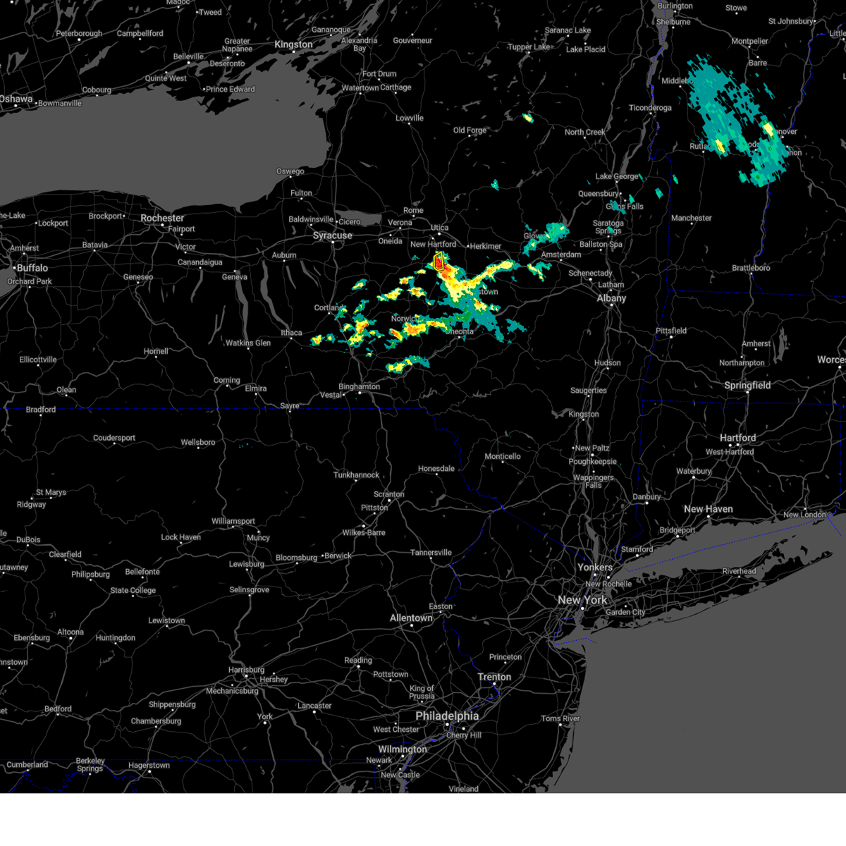
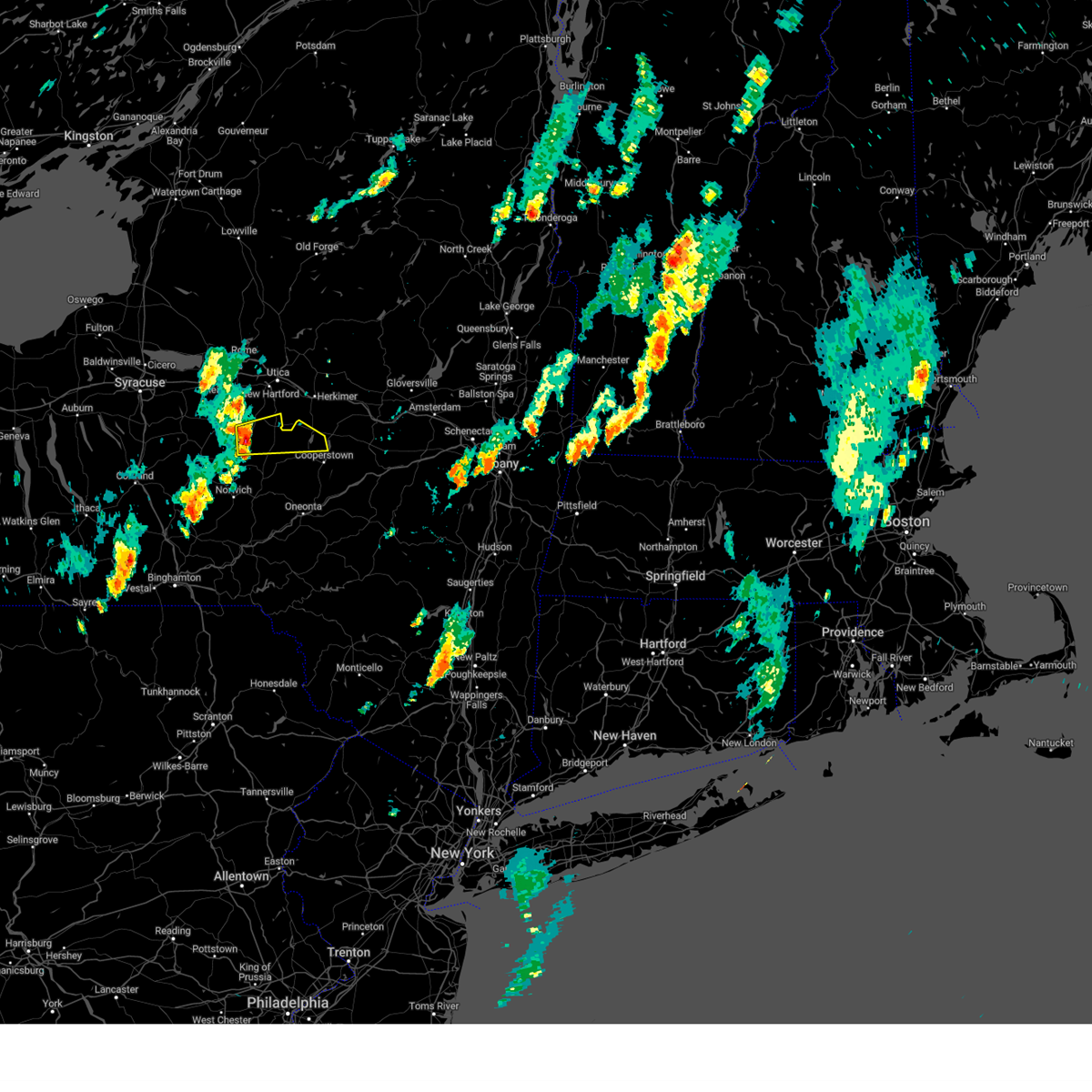
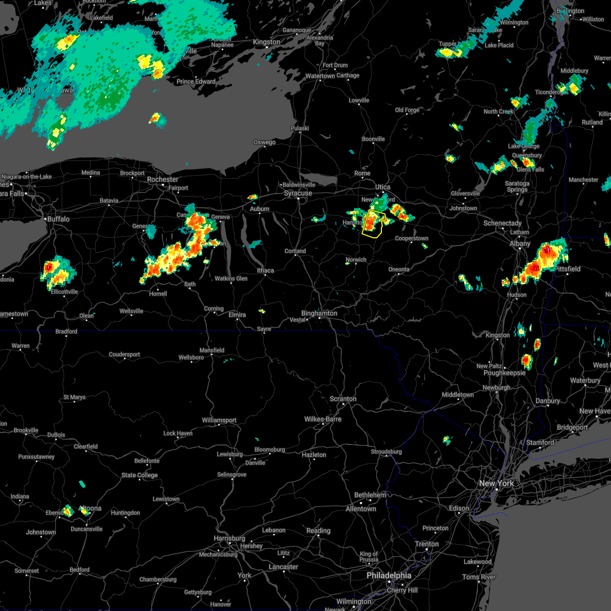
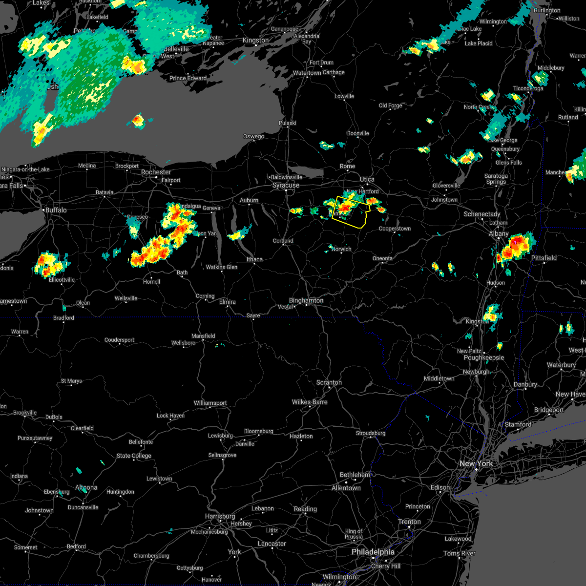
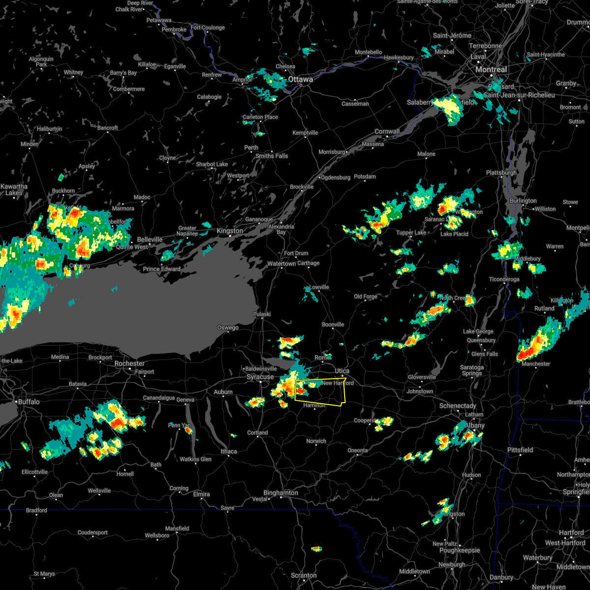
Hail Map for Bridgewater, NY
The Bridgewater, NY area has had 1 report of on-the-ground hail by trained spotters, and has been under severe weather warnings 7 times during the past 12 months. Doppler radar has detected hail at or near Bridgewater, NY on 18 occasions, including 1 occasion during the past year.
| Name: | Bridgewater, NY |
| Where Located: | 47.3 miles ESE of Syracuse, NY |
| Map: | Google Map for Bridgewater, NY |
| Population: | 470 |
| Housing Units: | 203 |
| More Info: | Search Google for Bridgewater, NY |
2
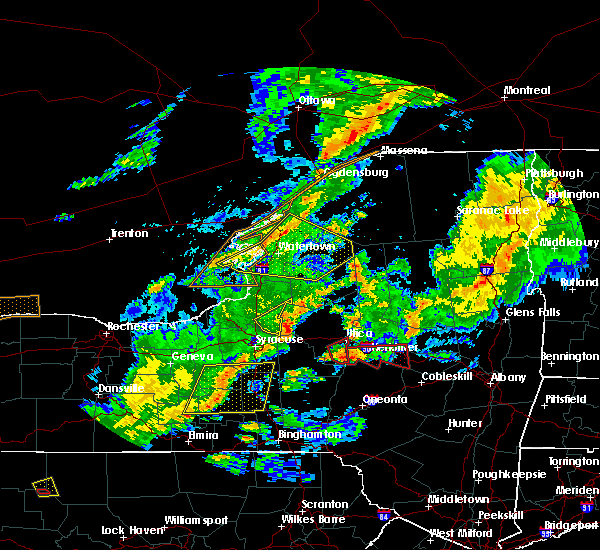
The Top Recent Hail Date for Bridgewater, NY is Friday, August 4, 2023 (3rd out of 18)

Hail and Wind Damage Spotted near Bridgewater, NY
| Date / Time | Report Details |
|---|---|
| 8/4/2023 10:10 AM EDT |
 At 1010 am edt, a severe thunderstorm was located near west winfield, or 9 miles southwest of ilion, moving east at 30 mph (radar indicated). Hazards include 60 mph wind gusts and quarter size hail. Hail damage to vehicles is expected. expect wind damage to roofs, siding, and trees. locations impacted include, west winfield, bridgewater and clayville. hail threat, radar indicated max hail size, 1. 00 in wind threat, radar indicated max wind gust, 60 mph. At 1010 am edt, a severe thunderstorm was located near west winfield, or 9 miles southwest of ilion, moving east at 30 mph (radar indicated). Hazards include 60 mph wind gusts and quarter size hail. Hail damage to vehicles is expected. expect wind damage to roofs, siding, and trees. locations impacted include, west winfield, bridgewater and clayville. hail threat, radar indicated max hail size, 1. 00 in wind threat, radar indicated max wind gust, 60 mph.
|
| 8/4/2023 9:59 AM EDT |
 At 959 am edt, a severe thunderstorm was located near bridgewater, or 11 miles south of new hartford, moving east at 30 mph (radar indicated). Hazards include 60 mph wind gusts and quarter size hail. Hail damage to vehicles is expected. Expect wind damage to roofs, siding, and trees. At 959 am edt, a severe thunderstorm was located near bridgewater, or 11 miles south of new hartford, moving east at 30 mph (radar indicated). Hazards include 60 mph wind gusts and quarter size hail. Hail damage to vehicles is expected. Expect wind damage to roofs, siding, and trees.
|
| 8/4/2023 9:48 AM EDT |
 At 948 am edt, a severe thunderstorm was located near waterville, or 8 miles northeast of hamilton, moving east at 30 mph (radar indicated). Hazards include 60 mph wind gusts and quarter size hail. Hail damage to vehicles is expected. expect wind damage to roofs, siding, and trees. locations impacted include, waterville, bridgewater, stockwell and north brookfield. hail threat, radar indicated max hail size, 1. 00 in wind threat, radar indicated max wind gust, 60 mph. At 948 am edt, a severe thunderstorm was located near waterville, or 8 miles northeast of hamilton, moving east at 30 mph (radar indicated). Hazards include 60 mph wind gusts and quarter size hail. Hail damage to vehicles is expected. expect wind damage to roofs, siding, and trees. locations impacted include, waterville, bridgewater, stockwell and north brookfield. hail threat, radar indicated max hail size, 1. 00 in wind threat, radar indicated max wind gust, 60 mph.
|
| 8/4/2023 9:37 AM EDT |
 At 937 am edt, a severe thunderstorm was located over pecksport, or near hamilton, moving east at 25 mph (radar indicated). Hazards include 60 mph wind gusts and quarter size hail. Hail damage to vehicles is expected. Expect wind damage to roofs, siding, and trees. At 937 am edt, a severe thunderstorm was located over pecksport, or near hamilton, moving east at 25 mph (radar indicated). Hazards include 60 mph wind gusts and quarter size hail. Hail damage to vehicles is expected. Expect wind damage to roofs, siding, and trees.
|
| 7/29/2023 11:41 AM EDT |
 At 1140 am edt, a severe thunderstorm was located over clayville, or near new hartford, moving east at 30 mph (radar indicated). Hazards include 60 mph wind gusts. Expect damage to roofs, siding, and trees. locations impacted include, utica, kirkland, westmoreland, paris, deerfield, whitesboro, new york mills, yorkville, clinton and new hartford. hail threat, radar indicated max hail size, <. 75 in wind threat, radar indicated max wind gust, 60 mph. At 1140 am edt, a severe thunderstorm was located over clayville, or near new hartford, moving east at 30 mph (radar indicated). Hazards include 60 mph wind gusts. Expect damage to roofs, siding, and trees. locations impacted include, utica, kirkland, westmoreland, paris, deerfield, whitesboro, new york mills, yorkville, clinton and new hartford. hail threat, radar indicated max hail size, <. 75 in wind threat, radar indicated max wind gust, 60 mph.
|
| 7/29/2023 11:16 AM EDT |
 At 1115 am edt, a severe thunderstorm was located near clinton, or 9 miles southwest of new hartford, moving east at 35 mph (radar indicated). Hazards include 60 mph wind gusts. expect damage to roofs, siding, and trees At 1115 am edt, a severe thunderstorm was located near clinton, or 9 miles southwest of new hartford, moving east at 35 mph (radar indicated). Hazards include 60 mph wind gusts. expect damage to roofs, siding, and trees
|
| 7/18/2023 5:49 PM EDT |
 At 549 pm edt, a severe thunderstorm was located near brookfield, or 8 miles east of hamilton, moving east at 30 mph (radar indicated). Hazards include 60 mph wind gusts. expect damage to roofs, siding, and trees At 549 pm edt, a severe thunderstorm was located near brookfield, or 8 miles east of hamilton, moving east at 30 mph (radar indicated). Hazards include 60 mph wind gusts. expect damage to roofs, siding, and trees
|
| 7/24/2022 4:58 PM EDT |
 At 458 pm edt, severe thunderstorms were located along a line extending from near truxton to mc donough to coventry, moving northeast at 50 mph (law enforcement). Hazards include 60 mph wind gusts and penny size hail. expect damage to roofs, siding, and trees At 458 pm edt, severe thunderstorms were located along a line extending from near truxton to mc donough to coventry, moving northeast at 50 mph (law enforcement). Hazards include 60 mph wind gusts and penny size hail. expect damage to roofs, siding, and trees
|
| 7/22/2022 7:51 PM EDT |
 At 751 pm edt, severe thunderstorms were located along a line extending from near solsville to near brookfield, moving northeast at 35 mph (radar indicated). Hazards include 60 mph wind gusts and penny size hail. expect damage to roofs, siding, and trees At 751 pm edt, severe thunderstorms were located along a line extending from near solsville to near brookfield, moving northeast at 35 mph (radar indicated). Hazards include 60 mph wind gusts and penny size hail. expect damage to roofs, siding, and trees
|
| 7/22/2022 7:21 PM EDT |
 At 720 pm edt, a severe thunderstorm was located over erieville, or 8 miles west of hamilton, moving northeast at 30 mph (radar indicated). Hazards include 60 mph wind gusts and penny size hail. expect damage to roofs, siding, and trees At 720 pm edt, a severe thunderstorm was located over erieville, or 8 miles west of hamilton, moving northeast at 30 mph (radar indicated). Hazards include 60 mph wind gusts and penny size hail. expect damage to roofs, siding, and trees
|
| 5/16/2022 2:41 PM EDT |
 At 240 pm edt, severe thunderstorms were located along a line extending from near boonville to near brookfield to near pittsfield, moving northeast at 50 mph (radar indicated). Hazards include 60 mph wind gusts and penny size hail. Expect damage to roofs, siding, and trees. locations impacted include, utica, rome, kirkland, westmoreland, trenton, paris, deerfield, floyd, whitesboro and new york mills. hail threat, radar indicated max hail size, 0. 75 in wind threat, radar indicated max wind gust, 60 mph. At 240 pm edt, severe thunderstorms were located along a line extending from near boonville to near brookfield to near pittsfield, moving northeast at 50 mph (radar indicated). Hazards include 60 mph wind gusts and penny size hail. Expect damage to roofs, siding, and trees. locations impacted include, utica, rome, kirkland, westmoreland, trenton, paris, deerfield, floyd, whitesboro and new york mills. hail threat, radar indicated max hail size, 0. 75 in wind threat, radar indicated max wind gust, 60 mph.
|
| 5/16/2022 2:16 PM EDT |
 At 215 pm edt, severe thunderstorms were located along a line extending from 8 miles northeast of taberg to near poolville to near norwich to near morris, moving northeast at 55 mph (radar indicated). Hazards include 60 mph wind gusts and penny size hail. expect damage to roofs, siding, and trees At 215 pm edt, severe thunderstorms were located along a line extending from 8 miles northeast of taberg to near poolville to near norwich to near morris, moving northeast at 55 mph (radar indicated). Hazards include 60 mph wind gusts and penny size hail. expect damage to roofs, siding, and trees
|
| 7/27/2021 3:19 PM EDT |
 At 319 pm edt, severe thunderstorms were located along a line extending from bridgewater to columbus to near plymouth, moving east at 45 mph (radar indicated). Hazards include 60 mph wind gusts. Expect damage to roofs, siding, and trees. Locations impacted include, norwich, hartwick, cooperstown, edmeston, pittsfield, richfield springs, burlington, new lisbon, new berlin and columbus. At 319 pm edt, severe thunderstorms were located along a line extending from bridgewater to columbus to near plymouth, moving east at 45 mph (radar indicated). Hazards include 60 mph wind gusts. Expect damage to roofs, siding, and trees. Locations impacted include, norwich, hartwick, cooperstown, edmeston, pittsfield, richfield springs, burlington, new lisbon, new berlin and columbus.
|
| 7/27/2021 2:59 PM EDT |
 At 259 pm edt, severe thunderstorms were located along a line extending from near solsville to south lebanon to taylor, moving east at 50 mph (radar indicated). Hazards include 60 mph wind gusts. Expect damage to roofs, siding, and trees. Locations impacted include, sullivan, oneida, lenox, norwich, eaton, chittenango, canastota, paris, hamilton and sherrill. At 259 pm edt, severe thunderstorms were located along a line extending from near solsville to south lebanon to taylor, moving east at 50 mph (radar indicated). Hazards include 60 mph wind gusts. Expect damage to roofs, siding, and trees. Locations impacted include, sullivan, oneida, lenox, norwich, eaton, chittenango, canastota, paris, hamilton and sherrill.
|
| 7/27/2021 2:29 PM EDT |
 At 228 pm edt, severe thunderstorms were located along a line extending from kirkville to la fayette to kelloggsville, moving east at 45 mph. Hazards include 60 mph wind gusts. expect damage to roofs, siding, and trees At 228 pm edt, severe thunderstorms were located along a line extending from kirkville to la fayette to kelloggsville, moving east at 45 mph. Hazards include 60 mph wind gusts. expect damage to roofs, siding, and trees
|
| 7/13/2021 11:57 PM EDT |
 The severe thunderstorm warning for southeastern oneida, northwestern otsego and southeastern madison counties will expire at midnight edt, the storms which prompted the warning have moved out of the area. therefore, the warning will be allowed to expire. The severe thunderstorm warning for southeastern oneida, northwestern otsego and southeastern madison counties will expire at midnight edt, the storms which prompted the warning have moved out of the area. therefore, the warning will be allowed to expire.
|
| 7/13/2021 11:28 PM EDT |
 At 1125 pm edt, severe thunderstorms were located along a line extending from near clinton to near edmeston, moving northeast at 45 mph (radar indicated). Hazards include 70 mph wind gusts. Expect considerable tree damage. damage is likely to mobile homes, roofs, and outbuildings. Locations impacted include, utica, kirkland, paris, deerfield, whitesboro, new york mills, yorkville, brookfield, clinton and new hartford. At 1125 pm edt, severe thunderstorms were located along a line extending from near clinton to near edmeston, moving northeast at 45 mph (radar indicated). Hazards include 70 mph wind gusts. Expect considerable tree damage. damage is likely to mobile homes, roofs, and outbuildings. Locations impacted include, utica, kirkland, paris, deerfield, whitesboro, new york mills, yorkville, brookfield, clinton and new hartford.
|
| 7/13/2021 10:57 PM EDT |
 At 1056 pm edt, severe thunderstorms were located along a line extending from near georgetown to 6 miles south of sidney, moving east at 35 mph (radar indicated). Hazards include 70 mph wind gusts. Expect considerable tree damage. Damage is likely to mobile homes, roofs, and outbuildings. At 1056 pm edt, severe thunderstorms were located along a line extending from near georgetown to 6 miles south of sidney, moving east at 35 mph (radar indicated). Hazards include 70 mph wind gusts. Expect considerable tree damage. Damage is likely to mobile homes, roofs, and outbuildings.
|
| 7/13/2021 10:35 PM EDT |
 At 1034 pm edt, severe thunderstorms were located along a line extending from 8 miles north of taberg to near rome to peterboro, moving northeast at 40 mph (radar indicated). Hazards include 60 mph wind gusts. Expect damage to roofs, siding, and trees. Locations impacted include, utica, rome, sullivan, oneida, kirkland, lenox, lee, verona, westmoreland and vienna. At 1034 pm edt, severe thunderstorms were located along a line extending from 8 miles north of taberg to near rome to peterboro, moving northeast at 40 mph (radar indicated). Hazards include 60 mph wind gusts. Expect damage to roofs, siding, and trees. Locations impacted include, utica, rome, sullivan, oneida, kirkland, lenox, lee, verona, westmoreland and vienna.
|
| 7/13/2021 9:57 PM EDT |
 At 956 pm edt, severe thunderstorms were located along a line extending from near cicero to near watervale to near truxton, moving east at 40 mph (radar indicated). Hazards include 60 mph wind gusts. expect damage to roofs, siding, and trees At 956 pm edt, severe thunderstorms were located along a line extending from near cicero to near watervale to near truxton, moving east at 40 mph (radar indicated). Hazards include 60 mph wind gusts. expect damage to roofs, siding, and trees
|
| 7/6/2021 3:12 PM EDT |
 At 312 pm edt, severe thunderstorms were located along a line extending from near cedarville to near exeter center to near morris, moving east at 40 mph (radar indicated). Hazards include 60 mph wind gusts. Expect damage to roofs, siding, and trees. Locations impacted include, oneonta, middlefield, hartwick, maryland, cooperstown, edmeston, westville, pittsfield, springfield and richfield springs. At 312 pm edt, severe thunderstorms were located along a line extending from near cedarville to near exeter center to near morris, moving east at 40 mph (radar indicated). Hazards include 60 mph wind gusts. Expect damage to roofs, siding, and trees. Locations impacted include, oneonta, middlefield, hartwick, maryland, cooperstown, edmeston, westville, pittsfield, springfield and richfield springs.
|
| 7/6/2021 2:44 PM EDT |
 At 244 pm edt, severe thunderstorms were located along a line extending from augusta to near poolville to near norwich, moving east at 40 mph (radar indicated). Hazards include 60 mph wind gusts and penny size hail. expect damage to roofs, siding, and trees At 244 pm edt, severe thunderstorms were located along a line extending from augusta to near poolville to near norwich, moving east at 40 mph (radar indicated). Hazards include 60 mph wind gusts and penny size hail. expect damage to roofs, siding, and trees
|
| 6/29/2021 5:06 PM EDT |
 The severe thunderstorm warning for south central oneida and southeastern madison counties will expire at 515 pm edt, the storm which prompted the warning has weakened below severe limits, and has exited the warned area. therefore, the warning will be allowed to expire. however small hail and gusty winds are still possible with this thunderstorm. to report severe weather, contact your nearest law enforcement agency. they will relay your report to the national weather service binghamton. The severe thunderstorm warning for south central oneida and southeastern madison counties will expire at 515 pm edt, the storm which prompted the warning has weakened below severe limits, and has exited the warned area. therefore, the warning will be allowed to expire. however small hail and gusty winds are still possible with this thunderstorm. to report severe weather, contact your nearest law enforcement agency. they will relay your report to the national weather service binghamton.
|
| 6/29/2021 4:59 PM EDT |
 At 459 pm edt, a severe thunderstorm was located near brookfield, or 10 miles east of hamilton, moving east at 25 mph (radar indicated). Hazards include 60 mph wind gusts and penny size hail. Expect damage to roofs, siding, and trees. Locations impacted include, brookfield, waterville, bridgewater, south brookfield, stockwell and north brookfield. At 459 pm edt, a severe thunderstorm was located near brookfield, or 10 miles east of hamilton, moving east at 25 mph (radar indicated). Hazards include 60 mph wind gusts and penny size hail. Expect damage to roofs, siding, and trees. Locations impacted include, brookfield, waterville, bridgewater, south brookfield, stockwell and north brookfield.
|
| 6/29/2021 4:40 PM EDT |
 At 440 pm edt, a severe thunderstorm was located over solsville, or near hamilton, moving east at 25 mph (radar indicated). Hazards include 60 mph wind gusts and penny size hail. expect damage to roofs, siding, and trees At 440 pm edt, a severe thunderstorm was located over solsville, or near hamilton, moving east at 25 mph (radar indicated). Hazards include 60 mph wind gusts and penny size hail. expect damage to roofs, siding, and trees
|
| 6/29/2021 4:22 PM EDT |
 The severe thunderstorm warning for southeastern oneida and central madison counties will expire at 430 pm edt, the storm which prompted the warning has weakened below severe limits, and no longer poses an immediate threat to life or property. therefore, the warning will be allowed to expire. however small hail and gusty winds are still possible with this thunderstorm. to report severe weather, contact your nearest law enforcement agency. they will relay your report to the national weather service binghamton. The severe thunderstorm warning for southeastern oneida and central madison counties will expire at 430 pm edt, the storm which prompted the warning has weakened below severe limits, and no longer poses an immediate threat to life or property. therefore, the warning will be allowed to expire. however small hail and gusty winds are still possible with this thunderstorm. to report severe weather, contact your nearest law enforcement agency. they will relay your report to the national weather service binghamton.
|
| 6/29/2021 4:16 PM EDT |
 At 416 pm edt, a severe thunderstorm was located over augusta, or 10 miles southeast of oneida, moving east at 35 mph (radar indicated). Hazards include 60 mph wind gusts and penny size hail. Expect damage to roofs, siding, and trees. Locations impacted include, paris, morrisville, stockbridge, augusta, nelson, clinton, new hartford, waterville, west winfield and oriskany falls. At 416 pm edt, a severe thunderstorm was located over augusta, or 10 miles southeast of oneida, moving east at 35 mph (radar indicated). Hazards include 60 mph wind gusts and penny size hail. Expect damage to roofs, siding, and trees. Locations impacted include, paris, morrisville, stockbridge, augusta, nelson, clinton, new hartford, waterville, west winfield and oriskany falls.
|
| 6/29/2021 4:04 PM EDT |
 At 404 pm edt, a severe thunderstorm was located over peterboro, or near oneida, moving east at 35 mph (radar indicated). Hazards include 60 mph wind gusts and penny size hail. expect damage to roofs, siding, and trees At 404 pm edt, a severe thunderstorm was located over peterboro, or near oneida, moving east at 35 mph (radar indicated). Hazards include 60 mph wind gusts and penny size hail. expect damage to roofs, siding, and trees
|
| 6/21/2021 6:46 PM EDT |
 At 646 pm edt, severe thunderstorms were located along a line extending from nicks lake campground to near peterboro, moving northeast at 50 mph (radar indicated). Hazards include 60 mph wind gusts and quarter size hail. Hail damage to vehicles is expected. expect wind damage to roofs, siding, and trees. Locations impacted include, utica, rome, oneida, kirkland, westmoreland, eaton, trenton, paris, deerfield and hamilton. At 646 pm edt, severe thunderstorms were located along a line extending from nicks lake campground to near peterboro, moving northeast at 50 mph (radar indicated). Hazards include 60 mph wind gusts and quarter size hail. Hail damage to vehicles is expected. expect wind damage to roofs, siding, and trees. Locations impacted include, utica, rome, oneida, kirkland, westmoreland, eaton, trenton, paris, deerfield and hamilton.
|
| 6/21/2021 6:05 PM EDT |
 At 605 pm edt, severe thunderstorms were located along a line extending from 8 miles south of highmarket to preble, moving northeast at 45 mph (radar indicated). Hazards include 60 mph wind gusts and quarter size hail. Hail damage to vehicles is expected. Expect wind damage to roofs, siding, and trees. At 605 pm edt, severe thunderstorms were located along a line extending from 8 miles south of highmarket to preble, moving northeast at 45 mph (radar indicated). Hazards include 60 mph wind gusts and quarter size hail. Hail damage to vehicles is expected. Expect wind damage to roofs, siding, and trees.
|
| 6/21/2021 3:51 PM EDT |
 At 351 pm edt, a severe thunderstorm was located near clayville, or 10 miles south of new hartford, moving east at 25 mph (radar indicated). Hazards include 60 mph wind gusts and quarter size hail. Hail damage to vehicles is expected. expect wind damage to roofs, siding, and trees. Locations impacted include, paris, waterville, bridgewater, clayville, hubbard corners and sauquoit. At 351 pm edt, a severe thunderstorm was located near clayville, or 10 miles south of new hartford, moving east at 25 mph (radar indicated). Hazards include 60 mph wind gusts and quarter size hail. Hail damage to vehicles is expected. expect wind damage to roofs, siding, and trees. Locations impacted include, paris, waterville, bridgewater, clayville, hubbard corners and sauquoit.
|
| 6/21/2021 3:33 PM EDT |
 At 333 pm edt, a severe thunderstorm was located over waterville, or 9 miles northeast of hamilton, moving east at 25 mph (radar indicated). Hazards include 60 mph wind gusts and quarter size hail. Hail damage to vehicles is expected. Expect wind damage to roofs, siding, and trees. At 333 pm edt, a severe thunderstorm was located over waterville, or 9 miles northeast of hamilton, moving east at 25 mph (radar indicated). Hazards include 60 mph wind gusts and quarter size hail. Hail damage to vehicles is expected. Expect wind damage to roofs, siding, and trees.
|
| 6/14/2021 1:41 AM EDT |
 At 141 am edt, severe thunderstorms were located along a line extending from near boonville to near waterville, moving east at 40 mph (radar indicated). Hazards include 60 mph wind gusts. expect damage to roofs, siding, and trees At 141 am edt, severe thunderstorms were located along a line extending from near boonville to near waterville, moving east at 40 mph (radar indicated). Hazards include 60 mph wind gusts. expect damage to roofs, siding, and trees
|
| 5/26/2021 3:06 PM EDT |
 The severe thunderstorm warning for southeastern oneida, northwestern otsego, southeastern madison and northeastern chenango counties will expire at 315 pm edt, the storms which prompted the warning have weakened below severe limits, and no longer pose an immediate threat to life or property. therefore, the warning will be allowed to expire. however gusty winds are still possible with these thunderstorms. a severe thunderstorm watch remains in effect until 800 pm edt for central new york. The severe thunderstorm warning for southeastern oneida, northwestern otsego, southeastern madison and northeastern chenango counties will expire at 315 pm edt, the storms which prompted the warning have weakened below severe limits, and no longer pose an immediate threat to life or property. therefore, the warning will be allowed to expire. however gusty winds are still possible with these thunderstorms. a severe thunderstorm watch remains in effect until 800 pm edt for central new york.
|
| 5/26/2021 2:43 PM EDT |
 At 242 pm edt, severe thunderstorms were located along a line extending from 7 miles northeast of middleville to near plymouth, moving east at 30 mph (several reports of downed trees and wires with this line of thunderstorms). Hazards include 60 mph wind gusts and penny size hail. Expect damage to roofs, siding, and trees. Locations impacted include, brookfield, edmeston, waterville, sherburne, pittsfield, springfield, richfield springs, burlington, new berlin and columbus. At 242 pm edt, severe thunderstorms were located along a line extending from 7 miles northeast of middleville to near plymouth, moving east at 30 mph (several reports of downed trees and wires with this line of thunderstorms). Hazards include 60 mph wind gusts and penny size hail. Expect damage to roofs, siding, and trees. Locations impacted include, brookfield, edmeston, waterville, sherburne, pittsfield, springfield, richfield springs, burlington, new berlin and columbus.
|
| 5/26/2021 2:25 PM EDT | Trees down across beaver creek roa in madison county NY, 5.5 miles NE of Bridgewater, NY |
| 5/26/2021 2:13 PM EDT |
 At 212 pm edt, severe thunderstorms were located along a line extending from near trenton falls to near taylor, moving east at 40 mph (law enforcement). Hazards include 60 mph wind gusts and penny size hail. expect damage to roofs, siding, and trees At 212 pm edt, severe thunderstorms were located along a line extending from near trenton falls to near taylor, moving east at 40 mph (law enforcement). Hazards include 60 mph wind gusts and penny size hail. expect damage to roofs, siding, and trees
|
| 5/26/2021 2:08 PM EDT |
 At 207 pm edt, severe thunderstorms were located along a line extending from 8 miles east of forestport to near taylor, moving east at 40 mph (reports of trees and wires downed in onondaga and madison counties). Hazards include 60 mph wind gusts and penny size hail. Expect damage to roofs, siding, and trees. Locations impacted include, utica, rome, oneida, kirkland, westmoreland, eaton, trenton, paris, deerfield and hamilton. At 207 pm edt, severe thunderstorms were located along a line extending from 8 miles east of forestport to near taylor, moving east at 40 mph (reports of trees and wires downed in onondaga and madison counties). Hazards include 60 mph wind gusts and penny size hail. Expect damage to roofs, siding, and trees. Locations impacted include, utica, rome, oneida, kirkland, westmoreland, eaton, trenton, paris, deerfield and hamilton.
|
| 5/26/2021 1:57 PM EDT |
 A severe thunderstorm warning remains in effect until 215 pm edt for oneida. madison. northeastern cortland. southeastern onondaga and northwestern chenango counties. At 155 pm edt, severe thunderstorms were located along a line extending from near forestport to near east homer, moving east at 40 mph. A severe thunderstorm warning remains in effect until 215 pm edt for oneida. madison. northeastern cortland. southeastern onondaga and northwestern chenango counties. At 155 pm edt, severe thunderstorms were located along a line extending from near forestport to near east homer, moving east at 40 mph.
|
| 5/26/2021 1:36 PM EDT |
 At 135 pm edt, severe thunderstorms were located along a line extending from 6 miles west of boonville to near sempronius, moving east at 40 mph (law enforcement has reported numerous trees and wires down in onondaga county). Hazards include 60 mph wind gusts and penny size hail. Expect damage to roofs, siding, and trees. Locations impacted include, syracuse, utica, rome, de witt, sullivan, oneida, kirkland, lenox, pompey and lee. At 135 pm edt, severe thunderstorms were located along a line extending from 6 miles west of boonville to near sempronius, moving east at 40 mph (law enforcement has reported numerous trees and wires down in onondaga county). Hazards include 60 mph wind gusts and penny size hail. Expect damage to roofs, siding, and trees. Locations impacted include, syracuse, utica, rome, de witt, sullivan, oneida, kirkland, lenox, pompey and lee.
|
| 5/26/2021 1:19 PM EDT |
 At 118 pm edt, severe thunderstorms were located along a line extending from 8 miles east of redfield to genoa, moving east at 40 mph (trees and wires downed in marcellus). Hazards include 60 mph wind gusts and penny size hail. expect damage to roofs, siding, and trees At 118 pm edt, severe thunderstorms were located along a line extending from 8 miles east of redfield to genoa, moving east at 40 mph (trees and wires downed in marcellus). Hazards include 60 mph wind gusts and penny size hail. expect damage to roofs, siding, and trees
|
| 10/7/2020 3:07 PM EDT |
 At 306 pm edt, severe thunderstorms were located along a line extending from near st. johnsville to sherburne, moving southeast at 55 mph (law enforcement reported multiple trees and powerlines down). Hazards include 60 mph wind gusts and penny size hail. Expect damage to roofs, siding, and trees. Locations impacted include, norwich, hamilton, brookfield, middlefield, hartwick, cooperstown, edmeston, westville, plymouth and north norwich. At 306 pm edt, severe thunderstorms were located along a line extending from near st. johnsville to sherburne, moving southeast at 55 mph (law enforcement reported multiple trees and powerlines down). Hazards include 60 mph wind gusts and penny size hail. Expect damage to roofs, siding, and trees. Locations impacted include, norwich, hamilton, brookfield, middlefield, hartwick, cooperstown, edmeston, westville, plymouth and north norwich.
|
| 10/7/2020 2:44 PM EDT |
 At 243 pm edt, severe thunderstorms were located along a line extending from near frankfort to near erieville, moving southeast at 55 mph (radar indicated). Hazards include 60 mph wind gusts and penny size hail. expect damage to roofs, siding, and trees At 243 pm edt, severe thunderstorms were located along a line extending from near frankfort to near erieville, moving southeast at 55 mph (radar indicated). Hazards include 60 mph wind gusts and penny size hail. expect damage to roofs, siding, and trees
|
| 10/7/2020 2:01 PM EDT |
 At 200 pm edt, a severe thunderstorm was located near bridgeport, or 11 miles northwest of oneida, moving southeast at 60 mph (radar indicated). Hazards include 60 mph wind gusts and quarter size hail. Hail damage to vehicles is expected. Expect wind damage to roofs, siding, and trees. At 200 pm edt, a severe thunderstorm was located near bridgeport, or 11 miles northwest of oneida, moving southeast at 60 mph (radar indicated). Hazards include 60 mph wind gusts and quarter size hail. Hail damage to vehicles is expected. Expect wind damage to roofs, siding, and trees.
|
| 7/1/2020 5:38 PM EDT |
 The severe thunderstorm warning for southeastern oneida county will expire at 545 pm edt, the storm which prompted the warning has weakened below severe limits, and no longer poses an immediate threat to life or property. therefore, the warning will be allowed to expire. however small hail, gusty winds and heavy rain are still possible with this thunderstorm. The severe thunderstorm warning for southeastern oneida county will expire at 545 pm edt, the storm which prompted the warning has weakened below severe limits, and no longer poses an immediate threat to life or property. therefore, the warning will be allowed to expire. however small hail, gusty winds and heavy rain are still possible with this thunderstorm.
|
| 7/1/2020 5:23 PM EDT |
 At 522 pm edt, a severe thunderstorm was located over new hartford, moving southwest at 15 mph (radar indicated). Hazards include 60 mph wind gusts and quarter size hail. Hail damage to vehicles is expected. expect wind damage to roofs, siding, and trees. Locations impacted include, kirkland, paris, whitesboro, new york mills, yorkville, augusta, clinton, new hartford, waterville and oriskany falls. At 522 pm edt, a severe thunderstorm was located over new hartford, moving southwest at 15 mph (radar indicated). Hazards include 60 mph wind gusts and quarter size hail. Hail damage to vehicles is expected. expect wind damage to roofs, siding, and trees. Locations impacted include, kirkland, paris, whitesboro, new york mills, yorkville, augusta, clinton, new hartford, waterville and oriskany falls.
|
| 7/1/2020 5:08 PM EDT |
 At 508 pm edt, a severe thunderstorm was located over utica, moving southwest at 15 mph (radar indicated). Hazards include 60 mph wind gusts and quarter size hail. Hail damage to vehicles is expected. Expect wind damage to roofs, siding, and trees. At 508 pm edt, a severe thunderstorm was located over utica, moving southwest at 15 mph (radar indicated). Hazards include 60 mph wind gusts and quarter size hail. Hail damage to vehicles is expected. Expect wind damage to roofs, siding, and trees.
|
| 5/15/2020 4:07 PM EDT |
 At 406 pm edt, severe thunderstorms were located along a line extending from near boonville to kirkville, moving southeast at 55 mph (radar indicated). Hazards include 60 mph wind gusts and quarter size hail. Hail damage to vehicles is expected. Expect wind damage to roofs, siding, and trees. At 406 pm edt, severe thunderstorms were located along a line extending from near boonville to kirkville, moving southeast at 55 mph (radar indicated). Hazards include 60 mph wind gusts and quarter size hail. Hail damage to vehicles is expected. Expect wind damage to roofs, siding, and trees.
|
| 10/31/2019 9:29 PM EDT |
 At 928 pm edt, gusty showers were located along a line extending from clayville to near east sidney, moving east at 50 mph. these showers have downed trees and wires throughout the evening so far (radar indicated). Hazards include 60 mph wind gusts. expect damage to roofs, siding, and trees At 928 pm edt, gusty showers were located along a line extending from clayville to near east sidney, moving east at 50 mph. these showers have downed trees and wires throughout the evening so far (radar indicated). Hazards include 60 mph wind gusts. expect damage to roofs, siding, and trees
|
| 10/31/2019 8:21 PM EDT |
 At 821 pm edt, gusty showers were located along a line extending from near fonda to near delhi, moving east at 60 mph (radar indicated). Hazards include 60 mph wind gusts. Expect damage to roofs, siding, and trees. Locations impacted include, paris, hamilton, brookfield, hartwick, clinton, cooperstown, edmeston, waterville, richfield springs and burlington. At 821 pm edt, gusty showers were located along a line extending from near fonda to near delhi, moving east at 60 mph (radar indicated). Hazards include 60 mph wind gusts. Expect damage to roofs, siding, and trees. Locations impacted include, paris, hamilton, brookfield, hartwick, clinton, cooperstown, edmeston, waterville, richfield springs and burlington.
|
| 10/31/2019 8:03 PM EDT |
 At 802 pm edt, gusty showers were located along a line extending from 7 miles southwest of st. johnsville to near sidney, moving northeast at 60 mph (radar indicated). Hazards include 60 mph wind gusts. Expect damage to roofs, siding, and trees. Locations impacted include, norwich, paris, hamilton, guilford, brookfield, hartwick, clinton, cooperstown, edmeston and plymouth. At 802 pm edt, gusty showers were located along a line extending from 7 miles southwest of st. johnsville to near sidney, moving northeast at 60 mph (radar indicated). Hazards include 60 mph wind gusts. Expect damage to roofs, siding, and trees. Locations impacted include, norwich, paris, hamilton, guilford, brookfield, hartwick, clinton, cooperstown, edmeston and plymouth.
|
| 10/31/2019 7:52 PM EDT |
 At 751 pm edt, gusty showers were located along a line extending from near golden beach campground to near cedarville, moving northeast at 75 mph (radar indicated). Hazards include 60 mph wind gusts. Expect damage to roofs, siding, and trees. Locations impacted include, hamilton, brookfield, plymouth, waterville, sherburne, lebanon, solon, cincinnatus, otselic and willet. At 751 pm edt, gusty showers were located along a line extending from near golden beach campground to near cedarville, moving northeast at 75 mph (radar indicated). Hazards include 60 mph wind gusts. Expect damage to roofs, siding, and trees. Locations impacted include, hamilton, brookfield, plymouth, waterville, sherburne, lebanon, solon, cincinnatus, otselic and willet.
|
| 10/31/2019 7:33 PM EDT |
 At 732 pm edt, a line of gusty showers was located along a line extending from waterville to near whitney point, moving east at 60 mph. these showers have resulted in downed trees and wires earlier this evening. seek shelter if trick or treating (radar indicated). Hazards include 60 mph wind gusts. expect damage to roofs, siding, and trees At 732 pm edt, a line of gusty showers was located along a line extending from waterville to near whitney point, moving east at 60 mph. these showers have resulted in downed trees and wires earlier this evening. seek shelter if trick or treating (radar indicated). Hazards include 60 mph wind gusts. expect damage to roofs, siding, and trees
|
| 10/31/2019 6:54 PM EDT |
 At 653 pm edt, gusty showers were located along a line extending from sylvan beach to slaterville springs, moving northeast at 75 mph. these showers have downed trees earlier this evening (radar indicated). Hazards include 60 mph wind gusts. expect damage to roofs, siding, and trees At 653 pm edt, gusty showers were located along a line extending from sylvan beach to slaterville springs, moving northeast at 75 mph. these showers have downed trees earlier this evening (radar indicated). Hazards include 60 mph wind gusts. expect damage to roofs, siding, and trees
|
| 8/8/2019 3:39 PM EDT |
 At 338 pm edt, severe thunderstorms were located along a line extending from near west winfield to near hartwick to near afton, moving east at 55 mph (radar indicated). Hazards include 60 mph wind gusts and nickel size hail. Expect damage to roofs, siding, and trees. Locations impacted include, norwich, sidney, guilford, brookfield, sanford, augusta, edmeston, deposit, coventry and waterville. At 338 pm edt, severe thunderstorms were located along a line extending from near west winfield to near hartwick to near afton, moving east at 55 mph (radar indicated). Hazards include 60 mph wind gusts and nickel size hail. Expect damage to roofs, siding, and trees. Locations impacted include, norwich, sidney, guilford, brookfield, sanford, augusta, edmeston, deposit, coventry and waterville.
|
| 8/8/2019 3:13 PM EDT |
 At 312 pm edt, severe thunderstorms were located along a line extending from morrisville to plymouth to greater binghamton airport, moving east at 55 mph (radar indicated). Hazards include 60 mph wind gusts and nickel size hail. expect damage to roofs, siding, and trees At 312 pm edt, severe thunderstorms were located along a line extending from morrisville to plymouth to greater binghamton airport, moving east at 55 mph (radar indicated). Hazards include 60 mph wind gusts and nickel size hail. expect damage to roofs, siding, and trees
|
| 7/20/2019 8:06 PM EDT |
 At 806 pm edt, a severe thunderstorm was located over leonardsville, or 15 miles northwest of cooperstown, moving southeast at 25 mph (radar indicated). Hazards include 60 mph wind gusts and penny size hail. Expect damage to roofs, siding, and trees. Locations impacted include, middlefield, hartwick, cooperstown, westville, waterville, springfield, richfield springs, burlington, oriskany falls and cherry valley. At 806 pm edt, a severe thunderstorm was located over leonardsville, or 15 miles northwest of cooperstown, moving southeast at 25 mph (radar indicated). Hazards include 60 mph wind gusts and penny size hail. Expect damage to roofs, siding, and trees. Locations impacted include, middlefield, hartwick, cooperstown, westville, waterville, springfield, richfield springs, burlington, oriskany falls and cherry valley.
|
| 7/20/2019 7:49 PM EDT |
 At 749 pm edt, a severe thunderstorm was located near cedarville, or near ilion, moving east at 25 mph (radar indicated). Hazards include 60 mph wind gusts and quarter size hail. Hail damage to vehicles is expected. expect wind damage to roofs, siding, and trees. Locations impacted include, paris, waterville, bridgewater, clayville and hubbard corners. At 749 pm edt, a severe thunderstorm was located near cedarville, or near ilion, moving east at 25 mph (radar indicated). Hazards include 60 mph wind gusts and quarter size hail. Hail damage to vehicles is expected. expect wind damage to roofs, siding, and trees. Locations impacted include, paris, waterville, bridgewater, clayville and hubbard corners.
|
| 7/20/2019 7:46 PM EDT |
 At 746 pm edt, a severe thunderstorm was located near waterville, or 11 miles east of hamilton, moving southeast at 25 mph (radar indicated). Hazards include 60 mph wind gusts and quarter size hail. Hail damage to vehicles is expected. Expect wind damage to roofs, siding, and trees. At 746 pm edt, a severe thunderstorm was located near waterville, or 11 miles east of hamilton, moving southeast at 25 mph (radar indicated). Hazards include 60 mph wind gusts and quarter size hail. Hail damage to vehicles is expected. Expect wind damage to roofs, siding, and trees.
|
| 7/20/2019 7:18 PM EDT |
 At 718 pm edt, a severe thunderstorm was located over clinton, or near new hartford, moving east at 25 mph (radar indicated). Hazards include 60 mph wind gusts and quarter size hail. Hail damage to vehicles is expected. expect wind damage to roofs, siding, and trees. Locations impacted include, oneida, paris, augusta, clinton, new hartford, waterville, vernon, bridgewater, clayville and vernon center. At 718 pm edt, a severe thunderstorm was located over clinton, or near new hartford, moving east at 25 mph (radar indicated). Hazards include 60 mph wind gusts and quarter size hail. Hail damage to vehicles is expected. expect wind damage to roofs, siding, and trees. Locations impacted include, oneida, paris, augusta, clinton, new hartford, waterville, vernon, bridgewater, clayville and vernon center.
|
| 7/20/2019 6:59 PM EDT |
 The national weather service in binghamton has issued a * severe thunderstorm warning for. southeastern oneida county in central new york. north central madison county in central new york. until 800 pm edt. At 658 pm edt, a severe thunderstorm was located over vernon, or. The national weather service in binghamton has issued a * severe thunderstorm warning for. southeastern oneida county in central new york. north central madison county in central new york. until 800 pm edt. At 658 pm edt, a severe thunderstorm was located over vernon, or.
|
| 6/26/2019 3:24 PM EDT |
 At 324 pm edt, severe thunderstorms were located along a line extending from morrisville to near peterboro, moving east at 30 mph (radar indicated). Hazards include 60 mph wind gusts and quarter size hail. Hail damage to vehicles is expected. expect wind damage to roofs, siding, and trees. Locations impacted include, oneida, kirkland, lenox, verona, westmoreland, eaton, paris, hamilton, whitesboro and new york mills. At 324 pm edt, severe thunderstorms were located along a line extending from morrisville to near peterboro, moving east at 30 mph (radar indicated). Hazards include 60 mph wind gusts and quarter size hail. Hail damage to vehicles is expected. expect wind damage to roofs, siding, and trees. Locations impacted include, oneida, kirkland, lenox, verona, westmoreland, eaton, paris, hamilton, whitesboro and new york mills.
|
| 6/26/2019 3:09 PM EDT |
 At 309 pm edt, severe thunderstorms were located along a line extending from near erieville to near cazenovia, moving east at 25 mph (radar indicated). Hazards include 60 mph wind gusts and quarter size hail. Hail damage to vehicles is expected. Expect wind damage to roofs, siding, and trees. At 309 pm edt, severe thunderstorms were located along a line extending from near erieville to near cazenovia, moving east at 25 mph (radar indicated). Hazards include 60 mph wind gusts and quarter size hail. Hail damage to vehicles is expected. Expect wind damage to roofs, siding, and trees.
|
| 5/23/2019 8:45 PM EDT |
 At 845 pm edt, a severe thunderstorm was located near solsville, or near hamilton, moving southeast at 45 mph (radar indicated). Hazards include 60 mph wind gusts and quarter size hail. Hail damage to vehicles is expected. expect wind damage to roofs, siding, and trees. Locations impacted include, eaton, paris, hamilton, brookfield, morrisville, clinton, waterville, lebanon, earlville and west winfield. At 845 pm edt, a severe thunderstorm was located near solsville, or near hamilton, moving southeast at 45 mph (radar indicated). Hazards include 60 mph wind gusts and quarter size hail. Hail damage to vehicles is expected. expect wind damage to roofs, siding, and trees. Locations impacted include, eaton, paris, hamilton, brookfield, morrisville, clinton, waterville, lebanon, earlville and west winfield.
|
| 5/23/2019 8:32 PM EDT |
 At 831 pm edt, a severe thunderstorm was located near stockbridge, or 7 miles north of hamilton, moving southeast at 55 mph (radar indicated). Hazards include 70 mph wind gusts and quarter size hail. Hail damage to vehicles is expected. expect considerable tree damage. wind damage is also likely to mobile homes, roofs, and outbuildings. Locations impacted include, oneida, eaton, paris, hamilton, sherrill, brookfield, morrisville, stockbridge, augusta and clinton. At 831 pm edt, a severe thunderstorm was located near stockbridge, or 7 miles north of hamilton, moving southeast at 55 mph (radar indicated). Hazards include 70 mph wind gusts and quarter size hail. Hail damage to vehicles is expected. expect considerable tree damage. wind damage is also likely to mobile homes, roofs, and outbuildings. Locations impacted include, oneida, eaton, paris, hamilton, sherrill, brookfield, morrisville, stockbridge, augusta and clinton.
|
| 5/23/2019 8:19 PM EDT |
 A severe thunderstorm warning remains in effect until 900 pm edt for southeastern oneida and madison counties. at 818 pm edt, a severe thunderstorm was located near chittenango, or 9 miles southwest of oneida, moving southeast at 45 mph. hazard. 70 mph wind gusts. source. Radar indicated. A severe thunderstorm warning remains in effect until 900 pm edt for southeastern oneida and madison counties. at 818 pm edt, a severe thunderstorm was located near chittenango, or 9 miles southwest of oneida, moving southeast at 45 mph. hazard. 70 mph wind gusts. source. Radar indicated.
|
| 5/23/2019 8:11 PM EDT |
 At 810 pm edt, a severe thunderstorm was located over kirkville, or 9 miles east of syracuse, moving southeast at 45 mph (radar indicated). Hazards include 70 mph wind gusts. Expect considerable tree damage. Damage is likely to mobile homes, roofs, and outbuildings. At 810 pm edt, a severe thunderstorm was located over kirkville, or 9 miles east of syracuse, moving southeast at 45 mph (radar indicated). Hazards include 70 mph wind gusts. Expect considerable tree damage. Damage is likely to mobile homes, roofs, and outbuildings.
|
| 5/10/2019 2:58 PM EDT |
 At 258 pm edt, a severe thunderstorm was located over hamilton, moving east at 40 mph (radar indicated). Hazards include 60 mph wind gusts and half dollar size hail. Hail damage to vehicles is expected. expect wind damage to roofs, siding, and trees. Locations impacted include, eaton, hamilton, brookfield, morrisville, waterville, lebanon, georgetown, earlville, west winfield and oriskany falls. At 258 pm edt, a severe thunderstorm was located over hamilton, moving east at 40 mph (radar indicated). Hazards include 60 mph wind gusts and half dollar size hail. Hail damage to vehicles is expected. expect wind damage to roofs, siding, and trees. Locations impacted include, eaton, hamilton, brookfield, morrisville, waterville, lebanon, georgetown, earlville, west winfield and oriskany falls.
|
| 5/10/2019 2:42 PM EDT |
 At 241 pm edt, a severe thunderstorm was located over erieville, or 10 miles west of hamilton, moving east at 40 mph (radar indicated). Hazards include 60 mph wind gusts and quarter size hail. Hail damage to vehicles is expected. expect wind damage to roofs, siding, and trees. Locations impacted include, eaton, paris, hamilton, brookfield, morrisville, augusta, nelson, waterville, lebanon and georgetown. At 241 pm edt, a severe thunderstorm was located over erieville, or 10 miles west of hamilton, moving east at 40 mph (radar indicated). Hazards include 60 mph wind gusts and quarter size hail. Hail damage to vehicles is expected. expect wind damage to roofs, siding, and trees. Locations impacted include, eaton, paris, hamilton, brookfield, morrisville, augusta, nelson, waterville, lebanon and georgetown.
|
| 5/10/2019 2:34 PM EDT |
 At 233 pm edt, a severe thunderstorm was located near de ruyter, or 15 miles west of hamilton, moving east at 40 mph (radar indicated). Hazards include 60 mph wind gusts and penny size hail. expect damage to roofs, siding, and trees At 233 pm edt, a severe thunderstorm was located near de ruyter, or 15 miles west of hamilton, moving east at 40 mph (radar indicated). Hazards include 60 mph wind gusts and penny size hail. expect damage to roofs, siding, and trees
|
| 7/27/2018 9:06 PM EDT |
 The severe thunderstorm warning for southeastern oneida county will expire at 915 pm edt, the storm which prompted the warning has moved out of the area. therefore, the warning will be allowed to expire. The severe thunderstorm warning for southeastern oneida county will expire at 915 pm edt, the storm which prompted the warning has moved out of the area. therefore, the warning will be allowed to expire.
|
| 7/27/2018 8:37 PM EDT |
 At 836 pm edt, a severe thunderstorm was located over clayville, or 8 miles south of new hartford, moving east at 30 mph (radar indicated). Hazards include ping pong ball size hail and 60 mph wind gusts. People and animals outdoors will be injured. expect hail damage to roofs, siding, windows, and vehicles. expect wind damage to roofs, siding, and trees. This severe thunderstorm will remain over mainly rural areas of southeastern oneida county. At 836 pm edt, a severe thunderstorm was located over clayville, or 8 miles south of new hartford, moving east at 30 mph (radar indicated). Hazards include ping pong ball size hail and 60 mph wind gusts. People and animals outdoors will be injured. expect hail damage to roofs, siding, windows, and vehicles. expect wind damage to roofs, siding, and trees. This severe thunderstorm will remain over mainly rural areas of southeastern oneida county.
|
| 7/27/2018 8:16 PM EDT |
 At 815 pm edt, a severe thunderstorm was located over solsville, or near hamilton, moving east at 35 mph (radar indicated). Hazards include 60 mph wind gusts and half dollar size hail. Hail damage to vehicles is expected. expect wind damage to roofs, siding, and trees. this severe thunderstorm will be near, waterville around 825 pm edt. bridgewater around 835 pm edt. clayville and unadilla forks around 840 pm edt. Richfield springs around 900 pm edt. At 815 pm edt, a severe thunderstorm was located over solsville, or near hamilton, moving east at 35 mph (radar indicated). Hazards include 60 mph wind gusts and half dollar size hail. Hail damage to vehicles is expected. expect wind damage to roofs, siding, and trees. this severe thunderstorm will be near, waterville around 825 pm edt. bridgewater around 835 pm edt. clayville and unadilla forks around 840 pm edt. Richfield springs around 900 pm edt.
|
| 7/16/2018 7:43 PM EDT |
 At 742 pm edt, severe thunderstorms were located along a line extending from near bridgeport to near fabius, moving east at 40 mph (radar indicated). Hazards include 60 mph wind gusts and penny size hail. Trees and wires may come down due to the wind. severe thunderstorms will be near, verona beach and erieville around 755 pm edt. vienna, nelson and sylvan beach around 800 pm edt. morrisville, peterboro and new london around 805 pm edt. hamilton, stockbridge and pecksport around 810 pm edt. sherrill, augusta and madison around 815 pm edt. vernon and delta lake around 820 pm edt. rome and waterville around 825 pm edt. Westmoreland, clinton and clark mills around 830 pm edt. At 742 pm edt, severe thunderstorms were located along a line extending from near bridgeport to near fabius, moving east at 40 mph (radar indicated). Hazards include 60 mph wind gusts and penny size hail. Trees and wires may come down due to the wind. severe thunderstorms will be near, verona beach and erieville around 755 pm edt. vienna, nelson and sylvan beach around 800 pm edt. morrisville, peterboro and new london around 805 pm edt. hamilton, stockbridge and pecksport around 810 pm edt. sherrill, augusta and madison around 815 pm edt. vernon and delta lake around 820 pm edt. rome and waterville around 825 pm edt. Westmoreland, clinton and clark mills around 830 pm edt.
|
| 5/4/2018 6:49 PM EDT |
 At 647 pm edt, severe thunderstorms were located along a line extending from near waterville to near earlville to near pitcher to near candor, moving southeast at 40 mph (radar indicated). Hazards include 60 mph wind gusts. Expect damage to trees, and power lines. these severe storms will be near, hamilton, waterville and lebanon around 650 pm edt. plymouth, sherburne and clayville around 655 pm edt. brookfield, north norwich and bridgewater around 700 pm edt. norwich, oxford and columbus around 705 pm edt. endicott, greater binghamton airport and vestal around 710 pm edt. johnson city, guilford and pittsfield around 715 pm edt. binghamton, richfield springs and mt upton around 720 pm edt. hartwick, morris and gilbertsville around 725 pm edt. a tornado watch remains in effect until 1000 pm edt for oneida county in central new york. A severe thunderstorm watch remains in effect until 900 pm edt for the remainder of central new york. At 647 pm edt, severe thunderstorms were located along a line extending from near waterville to near earlville to near pitcher to near candor, moving southeast at 40 mph (radar indicated). Hazards include 60 mph wind gusts. Expect damage to trees, and power lines. these severe storms will be near, hamilton, waterville and lebanon around 650 pm edt. plymouth, sherburne and clayville around 655 pm edt. brookfield, north norwich and bridgewater around 700 pm edt. norwich, oxford and columbus around 705 pm edt. endicott, greater binghamton airport and vestal around 710 pm edt. johnson city, guilford and pittsfield around 715 pm edt. binghamton, richfield springs and mt upton around 720 pm edt. hartwick, morris and gilbertsville around 725 pm edt. a tornado watch remains in effect until 1000 pm edt for oneida county in central new york. A severe thunderstorm watch remains in effect until 900 pm edt for the remainder of central new york.
|
| 5/4/2018 6:27 PM EDT |
 At 627 pm edt, severe thunderstorms were located along a line extending from near sherrill to near erieville to near truxton to near danby, moving southeast at 40 mph (radar indicated). Hazards include 60 mph wind gusts. Expect damage to trees, and power lines. severe thunderstorms will be near, oneida, sherrill and nelson around 630 pm edt. morrisville, stockbridge and georgetown around 635 pm edt. hamilton, augusta and lebanon around 640 pm edt. clinton, candor and pecksport around 645 pm edt. waterville, berkshire and earlville around 650 pm edt. owego, plymouth and sherburne around 655 pm edt. brookfield, north norwich and nanticoke around 700 pm edt. norwich, oxford and columbus around 705 pm edt. A tornado watch remains in effect until 1000 pm edt for central new york. At 627 pm edt, severe thunderstorms were located along a line extending from near sherrill to near erieville to near truxton to near danby, moving southeast at 40 mph (radar indicated). Hazards include 60 mph wind gusts. Expect damage to trees, and power lines. severe thunderstorms will be near, oneida, sherrill and nelson around 630 pm edt. morrisville, stockbridge and georgetown around 635 pm edt. hamilton, augusta and lebanon around 640 pm edt. clinton, candor and pecksport around 645 pm edt. waterville, berkshire and earlville around 650 pm edt. owego, plymouth and sherburne around 655 pm edt. brookfield, north norwich and nanticoke around 700 pm edt. norwich, oxford and columbus around 705 pm edt. A tornado watch remains in effect until 1000 pm edt for central new york.
|
| 5/4/2018 6:20 PM EDT |
 At 619 pm edt, severe thunderstorms were located along a line extending from near cazenovia to near truxton to homer to newfield, moving east at 50 mph (radar indicated). Hazards include 60 mph wind gusts. Expect damage to trees, and power lines. these severe storms will be near, cazenovia, nelson and cuyler around 625 pm edt. Caroline, morrisville and stockbridge around 630 pm edt. At 619 pm edt, severe thunderstorms were located along a line extending from near cazenovia to near truxton to homer to newfield, moving east at 50 mph (radar indicated). Hazards include 60 mph wind gusts. Expect damage to trees, and power lines. these severe storms will be near, cazenovia, nelson and cuyler around 625 pm edt. Caroline, morrisville and stockbridge around 630 pm edt.
|
| 5/4/2018 5:49 PM EDT |
 At 548 pm edt, severe thunderstorms were located along a line extending from near syracuse to kelloggsville to near genoa to near reading center, moving east at 75 mph (radar indicated). Hazards include 60 mph wind gusts. Expect damage to trees, and power lines. severe thunderstorms will be near, pompey, manlius and otisco around 555 pm edt. chittenango, cazenovia and preble around 600 pm edt. cortland, newfield and enfield around 605 pm edt. ithaca, danby and morrisville around 610 pm edt. hamilton, caroline and stockbridge around 615 pm edt. berkshire, lebanon and richford around 620 pm edt. nanticoke, waterville and sherburne around 625 pm edt. norwich, marathon and brookfield around 630 pm edt. A tornado watch remains in effect until 1000 pm edt for central new york. At 548 pm edt, severe thunderstorms were located along a line extending from near syracuse to kelloggsville to near genoa to near reading center, moving east at 75 mph (radar indicated). Hazards include 60 mph wind gusts. Expect damage to trees, and power lines. severe thunderstorms will be near, pompey, manlius and otisco around 555 pm edt. chittenango, cazenovia and preble around 600 pm edt. cortland, newfield and enfield around 605 pm edt. ithaca, danby and morrisville around 610 pm edt. hamilton, caroline and stockbridge around 615 pm edt. berkshire, lebanon and richford around 620 pm edt. nanticoke, waterville and sherburne around 625 pm edt. norwich, marathon and brookfield around 630 pm edt. A tornado watch remains in effect until 1000 pm edt for central new york.
|
| 10/15/2017 7:04 PM EDT |
 At 703 pm edt, severe thunderstorms were located along a line extending from 6 miles south of nicks lake campground to holland patent to new york mills to near peterboro to near fabius to scott, moving east at 55 mph (radar indicated). Hazards include 60 mph wind gusts. Expect damage to trees and power lines. severe thunderstorms will be near, utica, new hartford and trenton around 710 pm edt. nelson around 715 pm edt. clinton, waterville and pierceville around 720 pm edt. clayville around 725 pm edt. lebanon, otselic and georgetown around 730 pm edt. brookfield, earlville and smyrna around 735 pm edt. sherburne, bridgewater and unadilla forks around 740 pm edt. Edmeston, columbus and south brookfield around 745 pm edt. At 703 pm edt, severe thunderstorms were located along a line extending from 6 miles south of nicks lake campground to holland patent to new york mills to near peterboro to near fabius to scott, moving east at 55 mph (radar indicated). Hazards include 60 mph wind gusts. Expect damage to trees and power lines. severe thunderstorms will be near, utica, new hartford and trenton around 710 pm edt. nelson around 715 pm edt. clinton, waterville and pierceville around 720 pm edt. clayville around 725 pm edt. lebanon, otselic and georgetown around 730 pm edt. brookfield, earlville and smyrna around 735 pm edt. sherburne, bridgewater and unadilla forks around 740 pm edt. Edmeston, columbus and south brookfield around 745 pm edt.
|
| 8/22/2017 6:50 PM EDT |
 At 650 pm edt, severe thunderstorms were located along a line extending from near cedarville to near edmeston, moving east at 55 mph (radar indicated). Hazards include 60 mph wind gusts. Expect damage to trees, and power lines. these severe storms will be near, exeter center around 700 pm edt. cooperstown, hyde park and richfield springs around 705 pm edt. middlefield and springfield around 710 pm edt. cherry valley around 715 pm edt. A tornado watch remains in effect until 900 pm edt for central new york. At 650 pm edt, severe thunderstorms were located along a line extending from near cedarville to near edmeston, moving east at 55 mph (radar indicated). Hazards include 60 mph wind gusts. Expect damage to trees, and power lines. these severe storms will be near, exeter center around 700 pm edt. cooperstown, hyde park and richfield springs around 705 pm edt. middlefield and springfield around 710 pm edt. cherry valley around 715 pm edt. A tornado watch remains in effect until 900 pm edt for central new york.
|
| 8/22/2017 6:26 PM EDT |
 At 625 pm edt, severe thunderstorms were located along a line extending from hamilton to near plymouth, moving east at 55 mph (radar indicated). Hazards include 60 mph wind gusts. Expect damage to trees, and power lines. severe thunderstorms will be near, hamilton, madison and pecksport around 630 pm edt. sherburne around 635 pm edt. brookfield, waterville and new berlin around 640 pm edt. pittsfield, west winfield and morris around 645 pm edt. edmeston around 650 pm edt. hartwick around 655 pm edt. hyde park and exeter center around 700 pm edt. cooperstown, richfield springs and bowerstown around 705 pm edt. A tornado watch remains in effect until 900 pm edt for central new york. At 625 pm edt, severe thunderstorms were located along a line extending from hamilton to near plymouth, moving east at 55 mph (radar indicated). Hazards include 60 mph wind gusts. Expect damage to trees, and power lines. severe thunderstorms will be near, hamilton, madison and pecksport around 630 pm edt. sherburne around 635 pm edt. brookfield, waterville and new berlin around 640 pm edt. pittsfield, west winfield and morris around 645 pm edt. edmeston around 650 pm edt. hartwick around 655 pm edt. hyde park and exeter center around 700 pm edt. cooperstown, richfield springs and bowerstown around 705 pm edt. A tornado watch remains in effect until 900 pm edt for central new york.
|
| 8/22/2017 5:33 PM EDT |
 At 532 pm edt, a severe thunderstorm capable of producing a tornado was located over west winfield, or 11 miles southwest of ilion, moving east at 40 mph (radar indicated rotation). Hazards include tornado and half dollar size hail. Flying debris will be dangerous to those caught without shelter. mobile homes will be damaged or destroyed. damage to roofs, windows, and vehicles will occur. tree damage is likely. This tornadic thunderstorm will remain over mainly rural areas of southeastern oneida county. At 532 pm edt, a severe thunderstorm capable of producing a tornado was located over west winfield, or 11 miles southwest of ilion, moving east at 40 mph (radar indicated rotation). Hazards include tornado and half dollar size hail. Flying debris will be dangerous to those caught without shelter. mobile homes will be damaged or destroyed. damage to roofs, windows, and vehicles will occur. tree damage is likely. This tornadic thunderstorm will remain over mainly rural areas of southeastern oneida county.
|
| 8/22/2017 5:21 PM EDT |
 At 521 pm edt, a severe thunderstorm capable of producing a tornado was located near solsville, or near hamilton, moving east at 40 mph (radar indicated rotation). Hazards include tornado and half dollar size hail. Flying debris will be dangerous to those caught without shelter. mobile homes will be damaged or destroyed. damage to roofs, windows, and vehicles will occur. tree damage is likely. this dangerous storm will be near, waterville around 525 pm edt. brookfield around 530 pm edt. bridgewater, clayville and unadilla forks around 535 pm edt. West winfield around 540 pm edt. At 521 pm edt, a severe thunderstorm capable of producing a tornado was located near solsville, or near hamilton, moving east at 40 mph (radar indicated rotation). Hazards include tornado and half dollar size hail. Flying debris will be dangerous to those caught without shelter. mobile homes will be damaged or destroyed. damage to roofs, windows, and vehicles will occur. tree damage is likely. this dangerous storm will be near, waterville around 525 pm edt. brookfield around 530 pm edt. bridgewater, clayville and unadilla forks around 535 pm edt. West winfield around 540 pm edt.
|
| 8/22/2017 5:12 PM EDT |
 At 512 pm edt, a severe thunderstorm capable of producing a tornado was located over pecksport, or over hamilton, moving east at 40 mph (radar indicated rotation). Hazards include tornado and half dollar size hail. Flying debris will be dangerous to those caught without shelter. mobile homes will be damaged or destroyed. damage to roofs, windows, and vehicles will occur. tree damage is likely. this dangerous storm will be near, augusta, madison and solsville around 515 pm edt. waterville around 525 pm edt. brookfield around 530 pm edt. bridgewater, clayville and unadilla forks around 535 pm edt. West winfield around 540 pm edt. At 512 pm edt, a severe thunderstorm capable of producing a tornado was located over pecksport, or over hamilton, moving east at 40 mph (radar indicated rotation). Hazards include tornado and half dollar size hail. Flying debris will be dangerous to those caught without shelter. mobile homes will be damaged or destroyed. damage to roofs, windows, and vehicles will occur. tree damage is likely. this dangerous storm will be near, augusta, madison and solsville around 515 pm edt. waterville around 525 pm edt. brookfield around 530 pm edt. bridgewater, clayville and unadilla forks around 535 pm edt. West winfield around 540 pm edt.
|
| 7/24/2017 6:19 PM EDT |
 At 618 pm edt, a severe thunderstorm was located near brookfield, or 9 miles east of hamilton, moving east at 20 mph (radar indicated). Hazards include 60 mph wind gusts and quarter size hail. Minor hail damage to vehicles is possible. expect wind to cause damage to trees, and power lines. this severe storm will be near, brookfield around 625 pm edt. West winfield, bridgewater and south brookfield around 630 pm edt. At 618 pm edt, a severe thunderstorm was located near brookfield, or 9 miles east of hamilton, moving east at 20 mph (radar indicated). Hazards include 60 mph wind gusts and quarter size hail. Minor hail damage to vehicles is possible. expect wind to cause damage to trees, and power lines. this severe storm will be near, brookfield around 625 pm edt. West winfield, bridgewater and south brookfield around 630 pm edt.
|
| 7/24/2017 5:52 PM EDT |
 At 551 pm edt, a severe thunderstorm was located over madison, or near hamilton, moving east at 20 mph (radar indicated). Hazards include 60 mph wind gusts and quarter size hail. Minor hail damage to vehicles is possible. expect wind to cause damage to trees, and power lines. this severe thunderstorm will be near, augusta around 555 pm edt. madison and solsville around 600 pm edt. waterville around 620 pm edt. Brookfield, west winfield and bridgewater around 630 pm edt. At 551 pm edt, a severe thunderstorm was located over madison, or near hamilton, moving east at 20 mph (radar indicated). Hazards include 60 mph wind gusts and quarter size hail. Minor hail damage to vehicles is possible. expect wind to cause damage to trees, and power lines. this severe thunderstorm will be near, augusta around 555 pm edt. madison and solsville around 600 pm edt. waterville around 620 pm edt. Brookfield, west winfield and bridgewater around 630 pm edt.
|
| 7/1/2017 3:29 PM EDT |
 At 329 pm edt, a severe thunderstorm was located over madison, or near hamilton, moving east at 35 mph (radar indicated). Hazards include 60 mph wind gusts and very heavy rain. Expect damage to trees, and power lines, and flooding. this severe thunderstorm will be near, waterville around 345 pm edt. clinton around 350 pm edt. bridgewater around 355 pm edt. new hartford and clayville around 400 pm edt. Utica around 405 pm edt. At 329 pm edt, a severe thunderstorm was located over madison, or near hamilton, moving east at 35 mph (radar indicated). Hazards include 60 mph wind gusts and very heavy rain. Expect damage to trees, and power lines, and flooding. this severe thunderstorm will be near, waterville around 345 pm edt. clinton around 350 pm edt. bridgewater around 355 pm edt. new hartford and clayville around 400 pm edt. Utica around 405 pm edt.
|
| 6/25/2017 7:33 PM EDT |
 At 733 pm edt, a severe thunderstorm was located over west winfield, or 11 miles southwest of ilion, moving east at 35 mph (radar indicated). Hazards include 60 mph wind gusts. Expect damage to trees, and power lines. Locations impacted include, paris, waterville, west winfield, bridgewater, clayville and hubbard corners. At 733 pm edt, a severe thunderstorm was located over west winfield, or 11 miles southwest of ilion, moving east at 35 mph (radar indicated). Hazards include 60 mph wind gusts. Expect damage to trees, and power lines. Locations impacted include, paris, waterville, west winfield, bridgewater, clayville and hubbard corners.
|
| 6/25/2017 7:09 PM EDT |
 At 708 pm edt, a severe thunderstorm was located over solsville, or 7 miles north of hamilton, moving east at 35 mph (radar indicated. rotation also indicated in the storm). Hazards include 60 mph wind gusts and quarter size hail. Minor hail damage to vehicles is possible. expect wind to cause damage to trees, and power lines. this severe thunderstorm will be near, waterville around 720 pm edt. brookfield and clayville around 725 pm edt. bridgewater and unadilla forks around 730 pm edt. west winfield and leonardsville around 735 pm edt. Exeter center around 745 pm edt. At 708 pm edt, a severe thunderstorm was located over solsville, or 7 miles north of hamilton, moving east at 35 mph (radar indicated. rotation also indicated in the storm). Hazards include 60 mph wind gusts and quarter size hail. Minor hail damage to vehicles is possible. expect wind to cause damage to trees, and power lines. this severe thunderstorm will be near, waterville around 720 pm edt. brookfield and clayville around 725 pm edt. bridgewater and unadilla forks around 730 pm edt. west winfield and leonardsville around 735 pm edt. Exeter center around 745 pm edt.
|
| 5/18/2017 6:12 PM EDT |
 At 612 pm edt, severe thunderstorms were located along a line extending from near peterboro to near augusta to near brookfield to near poolville to near smyrna, moving east at 50 mph (radar indicated). Hazards include golf ball size hail and 70 mph wind gusts. People and animals outdoors will be injured. expect hail damage to roofs, siding, windows, and vehicles. expect considerable tree damage. wind damage is also likely to mobile homes, roofs, and outbuildings. severe thunderstorms will be near, brookfield around 615 pm edt. waterville, bridgewater and south brookfield around 620 pm edt. columbus, clayville and unadilla forks around 625 pm edt. clinton and new berlin around 630 pm edt. edmeston, pittsfield and exeter center around 635 pm edt. richfield springs around 640 pm edt. hartwick and springfield around 645 pm edt. Milford around 650 pm edt. At 612 pm edt, severe thunderstorms were located along a line extending from near peterboro to near augusta to near brookfield to near poolville to near smyrna, moving east at 50 mph (radar indicated). Hazards include golf ball size hail and 70 mph wind gusts. People and animals outdoors will be injured. expect hail damage to roofs, siding, windows, and vehicles. expect considerable tree damage. wind damage is also likely to mobile homes, roofs, and outbuildings. severe thunderstorms will be near, brookfield around 615 pm edt. waterville, bridgewater and south brookfield around 620 pm edt. columbus, clayville and unadilla forks around 625 pm edt. clinton and new berlin around 630 pm edt. edmeston, pittsfield and exeter center around 635 pm edt. richfield springs around 640 pm edt. hartwick and springfield around 645 pm edt. Milford around 650 pm edt.
|
| 5/1/2017 6:49 PM EDT |
 At 649 pm edt, a severe thunderstorm was located over la fayette, or 12 miles south of syracuse, moving northeast at 50 mph (radar indicated). Hazards include 60 mph wind gusts. Expect damage to roofs, siding, and trees. this severe thunderstorm will be near, manlius and watervale around 700 pm edt. sullivan, chittenango and cazenovia around 705 pm edt. nelson around 710 pm edt. lenox, canastota and wampsville around 715 pm edt. oneida, sherrill and stockbridge around 720 pm edt. verona and vernon around 725 pm edt. westmoreland and clinton around 730 pm edt. clark mills around 735 pm edt. A tornado watch remains in effect until 1000 pm edt for central new york. At 649 pm edt, a severe thunderstorm was located over la fayette, or 12 miles south of syracuse, moving northeast at 50 mph (radar indicated). Hazards include 60 mph wind gusts. Expect damage to roofs, siding, and trees. this severe thunderstorm will be near, manlius and watervale around 700 pm edt. sullivan, chittenango and cazenovia around 705 pm edt. nelson around 710 pm edt. lenox, canastota and wampsville around 715 pm edt. oneida, sherrill and stockbridge around 720 pm edt. verona and vernon around 725 pm edt. westmoreland and clinton around 730 pm edt. clark mills around 735 pm edt. A tornado watch remains in effect until 1000 pm edt for central new york.
|
| 8/16/2016 8:29 PM EDT |
 At 828 pm edt, a severe thunderstorm was located over vernon, or 7 miles east of oneida, moving east at 40 mph (radar indicated). Hazards include 60 mph wind gusts. Expect damage to roofs. siding. and trees. this severe storm will be near, westmoreland around 835 pm edt. clinton and clark mills around 840 pm edt. Utica, new hartford and new york mills around 845 pm edt. At 828 pm edt, a severe thunderstorm was located over vernon, or 7 miles east of oneida, moving east at 40 mph (radar indicated). Hazards include 60 mph wind gusts. Expect damage to roofs. siding. and trees. this severe storm will be near, westmoreland around 835 pm edt. clinton and clark mills around 840 pm edt. Utica, new hartford and new york mills around 845 pm edt.
|
| 8/16/2016 8:01 PM EDT |
 At 801 pm edt, a severe thunderstorm was located over sullivan, or 7 miles west of oneida, moving east at 45 mph (radar indicated). Hazards include 60 mph wind gusts. Expect damage to roofs. siding. and trees. this severe thunderstorm will be near, canastota around 805 pm edt. oneida, lenox and wampsville around 810 pm edt. verona, sherrill and peterboro around 815 pm edt. stockbridge, augusta and vernon around 820 pm edt. westmoreland around 825 pm edt. clinton, waterville and clark mills around 830 pm edt. new hartford, new york mills and yorkville around 835 pm edt. Utica and clayville around 840 pm edt. At 801 pm edt, a severe thunderstorm was located over sullivan, or 7 miles west of oneida, moving east at 45 mph (radar indicated). Hazards include 60 mph wind gusts. Expect damage to roofs. siding. and trees. this severe thunderstorm will be near, canastota around 805 pm edt. oneida, lenox and wampsville around 810 pm edt. verona, sherrill and peterboro around 815 pm edt. stockbridge, augusta and vernon around 820 pm edt. westmoreland around 825 pm edt. clinton, waterville and clark mills around 830 pm edt. new hartford, new york mills and yorkville around 835 pm edt. Utica and clayville around 840 pm edt.
|
| 8/13/2016 5:25 PM EDT |
 At 525 pm edt, a severe thunderstorm was located near waterville, or 7 miles southwest of new hartford, moving northeast at 45 mph (radar indicated). Hazards include 60 mph wind gusts and quarter size hail. Hail damage to vehicles is expected. expect wind damage to roofs, siding, and trees. this severe storm will be near, clark mills around 530 pm edt. Clayville around 535 pm edt. At 525 pm edt, a severe thunderstorm was located near waterville, or 7 miles southwest of new hartford, moving northeast at 45 mph (radar indicated). Hazards include 60 mph wind gusts and quarter size hail. Hail damage to vehicles is expected. expect wind damage to roofs, siding, and trees. this severe storm will be near, clark mills around 530 pm edt. Clayville around 535 pm edt.
|
| 8/13/2016 5:08 PM EDT |
 At 507 pm edt, a severe thunderstorm was located over pecksport, or near hamilton, moving northeast at 40 mph (radar indicated). Hazards include 60 mph wind gusts and quarter size hail. Hail damage to vehicles is expected. expect wind damage to roofs, siding, and trees. this severe thunderstorm will be near, augusta around 515 pm edt. waterville around 525 pm edt. clinton around 530 pm edt. Clayville and clark mills around 535 pm edt. At 507 pm edt, a severe thunderstorm was located over pecksport, or near hamilton, moving northeast at 40 mph (radar indicated). Hazards include 60 mph wind gusts and quarter size hail. Hail damage to vehicles is expected. expect wind damage to roofs, siding, and trees. this severe thunderstorm will be near, augusta around 515 pm edt. waterville around 525 pm edt. clinton around 530 pm edt. Clayville and clark mills around 535 pm edt.
|
| 7/23/2016 7:13 PM EDT |
 At 712 pm edt, a severe thunderstorm was located over clinton, or near new hartford, moving south at 30 mph (radar indicated). Hazards include 60 mph wind gusts and quarter size hail. Hail damage to vehicles is expected. expect wind damage to roofs, siding, and trees. this severe thunderstorm will be near, clayville around 725 pm edt. waterville around 730 pm edt. west winfield and bridgewater around 740 pm edt. brookfield and unadilla forks around 745 pm edt. leonardsville around 750 pm edt. South brookfield around 755 pm edt. At 712 pm edt, a severe thunderstorm was located over clinton, or near new hartford, moving south at 30 mph (radar indicated). Hazards include 60 mph wind gusts and quarter size hail. Hail damage to vehicles is expected. expect wind damage to roofs, siding, and trees. this severe thunderstorm will be near, clayville around 725 pm edt. waterville around 730 pm edt. west winfield and bridgewater around 740 pm edt. brookfield and unadilla forks around 745 pm edt. leonardsville around 750 pm edt. South brookfield around 755 pm edt.
|
| 6/28/2016 2:37 PM EDT |
 At 236 pm edt, a severe thunderstorm was located over waterville, or 10 miles northeast of hamilton, moving northeast at 40 mph (radar indicated). Hazards include ping pong ball size hail and 60 mph wind gusts. People and animals outdoors will be injured. expect hail damage to roofs, siding, windows, and vehicles. expect wind damage to roofs, siding, and trees. this severe thunderstorm will be near, new hartford, clinton and clayville around 245 pm edt. utica, new york mills and yorkville around 250 pm edt. holland patent around 255 pm edt. Trenton, remsen and trenton falls around 300 pm edt. At 236 pm edt, a severe thunderstorm was located over waterville, or 10 miles northeast of hamilton, moving northeast at 40 mph (radar indicated). Hazards include ping pong ball size hail and 60 mph wind gusts. People and animals outdoors will be injured. expect hail damage to roofs, siding, windows, and vehicles. expect wind damage to roofs, siding, and trees. this severe thunderstorm will be near, new hartford, clinton and clayville around 245 pm edt. utica, new york mills and yorkville around 250 pm edt. holland patent around 255 pm edt. Trenton, remsen and trenton falls around 300 pm edt.
|
| 6/12/2015 6:40 PM EDT | Trees down at rt8 and sickle r in oneida county NY, 3.2 miles SSE of Bridgewater, NY |
| 6/8/2015 2:09 PM EDT |
 At 209 pm edt, a severe thunderstorm was located near de ruyter, or 14 miles west of hamilton, moving east at 55 mph (radar indicated). Hazards include 60 mph wind gusts. Expect damage to roofs. siding and trees. this severe storm will be near, nelson and erieville around 215 pm edt. morrisville, lebanon and pierceville around 220 pm edt. hamilton, stockbridge and pecksport around 225 pm edt. augusta, madison and solsville around 230 pm edt. waterville around 235 pm edt. clinton and bridgewater around 240 pm edt. utica, new hartford and clayville around 245 pm edt. A tornado watch remains in effect until 800 pm edt for central new york. At 209 pm edt, a severe thunderstorm was located near de ruyter, or 14 miles west of hamilton, moving east at 55 mph (radar indicated). Hazards include 60 mph wind gusts. Expect damage to roofs. siding and trees. this severe storm will be near, nelson and erieville around 215 pm edt. morrisville, lebanon and pierceville around 220 pm edt. hamilton, stockbridge and pecksport around 225 pm edt. augusta, madison and solsville around 230 pm edt. waterville around 235 pm edt. clinton and bridgewater around 240 pm edt. utica, new hartford and clayville around 245 pm edt. A tornado watch remains in effect until 800 pm edt for central new york.
|
| 6/8/2015 1:49 PM EDT |
 At 149 pm edt, a severe thunderstorm was located over preble, or 9 miles north of cortland, moving northeast at 55 mph (radar indicated). Hazards include 60 mph wind gusts. Expect damage to roofs. siding and trees. this severe thunderstorm will be near, truxton around 155 pm edt. pompey, cuyler and fabius around 200 pm edt. de ruyter around 205 pm edt. cazenovia around 210 pm edt. nelson and erieville around 215 pm edt. morrisville, peterboro and pierceville around 220 pm edt. hamilton, stockbridge and madison around 225 pm edt. augusta and solsville around 230 pm edt. A tornado watch remains in effect until 800 pm edt for central new york. At 149 pm edt, a severe thunderstorm was located over preble, or 9 miles north of cortland, moving northeast at 55 mph (radar indicated). Hazards include 60 mph wind gusts. Expect damage to roofs. siding and trees. this severe thunderstorm will be near, truxton around 155 pm edt. pompey, cuyler and fabius around 200 pm edt. de ruyter around 205 pm edt. cazenovia around 210 pm edt. nelson and erieville around 215 pm edt. morrisville, peterboro and pierceville around 220 pm edt. hamilton, stockbridge and madison around 225 pm edt. augusta and solsville around 230 pm edt. A tornado watch remains in effect until 800 pm edt for central new york.
|
| 7/3/2014 4:00 PM EDT | Large tree dow in oneida county NY, 0.3 miles SE of Bridgewater, NY |
| 7/3/2014 3:45 PM EDT | Mutiple reports of trees down and some damage to structures. will follow up with 911 late in madison county NY, 5.5 miles NE of Bridgewater, NY |
| 1/1/0001 12:00 AM | Ping Pong Ball sized hail reported 2 miles WSW of Bridgewater, NY |
Hail Maps for Bridgewater, NY


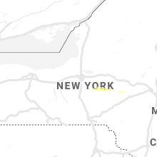
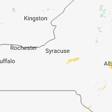


Connect with Interactive Hail Maps