

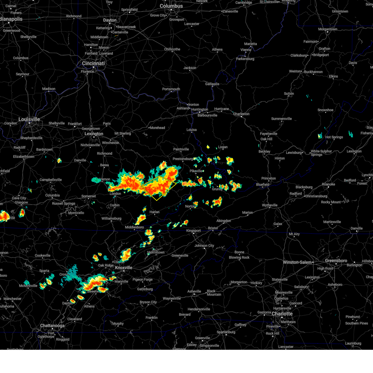
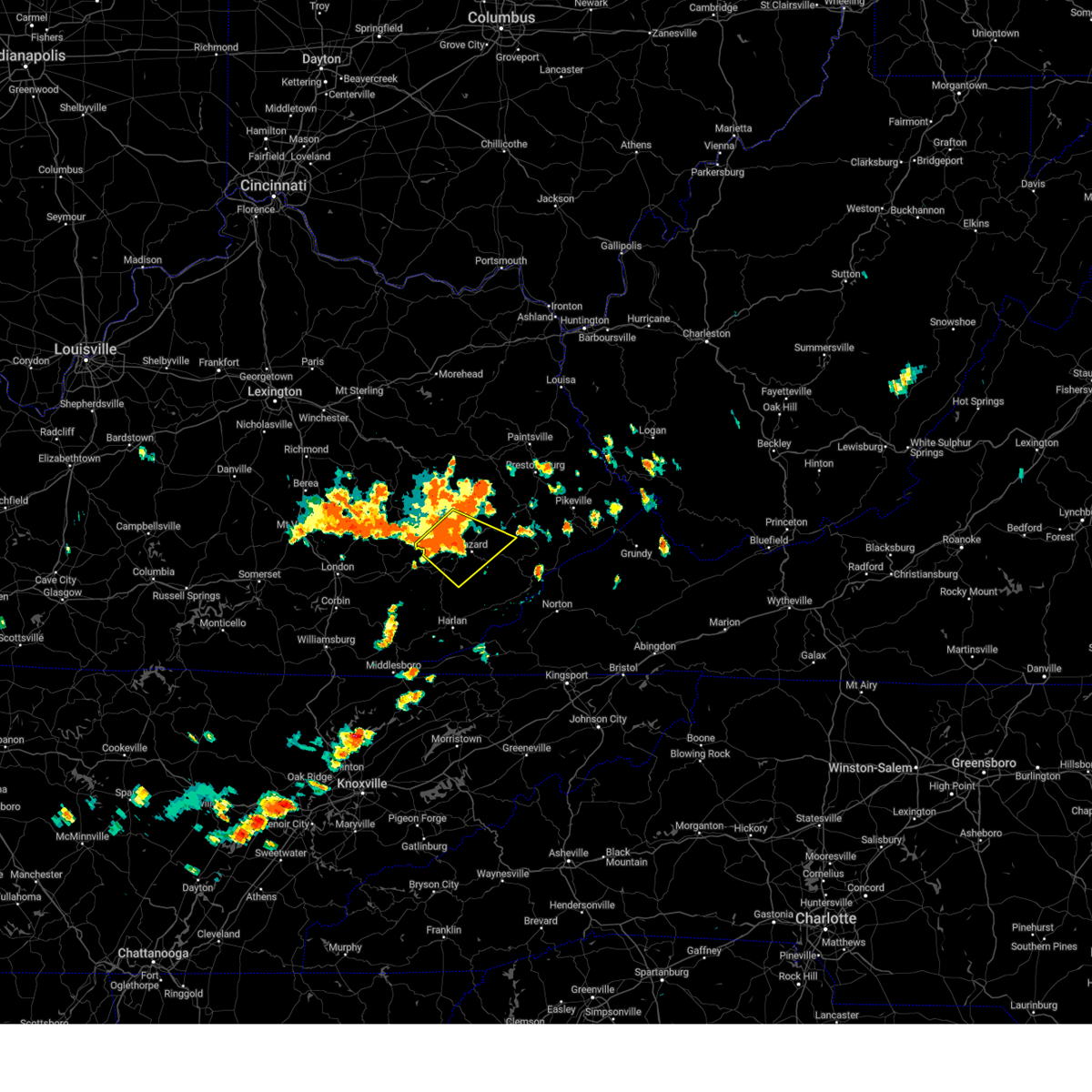
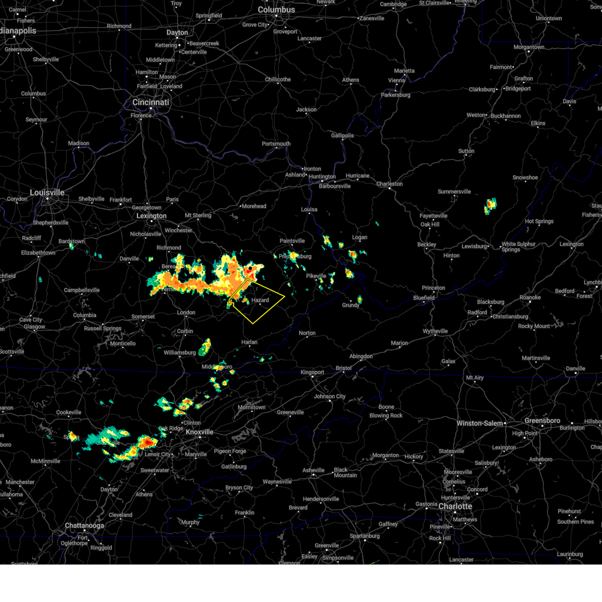
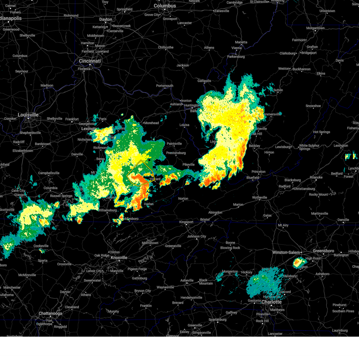
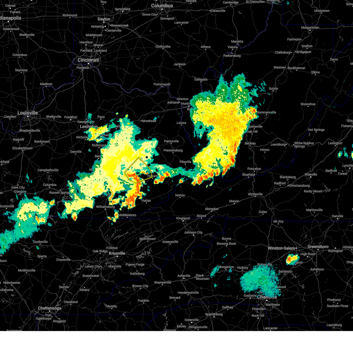
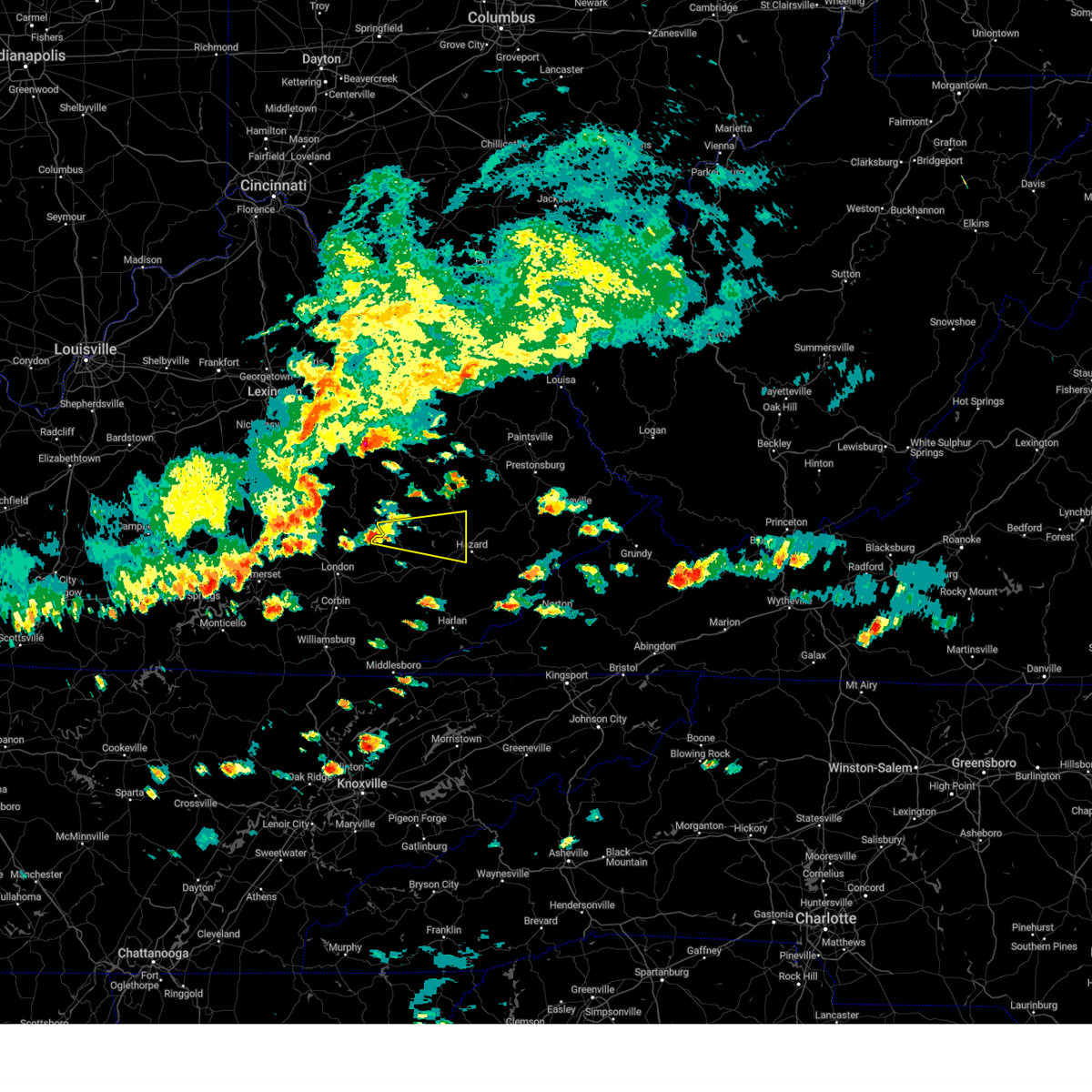
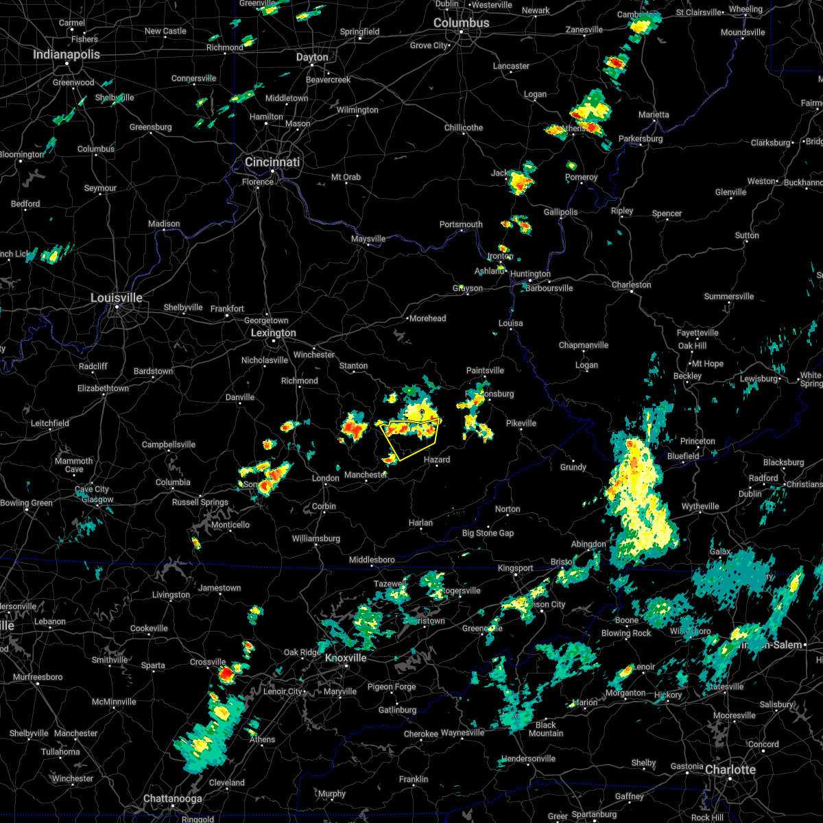
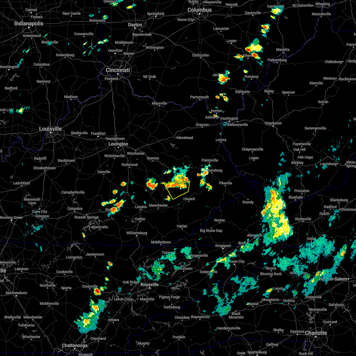
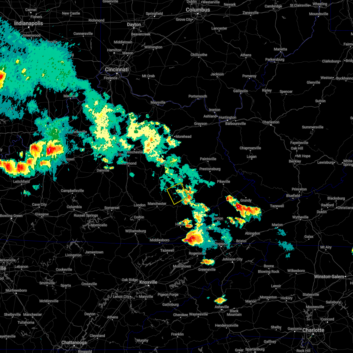
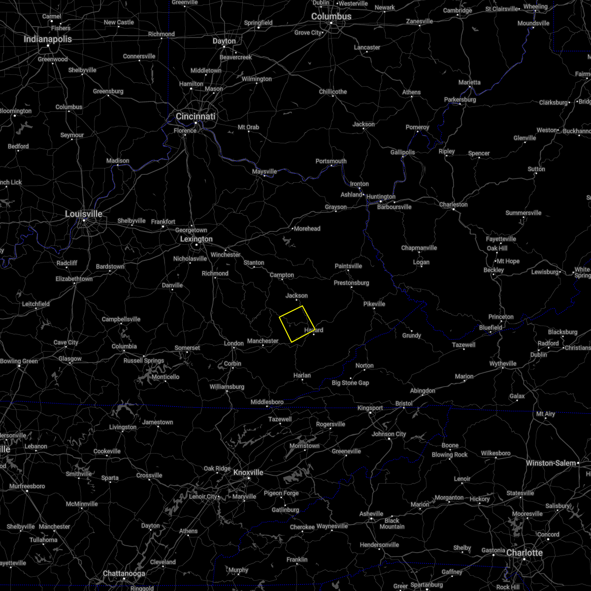
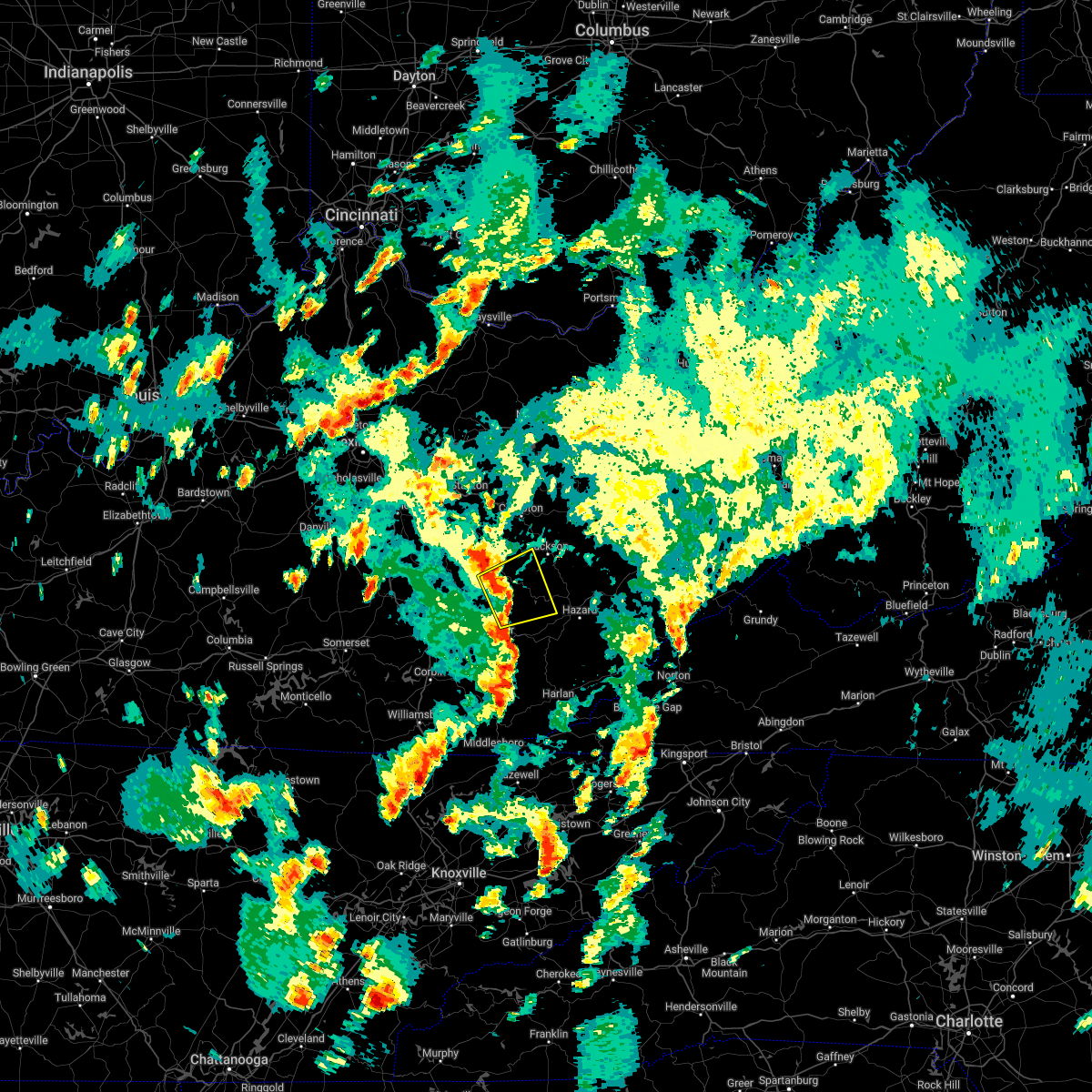
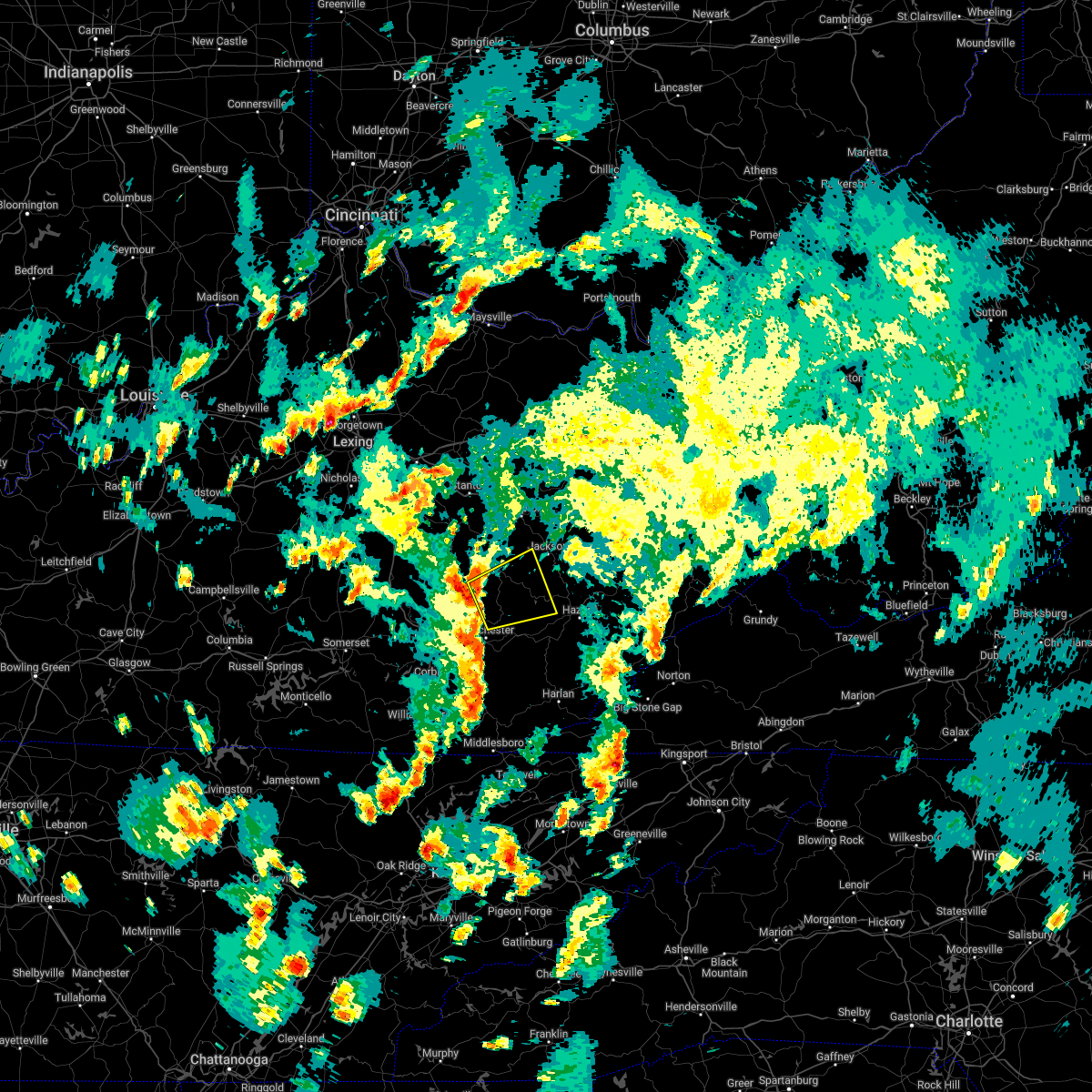
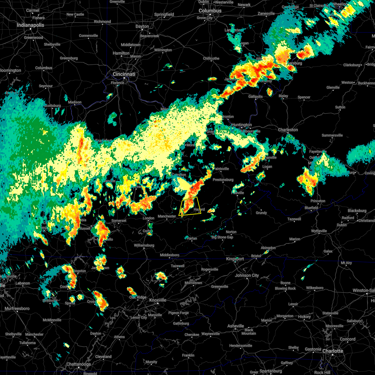
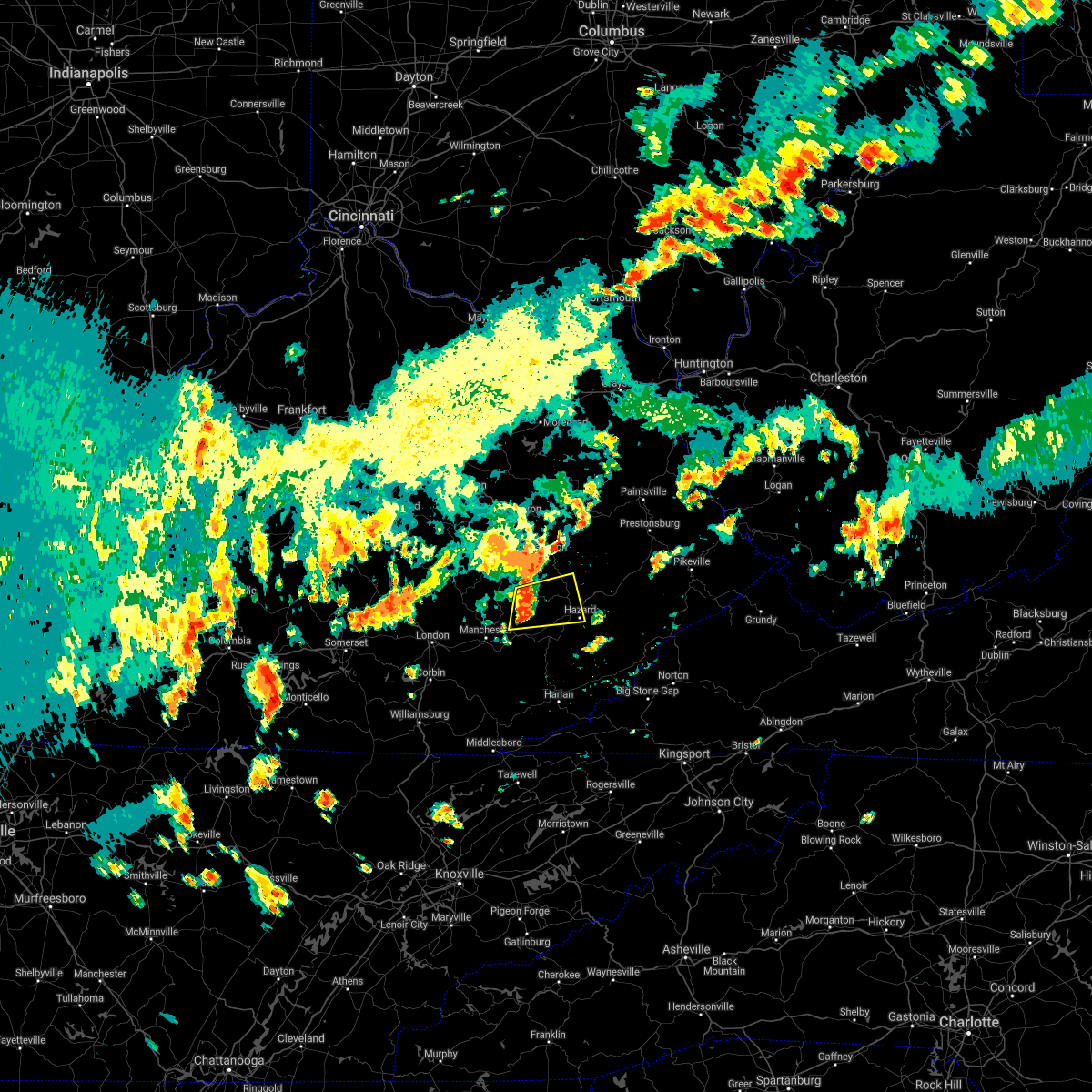
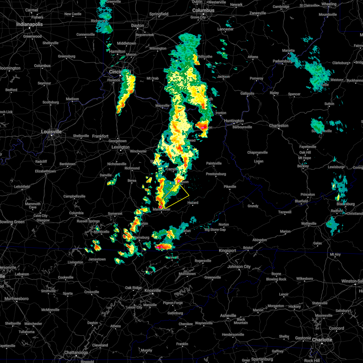
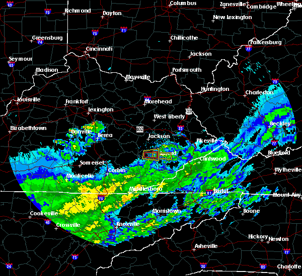
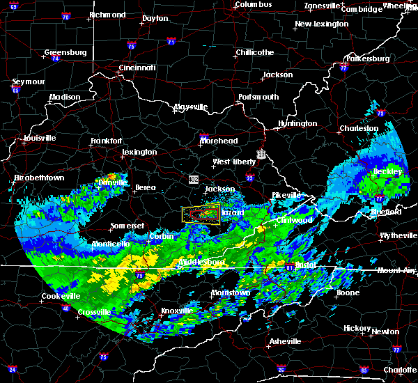
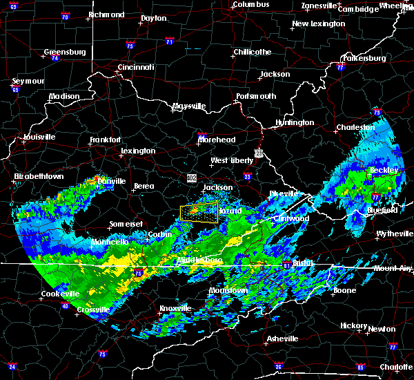
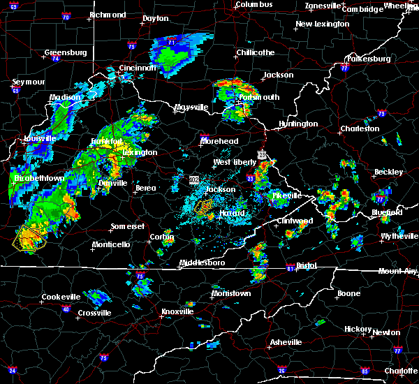
Hail Map for Buckhorn, KY
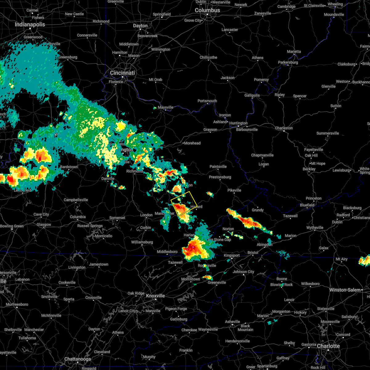
The Buckhorn, KY area has had 2 reports of on-the-ground hail by trained spotters, and has been under severe weather warnings 24 times during the past 12 months. Doppler radar has detected hail at or near Buckhorn, KY on 35 occasions, including 4 occasions during the past year.
| Name: | Buckhorn, KY |
| Where Located: | 37.3 miles SE of Irvine, KY |
| Map: | Google Map for Buckhorn, KY |
| Population: | 162 |
| Housing Units: | 61 |
| More Info: | Search Google for Buckhorn, KY |
3
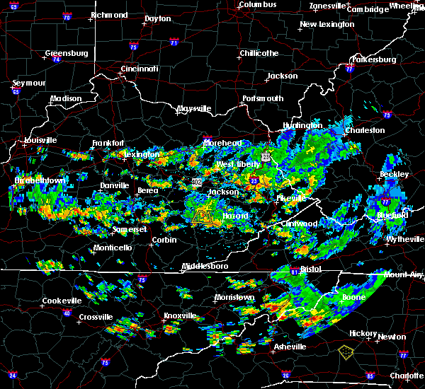
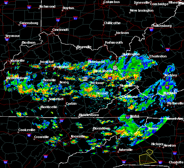
The Top Recent Hail Date for Buckhorn, KY is Tuesday, May 16, 2023 (5th out of 35)

Hail and Wind Damage Spotted near Buckhorn, KY
| Date / Time | Report Details |
|---|---|
| 3/6/2024 10:07 AM EST |
 Torjkl the national weather service in jackson ky has issued a * this is a test message. tornado warning for, montgomery county in east central kentucky, mccreary county in south central kentucky, rowan county in east central kentucky, morgan county in southeastern kentucky, bath county in east central kentucky, leslie county in southeastern kentucky, estill county in east central kentucky, pulaski county in south central kentucky, rockcastle county in south central kentucky, clay county in southeastern kentucky, elliott county in east central kentucky, wayne county in south central kentucky, harlan county in southeastern kentucky, knox county in southeastern kentucky, owsley county in southeastern kentucky, jackson county in southeastern kentucky, knott county in southeastern kentucky, floyd county in southeastern kentucky, whitley county in south central kentucky, menifee county in east central kentucky, lee county in southeastern kentucky, fleming county in east central kentucky, wolfe county in southeastern kentucky, powell county in east central kentucky, laurel county in south central kentucky, martin county in northeastern kentucky, bell county in southeastern kentucky, johnson county in northeastern kentucky, letcher county in southeastern kentucky, perry county in southeastern kentucky, breathitt county in southeastern kentucky, pike county in southeastern kentucky, magoffin county in southeastern kentucky, * this is a test message. until 1030 am est. * this is a test message. repeat, this is a test tornado warning message. there is no severe weather occuring at this time. this test warning message is part of the annual kentucky tornado drill. if this were an actual severe weather event, you would be given information about the hazard. the national weather service, kentucky emergency management angency, and the kentucky weather preparedness committee, encourges the use of this time to activate and review your severe weather safety plans. repeating, this has been a test tornado warning message for the 2024 kentucky tornado drill. this concludes the test. * this is a test message. Torjkl the national weather service in jackson ky has issued a * this is a test message. tornado warning for, montgomery county in east central kentucky, mccreary county in south central kentucky, rowan county in east central kentucky, morgan county in southeastern kentucky, bath county in east central kentucky, leslie county in southeastern kentucky, estill county in east central kentucky, pulaski county in south central kentucky, rockcastle county in south central kentucky, clay county in southeastern kentucky, elliott county in east central kentucky, wayne county in south central kentucky, harlan county in southeastern kentucky, knox county in southeastern kentucky, owsley county in southeastern kentucky, jackson county in southeastern kentucky, knott county in southeastern kentucky, floyd county in southeastern kentucky, whitley county in south central kentucky, menifee county in east central kentucky, lee county in southeastern kentucky, fleming county in east central kentucky, wolfe county in southeastern kentucky, powell county in east central kentucky, laurel county in south central kentucky, martin county in northeastern kentucky, bell county in southeastern kentucky, johnson county in northeastern kentucky, letcher county in southeastern kentucky, perry county in southeastern kentucky, breathitt county in southeastern kentucky, pike county in southeastern kentucky, magoffin county in southeastern kentucky, * this is a test message. until 1030 am est. * this is a test message. repeat, this is a test tornado warning message. there is no severe weather occuring at this time. this test warning message is part of the annual kentucky tornado drill. if this were an actual severe weather event, you would be given information about the hazard. the national weather service, kentucky emergency management angency, and the kentucky weather preparedness committee, encourges the use of this time to activate and review your severe weather safety plans. repeating, this has been a test tornado warning message for the 2024 kentucky tornado drill. this concludes the test. * this is a test message.
|
| 7/29/2023 3:34 PM EDT |
 At 334 pm edt, a severe thunderstorm was located over cordia, or near hazard, moving southeast at 30 mph (radar indicated). Hazards include 60 mph wind gusts. Expect damage to roofs, siding, and trees. locations impacted include, vicco and amburgey. hail threat, radar indicated max hail size, <. 75 in wind threat, radar indicated max wind gust, 60 mph. At 334 pm edt, a severe thunderstorm was located over cordia, or near hazard, moving southeast at 30 mph (radar indicated). Hazards include 60 mph wind gusts. Expect damage to roofs, siding, and trees. locations impacted include, vicco and amburgey. hail threat, radar indicated max hail size, <. 75 in wind threat, radar indicated max wind gust, 60 mph.
|
| 7/29/2023 3:11 PM EDT |
 At 310 pm edt, a severe thunderstorm was located over lamont, or 7 miles northwest of hazard, moving southeast at 30 mph (radar indicated). Hazards include 60 mph wind gusts. Expect damage to roofs, siding, and trees. this severe storm will be near, dice around 315 pm edt. hazard around 320 pm edt. other locations in the path of this severe thunderstorm include bulan, cordia, elic and vicco. hail threat, radar indicated max hail size, <. 75 in wind threat, radar indicated max wind gust, 60 mph. At 310 pm edt, a severe thunderstorm was located over lamont, or 7 miles northwest of hazard, moving southeast at 30 mph (radar indicated). Hazards include 60 mph wind gusts. Expect damage to roofs, siding, and trees. this severe storm will be near, dice around 315 pm edt. hazard around 320 pm edt. other locations in the path of this severe thunderstorm include bulan, cordia, elic and vicco. hail threat, radar indicated max hail size, <. 75 in wind threat, radar indicated max wind gust, 60 mph.
|
| 7/29/2023 3:02 PM EDT |
 At 302 pm edt, a severe thunderstorm was located over barwick, or 11 miles northwest of hazard, moving southeast at 30 mph (radar indicated). Hazards include 60 mph wind gusts. Expect damage to roofs, siding, and trees. this severe thunderstorm will be near, lamont around 310 pm edt. dice around 315 pm edt. hazard around 320 pm edt. other locations in the path of this severe thunderstorm include bulan, diablock and cordia. hail threat, radar indicated max hail size, <. 75 in wind threat, radar indicated max wind gust, 60 mph. At 302 pm edt, a severe thunderstorm was located over barwick, or 11 miles northwest of hazard, moving southeast at 30 mph (radar indicated). Hazards include 60 mph wind gusts. Expect damage to roofs, siding, and trees. this severe thunderstorm will be near, lamont around 310 pm edt. dice around 315 pm edt. hazard around 320 pm edt. other locations in the path of this severe thunderstorm include bulan, diablock and cordia. hail threat, radar indicated max hail size, <. 75 in wind threat, radar indicated max wind gust, 60 mph.
|
| 7/29/2023 2:48 PM EDT |
 At 248 pm edt, a severe thunderstorm was located over houston, or 10 miles east of booneville, moving southeast at 25 mph (radar indicated). Hazards include 60 mph wind gusts. Expect damage to roofs, siding, and trees. this severe storm will be near, beech around 300 pm edt. other locations in the path of this severe thunderstorm include altro and barwick. hail threat, radar indicated max hail size, <. 75 in wind threat, radar indicated max wind gust, 60 mph. At 248 pm edt, a severe thunderstorm was located over houston, or 10 miles east of booneville, moving southeast at 25 mph (radar indicated). Hazards include 60 mph wind gusts. Expect damage to roofs, siding, and trees. this severe storm will be near, beech around 300 pm edt. other locations in the path of this severe thunderstorm include altro and barwick. hail threat, radar indicated max hail size, <. 75 in wind threat, radar indicated max wind gust, 60 mph.
|
| 7/29/2023 2:41 PM EDT |
 At 241 pm edt, a severe thunderstorm was located over houston, or 7 miles east of booneville, moving southeast at 25 mph (radar indicated). Hazards include 60 mph wind gusts. Expect damage to roofs, siding, and trees. this severe thunderstorm will be near, houston around 245 pm edt. sebastian`s branch around 250 pm edt. talbert around 255 pm edt. beech around 300 pm edt. other locations in the path of this severe thunderstorm include bush branch and barwick. hail threat, radar indicated max hail size, <. 75 in wind threat, radar indicated max wind gust, 60 mph. At 241 pm edt, a severe thunderstorm was located over houston, or 7 miles east of booneville, moving southeast at 25 mph (radar indicated). Hazards include 60 mph wind gusts. Expect damage to roofs, siding, and trees. this severe thunderstorm will be near, houston around 245 pm edt. sebastian`s branch around 250 pm edt. talbert around 255 pm edt. beech around 300 pm edt. other locations in the path of this severe thunderstorm include bush branch and barwick. hail threat, radar indicated max hail size, <. 75 in wind threat, radar indicated max wind gust, 60 mph.
|
| 7/18/2023 9:14 PM EDT |
 At 914 pm edt, severe thunderstorms were located along a line extending from lane to lerose to thomas to near tanksley, moving east at 35 mph (radar indicated). Hazards include 70 mph wind gusts. Expect considerable tree damage. damage is likely to mobile homes, roofs, and outbuildings. these severe storms will be near, hollonville around 920 pm edt. other locations in the path of these severe thunderstorms include simpson, lucky fork, morris fork, jackson and noctor. thunderstorm damage threat, considerable hail threat, radar indicated max hail size, <. 75 in wind threat, radar indicated max wind gust, 70 mph. At 914 pm edt, severe thunderstorms were located along a line extending from lane to lerose to thomas to near tanksley, moving east at 35 mph (radar indicated). Hazards include 70 mph wind gusts. Expect considerable tree damage. damage is likely to mobile homes, roofs, and outbuildings. these severe storms will be near, hollonville around 920 pm edt. other locations in the path of these severe thunderstorms include simpson, lucky fork, morris fork, jackson and noctor. thunderstorm damage threat, considerable hail threat, radar indicated max hail size, <. 75 in wind threat, radar indicated max wind gust, 70 mph.
|
| 7/18/2023 9:00 PM EDT |
 At 900 pm edt, severe thunderstorms were located along a line extending from vada to endee to malcomb to herron, moving east at 35 mph (radar indicated). Hazards include 70 mph wind gusts. Expect considerable tree damage. damage is likely to mobile homes, roofs, and outbuildings. severe thunderstorms will be near, booneville around 905 pm edt. mary around 910 pm edt. hollonville around 915 pm edt. jetts creek around 920 pm edt. other locations in the path of these severe thunderstorms include simpson and morris fork. thunderstorm damage threat, considerable hail threat, radar indicated max hail size, <. 75 in wind threat, radar indicated max wind gust, 70 mph. At 900 pm edt, severe thunderstorms were located along a line extending from vada to endee to malcomb to herron, moving east at 35 mph (radar indicated). Hazards include 70 mph wind gusts. Expect considerable tree damage. damage is likely to mobile homes, roofs, and outbuildings. severe thunderstorms will be near, booneville around 905 pm edt. mary around 910 pm edt. hollonville around 915 pm edt. jetts creek around 920 pm edt. other locations in the path of these severe thunderstorms include simpson and morris fork. thunderstorm damage threat, considerable hail threat, radar indicated max hail size, <. 75 in wind threat, radar indicated max wind gust, 70 mph.
|
| 7/3/2023 12:06 AM EDT |
 The severe thunderstorm warning for southeastern owsley, northwestern leslie, northwestern perry, southwestern breathitt and northeastern clay counties will expire at 1215 am edt, the storms which prompted the warning have weakened below severe limits, and no longer pose an immediate threat to life or property. therefore, the warning will be allowed to expire. The severe thunderstorm warning for southeastern owsley, northwestern leslie, northwestern perry, southwestern breathitt and northeastern clay counties will expire at 1215 am edt, the storms which prompted the warning have weakened below severe limits, and no longer pose an immediate threat to life or property. therefore, the warning will be allowed to expire.
|
| 7/2/2023 11:55 PM EDT |
 At 1155 pm edt, severe thunderstorms were located along a line extending from southfork to valjean to sizerock, moving northeast at 40 mph (radar indicated). Hazards include 60 mph wind gusts and penny size hail. Expect damage to roofs, siding, and trees. locations impacted include, buckhorn, mosley bend, altro, hazard and ned. hail threat, radar indicated max hail size, 0. 75 in wind threat, radar indicated max wind gust, 60 mph. At 1155 pm edt, severe thunderstorms were located along a line extending from southfork to valjean to sizerock, moving northeast at 40 mph (radar indicated). Hazards include 60 mph wind gusts and penny size hail. Expect damage to roofs, siding, and trees. locations impacted include, buckhorn, mosley bend, altro, hazard and ned. hail threat, radar indicated max hail size, 0. 75 in wind threat, radar indicated max wind gust, 60 mph.
|
| 7/2/2023 11:34 PM EDT |
 At 1134 pm edt, severe thunderstorms were located along a line extending from maulden to mill pond to hector, moving northeast at 40 mph (radar indicated). Hazards include 60 mph wind gusts and penny size hail. Expect damage to roofs, siding, and trees. severe thunderstorms will be near, oneida around 1140 pm edt. blake around 1145 pm edt. major around 1150 pm edt. other locations in the path of these severe thunderstorms include booneville, buckhorn and mosley bend. hail threat, radar indicated max hail size, 0. 75 in wind threat, radar indicated max wind gust, 60 mph. At 1134 pm edt, severe thunderstorms were located along a line extending from maulden to mill pond to hector, moving northeast at 40 mph (radar indicated). Hazards include 60 mph wind gusts and penny size hail. Expect damage to roofs, siding, and trees. severe thunderstorms will be near, oneida around 1140 pm edt. blake around 1145 pm edt. major around 1150 pm edt. other locations in the path of these severe thunderstorms include booneville, buckhorn and mosley bend. hail threat, radar indicated max hail size, 0. 75 in wind threat, radar indicated max wind gust, 60 mph.
|
| 7/2/2023 10:10 PM EDT |
 The severe thunderstorm warning for northern leslie, perry, northwestern knott, central breathitt and east central clay counties will expire at 1015 pm edt, the storms which prompted the warning have moved out of the area. therefore, the warning will be allowed to expire. a new warning has been issued. a severe thunderstorm watch remains in effect until midnight edt for southeastern kentucky. The severe thunderstorm warning for northern leslie, perry, northwestern knott, central breathitt and east central clay counties will expire at 1015 pm edt, the storms which prompted the warning have moved out of the area. therefore, the warning will be allowed to expire. a new warning has been issued. a severe thunderstorm watch remains in effect until midnight edt for southeastern kentucky.
|
| 7/2/2023 9:58 PM EDT |
 At 957 pm edt, severe thunderstorms were located along a line extending from carver to evanston to noble to dice to near avawam, moving east at 45 mph (radar indicated). Hazards include 60 mph wind gusts and penny size hail. Expect damage to roofs, siding, and trees. locations impacted include, evanston, elmrock and vail. hail threat, radar indicated max hail size, 0. 75 in wind threat, radar indicated max wind gust, 60 mph. At 957 pm edt, severe thunderstorms were located along a line extending from carver to evanston to noble to dice to near avawam, moving east at 45 mph (radar indicated). Hazards include 60 mph wind gusts and penny size hail. Expect damage to roofs, siding, and trees. locations impacted include, evanston, elmrock and vail. hail threat, radar indicated max hail size, 0. 75 in wind threat, radar indicated max wind gust, 60 mph.
|
| 7/2/2023 9:41 PM EDT |
 The severe thunderstorm warning for eastern owsley, northwestern leslie, west central perry, southwestern breathitt, southeastern lee and northeastern clay counties will expire at 945 pm edt, the storms which prompted the warning have moved out of the area. therefore, the warning will be allowed to expire. a new warning was issued for portions of owsley, leslie, perry, breathitt and clay counties. a severe thunderstorm watch remains in effect until midnight edt for southeastern kentucky. The severe thunderstorm warning for eastern owsley, northwestern leslie, west central perry, southwestern breathitt, southeastern lee and northeastern clay counties will expire at 945 pm edt, the storms which prompted the warning have moved out of the area. therefore, the warning will be allowed to expire. a new warning was issued for portions of owsley, leslie, perry, breathitt and clay counties. a severe thunderstorm watch remains in effect until midnight edt for southeastern kentucky.
|
| 7/2/2023 9:39 PM EDT |
 At 939 pm edt, severe thunderstorms were located along a line extending from bays to smith branch to canoe to buckhorn to sizerock, moving east at 45 mph (radar indicated). Hazards include 60 mph wind gusts and penny size hail. Expect damage to roofs, siding, and trees. severe thunderstorms will be near, sikes around 945 pm edt. toulouse around 950 pm edt. dice around 955 pm edt. other locations in the path of these severe thunderstorms include hazard, talcum and bearville. hail threat, radar indicated max hail size, 0. 75 in wind threat, radar indicated max wind gust, 60 mph. At 939 pm edt, severe thunderstorms were located along a line extending from bays to smith branch to canoe to buckhorn to sizerock, moving east at 45 mph (radar indicated). Hazards include 60 mph wind gusts and penny size hail. Expect damage to roofs, siding, and trees. severe thunderstorms will be near, sikes around 945 pm edt. toulouse around 950 pm edt. dice around 955 pm edt. other locations in the path of these severe thunderstorms include hazard, talcum and bearville. hail threat, radar indicated max hail size, 0. 75 in wind threat, radar indicated max wind gust, 60 mph.
|
| 7/2/2023 9:36 PM EDT |
 At 935 pm edt, severe thunderstorms were located along a line extending from elkatawa to near guerrant to turkey to near whoopflarea, moving east at 45 mph (radar indicated). Hazards include 60 mph wind gusts and penny size hail. Expect damage to roofs, siding, and trees. these severe storms will be near, jackson around 940 pm edt. hail threat, radar indicated max hail size, 0. 75 in wind threat, radar indicated max wind gust, 60 mph. At 935 pm edt, severe thunderstorms were located along a line extending from elkatawa to near guerrant to turkey to near whoopflarea, moving east at 45 mph (radar indicated). Hazards include 60 mph wind gusts and penny size hail. Expect damage to roofs, siding, and trees. these severe storms will be near, jackson around 940 pm edt. hail threat, radar indicated max hail size, 0. 75 in wind threat, radar indicated max wind gust, 60 mph.
|
| 7/2/2023 9:20 PM EDT |
 At 920 pm edt, severe thunderstorms were located along a line extending from grass to turin to scoville to near felty, moving east at 45 mph (radar indicated). Hazards include 60 mph wind gusts and penny size hail. Expect damage to roofs, siding, and trees. severe thunderstorms will be near, lerose around 925 pm edt. chenowee around 930 pm edt. elkatawa around 935 pm edt. jackson around 940 pm edt. hail threat, radar indicated max hail size, 0. 75 in wind threat, radar indicated max wind gust, 60 mph. At 920 pm edt, severe thunderstorms were located along a line extending from grass to turin to scoville to near felty, moving east at 45 mph (radar indicated). Hazards include 60 mph wind gusts and penny size hail. Expect damage to roofs, siding, and trees. severe thunderstorms will be near, lerose around 925 pm edt. chenowee around 930 pm edt. elkatawa around 935 pm edt. jackson around 940 pm edt. hail threat, radar indicated max hail size, 0. 75 in wind threat, radar indicated max wind gust, 60 mph.
|
| 6/25/2023 11:51 PM EDT |
 At 1151 pm edt, severe thunderstorms were located along a line extending from war creek to mistletoe to hooker, moving southeast at 45 mph (radar indicated). Hazards include 60 mph wind gusts and quarter size hail. Hail damage to vehicles is expected. expect wind damage to roofs, siding, and trees. severe thunderstorms will be near, whoopflarea around 1155 pm edt. jackson around 1200 am edt. dumont around 1205 am edt. hyden around 1210 am edt. hardshell around 1215 am edt. other locations impacted by these severe thunderstorms include garrard. hail threat, radar indicated max hail size, 1. 00 in wind threat, radar indicated max wind gust, 60 mph. At 1151 pm edt, severe thunderstorms were located along a line extending from war creek to mistletoe to hooker, moving southeast at 45 mph (radar indicated). Hazards include 60 mph wind gusts and quarter size hail. Hail damage to vehicles is expected. expect wind damage to roofs, siding, and trees. severe thunderstorms will be near, whoopflarea around 1155 pm edt. jackson around 1200 am edt. dumont around 1205 am edt. hyden around 1210 am edt. hardshell around 1215 am edt. other locations impacted by these severe thunderstorms include garrard. hail threat, radar indicated max hail size, 1. 00 in wind threat, radar indicated max wind gust, 60 mph.
|
| 6/25/2023 11:50 PM EDT |
 At 1149 pm edt, severe thunderstorms were located along a line extending from war creek to mistletoe to hooker, moving southeast at 45 mph (radar indicated). Hazards include 60 mph wind gusts and quarter size hail. Hail damage to vehicles is expected. expect wind damage to roofs, siding, and trees. severe thunderstorms will be near, saul around 1155 pm edt. jackson around 1200 am edt. haddix around 1205 am edt. hyden around 1210 am edt. hardshell around 1215 am edt. other locations impacted by these severe thunderstorms include garrard. hail threat, radar indicated max hail size, 1. 00 in wind threat, radar indicated max wind gust, 60 mph. At 1149 pm edt, severe thunderstorms were located along a line extending from war creek to mistletoe to hooker, moving southeast at 45 mph (radar indicated). Hazards include 60 mph wind gusts and quarter size hail. Hail damage to vehicles is expected. expect wind damage to roofs, siding, and trees. severe thunderstorms will be near, saul around 1155 pm edt. jackson around 1200 am edt. haddix around 1205 am edt. hyden around 1210 am edt. hardshell around 1215 am edt. other locations impacted by these severe thunderstorms include garrard. hail threat, radar indicated max hail size, 1. 00 in wind threat, radar indicated max wind gust, 60 mph.
|
| 5/16/2023 4:08 PM EDT |
 The severe thunderstorm warning for northwestern leslie, northwestern perry and southwestern breathitt counties will expire at 415 pm edt, the storm which prompted the warning has moved out of the area. therefore, the warning will be allowed to expire. a new warning has been issued for perry and knott counties. a severe thunderstorm watch remains in effect until 800 pm edt for southeastern kentucky. The severe thunderstorm warning for northwestern leslie, northwestern perry and southwestern breathitt counties will expire at 415 pm edt, the storm which prompted the warning has moved out of the area. therefore, the warning will be allowed to expire. a new warning has been issued for perry and knott counties. a severe thunderstorm watch remains in effect until 800 pm edt for southeastern kentucky.
|
| 5/16/2023 4:03 PM EDT |
 At 402 pm edt, a severe thunderstorm was located over krypton, or 9 miles northwest of hazard, moving east at 45 mph (radar indicated). Hazards include 60 mph wind gusts and half dollar size hail. Hail damage to vehicles is expected. expect wind damage to roofs, siding, and trees. Locations impacted include, hazard, buckhorn, altro, avawam, bush branch, dryhill, lamont, shoal, toulouse, kaliopi, crockettsville and krypton. At 402 pm edt, a severe thunderstorm was located over krypton, or 9 miles northwest of hazard, moving east at 45 mph (radar indicated). Hazards include 60 mph wind gusts and half dollar size hail. Hail damage to vehicles is expected. expect wind damage to roofs, siding, and trees. Locations impacted include, hazard, buckhorn, altro, avawam, bush branch, dryhill, lamont, shoal, toulouse, kaliopi, crockettsville and krypton.
|
| 5/16/2023 3:48 PM EDT |
 At 348 pm edt, a severe thunderstorm was located over mistletoe, or 10 miles southeast of booneville, moving east at 35 mph (radar indicated). Hazards include golf ball size hail and 60 mph wind gusts. People and animals outdoors will be injured. expect hail damage to roofs, siding, windows, and vehicles. expect wind damage to roofs, siding, and trees. Locations impacted include, morris fork, buckhorn, gays creek, chavies, lamont and hazard. At 348 pm edt, a severe thunderstorm was located over mistletoe, or 10 miles southeast of booneville, moving east at 35 mph (radar indicated). Hazards include golf ball size hail and 60 mph wind gusts. People and animals outdoors will be injured. expect hail damage to roofs, siding, windows, and vehicles. expect wind damage to roofs, siding, and trees. Locations impacted include, morris fork, buckhorn, gays creek, chavies, lamont and hazard.
|
| 5/16/2023 3:27 PM EDT |
 At 327 pm edt, a severe thunderstorm was located over sourwood, or 11 miles southeast of mckee, moving east at 35 mph (radar indicated). Hazards include 60 mph wind gusts and quarter size hail. Hail damage to vehicles is expected. expect wind damage to roofs, siding, and trees. this severe thunderstorm will be near, sextons creek around 330 pm edt. thomas around 335 pm edt. trixie around 340 pm edt. newfound around 345 pm edt. Other locations in the path of this severe thunderstorm include mistletoe and valjean. At 327 pm edt, a severe thunderstorm was located over sourwood, or 11 miles southeast of mckee, moving east at 35 mph (radar indicated). Hazards include 60 mph wind gusts and quarter size hail. Hail damage to vehicles is expected. expect wind damage to roofs, siding, and trees. this severe thunderstorm will be near, sextons creek around 330 pm edt. thomas around 335 pm edt. trixie around 340 pm edt. newfound around 345 pm edt. Other locations in the path of this severe thunderstorm include mistletoe and valjean.
|
| 2/16/2023 5:40 PM EST |
 The severe thunderstorm warning for southern morgan, southeastern owsley, north central leslie, northwestern perry, breathitt, northwestern magoffin, southeastern wolfe and northeastern clay counties will expire at 545 pm est, the storms which prompted the warning have weakened below severe limits, and no longer pose an immediate threat to life or property. therefore, the warning will be allowed to expire. however heavy rain is still possible with these thunderstorms. The severe thunderstorm warning for southern morgan, southeastern owsley, north central leslie, northwestern perry, breathitt, northwestern magoffin, southeastern wolfe and northeastern clay counties will expire at 545 pm est, the storms which prompted the warning have weakened below severe limits, and no longer pose an immediate threat to life or property. therefore, the warning will be allowed to expire. however heavy rain is still possible with these thunderstorms.
|
| 2/16/2023 5:33 PM EST |
 At 533 pm est, severe thunderstorms were located along a line extending from paxton to near guerrant to valjean, moving east at 50 mph (radar indicated). Hazards include 60 mph wind gusts and penny size hail. Expect damage to roofs, siding, and trees. locations impacted include, simpson, press, fritz, daisydell and salyersville. hail threat, radar indicated max hail size, 0. 75 in wind threat, radar indicated max wind gust, 60 mph. At 533 pm est, severe thunderstorms were located along a line extending from paxton to near guerrant to valjean, moving east at 50 mph (radar indicated). Hazards include 60 mph wind gusts and penny size hail. Expect damage to roofs, siding, and trees. locations impacted include, simpson, press, fritz, daisydell and salyersville. hail threat, radar indicated max hail size, 0. 75 in wind threat, radar indicated max wind gust, 60 mph.
|
| 2/16/2023 5:13 PM EST |
 At 513 pm est, severe thunderstorms were located along a line extending from mount olive to scoville to sourwood, moving east at 50 mph (radar indicated). Hazards include 60 mph wind gusts and penny size hail. Expect damage to roofs, siding, and trees. severe thunderstorms will be near, fincastle around 520 pm est. flat around 525 pm est. hollonville around 530 pm est. other locations in the path of these severe thunderstorms include simpson, beech and dale. hail threat, radar indicated max hail size, 0. 75 in wind threat, radar indicated max wind gust, 60 mph. At 513 pm est, severe thunderstorms were located along a line extending from mount olive to scoville to sourwood, moving east at 50 mph (radar indicated). Hazards include 60 mph wind gusts and penny size hail. Expect damage to roofs, siding, and trees. severe thunderstorms will be near, fincastle around 520 pm est. flat around 525 pm est. hollonville around 530 pm est. other locations in the path of these severe thunderstorms include simpson, beech and dale. hail threat, radar indicated max hail size, 0. 75 in wind threat, radar indicated max wind gust, 60 mph.
|
| 7/21/2022 12:48 AM EDT |
 At 1248 am edt, a severe thunderstorm was located over southfork, or near booneville, moving east at 40 mph (radar indicated). Hazards include 60 mph wind gusts and quarter size hail. Hail damage to vehicles is expected. expect wind damage to roofs, siding, and trees. this severe thunderstorm will be near, arnett around 1255 am edt. houston around 100 am edt. sebastian`s branch around 105 am edt. other locations in the path of this severe thunderstorm include saldee and copland. hail threat, radar indicated max hail size, 1. 00 in wind threat, radar indicated max wind gust, 60 mph. At 1248 am edt, a severe thunderstorm was located over southfork, or near booneville, moving east at 40 mph (radar indicated). Hazards include 60 mph wind gusts and quarter size hail. Hail damage to vehicles is expected. expect wind damage to roofs, siding, and trees. this severe thunderstorm will be near, arnett around 1255 am edt. houston around 100 am edt. sebastian`s branch around 105 am edt. other locations in the path of this severe thunderstorm include saldee and copland. hail threat, radar indicated max hail size, 1. 00 in wind threat, radar indicated max wind gust, 60 mph.
|
| 7/3/2022 7:26 AM EDT |
 The severe thunderstorm warning for northeastern owsley, northwestern perry, southwestern breathitt and southeastern lee counties will expire at 730 am edt, the storm which prompted the warning has weakened below severe limits, and no longer poses an immediate threat to life or property. therefore, the warning will be allowed to expire. The severe thunderstorm warning for northeastern owsley, northwestern perry, southwestern breathitt and southeastern lee counties will expire at 730 am edt, the storm which prompted the warning has weakened below severe limits, and no longer poses an immediate threat to life or property. therefore, the warning will be allowed to expire.
|
| 7/3/2022 7:16 AM EDT |
 At 715 am edt, a severe thunderstorm was located over canoe, or 8 miles south of jackson, moving southeast at 25 mph (radar indicated). Hazards include 60 mph wind gusts and quarter size hail. Hail damage to vehicles is expected. expect wind damage to roofs, siding, and trees. locations impacted include, saldee and whick. hail threat, radar indicated max hail size, 1. 00 in wind threat, radar indicated max wind gust, 60 mph. At 715 am edt, a severe thunderstorm was located over canoe, or 8 miles south of jackson, moving southeast at 25 mph (radar indicated). Hazards include 60 mph wind gusts and quarter size hail. Hail damage to vehicles is expected. expect wind damage to roofs, siding, and trees. locations impacted include, saldee and whick. hail threat, radar indicated max hail size, 1. 00 in wind threat, radar indicated max wind gust, 60 mph.
|
| 7/3/2022 6:53 AM EDT |
 At 653 am edt, a severe thunderstorm was located over lone, or near booneville, moving southeast at 25 mph (radar indicated). Hazards include 60 mph wind gusts and quarter size hail. Hail damage to vehicles is expected. expect wind damage to roofs, siding, and trees. this severe thunderstorm will be near, jetts creek around 700 am edt. turkey around 705 am edt. houston around 710 am edt. other locations in the path of this severe thunderstorm include canoe, talbert and whick. hail threat, radar indicated max hail size, 1. 00 in wind threat, radar indicated max wind gust, 60 mph. At 653 am edt, a severe thunderstorm was located over lone, or near booneville, moving southeast at 25 mph (radar indicated). Hazards include 60 mph wind gusts and quarter size hail. Hail damage to vehicles is expected. expect wind damage to roofs, siding, and trees. this severe thunderstorm will be near, jetts creek around 700 am edt. turkey around 705 am edt. houston around 710 am edt. other locations in the path of this severe thunderstorm include canoe, talbert and whick. hail threat, radar indicated max hail size, 1. 00 in wind threat, radar indicated max wind gust, 60 mph.
|
| 6/26/2022 2:50 PM EDT |
 The severe thunderstorm warning for northeastern owsley, northwestern perry and southwestern breathitt counties will expire at 300 pm edt, the storms which prompted the warning have weakened below severe limits, and no longer pose an immediate threat to life or property. therefore, the warning will be allowed to expire. however gusty winds are still possible with these thunderstorms. The severe thunderstorm warning for northeastern owsley, northwestern perry and southwestern breathitt counties will expire at 300 pm edt, the storms which prompted the warning have weakened below severe limits, and no longer pose an immediate threat to life or property. therefore, the warning will be allowed to expire. however gusty winds are still possible with these thunderstorms.
|
| 6/26/2022 2:47 PM EDT |
 At 246 pm edt, severe thunderstorms were located along a line extending from burkhart to watts to crockettsville, moving southeast at 20 mph (radar indicated). Hazards include 60 mph wind gusts. Expect damage to roofs, siding, and trees. locations impacted include, buckhorn, altro, bush branch, hardshell, copland, lamont, copebranch, wolf coal, beech, dalesburg, chavies and canoe. hail threat, radar indicated max hail size, <. 75 in wind threat, radar indicated max wind gust, 60 mph. At 246 pm edt, severe thunderstorms were located along a line extending from burkhart to watts to crockettsville, moving southeast at 20 mph (radar indicated). Hazards include 60 mph wind gusts. Expect damage to roofs, siding, and trees. locations impacted include, buckhorn, altro, bush branch, hardshell, copland, lamont, copebranch, wolf coal, beech, dalesburg, chavies and canoe. hail threat, radar indicated max hail size, <. 75 in wind threat, radar indicated max wind gust, 60 mph.
|
| 6/26/2022 2:38 PM EDT |
 At 237 pm edt, severe thunderstorms were located along a line extending from burkhart to lost creek to houston, moving east at 20 mph (radar indicated). Hazards include 60 mph wind gusts. Expect damage to roofs, siding, and trees. locations impacted include, clayhole, hardshell, beech, whick, little and watts. hail threat, radar indicated max hail size, <. 75 in wind threat, radar indicated max wind gust, 60 mph. At 237 pm edt, severe thunderstorms were located along a line extending from burkhart to lost creek to houston, moving east at 20 mph (radar indicated). Hazards include 60 mph wind gusts. Expect damage to roofs, siding, and trees. locations impacted include, clayhole, hardshell, beech, whick, little and watts. hail threat, radar indicated max hail size, <. 75 in wind threat, radar indicated max wind gust, 60 mph.
|
| 6/26/2022 2:23 PM EDT |
 At 222 pm edt, severe thunderstorms were located along a line extending from lee city to curt to near cowcreek, moving southeast at 20 mph (radar indicated). Hazards include 60 mph wind gusts. Expect damage to roofs, siding, and trees. severe thunderstorms will be near, haddix around 230 pm edt. lost creek around 235 pm edt. watts around 240 pm edt. other locations in the path of these severe thunderstorms include dalesburg, buckhorn and rowdy. hail threat, radar indicated max hail size, <. 75 in wind threat, radar indicated max wind gust, 60 mph. At 222 pm edt, severe thunderstorms were located along a line extending from lee city to curt to near cowcreek, moving southeast at 20 mph (radar indicated). Hazards include 60 mph wind gusts. Expect damage to roofs, siding, and trees. severe thunderstorms will be near, haddix around 230 pm edt. lost creek around 235 pm edt. watts around 240 pm edt. other locations in the path of these severe thunderstorms include dalesburg, buckhorn and rowdy. hail threat, radar indicated max hail size, <. 75 in wind threat, radar indicated max wind gust, 60 mph.
|
| 5/19/2022 6:08 PM EDT |
 The severe thunderstorm warning for east central owsley, north central leslie, northwestern perry and southwestern breathitt counties will expire at 615 pm edt, the storm which prompted the warning has moved out of the area. therefore, the warning will be allowed to expire. a severe thunderstorm watch remains in effect until 1000 pm edt for southeastern kentucky. The severe thunderstorm warning for east central owsley, north central leslie, northwestern perry and southwestern breathitt counties will expire at 615 pm edt, the storm which prompted the warning has moved out of the area. therefore, the warning will be allowed to expire. a severe thunderstorm watch remains in effect until 1000 pm edt for southeastern kentucky.
|
| 5/19/2022 5:59 PM EDT |
 At 557 pm edt, a severe thunderstorm was located over chavies, or 11 miles northeast of hyden, moving northeast at 30 mph (radar indicated). Hazards include 60 mph wind gusts and quarter size hail. Hail damage to vehicles is expected. expect wind damage to roofs, siding, and trees. Locations impacted include, barwick, lamont, watts and ned. At 557 pm edt, a severe thunderstorm was located over chavies, or 11 miles northeast of hyden, moving northeast at 30 mph (radar indicated). Hazards include 60 mph wind gusts and quarter size hail. Hail damage to vehicles is expected. expect wind damage to roofs, siding, and trees. Locations impacted include, barwick, lamont, watts and ned.
|
| 5/19/2022 5:44 PM EDT |
 At 544 pm edt, a severe thunderstorm was located over saul, or 11 miles northwest of hyden, moving northeast at 30 mph (radar indicated). Hazards include 60 mph wind gusts and quarter size hail. Hail damage to vehicles is expected. expect wind damage to roofs, siding, and trees. this severe thunderstorm will be near, buckhorn lake s. p. around 550 pm edt. buckhorn around 555 pm edt. gays creek around 600 pm edt. other locations in the path of this severe thunderstorm include barwick, lamont and ned. hail threat, radar indicated max hail size, 1. 00 in wind threat, radar indicated max wind gust, 60 mph. At 544 pm edt, a severe thunderstorm was located over saul, or 11 miles northwest of hyden, moving northeast at 30 mph (radar indicated). Hazards include 60 mph wind gusts and quarter size hail. Hail damage to vehicles is expected. expect wind damage to roofs, siding, and trees. this severe thunderstorm will be near, buckhorn lake s. p. around 550 pm edt. buckhorn around 555 pm edt. gays creek around 600 pm edt. other locations in the path of this severe thunderstorm include barwick, lamont and ned. hail threat, radar indicated max hail size, 1. 00 in wind threat, radar indicated max wind gust, 60 mph.
|
| 5/19/2022 5:33 PM EDT |
 At 533 pm edt, a severe thunderstorm was located over panco, or 10 miles northwest of hyden, moving northeast at 40 mph (radar indicated). Hazards include 60 mph wind gusts and quarter size hail. Hail damage to vehicles is expected. expect wind damage to roofs, siding, and trees. this severe storm will be near, buckhorn around 540 pm edt. other locations in the path of this severe thunderstorm include gays creek, chavies and lamont. hail threat, radar indicated max hail size, 1. 00 in wind threat, radar indicated max wind gust, 60 mph. At 533 pm edt, a severe thunderstorm was located over panco, or 10 miles northwest of hyden, moving northeast at 40 mph (radar indicated). Hazards include 60 mph wind gusts and quarter size hail. Hail damage to vehicles is expected. expect wind damage to roofs, siding, and trees. this severe storm will be near, buckhorn around 540 pm edt. other locations in the path of this severe thunderstorm include gays creek, chavies and lamont. hail threat, radar indicated max hail size, 1. 00 in wind threat, radar indicated max wind gust, 60 mph.
|
| 5/19/2022 5:22 PM EDT |
 At 521 pm edt, a severe thunderstorm was located over spurlock, or 7 miles east of manchester, moving northeast at 40 mph (radar indicated). Hazards include 60 mph wind gusts and quarter size hail. Hail damage to vehicles is expected. expect wind damage to roofs, siding, and trees. this severe thunderstorm will be near, enline around 525 pm edt. panco around 530 pm edt. saul around 535 pm edt. buckhorn lake s. p. around 540 pm edt. other locations in the path of this severe thunderstorm include gays creek. hail threat, radar indicated max hail size, 1. 00 in wind threat, radar indicated max wind gust, 60 mph. At 521 pm edt, a severe thunderstorm was located over spurlock, or 7 miles east of manchester, moving northeast at 40 mph (radar indicated). Hazards include 60 mph wind gusts and quarter size hail. Hail damage to vehicles is expected. expect wind damage to roofs, siding, and trees. this severe thunderstorm will be near, enline around 525 pm edt. panco around 530 pm edt. saul around 535 pm edt. buckhorn lake s. p. around 540 pm edt. other locations in the path of this severe thunderstorm include gays creek. hail threat, radar indicated max hail size, 1. 00 in wind threat, radar indicated max wind gust, 60 mph.
|
| 5/6/2022 3:35 PM EDT |
 At 335 pm edt, a severe thunderstorm was located over arnett, or 8 miles southeast of booneville, moving northeast at 35 mph (radar indicated). Hazards include 60 mph wind gusts. Expect damage to roofs, siding, and trees. Locations impacted include, houston and sebastian`s branch. At 335 pm edt, a severe thunderstorm was located over arnett, or 8 miles southeast of booneville, moving northeast at 35 mph (radar indicated). Hazards include 60 mph wind gusts. Expect damage to roofs, siding, and trees. Locations impacted include, houston and sebastian`s branch.
|
| 5/6/2022 3:18 PM EDT |
 At 318 pm edt, a severe thunderstorm was located over thomas, or 9 miles south of booneville, moving northeast at 35 mph (radar indicated). Hazards include 60 mph wind gusts. Expect damage to roofs, siding, and trees. this severe thunderstorm will be near, newfound around 325 pm edt. gobbard around 330 pm edt. arnett around 335 pm edt. Other locations in the path of this severe thunderstorm include houston and talbert. At 318 pm edt, a severe thunderstorm was located over thomas, or 9 miles south of booneville, moving northeast at 35 mph (radar indicated). Hazards include 60 mph wind gusts. Expect damage to roofs, siding, and trees. this severe thunderstorm will be near, newfound around 325 pm edt. gobbard around 330 pm edt. arnett around 335 pm edt. Other locations in the path of this severe thunderstorm include houston and talbert.
|
| 4/6/2022 5:52 PM EDT |
 At 552 pm edt, severe thunderstorms were located along a line extending from jetts creek to sebastian`s branch to whoopflarea, moving east at 45 mph (radar indicated). Hazards include 60 mph wind gusts. Expect damage to roofs, siding, and trees. locations impacted include, jackson, booneville, buckhorn, turin, southfork, cowcreek, noctor, lerose, war creek, elkatawa, tallega and valjean. hail threat, radar indicated max hail size, <. 75 in wind threat, radar indicated max wind gust, 60 mph. At 552 pm edt, severe thunderstorms were located along a line extending from jetts creek to sebastian`s branch to whoopflarea, moving east at 45 mph (radar indicated). Hazards include 60 mph wind gusts. Expect damage to roofs, siding, and trees. locations impacted include, jackson, booneville, buckhorn, turin, southfork, cowcreek, noctor, lerose, war creek, elkatawa, tallega and valjean. hail threat, radar indicated max hail size, <. 75 in wind threat, radar indicated max wind gust, 60 mph.
|
| 4/6/2022 5:43 PM EDT |
 At 543 pm edt, severe thunderstorms were located along a line extending from scoville to gobbard to teges, moving east at 55 mph (radar indicated). Hazards include 60 mph wind gusts and penny size hail. Expect damage to roofs, siding, and trees. locations impacted include, valjean, buckhorn, saldee, jackson and haginsville. hail threat, radar indicated max hail size, 0. 75 in wind threat, radar indicated max wind gust, 60 mph. At 543 pm edt, severe thunderstorms were located along a line extending from scoville to gobbard to teges, moving east at 55 mph (radar indicated). Hazards include 60 mph wind gusts and penny size hail. Expect damage to roofs, siding, and trees. locations impacted include, valjean, buckhorn, saldee, jackson and haginsville. hail threat, radar indicated max hail size, 0. 75 in wind threat, radar indicated max wind gust, 60 mph.
|
| 4/6/2022 5:27 PM EDT | At 527 pm edt, severe thunderstorms were located along a line extending from gray hawk to egypt to benge, moving east at 55 mph (radar indicated). Hazards include 60 mph wind gusts and penny size hail. Expect damage to roofs, siding, and trees. severe thunderstorms will be near, maulden around 530 pm edt. sacker gap around 535 pm edt. conkling around 540 pm edt. booneville around 545 pm edt. other locations in the path of these severe thunderstorms include lerose and buckhorn. hail threat, radar indicated max hail size, 0. 75 in wind threat, radar indicated max wind gust, 60 mph. |
| 3/23/2022 2:47 PM EDT |
 At 247 pm edt, a severe thunderstorm was located over ammie, or 9 miles north of manchester, moving northeast at 60 mph (radar indicated). Hazards include 60 mph wind gusts and quarter size hail. Hail damage to vehicles is expected. expect wind damage to roofs, siding, and trees. this severe thunderstorm will be near, trixie around 250 pm edt. sebastian around 255 pm edt. arnett around 300 pm edt. turkey around 305 pm edt. Other locations in the path of this severe thunderstorm include yeadon and jackson. At 247 pm edt, a severe thunderstorm was located over ammie, or 9 miles north of manchester, moving northeast at 60 mph (radar indicated). Hazards include 60 mph wind gusts and quarter size hail. Hail damage to vehicles is expected. expect wind damage to roofs, siding, and trees. this severe thunderstorm will be near, trixie around 250 pm edt. sebastian around 255 pm edt. arnett around 300 pm edt. turkey around 305 pm edt. Other locations in the path of this severe thunderstorm include yeadon and jackson.
|
| 3/23/2022 1:58 PM EDT |
 At 158 pm edt, a severe thunderstorm was located over conkling, or near booneville, moving northeast at 60 mph (radar indicated). Hazards include 60 mph wind gusts and quarter size hail. Hail damage to vehicles is expected. expect wind damage to roofs, siding, and trees. this severe thunderstorm will be near, lerose around 205 pm edt. jetts creek around 210 pm edt. chenowee around 215 pm edt. Other locations in the path of this severe thunderstorm include frozen creek and simpson. At 158 pm edt, a severe thunderstorm was located over conkling, or near booneville, moving northeast at 60 mph (radar indicated). Hazards include 60 mph wind gusts and quarter size hail. Hail damage to vehicles is expected. expect wind damage to roofs, siding, and trees. this severe thunderstorm will be near, lerose around 205 pm edt. jetts creek around 210 pm edt. chenowee around 215 pm edt. Other locations in the path of this severe thunderstorm include frozen creek and simpson.
|
| 6/21/2021 4:11 PM EDT |
 At 410 pm edt, a severe thunderstorm was located over mosley bend, or 7 miles north of hyden, moving east at 35 mph (radar indicated). Hazards include 60 mph wind gusts. Expect damage to roofs, siding, and trees. Locations impacted include, avawam, hazard and diablock. At 410 pm edt, a severe thunderstorm was located over mosley bend, or 7 miles north of hyden, moving east at 35 mph (radar indicated). Hazards include 60 mph wind gusts. Expect damage to roofs, siding, and trees. Locations impacted include, avawam, hazard and diablock.
|
| 6/21/2021 3:55 PM EDT |
 At 355 pm edt, a severe thunderstorm was located over panco, or 11 miles northwest of hyden, moving east at 35 mph (radar indicated). Hazards include 60 mph wind gusts. Expect damage to roofs, siding, and trees. this severe thunderstorm will be near, shoal around 405 pm edt. confluence around 410 pm edt. krypton around 415 pm edt. Other locations in the path of this severe thunderstorm include hazard. At 355 pm edt, a severe thunderstorm was located over panco, or 11 miles northwest of hyden, moving east at 35 mph (radar indicated). Hazards include 60 mph wind gusts. Expect damage to roofs, siding, and trees. this severe thunderstorm will be near, shoal around 405 pm edt. confluence around 410 pm edt. krypton around 415 pm edt. Other locations in the path of this severe thunderstorm include hazard.
|
| 4/8/2021 8:00 PM EDT |
 At 800 pm edt, a severe thunderstorm was located over teges, or 11 miles northeast of manchester, moving northeast at 35 mph (radar indicated). Hazards include ping pong ball size hail and 60 mph wind gusts. People and animals outdoors will be injured. expect hail damage to roofs, siding, windows, and vehicles. Expect wind damage to roofs, siding, and trees. At 800 pm edt, a severe thunderstorm was located over teges, or 11 miles northeast of manchester, moving northeast at 35 mph (radar indicated). Hazards include ping pong ball size hail and 60 mph wind gusts. People and animals outdoors will be injured. expect hail damage to roofs, siding, windows, and vehicles. Expect wind damage to roofs, siding, and trees.
|
| 5/3/2020 8:42 PM EDT |
 The severe thunderstorm warning for owsley, northwestern perry, jackson, southwestern breathitt, southwestern lee and northern clay counties will expire at 845 pm edt, the storm which prompted the warning has weakened below severe limits, and no longer poses an immediate threat to life or property. therefore, the warning will be allowed to expire. however gusty winds and heavy rain are still possible with this thunderstorm. a severe thunderstorm watch remains in effect until 1100 pm edt for south central and southeastern kentucky. The severe thunderstorm warning for owsley, northwestern perry, jackson, southwestern breathitt, southwestern lee and northern clay counties will expire at 845 pm edt, the storm which prompted the warning has weakened below severe limits, and no longer poses an immediate threat to life or property. therefore, the warning will be allowed to expire. however gusty winds and heavy rain are still possible with this thunderstorm. a severe thunderstorm watch remains in effect until 1100 pm edt for south central and southeastern kentucky.
|
| 5/3/2020 8:26 PM EDT |
 At 825 pm edt, a severe thunderstorm was located over turkey foot, or near mckee, moving east at 20 mph (radar indicated). Hazards include 60 mph wind gusts and penny size hail. Expect damage to roofs, siding, and trees. Locations impacted include, manchester, mckee, booneville, buckhorn, turin, travellers rest, blake, southfork, cowcreek, shop branch, fogertown and tyner. At 825 pm edt, a severe thunderstorm was located over turkey foot, or near mckee, moving east at 20 mph (radar indicated). Hazards include 60 mph wind gusts and penny size hail. Expect damage to roofs, siding, and trees. Locations impacted include, manchester, mckee, booneville, buckhorn, turin, travellers rest, blake, southfork, cowcreek, shop branch, fogertown and tyner.
|
| 5/3/2020 8:05 PM EDT |
 At 805 pm edt, a severe thunderstorm was located over waneta, or near mckee, moving east at 20 mph (radar indicated). Hazards include 60 mph wind gusts and penny size hail. Expect damage to roofs, siding, and trees. Locations impacted include, manchester, mckee, booneville, buckhorn, turin, travellers rest, blake, robinet, southfork, cowcreek, shop branch and fogertown. At 805 pm edt, a severe thunderstorm was located over waneta, or near mckee, moving east at 20 mph (radar indicated). Hazards include 60 mph wind gusts and penny size hail. Expect damage to roofs, siding, and trees. Locations impacted include, manchester, mckee, booneville, buckhorn, turin, travellers rest, blake, robinet, southfork, cowcreek, shop branch and fogertown.
|
| 5/3/2020 7:40 PM EDT |
 At 739 pm edt, a severe thunderstorm was located over morrill, or 12 miles northwest of mckee, moving southeast at 30 mph (radar indicated). Hazards include 60 mph wind gusts and penny size hail. expect damage to roofs, siding, and trees At 739 pm edt, a severe thunderstorm was located over morrill, or 12 miles northwest of mckee, moving southeast at 30 mph (radar indicated). Hazards include 60 mph wind gusts and penny size hail. expect damage to roofs, siding, and trees
|
| 4/9/2020 1:55 AM EDT |
 The severe thunderstorm warning for letcher, perry, knott, floyd, southeastern breathitt, pike and southeastern magoffin counties will expire at 200 am edt, the storms which prompted the warning are still capable of producing damaging winds and hail. the warning will be allowed to expire at its designated time, but has been replaced with a new severe thunderstorm warning in effect until 6:15 am edt. a tornado watch remains in effect until 400 am edt for southeastern and northeastern kentucky. The severe thunderstorm warning for letcher, perry, knott, floyd, southeastern breathitt, pike and southeastern magoffin counties will expire at 200 am edt, the storms which prompted the warning are still capable of producing damaging winds and hail. the warning will be allowed to expire at its designated time, but has been replaced with a new severe thunderstorm warning in effect until 6:15 am edt. a tornado watch remains in effect until 400 am edt for southeastern and northeastern kentucky.
|
| 4/9/2020 1:42 AM EDT |
 At 141 am edt, severe thunderstorms were located along a line extending from near red jacket to osborn to soft shell to near hazard, moving southeast at 45 mph (radar indicated). Hazards include 60 mph wind gusts and penny size hail. Expect damage to roofs, siding, and trees. Locations impacted include, pikeville, hazard, prestonsburg, whitesburg, hindman, letcher, estill, bath, cumberland, jenkins, coal run village and elkhorn city. At 141 am edt, severe thunderstorms were located along a line extending from near red jacket to osborn to soft shell to near hazard, moving southeast at 45 mph (radar indicated). Hazards include 60 mph wind gusts and penny size hail. Expect damage to roofs, siding, and trees. Locations impacted include, pikeville, hazard, prestonsburg, whitesburg, hindman, letcher, estill, bath, cumberland, jenkins, coal run village and elkhorn city.
|
| 4/9/2020 1:18 AM EDT |
 At 118 am edt, severe thunderstorms were located along a line extending from near oppy to dotson to lunah to canoe, moving southeast at 45 mph (radar indicated). Hazards include 60 mph wind gusts and penny size hail. expect damage to roofs, siding, and trees At 118 am edt, severe thunderstorms were located along a line extending from near oppy to dotson to lunah to canoe, moving southeast at 45 mph (radar indicated). Hazards include 60 mph wind gusts and penny size hail. expect damage to roofs, siding, and trees
|
| 4/8/2020 6:45 PM EDT |
 At 644 pm edt, a severe thunderstorm was located over valjean, or 11 miles southeast of booneville, moving southeast at 35 mph (radar indicated). Hazards include 60 mph wind gusts and quarter size hail. Hail damage to vehicles is expected. expect wind damage to roofs, siding, and trees. Locations impacted include, buckhorn, altro, bush branch, mistletoe, lamont, southfork, cowcreek, ricetown, wolf coal, beech, whoopflarea and dalesburg. At 644 pm edt, a severe thunderstorm was located over valjean, or 11 miles southeast of booneville, moving southeast at 35 mph (radar indicated). Hazards include 60 mph wind gusts and quarter size hail. Hail damage to vehicles is expected. expect wind damage to roofs, siding, and trees. Locations impacted include, buckhorn, altro, bush branch, mistletoe, lamont, southfork, cowcreek, ricetown, wolf coal, beech, whoopflarea and dalesburg.
|
| 4/8/2020 6:27 PM EDT |
 At 626 pm edt, a severe thunderstorm was located over booneville, moving southeast at 35 mph (radar indicated). Hazards include 60 mph wind gusts and quarter size hail. Hail damage to vehicles is expected. Expect wind damage to roofs, siding, and trees. At 626 pm edt, a severe thunderstorm was located over booneville, moving southeast at 35 mph (radar indicated). Hazards include 60 mph wind gusts and quarter size hail. Hail damage to vehicles is expected. Expect wind damage to roofs, siding, and trees.
|
| 3/20/2020 7:30 PM EDT |
 At 728 pm edt, a severe thunderstorm was located over privett, or near mckee, moving east at 30 mph (radar indicated). Hazards include 60 mph wind gusts. expect damage to roofs, siding, and trees At 728 pm edt, a severe thunderstorm was located over privett, or near mckee, moving east at 30 mph (radar indicated). Hazards include 60 mph wind gusts. expect damage to roofs, siding, and trees
|
| 3/20/2020 4:25 PM EDT |
 The severe thunderstorm warning for northwestern perry and southern breathitt counties will expire at 430 pm edt, the storm which prompted the warning has moved out of the area. therefore, the warning will be allowed to expire. however gusty winds are still possible with this thunderstorm. The severe thunderstorm warning for northwestern perry and southern breathitt counties will expire at 430 pm edt, the storm which prompted the warning has moved out of the area. therefore, the warning will be allowed to expire. however gusty winds are still possible with this thunderstorm.
|
| 3/20/2020 4:08 PM EDT |
 At 407 pm edt, a severe thunderstorm was located over mosley bend, or 9 miles north of hyden, moving east at 30 mph (radar indicated). Hazards include 70 mph wind gusts and quarter size hail. Hail damage to vehicles is expected. expect considerable tree damage. wind damage is also likely to mobile homes, roofs, and outbuildings. Locations impacted include, hazard, avawam, dryhill, lamont, shoal, dice, toulouse, kaliopi, krypton, barwick, confluence and gays creek. At 407 pm edt, a severe thunderstorm was located over mosley bend, or 9 miles north of hyden, moving east at 30 mph (radar indicated). Hazards include 70 mph wind gusts and quarter size hail. Hail damage to vehicles is expected. expect considerable tree damage. wind damage is also likely to mobile homes, roofs, and outbuildings. Locations impacted include, hazard, avawam, dryhill, lamont, shoal, dice, toulouse, kaliopi, krypton, barwick, confluence and gays creek.
|
| 3/20/2020 3:53 PM EDT |
 At 352 pm edt, a severe thunderstorm capable of producing a tornado was located over saul, or 11 miles northwest of hyden, moving east at 30 mph (radar indicated rotation). Hazards include tornado. Flying debris will be dangerous to those caught without shelter. mobile homes will be damaged or destroyed. damage to roofs, windows, and vehicles will occur. tree damage is likely. this dangerous storm will be near, buckhorn lake s. p. around 400 pm edt. confluence around 405 pm edt. mosley bend around 410 pm edt. Hazard around 425 pm edt. At 352 pm edt, a severe thunderstorm capable of producing a tornado was located over saul, or 11 miles northwest of hyden, moving east at 30 mph (radar indicated rotation). Hazards include tornado. Flying debris will be dangerous to those caught without shelter. mobile homes will be damaged or destroyed. damage to roofs, windows, and vehicles will occur. tree damage is likely. this dangerous storm will be near, buckhorn lake s. p. around 400 pm edt. confluence around 405 pm edt. mosley bend around 410 pm edt. Hazard around 425 pm edt.
|
| 3/20/2020 3:45 PM EDT |
 At 345 pm edt, a severe thunderstorm was located over whoopflarea, or 13 miles southeast of booneville, moving east at 30 mph (radar indicated). Hazards include 70 mph wind gusts. Expect considerable tree damage. Damage is likely to mobile homes, roofs, and outbuildings. At 345 pm edt, a severe thunderstorm was located over whoopflarea, or 13 miles southeast of booneville, moving east at 30 mph (radar indicated). Hazards include 70 mph wind gusts. Expect considerable tree damage. Damage is likely to mobile homes, roofs, and outbuildings.
|
| 8/20/2019 6:51 PM EDT |
 At 651 pm edt, a severe thunderstorm was located over bush branch, or 12 miles south of jackson, moving northeast at 15 mph (radar indicated). Hazards include 60 mph wind gusts. Expect damage to roofs, siding, and trees. Locations impacted include, buckhorn, altro, bush branch, barwick, wolf coal, beech, gays creek and whick. At 651 pm edt, a severe thunderstorm was located over bush branch, or 12 miles south of jackson, moving northeast at 15 mph (radar indicated). Hazards include 60 mph wind gusts. Expect damage to roofs, siding, and trees. Locations impacted include, buckhorn, altro, bush branch, barwick, wolf coal, beech, gays creek and whick.
|
| 8/20/2019 6:43 PM EDT | Trees down at campground near buckhorn lake. report via social medi in perry county KY, 0.4 miles NE of Buckhorn, KY |
| 8/20/2019 6:41 PM EDT |
 The national weather service in jackson ky has issued a * severe thunderstorm warning for. northwestern perry county in southeastern kentucky. southwestern breathitt county in southeastern kentucky. until 700 pm edt. At 640 pm edt, a severe thunderstorm was located over beech, or 13. The national weather service in jackson ky has issued a * severe thunderstorm warning for. northwestern perry county in southeastern kentucky. southwestern breathitt county in southeastern kentucky. until 700 pm edt. At 640 pm edt, a severe thunderstorm was located over beech, or 13.
|
| 6/24/2019 4:52 PM EDT |
 The severe thunderstorm warning for owsley, west central perry, southwestern breathitt, lee, south central wolfe and northeastern clay counties will expire at 500 pm edt, the storms which prompted the warning have moved out of the area. therefore, the warning will be allowed to expire. a severe thunderstorm watch remains in effect until 900 pm edt for southeastern kentucky. remember, a severe thunderstorm warning still remains in effect for breathitt county until 530 pm edt. The severe thunderstorm warning for owsley, west central perry, southwestern breathitt, lee, south central wolfe and northeastern clay counties will expire at 500 pm edt, the storms which prompted the warning have moved out of the area. therefore, the warning will be allowed to expire. a severe thunderstorm watch remains in effect until 900 pm edt for southeastern kentucky. remember, a severe thunderstorm warning still remains in effect for breathitt county until 530 pm edt.
|
| 6/24/2019 4:37 PM EDT |
 At 437 pm edt, severe thunderstorms were located along a line extending from beattyville to southfork to wild cat, moving northeast at 45 mph (radar indicated). Hazards include 60 mph wind gusts and penny size hail. Expect damage to roofs, siding, and trees. Locations impacted include, beattyville, manchester, booneville, fincastle, buckhorn, turin, travellers rest, white ash, blake, southfork, fillmore and cowcreek. At 437 pm edt, severe thunderstorms were located along a line extending from beattyville to southfork to wild cat, moving northeast at 45 mph (radar indicated). Hazards include 60 mph wind gusts and penny size hail. Expect damage to roofs, siding, and trees. Locations impacted include, beattyville, manchester, booneville, fincastle, buckhorn, turin, travellers rest, white ash, blake, southfork, fillmore and cowcreek.
|
| 6/24/2019 4:25 PM EDT |
 At 425 pm edt, severe thunderstorms were located along a line extending from banford to nathanton to sidell, moving northeast at 45 mph (radar indicated). Hazards include 60 mph wind gusts and penny size hail. Expect damage to roofs, siding, and trees. Locations impacted include, beattyville, manchester, mckee, booneville, fincastle, buckhorn, turin, travellers rest, white ash, blake, southfork and fillmore. At 425 pm edt, severe thunderstorms were located along a line extending from banford to nathanton to sidell, moving northeast at 45 mph (radar indicated). Hazards include 60 mph wind gusts and penny size hail. Expect damage to roofs, siding, and trees. Locations impacted include, beattyville, manchester, mckee, booneville, fincastle, buckhorn, turin, travellers rest, white ash, blake, southfork and fillmore.
|
| 6/24/2019 4:10 PM EDT |
 At 410 pm edt, severe thunderstorms were located along a line extending from mckee to green hill to lesbas, moving northeast at 45 mph (radar indicated). Hazards include 60 mph wind gusts and penny size hail. expect damage to roofs, siding, and trees At 410 pm edt, severe thunderstorms were located along a line extending from mckee to green hill to lesbas, moving northeast at 45 mph (radar indicated). Hazards include 60 mph wind gusts and penny size hail. expect damage to roofs, siding, and trees
|
| 6/23/2019 8:33 PM EDT |
 At 833 pm edt, a severe thunderstorm was located over beech, or 11 miles south of jackson, moving east at 30 mph (radar indicated). Hazards include 60 mph wind gusts. expect damage to roofs, siding, and trees At 833 pm edt, a severe thunderstorm was located over beech, or 11 miles south of jackson, moving east at 30 mph (radar indicated). Hazards include 60 mph wind gusts. expect damage to roofs, siding, and trees
|
| 6/23/2019 8:14 PM EDT |
 At 814 pm edt, a severe thunderstorm was located over morris fork, or 10 miles southeast of booneville, moving east at 45 mph (radar indicated). Hazards include 60 mph wind gusts. Expect damage to roofs, siding, and trees. Locations impacted include, booneville, buckhorn, turin, travellers rest, blake, southfork, cowcreek, grass, treadway, chestnut gap, copebranch and barcreek. At 814 pm edt, a severe thunderstorm was located over morris fork, or 10 miles southeast of booneville, moving east at 45 mph (radar indicated). Hazards include 60 mph wind gusts. Expect damage to roofs, siding, and trees. Locations impacted include, booneville, buckhorn, turin, travellers rest, blake, southfork, cowcreek, grass, treadway, chestnut gap, copebranch and barcreek.
|
| 6/23/2019 7:34 PM EDT |
 The national weather service in jackson ky has issued a * severe thunderstorm warning for. northeastern laurel county in south central kentucky. owsley county in southeastern kentucky. northwestern perry county in southeastern kentucky. Jackson county in southeastern kentucky. The national weather service in jackson ky has issued a * severe thunderstorm warning for. northeastern laurel county in south central kentucky. owsley county in southeastern kentucky. northwestern perry county in southeastern kentucky. Jackson county in southeastern kentucky.
|
| 5/26/2019 7:40 PM EDT |
 The severe thunderstorm warning for west central letcher, north central leslie, perry, knott, west central floyd, breathitt and southeastern magoffin counties will expire at 745 pm edt, the storm which prompted the warning will move into a new warning area. therefore, the warning will be allowed to expire. however severe wind gusts are still possible with this thunderstorm. a severe thunderstorm watch remains in effect until 900 pm edt for southeastern kentucky. The severe thunderstorm warning for west central letcher, north central leslie, perry, knott, west central floyd, breathitt and southeastern magoffin counties will expire at 745 pm edt, the storm which prompted the warning will move into a new warning area. therefore, the warning will be allowed to expire. however severe wind gusts are still possible with this thunderstorm. a severe thunderstorm watch remains in effect until 900 pm edt for southeastern kentucky.
|
| 5/26/2019 7:19 PM EDT |
 A severe thunderstorm warning remains in effect until 745 pm edt for west central letcher. north central leslie. perry. knott. west central floyd. breathitt and southeastern magoffin counties. at 718 pm edt, a severe thunderstorm was located over ary, or 9 miles northwest of hindman, moving east at 55 mph. hazard. 60 mph wind gusts. A severe thunderstorm warning remains in effect until 745 pm edt for west central letcher. north central leslie. perry. knott. west central floyd. breathitt and southeastern magoffin counties. at 718 pm edt, a severe thunderstorm was located over ary, or 9 miles northwest of hindman, moving east at 55 mph. hazard. 60 mph wind gusts.
|
| 5/26/2019 7:04 PM EDT | Tree down near buckhorn lake on hwy 1833 in perry county KY, 3 miles NW of Buckhorn, KY |
| 5/26/2019 6:56 PM EDT |
 At 656 pm edt, a severe thunderstorm was located over turkey, or 8 miles southwest of jackson, moving east at 55 mph (radar indicated). Hazards include 60 mph wind gusts. expect damage to roofs, siding, and trees At 656 pm edt, a severe thunderstorm was located over turkey, or 8 miles southwest of jackson, moving east at 55 mph (radar indicated). Hazards include 60 mph wind gusts. expect damage to roofs, siding, and trees
|
| 5/26/2019 6:46 PM EDT |
 At 643 pm edt, a severe thunderstorm was located over lone, or near booneville, moving east at 55 mph (radar indicated). Hazards include 60 mph wind gusts. Expect damage to roofs, siding, and trees. Locations impacted include, jackson, beattyville, mckee, booneville, simpson, fincastle, buckhorn, turin, travellers rest, white ash, blake and leeco. At 643 pm edt, a severe thunderstorm was located over lone, or near booneville, moving east at 55 mph (radar indicated). Hazards include 60 mph wind gusts. Expect damage to roofs, siding, and trees. Locations impacted include, jackson, beattyville, mckee, booneville, simpson, fincastle, buckhorn, turin, travellers rest, white ash, blake and leeco.
|
| 5/26/2019 6:20 PM EDT |
 At 620 pm edt, a severe thunderstorm was located over sand springs, or 7 miles north of mckee, moving east at 50 mph (radar indicated). Hazards include 60 mph wind gusts. expect damage to roofs, siding, and trees At 620 pm edt, a severe thunderstorm was located over sand springs, or 7 miles north of mckee, moving east at 50 mph (radar indicated). Hazards include 60 mph wind gusts. expect damage to roofs, siding, and trees
|
| 7/6/2018 3:24 PM EDT |
 At 323 pm edt, a severe thunderstorm was located over buckhorn, or 13 miles north of hyden, moving south at 20 mph (radar indicated). Hazards include 60 mph wind gusts. Expect damage to roofs, siding, and trees. locations impacted include, buckhorn, saul, confluence, dryhill, gays creek, shoal, toulouse, kaliopi, mosley bend, panco and buckhorn lake s. P At 323 pm edt, a severe thunderstorm was located over buckhorn, or 13 miles north of hyden, moving south at 20 mph (radar indicated). Hazards include 60 mph wind gusts. Expect damage to roofs, siding, and trees. locations impacted include, buckhorn, saul, confluence, dryhill, gays creek, shoal, toulouse, kaliopi, mosley bend, panco and buckhorn lake s. P
|
| 7/6/2018 3:12 PM EDT |
 At 312 pm edt, a severe thunderstorm was located over beech, or 11 miles south of jackson, moving south at 20 mph (radar indicated). Hazards include 60 mph wind gusts. expect damage to roofs, siding, and trees At 312 pm edt, a severe thunderstorm was located over beech, or 11 miles south of jackson, moving south at 20 mph (radar indicated). Hazards include 60 mph wind gusts. expect damage to roofs, siding, and trees
|
| 4/4/2018 12:59 AM EDT |
 At 1258 am edt, severe thunderstorms were located along a line extending from buckhorn lake s.p. to roark, moving east at 65 mph (radar indicated). Hazards include 60 mph wind gusts. expect damage to roofs, siding, and trees At 1258 am edt, severe thunderstorms were located along a line extending from buckhorn lake s.p. to roark, moving east at 65 mph (radar indicated). Hazards include 60 mph wind gusts. expect damage to roofs, siding, and trees
|
| 3/17/2018 7:08 PM EDT |
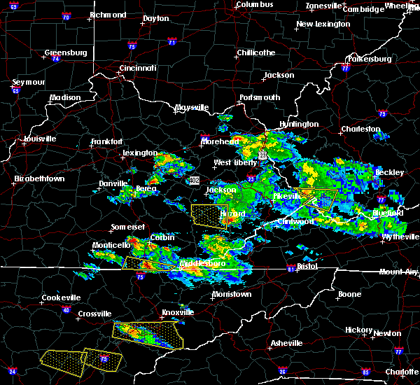 The severe thunderstorm warning for northern leslie, perry, west central knott and southwestern breathitt counties will expire at 715 pm edt, the storm which prompted the warning has weakened below severe limits, and has exited the warned area. therefore, the warning will be allowed to expire. however gusty winds are still possible with this thunderstorm. a severe thunderstorm watch remains in effect until midnight edt for southeastern kentucky. The severe thunderstorm warning for northern leslie, perry, west central knott and southwestern breathitt counties will expire at 715 pm edt, the storm which prompted the warning has weakened below severe limits, and has exited the warned area. therefore, the warning will be allowed to expire. however gusty winds are still possible with this thunderstorm. a severe thunderstorm watch remains in effect until midnight edt for southeastern kentucky.
|
| 3/17/2018 6:44 PM EDT |
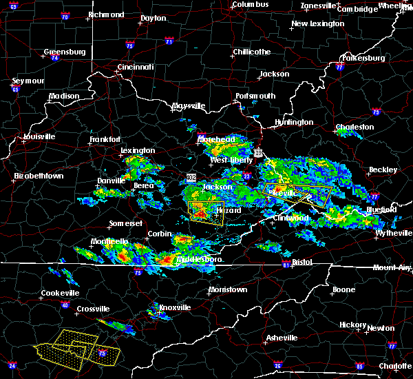 At 643 pm edt, a severe thunderstorm was located over valjean, or 12 miles southeast of booneville, moving east at 45 mph (radar indicated). Hazards include 60 mph wind gusts and quarter size hail. Hail damage to vehicles is expected. expect wind damage to roofs, siding, and trees. locations impacted include, hazard, hyden, buckhorn, altro, bush branch, dryhill, lamont, shoal, viper, daley, kaliopi, ary, wolf coal, confluence, beech, dalesburg, mosley bend, chavies, thousandsticks and buckhorn lake s. P At 643 pm edt, a severe thunderstorm was located over valjean, or 12 miles southeast of booneville, moving east at 45 mph (radar indicated). Hazards include 60 mph wind gusts and quarter size hail. Hail damage to vehicles is expected. expect wind damage to roofs, siding, and trees. locations impacted include, hazard, hyden, buckhorn, altro, bush branch, dryhill, lamont, shoal, viper, daley, kaliopi, ary, wolf coal, confluence, beech, dalesburg, mosley bend, chavies, thousandsticks and buckhorn lake s. P
|
| 3/17/2018 6:26 PM EDT |
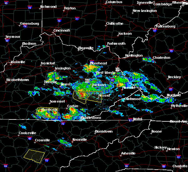 At 626 pm edt, a severe thunderstorm was located over sourwood, or 11 miles southwest of booneville, moving east at 45 mph (radar indicated). Hazards include 60 mph wind gusts and quarter size hail. Hail damage to vehicles is expected. Expect wind damage to roofs, siding, and trees. At 626 pm edt, a severe thunderstorm was located over sourwood, or 11 miles southwest of booneville, moving east at 45 mph (radar indicated). Hazards include 60 mph wind gusts and quarter size hail. Hail damage to vehicles is expected. Expect wind damage to roofs, siding, and trees.
|
| 3/17/2018 6:17 PM EDT |
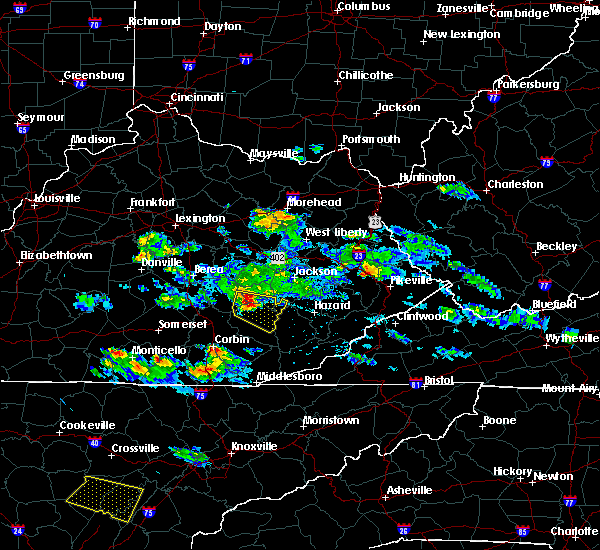 At 616 pm edt, a severe thunderstorm was located over herd, or 7 miles southeast of mckee, moving east at 45 mph (radar indicated). Hazards include 60 mph wind gusts and quarter size hail. Hail damage to vehicles is expected. expect wind damage to roofs, siding, and trees. Locations impacted include, manchester, buckhorn, blake, zekes point, maulden, mummie, treadway, tyner, privett, barcreek, chestnutburg, shepherdtown, saul, sacker gap, taff, hector, oneida, herd, sidell and high knob. At 616 pm edt, a severe thunderstorm was located over herd, or 7 miles southeast of mckee, moving east at 45 mph (radar indicated). Hazards include 60 mph wind gusts and quarter size hail. Hail damage to vehicles is expected. expect wind damage to roofs, siding, and trees. Locations impacted include, manchester, buckhorn, blake, zekes point, maulden, mummie, treadway, tyner, privett, barcreek, chestnutburg, shepherdtown, saul, sacker gap, taff, hector, oneida, herd, sidell and high knob.
|
| 3/17/2018 6:00 PM EDT |
 At 600 pm edt, a severe thunderstorm was located over dango, or near mckee, moving east at 45 mph (radar indicated). Hazards include 60 mph wind gusts and quarter size hail. Hail damage to vehicles is expected. Expect wind damage to roofs, siding, and trees. At 600 pm edt, a severe thunderstorm was located over dango, or near mckee, moving east at 45 mph (radar indicated). Hazards include 60 mph wind gusts and quarter size hail. Hail damage to vehicles is expected. Expect wind damage to roofs, siding, and trees.
|
| 7/6/2017 6:15 PM EDT |
 At 615 pm edt, a severe thunderstorm was located over buckhorn, or 13 miles northwest of hyden, moving east at 30 mph (radar indicated). Hazards include 60 mph wind gusts and quarter size hail. Hail damage to vehicles is expected. Expect wind damage to roofs, siding, and trees. At 615 pm edt, a severe thunderstorm was located over buckhorn, or 13 miles northwest of hyden, moving east at 30 mph (radar indicated). Hazards include 60 mph wind gusts and quarter size hail. Hail damage to vehicles is expected. Expect wind damage to roofs, siding, and trees.
|
| 6/13/2017 5:21 PM EDT |
 At 521 pm edt, a severe thunderstorm was located over krypton, or 8 miles northwest of hazard, moving southeast at 15 mph (radar indicated). Hazards include 60 mph wind gusts and half dollar size hail. Hail damage to vehicles is expected. Expect wind damage to roofs, siding, and trees. At 521 pm edt, a severe thunderstorm was located over krypton, or 8 miles northwest of hazard, moving southeast at 15 mph (radar indicated). Hazards include 60 mph wind gusts and half dollar size hail. Hail damage to vehicles is expected. Expect wind damage to roofs, siding, and trees.
|
| 5/19/2017 10:58 PM EDT |
 At 1056 pm edt, severe thunderstorms were located along a line extending from inverness to island city, moving southeast at 25 mph (radar indicated). Hazards include 60 mph wind gusts. Expect damage to roofs, siding, and trees. Locations impacted include, jackson, booneville, buckhorn, turin, travellers rest, blake, southfork, fillmore, cowcreek, lerose, war creek, elkatawa, tallega, levi, valjean, taff, haddix, arnett, conkling and turkey. At 1056 pm edt, severe thunderstorms were located along a line extending from inverness to island city, moving southeast at 25 mph (radar indicated). Hazards include 60 mph wind gusts. Expect damage to roofs, siding, and trees. Locations impacted include, jackson, booneville, buckhorn, turin, travellers rest, blake, southfork, fillmore, cowcreek, lerose, war creek, elkatawa, tallega, levi, valjean, taff, haddix, arnett, conkling and turkey.
|
| 5/19/2017 10:34 PM EDT |
 At 1033 pm edt, severe thunderstorms were located along a line extending from war creek to near privett, moving southeast at 25 mph (radar indicated). Hazards include 60 mph wind gusts and quarter size hail. Hail damage to vehicles is expected. Expect wind damage to roofs, siding, and trees. At 1033 pm edt, severe thunderstorms were located along a line extending from war creek to near privett, moving southeast at 25 mph (radar indicated). Hazards include 60 mph wind gusts and quarter size hail. Hail damage to vehicles is expected. Expect wind damage to roofs, siding, and trees.
|
| 3/27/2017 9:13 PM EDT |
 The severe thunderstorm warning for northwestern perry and western breathitt counties will expire at 915 pm edt. the storms which prompted the warning have moved out of the area. therefore the warning will be allowed to expire. however heavy rain is still possible with these thunderstorms. A severe thunderstorm watch remains in effect until 1100 pm edt for. The severe thunderstorm warning for northwestern perry and western breathitt counties will expire at 915 pm edt. the storms which prompted the warning have moved out of the area. therefore the warning will be allowed to expire. however heavy rain is still possible with these thunderstorms. A severe thunderstorm watch remains in effect until 1100 pm edt for.
|
| 3/27/2017 9:05 PM EDT |
 At 905 pm edt, a severe thunderstorm was located over noble, or 10 miles southeast of jackson, moving east at 30 mph (radar indicated). Hazards include 60 mph wind gusts and quarter size hail. Hail damage to vehicles is expected. expect wind damage to roofs, siding, and trees. Locations impacted include, buckhorn, altro, bush branch, hardshell, copland, lamont, wolf coal, wilstacy, beech, dalesburg, chavies, canoe, sikes, noble, dice, haddix, crockettsville, ned, saldee and clayhole. At 905 pm edt, a severe thunderstorm was located over noble, or 10 miles southeast of jackson, moving east at 30 mph (radar indicated). Hazards include 60 mph wind gusts and quarter size hail. Hail damage to vehicles is expected. expect wind damage to roofs, siding, and trees. Locations impacted include, buckhorn, altro, bush branch, hardshell, copland, lamont, wolf coal, wilstacy, beech, dalesburg, chavies, canoe, sikes, noble, dice, haddix, crockettsville, ned, saldee and clayhole.
|
| 3/27/2017 9:04 PM EDT |
 At 904 pm edt, severe thunderstorms were located along a line extending from lawson to canoe to buckhorn, moving northeast at 45 mph (radar indicated). Hazards include 60 mph wind gusts. Expect damage to roofs, siding, and trees. Locations impacted include, jackson, buckhorn, oakdale, vancleve, beech, frozen creek, dalesburg, canoe, wilhurst, war creek, gentry, elkatawa, chenowee, morris fork, crockettsville, lawson, guerrant, yeadon, turkey and talbert. At 904 pm edt, severe thunderstorms were located along a line extending from lawson to canoe to buckhorn, moving northeast at 45 mph (radar indicated). Hazards include 60 mph wind gusts. Expect damage to roofs, siding, and trees. Locations impacted include, jackson, buckhorn, oakdale, vancleve, beech, frozen creek, dalesburg, canoe, wilhurst, war creek, gentry, elkatawa, chenowee, morris fork, crockettsville, lawson, guerrant, yeadon, turkey and talbert.
|
| 3/27/2017 8:54 PM EDT |
 At 854 pm edt, a severe thunderstorm was located over watts, or 8 miles southeast of jackson, moving east at 30 mph (radar indicated). Hazards include 60 mph wind gusts and quarter size hail. Hail damage to vehicles is expected. expect wind damage to roofs, siding, and trees. Locations impacted include, buckhorn, altro, bush branch, hardshell, copland, lamont, wolf coal, wilstacy, beech, dalesburg, quicksand, chavies, canoe, sikes, noble, morris fork, dice, valjean, haddix and crockettsville. At 854 pm edt, a severe thunderstorm was located over watts, or 8 miles southeast of jackson, moving east at 30 mph (radar indicated). Hazards include 60 mph wind gusts and quarter size hail. Hail damage to vehicles is expected. expect wind damage to roofs, siding, and trees. Locations impacted include, buckhorn, altro, bush branch, hardshell, copland, lamont, wolf coal, wilstacy, beech, dalesburg, quicksand, chavies, canoe, sikes, noble, morris fork, dice, valjean, haddix and crockettsville.
|
| 3/27/2017 8:47 PM EDT |
 At 847 pm edt, severe thunderstorms were located along a line extending from mary to near houston to mistletoe, moving east at 45 mph (radar indicated). Hazards include 60 mph wind gusts. Expect damage to roofs, siding, and trees. Locations impacted include, jackson, buckhorn, southfork, fillmore, cowcreek, grass, pence, chestnut gap, copebranch, vancleve, beech, wilhurst, lerose, war creek, vada, elkatawa, tallega, morris fork, valjean and lane. At 847 pm edt, severe thunderstorms were located along a line extending from mary to near houston to mistletoe, moving east at 45 mph (radar indicated). Hazards include 60 mph wind gusts. Expect damage to roofs, siding, and trees. Locations impacted include, jackson, buckhorn, southfork, fillmore, cowcreek, grass, pence, chestnut gap, copebranch, vancleve, beech, wilhurst, lerose, war creek, vada, elkatawa, tallega, morris fork, valjean and lane.
|
| 3/27/2017 8:36 PM EDT |
 At 835 pm edt, severe thunderstorms were located along a line extending from blackburn to shop branch to mershons, moving east at 50 mph (radar indicated). Hazards include 60 mph wind gusts. Expect damage to roofs, siding, and trees. Locations impacted include, jackson, beattyville, campton, booneville, fincastle, buckhorn, turin, travellers rest, white ash, blake, leeco, southfork, fillmore, cowcreek, ida may, shepherdtown, lerose, war creek, elkatawa and tallega. At 835 pm edt, severe thunderstorms were located along a line extending from blackburn to shop branch to mershons, moving east at 50 mph (radar indicated). Hazards include 60 mph wind gusts. Expect damage to roofs, siding, and trees. Locations impacted include, jackson, beattyville, campton, booneville, fincastle, buckhorn, turin, travellers rest, white ash, blake, leeco, southfork, fillmore, cowcreek, ida may, shepherdtown, lerose, war creek, elkatawa and tallega.
|
| 3/27/2017 8:29 PM EDT |
 At 828 pm edt, a severe thunderstorm was located over morris fork, or 11 miles southeast of booneville, moving east at 30 mph (radar indicated). Hazards include 60 mph wind gusts and quarter size hail. Hail damage to vehicles is expected. Expect wind damage to roofs, siding, and trees. At 828 pm edt, a severe thunderstorm was located over morris fork, or 11 miles southeast of booneville, moving east at 30 mph (radar indicated). Hazards include 60 mph wind gusts and quarter size hail. Hail damage to vehicles is expected. Expect wind damage to roofs, siding, and trees.
|
| 3/27/2017 8:23 PM EDT |
 At 823 pm edt, severe thunderstorms were located along a line extending from 6 miles northwest of shirley to robinet to luner, moving east at 50 mph (radar indicated). Hazards include 60 mph wind gusts. expect damage to roofs, siding, and trees At 823 pm edt, severe thunderstorms were located along a line extending from 6 miles northwest of shirley to robinet to luner, moving east at 50 mph (radar indicated). Hazards include 60 mph wind gusts. expect damage to roofs, siding, and trees
|
| 3/27/2017 8:12 PM EDT |
 At 812 pm edt, a severe thunderstorm was located over gobbard, or 7 miles southeast of booneville, moving northeast at 20 mph (radar indicated). Hazards include ping pong ball size hail. People and animals outdoors will be injured. expect damage to roofs, siding, windows, and vehicles. Locations impacted include, booneville, buckhorn, turin, travellers rest, blake, southfork, zekes point, cowcreek, grass, maulden, mummie, chestnut gap, beech, scoville, chestnutburg, shepherdtown, lerose, sacker gap, morris fork and levi. At 812 pm edt, a severe thunderstorm was located over gobbard, or 7 miles southeast of booneville, moving northeast at 20 mph (radar indicated). Hazards include ping pong ball size hail. People and animals outdoors will be injured. expect damage to roofs, siding, windows, and vehicles. Locations impacted include, booneville, buckhorn, turin, travellers rest, blake, southfork, zekes point, cowcreek, grass, maulden, mummie, chestnut gap, beech, scoville, chestnutburg, shepherdtown, lerose, sacker gap, morris fork and levi.
|
| 3/27/2017 8:00 PM EDT |
 At 759 pm edt, a severe thunderstorm was located over island city, or 8 miles southwest of booneville, moving northeast at 25 mph (radar indicated). Hazards include half dollar to ping pong ball size hail. People and animals outdoors will be injured. expect damage to roofs, siding, windows, and vehicles. Locations impacted include, booneville, buckhorn, turin, travellers rest, blake, southfork, zekes point, cowcreek, grass, maulden, mummie, chestnut gap, beech, scoville, chestnutburg, shepherdtown, lerose, sacker gap, morris fork and levi. At 759 pm edt, a severe thunderstorm was located over island city, or 8 miles southwest of booneville, moving northeast at 25 mph (radar indicated). Hazards include half dollar to ping pong ball size hail. People and animals outdoors will be injured. expect damage to roofs, siding, windows, and vehicles. Locations impacted include, booneville, buckhorn, turin, travellers rest, blake, southfork, zekes point, cowcreek, grass, maulden, mummie, chestnut gap, beech, scoville, chestnutburg, shepherdtown, lerose, sacker gap, morris fork and levi.
|
| 3/27/2017 7:34 PM EDT |
 At 734 pm edt, a severe thunderstorm was located over high knob, or 10 miles southeast of mckee, moving northeast at 25 mph (radar indicated). Hazards include ping pong ball size hail. People and animals outdoors will be injured. Expect damage to roofs, siding, windows, and vehicles. At 734 pm edt, a severe thunderstorm was located over high knob, or 10 miles southeast of mckee, moving northeast at 25 mph (radar indicated). Hazards include ping pong ball size hail. People and animals outdoors will be injured. Expect damage to roofs, siding, windows, and vehicles.
|
| 3/1/2017 9:25 AM EST |
 At 925 am est, severe thunderstorms were located along a line extending from ulysses to evanston to tanksley, moving east at 60 mph (radar indicated). Hazards include 70 mph wind gusts. Expect considerable tree damage. Damage is likely to mobile homes, roofs, and outbuildings. At 925 am est, severe thunderstorms were located along a line extending from ulysses to evanston to tanksley, moving east at 60 mph (radar indicated). Hazards include 70 mph wind gusts. Expect considerable tree damage. Damage is likely to mobile homes, roofs, and outbuildings.
|
| 7/4/2016 5:28 PM EDT |
 At 528 pm edt, severe thunderstorms were located along a line extending from turin to ammie, moving east at 45 mph (radar indicated). Hazards include 60 mph wind gusts. Expect damage to roofs. siding. and trees. Locations impacted include, booneville, buckhorn, crockettsville, sourwood, sacker gap, taff, lerose, canoe, chestnutburg, fall rock, thomas, travellers rest, valjean, gobbard, sturgeon, panco, enline, lucky fork, jetts creek and levi. At 528 pm edt, severe thunderstorms were located along a line extending from turin to ammie, moving east at 45 mph (radar indicated). Hazards include 60 mph wind gusts. Expect damage to roofs. siding. and trees. Locations impacted include, booneville, buckhorn, crockettsville, sourwood, sacker gap, taff, lerose, canoe, chestnutburg, fall rock, thomas, travellers rest, valjean, gobbard, sturgeon, panco, enline, lucky fork, jetts creek and levi.
|
| 7/4/2016 5:16 PM EDT |
 At 515 pm edt, severe thunderstorms were located along a line extending from travellers rest to near malcomb, moving east at 45 mph (radar indicated). Hazards include 60 mph wind gusts. Expect damage to roofs. siding. And trees. At 515 pm edt, severe thunderstorms were located along a line extending from travellers rest to near malcomb, moving east at 45 mph (radar indicated). Hazards include 60 mph wind gusts. Expect damage to roofs. siding. And trees.
|
| 6/23/2016 8:13 PM EDT |
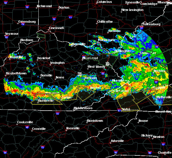 At 812 pm edt, a severe thunderstorm was located over brutus, or 12 miles northwest of hyden, moving southeast at 40 mph (radar indicated). Hazards include 60 mph wind gusts. Expect damage to roofs. siding. And trees. At 812 pm edt, a severe thunderstorm was located over brutus, or 12 miles northwest of hyden, moving southeast at 40 mph (radar indicated). Hazards include 60 mph wind gusts. Expect damage to roofs. siding. And trees.
|
| 6/23/2016 6:43 PM EDT |
 At 642 pm edt, a severe thunderstorm was located over paxton, or 7 miles southeast of campton, moving southeast at 55 mph (radar indicated). Hazards include 70 mph wind gusts. Expect considerable tree damage. Damage is likely to mobile homes, roofs, and outbuildings. At 642 pm edt, a severe thunderstorm was located over paxton, or 7 miles southeast of campton, moving southeast at 55 mph (radar indicated). Hazards include 70 mph wind gusts. Expect considerable tree damage. Damage is likely to mobile homes, roofs, and outbuildings.
|
| 5/12/2016 12:23 AM EDT |
 At 1223 am edt, a severe thunderstorm was located over canoe, or 7 miles southwest of jackson, moving east at 25 mph (radar indicated). Hazards include 60 mph wind gusts. Expect damage to roofs. siding. and trees. locations impacted include, jackson, buckhorn, crockettsville, sewell, quicksand, lerose, buckhorn lake s. p,. st. Helens, lost creek, krypton, canoe, copland, vancleve, howard creek, valjean, yeadon, whick, oakdale, wolf coal and lamont. At 1223 am edt, a severe thunderstorm was located over canoe, or 7 miles southwest of jackson, moving east at 25 mph (radar indicated). Hazards include 60 mph wind gusts. Expect damage to roofs. siding. and trees. locations impacted include, jackson, buckhorn, crockettsville, sewell, quicksand, lerose, buckhorn lake s. p,. st. Helens, lost creek, krypton, canoe, copland, vancleve, howard creek, valjean, yeadon, whick, oakdale, wolf coal and lamont.
|
| 5/11/2016 11:58 PM EDT |
 At 1158 pm edt, a severe thunderstorm was located over eversole, or near booneville, moving east at 25 mph (radar indicated). Hazards include 60 mph wind gusts and quarter size hail. Hail damage to vehicles is expected. Expect wind damage to roofs, siding, and trees. At 1158 pm edt, a severe thunderstorm was located over eversole, or near booneville, moving east at 25 mph (radar indicated). Hazards include 60 mph wind gusts and quarter size hail. Hail damage to vehicles is expected. Expect wind damage to roofs, siding, and trees.
|
| 5/2/2016 2:30 PM EDT |
 At 229 pm edt, a severe thunderstorm was located over dalesburg, or 12 miles southeast of booneville, moving east at 40 mph (radar indicated). Hazards include golf ball size hail and 60 mph wind gusts. People and animals outdoors will be injured. expect hail damage to roofs, siding, windows, and vehicles. Expect wind damage to roofs, siding, and trees. At 229 pm edt, a severe thunderstorm was located over dalesburg, or 12 miles southeast of booneville, moving east at 40 mph (radar indicated). Hazards include golf ball size hail and 60 mph wind gusts. People and animals outdoors will be injured. expect hail damage to roofs, siding, windows, and vehicles. Expect wind damage to roofs, siding, and trees.
|
| 5/2/2016 2:28 PM EDT |
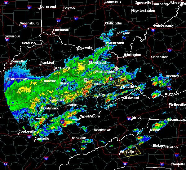 At 228 pm edt, a severe thunderstorm was located over valjean, or 11 miles southeast of booneville, moving east at 35 mph (law enforcement). Hazards include golf ball size hail and 60 mph wind gusts. People and animals outdoors will be injured. expect hail damage to roofs, siding, windows, and vehicles. expect wind damage to roofs, siding, and trees. locations impacted include, buckhorn, lucky fork, crockettsville, whoopflarea, saul, houston, talbert, buckhorn lake s. p,. Sebastian`s branch, valjean, dalesburg, arnett, morris fork and mistletoe. At 228 pm edt, a severe thunderstorm was located over valjean, or 11 miles southeast of booneville, moving east at 35 mph (law enforcement). Hazards include golf ball size hail and 60 mph wind gusts. People and animals outdoors will be injured. expect hail damage to roofs, siding, windows, and vehicles. expect wind damage to roofs, siding, and trees. locations impacted include, buckhorn, lucky fork, crockettsville, whoopflarea, saul, houston, talbert, buckhorn lake s. p,. Sebastian`s branch, valjean, dalesburg, arnett, morris fork and mistletoe.
|
| 5/2/2016 2:20 PM EDT | Golf Ball sized hail reported 0.6 miles SSE of Buckhorn, KY |
| 5/2/2016 2:14 PM EDT |
 At 213 pm edt, a severe thunderstorm was located over thomas, or 10 miles south of booneville, moving east at 30 mph. golf ball sized hail was recently reported from this storm by a constable in burning springs (law enforcement). Hazards include golf ball size hail and 60 mph wind gusts. People and animals outdoors will be injured. expect hail damage to roofs, siding, windows, and vehicles. expect wind damage to roofs, siding, and trees. locations impacted include, buckhorn, crockettsville, whoopflarea, taff, blake, buckhorn lake s. p,. Oneida, sebastian`s branch, brutus, ricetown, thomas, cowcreek, valjean, gobbard, newfound, panco, wild cat, arnett, lucky fork and laurel creek. At 213 pm edt, a severe thunderstorm was located over thomas, or 10 miles south of booneville, moving east at 30 mph. golf ball sized hail was recently reported from this storm by a constable in burning springs (law enforcement). Hazards include golf ball size hail and 60 mph wind gusts. People and animals outdoors will be injured. expect hail damage to roofs, siding, windows, and vehicles. expect wind damage to roofs, siding, and trees. locations impacted include, buckhorn, crockettsville, whoopflarea, taff, blake, buckhorn lake s. p,. Oneida, sebastian`s branch, brutus, ricetown, thomas, cowcreek, valjean, gobbard, newfound, panco, wild cat, arnett, lucky fork and laurel creek.
|
| 5/2/2016 2:06 PM EDT |
 At 206 pm edt, a severe thunderstorm was located over sextons creek, or 10 miles north of manchester, moving east at 30 mph (radar indicated). Hazards include 60 mph wind gusts and quarter size hail. Hail damage to vehicles is expected. Expect wind damage to roofs, siding, and trees. At 206 pm edt, a severe thunderstorm was located over sextons creek, or 10 miles north of manchester, moving east at 30 mph (radar indicated). Hazards include 60 mph wind gusts and quarter size hail. Hail damage to vehicles is expected. Expect wind damage to roofs, siding, and trees.
|
| 8/19/2015 12:58 PM EDT |
 At 1256 pm edt, severe thunderstorms were located along a line extending from near mount olive to beech, moving northeast at 30 mph (radar indicated). Hazards include 60 mph wind gusts. Expect damage to roofs. siding and trees. locations impacted include, jackson, beattyville, campton, simpson, fincastle, buckhorn, sewell, lane, portsmouth, vada, lerose, st. Helens, zachariah, ned, copland, vancleve, koomer ridge campground, howard creek, rogers and airedale. At 1256 pm edt, severe thunderstorms were located along a line extending from near mount olive to beech, moving northeast at 30 mph (radar indicated). Hazards include 60 mph wind gusts. Expect damage to roofs. siding and trees. locations impacted include, jackson, beattyville, campton, simpson, fincastle, buckhorn, sewell, lane, portsmouth, vada, lerose, st. Helens, zachariah, ned, copland, vancleve, koomer ridge campground, howard creek, rogers and airedale.
|
| 8/19/2015 12:46 PM EDT |
 At 1246 pm edt, severe thunderstorms were located along a line extending from belle point to buckhorn, moving northeast at 30 mph (radar indicated). Hazards include 60 mph wind gusts. Expect damage to roofs. Siding and trees. At 1246 pm edt, severe thunderstorms were located along a line extending from belle point to buckhorn, moving northeast at 30 mph (radar indicated). Hazards include 60 mph wind gusts. Expect damage to roofs. Siding and trees.
|
| 8/4/2015 5:03 PM EDT |
 At 502 pm edt, a severe thunderstorm was located over whick, or 8 miles south of jackson, moving east at 30 mph (radar indicated). Hazards include quarter size hail and 60 mph wind gusts. Hail damage to vehicles is expected. expect wind damage to roofs, siding and trees. Locations impacted include, booneville, buckhorn, crockettsville, barwick, saldee, lerose, lost creek, krypton, ned, canoe, copland, beech, guerrant, sebastian`s branch, altro, howard creek, cowcreek, whick, watts and wolf coal. At 502 pm edt, a severe thunderstorm was located over whick, or 8 miles south of jackson, moving east at 30 mph (radar indicated). Hazards include quarter size hail and 60 mph wind gusts. Hail damage to vehicles is expected. expect wind damage to roofs, siding and trees. Locations impacted include, booneville, buckhorn, crockettsville, barwick, saldee, lerose, lost creek, krypton, ned, canoe, copland, beech, guerrant, sebastian`s branch, altro, howard creek, cowcreek, whick, watts and wolf coal.
|
| 8/4/2015 4:50 PM EDT |
 At 450 pm edt, a severe thunderstorm was located over houston, or 9 miles southwest of jackson, moving east at 30 mph (radar indicated). Hazards include quarter size hail and 60 mph wind gusts. Hail damage to vehicles is expected. Expect wind damage to roofs, siding and trees. At 450 pm edt, a severe thunderstorm was located over houston, or 9 miles southwest of jackson, moving east at 30 mph (radar indicated). Hazards include quarter size hail and 60 mph wind gusts. Hail damage to vehicles is expected. Expect wind damage to roofs, siding and trees.
|
| 7/14/2015 8:24 PM EDT |
 At 824 pm edt, severe thunderstorms were located along a line extending from diablock to kaliopi to thomas, moving southeast at 35 mph (radar indicated). Hazards include 60 mph wind gusts. Expect damage to roofs. Siding and trees. At 824 pm edt, severe thunderstorms were located along a line extending from diablock to kaliopi to thomas, moving southeast at 35 mph (radar indicated). Hazards include 60 mph wind gusts. Expect damage to roofs. Siding and trees.
|
| 7/14/2015 7:50 PM EDT | A tree was blown down on houston roa in breathitt county KY, 6.1 miles SE of Buckhorn, KY |
| 7/14/2015 7:47 PM EDT |
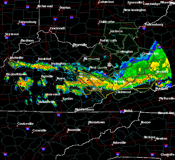 At 747 pm edt, severe thunderstorms were located along a line extending from guerrant to chestnut gap to vincent to sand springs, moving southeast at 40 mph (radar indicated). Hazards include 60 mph wind gusts. Expect damage to roofs. Siding and trees. At 747 pm edt, severe thunderstorms were located along a line extending from guerrant to chestnut gap to vincent to sand springs, moving southeast at 40 mph (radar indicated). Hazards include 60 mph wind gusts. Expect damage to roofs. Siding and trees.
|
| 7/13/2015 4:55 PM EDT |
 At 455 pm edt, severe thunderstorms were located along a line extending from near galveston to amburgey to diablock to near causey to cottongin, moving southeast at 45 mph (radar indicated). Hazards include 60 mph wind gusts and penny size hail. Expect damage to roofs. Siding and trees. At 455 pm edt, severe thunderstorms were located along a line extending from near galveston to amburgey to diablock to near causey to cottongin, moving southeast at 45 mph (radar indicated). Hazards include 60 mph wind gusts and penny size hail. Expect damage to roofs. Siding and trees.
|
| 7/13/2015 4:47 PM EDT |
 At 446 pm edt, severe thunderstorms were located along a line extending from hueysville to mousie to talcum to kaliopi to high knob, moving southeast at 40 mph (radar indicated). Hazards include 60 mph wind gusts and penny size hail. Expect damage to roofs. siding and trees. Locations impacted include,. At 446 pm edt, severe thunderstorms were located along a line extending from hueysville to mousie to talcum to kaliopi to high knob, moving southeast at 40 mph (radar indicated). Hazards include 60 mph wind gusts and penny size hail. Expect damage to roofs. siding and trees. Locations impacted include,.
|
| 7/13/2015 4:25 PM EDT | Numerous trees... large limbs and power lines dow in breathitt county KY, 3.9 miles S of Buckhorn, KY |
| 7/13/2015 4:24 PM EDT |
 At 424 pm edt, severe thunderstorms were located along a line extending from ivyton to evanston to wilstacy to lucky fork to atkinstown, moving southeast at 40 mph (radar indicated). Hazards include half dollar size hail and 60 mph wind gusts. Hail damage to vehicles is expected. Expect wind damage to roofs, siding and trees. At 424 pm edt, severe thunderstorms were located along a line extending from ivyton to evanston to wilstacy to lucky fork to atkinstown, moving southeast at 40 mph (radar indicated). Hazards include half dollar size hail and 60 mph wind gusts. Hail damage to vehicles is expected. Expect wind damage to roofs, siding and trees.
|
| 7/13/2015 4:01 PM EDT |
 At 400 pm edt, severe thunderstorms were located along a line extending from hendricks to fillmore to near shirley, moving southeast at 60 mph (radar indicated). Hazards include quarter size hail and 70 mph wind gusts. Hail damage to vehicles is expected. Expect wind damage to roofs, siding and trees. At 400 pm edt, severe thunderstorms were located along a line extending from hendricks to fillmore to near shirley, moving southeast at 60 mph (radar indicated). Hazards include quarter size hail and 70 mph wind gusts. Hail damage to vehicles is expected. Expect wind damage to roofs, siding and trees.
|
| 7/9/2015 6:55 PM EDT |
 The severe thunderstorm warning for northeastern laurel, southeastern owsley, west central perry, clay, southeastern jackson and northwestern leslie counties will expire at 700 pm edt, the storm which prompted the warning has weakened below severe limits, and no longer poses an immediate threat to life or property. therefore the warning will be allowed to expire. The severe thunderstorm warning for northeastern laurel, southeastern owsley, west central perry, clay, southeastern jackson and northwestern leslie counties will expire at 700 pm edt, the storm which prompted the warning has weakened below severe limits, and no longer poses an immediate threat to life or property. therefore the warning will be allowed to expire.
|
| 7/9/2015 6:29 PM EDT |
 At 629 pm edt, a severe thunderstorm was located over langnau, or 7 miles northeast of london, moving east at 50 mph (radar indicated). Hazards include 60 mph wind gusts and penny size hail. Expect damage to roofs. Siding and trees. At 629 pm edt, a severe thunderstorm was located over langnau, or 7 miles northeast of london, moving east at 50 mph (radar indicated). Hazards include 60 mph wind gusts and penny size hail. Expect damage to roofs. Siding and trees.
|
| 7/9/2015 3:15 PM EDT |
 At 315 pm edt, a severe thunderstorm was located over jackson, moving northeast at 45 mph (radar indicated). Hazards include 60 mph wind gusts. Expect damage to roofs. siding and trees. locations impacted include, jackson, buckhorn, crockettsville, press, quicksand, portsmouth, buckhorn lake s. p,. Lost creek, krypton, ned, canoe, copland, noble, guage, howard creek, valjean, yeadon, whick, oakdale and haginsville. At 315 pm edt, a severe thunderstorm was located over jackson, moving northeast at 45 mph (radar indicated). Hazards include 60 mph wind gusts. Expect damage to roofs. siding and trees. locations impacted include, jackson, buckhorn, crockettsville, press, quicksand, portsmouth, buckhorn lake s. p,. Lost creek, krypton, ned, canoe, copland, noble, guage, howard creek, valjean, yeadon, whick, oakdale and haginsville.
|
| 7/9/2015 3:05 PM EDT | Tree down on hwy 111 in breathitt county KY, 6.1 miles SW of Buckhorn, KY |
| 7/9/2015 2:53 PM EDT |
 At 252 pm edt, a severe thunderstorm was located over booneville, moving east at 60 mph (radar indicated). Hazards include 60 mph wind gusts. Expect damage to roofs. Siding and trees. At 252 pm edt, a severe thunderstorm was located over booneville, moving east at 60 mph (radar indicated). Hazards include 60 mph wind gusts. Expect damage to roofs. Siding and trees.
|
| 6/25/2015 8:26 PM EDT |
 The severe thunderstorm warning for east central owsley, northwestern perry and southwestern breathitt counties will expire at 830 pm edt, the storm which prompted the warning has weakened below severe limits, and no longer pose an immediate threat to life or property. therefore the warning will be allowed to expire. a severe thunderstorm watch remains in effect until 200 am edt for southeastern kentucky. The severe thunderstorm warning for east central owsley, northwestern perry and southwestern breathitt counties will expire at 830 pm edt, the storm which prompted the warning has weakened below severe limits, and no longer pose an immediate threat to life or property. therefore the warning will be allowed to expire. a severe thunderstorm watch remains in effect until 200 am edt for southeastern kentucky.
|
| 6/25/2015 7:59 PM EDT |
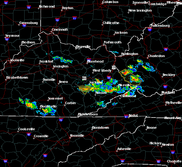 At 759 pm edt, a severe thunderstorm was located over houston, or 8 miles southeast of booneville, moving east at 20 mph (radar indicated). Hazards include ping pong size hail and 60 mph wind gusts. People and animals outdoors will be injured. expect hail damage to roofs, siding, windows and vehicles. expect wind damage to roofs, siding and trees. Locations impacted include, buckhorn, lucky fork, crockettsville, saul, houston, saldee, talbert, canoe, copland, beech, sebastian`s branch, chestnut gap, howard creek, ricetown, cowcreek, valjean, morris fork and eversole. At 759 pm edt, a severe thunderstorm was located over houston, or 8 miles southeast of booneville, moving east at 20 mph (radar indicated). Hazards include ping pong size hail and 60 mph wind gusts. People and animals outdoors will be injured. expect hail damage to roofs, siding, windows and vehicles. expect wind damage to roofs, siding and trees. Locations impacted include, buckhorn, lucky fork, crockettsville, saul, houston, saldee, talbert, canoe, copland, beech, sebastian`s branch, chestnut gap, howard creek, ricetown, cowcreek, valjean, morris fork and eversole.
|
| 6/25/2015 7:47 PM EDT |
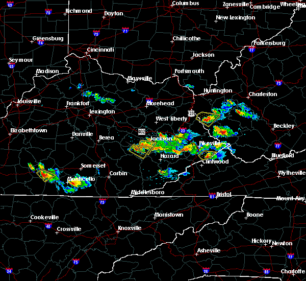 At 746 pm edt, a severe thunderstorm was located over cowcreek, or near booneville, moving east at 20 mph (radar indicated). Hazards include quarter size hail and 60 mph wind gusts. Hail damage to vehicles is expected. Expect wind damage to roofs, siding and trees. At 746 pm edt, a severe thunderstorm was located over cowcreek, or near booneville, moving east at 20 mph (radar indicated). Hazards include quarter size hail and 60 mph wind gusts. Hail damage to vehicles is expected. Expect wind damage to roofs, siding and trees.
|
| 6/25/2015 6:28 PM EDT |
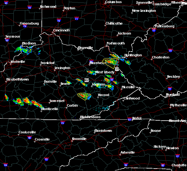 At 627 pm edt, a severe thunderstorm was located over newfound, or 11 miles south of booneville, moving east at 25 mph (radar indicated). Hazards include golf ball size hail and 60 mph wind gusts. People and animals outdoors will be injured. expect hail damage to roofs, siding, windows and vehicles. expect wind damage to roofs, siding and trees. locations impacted include, buckhorn, lucky fork, whoopflarea, saul, teges, taff, hensley, buckhorn lake s. p,. Jacks creek, oneida, spurlock, brutus, thomas, barcreek, mistletoe, newfound, panco, trixie, ammie and seth. At 627 pm edt, a severe thunderstorm was located over newfound, or 11 miles south of booneville, moving east at 25 mph (radar indicated). Hazards include golf ball size hail and 60 mph wind gusts. People and animals outdoors will be injured. expect hail damage to roofs, siding, windows and vehicles. expect wind damage to roofs, siding and trees. locations impacted include, buckhorn, lucky fork, whoopflarea, saul, teges, taff, hensley, buckhorn lake s. p,. Jacks creek, oneida, spurlock, brutus, thomas, barcreek, mistletoe, newfound, panco, trixie, ammie and seth.
|
| 6/25/2015 6:17 PM EDT |
 At 611 pm edt, a severe thunderstorm was located over island city, or 10 miles southwest of booneville, moving east at 25 mph (radar indicated). Hazards include quarter size hail and 60 mph wind gusts. Hail damage to vehicles is expected. Expect wind damage to roofs, siding and trees. At 611 pm edt, a severe thunderstorm was located over island city, or 10 miles southwest of booneville, moving east at 25 mph (radar indicated). Hazards include quarter size hail and 60 mph wind gusts. Hail damage to vehicles is expected. Expect wind damage to roofs, siding and trees.
|
| 6/21/2015 5:31 PM EDT |
 At 530 pm edt, a severe thunderstorm was located over buckhorn lake s.p, .or 11 miles north of hyden, moving southeast at 35 mph (radar indicated). Hazards include quarter size hail and 70 mph wind gusts. Hail damage to vehicles is expected. expect considerable tree damage. Wind damage is also likely to mobile homes, roofs and outbuildings. At 530 pm edt, a severe thunderstorm was located over buckhorn lake s.p, .or 11 miles north of hyden, moving southeast at 35 mph (radar indicated). Hazards include quarter size hail and 70 mph wind gusts. Hail damage to vehicles is expected. expect considerable tree damage. Wind damage is also likely to mobile homes, roofs and outbuildings.
|
| 6/21/2015 5:26 PM EDT |
 The severe thunderstorm warning for northern perry, west central knott and southwestern breathitt counties will expire at 530 pm edt, the severe thunderstorm which prompted the warning has weakened. however, another severe thunderstorm is moving into perry county from owsley county. a severe thunderstorm watch remains in effect until 800 pm edt for southeastern kentucky. remember, a severe thunderstorm warning still remains in effect for northwestern perry county names until time 545 pm edt. The severe thunderstorm warning for northern perry, west central knott and southwestern breathitt counties will expire at 530 pm edt, the severe thunderstorm which prompted the warning has weakened. however, another severe thunderstorm is moving into perry county from owsley county. a severe thunderstorm watch remains in effect until 800 pm edt for southeastern kentucky. remember, a severe thunderstorm warning still remains in effect for northwestern perry county names until time 545 pm edt.
|
| 6/21/2015 5:24 PM EDT |
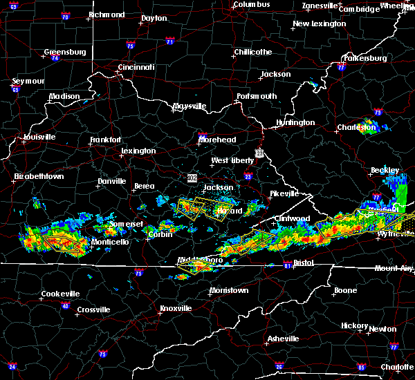 At 524 pm edt, a severe thunderstorm was located over lucky fork, or 10 miles southeast of booneville, moving east at 40 mph (radar indicated). Hazards include quarter size hail and 70 mph wind gusts. Hail damage to vehicles is expected. expect considerable tree damage. wind damage is also likely to mobile homes, roofs and outbuildings. locations impacted include, booneville, buckhorn, crockettsville, whoopflarea, sizerock, taff, buckhorn lake s. p,. Beech, altro, brutus, ricetown, cowcreek, valjean, gobbard, newfound, panco, wolf coal, lucky fork, conkling and saul. At 524 pm edt, a severe thunderstorm was located over lucky fork, or 10 miles southeast of booneville, moving east at 40 mph (radar indicated). Hazards include quarter size hail and 70 mph wind gusts. Hail damage to vehicles is expected. expect considerable tree damage. wind damage is also likely to mobile homes, roofs and outbuildings. locations impacted include, booneville, buckhorn, crockettsville, whoopflarea, sizerock, taff, buckhorn lake s. p,. Beech, altro, brutus, ricetown, cowcreek, valjean, gobbard, newfound, panco, wolf coal, lucky fork, conkling and saul.
|
| 6/21/2015 5:10 PM EDT |
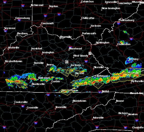 At 509 pm edt, a severe thunderstorm was located over major, or near booneville, moving east at 40 mph (radar indicated). Hazards include quarter size hail and 60 mph wind gusts. Hail damage to vehicles is expected. Expect wind damage to roofs, siding and trees. At 509 pm edt, a severe thunderstorm was located over major, or near booneville, moving east at 40 mph (radar indicated). Hazards include quarter size hail and 60 mph wind gusts. Hail damage to vehicles is expected. Expect wind damage to roofs, siding and trees.
|
| 6/21/2015 4:51 PM EDT |
 At 450 pm edt, a severe thunderstorm was located over beech, or 11 miles south of jackson, moving east at 25 mph (radar indicated). Hazards include quarter size hail and 60 mph wind gusts. Hail damage to vehicles is expected. Expect wind damage to roofs, siding and trees. At 450 pm edt, a severe thunderstorm was located over beech, or 11 miles south of jackson, moving east at 25 mph (radar indicated). Hazards include quarter size hail and 60 mph wind gusts. Hail damage to vehicles is expected. Expect wind damage to roofs, siding and trees.
|
| 4/25/2015 10:00 PM EDT | At 959 pm edt, a severe thunderstorm was located over sebastian, or 9 miles south of booneville, moving east at 55 mph (radar indicated). Hazards include quarter size hail and 60 mph wind gusts. Hail damage to vehicles is expected. Expect wind damage to roofs, siding and trees. |
| 4/25/2015 9:37 PM EDT | Quarter sized hail reported 7.2 miles WNW of Buckhorn, KY |
| 4/25/2015 9:25 PM EDT | The tornado warning for southeastern owsley, northwestern perry and northeastern clay counties will expire at 930 pm edt, the storm which prompted the warning has weakened, and no longer appears capable of producing a tornado. therefore the warning will be allowed to expire. a severe thunderstorm watch remains in effect until 1100 pm edt for southeastern kentucky. remember, a severe thunderstorm warning still remains in effect until 9:45 pm. |
| 4/25/2015 9:11 PM EDT | At 910 pm edt, a severe thunderstorm capable of producing a tornado was located over newfound, or 11 miles south of booneville, moving east at 40 mph (radar indicated rotation). Hazards include tornado and golf ball size hail. Mobile homes will be damaged or destroyed. damage to roofs, windows and vehicles will occur. flying debris will be deadly to people and animals. tree damage is likely. locations impacted include, buckhorn, lucky fork, whoopflarea, saul, teges, taff, jacks creek, oneida, brutus, thomas, mistletoe, newfound, panco, trixie, ammie, seth, sebastian and felty. Radar indicated. |
| 4/25/2015 8:58 PM EDT | At 858 pm edt, a severe thunderstorm capable of producing a tornado was located over nathanton, or 11 miles southeast of mckee, moving east at 35 mph (radar indicated rotation). Hazards include tornado and golf ball size hail. Mobile homes will be damaged or destroyed. damage to roofs, windows and vehicles will occur. flying debris will be deadly to people and animals. Tree damage is likely. |
| 4/25/2015 8:45 PM EDT | At 844 pm edt, a severe thunderstorm was located over turkey foot, or near mckee, moving east at 35 mph (radar indicated). Hazards include golf ball size hail and 60 mph wind gusts. People and animals outdoors will be injured. expect hail damage to roofs, siding, windows and vehicles. Expect wind damage to roofs, siding and trees. |
| 4/10/2015 7:11 AM EDT | A severe thunderstorm warning remains in effect until 730 am edt for southeastern owsley. perry. southwestern breathitt and central leslie counties. at 710 am edt. a severe thunderstorm was located over krypton. or 8 miles west of hazard. moving northeast at 60 mph. hazard. 60 mph wind gusts. |
| 4/10/2015 6:57 AM EDT | A severe thunderstorm warning remains in effect until 730 am edt for southeastern owsley. perry. eastern clay. southwestern breathitt. northeastern knox and leslie counties. at 657 am edt. a severe thunderstorm was located over bear branch. or 9 miles west of hyden. moving east at 50 mph. hazard. 60 mph wind gusts. |
| 4/10/2015 6:45 AM EDT | The national weather service in jackson ky has issued a * severe thunderstorm warning for. southeastern laurel county in south central kentucky. southeastern owsley county in southeastern kentucky. perry county in southeastern kentucky. Clay county in southeastern kentucky. |
| 7/14/2014 3:00 PM EDT | Tree down on combs b in perry county KY, 6.3 miles W of Buckhorn, KY |
| 7/4/2013 9:25 PM EDT | 3 trees fell off hillside onto highway 30 as a result of high winds and excessive rainfal in breathitt county KY, 8 miles SSE of Buckhorn, KY |
| 5/21/2013 5:40 PM EDT | Large tree down on hwy 2 in owsley county KY, 7.4 miles SE of Buckhorn, KY |
| 1/30/2013 7:51 AM EST | Trees down on highway 31 in breathitt county KY, 5.3 miles S of Buckhorn, KY |
| 7/5/2012 3:13 PM EDT | Trees down at chavie in perry county KY, 6.3 miles W of Buckhorn, KY |
| 1/1/0001 12:00 AM | Couple of trees down off of ky highway 28 near buckhorn high school in perry county KY, 0.6 miles SSE of Buckhorn, KY |
Hail Maps for Buckhorn, KY


Connect with Interactive Hail Maps