

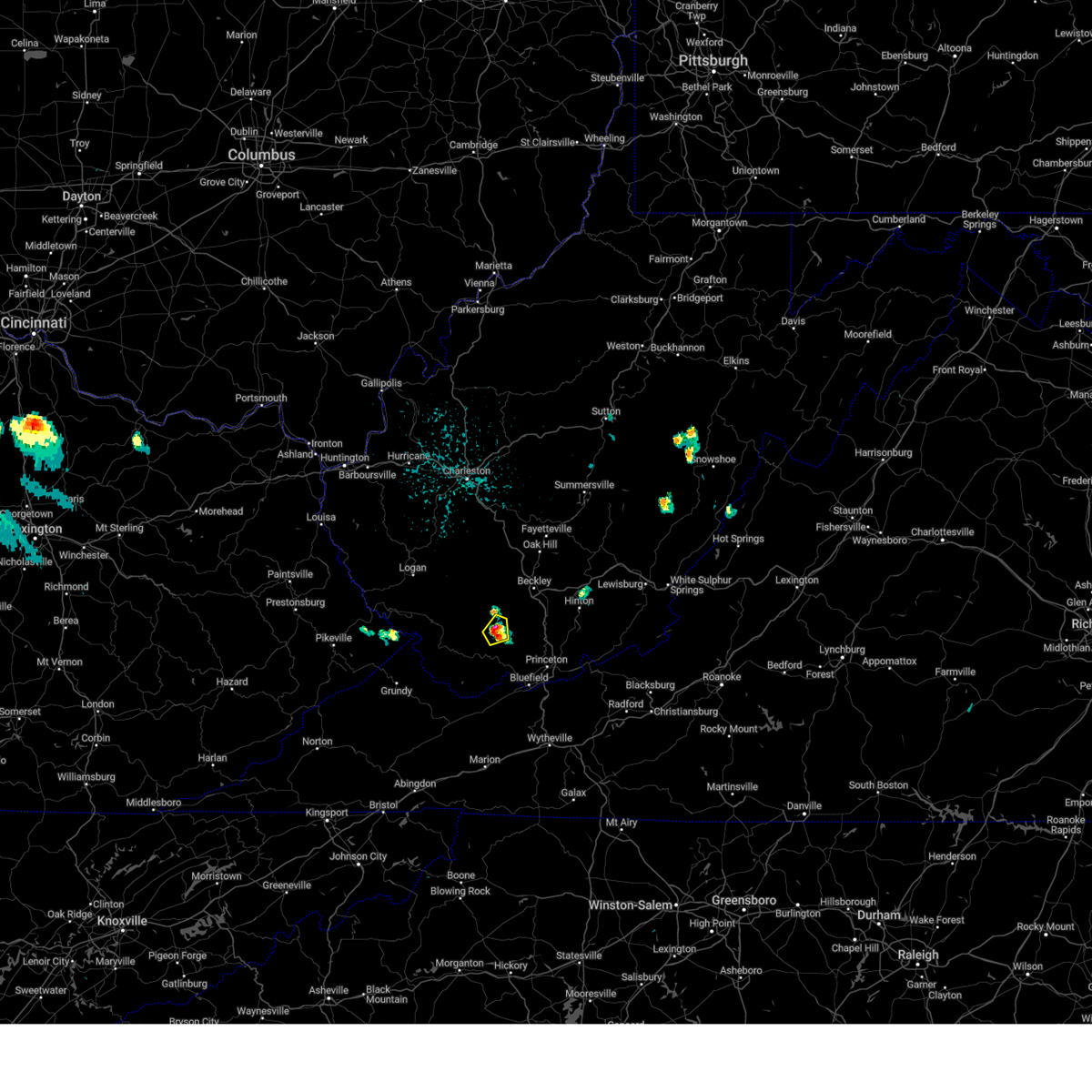
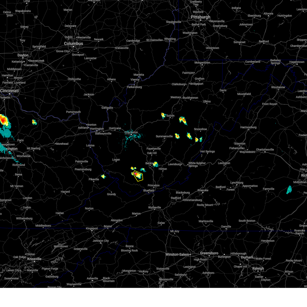
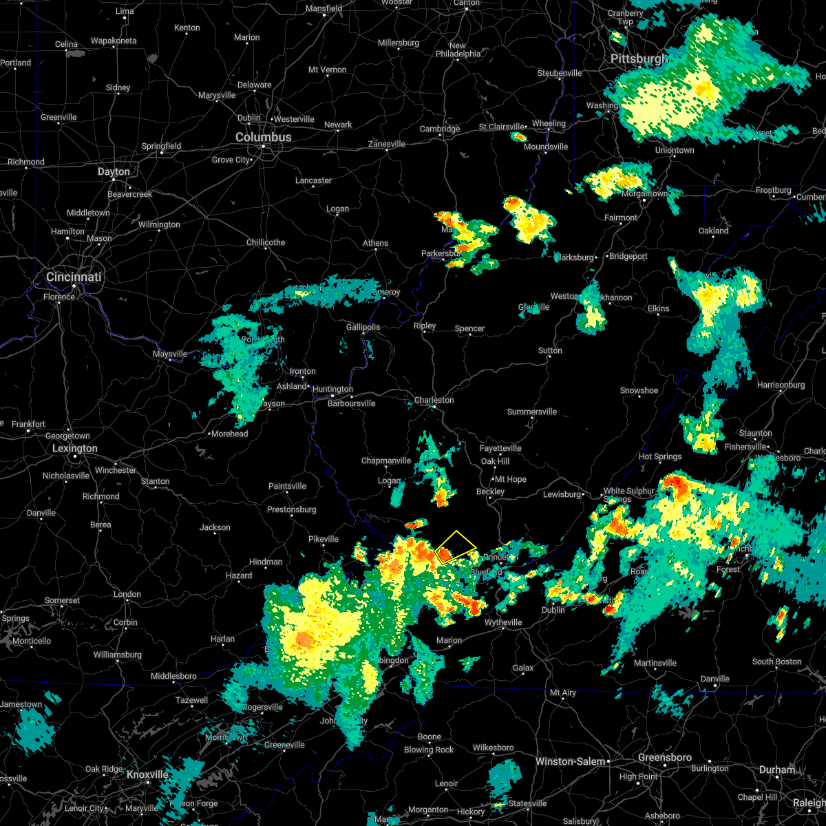
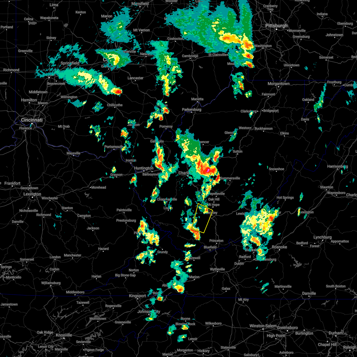
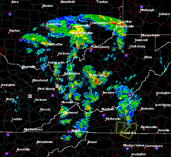
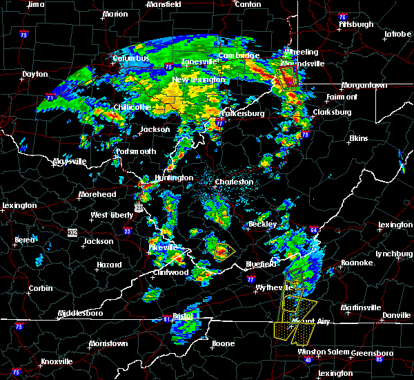
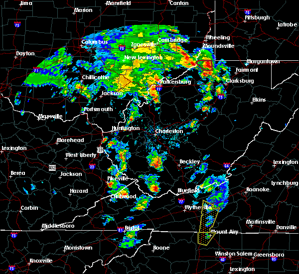
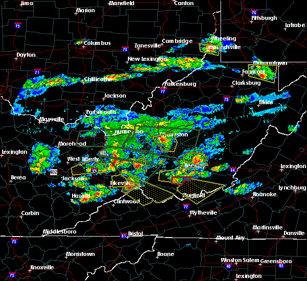
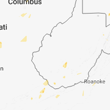
Hail Map for Bud, WV
The Bud, WV area has had 2 reports of on-the-ground hail by trained spotters, and has been under severe weather warnings 9 times during the past 12 months. Doppler radar has detected hail at or near Bud, WV on 37 occasions, including 3 occasions during the past year.
| Name: | Bud, WV |
| Where Located: | 58.2 miles SSE of Charleston, WV |
| Map: | Google Map for Bud, WV |
| Population: | 487 |
| Housing Units: | 230 |
| More Info: | Search Google for Bud, WV |
0
The Top Recent Hail Date for Bud, WV is Monday, April 15, 2024 (13th out of 37)

Hail and Wind Damage Spotted near Bud, WV
| Date / Time | Report Details |
|---|---|
| 4/15/2024 9:40 PM EDT |
 The storm which prompted the warning has moved out of the area. therefore, the warning will be allowed to expire. a severe thunderstorm watch remains in effect until 1000 pm edt for southern west virginia. to report severe weather, contact your nearest law enforcement agency. they will relay your report to the national weather service charleston west virginia. The storm which prompted the warning has moved out of the area. therefore, the warning will be allowed to expire. a severe thunderstorm watch remains in effect until 1000 pm edt for southern west virginia. to report severe weather, contact your nearest law enforcement agency. they will relay your report to the national weather service charleston west virginia.
|
| 4/15/2024 9:25 PM EDT |
 At 924 pm edt, a severe thunderstorm was located near mullens, or 9 miles northwest of matoaka, moving southeast at 20 mph (radar indicated). Hazards include 60 mph wind gusts and half dollar size hail. Hail damage to vehicles is expected. expect wind damage to roofs, siding, and trees. Locations impacted include, herndon and maybeury. At 924 pm edt, a severe thunderstorm was located near mullens, or 9 miles northwest of matoaka, moving southeast at 20 mph (radar indicated). Hazards include 60 mph wind gusts and half dollar size hail. Hail damage to vehicles is expected. expect wind damage to roofs, siding, and trees. Locations impacted include, herndon and maybeury.
|
| 4/15/2024 9:13 PM EDT |
 Svrrlx the national weather service in charleston west virginia has issued a * severe thunderstorm warning for, northeastern mcdowell county in southern west virginia, southeastern wyoming county in southern west virginia, * until 945 pm edt. * at 912 pm edt, a severe thunderstorm was located near mullens, or near pineville, moving southeast at 20 mph (radar indicated). Hazards include 60 mph wind gusts and half dollar size hail. Hail damage to vehicles is expected. Expect wind damage to roofs, siding, and trees. Svrrlx the national weather service in charleston west virginia has issued a * severe thunderstorm warning for, northeastern mcdowell county in southern west virginia, southeastern wyoming county in southern west virginia, * until 945 pm edt. * at 912 pm edt, a severe thunderstorm was located near mullens, or near pineville, moving southeast at 20 mph (radar indicated). Hazards include 60 mph wind gusts and half dollar size hail. Hail damage to vehicles is expected. Expect wind damage to roofs, siding, and trees.
|
| 4/15/2024 9:09 PM EDT |
 At 908 pm edt, a severe thunderstorm was located over mullens, or near pineville, moving southeast at 20 mph (radar indicated). Hazards include golf ball size hail and 60 mph wind gusts. People and animals outdoors will be injured. expect hail damage to roofs, siding, windows, and vehicles. expect wind damage to roofs, siding, and trees. Locations impacted include, mullens and twin falls state park. At 908 pm edt, a severe thunderstorm was located over mullens, or near pineville, moving southeast at 20 mph (radar indicated). Hazards include golf ball size hail and 60 mph wind gusts. People and animals outdoors will be injured. expect hail damage to roofs, siding, windows, and vehicles. expect wind damage to roofs, siding, and trees. Locations impacted include, mullens and twin falls state park.
|
| 4/15/2024 8:48 PM EDT |
 Svrrlx the national weather service in charleston west virginia has issued a * severe thunderstorm warning for, central wyoming county in southern west virginia, * until 915 pm edt. * at 848 pm edt, a severe thunderstorm was located over pineville, moving southeast at 20 mph (radar indicated). Hazards include 60 mph wind gusts and quarter size hail. Hail damage to vehicles is expected. Expect wind damage to roofs, siding, and trees. Svrrlx the national weather service in charleston west virginia has issued a * severe thunderstorm warning for, central wyoming county in southern west virginia, * until 915 pm edt. * at 848 pm edt, a severe thunderstorm was located over pineville, moving southeast at 20 mph (radar indicated). Hazards include 60 mph wind gusts and quarter size hail. Hail damage to vehicles is expected. Expect wind damage to roofs, siding, and trees.
|
| 4/2/2024 12:22 PM EDT |
 The storms which prompted the warning have weakened below severe limits, and no longer pose an immediate threat to life or property. therefore, the warning will be allowed to expire. a tornado watch remains in effect until 100 pm edt for central, southern and southeastern west virginia. The storms which prompted the warning have weakened below severe limits, and no longer pose an immediate threat to life or property. therefore, the warning will be allowed to expire. a tornado watch remains in effect until 100 pm edt for central, southern and southeastern west virginia.
|
| 4/2/2024 11:46 AM EDT |
 Svrrlx the national weather service in charleston west virginia has issued a * severe thunderstorm warning for, northeastern mcdowell county in southern west virginia, southeastern mingo county in southern west virginia, raleigh county in southeastern west virginia, wyoming county in southern west virginia, southeastern logan county in southern west virginia, southern fayette county in southeastern west virginia, southern boone county in central west virginia, * until 1230 pm edt. * at 1146 am edt, severe thunderstorms were located along a line extending from mount hope to 7 miles west of dry creek to near r.d. bailey lake, moving southeast at 55 mph (radar indicated). Hazards include 60 mph wind gusts. expect damage to roofs, siding, and trees Svrrlx the national weather service in charleston west virginia has issued a * severe thunderstorm warning for, northeastern mcdowell county in southern west virginia, southeastern mingo county in southern west virginia, raleigh county in southeastern west virginia, wyoming county in southern west virginia, southeastern logan county in southern west virginia, southern fayette county in southeastern west virginia, southern boone county in central west virginia, * until 1230 pm edt. * at 1146 am edt, severe thunderstorms were located along a line extending from mount hope to 7 miles west of dry creek to near r.d. bailey lake, moving southeast at 55 mph (radar indicated). Hazards include 60 mph wind gusts. expect damage to roofs, siding, and trees
|
| 7/28/2023 4:25 PM EDT |
 The severe thunderstorm warning for northeastern mcdowell, raleigh, eastern wyoming and southeastern fayette counties will expire at 430 pm edt, the storms which prompted the warning are nivubg out of the area. therefore, the warning will be allowed to expire. a severe thunderstorm watch remains in effect until 800 pm edt for southern and southeastern west virginia. The severe thunderstorm warning for northeastern mcdowell, raleigh, eastern wyoming and southeastern fayette counties will expire at 430 pm edt, the storms which prompted the warning are nivubg out of the area. therefore, the warning will be allowed to expire. a severe thunderstorm watch remains in effect until 800 pm edt for southern and southeastern west virginia.
|
| 7/28/2023 3:59 PM EDT |
 At 359 pm edt, severe thunderstorms were located along a line extending from near dry creek to near pineville, moving east at 45 mph (radar indicated). Hazards include 60 mph wind gusts and nickel size hail. expect damage to roofs, siding, and trees At 359 pm edt, severe thunderstorms were located along a line extending from near dry creek to near pineville, moving east at 45 mph (radar indicated). Hazards include 60 mph wind gusts and nickel size hail. expect damage to roofs, siding, and trees
|
| 8/5/2022 7:31 PM EDT |
 At 730 pm edt, a severe thunderstorm was located over welch, moving northeast at 15 mph (radar indicated). Hazards include 60 mph wind gusts and penny size hail. expect damage to roofs, siding, and trees At 730 pm edt, a severe thunderstorm was located over welch, moving northeast at 15 mph (radar indicated). Hazards include 60 mph wind gusts and penny size hail. expect damage to roofs, siding, and trees
|
| 6/17/2022 2:30 PM EDT |
 At 230 pm edt, severe thunderstorms were located along a line extending from jenkins to near bald knob, moving southeast at 45 mph (radar indicated). Hazards include 60 mph wind gusts. expect damage to roofs, siding, and trees At 230 pm edt, severe thunderstorms were located along a line extending from jenkins to near bald knob, moving southeast at 45 mph (radar indicated). Hazards include 60 mph wind gusts. expect damage to roofs, siding, and trees
|
| 6/13/2022 10:36 PM EDT |
 The severe thunderstorm warning for southeastern nicholas, raleigh, southwestern webster, central wyoming and southeastern fayette counties will expire at 1045 pm edt, the storms which prompted the warning have weakened below severe limits, and have exited the warned area. therefore, the warning will be allowed to expire. however gusty winds and heavy rain are still possible with these thunderstorms. a severe thunderstorm watch remains in effect until 100 am edt for central, southern, southeastern and northeastern west virginia. The severe thunderstorm warning for southeastern nicholas, raleigh, southwestern webster, central wyoming and southeastern fayette counties will expire at 1045 pm edt, the storms which prompted the warning have weakened below severe limits, and have exited the warned area. therefore, the warning will be allowed to expire. however gusty winds and heavy rain are still possible with these thunderstorms. a severe thunderstorm watch remains in effect until 100 am edt for central, southern, southeastern and northeastern west virginia.
|
| 6/13/2022 10:27 PM EDT |
 At 1027 pm edt, severe thunderstorms were located along a line extending from near craigsville to near babcock state park to 8 miles north of twin falls state park, moving east at 45 mph (radar indicated). Hazards include 60 mph wind gusts and penny size hail. Expect damage to roofs, siding, and trees. locations impacted include, beckley, summersville, richwood, pineville, babcock state park, mullens, mabscott, oceana, sophia, crab orchard, dry creek, macarthur, bradley, shady spring, beaver, piney view, stanaford, coal city, prosperity and craigsville. hail threat, radar indicated max hail size, 0. 75 in wind threat, radar indicated max wind gust, 60 mph. At 1027 pm edt, severe thunderstorms were located along a line extending from near craigsville to near babcock state park to 8 miles north of twin falls state park, moving east at 45 mph (radar indicated). Hazards include 60 mph wind gusts and penny size hail. Expect damage to roofs, siding, and trees. locations impacted include, beckley, summersville, richwood, pineville, babcock state park, mullens, mabscott, oceana, sophia, crab orchard, dry creek, macarthur, bradley, shady spring, beaver, piney view, stanaford, coal city, prosperity and craigsville. hail threat, radar indicated max hail size, 0. 75 in wind threat, radar indicated max wind gust, 60 mph.
|
| 6/13/2022 10:01 PM EDT |
 The national weather service in charleston west virginia has issued a * severe thunderstorm warning for. nicholas county in southeastern west virginia. raleigh county in southeastern west virginia. southwestern webster county in northeastern west virginia. Southeastern logan county in southern west virginia. The national weather service in charleston west virginia has issued a * severe thunderstorm warning for. nicholas county in southeastern west virginia. raleigh county in southeastern west virginia. southwestern webster county in northeastern west virginia. Southeastern logan county in southern west virginia.
|
| 5/19/2022 7:29 PM EDT |
 At 729 pm edt, a severe thunderstorm was located over war, or 10 miles southwest of welch, moving northeast at 20 mph (radar indicated). Hazards include 60 mph wind gusts and quarter size hail. Hail damage to vehicles is expected. Expect wind damage to roofs, siding, and trees. At 729 pm edt, a severe thunderstorm was located over war, or 10 miles southwest of welch, moving northeast at 20 mph (radar indicated). Hazards include 60 mph wind gusts and quarter size hail. Hail damage to vehicles is expected. Expect wind damage to roofs, siding, and trees.
|
| 6/13/2021 7:08 PM EDT |
 At 708 pm edt, severe thunderstorms were located along a line extending from powellton to 9 miles east of madison to near amherstdale-robinette, moving southeast at 30 mph (radar indicated). Hazards include 60 mph wind gusts and quarter size hail. Hail damage to vehicles is expected. Expect wind damage to roofs, siding, and trees. At 708 pm edt, severe thunderstorms were located along a line extending from powellton to 9 miles east of madison to near amherstdale-robinette, moving southeast at 30 mph (radar indicated). Hazards include 60 mph wind gusts and quarter size hail. Hail damage to vehicles is expected. Expect wind damage to roofs, siding, and trees.
|
| 3/18/2021 6:53 PM EDT |
 At 653 pm edt, a severe thunderstorm was located over coal city, or 9 miles south of beckley, moving east at 25 mph (radar indicated). Hazards include 60 mph wind gusts and quarter size hail. Hail damage to vehicles is expected. expect wind damage to roofs, siding, and trees. Locations impacted include, pineville, mullens, sophia, coal city, shady spring, twin falls state park, beaver, daniels, crab orchard, rhodell, ghent, wolf pen, josephine and maben. At 653 pm edt, a severe thunderstorm was located over coal city, or 9 miles south of beckley, moving east at 25 mph (radar indicated). Hazards include 60 mph wind gusts and quarter size hail. Hail damage to vehicles is expected. expect wind damage to roofs, siding, and trees. Locations impacted include, pineville, mullens, sophia, coal city, shady spring, twin falls state park, beaver, daniels, crab orchard, rhodell, ghent, wolf pen, josephine and maben.
|
| 3/18/2021 6:30 PM EDT |
 At 629 pm edt, a severe thunderstorm was located near twin falls state park, or 9 miles northeast of pineville, moving east at 25 mph (radar indicated). Hazards include 60 mph wind gusts and quarter size hail. Hail damage to vehicles is expected. Expect wind damage to roofs, siding, and trees. At 629 pm edt, a severe thunderstorm was located near twin falls state park, or 9 miles northeast of pineville, moving east at 25 mph (radar indicated). Hazards include 60 mph wind gusts and quarter size hail. Hail damage to vehicles is expected. Expect wind damage to roofs, siding, and trees.
|
| 4/8/2020 4:40 PM EDT |
 The severe thunderstorm warning for eastern mcdowell and wyoming counties will expire at 445 pm edt, the storms which prompted the warning have weakened below severe limits, and no longer pose an immediate threat to life or property. therefore, the warning will be allowed to expire. however small hail, gusty winds and heavy rain are still possible with these thunderstorms. a severe thunderstorm watch remains in effect until 800 pm edt for southern and southeastern west virginia. to report severe weather, contact your nearest law enforcement agency. they will relay your report to the national weather service charleston west virginia. The severe thunderstorm warning for eastern mcdowell and wyoming counties will expire at 445 pm edt, the storms which prompted the warning have weakened below severe limits, and no longer pose an immediate threat to life or property. therefore, the warning will be allowed to expire. however small hail, gusty winds and heavy rain are still possible with these thunderstorms. a severe thunderstorm watch remains in effect until 800 pm edt for southern and southeastern west virginia. to report severe weather, contact your nearest law enforcement agency. they will relay your report to the national weather service charleston west virginia.
|
| 4/8/2020 4:21 PM EDT |
 At 420 pm edt, severe thunderstorms were located along a line extending from near lick creek to near princeton to pinnacle rock state park to northfork, moving southeast at 45 mph (radar indicated). Hazards include 60 mph wind gusts and penny size hail. Expect damage to roofs, siding, and trees. Locations impacted include, welch, pineville, mullens, gary, northfork, twin falls state park, hanover, davy, keystone, anawalt, kimball, clear fork, maybeury, elbert, wolf pen, maben, baileysville, jenkinjones and herndon. At 420 pm edt, severe thunderstorms were located along a line extending from near lick creek to near princeton to pinnacle rock state park to northfork, moving southeast at 45 mph (radar indicated). Hazards include 60 mph wind gusts and penny size hail. Expect damage to roofs, siding, and trees. Locations impacted include, welch, pineville, mullens, gary, northfork, twin falls state park, hanover, davy, keystone, anawalt, kimball, clear fork, maybeury, elbert, wolf pen, maben, baileysville, jenkinjones and herndon.
|
| 4/8/2020 3:58 PM EDT |
 At 357 pm edt, severe thunderstorms were located along a line extending from near shady spring to near flat top to near mullens to near oceana, moving southeast at 45 mph (radar indicated). Hazards include 60 mph wind gusts and nickel size hail. expect damage to roofs, siding, and trees At 357 pm edt, severe thunderstorms were located along a line extending from near shady spring to near flat top to near mullens to near oceana, moving southeast at 45 mph (radar indicated). Hazards include 60 mph wind gusts and nickel size hail. expect damage to roofs, siding, and trees
|
| 4/8/2020 3:52 PM EDT |
 At 352 pm edt, severe thunderstorms were located along a line extending from beckley to near mullens to pineville to near oceana, moving south at 45 mph (radar indicated). Hazards include 70 mph wind gusts and quarter size hail. Hail damage to vehicles is expected. expect considerable tree damage. wind damage is also likely to mobile homes, roofs, and outbuildings. Locations impacted include, beckley, pineville, mullens, mabscott, oceana, sophia, crab orchard, dry creek, macarthur, bradley, shady spring, beaver, bald knob, stanaford, coal city, prosperity, amherstdale-robinette, twin falls state park, daniels and piney view. At 352 pm edt, severe thunderstorms were located along a line extending from beckley to near mullens to pineville to near oceana, moving south at 45 mph (radar indicated). Hazards include 70 mph wind gusts and quarter size hail. Hail damage to vehicles is expected. expect considerable tree damage. wind damage is also likely to mobile homes, roofs, and outbuildings. Locations impacted include, beckley, pineville, mullens, mabscott, oceana, sophia, crab orchard, dry creek, macarthur, bradley, shady spring, beaver, bald knob, stanaford, coal city, prosperity, amherstdale-robinette, twin falls state park, daniels and piney view.
|
| 4/8/2020 3:28 PM EDT |
 At 327 pm edt, severe thunderstorms were located along a line extending from 6 miles southeast of powellton to 11 miles northwest of dry creek to near bald knob to near van, moving south at 45 mph (radar indicated). Hazards include 70 mph wind gusts and quarter size hail. Hail damage to vehicles is expected. expect considerable tree damage. Wind damage is also likely to mobile homes, roofs, and outbuildings. At 327 pm edt, severe thunderstorms were located along a line extending from 6 miles southeast of powellton to 11 miles northwest of dry creek to near bald knob to near van, moving south at 45 mph (radar indicated). Hazards include 70 mph wind gusts and quarter size hail. Hail damage to vehicles is expected. expect considerable tree damage. Wind damage is also likely to mobile homes, roofs, and outbuildings.
|
| 10/31/2019 1:38 PM EDT |
 At 138 pm edt, severe thunderstorms were located along a line extending from 6 miles northeast of van to 7 miles northwest of war, moving northeast at 60 mph (radar indicated). Hazards include 60 mph wind gusts. Expect damage to roofs, siding, and trees. locations impacted include, welch, pineville, mullens, oceana, gary, northfork, hanover, r. d. Bailey lake, bald knob, mallory, amherstdale-robinette, twin falls state park, wharton, gilbert creek, davy, bradshaw, iaeger, keystone, kimball and coal mountain. At 138 pm edt, severe thunderstorms were located along a line extending from 6 miles northeast of van to 7 miles northwest of war, moving northeast at 60 mph (radar indicated). Hazards include 60 mph wind gusts. Expect damage to roofs, siding, and trees. locations impacted include, welch, pineville, mullens, oceana, gary, northfork, hanover, r. d. Bailey lake, bald knob, mallory, amherstdale-robinette, twin falls state park, wharton, gilbert creek, davy, bradshaw, iaeger, keystone, kimball and coal mountain.
|
| 10/31/2019 1:24 PM EDT |
 At 123 pm edt, severe thunderstorms were located along a line extending from 6 miles west of van to 7 miles east of grundy, moving northeast at 60 mph (radar indicated). Hazards include 60 mph wind gusts. expect damage to roofs, siding, and trees At 123 pm edt, severe thunderstorms were located along a line extending from 6 miles west of van to 7 miles east of grundy, moving northeast at 60 mph (radar indicated). Hazards include 60 mph wind gusts. expect damage to roofs, siding, and trees
|
| 5/29/2019 4:23 PM EDT |
 The severe thunderstorm warning for raleigh, southeastern wyoming and southern fayette counties will expire at 430 pm edt, the storm which prompted the warning has weakened below severe limits, and has exited the warned area. therefore, the warning will be allowed to expire. however gusty winds are still possible with this thunderstorm. a severe thunderstorm watch remains in effect until 700 pm edt for southern and southeastern west virginia. The severe thunderstorm warning for raleigh, southeastern wyoming and southern fayette counties will expire at 430 pm edt, the storm which prompted the warning has weakened below severe limits, and has exited the warned area. therefore, the warning will be allowed to expire. however gusty winds are still possible with this thunderstorm. a severe thunderstorm watch remains in effect until 700 pm edt for southern and southeastern west virginia.
|
| 5/29/2019 4:01 PM EDT |
 At 341 pm edt, a severe thunderstorm was located 10 miles southeast of bald knob, or 14 miles west of beckley, moving east at 50 mph (radar indicated). Hazards include 70 mph wind gusts and quarter size hail. Hail damage to vehicles is expected. expect considerable tree damage. Wind damage is also likely to mobile homes, roofs, and outbuildings. At 341 pm edt, a severe thunderstorm was located 10 miles southeast of bald knob, or 14 miles west of beckley, moving east at 50 mph (radar indicated). Hazards include 70 mph wind gusts and quarter size hail. Hail damage to vehicles is expected. expect considerable tree damage. Wind damage is also likely to mobile homes, roofs, and outbuildings.
|
| 5/29/2019 3:42 PM EDT |
 At 341 pm edt, a severe thunderstorm was located 10 miles southeast of bald knob, or 14 miles west of beckley, moving east at 50 mph (radar indicated). Hazards include 70 mph wind gusts and quarter size hail. Hail damage to vehicles is expected. expect considerable tree damage. Wind damage is also likely to mobile homes, roofs, and outbuildings. At 341 pm edt, a severe thunderstorm was located 10 miles southeast of bald knob, or 14 miles west of beckley, moving east at 50 mph (radar indicated). Hazards include 70 mph wind gusts and quarter size hail. Hail damage to vehicles is expected. expect considerable tree damage. Wind damage is also likely to mobile homes, roofs, and outbuildings.
|
| 5/17/2019 9:40 PM EDT |
 The severe thunderstorm warning for eastern mcdowell, south central raleigh and southeastern wyoming counties will expire at 945 pm edt, the storm which prompted the warning has weakened below severe limits, and has exited the warned area. therefore, the warning will be allowed to expire. a severe thunderstorm watch remains in effect until 1100 pm edt for southern and southeastern west virginia. The severe thunderstorm warning for eastern mcdowell, south central raleigh and southeastern wyoming counties will expire at 945 pm edt, the storm which prompted the warning has weakened below severe limits, and has exited the warned area. therefore, the warning will be allowed to expire. a severe thunderstorm watch remains in effect until 1100 pm edt for southern and southeastern west virginia.
|
| 5/17/2019 9:29 PM EDT |
 At 929 pm edt, a severe thunderstorm was located over boissevain, or 7 miles northwest of bluefield, moving southeast at 45 mph (radar indicated). Hazards include 60 mph wind gusts and penny size hail. Expect damage to roofs, siding, and trees. Locations impacted include, welch, mullens, gary, northfork, davy, keystone, anawalt, kimball, rhodell, maybeury, elbert, coalwood, wolf pen, jenkinjones and herndon. At 929 pm edt, a severe thunderstorm was located over boissevain, or 7 miles northwest of bluefield, moving southeast at 45 mph (radar indicated). Hazards include 60 mph wind gusts and penny size hail. Expect damage to roofs, siding, and trees. Locations impacted include, welch, mullens, gary, northfork, davy, keystone, anawalt, kimball, rhodell, maybeury, elbert, coalwood, wolf pen, jenkinjones and herndon.
|
| 5/17/2019 8:59 PM EDT |
 The national weather service in charleston west virginia has issued a * severe thunderstorm warning for. eastern mcdowell county in southern west virginia. south central raleigh county in southeastern west virginia. wyoming county in southern west virginia. Until 945 pm edt. The national weather service in charleston west virginia has issued a * severe thunderstorm warning for. eastern mcdowell county in southern west virginia. south central raleigh county in southeastern west virginia. wyoming county in southern west virginia. Until 945 pm edt.
|
| 4/14/2019 8:53 PM EDT |
 The severe thunderstorm warning for east central buchanan, mcdowell, south central raleigh and central wyoming counties will expire at 900 pm edt, the storms which prompted the warning have weakened below severe limits, and no longer pose an immediate threat to life or property. therefore, the warning will be allowed to expire. The severe thunderstorm warning for east central buchanan, mcdowell, south central raleigh and central wyoming counties will expire at 900 pm edt, the storms which prompted the warning have weakened below severe limits, and no longer pose an immediate threat to life or property. therefore, the warning will be allowed to expire.
|
| 4/14/2019 8:20 PM EDT |
 At 819 pm edt, severe thunderstorms were located along a line extending from near oceana to near jewell ridge to quarry, moving east at 40 mph (radar indicated). Hazards include 60 mph wind gusts. expect damage to roofs, siding, and trees At 819 pm edt, severe thunderstorms were located along a line extending from near oceana to near jewell ridge to quarry, moving east at 40 mph (radar indicated). Hazards include 60 mph wind gusts. expect damage to roofs, siding, and trees
|
| 5/5/2018 5:28 PM EDT |
 At 528 pm edt, a severe thunderstorm was located over welch, moving northeast at 20 mph (radar indicated). Hazards include 60 mph wind gusts and half dollar size hail. Hail damage to vehicles is expected. Expect wind damage to roofs, siding, and trees. At 528 pm edt, a severe thunderstorm was located over welch, moving northeast at 20 mph (radar indicated). Hazards include 60 mph wind gusts and half dollar size hail. Hail damage to vehicles is expected. Expect wind damage to roofs, siding, and trees.
|
| 3/1/2017 10:44 AM EST |
 At 1044 am est, a severe thunderstorm was located over welch, moving east at 60 mph (radar indicated). Hazards include 60 mph wind gusts. Expect damage to roofs, siding, and trees. Locations impacted include, welch, pineville, gary, war, northfork, hanover, davy, bradshaw, iaeger, keystone, anawalt, kimball, jolo, maybeury, elbert, coalwood, avondale, wolf pen, cucumber and baileysville. At 1044 am est, a severe thunderstorm was located over welch, moving east at 60 mph (radar indicated). Hazards include 60 mph wind gusts. Expect damage to roofs, siding, and trees. Locations impacted include, welch, pineville, gary, war, northfork, hanover, davy, bradshaw, iaeger, keystone, anawalt, kimball, jolo, maybeury, elbert, coalwood, avondale, wolf pen, cucumber and baileysville.
|
| 3/1/2017 10:28 AM EST |
 At 1028 am est, a severe thunderstorm was located near gilbert creek, or 16 miles west of welch, moving east at 60 mph (radar indicated). Hazards include 60 mph wind gusts. expect damage to roofs, siding, and trees At 1028 am est, a severe thunderstorm was located near gilbert creek, or 16 miles west of welch, moving east at 60 mph (radar indicated). Hazards include 60 mph wind gusts. expect damage to roofs, siding, and trees
|
| 9/29/2016 3:58 PM EDT |
 At 352 pm edt, a severe thunderstorm was located near twin falls state park, or 11 miles northeast of pineville, moving north at 20 mph (radar indicated). Hazards include 60 mph wind gusts and quarter size hail. Hail damage to vehicles is expected. expect wind damage to roofs, siding, and trees. Locations impacted include, beckley, pineville, mullens, mabscott, sophia, prosperity, crab orchard, dry creek, twin falls state park, bradley, macarthur, lester, rhodell, bolt, glen daniel, maben and arnett. At 352 pm edt, a severe thunderstorm was located near twin falls state park, or 11 miles northeast of pineville, moving north at 20 mph (radar indicated). Hazards include 60 mph wind gusts and quarter size hail. Hail damage to vehicles is expected. expect wind damage to roofs, siding, and trees. Locations impacted include, beckley, pineville, mullens, mabscott, sophia, prosperity, crab orchard, dry creek, twin falls state park, bradley, macarthur, lester, rhodell, bolt, glen daniel, maben and arnett.
|
| 9/29/2016 3:52 PM EDT |
 At 352 pm edt, a severe thunderstorm was located near twin falls state park, or 11 miles northeast of pineville, moving north at 20 mph (radar indicated). Hazards include 60 mph wind gusts and quarter size hail. Hail damage to vehicles is expected. expect wind damage to roofs, siding, and trees. Locations impacted include, beckley, pineville, mullens, mabscott, sophia, prosperity, crab orchard, dry creek, twin falls state park, bradley, macarthur, lester, rhodell, bolt, glen daniel, maben and arnett. At 352 pm edt, a severe thunderstorm was located near twin falls state park, or 11 miles northeast of pineville, moving north at 20 mph (radar indicated). Hazards include 60 mph wind gusts and quarter size hail. Hail damage to vehicles is expected. expect wind damage to roofs, siding, and trees. Locations impacted include, beckley, pineville, mullens, mabscott, sophia, prosperity, crab orchard, dry creek, twin falls state park, bradley, macarthur, lester, rhodell, bolt, glen daniel, maben and arnett.
|
| 9/29/2016 3:32 PM EDT |
 At 332 pm edt, a severe thunderstorm was located over twin falls state park, or near pineville, moving north at 20 mph (radar indicated). Hazards include 60 mph wind gusts and quarter size hail. Hail damage to vehicles is expected. Expect wind damage to roofs, siding, and trees. At 332 pm edt, a severe thunderstorm was located over twin falls state park, or near pineville, moving north at 20 mph (radar indicated). Hazards include 60 mph wind gusts and quarter size hail. Hail damage to vehicles is expected. Expect wind damage to roofs, siding, and trees.
|
| 9/29/2016 3:07 PM EDT |
 At 306 pm edt, a severe thunderstorm was located over mullens, or near pineville, moving northeast at 35 mph (radar indicated). Hazards include 60 mph wind gusts and quarter size hail. Hail damage to vehicles is expected. Expect wind damage to roofs, siding, and trees. At 306 pm edt, a severe thunderstorm was located over mullens, or near pineville, moving northeast at 35 mph (radar indicated). Hazards include 60 mph wind gusts and quarter size hail. Hail damage to vehicles is expected. Expect wind damage to roofs, siding, and trees.
|
| 9/29/2016 2:51 PM EDT |
 At 251 pm edt, a severe thunderstorm was located near welch, moving northeast at 30 mph (doh reported quarter sized hail in welch). Hazards include 60 mph wind gusts and quarter size hail. Hail damage to vehicles is expected. expect wind damage to roofs, siding, and trees. Locations impacted include, welch, pineville, kimball and wolf pen. At 251 pm edt, a severe thunderstorm was located near welch, moving northeast at 30 mph (doh reported quarter sized hail in welch). Hazards include 60 mph wind gusts and quarter size hail. Hail damage to vehicles is expected. expect wind damage to roofs, siding, and trees. Locations impacted include, welch, pineville, kimball and wolf pen.
|
| 9/29/2016 2:34 PM EDT |
 At 234 pm edt, a severe thunderstorm was located near welch, moving northeast at 30 mph (radar indicated). Hazards include 60 mph wind gusts and quarter size hail. Hail damage to vehicles is expected. Expect wind damage to roofs, siding, and trees. At 234 pm edt, a severe thunderstorm was located near welch, moving northeast at 30 mph (radar indicated). Hazards include 60 mph wind gusts and quarter size hail. Hail damage to vehicles is expected. Expect wind damage to roofs, siding, and trees.
|
| 8/17/2016 2:54 PM EDT |
 At 253 pm edt, a severe thunderstorm was located over mullens, or 7 miles east of pineville, moving east at 30 mph (radar indicated). Hazards include 60 mph wind gusts and quarter size hail. Hail damage to vehicles is expected. Expect wind damage to roofs, siding, and trees. At 253 pm edt, a severe thunderstorm was located over mullens, or 7 miles east of pineville, moving east at 30 mph (radar indicated). Hazards include 60 mph wind gusts and quarter size hail. Hail damage to vehicles is expected. Expect wind damage to roofs, siding, and trees.
|
| 7/8/2016 3:38 PM EDT |
 At 337 pm edt, severe thunderstorms were located along a line extending from 11 miles south of burnwell to 6 miles west of wenonah, moving east at 50 mph (radar indicated). Hazards include 60 mph wind gusts. Expect damage to roofs. siding. and trees. Locations impacted include, pineville, mullens, mabscott, oceana, sophia, bald knob, crab orchard, dry creek, twin falls state park, coal city, macarthur, bradley, whitesville, lester, rhodell, sylvester, herndon, clear fork, josephine and stickney. At 337 pm edt, severe thunderstorms were located along a line extending from 11 miles south of burnwell to 6 miles west of wenonah, moving east at 50 mph (radar indicated). Hazards include 60 mph wind gusts. Expect damage to roofs. siding. and trees. Locations impacted include, pineville, mullens, mabscott, oceana, sophia, bald knob, crab orchard, dry creek, twin falls state park, coal city, macarthur, bradley, whitesville, lester, rhodell, sylvester, herndon, clear fork, josephine and stickney.
|
| 7/8/2016 3:01 PM EDT |
 At 301 pm edt, severe thunderstorms were located along a line extending from 6 miles south of madison to hanover, moving east at 50 mph (radar indicated). Hazards include 60 mph wind gusts. Expect damage to roofs. siding. And trees. At 301 pm edt, severe thunderstorms were located along a line extending from 6 miles south of madison to hanover, moving east at 50 mph (radar indicated). Hazards include 60 mph wind gusts. Expect damage to roofs. siding. And trees.
|
| 6/23/2016 7:12 PM EDT | The severe thunderstorm warning for southeastern raleigh and east central wyoming counties will expire at 715 pm edt, the storm which prompted the warning has moved out of the area. therefore, the warning will be allowed to expire. a tornado watch remains in effect until 1000 pm edt for southern and southeastern west virginia. |
| 6/23/2016 7:00 PM EDT |
 At 700 pm edt, a severe thunderstorm was located over dunns, or near camp creek, moving southeast at 45 mph (radar indicated). Hazards include 60 mph wind gusts. Expect damage to roofs. siding. and trees. locations impacted include, daniels, shady spring, beaver, coal city, rhodell, herndon, josephine and ghent. A tornado watch remains in effect until 1000 pm edt for southern and southeastern west virginia. At 700 pm edt, a severe thunderstorm was located over dunns, or near camp creek, moving southeast at 45 mph (radar indicated). Hazards include 60 mph wind gusts. Expect damage to roofs. siding. and trees. locations impacted include, daniels, shady spring, beaver, coal city, rhodell, herndon, josephine and ghent. A tornado watch remains in effect until 1000 pm edt for southern and southeastern west virginia.
|
| 6/23/2016 6:44 PM EDT |
 At 644 pm edt, a severe thunderstorm was located near coal city, or 11 miles southwest of beckley, moving southeast at 45 mph (radar indicated). Hazards include 60 mph wind gusts and penny size hail. Expect damage to roofs. siding. And trees. At 644 pm edt, a severe thunderstorm was located near coal city, or 11 miles southwest of beckley, moving southeast at 45 mph (radar indicated). Hazards include 60 mph wind gusts and penny size hail. Expect damage to roofs. siding. And trees.
|
| 6/23/2016 6:35 PM EDT |
 At 634 pm edt, a severe thunderstorm was located near bald knob, or 15 miles north of pineville, moving east at 40 mph (radar indicated). Hazards include 70 mph wind gusts. Expect considerable tree damage. damage is likely to mobile homes, roofs, and outbuildings. locations impacted include, beckley, mullens, mabscott, oceana, sophia, prosperity, macarthur, bald knob, crab orchard, twin falls state park, dry creek, amherstdale-robinette, coal city, mallory, lester, rhodell, stickney, naoma, kopperston and arnett. A tornado watch remains in effect until 1000 pm edt for southern, southeastern and central west virginia. At 634 pm edt, a severe thunderstorm was located near bald knob, or 15 miles north of pineville, moving east at 40 mph (radar indicated). Hazards include 70 mph wind gusts. Expect considerable tree damage. damage is likely to mobile homes, roofs, and outbuildings. locations impacted include, beckley, mullens, mabscott, oceana, sophia, prosperity, macarthur, bald knob, crab orchard, twin falls state park, dry creek, amherstdale-robinette, coal city, mallory, lester, rhodell, stickney, naoma, kopperston and arnett. A tornado watch remains in effect until 1000 pm edt for southern, southeastern and central west virginia.
|
| 6/23/2016 6:13 PM EDT |
 At 613 pm edt, a severe thunderstorm was located near amherstdale- robinette, or 10 miles east of logan, moving east at 40 mph (radar indicated). Hazards include 60 mph wind gusts. Expect damage to roofs. siding. And trees. At 613 pm edt, a severe thunderstorm was located near amherstdale- robinette, or 10 miles east of logan, moving east at 40 mph (radar indicated). Hazards include 60 mph wind gusts. Expect damage to roofs. siding. And trees.
|
| 6/23/2016 8:57 AM EDT | The severe thunderstorm warning for northeastern buchanan, raleigh, mingo, mcdowell, southwestern fayette, southeastern boone, logan, wyoming and south central kanawha counties will expire at 900 am edt, the storms which prompted the warning weakened below severe limits and exited the warned area. therefore, the warning will be allowed to expire. |
| 6/23/2016 8:57 AM EDT | The severe thunderstorm warning for northeastern buchanan, raleigh, mingo, mcdowell, southwestern fayette, southeastern boone, logan, wyoming and south central kanawha counties will expire at 900 am edt, the storms which prompted the warning weakened below severe limits and exited the warned area. therefore, the warning will be allowed to expire. |
| 6/23/2016 8:27 AM EDT |
 At 827 am edt, severe thunderstorms were located along a line extending from near hinton to mallory, moving south at 45 mph (radar indicated). Hazards include 60 mph wind gusts. Expect damage to roofs. siding. And trees. At 827 am edt, severe thunderstorms were located along a line extending from near hinton to mallory, moving south at 45 mph (radar indicated). Hazards include 60 mph wind gusts. Expect damage to roofs. siding. And trees.
|
| 6/23/2016 8:10 AM EDT |
 At 809 am edt, severe thunderstorms were located along a line extending from near burnwell to oppy, moving southeast at 50 mph (radar indicated). Hazards include 60 mph wind gusts. Expect damage to roofs. siding. and trees. locations impacted include, beckley, welch, logan, pineville, oak hill, mullens, mount hope, mabscott, oceana, sophia, gary, war, man, delbarton, northfork, shady spring, r. d. Bailey lake, wharton, holden and daniels. At 809 am edt, severe thunderstorms were located along a line extending from near burnwell to oppy, moving southeast at 50 mph (radar indicated). Hazards include 60 mph wind gusts. Expect damage to roofs. siding. and trees. locations impacted include, beckley, welch, logan, pineville, oak hill, mullens, mount hope, mabscott, oceana, sophia, gary, war, man, delbarton, northfork, shady spring, r. d. Bailey lake, wharton, holden and daniels.
|
| 6/23/2016 7:47 AM EDT |
 At 746 am edt, severe thunderstorms were located along a line extending from 8 miles south of chesapeake to coalpoint, moving southeast at 45 mph (radar indicated). Hazards include 60 mph wind gusts. Expect damage to roofs. siding. And trees. At 746 am edt, severe thunderstorms were located along a line extending from 8 miles south of chesapeake to coalpoint, moving southeast at 45 mph (radar indicated). Hazards include 60 mph wind gusts. Expect damage to roofs. siding. And trees.
|
| 6/16/2016 6:33 PM EDT |
 At 633 pm edt, a severe thunderstorm was located near camp creek state park, or 7 miles northwest of camp creek, moving southeast at 35 mph (radar indicated). Hazards include 60 mph wind gusts and quarter size hail. Hail damage to vehicles is expected. expect wind damage to roofs, siding, and trees. Locations impacted include, coal city, rhodell, josephine and herndon. At 633 pm edt, a severe thunderstorm was located near camp creek state park, or 7 miles northwest of camp creek, moving southeast at 35 mph (radar indicated). Hazards include 60 mph wind gusts and quarter size hail. Hail damage to vehicles is expected. expect wind damage to roofs, siding, and trees. Locations impacted include, coal city, rhodell, josephine and herndon.
|
| 6/16/2016 6:07 PM EDT |
 At 607 pm edt, a severe thunderstorm was located near twin falls state park, or 9 miles northeast of pineville, moving southeast at 35 mph (radar indicated). Hazards include 70 mph wind gusts and half dollar size hail. Hail damage to vehicles is expected. expect considerable tree damage. Wind damage is also likely to mobile homes, roofs, and outbuildings. At 607 pm edt, a severe thunderstorm was located near twin falls state park, or 9 miles northeast of pineville, moving southeast at 35 mph (radar indicated). Hazards include 70 mph wind gusts and half dollar size hail. Hail damage to vehicles is expected. expect considerable tree damage. Wind damage is also likely to mobile homes, roofs, and outbuildings.
|
| 6/15/2016 3:30 PM EDT |
 At 330 pm edt, a severe thunderstorm was located near pineville, moving east at 20 mph (radar indicated). Hazards include 60 mph wind gusts and quarter size hail. Hail damage to vehicles is expected. expect wind damage to roofs, siding, and trees. Locations impacted include, mullens and wolf pen. At 330 pm edt, a severe thunderstorm was located near pineville, moving east at 20 mph (radar indicated). Hazards include 60 mph wind gusts and quarter size hail. Hail damage to vehicles is expected. expect wind damage to roofs, siding, and trees. Locations impacted include, mullens and wolf pen.
|
| 6/15/2016 3:10 PM EDT |
 At 310 pm edt, a severe thunderstorm was located near welch, moving east at 20 mph (radar indicated). Hazards include 60 mph wind gusts and quarter size hail. Hail damage to vehicles is expected. Expect wind damage to roofs, siding, and trees. At 310 pm edt, a severe thunderstorm was located near welch, moving east at 20 mph (radar indicated). Hazards include 60 mph wind gusts and quarter size hail. Hail damage to vehicles is expected. Expect wind damage to roofs, siding, and trees.
|
| 5/2/2016 4:56 PM EDT |
 The severe thunderstorm warning for south central raleigh, southeastern wyoming and northeastern mcdowell counties will expire at 500 pm edt, the storm which prompted the warning has moved out of the area. therefore the warning will be allowed to expire. however heavy rain is still possible with thunderstorms across the area. a severe thunderstorm watch remains in effect until 1000 pm edt for southeastern west virginia. The severe thunderstorm warning for south central raleigh, southeastern wyoming and northeastern mcdowell counties will expire at 500 pm edt, the storm which prompted the warning has moved out of the area. therefore the warning will be allowed to expire. however heavy rain is still possible with thunderstorms across the area. a severe thunderstorm watch remains in effect until 1000 pm edt for southeastern west virginia.
|
| 5/2/2016 4:43 PM EDT |
 At 443 pm edt, a severe thunderstorm was located near wenonah, or 7 miles northwest of matoaka, moving east at 40 mph (radar indicated). Hazards include 60 mph wind gusts and quarter size hail. Hail damage to vehicles is expected. expect wind damage to roofs, siding, and trees. Locations impacted include, mullens, northfork, coal city, keystone, kimball, rhodell, herndon and josephine. At 443 pm edt, a severe thunderstorm was located near wenonah, or 7 miles northwest of matoaka, moving east at 40 mph (radar indicated). Hazards include 60 mph wind gusts and quarter size hail. Hail damage to vehicles is expected. expect wind damage to roofs, siding, and trees. Locations impacted include, mullens, northfork, coal city, keystone, kimball, rhodell, herndon and josephine.
|
| 5/2/2016 4:42 PM EDT | Hen Egg sized hail reported 4.2 miles N of Bud, WV, two inch diameter reported at the wagon wheel atv park in wyoming county. time estimated from radar. |
| 5/2/2016 4:40 PM EDT | Quarter sized hail reported 2.9 miles WNW of Bud, WV, on top of hill - high winds and a lot of hail coverage |
| 5/2/2016 4:27 PM EDT |
 At 427 pm edt, a severe thunderstorm was located near welch, moving east at 35 mph (radar indicated). Hazards include 60 mph wind gusts and half dollar size hail. Hail damage to vehicles is expected. Expect wind damage to roofs, siding, and trees. At 427 pm edt, a severe thunderstorm was located near welch, moving east at 35 mph (radar indicated). Hazards include 60 mph wind gusts and half dollar size hail. Hail damage to vehicles is expected. Expect wind damage to roofs, siding, and trees.
|
| 5/1/2016 7:25 PM EDT |
 At 725 pm edt, a severe thunderstorm capable of producing a tornado was located near mullens, or 12 miles north of matoaka, moving east at 45 mph (radar indicated rotation). Hazards include tornado and quarter size hail. Flying debris will be dangerous to those caught without shelter. mobile homes will be damaged or destroyed. damage to roofs, windows, and vehicles will occur. tree damage is likely. This tornadic thunderstorm will remain over mainly rural areas of southeastern raleigh and east central wyoming counties, including the following locations: josephine, ghent and rhodell. At 725 pm edt, a severe thunderstorm capable of producing a tornado was located near mullens, or 12 miles north of matoaka, moving east at 45 mph (radar indicated rotation). Hazards include tornado and quarter size hail. Flying debris will be dangerous to those caught without shelter. mobile homes will be damaged or destroyed. damage to roofs, windows, and vehicles will occur. tree damage is likely. This tornadic thunderstorm will remain over mainly rural areas of southeastern raleigh and east central wyoming counties, including the following locations: josephine, ghent and rhodell.
|
| 7/14/2015 7:41 PM EDT |
 At 739 pm edt, doppler radar indicated a line of severe thunderstorms capable of producing damaging winds in excess of 60 mph. these storms were located along a line extending from near sandstone to near oceana to near buskirk, moving west at 15 mph. locations impacted include, beckley, welch, pineville, mullens, mabscott, oceana, sophia, gary, northfork, shady spring, r.d. bailey lake, twin falls state park, daniels, gilbert creek, buskirk, macarthur, crab orchard, paw paw, beaver and coal city. At 739 pm edt, doppler radar indicated a line of severe thunderstorms capable of producing damaging winds in excess of 60 mph. these storms were located along a line extending from near sandstone to near oceana to near buskirk, moving west at 15 mph. locations impacted include, beckley, welch, pineville, mullens, mabscott, oceana, sophia, gary, northfork, shady spring, r.d. bailey lake, twin falls state park, daniels, gilbert creek, buskirk, macarthur, crab orchard, paw paw, beaver and coal city.
|
| 7/14/2015 6:59 PM EDT |
 At 659 pm edt, doppler radar indicated a line of severe thunderstorms capable of producing damaging winds in excess of 60 mph. these storms were located along a line extending from babcock state park to 7 miles east of bald knob to davella, and moving south at 35 mph. At 659 pm edt, doppler radar indicated a line of severe thunderstorms capable of producing damaging winds in excess of 60 mph. these storms were located along a line extending from babcock state park to 7 miles east of bald knob to davella, and moving south at 35 mph.
|
| 7/13/2015 5:46 PM EDT |
 At 545 pm edt, doppler radar indicated a line of severe thunderstorms capable of producing damaging winds in excess of 60 mph. these storms were located along a line extending from near bradley to near mullens to near war, moving southeast at 40 mph. locations impacted include, beckley, fayetteville, welch, pineville, oak hill, mullens, mount hope, mabscott, sophia, gary, war, northfork, shady spring, prosperity, dry creek, twin falls state park, daniels, macarthur, crab orchard and bradley. At 545 pm edt, doppler radar indicated a line of severe thunderstorms capable of producing damaging winds in excess of 60 mph. these storms were located along a line extending from near bradley to near mullens to near war, moving southeast at 40 mph. locations impacted include, beckley, fayetteville, welch, pineville, oak hill, mullens, mount hope, mabscott, sophia, gary, war, northfork, shady spring, prosperity, dry creek, twin falls state park, daniels, macarthur, crab orchard and bradley.
|
| 7/13/2015 5:05 PM EDT |
 At 505 pm edt, doppler radar indicated a line of severe thunderstorms capable of producing damaging winds in excess of 60 mph. these storms were located along a line extending from 9 miles south of chesapeake to near amherstdale-robinette to majestic, and moving southeast at 40 mph. At 505 pm edt, doppler radar indicated a line of severe thunderstorms capable of producing damaging winds in excess of 60 mph. these storms were located along a line extending from 9 miles south of chesapeake to near amherstdale-robinette to majestic, and moving southeast at 40 mph.
|
| 7/9/2015 5:19 PM EDT |
 At 519 pm edt, radar indicates a line of severe thunderstorms producing damaging winds in excess of 60 mph. these storms were located along a line extending from near madison to near pineville, moving east at 45 mph. trees have already been downed in mingo and logan counties with these storms. locations impacted include, beckley, madison, pineville, mullens, mabscott, oceana, sophia, wharton, bald knob, macarthur, crab orchard, dry creek, twin falls state park, coal city, burnwell, van, amherstdale-robinette, mallory, danville and whitesville. At 519 pm edt, radar indicates a line of severe thunderstorms producing damaging winds in excess of 60 mph. these storms were located along a line extending from near madison to near pineville, moving east at 45 mph. trees have already been downed in mingo and logan counties with these storms. locations impacted include, beckley, madison, pineville, mullens, mabscott, oceana, sophia, wharton, bald knob, macarthur, crab orchard, dry creek, twin falls state park, coal city, burnwell, van, amherstdale-robinette, mallory, danville and whitesville.
|
| 7/9/2015 4:48 PM EDT |
 At 448 pm edt, doppler radar indicated a line of severe thunderstorms capable of producing damaging winds in excess of 60 mph. these storms were located along a line extending from 6 miles southwest of harts to near woodman, and moving east at 50 mph. At 448 pm edt, doppler radar indicated a line of severe thunderstorms capable of producing damaging winds in excess of 60 mph. these storms were located along a line extending from 6 miles southwest of harts to near woodman, and moving east at 50 mph.
|
| 7/7/2015 5:08 PM EDT |
 At 508 pm edt, doppler radar indicated a line of severe thunderstorms capable of producing damaging winds in excess of 60 mph. these storms were located along a line extending from near r.d. bailey lake to 6 miles southeast of hanover to 10 miles northwest of war. these storms were nearly stationary. locations impacted include, welch, pineville, mullens, gary, northfork, twin falls state park, davy, keystone, kimball, herndon, wolf pen, avondale, maben and coalwood. At 508 pm edt, doppler radar indicated a line of severe thunderstorms capable of producing damaging winds in excess of 60 mph. these storms were located along a line extending from near r.d. bailey lake to 6 miles southeast of hanover to 10 miles northwest of war. these storms were nearly stationary. locations impacted include, welch, pineville, mullens, gary, northfork, twin falls state park, davy, keystone, kimball, herndon, wolf pen, avondale, maben and coalwood.
|
| 7/7/2015 4:39 PM EDT |
 At 439 pm edt, doppler radar indicated a line of severe thunderstorms capable of producing damaging winds in excess of 60 mph. these storms were located along a line extending from near r.d. bailey lake to 6 miles southeast of hanover to 11 miles southeast of gilbert creek, and moving east at 25 mph. At 439 pm edt, doppler radar indicated a line of severe thunderstorms capable of producing damaging winds in excess of 60 mph. these storms were located along a line extending from near r.d. bailey lake to 6 miles southeast of hanover to 11 miles southeast of gilbert creek, and moving east at 25 mph.
|
| 6/23/2015 6:34 PM EDT |
 At 633 pm edt, doppler radar indicated a severe thunderstorm capable of producing quarter size hail and damaging winds in excess of 60 mph. this storm was located near northfork, or 9 miles west of matoaka, and moving southeast at 30 mph. At 633 pm edt, doppler radar indicated a severe thunderstorm capable of producing quarter size hail and damaging winds in excess of 60 mph. this storm was located near northfork, or 9 miles west of matoaka, and moving southeast at 30 mph.
|
| 4/25/2015 9:43 PM EDT | At 942 pm edt, national weather service doppler radar continued to indicate a severe thunderstorm capable of producing quarter size hail. this storm was located near baileysville, or 6 miles west of pineville, moving east at 35 mph. other locations in the warning include but are not limited to wolf pen, maben, twin falls state park and mullens please report severe weather to the national weather service by calling toll free, 800-401-9535, when you can do so safely. you may also report severe weather by posting your report to the charleston west virginia national weather service facebook page, or by using the twitter hashtag, nwsrlx. |
| 4/25/2015 9:20 PM EDT | At 918 pm edt, national weather service doppler radar indicated a severe thunderstorm capable of producing quarter size hail. this storm was located near gilbert creek, or 19 miles northwest of welch, moving east at 35 mph. * other locations in the warning include but are not limited to hanover, r.d. bailey lake, twin falls state park and mullens. please report hail or strong wind to the national weather service by calling toll free, 800-401-9535, when you can do so safely. you may also report severe weather by posting your report to the charleston west virginia national weather service facebook page, or by using the twitter hashtag, nwsrlx. |
| 4/8/2015 4:28 PM EDT | A severe thunderstorm warning remains in effect until 500 pm edt for wyoming. southeastern logan. mcdowell. southeastern mingo and northeastern buchanan counties. at 417 pm edt. national weather service doppler radar continued to indicate a severe thunderstorm capable of producing golf ball size hail. and damaging winds in excess of 60 mph. This storm was. |
| 4/8/2015 4:28 PM EDT | A severe thunderstorm warning remains in effect until 500 pm edt for wyoming. southeastern logan. mcdowell. southeastern mingo and northeastern buchanan counties. at 417 pm edt. national weather service doppler radar continued to indicate a severe thunderstorm capable of producing golf ball size hail. and damaging winds in excess of 60 mph. This storm was. |
| 4/8/2015 4:05 PM EDT | The national weather service in charleston has issued a * severe thunderstorm warning for. northeastern buchanan county in virginia. southeastern logan county in west virginia. mcdowell county in west virginia. This includes the city of welch. |
| 4/8/2015 4:05 PM EDT | The national weather service in charleston has issued a * severe thunderstorm warning for. northeastern buchanan county in virginia. southeastern logan county in west virginia. mcdowell county in west virginia. This includes the city of welch. |
| 1/1/0001 12:00 AM | Multiple trees down in the town of bud in wyoming county WV, 0.8 miles NNE of Bud, WV |
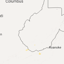
Hail Maps for Bud, WV


Connect with Interactive Hail Maps