

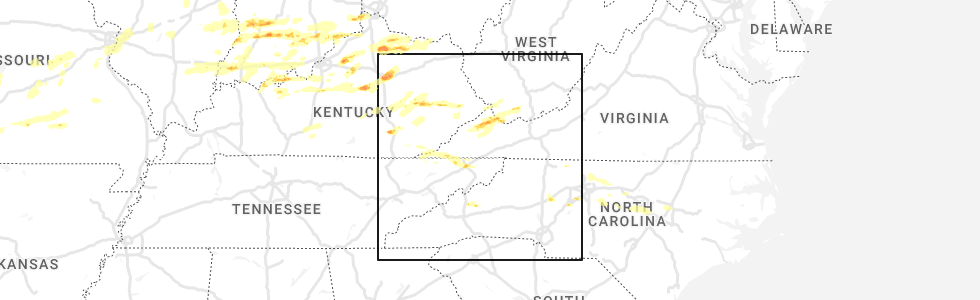
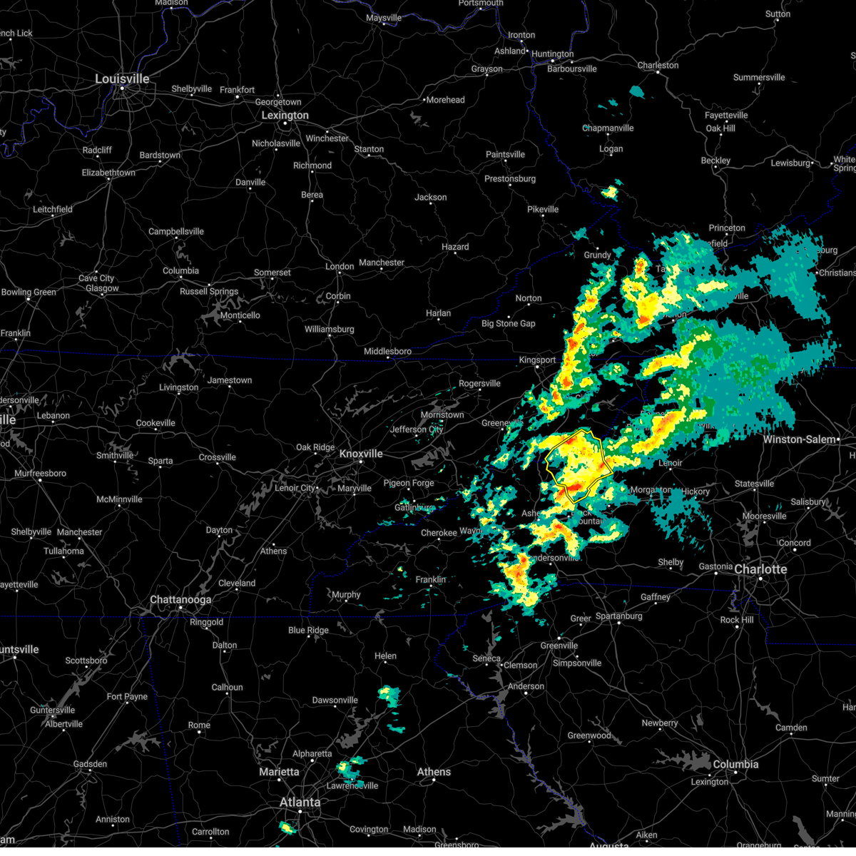
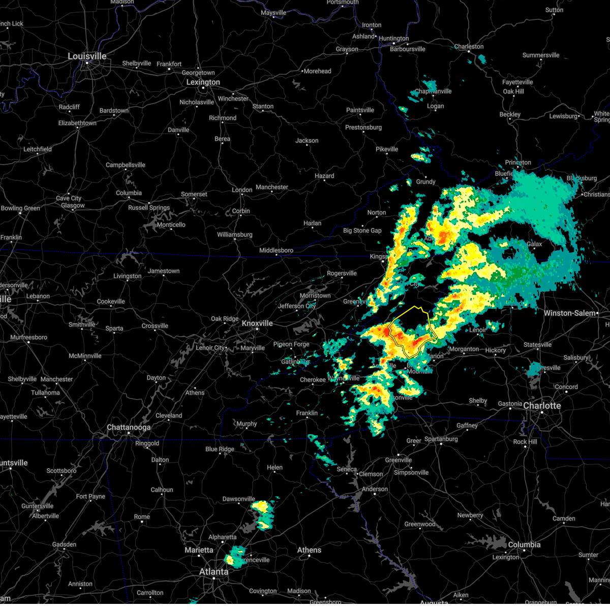
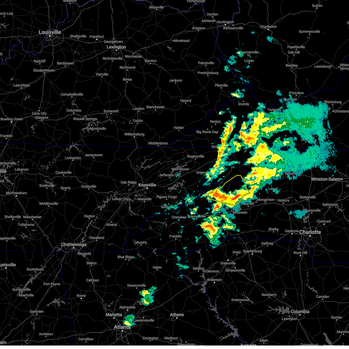
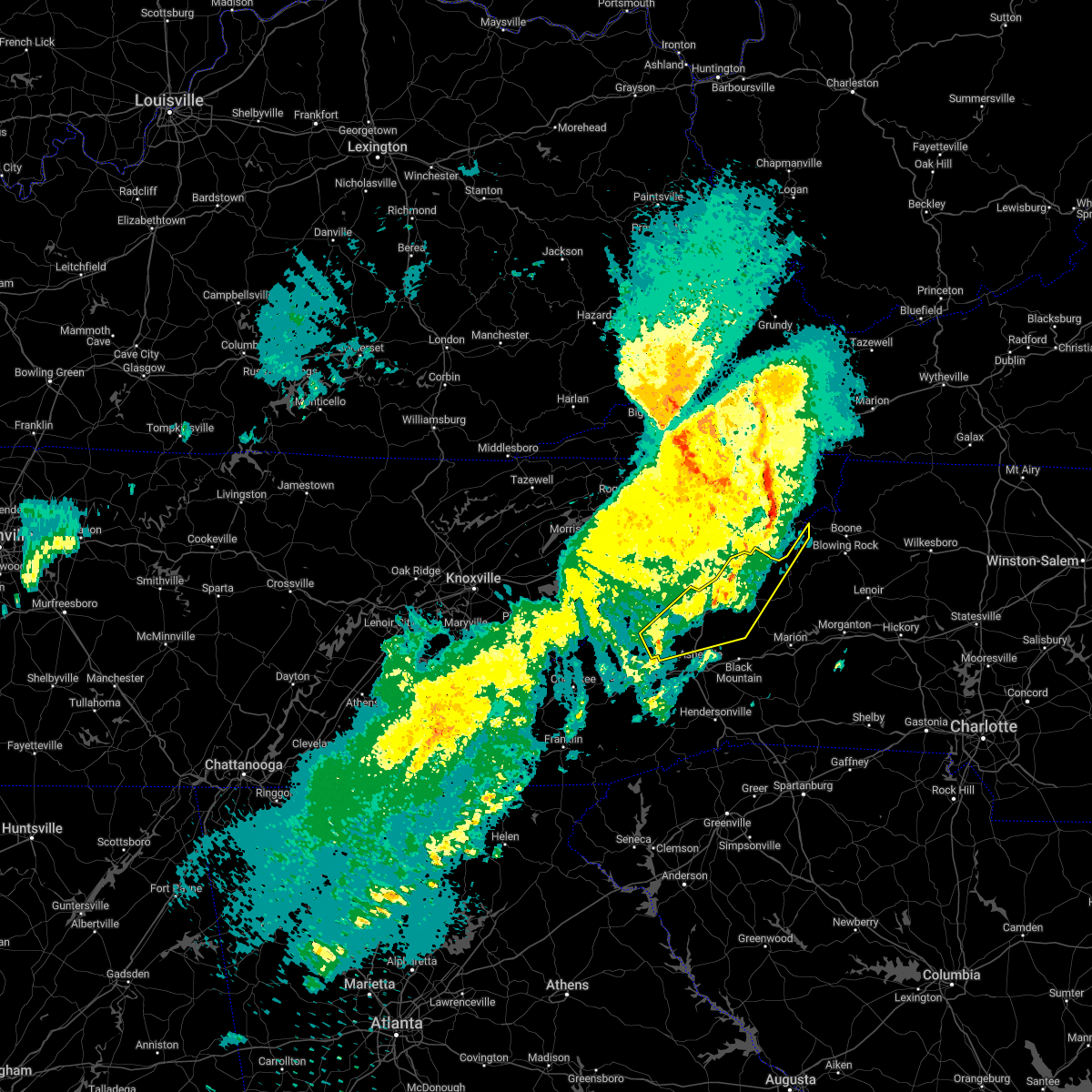
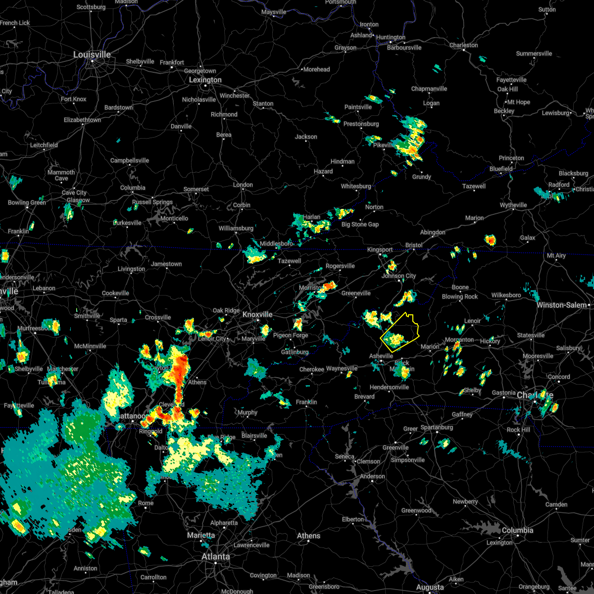
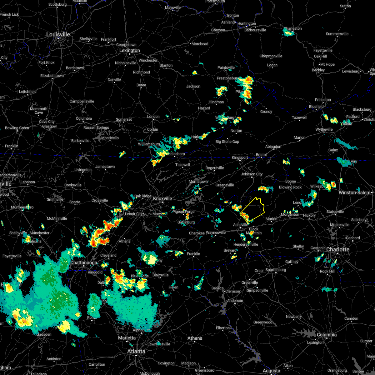
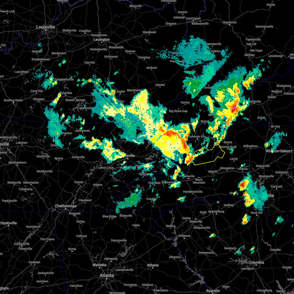
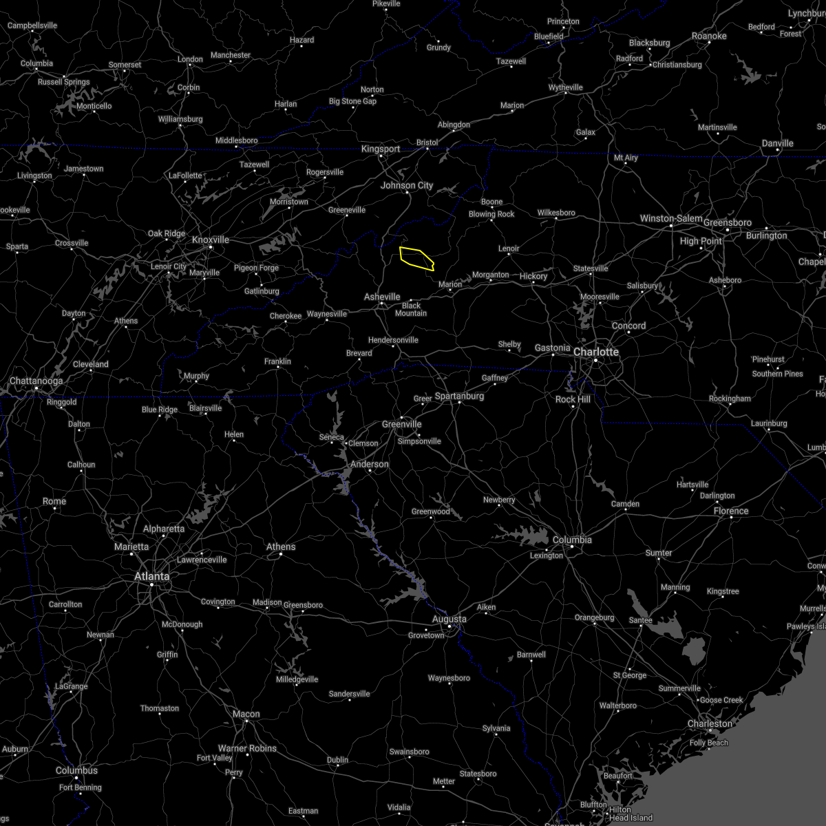
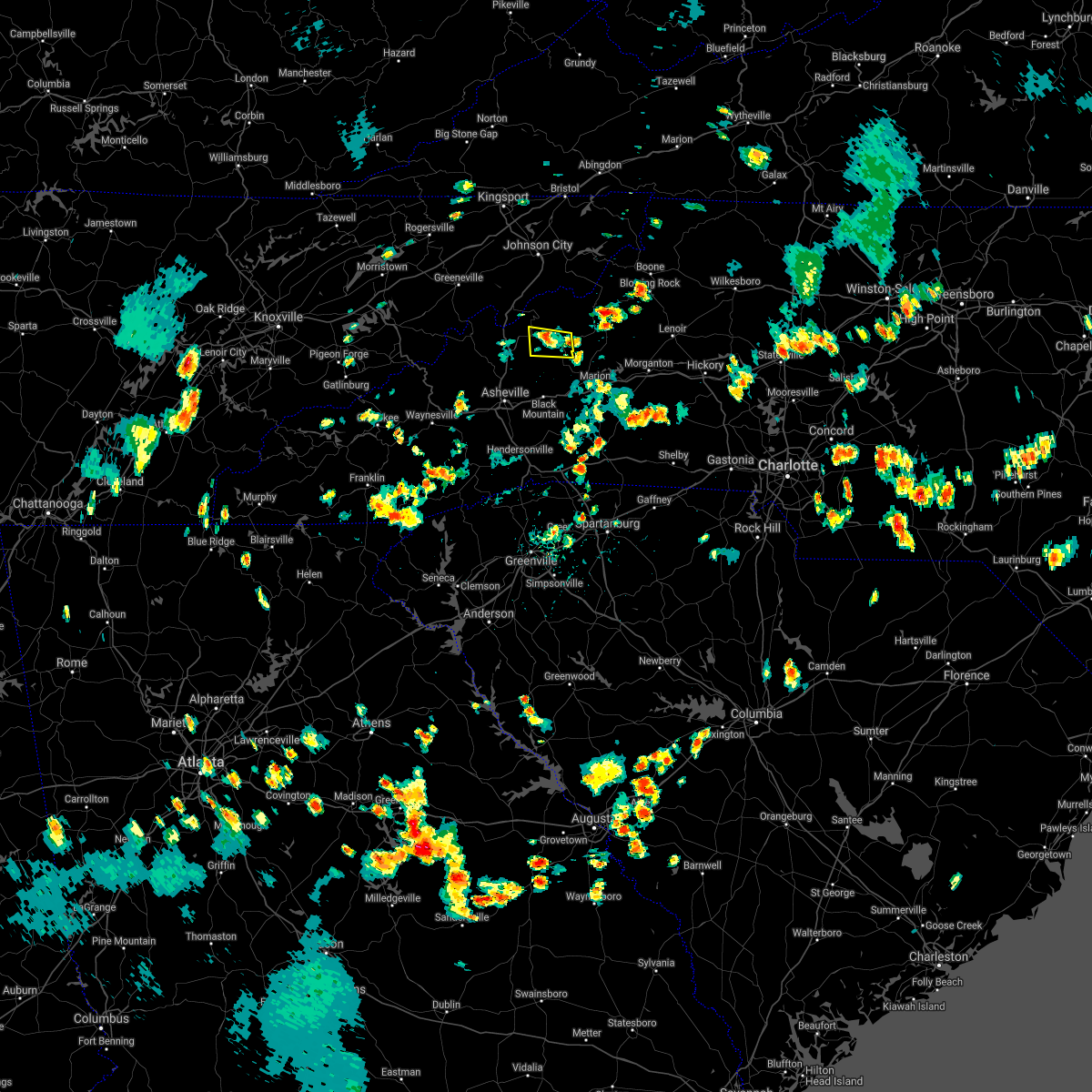
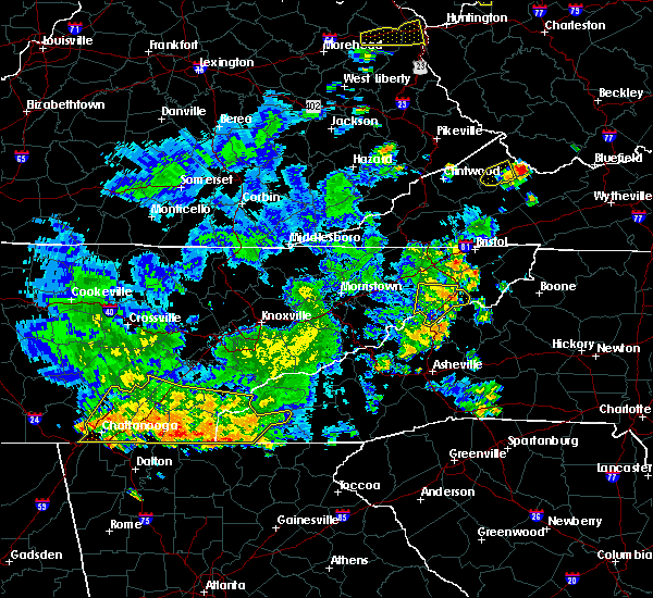
Hail Map for Burnsville, NC
The Burnsville, NC area has had 5 reports of on-the-ground hail by trained spotters, and has been under severe weather warnings 18 times during the past 12 months. Doppler radar has detected hail at or near Burnsville, NC on 11 occasions.
| Name: | Burnsville, NC |
| Where Located: | 46.8 miles S of Bristol, TN |
| Map: | Google Map for Burnsville, NC |
| Population: | 1693 |
| Housing Units: | 879 |
| More Info: | Search Google for Burnsville, NC |
0
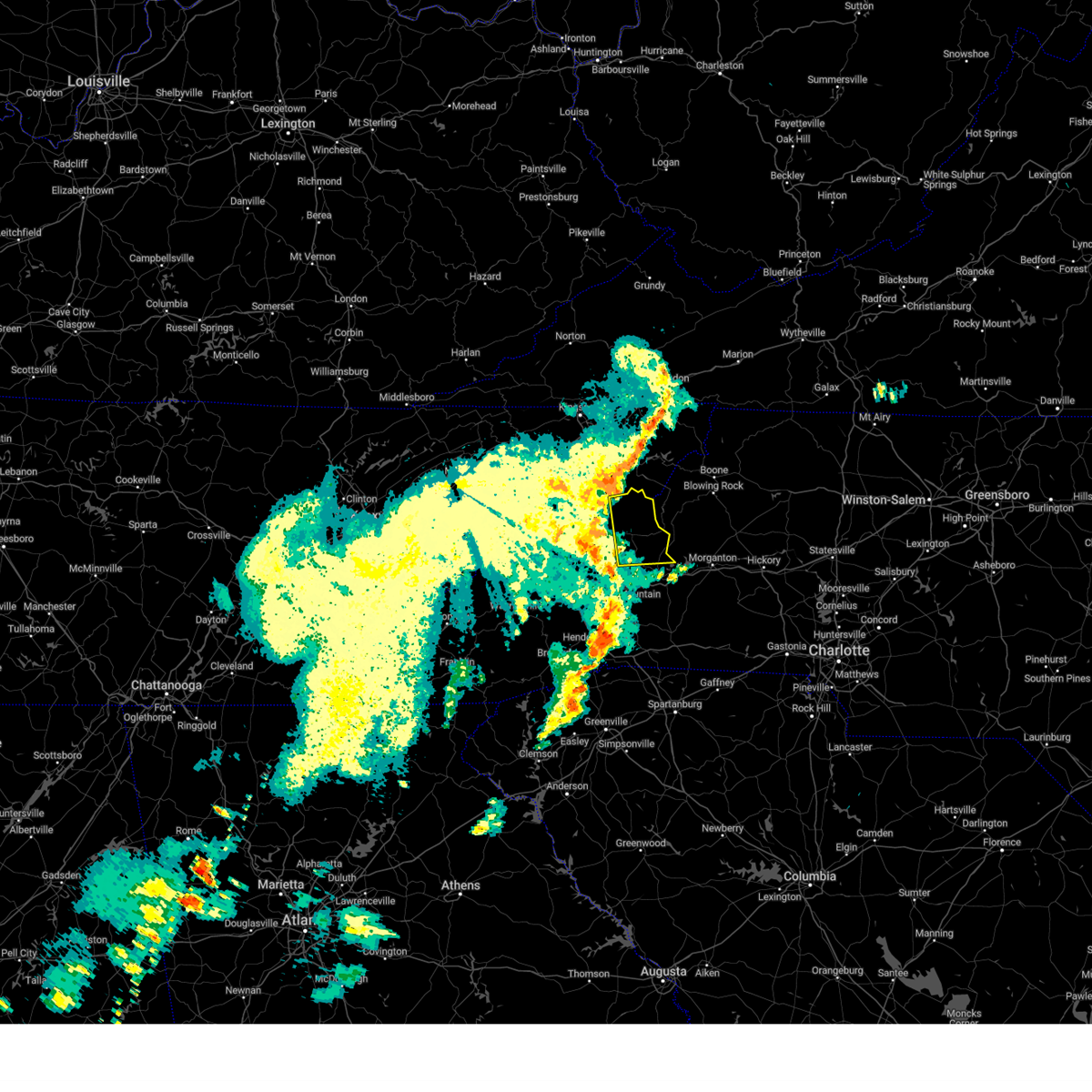
The Top Recent Hail Date for Burnsville, NC is Thursday, May 19, 2022 (11th out of 11)
Hail and Wind Damage Spotted near Burnsville, NC
| Date / Time | Report Details |
|---|---|
| 2/28/2024 1:51 PM EST |
 The storm which prompted the warning has weakened below severe limits, and no longer poses an immediate threat to life or property. therefore, the warning will be allowed to expire. however, gusty winds are still possible with this thunderstorm. to report severe weather to the national weather service greenville-spartanburg, call toll free, 1, 800, 2 6 7, 8 1 0 1, or post on our facebook page, or tweet it using hashtag nwsgsp. your message should describe the event and the specific location where it occurred. The storm which prompted the warning has weakened below severe limits, and no longer poses an immediate threat to life or property. therefore, the warning will be allowed to expire. however, gusty winds are still possible with this thunderstorm. to report severe weather to the national weather service greenville-spartanburg, call toll free, 1, 800, 2 6 7, 8 1 0 1, or post on our facebook page, or tweet it using hashtag nwsgsp. your message should describe the event and the specific location where it occurred.
|
| 2/28/2024 1:25 PM EST |
 Svrgsp the national weather service in greenville-spartanburg has issued a * severe thunderstorm warning for, northeastern madison county in western north carolina, northwestern mitchell county in western north carolina, northern yancey county in western north carolina, * until 200 pm est. * at 125 pm est, a severe thunderstorm was located 11 miles south of greeneville, or 9 miles northeast of hot springs, moving east at 60 mph (radar indicated). Hazards include 60 mph wind gusts. expect damage to trees and power lines Svrgsp the national weather service in greenville-spartanburg has issued a * severe thunderstorm warning for, northeastern madison county in western north carolina, northwestern mitchell county in western north carolina, northern yancey county in western north carolina, * until 200 pm est. * at 125 pm est, a severe thunderstorm was located 11 miles south of greeneville, or 9 miles northeast of hot springs, moving east at 60 mph (radar indicated). Hazards include 60 mph wind gusts. expect damage to trees and power lines
|
| 2/12/2024 10:41 PM EST |
 The severe thunderstorm warning for central madison, mitchell and northern yancey counties will expire at 1045 pm est, the storms which prompted the warning have weakened below severe limits, and no longer pose an immediate threat to life or property. therefore, the warning will be allowed to expire. however, gusty winds are still possible with these thunderstorms. The severe thunderstorm warning for central madison, mitchell and northern yancey counties will expire at 1045 pm est, the storms which prompted the warning have weakened below severe limits, and no longer pose an immediate threat to life or property. therefore, the warning will be allowed to expire. however, gusty winds are still possible with these thunderstorms.
|
| 2/12/2024 9:42 PM EST |
 At 940 pm est, severe thunderstorms were located along a line extending from 16 miles southwest of kingsport to 9 miles southeast of greeneville to 12 miles west of marshall, moving east at 45 mph (radar indicated). Hazards include 60 mph wind gusts. expect damage to trees and power lines At 940 pm est, severe thunderstorms were located along a line extending from 16 miles southwest of kingsport to 9 miles southeast of greeneville to 12 miles west of marshall, moving east at 45 mph (radar indicated). Hazards include 60 mph wind gusts. expect damage to trees and power lines
|
| 8/15/2023 12:30 AM EDT | At 1230 am edt, severe thunderstorms were located along a line extending from 3 miles north of beech mountain to 10 miles west of burnsville, moving east at 25 mph (radar indicated). Hazards include 60 mph wind gusts and quarter size hail. Minor hail damage to vehicles is expected. Expect wind damage to trees and power lines. |
| 8/12/2023 5:42 PM EDT |
 At 542 pm edt, severe thunderstorms were located along a line extending from 11 miles south of elizabethton to 12 miles south of burnsville, moving east at 40 mph (radar indicated). Hazards include 60 mph wind gusts. Expect damage to trees and power lines. locations impacted include, spruce pine, burnsville, bakersville, mount mitchell state park, buladean, bandana, green mountain, woodlawn, north cove and busick. hail threat, radar indicated max hail size, <. 75 in wind threat, radar indicated max wind gust, 60 mph. At 542 pm edt, severe thunderstorms were located along a line extending from 11 miles south of elizabethton to 12 miles south of burnsville, moving east at 40 mph (radar indicated). Hazards include 60 mph wind gusts. Expect damage to trees and power lines. locations impacted include, spruce pine, burnsville, bakersville, mount mitchell state park, buladean, bandana, green mountain, woodlawn, north cove and busick. hail threat, radar indicated max hail size, <. 75 in wind threat, radar indicated max wind gust, 60 mph.
|
| 8/12/2023 5:38 PM EDT | Tree down on hwy 197 n in the green mountain are in yancey county NC, 5.5 miles SSW of Burnsville, NC |
| 8/12/2023 5:30 PM EDT | Tree down on bakers creek r in yancey county NC, 2.9 miles NE of Burnsville, NC |
| 8/12/2023 5:30 PM EDT | Tree down on hwy 197 in yancey county NC, 2.6 miles NNE of Burnsville, NC |
| 8/12/2023 5:26 PM EDT | Tree down in the 700 block of possum trot r in yancey county NC, 5.7 miles E of Burnsville, NC |
| 8/12/2023 5:26 PM EDT | Tree down on little creek r in yancey county NC, 9 miles SE of Burnsville, NC |
| 8/12/2023 5:05 PM EDT |
 At 505 pm edt, severe thunderstorms were located along a line extending from 11 miles west of erwin to 3 miles southeast of marshall, moving east at 40 mph (radar indicated). Hazards include 60 mph wind gusts. expect damage to trees and power lines At 505 pm edt, severe thunderstorms were located along a line extending from 11 miles west of erwin to 3 miles southeast of marshall, moving east at 40 mph (radar indicated). Hazards include 60 mph wind gusts. expect damage to trees and power lines
|
| 8/7/2023 3:56 PM EDT |
 At 356 pm edt, severe thunderstorms were located along a line extending from 6 miles south of blowing rock to 7 miles west of lenoir to 7 miles east of marion, moving east at 45 mph (radar indicated). Hazards include 70 mph wind gusts and quarter size hail. Minor hail damage to vehicles is expected. expect considerable tree damage. wind damage is also likely to mobile homes, roofs, and outbuildings. Locations impacted include, lenoir, spruce pine, burnsville, newland, gamewell, cajah`s mountain, glen alpine, banner elk, elk park and bakersville. At 356 pm edt, severe thunderstorms were located along a line extending from 6 miles south of blowing rock to 7 miles west of lenoir to 7 miles east of marion, moving east at 45 mph (radar indicated). Hazards include 70 mph wind gusts and quarter size hail. Minor hail damage to vehicles is expected. expect considerable tree damage. wind damage is also likely to mobile homes, roofs, and outbuildings. Locations impacted include, lenoir, spruce pine, burnsville, newland, gamewell, cajah`s mountain, glen alpine, banner elk, elk park and bakersville.
|
| 8/7/2023 3:50 PM EDT |
 At 349 pm edt, severe thunderstorms were located along a line extending from 4 miles north of downtown asheville to 8 miles northwest of brevard to 15 miles southeast of sylva, moving east at 50 mph (radar indicated). Hazards include 70 mph wind gusts and penny size hail. Expect considerable tree damage. damage is likely to mobile homes, roofs, and outbuildings. locations impacted include, downtown asheville, brevard, sylva, waynesville, burnsville, east asheville, arden, west asheville, north asheville and black mountain. thunderstorm damage threat, considerable hail threat, radar indicated max hail size, 0. 75 in wind threat, radar indicated max wind gust, 70 mph. At 349 pm edt, severe thunderstorms were located along a line extending from 4 miles north of downtown asheville to 8 miles northwest of brevard to 15 miles southeast of sylva, moving east at 50 mph (radar indicated). Hazards include 70 mph wind gusts and penny size hail. Expect considerable tree damage. damage is likely to mobile homes, roofs, and outbuildings. locations impacted include, downtown asheville, brevard, sylva, waynesville, burnsville, east asheville, arden, west asheville, north asheville and black mountain. thunderstorm damage threat, considerable hail threat, radar indicated max hail size, 0. 75 in wind threat, radar indicated max wind gust, 70 mph.
|
| 8/7/2023 3:46 PM EDT |
 At 346 pm edt, severe thunderstorms were located along a line extending from 13 miles south of elizabethton to near burnsville, moving east at 65 mph (radar indicated). Hazards include 70 mph wind gusts. Expect considerable tree damage. Damage is likely to mobile homes, roofs, and outbuildings. At 346 pm edt, severe thunderstorms were located along a line extending from 13 miles south of elizabethton to near burnsville, moving east at 65 mph (radar indicated). Hazards include 70 mph wind gusts. Expect considerable tree damage. Damage is likely to mobile homes, roofs, and outbuildings.
|
| 8/7/2023 3:34 PM EDT |
 At 334 pm edt, severe thunderstorms were located along a line extending from 14 miles southwest of marshall to 7 miles south of waynesville to 9 miles south of sylva, moving east at 50 mph (radar indicated). Hazards include 70 mph wind gusts and quarter size hail. Minor hail damage to vehicles is expected. expect considerable tree damage. Wind damage is also likely to mobile homes, roofs, and outbuildings. At 334 pm edt, severe thunderstorms were located along a line extending from 14 miles southwest of marshall to 7 miles south of waynesville to 9 miles south of sylva, moving east at 50 mph (radar indicated). Hazards include 70 mph wind gusts and quarter size hail. Minor hail damage to vehicles is expected. expect considerable tree damage. Wind damage is also likely to mobile homes, roofs, and outbuildings.
|
| 8/7/2023 3:25 PM EDT |
 At 325 pm edt, severe thunderstorms were located along a line extending from 4 miles southwest of foscoe to 4 miles northeast of spruce pine to 8 miles southwest of burnsville, moving east at 40 mph (radar indicated). Hazards include 70 mph wind gusts and quarter size hail. Minor hail damage to vehicles is expected. expect considerable tree damage. Wind damage is also likely to mobile homes, roofs, and outbuildings. At 325 pm edt, severe thunderstorms were located along a line extending from 4 miles southwest of foscoe to 4 miles northeast of spruce pine to 8 miles southwest of burnsville, moving east at 40 mph (radar indicated). Hazards include 70 mph wind gusts and quarter size hail. Minor hail damage to vehicles is expected. expect considerable tree damage. Wind damage is also likely to mobile homes, roofs, and outbuildings.
|
| 8/7/2023 3:15 PM EDT | Yancey county emergency manager reported about 7-10 large trees down within a quarter-acre area near jacks creek rd. time estimated from rada in yancey county NC, 3.2 miles SSE of Burnsville, NC |
| 8/7/2023 3:00 PM EDT |
 At 300 pm edt, severe thunderstorms were located along a line extending from 11 miles northwest of newland to 6 miles northeast of burnsville to 12 miles east of marshall, moving east at 45 mph (radar indicated). Hazards include 70 mph wind gusts and quarter size hail. Minor hail damage to vehicles is expected. expect considerable tree damage. Wind damage is also likely to mobile homes, roofs, and outbuildings. At 300 pm edt, severe thunderstorms were located along a line extending from 11 miles northwest of newland to 6 miles northeast of burnsville to 12 miles east of marshall, moving east at 45 mph (radar indicated). Hazards include 70 mph wind gusts and quarter size hail. Minor hail damage to vehicles is expected. expect considerable tree damage. Wind damage is also likely to mobile homes, roofs, and outbuildings.
|
| 8/7/2023 2:57 PM EDT | Corrects previous tstm wnd dmg report from 3 nnw burnsville for updated location and time. the report actually occurred at 36.0151... -82.2965 or 4 ene ramseytown. yanc in yancey county NC, 3.2 miles SSE of Burnsville, NC |
| 8/7/2023 2:46 PM EDT |
 At 246 pm edt, severe thunderstorms were located along a line extending from 7 miles south of johnson city to 5 miles southeast of erwin to 11 miles northeast of marshall, moving east at 50 mph (radar indicated). Hazards include 60 mph wind gusts and quarter size hail. Minor hail damage to vehicles is expected. expect wind damage to trees and power lines. Locations impacted include, hot springs, buladean, ramseytown, faust, allenstand, walnut, wolf ridge, poplar, green mountain and swiss. At 246 pm edt, severe thunderstorms were located along a line extending from 7 miles south of johnson city to 5 miles southeast of erwin to 11 miles northeast of marshall, moving east at 50 mph (radar indicated). Hazards include 60 mph wind gusts and quarter size hail. Minor hail damage to vehicles is expected. expect wind damage to trees and power lines. Locations impacted include, hot springs, buladean, ramseytown, faust, allenstand, walnut, wolf ridge, poplar, green mountain and swiss.
|
| 8/7/2023 2:23 PM EDT |
 At 223 pm edt, severe thunderstorms were located along a line extending from 18 miles northwest of erwin to 7 miles southeast of greeneville to 15 miles east of newport, moving east at 50 mph (radar indicated). Hazards include 60 mph wind gusts and quarter size hail. Minor hail damage to vehicles is expected. Expect wind damage to trees and power lines. At 223 pm edt, severe thunderstorms were located along a line extending from 18 miles northwest of erwin to 7 miles southeast of greeneville to 15 miles east of newport, moving east at 50 mph (radar indicated). Hazards include 60 mph wind gusts and quarter size hail. Minor hail damage to vehicles is expected. Expect wind damage to trees and power lines.
|
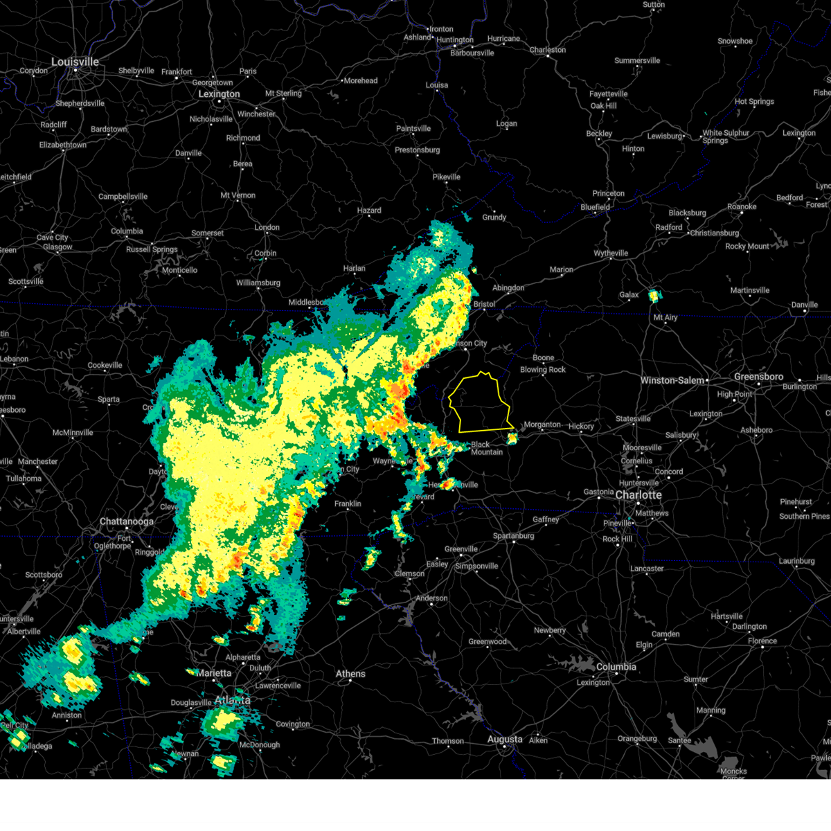
| 7/29/2023 6:13 PM EDT |
 At 613 pm edt, severe thunderstorms were located along a line extending from 4 miles west of foscoe to 4 miles north of spruce pine to 9 miles west of burnsville, moving southeast at 35 mph (radar indicated). Hazards include 60 mph wind gusts. Expect damage to trees and power lines. locations impacted include, spruce pine, burnsville, newland, crossnore, sugar mountain, grandfather mountain state park, linville falls, bandana, ingalls, and the blue ridge parkway from linville falls and grandfather. hail threat, radar indicated max hail size, <. 75 in wind threat, radar indicated max wind gust, 60 mph. At 613 pm edt, severe thunderstorms were located along a line extending from 4 miles west of foscoe to 4 miles north of spruce pine to 9 miles west of burnsville, moving southeast at 35 mph (radar indicated). Hazards include 60 mph wind gusts. Expect damage to trees and power lines. locations impacted include, spruce pine, burnsville, newland, crossnore, sugar mountain, grandfather mountain state park, linville falls, bandana, ingalls, and the blue ridge parkway from linville falls and grandfather. hail threat, radar indicated max hail size, <. 75 in wind threat, radar indicated max wind gust, 60 mph.
|
| 7/29/2023 6:11 PM EDT |
 At 610 pm edt, severe thunderstorms were located along a line extending from 4 miles northeast of newland to 9 miles southwest of burnsville to 7 miles north of waynesville, moving east at 35 mph (radar indicated). Hazards include 60 mph wind gusts. expect damage to trees and power lines At 610 pm edt, severe thunderstorms were located along a line extending from 4 miles northeast of newland to 9 miles southwest of burnsville to 7 miles north of waynesville, moving east at 35 mph (radar indicated). Hazards include 60 mph wind gusts. expect damage to trees and power lines
|
| 7/29/2023 5:39 PM EDT |
 At 539 pm edt, severe thunderstorms were located in east tennessee, along a line extending from 10 miles west of mountain city to 7 miles northeast of erwin to 11 miles southeast of greeneville tn, moving southeast at 25 mph (radar indicated). Hazards include 60 mph wind gusts. expect damage to trees and power lines At 539 pm edt, severe thunderstorms were located in east tennessee, along a line extending from 10 miles west of mountain city to 7 miles northeast of erwin to 11 miles southeast of greeneville tn, moving southeast at 25 mph (radar indicated). Hazards include 60 mph wind gusts. expect damage to trees and power lines
|
| 3/25/2023 4:57 AM EDT |
 At 457 am edt, severe thunderstorms were located along a line extending from 10 miles west of erwin to 4 miles north of marshall to 17 miles northwest of downtown asheville, moving east at 55 mph (radar indicated). Hazards include 60 mph wind gusts. expect damage to trees and power lines At 457 am edt, severe thunderstorms were located along a line extending from 10 miles west of erwin to 4 miles north of marshall to 17 miles northwest of downtown asheville, moving east at 55 mph (radar indicated). Hazards include 60 mph wind gusts. expect damage to trees and power lines
|
| 3/3/2023 5:36 PM EST |
 The severe thunderstorm warning for mitchell and yancey counties will expire at 545 pm est, the storm which prompted the warning has weakened below severe limits, and has exited the warned area. therefore, the warning will be allowed to expire. a tornado watch remains in effect until 800 pm est for western north carolina. The severe thunderstorm warning for mitchell and yancey counties will expire at 545 pm est, the storm which prompted the warning has weakened below severe limits, and has exited the warned area. therefore, the warning will be allowed to expire. a tornado watch remains in effect until 800 pm est for western north carolina.
|
| 3/3/2023 5:27 PM EST |
 At 527 pm est, a severe thunderstorm was located near burnsville, moving northeast at 70 mph (radar indicated). Hazards include 60 mph wind gusts. Expect damage to trees and power lines. locations impacted include, spruce pine, burnsville, bakersville, mount mitchell state park, buladean, bandana, ramseytown, green mountain, swiss and busick. hail threat, radar indicated max hail size, <. 75 in wind threat, radar indicated max wind gust, 60 mph. At 527 pm est, a severe thunderstorm was located near burnsville, moving northeast at 70 mph (radar indicated). Hazards include 60 mph wind gusts. Expect damage to trees and power lines. locations impacted include, spruce pine, burnsville, bakersville, mount mitchell state park, buladean, bandana, ramseytown, green mountain, swiss and busick. hail threat, radar indicated max hail size, <. 75 in wind threat, radar indicated max wind gust, 60 mph.
|
| 3/3/2023 5:20 PM EST |
 At 520 pm est, a severe thunderstorm was located 7 miles southwest of burnsville, moving northeast at 100 mph (radar indicated). Hazards include 60 mph wind gusts. Expect damage to trees and power lines. locations impacted include, spruce pine, burnsville, marshall, mars hill, bakersville, b. r. parkway-little switzerland to linville, mount mitchell state park, b. r. parkway-craggy to little switzerland, buladean and bandana. hail threat, radar indicated max hail size, <. 75 in wind threat, radar indicated max wind gust, 60 mph. At 520 pm est, a severe thunderstorm was located 7 miles southwest of burnsville, moving northeast at 100 mph (radar indicated). Hazards include 60 mph wind gusts. Expect damage to trees and power lines. locations impacted include, spruce pine, burnsville, marshall, mars hill, bakersville, b. r. parkway-little switzerland to linville, mount mitchell state park, b. r. parkway-craggy to little switzerland, buladean and bandana. hail threat, radar indicated max hail size, <. 75 in wind threat, radar indicated max wind gust, 60 mph.
|
| 3/3/2023 4:41 PM EST |
 At 440 pm est, a severe thunderstorm was located 12 miles southwest of marshall, or 7 miles west of leicester, moving northeast at 70 mph (radar indicated). Hazards include 60 mph wind gusts. expect damage to trees and power lines At 440 pm est, a severe thunderstorm was located 12 miles southwest of marshall, or 7 miles west of leicester, moving northeast at 70 mph (radar indicated). Hazards include 60 mph wind gusts. expect damage to trees and power lines
|
| 1/12/2023 2:32 PM EST |
 At 229 pm est, severe thunderstorms were located along a line extending from 3 miles south of bristol tn to 7 miles east of elizabethton to 9 miles north of burnsville to 12 miles southwest of marshall, moving east at 60 mph. wind gusts over 60 mph have been confirmed with this line of storms in east tennessee (radar indicated). Hazards include 60 mph wind gusts. Expect damage to trees and power lines. locations impacted include, burnsville, marshall, weaverville, mars hill, elk park, bakersville, leicester, mount mitchell state park, buladean and bandana. hail threat, radar indicated max hail size, <. 75 in wind threat, observed max wind gust, 60 mph. At 229 pm est, severe thunderstorms were located along a line extending from 3 miles south of bristol tn to 7 miles east of elizabethton to 9 miles north of burnsville to 12 miles southwest of marshall, moving east at 60 mph. wind gusts over 60 mph have been confirmed with this line of storms in east tennessee (radar indicated). Hazards include 60 mph wind gusts. Expect damage to trees and power lines. locations impacted include, burnsville, marshall, weaverville, mars hill, elk park, bakersville, leicester, mount mitchell state park, buladean and bandana. hail threat, radar indicated max hail size, <. 75 in wind threat, observed max wind gust, 60 mph.
|
| 1/12/2023 2:08 PM EST |
 At 208 pm est, severe thunderstorms were located along a line extending from 7 miles south of kingsport to 5 miles northwest of erwin to 10 miles north of marshall to 11 miles north of waynesville, moving east at 60 mph (radar indicated). Hazards include 60 mph wind gusts. Expect damage to trees and power lines. locations impacted include, burnsville, marshall, weaverville, mars hill, hot springs, elk park, bakersville, leicester, mount mitchell state park and buladean. hail threat, radar indicated max hail size, <. 75 in wind threat, radar indicated max wind gust, 60 mph. At 208 pm est, severe thunderstorms were located along a line extending from 7 miles south of kingsport to 5 miles northwest of erwin to 10 miles north of marshall to 11 miles north of waynesville, moving east at 60 mph (radar indicated). Hazards include 60 mph wind gusts. Expect damage to trees and power lines. locations impacted include, burnsville, marshall, weaverville, mars hill, hot springs, elk park, bakersville, leicester, mount mitchell state park and buladean. hail threat, radar indicated max hail size, <. 75 in wind threat, radar indicated max wind gust, 60 mph.
|
| 1/12/2023 1:44 PM EST |
 At 144 pm est, severe thunderstorms were located along a line extending from 10 miles northwest of greeneville to 16 miles east of newport to 8 miles northeast of bryson city, moving east at 60 mph (radar indicated). Hazards include 70 mph wind gusts. Expect considerable tree damage. Damage is likely to mobile homes, roofs, and outbuildings. At 144 pm est, severe thunderstorms were located along a line extending from 10 miles northwest of greeneville to 16 miles east of newport to 8 miles northeast of bryson city, moving east at 60 mph (radar indicated). Hazards include 70 mph wind gusts. Expect considerable tree damage. Damage is likely to mobile homes, roofs, and outbuildings.
|
| 8/9/2022 4:39 PM EDT |
 The severe thunderstorm warning for east central madison, northeastern buncombe and yancey counties will expire at 445 pm edt, the storm which prompted the warning has weakened below severe limits, and no longer poses an immediate threat to life or property. therefore, the warning will be allowed to expire. however gusty winds are still possible with this thunderstorm. The severe thunderstorm warning for east central madison, northeastern buncombe and yancey counties will expire at 445 pm edt, the storm which prompted the warning has weakened below severe limits, and no longer poses an immediate threat to life or property. therefore, the warning will be allowed to expire. however gusty winds are still possible with this thunderstorm.
|
| 8/9/2022 3:55 PM EDT |
 At 355 pm edt, a severe thunderstorm was located 11 miles southwest of burnsville, or 7 miles north of b.r. parkway-east asheville to craggy gardens, moving northeast at 20 mph (radar indicated). Hazards include 60 mph wind gusts and penny size hail. expect damage to trees and power lines At 355 pm edt, a severe thunderstorm was located 11 miles southwest of burnsville, or 7 miles north of b.r. parkway-east asheville to craggy gardens, moving northeast at 20 mph (radar indicated). Hazards include 60 mph wind gusts and penny size hail. expect damage to trees and power lines
|
| 6/17/2022 3:41 PM EDT |
 At 340 pm edt, severe thunderstorms were located along a line extending from 4 miles south of burnsville to 15 miles east of marshall, moving southeast at 20 mph (radar indicated). Hazards include 60 mph wind gusts and nickel size hail. expect damage to trees and power lines At 340 pm edt, severe thunderstorms were located along a line extending from 4 miles south of burnsville to 15 miles east of marshall, moving southeast at 20 mph (radar indicated). Hazards include 60 mph wind gusts and nickel size hail. expect damage to trees and power lines
|
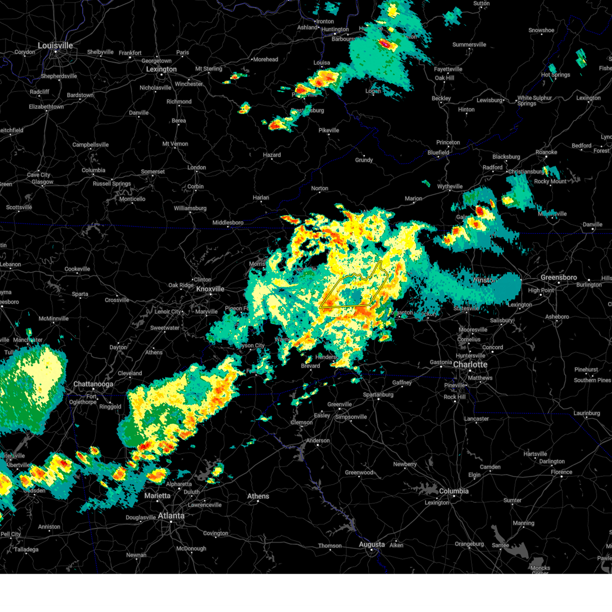
| 6/14/2022 7:28 AM EDT |
 At 726 am edt, severe thunderstorms were located along a line extending from 8 miles northwest of burnsville to 13 miles southwest of hickory to near downtown concord, moving south at 20 mph (radar indicated). Hazards include 60 mph wind gusts and quarter size hail. Minor hail damage to vehicles is expected. expect wind damage to trees and power lines. locations impacted include, charlotte, huntersville, kannapolis, concord, morganton, lincolnton, marion, spruce pine, and burnsville. hail threat, radar indicated max hail size, 1. 00 in wind threat, radar indicated max wind gust, 60 mph. At 726 am edt, severe thunderstorms were located along a line extending from 8 miles northwest of burnsville to 13 miles southwest of hickory to near downtown concord, moving south at 20 mph (radar indicated). Hazards include 60 mph wind gusts and quarter size hail. Minor hail damage to vehicles is expected. expect wind damage to trees and power lines. locations impacted include, charlotte, huntersville, kannapolis, concord, morganton, lincolnton, marion, spruce pine, and burnsville. hail threat, radar indicated max hail size, 1. 00 in wind threat, radar indicated max wind gust, 60 mph.
|
| 6/14/2022 6:55 AM EDT |
 At 655 am edt, severe thunderstorms were located along a line extending from 6 miles southeast of erwin to 12 miles north of morganton to 4 miles southwest of kannapolis, moving south at 25 mph (radar indicated). Hazards include 60 mph wind gusts. expect damage to trees and power lines At 655 am edt, severe thunderstorms were located along a line extending from 6 miles southeast of erwin to 12 miles north of morganton to 4 miles southwest of kannapolis, moving south at 25 mph (radar indicated). Hazards include 60 mph wind gusts. expect damage to trees and power lines
|
| 6/14/2022 6:37 AM EDT |
 At 637 am edt, severe thunderstorms were located along a line extending from 8 miles southeast of taylorsville to 7 miles west of lenoir to near newland to 9 miles north of burnsville, moving south at 30 mph (radar indicated). Hazards include 60 mph wind gusts. Expect damage to trees and power lines. locations impacted include, hickory, lenoir, morganton, spruce pine, taylorsville, burnsville, newland, st. stephens, longview and sawmills. hail threat, radar indicated max hail size, <. 75 in wind threat, radar indicated max wind gust, 60 mph. At 637 am edt, severe thunderstorms were located along a line extending from 8 miles southeast of taylorsville to 7 miles west of lenoir to near newland to 9 miles north of burnsville, moving south at 30 mph (radar indicated). Hazards include 60 mph wind gusts. Expect damage to trees and power lines. locations impacted include, hickory, lenoir, morganton, spruce pine, taylorsville, burnsville, newland, st. stephens, longview and sawmills. hail threat, radar indicated max hail size, <. 75 in wind threat, radar indicated max wind gust, 60 mph.
|
| 6/14/2022 6:09 AM EDT |
 At 608 am edt, severe thunderstorms were located along a line extending from 3 miles southeast of traphill to 9 miles southeast of deep gap to 3 miles southwest of beech mountain to 4 miles north of elizabethton, moving south at 35 mph (radar indicated). Hazards include 60 mph wind gusts. expect damage to trees and power lines At 608 am edt, severe thunderstorms were located along a line extending from 3 miles southeast of traphill to 9 miles southeast of deep gap to 3 miles southwest of beech mountain to 4 miles north of elizabethton, moving south at 35 mph (radar indicated). Hazards include 60 mph wind gusts. expect damage to trees and power lines
|
| 5/19/2022 7:09 PM EDT |
 At 709 pm edt, a severe thunderstorm was located 10 miles southwest of spruce pine, or near b.r. parkway-little switzerland to linville, moving east at 30 mph (radar indicated). Hazards include 60 mph wind gusts and quarter size hail. Minor hail damage to vehicles is expected. expect wind damage to trees and power lines. locations impacted include, marion, spruce pine, b. r. parkway-little switzerland to linville, mount mitchell state park, b. r. parkway-craggy to little switzerland, pleasant gardens, woodlawn, north cove, busick and micaville. hail threat, observed max hail size, 1. 00 in wind threat, radar indicated max wind gust, 60 mph. At 709 pm edt, a severe thunderstorm was located 10 miles southwest of spruce pine, or near b.r. parkway-little switzerland to linville, moving east at 30 mph (radar indicated). Hazards include 60 mph wind gusts and quarter size hail. Minor hail damage to vehicles is expected. expect wind damage to trees and power lines. locations impacted include, marion, spruce pine, b. r. parkway-little switzerland to linville, mount mitchell state park, b. r. parkway-craggy to little switzerland, pleasant gardens, woodlawn, north cove, busick and micaville. hail threat, observed max hail size, 1. 00 in wind threat, radar indicated max wind gust, 60 mph.
|
| 5/19/2022 6:51 PM EDT |
 At 650 pm edt, a severe thunderstorm was located 10 miles south of burnsville, or near mount mitchell state park, moving east at 25 mph (radar indicated). Hazards include 60 mph wind gusts and quarter size hail. Minor hail damage to vehicles is expected. Expect wind damage to trees and power lines. At 650 pm edt, a severe thunderstorm was located 10 miles south of burnsville, or near mount mitchell state park, moving east at 25 mph (radar indicated). Hazards include 60 mph wind gusts and quarter size hail. Minor hail damage to vehicles is expected. Expect wind damage to trees and power lines.
|
| 5/6/2022 6:36 PM EDT |
 The severe thunderstorm warning for mitchell, avery and northeastern yancey counties will expire at 645 pm edt, the storms which prompted the warning have weakened below severe limits, and no longer pose an immediate threat to life or property. therefore, the warning will be allowed to expire. however gusty winds are still possible with these thunderstorms. a tornado watch remains in effect until 800 pm edt for western north carolina. to report severe weather to the national weather service greenville-spartanburg, call toll free, 1, 800, 2 6 7, 8 1 0 1, or post on our facebook page, or tweet it using hashtag nwsgsp. your message should describe the event and the specific location where it occurred. The severe thunderstorm warning for mitchell, avery and northeastern yancey counties will expire at 645 pm edt, the storms which prompted the warning have weakened below severe limits, and no longer pose an immediate threat to life or property. therefore, the warning will be allowed to expire. however gusty winds are still possible with these thunderstorms. a tornado watch remains in effect until 800 pm edt for western north carolina. to report severe weather to the national weather service greenville-spartanburg, call toll free, 1, 800, 2 6 7, 8 1 0 1, or post on our facebook page, or tweet it using hashtag nwsgsp. your message should describe the event and the specific location where it occurred.
|
| 5/6/2022 6:27 PM EDT |
 At 626 pm edt, severe thunderstorms were located along a line extending from 8 miles southeast of elizabethton to 9 miles south of burnsville, moving east at 50 mph (radar indicated). Hazards include 60 mph wind gusts and penny size hail. Expect damage to trees and power lines. locations impacted include, spruce pine, burnsville, newland, banner elk, elk park, bakersville, beech mountain in avery county, crossnore, sugar mountain and grandfather mountain state park. hail threat, radar indicated max hail size, 0. 75 in wind threat, radar indicated max wind gust, 60 mph. At 626 pm edt, severe thunderstorms were located along a line extending from 8 miles southeast of elizabethton to 9 miles south of burnsville, moving east at 50 mph (radar indicated). Hazards include 60 mph wind gusts and penny size hail. Expect damage to trees and power lines. locations impacted include, spruce pine, burnsville, newland, banner elk, elk park, bakersville, beech mountain in avery county, crossnore, sugar mountain and grandfather mountain state park. hail threat, radar indicated max hail size, 0. 75 in wind threat, radar indicated max wind gust, 60 mph.
|
| 5/6/2022 6:06 PM EDT |
 At 605 pm edt, a severe thunderstorm was located 6 miles northwest of burnsville, moving east at 45 mph (radar indicated). Hazards include 60 mph wind gusts and penny size hail. expect damage to trees and power lines At 605 pm edt, a severe thunderstorm was located 6 miles northwest of burnsville, moving east at 45 mph (radar indicated). Hazards include 60 mph wind gusts and penny size hail. expect damage to trees and power lines
|
| 8/10/2021 5:16 PM EDT |
 At 516 pm edt, a severe thunderstorm was located near burnsville, and is nearly stationary (radar indicated). Hazards include 60 mph wind gusts and quarter size hail. Minor hail damage to vehicles is expected. expect wind damage to trees and power lines. locations impacted include, burnsville, celo and micaville. hail threat, radar indicated max hail size, 1. 00 in wind threat, radar indicated max wind gust, 60 mph. At 516 pm edt, a severe thunderstorm was located near burnsville, and is nearly stationary (radar indicated). Hazards include 60 mph wind gusts and quarter size hail. Minor hail damage to vehicles is expected. expect wind damage to trees and power lines. locations impacted include, burnsville, celo and micaville. hail threat, radar indicated max hail size, 1. 00 in wind threat, radar indicated max wind gust, 60 mph.
|
| 8/10/2021 5:02 PM EDT |
 At 502 pm edt, a severe thunderstorm was located near burnsville, and is nearly stationary (radar indicated). Hazards include 60 mph wind gusts and quarter size hail. Minor hail damage to vehicles is expected. Expect wind damage to trees and power lines. At 502 pm edt, a severe thunderstorm was located near burnsville, and is nearly stationary (radar indicated). Hazards include 60 mph wind gusts and quarter size hail. Minor hail damage to vehicles is expected. Expect wind damage to trees and power lines.
|
| 8/10/2021 4:44 PM EDT | Quarter sized hail reported 0.2 miles SSE of Burnsville, NC, public reported quarter (1.00") size hail in burnsville. also reported small tree limbs down. |
| 7/31/2020 7:56 PM EDT |
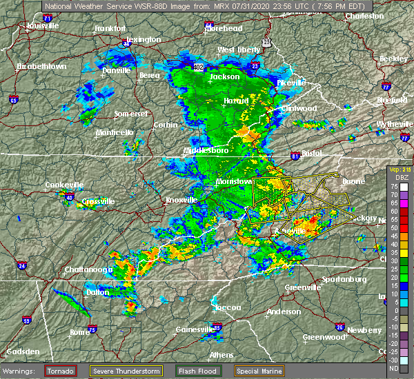 At 756 pm edt, a severe thunderstorm was located 10 miles southeast of erwin, or 6 miles northwest of bakersville, moving east at 40 mph (radar indicated). Hazards include 60 mph wind gusts. expect damage to trees and power lines At 756 pm edt, a severe thunderstorm was located 10 miles southeast of erwin, or 6 miles northwest of bakersville, moving east at 40 mph (radar indicated). Hazards include 60 mph wind gusts. expect damage to trees and power lines
|
| 8/13/2019 2:20 PM EDT | Public reported line down on bald mountain r in yancey county NC, 10 miles ESE of Burnsville, NC |
| 8/13/2019 2:15 PM EDT |
 At 215 pm edt, severe thunderstorms were located along a line extending from 12 miles southwest of erwin to 17 miles west of burnsville to 5 miles southwest of marshall, moving southeast at 25 mph (radar indicated). Hazards include 60 mph wind gusts. Expect damage to trees and power lines. Locations impacted include, burnsville, marshall, swannanoa, weaverville, mars hill, ramseytown, green mountain, swiss and flat creek. At 215 pm edt, severe thunderstorms were located along a line extending from 12 miles southwest of erwin to 17 miles west of burnsville to 5 miles southwest of marshall, moving southeast at 25 mph (radar indicated). Hazards include 60 mph wind gusts. Expect damage to trees and power lines. Locations impacted include, burnsville, marshall, swannanoa, weaverville, mars hill, ramseytown, green mountain, swiss and flat creek.
|
| 8/13/2019 1:46 PM EDT |
 At 146 pm edt, a severe thunderstorm was located 13 miles south of greeneville, or 5 miles north of hot springs, moving southeast at 30 mph (radar indicated). Hazards include 60 mph wind gusts and penny size hail. expect damage to trees and power lines At 146 pm edt, a severe thunderstorm was located 13 miles south of greeneville, or 5 miles north of hot springs, moving southeast at 30 mph (radar indicated). Hazards include 60 mph wind gusts and penny size hail. expect damage to trees and power lines
|
| 8/30/2018 3:07 PM EDT | 911 call center reported trees down to the south of burnsville. time estimated from rada in yancey county NC, 5.6 miles NE of Burnsville, NC |
| 8/30/2018 3:04 PM EDT |
 At 304 pm edt, a severe thunderstorm was located 6 miles southwest of burnsville, and is nearly stationary (radar indicated). Hazards include 60 mph wind gusts and quarter size hail. Minor hail damage to vehicles is expected. expect wind damage to trees and power lines. Locations impacted include, swiss, burnsville, ramseytown, wolf ridge and barnardsville. At 304 pm edt, a severe thunderstorm was located 6 miles southwest of burnsville, and is nearly stationary (radar indicated). Hazards include 60 mph wind gusts and quarter size hail. Minor hail damage to vehicles is expected. expect wind damage to trees and power lines. Locations impacted include, swiss, burnsville, ramseytown, wolf ridge and barnardsville.
|
| 8/30/2018 2:53 PM EDT |
 At 252 pm edt, a severe thunderstorm was located 6 miles southwest of burnsville, moving north at 5 mph (radar indicated). Hazards include 60 mph wind gusts and quarter size hail. Minor hail damage to vehicles is expected. Expect wind damage to trees and power lines. At 252 pm edt, a severe thunderstorm was located 6 miles southwest of burnsville, moving north at 5 mph (radar indicated). Hazards include 60 mph wind gusts and quarter size hail. Minor hail damage to vehicles is expected. Expect wind damage to trees and power lines.
|
| 8/8/2018 5:18 PM EDT |
 At 517 pm edt, severe thunderstorms were located along a line extending from near burnsville to 13 miles northeast of downtown asheville, moving east at 30 mph (radar indicated). Hazards include 60 mph wind gusts. Expect damage to trees and power lines. locations impacted include, burnsville, mount mitchell state park, busick, micaville, barnardsville, celo, swiss and b. r. Parkway-craggy to little switzerland. At 517 pm edt, severe thunderstorms were located along a line extending from near burnsville to 13 miles northeast of downtown asheville, moving east at 30 mph (radar indicated). Hazards include 60 mph wind gusts. Expect damage to trees and power lines. locations impacted include, burnsville, mount mitchell state park, busick, micaville, barnardsville, celo, swiss and b. r. Parkway-craggy to little switzerland.
|
| 8/8/2018 4:57 PM EDT |
 At 457 pm edt, severe thunderstorms were located along a line extending from 9 miles west of burnsville to 7 miles southeast of marshall, moving east at 25 mph (radar indicated). Hazards include 60 mph wind gusts and nickel size hail. Expect damage to trees and power lines. Locations impacted include, burnsville, marshall, mars hill, mount mitchell state park, ramseytown, green mountain, swiss, faust, wolf ridge and busick. At 457 pm edt, severe thunderstorms were located along a line extending from 9 miles west of burnsville to 7 miles southeast of marshall, moving east at 25 mph (radar indicated). Hazards include 60 mph wind gusts and nickel size hail. Expect damage to trees and power lines. Locations impacted include, burnsville, marshall, mars hill, mount mitchell state park, ramseytown, green mountain, swiss, faust, wolf ridge and busick.
|
| 8/8/2018 4:25 PM EDT |
 At 425 pm edt, a severe thunderstorm was located 9 miles west of marshall, or near hot springs, moving east at 40 mph (radar indicated). Hazards include 60 mph wind gusts. expect damage to trees and power lines At 425 pm edt, a severe thunderstorm was located 9 miles west of marshall, or near hot springs, moving east at 40 mph (radar indicated). Hazards include 60 mph wind gusts. expect damage to trees and power lines
|
| 7/20/2018 10:51 PM EDT |
 At 1050 pm edt, severe thunderstorms were located along a line extending from near johnson city to 6 miles south of newport, moving southeast at 40 mph (radar indicated). Hazards include 60 mph wind gusts and penny size hail. expect damage to trees and power lines At 1050 pm edt, severe thunderstorms were located along a line extending from near johnson city to 6 miles south of newport, moving southeast at 40 mph (radar indicated). Hazards include 60 mph wind gusts and penny size hail. expect damage to trees and power lines
|
| 6/25/2018 4:26 PM EDT |
 At 426 pm edt, severe thunderstorms were located along a line extending from near todd to 8 miles northeast of marion to 12 miles northeast of downtown asheville, moving east at 35 mph (radar indicated). Hazards include 60 mph wind gusts and quarter size hail. Minor hail damage to vehicles is expected. expect wind damage to trees and power lines. Locations impacted include, downtown asheville, marion, spruce pine, burnsville, newland, east asheville, west asheville, north asheville, black mountain and woodfin. At 426 pm edt, severe thunderstorms were located along a line extending from near todd to 8 miles northeast of marion to 12 miles northeast of downtown asheville, moving east at 35 mph (radar indicated). Hazards include 60 mph wind gusts and quarter size hail. Minor hail damage to vehicles is expected. expect wind damage to trees and power lines. Locations impacted include, downtown asheville, marion, spruce pine, burnsville, newland, east asheville, west asheville, north asheville, black mountain and woodfin.
|
| 6/25/2018 4:00 PM EDT |
 At 359 pm edt, severe thunderstorms were located along a line extending from 4 miles north of beech mountain to 11 miles northwest of marion to 6 miles south of marshall, moving east at 35 mph (radar indicated). Hazards include 60 mph wind gusts and quarter size hail. Minor hail damage to vehicles is expected. Expect wind damage to trees and power lines. At 359 pm edt, severe thunderstorms were located along a line extending from 4 miles north of beech mountain to 11 miles northwest of marion to 6 miles south of marshall, moving east at 35 mph (radar indicated). Hazards include 60 mph wind gusts and quarter size hail. Minor hail damage to vehicles is expected. Expect wind damage to trees and power lines.
|
| 5/5/2018 3:56 PM EDT |
 At 355 pm edt, a severe thunderstorm was located 10 miles northeast of downtown asheville, moving northeast at 15 mph (radar indicated). Hazards include half dollar size hail. damage to vehicles is expected At 355 pm edt, a severe thunderstorm was located 10 miles northeast of downtown asheville, moving northeast at 15 mph (radar indicated). Hazards include half dollar size hail. damage to vehicles is expected
|
| 5/28/2017 12:31 AM EDT | Public reported strong winds felled a 60ft hickory tree which clipped a home on sam greene rd. near arbuckle rd. and nc 8 in yancey county NC, 7.8 miles W of Burnsville, NC |
| 5/28/2017 12:25 AM EDT | Yancey county 911 call center reports widespread tree damage across the county... especially along u.s. 1 in yancey county NC, 0.2 miles SSE of Burnsville, NC |
| 5/28/2017 12:21 AM EDT |
 At 1221 am edt, severe thunderstorms were located along a line extending from 5 miles south of elizabethton to 5 miles east of downtown asheville, moving east at 45 mph (radar indicated). Hazards include 60 mph wind gusts and penny size hail. expect damage to trees and power lines At 1221 am edt, severe thunderstorms were located along a line extending from 5 miles south of elizabethton to 5 miles east of downtown asheville, moving east at 45 mph (radar indicated). Hazards include 60 mph wind gusts and penny size hail. expect damage to trees and power lines
|
| 8/27/2016 5:45 PM EDT |
 At 545 pm edt, a severe thunderstorm was located 10 miles west of marion, or near old fort, moving northwest at 15 mph (radar indicated). Hazards include 60 mph wind gusts. Expect damage to roofs. siding and trees. locations impacted include, marion, spruce pine, burnsville, old fort, b. r. parkway-little switzerland to linville, lake james, b. r. Parkway-craggy to little switzerland, mount mitchell state park, lake james state park and montreat. At 545 pm edt, a severe thunderstorm was located 10 miles west of marion, or near old fort, moving northwest at 15 mph (radar indicated). Hazards include 60 mph wind gusts. Expect damage to roofs. siding and trees. locations impacted include, marion, spruce pine, burnsville, old fort, b. r. parkway-little switzerland to linville, lake james, b. r. Parkway-craggy to little switzerland, mount mitchell state park, lake james state park and montreat.
|
| 8/27/2016 5:18 PM EDT |
 At 518 pm edt, a severe thunderstorm was located 4 miles northwest of marion, moving northwest at 20 mph (radar indicated). Hazards include 60 mph wind gusts. Expect damage to roofs. Siding and trees. At 518 pm edt, a severe thunderstorm was located 4 miles northwest of marion, moving northwest at 20 mph (radar indicated). Hazards include 60 mph wind gusts. Expect damage to roofs. Siding and trees.
|
| 7/8/2016 7:52 PM EDT |
 The severe thunderstorm warning for caldwell, burke, eastern mitchell, northwestern catawba, southern yancey, avery, central mcdowell and alexander counties will expire at 800 pm edt, the storms which prompted the warning have weakened below severe limits, and have exited the warned area. therefore the warning will be allowed to expire. however gusty winds are still possible with these thunderstorms. a severe thunderstorm watch remains in effect until midnight edt for the piedmont of and western north carolina. The severe thunderstorm warning for caldwell, burke, eastern mitchell, northwestern catawba, southern yancey, avery, central mcdowell and alexander counties will expire at 800 pm edt, the storms which prompted the warning have weakened below severe limits, and have exited the warned area. therefore the warning will be allowed to expire. however gusty winds are still possible with these thunderstorms. a severe thunderstorm watch remains in effect until midnight edt for the piedmont of and western north carolina.
|
| 7/8/2016 7:35 PM EDT |
 The severe thunderstorm warning for west central yancey and north central buncombe counties will expire at 745 pm edt, the storm which prompted the warning has moved out of the area. therefore the warning will be allowed to expire. a severe thunderstorm watch remains in effect until midnight edt for western north carolina. The severe thunderstorm warning for west central yancey and north central buncombe counties will expire at 745 pm edt, the storm which prompted the warning has moved out of the area. therefore the warning will be allowed to expire. a severe thunderstorm watch remains in effect until midnight edt for western north carolina.
|
| 7/8/2016 7:28 PM EDT |
 At 727 pm edt, a severe thunderstorm was located 5 miles southwest of burnsville, moving east at 40 mph (radar indicated). Hazards include 60 mph wind gusts and penny size hail. Expect damage to roofs. siding and trees. Locations impacted include, barnardsville and burnsville. At 727 pm edt, a severe thunderstorm was located 5 miles southwest of burnsville, moving east at 40 mph (radar indicated). Hazards include 60 mph wind gusts and penny size hail. Expect damage to roofs. siding and trees. Locations impacted include, barnardsville and burnsville.
|
| 7/8/2016 7:20 PM EDT | Trees dow in yancey county NC, 0.2 miles SSE of Burnsville, NC |
| 7/8/2016 7:18 PM EDT |
 At 718 pm edt, severe thunderstorms were located along a line extending from 5 miles north of beech mountain to 6 miles north of spruce pine to 3 miles west of burnsville, moving east at 55 mph (radar indicated). Hazards include 70 mph wind gusts. Expect considerable tree damage. Damage is likely to mobile homes, roofs and outbuildings. At 718 pm edt, severe thunderstorms were located along a line extending from 5 miles north of beech mountain to 6 miles north of spruce pine to 3 miles west of burnsville, moving east at 55 mph (radar indicated). Hazards include 70 mph wind gusts. Expect considerable tree damage. Damage is likely to mobile homes, roofs and outbuildings.
|
| 7/8/2016 7:02 PM EDT |
 At 701 pm edt, severe thunderstorms were located along a line extending from 12 miles east of erwin to 12 miles northeast of marshall, moving southeast at 30 mph (radar indicated). Hazards include 70 mph wind gusts and penny size hail. Expect considerable tree damage. damage is likely to mobile homes, roofs and outbuildings. Locations impacted include, spruce pine, burnsville, newland, banner elk, elk park, bakersville, beech mountain in avery county, crossnore, sugar mountain and seven devils. At 701 pm edt, severe thunderstorms were located along a line extending from 12 miles east of erwin to 12 miles northeast of marshall, moving southeast at 30 mph (radar indicated). Hazards include 70 mph wind gusts and penny size hail. Expect considerable tree damage. damage is likely to mobile homes, roofs and outbuildings. Locations impacted include, spruce pine, burnsville, newland, banner elk, elk park, bakersville, beech mountain in avery county, crossnore, sugar mountain and seven devils.
|
| 7/8/2016 6:53 PM EDT |
 At 653 pm edt, a severe thunderstorm was located 10 miles north of marshall, or 7 miles northeast of hot springs, moving east at 30 mph (radar indicated). Hazards include 60 mph wind gusts and quarter size hail. Hail damage to vehicles is expected. Expect wind damage to roofs, siding and trees. At 653 pm edt, a severe thunderstorm was located 10 miles north of marshall, or 7 miles northeast of hot springs, moving east at 30 mph (radar indicated). Hazards include 60 mph wind gusts and quarter size hail. Hail damage to vehicles is expected. Expect wind damage to roofs, siding and trees.
|
| 7/8/2016 6:30 PM EDT |
 At 629 pm edt, severe thunderstorms were located along a line extending from 9 miles west of mountain city to 6 miles northeast of erwin to 9 miles south of greeneville, moving east at 55 mph (radar indicated). Hazards include 70 mph wind gusts and penny size hail. Expect considerable tree damage. Damage is likely to mobile homes, roofs and outbuildings. At 629 pm edt, severe thunderstorms were located along a line extending from 9 miles west of mountain city to 6 miles northeast of erwin to 9 miles south of greeneville, moving east at 55 mph (radar indicated). Hazards include 70 mph wind gusts and penny size hail. Expect considerable tree damage. Damage is likely to mobile homes, roofs and outbuildings.
|
| 7/6/2016 9:06 PM EDT |
 The severe thunderstorm warning for east central madison, northern mitchell and yancey counties will expire at 915 pm edt, the storm which prompted the warning has weakened below severe limits, and have exited the warned area. therefore the warning will be allowed to expire. The severe thunderstorm warning for east central madison, northern mitchell and yancey counties will expire at 915 pm edt, the storm which prompted the warning has weakened below severe limits, and have exited the warned area. therefore the warning will be allowed to expire.
|
| 7/6/2016 8:26 PM EDT |
 At 826 pm edt, a severe thunderstorm was located 8 miles northwest of burnsville, or 8 miles south of banner hill, moving southeast at 20 mph (radar indicated). Hazards include 60 mph wind gusts. Expect damage to roofs. Siding and trees. At 826 pm edt, a severe thunderstorm was located 8 miles northwest of burnsville, or 8 miles south of banner hill, moving southeast at 20 mph (radar indicated). Hazards include 60 mph wind gusts. Expect damage to roofs. Siding and trees.
|
| 5/1/2016 4:42 PM EDT | Quarter sized hail reported 10.3 miles NNW of Burnsville, NC, lots and lots of pea size hail...enough to pile in drifts. some larger hail...largest up to quarters. |
| 7/13/2015 7:35 PM EDT |
 At 734 pm edt, doppler radar indicated a line of severe thunderstorms with a history of producing damaging winds in excess of 60 mph. these storms were located along a line extending from 4 miles south of deep gap to 3 miles northeast of spruce pine to 6 miles west of marshall, moving southeast at 40 mph. penny size hail may also accompany the damaging winds. locations impacted include, lenoir, spruce pine, burnsville, marshall, newland, beech mountain, gamewell, cajah`s mountain, mars hill and banner elk. At 734 pm edt, doppler radar indicated a line of severe thunderstorms with a history of producing damaging winds in excess of 60 mph. these storms were located along a line extending from 4 miles south of deep gap to 3 miles northeast of spruce pine to 6 miles west of marshall, moving southeast at 40 mph. penny size hail may also accompany the damaging winds. locations impacted include, lenoir, spruce pine, burnsville, marshall, newland, beech mountain, gamewell, cajah`s mountain, mars hill and banner elk.
|
| 7/13/2015 6:59 PM EDT |
 At 657 pm edt, doppler radar indicated a line of severe thunderstorms capable of producing damaging winds in excess of 60 mph. these storms were located along a line extending from near whitetop to 9 miles northwest of beech mountain to 11 miles east of morristown, and moving southeast at 30 mph. nickel size hail may also accompany the damaging winds. At 657 pm edt, doppler radar indicated a line of severe thunderstorms capable of producing damaging winds in excess of 60 mph. these storms were located along a line extending from near whitetop to 9 miles northwest of beech mountain to 11 miles east of morristown, and moving southeast at 30 mph. nickel size hail may also accompany the damaging winds.
|
| 5/23/2014 8:38 AM EDT | Numerous trees blown down around heritage schoo in yancey county NC, 0.2 miles SSE of Burnsville, NC |
| 6/13/2013 4:15 PM EDT | Few roofs blow in yancey county NC, 0.2 miles SSE of Burnsville, NC |
| 1/30/2013 2:50 PM EST | Scattered small trees and large limbs had to be removed from mainly secondary roads in yancey county. the contact for dot could not be more specific on locatio in yancey county NC, 0.2 miles SSE of Burnsville, NC |
| 7/5/2012 4:52 PM EDT | Many trees down in the northwestern part of yancey count in yancey county NC, 6.7 miles SSE of Burnsville, NC |
| 7/2/2012 12:55 AM EDT | Trees down in yancey county NC, 0.2 miles SSE of Burnsville, NC |
| 4/30/2012 8:17 PM EDT | Quarter sized hail reported 4.4 miles S of Burnsville, NC |
| 4/26/2012 8:45 AM EDT | County reports trees and power lines down around county...western yancey hardest hi in yancey county NC, 0.2 miles SSE of Burnsville, NC |
| 1/1/0001 12:00 AM | Numerous trees down in burnsville and parts of the town without power. first report from spotter then confirmed with count in yancey county NC, 0.2 miles SSE of Burnsville, NC |
| 1/1/0001 12:00 AM | Tree and large limbs down near green mountain post office on hwy 197 west. mothball size hai in yancey county NC, 7.8 miles S of Burnsville, NC |
| 1/1/0001 12:00 AM | Several trees down on and along prices creek roa in yancey county NC, 2.8 miles NNE of Burnsville, NC |
| 1/1/0001 12:00 AM | Half Dollar sized hail reported 8 miles N of Burnsville, NC, hail quarter to half dollar near laurel ridge. |
| 1/1/0001 12:00 AM | Quarter sized hail reported 0.2 miles SSE of Burnsville, NC |
| 1/1/0001 12:00 AM | Many large limbs dow in yancey county NC, 0.2 miles SSE of Burnsville, NC |
| 1/1/0001 12:00 AM | Large limbs down. pea size hai in yancey county NC, 8.2 miles NW of Burnsville, NC |
Hail Maps for Burnsville, NC


Connect with Interactive Hail Maps