

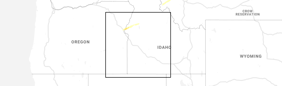
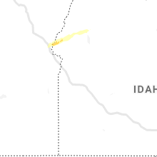
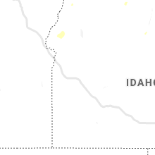
Hail Map for Cambridge, ID
The Cambridge, ID area has had 1 report of on-the-ground hail by trained spotters, and has been under severe weather warnings 0 times during the past 12 months. Doppler radar has detected hail at or near Cambridge, ID on 3 occasions.
| Name: | Cambridge, ID |
| Where Located: | 70.8 miles NNW of Boise, ID |
| Map: | Google Map for Cambridge, ID |
| Population: | 328 |
| Housing Units: | 178 |
| More Info: | Search Google for Cambridge, ID |
0
The Top Recent Hail Date for Cambridge, ID is Saturday, July 9, 2022 (2nd out of 3)
Hail and Wind Damage Spotted near Cambridge, ID
| Date / Time | Report Details |
|---|---|
| 9/7/2022 6:41 PM MDT |
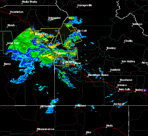
 At 640 pm mdt/540 pm pdt/, severe thunderstorms were located along a line extending from richland to near homedale, moving east-northeast at 55 mph (radar indicated). Hazards include 70 mph wind gusts. Expect considerable tree damage. damage is likely to mobile homes, roofs, and outbuildings. severe thunderstorms will be near, halfway, richland and carson around 550 pm pdt. cambridge around 650 pm mdt. oxbow dam and brownlee dam around 600 pm pdt. goodrich and brownlee reservoir around 700 pm mdt. emmett, eagle, council and bear around 710 pm mdt. sweet, horseshoe bend, montour and lost valley reservoir around 720 pm mdt. mccall, gardena, ola and new meadows around 730 pm mdt. thunderstorm damage threat, considerable hail threat, radar indicated max hail size, <. 75 in wind threat, radar indicated max wind gust, 70 mph. At 640 pm mdt/540 pm pdt/, severe thunderstorms were located along a line extending from richland to near homedale, moving east-northeast at 55 mph (radar indicated). Hazards include 70 mph wind gusts. Expect considerable tree damage. damage is likely to mobile homes, roofs, and outbuildings. severe thunderstorms will be near, halfway, richland and carson around 550 pm pdt. cambridge around 650 pm mdt. oxbow dam and brownlee dam around 600 pm pdt. goodrich and brownlee reservoir around 700 pm mdt. emmett, eagle, council and bear around 710 pm mdt. sweet, horseshoe bend, montour and lost valley reservoir around 720 pm mdt. mccall, gardena, ola and new meadows around 730 pm mdt. thunderstorm damage threat, considerable hail threat, radar indicated max hail size, <. 75 in wind threat, radar indicated max wind gust, 70 mph.
|
| 9/7/2022 6:41 PM MDT |
 At 640 pm mdt/540 pm pdt/, severe thunderstorms were located along a line extending from richland to near homedale, moving east-northeast at 55 mph (radar indicated). Hazards include 70 mph wind gusts. Expect considerable tree damage. damage is likely to mobile homes, roofs, and outbuildings. severe thunderstorms will be near, halfway, richland and carson around 550 pm pdt. cambridge around 650 pm mdt. oxbow dam and brownlee dam around 600 pm pdt. goodrich and brownlee reservoir around 700 pm mdt. emmett, eagle, council and bear around 710 pm mdt. sweet, horseshoe bend, montour and lost valley reservoir around 720 pm mdt. mccall, gardena, ola and new meadows around 730 pm mdt. thunderstorm damage threat, considerable hail threat, radar indicated max hail size, <. 75 in wind threat, radar indicated max wind gust, 70 mph. At 640 pm mdt/540 pm pdt/, severe thunderstorms were located along a line extending from richland to near homedale, moving east-northeast at 55 mph (radar indicated). Hazards include 70 mph wind gusts. Expect considerable tree damage. damage is likely to mobile homes, roofs, and outbuildings. severe thunderstorms will be near, halfway, richland and carson around 550 pm pdt. cambridge around 650 pm mdt. oxbow dam and brownlee dam around 600 pm pdt. goodrich and brownlee reservoir around 700 pm mdt. emmett, eagle, council and bear around 710 pm mdt. sweet, horseshoe bend, montour and lost valley reservoir around 720 pm mdt. mccall, gardena, ola and new meadows around 730 pm mdt. thunderstorm damage threat, considerable hail threat, radar indicated max hail size, <. 75 in wind threat, radar indicated max wind gust, 70 mph.
|
| 7/9/2022 4:33 PM MDT |
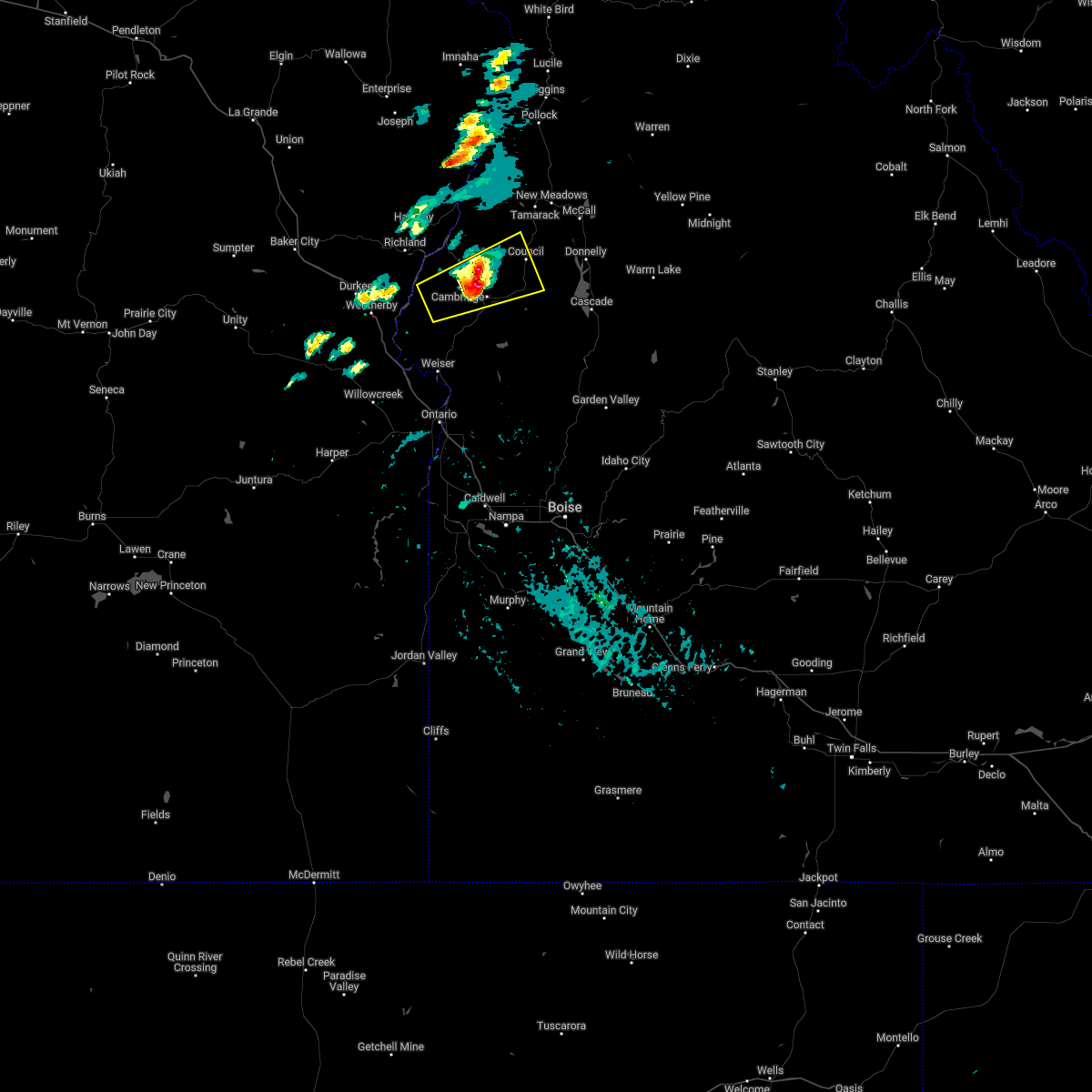 At 433 pm mdt, a severe thunderstorm was located near cambridge, or 28 miles northeast of weiser, moving east at 30 mph (radar indicated). Hazards include 60 mph wind gusts and half dollar size hail. Hail damage to vehicles is expected. expect wind damage to roofs, siding, and trees. this severe storm will be near, goodrich and pyramid point around 450 pm mdt. mesa around 500 pm mdt. council around 510 pm mdt. hail threat, radar indicated max hail size, 1. 25 in wind threat, radar indicated max wind gust, 60 mph. At 433 pm mdt, a severe thunderstorm was located near cambridge, or 28 miles northeast of weiser, moving east at 30 mph (radar indicated). Hazards include 60 mph wind gusts and half dollar size hail. Hail damage to vehicles is expected. expect wind damage to roofs, siding, and trees. this severe storm will be near, goodrich and pyramid point around 450 pm mdt. mesa around 500 pm mdt. council around 510 pm mdt. hail threat, radar indicated max hail size, 1. 25 in wind threat, radar indicated max wind gust, 60 mph.
|
| 7/9/2022 4:09 PM MDT |
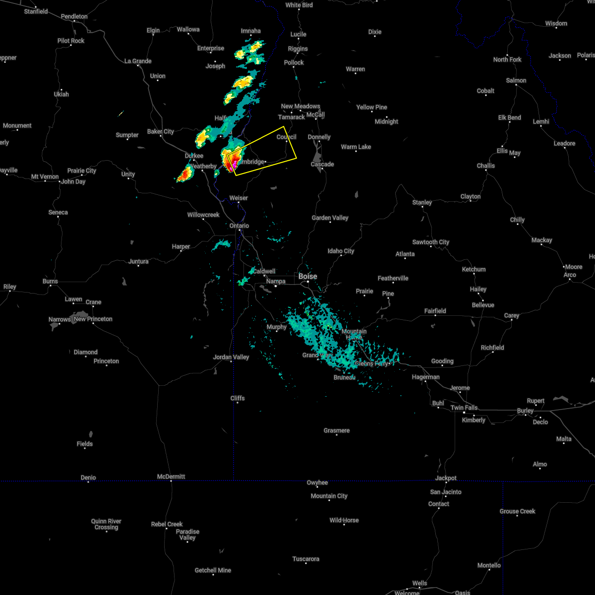 At 409 pm mdt, a severe thunderstorm was located near sturgill peak, or 22 miles north of weiser, moving east at 30 mph (radar indicated). Hazards include 60 mph wind gusts and half dollar size hail. Hail damage to vehicles is expected. expect wind damage to roofs, siding, and trees. this severe thunderstorm will be near, sturgill peak around 410 pm mdt. cambridge around 440 pm mdt. goodrich and pyramid point around 450 pm mdt. council and mesa around 500 pm mdt. hail threat, radar indicated max hail size, 1. 25 in wind threat, radar indicated max wind gust, 60 mph. At 409 pm mdt, a severe thunderstorm was located near sturgill peak, or 22 miles north of weiser, moving east at 30 mph (radar indicated). Hazards include 60 mph wind gusts and half dollar size hail. Hail damage to vehicles is expected. expect wind damage to roofs, siding, and trees. this severe thunderstorm will be near, sturgill peak around 410 pm mdt. cambridge around 440 pm mdt. goodrich and pyramid point around 450 pm mdt. council and mesa around 500 pm mdt. hail threat, radar indicated max hail size, 1. 25 in wind threat, radar indicated max wind gust, 60 mph.
|
| 5/25/2018 8:41 PM MDT |
 At 841 pm mdt, a severe thunderstorm was located over goodrich, or 26 miles southwest of mccall, moving north at 35 mph (radar indicated). Hazards include 60 mph wind gusts and quarter size hail. Hail damage to vehicles is expected. expect wind damage to roofs, siding, and trees. this severe thunderstorm will be near, mccall, pyramid point, fruitvale and glendale around 900 pm mdt. new meadows, summers point, tamarack and meadows around 910 pm mdt. lafferty campground, lost valley reservoir and price valley guard station around 920 pm mdt. bear around 930 pm mdt. Cuprum, black lake and pollock mountain around 940 pm mdt. At 841 pm mdt, a severe thunderstorm was located over goodrich, or 26 miles southwest of mccall, moving north at 35 mph (radar indicated). Hazards include 60 mph wind gusts and quarter size hail. Hail damage to vehicles is expected. expect wind damage to roofs, siding, and trees. this severe thunderstorm will be near, mccall, pyramid point, fruitvale and glendale around 900 pm mdt. new meadows, summers point, tamarack and meadows around 910 pm mdt. lafferty campground, lost valley reservoir and price valley guard station around 920 pm mdt. bear around 930 pm mdt. Cuprum, black lake and pollock mountain around 940 pm mdt.
|
| 6/4/2012 6:13 PM MDT | Quarter sized hail reported 0.2 miles NE of Cambridge, ID, public report via local media. time estimated based on radar. |
Hail Maps for Cambridge, ID

Connect with Interactive Hail Maps