

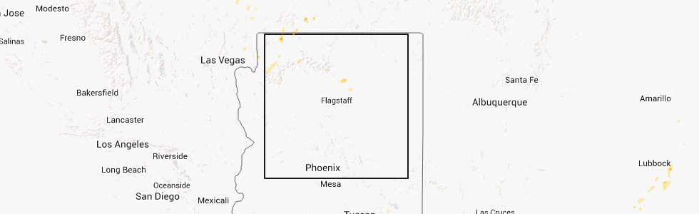
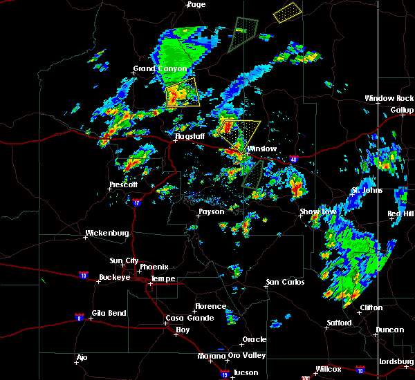
Hail Map for Cameron, AZ
The Cameron, AZ area has had 2 reports of on-the-ground hail by trained spotters, and has been under severe weather warnings 0 times during the past 12 months. Doppler radar has detected hail at or near Cameron, AZ on 8 occasions.
| Name: | Cameron, AZ |
| Where Located: | 48.4 miles NNE of Flagstaff, AZ |
| Map: | Google Map for Cameron, AZ |
| Population: | 885 |
| Housing Units: | 285 |
| More Info: | Search Google for Cameron, AZ |
5
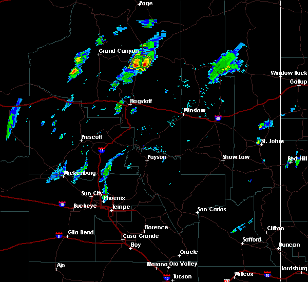
The Top Recent Hail Date for Cameron, AZ is Monday, July 16, 2012 (1st out of 8)
Hail and Wind Damage Spotted near Cameron, AZ
| Date / Time | Report Details |
|---|---|
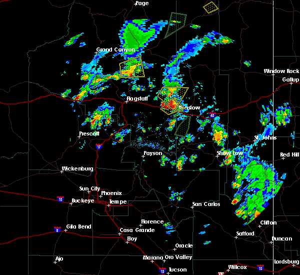
| 10/3/2018 7:09 PM MDT |
 At 708 pm mdt, a severe thunderstorm was located 7 miles north of gray mountain, moving northeast at 25 to 30 mph (radar indicated). Hazards include 60 mph wind gusts and quarter size hail. Hail damage to vehicles is expected. Expect wind damage to roofs, siding, and trees. At 708 pm mdt, a severe thunderstorm was located 7 miles north of gray mountain, moving northeast at 25 to 30 mph (radar indicated). Hazards include 60 mph wind gusts and quarter size hail. Hail damage to vehicles is expected. Expect wind damage to roofs, siding, and trees.
|
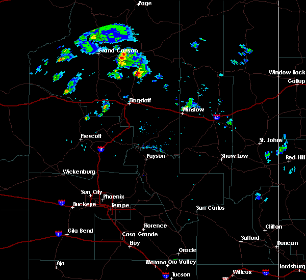
| 9/1/2018 4:14 PM MDT | Quarter sized hail reported 8.7 miles NNW of Cameron, AZ, relayed via social media. time and location estimated. |
| 9/14/2015 2:10 PM MST | The severe thunderstorm warning for east central coconino county will expire at 215 pm mst. the storm near gray mountain which prompted the warning has weakened below severe limits. and no longer poses an immediate threat to life or property. Therefore the warning will be allowed to expire. |
| 9/14/2015 1:34 PM MST |
 At 133 pm mst, doppler radar indicated a severe thunderstorm capable of producing half dollar size hail and damaging winds in excess of 60 mph. this storm was located near gray mountain, or 31 miles southeast of desert view at grand canyon, and moving northeast at 10 mph. At 133 pm mst, doppler radar indicated a severe thunderstorm capable of producing half dollar size hail and damaging winds in excess of 60 mph. this storm was located near gray mountain, or 31 miles southeast of desert view at grand canyon, and moving northeast at 10 mph.
|
| 8/31/2015 1:57 PM MST | The severe thunderstorm warning for east central coconino county will expire at 200 pm mst, the storm which prompted the warning has weakened below severe limits, and no longer poses an immediate threat to life or property. therefore the warning will be allowed to expire. however gusty winds are still possible with this thunderstorm as it crosses us-89 near gray mountain. |
| 8/31/2015 1:45 PM MST |
 At 143 pm mst, doppler radar indicated a severe thunderstorm capable of producing damaging winds in excess of 60 mph. this storm was located near gray mountain, or 24 miles southeast of desert view at grand canyon, moving east at 20 mph. this includes us-89 from cameron southward to south of gray mountain. locations impacted include, gray mountain and cameron. At 143 pm mst, doppler radar indicated a severe thunderstorm capable of producing damaging winds in excess of 60 mph. this storm was located near gray mountain, or 24 miles southeast of desert view at grand canyon, moving east at 20 mph. this includes us-89 from cameron southward to south of gray mountain. locations impacted include, gray mountain and cameron.
|
| 8/31/2015 2:26 PM MDT |
 At 125 pm mst, doppler radar indicated a line of severe thunderstorms capable of producing destructive winds to 70 mph. these storms were located 8 miles west of gray mountain, or 22 miles southeast of desert view at grand canyon, and moving east northeast at 20 mph. At 125 pm mst, doppler radar indicated a line of severe thunderstorms capable of producing destructive winds to 70 mph. these storms were located 8 miles west of gray mountain, or 22 miles southeast of desert view at grand canyon, and moving east northeast at 20 mph.
|
| 7/16/2012 5:10 PM MDT | Golf Ball sized hail reported 1.8 miles N of Cameron, AZ, at cameron trading post |
Hail Maps for Cameron, AZ


Connect with Interactive Hail Maps