

Hail Map for Camino, CA
The Camino, CA area has had 0 reports of on-the-ground hail by trained spotters, and has been under severe weather warnings 0 times during the past 12 months. Doppler radar has detected hail at or near Camino, CA on 1 occasion.
| Name: | Camino, CA |
| Where Located: | 32 miles E of Citrus Heights, CA |
| Map: | Google Map for Camino, CA |
| Population: | 1750 |
| Housing Units: | 810 |
| More Info: | Search Google for Camino, CA |
5
The Top Recent Hail Date for Camino, CA is Friday, June 5, 2015 (1st out of 1)

Hail and Wind Damage Spotted near Camino, CA
| Date / Time | Report Details |
|---|---|
| 1/10/2023 4:40 AM PST |
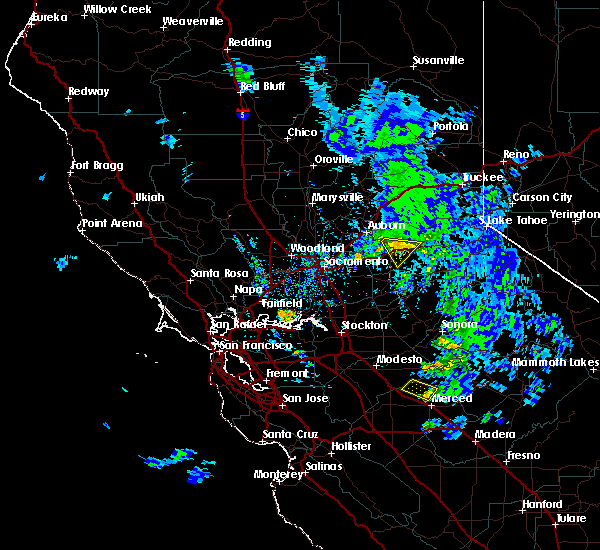
 The severe thunderstorm warning for southwestern tuolumne, northeastern sacramento, northeastern stanislaus, western el dorado, southwestern placer, calaveras, southeastern yuba, southwestern nevada and amador counties will expire at 445 am pst, the storms which prompted the warning have weakened, and have exited the warned area. therefore, the warning will be allowed to expire. however gusty winds and heavy rain are still possible with these thunderstorms. The severe thunderstorm warning for southwestern tuolumne, northeastern sacramento, northeastern stanislaus, western el dorado, southwestern placer, calaveras, southeastern yuba, southwestern nevada and amador counties will expire at 445 am pst, the storms which prompted the warning have weakened, and have exited the warned area. therefore, the warning will be allowed to expire. however gusty winds and heavy rain are still possible with these thunderstorms.
|
| 1/10/2023 4:09 AM PST |
 At 407 am pst, severe thunderstorms were located along a line extending from 5 miles east of lincoln to turlock, moving east at 45 mph (radar indicated). Hazards include 60 mph wind gusts. expect damage to roofs, siding, and trees At 407 am pst, severe thunderstorms were located along a line extending from 5 miles east of lincoln to turlock, moving east at 45 mph (radar indicated). Hazards include 60 mph wind gusts. expect damage to roofs, siding, and trees
|
| 12/24/2015 4:14 PM PST |
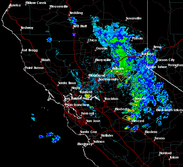
 At 410 pm pst, doppler radar indicated a severe thunderstorm capable of producing a tornado. this dangerous storm was located near somerset, or 7 miles southeast of placerville, moving east- southeast at 20 mph. locations impacted include, somerset. At 410 pm pst, doppler radar indicated a severe thunderstorm capable of producing a tornado. this dangerous storm was located near somerset, or 7 miles southeast of placerville, moving east- southeast at 20 mph. locations impacted include, somerset.
|
| 12/24/2015 4:00 PM PST |
 At 358 pm pst, doppler radar indicated a severe thunderstorm capable of producing a tornado. this dangerous storm was located near diamond springs, and moving east-southeast at 20 mph. At 358 pm pst, doppler radar indicated a severe thunderstorm capable of producing a tornado. this dangerous storm was located near diamond springs, and moving east-southeast at 20 mph.
|
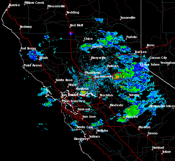
| 11/15/2015 3:06 PM PST |
 The severe thunderstorm warning for southwestern el dorado county will expire at 315 pm pst, the storm which prompted the warning has weakened below severe limits and exited the warned area. therefore the warning will be allowed to expire. however small hail is still possible with this thunderstorm. The severe thunderstorm warning for southwestern el dorado county will expire at 315 pm pst, the storm which prompted the warning has weakened below severe limits and exited the warned area. therefore the warning will be allowed to expire. however small hail is still possible with this thunderstorm.
|
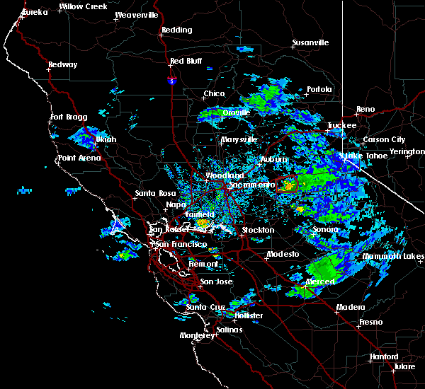
| 11/15/2015 2:48 PM PST |
 At 243 pm pst, marshall gold discovery state park officials reported a severe thunderstorm producing quarter size hail and damaging winds in excess of 60 mph. this storm was located over placerville, moving southeast at 15 mph. in addition, hail was reported to cover the ground in coloma with nickel to quarter size hail. locations impacted include, placerville, smithflat, camino, lotus, coloma, pollock pines and diamond springs. At 243 pm pst, marshall gold discovery state park officials reported a severe thunderstorm producing quarter size hail and damaging winds in excess of 60 mph. this storm was located over placerville, moving southeast at 15 mph. in addition, hail was reported to cover the ground in coloma with nickel to quarter size hail. locations impacted include, placerville, smithflat, camino, lotus, coloma, pollock pines and diamond springs.
|
| 11/15/2015 2:32 PM PST |
 At 232 pm pst, doppler radar indicated a severe thunderstorm capable of producing quarter size hail and damaging winds in excess of 60 mph. this storm was located over coloma, or near placerville, and moving southeast at 15 mph. At 232 pm pst, doppler radar indicated a severe thunderstorm capable of producing quarter size hail and damaging winds in excess of 60 mph. this storm was located over coloma, or near placerville, and moving southeast at 15 mph.
|
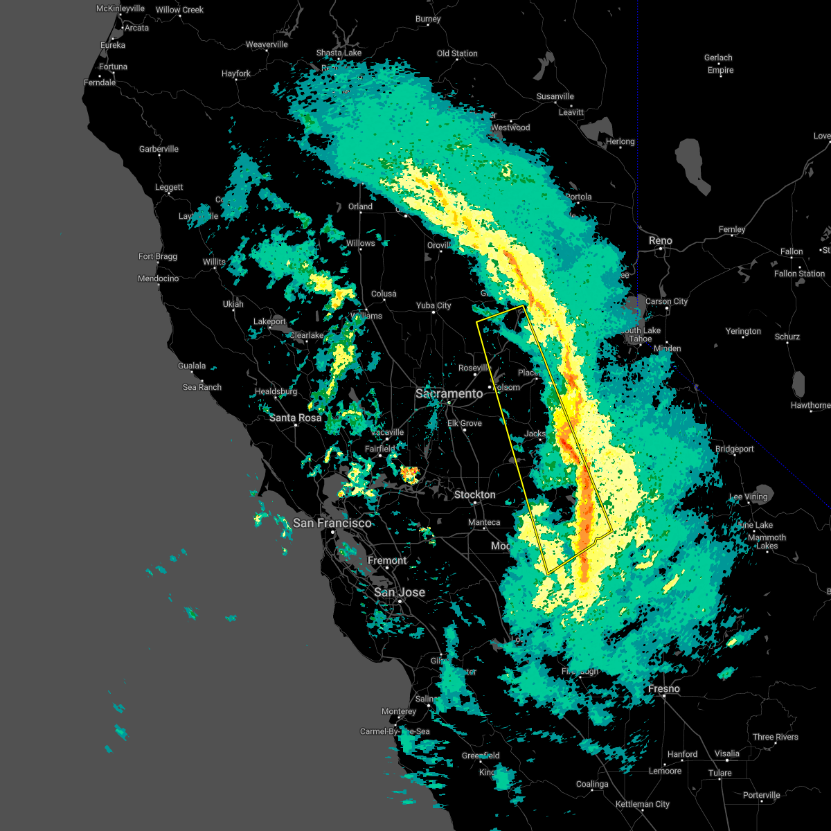
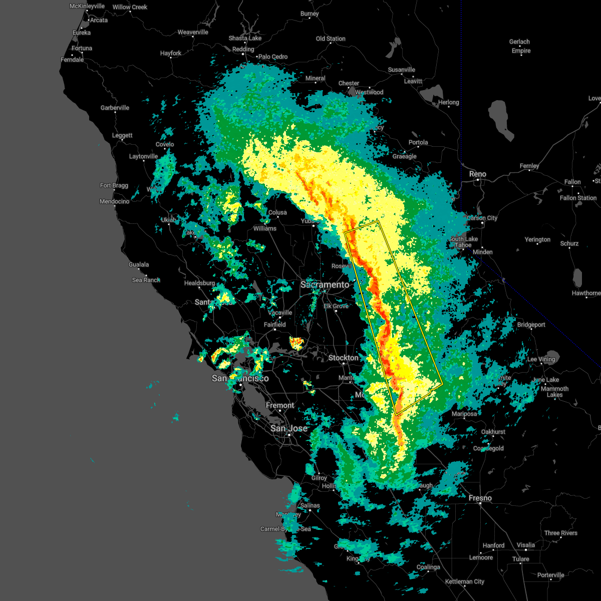
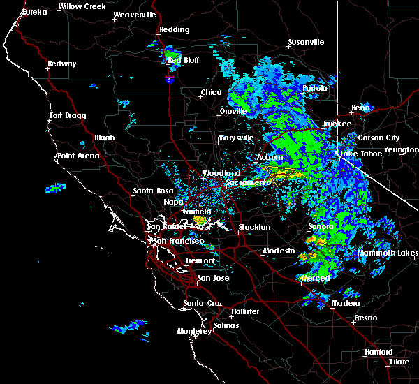
| 6/5/2015 6:05 PM PDT | At 600 pm pdt, doppler radar indicated a severe thunderstorm capable of producing large hail. this storm was located near camino and moving westsouthwest at 15 mph. it has a history of producing hail. the core of the storm is moving towards diamond springs and somerset and will affecct those areas through 615 pm. |
| 6/5/2015 5:46 PM PDT | At 545 pm pdt, doppler radar indicated a severe thunderstorm capable of producing quarter size hail. this storm was located over camino, or near placerville, and moving westsouthwest at 15 mph. this storm has a history of producing hail. |
| 6/5/2015 5:31 PM PDT | At 525 pm pdt, doppler radar indicated a severe thunderstorm capable of producing quarter size hail. this storm was located over camino, moving west at 15 mph towards placerville. in addition, a weather spotter in pollack pines reported copious amounts of pea size hail, and a weather spotter in pacific house reported half inch size hail. this severe storm will be near, somerset around 535 pm pdt. smithflat around 540 pm pdt. placerville around 545 pm pdt. other locations impacted by this severe thunderstorm include diamond springs. |
| 6/5/2015 4:59 PM PDT | At 458 pm pdt, doppler radar indicated a severe thunderstorm capable of producing quarter size hail. this storm was located near pollock pines, or 9 miles south of big bend summit, and moving west at 15 mph. * this severe thunderstorm will be near, camino around 530 pm pdt. somerset around 535 pm pdt. placerville and smithflat around 545 pm pdt. other locations impacted by this severe thunderstorm include diamond springs. |
Hail Maps for Camino, CA
Connect with Interactive Hail Maps