

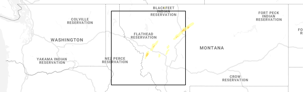
Hail Map for Carlton, MT
The Carlton, MT area has had 0 reports of on-the-ground hail by trained spotters, and has been under severe weather warnings 1 time during the past 12 months. Doppler radar has detected hail at or near Carlton, MT on 5 occasions.
| Name: | Carlton, MT |
| Where Located: | 13.4 miles SSW of Missoula, MT |
| Map: | Google Map for Carlton, MT |
| Population: | 694 |
| Housing Units: | 290 |
| More Info: | Search Google for Carlton, MT |
5
The Top Recent Hail Date for Carlton, MT is Saturday, June 18, 2022 (2nd out of 5)
Hail and Wind Damage Spotted near Carlton, MT
| Date / Time | Report Details |
|---|---|
| 8/22/2023 5:02 PM MDT |
 At 502 pm mdt, a severe thunderstorm was located over lolo, or near missoula, moving northeast at 30 mph (radar indicated). Hazards include 60 mph wind gusts and quarter size hail. Hail damage to vehicles is expected. Expect wind damage to roofs, siding, and trees. At 502 pm mdt, a severe thunderstorm was located over lolo, or near missoula, moving northeast at 30 mph (radar indicated). Hazards include 60 mph wind gusts and quarter size hail. Hail damage to vehicles is expected. Expect wind damage to roofs, siding, and trees.
|
| 7/9/2022 3:36 PM MDT |
 At 336 pm mdt, a severe thunderstorm was located 9 miles south of bonner-west riverside, or 12 miles southeast of missoula, moving northeast at 20 mph (radar indicated). Hazards include 60 mph wind gusts and quarter size hail. Hail damage to vehicles is expected. Expect wind damage to roofs, siding, and trees. At 336 pm mdt, a severe thunderstorm was located 9 miles south of bonner-west riverside, or 12 miles southeast of missoula, moving northeast at 20 mph (radar indicated). Hazards include 60 mph wind gusts and quarter size hail. Hail damage to vehicles is expected. Expect wind damage to roofs, siding, and trees.
|
| 6/18/2022 2:09 PM MDT |
 The severe thunderstorm warning for southeastern missoula county will expire at 215 pm mdt, the storm which prompted the warning has moved out of the area. therefore, the warning will be allowed to expire. a severe thunderstorm watch remains in effect until 700 pm mdt for west central montana. The severe thunderstorm warning for southeastern missoula county will expire at 215 pm mdt, the storm which prompted the warning has moved out of the area. therefore, the warning will be allowed to expire. a severe thunderstorm watch remains in effect until 700 pm mdt for west central montana.
|
| 6/18/2022 1:38 PM MDT |
 The severe thunderstorm warning for south central missoula and north central ravalli counties will expire at 145 pm mdt, the severe thunderstorm which prompted the warning has moved out of the warned area. therefore, the warning will be allowed to expire. a severe thunderstorm watch remains in effect until 700 pm mdt for west central montana. The severe thunderstorm warning for south central missoula and north central ravalli counties will expire at 145 pm mdt, the severe thunderstorm which prompted the warning has moved out of the warned area. therefore, the warning will be allowed to expire. a severe thunderstorm watch remains in effect until 700 pm mdt for west central montana.
|
| 6/18/2022 1:34 PM MDT |
 At 133 pm mdt, a severe thunderstorm was located near florence, or 12 miles south of missoula, moving northeast at 45 mph (radar indicated). Hazards include quarter size hail. in addition wind gusts to 40 mph and heavy rain is anticipated. damage to vehicles is expected At 133 pm mdt, a severe thunderstorm was located near florence, or 12 miles south of missoula, moving northeast at 45 mph (radar indicated). Hazards include quarter size hail. in addition wind gusts to 40 mph and heavy rain is anticipated. damage to vehicles is expected
|
| 6/18/2022 1:13 PM MDT |
 At 112 pm mdt, a severe thunderstorm was located over victor, or 14 miles north of hamilton, moving northeast at 25 mph (radar indicated). Hazards include quarter size hail. winds gusting to 40 mph and heavy rain are also expected. damage to vehicles is expected At 112 pm mdt, a severe thunderstorm was located over victor, or 14 miles north of hamilton, moving northeast at 25 mph (radar indicated). Hazards include quarter size hail. winds gusting to 40 mph and heavy rain are also expected. damage to vehicles is expected
|
| 7/15/2017 5:39 PM MDT |
 The severe thunderstorm warning for southeastern missoula and north central ravalli counties will expire at 545 pm mdt, the storm which prompted the warning has weakened below severe limits, and has exited the warned area. therefore, the warning will be allowed to expire. The severe thunderstorm warning for southeastern missoula and north central ravalli counties will expire at 545 pm mdt, the storm which prompted the warning has weakened below severe limits, and has exited the warned area. therefore, the warning will be allowed to expire.
|
| 7/15/2017 4:59 PM MDT |
 At 458 pm mdt, a severe thunderstorm was located over florence, or 16 miles south of missoula, moving northeast at 30 mph (radar indicated). Hazards include 60 mph wind gusts, heavy rain and penny size hail. expect damage to roofs, siding, and trees At 458 pm mdt, a severe thunderstorm was located over florence, or 16 miles south of missoula, moving northeast at 30 mph (radar indicated). Hazards include 60 mph wind gusts, heavy rain and penny size hail. expect damage to roofs, siding, and trees
|
| 7/15/2017 4:27 PM MDT |
 At 426 pm mdt, a severe thunderstorm was located 8 miles west of stevensville, or 19 miles north of hamilton, moving northeast at 45 mph (radar indicated). Hazards include 65 mph wind gusts and penny size hail. expect damage to roofs, siding, and trees At 426 pm mdt, a severe thunderstorm was located 8 miles west of stevensville, or 19 miles north of hamilton, moving northeast at 45 mph (radar indicated). Hazards include 65 mph wind gusts and penny size hail. expect damage to roofs, siding, and trees
|
| 8/6/2016 4:55 PM MDT |
 The severe thunderstorm warning for northern ravalli and south central missoula counties will expire at 500 pm mdt, the storm which prompted the warning has weakened below severe limits, and no longer poses an immediate threat to life or property. therefore the warning will be allowed to expire. however gusty winds are still possible with this thunderstorm and power outages have been reported in the missoula area. The severe thunderstorm warning for northern ravalli and south central missoula counties will expire at 500 pm mdt, the storm which prompted the warning has weakened below severe limits, and no longer poses an immediate threat to life or property. therefore the warning will be allowed to expire. however gusty winds are still possible with this thunderstorm and power outages have been reported in the missoula area.
|
| 8/6/2016 4:18 PM MDT |
 At 417 pm mdt, doppler radar indicated a severe thunderstorm capable of producing damaging winds in excess of 60 mph. this storm was located over lolo, or 9 miles south of missoula, and moving northeast at 15 mph. the gust front ahead of the main thunderstorm could produce damaging winds. At 417 pm mdt, doppler radar indicated a severe thunderstorm capable of producing damaging winds in excess of 60 mph. this storm was located over lolo, or 9 miles south of missoula, and moving northeast at 15 mph. the gust front ahead of the main thunderstorm could produce damaging winds.
|
| 7/17/2016 9:51 PM MDT |
 At 951 pm mdt, multiple trained weather spotters reported a severe thunderstorm producing quarter size hail and damaging winds in excess of 60 mph. this storm was located 10 miles northeast of bonner-west riverside, or 15 miles east of missoula, moving northeast at 55 mph. locations impacted include, missoula, lolo, stevensville, evaro, wye, bonner-west riverside, frenchtown, florence, east missoula, arlee, twin creeks, clinton, potomac and turah. At 951 pm mdt, multiple trained weather spotters reported a severe thunderstorm producing quarter size hail and damaging winds in excess of 60 mph. this storm was located 10 miles northeast of bonner-west riverside, or 15 miles east of missoula, moving northeast at 55 mph. locations impacted include, missoula, lolo, stevensville, evaro, wye, bonner-west riverside, frenchtown, florence, east missoula, arlee, twin creeks, clinton, potomac and turah.
|
| 7/17/2016 9:27 PM MDT |
 At 926 pm mdt, doppler radar indicated a severe thunderstorm capable of producing damaging winds in excess of 60 mph. this storm was located over lolo, or 10 miles south of missoula, and moving northeast at 55 mph. nickel size to quarter size hail may also accompany the damaging winds. At 926 pm mdt, doppler radar indicated a severe thunderstorm capable of producing damaging winds in excess of 60 mph. this storm was located over lolo, or 10 miles south of missoula, and moving northeast at 55 mph. nickel size to quarter size hail may also accompany the damaging winds.
|
| 8/14/2015 4:11 PM MDT |
 The severe thunderstorm warning for southeastern missoula and northern ravalli counties will expire at 415 pm mdt, the storm which prompted the warning has weakened below severe limits, and no longer poses an immediate threat to life or property. therefore the warning will be allowed to expire. however gusty winds and heavy rain are still possible with this thunderstorm. to report severe weather, contact your nearest law enforcement agency. they will relay your report to the national weather service missoula. The severe thunderstorm warning for southeastern missoula and northern ravalli counties will expire at 415 pm mdt, the storm which prompted the warning has weakened below severe limits, and no longer poses an immediate threat to life or property. therefore the warning will be allowed to expire. however gusty winds and heavy rain are still possible with this thunderstorm. to report severe weather, contact your nearest law enforcement agency. they will relay your report to the national weather service missoula.
|
| 8/14/2015 3:58 PM MDT |
 At 358 pm mdt, the public reported a severe thunderstorm producing quarter size hail and damaging winds in excess of 60 mph. this storm was located over bonner-west riverside, or near missoula, moving northeast at 35 mph. locations impacted include, missoula, lolo, east missoula, bonner-west riverside, turah and clinton. At 358 pm mdt, the public reported a severe thunderstorm producing quarter size hail and damaging winds in excess of 60 mph. this storm was located over bonner-west riverside, or near missoula, moving northeast at 35 mph. locations impacted include, missoula, lolo, east missoula, bonner-west riverside, turah and clinton.
|
| 8/14/2015 3:38 PM MDT |
 At 337 pm mdt, doppler radar indicated a severe thunderstorm capable of producing quarter size hail and damaging winds in excess of 60 mph. this storm was located near florence, or 12 miles south of missoula, and moving northeast at 30 mph. At 337 pm mdt, doppler radar indicated a severe thunderstorm capable of producing quarter size hail and damaging winds in excess of 60 mph. this storm was located near florence, or 12 miles south of missoula, and moving northeast at 30 mph.
|
| 8/10/2015 6:04 PM MDT |
 At 602 pm mdt, doppler radar indicated a severe thunderstorm capable of producing damaging winds in excess of 60 mph. this storm was located near stevensville, or 17 miles north of hamilton, and moving north at 25 mph. this storm has a history of damaging winds, causing downed power lines and downed trees. At 602 pm mdt, doppler radar indicated a severe thunderstorm capable of producing damaging winds in excess of 60 mph. this storm was located near stevensville, or 17 miles north of hamilton, and moving north at 25 mph. this storm has a history of damaging winds, causing downed power lines and downed trees.
|
Hail Maps for Carlton, MT


Connect with Interactive Hail Maps