

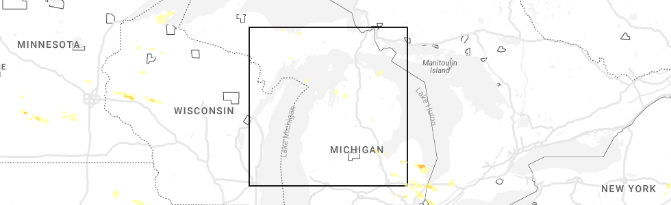
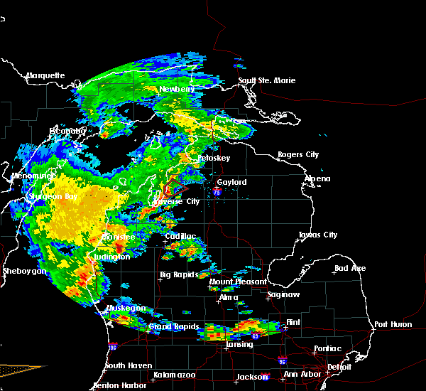
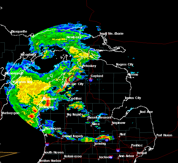
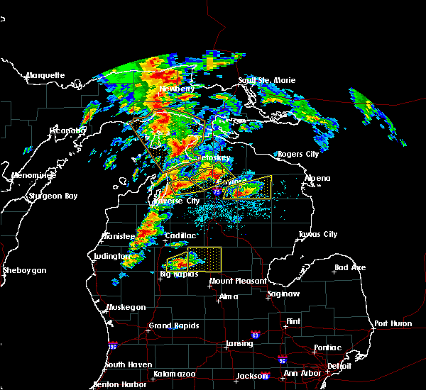
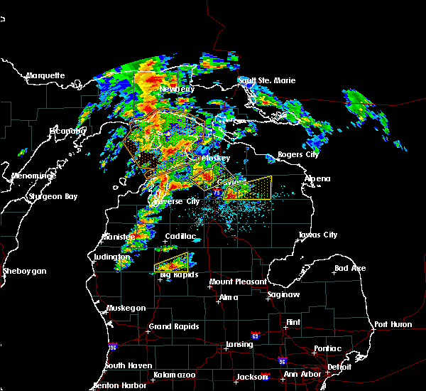
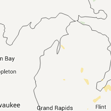
Hail Map for Central Lake, MI
The Central Lake, MI area has had 3 reports of on-the-ground hail by trained spotters, and has been under severe weather warnings 2 times during the past 12 months. Doppler radar has detected hail at or near Central Lake, MI on 13 occasions, including 2 occasions during the past year.
| Name: | Central Lake, MI |
| Where Located: | 27.6 miles NE of Traverse City, MI |
| Map: | Google Map for Central Lake, MI |
| Population: | 952 |
| Housing Units: | 549 |
| More Info: | Search Google for Central Lake, MI |
0
The Top Recent Hail Date for Central Lake, MI is Friday, July 14, 2023 (12th out of 13)
Hail and Wind Damage Spotted near Central Lake, MI
| Date / Time | Report Details |
|---|---|
| 6/25/2023 7:04 PM EDT |
 At 704 pm edt, severe thunderstorms were located along a line extending from clam river to near darragh to near sharon, moving east at 20 mph (radar indicated). Hazards include 60 mph wind gusts. Expect damage to roofs, siding, and trees. locations impacted include, kalkaska, elk rapids, mancelona, bellaire, antrim, sharon, torch lake, central lake, clam river, kewadin, rapid city, alden, sigma, darragh, blue lake township and lake bellaire. hail threat, radar indicated max hail size, <. 75 in wind threat, radar indicated max wind gust, 60 mph. At 704 pm edt, severe thunderstorms were located along a line extending from clam river to near darragh to near sharon, moving east at 20 mph (radar indicated). Hazards include 60 mph wind gusts. Expect damage to roofs, siding, and trees. locations impacted include, kalkaska, elk rapids, mancelona, bellaire, antrim, sharon, torch lake, central lake, clam river, kewadin, rapid city, alden, sigma, darragh, blue lake township and lake bellaire. hail threat, radar indicated max hail size, <. 75 in wind threat, radar indicated max wind gust, 60 mph.
|
| 6/25/2023 6:29 PM EDT |
 At 629 pm edt, severe thunderstorms were located along a line extending from near elk rapids to near south boardman to near morey, moving northeast at 20 mph (radar indicated). Hazards include 60 mph wind gusts and nickel size hail. expect damage to roofs, siding, and trees At 629 pm edt, severe thunderstorms were located along a line extending from near elk rapids to near south boardman to near morey, moving northeast at 20 mph (radar indicated). Hazards include 60 mph wind gusts and nickel size hail. expect damage to roofs, siding, and trees
|
| 5/20/2022 3:14 PM EDT | Scanner reports crews are on the scene of a tree blocking a roadway near central lake. time estimated by rada in antrim county MI, 0.1 miles SW of Central Lake, MI |
| 5/20/2022 2:46 PM EDT |
 At 246 pm edt, severe thunderstorms were located along a line extending from grand traverse light to traverse city, moving northeast at 50 mph (radar indicated). Hazards include 60 mph wind gusts and quarter size hail. Hail damage to vehicles is expected. expect wind damage to roofs, siding, and trees. severe thunderstorms will be near, elk rapids, norwood, fishermans island state park and barker creek around 255 pm edt. charlevoix, rapid city, alden, ironton, clam river and kewadin around 300 pm edt. bayshore and horton bay around 305 pm edt. other locations in the path of these severe thunderstorms include petoskey, mancelona, harbor springs, antrim, bay view, conway, oden, petoskey state park, alba, alanson and brutus. hail threat, radar indicated max hail size, 1. 00 in wind threat, radar indicated max wind gust, 60 mph. At 246 pm edt, severe thunderstorms were located along a line extending from grand traverse light to traverse city, moving northeast at 50 mph (radar indicated). Hazards include 60 mph wind gusts and quarter size hail. Hail damage to vehicles is expected. expect wind damage to roofs, siding, and trees. severe thunderstorms will be near, elk rapids, norwood, fishermans island state park and barker creek around 255 pm edt. charlevoix, rapid city, alden, ironton, clam river and kewadin around 300 pm edt. bayshore and horton bay around 305 pm edt. other locations in the path of these severe thunderstorms include petoskey, mancelona, harbor springs, antrim, bay view, conway, oden, petoskey state park, alba, alanson and brutus. hail threat, radar indicated max hail size, 1. 00 in wind threat, radar indicated max wind gust, 60 mph.
|
| 8/29/2021 2:00 PM EDT |
 At 159 pm edt, severe thunderstorms were located along a line extending from pleasant view to near ironton to near torch lake, moving northeast at 50 mph (radar indicated). Hazards include 60 mph wind gusts. Expect damage to roofs, siding, and trees. locations impacted include, petoskey, bay view, petoskey state park, east jordan, conway, alanson, oden, boyne city, clarion and walloon lake. hail threat, radar indicated max hail size, <. 75 in wind threat, radar indicated max wind gust, 60 mph. At 159 pm edt, severe thunderstorms were located along a line extending from pleasant view to near ironton to near torch lake, moving northeast at 50 mph (radar indicated). Hazards include 60 mph wind gusts. Expect damage to roofs, siding, and trees. locations impacted include, petoskey, bay view, petoskey state park, east jordan, conway, alanson, oden, boyne city, clarion and walloon lake. hail threat, radar indicated max hail size, <. 75 in wind threat, radar indicated max wind gust, 60 mph.
|
| 8/29/2021 1:37 PM EDT |
 At 136 pm edt, severe thunderstorms were located along a line extending from near fishermans island state park to peshawbestown to near lake ann, moving northeast at 50 mph (radar indicated). Hazards include 60 mph wind gusts. Expect damage to roofs, siding, and trees. severe thunderstorms will be near, charlevoix and fishermans island state park around 140 pm edt. norwood, bayshore and mapleton around 150 pm edt. elk rapids, harbor springs and ironton around 155 pm edt. other locations in the path of these severe thunderstorms include horton bay, kewadin, petoskey, torch lake, central lake, clarion, walloon lake, ellsworth, bay view, petoskey state park, boyne city, east jordan, conway, alanson, oden, young state park and jordan township. hail threat, radar indicated max hail size, <. 75 in wind threat, radar indicated max wind gust, 60 mph. At 136 pm edt, severe thunderstorms were located along a line extending from near fishermans island state park to peshawbestown to near lake ann, moving northeast at 50 mph (radar indicated). Hazards include 60 mph wind gusts. Expect damage to roofs, siding, and trees. severe thunderstorms will be near, charlevoix and fishermans island state park around 140 pm edt. norwood, bayshore and mapleton around 150 pm edt. elk rapids, harbor springs and ironton around 155 pm edt. other locations in the path of these severe thunderstorms include horton bay, kewadin, petoskey, torch lake, central lake, clarion, walloon lake, ellsworth, bay view, petoskey state park, boyne city, east jordan, conway, alanson, oden, young state park and jordan township. hail threat, radar indicated max hail size, <. 75 in wind threat, radar indicated max wind gust, 60 mph.
|
| 8/11/2021 6:02 PM EDT |
 At 601 pm edt, severe thunderstorms were located along a line extending from torch lake to clam river to near barker creek, moving east at 55 mph (radar indicated). Hazards include 60 mph wind gusts. Expect damage to roofs, siding, and trees. these severe storms will be near, central lake around 605 pm edt. other locations in the path of these severe thunderstorms include bellaire, antrim and mancelona. hail threat, radar indicated max hail size, <. 75 in wind threat, radar indicated max wind gust, 60 mph. At 601 pm edt, severe thunderstorms were located along a line extending from torch lake to clam river to near barker creek, moving east at 55 mph (radar indicated). Hazards include 60 mph wind gusts. Expect damage to roofs, siding, and trees. these severe storms will be near, central lake around 605 pm edt. other locations in the path of these severe thunderstorms include bellaire, antrim and mancelona. hail threat, radar indicated max hail size, <. 75 in wind threat, radar indicated max wind gust, 60 mph.
|
| 8/11/2021 5:46 PM EDT |
 At 546 pm edt, severe thunderstorms were located along a line extending from peshawbestown to near mapleton to greilickville, moving east at 55 mph (radar indicated). Hazards include 60 mph wind gusts. Expect damage to roofs, siding, and trees. these severe storms will be near, mapleton and old mission around 550 pm edt. other locations in the path of these severe thunderstorms include elk rapids, torch lake, clam river, kewadin, alden, barker creek, williamsburg, bellaire, central lake, rapid city, kalkaska, ellsworth, antrim, darragh and mancelona. hail threat, radar indicated max hail size, <. 75 in wind threat, radar indicated max wind gust, 60 mph. At 546 pm edt, severe thunderstorms were located along a line extending from peshawbestown to near mapleton to greilickville, moving east at 55 mph (radar indicated). Hazards include 60 mph wind gusts. Expect damage to roofs, siding, and trees. these severe storms will be near, mapleton and old mission around 550 pm edt. other locations in the path of these severe thunderstorms include elk rapids, torch lake, clam river, kewadin, alden, barker creek, williamsburg, bellaire, central lake, rapid city, kalkaska, ellsworth, antrim, darragh and mancelona. hail threat, radar indicated max hail size, <. 75 in wind threat, radar indicated max wind gust, 60 mph.
|
| 8/11/2021 5:30 PM EDT |
 At 530 pm edt, severe thunderstorms were located along a line extending from near leland to cedar to lake ann, moving east at 55 mph (radar indicated). Hazards include 60 mph wind gusts and quarter size hail. Hail damage to vehicles is expected. expect wind damage to roofs, siding, and trees. severe thunderstorms will be near, leland, bingham and fouch around 535 pm edt. suttons bay, lake leelanau and grawn around 540 pm edt. traverse city, peshawbestown, mapleton, omena, traverse city state park and greilickville around 545 pm edt. old mission around 550 pm edt. other locations in the path of these severe thunderstorms include elk rapids, torch lake, kewadin, williamsburg, clam river, rapid city, barker creek, alden, kalkaska, bellaire, ellsworth, central lake, mancelona, antrim and darragh. hail threat, radar indicated max hail size, 1. 00 in wind threat, radar indicated max wind gust, 60 mph. At 530 pm edt, severe thunderstorms were located along a line extending from near leland to cedar to lake ann, moving east at 55 mph (radar indicated). Hazards include 60 mph wind gusts and quarter size hail. Hail damage to vehicles is expected. expect wind damage to roofs, siding, and trees. severe thunderstorms will be near, leland, bingham and fouch around 535 pm edt. suttons bay, lake leelanau and grawn around 540 pm edt. traverse city, peshawbestown, mapleton, omena, traverse city state park and greilickville around 545 pm edt. old mission around 550 pm edt. other locations in the path of these severe thunderstorms include elk rapids, torch lake, kewadin, williamsburg, clam river, rapid city, barker creek, alden, kalkaska, bellaire, ellsworth, central lake, mancelona, antrim and darragh. hail threat, radar indicated max hail size, 1. 00 in wind threat, radar indicated max wind gust, 60 mph.
|
| 8/10/2021 10:16 PM EDT |
 At 1016 pm edt, a severe thunderstorm was located near central lake, or near bellaire, moving east at 25 mph (radar indicated). Hazards include 60 mph wind gusts and quarter size hail. Hail damage to vehicles is expected. expect wind damage to roofs, siding, and trees. locations impacted include, east jordan and jordan township. hail threat, radar indicated max hail size, 1. 00 in wind threat, radar indicated max wind gust, 60 mph. At 1016 pm edt, a severe thunderstorm was located near central lake, or near bellaire, moving east at 25 mph (radar indicated). Hazards include 60 mph wind gusts and quarter size hail. Hail damage to vehicles is expected. expect wind damage to roofs, siding, and trees. locations impacted include, east jordan and jordan township. hail threat, radar indicated max hail size, 1. 00 in wind threat, radar indicated max wind gust, 60 mph.
|
| 8/10/2021 9:44 PM EDT |
 At 943 pm edt, a severe thunderstorm was located near old mission, or 7 miles north of elk rapids, moving east at 20 mph (radar indicated). Hazards include 60 mph wind gusts and quarter size hail. Hail damage to vehicles is expected. expect wind damage to roofs, siding, and trees. this severe thunderstorm will be near, torch lake and clam river around 955 pm edt. other locations in the path of this severe thunderstorm include bellaire, central lake, east jordan and jordan township. hail threat, radar indicated max hail size, 1. 00 in wind threat, radar indicated max wind gust, 60 mph. At 943 pm edt, a severe thunderstorm was located near old mission, or 7 miles north of elk rapids, moving east at 20 mph (radar indicated). Hazards include 60 mph wind gusts and quarter size hail. Hail damage to vehicles is expected. expect wind damage to roofs, siding, and trees. this severe thunderstorm will be near, torch lake and clam river around 955 pm edt. other locations in the path of this severe thunderstorm include bellaire, central lake, east jordan and jordan township. hail threat, radar indicated max hail size, 1. 00 in wind threat, radar indicated max wind gust, 60 mph.
|
| 4/27/2021 3:46 PM EDT |
 At 345 pm edt, a severe thunderstorm was located near jordan township, or near east jordan, moving northeast at 20 mph (radar indicated). Hazards include quarter size hail. Damage to vehicles is expected. Locations impacted include, boyne city, east jordan, bellaire, ellsworth, torch lake, central lake, clam river, ironton, jordan township, young state park and lake bellaire. At 345 pm edt, a severe thunderstorm was located near jordan township, or near east jordan, moving northeast at 20 mph (radar indicated). Hazards include quarter size hail. Damage to vehicles is expected. Locations impacted include, boyne city, east jordan, bellaire, ellsworth, torch lake, central lake, clam river, ironton, jordan township, young state park and lake bellaire.
|
| 4/27/2021 3:31 PM EDT |
 At 331 pm edt, a severe thunderstorm was located over central lake, or near ellsworth, moving northeast at 20 mph (radar indicated). Hazards include quarter size hail. Damage to vehicles is expected. Locations impacted include, boyne city, east jordan, bellaire, ellsworth, torch lake, central lake, clam river, ironton, jordan township, young state park and lake bellaire. At 331 pm edt, a severe thunderstorm was located over central lake, or near ellsworth, moving northeast at 20 mph (radar indicated). Hazards include quarter size hail. Damage to vehicles is expected. Locations impacted include, boyne city, east jordan, bellaire, ellsworth, torch lake, central lake, clam river, ironton, jordan township, young state park and lake bellaire.
|
| 4/27/2021 3:20 PM EDT |
 At 320 pm edt, a severe thunderstorm was located near torch lake, or 7 miles northwest of bellaire, moving northeast at 15 mph (radar indicated). Hazards include quarter size hail. damage to vehicles is expected At 320 pm edt, a severe thunderstorm was located near torch lake, or 7 miles northwest of bellaire, moving northeast at 15 mph (radar indicated). Hazards include quarter size hail. damage to vehicles is expected
|
| 7/19/2020 5:48 AM EDT |
 At 547 am edt, severe thunderstorms were located along a line extending from near wolverine to near alba, moving east at 35 mph (radar indicated). Hazards include 60 mph wind gusts and quarter size hail. Hail damage to vehicles is expected. expect wind damage to roofs, siding, and trees. Locations impacted include, boyne city, gaylord, east jordan, elk rapids, bellaire, indian river, elmira, torch lake, central lake, aloha, vanderbilt, boyne falls, wolverine, clam river, aloha state park, kewadin, sparr, warner township, young state park and alba. At 547 am edt, severe thunderstorms were located along a line extending from near wolverine to near alba, moving east at 35 mph (radar indicated). Hazards include 60 mph wind gusts and quarter size hail. Hail damage to vehicles is expected. expect wind damage to roofs, siding, and trees. Locations impacted include, boyne city, gaylord, east jordan, elk rapids, bellaire, indian river, elmira, torch lake, central lake, aloha, vanderbilt, boyne falls, wolverine, clam river, aloha state park, kewadin, sparr, warner township, young state park and alba.
|
| 7/19/2020 5:26 AM EDT |
 At 525 am edt, severe thunderstorms were located along a line extending from 6 miles north of torch lake to near omena, moving east at 40 mph (radar indicated). Hazards include 60 mph wind gusts and quarter size hail. Hail damage to vehicles is expected. Expect wind damage to roofs, siding, and trees. At 525 am edt, severe thunderstorms were located along a line extending from 6 miles north of torch lake to near omena, moving east at 40 mph (radar indicated). Hazards include 60 mph wind gusts and quarter size hail. Hail damage to vehicles is expected. Expect wind damage to roofs, siding, and trees.
|
| 7/18/2020 11:11 AM EDT |
 The severe thunderstorm warning for antrim county will expire at 1115 am edt, the storm which prompted the warning has moved out of the area. therefore, the warning will be allowed to expire. however gusty winds are still possible with this thunderstorm. remember, a severe thunderstorm warning still remains in effect for far southern antrim county until 1145 am. The severe thunderstorm warning for antrim county will expire at 1115 am edt, the storm which prompted the warning has moved out of the area. therefore, the warning will be allowed to expire. however gusty winds are still possible with this thunderstorm. remember, a severe thunderstorm warning still remains in effect for far southern antrim county until 1145 am.
|
| 7/18/2020 10:26 AM EDT |
 At 1025 am edt, a severe thunderstorm was located near clam river, or near bellaire, moving east at 40 mph (radar indicated). Hazards include 60 mph wind gusts. expect damage to roofs, siding, and trees At 1025 am edt, a severe thunderstorm was located near clam river, or near bellaire, moving east at 40 mph (radar indicated). Hazards include 60 mph wind gusts. expect damage to roofs, siding, and trees
|
| 7/15/2020 4:38 PM EDT |
 The national weather service in gaylord has issued a * severe thunderstorm warning for. western otsego county in northern michigan. antrim county in northern michigan. north central kalkaska county in northern michigan. Southeastern charlevoix county in northern michigan. The national weather service in gaylord has issued a * severe thunderstorm warning for. western otsego county in northern michigan. antrim county in northern michigan. north central kalkaska county in northern michigan. Southeastern charlevoix county in northern michigan.
|
| 9/3/2019 5:38 PM EDT |
 At 537 pm edt, a severe thunderstorm was located near jordan township, or 7 miles northeast of bellaire, moving east at 55 mph (radar indicated). Hazards include 60 mph wind gusts. Expect damage to roofs, siding, and trees. Locations impacted include, east jordan, mancelona, bellaire, torch lake, central lake, boyne falls, clam river, kewadin, alba, jordan township, warner township and lake bellaire. At 537 pm edt, a severe thunderstorm was located near jordan township, or 7 miles northeast of bellaire, moving east at 55 mph (radar indicated). Hazards include 60 mph wind gusts. Expect damage to roofs, siding, and trees. Locations impacted include, east jordan, mancelona, bellaire, torch lake, central lake, boyne falls, clam river, kewadin, alba, jordan township, warner township and lake bellaire.
|
| 9/3/2019 5:25 PM EDT |
 At 524 pm edt, a severe thunderstorm was located over torch lake, or 7 miles northwest of bellaire, moving east at 50 mph (radar indicated). Hazards include 60 mph wind gusts. expect damage to roofs, siding, and trees At 524 pm edt, a severe thunderstorm was located over torch lake, or 7 miles northwest of bellaire, moving east at 50 mph (radar indicated). Hazards include 60 mph wind gusts. expect damage to roofs, siding, and trees
|
| 9/21/2018 3:40 AM EDT | Trees down in north and west portions of antrim county around central lake... bellaire... torch lake and echo township... as line of storms moved through early in the m in antrim county MI, 0.1 miles SW of Central Lake, MI |
| 8/28/2018 7:32 PM EDT |
 At 732 pm edt, severe thunderstorms were located along a line extending from near east jordan to near rapid city, moving east at 35 mph (radar indicated). Hazards include 60 mph wind gusts. expect damage to roofs, siding, and trees At 732 pm edt, severe thunderstorms were located along a line extending from near east jordan to near rapid city, moving east at 35 mph (radar indicated). Hazards include 60 mph wind gusts. expect damage to roofs, siding, and trees
|
| 8/28/2018 7:13 PM EDT |
 At 711 pm edt, a severe thunderstorm capable of producing a tornado was located over torch lake, or 9 miles southwest of ellsworth, moving east at 20 mph (radar indicated rotation). Hazards include tornado. Flying debris will be dangerous to those caught without shelter. mobile homes will be damaged or destroyed. damage to roofs, windows, and vehicles will occur. tree damage is likely. This dangerous storm will be near, east jordan, ellsworth and central lake around 730 pm edt. At 711 pm edt, a severe thunderstorm capable of producing a tornado was located over torch lake, or 9 miles southwest of ellsworth, moving east at 20 mph (radar indicated rotation). Hazards include tornado. Flying debris will be dangerous to those caught without shelter. mobile homes will be damaged or destroyed. damage to roofs, windows, and vehicles will occur. tree damage is likely. This dangerous storm will be near, east jordan, ellsworth and central lake around 730 pm edt.
|
| 8/28/2018 6:59 PM EDT |
 At 658 pm edt, a severe thunderstorm capable of producing a tornado was located near torch lake, or 10 miles southeast of grand traverse light, moving northeast at 25 mph (radar indicated rotation). Hazards include tornado. Flying debris will be dangerous to those caught without shelter. mobile homes will be damaged or destroyed. damage to roofs, windows, and vehicles will occur. tree damage is likely. this dangerous storm will be near, torch lake around 705 pm edt. central lake around 720 pm edt. East jordan, ellsworth and ironton around 730 pm edt. At 658 pm edt, a severe thunderstorm capable of producing a tornado was located near torch lake, or 10 miles southeast of grand traverse light, moving northeast at 25 mph (radar indicated rotation). Hazards include tornado. Flying debris will be dangerous to those caught without shelter. mobile homes will be damaged or destroyed. damage to roofs, windows, and vehicles will occur. tree damage is likely. this dangerous storm will be near, torch lake around 705 pm edt. central lake around 720 pm edt. East jordan, ellsworth and ironton around 730 pm edt.
|
| 8/28/2018 1:19 AM EDT |
 At 119 am edt, severe thunderstorms were located along a line extending from 6 miles northwest of fishermans island state park to greilickville to near norwalk, moving east at 60 mph (radar indicated. at 110 am, leland harbor reported a wind gust to 65 mph). Hazards include 70 mph wind gusts. Expect considerable tree damage. damage is likely to mobile homes, roofs, and outbuildings. Locations impacted include, traverse city, cadillac, kalkaska, elk rapids, mancelona, bellaire, lake city, ellsworth, antrim, sharon, kingsley, manton, torch lake, sherman, central lake, buckley, boon, mcbain, fife lake and mesick. At 119 am edt, severe thunderstorms were located along a line extending from 6 miles northwest of fishermans island state park to greilickville to near norwalk, moving east at 60 mph (radar indicated. at 110 am, leland harbor reported a wind gust to 65 mph). Hazards include 70 mph wind gusts. Expect considerable tree damage. damage is likely to mobile homes, roofs, and outbuildings. Locations impacted include, traverse city, cadillac, kalkaska, elk rapids, mancelona, bellaire, lake city, ellsworth, antrim, sharon, kingsley, manton, torch lake, sherman, central lake, buckley, boon, mcbain, fife lake and mesick.
|
| 8/28/2018 1:01 AM EDT |
 At 101 am edt, severe thunderstorms were located along a line extending from 14 miles northwest of grand traverse light to near empire to 9 miles west of manistee, moving east at 60 mph (radar indicated). Hazards include 70 mph wind gusts. Expect considerable tree damage. Damage is likely to mobile homes, roofs, and outbuildings. At 101 am edt, severe thunderstorms were located along a line extending from 14 miles northwest of grand traverse light to near empire to 9 miles west of manistee, moving east at 60 mph (radar indicated). Hazards include 70 mph wind gusts. Expect considerable tree damage. Damage is likely to mobile homes, roofs, and outbuildings.
|
| 7/1/2018 8:08 PM EDT |
 At 808 pm edt, severe thunderstorms were located along a line extending from charlevoix to near central lake to near sherman, moving northeast at 55 mph (radar indicated). Hazards include 60 mph wind gusts. Expect damage to roofs, siding, and trees. Locations impacted include, boyne city, east jordan, kalkaska, elk rapids, mancelona, bellaire, ellsworth, antrim, central lake, fife lake, boyne falls, clam river, kewadin, sigma, warner township, young state park, ironton, alba, horton bay and clarion. At 808 pm edt, severe thunderstorms were located along a line extending from charlevoix to near central lake to near sherman, moving northeast at 55 mph (radar indicated). Hazards include 60 mph wind gusts. Expect damage to roofs, siding, and trees. Locations impacted include, boyne city, east jordan, kalkaska, elk rapids, mancelona, bellaire, ellsworth, antrim, central lake, fife lake, boyne falls, clam river, kewadin, sigma, warner township, young state park, ironton, alba, horton bay and clarion.
|
| 7/1/2018 7:59 PM EDT |
 At 759 pm edt, severe thunderstorms were located along a line extending from norwood to near central lake to mesick, moving northeast at 50 mph (radar indicated). Hazards include 60 mph wind gusts. Expect damage to roofs, siding, and trees. Locations impacted include, boyne city, east jordan, kalkaska, elk rapids, mancelona, bellaire, ellsworth, antrim, central lake, fife lake, boyne falls, clam river, kewadin, sigma, warner township, young state park, ironton, alba, horton bay and clarion. At 759 pm edt, severe thunderstorms were located along a line extending from norwood to near central lake to mesick, moving northeast at 50 mph (radar indicated). Hazards include 60 mph wind gusts. Expect damage to roofs, siding, and trees. Locations impacted include, boyne city, east jordan, kalkaska, elk rapids, mancelona, bellaire, ellsworth, antrim, central lake, fife lake, boyne falls, clam river, kewadin, sigma, warner township, young state park, ironton, alba, horton bay and clarion.
|
| 7/1/2018 7:37 PM EDT |
 At 736 pm edt, severe thunderstorms were located along a line extending from near peshawbestown to hannah, moving northeast at 40 mph (radar indicated). Hazards include 60 mph wind gusts. expect damage to roofs, siding, and trees At 736 pm edt, severe thunderstorms were located along a line extending from near peshawbestown to hannah, moving northeast at 40 mph (radar indicated). Hazards include 60 mph wind gusts. expect damage to roofs, siding, and trees
|
| 9/4/2017 11:31 AM EDT |
 At 1130 am edt, a cluster of severe thunderstorms were located along a line extending from near leelanau state park to near leland, moving east at 45 mph (radar indicated). Hazards include 60 mph wind gusts and quarter size hail. Hail damage to vehicles is expected. expect wind damage to roofs, siding, and trees. severe thunderstorms will be near, ellsworth and omena around 1145 am edt. east jordan, old mission and mapleton around 1150 am edt. elk rapids, torch lake, kewadin and jordan township around 1155 am edt. boyne city, bellaire, central lake, boyne falls, warner township, clam river and alden around 1200 pm edt. Other locations impacted by these severe thunderstorms include good harbor and lake bellaire. At 1130 am edt, a cluster of severe thunderstorms were located along a line extending from near leelanau state park to near leland, moving east at 45 mph (radar indicated). Hazards include 60 mph wind gusts and quarter size hail. Hail damage to vehicles is expected. expect wind damage to roofs, siding, and trees. severe thunderstorms will be near, ellsworth and omena around 1145 am edt. east jordan, old mission and mapleton around 1150 am edt. elk rapids, torch lake, kewadin and jordan township around 1155 am edt. boyne city, bellaire, central lake, boyne falls, warner township, clam river and alden around 1200 pm edt. Other locations impacted by these severe thunderstorms include good harbor and lake bellaire.
|
| 8/3/2017 6:40 PM EDT |
 The tornado warning for west central antrim county will expire at 645 pm edt, the storm which prompted the warning has weakened below severe limits, and no longer appears capable of producing a tornado. therefore the warning will be allowed to expire. however heavy rain is still possible with this thunderstorm. The tornado warning for west central antrim county will expire at 645 pm edt, the storm which prompted the warning has weakened below severe limits, and no longer appears capable of producing a tornado. therefore the warning will be allowed to expire. however heavy rain is still possible with this thunderstorm.
|
| 8/3/2017 6:30 PM EDT |
 At 629 pm edt, a severe thunderstorm capable of producing a tornado was located just northeast of kewadin, moving northeast at 15 mph (radar indicated rotation). Hazards include tornado. Flying debris will be dangerous to those caught without shelter. mobile homes will be damaged or destroyed. damage to roofs, windows, and vehicles will occur. tree damage is likely. Locations impacted include, bellaire, central lake, clam river, kewadin and lake bellaire. At 629 pm edt, a severe thunderstorm capable of producing a tornado was located just northeast of kewadin, moving northeast at 15 mph (radar indicated rotation). Hazards include tornado. Flying debris will be dangerous to those caught without shelter. mobile homes will be damaged or destroyed. damage to roofs, windows, and vehicles will occur. tree damage is likely. Locations impacted include, bellaire, central lake, clam river, kewadin and lake bellaire.
|
| 8/3/2017 6:23 PM EDT |
 At 623 pm edt, a severe thunderstorm capable of producing a tornado was located just north of kewadin, moving northeast at 15 mph (radar indicated rotation). Hazards include tornado. Flying debris will be dangerous to those caught without shelter. mobile homes will be damaged or destroyed. damage to roofs, windows, and vehicles will occur. tree damage is likely. Locations impacted include, bellaire, torch lake, central lake, clam river, kewadin and lake bellaire. At 623 pm edt, a severe thunderstorm capable of producing a tornado was located just north of kewadin, moving northeast at 15 mph (radar indicated rotation). Hazards include tornado. Flying debris will be dangerous to those caught without shelter. mobile homes will be damaged or destroyed. damage to roofs, windows, and vehicles will occur. tree damage is likely. Locations impacted include, bellaire, torch lake, central lake, clam river, kewadin and lake bellaire.
|
| 8/3/2017 6:14 PM EDT |
 At 613 pm edt, a severe thunderstorm capable of producing a tornado was located over kewadin, or just north of elk rapids, moving northeast at 20 mph (radar indicated rotation). Hazards include tornado. Flying debris will be dangerous to those caught without shelter. mobile homes will be damaged or destroyed. damage to roofs, windows, and vehicles will occur. Tree damage is likely. At 613 pm edt, a severe thunderstorm capable of producing a tornado was located over kewadin, or just north of elk rapids, moving northeast at 20 mph (radar indicated rotation). Hazards include tornado. Flying debris will be dangerous to those caught without shelter. mobile homes will be damaged or destroyed. damage to roofs, windows, and vehicles will occur. Tree damage is likely.
|
| 6/12/2017 11:46 PM EDT |
 At 1145 pm edt, severe thunderstorms were located along a line extending from peshawbestown to near mapleton, moving east at 50 mph (radar indicated). Hazards include 60 mph wind gusts. Expect damage to roofs, siding, and trees. Locations impacted include, boyne city, charlevoix, east jordan, elk rapids, bellaire, ellsworth, torch lake, central lake, norwood, fishermans island state park, clam river, kewadin, alden, mapleton, young state park, ironton, old mission and lake bellaire. At 1145 pm edt, severe thunderstorms were located along a line extending from peshawbestown to near mapleton, moving east at 50 mph (radar indicated). Hazards include 60 mph wind gusts. Expect damage to roofs, siding, and trees. Locations impacted include, boyne city, charlevoix, east jordan, elk rapids, bellaire, ellsworth, torch lake, central lake, norwood, fishermans island state park, clam river, kewadin, alden, mapleton, young state park, ironton, old mission and lake bellaire.
|
| 6/12/2017 11:20 PM EDT |
 At 1120 pm edt, severe thunderstorms were located along a line extending from 10 miles west of sleeping bear point to glen arbor to lake ann, moving northeast at 45 mph (radar indicated). Hazards include 60 mph wind gusts. expect damage to roofs, siding, and trees At 1120 pm edt, severe thunderstorms were located along a line extending from 10 miles west of sleeping bear point to glen arbor to lake ann, moving northeast at 45 mph (radar indicated). Hazards include 60 mph wind gusts. expect damage to roofs, siding, and trees
|
| 6/12/2017 4:23 AM EDT |
 The severe thunderstorm warning for southeastern leelanau, central grand traverse and western antrim counties will expire at 430 am edt, the storm which prompted the warning has weakened below severe limits, and has exited the warned area. therefore, the warning will be allowed to expire. The severe thunderstorm warning for southeastern leelanau, central grand traverse and western antrim counties will expire at 430 am edt, the storm which prompted the warning has weakened below severe limits, and has exited the warned area. therefore, the warning will be allowed to expire.
|
| 6/12/2017 3:55 AM EDT |
 At 354 am edt, a severe thunderstorm was located near peshawbestown, or 10 miles northwest of elk rapids, moving east at 40 mph (radar indicated). Hazards include 60 mph wind gusts. expect damage to roofs, siding, and trees At 354 am edt, a severe thunderstorm was located near peshawbestown, or 10 miles northwest of elk rapids, moving east at 40 mph (radar indicated). Hazards include 60 mph wind gusts. expect damage to roofs, siding, and trees
|
| 10/17/2016 7:43 AM EDT |
 At 742 am edt, severe thunderstorms were located along a line extending from norwood to 6 miles northeast of glen arbor, moving east at 30 mph (radar indicated). Hazards include 70 mph wind gusts and ping pong ball size hail. People and animals outdoors will be injured. expect hail damage to roofs, siding, windows, and vehicles. expect considerable tree damage. Wind damage is also likely to mobile homes, roofs, and outbuildings. At 742 am edt, severe thunderstorms were located along a line extending from norwood to 6 miles northeast of glen arbor, moving east at 30 mph (radar indicated). Hazards include 70 mph wind gusts and ping pong ball size hail. People and animals outdoors will be injured. expect hail damage to roofs, siding, windows, and vehicles. expect considerable tree damage. Wind damage is also likely to mobile homes, roofs, and outbuildings.
|
| 9/6/2016 3:18 PM EDT |
 At 318 pm edt, a severe thunderstorm was located over jordan township, or near east jordan, moving east at 45 mph (radar indicated). Hazards include 60 mph wind gusts. Expect damage to roofs. siding. and trees. this severe storm will be near, boyne falls around 325 pm edt. elmira around 330 pm edt. Other locations impacted by this severe thunderstorm include lake bellaire. At 318 pm edt, a severe thunderstorm was located over jordan township, or near east jordan, moving east at 45 mph (radar indicated). Hazards include 60 mph wind gusts. Expect damage to roofs. siding. and trees. this severe storm will be near, boyne falls around 325 pm edt. elmira around 330 pm edt. Other locations impacted by this severe thunderstorm include lake bellaire.
|
| 9/6/2016 2:58 PM EDT |
 At 257 pm edt, a severe thunderstorm was located over eastern grand traverse bay lake, or 7 miles southwest of ellsworth, moving east at 45 mph (radar indicated). Hazards include 60 mph wind gusts. Expect damage to roofs. siding. and trees. this severe thunderstorm will be near, ellsworth and central lake around 305 pm edt. east jordan around 315 pm edt. boyne city, jordan township and young state park around 320 pm edt. boyne falls and warner township around 325 pm edt. elmira around 330 pm edt. Other locations impacted by this severe thunderstorm include lake bellaire. At 257 pm edt, a severe thunderstorm was located over eastern grand traverse bay lake, or 7 miles southwest of ellsworth, moving east at 45 mph (radar indicated). Hazards include 60 mph wind gusts. Expect damage to roofs. siding. and trees. this severe thunderstorm will be near, ellsworth and central lake around 305 pm edt. east jordan around 315 pm edt. boyne city, jordan township and young state park around 320 pm edt. boyne falls and warner township around 325 pm edt. elmira around 330 pm edt. Other locations impacted by this severe thunderstorm include lake bellaire.
|
| 7/8/2016 12:55 PM EDT |
 At 1254 pm edt, a severe thunderstorm was located near jordan township, or near bellaire, moving east at 30 mph. this is a very dangerous storm (radar indicated. at 1248 pm edt...three inch hail was reported in bellaire). Hazards include three inch hail and 60 mph wind gusts. People and animals outdoors will be severely injured. expect shattered windows, extensive damage to roofs, siding, and vehicles. Locations impacted include, east jordan, bellaire, central lake, alba, jordan township and lake bellaire. At 1254 pm edt, a severe thunderstorm was located near jordan township, or near bellaire, moving east at 30 mph. this is a very dangerous storm (radar indicated. at 1248 pm edt...three inch hail was reported in bellaire). Hazards include three inch hail and 60 mph wind gusts. People and animals outdoors will be severely injured. expect shattered windows, extensive damage to roofs, siding, and vehicles. Locations impacted include, east jordan, bellaire, central lake, alba, jordan township and lake bellaire.
|
| 7/8/2016 12:49 PM EDT | Golf Ball sized hail reported 3.7 miles NW of Central Lake, MI |
| 7/8/2016 12:40 PM EDT |
 At 1240 pm edt, a severe thunderstorm was located near bellaire, moving east at 40 mph (radar indicated). Hazards include ping pong ball size hail and 60 mph wind gusts. People and animals outdoors will be injured. expect hail damage to roofs, siding, windows, and vehicles. Expect wind damage to roofs, siding, and trees. At 1240 pm edt, a severe thunderstorm was located near bellaire, moving east at 40 mph (radar indicated). Hazards include ping pong ball size hail and 60 mph wind gusts. People and animals outdoors will be injured. expect hail damage to roofs, siding, windows, and vehicles. Expect wind damage to roofs, siding, and trees.
|
| 7/8/2016 12:00 PM EDT | Quarter sized hail reported 0.1 miles SW of Central Lake, MI, 1.00 inch of rain in 20 minutes |
| 7/8/2016 11:46 AM EDT |
 At 1146 am edt, a severe thunderstorm was located over torch lake, or 7 miles southwest of ellsworth, moving northeast at 35 mph (radar indicated). Hazards include two inch hail and 70 mph wind gusts. People and animals outdoors will be injured. expect hail damage to roofs, siding, windows, and vehicles. expect considerable tree damage. wind damage is also likely to mobile homes, roofs, and outbuildings. Locations impacted include, petoskey, boyne city, charlevoix, east jordan, ellsworth, torch lake, central lake, norwood, northport, omena, ironton, bayshore, peshawbestown, mapleton, fishermans island state park, young state park, horton bay, old mission, clarion and walloon lake. At 1146 am edt, a severe thunderstorm was located over torch lake, or 7 miles southwest of ellsworth, moving northeast at 35 mph (radar indicated). Hazards include two inch hail and 70 mph wind gusts. People and animals outdoors will be injured. expect hail damage to roofs, siding, windows, and vehicles. expect considerable tree damage. wind damage is also likely to mobile homes, roofs, and outbuildings. Locations impacted include, petoskey, boyne city, charlevoix, east jordan, ellsworth, torch lake, central lake, norwood, northport, omena, ironton, bayshore, peshawbestown, mapleton, fishermans island state park, young state park, horton bay, old mission, clarion and walloon lake.
|
| 7/8/2016 11:29 AM EDT |
 At 1128 am edt, a severe thunderstorm was located near torch lake, or 10 miles south of grand traverse light, moving northeast at 35 mph (radar indicated). Hazards include two inch hail and 70 mph wind gusts. People and animals outdoors will be injured. expect hail damage to roofs, siding, windows, and vehicles. expect considerable tree damage. Wind damage is also likely to mobile homes, roofs, and outbuildings. At 1128 am edt, a severe thunderstorm was located near torch lake, or 10 miles south of grand traverse light, moving northeast at 35 mph (radar indicated). Hazards include two inch hail and 70 mph wind gusts. People and animals outdoors will be injured. expect hail damage to roofs, siding, windows, and vehicles. expect considerable tree damage. Wind damage is also likely to mobile homes, roofs, and outbuildings.
|
| 8/2/2015 5:04 PM EDT |
 At 502 pm edt, severe thunderstorms were located along a line extending from near northport to cedar to near bendon to near elberta, and are nearly stationary (radar indicated. there have numerous reports of 60 to 70 mph winds and widespread wind damage). Hazards include 60 mph wind gusts and quarter size hail. Expect damage to roofs. siding and trees. Locations impacted include, east jordan, kalkaska, elk rapids, mancelona, bellaire, lake city, ellsworth, antrim, sharon, torch lake, central lake, mcbain, fife lake, darragh, kewadin, moddersville, vogel center, sigma, morey and south boardman. At 502 pm edt, severe thunderstorms were located along a line extending from near northport to cedar to near bendon to near elberta, and are nearly stationary (radar indicated. there have numerous reports of 60 to 70 mph winds and widespread wind damage). Hazards include 60 mph wind gusts and quarter size hail. Expect damage to roofs. siding and trees. Locations impacted include, east jordan, kalkaska, elk rapids, mancelona, bellaire, lake city, ellsworth, antrim, sharon, torch lake, central lake, mcbain, fife lake, darragh, kewadin, moddersville, vogel center, sigma, morey and south boardman.
|
| 8/2/2015 4:31 PM EDT |
 At 428 pm edt, severe thunderstorms were located along a line extending from near northport to cedar to near bendon to near elberta, moving east at 60 mph (radar indicated. at 426 pm 60 mph wind gust was reported at lake ann). Hazards include 60 mph wind gusts and penny size hail. Expect damage to roofs. Siding and trees. At 428 pm edt, severe thunderstorms were located along a line extending from near northport to cedar to near bendon to near elberta, moving east at 60 mph (radar indicated. at 426 pm 60 mph wind gust was reported at lake ann). Hazards include 60 mph wind gusts and penny size hail. Expect damage to roofs. Siding and trees.
|
| 8/2/2015 11:52 AM EDT |
 At 1151 am edt, severe thunderstorms were located along a line extending from near good hart to bingham, moving east at 55 mph (radar indicated). Hazards include 60 mph wind gusts and quarter size hail. Hail damage to vehicles is expected. Expect wind damage to roofs, siding and trees. At 1151 am edt, severe thunderstorms were located along a line extending from near good hart to bingham, moving east at 55 mph (radar indicated). Hazards include 60 mph wind gusts and quarter size hail. Hail damage to vehicles is expected. Expect wind damage to roofs, siding and trees.
|
| 5/20/2012 10:52 PM EDT | Quarter sized hail reported 0.1 miles SW of Central Lake, MI, time estimated from radar. |
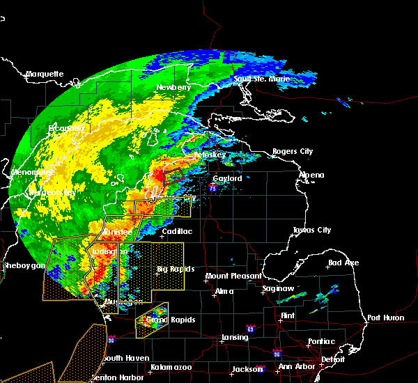
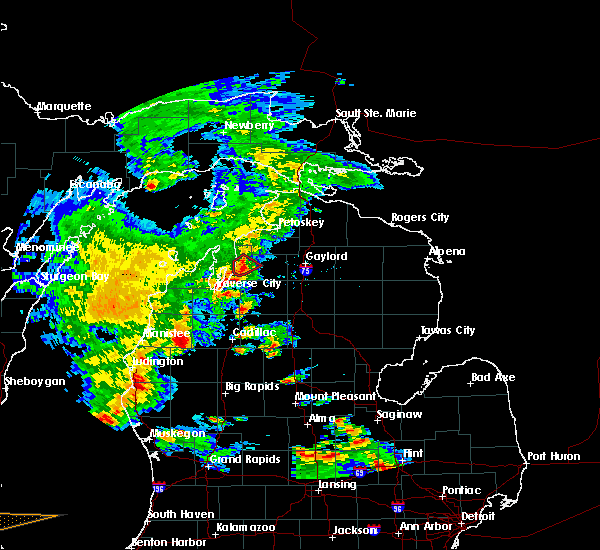
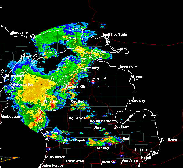
Hail Maps for Central Lake, MI


Connect with Interactive Hail Maps