

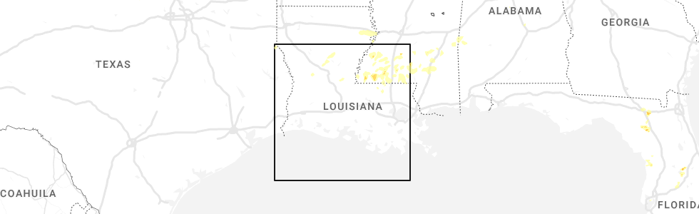
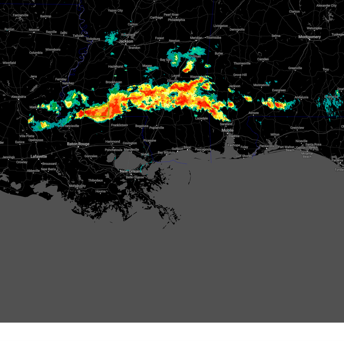
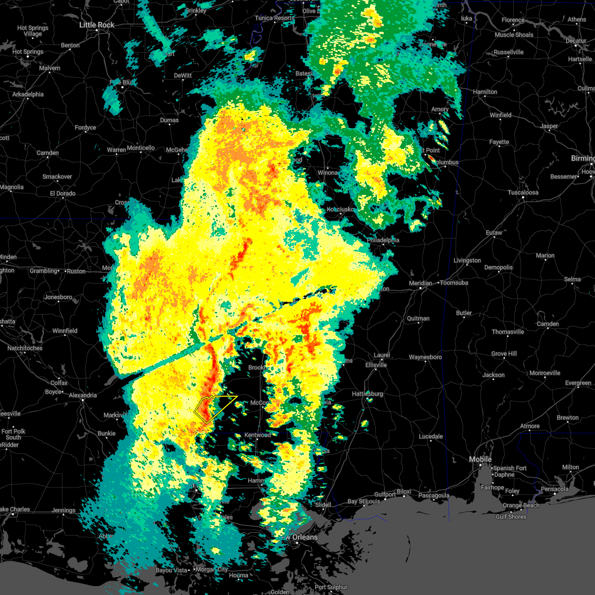
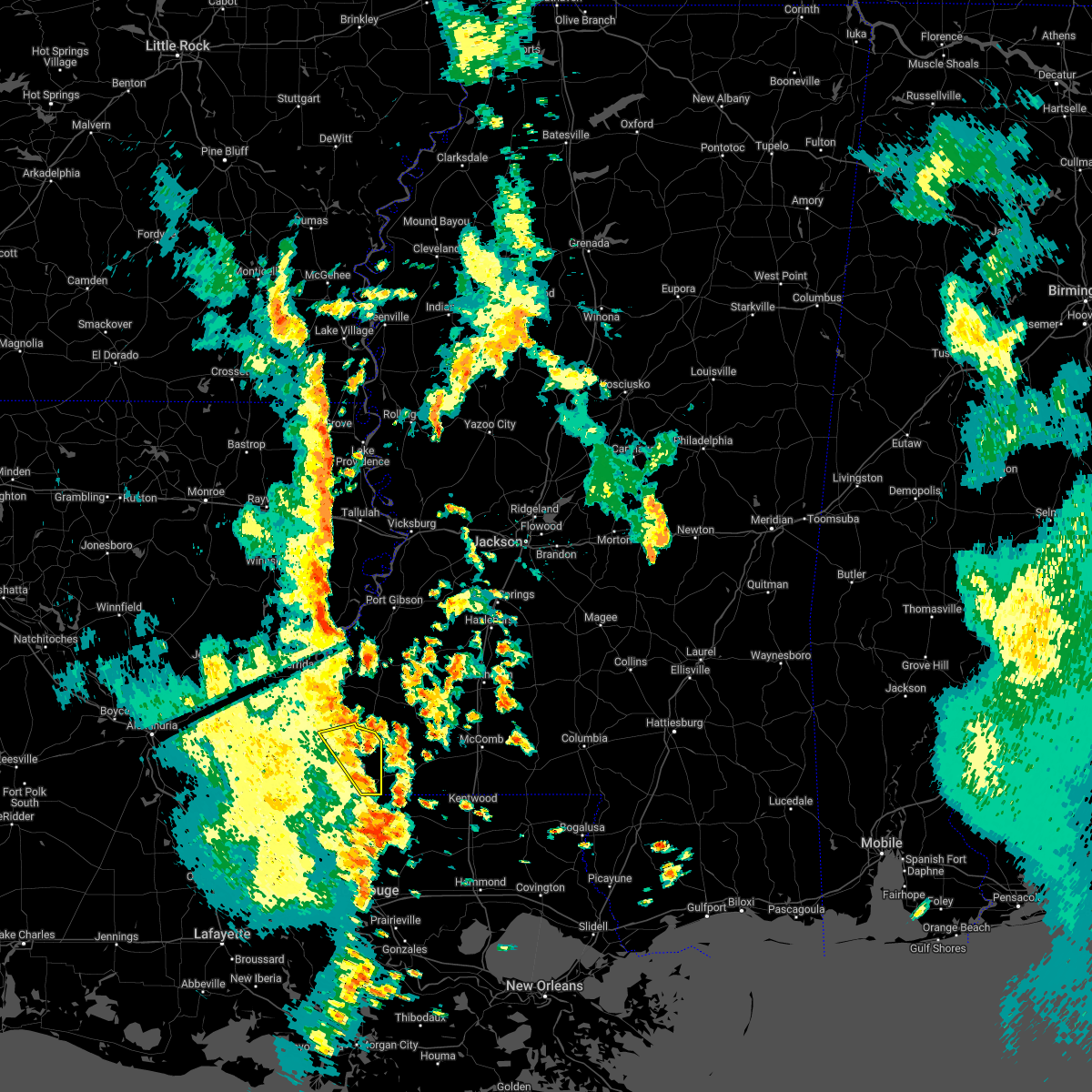
Hail Map for Centreville, MS
The Centreville, MS area has had 4 reports of on-the-ground hail by trained spotters, and has been under severe weather warnings 34 times during the past 12 months. Doppler radar has detected hail at or near Centreville, MS on 51 occasions, including 8 occasions during the past year.
| Name: | Centreville, MS |
| Where Located: | 82 miles NE of Lafayette, LA |
| Map: | Google Map for Centreville, MS |
| Population: | 1684 |
| Housing Units: | 741 |
| More Info: | Search Google for Centreville, MS |
5
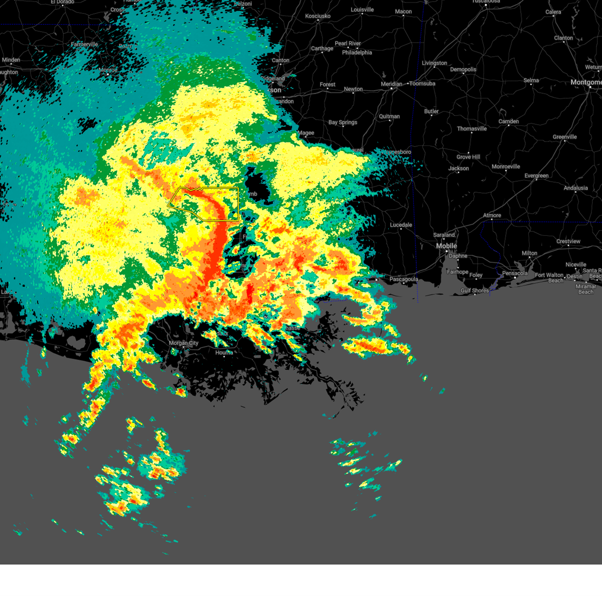
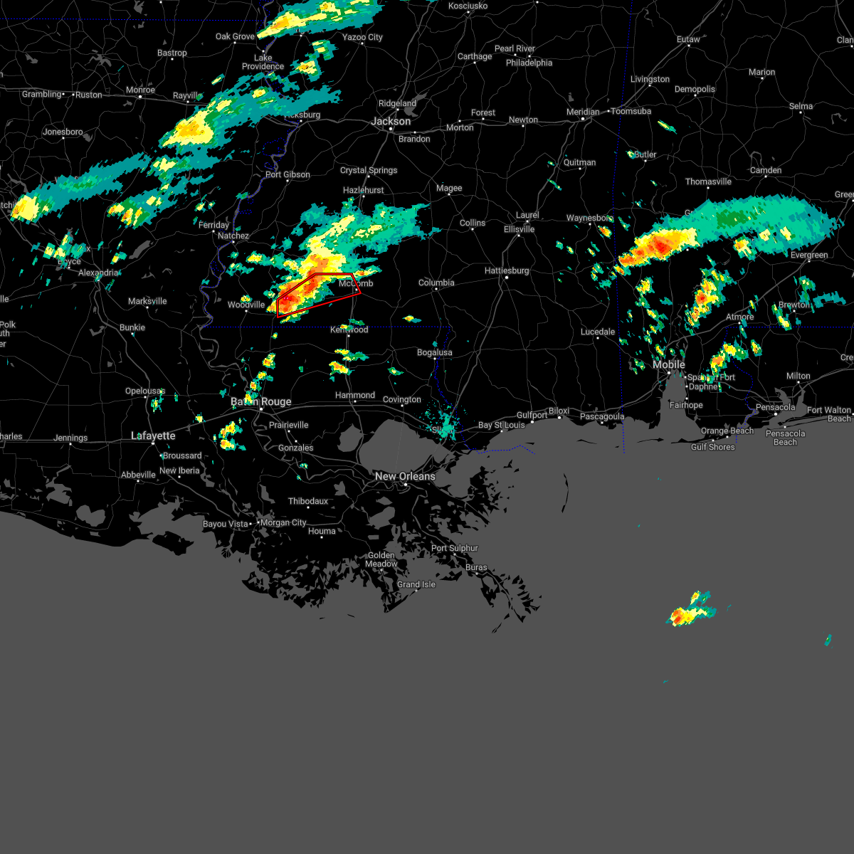
The Top Recent Hail Date for Centreville, MS is Thursday, May 11, 2023 (2nd out of 51)
Hail and Wind Damage Spotted near Centreville, MS
| Date / Time | Report Details |
|---|---|
| 4/10/2024 8:53 AM CDT |
 At 853 am cdt, severe thunderstorms were located along a line extending from near garden city to 8 miles north of gloster to near liberty to near gillsburg, moving northeast at 65 mph (radar indicated). Hazards include 70 mph wind gusts and quarter size hail. Hail damage to vehicles is expected. expect considerable tree damage. wind damage is also likely to mobile homes, roofs, and outbuildings. Locations impacted include, liberty, centreville, gloster, smithdale, gillsburg, and crosby. At 853 am cdt, severe thunderstorms were located along a line extending from near garden city to 8 miles north of gloster to near liberty to near gillsburg, moving northeast at 65 mph (radar indicated). Hazards include 70 mph wind gusts and quarter size hail. Hail damage to vehicles is expected. expect considerable tree damage. wind damage is also likely to mobile homes, roofs, and outbuildings. Locations impacted include, liberty, centreville, gloster, smithdale, gillsburg, and crosby.
|
| 4/10/2024 8:40 AM CDT | Tree limbs down causing power outages in centreville. relayed via social medi in wilkinson county MS, 0.6 miles SSE of Centreville, MS |
| 4/10/2024 8:30 AM CDT |
 Svrlix the national weather service in new orleans has issued a * severe thunderstorm warning for, wilkinson county in southern mississippi, amite county in southern mississippi, * until 915 am cdt. * at 829 am cdt, severe thunderstorms were located along a line extending from 9 miles northwest of spillman to near woodville to near norwood to wilson to near clinton, moving northeast at 65 mph (radar indicated). Hazards include 70 mph wind gusts and quarter size hail. Hail damage to vehicles is expected. expect considerable tree damage. Wind damage is also likely to mobile homes, roofs, and outbuildings. Svrlix the national weather service in new orleans has issued a * severe thunderstorm warning for, wilkinson county in southern mississippi, amite county in southern mississippi, * until 915 am cdt. * at 829 am cdt, severe thunderstorms were located along a line extending from 9 miles northwest of spillman to near woodville to near norwood to wilson to near clinton, moving northeast at 65 mph (radar indicated). Hazards include 70 mph wind gusts and quarter size hail. Hail damage to vehicles is expected. expect considerable tree damage. Wind damage is also likely to mobile homes, roofs, and outbuildings.
|
| 12/9/2023 9:58 PM CST |
 At 958 pm cst, severe thunderstorms were located along a line extending from 6 miles northwest of centreville to new roads, moving east at 50 mph (radar indicated). Hazards include 60 mph wind gusts and penny size hail. expect damage to roofs, siding, and trees At 958 pm cst, severe thunderstorms were located along a line extending from 6 miles northwest of centreville to new roads, moving east at 50 mph (radar indicated). Hazards include 60 mph wind gusts and penny size hail. expect damage to roofs, siding, and trees
|
| 9/8/2023 1:25 PM CDT |
 The severe thunderstorm warning for eastern west feliciana and east feliciana parishes, southeastern wilkinson and southwestern amite counties will expire at 130 pm cdt, the storm which prompted the warning has weakened below severe limits, and no longer poses an immediate threat to life or property. therefore, the warning will be allowed to expire. however, gusty winds are still possible with this thunderstorm. The severe thunderstorm warning for eastern west feliciana and east feliciana parishes, southeastern wilkinson and southwestern amite counties will expire at 130 pm cdt, the storm which prompted the warning has weakened below severe limits, and no longer poses an immediate threat to life or property. therefore, the warning will be allowed to expire. however, gusty winds are still possible with this thunderstorm.
|
| 9/8/2023 1:05 PM CDT |
 At 105 pm cdt, a severe thunderstorm was located over norwood, or 10 miles north of clinton, moving southeast at 35 mph (radar indicated). Hazards include 60 mph wind gusts and quarter size hail. Hail damage to vehicles is expected. expect wind damage to roofs, siding, and trees. locations impacted include, jackson, clinton, centreville, slaughter, wilson, norwood, and spillman. hail threat, radar indicated max hail size, 1. 00 in wind threat, radar indicated max wind gust, 60 mph. At 105 pm cdt, a severe thunderstorm was located over norwood, or 10 miles north of clinton, moving southeast at 35 mph (radar indicated). Hazards include 60 mph wind gusts and quarter size hail. Hail damage to vehicles is expected. expect wind damage to roofs, siding, and trees. locations impacted include, jackson, clinton, centreville, slaughter, wilson, norwood, and spillman. hail threat, radar indicated max hail size, 1. 00 in wind threat, radar indicated max wind gust, 60 mph.
|
| 9/8/2023 12:42 PM CDT |
 At 1242 pm cdt, a severe thunderstorm was located 8 miles northwest of centreville, or 21 miles west of liberty, moving south at 35 mph (radar indicated). Hazards include 60 mph wind gusts and quarter size hail. Hail damage to vehicles is expected. Expect wind damage to roofs, siding, and trees. At 1242 pm cdt, a severe thunderstorm was located 8 miles northwest of centreville, or 21 miles west of liberty, moving south at 35 mph (radar indicated). Hazards include 60 mph wind gusts and quarter size hail. Hail damage to vehicles is expected. Expect wind damage to roofs, siding, and trees.
|
| 7/16/2023 5:56 PM CDT |
 The severe thunderstorm warning for eastern wilkinson and southwestern amite counties will expire at 600 pm cdt, the storm which prompted the warning has weakened below severe limits, and no longer poses an immediate threat to life or property. therefore, the warning will be allowed to expire. a severe thunderstorm watch remains in effect until 1000 pm cdt for southeastern louisiana, and southern mississippi. The severe thunderstorm warning for eastern wilkinson and southwestern amite counties will expire at 600 pm cdt, the storm which prompted the warning has weakened below severe limits, and no longer poses an immediate threat to life or property. therefore, the warning will be allowed to expire. a severe thunderstorm watch remains in effect until 1000 pm cdt for southeastern louisiana, and southern mississippi.
|
| 7/16/2023 5:46 PM CDT |
 At 546 pm cdt, a severe thunderstorm was located near centreville, or 14 miles northwest of clinton, moving southeast at 25 mph (radar indicated). Hazards include 60 mph wind gusts. Expect damage to roofs, siding, and trees. locations impacted include, centreville, gloster and crosby. hail threat, radar indicated max hail size, <. 75 in wind threat, radar indicated max wind gust, 60 mph. At 546 pm cdt, a severe thunderstorm was located near centreville, or 14 miles northwest of clinton, moving southeast at 25 mph (radar indicated). Hazards include 60 mph wind gusts. Expect damage to roofs, siding, and trees. locations impacted include, centreville, gloster and crosby. hail threat, radar indicated max hail size, <. 75 in wind threat, radar indicated max wind gust, 60 mph.
|
| 7/16/2023 5:23 PM CDT |
 At 522 pm cdt, a severe thunderstorm was located near woodville, or 20 miles north of jackson, moving southeast at 25 mph (radar indicated). Hazards include 60 mph wind gusts and quarter size hail. Hail damage to vehicles is expected. expect wind damage to roofs, siding, and trees. locations impacted include, centreville, gloster, dolorosa and crosby. hail threat, radar indicated max hail size, 1. 00 in wind threat, radar indicated max wind gust, 60 mph. At 522 pm cdt, a severe thunderstorm was located near woodville, or 20 miles north of jackson, moving southeast at 25 mph (radar indicated). Hazards include 60 mph wind gusts and quarter size hail. Hail damage to vehicles is expected. expect wind damage to roofs, siding, and trees. locations impacted include, centreville, gloster, dolorosa and crosby. hail threat, radar indicated max hail size, 1. 00 in wind threat, radar indicated max wind gust, 60 mph.
|
| 7/16/2023 4:56 PM CDT |
 At 455 pm cdt, severe thunderstorms were located near dolorosa, or 23 miles south of natchez, moving southeast at 25 mph (radar indicated). Hazards include 60 mph wind gusts and quarter size hail. Hail damage to vehicles is expected. Expect wind damage to roofs, siding, and trees. At 455 pm cdt, severe thunderstorms were located near dolorosa, or 23 miles south of natchez, moving southeast at 25 mph (radar indicated). Hazards include 60 mph wind gusts and quarter size hail. Hail damage to vehicles is expected. Expect wind damage to roofs, siding, and trees.
|
| 6/17/2023 3:35 PM CDT |
 At 333 pm cdt, a severe thunderstorm was located near woodville, or 25 miles northwest of jackson, moving southeast at 20 mph. this is a destructive storm for central wilkinson county (radar indicated). Hazards include baseball size hail and 60 mph wind gusts. People and animals outdoors will be severely injured. Expect shattered windows, extensive damage to roofs, siding, and vehicles. At 333 pm cdt, a severe thunderstorm was located near woodville, or 25 miles northwest of jackson, moving southeast at 20 mph. this is a destructive storm for central wilkinson county (radar indicated). Hazards include baseball size hail and 60 mph wind gusts. People and animals outdoors will be severely injured. Expect shattered windows, extensive damage to roofs, siding, and vehicles.
|
| 6/12/2023 5:14 PM CDT |
 At 513 pm cdt, a severe thunderstorm was located near centreville, or 11 miles north of clinton, moving southeast at 30 mph (radar indicated). Hazards include 60 mph wind gusts and quarter size hail. Hail damage to vehicles is expected. Expect wind damage to roofs, siding, and trees. At 513 pm cdt, a severe thunderstorm was located near centreville, or 11 miles north of clinton, moving southeast at 30 mph (radar indicated). Hazards include 60 mph wind gusts and quarter size hail. Hail damage to vehicles is expected. Expect wind damage to roofs, siding, and trees.
|
| 6/12/2023 5:10 PM CDT |
 At 509 pm cdt, severe thunderstorms were located along a line extending from magnolia to gillsburg to near norwood, moving southeast at 25 mph (radar indicated). Hazards include 60 mph wind gusts and half dollar size hail. Hail damage to vehicles is expected. expect wind damage to roofs, siding, and trees. locations impacted include, liberty, centreville and gillsburg. hail threat, radar indicated max hail size, 1. 25 in wind threat, radar indicated max wind gust, 60 mph. At 509 pm cdt, severe thunderstorms were located along a line extending from magnolia to gillsburg to near norwood, moving southeast at 25 mph (radar indicated). Hazards include 60 mph wind gusts and half dollar size hail. Hail damage to vehicles is expected. expect wind damage to roofs, siding, and trees. locations impacted include, liberty, centreville and gillsburg. hail threat, radar indicated max hail size, 1. 25 in wind threat, radar indicated max wind gust, 60 mph.
|
| 6/12/2023 4:56 PM CDT |
 At 455 pm cdt, severe thunderstorms were located along a line extending from near mccomb to 6 miles northwest of gillsburg to near centreville, moving southeast at 25 mph (radar indicated). Hazards include 60 mph wind gusts and half dollar size hail. Hail damage to vehicles is expected. expect wind damage to roofs, siding, and trees. locations impacted include, liberty, centreville, gloster and gillsburg. hail threat, radar indicated max hail size, 1. 25 in wind threat, radar indicated max wind gust, 60 mph. At 455 pm cdt, severe thunderstorms were located along a line extending from near mccomb to 6 miles northwest of gillsburg to near centreville, moving southeast at 25 mph (radar indicated). Hazards include 60 mph wind gusts and half dollar size hail. Hail damage to vehicles is expected. expect wind damage to roofs, siding, and trees. locations impacted include, liberty, centreville, gloster and gillsburg. hail threat, radar indicated max hail size, 1. 25 in wind threat, radar indicated max wind gust, 60 mph.
|
| 6/12/2023 4:43 PM CDT |
 At 443 pm cdt, a severe thunderstorm was located near gloster, or 17 miles west of liberty, moving southeast at 20 mph (radar indicated). Hazards include 60 mph wind gusts and half dollar size hail. Hail damage to vehicles is expected. Expect wind damage to roofs, siding, and trees. At 443 pm cdt, a severe thunderstorm was located near gloster, or 17 miles west of liberty, moving southeast at 20 mph (radar indicated). Hazards include 60 mph wind gusts and half dollar size hail. Hail damage to vehicles is expected. Expect wind damage to roofs, siding, and trees.
|
| 6/12/2023 4:38 PM CDT |
 At 437 pm cdt, severe thunderstorms were located along a line extending from near center point to liberty to near woodville, moving southeast at 25 mph (radar indicated). Hazards include 60 mph wind gusts and half dollar size hail. Hail damage to vehicles is expected. Expect wind damage to roofs, siding, and trees. At 437 pm cdt, severe thunderstorms were located along a line extending from near center point to liberty to near woodville, moving southeast at 25 mph (radar indicated). Hazards include 60 mph wind gusts and half dollar size hail. Hail damage to vehicles is expected. Expect wind damage to roofs, siding, and trees.
|
| 6/12/2023 4:34 PM CDT |
 At 433 pm cdt, a severe thunderstorm was located near centreville, or 18 miles west of liberty, moving southeast at 30 mph (radar indicated). Hazards include ping pong ball size hail and 60 mph wind gusts. People and animals outdoors will be injured. expect hail damage to roofs, siding, windows, and vehicles. expect wind damage to roofs, siding, and trees. locations impacted include, centreville and crosby. hail threat, radar indicated max hail size, 1. 50 in wind threat, radar indicated max wind gust, 60 mph. At 433 pm cdt, a severe thunderstorm was located near centreville, or 18 miles west of liberty, moving southeast at 30 mph (radar indicated). Hazards include ping pong ball size hail and 60 mph wind gusts. People and animals outdoors will be injured. expect hail damage to roofs, siding, windows, and vehicles. expect wind damage to roofs, siding, and trees. locations impacted include, centreville and crosby. hail threat, radar indicated max hail size, 1. 50 in wind threat, radar indicated max wind gust, 60 mph.
|
| 6/12/2023 4:31 PM CDT |
 At 430 pm cdt, a severe thunderstorm was located 7 miles west of gloster, or 19 miles west of liberty, moving southeast at 30 mph (radar indicated). Hazards include 60 mph wind gusts and quarter size hail. Hail damage to vehicles is expected. expect wind damage to roofs, siding, and trees. locations impacted include, centreville and crosby. hail threat, radar indicated max hail size, 1. 00 in wind threat, radar indicated max wind gust, 60 mph. At 430 pm cdt, a severe thunderstorm was located 7 miles west of gloster, or 19 miles west of liberty, moving southeast at 30 mph (radar indicated). Hazards include 60 mph wind gusts and quarter size hail. Hail damage to vehicles is expected. expect wind damage to roofs, siding, and trees. locations impacted include, centreville and crosby. hail threat, radar indicated max hail size, 1. 00 in wind threat, radar indicated max wind gust, 60 mph.
|
| 6/12/2023 4:20 PM CDT |
 At 419 pm cdt, a severe thunderstorm was located 10 miles southeast of dolorosa, or 24 miles west of liberty, moving southeast at 30 mph (radar indicated). Hazards include 60 mph wind gusts and quarter size hail. Hail damage to vehicles is expected. Expect wind damage to roofs, siding, and trees. At 419 pm cdt, a severe thunderstorm was located 10 miles southeast of dolorosa, or 24 miles west of liberty, moving southeast at 30 mph (radar indicated). Hazards include 60 mph wind gusts and quarter size hail. Hail damage to vehicles is expected. Expect wind damage to roofs, siding, and trees.
|
| 6/5/2023 3:52 PM CDT |
 The severe thunderstorm warning for eastern west feliciana and northeastern east feliciana parishes, southeastern wilkinson and southwestern amite counties will expire at 400 pm cdt, the storm which prompted the warning has weakened below severe limits, and no longer poses an immediate threat to life or property. therefore, the warning will be allowed to expire. however heavy rain is still possible with this thunderstorm. The severe thunderstorm warning for eastern west feliciana and northeastern east feliciana parishes, southeastern wilkinson and southwestern amite counties will expire at 400 pm cdt, the storm which prompted the warning has weakened below severe limits, and no longer poses an immediate threat to life or property. therefore, the warning will be allowed to expire. however heavy rain is still possible with this thunderstorm.
|
| 6/5/2023 3:21 PM CDT |
 At 321 pm cdt, a severe thunderstorm was located near felps, or 12 miles southwest of liberty, moving west at 10 mph (radar indicated). Hazards include 60 mph wind gusts and quarter size hail. Hail damage to vehicles is expected. Expect wind damage to roofs, siding, and trees. At 321 pm cdt, a severe thunderstorm was located near felps, or 12 miles southwest of liberty, moving west at 10 mph (radar indicated). Hazards include 60 mph wind gusts and quarter size hail. Hail damage to vehicles is expected. Expect wind damage to roofs, siding, and trees.
|
| 4/27/2023 5:12 AM CDT |
 At 512 am cdt, a severe thunderstorm was located near felps, or near clinton, moving northeast at 35 mph (radar indicated). Hazards include 60 mph wind gusts and quarter size hail. Hail damage to vehicles is expected. expect wind damage to roofs, siding, and trees. Locations impacted include, liberty, centreville, gloster, norwood, smithdale, felps, darlington, gillsburg and easleyville. At 512 am cdt, a severe thunderstorm was located near felps, or near clinton, moving northeast at 35 mph (radar indicated). Hazards include 60 mph wind gusts and quarter size hail. Hail damage to vehicles is expected. expect wind damage to roofs, siding, and trees. Locations impacted include, liberty, centreville, gloster, norwood, smithdale, felps, darlington, gillsburg and easleyville.
|
| 4/27/2023 4:55 AM CDT |
 At 455 am cdt, a severe thunderstorm was located near wilson, or near jackson, moving northeast at 35 mph (radar indicated). Hazards include 60 mph wind gusts and quarter size hail. Hail damage to vehicles is expected. Expect wind damage to roofs, siding, and trees. At 455 am cdt, a severe thunderstorm was located near wilson, or near jackson, moving northeast at 35 mph (radar indicated). Hazards include 60 mph wind gusts and quarter size hail. Hail damage to vehicles is expected. Expect wind damage to roofs, siding, and trees.
|
| 2/8/2023 8:19 PM CST |
 At 818 pm cst, a severe thunderstorm was located near gloster, or 16 miles west of liberty, moving northeast at 55 mph (radar indicated). Hazards include 60 mph wind gusts. Expect damage to roofs, siding, and trees. Locations impacted include, centreville, gloster and crosby. At 818 pm cst, a severe thunderstorm was located near gloster, or 16 miles west of liberty, moving northeast at 55 mph (radar indicated). Hazards include 60 mph wind gusts. Expect damage to roofs, siding, and trees. Locations impacted include, centreville, gloster and crosby.
|
| 2/8/2023 8:05 PM CST |
 At 804 pm cst, a severe thunderstorm was located near woodville, or 17 miles north of jackson, moving northeast at 55 mph (radar indicated). Hazards include 60 mph wind gusts. expect damage to roofs, siding, and trees At 804 pm cst, a severe thunderstorm was located near woodville, or 17 miles north of jackson, moving northeast at 55 mph (radar indicated). Hazards include 60 mph wind gusts. expect damage to roofs, siding, and trees
|
| 11/29/2022 10:47 PM CST |
 At 1047 pm cst, a severe thunderstorm capable of producing a tornado was located near norwood, or 11 miles north of jackson, moving east at 30 mph (radar indicated rotation). Hazards include tornado. Flying debris will be dangerous to those caught without shelter. mobile homes will be damaged or destroyed. damage to roofs, windows, and vehicles will occur. tree damage is likely. this dangerous storm will be near, norwood around 1055 pm cst. Centreville around 1105 pm cst. At 1047 pm cst, a severe thunderstorm capable of producing a tornado was located near norwood, or 11 miles north of jackson, moving east at 30 mph (radar indicated rotation). Hazards include tornado. Flying debris will be dangerous to those caught without shelter. mobile homes will be damaged or destroyed. damage to roofs, windows, and vehicles will occur. tree damage is likely. this dangerous storm will be near, norwood around 1055 pm cst. Centreville around 1105 pm cst.
|
| 11/29/2022 10:31 PM CST |
 At 1031 pm cst, a severe thunderstorm capable of producing a tornado was located over spillman, or 10 miles northwest of jackson, moving east at 30 mph (radar indicated rotation). Hazards include tornado and quarter size hail. Flying debris will be dangerous to those caught without shelter. mobile homes will be damaged or destroyed. damage to roofs, windows, and vehicles will occur. tree damage is likely. this dangerous storm will be near, spillman around 1035 pm cst. wilson around 1050 pm cst. norwood around 1055 pm cst. Centreville around 1100 pm cst. At 1031 pm cst, a severe thunderstorm capable of producing a tornado was located over spillman, or 10 miles northwest of jackson, moving east at 30 mph (radar indicated rotation). Hazards include tornado and quarter size hail. Flying debris will be dangerous to those caught without shelter. mobile homes will be damaged or destroyed. damage to roofs, windows, and vehicles will occur. tree damage is likely. this dangerous storm will be near, spillman around 1035 pm cst. wilson around 1050 pm cst. norwood around 1055 pm cst. Centreville around 1100 pm cst.
|
| 11/29/2022 10:08 PM CST |
 At 1007 pm cst, a severe thunderstorm was located over woodville, or 18 miles north of jackson, moving northeast at 40 mph (radar indicated). Hazards include 60 mph wind gusts and quarter size hail. Hail damage to vehicles is expected. expect wind damage to roofs, siding, and trees. locations impacted include, centreville, woodville and crosby. hail threat, radar indicated max hail size, 1. 00 in wind threat, radar indicated max wind gust, 60 mph. At 1007 pm cst, a severe thunderstorm was located over woodville, or 18 miles north of jackson, moving northeast at 40 mph (radar indicated). Hazards include 60 mph wind gusts and quarter size hail. Hail damage to vehicles is expected. expect wind damage to roofs, siding, and trees. locations impacted include, centreville, woodville and crosby. hail threat, radar indicated max hail size, 1. 00 in wind threat, radar indicated max wind gust, 60 mph.
|
| 11/29/2022 9:50 PM CST |
 At 949 pm cst, a severe thunderstorm was located near fort adams, or 16 miles north of st. francisville, moving northeast at 45 mph (radar indicated). Hazards include 60 mph wind gusts and quarter size hail. Hail damage to vehicles is expected. Expect wind damage to roofs, siding, and trees. At 949 pm cst, a severe thunderstorm was located near fort adams, or 16 miles north of st. francisville, moving northeast at 45 mph (radar indicated). Hazards include 60 mph wind gusts and quarter size hail. Hail damage to vehicles is expected. Expect wind damage to roofs, siding, and trees.
|
| 11/29/2022 2:47 PM CST |
 At 246 pm cst, a severe thunderstorm capable of producing a tornado was located near gloster, or 9 miles west of liberty, moving northeast at 40 mph (radar indicated rotation). Hazards include tornado and quarter size hail. Flying debris will be dangerous to those caught without shelter. mobile homes will be damaged or destroyed. damage to roofs, windows, and vehicles will occur. tree damage is likely. this dangerous storm will be near, liberty around 300 pm cst. smithdale around 320 pm cst. mccomb and summit around 335 pm cst. This includes interstate 55 in mississippi between mile markers 15 and 22. At 246 pm cst, a severe thunderstorm capable of producing a tornado was located near gloster, or 9 miles west of liberty, moving northeast at 40 mph (radar indicated rotation). Hazards include tornado and quarter size hail. Flying debris will be dangerous to those caught without shelter. mobile homes will be damaged or destroyed. damage to roofs, windows, and vehicles will occur. tree damage is likely. this dangerous storm will be near, liberty around 300 pm cst. smithdale around 320 pm cst. mccomb and summit around 335 pm cst. This includes interstate 55 in mississippi between mile markers 15 and 22.
|
| 11/29/2022 2:40 PM CST |
 At 240 pm cst, a severe thunderstorm capable of producing a tornado was located near centreville, or 13 miles west of liberty, moving northeast at 40 mph (radar indicated rotation). Hazards include tornado. Flying debris will be dangerous to those caught without shelter. mobile homes will be damaged or destroyed. damage to roofs, windows, and vehicles will occur. tree damage is likely. this dangerous storm will be near, liberty around 305 pm cst. smithdale around 320 pm cst. mccomb and summit around 335 pm cst. This includes interstate 55 in mississippi between mile markers 15 and 22. At 240 pm cst, a severe thunderstorm capable of producing a tornado was located near centreville, or 13 miles west of liberty, moving northeast at 40 mph (radar indicated rotation). Hazards include tornado. Flying debris will be dangerous to those caught without shelter. mobile homes will be damaged or destroyed. damage to roofs, windows, and vehicles will occur. tree damage is likely. this dangerous storm will be near, liberty around 305 pm cst. smithdale around 320 pm cst. mccomb and summit around 335 pm cst. This includes interstate 55 in mississippi between mile markers 15 and 22.
|
| 11/29/2022 2:06 PM CST |
 At 205 pm cst, a severe thunderstorm capable of producing a tornado was located over gloster, or 12 miles west of liberty, moving northeast at 30 mph (radar indicated rotation). Hazards include tornado. Flying debris will be dangerous to those caught without shelter. mobile homes will be damaged or destroyed. damage to roofs, windows, and vehicles will occur. tree damage is likely. This tornadic thunderstorm will remain over mainly rural areas of northwestern amite county. At 205 pm cst, a severe thunderstorm capable of producing a tornado was located over gloster, or 12 miles west of liberty, moving northeast at 30 mph (radar indicated rotation). Hazards include tornado. Flying debris will be dangerous to those caught without shelter. mobile homes will be damaged or destroyed. damage to roofs, windows, and vehicles will occur. tree damage is likely. This tornadic thunderstorm will remain over mainly rural areas of northwestern amite county.
|
| 11/29/2022 1:41 PM CST |
 At 141 pm cst, a severe thunderstorm capable of producing a tornado was located near centreville, or 15 miles north of jackson, moving northeast at 30 mph (radar indicated rotation). Hazards include tornado. Flying debris will be dangerous to those caught without shelter. mobile homes will be damaged or destroyed. damage to roofs, windows, and vehicles will occur. tree damage is likely. this dangerous storm will be near, centreville around 155 pm cst. gloster around 210 pm cst. Liberty around 230 pm cst. At 141 pm cst, a severe thunderstorm capable of producing a tornado was located near centreville, or 15 miles north of jackson, moving northeast at 30 mph (radar indicated rotation). Hazards include tornado. Flying debris will be dangerous to those caught without shelter. mobile homes will be damaged or destroyed. damage to roofs, windows, and vehicles will occur. tree damage is likely. this dangerous storm will be near, centreville around 155 pm cst. gloster around 210 pm cst. Liberty around 230 pm cst.
|
| 5/25/2022 9:39 AM CDT |
 At 938 am cdt, severe thunderstorms were located along a line extending from near sibley to near jackson, moving northeast at 25 mph (radar indicated). Hazards include 60 mph wind gusts. Expect damage to roofs, siding, and trees. Locations impacted include, centreville, dolorosa and crosby. At 938 am cdt, severe thunderstorms were located along a line extending from near sibley to near jackson, moving northeast at 25 mph (radar indicated). Hazards include 60 mph wind gusts. Expect damage to roofs, siding, and trees. Locations impacted include, centreville, dolorosa and crosby.
|
| 5/25/2022 9:28 AM CDT |
 At 928 am cdt, severe thunderstorms were located along a line extending from near sibley to near jackson, moving northeast at 25 mph (radar indicated). Hazards include 60 mph wind gusts. Expect damage to roofs, siding, and trees. Locations impacted include, centreville, woodville, norwood, dolorosa, spillman and crosby. At 928 am cdt, severe thunderstorms were located along a line extending from near sibley to near jackson, moving northeast at 25 mph (radar indicated). Hazards include 60 mph wind gusts. Expect damage to roofs, siding, and trees. Locations impacted include, centreville, woodville, norwood, dolorosa, spillman and crosby.
|
| 5/25/2022 9:09 AM CDT |
 At 909 am cdt, severe thunderstorms were located along a line extending from 6 miles southeast of slocum to st. francisville, moving northeast at 25 mph (radar indicated). Hazards include 60 mph wind gusts and penny size hail. expect damage to roofs, siding, and trees At 909 am cdt, severe thunderstorms were located along a line extending from 6 miles southeast of slocum to st. francisville, moving northeast at 25 mph (radar indicated). Hazards include 60 mph wind gusts and penny size hail. expect damage to roofs, siding, and trees
|
| 5/16/2022 6:44 PM CDT |
 At 643 pm cdt, a severe thunderstorm was located near centreville, or 12 miles north of clinton, moving south at 15 mph (radar indicated). Hazards include 60 mph wind gusts and quarter size hail. Hail damage to vehicles is expected. expect wind damage to roofs, siding, and trees. locations impacted include, clinton, centreville, wilson, norwood and felps. hail threat, radar indicated max hail size, 1. 00 in wind threat, radar indicated max wind gust, 60 mph. At 643 pm cdt, a severe thunderstorm was located near centreville, or 12 miles north of clinton, moving south at 15 mph (radar indicated). Hazards include 60 mph wind gusts and quarter size hail. Hail damage to vehicles is expected. expect wind damage to roofs, siding, and trees. locations impacted include, clinton, centreville, wilson, norwood and felps. hail threat, radar indicated max hail size, 1. 00 in wind threat, radar indicated max wind gust, 60 mph.
|
| 5/16/2022 6:18 PM CDT |
 At 618 pm cdt, a severe thunderstorm was located near gloster, or 12 miles west of liberty, moving south at 15 mph (radar indicated). Hazards include 60 mph wind gusts and half dollar size hail. Hail damage to vehicles is expected. Expect wind damage to roofs, siding, and trees. At 618 pm cdt, a severe thunderstorm was located near gloster, or 12 miles west of liberty, moving south at 15 mph (radar indicated). Hazards include 60 mph wind gusts and half dollar size hail. Hail damage to vehicles is expected. Expect wind damage to roofs, siding, and trees.
|
| 5/13/2022 2:22 PM CDT |
 At 222 pm cdt, severe thunderstorms were located along a line extending from near gillsburg to pride to near centreville, moving south at 30 mph (radar indicated). Hazards include 60 mph wind gusts. Expect damage to roofs, siding, and trees. locations impacted include, clinton, liberty, greensburg, centreville, gloster, wilson, norwood, felps, darlington, gillsburg, easleyville and crosby. hail threat, radar indicated max hail size, <. 75 in wind threat, radar indicated max wind gust, 60 mph. At 222 pm cdt, severe thunderstorms were located along a line extending from near gillsburg to pride to near centreville, moving south at 30 mph (radar indicated). Hazards include 60 mph wind gusts. Expect damage to roofs, siding, and trees. locations impacted include, clinton, liberty, greensburg, centreville, gloster, wilson, norwood, felps, darlington, gillsburg, easleyville and crosby. hail threat, radar indicated max hail size, <. 75 in wind threat, radar indicated max wind gust, 60 mph.
|
| 5/13/2022 2:06 PM CDT |
 At 205 pm cdt, severe thunderstorms were located along a line extending from near smithdale to 6 miles southwest of darlington to near garden city, moving south at 30 mph (radar indicated). Hazards include 60 mph wind gusts and penny size hail. Expect damage to roofs, siding, and trees. locations impacted include, clinton, liberty, greensburg, centreville, gloster, wilson, norwood, smithdale, darlington, felps, gillsburg, easleyville and crosby. hail threat, radar indicated max hail size, 0. 75 in wind threat, radar indicated max wind gust, 60 mph. At 205 pm cdt, severe thunderstorms were located along a line extending from near smithdale to 6 miles southwest of darlington to near garden city, moving south at 30 mph (radar indicated). Hazards include 60 mph wind gusts and penny size hail. Expect damage to roofs, siding, and trees. locations impacted include, clinton, liberty, greensburg, centreville, gloster, wilson, norwood, smithdale, darlington, felps, gillsburg, easleyville and crosby. hail threat, radar indicated max hail size, 0. 75 in wind threat, radar indicated max wind gust, 60 mph.
|
| 5/13/2022 1:44 PM CDT |
 At 143 pm cdt, severe thunderstorms were located along a line extending from near center point to near felps to near garden city, moving south at 30 mph (radar indicated). Hazards include 60 mph wind gusts and quarter size hail. Hail damage to vehicles is expected. Expect wind damage to roofs, siding, and trees. At 143 pm cdt, severe thunderstorms were located along a line extending from near center point to near felps to near garden city, moving south at 30 mph (radar indicated). Hazards include 60 mph wind gusts and quarter size hail. Hail damage to vehicles is expected. Expect wind damage to roofs, siding, and trees.
|
| 4/17/2022 9:39 PM CDT |
 At 939 pm cdt, a severe thunderstorm was located near liberty, moving east at 45 mph (radar indicated). Hazards include two inch hail and 60 mph wind gusts. People and animals outdoors will be injured. expect hail damage to roofs, siding, windows, and vehicles. expect wind damage to roofs, siding, and trees. locations impacted include, liberty, centreville, gloster and gillsberg. thunderstorm damage threat, considerable hail threat, radar indicated max hail size, 2. 00 in wind threat, radar indicated max wind gust, 60 mph. At 939 pm cdt, a severe thunderstorm was located near liberty, moving east at 45 mph (radar indicated). Hazards include two inch hail and 60 mph wind gusts. People and animals outdoors will be injured. expect hail damage to roofs, siding, windows, and vehicles. expect wind damage to roofs, siding, and trees. locations impacted include, liberty, centreville, gloster and gillsberg. thunderstorm damage threat, considerable hail threat, radar indicated max hail size, 2. 00 in wind threat, radar indicated max wind gust, 60 mph.
|
| 4/17/2022 9:22 PM CDT |
 At 921 pm cdt, a severe thunderstorm was located near centreville, or 12 miles west of liberty, moving east at 30 mph (radar indicated). Hazards include ping pong ball size hail and 60 mph wind gusts. People and animals outdoors will be injured. expect hail damage to roofs, siding, windows, and vehicles. Expect wind damage to roofs, siding, and trees. At 921 pm cdt, a severe thunderstorm was located near centreville, or 12 miles west of liberty, moving east at 30 mph (radar indicated). Hazards include ping pong ball size hail and 60 mph wind gusts. People and animals outdoors will be injured. expect hail damage to roofs, siding, windows, and vehicles. Expect wind damage to roofs, siding, and trees.
|
| 4/17/2022 7:55 PM CDT |
 At 755 pm cdt, a severe thunderstorm was located near woodville, or 23 miles northwest of jackson, moving east at 35 mph (radar indicated). Hazards include 60 mph wind gusts and half dollar size hail. Hail damage to vehicles is expected. Expect wind damage to roofs, siding, and trees. At 755 pm cdt, a severe thunderstorm was located near woodville, or 23 miles northwest of jackson, moving east at 35 mph (radar indicated). Hazards include 60 mph wind gusts and half dollar size hail. Hail damage to vehicles is expected. Expect wind damage to roofs, siding, and trees.
|
| 4/17/2022 7:47 PM CDT |
 At 747 pm cdt, a severe thunderstorm was located near woodville, or 21 miles northwest of jackson, moving east at 40 mph (radar indicated). Hazards include ping pong ball size hail and 60 mph wind gusts. People and animals outdoors will be injured. expect hail damage to roofs, siding, windows, and vehicles. expect wind damage to roofs, siding, and trees. locations impacted include, centreville, woodville, dolorosa and crosby. hail threat, radar indicated max hail size, 1. 50 in wind threat, radar indicated max wind gust, 60 mph. At 747 pm cdt, a severe thunderstorm was located near woodville, or 21 miles northwest of jackson, moving east at 40 mph (radar indicated). Hazards include ping pong ball size hail and 60 mph wind gusts. People and animals outdoors will be injured. expect hail damage to roofs, siding, windows, and vehicles. expect wind damage to roofs, siding, and trees. locations impacted include, centreville, woodville, dolorosa and crosby. hail threat, radar indicated max hail size, 1. 50 in wind threat, radar indicated max wind gust, 60 mph.
|
| 4/17/2022 7:37 PM CDT |
 At 736 pm cdt, a severe thunderstorm was located 8 miles northeast of fort adams, or 22 miles southeast of monterey, moving southeast at 35 mph (radar indicated). Hazards include two inch hail and 60 mph wind gusts. People and animals outdoors will be injured. expect hail damage to roofs, siding, windows, and vehicles. expect wind damage to roofs, siding, and trees. locations impacted include, centreville, woodville, dolorosa and crosby. thunderstorm damage threat, considerable hail threat, radar indicated max hail size, 2. 00 in wind threat, radar indicated max wind gust, 60 mph. At 736 pm cdt, a severe thunderstorm was located 8 miles northeast of fort adams, or 22 miles southeast of monterey, moving southeast at 35 mph (radar indicated). Hazards include two inch hail and 60 mph wind gusts. People and animals outdoors will be injured. expect hail damage to roofs, siding, windows, and vehicles. expect wind damage to roofs, siding, and trees. locations impacted include, centreville, woodville, dolorosa and crosby. thunderstorm damage threat, considerable hail threat, radar indicated max hail size, 2. 00 in wind threat, radar indicated max wind gust, 60 mph.
|
| 4/17/2022 7:29 PM CDT |
 At 729 pm cdt, a severe thunderstorm was located 7 miles northeast of fort adams, or 24 miles northeast of simmesport, moving southeast at 35 mph (radar indicated). Hazards include two inch hail and 60 mph wind gusts. People and animals outdoors will be injured. expect hail damage to roofs, siding, windows, and vehicles. expect wind damage to roofs, siding, and trees. locations impacted include, centreville, woodville, dolorosa and crosby. thunderstorm damage threat, considerable hail threat, radar indicated max hail size, 2. 00 in wind threat, radar indicated max wind gust, 60 mph. At 729 pm cdt, a severe thunderstorm was located 7 miles northeast of fort adams, or 24 miles northeast of simmesport, moving southeast at 35 mph (radar indicated). Hazards include two inch hail and 60 mph wind gusts. People and animals outdoors will be injured. expect hail damage to roofs, siding, windows, and vehicles. expect wind damage to roofs, siding, and trees. locations impacted include, centreville, woodville, dolorosa and crosby. thunderstorm damage threat, considerable hail threat, radar indicated max hail size, 2. 00 in wind threat, radar indicated max wind gust, 60 mph.
|
| 4/17/2022 7:23 PM CDT |
 At 723 pm cdt, a severe thunderstorm was located near slocum, or 17 miles southeast of monterey, moving southeast at 35 mph (radar indicated). Hazards include two inch hail and 60 mph wind gusts. People and animals outdoors will be injured. expect hail damage to roofs, siding, windows, and vehicles. expect wind damage to roofs, siding, and trees. locations impacted include, centreville, woodville, dolorosa and crosby. thunderstorm damage threat, considerable hail threat, radar indicated max hail size, 2. 00 in wind threat, radar indicated max wind gust, 60 mph. At 723 pm cdt, a severe thunderstorm was located near slocum, or 17 miles southeast of monterey, moving southeast at 35 mph (radar indicated). Hazards include two inch hail and 60 mph wind gusts. People and animals outdoors will be injured. expect hail damage to roofs, siding, windows, and vehicles. expect wind damage to roofs, siding, and trees. locations impacted include, centreville, woodville, dolorosa and crosby. thunderstorm damage threat, considerable hail threat, radar indicated max hail size, 2. 00 in wind threat, radar indicated max wind gust, 60 mph.
|
| 4/17/2022 7:11 PM CDT |
 At 711 pm cdt, a severe thunderstorm was located over slocum, or 13 miles southeast of monterey, moving southeast at 40 mph (radar indicated). Hazards include ping pong ball size hail and 60 mph wind gusts. People and animals outdoors will be injured. expect hail damage to roofs, siding, windows, and vehicles. expect wind damage to roofs, siding, and trees. locations impacted include, centreville, woodville, dolorosa and crosby. hail threat, radar indicated max hail size, 1. 50 in wind threat, radar indicated max wind gust, 60 mph. At 711 pm cdt, a severe thunderstorm was located over slocum, or 13 miles southeast of monterey, moving southeast at 40 mph (radar indicated). Hazards include ping pong ball size hail and 60 mph wind gusts. People and animals outdoors will be injured. expect hail damage to roofs, siding, windows, and vehicles. expect wind damage to roofs, siding, and trees. locations impacted include, centreville, woodville, dolorosa and crosby. hail threat, radar indicated max hail size, 1. 50 in wind threat, radar indicated max wind gust, 60 mph.
|
| 4/17/2022 7:02 PM CDT |
 At 701 pm cdt, a severe thunderstorm was located near slocum, or 9 miles south of monterey, moving southeast at 40 mph (radar indicated). Hazards include ping pong ball size hail and 60 mph wind gusts. People and animals outdoors will be injured. expect hail damage to roofs, siding, windows, and vehicles. expect wind damage to roofs, siding, and trees. locations impacted include, centreville, woodville, dolorosa and crosby. hail threat, radar indicated max hail size, 1. 50 in wind threat, radar indicated max wind gust, 60 mph. At 701 pm cdt, a severe thunderstorm was located near slocum, or 9 miles south of monterey, moving southeast at 40 mph (radar indicated). Hazards include ping pong ball size hail and 60 mph wind gusts. People and animals outdoors will be injured. expect hail damage to roofs, siding, windows, and vehicles. expect wind damage to roofs, siding, and trees. locations impacted include, centreville, woodville, dolorosa and crosby. hail threat, radar indicated max hail size, 1. 50 in wind threat, radar indicated max wind gust, 60 mph.
|
| 4/17/2022 6:54 PM CDT |
 At 653 pm cdt, a severe thunderstorm was located over slocum, or 10 miles south of monterey, moving southeast at 45 mph (radar indicated). Hazards include ping pong ball size hail and 60 mph wind gusts. People and animals outdoors will be injured. expect hail damage to roofs, siding, windows, and vehicles. expect wind damage to roofs, siding, and trees. locations impacted include, centreville, woodville, dolorosa and crosby. hail threat, radar indicated max hail size, 1. 50 in wind threat, radar indicated max wind gust, 60 mph. At 653 pm cdt, a severe thunderstorm was located over slocum, or 10 miles south of monterey, moving southeast at 45 mph (radar indicated). Hazards include ping pong ball size hail and 60 mph wind gusts. People and animals outdoors will be injured. expect hail damage to roofs, siding, windows, and vehicles. expect wind damage to roofs, siding, and trees. locations impacted include, centreville, woodville, dolorosa and crosby. hail threat, radar indicated max hail size, 1. 50 in wind threat, radar indicated max wind gust, 60 mph.
|
| 4/17/2022 6:42 PM CDT |
 At 641 pm cdt, a severe thunderstorm was located over new era, or near larto, moving east at 45 mph (radar indicated). Hazards include ping pong ball size hail and 60 mph wind gusts. People and animals outdoors will be injured. expect hail damage to roofs, siding, windows, and vehicles. Expect wind damage to roofs, siding, and trees. At 641 pm cdt, a severe thunderstorm was located over new era, or near larto, moving east at 45 mph (radar indicated). Hazards include ping pong ball size hail and 60 mph wind gusts. People and animals outdoors will be injured. expect hail damage to roofs, siding, windows, and vehicles. Expect wind damage to roofs, siding, and trees.
|
| 4/13/2022 8:39 PM CDT |
 The severe thunderstorm warning for southeastern wilkinson and western amite counties will expire at 845 pm cdt, the storm which prompted the warning has weakened below severe limits, and no longer poses an immediate threat to life or property. therefore, the warning will be allowed to expire. however small hail and gusty winds are still possible with this thunderstorm. a tornado watch remains in effect until midnight cdt for southern mississippi. The severe thunderstorm warning for southeastern wilkinson and western amite counties will expire at 845 pm cdt, the storm which prompted the warning has weakened below severe limits, and no longer poses an immediate threat to life or property. therefore, the warning will be allowed to expire. however small hail and gusty winds are still possible with this thunderstorm. a tornado watch remains in effect until midnight cdt for southern mississippi.
|
| 4/13/2022 8:29 PM CDT |
 At 828 pm cdt, a severe thunderstorm was located over centreville, or 17 miles west of liberty, moving east at 55 mph (radar indicated). Hazards include 60 mph wind gusts. Expect damage to roofs, siding, and trees. locations impacted include, centreville, woodville, gloster and crosby. hail threat, radar indicated max hail size, <. 75 in wind threat, radar indicated max wind gust, 60 mph. At 828 pm cdt, a severe thunderstorm was located over centreville, or 17 miles west of liberty, moving east at 55 mph (radar indicated). Hazards include 60 mph wind gusts. Expect damage to roofs, siding, and trees. locations impacted include, centreville, woodville, gloster and crosby. hail threat, radar indicated max hail size, <. 75 in wind threat, radar indicated max wind gust, 60 mph.
|
| 4/13/2022 7:59 PM CDT |
 At 759 pm cdt, a severe thunderstorm was located near fort adams, or 18 miles northeast of simmesport, moving east at 55 mph (radar indicated). Hazards include 60 mph wind gusts. expect damage to roofs, siding, and trees At 759 pm cdt, a severe thunderstorm was located near fort adams, or 18 miles northeast of simmesport, moving east at 55 mph (radar indicated). Hazards include 60 mph wind gusts. expect damage to roofs, siding, and trees
|
| 3/30/2022 5:22 PM CDT |
 At 522 pm cdt, a severe thunderstorm was located near liberty, moving northeast at 55 mph (radar indicated). Hazards include 60 mph wind gusts. Expect damage to roofs, siding, and trees. Locations impacted include, clinton, liberty, centreville, gloster, wilson, smithdale, felps and gillsberg. At 522 pm cdt, a severe thunderstorm was located near liberty, moving northeast at 55 mph (radar indicated). Hazards include 60 mph wind gusts. Expect damage to roofs, siding, and trees. Locations impacted include, clinton, liberty, centreville, gloster, wilson, smithdale, felps and gillsberg.
|
| 3/30/2022 5:12 PM CDT |
 At 511 pm cdt, a severe thunderstorm was located near centreville, or 13 miles southwest of liberty, moving northeast at 55 mph (radar indicated). Hazards include 60 mph wind gusts. expect damage to roofs, siding, and trees At 511 pm cdt, a severe thunderstorm was located near centreville, or 13 miles southwest of liberty, moving northeast at 55 mph (radar indicated). Hazards include 60 mph wind gusts. expect damage to roofs, siding, and trees
|
| 3/30/2022 4:52 PM CDT |
 The severe thunderstorm warning for west feliciana, southern pointe coupee, western east feliciana parishes in southeastern louisiana and southeastern wilkinson counties will expire at 500 pm cdt, the storm which prompted the warning has weakened below severe limits, and no longer poses an immediate threat to life or property. therefore, the warning will be allowed to expire. however gusty winds and heavy rain are still possible with this thunderstorm. a tornado watch remains in effect until 900 pm cdt for southeastern louisiana, and southern mississippi. The severe thunderstorm warning for west feliciana, southern pointe coupee, western east feliciana parishes in southeastern louisiana and southeastern wilkinson counties will expire at 500 pm cdt, the storm which prompted the warning has weakened below severe limits, and no longer poses an immediate threat to life or property. therefore, the warning will be allowed to expire. however gusty winds and heavy rain are still possible with this thunderstorm. a tornado watch remains in effect until 900 pm cdt for southeastern louisiana, and southern mississippi.
|
| 3/30/2022 4:35 PM CDT |
 At 435 pm cdt, a severe thunderstorm was located near wakefield, or 12 miles north of st. francisville, moving northeast at 55 mph (radar indicated). Hazards include 60 mph wind gusts. Expect damage to roofs, siding, and trees. locations impacted include, new roads, jackson, st. Francisville, centreville, livonia, woodville, slaughter, fordoche, morganza, wilson, norwood, wakefield, spillman and lottie. At 435 pm cdt, a severe thunderstorm was located near wakefield, or 12 miles north of st. francisville, moving northeast at 55 mph (radar indicated). Hazards include 60 mph wind gusts. Expect damage to roofs, siding, and trees. locations impacted include, new roads, jackson, st. Francisville, centreville, livonia, woodville, slaughter, fordoche, morganza, wilson, norwood, wakefield, spillman and lottie.
|
| 3/30/2022 4:13 PM CDT |
 At 412 pm cdt, a severe thunderstorm was located near morganza, or 7 miles northeast of melville, moving northeast at 55 mph (radar indicated). Hazards include 60 mph wind gusts. expect damage to roofs, siding, and trees At 412 pm cdt, a severe thunderstorm was located near morganza, or 7 miles northeast of melville, moving northeast at 55 mph (radar indicated). Hazards include 60 mph wind gusts. expect damage to roofs, siding, and trees
|
| 10/27/2021 3:56 PM CDT |
 At 355 pm cdt, severe thunderstorms were located along a line extending from 7 miles southeast of garden city to near gloster to near jackson to near port allen, moving northeast at 40 mph (radar indicated). Hazards include 60 mph wind gusts. expect damage to roofs, siding, and trees At 355 pm cdt, severe thunderstorms were located along a line extending from 7 miles southeast of garden city to near gloster to near jackson to near port allen, moving northeast at 40 mph (radar indicated). Hazards include 60 mph wind gusts. expect damage to roofs, siding, and trees
|
| 10/27/2021 3:36 PM CDT |
 At 335 pm cdt, a squall line capable of producing both tornadoes and straight line wind damage was located along a line extending from spillman to near jackson, moving northeast at 45 mph (radar indicated rotation). Hazards include tornado. Flying debris will be dangerous to those caught without shelter. mobile homes will be damaged or destroyed. damage to roofs, windows, and vehicles will occur. tree damage is likely. these dangerous storms will be near, wilson around 350 pm cdt. Centreville and norwood around 355 pm cdt. At 335 pm cdt, a squall line capable of producing both tornadoes and straight line wind damage was located along a line extending from spillman to near jackson, moving northeast at 45 mph (radar indicated rotation). Hazards include tornado. Flying debris will be dangerous to those caught without shelter. mobile homes will be damaged or destroyed. damage to roofs, windows, and vehicles will occur. tree damage is likely. these dangerous storms will be near, wilson around 350 pm cdt. Centreville and norwood around 355 pm cdt.
|
| 10/27/2021 3:33 PM CDT |
 At 332 pm cdt, severe thunderstorms were located along a line extending from 9 miles southeast of dolorosa to 6 miles southeast of woodville to 6 miles southwest of ramah, moving northeast at 45 mph (radar indicated). Hazards include 60 mph wind gusts. Expect damage to roofs, siding, and trees. locations impacted include, zachary, new roads, jackson, st. francisville, centreville, livonia, maringouin, woodville, slaughter, gloster, fordoche, rosedale, grosse tete, wilson, norwood, wakefield, spillman, erwinville, ramah and lottie. This includes interstate 10 in louisiana between mile markers 127 and 145. At 332 pm cdt, severe thunderstorms were located along a line extending from 9 miles southeast of dolorosa to 6 miles southeast of woodville to 6 miles southwest of ramah, moving northeast at 45 mph (radar indicated). Hazards include 60 mph wind gusts. Expect damage to roofs, siding, and trees. locations impacted include, zachary, new roads, jackson, st. francisville, centreville, livonia, maringouin, woodville, slaughter, gloster, fordoche, rosedale, grosse tete, wilson, norwood, wakefield, spillman, erwinville, ramah and lottie. This includes interstate 10 in louisiana between mile markers 127 and 145.
|
| 10/27/2021 3:19 PM CDT |
 At 319 pm cdt, a severe thunderstorm capable of producing a tornado was located over st. francisville, moving northeast at 55 mph (radar indicated rotation). Hazards include tornado. Flying debris will be dangerous to those caught without shelter. mobile homes will be damaged or destroyed. damage to roofs, windows, and vehicles will occur. tree damage is likely. this dangerous storm will be near, jackson and spillman around 330 pm cdt. wilson around 335 pm cdt. norwood around 340 pm cdt. Centreville around 345 pm cdt. At 319 pm cdt, a severe thunderstorm capable of producing a tornado was located over st. francisville, moving northeast at 55 mph (radar indicated rotation). Hazards include tornado. Flying debris will be dangerous to those caught without shelter. mobile homes will be damaged or destroyed. damage to roofs, windows, and vehicles will occur. tree damage is likely. this dangerous storm will be near, jackson and spillman around 330 pm cdt. wilson around 335 pm cdt. norwood around 340 pm cdt. Centreville around 345 pm cdt.
|
| 10/27/2021 3:10 PM CDT |
 At 309 pm cdt, severe thunderstorms were located along a line extending from 7 miles southwest of woodville to near st. francisville to near lottie, moving northeast at 45 mph (radar indicated). Hazards include 60 mph wind gusts. expect damage to roofs, siding, and trees At 309 pm cdt, severe thunderstorms were located along a line extending from 7 miles southwest of woodville to near st. francisville to near lottie, moving northeast at 45 mph (radar indicated). Hazards include 60 mph wind gusts. expect damage to roofs, siding, and trees
|
| 6/21/2021 9:31 PM CDT |
 At 931 pm cdt, a severe thunderstorm was located near felps, or 9 miles north of clinton, moving southeast at 40 mph (radar indicated). Hazards include 60 mph wind gusts. expect damage to roofs, siding, and trees At 931 pm cdt, a severe thunderstorm was located near felps, or 9 miles north of clinton, moving southeast at 40 mph (radar indicated). Hazards include 60 mph wind gusts. expect damage to roofs, siding, and trees
|
| 6/21/2021 9:01 PM CDT |
 At 901 pm cdt, severe thunderstorms were located along a line extending from near kirby to 7 miles east of woodville to near fort adams, moving southeast at 35 mph (radar indicated). Hazards include 60 mph wind gusts. expect damage to roofs, siding, and trees At 901 pm cdt, severe thunderstorms were located along a line extending from near kirby to 7 miles east of woodville to near fort adams, moving southeast at 35 mph (radar indicated). Hazards include 60 mph wind gusts. expect damage to roofs, siding, and trees
|
| 5/20/2021 9:06 AM CDT |
 At 905 am cdt, a severe thunderstorm capable of producing a tornado was located near clinton, moving northwest at 30 mph (radar indicated rotation). Hazards include tornado. Flying debris will be dangerous to those caught without shelter. mobile homes will be damaged or destroyed. damage to roofs, windows, and vehicles will occur. tree damage is likely. this dangerous storm will be near, wilson around 910 am cdt. norwood around 920 am cdt. Centreville around 930 am cdt. At 905 am cdt, a severe thunderstorm capable of producing a tornado was located near clinton, moving northwest at 30 mph (radar indicated rotation). Hazards include tornado. Flying debris will be dangerous to those caught without shelter. mobile homes will be damaged or destroyed. damage to roofs, windows, and vehicles will occur. tree damage is likely. this dangerous storm will be near, wilson around 910 am cdt. norwood around 920 am cdt. Centreville around 930 am cdt.
|
| 5/20/2021 8:58 AM CDT |
 At 857 am cdt, a severe thunderstorm capable of producing a tornado was located over clinton, moving north at 25 mph (radar indicated rotation). Hazards include tornado. Flying debris will be dangerous to those caught without shelter. mobile homes will be damaged or destroyed. damage to roofs, windows, and vehicles will occur. tree damage is likely. this dangerous storm will be near, wilson and felps around 910 am cdt. norwood around 920 am cdt. Centreville around 930 am cdt. At 857 am cdt, a severe thunderstorm capable of producing a tornado was located over clinton, moving north at 25 mph (radar indicated rotation). Hazards include tornado. Flying debris will be dangerous to those caught without shelter. mobile homes will be damaged or destroyed. damage to roofs, windows, and vehicles will occur. tree damage is likely. this dangerous storm will be near, wilson and felps around 910 am cdt. norwood around 920 am cdt. Centreville around 930 am cdt.
|
| 5/4/2021 3:33 PM CDT |
 At 333 pm cdt, severe thunderstorms were located along a line extending from near bogue chitto to near zachary, moving east at 50 mph (radar indicated). Hazards include 60 mph wind gusts and quarter size hail. Hail damage to vehicles is expected. Expect wind damage to roofs, siding, and trees. At 333 pm cdt, severe thunderstorms were located along a line extending from near bogue chitto to near zachary, moving east at 50 mph (radar indicated). Hazards include 60 mph wind gusts and quarter size hail. Hail damage to vehicles is expected. Expect wind damage to roofs, siding, and trees.
|
| 5/4/2021 2:58 PM CDT |
 At 257 pm cdt, severe thunderstorms were located along a line extending from near garden city to near st. francisville, moving east at 45 mph (radar indicated). Hazards include 60 mph wind gusts and quarter size hail. Hail damage to vehicles is expected. Expect wind damage to roofs, siding, and trees. At 257 pm cdt, severe thunderstorms were located along a line extending from near garden city to near st. francisville, moving east at 45 mph (radar indicated). Hazards include 60 mph wind gusts and quarter size hail. Hail damage to vehicles is expected. Expect wind damage to roofs, siding, and trees.
|
| 4/24/2021 1:26 AM CDT |
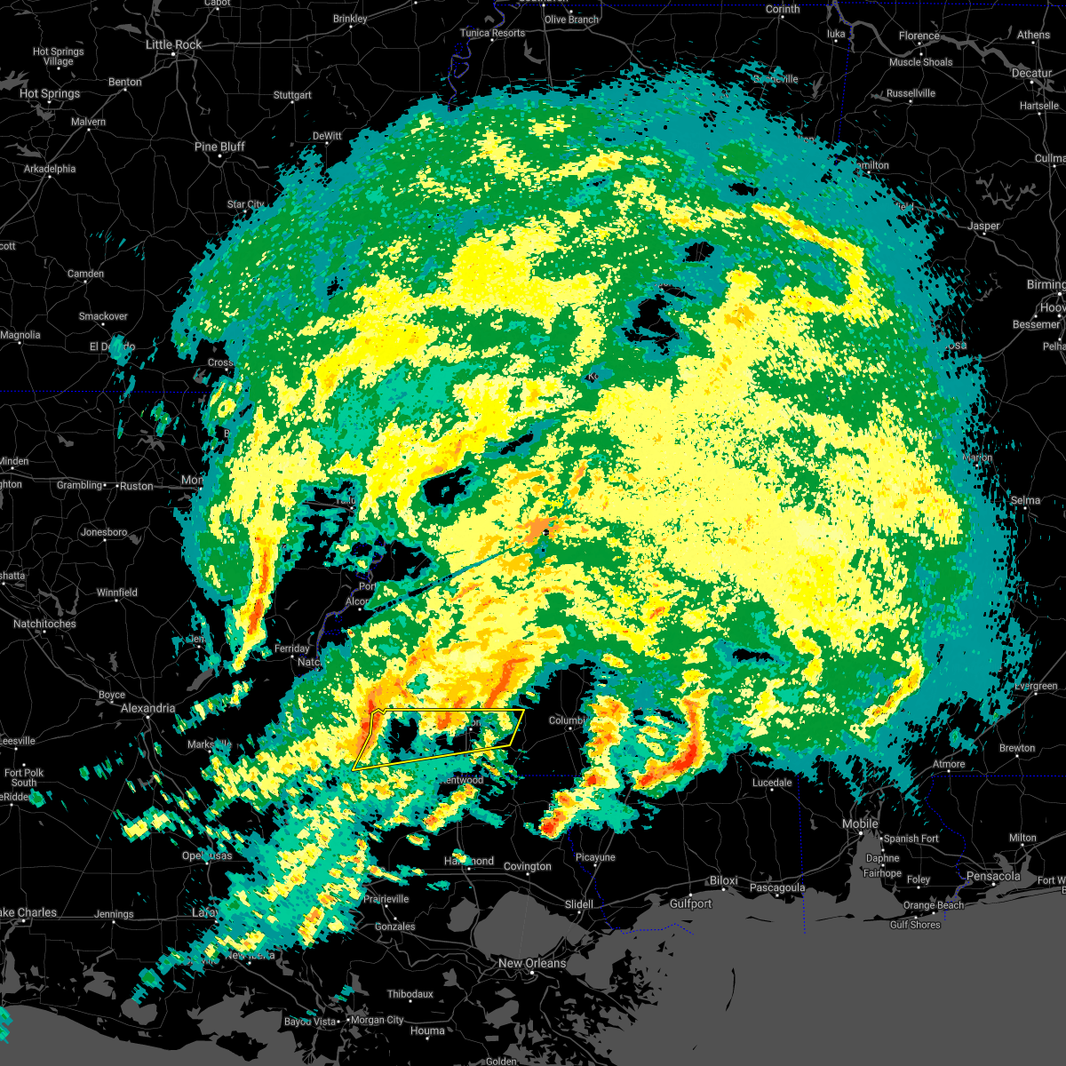 At 125 am cdt, severe thunderstorms were located along a line extending from 7 miles south of kirby to near gloster to near centreville, moving east at 65 mph (radar indicated). Hazards include 60 mph wind gusts and penny size hail. expect damage to roofs, siding, and trees At 125 am cdt, severe thunderstorms were located along a line extending from 7 miles south of kirby to near gloster to near centreville, moving east at 65 mph (radar indicated). Hazards include 60 mph wind gusts and penny size hail. expect damage to roofs, siding, and trees
|
| 4/15/2021 4:36 AM CDT |
 At 436 am cdt, a severe thunderstorm was located near woodville, or 16 miles north of jackson, moving east at 35 mph (radar indicated). Hazards include 60 mph wind gusts and quarter size hail. Hail damage to vehicles is expected. Expect wind damage to roofs, siding, and trees. At 436 am cdt, a severe thunderstorm was located near woodville, or 16 miles north of jackson, moving east at 35 mph (radar indicated). Hazards include 60 mph wind gusts and quarter size hail. Hail damage to vehicles is expected. Expect wind damage to roofs, siding, and trees.
|
| 4/10/2021 3:20 AM CDT |
 At 320 am cdt, severe thunderstorms were located along a line extending from 7 miles southwest of woodville to near melville, moving northeast at 40 mph (radar indicated). Hazards include 60 mph wind gusts and nickel size hail. expect damage to roofs, siding, and trees At 320 am cdt, severe thunderstorms were located along a line extending from 7 miles southwest of woodville to near melville, moving northeast at 40 mph (radar indicated). Hazards include 60 mph wind gusts and nickel size hail. expect damage to roofs, siding, and trees
|
| 4/7/2021 11:48 PM CDT |
 At 1147 pm cdt, a severe thunderstorm was located near norwood, or 10 miles north of jackson, moving east at 40 mph (radar indicated). Hazards include 60 mph wind gusts and quarter size hail. Hail damage to vehicles is expected. expect wind damage to roofs, siding, and trees. Locations impacted include, centreville, gloster, wilson, norwood, felps and spillman. At 1147 pm cdt, a severe thunderstorm was located near norwood, or 10 miles north of jackson, moving east at 40 mph (radar indicated). Hazards include 60 mph wind gusts and quarter size hail. Hail damage to vehicles is expected. expect wind damage to roofs, siding, and trees. Locations impacted include, centreville, gloster, wilson, norwood, felps and spillman.
|
| 4/7/2021 11:27 PM CDT |
 At 1126 pm cdt, a severe thunderstorm was located near woodville, or 15 miles northwest of jackson, moving east at 35 mph (radar indicated). Hazards include ping pong ball size hail and 60 mph wind gusts. People and animals outdoors will be injured. expect hail damage to roofs, siding, windows, and vehicles. expect wind damage to roofs, siding, and trees. locations impacted include, centreville, woodville, gloster, wilson, norwood, spillman and felps. This is a separate storm not associated with the tornado warning and may become the dominant storm soon. At 1126 pm cdt, a severe thunderstorm was located near woodville, or 15 miles northwest of jackson, moving east at 35 mph (radar indicated). Hazards include ping pong ball size hail and 60 mph wind gusts. People and animals outdoors will be injured. expect hail damage to roofs, siding, windows, and vehicles. expect wind damage to roofs, siding, and trees. locations impacted include, centreville, woodville, gloster, wilson, norwood, spillman and felps. This is a separate storm not associated with the tornado warning and may become the dominant storm soon.
|
| 4/7/2021 11:22 PM CDT |
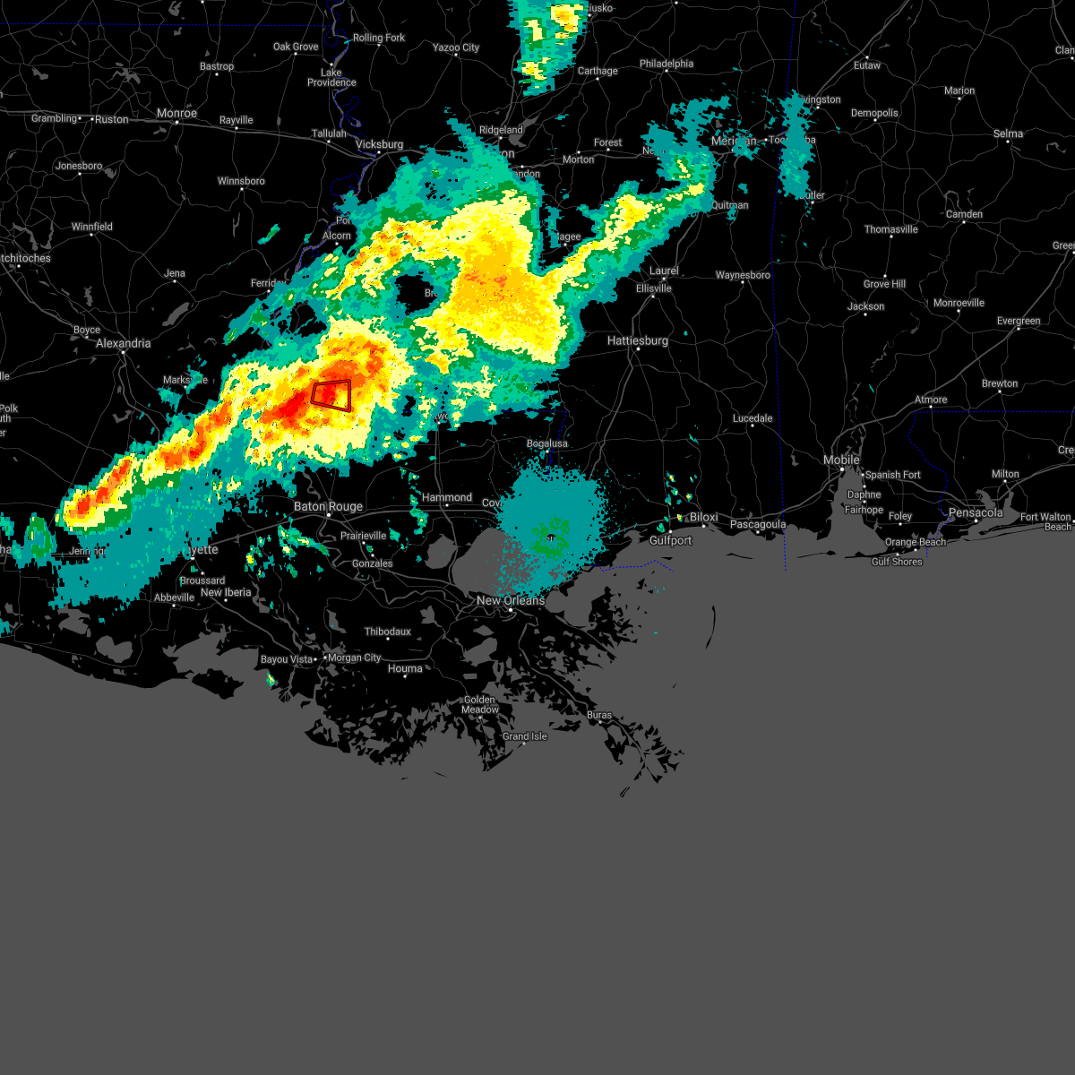 At 1122 pm cdt, a severe thunderstorm capable of producing a tornado was located near woodville, or 16 miles north of jackson, moving east at 30 mph (radar indicated rotation). Hazards include tornado and quarter size hail. Flying debris will be dangerous to those caught without shelter. mobile homes will be damaged or destroyed. damage to roofs, windows, and vehicles will occur. tree damage is likely. This dangerous storm will be near, centreville around 1140 pm cdt. At 1122 pm cdt, a severe thunderstorm capable of producing a tornado was located near woodville, or 16 miles north of jackson, moving east at 30 mph (radar indicated rotation). Hazards include tornado and quarter size hail. Flying debris will be dangerous to those caught without shelter. mobile homes will be damaged or destroyed. damage to roofs, windows, and vehicles will occur. tree damage is likely. This dangerous storm will be near, centreville around 1140 pm cdt.
|
| 4/7/2021 11:12 PM CDT |
 At 1112 pm cdt, a severe thunderstorm capable of producing a tornado was located over woodville, or 16 miles north of jackson, moving east at 30 mph (radar indicated rotation). Hazards include tornado and half dollar size hail. Flying debris will be dangerous to those caught without shelter. mobile homes will be damaged or destroyed. damage to roofs, windows, and vehicles will occur. tree damage is likely. This dangerous storm will be near, centreville around 1140 pm cdt. At 1112 pm cdt, a severe thunderstorm capable of producing a tornado was located over woodville, or 16 miles north of jackson, moving east at 30 mph (radar indicated rotation). Hazards include tornado and half dollar size hail. Flying debris will be dangerous to those caught without shelter. mobile homes will be damaged or destroyed. damage to roofs, windows, and vehicles will occur. tree damage is likely. This dangerous storm will be near, centreville around 1140 pm cdt.
|
| 4/7/2021 10:50 PM CDT |
 At 1050 pm cdt, a severe thunderstorm was located near woodville, or 19 miles north of st. francisville, moving east at 35 mph (radar indicated). Hazards include ping pong ball size hail and 60 mph wind gusts. People and animals outdoors will be injured. expect hail damage to roofs, siding, windows, and vehicles. Expect wind damage to roofs, siding, and trees. At 1050 pm cdt, a severe thunderstorm was located near woodville, or 19 miles north of st. francisville, moving east at 35 mph (radar indicated). Hazards include ping pong ball size hail and 60 mph wind gusts. People and animals outdoors will be injured. expect hail damage to roofs, siding, windows, and vehicles. Expect wind damage to roofs, siding, and trees.
|
| 3/24/2021 9:38 PM CDT |
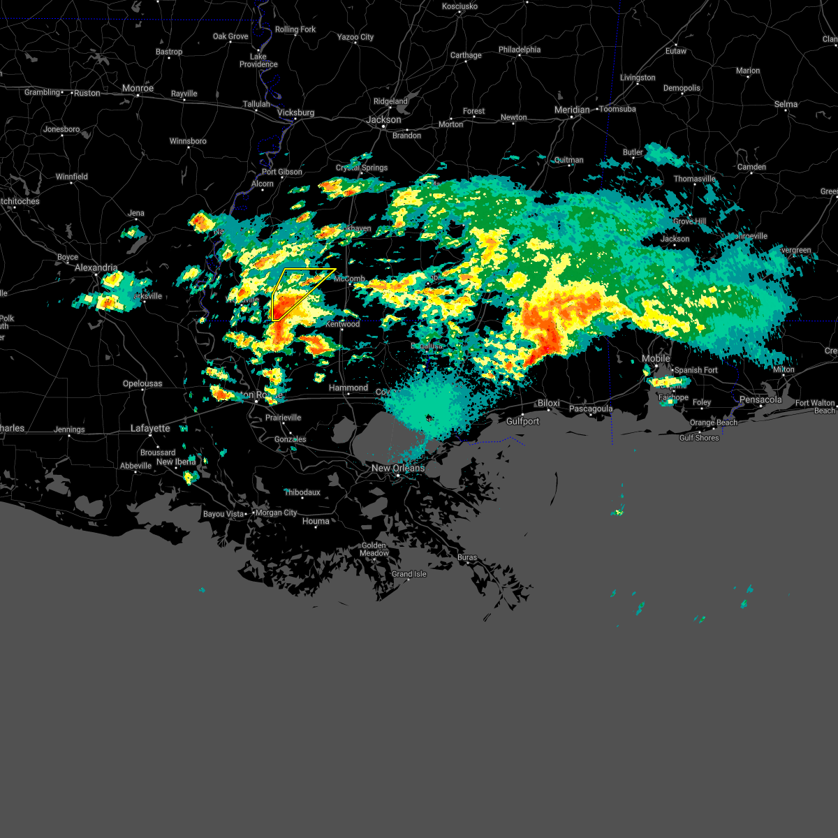 At 937 pm cdt, a severe thunderstorm was located over centreville, or 13 miles southwest of liberty, moving northeast at 35 mph (radar indicated). Hazards include quarter size hail. Damage to vehicles is expected. Locations impacted include, liberty, centreville, gloster and smithdale. At 937 pm cdt, a severe thunderstorm was located over centreville, or 13 miles southwest of liberty, moving northeast at 35 mph (radar indicated). Hazards include quarter size hail. Damage to vehicles is expected. Locations impacted include, liberty, centreville, gloster and smithdale.
|
| 3/24/2021 9:29 PM CDT |
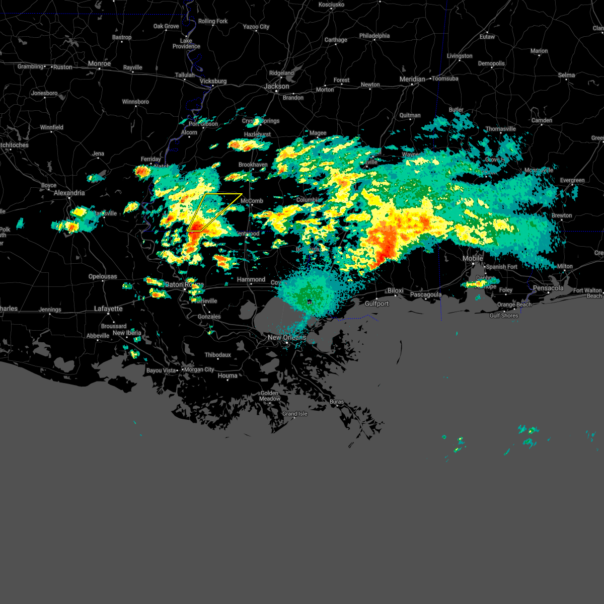 At 928 pm cdt, a severe thunderstorm was located near norwood, or 10 miles north of clinton, moving northeast at 35 mph (radar indicated). Hazards include quarter size hail. damage to vehicles is expected At 928 pm cdt, a severe thunderstorm was located near norwood, or 10 miles north of clinton, moving northeast at 35 mph (radar indicated). Hazards include quarter size hail. damage to vehicles is expected
|
| 3/24/2021 9:15 PM CDT |
 At 915 pm cdt, a severe thunderstorm was located over wilson, or 7 miles northeast of jackson, moving northeast at 45 mph (radar indicated). Hazards include ping pong ball size hail. People and animals outdoors will be injured. expect damage to roofs, siding, windows, and vehicles. Locations impacted include, centreville, gloster, wilson and norwood. At 915 pm cdt, a severe thunderstorm was located over wilson, or 7 miles northeast of jackson, moving northeast at 45 mph (radar indicated). Hazards include ping pong ball size hail. People and animals outdoors will be injured. expect damage to roofs, siding, windows, and vehicles. Locations impacted include, centreville, gloster, wilson and norwood.
|
| 3/24/2021 9:02 PM CDT |
 At 902 pm cdt, a severe thunderstorm was located over jackson, moving northeast at 45 mph (radar indicated). Hazards include quarter size hail. damage to vehicles is expected At 902 pm cdt, a severe thunderstorm was located over jackson, moving northeast at 45 mph (radar indicated). Hazards include quarter size hail. damage to vehicles is expected
|
| 3/24/2021 3:10 PM CDT | Quarter sized hail reported 0.6 miles SSE of Centreville, MS, picture of quarter-sized hail in centreville relayed via social media. |
| 3/23/2021 8:06 AM CDT |
 At 805 am cdt, a severe thunderstorm was located over centreville, or 13 miles west of liberty, moving northeast at 40 mph (radar indicated). Hazards include 60 mph wind gusts and quarter size hail. Hail damage to vehicles is expected. expect wind damage to roofs, siding, and trees. Locations impacted include, liberty, centreville, gloster and norwood. At 805 am cdt, a severe thunderstorm was located over centreville, or 13 miles west of liberty, moving northeast at 40 mph (radar indicated). Hazards include 60 mph wind gusts and quarter size hail. Hail damage to vehicles is expected. expect wind damage to roofs, siding, and trees. Locations impacted include, liberty, centreville, gloster and norwood.
|
| 3/23/2021 7:47 AM CDT |
 At 746 am cdt, a severe thunderstorm was located near norwood, or 10 miles north of jackson, moving northeast at 40 mph (radar indicated). Hazards include 60 mph wind gusts and quarter size hail. Hail damage to vehicles is expected. Expect wind damage to roofs, siding, and trees. At 746 am cdt, a severe thunderstorm was located near norwood, or 10 miles north of jackson, moving northeast at 40 mph (radar indicated). Hazards include 60 mph wind gusts and quarter size hail. Hail damage to vehicles is expected. Expect wind damage to roofs, siding, and trees.
|
| 12/23/2020 11:50 PM CST |
 The severe thunderstorm warning for east central west feliciana and northwestern east feliciana parishes, southeastern wilkinson and southwestern amite counties will expire at midnight cst, the storms which prompted the warning have weakened below severe limits, and no longer pose an immediate threat to life or property. therefore, the warning will be allowed to expire. however gusty winds are still possible with these thunderstorms. a tornado watch remains in effect until 200 am cst for southeastern louisiana, and southern mississippi. to report severe weather, contact your nearest law enforcement agency. they will relay your report to the national weather service new orleans. The severe thunderstorm warning for east central west feliciana and northwestern east feliciana parishes, southeastern wilkinson and southwestern amite counties will expire at midnight cst, the storms which prompted the warning have weakened below severe limits, and no longer pose an immediate threat to life or property. therefore, the warning will be allowed to expire. however gusty winds are still possible with these thunderstorms. a tornado watch remains in effect until 200 am cst for southeastern louisiana, and southern mississippi. to report severe weather, contact your nearest law enforcement agency. they will relay your report to the national weather service new orleans.
|
| 12/23/2020 11:41 PM CST |
 At 1141 pm cst, severe thunderstorms were located along a line extending from 10 miles west of gloster to 6 miles southeast of woodville, moving east at 40 mph (radar indicated). Hazards include 60 mph wind gusts. Expect damage to roofs, siding, and trees. Locations impacted include, jackson, clinton, centreville, gloster, wilson, norwood and spillman. At 1141 pm cst, severe thunderstorms were located along a line extending from 10 miles west of gloster to 6 miles southeast of woodville, moving east at 40 mph (radar indicated). Hazards include 60 mph wind gusts. Expect damage to roofs, siding, and trees. Locations impacted include, jackson, clinton, centreville, gloster, wilson, norwood and spillman.
|
| 12/23/2020 11:41 PM CST |
 At 1130 pm cst, severe thunderstorms were located along a line extending from near woodville to 6 miles north of spillman, moving east at 40 mph (radar indicated). Hazards include 60 mph wind gusts. Expect damage to roofs, siding, and trees. Locations impacted include, jackson, clinton, centreville, gloster, wilson, norwood, wakefield, spillman and crosby. At 1130 pm cst, severe thunderstorms were located along a line extending from near woodville to 6 miles north of spillman, moving east at 40 mph (radar indicated). Hazards include 60 mph wind gusts. Expect damage to roofs, siding, and trees. Locations impacted include, jackson, clinton, centreville, gloster, wilson, norwood, wakefield, spillman and crosby.
|
| 12/23/2020 11:30 PM CST |
 At 1130 pm cst, severe thunderstorms were located along a line extending from near woodville to 6 miles north of spillman, moving east at 40 mph (radar indicated). Hazards include 60 mph wind gusts. Expect damage to roofs, siding, and trees. Locations impacted include, jackson, clinton, centreville, gloster, wilson, norwood, wakefield, spillman and crosby. At 1130 pm cst, severe thunderstorms were located along a line extending from near woodville to 6 miles north of spillman, moving east at 40 mph (radar indicated). Hazards include 60 mph wind gusts. Expect damage to roofs, siding, and trees. Locations impacted include, jackson, clinton, centreville, gloster, wilson, norwood, wakefield, spillman and crosby.
|
| 12/23/2020 11:18 PM CST |
 At 1118 pm cst, severe thunderstorms were located along a line extending from 7 miles west of woodville to 8 miles northwest of wakefield, moving east at 40 mph (radar indicated). Hazards include 60 mph wind gusts and penny size hail. Expect damage to roofs, siding, and trees. Locations impacted include, jackson, clinton, centreville, woodville, gloster, wilson, norwood, wakefield, spillman and crosby. At 1118 pm cst, severe thunderstorms were located along a line extending from 7 miles west of woodville to 8 miles northwest of wakefield, moving east at 40 mph (radar indicated). Hazards include 60 mph wind gusts and penny size hail. Expect damage to roofs, siding, and trees. Locations impacted include, jackson, clinton, centreville, woodville, gloster, wilson, norwood, wakefield, spillman and crosby.
|
| 12/23/2020 10:55 PM CST |
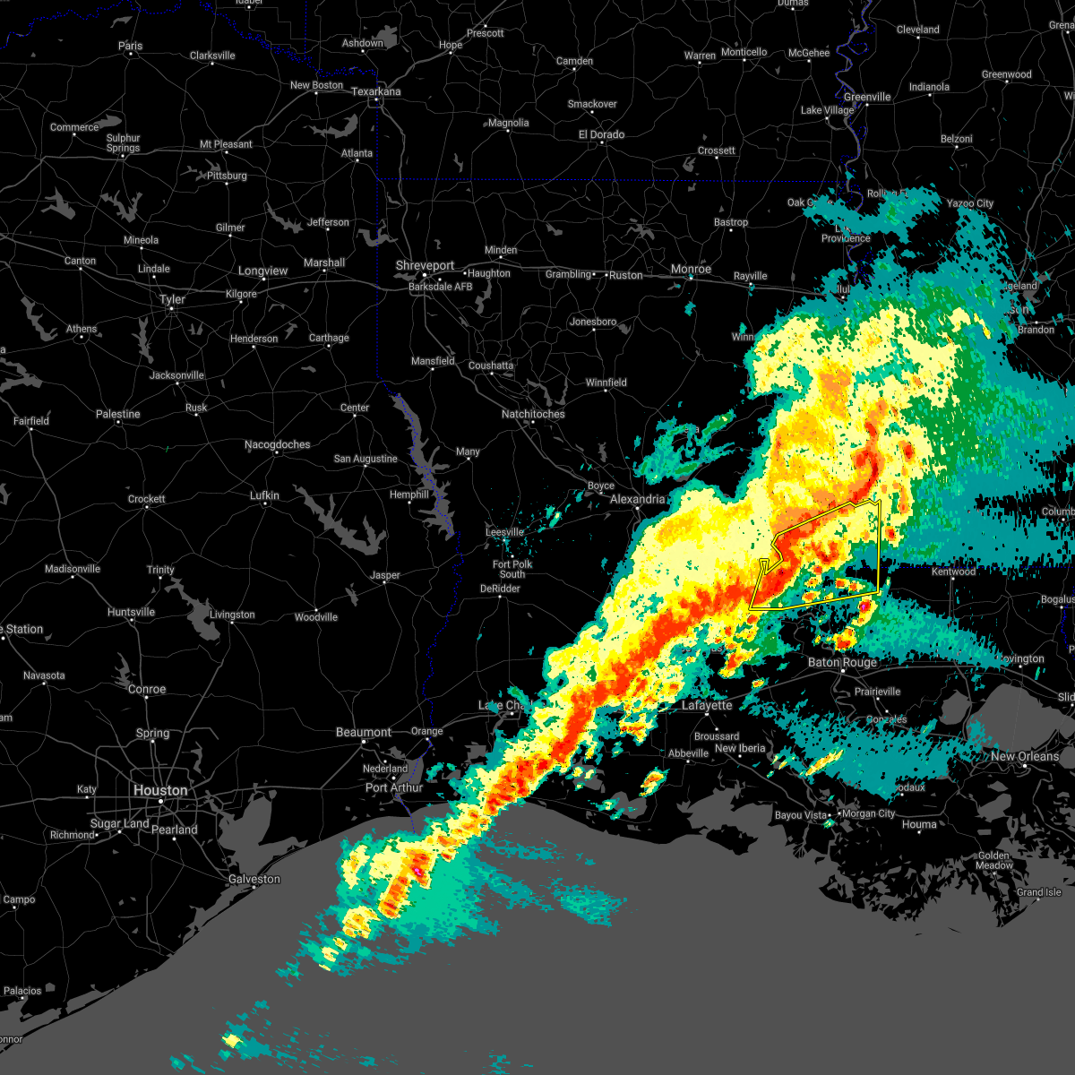 At 1054 pm cst, severe thunderstorms were located along a line extending from near fort adams to near lettsworth, moving east at 40 mph (radar indicated). Hazards include 60 mph wind gusts and penny size hail. expect damage to roofs, siding, and trees At 1054 pm cst, severe thunderstorms were located along a line extending from near fort adams to near lettsworth, moving east at 40 mph (radar indicated). Hazards include 60 mph wind gusts and penny size hail. expect damage to roofs, siding, and trees
|
| 9/23/2020 5:55 PM CDT |
 The severe thunderstorm warning for northeastern west feliciana and north central east feliciana parishes, wilkinson and northwestern amite counties will expire at 600 pm cdt, the storm which prompted the warning has weakened below severe limits, and no longer poses an immediate threat to life or property. therefore, the warning will be allowed to expire. however gusty winds are still possible with this thunderstorm. additional warnings may still be possible if these storms reintensify. a tornado watch remains in effect until 1000 pm cdt for southeastern louisiana, and southern mississippi. The severe thunderstorm warning for northeastern west feliciana and north central east feliciana parishes, wilkinson and northwestern amite counties will expire at 600 pm cdt, the storm which prompted the warning has weakened below severe limits, and no longer poses an immediate threat to life or property. therefore, the warning will be allowed to expire. however gusty winds are still possible with this thunderstorm. additional warnings may still be possible if these storms reintensify. a tornado watch remains in effect until 1000 pm cdt for southeastern louisiana, and southern mississippi.
|
| 9/23/2020 5:13 PM CDT |
 At 512 pm cdt, a severe thunderstorm was located near spillman, or 10 miles northwest of jackson, moving northeast at 30 mph (radar indicated). Hazards include 60 mph wind gusts. expect damage to roofs, siding, and trees At 512 pm cdt, a severe thunderstorm was located near spillman, or 10 miles northwest of jackson, moving northeast at 30 mph (radar indicated). Hazards include 60 mph wind gusts. expect damage to roofs, siding, and trees
|
| 8/27/2020 7:15 AM CDT |
 At 714 am cdt, a severe thunderstorm was located along a line near spillman, or 12 miles north of jackson, moving north at 55 mph (radar indicated). Hazards include 60 mph wind gusts. Expect damage to roofs, siding, and trees. locations impacted include, jackson, st. Francisville, clinton, liberty, centreville, woodville, slaughter, gloster, wilson, norwood, wakefield, spillman, fort adams, dolorosa, felps and crosby. At 714 am cdt, a severe thunderstorm was located along a line near spillman, or 12 miles north of jackson, moving north at 55 mph (radar indicated). Hazards include 60 mph wind gusts. Expect damage to roofs, siding, and trees. locations impacted include, jackson, st. Francisville, clinton, liberty, centreville, woodville, slaughter, gloster, wilson, norwood, wakefield, spillman, fort adams, dolorosa, felps and crosby.
|
| 8/27/2020 7:01 AM CDT |
 At 700 am cdt, a severe thunderstorm was located along a line near jackson, moving north at 55 mph (radar indicated). Hazards include 60 mph wind gusts. expect damage to roofs, siding, and trees At 700 am cdt, a severe thunderstorm was located along a line near jackson, moving north at 55 mph (radar indicated). Hazards include 60 mph wind gusts. expect damage to roofs, siding, and trees
|
| 8/26/2020 7:41 PM CDT |
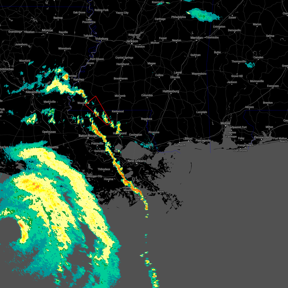 The national weather service in new orleans has issued a * tornado warning for. central st. helena parish in southeastern louisiana. northeastern east feliciana parish in southeastern louisiana. southeastern wilkinson county in southern mississippi. Southwestern amite county in southern mississippi. The national weather service in new orleans has issued a * tornado warning for. central st. helena parish in southeastern louisiana. northeastern east feliciana parish in southeastern louisiana. southeastern wilkinson county in southern mississippi. Southwestern amite county in southern mississippi.
|
| 8/26/2020 7:41 PM CDT |
 At 741 pm cdt, a severe thunderstorm capable of producing a tornado was located near greensburg, moving northwest at 30 mph (radar indicated rotation). Hazards include tornado. Flying debris will be dangerous to those caught without shelter. mobile homes will be damaged or destroyed. damage to roofs, windows, and vehicles will occur. Tree damage is likely. At 741 pm cdt, a severe thunderstorm capable of producing a tornado was located near greensburg, moving northwest at 30 mph (radar indicated rotation). Hazards include tornado. Flying debris will be dangerous to those caught without shelter. mobile homes will be damaged or destroyed. damage to roofs, windows, and vehicles will occur. Tree damage is likely.
|
| 8/26/2020 5:40 PM CDT |
 At 540 pm cdt, a severe thunderstorm capable of producing a tornado was located near clinton, moving northwest at 35 mph (radar indicated rotation). Hazards include tornado. Flying debris will be dangerous to those caught without shelter. mobile homes will be damaged or destroyed. damage to roofs, windows, and vehicles will occur. tree damage is likely. this dangerous storm will be near, wilson around 555 pm cdt. norwood around 600 pm cdt. Centreville around 605 pm cdt. At 540 pm cdt, a severe thunderstorm capable of producing a tornado was located near clinton, moving northwest at 35 mph (radar indicated rotation). Hazards include tornado. Flying debris will be dangerous to those caught without shelter. mobile homes will be damaged or destroyed. damage to roofs, windows, and vehicles will occur. tree damage is likely. this dangerous storm will be near, wilson around 555 pm cdt. norwood around 600 pm cdt. Centreville around 605 pm cdt.
|
| 6/25/2020 3:25 PM CDT |
 At 325 pm cdt, severe thunderstorms were located along a line extending from near garden city to montpelier, moving northeast at 50 mph (radar indicated). Hazards include 60 mph wind gusts. expect damage to roofs, siding, and trees At 325 pm cdt, severe thunderstorms were located along a line extending from near garden city to montpelier, moving northeast at 50 mph (radar indicated). Hazards include 60 mph wind gusts. expect damage to roofs, siding, and trees
|
| 6/25/2020 3:25 PM CDT |
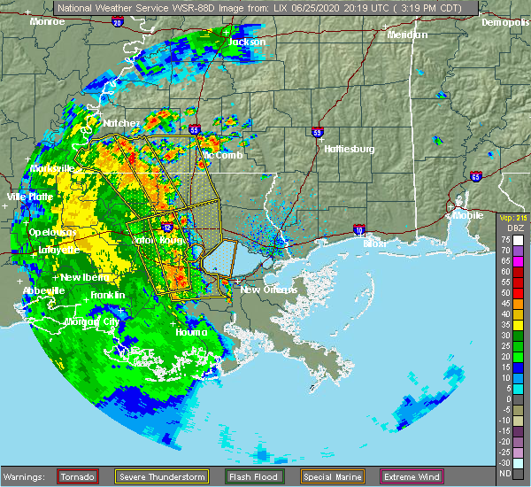 At 325 pm cdt, severe thunderstorms were located along a line extending from near garden city to montpelier, moving northeast at 50 mph (radar indicated). Hazards include 60 mph wind gusts. expect damage to roofs, siding, and trees At 325 pm cdt, severe thunderstorms were located along a line extending from near garden city to montpelier, moving northeast at 50 mph (radar indicated). Hazards include 60 mph wind gusts. expect damage to roofs, siding, and trees
|
| 6/25/2020 3:14 PM CDT |
 At 313 pm cdt, severe thunderstorms were located along a line extending from near kingston to 6 miles west of darlington, moving northeast at 65 mph (radar indicated). Hazards include 60 mph wind gusts. Expect damage to roofs, siding, and trees. Locations impacted include, jackson, clinton, greensburg, centreville, woodville, slaughter, gloster, wilson, norwood, montpelier, spillman, darlington, pride, fort adams, dolorosa, felps, greenwell spring and crosby. At 313 pm cdt, severe thunderstorms were located along a line extending from near kingston to 6 miles west of darlington, moving northeast at 65 mph (radar indicated). Hazards include 60 mph wind gusts. Expect damage to roofs, siding, and trees. Locations impacted include, jackson, clinton, greensburg, centreville, woodville, slaughter, gloster, wilson, norwood, montpelier, spillman, darlington, pride, fort adams, dolorosa, felps, greenwell spring and crosby.
|
| 6/25/2020 2:58 PM CDT |
 At 257 pm cdt, severe thunderstorms were located along a line extending from 7 miles northeast of fort adams to near pride, moving northeast at 60 mph (radar indicated). Hazards include 60 mph wind gusts. expect damage to roofs, siding, and trees At 257 pm cdt, severe thunderstorms were located along a line extending from 7 miles northeast of fort adams to near pride, moving northeast at 60 mph (radar indicated). Hazards include 60 mph wind gusts. expect damage to roofs, siding, and trees
|
| 5/23/2020 3:12 PM CDT |
 At 311 pm cdt, a severe thunderstorm was located near felps, or near clinton, moving northeast at 20 mph (radar indicated). Hazards include 60 mph wind gusts and penny size hail. expect damage to roofs, siding, and trees At 311 pm cdt, a severe thunderstorm was located near felps, or near clinton, moving northeast at 20 mph (radar indicated). Hazards include 60 mph wind gusts and penny size hail. expect damage to roofs, siding, and trees
|
| 5/8/2020 9:38 AM CDT |
 At 937 am cdt, severe thunderstorms were located along a line extending from wesson to center point to near fort adams, moving east at 50 mph (radar indicated). Hazards include 60 mph wind gusts. Expect damage to roofs, siding, and trees. Locations impacted include, mccomb, liberty, summit, centreville, woodville, gloster, norwood, smithdale, fort adams, dolorosa and crosby. At 937 am cdt, severe thunderstorms were located along a line extending from wesson to center point to near fort adams, moving east at 50 mph (radar indicated). Hazards include 60 mph wind gusts. Expect damage to roofs, siding, and trees. Locations impacted include, mccomb, liberty, summit, centreville, woodville, gloster, norwood, smithdale, fort adams, dolorosa and crosby.
|
| 5/8/2020 9:08 AM CDT |
 At 908 am cdt, severe thunderstorms were located along a line extending from near peyton to near kirby to acme, moving southeast at 40 mph (radar indicated). Hazards include 60 mph wind gusts. expect damage to roofs, siding, and trees At 908 am cdt, severe thunderstorms were located along a line extending from near peyton to near kirby to acme, moving southeast at 40 mph (radar indicated). Hazards include 60 mph wind gusts. expect damage to roofs, siding, and trees
|
| 4/23/2020 3:36 AM CDT |
 The severe thunderstorm warning for northern pike and amite counties will expire at 345 am cdt, the storm which prompted the warning has moved out of the area. therefore, the warning will be allowed to expire. however gusty winds and heavy rain are still possible with this thunderstorm. a tornado watch remains in effect until 700 am cdt for southern mississippi. remember, a tornado warning still remains in effect for pike county until 415 am cdt. The severe thunderstorm warning for northern pike and amite counties will expire at 345 am cdt, the storm which prompted the warning has moved out of the area. therefore, the warning will be allowed to expire. however gusty winds and heavy rain are still possible with this thunderstorm. a tornado watch remains in effect until 700 am cdt for southern mississippi. remember, a tornado warning still remains in effect for pike county until 415 am cdt.
|
| 4/23/2020 2:53 AM CDT |
 The severe thunderstorm warning for wilkinson county will expire at 300 am cdt, the storm which prompted the warning has moved out of the area. therefore, the warning will be allowed to expire. however small hail, gusty winds and heavy rain are still possible with this thunderstorm. a tornado watch remains in effect until 500 am cdt for southern mississippi. The severe thunderstorm warning for wilkinson county will expire at 300 am cdt, the storm which prompted the warning has moved out of the area. therefore, the warning will be allowed to expire. however small hail, gusty winds and heavy rain are still possible with this thunderstorm. a tornado watch remains in effect until 500 am cdt for southern mississippi.
|
| 4/23/2020 2:46 AM CDT |
 At 245 am cdt, a severe thunderstorm was located over garden city, or 22 miles northwest of liberty, moving northeast at 45 mph (radar indicated). Hazards include 60 mph wind gusts and quarter size hail. Hail damage to vehicles is expected. expect wind damage to roofs, siding, and trees. Locations impacted include, centreville, woodville, dolorosa and crosby. At 245 am cdt, a severe thunderstorm was located over garden city, or 22 miles northwest of liberty, moving northeast at 45 mph (radar indicated). Hazards include 60 mph wind gusts and quarter size hail. Hail damage to vehicles is expected. expect wind damage to roofs, siding, and trees. Locations impacted include, centreville, woodville, dolorosa and crosby.
|
| 4/23/2020 2:44 AM CDT |
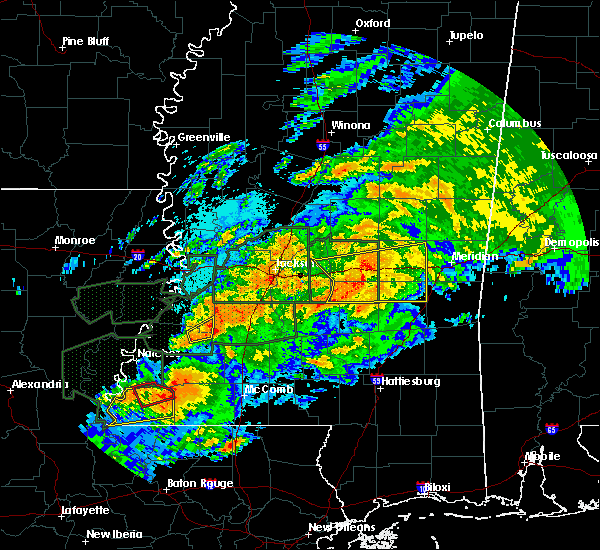 At 243 am cdt, a severe thunderstorm was located over gloster, or 12 miles west of liberty, moving east at 35 mph (radar indicated). Hazards include 60 mph wind gusts and quarter size hail. Hail damage to vehicles is expected. Expect wind damage to roofs, siding, and trees. At 243 am cdt, a severe thunderstorm was located over gloster, or 12 miles west of liberty, moving east at 35 mph (radar indicated). Hazards include 60 mph wind gusts and quarter size hail. Hail damage to vehicles is expected. Expect wind damage to roofs, siding, and trees.
|
| 4/23/2020 2:01 AM CDT |
 At 200 am cdt, a severe thunderstorm was located near black hawk, or 16 miles northeast of simmesport, moving northeast at 45 mph (radar indicated). Hazards include ping pong ball size hail and 60 mph wind gusts. People and animals outdoors will be injured. expect hail damage to roofs, siding, windows, and vehicles. Expect wind damage to roofs, siding, and trees. At 200 am cdt, a severe thunderstorm was located near black hawk, or 16 miles northeast of simmesport, moving northeast at 45 mph (radar indicated). Hazards include ping pong ball size hail and 60 mph wind gusts. People and animals outdoors will be injured. expect hail damage to roofs, siding, windows, and vehicles. Expect wind damage to roofs, siding, and trees.
|
| 4/19/2020 5:53 PM CDT |
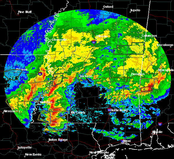 At 553 pm cdt, a severe thunderstorm was located 8 miles northeast of gloster, or 14 miles northwest of liberty, moving east at 50 mph (radar indicated). Hazards include golf ball size hail and 60 mph wind gusts. People and animals outdoors will be injured. expect hail damage to roofs, siding, windows, and vehicles. expect wind damage to roofs, siding, and trees. Locations impacted include, liberty, centreville, gloster, smithdale and crosby. At 553 pm cdt, a severe thunderstorm was located 8 miles northeast of gloster, or 14 miles northwest of liberty, moving east at 50 mph (radar indicated). Hazards include golf ball size hail and 60 mph wind gusts. People and animals outdoors will be injured. expect hail damage to roofs, siding, windows, and vehicles. expect wind damage to roofs, siding, and trees. Locations impacted include, liberty, centreville, gloster, smithdale and crosby.
|
| 4/19/2020 5:41 PM CDT |
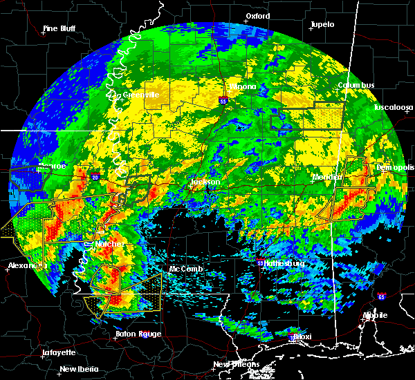 At 541 pm cdt, a severe thunderstorm was located 7 miles northwest of gloster, or 19 miles west of liberty, moving northeast at 50 mph (radar indicated). Hazards include ping pong ball size hail and 60 mph wind gusts. People and animals outdoors will be injured. expect hail damage to roofs, siding, windows, and vehicles. Expect wind damage to roofs, siding, and trees. At 541 pm cdt, a severe thunderstorm was located 7 miles northwest of gloster, or 19 miles west of liberty, moving northeast at 50 mph (radar indicated). Hazards include ping pong ball size hail and 60 mph wind gusts. People and animals outdoors will be injured. expect hail damage to roofs, siding, windows, and vehicles. Expect wind damage to roofs, siding, and trees.
|
| 4/19/2020 5:32 PM CDT |
 At 532 pm cdt, a severe thunderstorm was located 8 miles northeast of woodville, or 24 miles west of liberty, moving northeast at 50 mph (radar indicated). Hazards include 60 mph wind gusts and half dollar size hail. Hail damage to vehicles is expected. expect wind damage to roofs, siding, and trees. Locations impacted include, centreville, woodville and crosby. At 532 pm cdt, a severe thunderstorm was located 8 miles northeast of woodville, or 24 miles west of liberty, moving northeast at 50 mph (radar indicated). Hazards include 60 mph wind gusts and half dollar size hail. Hail damage to vehicles is expected. expect wind damage to roofs, siding, and trees. Locations impacted include, centreville, woodville and crosby.
|
| 4/19/2020 5:23 PM CDT |
 At 523 pm cdt, a severe thunderstorm was located near woodville, or 24 miles north of jackson, moving northeast at 55 mph (radar indicated). Hazards include 60 mph wind gusts and quarter size hail. Hail damage to vehicles is expected. expect wind damage to roofs, siding, and trees. Locations impacted include, centreville, woodville and crosby. At 523 pm cdt, a severe thunderstorm was located near woodville, or 24 miles north of jackson, moving northeast at 55 mph (radar indicated). Hazards include 60 mph wind gusts and quarter size hail. Hail damage to vehicles is expected. expect wind damage to roofs, siding, and trees. Locations impacted include, centreville, woodville and crosby.
|
| 4/19/2020 5:11 PM CDT |
 At 510 pm cdt, a severe thunderstorm was located near fort adams, or 21 miles north of st. francisville, moving northeast at 65 mph (radar indicated). Hazards include 60 mph wind gusts and quarter size hail. Hail damage to vehicles is expected. Expect wind damage to roofs, siding, and trees. At 510 pm cdt, a severe thunderstorm was located near fort adams, or 21 miles north of st. francisville, moving northeast at 65 mph (radar indicated). Hazards include 60 mph wind gusts and quarter size hail. Hail damage to vehicles is expected. Expect wind damage to roofs, siding, and trees.
|
| 4/12/2020 8:40 PM CDT |
 At 840 pm cdt, a severe thunderstorm was located near fort adams, or 23 miles northeast of simmesport, moving east at 75 mph (radar indicated). Hazards include 60 mph wind gusts and quarter size hail. Hail damage to vehicles is expected. Expect wind damage to roofs, siding, and trees. At 840 pm cdt, a severe thunderstorm was located near fort adams, or 23 miles northeast of simmesport, moving east at 75 mph (radar indicated). Hazards include 60 mph wind gusts and quarter size hail. Hail damage to vehicles is expected. Expect wind damage to roofs, siding, and trees.
|
| 12/16/2019 4:29 PM CST |
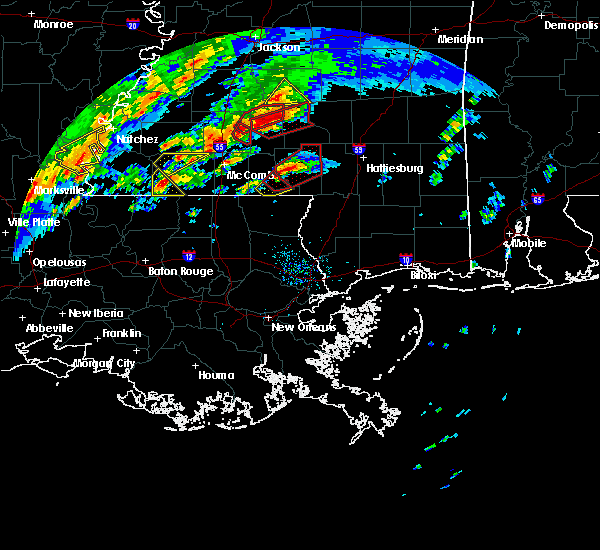 At 429 pm cst, a severe thunderstorm was located near centreville, or 12 miles southwest of liberty, moving northeast at 40 mph (radar indicated). Hazards include 60 mph wind gusts. Expect damage to roofs, siding, and trees. Locations impacted include, centreville and gloster. At 429 pm cst, a severe thunderstorm was located near centreville, or 12 miles southwest of liberty, moving northeast at 40 mph (radar indicated). Hazards include 60 mph wind gusts. Expect damage to roofs, siding, and trees. Locations impacted include, centreville and gloster.
|
| 12/16/2019 4:22 PM CST |
 At 421 pm cst, a severe thunderstorm was located near centreville, or 11 miles north of clinton, moving northeast at 40 mph (radar indicated). Hazards include 60 mph wind gusts. Expect damage to roofs, siding, and trees. Locations impacted include, centreville, gloster, norwood and felps. At 421 pm cst, a severe thunderstorm was located near centreville, or 11 miles north of clinton, moving northeast at 40 mph (radar indicated). Hazards include 60 mph wind gusts. Expect damage to roofs, siding, and trees. Locations impacted include, centreville, gloster, norwood and felps.
|
| 12/16/2019 4:20 PM CST | Half Dollar sized hail reported 1 miles W of Centreville, MS, public reported half dollar sized hail near centreville... ms in amite county. |
| 12/16/2019 4:12 PM CST |
 At 412 pm cst, a severe thunderstorm was located over norwood, or 10 miles northwest of clinton, moving northeast at 40 mph (radar indicated). Hazards include 60 mph wind gusts. expect damage to roofs, siding, and trees At 412 pm cst, a severe thunderstorm was located over norwood, or 10 miles northwest of clinton, moving northeast at 40 mph (radar indicated). Hazards include 60 mph wind gusts. expect damage to roofs, siding, and trees
|
| 12/16/2019 2:09 PM CST |
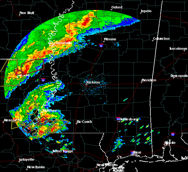 At 209 pm cst, a severe thunderstorm was located near centreville, or 17 miles north of clinton, moving northeast at 30 mph (radar indicated). Hazards include 60 mph wind gusts and quarter size hail. Hail damage to vehicles is expected. Expect wind damage to roofs, siding, and trees. At 209 pm cst, a severe thunderstorm was located near centreville, or 17 miles north of clinton, moving northeast at 30 mph (radar indicated). Hazards include 60 mph wind gusts and quarter size hail. Hail damage to vehicles is expected. Expect wind damage to roofs, siding, and trees.
|
| 12/16/2019 2:01 PM CST |
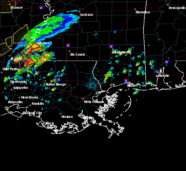 At 201 pm cst, a severe thunderstorm was located near centreville, or 15 miles north of jackson, moving northeast at 40 mph (radar indicated). Hazards include 60 mph wind gusts and quarter size hail. Hail damage to vehicles is expected. expect wind damage to roofs, siding, and trees. Locations impacted include, centreville and gloster. At 201 pm cst, a severe thunderstorm was located near centreville, or 15 miles north of jackson, moving northeast at 40 mph (radar indicated). Hazards include 60 mph wind gusts and quarter size hail. Hail damage to vehicles is expected. expect wind damage to roofs, siding, and trees. Locations impacted include, centreville and gloster.
|
| 12/16/2019 1:47 PM CST |
 At 147 pm cst, a severe thunderstorm was located over spillman, or 8 miles north of jackson, moving northeast at 40 mph (radar indicated). Hazards include 60 mph wind gusts and quarter size hail. Hail damage to vehicles is expected. Expect wind damage to roofs, siding, and trees. At 147 pm cst, a severe thunderstorm was located over spillman, or 8 miles north of jackson, moving northeast at 40 mph (radar indicated). Hazards include 60 mph wind gusts and quarter size hail. Hail damage to vehicles is expected. Expect wind damage to roofs, siding, and trees.
|
| 7/15/2019 7:06 AM CDT |
 The severe thunderstorm warning for wilkinson county will expire at 715 am cdt, the storm which prompted the warning has weakened below severe limits, and no longer poses an immediate threat to life or property. therefore, the warning will be allowed to expire. The severe thunderstorm warning for wilkinson county will expire at 715 am cdt, the storm which prompted the warning has weakened below severe limits, and no longer poses an immediate threat to life or property. therefore, the warning will be allowed to expire.
|
| 7/15/2019 6:44 AM CDT |
 At 644 am cdt, a severe thunderstorm was located 7 miles south of dolorosa, or 24 miles south of natchez, moving east at 40 mph (radar indicated). Hazards include 60 mph wind gusts. expect damage to roofs, siding, and trees At 644 am cdt, a severe thunderstorm was located 7 miles south of dolorosa, or 24 miles south of natchez, moving east at 40 mph (radar indicated). Hazards include 60 mph wind gusts. expect damage to roofs, siding, and trees
|
| 7/14/2019 9:11 AM CDT |
 The tornado warning for north central east feliciana parish, southeastern wilkinson and southwestern amite counties will expire at 915 am cdt, the storm which prompted the warning has weakened below severe limits, and no longer appears capable of producing a tornado. therefore, the warning will be allowed to expire. The tornado warning for north central east feliciana parish, southeastern wilkinson and southwestern amite counties will expire at 915 am cdt, the storm which prompted the warning has weakened below severe limits, and no longer appears capable of producing a tornado. therefore, the warning will be allowed to expire.
|
| 7/14/2019 8:55 AM CDT |
 At 855 am cdt, a severe thunderstorm capable of producing a tornado was located over clinton, moving north at 55 mph (radar indicated rotation). Hazards include tornado. Flying debris will be dangerous to those caught without shelter. mobile homes will be damaged or destroyed. damage to roofs, windows, and vehicles will occur. tree damage is likely. this dangerous storm will be near, wilson around 900 am cdt. norwood around 905 am cdt. Centreville around 910 am cdt. At 855 am cdt, a severe thunderstorm capable of producing a tornado was located over clinton, moving north at 55 mph (radar indicated rotation). Hazards include tornado. Flying debris will be dangerous to those caught without shelter. mobile homes will be damaged or destroyed. damage to roofs, windows, and vehicles will occur. tree damage is likely. this dangerous storm will be near, wilson around 900 am cdt. norwood around 905 am cdt. Centreville around 910 am cdt.
|
| 6/28/2019 2:47 PM CDT |
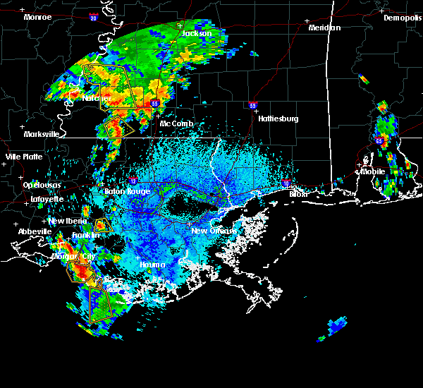 At 246 pm cdt, a severe thunderstorm was located near gloster, or 10 miles west of liberty, moving southeast at 10 mph (radar indicated). Hazards include 60 mph wind gusts and quarter size hail. Hail damage to vehicles is expected. Expect wind damage to roofs, siding, and trees. At 246 pm cdt, a severe thunderstorm was located near gloster, or 10 miles west of liberty, moving southeast at 10 mph (radar indicated). Hazards include 60 mph wind gusts and quarter size hail. Hail damage to vehicles is expected. Expect wind damage to roofs, siding, and trees.
|
| 6/24/2019 4:10 AM CDT | Report of uprooted trees and several large limbs downe in wilkinson county MS, 0.9 miles NNE of Centreville, MS |
| 6/24/2019 4:02 AM CDT |
 At 401 am cdt, severe thunderstorms were located along a line extending from 6 miles northwest of gloster to 7 miles southeast of fort adams, moving southeast at 25 mph (radar indicated). Hazards include 60 mph wind gusts. Expect damage to roofs, siding, and trees. locations impacted include, jackson, st. Francisville, liberty, centreville, woodville, gloster, wilson, norwood, wakefield, spillman, fort adams, dolorosa and crosby. At 401 am cdt, severe thunderstorms were located along a line extending from 6 miles northwest of gloster to 7 miles southeast of fort adams, moving southeast at 25 mph (radar indicated). Hazards include 60 mph wind gusts. Expect damage to roofs, siding, and trees. locations impacted include, jackson, st. Francisville, liberty, centreville, woodville, gloster, wilson, norwood, wakefield, spillman, fort adams, dolorosa and crosby.
|
| 6/24/2019 3:44 AM CDT |
 The national weather service in new orleans has issued a * severe thunderstorm warning for. northeastern west feliciana parish in southeastern louisiana. northwestern east feliciana parish in southeastern louisiana. wilkinson county in southern mississippi. Western amite county in southern mississippi. The national weather service in new orleans has issued a * severe thunderstorm warning for. northeastern west feliciana parish in southeastern louisiana. northwestern east feliciana parish in southeastern louisiana. wilkinson county in southern mississippi. Western amite county in southern mississippi.
|
| 6/24/2019 3:44 AM CDT |
 At 343 am cdt, severe thunderstorms were located along a line extending from near garden city to fort adams, moving southeast at 25 mph (radar indicated). Hazards include 60 mph wind gusts. expect damage to roofs, siding, and trees At 343 am cdt, severe thunderstorms were located along a line extending from near garden city to fort adams, moving southeast at 25 mph (radar indicated). Hazards include 60 mph wind gusts. expect damage to roofs, siding, and trees
|
| 5/9/2019 11:15 AM CDT |
 At 1115 am cdt, a severe thunderstorm was located near norwood, or 13 miles north of jackson, moving northeast at 30 mph (radar indicated). Hazards include 60 mph wind gusts and quarter size hail. Hail damage to vehicles is expected. expect wind damage to roofs, siding, and trees. Locations impacted include, centreville, gloster, wilson, norwood and felps. At 1115 am cdt, a severe thunderstorm was located near norwood, or 13 miles north of jackson, moving northeast at 30 mph (radar indicated). Hazards include 60 mph wind gusts and quarter size hail. Hail damage to vehicles is expected. expect wind damage to roofs, siding, and trees. Locations impacted include, centreville, gloster, wilson, norwood and felps.
|
| 5/9/2019 11:00 AM CDT | Large tree on home in centreville via social medi in wilkinson county MS, 0.6 miles SSE of Centreville, MS |
| 5/9/2019 10:54 AM CDT |
 At 1053 am cdt, a severe thunderstorm was located near wakefield, or 11 miles north of st. francisville, moving east at 30 mph (radar indicated). Hazards include 60 mph wind gusts and quarter size hail. Hail damage to vehicles is expected. Expect wind damage to roofs, siding, and trees. At 1053 am cdt, a severe thunderstorm was located near wakefield, or 11 miles north of st. francisville, moving east at 30 mph (radar indicated). Hazards include 60 mph wind gusts and quarter size hail. Hail damage to vehicles is expected. Expect wind damage to roofs, siding, and trees.
|
| 5/9/2019 10:42 AM CDT |
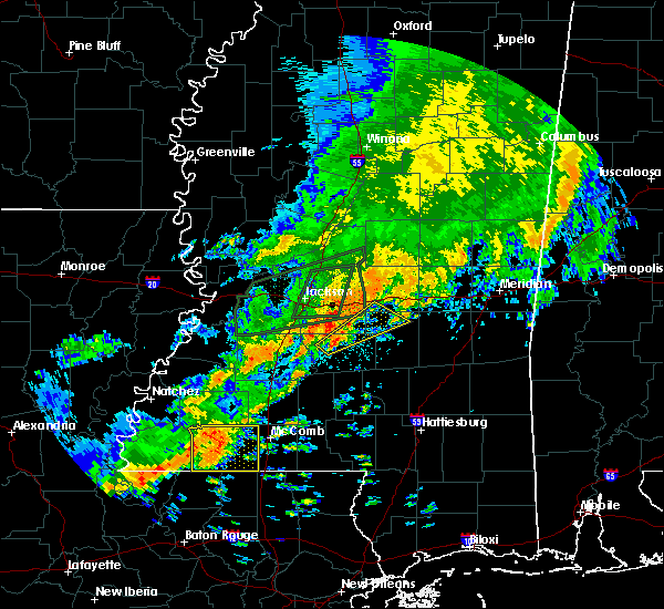 At 1042 am cdt, a severe thunderstorm was located 7 miles east of gloster, or 7 miles northwest of liberty, moving east at 35 mph (radar indicated). Hazards include 60 mph wind gusts and nickel size hail. Expect damage to roofs, siding, and trees. Locations impacted include, liberty, centreville, gloster, smithdale, gillsberg and crosby. At 1042 am cdt, a severe thunderstorm was located 7 miles east of gloster, or 7 miles northwest of liberty, moving east at 35 mph (radar indicated). Hazards include 60 mph wind gusts and nickel size hail. Expect damage to roofs, siding, and trees. Locations impacted include, liberty, centreville, gloster, smithdale, gillsberg and crosby.
|
| 5/9/2019 10:28 AM CDT |
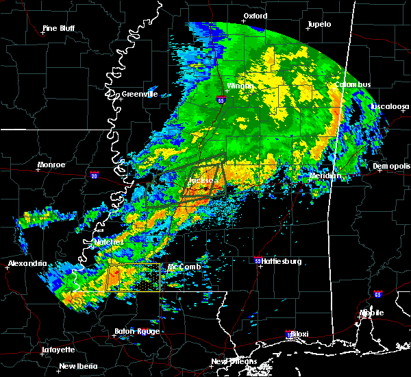 At 1027 am cdt, a severe thunderstorm was located over gloster, or 12 miles west of liberty, moving east at 35 mph (radar indicated). Hazards include 60 mph wind gusts and nickel size hail. expect damage to roofs, siding, and trees At 1027 am cdt, a severe thunderstorm was located over gloster, or 12 miles west of liberty, moving east at 35 mph (radar indicated). Hazards include 60 mph wind gusts and nickel size hail. expect damage to roofs, siding, and trees
|
| 4/25/2019 8:56 AM CDT |
 The severe thunderstorm warning for northern west feliciana, northwestern pointe coupee parishes in southeastern louisiana and wilkinson counties will expire at 900 am cdt, the severe thunderstorm which prompted the warning has weakened. therefore, the warning will be allowed to expire. a tornado watch remains in effect until 300 pm cdt for southeastern louisiana, and southern mississippi. The severe thunderstorm warning for northern west feliciana, northwestern pointe coupee parishes in southeastern louisiana and wilkinson counties will expire at 900 am cdt, the severe thunderstorm which prompted the warning has weakened. therefore, the warning will be allowed to expire. a tornado watch remains in effect until 300 pm cdt for southeastern louisiana, and southern mississippi.
|
| 4/25/2019 8:23 AM CDT |
 At 823 am cdt, a severe thunderstorm was located near big bend, or near simmesport, moving east at 45 mph (radar indicated). Hazards include 60 mph wind gusts. Expect damage to roofs, siding, and trees. Locations impacted include, centreville, woodville, wakefield, lettsworth, spillman, batchelor, fort adams, dolorosa and crosby. At 823 am cdt, a severe thunderstorm was located near big bend, or near simmesport, moving east at 45 mph (radar indicated). Hazards include 60 mph wind gusts. Expect damage to roofs, siding, and trees. Locations impacted include, centreville, woodville, wakefield, lettsworth, spillman, batchelor, fort adams, dolorosa and crosby.
|
| 4/25/2019 8:06 AM CDT |
 At 805 am cdt, a severe thunderstorm was located over plaucheville, or near moreauville, moving east at 55 mph (radar indicated). Hazards include 60 mph wind gusts. expect damage to roofs, siding, and trees At 805 am cdt, a severe thunderstorm was located over plaucheville, or near moreauville, moving east at 55 mph (radar indicated). Hazards include 60 mph wind gusts. expect damage to roofs, siding, and trees
|
| 4/18/2019 2:04 PM CDT |
 At 202 pm cdt, severe thunderstorms were located along a line extending from near bude to near liberty to near clinton, moving east at 35 mph (radar indicated). Hazards include 60 mph wind gusts and penny size hail. Expect damage to roofs, siding, and trees. Locations impacted include, zachary, jackson, clinton, liberty, centreville, slaughter, gloster, wilson, norwood, smithdale, darlington, gillsberg, felps, easleyville and crosby. At 202 pm cdt, severe thunderstorms were located along a line extending from near bude to near liberty to near clinton, moving east at 35 mph (radar indicated). Hazards include 60 mph wind gusts and penny size hail. Expect damage to roofs, siding, and trees. Locations impacted include, zachary, jackson, clinton, liberty, centreville, slaughter, gloster, wilson, norwood, smithdale, darlington, gillsberg, felps, easleyville and crosby.
|
| 4/18/2019 1:48 PM CDT |
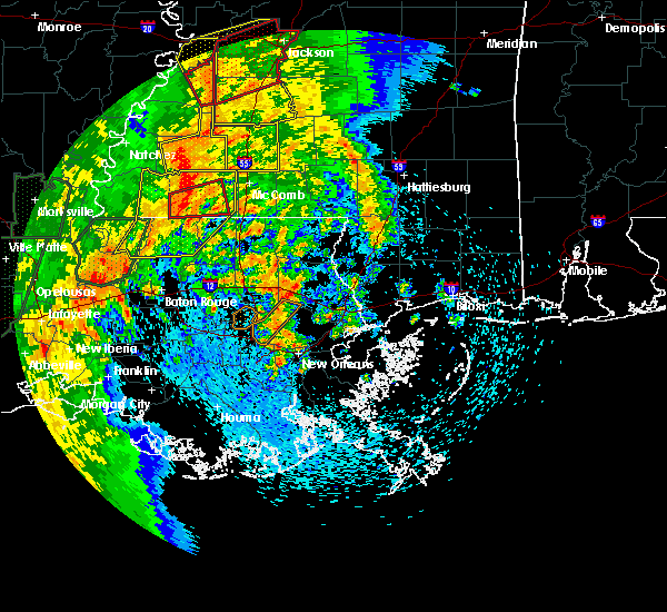 At 147 pm cdt, a severe thunderstorm capable of producing a tornado was located just east of centreville, or 12 miles west of liberty, moving east at 35 mph (radar indicated rotation). Hazards include tornado. Flying debris will be dangerous to those caught without shelter. mobile homes will be damaged or destroyed. damage to roofs, windows, and vehicles will occur. tree damage is likely. This dangerous storm will be near, liberty around 210 pm cdt. At 147 pm cdt, a severe thunderstorm capable of producing a tornado was located just east of centreville, or 12 miles west of liberty, moving east at 35 mph (radar indicated rotation). Hazards include tornado. Flying debris will be dangerous to those caught without shelter. mobile homes will be damaged or destroyed. damage to roofs, windows, and vehicles will occur. tree damage is likely. This dangerous storm will be near, liberty around 210 pm cdt.
|
| 4/18/2019 1:41 PM CDT |
 At 141 pm cdt, a severe thunderstorm capable of producing a tornado was located over centreville, or 16 miles north of clinton, moving east at 35 mph (radar indicated rotation). Hazards include tornado. Flying debris will be dangerous to those caught without shelter. mobile homes will be damaged or destroyed. damage to roofs, windows, and vehicles will occur. tree damage is likely. this dangerous storm will be near, gloster around 150 pm cdt. Liberty around 210 pm cdt. At 141 pm cdt, a severe thunderstorm capable of producing a tornado was located over centreville, or 16 miles north of clinton, moving east at 35 mph (radar indicated rotation). Hazards include tornado. Flying debris will be dangerous to those caught without shelter. mobile homes will be damaged or destroyed. damage to roofs, windows, and vehicles will occur. tree damage is likely. this dangerous storm will be near, gloster around 150 pm cdt. Liberty around 210 pm cdt.
|
| 4/18/2019 1:22 PM CDT |
 At 122 pm cdt, severe thunderstorms were located along a line extending from near garden city to 6 miles northeast of spillman to st. francisville, moving east at 35 mph (radar indicated). Hazards include 60 mph wind gusts and penny size hail. expect damage to roofs, siding, and trees At 122 pm cdt, severe thunderstorms were located along a line extending from near garden city to 6 miles northeast of spillman to st. francisville, moving east at 35 mph (radar indicated). Hazards include 60 mph wind gusts and penny size hail. expect damage to roofs, siding, and trees
|
| 4/7/2019 6:10 PM CDT |
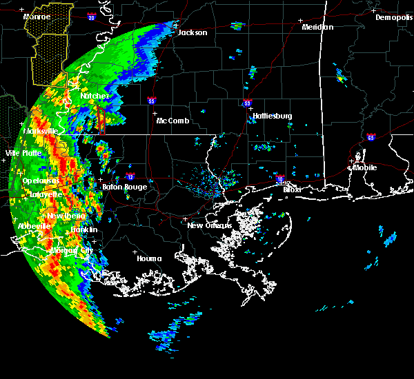 At 609 pm cdt, a severe thunderstorm capable of producing a tornado was located over centreville, or 15 miles north of clinton, moving north at 25 mph (radar indicated rotation). Hazards include tornado and quarter size hail. Flying debris will be dangerous to those caught without shelter. mobile homes will be damaged or destroyed. damage to roofs, windows, and vehicles will occur. tree damage is likely. This tornadic thunderstorm will remain over mainly rural areas of eastern wilkinson county, including the following locations, crosby. At 609 pm cdt, a severe thunderstorm capable of producing a tornado was located over centreville, or 15 miles north of clinton, moving north at 25 mph (radar indicated rotation). Hazards include tornado and quarter size hail. Flying debris will be dangerous to those caught without shelter. mobile homes will be damaged or destroyed. damage to roofs, windows, and vehicles will occur. tree damage is likely. This tornadic thunderstorm will remain over mainly rural areas of eastern wilkinson county, including the following locations, crosby.
|
| 4/7/2019 6:03 PM CDT |
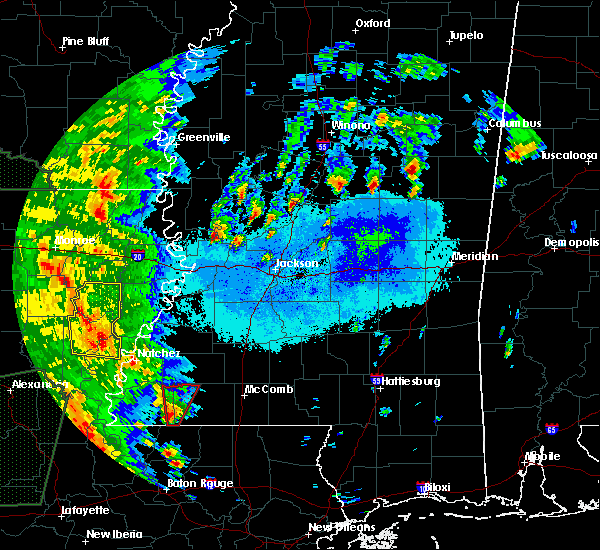 At 602 pm cdt, a severe thunderstorm capable of producing a tornado was located near norwood, or 11 miles northwest of clinton, moving north at 20 mph (radar indicated rotation). Hazards include tornado and quarter size hail. Flying debris will be dangerous to those caught without shelter. mobile homes will be damaged or destroyed. damage to roofs, windows, and vehicles will occur. tree damage is likely. this dangerous storm will be near, centreville around 615 pm cdt. gloster around 630 pm cdt. Other locations impacted by this tornadic thunderstorm include crosby. At 602 pm cdt, a severe thunderstorm capable of producing a tornado was located near norwood, or 11 miles northwest of clinton, moving north at 20 mph (radar indicated rotation). Hazards include tornado and quarter size hail. Flying debris will be dangerous to those caught without shelter. mobile homes will be damaged or destroyed. damage to roofs, windows, and vehicles will occur. tree damage is likely. this dangerous storm will be near, centreville around 615 pm cdt. gloster around 630 pm cdt. Other locations impacted by this tornadic thunderstorm include crosby.
|
| 4/7/2019 5:56 PM CDT |
 At 555 pm cdt, a severe thunderstorm capable of producing a tornado was located over norwood, or 9 miles northwest of clinton, moving north at 20 mph (radar indicated rotation). Hazards include tornado and quarter size hail. Flying debris will be dangerous to those caught without shelter. mobile homes will be damaged or destroyed. damage to roofs, windows, and vehicles will occur. tree damage is likely. this dangerous storm will be near, centreville around 615 pm cdt. gloster around 630 pm cdt. Other locations impacted by this tornadic thunderstorm include crosby. At 555 pm cdt, a severe thunderstorm capable of producing a tornado was located over norwood, or 9 miles northwest of clinton, moving north at 20 mph (radar indicated rotation). Hazards include tornado and quarter size hail. Flying debris will be dangerous to those caught without shelter. mobile homes will be damaged or destroyed. damage to roofs, windows, and vehicles will occur. tree damage is likely. this dangerous storm will be near, centreville around 615 pm cdt. gloster around 630 pm cdt. Other locations impacted by this tornadic thunderstorm include crosby.
|
| 4/7/2019 5:37 PM CDT |
 At 536 pm cdt, a severe thunderstorm was located near norwood, or 11 miles north of jackson, moving north at 30 mph (radar indicated). Hazards include 60 mph wind gusts and quarter size hail. Hail damage to vehicles is expected. Expect wind damage to roofs, siding, and trees. At 536 pm cdt, a severe thunderstorm was located near norwood, or 11 miles north of jackson, moving north at 30 mph (radar indicated). Hazards include 60 mph wind gusts and quarter size hail. Hail damage to vehicles is expected. Expect wind damage to roofs, siding, and trees.
|
| 12/27/2018 11:23 AM CST |
 The severe thunderstorm warning for wilkinson and northwestern amite counties will expire at 1130 am cst, the storms which prompted the warning have weakened below severe limits, and no longer pose an immediate threat to life or property. therefore, the warning will be allowed to expire. however gusty winds are still possible with these thunderstorms. a tornado watch remains in effect until 600 pm cst for southern mississippi. The severe thunderstorm warning for wilkinson and northwestern amite counties will expire at 1130 am cst, the storms which prompted the warning have weakened below severe limits, and no longer pose an immediate threat to life or property. therefore, the warning will be allowed to expire. however gusty winds are still possible with these thunderstorms. a tornado watch remains in effect until 600 pm cst for southern mississippi.
|
| 12/27/2018 11:02 AM CST |
 At 1100 am cst, severe thunderstorms were located along a line extending from near dolorosa to near lettsworth, moving east at 20 mph (radar indicated). Hazards include 60 mph wind gusts. Expect damage to roofs, siding, and trees. locations impacted include, centreville, woodville, fort adams, dolorosa and crosby. A tornado watch remains in effect until 600 pm cst for southern mississippi. At 1100 am cst, severe thunderstorms were located along a line extending from near dolorosa to near lettsworth, moving east at 20 mph (radar indicated). Hazards include 60 mph wind gusts. Expect damage to roofs, siding, and trees. locations impacted include, centreville, woodville, fort adams, dolorosa and crosby. A tornado watch remains in effect until 600 pm cst for southern mississippi.
|
| 12/27/2018 10:47 AM CST |
 At 1047 am cst, severe thunderstorms were located along a line extending from near dolorosa to lettsworth, moving east at 20 mph (radar indicated). Hazards include 60 mph wind gusts. expect damage to roofs, siding, and trees At 1047 am cst, severe thunderstorms were located along a line extending from near dolorosa to lettsworth, moving east at 20 mph (radar indicated). Hazards include 60 mph wind gusts. expect damage to roofs, siding, and trees
|
| 8/8/2018 6:51 PM CDT |
 The severe thunderstorm warning for eastern east feliciana parish, southeastern wilkinson and southwestern amite counties will expire at 700 pm cdt, the storm which prompted the warning has weakened below severe limits, and no longer poses an immediate threat to life or property. therefore, the warning will be allowed to expire. The severe thunderstorm warning for eastern east feliciana parish, southeastern wilkinson and southwestern amite counties will expire at 700 pm cdt, the storm which prompted the warning has weakened below severe limits, and no longer poses an immediate threat to life or property. therefore, the warning will be allowed to expire.
|
| 8/8/2018 6:33 PM CDT |
 At 633 pm cdt, a severe thunderstorm was located over norwood, or near clinton, moving northeast at 5 mph (radar indicated). Hazards include 60 mph wind gusts and penny size hail. expect damage to roofs, siding, and trees At 633 pm cdt, a severe thunderstorm was located over norwood, or near clinton, moving northeast at 5 mph (radar indicated). Hazards include 60 mph wind gusts and penny size hail. expect damage to roofs, siding, and trees
|
| 4/14/2018 7:37 AM CDT |
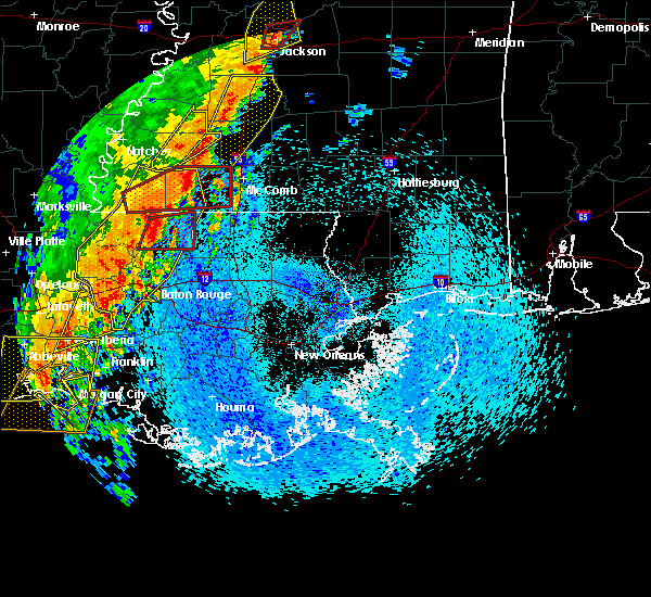 At 737 am cdt, a severe thunderstorm capable of producing a tornado was located near liberty, moving northeast at 60 mph (radar indicated rotation). Hazards include tornado. Flying debris will be dangerous to those caught without shelter. mobile homes will be damaged or destroyed. damage to roofs, windows, and vehicles will occur. tree damage is likely. this dangerous storm will be near, liberty around 740 am cdt. smithdale around 750 am cdt. Other locations impacted by this tornadic thunderstorm include crosby. At 737 am cdt, a severe thunderstorm capable of producing a tornado was located near liberty, moving northeast at 60 mph (radar indicated rotation). Hazards include tornado. Flying debris will be dangerous to those caught without shelter. mobile homes will be damaged or destroyed. damage to roofs, windows, and vehicles will occur. tree damage is likely. this dangerous storm will be near, liberty around 740 am cdt. smithdale around 750 am cdt. Other locations impacted by this tornadic thunderstorm include crosby.
|
| 4/14/2018 7:18 AM CDT |
 At 718 am cdt, severe thunderstorms were located along a line extending from 6 miles north of gloster to near jackson to near livonia to catahoula, moving east at 30 mph (radar indicated). Hazards include 60 mph wind gusts. Expect damage to roofs, siding, and trees. locations impacted include, baton rouge, zachary, baker, port allen, new roads, jackson, st. francisville, clinton, liberty, addis, brusly, centreville, livonia, maringouin, woodville, slaughter, gloster, fordoche, rosedale and grosse tete. A tornado watch remains in effect until 200 pm cdt for southeastern louisiana, and southern mississippi. At 718 am cdt, severe thunderstorms were located along a line extending from 6 miles north of gloster to near jackson to near livonia to catahoula, moving east at 30 mph (radar indicated). Hazards include 60 mph wind gusts. Expect damage to roofs, siding, and trees. locations impacted include, baton rouge, zachary, baker, port allen, new roads, jackson, st. francisville, clinton, liberty, addis, brusly, centreville, livonia, maringouin, woodville, slaughter, gloster, fordoche, rosedale and grosse tete. A tornado watch remains in effect until 200 pm cdt for southeastern louisiana, and southern mississippi.
|
| 4/14/2018 7:13 AM CDT |
 At 712 am cdt, a severe thunderstorm capable of producing a tornado was located near woodville, or 16 miles north of jackson, moving northeast at 55 mph (radar indicated rotation). Hazards include tornado. Flying debris will be dangerous to those caught without shelter. mobile homes will be damaged or destroyed. damage to roofs, windows, and vehicles will occur. tree damage is likely. this dangerous storm will be near, centreville around 725 am cdt. gloster around 735 am cdt. liberty around 745 am cdt. smithdale around 755 am cdt. Other locations impacted by this tornadic thunderstorm include crosby. At 712 am cdt, a severe thunderstorm capable of producing a tornado was located near woodville, or 16 miles north of jackson, moving northeast at 55 mph (radar indicated rotation). Hazards include tornado. Flying debris will be dangerous to those caught without shelter. mobile homes will be damaged or destroyed. damage to roofs, windows, and vehicles will occur. tree damage is likely. this dangerous storm will be near, centreville around 725 am cdt. gloster around 735 am cdt. liberty around 745 am cdt. smithdale around 755 am cdt. Other locations impacted by this tornadic thunderstorm include crosby.
|
| 4/7/2018 12:36 AM CDT |
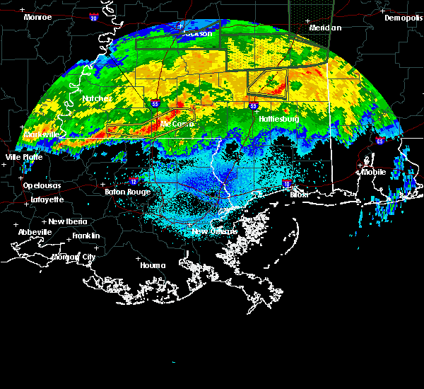 At 1234 am cdt, severe thunderstorms were located along a line extending from near jayess to near magnolia to gillsberg to just east of centreville, moving east at 45 mph (radar indicated). Hazards include 60 mph wind gusts. Expect damage to roofs, siding, and trees. Locations impacted include, mccomb, liberty, magnolia, centreville, salem, gillsberg and mccomb airport. At 1234 am cdt, severe thunderstorms were located along a line extending from near jayess to near magnolia to gillsberg to just east of centreville, moving east at 45 mph (radar indicated). Hazards include 60 mph wind gusts. Expect damage to roofs, siding, and trees. Locations impacted include, mccomb, liberty, magnolia, centreville, salem, gillsberg and mccomb airport.
|
| 4/7/2018 12:14 AM CDT |
 At 1213 am cdt, severe thunderstorms were located along a line extending from near summit to liberty to near woodville, moving east at 35 mph (radar indicated). Hazards include 60 mph wind gusts. Expect damage to roofs, siding, and trees. Locations impacted include, mccomb, liberty, magnolia, summit, centreville, woodville, gloster, osyka, smithdale, salem, gillsberg and mccomb airport. At 1213 am cdt, severe thunderstorms were located along a line extending from near summit to liberty to near woodville, moving east at 35 mph (radar indicated). Hazards include 60 mph wind gusts. Expect damage to roofs, siding, and trees. Locations impacted include, mccomb, liberty, magnolia, summit, centreville, woodville, gloster, osyka, smithdale, salem, gillsberg and mccomb airport.
|
| 4/6/2018 11:44 PM CDT |
 At 1143 pm cdt, severe thunderstorms were located along a line extending from center point to near woodville, moving east at 45 mph (radar indicated). Hazards include 60 mph wind gusts. Expect damage to roofs, siding, and trees. severe thunderstorms will be near, summit around 1155 pm cdt. gloster around 1205 am cdt. liberty around 1220 am cdt. gillsberg around 1235 am cdt. magnolia and osyka around 1245 am cdt. Other locations impacted by these severe thunderstorms include mccomb airport. At 1143 pm cdt, severe thunderstorms were located along a line extending from center point to near woodville, moving east at 45 mph (radar indicated). Hazards include 60 mph wind gusts. Expect damage to roofs, siding, and trees. severe thunderstorms will be near, summit around 1155 pm cdt. gloster around 1205 am cdt. liberty around 1220 am cdt. gillsberg around 1235 am cdt. magnolia and osyka around 1245 am cdt. Other locations impacted by these severe thunderstorms include mccomb airport.
|
| 4/4/2018 1:12 AM CDT |
 The severe thunderstorm warning for north central ascension, southeastern west baton rouge, st. helena, livingston, east feliciana, northwestern tangipahoa and east baton rouge parishes, southwestern pike, southeastern wilkinson and southern amite counties will expire at 115 am cdt, the storms which prompted the warning have weakened below severe limits, and no longer pose an immediate threat to life or property. therefore the warning will be allowed to expire. however small hail and gusty winds are still possible with these thunderstorms. The severe thunderstorm warning for north central ascension, southeastern west baton rouge, st. helena, livingston, east feliciana, northwestern tangipahoa and east baton rouge parishes, southwestern pike, southeastern wilkinson and southern amite counties will expire at 115 am cdt, the storms which prompted the warning have weakened below severe limits, and no longer pose an immediate threat to life or property. therefore the warning will be allowed to expire. however small hail and gusty winds are still possible with these thunderstorms.
|
| 4/4/2018 12:41 AM CDT |
 At 1240 am cdt, severe thunderstorms were located along a line extending from centreville to near pride to slaughter to near port allen, moving east at 45 mph (radar indicated). Hazards include 60 mph wind gusts and quarter size hail. Hail damage to vehicles is expected. expect wind damage to roofs, siding, and trees. severe thunderstorms will be near, felps and brownfields around 1250 am cdt. oak hills place, pride, westminster, inniswold, village st. george and greenwell spring around 1255 am cdt. shenandoah, old jefferson and watson around 100 am cdt. denham springs around 105 am cdt. walker, montpelier, gillsberg and easleyville around 110 am cdt. amite, amite city, kentwood, livingston, roseland, french settlement and port vincent around 115 am cdt. Other locations impacted by these severe thunderstorms include tangipahoa and baton rouge airport. At 1240 am cdt, severe thunderstorms were located along a line extending from centreville to near pride to slaughter to near port allen, moving east at 45 mph (radar indicated). Hazards include 60 mph wind gusts and quarter size hail. Hail damage to vehicles is expected. expect wind damage to roofs, siding, and trees. severe thunderstorms will be near, felps and brownfields around 1250 am cdt. oak hills place, pride, westminster, inniswold, village st. george and greenwell spring around 1255 am cdt. shenandoah, old jefferson and watson around 100 am cdt. denham springs around 105 am cdt. walker, montpelier, gillsberg and easleyville around 110 am cdt. amite, amite city, kentwood, livingston, roseland, french settlement and port vincent around 115 am cdt. Other locations impacted by these severe thunderstorms include tangipahoa and baton rouge airport.
|
| 4/4/2018 12:34 AM CDT |
 At 1233 am cdt, severe thunderstorms were located along a line extending from near centreville to wilson to near baker, moving east at 40 mph (radar indicated). Hazards include 60 mph wind gusts and quarter size hail. Hail damage to vehicles is expected. expect wind damage to roofs, siding, and trees. Locations impacted include, baton rouge, zachary, baker, denham springs, jackson, clinton, liberty, centreville, slaughter, gloster, wilson, norwood, merrydale, pride, felps, brownfields, greenwell spring, shenandoah and baton rouge airport. At 1233 am cdt, severe thunderstorms were located along a line extending from near centreville to wilson to near baker, moving east at 40 mph (radar indicated). Hazards include 60 mph wind gusts and quarter size hail. Hail damage to vehicles is expected. expect wind damage to roofs, siding, and trees. Locations impacted include, baton rouge, zachary, baker, denham springs, jackson, clinton, liberty, centreville, slaughter, gloster, wilson, norwood, merrydale, pride, felps, brownfields, greenwell spring, shenandoah and baton rouge airport.
|
| 4/4/2018 12:16 AM CDT |
 At 1215 am cdt, severe thunderstorms were located along a line extending from near woodville to spillman to near erwinville, moving east at 40 mph (radar indicated). Hazards include 60 mph wind gusts and quarter size hail. Hail damage to vehicles is expected. Expect wind damage to roofs, siding, and trees. At 1215 am cdt, severe thunderstorms were located along a line extending from near woodville to spillman to near erwinville, moving east at 40 mph (radar indicated). Hazards include 60 mph wind gusts and quarter size hail. Hail damage to vehicles is expected. Expect wind damage to roofs, siding, and trees.
|
| 2/7/2018 6:38 AM CST |
 The severe thunderstorm warning for wilkinson and southwestern amite counties will expire at 645 am cst, the severe thunderstorm which prompted the warning has weakened. therefore, the warning will be allowed to expire. The severe thunderstorm warning for wilkinson and southwestern amite counties will expire at 645 am cst, the severe thunderstorm which prompted the warning has weakened. therefore, the warning will be allowed to expire.
|
| 2/7/2018 6:00 AM CST |
 At 600 am cst, a severe thunderstorm was located over fort adams, or 17 miles northeast of simmesport, moving east at 50 mph (radar indicated). Hazards include 60 mph wind gusts. expect damage to roofs, siding, and trees At 600 am cst, a severe thunderstorm was located over fort adams, or 17 miles northeast of simmesport, moving east at 50 mph (radar indicated). Hazards include 60 mph wind gusts. expect damage to roofs, siding, and trees
|
| 4/30/2017 7:56 AM CDT |
 At 756 am cdt, severe thunderstorms were located along a line extending from centreville to near jackson, moving east at 40 mph (radar indicated). Hazards include 60 mph wind gusts. expect damage to roofs, siding, and trees At 756 am cdt, severe thunderstorms were located along a line extending from centreville to near jackson, moving east at 40 mph (radar indicated). Hazards include 60 mph wind gusts. expect damage to roofs, siding, and trees
|
| 4/30/2017 7:30 AM CDT |
 At 729 am cdt, severe thunderstorms were located along a line extending from woodville to near new roads to 6 miles southwest of ramah, moving northeast at 45 mph (emergency management). Hazards include 70 mph wind gusts. Expect considerable tree damage. Damage is likely to mobile homes, roofs, and outbuildings. At 729 am cdt, severe thunderstorms were located along a line extending from woodville to near new roads to 6 miles southwest of ramah, moving northeast at 45 mph (emergency management). Hazards include 70 mph wind gusts. Expect considerable tree damage. Damage is likely to mobile homes, roofs, and outbuildings.
|
| 4/30/2017 6:37 AM CDT |
 At 637 am cdt, a severe thunderstorm was located near black hawk, or 11 miles northeast of simmesport, moving east at 45 mph (radar indicated). Hazards include 60 mph wind gusts and quarter size hail. Hail damage to vehicles is expected. Expect wind damage to roofs, siding, and trees. At 637 am cdt, a severe thunderstorm was located near black hawk, or 11 miles northeast of simmesport, moving east at 45 mph (radar indicated). Hazards include 60 mph wind gusts and quarter size hail. Hail damage to vehicles is expected. Expect wind damage to roofs, siding, and trees.
|
| 4/2/2017 5:39 PM CDT |
 The severe thunderstorm warning for northeastern east feliciana parish, southeastern wilkinson and southwestern amite counties will expire at 545 pm cdt, the storm which prompted the warning has weakened below severe limits, and no longer poses an immediate threat to life or property. therefore the warning will be allowed to expire. however small hail and gusty winds are still possible with this thunderstorm. a tornado watch remains in effect until 200 am cdt for southeastern louisiana, and southern mississippi. The severe thunderstorm warning for northeastern east feliciana parish, southeastern wilkinson and southwestern amite counties will expire at 545 pm cdt, the storm which prompted the warning has weakened below severe limits, and no longer poses an immediate threat to life or property. therefore the warning will be allowed to expire. however small hail and gusty winds are still possible with this thunderstorm. a tornado watch remains in effect until 200 am cdt for southeastern louisiana, and southern mississippi.
|
| 4/2/2017 5:24 PM CDT |
 At 524 pm cdt, a severe thunderstorm was located over wilson, or near clinton, moving northeast at 55 mph (radar indicated). Hazards include 60 mph wind gusts and quarter size hail. Hail damage to vehicles is expected. expect wind damage to roofs, siding, and trees. locations impacted include, clinton, centreville, wilson, norwood and felps. A tornado watch remains in effect until 200 am cdt for southeastern louisiana, and southern mississippi. At 524 pm cdt, a severe thunderstorm was located over wilson, or near clinton, moving northeast at 55 mph (radar indicated). Hazards include 60 mph wind gusts and quarter size hail. Hail damage to vehicles is expected. expect wind damage to roofs, siding, and trees. locations impacted include, clinton, centreville, wilson, norwood and felps. A tornado watch remains in effect until 200 am cdt for southeastern louisiana, and southern mississippi.
|
| 4/2/2017 5:07 PM CDT |
 At 507 pm cdt, a severe thunderstorm was located near jackson, moving northeast at 55 mph (radar indicated). Hazards include 60 mph wind gusts and quarter size hail. Hail damage to vehicles is expected. Expect wind damage to roofs, siding, and trees. At 507 pm cdt, a severe thunderstorm was located near jackson, moving northeast at 55 mph (radar indicated). Hazards include 60 mph wind gusts and quarter size hail. Hail damage to vehicles is expected. Expect wind damage to roofs, siding, and trees.
|
| 3/7/2017 2:53 PM CST |
 At 252 pm cst, severe thunderstorms were located along a line extending from near gloster to near centreville to near st. francisville, moving east at 35 mph (radar indicated). Hazards include 60 mph wind gusts. expect damage to roofs, siding, and trees At 252 pm cst, severe thunderstorms were located along a line extending from near gloster to near centreville to near st. francisville, moving east at 35 mph (radar indicated). Hazards include 60 mph wind gusts. expect damage to roofs, siding, and trees
|
| 2/7/2017 7:56 AM CST |
 At 756 am cst, a severe thunderstorm capable of producing a tornado was located near wakefield, or 7 miles north of st. francisville, moving northeast at 40 mph (radar indicated rotation). Hazards include tornado. Flying debris will be dangerous to those caught without shelter. mobile homes will be damaged or destroyed. damage to roofs, windows, and vehicles will occur. tree damage is likely. this dangerous storm will be near, wakefield around 800 am cst. spillman around 810 am cst. woodville around 820 am cst. centreville around 830 am cst. Other locations impacted by this tornadic thunderstorm include crosby. At 756 am cst, a severe thunderstorm capable of producing a tornado was located near wakefield, or 7 miles north of st. francisville, moving northeast at 40 mph (radar indicated rotation). Hazards include tornado. Flying debris will be dangerous to those caught without shelter. mobile homes will be damaged or destroyed. damage to roofs, windows, and vehicles will occur. tree damage is likely. this dangerous storm will be near, wakefield around 800 am cst. spillman around 810 am cst. woodville around 820 am cst. centreville around 830 am cst. Other locations impacted by this tornadic thunderstorm include crosby.
|
| 2/7/2017 7:35 AM CST |
 At 734 am cst, a severe thunderstorm capable of producing a tornado was located near batchelor, or 11 miles northwest of new roads, moving northeast at 50 mph (radar indicated rotation). Hazards include tornado. Flying debris will be dangerous to those caught without shelter. mobile homes will be damaged or destroyed. damage to roofs, windows, and vehicles will occur. tree damage is likely. this dangerous storm will be near, wakefield around 750 am cst. spillman around 800 am cst. woodville around 805 am cst. centreville around 820 am cst. Other locations impacted by this tornadic thunderstorm include crosby. At 734 am cst, a severe thunderstorm capable of producing a tornado was located near batchelor, or 11 miles northwest of new roads, moving northeast at 50 mph (radar indicated rotation). Hazards include tornado. Flying debris will be dangerous to those caught without shelter. mobile homes will be damaged or destroyed. damage to roofs, windows, and vehicles will occur. tree damage is likely. this dangerous storm will be near, wakefield around 750 am cst. spillman around 800 am cst. woodville around 805 am cst. centreville around 820 am cst. Other locations impacted by this tornadic thunderstorm include crosby.
|
| 1/21/2017 2:25 AM CST |
 At 224 am cst, severe thunderstorms were located along a line extending from near woodville to near wilson to near slaughter, moving northeast at 55 mph (radar indicated). Hazards include 60 mph wind gusts and quarter size hail. Hail damage to vehicles is expected. expect wind damage to roofs, siding, and trees. locations impacted include, jackson, clinton, liberty, greensburg, centreville, slaughter, gloster, wilson, norwood, easleyville, darlington, gillsberg and felps. A tornado watch remains in effect until 700 am cst for southeastern louisiana, and southern mississippi. At 224 am cst, severe thunderstorms were located along a line extending from near woodville to near wilson to near slaughter, moving northeast at 55 mph (radar indicated). Hazards include 60 mph wind gusts and quarter size hail. Hail damage to vehicles is expected. expect wind damage to roofs, siding, and trees. locations impacted include, jackson, clinton, liberty, greensburg, centreville, slaughter, gloster, wilson, norwood, easleyville, darlington, gillsberg and felps. A tornado watch remains in effect until 700 am cst for southeastern louisiana, and southern mississippi.
|
| 1/21/2017 2:14 AM CST |
 At 213 am cst, severe thunderstorms were located along a line extending from 7 miles southwest of woodville to near jackson to 6 miles southeast of new roads, moving northeast at 55 mph (radar indicated). Hazards include 60 mph wind gusts and quarter size hail. Hail damage to vehicles is expected. Expect wind damage to roofs, siding, and trees. At 213 am cst, severe thunderstorms were located along a line extending from 7 miles southwest of woodville to near jackson to 6 miles southeast of new roads, moving northeast at 55 mph (radar indicated). Hazards include 60 mph wind gusts and quarter size hail. Hail damage to vehicles is expected. Expect wind damage to roofs, siding, and trees.
|
| 1/21/2017 1:14 AM CST |
 At 114 am cst, a severe thunderstorm capable of producing a tornado was located near fort adams, or 21 miles northeast of simmesport, moving east at 25 mph (radar indicated rotation). Hazards include tornado and quarter size hail. Flying debris will be dangerous to those caught without shelter. mobile homes will be damaged or destroyed. damage to roofs, windows, and vehicles will occur. tree damage is likely. this dangerous storm will be near, woodville around 140 am cst. Other locations impacted by this tornadic thunderstorm include crosby. At 114 am cst, a severe thunderstorm capable of producing a tornado was located near fort adams, or 21 miles northeast of simmesport, moving east at 25 mph (radar indicated rotation). Hazards include tornado and quarter size hail. Flying debris will be dangerous to those caught without shelter. mobile homes will be damaged or destroyed. damage to roofs, windows, and vehicles will occur. tree damage is likely. this dangerous storm will be near, woodville around 140 am cst. Other locations impacted by this tornadic thunderstorm include crosby.
|
| 1/2/2017 12:15 PM CST |
 At 1215 pm cst, a severe thunderstorm was located over wilson, or near clinton, moving northeast at 35 mph (radar indicated). Hazards include 60 mph wind gusts. expect damage to roofs, siding, and trees At 1215 pm cst, a severe thunderstorm was located over wilson, or near clinton, moving northeast at 35 mph (radar indicated). Hazards include 60 mph wind gusts. expect damage to roofs, siding, and trees
|
| 11/30/2016 1:56 AM CST |
 The severe thunderstorm warning for wilkinson county will expire at 200 am cst, the strongest portion of the storm which prompted the warning has moved out of the area into southern adams and franklin counties. therefore the warning will be allowed to expire. however gusty winds are still possible with this thunderstorm. a tornado watch remains in effect until 500 am cst for southern mississippi. The severe thunderstorm warning for wilkinson county will expire at 200 am cst, the strongest portion of the storm which prompted the warning has moved out of the area into southern adams and franklin counties. therefore the warning will be allowed to expire. however gusty winds are still possible with this thunderstorm. a tornado watch remains in effect until 500 am cst for southern mississippi.
|
| 11/30/2016 1:27 AM CST |
 At 127 am cst, a severe thunderstorm was located 8 miles northeast of fort adams, or 22 miles southeast of monterey, moving east at 55 mph (radar indicated). Hazards include 60 mph wind gusts and quarter size hail. Hail damage to vehicles is expected. Expect wind damage to roofs, siding, and trees. At 127 am cst, a severe thunderstorm was located 8 miles northeast of fort adams, or 22 miles southeast of monterey, moving east at 55 mph (radar indicated). Hazards include 60 mph wind gusts and quarter size hail. Hail damage to vehicles is expected. Expect wind damage to roofs, siding, and trees.
|
| 8/4/2016 6:55 PM CDT |
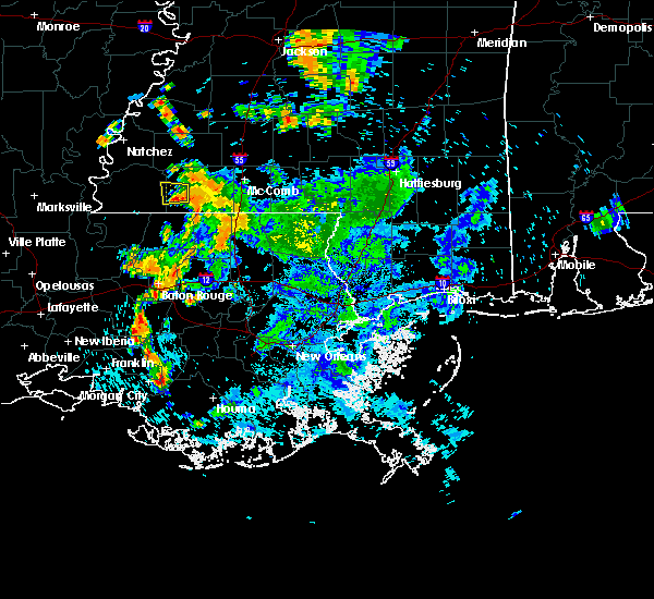 The severe thunderstorm warning for west central amite and east central wilkinson counties will expire at 700 pm cdt, the storm which prompted the warning has weakened below severe limits, and no longer pose an immediate threat to life or property. therefore, the warning will be allowed to expire. however gusty winds are still possible with this thunderstorm. The severe thunderstorm warning for west central amite and east central wilkinson counties will expire at 700 pm cdt, the storm which prompted the warning has weakened below severe limits, and no longer pose an immediate threat to life or property. therefore, the warning will be allowed to expire. however gusty winds are still possible with this thunderstorm.
|
| 8/4/2016 6:36 PM CDT |
 At 635 pm cdt, a severe thunderstorm was located near gloster, or 9 miles west of liberty, moving west at 5 mph (radar indicated). Hazards include 60 mph wind gusts. Expect damage to roofs. siding. And trees. At 635 pm cdt, a severe thunderstorm was located near gloster, or 9 miles west of liberty, moving west at 5 mph (radar indicated). Hazards include 60 mph wind gusts. Expect damage to roofs. siding. And trees.
|
| 4/30/2016 1:13 PM CDT |
 At 113 pm cdt, severe thunderstorms were located along a line extending from centreville to near felps to near darlington, moving northeast at 45 mph (radar indicated). Hazards include 60 mph wind gusts. Expect damage to roofs. siding. And trees. At 113 pm cdt, severe thunderstorms were located along a line extending from centreville to near felps to near darlington, moving northeast at 45 mph (radar indicated). Hazards include 60 mph wind gusts. Expect damage to roofs. siding. And trees.
|
| 4/30/2016 1:13 PM CDT |
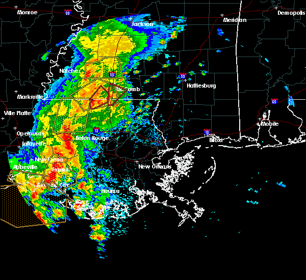 At 113 pm cdt, severe thunderstorms were located along a line extending from centreville to near felps to near darlington, moving northeast at 45 mph (radar indicated). Hazards include 60 mph wind gusts. Expect damage to roofs. siding. And trees. At 113 pm cdt, severe thunderstorms were located along a line extending from centreville to near felps to near darlington, moving northeast at 45 mph (radar indicated). Hazards include 60 mph wind gusts. Expect damage to roofs. siding. And trees.
|
| 4/30/2016 12:41 PM CDT | The tornado warning for eastern west feliciana and north central east feliciana parishes, southwestern amite and southeastern wilkinson counties will expire at 1245 pm cdt, the storm which prompted the warning has weakened below severe limits, and no longer appears capable of producing a tornado. therefore the warning will be allowed to expire. however gusty winds and heavy rain are still possible with this thunderstorm. a severe thunderstorm watch remains in effect until 500 pm cdt for southeastern louisiana, and southern mississippi. to report severe weather, contact your nearest law enforcement agency. they will relay your report to the national weather service new orleans. |
| 4/30/2016 12:41 PM CDT | The tornado warning for eastern west feliciana and north central east feliciana parishes, southwestern amite and southeastern wilkinson counties will expire at 1245 pm cdt, the storm which prompted the warning has weakened below severe limits, and no longer appears capable of producing a tornado. therefore the warning will be allowed to expire. however gusty winds and heavy rain are still possible with this thunderstorm. a severe thunderstorm watch remains in effect until 500 pm cdt for southeastern louisiana, and southern mississippi. to report severe weather, contact your nearest law enforcement agency. they will relay your report to the national weather service new orleans. |
| 4/30/2016 12:21 PM CDT |
 At 1221 pm cdt, a severe thunderstorm capable of producing a tornado was located near wilson, or 8 miles northeast of jackson, moving northeast at 25 mph (radar indicated rotation). Hazards include tornado. Flying debris will be dangerous to those caught without shelter. mobile homes will be damaged or destroyed. damage to roofs, windows, and vehicles will occur. tree damage is likely. this dangerous storm will be near, norwood around 1230 pm cdt. Centreville around 1245 pm cdt. At 1221 pm cdt, a severe thunderstorm capable of producing a tornado was located near wilson, or 8 miles northeast of jackson, moving northeast at 25 mph (radar indicated rotation). Hazards include tornado. Flying debris will be dangerous to those caught without shelter. mobile homes will be damaged or destroyed. damage to roofs, windows, and vehicles will occur. tree damage is likely. this dangerous storm will be near, norwood around 1230 pm cdt. Centreville around 1245 pm cdt.
|
| 3/17/2016 5:28 PM CDT |
 At 528 pm cdt, a severe thunderstorm was located near norwood, or 11 miles north of clinton, moving east at 50 mph (radar indicated). Hazards include 60 mph wind gusts and half dollar size hail. Hail damage to vehicles is expected. Expect wind damage to roofs, siding and trees. At 528 pm cdt, a severe thunderstorm was located near norwood, or 11 miles north of clinton, moving east at 50 mph (radar indicated). Hazards include 60 mph wind gusts and half dollar size hail. Hail damage to vehicles is expected. Expect wind damage to roofs, siding and trees.
|
| 3/17/2016 5:03 PM CDT |
 At 503 pm cdt, a severe thunderstorm was located near woodville, or 17 miles northwest of jackson, moving east at 45 mph (radar indicated). Hazards include 60 mph wind gusts and half dollar size hail. Hail damage to vehicles is expected. Expect wind damage to roofs, siding and trees. At 503 pm cdt, a severe thunderstorm was located near woodville, or 17 miles northwest of jackson, moving east at 45 mph (radar indicated). Hazards include 60 mph wind gusts and half dollar size hail. Hail damage to vehicles is expected. Expect wind damage to roofs, siding and trees.
|
| 2/15/2016 11:54 AM CST |
 At 1154 am cst, a severe thunderstorm capable of producing a tornado was located near norwood, or 11 miles north of jackson, moving east at 25 mph (radar indicated rotation). Hazards include tornado and ping pong ball size hail. Flying debris will be dangerous to those caught without shelter. mobile homes will be damaged or destroyed. damage to roofs, windows and vehicles will occur. tree damage is likely. this dangerous storm will be near, wilson and norwood around 1200 pm cst. centreville around 1205 pm cst. Felps around 1215 pm cst. At 1154 am cst, a severe thunderstorm capable of producing a tornado was located near norwood, or 11 miles north of jackson, moving east at 25 mph (radar indicated rotation). Hazards include tornado and ping pong ball size hail. Flying debris will be dangerous to those caught without shelter. mobile homes will be damaged or destroyed. damage to roofs, windows and vehicles will occur. tree damage is likely. this dangerous storm will be near, wilson and norwood around 1200 pm cst. centreville around 1205 pm cst. Felps around 1215 pm cst.
|
| 2/15/2016 11:53 AM CST | Quarter sized hail reported 0.6 miles SSE of Centreville, MS, quarter sized hail reported in centreville. time estimated by radar. |
| 2/15/2016 11:44 AM CST |
 At 1144 am cst, a severe thunderstorm capable of producing a tornado was located near spillman, or 11 miles north of jackson, moving east at 25 mph (radar indicated rotation). Hazards include tornado and quarter size hail. Flying debris will be dangerous to those caught without shelter. mobile homes will be damaged or destroyed. damage to roofs, windows and vehicles will occur. tree damage is likely. this dangerous storm will be near, wilson and norwood around 1200 pm cst. centreville around 1205 pm cst. Felps around 1215 pm cst. At 1144 am cst, a severe thunderstorm capable of producing a tornado was located near spillman, or 11 miles north of jackson, moving east at 25 mph (radar indicated rotation). Hazards include tornado and quarter size hail. Flying debris will be dangerous to those caught without shelter. mobile homes will be damaged or destroyed. damage to roofs, windows and vehicles will occur. tree damage is likely. this dangerous storm will be near, wilson and norwood around 1200 pm cst. centreville around 1205 pm cst. Felps around 1215 pm cst.
|
| 1/21/2016 4:54 PM CST | At 454 pm cst, a severe thunderstorm was located over spillman, or 9 miles northwest of jackson, moving northeast at 45 mph (radar indicated). Hazards include ping pong ball size hail and 60 mph wind gusts. People and animals outdoors will be injured. expect hail damage to roofs, siding, windows and vehicles. Expect wind damage to roofs, siding and trees. |
| 1/21/2016 4:54 PM CST | At 454 pm cst, a severe thunderstorm was located over spillman, or 9 miles northwest of jackson, moving northeast at 45 mph (radar indicated). Hazards include ping pong ball size hail and 60 mph wind gusts. People and animals outdoors will be injured. expect hail damage to roofs, siding, windows and vehicles. Expect wind damage to roofs, siding and trees. |
| 12/28/2015 1:35 AM CST |
 At 134 am cst, a severe thunderstorm capable of producing a tornado was located near felps, or 8 miles north of clinton, moving north at 45 mph (radar indicated rotation). Hazards include tornado. Flying debris will be dangerous to those caught without shelter. mobile homes will be damaged or destroyed. damage to roofs, windows and vehicles will occur. tree damage is likely. this dangerous storm will be near, centreville around 140 am cst. gloster around 155 am cst. Other locations impacted by this tornadic thunderstorm include crosby. At 134 am cst, a severe thunderstorm capable of producing a tornado was located near felps, or 8 miles north of clinton, moving north at 45 mph (radar indicated rotation). Hazards include tornado. Flying debris will be dangerous to those caught without shelter. mobile homes will be damaged or destroyed. damage to roofs, windows and vehicles will occur. tree damage is likely. this dangerous storm will be near, centreville around 140 am cst. gloster around 155 am cst. Other locations impacted by this tornadic thunderstorm include crosby.
|
| 7/5/2015 3:58 PM CDT |
 At 357 pm cdt, doppler radar indicated a line of severe thunderstorms capable of producing quarter size hail and damaging winds in excess of 60 mph. these storms were located along a line extending from near garden city to near centreville to near norwood, and moving east at 40 mph. At 357 pm cdt, doppler radar indicated a line of severe thunderstorms capable of producing quarter size hail and damaging winds in excess of 60 mph. these storms were located along a line extending from near garden city to near centreville to near norwood, and moving east at 40 mph.
|
| 7/5/2015 3:23 PM CDT |
 At 323 pm cdt, doppler radar indicated a line of severe thunderstorms capable of producing quarter size hail and damaging winds in excess of 60 mph. these storms were located along a line extending from near fort adams to near new roads, and moving northeast at 35 mph. At 323 pm cdt, doppler radar indicated a line of severe thunderstorms capable of producing quarter size hail and damaging winds in excess of 60 mph. these storms were located along a line extending from near fort adams to near new roads, and moving northeast at 35 mph.
|
| 7/4/2015 2:14 PM CDT |
 At 214 pm cdt, doppler radar indicated a severe thunderstorm capable of producing damaging winds in excess of 60 mph. this storm was located 7 miles west of woodville, or 20 miles north of st. francisville, and moving northeast at 30 mph. At 214 pm cdt, doppler radar indicated a severe thunderstorm capable of producing damaging winds in excess of 60 mph. this storm was located 7 miles west of woodville, or 20 miles north of st. francisville, and moving northeast at 30 mph.
|
| 5/26/2015 1:30 AM CDT | At 129 am cdt, doppler radar indicated a severe thunderstorm capable of producing a tornado. this dangerous storm was located near norwood, or 14 miles north of jackson, and moving east at 25 mph. |
| 5/26/2015 1:08 AM CDT | At 107 am cdt, doppler radar indicated a line of severe thunderstorms capable of producing damaging winds in excess of 60 mph. these storms were located along a line extending from near garden city to near wakefield, and moving east at 30 mph. penny size hail may also accompany the damaging winds. |
| 5/26/2015 1:08 AM CDT | At 107 am cdt, doppler radar indicated a line of severe thunderstorms capable of producing damaging winds in excess of 60 mph. these storms were located along a line extending from near garden city to near wakefield, and moving east at 30 mph. penny size hail may also accompany the damaging winds. |
| 5/11/2015 1:05 PM CDT | At 104 pm cdt, doppler radar indicated a severe thunderstorm capable of producing damaging winds in excess of 60 mph. this storm was located 8 miles east of centreville, or 8 miles southwest of liberty, and moving east at 25 mph. |
| 4/27/2015 9:17 AM CDT | At 917 am cdt, doppler radar indicated a line of severe thunderstorms capable of producing quarter size hail and destructive winds in excess of 70 mph. these storms were located along a line extending from near felps to north vacherie, and moving east at 60 mph. |
| 4/27/2015 9:17 AM CDT | The national weather service in new orleans has issued a * severe thunderstorm warning for. east central iberville parish in southeastern louisiana. northwestern washington parish in southeastern louisiana. tangipahoa parish in southeastern louisiana. East baton rouge parish in southeastern louisiana. |
| 4/27/2015 9:17 AM CDT | The national weather service in new orleans has issued a * severe thunderstorm warning for. east central iberville parish in southeastern louisiana. northwestern washington parish in southeastern louisiana. tangipahoa parish in southeastern louisiana. East baton rouge parish in southeastern louisiana. |
| 4/27/2015 9:17 AM CDT | At 917 am cdt, doppler radar indicated a line of severe thunderstorms capable of producing quarter size hail and destructive winds in excess of 70 mph. these storms were located along a line extending from near felps to north vacherie, and moving east at 60 mph. |
| 4/27/2015 8:51 AM CDT | At 849 am cdt, doppler radar indicated a line of severe thunderstorms capable of producing destructive winds in excess of 70 mph. these storms were located along a line extending from woodville to near ramah, and moving east at 55 mph. nickel size hail may also accompany the damaging winds. |
| 4/27/2015 8:51 AM CDT | At 849 am cdt, doppler radar indicated a line of severe thunderstorms capable of producing destructive winds in excess of 70 mph. these storms were located along a line extending from woodville to near ramah, and moving east at 55 mph. nickel size hail may also accompany the damaging winds. |
| 12/23/2014 6:45 AM CST | Quarter sized hail reported 0.6 miles SSE of Centreville, MS, public reports of quarter size hail. time estimated based on radar. |
| 12/25/2012 2:56 PM CST | Possible tornado damage with trailers damaged and tree on house on fort stree in wilkinson county MS, 0.6 miles SSE of Centreville, MS |
| 12/25/2012 2:32 PM CST | Possible tornado downed a medium sized tree on gordon stree in wilkinson county MS, 0.6 miles SSE of Centreville, MS |
Hail Maps for Centreville, MS


Connect with Interactive Hail Maps