

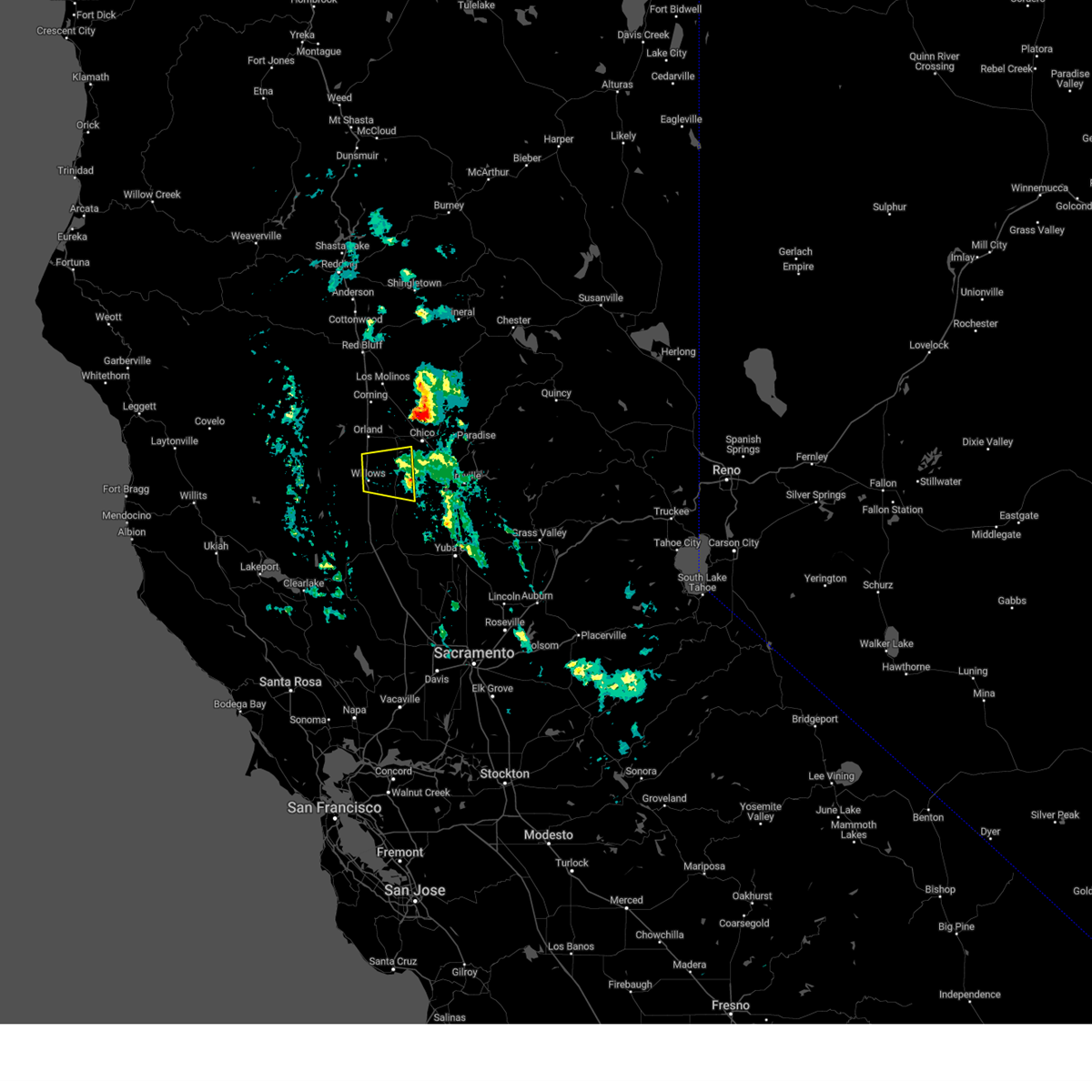
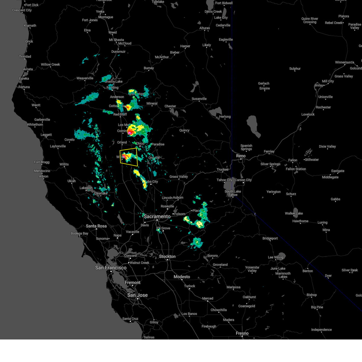
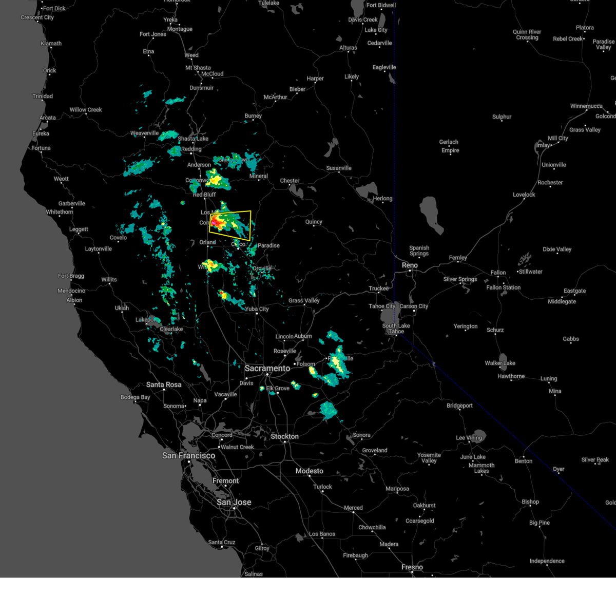
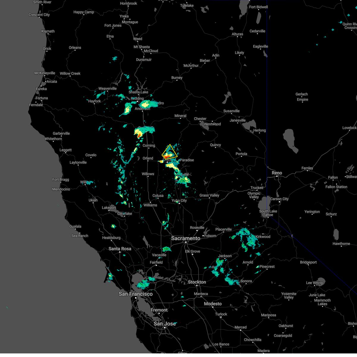
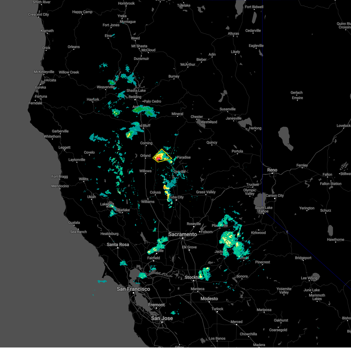
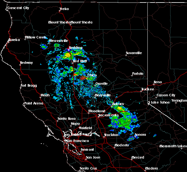
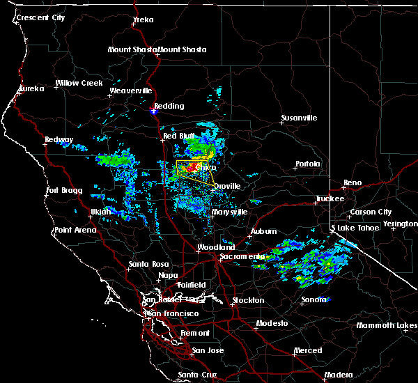
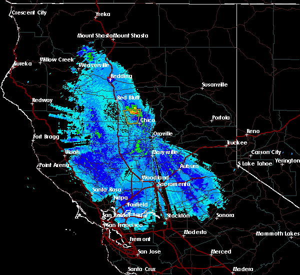
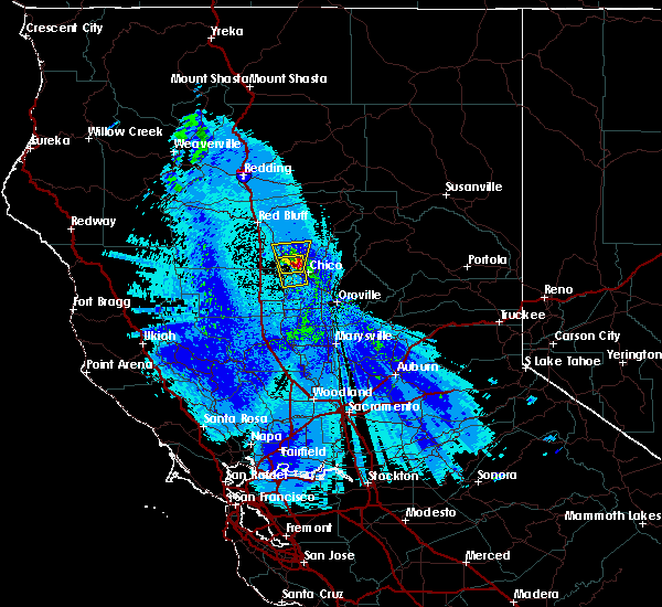
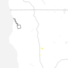
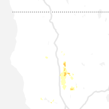
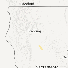
Hail Map for Chico, CA
The Chico, CA area has had 3 reports of on-the-ground hail by trained spotters, and has been under severe weather warnings 0 times during the past 12 months. Doppler radar has detected hail at or near Chico, CA on 7 occasions.
| Name: | Chico, CA |
| Where Located: | 65.2 miles SSE of Redding, CA |
| Map: | Google Map for Chico, CA |
| Population: | 86187 |
| Housing Units: | 37050 |
| More Info: | Search Google for Chico, CA |
0
The Top Recent Hail Date for Chico, CA is Thursday, March 23, 2023 (7th out of 7)

Hail and Wind Damage Spotted near Chico, CA
| Date / Time | Report Details |
|---|---|
| 3/23/2023 6:21 PM PDT |
 The severe thunderstorm warning for west central butte and southeastern glenn counties will expire at 630 pm pdt, the storm which prompted the warning has moved out of the area. therefore, the warning will be allowed to expire. The severe thunderstorm warning for west central butte and southeastern glenn counties will expire at 630 pm pdt, the storm which prompted the warning has moved out of the area. therefore, the warning will be allowed to expire.
|
| 3/23/2023 5:35 PM PDT |
 At 534 pm pdt, a severe thunderstorm was located over bluegum, or near willows, moving east at 5 mph. nickel size hail has been reported with this storm near willows (radar indicated). Hazards include quarter size hail. damage to vehicles is expected At 534 pm pdt, a severe thunderstorm was located over bluegum, or near willows, moving east at 5 mph. nickel size hail has been reported with this storm near willows (radar indicated). Hazards include quarter size hail. damage to vehicles is expected
|
| 3/23/2023 5:18 PM PDT |
 At 517 pm pdt, a severe thunderstorm was located over vina, or near corning, moving east at 15 mph (radar indicated). Hazards include quarter size hail. damage to vehicles is expected At 517 pm pdt, a severe thunderstorm was located over vina, or near corning, moving east at 15 mph (radar indicated). Hazards include quarter size hail. damage to vehicles is expected
|
| 3/6/2023 5:28 PM PST |
 The severe thunderstorm warning for west central butte county will expire at 530 pm pst, the storm which prompted the warning has moved out of the area. therefore, this warning will be allowed to expire. a new severe thunderstorm warning has been issued for an updated geographic area as the storm continues to move northeast. main threat with this storm will continue to be 1 inch hail. The severe thunderstorm warning for west central butte county will expire at 530 pm pst, the storm which prompted the warning has moved out of the area. therefore, this warning will be allowed to expire. a new severe thunderstorm warning has been issued for an updated geographic area as the storm continues to move northeast. main threat with this storm will continue to be 1 inch hail.
|
| 3/6/2023 5:26 PM PST |
 At 526 pm pst, a severe thunderstorm was located near chico, moving northeast at 10 mph (trained weather spotters). Hazards include quarter size hail. damage to vehicles is expected At 526 pm pst, a severe thunderstorm was located near chico, moving northeast at 10 mph (trained weather spotters). Hazards include quarter size hail. damage to vehicles is expected
|
| 3/6/2023 5:09 PM PST |
 At 508 pm pst, a severe thunderstorm was located over nord, or near chico, moving northeast at 15 mph (trained weather spotters). Hazards include quarter size hail. Damage to vehicles is expected. Locations impacted include, chico and nord. At 508 pm pst, a severe thunderstorm was located over nord, or near chico, moving northeast at 15 mph (trained weather spotters). Hazards include quarter size hail. Damage to vehicles is expected. Locations impacted include, chico and nord.
|
| 3/6/2023 4:42 PM PST |
 At 442 pm pst, a severe thunderstorm was located near ordbend, or 10 miles east of orland, moving northeast at 15 mph (trained weather spotters). Hazards include quarter size hail. damage to vehicles is expected At 442 pm pst, a severe thunderstorm was located near ordbend, or 10 miles east of orland, moving northeast at 15 mph (trained weather spotters). Hazards include quarter size hail. damage to vehicles is expected
|
| 1/14/2023 10:11 AM PST | Chp reports a large pine tree down across both lanes of sr 99 just north of e 1st av in butte county CA, 0.4 miles SSW of Chico, CA |
| 1/4/2023 8:19 PM PST | Power pole and tree leaning over aguas frias r in butte county CA, 7.3 miles N of Chico, CA |
| 8/10/2019 12:48 PM PDT |
 At 1247 pm pdt, a severe thunderstorm was located 8 miles northwest of orland, moving east at 25 mph (radar indicated). Hazards include 50 mph wind gusts and quarter size hail. hail damage to vehicles and possible wind damage to trees At 1247 pm pdt, a severe thunderstorm was located 8 miles northwest of orland, moving east at 25 mph (radar indicated). Hazards include 50 mph wind gusts and quarter size hail. hail damage to vehicles and possible wind damage to trees
|
| 4/2/2019 5:16 PM PDT |
 At 515 pm pdt, a severe thunderstorm capable of producing a tornado was located over nord, or near chico, moving northeast at 5 mph (radar indicated rotation). Hazards include tornado. Flying debris will be dangerous to those caught without shelter. mobile homes will be damaged or destroyed. damage to roofs, windows, and vehicles will occur. tree damage is likely. in addition, copious amounts of small hail, heavy rain, and localized flooding will be possible. Other locations impacted by this tornadic thunderstorm include hamilton city, nord. At 515 pm pdt, a severe thunderstorm capable of producing a tornado was located over nord, or near chico, moving northeast at 5 mph (radar indicated rotation). Hazards include tornado. Flying debris will be dangerous to those caught without shelter. mobile homes will be damaged or destroyed. damage to roofs, windows, and vehicles will occur. tree damage is likely. in addition, copious amounts of small hail, heavy rain, and localized flooding will be possible. Other locations impacted by this tornadic thunderstorm include hamilton city, nord.
|
| 4/2/2019 5:15 PM PDT | Tree damage or downed trees reported near west sacramento ave and river road. time estimate in butte county CA, 5.8 miles E of Chico, CA |
| 4/2/2019 4:54 PM PDT |
 At 453 pm pdt, a severe thunderstorm capable of producing a tornado was located near nord, or 8 miles west of chico, moving northeast at 5 mph (radar indicated rotation). Hazards include tornado. Flying debris will be dangerous to those caught without shelter. mobile homes will be damaged or destroyed. damage to roofs, windows, and vehicles will occur. tree damage is likely. in addition, copious amounts of small hail, heavy rain, and localized flooding will be possible. this dangerous storm will be near, nord around 525 pm pdt. chico around 540 pm pdt. Other locations impacted by this tornadic thunderstorm include hamilton city. At 453 pm pdt, a severe thunderstorm capable of producing a tornado was located near nord, or 8 miles west of chico, moving northeast at 5 mph (radar indicated rotation). Hazards include tornado. Flying debris will be dangerous to those caught without shelter. mobile homes will be damaged or destroyed. damage to roofs, windows, and vehicles will occur. tree damage is likely. in addition, copious amounts of small hail, heavy rain, and localized flooding will be possible. this dangerous storm will be near, nord around 525 pm pdt. chico around 540 pm pdt. Other locations impacted by this tornadic thunderstorm include hamilton city.
|
| 10/2/2016 4:48 PM PDT | Quarter sized hail reported 1.3 miles WSW of Chico, CA |
| 10/2/2016 4:46 PM PDT |
 At 440 pm pdt, doppler radar indicated a severe thunderstorm capable of producing quarter size or larger hail. this storm was located near chico, moving east-southeast at 20 mph. residents should prepare for large hail and heavy downpours. locations possibly impacted include, chico, paradise, de sabla powerhouse, forest ranch, richardson springs, nord, magalia, durham and hamilton city. At 440 pm pdt, doppler radar indicated a severe thunderstorm capable of producing quarter size or larger hail. this storm was located near chico, moving east-southeast at 20 mph. residents should prepare for large hail and heavy downpours. locations possibly impacted include, chico, paradise, de sabla powerhouse, forest ranch, richardson springs, nord, magalia, durham and hamilton city.
|
| 10/2/2016 4:28 PM PDT |
 At 425 pm pdt, doppler radar indicated a severe thunderstorm capable of producing quarter size hail and gusty outflow winds. this storm was located near nord, and moving east at 30 mph towards chico. At 425 pm pdt, doppler radar indicated a severe thunderstorm capable of producing quarter size hail and gusty outflow winds. this storm was located near nord, and moving east at 30 mph towards chico.
|
| 5/4/2016 10:43 PM PDT | The severe thunderstorm warning for northeastern glenn, south central tehama and west central butte counties will expire at 1045 pm pdt, the storm which prompted the warning has weakened below severe limits, and no longer poses an immediate threat to life or property. therefore the warning will be allowed to expire. however small hail and heavy rain are still possible with this thunderstorm. |
| 5/4/2016 10:31 PM PDT |
 At 1030 pm pdt, doppler radar indicated a severe thunderstorm capable of producing quarter size hail and damaging winds in excess of 60 mph. this storm was located near vina, or 13 miles east of corning, moving north at 25 mph. locations impacted include, vina. At 1030 pm pdt, doppler radar indicated a severe thunderstorm capable of producing quarter size hail and damaging winds in excess of 60 mph. this storm was located near vina, or 13 miles east of corning, moving north at 25 mph. locations impacted include, vina.
|
| 5/4/2016 10:12 PM PDT |
 At 1010 pm pdt, doppler radar indicated a severe thunderstorm capable of producing quarter size hail and damaging winds in excess of 60 mph. this storm was located over nord, or 7 miles northwest of chico, and moving north at 15 mph. At 1010 pm pdt, doppler radar indicated a severe thunderstorm capable of producing quarter size hail and damaging winds in excess of 60 mph. this storm was located over nord, or 7 miles northwest of chico, and moving north at 15 mph.
|
| 5/4/2016 10:10 PM PDT |
 At 1008 pm pdt, doppler radar indicated a severe thunderstorm capable of producing quarter size hail and damaging winds in excess of 60 mph. this storm was located over nord, or 7 miles west of chico, and moving north at 15 mph. At 1008 pm pdt, doppler radar indicated a severe thunderstorm capable of producing quarter size hail and damaging winds in excess of 60 mph. this storm was located over nord, or 7 miles west of chico, and moving north at 15 mph.
|
| 11/2/2015 4:26 PM PST | 6 power poles snapped off along east eaton rd at godman ave. 10000 pge customers without powe in butte county CA, 1.3 miles WSW of Chico, CA |
| 4/7/2015 4:31 PM PDT | A tornado warning remains in effect until 500 pm pdt for central butte county. at 428 pm pdt. national weather service doppler radar continued to indicate a tornado. this tornado was located 11 miles north of thermalito. or 9 miles southwest of paradise. Moving north at 15 mph. |
| 4/7/2015 4:00 PM PDT | The national weather service in sacramento has issued a * tornado warning for. central butte county in northern california. until 500 pm pdt * at 350 pm pdt. National weather service doppler radar indicated a severe thunderstorm capable of producing a tornado near. |
| 4/7/2015 3:54 PM PDT | The national weather service in sacramento has issued a * tornado warning for. central butte county in northern california. until 500 pm pdt * at 350 pm pdt. National weather service doppler radar indicated a severe thunderstorm capable of producing a tornado near. |
| 10/5/2011 6:50 PM PDT | Quarter sized hail reported 1.3 miles WNW of Chico, CA, large hail 1 to 1.125 diameter |
| 10/5/2011 6:25 PM PDT | Quarter sized hail reported 1.3 miles WSW of Chico, CA, hail covering ground. tree branches down. |
Hail Maps for Chico, CA


Connect with Interactive Hail Maps