

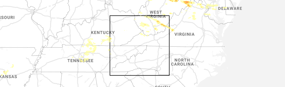
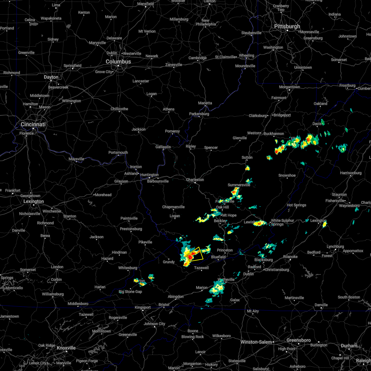
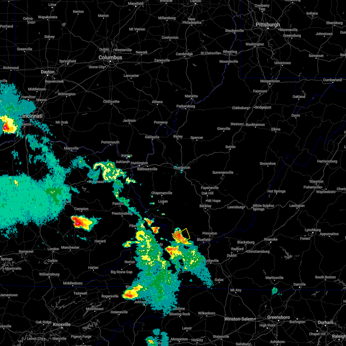
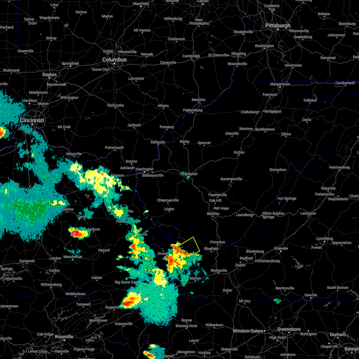
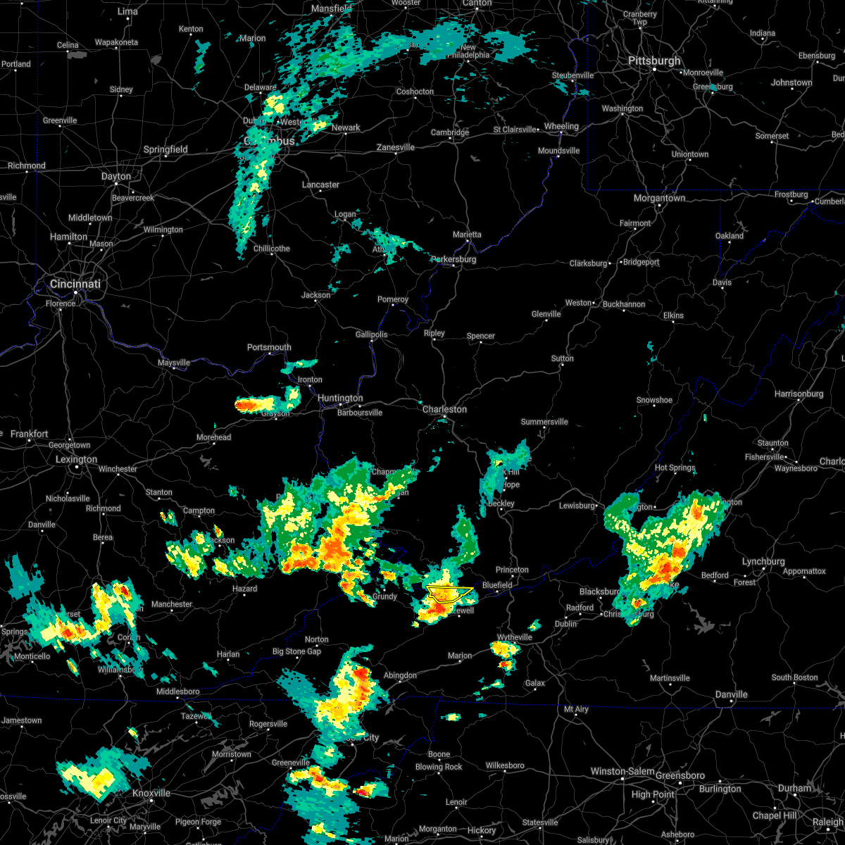
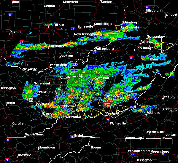
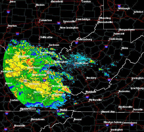
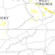
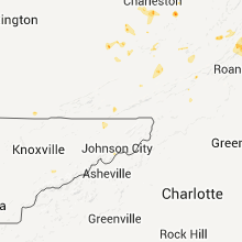
Hail Map for Cucumber, WV
The Cucumber, WV area has had 1 report of on-the-ground hail by trained spotters, and has been under severe weather warnings 4 times during the past 12 months. Doppler radar has detected hail at or near Cucumber, WV on 22 occasions.
| Name: | Cucumber, WV |
| Where Located: | 57.9 miles NE of Bristol, TN |
| Map: | Google Map for Cucumber, WV |
| Population: | 94 |
| Housing Units: | 58 |
| More Info: | Search Google for Cucumber, WV |
2
The Top Recent Hail Date for Cucumber, WV is Tuesday, July 12, 2022 (7th out of 22)
Hail and Wind Damage Spotted near Cucumber, WV
| Date / Time | Report Details |
|---|---|
| 5/16/2023 6:27 PM EDT |
 The severe thunderstorm warning for southeastern mcdowell county will expire at 630 pm edt, the storm which prompted the warning has moved out of the area. therefore, the warning will be allowed to expire. however gusty winds are still possible with this thunderstorm. a severe thunderstorm watch remains in effect until 800 pm edt for southern west virginia. The severe thunderstorm warning for southeastern mcdowell county will expire at 630 pm edt, the storm which prompted the warning has moved out of the area. therefore, the warning will be allowed to expire. however gusty winds are still possible with this thunderstorm. a severe thunderstorm watch remains in effect until 800 pm edt for southern west virginia.
|
| 5/16/2023 6:19 PM EDT |
 At 619 pm edt, a severe thunderstorm was located near gary, or 10 miles north of tazewell, moving east at 55 mph (radar indicated). Hazards include 60 mph wind gusts. Expect damage to roofs, siding, and trees. locations impacted include, gary, war, anawalt, elbert, cucumber and jenkinjones. hail threat, radar indicated max hail size, <. 75 in wind threat, radar indicated max wind gust, 60 mph. At 619 pm edt, a severe thunderstorm was located near gary, or 10 miles north of tazewell, moving east at 55 mph (radar indicated). Hazards include 60 mph wind gusts. Expect damage to roofs, siding, and trees. locations impacted include, gary, war, anawalt, elbert, cucumber and jenkinjones. hail threat, radar indicated max hail size, <. 75 in wind threat, radar indicated max wind gust, 60 mph.
|
| 5/16/2023 5:52 PM EDT |
 At 551 pm edt, a severe thunderstorm was located over jewell ridge, or near richlands, moving east at 60 mph. this is a destructive storm for southern mcdowell county (radar indicated). Hazards include 80 mph wind gusts. Flying debris will be dangerous to those caught without shelter. mobile homes will be heavily damaged. expect considerable damage to roofs, windows, and vehicles. Extensive tree damage and power outages are likely. At 551 pm edt, a severe thunderstorm was located over jewell ridge, or near richlands, moving east at 60 mph. this is a destructive storm for southern mcdowell county (radar indicated). Hazards include 80 mph wind gusts. Flying debris will be dangerous to those caught without shelter. mobile homes will be heavily damaged. expect considerable damage to roofs, windows, and vehicles. Extensive tree damage and power outages are likely.
|
| 8/19/2022 3:43 PM EDT |
 At 343 pm edt, a severe thunderstorm was located over war, or 8 miles southwest of welch, moving northeast at 15 mph (radar indicated). Hazards include 60 mph wind gusts and quarter size hail. Hail damage to vehicles is expected. Expect wind damage to roofs, siding, and trees. At 343 pm edt, a severe thunderstorm was located over war, or 8 miles southwest of welch, moving northeast at 15 mph (radar indicated). Hazards include 60 mph wind gusts and quarter size hail. Hail damage to vehicles is expected. Expect wind damage to roofs, siding, and trees.
|
| 6/17/2022 2:30 PM EDT |
 At 230 pm edt, severe thunderstorms were located along a line extending from jenkins to near bald knob, moving southeast at 45 mph (radar indicated). Hazards include 60 mph wind gusts. expect damage to roofs, siding, and trees At 230 pm edt, severe thunderstorms were located along a line extending from jenkins to near bald knob, moving southeast at 45 mph (radar indicated). Hazards include 60 mph wind gusts. expect damage to roofs, siding, and trees
|
| 5/19/2022 7:11 PM EDT |
 At 711 pm edt, a severe thunderstorm was located over war, or 8 miles southwest of welch, moving east at 30 mph (radar indicated). Hazards include 60 mph wind gusts and quarter size hail. Hail damage to vehicles is expected. expect wind damage to roofs, siding, and trees. Locations impacted include, welch, gary, war, elbert, cucumber and coalwood. At 711 pm edt, a severe thunderstorm was located over war, or 8 miles southwest of welch, moving east at 30 mph (radar indicated). Hazards include 60 mph wind gusts and quarter size hail. Hail damage to vehicles is expected. expect wind damage to roofs, siding, and trees. Locations impacted include, welch, gary, war, elbert, cucumber and coalwood.
|
| 5/19/2022 6:55 PM EDT |
 At 655 pm edt, a severe thunderstorm was located 7 miles north of jewell ridge, or 13 miles north of richlands, moving east at 30 mph (radar indicated). Hazards include two inch hail and 60 mph wind gusts. People and animals outdoors will be injured. expect hail damage to roofs, siding, windows, and vehicles. Expect wind damage to roofs, siding, and trees. At 655 pm edt, a severe thunderstorm was located 7 miles north of jewell ridge, or 13 miles north of richlands, moving east at 30 mph (radar indicated). Hazards include two inch hail and 60 mph wind gusts. People and animals outdoors will be injured. expect hail damage to roofs, siding, windows, and vehicles. Expect wind damage to roofs, siding, and trees.
|
| 7/10/2021 5:39 PM EDT |
 The severe thunderstorm warning for southeastern mcdowell county will expire at 545 pm edt, the storm which prompted the warning has weakened below severe limits, and no longer poses an immediate threat to life or property. therefore, the warning will be allowed to expire. however heavy rain is still possible with this thunderstorm. The severe thunderstorm warning for southeastern mcdowell county will expire at 545 pm edt, the storm which prompted the warning has weakened below severe limits, and no longer poses an immediate threat to life or property. therefore, the warning will be allowed to expire. however heavy rain is still possible with this thunderstorm.
|
| 7/10/2021 5:16 PM EDT |
 At 515 pm edt, a severe thunderstorm was located near war, or 11 miles north of cedar bluff, moving east at 25 mph (radar indicated). Hazards include 60 mph wind gusts and penny size hail. expect damage to roofs, siding, and trees At 515 pm edt, a severe thunderstorm was located near war, or 11 miles north of cedar bluff, moving east at 25 mph (radar indicated). Hazards include 60 mph wind gusts and penny size hail. expect damage to roofs, siding, and trees
|
| 5/29/2019 4:22 PM EDT |
 The severe thunderstorm warning for southeastern buchanan and mcdowell counties will expire at 430 pm edt, the storm which prompted the warning has moved out of the area. therefore, the warning will be allowed to expire. however gusty winds are still possible with this thunderstorm. a severe thunderstorm watch remains in effect until 700 pm edt for southwestern virginia, and southern west virginia. The severe thunderstorm warning for southeastern buchanan and mcdowell counties will expire at 430 pm edt, the storm which prompted the warning has moved out of the area. therefore, the warning will be allowed to expire. however gusty winds are still possible with this thunderstorm. a severe thunderstorm watch remains in effect until 700 pm edt for southwestern virginia, and southern west virginia.
|
| 5/29/2019 4:05 PM EDT |
 At 405 pm edt, a severe thunderstorm was located near gary, or 8 miles southeast of welch, moving east at 45 mph (radar indicated). Hazards include 60 mph wind gusts and nickel size hail. Expect damage to roofs, siding, and trees. Locations impacted include, welch, gary, war, northfork, bradshaw, keystone, anawalt, kimball, jolo, maybeury, elbert, coalwood, cucumber and jenkinjones. At 405 pm edt, a severe thunderstorm was located near gary, or 8 miles southeast of welch, moving east at 45 mph (radar indicated). Hazards include 60 mph wind gusts and nickel size hail. Expect damage to roofs, siding, and trees. Locations impacted include, welch, gary, war, northfork, bradshaw, keystone, anawalt, kimball, jolo, maybeury, elbert, coalwood, cucumber and jenkinjones.
|
| 5/29/2019 3:51 PM EDT |
 At 351 pm edt, a severe thunderstorm was located near war, or 7 miles southwest of welch, moving east at 50 mph (radar indicated). Hazards include 60 mph wind gusts and penny size hail. expect damage to roofs, siding, and trees At 351 pm edt, a severe thunderstorm was located near war, or 7 miles southwest of welch, moving east at 50 mph (radar indicated). Hazards include 60 mph wind gusts and penny size hail. expect damage to roofs, siding, and trees
|
| 4/14/2019 8:53 PM EDT |
 The severe thunderstorm warning for east central buchanan, mcdowell, south central raleigh and central wyoming counties will expire at 900 pm edt, the storms which prompted the warning have weakened below severe limits, and no longer pose an immediate threat to life or property. therefore, the warning will be allowed to expire. The severe thunderstorm warning for east central buchanan, mcdowell, south central raleigh and central wyoming counties will expire at 900 pm edt, the storms which prompted the warning have weakened below severe limits, and no longer pose an immediate threat to life or property. therefore, the warning will be allowed to expire.
|
| 4/14/2019 8:20 PM EDT |
 At 819 pm edt, severe thunderstorms were located along a line extending from near oceana to near jewell ridge to quarry, moving east at 40 mph (radar indicated). Hazards include 60 mph wind gusts. expect damage to roofs, siding, and trees At 819 pm edt, severe thunderstorms were located along a line extending from near oceana to near jewell ridge to quarry, moving east at 40 mph (radar indicated). Hazards include 60 mph wind gusts. expect damage to roofs, siding, and trees
|
| 4/4/2018 2:16 AM EDT |
 At 215 am edt, a severe thunderstorm was located over argo, or 14 miles north of grundy, moving northeast at 65 mph (radar indicated). Hazards include 60 mph wind gusts. expect damage to roofs, siding, and trees At 215 am edt, a severe thunderstorm was located over argo, or 14 miles north of grundy, moving northeast at 65 mph (radar indicated). Hazards include 60 mph wind gusts. expect damage to roofs, siding, and trees
|
| 3/17/2018 5:05 PM EDT | Quarter sized hail reported 3 miles NW of Cucumber, WV, 1 inch hail reported by a resident on cucumber creek road |
| 3/17/2018 5:03 PM EDT |
 At 503 pm edt, a severe thunderstorm was located near war, or 12 miles north of cedar bluff, moving east at 20 mph (radar indicated). Hazards include 60 mph wind gusts and quarter size hail. Hail damage to vehicles is expected. Expect wind damage to roofs, siding, and trees. At 503 pm edt, a severe thunderstorm was located near war, or 12 miles north of cedar bluff, moving east at 20 mph (radar indicated). Hazards include 60 mph wind gusts and quarter size hail. Hail damage to vehicles is expected. Expect wind damage to roofs, siding, and trees.
|
| 3/1/2017 10:44 AM EST |
 At 1044 am est, a severe thunderstorm was located over welch, moving east at 60 mph (radar indicated). Hazards include 60 mph wind gusts. Expect damage to roofs, siding, and trees. Locations impacted include, welch, pineville, gary, war, northfork, hanover, davy, bradshaw, iaeger, keystone, anawalt, kimball, jolo, maybeury, elbert, coalwood, avondale, wolf pen, cucumber and baileysville. At 1044 am est, a severe thunderstorm was located over welch, moving east at 60 mph (radar indicated). Hazards include 60 mph wind gusts. Expect damage to roofs, siding, and trees. Locations impacted include, welch, pineville, gary, war, northfork, hanover, davy, bradshaw, iaeger, keystone, anawalt, kimball, jolo, maybeury, elbert, coalwood, avondale, wolf pen, cucumber and baileysville.
|
| 3/1/2017 10:28 AM EST |
 At 1028 am est, a severe thunderstorm was located near gilbert creek, or 16 miles west of welch, moving east at 60 mph (radar indicated). Hazards include 60 mph wind gusts. expect damage to roofs, siding, and trees At 1028 am est, a severe thunderstorm was located near gilbert creek, or 16 miles west of welch, moving east at 60 mph (radar indicated). Hazards include 60 mph wind gusts. expect damage to roofs, siding, and trees
|
| 6/23/2016 7:53 PM EDT |
 The severe thunderstorm warning for east central buchanan, southern mcdowell and southeastern wyoming counties will expire at 800 pm edt, the storm which prompted the warning has moved out of the area. therefore, the warning will be allowed to expire. a tornado watch remains in effect until 1000 pm edt for southwestern virginia, and southern west virginia. The severe thunderstorm warning for east central buchanan, southern mcdowell and southeastern wyoming counties will expire at 800 pm edt, the storm which prompted the warning has moved out of the area. therefore, the warning will be allowed to expire. a tornado watch remains in effect until 1000 pm edt for southwestern virginia, and southern west virginia.
|
| 6/23/2016 7:41 PM EDT |
 At 741 pm edt, a severe thunderstorm was located near gary, or 8 miles southeast of welch, moving southeast at 30 mph (radar indicated). Hazards include 60 mph wind gusts. Expect damage to roofs. siding. and trees. locations impacted include, gary, war, northfork, bradshaw, keystone, anawalt, kimball, elbert, jolo, jenkinjones, maybeury and cucumber. A tornado watch remains in effect until 1000 pm edt for southwestern virginia, and southern west virginia. At 741 pm edt, a severe thunderstorm was located near gary, or 8 miles southeast of welch, moving southeast at 30 mph (radar indicated). Hazards include 60 mph wind gusts. Expect damage to roofs. siding. and trees. locations impacted include, gary, war, northfork, bradshaw, keystone, anawalt, kimball, elbert, jolo, jenkinjones, maybeury and cucumber. A tornado watch remains in effect until 1000 pm edt for southwestern virginia, and southern west virginia.
|
| 6/23/2016 7:33 PM EDT |
 At 732 pm edt, a severe thunderstorm was located over gary, or near welch, moving southeast at 30 mph (radar indicated). Hazards include 60 mph wind gusts. Expect damage to roofs. siding. and trees. locations impacted include, welch, gary, war, northfork, bradshaw, keystone, anawalt, kimball, jolo, maybeury, avondale, elbert, jenkinjones, coalwood and cucumber. A tornado watch remains in effect until 1000 pm edt for southwestern virginia, and southern west virginia. At 732 pm edt, a severe thunderstorm was located over gary, or near welch, moving southeast at 30 mph (radar indicated). Hazards include 60 mph wind gusts. Expect damage to roofs. siding. and trees. locations impacted include, welch, gary, war, northfork, bradshaw, keystone, anawalt, kimball, jolo, maybeury, avondale, elbert, jenkinjones, coalwood and cucumber. A tornado watch remains in effect until 1000 pm edt for southwestern virginia, and southern west virginia.
|
| 6/23/2016 7:27 PM EDT |
 At 727 pm edt, a severe thunderstorm was located near welch, moving southeast at 30 mph (radar indicated). Hazards include 60 mph wind gusts. Expect damage to roofs. siding. and trees. locations impacted include, welch, pineville, gary, war, northfork, davy, bradshaw, iaeger, keystone, anawalt, kimball, jolo, maybeury, wolf pen, avondale, elbert, jenkinjones, coalwood and cucumber. A tornado watch remains in effect until 1000 pm edt for southwestern virginia, and southern west virginia. At 727 pm edt, a severe thunderstorm was located near welch, moving southeast at 30 mph (radar indicated). Hazards include 60 mph wind gusts. Expect damage to roofs. siding. and trees. locations impacted include, welch, pineville, gary, war, northfork, davy, bradshaw, iaeger, keystone, anawalt, kimball, jolo, maybeury, wolf pen, avondale, elbert, jenkinjones, coalwood and cucumber. A tornado watch remains in effect until 1000 pm edt for southwestern virginia, and southern west virginia.
|
| 6/23/2016 7:18 PM EDT |
 At 717 pm edt, a severe thunderstorm was located near welch, moving southeast at 30 mph (radar indicated). Hazards include 60 mph wind gusts. Expect damage to roofs. siding. and trees. locations impacted include, welch, pineville, gary, war, northfork, davy, bradshaw, iaeger, keystone, anawalt, kimball, jolo, maybeury, panther, wolf pen, avondale, elbert, jenkinjones, coalwood and cucumber. A tornado watch remains in effect until 1000 pm edt for southwestern virginia, and southern west virginia. At 717 pm edt, a severe thunderstorm was located near welch, moving southeast at 30 mph (radar indicated). Hazards include 60 mph wind gusts. Expect damage to roofs. siding. and trees. locations impacted include, welch, pineville, gary, war, northfork, davy, bradshaw, iaeger, keystone, anawalt, kimball, jolo, maybeury, panther, wolf pen, avondale, elbert, jenkinjones, coalwood and cucumber. A tornado watch remains in effect until 1000 pm edt for southwestern virginia, and southern west virginia.
|
| 6/23/2016 7:00 PM EDT |
 At 700 pm edt, a severe thunderstorm was located near hanover, or 14 miles northwest of welch, moving southeast at 30 mph (radar indicated). Hazards include 60 mph wind gusts. Expect damage to roofs. siding. And trees. At 700 pm edt, a severe thunderstorm was located near hanover, or 14 miles northwest of welch, moving southeast at 30 mph (radar indicated). Hazards include 60 mph wind gusts. Expect damage to roofs. siding. And trees.
|
| 6/23/2016 8:57 AM EDT | The severe thunderstorm warning for northeastern buchanan, raleigh, mingo, mcdowell, southwestern fayette, southeastern boone, logan, wyoming and south central kanawha counties will expire at 900 am edt, the storms which prompted the warning weakened below severe limits and exited the warned area. therefore, the warning will be allowed to expire. |
| 6/23/2016 8:57 AM EDT | The severe thunderstorm warning for northeastern buchanan, raleigh, mingo, mcdowell, southwestern fayette, southeastern boone, logan, wyoming and south central kanawha counties will expire at 900 am edt, the storms which prompted the warning weakened below severe limits and exited the warned area. therefore, the warning will be allowed to expire. |
| 6/23/2016 8:27 AM EDT |
 At 827 am edt, severe thunderstorms were located along a line extending from near hinton to mallory, moving south at 45 mph (radar indicated). Hazards include 60 mph wind gusts. Expect damage to roofs. siding. And trees. At 827 am edt, severe thunderstorms were located along a line extending from near hinton to mallory, moving south at 45 mph (radar indicated). Hazards include 60 mph wind gusts. Expect damage to roofs. siding. And trees.
|
| 6/23/2016 8:10 AM EDT |
 At 809 am edt, severe thunderstorms were located along a line extending from near burnwell to oppy, moving southeast at 50 mph (radar indicated). Hazards include 60 mph wind gusts. Expect damage to roofs. siding. and trees. locations impacted include, beckley, welch, logan, pineville, oak hill, mullens, mount hope, mabscott, oceana, sophia, gary, war, man, delbarton, northfork, shady spring, r. d. Bailey lake, wharton, holden and daniels. At 809 am edt, severe thunderstorms were located along a line extending from near burnwell to oppy, moving southeast at 50 mph (radar indicated). Hazards include 60 mph wind gusts. Expect damage to roofs. siding. and trees. locations impacted include, beckley, welch, logan, pineville, oak hill, mullens, mount hope, mabscott, oceana, sophia, gary, war, man, delbarton, northfork, shady spring, r. d. Bailey lake, wharton, holden and daniels.
|
| 6/23/2016 7:47 AM EDT |
 At 746 am edt, severe thunderstorms were located along a line extending from 8 miles south of chesapeake to coalpoint, moving southeast at 45 mph (radar indicated). Hazards include 60 mph wind gusts. Expect damage to roofs. siding. And trees. At 746 am edt, severe thunderstorms were located along a line extending from 8 miles south of chesapeake to coalpoint, moving southeast at 45 mph (radar indicated). Hazards include 60 mph wind gusts. Expect damage to roofs. siding. And trees.
|
| 5/1/2016 8:17 PM EDT |
 At 816 pm edt, a severe thunderstorm was located near war, or 8 miles southwest of welch, moving east at 30 mph (public). Hazards include golf ball size hail. People and animals outdoors will be injured. expect damage to roofs, siding, windows, and vehicles. Locations impacted include, welch, gary, war, coaldale, bradshaw, anawalt, elbert, jenkinjones, coalwood, cucumber and avondale. At 816 pm edt, a severe thunderstorm was located near war, or 8 miles southwest of welch, moving east at 30 mph (public). Hazards include golf ball size hail. People and animals outdoors will be injured. expect damage to roofs, siding, windows, and vehicles. Locations impacted include, welch, gary, war, coaldale, bradshaw, anawalt, elbert, jenkinjones, coalwood, cucumber and avondale.
|
| 5/1/2016 7:54 PM EDT |
 At 754 pm edt, a severe thunderstorm was located 11 miles southeast of argo, or 14 miles northeast of grundy, moving southeast at 45 mph (radar indicated). Hazards include golf ball size hail. People and animals outdoors will be injured. Expect damage to roofs, siding, windows, and vehicles. At 754 pm edt, a severe thunderstorm was located 11 miles southeast of argo, or 14 miles northeast of grundy, moving southeast at 45 mph (radar indicated). Hazards include golf ball size hail. People and animals outdoors will be injured. Expect damage to roofs, siding, windows, and vehicles.
|
| 5/1/2016 7:42 PM EDT |
 At 742 pm edt, a severe thunderstorm was located 11 miles northwest of war, or 13 miles northeast of grundy, moving southeast at 50 mph (radar indicated). Hazards include 60 mph wind gusts and half dollar size hail. Hail damage to vehicles is expected. expect wind damage to roofs, siding, and trees. Locations impacted include, welch, gary, war, paw paw, bradshaw, iaeger, anawalt, jolo, panther, avondale, elbert, coalwood, cucumber and hurley. At 742 pm edt, a severe thunderstorm was located 11 miles northwest of war, or 13 miles northeast of grundy, moving southeast at 50 mph (radar indicated). Hazards include 60 mph wind gusts and half dollar size hail. Hail damage to vehicles is expected. expect wind damage to roofs, siding, and trees. Locations impacted include, welch, gary, war, paw paw, bradshaw, iaeger, anawalt, jolo, panther, avondale, elbert, coalwood, cucumber and hurley.
|
| 5/1/2016 7:23 PM EDT |
 At 723 pm edt, a severe thunderstorm was located over paw paw, or 12 miles north of grundy, moving southeast at 50 mph (radar indicated). Hazards include 60 mph wind gusts and quarter size hail. Hail damage to vehicles is expected. Expect wind damage to roofs, siding, and trees. At 723 pm edt, a severe thunderstorm was located over paw paw, or 12 miles north of grundy, moving southeast at 50 mph (radar indicated). Hazards include 60 mph wind gusts and quarter size hail. Hail damage to vehicles is expected. Expect wind damage to roofs, siding, and trees.
|
| 7/13/2015 5:46 PM EDT |
 At 545 pm edt, doppler radar indicated a line of severe thunderstorms capable of producing damaging winds in excess of 60 mph. these storms were located along a line extending from near bradley to near mullens to near war, moving southeast at 40 mph. locations impacted include, beckley, fayetteville, welch, pineville, oak hill, mullens, mount hope, mabscott, sophia, gary, war, northfork, shady spring, prosperity, dry creek, twin falls state park, daniels, macarthur, crab orchard and bradley. At 545 pm edt, doppler radar indicated a line of severe thunderstorms capable of producing damaging winds in excess of 60 mph. these storms were located along a line extending from near bradley to near mullens to near war, moving southeast at 40 mph. locations impacted include, beckley, fayetteville, welch, pineville, oak hill, mullens, mount hope, mabscott, sophia, gary, war, northfork, shady spring, prosperity, dry creek, twin falls state park, daniels, macarthur, crab orchard and bradley.
|
| 7/13/2015 5:05 PM EDT |
 At 505 pm edt, doppler radar indicated a line of severe thunderstorms capable of producing damaging winds in excess of 60 mph. these storms were located along a line extending from 9 miles south of chesapeake to near amherstdale-robinette to majestic, and moving southeast at 40 mph. At 505 pm edt, doppler radar indicated a line of severe thunderstorms capable of producing damaging winds in excess of 60 mph. these storms were located along a line extending from 9 miles south of chesapeake to near amherstdale-robinette to majestic, and moving southeast at 40 mph.
|
| 6/26/2015 4:27 AM EDT |
 At 426 am edt, doppler radar indicated a severe thunderstorm capable of producing quarter size hail and damaging winds in excess of 60 mph. this storm was located 10 miles southeast of argo, or 12 miles northeast of grundy, and moving southeast at 20 mph. At 426 am edt, doppler radar indicated a severe thunderstorm capable of producing quarter size hail and damaging winds in excess of 60 mph. this storm was located 10 miles southeast of argo, or 12 miles northeast of grundy, and moving southeast at 20 mph.
|
| 4/8/2015 5:23 PM EDT | A severe thunderstorm warning remains in effect until 545 pm edt for central mcdowell county. at 514 pm edt. national weather service doppler radar continued to indicate a severe thunderstorm still capable of producing quarter size hail. and damaging winds in excess of 60 mph. this storm was located near coalwood. or 9 miles southwest of welch. Moving. |
| 4/8/2015 5:01 PM EDT | The national weather service in charleston has issued a * severe thunderstorm warning for. mcdowell county in west virginia. this includes the city of welch. until 545 pm edt * at 454 pm edt. National weather service doppler radar indicated a. |
| 4/8/2015 4:28 PM EDT | A severe thunderstorm warning remains in effect until 500 pm edt for wyoming. southeastern logan. mcdowell. southeastern mingo and northeastern buchanan counties. at 417 pm edt. national weather service doppler radar continued to indicate a severe thunderstorm capable of producing golf ball size hail. and damaging winds in excess of 60 mph. This storm was. |
| 4/8/2015 4:28 PM EDT | A severe thunderstorm warning remains in effect until 500 pm edt for wyoming. southeastern logan. mcdowell. southeastern mingo and northeastern buchanan counties. at 417 pm edt. national weather service doppler radar continued to indicate a severe thunderstorm capable of producing golf ball size hail. and damaging winds in excess of 60 mph. This storm was. |
| 4/8/2015 4:05 PM EDT | The national weather service in charleston has issued a * severe thunderstorm warning for. northeastern buchanan county in virginia. southeastern logan county in west virginia. mcdowell county in west virginia. This includes the city of welch. |
| 4/8/2015 4:05 PM EDT | The national weather service in charleston has issued a * severe thunderstorm warning for. northeastern buchanan county in virginia. southeastern logan county in west virginia. mcdowell county in west virginia. This includes the city of welch. |
| 6/13/2013 1:54 PM EDT | Trees down in berwind in mcdowell county WV, 1.6 miles N of Cucumber, WV |
Hail Maps for Cucumber, WV


Connect with Interactive Hail Maps