

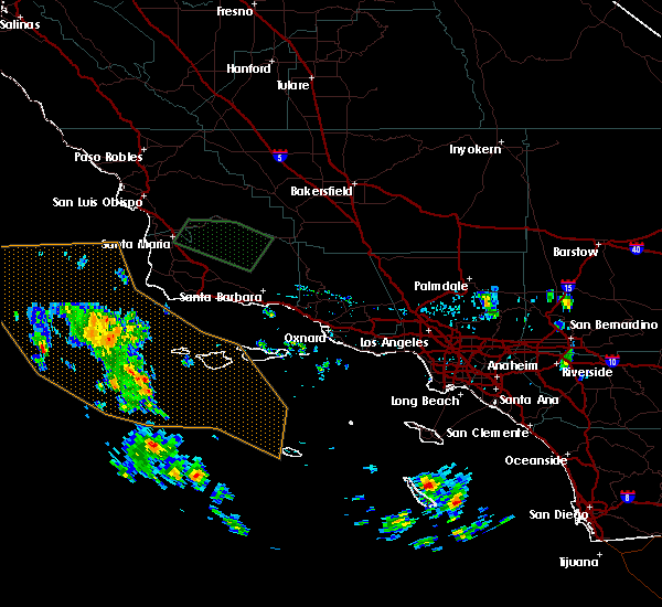
Hail Map for Cuyama, CA
The Cuyama, CA area has had 0 reports of on-the-ground hail by trained spotters, and has been under severe weather warnings 0 times during the past 12 months. Doppler radar has detected hail at or near Cuyama, CA on 1 occasion.
| Name: | Cuyama, CA |
| Where Located: | 45 miles SW of Bakersfield, CA |
| Map: | Google Map for Cuyama, CA |
| Population: | 57 |
| Housing Units: | 30 |
| More Info: | Search Google for Cuyama, CA |
0
The Top Recent Hail Date for Cuyama, CA is Saturday, September 10, 2011 (1st out of 1)

Hail and Wind Damage Spotted near Cuyama, CA
| Date / Time | Report Details |
|---|---|
| 6/5/2019 5:15 PM PDT |
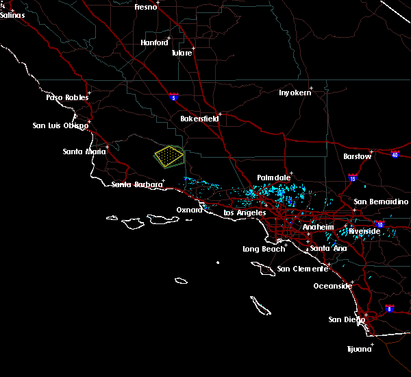 At 510 pm pdt, a severe thunderstorm in the northern santa barbara county mountains is slowly moving into the cuyama valley (radar indicated). Hazards include 60 mph wind gusts and one half to one inch hail. radar estimated rain rates between 1.5 to 2 inches per hour, with flash flooding expected in the cuyama valley and the surrounding area. Hail damage to vehicles is possible. expect wind damage to roofs, siding, and trees. frequent lightning is occuring with this storm. Locations impacted include, cuyama and portions of highway 166. At 510 pm pdt, a severe thunderstorm in the northern santa barbara county mountains is slowly moving into the cuyama valley (radar indicated). Hazards include 60 mph wind gusts and one half to one inch hail. radar estimated rain rates between 1.5 to 2 inches per hour, with flash flooding expected in the cuyama valley and the surrounding area. Hail damage to vehicles is possible. expect wind damage to roofs, siding, and trees. frequent lightning is occuring with this storm. Locations impacted include, cuyama and portions of highway 166.
|
| 6/5/2019 4:42 PM PDT |
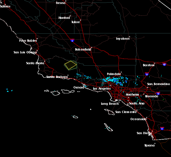 At 440 pm pdt, a severe thunderstorm was located in the northern santa barbara county mountains, near cuyama. the storm was nearly stationary (radar indicated). Hazards include 60 mph wind gusts and quarter size hail. heavy rain and flash flooding are also expected. Hail damage to vehicles is expected. Expect wind damage to roofs, siding, and trees. At 440 pm pdt, a severe thunderstorm was located in the northern santa barbara county mountains, near cuyama. the storm was nearly stationary (radar indicated). Hazards include 60 mph wind gusts and quarter size hail. heavy rain and flash flooding are also expected. Hail damage to vehicles is expected. Expect wind damage to roofs, siding, and trees.
|
| 6/5/2019 4:17 PM PDT |
 At 415 pm pdt, a severe thunderstorm was located in the northern santa barbara county mountains, near cuyama. the storm was nearly stationary (radar indicated). Hazards include wind gusts 60 mph or greater and quarter size hail, heavy rain and flooding with potential flash flooding. Hail damage to vehicles is expected. Expect wind damage to roofs, siding, and trees, and flooding. At 415 pm pdt, a severe thunderstorm was located in the northern santa barbara county mountains, near cuyama. the storm was nearly stationary (radar indicated). Hazards include wind gusts 60 mph or greater and quarter size hail, heavy rain and flooding with potential flash flooding. Hail damage to vehicles is expected. Expect wind damage to roofs, siding, and trees, and flooding.
|
| 9/10/2017 6:22 PM PDT |
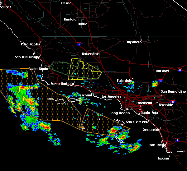 At 615 pm pdt, national weather service doppler radars indicated a line of severe thunderstorms extending from west of lockwood valley across northern ventura county into northeastern santa barbara county including the cuyama valley. these storms were moving west northwest at 45 mph. radar indicated some rotation with these storms, strongest near big pine mountain, so brief tornadoes are possible with these storms (radar indicated). Hazards include 60 mph wind gusts and quarter size hail. Hail damage to vehicles is expected. expect wind damage to roofs, siding, and trees. Locations impacted include, cuyama, lockwood valley, reyes peak, big pine mountain, frazier mountain, ventucopa, highway 33 from lockwood valley road to the santa barbara county line, carrizo plain, and highway 166 between twitchell dam and the cuyama valley. At 615 pm pdt, national weather service doppler radars indicated a line of severe thunderstorms extending from west of lockwood valley across northern ventura county into northeastern santa barbara county including the cuyama valley. these storms were moving west northwest at 45 mph. radar indicated some rotation with these storms, strongest near big pine mountain, so brief tornadoes are possible with these storms (radar indicated). Hazards include 60 mph wind gusts and quarter size hail. Hail damage to vehicles is expected. expect wind damage to roofs, siding, and trees. Locations impacted include, cuyama, lockwood valley, reyes peak, big pine mountain, frazier mountain, ventucopa, highway 33 from lockwood valley road to the santa barbara county line, carrizo plain, and highway 166 between twitchell dam and the cuyama valley.
|
| 9/10/2017 5:53 PM PDT |
 At 548 pm pdt, a couple of severe thunderstorms were located between lockwood valley and ventucopa. these storms were moving west northwest at 40 mph and will affect northern ventura county, northeastern santa barbara county and southeastern san luis obispo county through 645 pm. this storm will affect highway 33. radar showed some rotation with this storm, so a brief weak tornado is possible (radar indicated). Hazards include 60 mph wind gusts and quarter size hail. Hail damage to vehicles is expected. Expect wind damage to roofs, siding, and trees. At 548 pm pdt, a couple of severe thunderstorms were located between lockwood valley and ventucopa. these storms were moving west northwest at 40 mph and will affect northern ventura county, northeastern santa barbara county and southeastern san luis obispo county through 645 pm. this storm will affect highway 33. radar showed some rotation with this storm, so a brief weak tornado is possible (radar indicated). Hazards include 60 mph wind gusts and quarter size hail. Hail damage to vehicles is expected. Expect wind damage to roofs, siding, and trees.
|
Hail Maps for Cuyama, CA

Connect with Interactive Hail Maps