

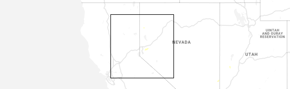
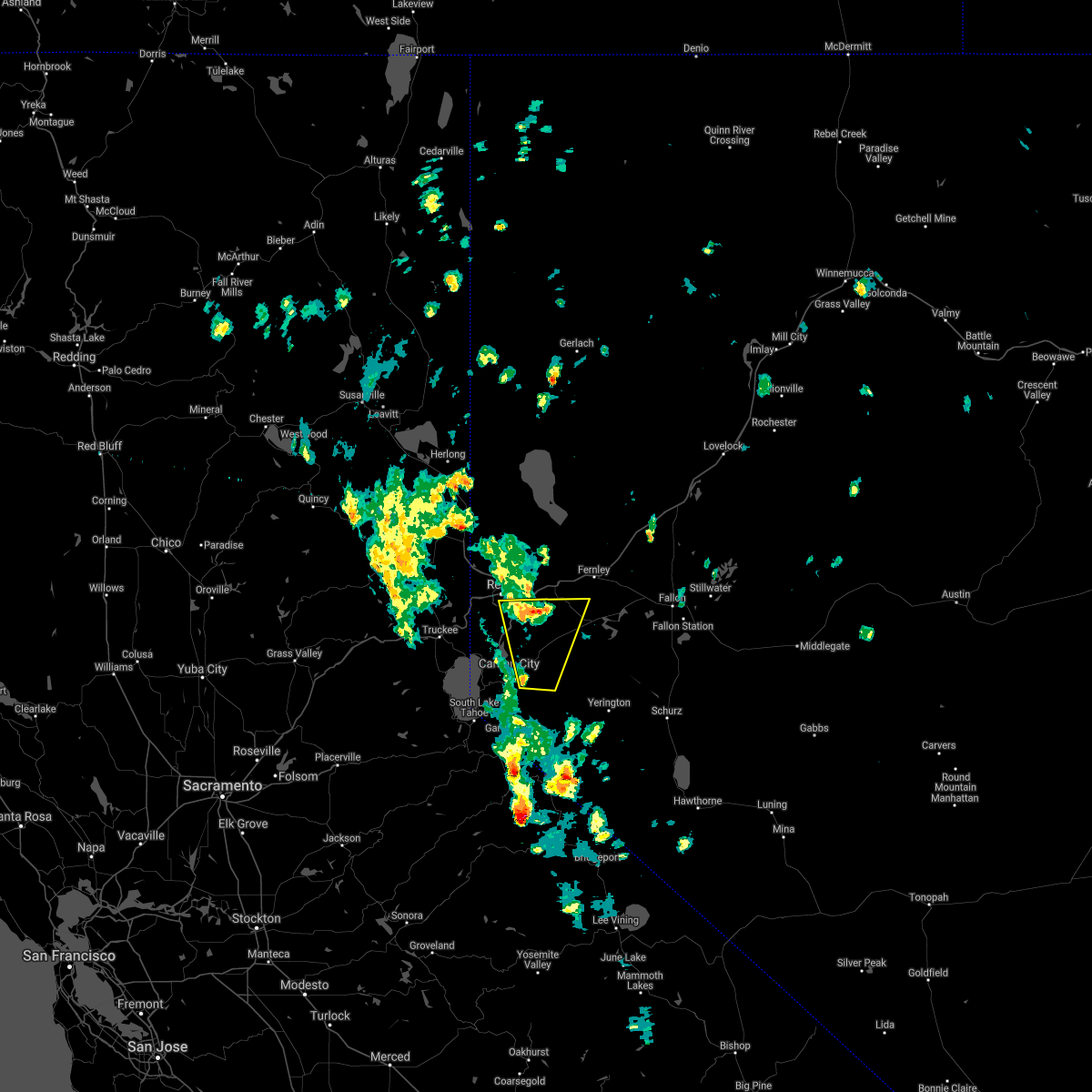
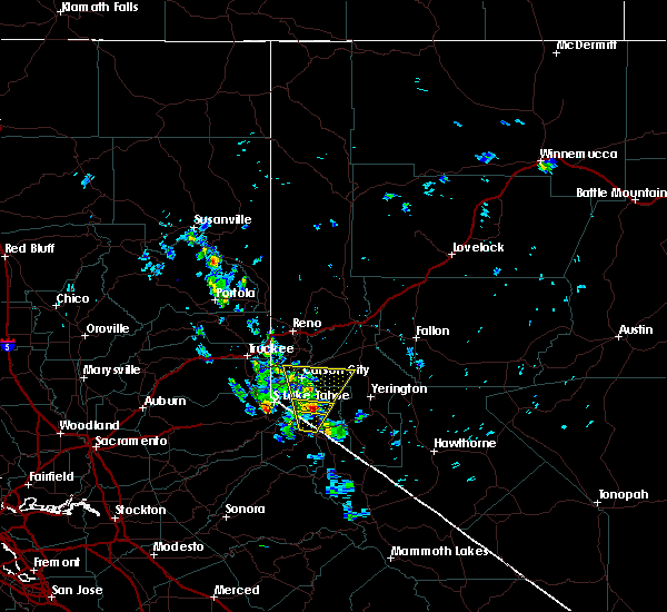
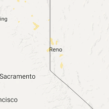
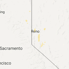
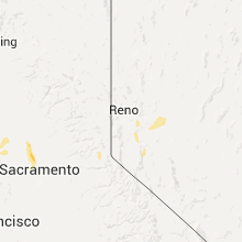
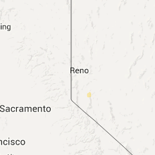
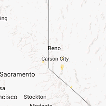
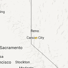
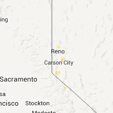
Hail Map for Dayton, NV
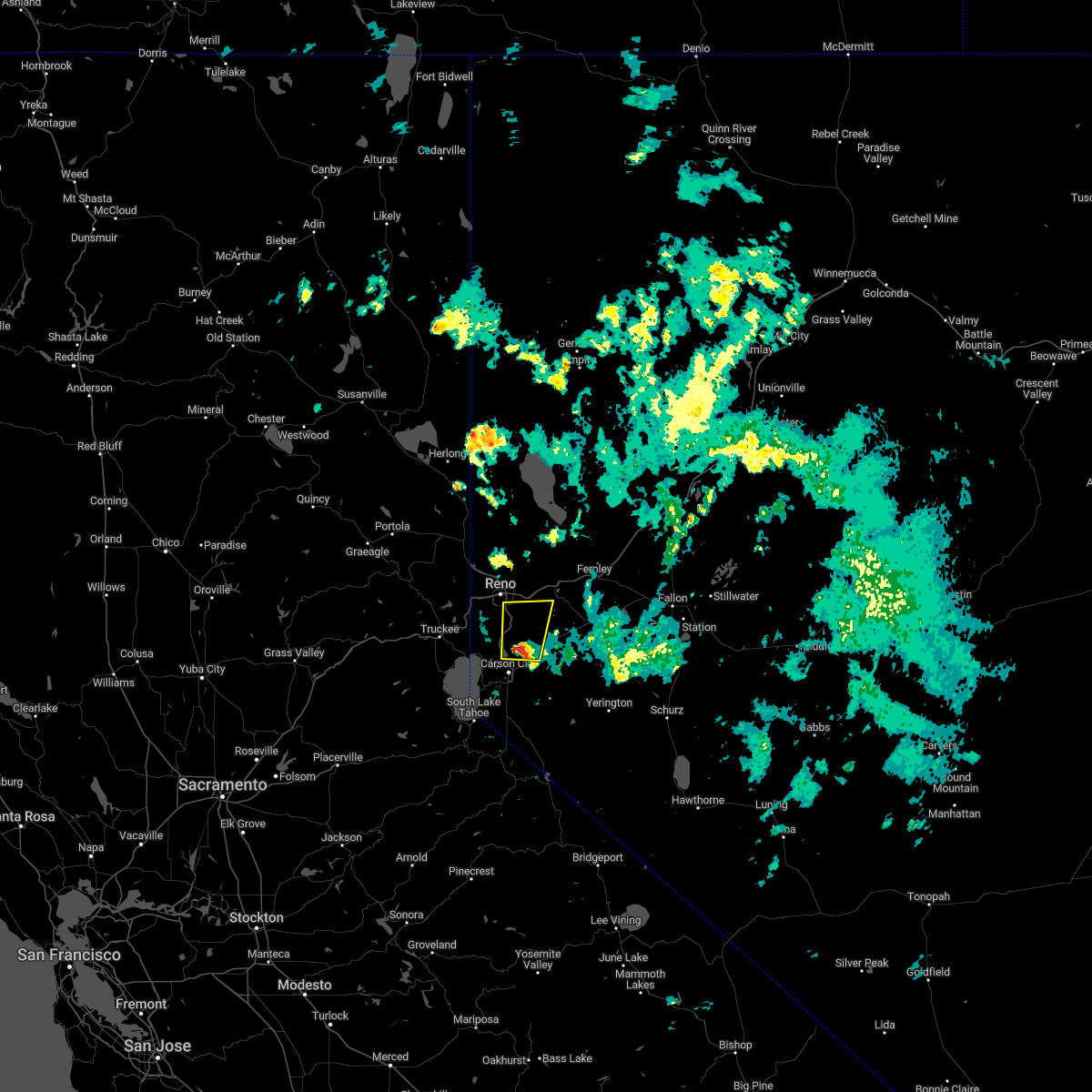
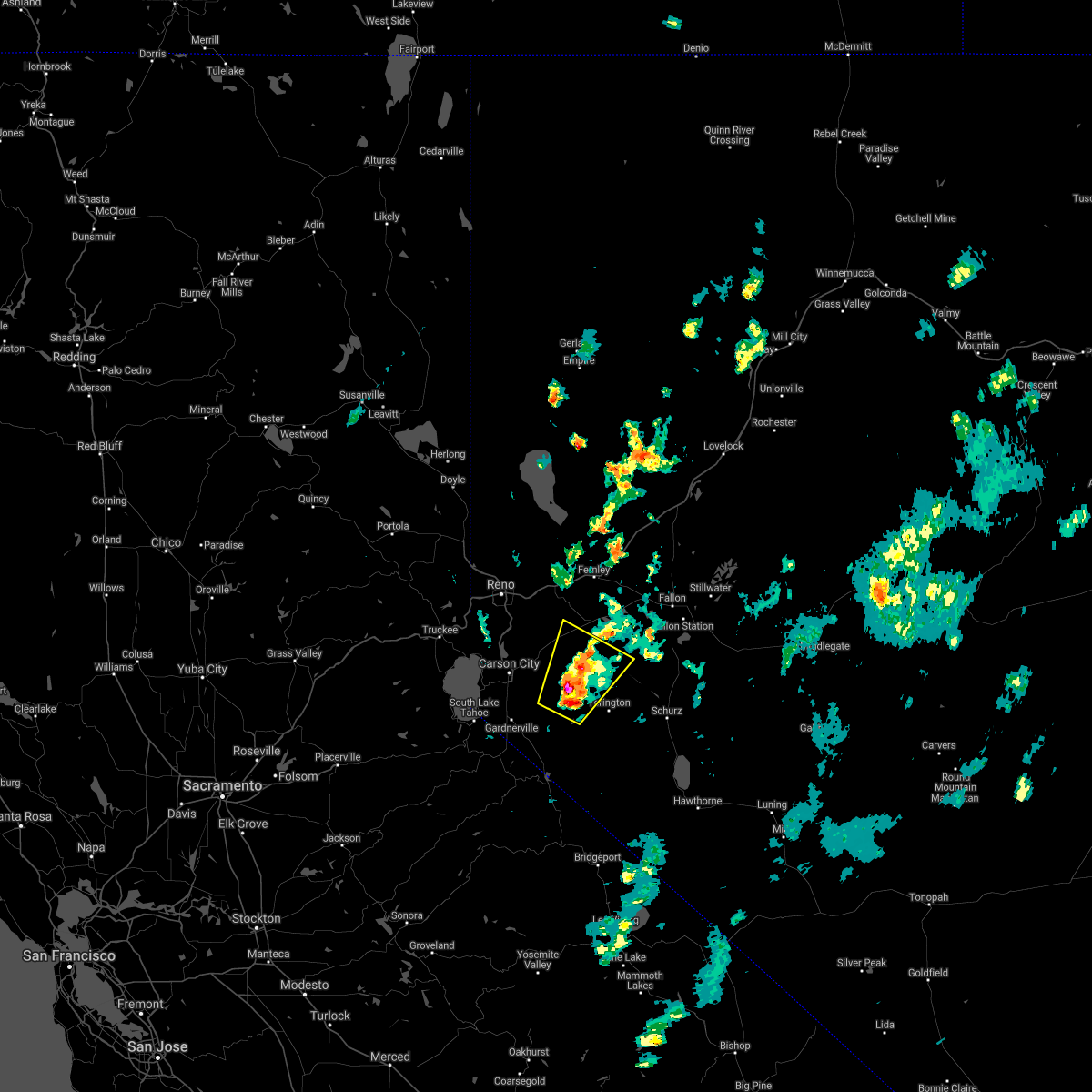
The Dayton, NV area has had 0 reports of on-the-ground hail by trained spotters, and has been under severe weather warnings 0 times during the past 12 months. Doppler radar has detected hail at or near Dayton, NV on 14 occasions.
| Name: | Dayton, NV |
| Where Located: | 23.3 miles SE of Reno, NV |
| Map: | Google Map for Dayton, NV |
| Population: | 8964 |
| Housing Units: | 3766 |
| More Info: | Search Google for Dayton, NV |
0
The Top Recent Hail Date for Dayton, NV is Thursday, August 18, 2022 (8th out of 14)
Hail and Wind Damage Spotted near Dayton, NV
| Date / Time | Report Details |
|---|---|
| 8/18/2022 1:17 PM PDT |
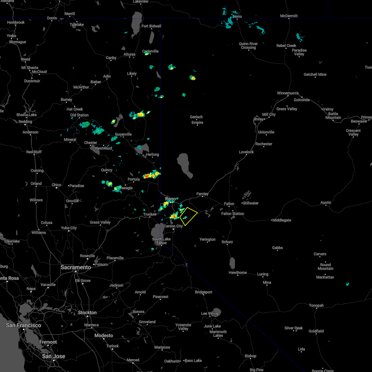 At 116 pm pdt, a severe thunderstorm was located near dayton, or 7 miles east of virginia city, moving southeast at 15 mph towards us-50 (radar indicated). Hazards include 60 mph wind gusts and quarter size hail. Hail damage to vehicles is expected. Expect wind damage to roofs, siding, fencing and trees. At 116 pm pdt, a severe thunderstorm was located near dayton, or 7 miles east of virginia city, moving southeast at 15 mph towards us-50 (radar indicated). Hazards include 60 mph wind gusts and quarter size hail. Hail damage to vehicles is expected. Expect wind damage to roofs, siding, fencing and trees.
|
| 8/8/2022 6:57 PM PDT |
 The severe thunderstorm warning for storey, south central washoe and northern lyon counties and central carson city will expire at 700 pm pdt, the storm which prompted the warning has weakened below severe limits, and no longer poses an immediate threat to life or property. therefore, the warning will be allowed to expire. however gusty winds and heavy rain are still possible with this thunderstorm. The severe thunderstorm warning for storey, south central washoe and northern lyon counties and central carson city will expire at 700 pm pdt, the storm which prompted the warning has weakened below severe limits, and no longer poses an immediate threat to life or property. therefore, the warning will be allowed to expire. however gusty winds and heavy rain are still possible with this thunderstorm.
|
| 8/8/2022 6:33 PM PDT |
 At 633 pm pdt, a severe thunderstorm was located over virginia city, moving north at 25 mph (radar indicated). Hazards include 60 mph wind gusts and penny size hail. expect damage to roofs, siding, fencing and trees At 633 pm pdt, a severe thunderstorm was located over virginia city, moving north at 25 mph (radar indicated). Hazards include 60 mph wind gusts and penny size hail. expect damage to roofs, siding, fencing and trees
|
| 8/18/2020 5:21 PM PDT |
 At 519 pm pdt, a severe thunderstorm was located 12 miles northwest of weed heights, or 19 miles east of carson city, moving northeast at 15 mph (radar indicated). Hazards include 60 mph wind gusts and quarter size hail. Hail damage to vehicles is expected. Expect wind damage to roofs, siding, fencing and trees. At 519 pm pdt, a severe thunderstorm was located 12 miles northwest of weed heights, or 19 miles east of carson city, moving northeast at 15 mph (radar indicated). Hazards include 60 mph wind gusts and quarter size hail. Hail damage to vehicles is expected. Expect wind damage to roofs, siding, fencing and trees.
|
| 7/22/2020 1:42 PM PDT |
 At 140 pm pdt, a severe thunderstorm was located near johnson lane, or 8 miles northeast of gardnerville, moving northwest at 10 mph (radar indicated). Hazards include 60 mph wind gusts and quarter size hail. Hail damage to vehicles is expected. expect wind damage to roofs, siding, fencing and trees. Locations impacted include, johnson lane, indian hills, and carson city. At 140 pm pdt, a severe thunderstorm was located near johnson lane, or 8 miles northeast of gardnerville, moving northwest at 10 mph (radar indicated). Hazards include 60 mph wind gusts and quarter size hail. Hail damage to vehicles is expected. expect wind damage to roofs, siding, fencing and trees. Locations impacted include, johnson lane, indian hills, and carson city.
|
| 7/22/2020 1:24 PM PDT |
 At 123 pm pdt, a severe thunderstorm was located 9 miles east of johnson lane, or 10 miles northeast of gardnerville, moving northwest at 5 mph (radar indicated). Hazards include 60 mph wind gusts and quarter size hail. Hail damage to vehicles is expected. Expect wind damage to roofs, siding, fencing and trees. At 123 pm pdt, a severe thunderstorm was located 9 miles east of johnson lane, or 10 miles northeast of gardnerville, moving northwest at 5 mph (radar indicated). Hazards include 60 mph wind gusts and quarter size hail. Hail damage to vehicles is expected. Expect wind damage to roofs, siding, fencing and trees.
|
| 5/24/2018 4:26 PM PDT |
 The severe thunderstorm warning for storey, south central washoe, douglas, and northern lyon counties and eastern carson city will expire at 430 pm pdt, the severe thunderstorm which prompted the warning has weakened. therefore, the warning will be allowed to expire. however heavy rain, pea size hail, and gusty winds are still likely with this thunderstorm. i-80 will likely be impacted by heavy rain between reno and usa parkway. The severe thunderstorm warning for storey, south central washoe, douglas, and northern lyon counties and eastern carson city will expire at 430 pm pdt, the severe thunderstorm which prompted the warning has weakened. therefore, the warning will be allowed to expire. however heavy rain, pea size hail, and gusty winds are still likely with this thunderstorm. i-80 will likely be impacted by heavy rain between reno and usa parkway.
|
| 5/24/2018 3:28 PM PDT |
 At 328 pm pdt, a severe thunderstorm was located near dayton, or 9 miles east of carson city, moving north at 20 mph (radar indicated). Hazards include 60 mph wind gusts and quarter size hail. Hail damage to vehicles is expected. expect wind damage to roofs, siding, fencing, and trees. Dust storms resulting in serious accidents. At 328 pm pdt, a severe thunderstorm was located near dayton, or 9 miles east of carson city, moving north at 20 mph (radar indicated). Hazards include 60 mph wind gusts and quarter size hail. Hail damage to vehicles is expected. expect wind damage to roofs, siding, fencing, and trees. Dust storms resulting in serious accidents.
|
| 5/24/2018 2:39 PM PDT |
 At 238 pm pdt, a severe thunderstorm was located near gardnerville, moving north at 20 mph (radar indicated). Hazards include 60 mph wind gusts and quarter size hail. Hail damage to vehicles is expected. expect wind damage to roofs, siding, fencing, and trees. Dust storms resulting in serious accidents. At 238 pm pdt, a severe thunderstorm was located near gardnerville, moving north at 20 mph (radar indicated). Hazards include 60 mph wind gusts and quarter size hail. Hail damage to vehicles is expected. expect wind damage to roofs, siding, fencing, and trees. Dust storms resulting in serious accidents.
|
| 7/25/2017 5:43 PM PDT | Mesowest station just north of dayton... nv reported a 61 mph wind gust associated with a strong thunderstor in lyon county NV, 1.7 miles SSE of Dayton, NV |
Hail Maps for Dayton, NV


Connect with Interactive Hail Maps