

Hail Map for Dover, ID
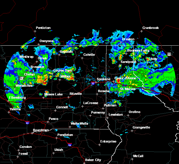
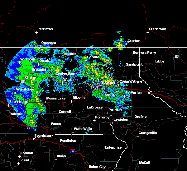
The Dover, ID area has had 2 reports of on-the-ground hail by trained spotters, and has been under severe weather warnings 3 times during the past 12 months. Doppler radar has detected hail at or near Dover, ID on 3 occasions.
| Name: | Dover, ID |
| Where Located: | 56.1 miles NE of Spokane, WA |
| Map: | Google Map for Dover, ID |
| Population: | 556 |
| Housing Units: | 327 |
| More Info: | Search Google for Dover, ID |
5
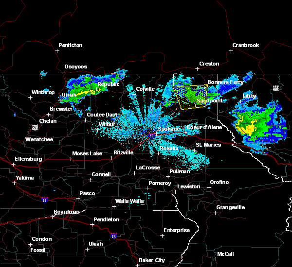
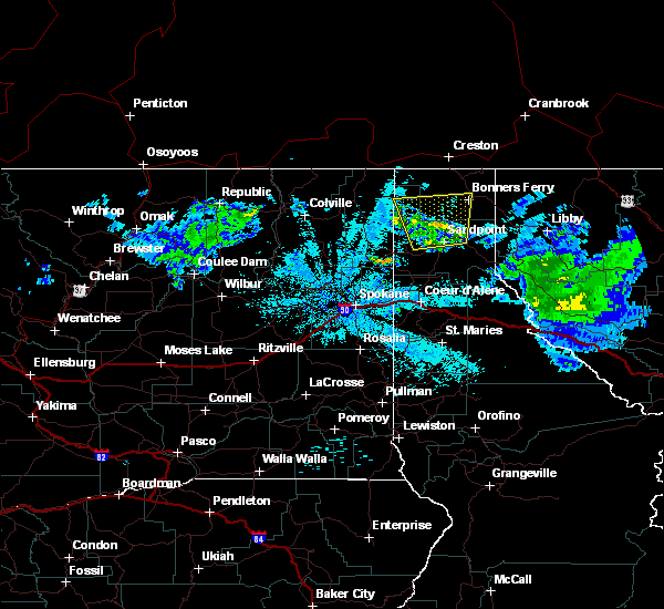
The Top Recent Hail Date for Dover, ID is Saturday, August 10, 2019 (1st out of 3)

Hail and Wind Damage Spotted near Dover, ID
| Date / Time | Report Details |
|---|---|
| 7/10/2023 7:32 PM PDT |
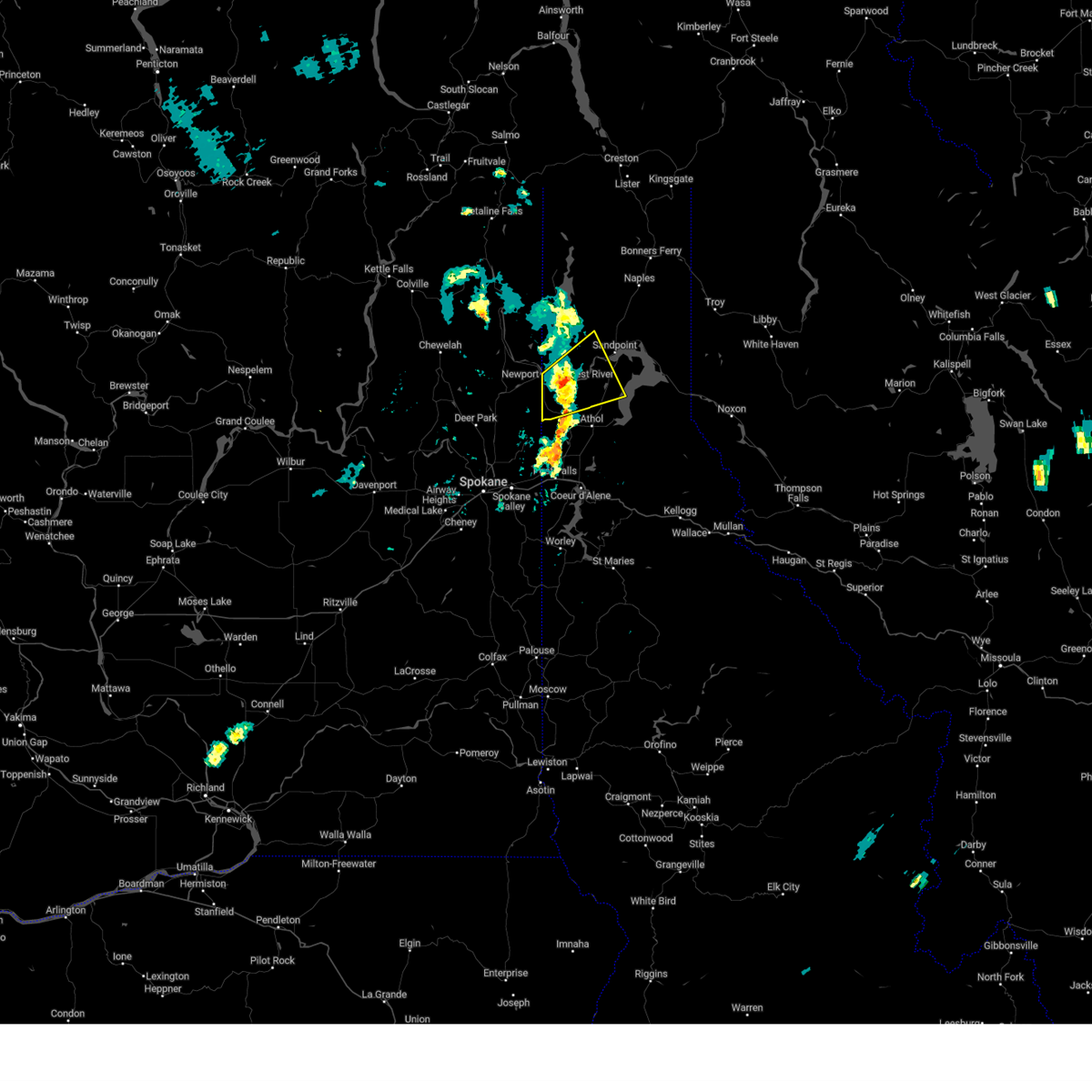 At 730 pm pdt, a severe thunderstorm was located near priest river, moving northeast at 30 mph (radar indicated for wind. at 710 pm one-inch diameter hail was reported in blanchard, id). Hazards include 60 mph wind gusts and half dollar size hail. Hail damage to vehicles is expected. expect wind damage to roofs, siding, and trees. locations impacted include, priest river, dover, oldtown, cocolalla, and blanchard. this includes the following highways, u. s. highway 95 in idaho between mile markers 458 and 468. u. s. highway 2 in idaho between mile markers 1 and 25. hail threat, observed max hail size, 1. 25 in wind threat, radar indicated max wind gust, 60 mph. At 730 pm pdt, a severe thunderstorm was located near priest river, moving northeast at 30 mph (radar indicated for wind. at 710 pm one-inch diameter hail was reported in blanchard, id). Hazards include 60 mph wind gusts and half dollar size hail. Hail damage to vehicles is expected. expect wind damage to roofs, siding, and trees. locations impacted include, priest river, dover, oldtown, cocolalla, and blanchard. this includes the following highways, u. s. highway 95 in idaho between mile markers 458 and 468. u. s. highway 2 in idaho between mile markers 1 and 25. hail threat, observed max hail size, 1. 25 in wind threat, radar indicated max wind gust, 60 mph.
|
| 7/10/2023 7:11 PM PDT |
 At 710 pm pdt, a severe thunderstorm was located 9 miles south of newport, or 11 miles southwest of priest river, moving northeast at 30 mph (radar indicated). Hazards include 60 mph wind gusts and half dollar size hail. Hail damage to vehicles is expected. Expect wind damage to roofs, siding, and trees. At 710 pm pdt, a severe thunderstorm was located 9 miles south of newport, or 11 miles southwest of priest river, moving northeast at 30 mph (radar indicated). Hazards include 60 mph wind gusts and half dollar size hail. Hail damage to vehicles is expected. Expect wind damage to roofs, siding, and trees.
|
| 7/10/2023 7:11 PM PDT |
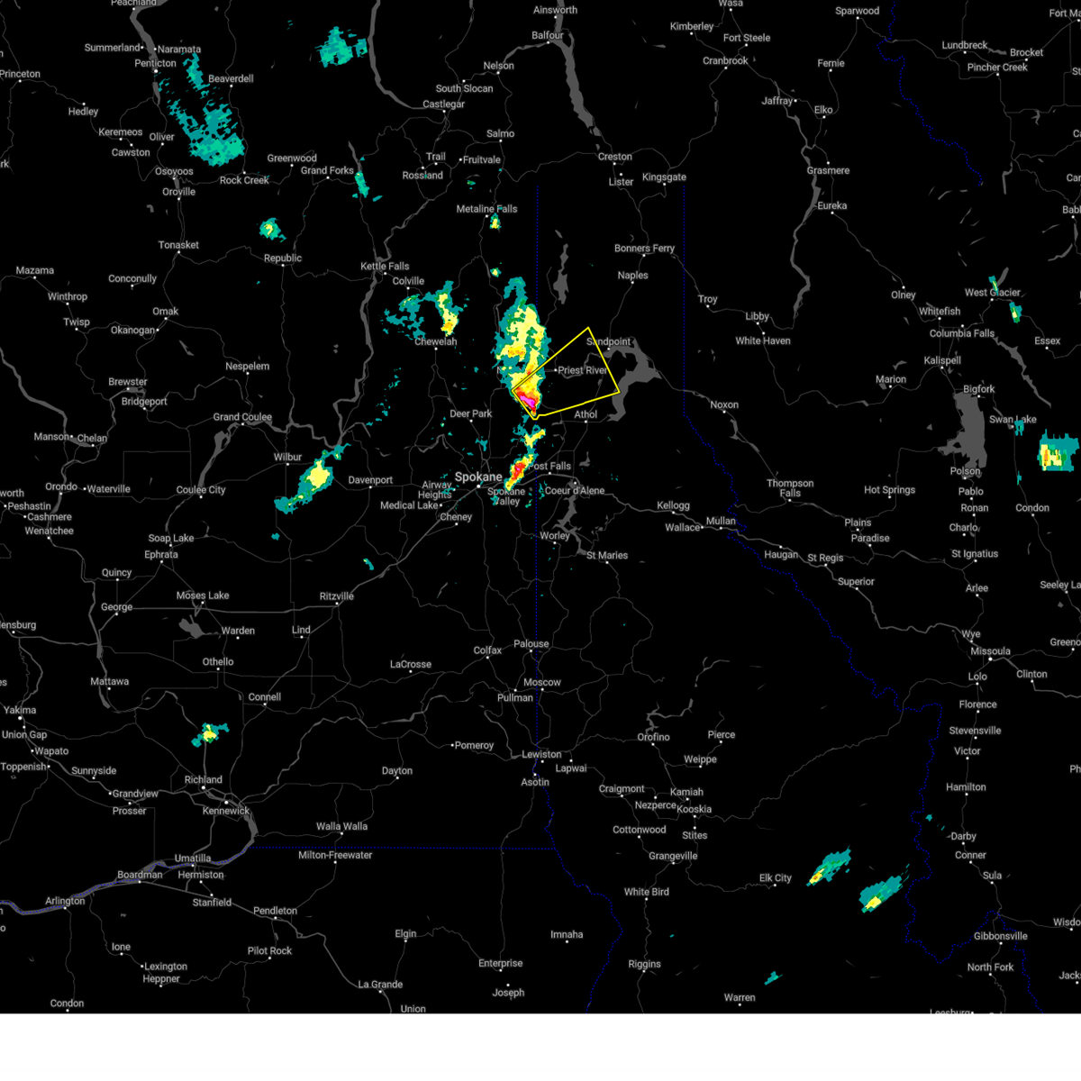 At 710 pm pdt, a severe thunderstorm was located 9 miles south of newport, or 11 miles southwest of priest river, moving northeast at 30 mph (radar indicated). Hazards include 60 mph wind gusts and half dollar size hail. Hail damage to vehicles is expected. Expect wind damage to roofs, siding, and trees. At 710 pm pdt, a severe thunderstorm was located 9 miles south of newport, or 11 miles southwest of priest river, moving northeast at 30 mph (radar indicated). Hazards include 60 mph wind gusts and half dollar size hail. Hail damage to vehicles is expected. Expect wind damage to roofs, siding, and trees.
|
| 8/10/2019 6:39 PM PDT |
 At 639 pm pdt, a severe thunderstorm was located over sandpoint, and is nearly stationary (radar indicated). Hazards include quarter size hail. damage to vehicles is expected At 639 pm pdt, a severe thunderstorm was located over sandpoint, and is nearly stationary (radar indicated). Hazards include quarter size hail. damage to vehicles is expected
|
| 7/23/2019 9:35 PM PDT |
 At 934 pm pdt, severe thunderstorms were located along a line extending from 10 miles southwest of newport to near hayden lake, moving northeast at 75 mph (radar indicated). Hazards include 60 mph wind gusts and penny size hail. expect damage to roofs, siding, and trees At 934 pm pdt, severe thunderstorms were located along a line extending from 10 miles southwest of newport to near hayden lake, moving northeast at 75 mph (radar indicated). Hazards include 60 mph wind gusts and penny size hail. expect damage to roofs, siding, and trees
|
| 8/10/2015 10:07 PM PDT |
 At 1000 pm, the large area of thunderstorms that prompted a severe thunderstorm warning has weakened considerably, stretching from colburn to bonners ferry and priest lake. we`ll let the warning expire at 1015 pm. winds gusts to 35 mph and dangerous lightning can be expected. At 1000 pm, the large area of thunderstorms that prompted a severe thunderstorm warning has weakened considerably, stretching from colburn to bonners ferry and priest lake. we`ll let the warning expire at 1015 pm. winds gusts to 35 mph and dangerous lightning can be expected.
|
| 8/10/2015 9:27 PM PDT |
 At 915 pm pdt, emergency management reported a severe thunderstorm producing damaging winds strong enough to down a few power lines in cocolalla. this storm was located 8 miles northwest of dover, or 8 miles west of sandpoint, and moving north at 30 mph. penny size hail may also accompany the damaging winds. another storm was strengthening just south of the boundary county line near colburn, which will produce the same dangerous weather. At 915 pm pdt, emergency management reported a severe thunderstorm producing damaging winds strong enough to down a few power lines in cocolalla. this storm was located 8 miles northwest of dover, or 8 miles west of sandpoint, and moving north at 30 mph. penny size hail may also accompany the damaging winds. another storm was strengthening just south of the boundary county line near colburn, which will produce the same dangerous weather.
|
| 8/10/2015 8:45 PM PDT | A few power lines down. fire starts from the downed lines as well as lightning strikes. time estimated based on radar. hail was also reported but size was unknow in bonner county ID, 11.1 miles N of Dover, ID |
| 7/25/2015 4:36 PM PDT | Quarter sized hail reported 4 miles NNW of Dover, ID |
| 7/25/2015 4:36 PM PDT | Half Dollar sized hail reported 4 miles NNW of Dover, ID, photo via social media. |
| 6/4/2012 6:41 PM PDT | Us navy buoy on lake pend oreille measured wind gust in bonner county ID, 13.7 miles NNW of Dover, ID |
Hail Maps for Dover, ID


Connect with Interactive Hail Maps