

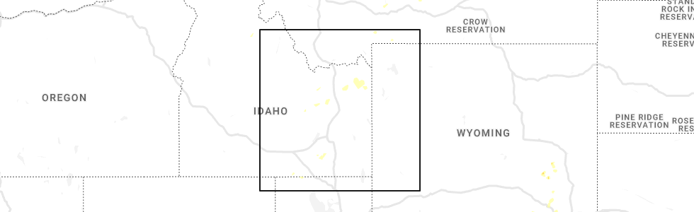
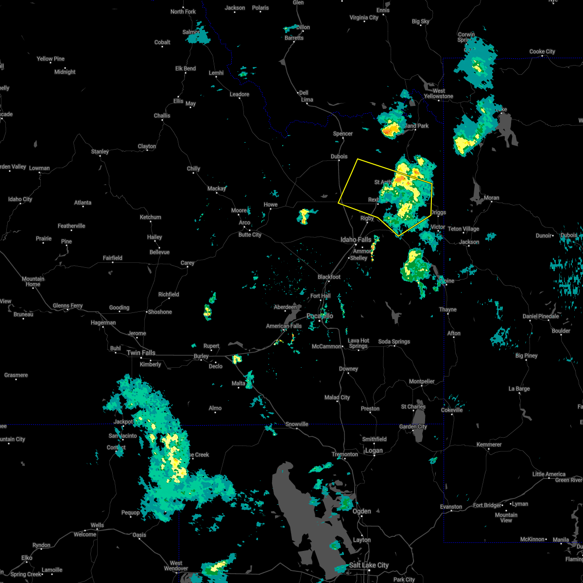
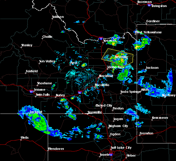
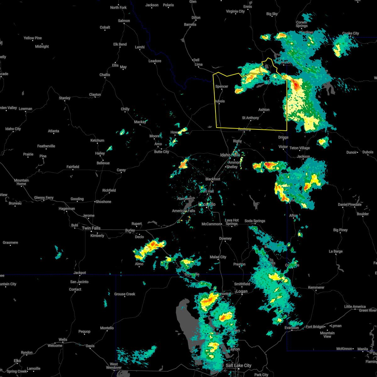
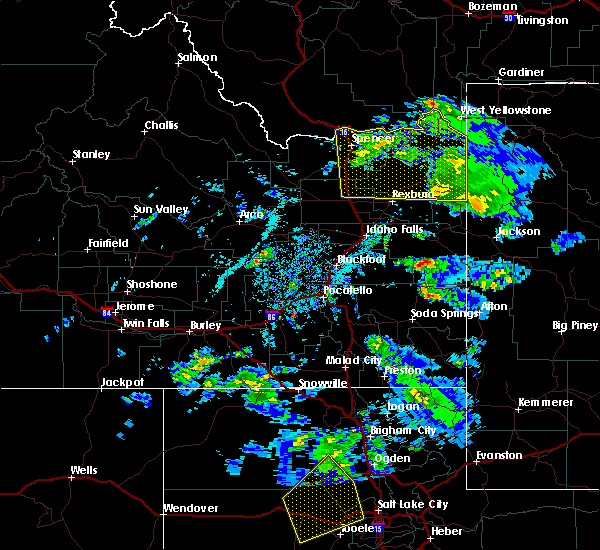
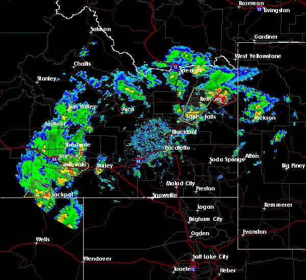
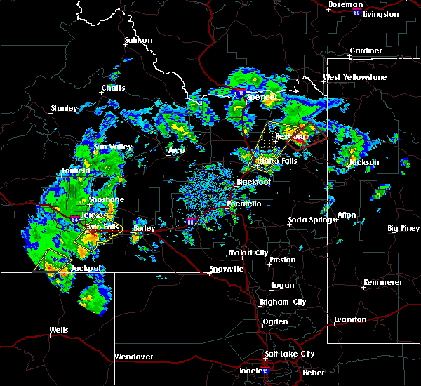
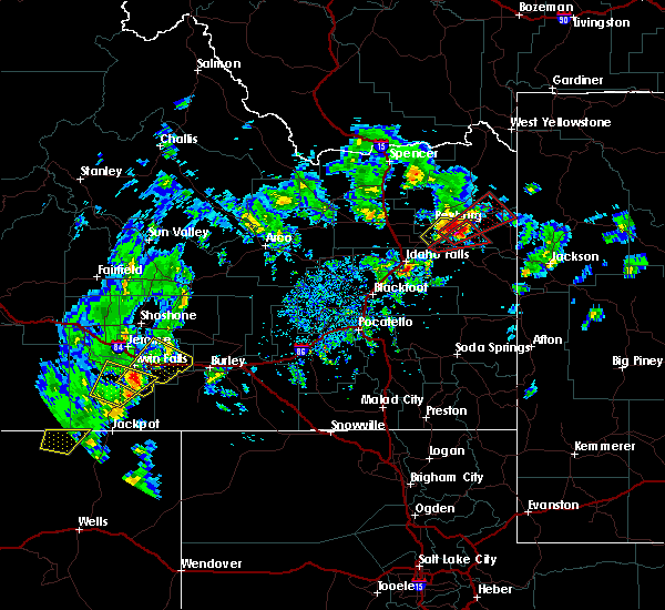
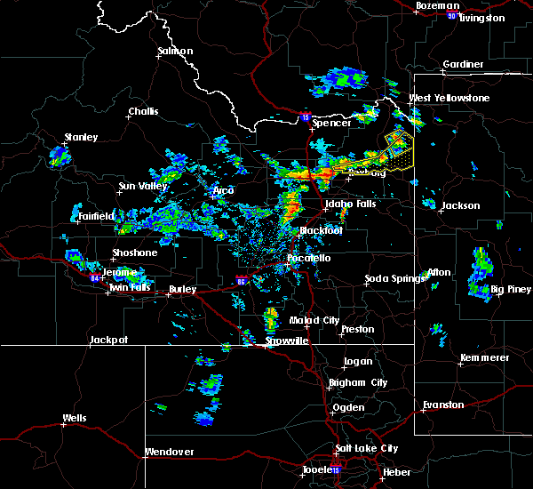
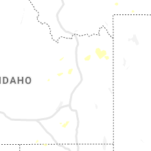
Hail Map for Drummond, ID
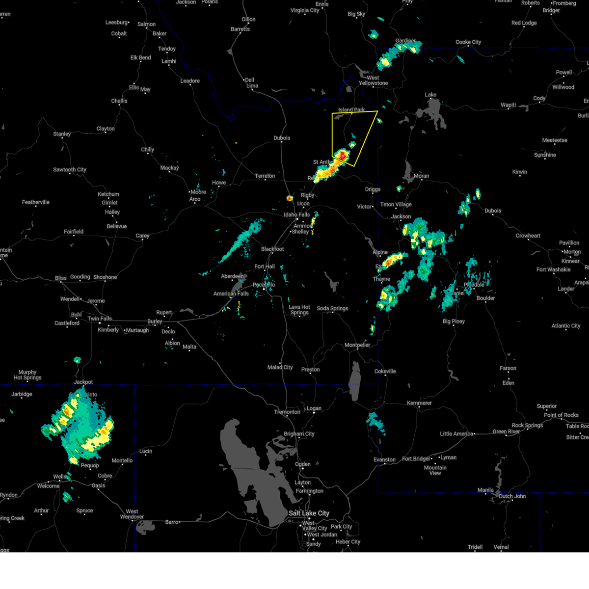
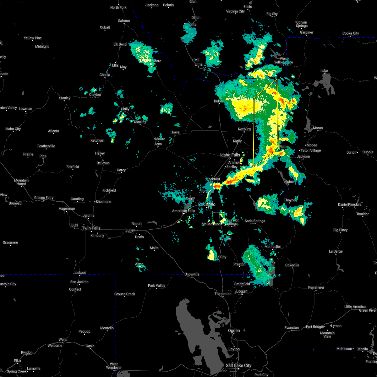
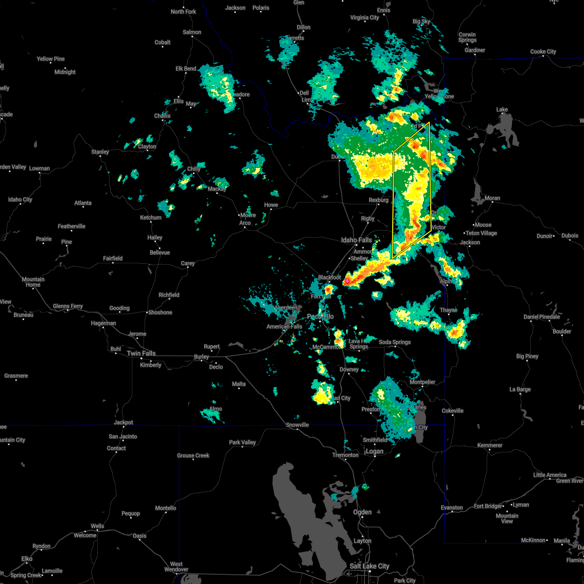
The Drummond, ID area has had 0 reports of on-the-ground hail by trained spotters, and has been under severe weather warnings 1 time during the past 12 months. Doppler radar has detected hail at or near Drummond, ID on 7 occasions.
| Name: | Drummond, ID |
| Where Located: | 49.6 miles NE of Idaho Falls, ID |
| Map: | Google Map for Drummond, ID |
| Population: | 16 |
| Housing Units: | 10 |
| More Info: | Search Google for Drummond, ID |
0
The Top Recent Hail Date for Drummond, ID is Saturday, August 13, 2022 (5th out of 7)
Hail and Wind Damage Spotted near Drummond, ID
| Date / Time | Report Details |
|---|---|
| 9/1/2023 3:44 PM MDT |
 At 344 pm mdt, a severe thunderstorm was located over ashton, moving northeast at 40 mph (radar indicated). Hazards include 60 mph wind gusts and quarter size hail. Hail damage to vehicles is expected. Expect wind damage to roofs, siding, and trees. At 344 pm mdt, a severe thunderstorm was located over ashton, moving northeast at 40 mph (radar indicated). Hazards include 60 mph wind gusts and quarter size hail. Hail damage to vehicles is expected. Expect wind damage to roofs, siding, and trees.
|
| 9/19/2020 6:12 PM MDT |
 The severe thunderstorm warning for western teton, southeastern fremont, southeastern jefferson, north central bonneville and madison counties will expire at 615 pm mdt, the storms which prompted the warning have weakened below severe limits, and no longer pose an immediate threat to life or property. therefore, the warning will be allowed to expire. however gusty winds are still possible with these thunderstorms. The severe thunderstorm warning for western teton, southeastern fremont, southeastern jefferson, north central bonneville and madison counties will expire at 615 pm mdt, the storms which prompted the warning have weakened below severe limits, and no longer pose an immediate threat to life or property. therefore, the warning will be allowed to expire. however gusty winds are still possible with these thunderstorms.
|
| 9/19/2020 6:11 PM MDT |
 The severe thunderstorm warning for western teton, southeastern fremont, southeastern jefferson, north central bonneville and eastern madison counties will expire at 615 pm mdt, the line of storms which prompted the warning have weakened below severe limits, and no longer pose an immediate threat to life or property. therefore, the warning will be allowed to expire. however gusty winds are still possible with these thunderstorms as they track to the east and northeast. The severe thunderstorm warning for western teton, southeastern fremont, southeastern jefferson, north central bonneville and eastern madison counties will expire at 615 pm mdt, the line of storms which prompted the warning have weakened below severe limits, and no longer pose an immediate threat to life or property. therefore, the warning will be allowed to expire. however gusty winds are still possible with these thunderstorms as they track to the east and northeast.
|
| 9/19/2020 6:04 PM MDT |
 At 604 pm mdt, severe thunderstorms were located along a line extending from 6 miles north of ashton reservoir to near ririe reservoir, moving northeast at 20 mph (radar indicated). Hazards include 60 mph wind gusts and quarter size hail. Hail damage to vehicles is expected. expect wind damage to roofs, siding, and trees. Locations impacted include, ashton, marysville, drummond, chester, last chance, ashton reservoir, warm river, tetonia research station, green canyon hot springs, harriman state park, newdale, ashton hill and mesa falls state park. At 604 pm mdt, severe thunderstorms were located along a line extending from 6 miles north of ashton reservoir to near ririe reservoir, moving northeast at 20 mph (radar indicated). Hazards include 60 mph wind gusts and quarter size hail. Hail damage to vehicles is expected. expect wind damage to roofs, siding, and trees. Locations impacted include, ashton, marysville, drummond, chester, last chance, ashton reservoir, warm river, tetonia research station, green canyon hot springs, harriman state park, newdale, ashton hill and mesa falls state park.
|
| 9/19/2020 5:38 PM MDT |
 At 531 pm mdt, severe thunderstorms were located along a line extending from near parker to goshen, moving northeast at 20 mph. there have been reports of downed trees and powerline as a result of this line of thunderstorms. frequent lightning is also occuring. move indoors now! (radar indicated). Hazards include 60 mph wind gusts and quarter size hail. Hail damage to vehicles is expected. Expect wind damage to roofs, siding, and trees. At 531 pm mdt, severe thunderstorms were located along a line extending from near parker to goshen, moving northeast at 20 mph. there have been reports of downed trees and powerline as a result of this line of thunderstorms. frequent lightning is also occuring. move indoors now! (radar indicated). Hazards include 60 mph wind gusts and quarter size hail. Hail damage to vehicles is expected. Expect wind damage to roofs, siding, and trees.
|
| 9/19/2020 5:34 PM MDT |
 At 531 pm mdt, severe thunderstorms were located along a line extending from near parker to goshen, moving northeast at 20 mph. there have been reports of downed trees and powerline as a result of this line of thunderstorms. frequent lightning is also occuring. move indoors now! (radar indicated). Hazards include 60 mph wind gusts and quarter size hail. Hail damage to vehicles is expected. Expect wind damage to roofs, siding, and trees. At 531 pm mdt, severe thunderstorms were located along a line extending from near parker to goshen, moving northeast at 20 mph. there have been reports of downed trees and powerline as a result of this line of thunderstorms. frequent lightning is also occuring. move indoors now! (radar indicated). Hazards include 60 mph wind gusts and quarter size hail. Hail damage to vehicles is expected. Expect wind damage to roofs, siding, and trees.
|
| 6/6/2019 9:13 PM MDT |
 The severe thunderstorm warning for northwestern teton, southern fremont, central jefferson, north central bonneville, madison and southeastern clark counties will expire at 915 pm mdt, the storms which prompted the warning have weakened below severe limits, and have exited the warned area. therefore, the warning will be allowed to expire. however gusty winds are still possible with these thunderstorms. a severe thunderstorm watch remains in effect until 1100 pm mdt for eastern and southeastern idaho. The severe thunderstorm warning for northwestern teton, southern fremont, central jefferson, north central bonneville, madison and southeastern clark counties will expire at 915 pm mdt, the storms which prompted the warning have weakened below severe limits, and have exited the warned area. therefore, the warning will be allowed to expire. however gusty winds are still possible with these thunderstorms. a severe thunderstorm watch remains in effect until 1100 pm mdt for eastern and southeastern idaho.
|
| 6/6/2019 8:56 PM MDT |
 At 855 pm mdt, severe thunderstorms and associated outflow winds were located along a line extending from near hamer to 6 miles southeast of teton to 14 miles northwest of swan valley, moving northeast at 50 mph (radar indicated). Hazards include 60 mph wind gusts. Expect damage to roofs, siding, and trees. Locations impacted include, rexburg, sugar city, teton, parker, drummond, archer, egin, st anthony, chester, plano, tetonia research station, green canyon hot springs, sage junction, newdale, thornton, saint anthony sand dunes and heise. At 855 pm mdt, severe thunderstorms and associated outflow winds were located along a line extending from near hamer to 6 miles southeast of teton to 14 miles northwest of swan valley, moving northeast at 50 mph (radar indicated). Hazards include 60 mph wind gusts. Expect damage to roofs, siding, and trees. Locations impacted include, rexburg, sugar city, teton, parker, drummond, archer, egin, st anthony, chester, plano, tetonia research station, green canyon hot springs, sage junction, newdale, thornton, saint anthony sand dunes and heise.
|
| 6/6/2019 8:41 PM MDT |
 At 841 pm mdt, severe thunderstorms were located along a line extending from 6 miles east of terreton to archer to near ririe reservoir, moving northeast at 50 mph (radar indicated. 57 mph winds were reported at the idaho falls airport). Hazards include 60 mph wind gusts. Expect damage to roofs, siding, and trees. Locations impacted include, northern idaho falls, rexburg, rigby, ririe reservoir, lorenzo, ammon, iona, sugar city, ucon, menan, teton, ririe, roberts, lewisville, parker, hamer, drummond, archer, egin and st anthony. At 841 pm mdt, severe thunderstorms were located along a line extending from 6 miles east of terreton to archer to near ririe reservoir, moving northeast at 50 mph (radar indicated. 57 mph winds were reported at the idaho falls airport). Hazards include 60 mph wind gusts. Expect damage to roofs, siding, and trees. Locations impacted include, northern idaho falls, rexburg, rigby, ririe reservoir, lorenzo, ammon, iona, sugar city, ucon, menan, teton, ririe, roberts, lewisville, parker, hamer, drummond, archer, egin and st anthony.
|
| 6/6/2019 8:26 PM MDT |
 At 825 pm mdt, severe thunderstorms and associated outflow winds were located along a line extending from 7 miles south of terreton to near ucon to 7 miles southeast of ammon, moving northeast at 50 mph (radar indicated). Hazards include 60 mph wind gusts. expect damage to roofs, siding, and trees At 825 pm mdt, severe thunderstorms and associated outflow winds were located along a line extending from 7 miles south of terreton to near ucon to 7 miles southeast of ammon, moving northeast at 50 mph (radar indicated). Hazards include 60 mph wind gusts. expect damage to roofs, siding, and trees
|
| 6/6/2019 6:27 PM MDT |
 The severe thunderstorm warning for northern teton, fremont, north central jefferson, northern madison and eastern clark counties will expire at 630 pm mdt, the storms which prompted the warning has weakened below severe limits, and has exited the warned area. therefore, the warning will be allowed to expire. however gusty winds are still possible with this thunderstorm. a severe thunderstorm watch remains in effect until 1100 pm mdt for eastern and southeastern idaho. The severe thunderstorm warning for northern teton, fremont, north central jefferson, northern madison and eastern clark counties will expire at 630 pm mdt, the storms which prompted the warning has weakened below severe limits, and has exited the warned area. therefore, the warning will be allowed to expire. however gusty winds are still possible with this thunderstorm. a severe thunderstorm watch remains in effect until 1100 pm mdt for eastern and southeastern idaho.
|
| 6/6/2019 6:07 PM MDT |
 At 605 pm mdt, severe thunderstorms were located 12 miles southwest of henrys lake, moving generally north and east. severe wind gusts have been observed along highway 20 (radar indicated). Hazards include 60 mph wind gusts and penny size hail. Expect damage to roofs, siding, and trees. Locations impacted include, ashton, dubois, idmon, felt, henrys lake, marysville, sugar city, teton, parker, hamer, spencer, drummond, shotgun village, egin, ponds lodge, kilgore, st anthony, plano, island park village and macks inn. At 605 pm mdt, severe thunderstorms were located 12 miles southwest of henrys lake, moving generally north and east. severe wind gusts have been observed along highway 20 (radar indicated). Hazards include 60 mph wind gusts and penny size hail. Expect damage to roofs, siding, and trees. Locations impacted include, ashton, dubois, idmon, felt, henrys lake, marysville, sugar city, teton, parker, hamer, spencer, drummond, shotgun village, egin, ponds lodge, kilgore, st anthony, plano, island park village and macks inn.
|
| 6/6/2019 5:46 PM MDT |
 At 544 pm mdt, thunderstorms were located 11 miles northwest of ashton reservoir or 14 miles northwest of ashton, moving generally to the north and east. these storms are produced strong outflow boundaries (radar indicated). Hazards include 60 mph wind gusts and penny size hail. expect damage to roofs, siding, and trees At 544 pm mdt, thunderstorms were located 11 miles northwest of ashton reservoir or 14 miles northwest of ashton, moving generally to the north and east. these storms are produced strong outflow boundaries (radar indicated). Hazards include 60 mph wind gusts and penny size hail. expect damage to roofs, siding, and trees
|
| 5/31/2018 6:15 PM MDT |
 At 613 pm mdt, a line of severe thunderstorms was located from near ashton to just west of rea, moving northeast at 35 mph (trained weather spotters. this storm has a recent history of producing hail around quarter size and winds near 50 mph. weak rotation has also been reported). Hazards include 60 mph wind gusts and half dollar size hail. Hail damage to vehicles is expected. Expect wind damage to roofs, siding, and trees. At 613 pm mdt, a line of severe thunderstorms was located from near ashton to just west of rea, moving northeast at 35 mph (trained weather spotters. this storm has a recent history of producing hail around quarter size and winds near 50 mph. weak rotation has also been reported). Hazards include 60 mph wind gusts and half dollar size hail. Hail damage to vehicles is expected. Expect wind damage to roofs, siding, and trees.
|
| 5/31/2018 2:12 PM MDT |
 At 211 pm mdt, a severe thunderstorm capable of producing a tornado was located 8 miles northeast of felt, moving northeast at 40 mph (radar indicated rotation. this storm has a history of producing a rotating wall cloud, brief funnel clouds and large hail). Hazards include tornado and ping pong ball size hail. Flying debris will be dangerous to those caught without shelter. mobile homes will be damaged or destroyed. damage to roofs, windows, and vehicles will occur. tree damage is likely. This tornadic thunderstorm will remain over mainly rural areas of northern teton, southeastern fremont and northeastern madison counties, including the following locations: tetonia research station. At 211 pm mdt, a severe thunderstorm capable of producing a tornado was located 8 miles northeast of felt, moving northeast at 40 mph (radar indicated rotation. this storm has a history of producing a rotating wall cloud, brief funnel clouds and large hail). Hazards include tornado and ping pong ball size hail. Flying debris will be dangerous to those caught without shelter. mobile homes will be damaged or destroyed. damage to roofs, windows, and vehicles will occur. tree damage is likely. This tornadic thunderstorm will remain over mainly rural areas of northern teton, southeastern fremont and northeastern madison counties, including the following locations: tetonia research station.
|
| 5/31/2018 1:58 PM MDT |
 At 157 pm mdt, a severe thunderstorm capable of producing a tornado was located near felt, moving northeast at 40 mph (radar, trained spotter and public indicated rotation. this storm has a history of producing a rotating wall cloud and quarter size hail). Hazards include tornado and ping pong ball size hail. Flying debris will be dangerous to those caught without shelter. mobile homes will be damaged or destroyed. damage to roofs, windows, and vehicles will occur. tree damage is likely. this dangerous storm will be near, felt around 200 pm mdt. Other locations impacted by this tornadic thunderstorm include tetonia research station. At 157 pm mdt, a severe thunderstorm capable of producing a tornado was located near felt, moving northeast at 40 mph (radar, trained spotter and public indicated rotation. this storm has a history of producing a rotating wall cloud and quarter size hail). Hazards include tornado and ping pong ball size hail. Flying debris will be dangerous to those caught without shelter. mobile homes will be damaged or destroyed. damage to roofs, windows, and vehicles will occur. tree damage is likely. this dangerous storm will be near, felt around 200 pm mdt. Other locations impacted by this tornadic thunderstorm include tetonia research station.
|
| 5/31/2018 1:51 PM MDT |
 At 151 pm mdt, a severe thunderstorm capable of producing a tornado was located 8 miles south of drummond or 8 miles west of felt, moving northeast at 40 mph (radar, trained spotter and public indicated rotation). Hazards include tornado and ping pong ball size hail. Flying debris will be dangerous to those caught without shelter. mobile homes will be damaged or destroyed. damage to roofs, windows, and vehicles will occur. tree damage is likely. this dangerous storm will be near, felt and drummond around 200 pm mdt. Other locations impacted by this tornadic thunderstorm include tetonia research station. At 151 pm mdt, a severe thunderstorm capable of producing a tornado was located 8 miles south of drummond or 8 miles west of felt, moving northeast at 40 mph (radar, trained spotter and public indicated rotation). Hazards include tornado and ping pong ball size hail. Flying debris will be dangerous to those caught without shelter. mobile homes will be damaged or destroyed. damage to roofs, windows, and vehicles will occur. tree damage is likely. this dangerous storm will be near, felt and drummond around 200 pm mdt. Other locations impacted by this tornadic thunderstorm include tetonia research station.
|
| 5/31/2018 1:42 PM MDT |
 At 140 pm mdt, a severe thunderstorm capable of producing a tornado was located 11 miles southeast of teton or 14 miles west of felt, moving northeast at 40 mph (radar indicated rotation. trained spotters and the public continue to report rotation with this storm). Hazards include tornado and ping pong ball size hail. Flying debris will be dangerous to those caught without shelter. mobile homes will be damaged or destroyed. damage to roofs, windows, and vehicles will occur. tree damage is likely. this dangerous storm will be near, felt and drummond around 200 pm mdt. Other locations impacted by this tornadic thunderstorm include tetonia research station and green canyon hot springs. At 140 pm mdt, a severe thunderstorm capable of producing a tornado was located 11 miles southeast of teton or 14 miles west of felt, moving northeast at 40 mph (radar indicated rotation. trained spotters and the public continue to report rotation with this storm). Hazards include tornado and ping pong ball size hail. Flying debris will be dangerous to those caught without shelter. mobile homes will be damaged or destroyed. damage to roofs, windows, and vehicles will occur. tree damage is likely. this dangerous storm will be near, felt and drummond around 200 pm mdt. Other locations impacted by this tornadic thunderstorm include tetonia research station and green canyon hot springs.
|
| 5/31/2018 1:27 PM MDT |
 At 126 pm mdt, a severe thunderstorm capable of producing a tornado was located 9 miles east of archer or 11 miles southeast of rexburg, moving northeast at 35 mph (radar indicated rotation. trained spotters and members of the public are reporting rotation with this storm). Hazards include tornado and ping pong ball size hail. Flying debris will be dangerous to those caught without shelter. mobile homes will be damaged or destroyed. damage to roofs, windows, and vehicles will occur. tree damage is likely. this dangerous storm will be near, drummond around 200 pm mdt. Other locations impacted by this tornadic thunderstorm include tetonia research station and green canyon hot springs. At 126 pm mdt, a severe thunderstorm capable of producing a tornado was located 9 miles east of archer or 11 miles southeast of rexburg, moving northeast at 35 mph (radar indicated rotation. trained spotters and members of the public are reporting rotation with this storm). Hazards include tornado and ping pong ball size hail. Flying debris will be dangerous to those caught without shelter. mobile homes will be damaged or destroyed. damage to roofs, windows, and vehicles will occur. tree damage is likely. this dangerous storm will be near, drummond around 200 pm mdt. Other locations impacted by this tornadic thunderstorm include tetonia research station and green canyon hot springs.
|
| 5/8/2016 7:13 PM MDT | The severe thunderstorm warning for southeastern fremont county will expire at 715 pm mdt, the storms which prompted the warning have weakened below severe limits, and no longer pose an immediate threat to life or property. therefore the warning will be allowed to expire. however small hail is still possible with these thunderstorms. |
| 5/8/2016 6:23 PM MDT |
 At 622 pm mdt, emergency management reported a line of severe thunderstorms producing quarter size hail near ashton. these storms were located along a line extending from 14 miles northwest of gibson meadows to near marysville to egin, and moving southeast at 15 mph. At 622 pm mdt, emergency management reported a line of severe thunderstorms producing quarter size hail near ashton. these storms were located along a line extending from 14 miles northwest of gibson meadows to near marysville to egin, and moving southeast at 15 mph.
|
| 8/14/2015 7:58 PM MDT | The severe thunderstorm warning for east central bingham, central jefferson, northeastern caribou, eastern clark, fremont, bonneville, madison and teton counties will expire at 800 pm mdt, the storms which prompted the warning have weakened below severe limits and exited the warned area. therefore the warning will be allowed to expire. however small hail, gusty winds and heavy rain are still possible with these thunderstorms. |
| 8/14/2015 7:42 PM MDT |
 At 739 pm mdt, doppler radar indicated a line of severe thunderstorms capable of producing damaging winds in excess of 60 mph. these storms were located along a line extending from 10 miles northeast of kilgore to 6 miles southwest of island park reservoir to near felt to 6 miles west of alpine, moving northeast at 55 mph. locations impacted include, rexburg, rigby, driggs, ashton, dubois, swan valley, felt, marysville, lorenzo, henrys lake, ririe reservoir, wayan, idmon, palisades reservoir, blackfoot reservoir, victor, sugar city, teton, ririe and parker. At 739 pm mdt, doppler radar indicated a line of severe thunderstorms capable of producing damaging winds in excess of 60 mph. these storms were located along a line extending from 10 miles northeast of kilgore to 6 miles southwest of island park reservoir to near felt to 6 miles west of alpine, moving northeast at 55 mph. locations impacted include, rexburg, rigby, driggs, ashton, dubois, swan valley, felt, marysville, lorenzo, henrys lake, ririe reservoir, wayan, idmon, palisades reservoir, blackfoot reservoir, victor, sugar city, teton, ririe and parker.
|
| 8/14/2015 7:28 PM MDT |
 At 727 pm mdt, doppler radar indicated a line of severe thunderstorms capable of producing damaging winds in excess of 60 mph. these storms were located along a line extending from 6 miles northwest of kilgore to 11 miles southeast of idmon to 12 miles southeast of teton to near wayan, moving northeast at 55 mph. in addition, multiple reports of 55 to 60 mph winds reported earlier near interstate 15. also, tree limbs were reported down along the salem highway a few minutes ago. locations impacted include, rexburg, rigby, driggs, ashton, dubois, swan valley, felt, marysville, lorenzo, henrys lake, ririe reservoir, wayan, idmon, palisades reservoir, blackfoot reservoir, ammon, victor, iona, sugar city and ucon. At 727 pm mdt, doppler radar indicated a line of severe thunderstorms capable of producing damaging winds in excess of 60 mph. these storms were located along a line extending from 6 miles northwest of kilgore to 11 miles southeast of idmon to 12 miles southeast of teton to near wayan, moving northeast at 55 mph. in addition, multiple reports of 55 to 60 mph winds reported earlier near interstate 15. also, tree limbs were reported down along the salem highway a few minutes ago. locations impacted include, rexburg, rigby, driggs, ashton, dubois, swan valley, felt, marysville, lorenzo, henrys lake, ririe reservoir, wayan, idmon, palisades reservoir, blackfoot reservoir, ammon, victor, iona, sugar city and ucon.
|
| 8/14/2015 7:11 PM MDT |
 At 711 pm mdt, doppler radar indicated a line of severe thunderstorms capable of producing damaging winds in excess of 60 mph. these storms were located along a line extending from spencer to 12 miles east of dubois to near archer to near blackfoot reservoir, and moving northeast at 55 mph. 60 mph winds were recently reported at sage junction. At 711 pm mdt, doppler radar indicated a line of severe thunderstorms capable of producing damaging winds in excess of 60 mph. these storms were located along a line extending from spencer to 12 miles east of dubois to near archer to near blackfoot reservoir, and moving northeast at 55 mph. 60 mph winds were recently reported at sage junction.
|
| 8/5/2015 4:11 PM MDT |
 The severe thunderstorm warning for eastern jefferson, southeastern clark, southern fremont, northeastern bonneville, madison and teton counties will expire at 415 pm mdt, the storms which prompted the warning have weakened below severe limits, and no longer poses an immediate threat to life or property. therefore the warning will be allowed to expire. however small. The severe thunderstorm warning for eastern jefferson, southeastern clark, southern fremont, northeastern bonneville, madison and teton counties will expire at 415 pm mdt, the storms which prompted the warning have weakened below severe limits, and no longer poses an immediate threat to life or property. therefore the warning will be allowed to expire. however small.
|
| 8/5/2015 3:49 PM MDT |
 At 348 pm mdt, doppler radar indicated a line of severe thunderstorms capable of producing damaging winds in excess of 60 mph. these storms were located along a line extending from 8 miles northwest of egin to 7 miles east of teton to near swan valley, moving northeast at 45 mph. locations impacted include, rexburg, rigby, driggs, ashton, swan valley, felt, marysville, lorenzo, ririe reservoir, victor, sugar city, menan, teton, ririe, parker, tetonia, irwin, hamer, drummond and egin. At 348 pm mdt, doppler radar indicated a line of severe thunderstorms capable of producing damaging winds in excess of 60 mph. these storms were located along a line extending from 8 miles northwest of egin to 7 miles east of teton to near swan valley, moving northeast at 45 mph. locations impacted include, rexburg, rigby, driggs, ashton, swan valley, felt, marysville, lorenzo, ririe reservoir, victor, sugar city, menan, teton, ririe, parker, tetonia, irwin, hamer, drummond and egin.
|
| 8/5/2015 3:24 PM MDT |
 At 324 pm mdt, doppler radar indicated a line of severe thunderstorms capable of producing quarter size hail and damaging winds in excess of 60 mph. these storms were located along a line extending from 6 miles southwest of hamer to archer to 12 miles west of swan valley, and moving northeast at 45 mph. At 324 pm mdt, doppler radar indicated a line of severe thunderstorms capable of producing quarter size hail and damaging winds in excess of 60 mph. these storms were located along a line extending from 6 miles southwest of hamer to archer to 12 miles west of swan valley, and moving northeast at 45 mph.
|
| 5/31/2015 10:27 PM MDT | At 1025 pm mdt, doppler radar indicated the leading edge of outflow from thunderstorms capable of producing damaging winds in excess of 60 mph. these storms were located along a line extending from near drummond to 6 miles east of felt to 6 miles west of teton pass, moving east at 35 mph. locations impacted include, driggs, ashton, swan valley, marysville, felt, victor, tetonia, drummond, warm river, green canyon hot springs, tetonia research station and pine creek pass. |
| 5/31/2015 10:12 PM MDT | The severe thunderstorm warning for eastern jefferson, southern fremont, northeastern bonneville, madison and teton counties will expire at 1015 pm mdt, this warning has been replaced with a new severe thunderstorm warning in effect until 1045 pm. |
| 5/31/2015 10:11 PM MDT | At 1010 pm mdt, doppler radar indicated outflow from thunderstorms capable of producing damaging winds in excess of 60 mph. these storms were located along a line extending from near marysville to near felt to 7 miles south of victor, and moving east at 35 mph. |
| 5/31/2015 9:58 PM MDT | At 956 pm mdt, doppler radar indicated the leading edge of outflow winds in excess of 60 mph, extending from 12 miles west of ashton reservoir to 6 miles southeast of chester to 8 miles north of swan valley, moving northeast at 50 mph. up to half inch hail may also be falling from near swan valley to south of newdale. locations impacted include, rexburg, rigby, driggs, ashton, swan valley, felt, ririe reservoir, marysville, lorenzo, victor, sugar city, ucon, menan, teton, ririe, roberts, lewisville, parker, tetonia and drummond. |
| 5/31/2015 9:39 PM MDT | At 937 pm mdt, doppler radar indicated outflow winds from thunderstorms capable of producing damaging winds in excess of 60 mph. these storms were located along a line extending from 7 miles north of roberts to near archer to 7 miles west of swan valley, and moving northeast at 45 mph. quarter size hail may also be falling with this just west of swan valley. |
| 1/1/0001 12:00 AM | Eight large wooden power poles were snapped off near th in fremont county ID, 7.2 miles NE of Drummond, ID |
Hail Maps for Drummond, ID


Connect with Interactive Hail Maps