

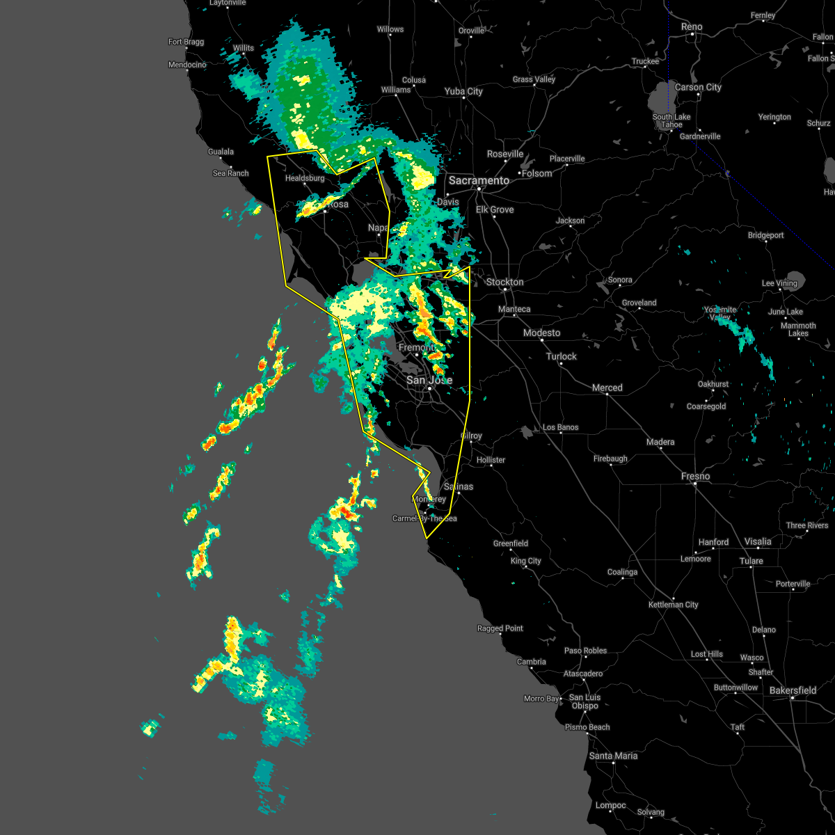
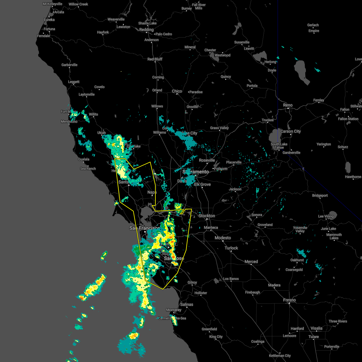
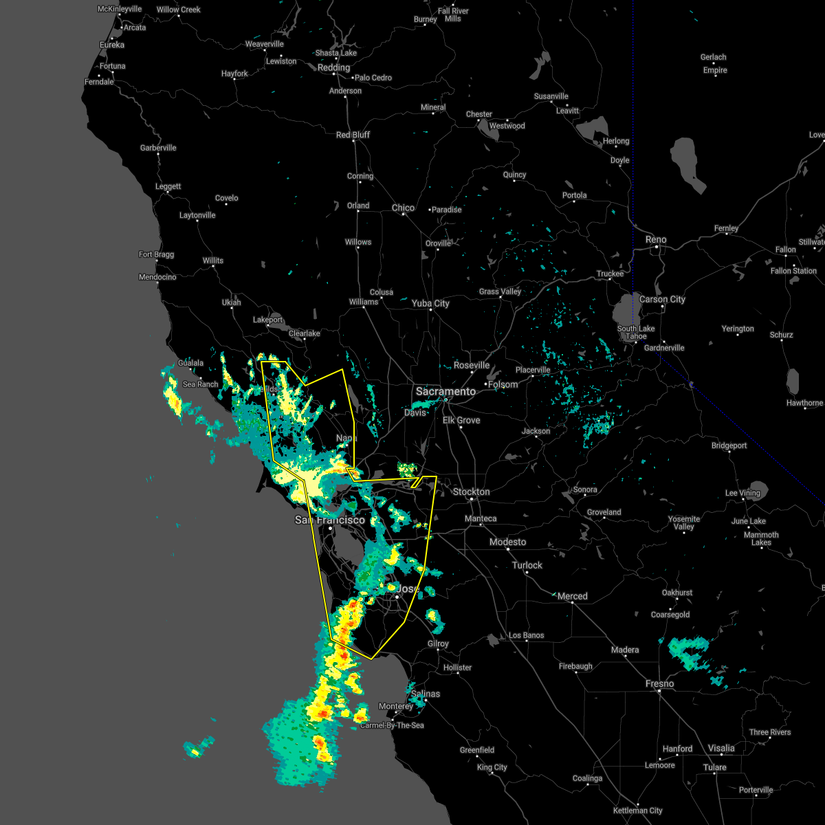
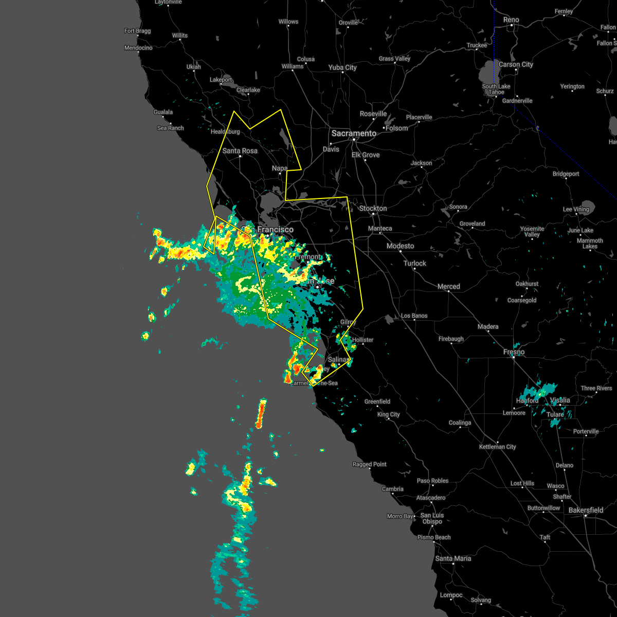
Hail Map for El Cerrito, CA
The El Cerrito, CA area has had 0 reports of on-the-ground hail by trained spotters, and has been under severe weather warnings 0 times during the past 12 months. Doppler radar has detected hail at or near El Cerrito, CA on 2 occasions.
| Name: | El Cerrito, CA |
| Where Located: | 45.8 miles NNW of San Jose, CA |
| Map: | Google Map for El Cerrito, CA |
| Population: | 23549 |
| Housing Units: | 10716 |
| More Info: | Search Google for El Cerrito, CA |
0
The Top Recent Hail Date for El Cerrito, CA is Thursday, August 31, 2017 (2nd out of 2)

Hail and Wind Damage Spotted near El Cerrito, CA
| Date / Time | Report Details |
|---|---|
| 9/11/2022 3:46 PM PDT |
 At 346 pm pdt, a severe thunderstorm was located over lake mathews, or 7 miles east of corona, moving northwest at 15 mph (radar indicated). Hazards include 60 mph wind gusts and nickel size hail. expect damage to roofs, siding, and trees At 346 pm pdt, a severe thunderstorm was located over lake mathews, or 7 miles east of corona, moving northwest at 15 mph (radar indicated). Hazards include 60 mph wind gusts and nickel size hail. expect damage to roofs, siding, and trees
|
| 8/16/2020 6:37 AM PDT |
 At 634 am pdt, public and radar indicate several training thunderstorms capable of producing gusty errastic winds and frequent lightning, moving north at 40 to 50mph across the region. a steady stream of new thunderstorms are expected to develop throughout the day (public). Hazards include erratic outflow wind gusts of 50 to 75 mph near thunderstorms. frequent lightning lead to new wildfire starts. expect down trees, down powerlines, power outages, wildfire starts in remote areas, difficulty driving in the winds At 634 am pdt, public and radar indicate several training thunderstorms capable of producing gusty errastic winds and frequent lightning, moving north at 40 to 50mph across the region. a steady stream of new thunderstorms are expected to develop throughout the day (public). Hazards include erratic outflow wind gusts of 50 to 75 mph near thunderstorms. frequent lightning lead to new wildfire starts. expect down trees, down powerlines, power outages, wildfire starts in remote areas, difficulty driving in the winds
|
| 8/16/2020 6:10 AM PDT |
 At 609 am pdt, several severe thunderstorms across the region were producing gusty erratic winds and frequent light, moving north at 40 to 50 mph (public). Hazards include erratic outflow wind gusts up to 60mph. frequent lightning. Expect damage to roofs, siding, and trees. wildfires may start in remote areas due to the lightning. Locations impacted include, san jose, san francisco, oakland, fremont, santa rosa, hayward, sunnyvale, concord, santa clara, berkeley, richmond, antioch, daly city, san mateo, san leandro, livermore, napa, redwood city, mountain view and alameda. At 609 am pdt, several severe thunderstorms across the region were producing gusty erratic winds and frequent light, moving north at 40 to 50 mph (public). Hazards include erratic outflow wind gusts up to 60mph. frequent lightning. Expect damage to roofs, siding, and trees. wildfires may start in remote areas due to the lightning. Locations impacted include, san jose, san francisco, oakland, fremont, santa rosa, hayward, sunnyvale, concord, santa clara, berkeley, richmond, antioch, daly city, san mateo, san leandro, livermore, napa, redwood city, mountain view and alameda.
|
| 8/16/2020 5:14 AM PDT |
 At 512 am pdt, severe thunderstorms were located along a line extending from 11 miles west of cloverdale to 8 miles west of boulder creek, moving north at 50 mph (public). Hazards include erratic outflow wind gusts of of 50-75 mph. frequent lightning. expect down trees, down powerlines, power outages, wildfire starts in remote areas, difficulty driving in the winds At 512 am pdt, severe thunderstorms were located along a line extending from 11 miles west of cloverdale to 8 miles west of boulder creek, moving north at 50 mph (public). Hazards include erratic outflow wind gusts of of 50-75 mph. frequent lightning. expect down trees, down powerlines, power outages, wildfire starts in remote areas, difficulty driving in the winds
|
| 8/16/2020 3:55 AM PDT |
 At 351 am pdt, a line of training severe thunderstorms were located over the san francisco peninsula, santa cruz mountains, and monterey bay, moving north at 45 mph (public). Hazards include erratic gusty outflow winds up to 60mph. frequent lightning which may lead to wildfire starts. Expect damage to roofs, siding, and trees. wildfire starts from the lightning. Power outages from the wind. At 351 am pdt, a line of training severe thunderstorms were located over the san francisco peninsula, santa cruz mountains, and monterey bay, moving north at 45 mph (public). Hazards include erratic gusty outflow winds up to 60mph. frequent lightning which may lead to wildfire starts. Expect damage to roofs, siding, and trees. wildfire starts from the lightning. Power outages from the wind.
|
| 9/2/2017 5:29 PM PDT |
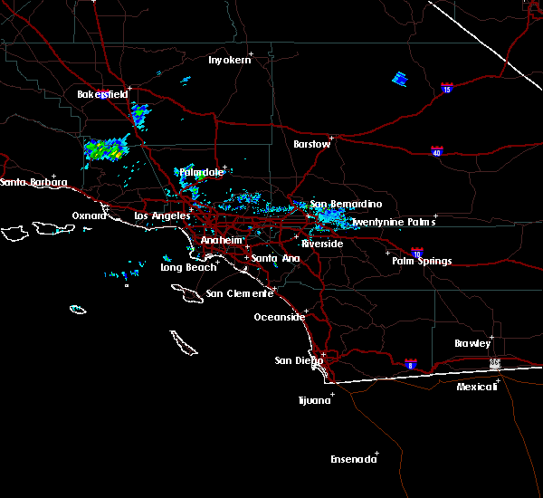 At 528 pm pdt, a severe thunderstorm was located near temescal valley, or near lake elsinore, moving west at 15 mph (radar indicated). Hazards include 60 mph wind gusts and penny size hail. expect damage to roofs, siding, and trees At 528 pm pdt, a severe thunderstorm was located near temescal valley, or near lake elsinore, moving west at 15 mph (radar indicated). Hazards include 60 mph wind gusts and penny size hail. expect damage to roofs, siding, and trees
|
| 8/31/2017 3:55 PM PDT |
 The severe thunderstorm warning for riverside county will expire at 400 pm pdt, the storm which prompted the warning has weakened below severe limits, and no longer poses an immediate threat to life or property. therefore the warning will be allowed to expire. additional thunderstorms are possible through the afternoon. to report severe weather, contact your nearest law enforcement agency. they will relay your report to the national weather service san diego. The severe thunderstorm warning for riverside county will expire at 400 pm pdt, the storm which prompted the warning has weakened below severe limits, and no longer poses an immediate threat to life or property. therefore the warning will be allowed to expire. additional thunderstorms are possible through the afternoon. to report severe weather, contact your nearest law enforcement agency. they will relay your report to the national weather service san diego.
|
| 8/31/2017 3:41 PM PDT |
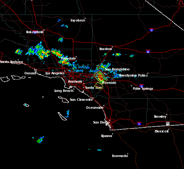 At 340 pm pdt, a severe thunderstorm was located over temescal valley, or 7 miles southeast of corona, and is nearly stationary (radar indicated). Hazards include 60 mph wind gusts and penny size hail. Expect damage to roofs, siding, and trees. Locations impacted include, southern corona, western lake elsinore, temescal valley, lake mathews, eagle valleyportions of the san diego city limits, and el cerrito. At 340 pm pdt, a severe thunderstorm was located over temescal valley, or 7 miles southeast of corona, and is nearly stationary (radar indicated). Hazards include 60 mph wind gusts and penny size hail. Expect damage to roofs, siding, and trees. Locations impacted include, southern corona, western lake elsinore, temescal valley, lake mathews, eagle valleyportions of the san diego city limits, and el cerrito.
|
| 8/31/2017 3:04 PM PDT |
 At 303 pm pdt, a severe thunderstorm was located over temescal valley, or 8 miles northwest of lake elsinore, and is nearly stationary (radar indicated). Hazards include 60 mph wind gusts and penny size hail. expect damage to roofs, siding, and trees At 303 pm pdt, a severe thunderstorm was located over temescal valley, or 8 miles northwest of lake elsinore, and is nearly stationary (radar indicated). Hazards include 60 mph wind gusts and penny size hail. expect damage to roofs, siding, and trees
|
| 3/7/2016 7:43 AM PST |
 At 740 am pst, doppler radar indicated a line of severe thunderstorms capable of producing damaging wind gusts of 45 to 60 mph over eastern orange county. this line of storms was located near canyon lake, moving east at 30 mph. the storms will progress eastward over the next hour, impacting the inland empire and northwest san diego county. locations impacted include but are not limited to, riverside, san bernardino, oceanside, ontario, irvine, moreno valley, corona, rialto, tustin, chino, redlands. At 740 am pst, doppler radar indicated a line of severe thunderstorms capable of producing damaging wind gusts of 45 to 60 mph over eastern orange county. this line of storms was located near canyon lake, moving east at 30 mph. the storms will progress eastward over the next hour, impacting the inland empire and northwest san diego county. locations impacted include but are not limited to, riverside, san bernardino, oceanside, ontario, irvine, moreno valley, corona, rialto, tustin, chino, redlands.
|
| 3/7/2016 7:10 AM PST |
 At 706 am pst, doppler radar indicated a line of severe thunderstorms capable of producing damaging wind gusts of 45 to 60 mph moving through central orange county. this line of storms was located near el toro, moving east at 35 mph. the stroms will progress eastward over the next hour, impacting the inland empire and northwest san diego county. locations impacted include, santa ana, anaheim, riverside, huntington beach, san bernardino, oceanside, ontario, irvine, fontana, orange, rancho cucamonga, corona, costa mesa, mission viejo, rialto. At 706 am pst, doppler radar indicated a line of severe thunderstorms capable of producing damaging wind gusts of 45 to 60 mph moving through central orange county. this line of storms was located near el toro, moving east at 35 mph. the stroms will progress eastward over the next hour, impacting the inland empire and northwest san diego county. locations impacted include, santa ana, anaheim, riverside, huntington beach, san bernardino, oceanside, ontario, irvine, fontana, orange, rancho cucamonga, corona, costa mesa, mission viejo, rialto.
|
| 3/7/2016 6:36 AM PST |
 At 635 am pst, doppler radar indicated a line of severe thunderstorms capable of producing damaging wind gusts of 45 to 60 mph approaching the orange county coast. the leading edge of the storms was located 5 miles southwest of seal beach, and moving east at 35 mph. At 635 am pst, doppler radar indicated a line of severe thunderstorms capable of producing damaging wind gusts of 45 to 60 mph approaching the orange county coast. the leading edge of the storms was located 5 miles southwest of seal beach, and moving east at 35 mph.
|
| 1/6/2016 1:12 PM PST |
 At 106 pm pst, doppler radar indicated a severe thunderstorm capable of producing damaging winds in excess of 60 mph. this storm was located near corona, moving northeast at 20 mph. locations impacted include, santa ana, anaheim, riverside, garden grove, ontario, irvine, moreno valley, fontana, orange, corona, mission viejo, rialto, tustin, chino, el toro, yorba linda, colton, placentia, perris and laguna hills. At 106 pm pst, doppler radar indicated a severe thunderstorm capable of producing damaging winds in excess of 60 mph. this storm was located near corona, moving northeast at 20 mph. locations impacted include, santa ana, anaheim, riverside, garden grove, ontario, irvine, moreno valley, fontana, orange, corona, mission viejo, rialto, tustin, chino, el toro, yorba linda, colton, placentia, perris and laguna hills.
|
| 1/6/2016 12:46 PM PST |
 At 1244 pm pst, doppler radar indicated a severe thunderstorm capable of producing damaging winds in excess of 60 mph. this storm was located over southwestern corona, and moving northeast at 25 mph. a line of storms will be capable of severe wind and heavy rain. cities of tustin and norco are in the path of the severe storm. At 1244 pm pst, doppler radar indicated a severe thunderstorm capable of producing damaging winds in excess of 60 mph. this storm was located over southwestern corona, and moving northeast at 25 mph. a line of storms will be capable of severe wind and heavy rain. cities of tustin and norco are in the path of the severe storm.
|
| 9/9/2015 3:12 PM PDT | The severe thunderstorm warning for san bernardino and riverside counties will expire at 315 pm pdt, the storm which prompted the warning has weakened below severe limits, and no longer poses an immediate threat to life or property. therefore the warning will be allowed to expire. however heavy rain is still possible with a thunderstorm near perris over the next hour. |
| 9/9/2015 2:40 PM PDT |
 At 230 pm pdt, doppler radar indicated a group of severe thunderstorms moving west around 5 mph, capable of producing damaging winds in excess of 60 mph. a wind gust to 49 mph was observed at lake mathews at 216 pm. nickel size hail may also accompany the damaging winds. locations impacted include, ontario, moreno valley, rancho cucamonga, corona, upland, chino, montclair, norco, mira loma, glen avon, pedley, home gardens, woodcrest and march afb. At 230 pm pdt, doppler radar indicated a group of severe thunderstorms moving west around 5 mph, capable of producing damaging winds in excess of 60 mph. a wind gust to 49 mph was observed at lake mathews at 216 pm. nickel size hail may also accompany the damaging winds. locations impacted include, ontario, moreno valley, rancho cucamonga, corona, upland, chino, montclair, norco, mira loma, glen avon, pedley, home gardens, woodcrest and march afb.
|
| 9/9/2015 2:10 PM PDT |
 At 209 pm pdt, doppler radar indicated a few severe thunderstorms capable of producing quarter size hail and damaging winds in excess of 60 mph. these storms were nearly stationary. flash flooding is also possible near these storms. At 209 pm pdt, doppler radar indicated a few severe thunderstorms capable of producing quarter size hail and damaging winds in excess of 60 mph. these storms were nearly stationary. flash flooding is also possible near these storms.
|
Hail Maps for El Cerrito, CA


Connect with Interactive Hail Maps