

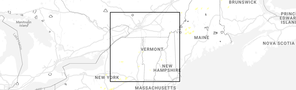
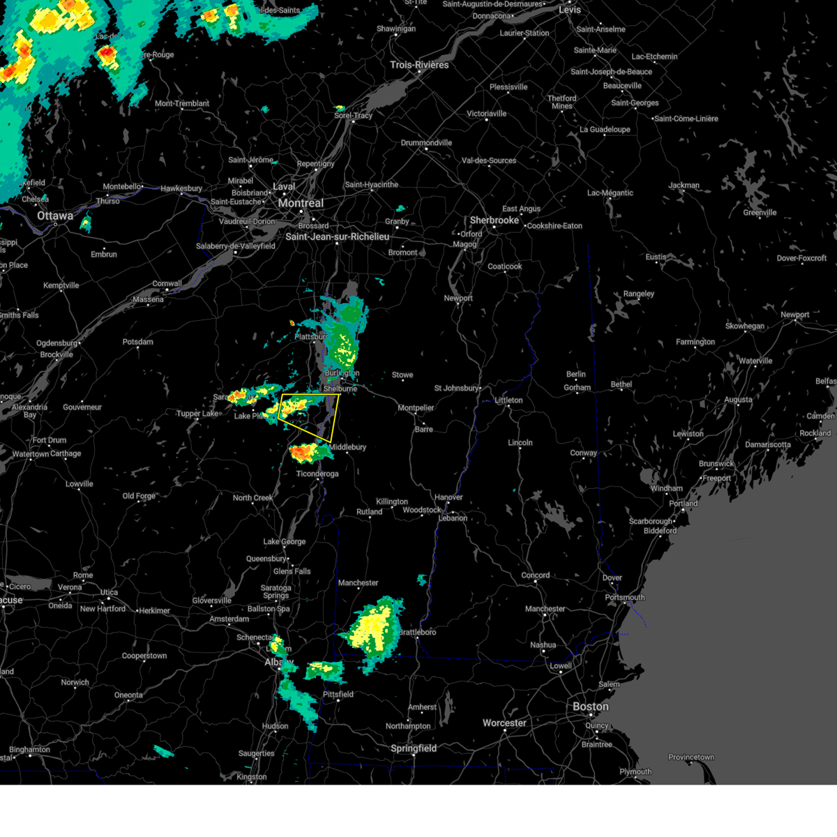
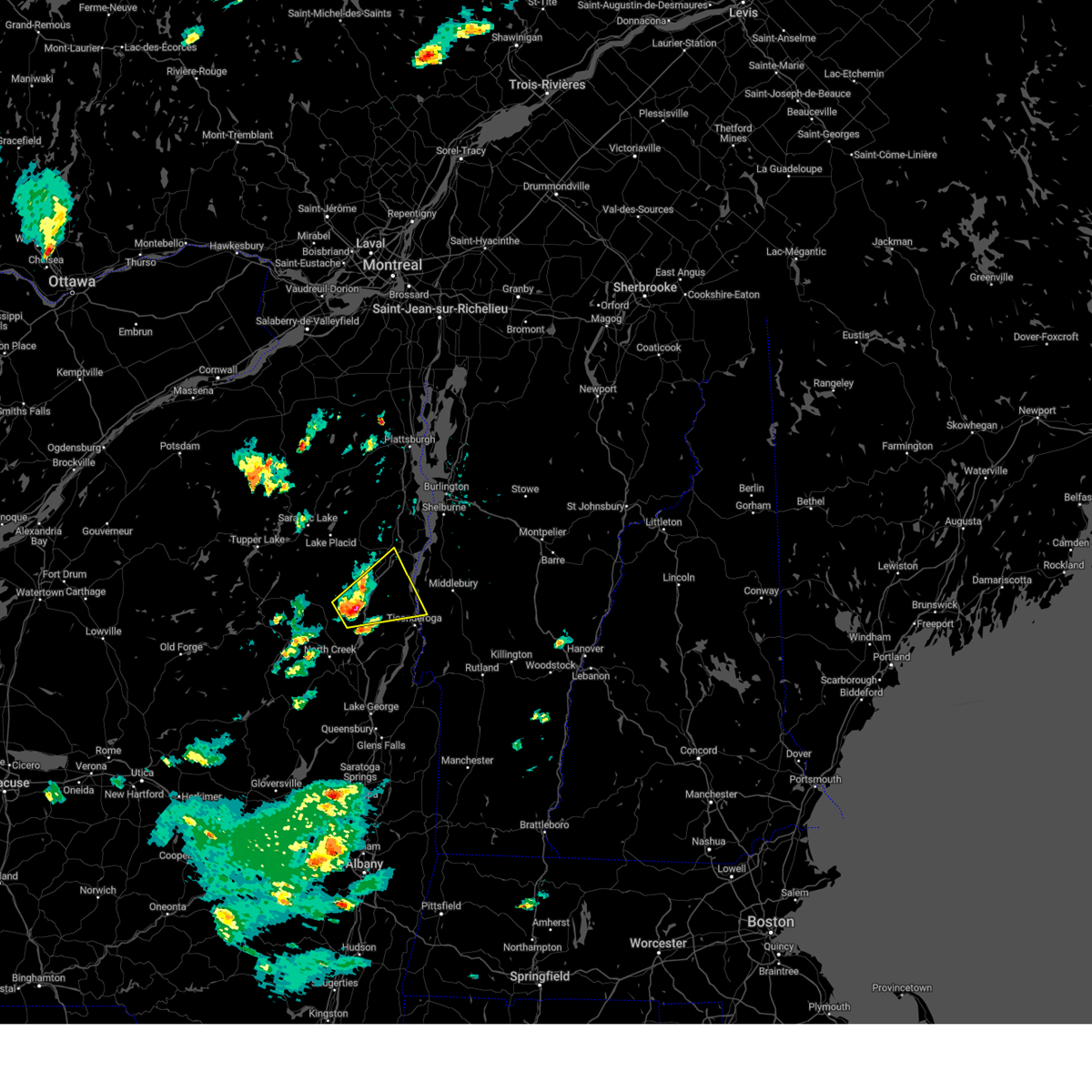
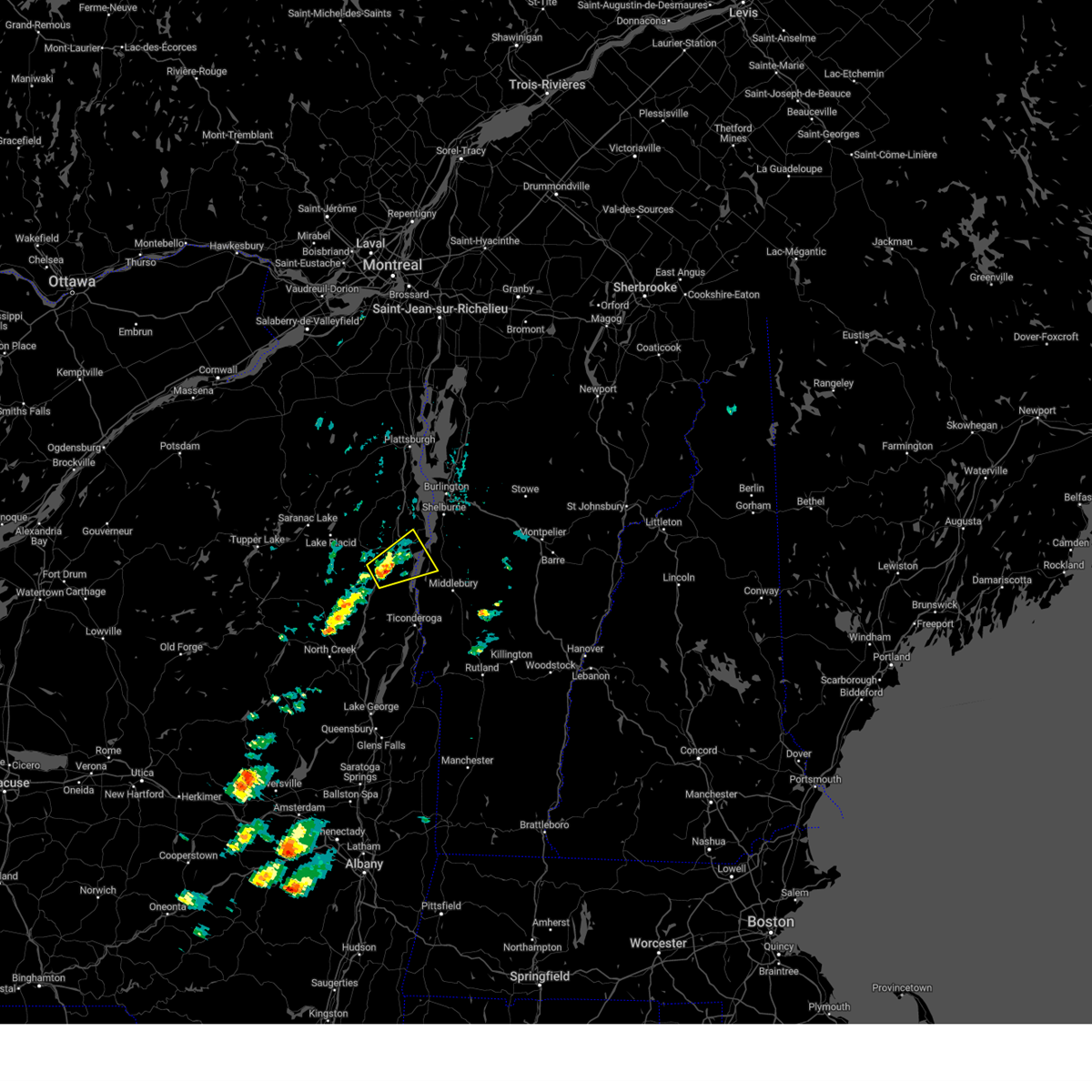
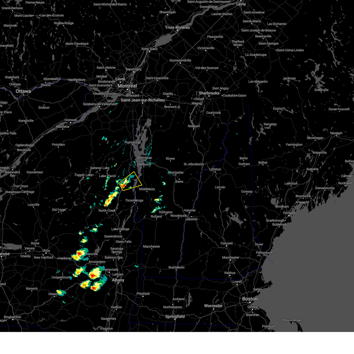
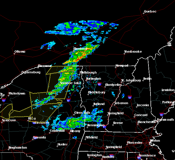
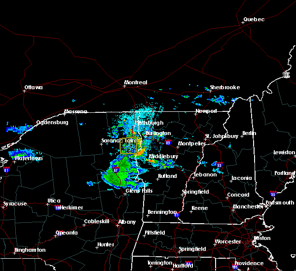
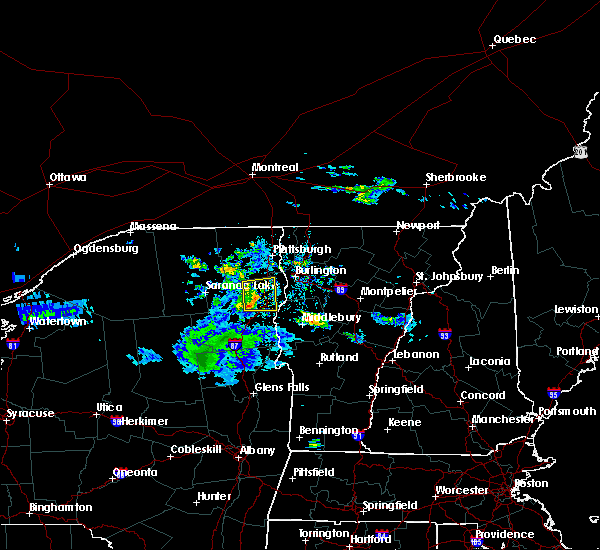
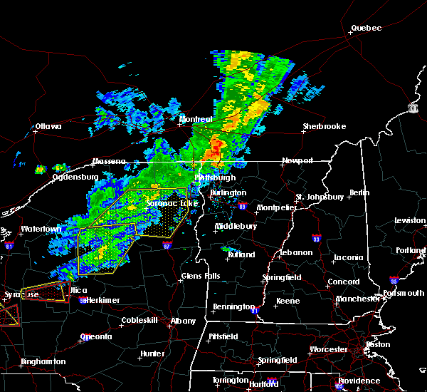
Hail Map for Elizabethtown, NY
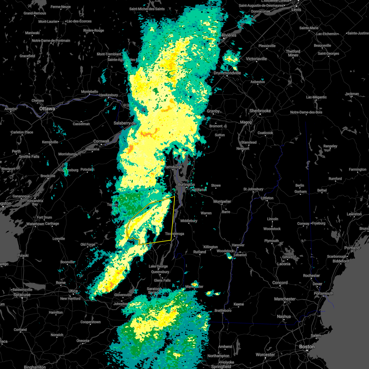
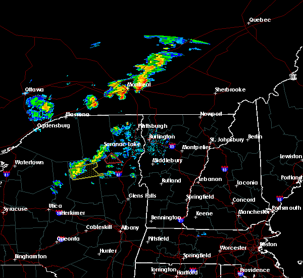
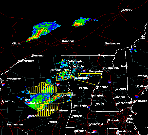
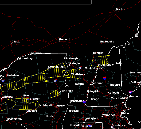
The Elizabethtown, NY area has had 1 report of on-the-ground hail by trained spotters, and has been under severe weather warnings 23 times during the past 12 months. Doppler radar has detected hail at or near Elizabethtown, NY on 12 occasions, including 1 occasion during the past year.
| Name: | Elizabethtown, NY |
| Where Located: | 26 miles SW of Burlington, VT |
| Map: | Google Map for Elizabethtown, NY |
| Population: | 754 |
| Housing Units: | 404 |
| More Info: | Search Google for Elizabethtown, NY |
1
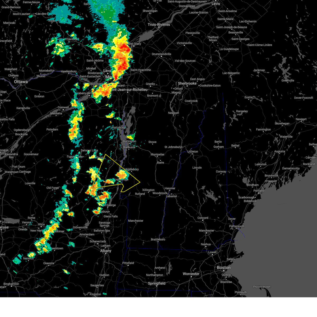
The Top Recent Hail Date for Elizabethtown, NY is Friday, July 7, 2023 (7th out of 12)
Hail and Wind Damage Spotted near Elizabethtown, NY
| Date / Time | Report Details |
|---|---|
| 9/7/2023 2:48 PM EDT |
 At 248 pm edt, severe thunderstorms were located along a line extending from morrisonville to near willsboro bay to moriah, moving east at 25 mph (radar indicated). Hazards include 60 mph wind gusts and quarter size hail. Minor hail damage to vehicles is possible. Expect wind damage to trees and powerlines. At 248 pm edt, severe thunderstorms were located along a line extending from morrisonville to near willsboro bay to moriah, moving east at 25 mph (radar indicated). Hazards include 60 mph wind gusts and quarter size hail. Minor hail damage to vehicles is possible. Expect wind damage to trees and powerlines.
|
| 8/3/2023 6:13 PM EDT |
 The severe thunderstorm warning for northeastern essex, northwestern addison and west central chittenden counties will expire at 615 pm edt, the storm which prompted the warning has weakened below severe limits, and no longer poses an immediate threat to life or property. therefore, the warning will be allowed to expire. to report severe weather, contact your nearest law enforcement agency. they will relay your report to the national weather service burlington. The severe thunderstorm warning for northeastern essex, northwestern addison and west central chittenden counties will expire at 615 pm edt, the storm which prompted the warning has weakened below severe limits, and no longer poses an immediate threat to life or property. therefore, the warning will be allowed to expire. to report severe weather, contact your nearest law enforcement agency. they will relay your report to the national weather service burlington.
|
| 8/3/2023 5:32 PM EDT |
 At 532 pm edt, a severe thunderstorm was located over lewis, moving east at 20 mph (radar indicated). Hazards include 60 mph wind gusts and quarter size hail. Minor hail damage to vehicles is possible. expect wind damage to trees and powerlines. locations impacted include, essex, willsboro, westport, elizabethtown, panton, kingsland bay state park, ferrisburgh, shelburne, charlotte, addison, lewis, fort cassin point, mcneil cove, sloop island, wings point, town farm bay, meach island, north west bay, mud island, and porter bay. hail threat, radar indicated max hail size, 1. 00 in wind threat, radar indicated max wind gust, 60 mph. At 532 pm edt, a severe thunderstorm was located over lewis, moving east at 20 mph (radar indicated). Hazards include 60 mph wind gusts and quarter size hail. Minor hail damage to vehicles is possible. expect wind damage to trees and powerlines. locations impacted include, essex, willsboro, westport, elizabethtown, panton, kingsland bay state park, ferrisburgh, shelburne, charlotte, addison, lewis, fort cassin point, mcneil cove, sloop island, wings point, town farm bay, meach island, north west bay, mud island, and porter bay. hail threat, radar indicated max hail size, 1. 00 in wind threat, radar indicated max wind gust, 60 mph.
|
| 8/3/2023 5:18 PM EDT |
 At 517 pm edt, a severe thunderstorm was located near lewis, moving east at 20 mph (radar indicated). Hazards include 60 mph wind gusts and quarter size hail. Minor hail damage to vehicles is possible. Expect wind damage to trees and powerlines. At 517 pm edt, a severe thunderstorm was located near lewis, moving east at 20 mph (radar indicated). Hazards include 60 mph wind gusts and quarter size hail. Minor hail damage to vehicles is possible. Expect wind damage to trees and powerlines.
|
| 7/24/2023 1:52 PM EDT |
 At 152 pm edt, a severe thunderstorm was located over mineville, moving northeast at 20 mph (radar indicated). Hazards include 60 mph wind gusts and quarter size hail. Minor hail damage to vehicles is possible. Expect wind damage to trees and powerlines. At 152 pm edt, a severe thunderstorm was located over mineville, moving northeast at 20 mph (radar indicated). Hazards include 60 mph wind gusts and quarter size hail. Minor hail damage to vehicles is possible. Expect wind damage to trees and powerlines.
|
| 7/24/2023 1:21 PM EDT |
 At 121 pm edt, a severe thunderstorm was located over schroon falls, moving northeast at 30 mph (radar indicated). Hazards include 60 mph wind gusts and quarter size hail. Minor hail damage to vehicles is possible. Expect wind damage to trees and powerlines. At 121 pm edt, a severe thunderstorm was located over schroon falls, moving northeast at 30 mph (radar indicated). Hazards include 60 mph wind gusts and quarter size hail. Minor hail damage to vehicles is possible. Expect wind damage to trees and powerlines.
|
| 7/14/2023 5:52 PM EDT |
 At 551 pm edt, a severe thunderstorm was located near new russia, moving northeast at 20 mph (radar indicated). Hazards include 60 mph wind gusts and quarter size hail. Minor hail damage to vehicles is possible. Expect wind damage to trees and powerlines. At 551 pm edt, a severe thunderstorm was located near new russia, moving northeast at 20 mph (radar indicated). Hazards include 60 mph wind gusts and quarter size hail. Minor hail damage to vehicles is possible. Expect wind damage to trees and powerlines.
|
| 7/13/2023 4:36 PM EDT |
 At 436 pm edt, a severe thunderstorm was located over grass island, moving northeast at 30 mph (radar indicated). Hazards include 60 mph wind gusts and quarter size hail. Minor hail damage to vehicles is possible. Expect wind damage to trees and powerlines. At 436 pm edt, a severe thunderstorm was located over grass island, moving northeast at 30 mph (radar indicated). Hazards include 60 mph wind gusts and quarter size hail. Minor hail damage to vehicles is possible. Expect wind damage to trees and powerlines.
|
| 7/13/2023 3:20 PM EDT |
 At 320 pm edt, a severe thunderstorm was located over witherbee, moving northeast at 35 mph (radar indicated). Hazards include 60 mph wind gusts and quarter size hail. Minor hail damage to vehicles is possible. Expect wind damage to trees and powerlines. At 320 pm edt, a severe thunderstorm was located over witherbee, moving northeast at 35 mph (radar indicated). Hazards include 60 mph wind gusts and quarter size hail. Minor hail damage to vehicles is possible. Expect wind damage to trees and powerlines.
|
| 7/7/2023 11:50 AM EDT |
 At 1149 am edt, a severe thunderstorm was located over lewis, moving east at 15 mph (radar indicated). Hazards include 60 mph wind gusts and quarter size hail. Minor hail damage to vehicles is possible. expect wind damage to trees and powerlines. locations impacted include, essex, willsboro, westport, elizabethtown, kingsland bay state park, ferrisburgh, lewis, fort cassin point, snake den harbor, ship point, summer point, hunter bay, north west bay, diamond island, cannon point, porter bay, partridge harbor, louis clearing bay, fields bay, and deerhead. hail threat, radar indicated max hail size, 1. 00 in wind threat, radar indicated max wind gust, 60 mph. At 1149 am edt, a severe thunderstorm was located over lewis, moving east at 15 mph (radar indicated). Hazards include 60 mph wind gusts and quarter size hail. Minor hail damage to vehicles is possible. expect wind damage to trees and powerlines. locations impacted include, essex, willsboro, westport, elizabethtown, kingsland bay state park, ferrisburgh, lewis, fort cassin point, snake den harbor, ship point, summer point, hunter bay, north west bay, diamond island, cannon point, porter bay, partridge harbor, louis clearing bay, fields bay, and deerhead. hail threat, radar indicated max hail size, 1. 00 in wind threat, radar indicated max wind gust, 60 mph.
|
| 7/7/2023 11:30 AM EDT |
 At 1129 am edt, a severe thunderstorm was located over elizabethtown, moving east at 15 mph (radar indicated). Hazards include 60 mph wind gusts and quarter size hail. Minor hail damage to vehicles is possible. Expect wind damage to trees and powerlines. At 1129 am edt, a severe thunderstorm was located over elizabethtown, moving east at 15 mph (radar indicated). Hazards include 60 mph wind gusts and quarter size hail. Minor hail damage to vehicles is possible. Expect wind damage to trees and powerlines.
|
| 7/4/2023 3:50 PM EDT |
 At 350 pm edt, a severe thunderstorm was located over new russia, moving south at 20 mph (radar indicated). Hazards include 60 mph wind gusts and quarter size hail. Minor hail damage to vehicles is possible. Expect wind damage to trees and powerlines. At 350 pm edt, a severe thunderstorm was located over new russia, moving south at 20 mph (radar indicated). Hazards include 60 mph wind gusts and quarter size hail. Minor hail damage to vehicles is possible. Expect wind damage to trees and powerlines.
|
| 10/16/2021 2:40 PM EDT |
 At 239 pm edt, severe thunderstorms were located along a line extending from boquet river point to ironville to near pharoah mountain, moving east at 45 mph. there have been reports of downed trees near schroon lake in association with these storms (emergency management). Hazards include 60 mph wind gusts. expect damage to trees and powerlines At 239 pm edt, severe thunderstorms were located along a line extending from boquet river point to ironville to near pharoah mountain, moving east at 45 mph. there have been reports of downed trees near schroon lake in association with these storms (emergency management). Hazards include 60 mph wind gusts. expect damage to trees and powerlines
|
| 7/20/2021 7:06 PM EDT |
 At 704 pm edt, a line of severe thunderstorms over northwest vermont and essex county new york was located along a line extending from shad island to south burlington to near chilson, new york moving east at 35 mph (radar indicated). Hazards include 60 mph wind gusts and quarter size hail. Expect wind damage to trees and powerlines. minor hail damage to vehicles is possible. Locations impacted include, essex junction, plattsburgh international airport, burlington, burlington international airport, plattsburgh, middlebury, south burlington, vergennes, peru, beekmantown, moriah, chazy, willsboro, crown point, morrisville, enosburg falls, westport, elizabethtown, champlain and waterbury village. At 704 pm edt, a line of severe thunderstorms over northwest vermont and essex county new york was located along a line extending from shad island to south burlington to near chilson, new york moving east at 35 mph (radar indicated). Hazards include 60 mph wind gusts and quarter size hail. Expect wind damage to trees and powerlines. minor hail damage to vehicles is possible. Locations impacted include, essex junction, plattsburgh international airport, burlington, burlington international airport, plattsburgh, middlebury, south burlington, vergennes, peru, beekmantown, moriah, chazy, willsboro, crown point, morrisville, enosburg falls, westport, elizabethtown, champlain and waterbury village.
|
| 7/20/2021 6:31 PM EDT |
 At 630 pm edt, a line of severe thunderstorms over northeast new york was located along a line extending from near perry mills to near harkness to 9 miles west of schroon falls, moving east at 40 mph (radar indicated). Hazards include 60 mph wind gusts and quarter size hail. Expect wind damage to trees and powerlines. Minor hail damage to vehicles is possible. At 630 pm edt, a line of severe thunderstorms over northeast new york was located along a line extending from near perry mills to near harkness to 9 miles west of schroon falls, moving east at 40 mph (radar indicated). Hazards include 60 mph wind gusts and quarter size hail. Expect wind damage to trees and powerlines. Minor hail damage to vehicles is possible.
|
| 7/20/2021 6:13 PM EDT |
 At 611 pm edt, an area of severe thunderstorms were located from reber to essex in essex county, new york, moving northeast at 20 mph (radar indicated). Hazards include 60 mph wind gusts and quarter size hail. Minor hail damage to vehicles is possible. expect wind damage to trees and powerlines. locations impacted include, essex, willsboro, westport, elizabethtown, charlotte, st. George, kingsland bay state park, shelburne, ferrisburgh, hinesburg, williston, lewis, fort cassin point, mcneil cove, sloop island, shelburne falls, wings point, town farm bay, meach island and north west bay. At 611 pm edt, an area of severe thunderstorms were located from reber to essex in essex county, new york, moving northeast at 20 mph (radar indicated). Hazards include 60 mph wind gusts and quarter size hail. Minor hail damage to vehicles is possible. expect wind damage to trees and powerlines. locations impacted include, essex, willsboro, westport, elizabethtown, charlotte, st. George, kingsland bay state park, shelburne, ferrisburgh, hinesburg, williston, lewis, fort cassin point, mcneil cove, sloop island, shelburne falls, wings point, town farm bay, meach island and north west bay.
|
| 7/20/2021 5:35 PM EDT |
 At 533 pm edt, severe thunderstorms were located over essex county, new york, extending from near keene to wadhams, moving northeast at 10 mph (radar indicated). Hazards include 60 mph wind gusts and quarter size hail. Minor hail damage to vehicles is possible. Expect wind damage to trees and powerlines. At 533 pm edt, severe thunderstorms were located over essex county, new york, extending from near keene to wadhams, moving northeast at 10 mph (radar indicated). Hazards include 60 mph wind gusts and quarter size hail. Minor hail damage to vehicles is possible. Expect wind damage to trees and powerlines.
|
| 7/8/2021 9:14 PM EDT |
 At 912 pm edt, a severe thunderstorm was located over st. huberts, moving east at 45 mph (radar indicated). Hazards include 60 mph wind gusts. Expect damage to trees and powerlines. Locations impacted include, moriah, elizabethtown, keene, minerva, newcomb, port henry, mount marcy, schroon lake, keene valley, lewis, north hudson, olmstedville, schroon falls, grass island, mount van hoevenberg, mineville, chilson, moriah center, new russia and vanderwhacker mountain. At 912 pm edt, a severe thunderstorm was located over st. huberts, moving east at 45 mph (radar indicated). Hazards include 60 mph wind gusts. Expect damage to trees and powerlines. Locations impacted include, moriah, elizabethtown, keene, minerva, newcomb, port henry, mount marcy, schroon lake, keene valley, lewis, north hudson, olmstedville, schroon falls, grass island, mount van hoevenberg, mineville, chilson, moriah center, new russia and vanderwhacker mountain.
|
| 7/8/2021 8:50 PM EDT |
 At 849 pm edt, a severe thunderstorm was located near tahawus, moving east at 45 mph (radar indicated). Hazards include 60 mph wind gusts. expect damage to trees and powerlines At 849 pm edt, a severe thunderstorm was located near tahawus, moving east at 45 mph (radar indicated). Hazards include 60 mph wind gusts. expect damage to trees and powerlines
|
| 3/26/2021 1:11 PM EDT |
 At 110 pm edt, severe thunderstorms were located along a line extending from deerhead to near ironville to near pharoah mountain, moving east at 50 mph (radar indicated). Hazards include 60 mph wind gusts. expect damage to trees and powerlines At 110 pm edt, severe thunderstorms were located along a line extending from deerhead to near ironville to near pharoah mountain, moving east at 50 mph (radar indicated). Hazards include 60 mph wind gusts. expect damage to trees and powerlines
|
| 10/10/2020 5:41 PM EDT |
 At 540 pm edt, a severe thunderstorm was located over wadhams, moving east at 60 mph (radar indicated). Hazards include 70 mph wind gusts and ping pong ball size hail. People and animals outdoors will be injured. expect hail damage to roofs, siding, windows, and vehicles. expect considerable tree damage. wind damage is also likely to mobile homes, roofs, and outbuildings. Locations impacted include, vergennes, essex, westport, elizabethtown, monkton ridge, waterbury village, lincoln, monkton, monkton boro, new haven, middlesex, hinesburg, moretown, starksboro, ferrisburg, charlotte, waltham, bristol, waitsfield and fayston. At 540 pm edt, a severe thunderstorm was located over wadhams, moving east at 60 mph (radar indicated). Hazards include 70 mph wind gusts and ping pong ball size hail. People and animals outdoors will be injured. expect hail damage to roofs, siding, windows, and vehicles. expect considerable tree damage. wind damage is also likely to mobile homes, roofs, and outbuildings. Locations impacted include, vergennes, essex, westport, elizabethtown, monkton ridge, waterbury village, lincoln, monkton, monkton boro, new haven, middlesex, hinesburg, moretown, starksboro, ferrisburg, charlotte, waltham, bristol, waitsfield and fayston.
|
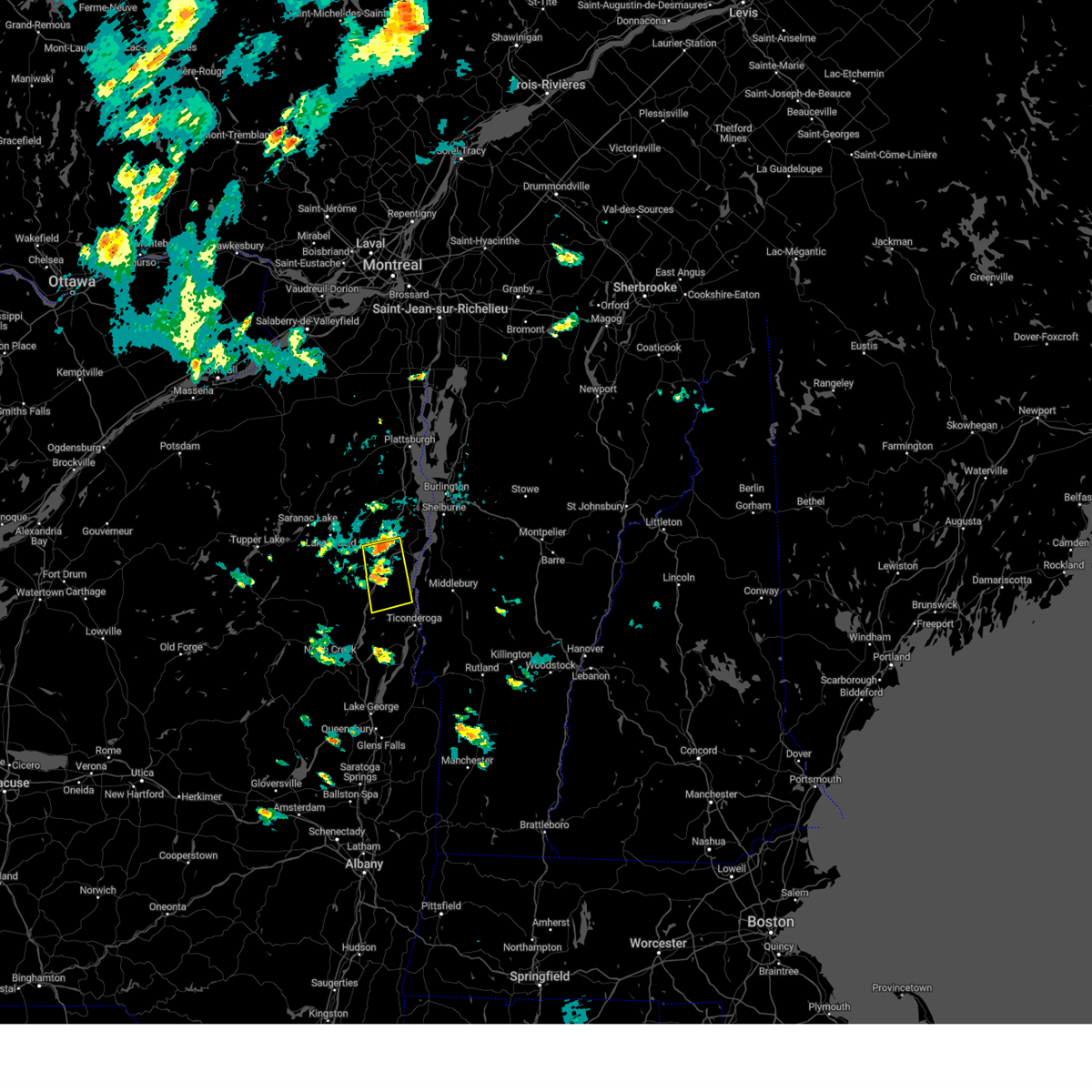
| 10/10/2020 5:40 PM EDT | Golf Ball sized hail reported 0.5 miles SE of Elizabethtown, NY |
| 10/10/2020 5:23 PM EDT |
 At 522 pm edt, a severe thunderstorm was located over keene, moving east at 60 mph (radar indicated). Hazards include 60 mph wind gusts and quarter size hail. Minor hail damage to vehicles is possible. Expect wind damage to trees and powerlines. At 522 pm edt, a severe thunderstorm was located over keene, moving east at 60 mph (radar indicated). Hazards include 60 mph wind gusts and quarter size hail. Minor hail damage to vehicles is possible. Expect wind damage to trees and powerlines.
|
| 8/2/2020 8:42 PM EDT |
 At 842 pm edt, a severe thunderstorm was located near mount van hoevenberg, moving northeast at 25 mph (radar indicated). Hazards include 60 mph wind gusts and penny size hail. expect damage to trees and powerlines At 842 pm edt, a severe thunderstorm was located near mount van hoevenberg, moving northeast at 25 mph (radar indicated). Hazards include 60 mph wind gusts and penny size hail. expect damage to trees and powerlines
|
| 5/29/2020 6:05 PM EDT |
 At 604 pm edt, a severe thunderstorm was located over hunter bay, moving northeast at 40 mph (radar indicated). Hazards include 60 mph wind gusts. Expect damage to trees and powerlines. locations impacted include, vergennes, essex, moriah, willsboro, westport, elizabethtown, monkton ridge, monkton, monkton boro, port henry, addison, hinesburg, starksboro, ferrisburg, charlotte, waltham, panton, mt. Philo state park, kingsland bay state park and d a r state park. At 604 pm edt, a severe thunderstorm was located over hunter bay, moving northeast at 40 mph (radar indicated). Hazards include 60 mph wind gusts. Expect damage to trees and powerlines. locations impacted include, vergennes, essex, moriah, willsboro, westport, elizabethtown, monkton ridge, monkton, monkton boro, port henry, addison, hinesburg, starksboro, ferrisburg, charlotte, waltham, panton, mt. Philo state park, kingsland bay state park and d a r state park.
|
| 5/29/2020 5:46 PM EDT |
 At 546 pm edt, a severe thunderstorm was located over witherbee, moving northeast at 40 mph (radar indicated). Hazards include 60 mph wind gusts. expect damage to trees and powerlines At 546 pm edt, a severe thunderstorm was located over witherbee, moving northeast at 40 mph (radar indicated). Hazards include 60 mph wind gusts. expect damage to trees and powerlines
|
| 3/20/2020 3:43 PM EDT |
 At 343 pm edt, severe thunderstorms were located along a line extending from bluff point to mount marcy, moving east at 65 mph (radar indicated). Hazards include 60 mph wind gusts. expect damage to trees and powerlines At 343 pm edt, severe thunderstorms were located along a line extending from bluff point to mount marcy, moving east at 65 mph (radar indicated). Hazards include 60 mph wind gusts. expect damage to trees and powerlines
|
| 3/20/2020 3:15 PM EDT |
 At 314 pm edt, severe thunderstorms were located along a line extending from standish to near ray brook, moving northeast at 70 mph (radar indicated. this line has a history of producing wind damage). Hazards include 60 mph wind gusts. expect damage to trees and powerlines At 314 pm edt, severe thunderstorms were located along a line extending from standish to near ray brook, moving northeast at 70 mph (radar indicated. this line has a history of producing wind damage). Hazards include 60 mph wind gusts. expect damage to trees and powerlines
|
| 8/15/2018 8:55 PM EDT |
 The severe thunderstorm warning for south central clinton and northeastern essex counties will expire at 900 pm edt, the storms which prompted the warning have weakened below severe limits and have exited the warned area. therefore, the warning will be allowed to expire. The severe thunderstorm warning for south central clinton and northeastern essex counties will expire at 900 pm edt, the storms which prompted the warning have weakened below severe limits and have exited the warned area. therefore, the warning will be allowed to expire.
|
| 8/15/2018 8:28 PM EDT |
 At 827 pm edt, severe thunderstorms were located along a line extending from near north jay to elizabethtown, moving east at 45 mph (radar indicated). Hazards include 60 mph wind gusts and quarter size hail. Minor hail damage to vehicles is possible. expect wind damage to trees and powerlines. Locations impacted include, westport, elizabethtown, au sable forks, jay in essex county, lewis, barber point, young bay, north west bay, reber, wadhams, clintonville, furnace point, deerhead, north jay, new russia, south bay in essex county, cold spring bay and ausable forks. At 827 pm edt, severe thunderstorms were located along a line extending from near north jay to elizabethtown, moving east at 45 mph (radar indicated). Hazards include 60 mph wind gusts and quarter size hail. Minor hail damage to vehicles is possible. expect wind damage to trees and powerlines. Locations impacted include, westport, elizabethtown, au sable forks, jay in essex county, lewis, barber point, young bay, north west bay, reber, wadhams, clintonville, furnace point, deerhead, north jay, new russia, south bay in essex county, cold spring bay and ausable forks.
|
| 8/15/2018 7:56 PM EDT |
 At 756 pm edt, severe thunderstorms were located along a line extending from near bloomingdale to near north elba, moving east at 30 mph (radar indicated). Hazards include 60 mph wind gusts and quarter size hail. Minor hail damage to vehicles is possible. Expect wind damage to trees and powerlines. At 756 pm edt, severe thunderstorms were located along a line extending from near bloomingdale to near north elba, moving east at 30 mph (radar indicated). Hazards include 60 mph wind gusts and quarter size hail. Minor hail damage to vehicles is possible. Expect wind damage to trees and powerlines.
|
| 6/18/2018 3:37 PM EDT |
 At 336 pm edt, severe thunderstorms were located along a line extending from near willsboro bay to lake placid, moving east at 45 mph (radar indicated). Hazards include 60 mph wind gusts and penny size hail. expect damage to trees and powerlines At 336 pm edt, severe thunderstorms were located along a line extending from near willsboro bay to lake placid, moving east at 45 mph (radar indicated). Hazards include 60 mph wind gusts and penny size hail. expect damage to trees and powerlines
|
| 5/4/2018 7:47 PM EDT |
 At 744 pm edt, severe thunderstorms were located along a line extending from jericho to richmond to mineville, moving east at 40 mph (public reported 1" hail 5 miles southeast of essex junction at 735 pm and multiple trees down in shelburne). Hazards include 60 mph wind gusts and quarter size hail. Minor hail damage to vehicles is possible. expect wind damage to trees and powerlines. locations impacted include, essex junction, barre, burlington international airport, montpelier, south burlington, burlington, vergennes, middlebury, essex, moriah, willsboro, morrisville, westport, elizabethtown, waterbury village, websterville, essex junction village, worcester, middlesex and marshfield. A tornado watch remains in effect until 1000 pm edt for northern new york, and central, northeastern and northwestern vermont. At 744 pm edt, severe thunderstorms were located along a line extending from jericho to richmond to mineville, moving east at 40 mph (public reported 1" hail 5 miles southeast of essex junction at 735 pm and multiple trees down in shelburne). Hazards include 60 mph wind gusts and quarter size hail. Minor hail damage to vehicles is possible. expect wind damage to trees and powerlines. locations impacted include, essex junction, barre, burlington international airport, montpelier, south burlington, burlington, vergennes, middlebury, essex, moriah, willsboro, morrisville, westport, elizabethtown, waterbury village, websterville, essex junction village, worcester, middlesex and marshfield. A tornado watch remains in effect until 1000 pm edt for northern new york, and central, northeastern and northwestern vermont.
|
| 5/4/2018 7:29 PM EDT |
 At 729 pm edt, a severe thunderstorm was located over shelburne falls, moving east at 40 mph (radar indicated). Hazards include 60 mph wind gusts and quarter size hail. Minor hail damage to vehicles is possible. Expect wind damage to trees and powerlines. At 729 pm edt, a severe thunderstorm was located over shelburne falls, moving east at 40 mph (radar indicated). Hazards include 60 mph wind gusts and quarter size hail. Minor hail damage to vehicles is possible. Expect wind damage to trees and powerlines.
|
| 5/4/2018 6:44 PM EDT |
 At 643 pm edt, a severe thunderstorm was located over barney point, moving east at 60 mph. this is a very dangerous storm (radar indicated). Hazards include 80 mph wind gusts and ping pong ball size hail. Flying debris will be dangerous to those caught without shelter. mobile homes will be heavily damaged. expect considerable damage to roofs, windows, and vehicles. extensive tree damage and power outages are likely. locations impacted include, essex junction, burlington international airport, south burlington, burlington, vergennes, middlebury, willsboro, westport, elizabethtown, keene, westford, colchester, essex junction village, au sable forks, addison, jay in essex county, shelburne, charlotte, waltham and cambridge village. A tornado watch remains in effect until 1000 pm edt for northern new york, and central and northwestern vermont. At 643 pm edt, a severe thunderstorm was located over barney point, moving east at 60 mph. this is a very dangerous storm (radar indicated). Hazards include 80 mph wind gusts and ping pong ball size hail. Flying debris will be dangerous to those caught without shelter. mobile homes will be heavily damaged. expect considerable damage to roofs, windows, and vehicles. extensive tree damage and power outages are likely. locations impacted include, essex junction, burlington international airport, south burlington, burlington, vergennes, middlebury, willsboro, westport, elizabethtown, keene, westford, colchester, essex junction village, au sable forks, addison, jay in essex county, shelburne, charlotte, waltham and cambridge village. A tornado watch remains in effect until 1000 pm edt for northern new york, and central and northwestern vermont.
|
| 5/4/2018 6:24 PM EDT |
 At 623 pm edt, a severe thunderstorm was located near keene, moving east at 50 mph (radar indicated). Hazards include 60 mph wind gusts and quarter size hail. Minor hail damage to vehicles is possible. Expect wind damage to trees and powerlines. At 623 pm edt, a severe thunderstorm was located near keene, moving east at 50 mph (radar indicated). Hazards include 60 mph wind gusts and quarter size hail. Minor hail damage to vehicles is possible. Expect wind damage to trees and powerlines.
|
| 5/4/2018 6:15 PM EDT |
 A severe thunderstorm warning remains in effect until 630 pm edt for south central clinton and central essex counties. at 614 pm edt, severe thunderstorms were located along a line extending from near black brook to near mount van hoevenburg recreation area, moving east at 50 mph. hazard. 60 mph wind gusts and quarter size hail. A severe thunderstorm warning remains in effect until 630 pm edt for south central clinton and central essex counties. at 614 pm edt, severe thunderstorms were located along a line extending from near black brook to near mount van hoevenburg recreation area, moving east at 50 mph. hazard. 60 mph wind gusts and quarter size hail.
|
| 5/4/2018 5:26 PM EDT |
 At 526 pm edt, severe thunderstorms were located along a line extending from piercefield to near horseshoe lake, moving east at 55 mph (radar indicated). Hazards include 60 mph wind gusts and quarter size hail. Minor hail damage to vehicles is possible. Expect wind damage to trees and powerlines. At 526 pm edt, severe thunderstorms were located along a line extending from piercefield to near horseshoe lake, moving east at 55 mph (radar indicated). Hazards include 60 mph wind gusts and quarter size hail. Minor hail damage to vehicles is possible. Expect wind damage to trees and powerlines.
|
| 8/22/2017 4:14 PM EDT |
 At 413 pm edt, severe thunderstorms were located along a line extending from loon lake to saranac inn, moving northeast at 45 mph (radar indicated). Hazards include 70 mph wind gusts. Expect considerable tree damage. damage is likely to mobile homes, roofs, and outbuildings. locations impacted include, tupper lake, adirondack regional airport, saranac lake, lake placid, schuyler falls, wilmington, elizabethtown, keene, newcomb, piercefield, wawbeek, clayburg, keene valley, au sable forks, debar mountain, mount marcy, peasleeville, horseshoe lake, jay in essex county and madawaska. A tornado watch remains in effect until 900 pm edt for northern new york. At 413 pm edt, severe thunderstorms were located along a line extending from loon lake to saranac inn, moving northeast at 45 mph (radar indicated). Hazards include 70 mph wind gusts. Expect considerable tree damage. damage is likely to mobile homes, roofs, and outbuildings. locations impacted include, tupper lake, adirondack regional airport, saranac lake, lake placid, schuyler falls, wilmington, elizabethtown, keene, newcomb, piercefield, wawbeek, clayburg, keene valley, au sable forks, debar mountain, mount marcy, peasleeville, horseshoe lake, jay in essex county and madawaska. A tornado watch remains in effect until 900 pm edt for northern new york.
|
| 8/22/2017 3:42 PM EDT |
 At 341 pm edt, severe thunderstorms were located along a line extending from near madawaska to near tupper lake to 7 miles south of wanakena, moving east at 35 mph (radar indicated). Hazards include 60 mph wind gusts and quarter size hail. Minor hail damage to vehicles is possible. Expect wind damage to trees and powerlines. At 341 pm edt, severe thunderstorms were located along a line extending from near madawaska to near tupper lake to 7 miles south of wanakena, moving east at 35 mph (radar indicated). Hazards include 60 mph wind gusts and quarter size hail. Minor hail damage to vehicles is possible. Expect wind damage to trees and powerlines.
|
| 6/27/2017 1:53 PM EDT |
 At 551 pm edt, a severe thunderstorm was located over barber point, moving east at 25 mph (public reported golf ball hail 3 miles east of elizabethtown at 535 pm). Hazards include 60 mph wind gusts and half dollar size hail. Minor hail damage to vehicles is possible. expect wind damage to trees and powerlines. locations impacted include, vergennes, middlebury, essex, moriah, westport, weybridge, monkton ridge, lincoln, monkton, monkton boro, new haven, port henry, addison, hinesburg, st. George, starksboro, ferrisburg, charlotte, waltham and bristol. At 551 pm edt, a severe thunderstorm was located over barber point, moving east at 25 mph (public reported golf ball hail 3 miles east of elizabethtown at 535 pm). Hazards include 60 mph wind gusts and half dollar size hail. Minor hail damage to vehicles is possible. expect wind damage to trees and powerlines. locations impacted include, vergennes, middlebury, essex, moriah, westport, weybridge, monkton ridge, lincoln, monkton, monkton boro, new haven, port henry, addison, hinesburg, st. George, starksboro, ferrisburg, charlotte, waltham and bristol.
|
| 6/27/2017 1:38 PM EDT |
 At 537 pm edt, a severe thunderstorm was located over cole bay, moving east at 25 mph (radar indicated). Hazards include 60 mph wind gusts and quarter size hail. Minor hail damage to vehicles is possible. expect wind damage to trees and powerlines. locations impacted include, vergennes, middlebury, essex, moriah, westport, elizabethtown, weybridge, monkton ridge, lincoln, monkton, monkton boro, new haven, port henry, addison, hinesburg, st. George, starksboro, ferrisburg, charlotte and waltham. At 537 pm edt, a severe thunderstorm was located over cole bay, moving east at 25 mph (radar indicated). Hazards include 60 mph wind gusts and quarter size hail. Minor hail damage to vehicles is possible. expect wind damage to trees and powerlines. locations impacted include, vergennes, middlebury, essex, moriah, westport, elizabethtown, weybridge, monkton ridge, lincoln, monkton, monkton boro, new haven, port henry, addison, hinesburg, st. George, starksboro, ferrisburg, charlotte and waltham.
|
| 6/27/2017 1:10 PM EDT |
 At 510 pm edt, a severe thunderstorm was located over underwood, moving east at 25 mph (radar indicated). Hazards include 60 mph wind gusts and quarter size hail. Minor hail damage to vehicles is possible. Expect wind damage to trees and powerlines. At 510 pm edt, a severe thunderstorm was located over underwood, moving east at 25 mph (radar indicated). Hazards include 60 mph wind gusts and quarter size hail. Minor hail damage to vehicles is possible. Expect wind damage to trees and powerlines.
|
| 5/18/2017 7:09 PM EDT |
 At 709 pm edt, a severe thunderstorm was located over underwood, moving east at 45 mph (radar indicated). Hazards include 60 mph wind gusts and quarter size hail. Minor hail damage to vehicles is possible. expect wind damage to trees and powerlines. Locations impacted include, moriah, willsboro, westport, elizabethtown, keene, keene valley, panton, port henry, addison, d a r state park, weybridge, ferrisburgh, lewis, fort cassin point, owls head bay, north west bay, mud island, potash bay, louis clearing bay and fields bay. At 709 pm edt, a severe thunderstorm was located over underwood, moving east at 45 mph (radar indicated). Hazards include 60 mph wind gusts and quarter size hail. Minor hail damage to vehicles is possible. expect wind damage to trees and powerlines. Locations impacted include, moriah, willsboro, westport, elizabethtown, keene, keene valley, panton, port henry, addison, d a r state park, weybridge, ferrisburgh, lewis, fort cassin point, owls head bay, north west bay, mud island, potash bay, louis clearing bay and fields bay.
|
| 5/18/2017 6:29 PM EDT |
 At 628 pm edt, a severe thunderstorm was located 8 miles northwest of newcomb, moving east at 50 mph (radar indicated). Hazards include 60 mph wind gusts and quarter size hail. Minor hail damage to vehicles is possible. Expect wind damage to trees and powerlines. At 628 pm edt, a severe thunderstorm was located 8 miles northwest of newcomb, moving east at 50 mph (radar indicated). Hazards include 60 mph wind gusts and quarter size hail. Minor hail damage to vehicles is possible. Expect wind damage to trees and powerlines.
|
| 5/18/2017 6:07 PM EDT |
 At 606 pm edt, a severe thunderstorm was located over underwood, moving east at 45 mph (radar indicated). Hazards include 60 mph wind gusts and quarter size hail. Minor hail damage to vehicles is possible. Expect wind damage to trees and powerlines. At 606 pm edt, a severe thunderstorm was located over underwood, moving east at 45 mph (radar indicated). Hazards include 60 mph wind gusts and quarter size hail. Minor hail damage to vehicles is possible. Expect wind damage to trees and powerlines.
|
| 5/1/2017 8:49 PM EDT |
 At 848 pm edt, severe thunderstorms were located along a line extending from near harkness to st. huberts to near south schroon, moving east at 50 mph (radar indicated). Hazards include 60 mph wind gusts. Expect damage to roofs, siding, and trees. Locations impacted include, plattsburgh international airport, essex, peru, willsboro, crown point, westport, wilmington, elizabethtown, minerva, schroon lake, au sable forks, mount marcy, jay in essex county, ferrisburg, clayburg, keene valley, port kent, kingsland bay state park, d a r state park and crown point center. At 848 pm edt, severe thunderstorms were located along a line extending from near harkness to st. huberts to near south schroon, moving east at 50 mph (radar indicated). Hazards include 60 mph wind gusts. Expect damage to roofs, siding, and trees. Locations impacted include, plattsburgh international airport, essex, peru, willsboro, crown point, westport, wilmington, elizabethtown, minerva, schroon lake, au sable forks, mount marcy, jay in essex county, ferrisburg, clayburg, keene valley, port kent, kingsland bay state park, d a r state park and crown point center.
|
| 5/1/2017 8:22 PM EDT |
 At 821 pm edt, severe thunderstorms were located along a line extending from near loon lake to near coreys to near long lake, moving east at 50 mph (radar indicated). Hazards include 60 mph wind gusts. expect damage to roofs, siding, and trees At 821 pm edt, severe thunderstorms were located along a line extending from near loon lake to near coreys to near long lake, moving east at 50 mph (radar indicated). Hazards include 60 mph wind gusts. expect damage to roofs, siding, and trees
|
| 7/22/2016 10:58 PM EDT |
 The severe thunderstorm warning for southern clinton, southeastern st. lawrence, southern franklin, essex, central chittenden and northwestern addison counties will expire at 1100 pm edt, the storms which prompted the warning will move out of the area. therefore the warning will be allowed to expire but a new severe thunderstorm warning has been issued for portions of eastern essex county new york eastward across vermont. The severe thunderstorm warning for southern clinton, southeastern st. lawrence, southern franklin, essex, central chittenden and northwestern addison counties will expire at 1100 pm edt, the storms which prompted the warning will move out of the area. therefore the warning will be allowed to expire but a new severe thunderstorm warning has been issued for portions of eastern essex county new york eastward across vermont.
|
| 7/22/2016 10:56 PM EDT |
 At 1054 pm edt, severe thunderstorms were located along a line extending from burlington to near lake placid, moving east at 40 mph. other isolated severe thunderstorms are ahead of this line across central vermont also moving east at 40 mph (radar indicated). Hazards include 60 mph wind gusts and quarter size hail. Hail damage to vehicles is expected. Expect wind damage to roofs, siding, and trees. At 1054 pm edt, severe thunderstorms were located along a line extending from burlington to near lake placid, moving east at 40 mph. other isolated severe thunderstorms are ahead of this line across central vermont also moving east at 40 mph (radar indicated). Hazards include 60 mph wind gusts and quarter size hail. Hail damage to vehicles is expected. Expect wind damage to roofs, siding, and trees.
|
| 7/22/2016 10:06 PM EDT |
 At 1004 pm edt, severe thunderstorms were located along a line extending from saranac to near gale, moving southeast at 35 mph (radar indicated). Hazards include 60 mph wind gusts and quarter size hail. Hail damage to vehicles is expected. Expect wind damage to roofs, siding, and trees. At 1004 pm edt, severe thunderstorms were located along a line extending from saranac to near gale, moving southeast at 35 mph (radar indicated). Hazards include 60 mph wind gusts and quarter size hail. Hail damage to vehicles is expected. Expect wind damage to roofs, siding, and trees.
|
| 5/29/2016 5:24 PM EDT |
 At 523 pm edt, a severe thunderstorm was located over ferrisburg, moving northeast at 35 mph (radar indicated). Hazards include 60 mph wind gusts. Expect damage to roofs. siding. and trees. locations impacted include, south burlington, burlington international airport, essex, addison, williston, shelburne, hinesburg, richmond, charlotte, ferrisburgh, willsboro, crown point, monkton, huntington, starksboro, new haven, westport, port henry, bolton and elizabethtown. At 523 pm edt, a severe thunderstorm was located over ferrisburg, moving northeast at 35 mph (radar indicated). Hazards include 60 mph wind gusts. Expect damage to roofs. siding. and trees. locations impacted include, south burlington, burlington international airport, essex, addison, williston, shelburne, hinesburg, richmond, charlotte, ferrisburgh, willsboro, crown point, monkton, huntington, starksboro, new haven, westport, port henry, bolton and elizabethtown.
|
| 5/29/2016 5:00 PM EDT |
 At 459 pm edt, a severe thunderstorm was located near port henry, moving northeast at 15 mph (radar indicated). Hazards include 60 mph wind gusts. Expect damage to roofs. siding. And trees. At 459 pm edt, a severe thunderstorm was located near port henry, moving northeast at 15 mph (radar indicated). Hazards include 60 mph wind gusts. Expect damage to roofs. siding. And trees.
|
| 7/21/2015 1:46 PM EDT |
 At 145 pm edt, doppler radar indicated a line of severe thunderstorms capable of producing quarter size hail and destructive winds in excess of 70 mph. these storms were located along a line extending from near colchester to near essex to near elizabethtown, moving east at 30 mph. locations impacted include, south burlington, colchester, essex junction, bristol, burlington international airport, essex, addison, williston, winooski, shelburne, jericho, hinesburg, fairfax, richmond, charlotte, underhill, ferrisburgh, westford, willsboro and monkton. At 145 pm edt, doppler radar indicated a line of severe thunderstorms capable of producing quarter size hail and destructive winds in excess of 70 mph. these storms were located along a line extending from near colchester to near essex to near elizabethtown, moving east at 30 mph. locations impacted include, south burlington, colchester, essex junction, bristol, burlington international airport, essex, addison, williston, winooski, shelburne, jericho, hinesburg, fairfax, richmond, charlotte, underhill, ferrisburgh, westford, willsboro and monkton.
|
| 7/21/2015 1:17 PM EDT |
 At 116 pm edt, doppler radar indicated a line of severe thunderstorms capable of producing quarter size hail and damaging winds in excess of 60 mph. these storms were located along a line extending from peru to near jay in essex county to near mount marcy, and moving east at 30 mph. * locations to be impacted include, south burlington, colchester, essex junction, bristol, plattsburgh international airport, burlington international airport, essex, addison, williston, winooski, shelburne, peru, jericho, hinesburg, fairfax, richmond, charlotte, underhill, ferrisburgh and westford. At 116 pm edt, doppler radar indicated a line of severe thunderstorms capable of producing quarter size hail and damaging winds in excess of 60 mph. these storms were located along a line extending from peru to near jay in essex county to near mount marcy, and moving east at 30 mph. * locations to be impacted include, south burlington, colchester, essex junction, bristol, plattsburgh international airport, burlington international airport, essex, addison, williston, winooski, shelburne, peru, jericho, hinesburg, fairfax, richmond, charlotte, underhill, ferrisburgh and westford.
|
| 6/9/2015 3:27 PM EDT | The severe thunderstorm warning for southern clinton, east central franklin, northeastern essex, southern grand isle, western chittenden and northwestern addison counties will expire at 330 pm edt, the storm which prompted the warning has weakened below severe limits, and no longer poses an immediate threat to life or property. therefore the warning will be allowed to expire. however gusty winds and heavy rain are still possible with this thunderstorm. |
| 6/9/2015 3:27 PM EDT | The severe thunderstorm warning for southern clinton, east central franklin, northeastern essex, southern grand isle, western chittenden and northwestern addison counties will expire at 330 pm edt, the storm which prompted the warning has weakened below severe limits, and no longer poses an immediate threat to life or property. therefore the warning will be allowed to expire. however gusty winds and heavy rain are still possible with this thunderstorm. |
| 6/9/2015 2:58 PM EDT |
 A severe thunderstorm warning remains in effect until 330 pm edt for southern clinton. east central franklin. northeastern essex. southern grand isle. western chittenden and northwestern addison counties. at 258 pm edt. Doppler radar indicated a severe thunderstorm capable of producing quarter size hail and damaging winds in excess of 60. A severe thunderstorm warning remains in effect until 330 pm edt for southern clinton. east central franklin. northeastern essex. southern grand isle. western chittenden and northwestern addison counties. at 258 pm edt. Doppler radar indicated a severe thunderstorm capable of producing quarter size hail and damaging winds in excess of 60.
|
| 6/9/2015 2:43 PM EDT |
 At 242 pm edt, doppler radar indicated a severe thunderstorm capable of producing quarter size hail and damaging winds in excess of 60 mph. this storm was located near wilmington, moving northeast at 35 mph. locations impacted include, plattsburgh international airport, adirondack regional airport, essex, shelburne, peru, grand isle, beekmantown, charlotte, willsboro, monkton, south hero, wilmington, north hero, au sable forks, mt. philo state park, kingsland bay state park, clayburg, jay in essex county, port kent and monkton boro. At 242 pm edt, doppler radar indicated a severe thunderstorm capable of producing quarter size hail and damaging winds in excess of 60 mph. this storm was located near wilmington, moving northeast at 35 mph. locations impacted include, plattsburgh international airport, adirondack regional airport, essex, shelburne, peru, grand isle, beekmantown, charlotte, willsboro, monkton, south hero, wilmington, north hero, au sable forks, mt. philo state park, kingsland bay state park, clayburg, jay in essex county, port kent and monkton boro.
|
| 6/9/2015 2:27 PM EDT |
 At 227 pm edt, doppler radar indicated a severe thunderstorm capable of producing damaging winds in excess of 60 mph. this storm was located near adirondack regional airport, and moving northeast at 35 mph. * locations to be impacted include, plattsburgh international airport, adirondack regional airport, essex, shelburne, peru, grand isle, beekmantown, charlotte, willsboro, monkton, south hero, wilmington, north hero, au sable forks, mt. philo state park, kingsland bay state park, clayburg, jay in essex county, port kent and monkton boro. At 227 pm edt, doppler radar indicated a severe thunderstorm capable of producing damaging winds in excess of 60 mph. this storm was located near adirondack regional airport, and moving northeast at 35 mph. * locations to be impacted include, plattsburgh international airport, adirondack regional airport, essex, shelburne, peru, grand isle, beekmantown, charlotte, willsboro, monkton, south hero, wilmington, north hero, au sable forks, mt. philo state park, kingsland bay state park, clayburg, jay in essex county, port kent and monkton boro.
|
| 5/27/2015 2:12 PM EDT | At 212 pm edt, doppler radar indicated a severe thunderstorm capable of producing quarter size hail and damaging winds in excess of 60 mph. this storm was located 8 miles south of elizabethtown, moving northeast at 35 mph. locations impacted include, essex, ferrisburgh, willsboro, westport, port henry, elizabethtown, panton, ferrisburg, kingsland bay state park, moriah, lewis, partridge harbor, louis clearing bay, boquet, moore point, potash bay, boquet river point, witherbee, mile point and arnold bay. |
| 5/27/2015 2:12 PM EDT | At 212 pm edt, doppler radar indicated a severe thunderstorm capable of producing quarter size hail and damaging winds in excess of 60 mph. this storm was located 8 miles south of elizabethtown, moving northeast at 35 mph. locations impacted include, essex, ferrisburgh, willsboro, westport, port henry, elizabethtown, panton, ferrisburg, kingsland bay state park, moriah, lewis, partridge harbor, louis clearing bay, boquet, moore point, potash bay, boquet river point, witherbee, mile point and arnold bay. |
| 5/27/2015 1:53 PM EDT | At 152 pm edt, doppler radar indicated a severe thunderstorm capable of producing quarter size hail and damaging winds in excess of 60 mph. this storm was located 9 miles north of schroon lake, and moving northeast at 35 mph. * locations to be impacted include, essex, ferrisburgh, willsboro, westport, port henry, elizabethtown, panton, ferrisburg, kingsland bay state park, moriah, lewis, north hudson, partridge harbor, louis clearing bay, boquet, moore point, potash bay, boquet river point, witherbee and mile point. |
| 5/27/2015 1:53 PM EDT | At 152 pm edt, doppler radar indicated a severe thunderstorm capable of producing quarter size hail and damaging winds in excess of 60 mph. this storm was located 9 miles north of schroon lake, and moving northeast at 35 mph. * locations to be impacted include, essex, ferrisburgh, willsboro, westport, port henry, elizabethtown, panton, ferrisburg, kingsland bay state park, moriah, lewis, north hudson, partridge harbor, louis clearing bay, boquet, moore point, potash bay, boquet river point, witherbee and mile point. |
| 9/8/2012 3:42 PM EDT | Tree down in essex county NY, 10 miles E of Elizabethtown, NY |
| 7/17/2012 4:36 PM EDT | Numerous trees down in essex county NY, 0.5 miles NE of Elizabethtown, NY |
| 5/29/2012 1:35 PM EDT | Tree down on power line. reported by essex county dispatc in essex county NY, 10 miles E of Elizabethtown, NY |
| 1/1/0001 12:00 AM | Trees dow in essex county NY, 0.5 miles NE of Elizabethtown, NY |
Hail Maps for Elizabethtown, NY


Connect with Interactive Hail Maps