

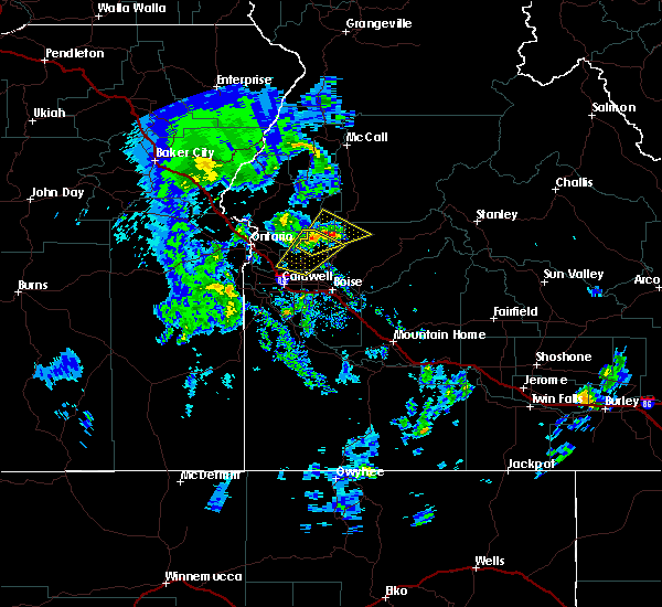
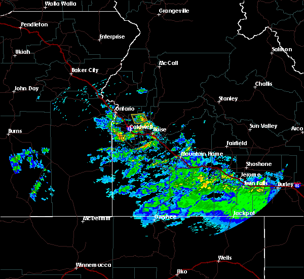
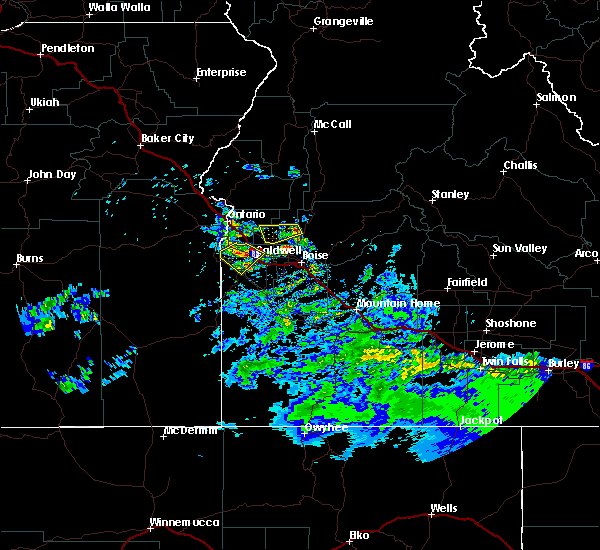
Hail Map for Emmett, ID
The Emmett, ID area has had 0 reports of on-the-ground hail by trained spotters, and has been under severe weather warnings 1 time during the past 12 months. Doppler radar has detected hail at or near Emmett, ID on 4 occasions, including 2 occasions during the past year.
| Name: | Emmett, ID |
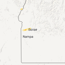
| Where Located: | 23.2 miles NW of Boise, ID |
| Map: | Google Map for Emmett, ID |
| Population: | 6557 |
| Housing Units: | 2916 |
| More Info: | Search Google for Emmett, ID |
0
The Top Recent Hail Date for Emmett, ID is Sunday, June 11, 2023 (3rd out of 4)

Hail and Wind Damage Spotted near Emmett, ID
| Date / Time | Report Details |
|---|---|
| 8/7/2023 4:48 PM MDT |
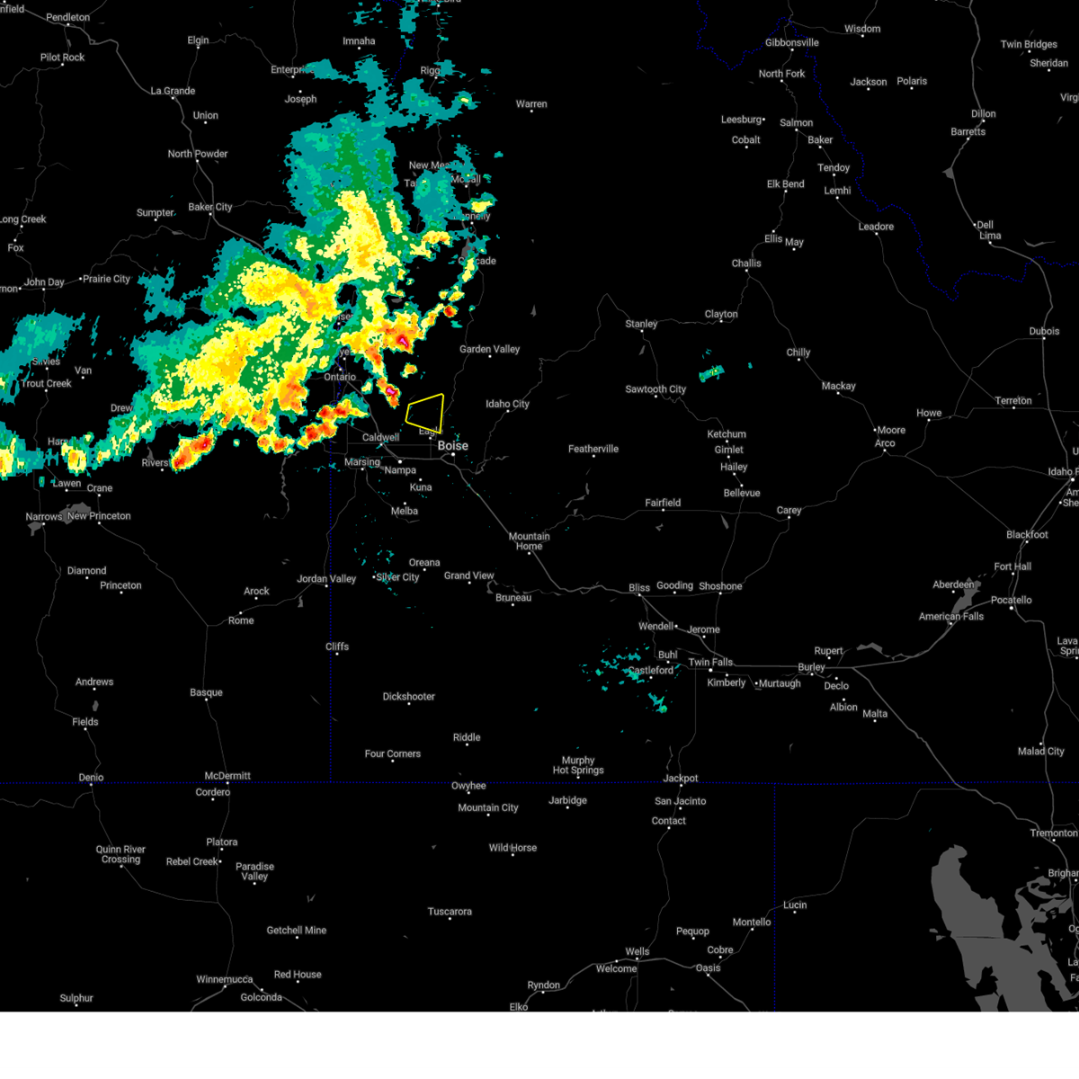 At 448 pm mdt, a severe thunderstorm was located near firebird speedway, or near emmett, moving east at 35 mph (radar indicated). Hazards include 60 mph wind gusts. Expect damage to roofs, siding, and trees. this severe thunderstorm will be near, emmett, eagle and firebird speedway around 450 pm mdt. hail threat, radar indicated max hail size, <. 75 in wind threat, radar indicated max wind gust, 60 mph. At 448 pm mdt, a severe thunderstorm was located near firebird speedway, or near emmett, moving east at 35 mph (radar indicated). Hazards include 60 mph wind gusts. Expect damage to roofs, siding, and trees. this severe thunderstorm will be near, emmett, eagle and firebird speedway around 450 pm mdt. hail threat, radar indicated max hail size, <. 75 in wind threat, radar indicated max wind gust, 60 mph.
|
| 9/7/2022 6:41 PM MDT |
 At 640 pm mdt/540 pm pdt/, severe thunderstorms were located along a line extending from richland to near homedale, moving east-northeast at 55 mph (radar indicated). Hazards include 70 mph wind gusts. Expect considerable tree damage. damage is likely to mobile homes, roofs, and outbuildings. severe thunderstorms will be near, halfway, richland and carson around 550 pm pdt. cambridge around 650 pm mdt. oxbow dam and brownlee dam around 600 pm pdt. goodrich and brownlee reservoir around 700 pm mdt. emmett, eagle, council and bear around 710 pm mdt. sweet, horseshoe bend, montour and lost valley reservoir around 720 pm mdt. mccall, gardena, ola and new meadows around 730 pm mdt. thunderstorm damage threat, considerable hail threat, radar indicated max hail size, <. 75 in wind threat, radar indicated max wind gust, 70 mph. At 640 pm mdt/540 pm pdt/, severe thunderstorms were located along a line extending from richland to near homedale, moving east-northeast at 55 mph (radar indicated). Hazards include 70 mph wind gusts. Expect considerable tree damage. damage is likely to mobile homes, roofs, and outbuildings. severe thunderstorms will be near, halfway, richland and carson around 550 pm pdt. cambridge around 650 pm mdt. oxbow dam and brownlee dam around 600 pm pdt. goodrich and brownlee reservoir around 700 pm mdt. emmett, eagle, council and bear around 710 pm mdt. sweet, horseshoe bend, montour and lost valley reservoir around 720 pm mdt. mccall, gardena, ola and new meadows around 730 pm mdt. thunderstorm damage threat, considerable hail threat, radar indicated max hail size, <. 75 in wind threat, radar indicated max wind gust, 70 mph.
|
| 9/7/2022 6:08 PM MDT |
 At 606 pm mdt/506 pm pdt/, severe thunderstorms were located along a line extending from near brogan to castro ridge, moving east at 60 mph (radar indicated). Hazards include 70 mph wind gusts. Expect considerable tree damage. damage is likely to mobile homes, roofs, and outbuildings. severe thunderstorms will be near, castro ridge, parsnip peak, little grassy reservoir and antelope reservoir around 610 pm mdt. reynolds, south mountain, henley basin and black warrior mountain around 620 pm mdt. weiser, silver city, murphy and melba around 630 pm mdt. payette, ontario, parma and emmett around 640 pm mdt. thunderstorm damage threat, considerable hail threat, radar indicated max hail size, <. 75 in wind threat, radar indicated max wind gust, 70 mph. At 606 pm mdt/506 pm pdt/, severe thunderstorms were located along a line extending from near brogan to castro ridge, moving east at 60 mph (radar indicated). Hazards include 70 mph wind gusts. Expect considerable tree damage. damage is likely to mobile homes, roofs, and outbuildings. severe thunderstorms will be near, castro ridge, parsnip peak, little grassy reservoir and antelope reservoir around 610 pm mdt. reynolds, south mountain, henley basin and black warrior mountain around 620 pm mdt. weiser, silver city, murphy and melba around 630 pm mdt. payette, ontario, parma and emmett around 640 pm mdt. thunderstorm damage threat, considerable hail threat, radar indicated max hail size, <. 75 in wind threat, radar indicated max wind gust, 70 mph.
|
| 9/10/2021 7:31 PM MDT |
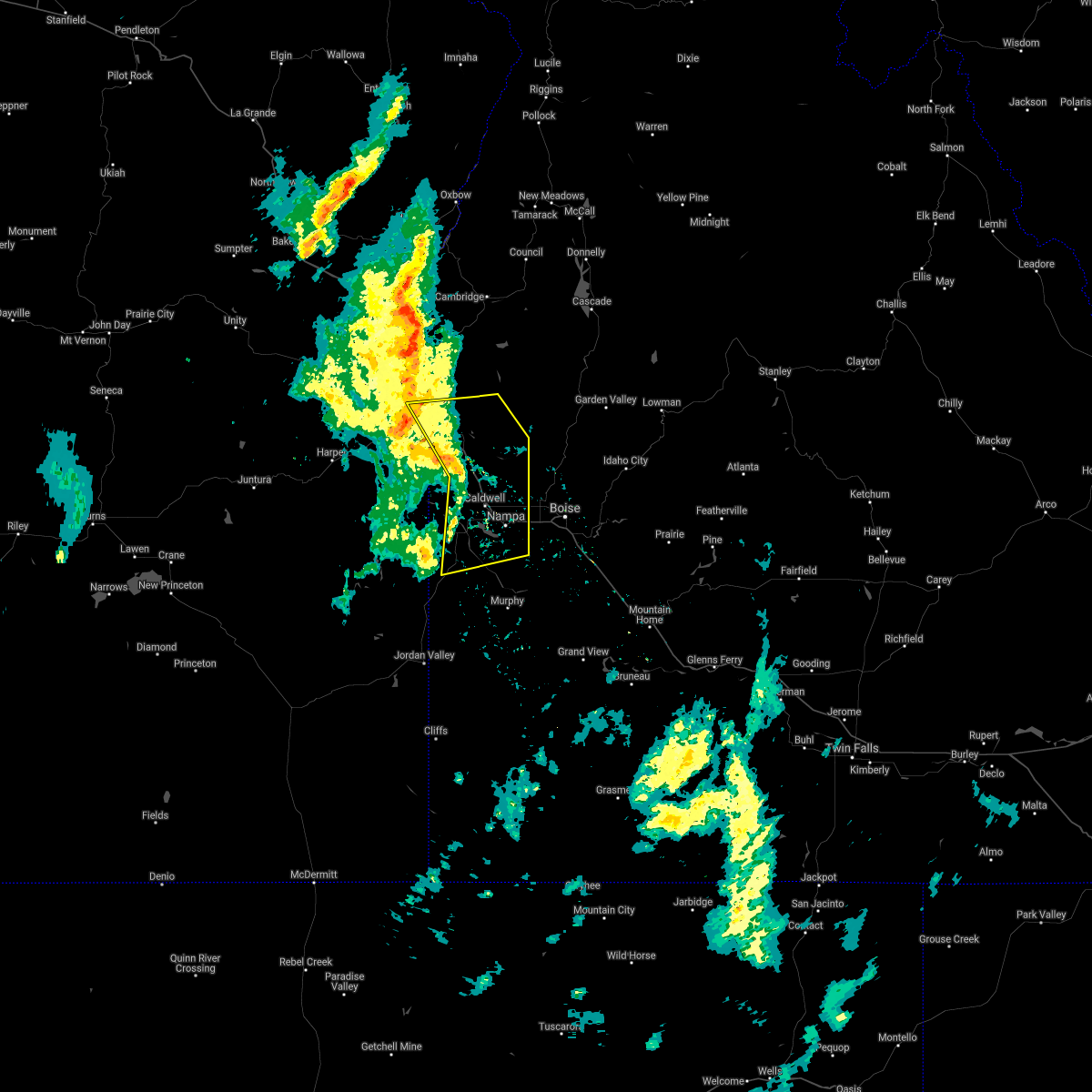 At 730 pm mdt, severe thunderstorms were located along a line extending from near payette to 7 miles northeast of parma to elephant butte, moving northeast at 40 mph (radar indicated). Hazards include 60 mph wind gusts. Expect damage to roofs, siding, and trees. severe thunderstorms will be near, new plymouth and middleton around 740 pm mdt. emmett, caldwell, letha and firebird speedway around 750 pm mdt. nampa, meridian, kuna and star around 800 pm mdt. hail threat, radar indicated max hail size, <. 75 in wind threat, radar indicated max wind gust, 60 mph. At 730 pm mdt, severe thunderstorms were located along a line extending from near payette to 7 miles northeast of parma to elephant butte, moving northeast at 40 mph (radar indicated). Hazards include 60 mph wind gusts. Expect damage to roofs, siding, and trees. severe thunderstorms will be near, new plymouth and middleton around 740 pm mdt. emmett, caldwell, letha and firebird speedway around 750 pm mdt. nampa, meridian, kuna and star around 800 pm mdt. hail threat, radar indicated max hail size, <. 75 in wind threat, radar indicated max wind gust, 60 mph.
|
| 6/22/2021 7:41 PM MDT | 1-inch tree limbs broken; shingles blown of in gem county ID, 2.2 miles ENE of Emmett, ID |
| 3/24/2020 6:08 PM MDT |
 At 608 pm mdt, a severe thunderstorm was located near parma, moving east at 30 mph (radar indicated). Hazards include 60 mph wind gusts and quarter size hail. Hail damage to vehicles is expected. expect wind damage to roofs, siding, and trees. This severe thunderstorm will be near, letha around 640 pm mdt. At 608 pm mdt, a severe thunderstorm was located near parma, moving east at 30 mph (radar indicated). Hazards include 60 mph wind gusts and quarter size hail. Hail damage to vehicles is expected. expect wind damage to roofs, siding, and trees. This severe thunderstorm will be near, letha around 640 pm mdt.
|
| 5/25/2018 8:00 PM MDT |
 At 759 pm mdt, a severe thunderstorm was located over notus, or 7 miles southeast of parma, moving north at 25 mph (trained weather spotters and doppler radar). Hazards include 60 mph wind gusts and half dollar size hail. Hail damage to vehicles is expected. expect wind damage to roofs, siding, and trees. this severe thunderstorm will be near, sand hollow around 800 pm mdt. parma and emmett around 810 pm mdt. owyhee and letha around 820 pm mdt. Nyssa around 830 pm mdt. At 759 pm mdt, a severe thunderstorm was located over notus, or 7 miles southeast of parma, moving north at 25 mph (trained weather spotters and doppler radar). Hazards include 60 mph wind gusts and half dollar size hail. Hail damage to vehicles is expected. expect wind damage to roofs, siding, and trees. this severe thunderstorm will be near, sand hollow around 800 pm mdt. parma and emmett around 810 pm mdt. owyhee and letha around 820 pm mdt. Nyssa around 830 pm mdt.
|
| 6/4/2017 6:51 PM MDT |
 The severe thunderstorm warning for northwestern ada, west central boise, northeastern payette, northeastern canyon and gem counties will expire at 700 pm mdt, the storm which prompted the warning has moved out of the area. therefore the warning will be allowed to expire. when safe to do so, please relay storm reports to the national weather service in boise via local law enforcement, or national weather service boise facebook and twitter accounts. The severe thunderstorm warning for northwestern ada, west central boise, northeastern payette, northeastern canyon and gem counties will expire at 700 pm mdt, the storm which prompted the warning has moved out of the area. therefore the warning will be allowed to expire. when safe to do so, please relay storm reports to the national weather service in boise via local law enforcement, or national weather service boise facebook and twitter accounts.
|
| 6/4/2017 6:24 PM MDT |
 At 623 pm mdt, a severe thunderstorm was located over emmett, moving northeast at 35 mph (radar indicated). Hazards include 60 mph wind gusts and quarter size hail. Hail damage to vehicles is expected. expect wind damage to roofs, siding, and trees. this severe thunderstorm will be near, sweet and montour around 640 pm mdt. Gardena around 650 pm mdt. At 623 pm mdt, a severe thunderstorm was located over emmett, moving northeast at 35 mph (radar indicated). Hazards include 60 mph wind gusts and quarter size hail. Hail damage to vehicles is expected. expect wind damage to roofs, siding, and trees. this severe thunderstorm will be near, sweet and montour around 640 pm mdt. Gardena around 650 pm mdt.
|
| 5/6/2016 7:35 PM MDT |
 At 734 pm mdt, doppler radar indicated a severe thunderstorm capable of producing quarter size hail. this storm was located near emmett, moving west at 20 mph. this severe thunderstorm will remain over mainly rural areas of southwestern gem county. At 734 pm mdt, doppler radar indicated a severe thunderstorm capable of producing quarter size hail. this storm was located near emmett, moving west at 20 mph. this severe thunderstorm will remain over mainly rural areas of southwestern gem county.
|
| 5/6/2016 7:15 PM MDT |
 At 714 pm mdt, doppler radar indicated a severe thunderstorm capable of producing quarter size hail and damaging winds in excess of 40 mph. this storm was located over montour, or 10 miles northeast of emmett, and moving west at 20 mph. * this severe thunderstorm will be near, montour around 720 pm mdt. emmett around 740 pm mdt. At 714 pm mdt, doppler radar indicated a severe thunderstorm capable of producing quarter size hail and damaging winds in excess of 40 mph. this storm was located over montour, or 10 miles northeast of emmett, and moving west at 20 mph. * this severe thunderstorm will be near, montour around 720 pm mdt. emmett around 740 pm mdt.
|
Hail Maps for Emmett, ID


Connect with Interactive Hail Maps