

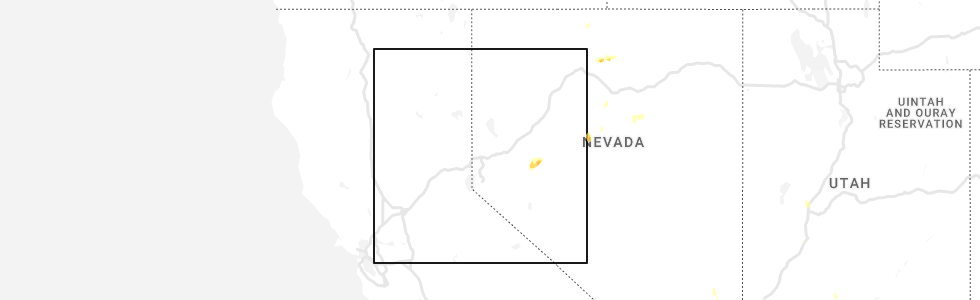
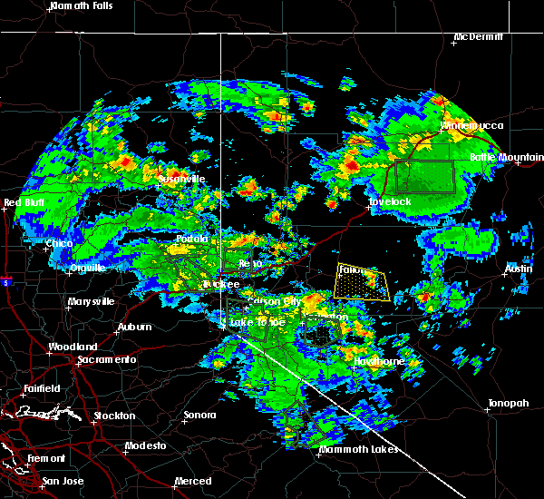
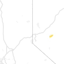
Hail Map for Fallon, NV
The Fallon, NV area has had 1 report of on-the-ground hail by trained spotters, and has been under severe weather warnings 0 times during the past 12 months. Doppler radar has detected hail at or near Fallon, NV on 2 occasions.
| Name: | Fallon, NV |
| Where Located: | 55.5 miles E of Reno, NV |
| Map: | Google Map for Fallon, NV |
| Population: | 8606 |
| Housing Units: | 3979 |
| More Info: | Search Google for Fallon, NV |
0
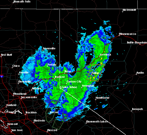
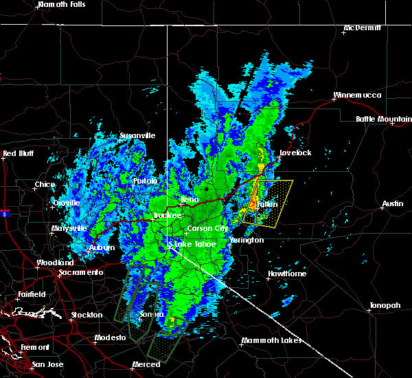
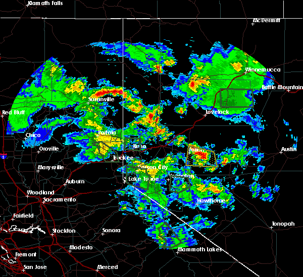
The Top Recent Hail Date for Fallon, NV is Wednesday, August 10, 2022 (2nd out of 2)
Hail and Wind Damage Spotted near Fallon, NV
| Date / Time | Report Details |
|---|---|
| 7/29/2022 1:33 PM PDT | Mesonet station ntgnv 14.1 sw trinity junction (nv dot). outflow gust from virga/rain shower. station elevation: 4296 f in churchill county NV, 26.8 miles SSE of Fallon, NV |
| 8/7/2019 2:30 PM PDT | Ndot i-80 nightingale sensor measured a 60 mph wind gus in churchill county NV, 26.8 miles SSE of Fallon, NV |
| 2/14/2019 12:47 PM PST |
 At 1246 pm pst, strong to severe thunderstorms were located along a line from lovelock to fallon, moving east at 10 mph (radar indicated). Hazards include 60 mph wind gusts. Expect damage to roofs, siding, fencing and trees. locations impacted include, fallon, stillwater, fallon municipal airport, junction u. s 50 and nv 116 (stuart rd), junction u. s 95 and nv 120 (pasture rd), battleground point, junction u. S 50 and nv 117 (sheckler cutoff), fallon station and lone rock. At 1246 pm pst, strong to severe thunderstorms were located along a line from lovelock to fallon, moving east at 10 mph (radar indicated). Hazards include 60 mph wind gusts. Expect damage to roofs, siding, fencing and trees. locations impacted include, fallon, stillwater, fallon municipal airport, junction u. s 50 and nv 116 (stuart rd), junction u. s 95 and nv 120 (pasture rd), battleground point, junction u. S 50 and nv 117 (sheckler cutoff), fallon station and lone rock.
|
| 2/14/2019 12:11 PM PST |
 At 1209 pm pst, severe thunderstorms were located along a line extending from 10 miles north of trinity junction to 13 miles east of wabuska, moving east at 10 mph (radar indicated). Hazards include 60 mph wind gusts. expect damage to roofs, siding, fencing and trees At 1209 pm pst, severe thunderstorms were located along a line extending from 10 miles north of trinity junction to 13 miles east of wabuska, moving east at 10 mph (radar indicated). Hazards include 60 mph wind gusts. expect damage to roofs, siding, fencing and trees
|
| 5/5/2016 3:35 PM PDT | Meteorologist from fallon nas recorded a downburst to the west of fallon nas with winds on site of 43g52 kts and visibility reduced between 1 and 2 mile in churchill county NV, 5.2 miles NNW of Fallon, NV |
| 7/8/2015 4:31 PM PDT |
 At 426 pm pdt, doppler radar indicated a severe thunderstorm capable of producing quarter size hail and damaging winds in excess of 60 mph. this storm was located over stillwater and 5 miles east of fallon, moving west at 10 mph. the heaviest rain will occur along highway 95 north of fallon where significant ponding of water is occurring. locations impacted include, fallon, stillwater, sand mountain campground, sand mountain, fallon station, frenchman and fallon municipal airport. At 426 pm pdt, doppler radar indicated a severe thunderstorm capable of producing quarter size hail and damaging winds in excess of 60 mph. this storm was located over stillwater and 5 miles east of fallon, moving west at 10 mph. the heaviest rain will occur along highway 95 north of fallon where significant ponding of water is occurring. locations impacted include, fallon, stillwater, sand mountain campground, sand mountain, fallon station, frenchman and fallon municipal airport.
|
| 7/8/2015 4:10 PM PDT |
 At 408 pm pdt, doppler radar indicated a severe thunderstorm capable of producing half dollar size hail and damaging winds in excess of 60 mph. this storm was located 9 miles south of stillwater, or 16 miles east of fallon, and moving west at 10 mph. At 408 pm pdt, doppler radar indicated a severe thunderstorm capable of producing half dollar size hail and damaging winds in excess of 60 mph. this storm was located 9 miles south of stillwater, or 16 miles east of fallon, and moving west at 10 mph.
|
| 7/8/2015 4:05 PM PDT | 63 mph gust recorded by weather observer at naval air station fallo in churchill county NV, 0.6 miles SSE of Fallon, NV |
| 7/4/2013 6:14 PM PDT | Quarter sized hail reported 15.7 miles E of Fallon, NV, a park ranger reported 1 inch hail at the lahontan reservoir. |
| 8/9/2012 7:25 PM PDT | Thunderstorm with heavy rain with some ponding of water on local streets. small branches broken on nearby tree in churchill county NV, 0.7 miles ENE of Fallon, NV |
| 8/9/2012 7:25 PM PDT | Sheriffs office reported a 4 to 5 foot diameter tree down on st. clair s in churchill county NV, 0.6 miles SSE of Fallon, NV |
| 8/9/2012 7:24 PM PDT | Remote sensor west of ragtown near highway 50 reported south winds at 25g77 mp in churchill county NV, 8.2 miles E of Fallon, NV |
| 4/22/2012 5:56 PM PDT | 59 mph wind gust measured at fallon naval air statio in churchill county NV, 0.6 miles SSE of Fallon, NV |
Hail Maps for Fallon, NV

Connect with Interactive Hail Maps