

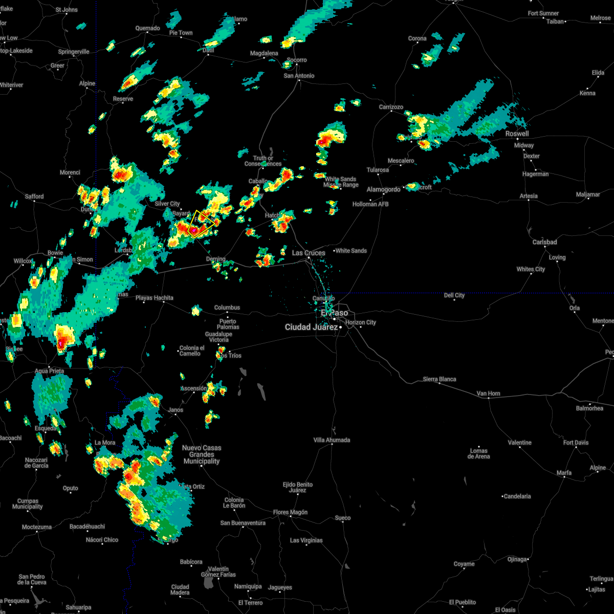
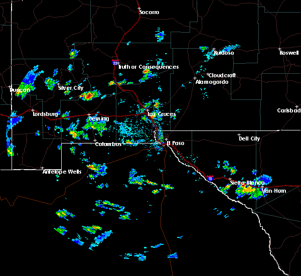
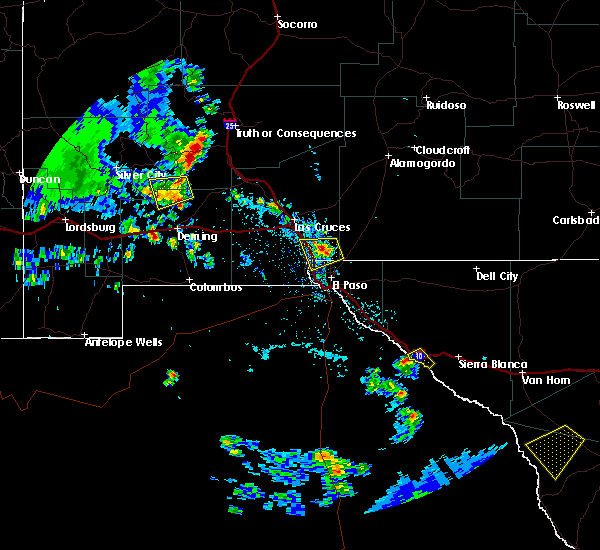
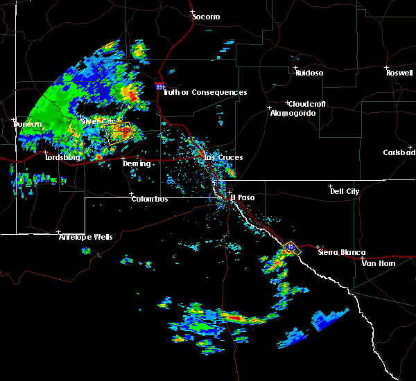
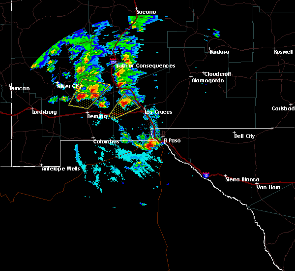
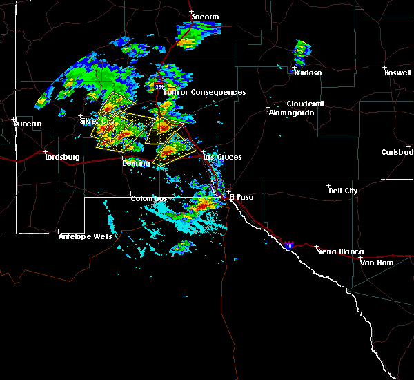
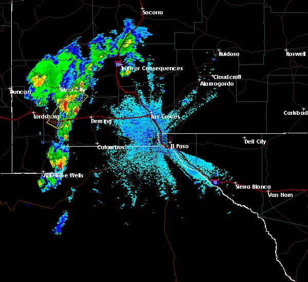
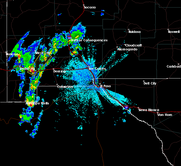
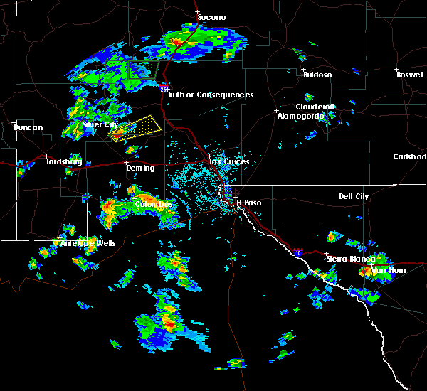
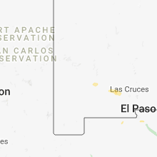
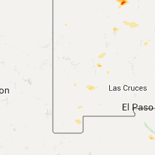
Hail Map for Faywood, NM
The Faywood, NM area has had 1 report of on-the-ground hail by trained spotters, and has been under severe weather warnings 0 times during the past 12 months. Doppler radar has detected hail at or near Faywood, NM on 12 occasions.
| Name: | Faywood, NM |
| Where Located: | 25.3 miles ESE of Silver City, NM |
| Map: | Google Map for Faywood, NM |
| Population: | 33 |
| Housing Units: | 20 |
| More Info: | Search Google for Faywood, NM |
0
The Top Recent Hail Date for Faywood, NM is Monday, July 4, 2022 (12th out of 12)
Hail and Wind Damage Spotted near Faywood, NM
| Date / Time | Report Details |
|---|---|
| 8/23/2021 4:03 PM MDT |
 At 403 pm mdt, a severe thunderstorm was located 6 miles southwest of faywood, moving northeast at 5 mph (radar indicated). Hazards include 60 mph wind gusts and quarter size hail. Hail damage to vehicles is expected. Expect wind damage to roofs, siding, and trees. At 403 pm mdt, a severe thunderstorm was located 6 miles southwest of faywood, moving northeast at 5 mph (radar indicated). Hazards include 60 mph wind gusts and quarter size hail. Hail damage to vehicles is expected. Expect wind damage to roofs, siding, and trees.
|
| 8/4/2021 3:53 PM MDT |
 At 353 pm mdt, a severe thunderstorm was located over san juan, moving southwest at 15 mph (radar indicated). Hazards include quarter size hail. damage to vehicles is expected At 353 pm mdt, a severe thunderstorm was located over san juan, moving southwest at 15 mph (radar indicated). Hazards include quarter size hail. damage to vehicles is expected
|
| 9/13/2019 4:26 PM MDT |
 At 425 pm mdt, a severe thunderstorm was located near cookes peak moving slowly to the west (radar indicated). Hazards include 60 mph wind gusts and quarter size hail. Hail damage to vehicles is expected. Expect wind damage to roofs, siding, and trees. At 425 pm mdt, a severe thunderstorm was located near cookes peak moving slowly to the west (radar indicated). Hazards include 60 mph wind gusts and quarter size hail. Hail damage to vehicles is expected. Expect wind damage to roofs, siding, and trees.
|
| 9/1/2018 9:54 PM MDT |
 The severe thunderstorm warning for east central grant and northwestern luna counties will expire at 1000 pm mdt, the storm which prompted the warning has weakened below severe limits, and no longer poses an immediate threat to life or property. therefore, the warning will be allowed to expire. however gusty winds and heavy rain are still possible with this thunderstorm. The severe thunderstorm warning for east central grant and northwestern luna counties will expire at 1000 pm mdt, the storm which prompted the warning has weakened below severe limits, and no longer poses an immediate threat to life or property. therefore, the warning will be allowed to expire. however gusty winds and heavy rain are still possible with this thunderstorm.
|
| 9/1/2018 9:40 PM MDT |
 At 939 pm mdt, a severe thunderstorm was located 8 miles west of faywood, moving east at 30 mph (radar indicated). Hazards include 60 mph wind gusts and quarter size hail. Hail damage to vehicles is expected. expect wind damage to roofs, siding, and trees. Locations impacted include, faywood, tyrone mine, silver city, north hurley, bayard, hurley, tyrone, city of rocks state park, santa clara, and white signal. At 939 pm mdt, a severe thunderstorm was located 8 miles west of faywood, moving east at 30 mph (radar indicated). Hazards include 60 mph wind gusts and quarter size hail. Hail damage to vehicles is expected. expect wind damage to roofs, siding, and trees. Locations impacted include, faywood, tyrone mine, silver city, north hurley, bayard, hurley, tyrone, city of rocks state park, santa clara, and white signal.
|
| 9/1/2018 9:15 PM MDT |
 At 915 pm mdt, a severe thunderstorm was located near hurley, moving east at 25 mph (radar indicated). Hazards include 60 mph wind gusts and quarter size hail. Hail damage to vehicles is expected. Expect wind damage to roofs, siding, and trees. At 915 pm mdt, a severe thunderstorm was located near hurley, moving east at 25 mph (radar indicated). Hazards include 60 mph wind gusts and quarter size hail. Hail damage to vehicles is expected. Expect wind damage to roofs, siding, and trees.
|
| 6/24/2017 6:58 PM MDT |
 At 657 pm mdt, a severe thunderstorm was located 4 miles southwest of deming, moving south at 35 mph (radar indicated). Hazards include 60 mph wind gusts and nickel size hail. Expect damage to roofs, siding, and trees. Locations impacted include, deming, city of rocks state park, faywood, gage, and rock hound state park. At 657 pm mdt, a severe thunderstorm was located 4 miles southwest of deming, moving south at 35 mph (radar indicated). Hazards include 60 mph wind gusts and nickel size hail. Expect damage to roofs, siding, and trees. Locations impacted include, deming, city of rocks state park, faywood, gage, and rock hound state park.
|
| 6/24/2017 6:33 PM MDT |
 At 629 pm mdt, a severe thunderstorm was located 9 miles south of city of rocks state park, moving southeast along highway 180 at 30 mph (radar indicated). Hazards include 60 mph wind gusts and nickel size hail. Expect visibility to zero miles. Damage to roofs, siding, and trees. At 629 pm mdt, a severe thunderstorm was located 9 miles south of city of rocks state park, moving southeast along highway 180 at 30 mph (radar indicated). Hazards include 60 mph wind gusts and nickel size hail. Expect visibility to zero miles. Damage to roofs, siding, and trees.
|
| 6/19/2017 5:08 PM MDT |
 The severe thunderstorm warning for east central grant, southwestern sierra and north central luna counties will expire at 515 pm mdt, the storm which prompted the warning has weakened below severe limits, and no longer pose an immediate threat to life or property. therefore, the warning will be allowed to expire. however heavy rain is still possible with this thunderstorm. The severe thunderstorm warning for east central grant, southwestern sierra and north central luna counties will expire at 515 pm mdt, the storm which prompted the warning has weakened below severe limits, and no longer pose an immediate threat to life or property. therefore, the warning will be allowed to expire. however heavy rain is still possible with this thunderstorm.
|
| 6/19/2017 4:36 PM MDT |
 At 435 pm mdt, a severe thunderstorm was located 9 miles east of faywood, or 15 miles east of city of rocks state park, moving west at 10 mph (radar indicated). Hazards include 60 mph wind gusts and quarter size hail. Hail damage to vehicles is expected. Expect wind damage to roofs, siding, and trees. At 435 pm mdt, a severe thunderstorm was located 9 miles east of faywood, or 15 miles east of city of rocks state park, moving west at 10 mph (radar indicated). Hazards include 60 mph wind gusts and quarter size hail. Hail damage to vehicles is expected. Expect wind damage to roofs, siding, and trees.
|
| 6/6/2017 3:20 PM MDT |
 At 301 pm mdt, a severe thunderstorm was located near north hurley, or 10 miles northwest of city of rocks state park, moving southeast at 15 mph (radar indicated). Hazards include 60 mph wind gusts and quarter size hail. Hail damage to vehicles is expected. Expect wind damage to roofs, siding, and trees. At 301 pm mdt, a severe thunderstorm was located near north hurley, or 10 miles northwest of city of rocks state park, moving southeast at 15 mph (radar indicated). Hazards include 60 mph wind gusts and quarter size hail. Hail damage to vehicles is expected. Expect wind damage to roofs, siding, and trees.
|
| 6/6/2017 3:01 PM MDT |
 At 301 pm mdt, a severe thunderstorm was located near north hurley, or 10 miles northwest of city of rocks state park, moving southeast at 15 mph (radar indicated). Hazards include 60 mph wind gusts and quarter size hail. Hail damage to vehicles is expected. Expect wind damage to roofs, siding, and trees. At 301 pm mdt, a severe thunderstorm was located near north hurley, or 10 miles northwest of city of rocks state park, moving southeast at 15 mph (radar indicated). Hazards include 60 mph wind gusts and quarter size hail. Hail damage to vehicles is expected. Expect wind damage to roofs, siding, and trees.
|
| 11/4/2016 5:15 PM MDT |
 At 515 pm mdt, a severe thunderstorm was located 5 miles southeast of faywood, moving northeast at 20 mph (radar indicated). Hazards include 60 mph wind gusts and quarter size hail. Hail damage to vehicles is expected. expect wind damage to roofs, siding, and trees. Locations impacted include, faywood, lake valley, sherman, macho springs wind farm, cookes peak, and city of rocks state park. At 515 pm mdt, a severe thunderstorm was located 5 miles southeast of faywood, moving northeast at 20 mph (radar indicated). Hazards include 60 mph wind gusts and quarter size hail. Hail damage to vehicles is expected. expect wind damage to roofs, siding, and trees. Locations impacted include, faywood, lake valley, sherman, macho springs wind farm, cookes peak, and city of rocks state park.
|
| 11/4/2016 4:46 PM MDT |
 At 445 pm mdt, a severe thunderstorm was located 10 miles east of faywood, moving northeast at 35 mph (radar indicated). Hazards include 60 mph wind gusts and half dollar size hail. Hail damage to vehicles is expected. Expect wind damage to roofs, siding, and trees. At 445 pm mdt, a severe thunderstorm was located 10 miles east of faywood, moving northeast at 35 mph (radar indicated). Hazards include 60 mph wind gusts and half dollar size hail. Hail damage to vehicles is expected. Expect wind damage to roofs, siding, and trees.
|
| 11/4/2016 4:40 PM MDT | Hen Egg sized hail reported 10.2 miles NE of Faywood, NM, public reported numerous cars damaged along hwy 180 near hwy 61 exit. 2 inch diameter hail and covering the ground. |
| 11/4/2016 4:40 PM MDT |
 At 439 pm mdt, a severe thunderstorm was located 4 miles west of faywood, moving northeast at 35 mph (radar indicated). Hazards include 60 mph wind gusts and quarter size hail. Hail damage to vehicles is expected. Expect wind damage to roofs, siding, and trees. At 439 pm mdt, a severe thunderstorm was located 4 miles west of faywood, moving northeast at 35 mph (radar indicated). Hazards include 60 mph wind gusts and quarter size hail. Hail damage to vehicles is expected. Expect wind damage to roofs, siding, and trees.
|
| 10/21/2015 2:39 AM MDT |
 At 237 am mdt, a severe thunderstorm was located 10 miles southwest of city of rocks state park, moving northeast at 45 mph. the storm has weakened somewhat but is still marginally severe. ping pong ball size hail affected motorists on i-10 earlier (public). Hazards include 60 mph wind gusts and quarter size hail. Hail damage to vehicles is expected. expect wind damage to roofs, siding and trees. Locations impacted include, city of rocks state park, faywood, separ. At 237 am mdt, a severe thunderstorm was located 10 miles southwest of city of rocks state park, moving northeast at 45 mph. the storm has weakened somewhat but is still marginally severe. ping pong ball size hail affected motorists on i-10 earlier (public). Hazards include 60 mph wind gusts and quarter size hail. Hail damage to vehicles is expected. expect wind damage to roofs, siding and trees. Locations impacted include, city of rocks state park, faywood, separ.
|
| 10/21/2015 2:11 AM MDT |
 At 209 am mdt, a severe thunderstorm was located 6 miles east of separ, or 24 miles east of lordsburg, moving northeast at 50 mph (radar indicated). Hazards include 60 mph wind gusts and quarter size hail. Hail damage to vehicles is expected. Expect wind damage to roofs, siding and trees. At 209 am mdt, a severe thunderstorm was located 6 miles east of separ, or 24 miles east of lordsburg, moving northeast at 50 mph (radar indicated). Hazards include 60 mph wind gusts and quarter size hail. Hail damage to vehicles is expected. Expect wind damage to roofs, siding and trees.
|
| 7/9/2015 3:57 PM MDT |
 At 356 pm mdt, a severe thunderstorm was located 4 miles southeast of faywood, or 8 miles east of city of rocks state park, moving east at 45 mph (radar indicated). Hazards include 60 mph wind gusts and quarter size hail. Hail damage to vehicles is expected. Expect wind damage to roofs, siding and trees. At 356 pm mdt, a severe thunderstorm was located 4 miles southeast of faywood, or 8 miles east of city of rocks state park, moving east at 45 mph (radar indicated). Hazards include 60 mph wind gusts and quarter size hail. Hail damage to vehicles is expected. Expect wind damage to roofs, siding and trees.
|
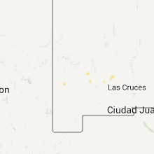
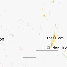
Hail Maps for Faywood, NM


Connect with Interactive Hail Maps