

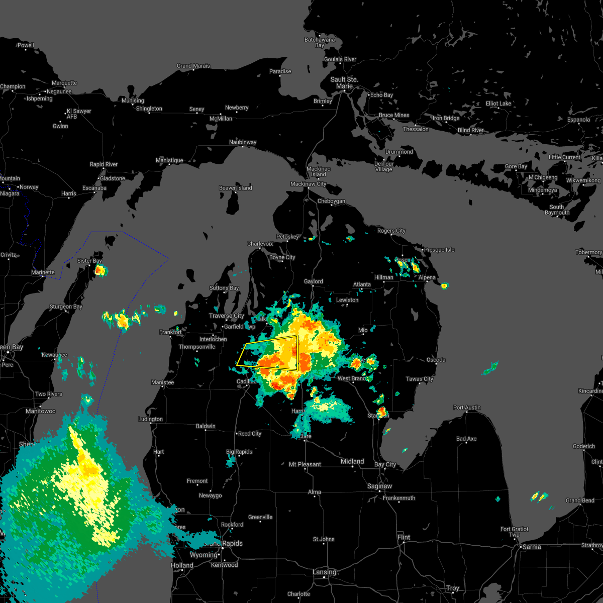
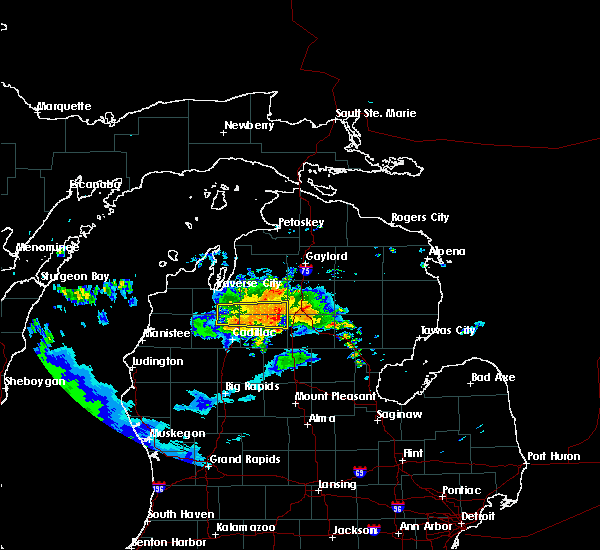
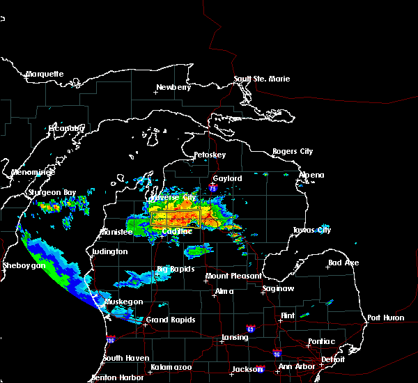
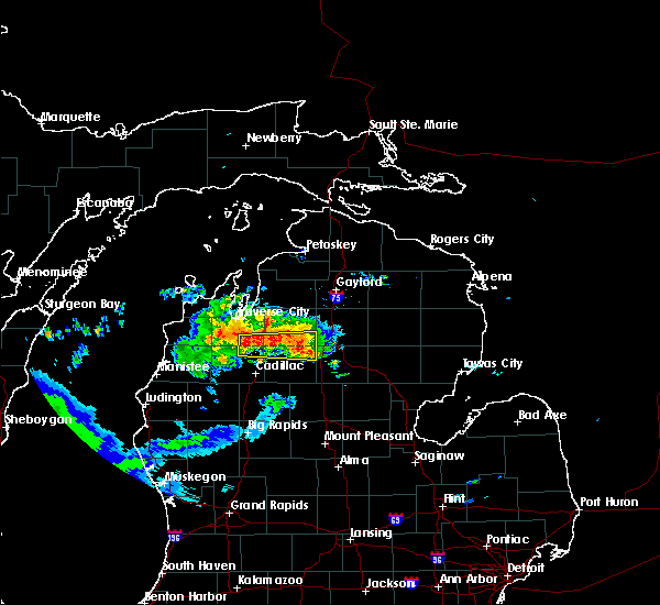
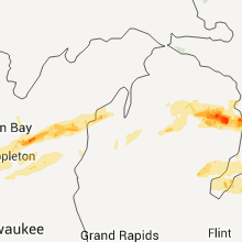
Hail Map for Fife Lake, MI
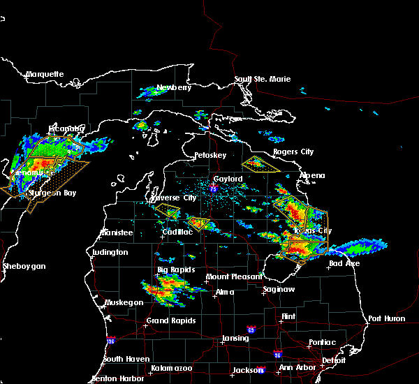
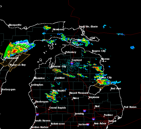
The Fife Lake, MI area has had 2 reports of on-the-ground hail by trained spotters, and has been under severe weather warnings 4 times during the past 12 months. Doppler radar has detected hail at or near Fife Lake, MI on 19 occasions.
| Name: | Fife Lake, MI |
| Where Located: | 18.3 miles SE of Traverse City, MI |
| Map: | Google Map for Fife Lake, MI |
| Population: | 443 |
| Housing Units: | 265 |
| More Info: | Search Google for Fife Lake, MI |
0
The Top Recent Hail Date for Fife Lake, MI is Wednesday, September 21, 2022 (11th out of 19)

Hail and Wind Damage Spotted near Fife Lake, MI
| Date / Time | Report Details |
|---|---|
| 8/3/2023 6:27 PM EDT |
 The severe thunderstorm warning for kalkaska county will expire at 630 pm edt, the storm which prompted the warning has weakened below severe limits, and no longer poses an immediate threat to life or property. therefore, the warning will be allowed to expire. The severe thunderstorm warning for kalkaska county will expire at 630 pm edt, the storm which prompted the warning has weakened below severe limits, and no longer poses an immediate threat to life or property. therefore, the warning will be allowed to expire.
|
| 8/3/2023 6:13 PM EDT |
 At 612 pm edt, a severe thunderstorm was located near south boardman, or near kalkaska, moving east at 35 mph (radar indicated). Hazards include 60 mph wind gusts and quarter size hail. Hail damage to vehicles is expected. expect wind damage to roofs, siding, and trees. locations impacted include, kalkaska, sharon, fife lake, barker creek, sigma, darragh and south boardman. hail threat, radar indicated max hail size, 1. 00 in wind threat, radar indicated max wind gust, 60 mph. At 612 pm edt, a severe thunderstorm was located near south boardman, or near kalkaska, moving east at 35 mph (radar indicated). Hazards include 60 mph wind gusts and quarter size hail. Hail damage to vehicles is expected. expect wind damage to roofs, siding, and trees. locations impacted include, kalkaska, sharon, fife lake, barker creek, sigma, darragh and south boardman. hail threat, radar indicated max hail size, 1. 00 in wind threat, radar indicated max wind gust, 60 mph.
|
| 8/3/2023 5:48 PM EDT |
 At 548 pm edt, a severe thunderstorm was located over traverse city, moving southeast at 40 mph (radar indicated). Hazards include 60 mph wind gusts and quarter size hail. Hail damage to vehicles is expected. Expect wind damage to roofs, siding, and trees. At 548 pm edt, a severe thunderstorm was located over traverse city, moving southeast at 40 mph (radar indicated). Hazards include 60 mph wind gusts and quarter size hail. Hail damage to vehicles is expected. Expect wind damage to roofs, siding, and trees.
|
| 6/25/2023 6:29 PM EDT |
 At 629 pm edt, severe thunderstorms were located along a line extending from near elk rapids to near south boardman to near morey, moving northeast at 20 mph (radar indicated). Hazards include 60 mph wind gusts and nickel size hail. expect damage to roofs, siding, and trees At 629 pm edt, severe thunderstorms were located along a line extending from near elk rapids to near south boardman to near morey, moving northeast at 20 mph (radar indicated). Hazards include 60 mph wind gusts and nickel size hail. expect damage to roofs, siding, and trees
|
| 6/15/2022 11:17 PM EDT |
 At 1116 pm edt, severe thunderstorms were located along a line extending from near rapid city to near fife lake, moving east at 30 mph (radar indicated). Hazards include 60 mph wind gusts and penny size hail. Expect damage to roofs, siding, and trees. these severe storms will be near, rapid city and barker creek around 1120 pm edt. other locations in the path of these severe thunderstorms include south boardman and antrim. hail threat, radar indicated max hail size, 0. 75 in wind threat, radar indicated max wind gust, 60 mph. At 1116 pm edt, severe thunderstorms were located along a line extending from near rapid city to near fife lake, moving east at 30 mph (radar indicated). Hazards include 60 mph wind gusts and penny size hail. Expect damage to roofs, siding, and trees. these severe storms will be near, rapid city and barker creek around 1120 pm edt. other locations in the path of these severe thunderstorms include south boardman and antrim. hail threat, radar indicated max hail size, 0. 75 in wind threat, radar indicated max wind gust, 60 mph.
|
| 6/15/2022 11:07 PM EDT |
 At 1107 pm edt, severe thunderstorms were located along a line extending from near williamsburg to kingsley, moving east at 35 mph (radar indicated). Hazards include 60 mph wind gusts and penny size hail. Expect damage to roofs, siding, and trees. these severe storms will be near, williamsburg around 1110 pm edt. other locations in the path of these severe thunderstorms include barker creek, fife lake, rapid city, south boardman, kalkaska, antrim and darragh. hail threat, radar indicated max hail size, 0. 75 in wind threat, radar indicated max wind gust, 60 mph. At 1107 pm edt, severe thunderstorms were located along a line extending from near williamsburg to kingsley, moving east at 35 mph (radar indicated). Hazards include 60 mph wind gusts and penny size hail. Expect damage to roofs, siding, and trees. these severe storms will be near, williamsburg around 1110 pm edt. other locations in the path of these severe thunderstorms include barker creek, fife lake, rapid city, south boardman, kalkaska, antrim and darragh. hail threat, radar indicated max hail size, 0. 75 in wind threat, radar indicated max wind gust, 60 mph.
|
| 6/15/2022 10:51 PM EDT |
 At 1051 pm edt, severe thunderstorms were located along a line extending from traverse city to buckley, moving east at 30 mph (radar indicated). Hazards include 60 mph wind gusts and penny size hail. Expect damage to roofs, siding, and trees. severe thunderstorms will be near, traverse city and traverse city state park around 1055 pm edt. kingsley around 1105 pm edt. williamsburg around 1110 pm edt. other locations in the path of these severe thunderstorms include barker creek, fife lake, rapid city, kalkaska, south boardman and antrim. hail threat, radar indicated max hail size, 0. 75 in wind threat, radar indicated max wind gust, 60 mph. At 1051 pm edt, severe thunderstorms were located along a line extending from traverse city to buckley, moving east at 30 mph (radar indicated). Hazards include 60 mph wind gusts and penny size hail. Expect damage to roofs, siding, and trees. severe thunderstorms will be near, traverse city and traverse city state park around 1055 pm edt. kingsley around 1105 pm edt. williamsburg around 1110 pm edt. other locations in the path of these severe thunderstorms include barker creek, fife lake, rapid city, kalkaska, south boardman and antrim. hail threat, radar indicated max hail size, 0. 75 in wind threat, radar indicated max wind gust, 60 mph.
|
| 9/7/2021 10:11 AM EDT |
 The severe thunderstorm warning for wexford, southeastern grand traverse, southern kalkaska and northwestern missaukee counties will expire at 1015 am edt, the storms which prompted the warning have weakened below severe limits, and no longer pose an immediate threat to life or property. therefore, the warning will be allowed to expire. however gusty winds are still possible with these thunderstorms. The severe thunderstorm warning for wexford, southeastern grand traverse, southern kalkaska and northwestern missaukee counties will expire at 1015 am edt, the storms which prompted the warning have weakened below severe limits, and no longer pose an immediate threat to life or property. therefore, the warning will be allowed to expire. however gusty winds are still possible with these thunderstorms.
|
| 9/7/2021 10:02 AM EDT |
 At 1001 am edt, severe thunderstorms were located along a line extending from near kalkaska to near sigma to near sharon to near meauwataka, moving east at 50 mph (radar indicated). Hazards include 60 mph wind gusts and penny size hail. Expect damage to roofs, siding, and trees. locations impacted include, cadillac, lake city, sharon, kingsley, manton, boon, fife lake, harrietta, meauwataka, jennings, south boardman, mitchell state park, morey, yuma and smithville. hail threat, radar indicated max hail size, 0. 75 in wind threat, radar indicated max wind gust, 60 mph. At 1001 am edt, severe thunderstorms were located along a line extending from near kalkaska to near sigma to near sharon to near meauwataka, moving east at 50 mph (radar indicated). Hazards include 60 mph wind gusts and penny size hail. Expect damage to roofs, siding, and trees. locations impacted include, cadillac, lake city, sharon, kingsley, manton, boon, fife lake, harrietta, meauwataka, jennings, south boardman, mitchell state park, morey, yuma and smithville. hail threat, radar indicated max hail size, 0. 75 in wind threat, radar indicated max wind gust, 60 mph.
|
| 9/7/2021 9:43 AM EDT |
 At 943 am edt, severe thunderstorms were located along a line extending from near spider lake to near fife lake to near kingsley to near yuma, moving east at 65 mph (radar indicated). Hazards include 60 mph wind gusts and quarter size hail. Hail damage to vehicles is expected. expect wind damage to roofs, siding, and trees. locations impacted include, fife lake, south boardman, cadillac, sharon, manton, jennings, lake city and morey. hail threat, radar indicated max hail size, 1. 00 in wind threat, radar indicated max wind gust, 60 mph. At 943 am edt, severe thunderstorms were located along a line extending from near spider lake to near fife lake to near kingsley to near yuma, moving east at 65 mph (radar indicated). Hazards include 60 mph wind gusts and quarter size hail. Hail damage to vehicles is expected. expect wind damage to roofs, siding, and trees. locations impacted include, fife lake, south boardman, cadillac, sharon, manton, jennings, lake city and morey. hail threat, radar indicated max hail size, 1. 00 in wind threat, radar indicated max wind gust, 60 mph.
|
| 9/7/2021 9:29 AM EDT |
 At 928 am edt, severe thunderstorms were located along a line extending from interlochen state park to near norwalk, moving east at 45 mph (radar indicated. at 913 em edt, penny size hail was reported 1 mile east of beulah). Hazards include 60 mph wind gusts and quarter size hail. Hail damage to vehicles is expected. expect wind damage to roofs, siding, and trees. severe thunderstorms will be near, grawn, interlochen, interlochen state park and karlin around 935 am edt. traverse city, buckley and hannah around 940 am edt. kingsley around 945 am edt. other locations in the path of these severe thunderstorms include yuma, spider lake, sherman, mesick, harrietta, boon, fife lake, south boardman, meauwataka, cadillac, sharon, mitchell state park and jennings. hail threat, radar indicated max hail size, 1. 00 in wind threat, radar indicated max wind gust, 60 mph. At 928 am edt, severe thunderstorms were located along a line extending from interlochen state park to near norwalk, moving east at 45 mph (radar indicated. at 913 em edt, penny size hail was reported 1 mile east of beulah). Hazards include 60 mph wind gusts and quarter size hail. Hail damage to vehicles is expected. expect wind damage to roofs, siding, and trees. severe thunderstorms will be near, grawn, interlochen, interlochen state park and karlin around 935 am edt. traverse city, buckley and hannah around 940 am edt. kingsley around 945 am edt. other locations in the path of these severe thunderstorms include yuma, spider lake, sherman, mesick, harrietta, boon, fife lake, south boardman, meauwataka, cadillac, sharon, mitchell state park and jennings. hail threat, radar indicated max hail size, 1. 00 in wind threat, radar indicated max wind gust, 60 mph.
|
| 8/28/2021 4:53 AM EDT |
 At 452 am edt, severe thunderstorms were located along a line extending from near spider lake to near meauwataka to near mitchell state park, moving east at 50 mph (radar indicated). Hazards include 60 mph wind gusts. Expect damage to roofs, siding, and trees. locations impacted include, cadillac, lake city, kingsley, manton, buckley, boon, mcbain, fife lake, meauwataka, hannah, lucas, jennings, hoxeyville, south boardman, mitchell state park and morey. hail threat, radar indicated max hail size, <. 75 in wind threat, radar indicated max wind gust, 60 mph. At 452 am edt, severe thunderstorms were located along a line extending from near spider lake to near meauwataka to near mitchell state park, moving east at 50 mph (radar indicated). Hazards include 60 mph wind gusts. Expect damage to roofs, siding, and trees. locations impacted include, cadillac, lake city, kingsley, manton, buckley, boon, mcbain, fife lake, meauwataka, hannah, lucas, jennings, hoxeyville, south boardman, mitchell state park and morey. hail threat, radar indicated max hail size, <. 75 in wind threat, radar indicated max wind gust, 60 mph.
|
| 8/28/2021 4:42 AM EDT |
 At 441 am edt, severe thunderstorms were located along a line extending from grawn to near sherman to hoxeyville, moving east at 50 mph (radar indicated). Hazards include 60 mph wind gusts. Expect damage to roofs, siding, and trees. locations impacted include, hannah, kingsley, boon, meauwataka, manton, cadillac, mitchell state park, fife lake, jennings, lake city, mcbain, lucas, south boardman and morey. hail threat, radar indicated max hail size, <. 75 in wind threat, radar indicated max wind gust, 60 mph. At 441 am edt, severe thunderstorms were located along a line extending from grawn to near sherman to hoxeyville, moving east at 50 mph (radar indicated). Hazards include 60 mph wind gusts. Expect damage to roofs, siding, and trees. locations impacted include, hannah, kingsley, boon, meauwataka, manton, cadillac, mitchell state park, fife lake, jennings, lake city, mcbain, lucas, south boardman and morey. hail threat, radar indicated max hail size, <. 75 in wind threat, radar indicated max wind gust, 60 mph.
|
| 8/28/2021 4:15 AM EDT |
 At 414 am edt, severe thunderstorms were located along a line extending from beulah to kaleva to near free soil, moving east at 50 mph (radar indicated. at blacker airport in manistee a wind gust of 45 mph was observed). Hazards include 60 mph wind gusts. Expect damage to roofs, siding, and trees. severe thunderstorms will be near, thompsonville, copemish, dublin and wellston around 425 am edt. bendon around 430 am edt. other locations in the path of these severe thunderstorms include sherman, mesick, harrietta, interlochen state park, yuma, karlin, hoxeyville, boon, meauwataka, hannah, kingsley, manton, mitchell state park, cadillac, fife lake and jennings. hail threat, radar indicated max hail size, <. 75 in wind threat, radar indicated max wind gust, 60 mph. At 414 am edt, severe thunderstorms were located along a line extending from beulah to kaleva to near free soil, moving east at 50 mph (radar indicated. at blacker airport in manistee a wind gust of 45 mph was observed). Hazards include 60 mph wind gusts. Expect damage to roofs, siding, and trees. severe thunderstorms will be near, thompsonville, copemish, dublin and wellston around 425 am edt. bendon around 430 am edt. other locations in the path of these severe thunderstorms include sherman, mesick, harrietta, interlochen state park, yuma, karlin, hoxeyville, boon, meauwataka, hannah, kingsley, manton, mitchell state park, cadillac, fife lake and jennings. hail threat, radar indicated max hail size, <. 75 in wind threat, radar indicated max wind gust, 60 mph.
|
| 8/28/2021 1:31 AM EDT |
 At 130 am edt, severe thunderstorms were located along a line extending from spider lake to near hoxeyville, moving east at 30 mph (radar indicated). Hazards include 60 mph wind gusts. Expect damage to roofs, siding, and trees. locations impacted include, fife lake, boon, mitchell state park and cadillac. hail threat, radar indicated max hail size, <. 75 in wind threat, radar indicated max wind gust, 60 mph. At 130 am edt, severe thunderstorms were located along a line extending from spider lake to near hoxeyville, moving east at 30 mph (radar indicated). Hazards include 60 mph wind gusts. Expect damage to roofs, siding, and trees. locations impacted include, fife lake, boon, mitchell state park and cadillac. hail threat, radar indicated max hail size, <. 75 in wind threat, radar indicated max wind gust, 60 mph.
|
| 8/28/2021 12:49 AM EDT |
 At 1248 am edt, severe thunderstorms were located along a line extending from bendon to near free soil, moving east at 30 mph (radar indicated). Hazards include 60 mph wind gusts and quarter size hail. Hail damage to vehicles is expected. expect wind damage to roofs, siding, and trees. severe thunderstorms will be near, interlochen, interlochen state park, bendon and karlin around 1255 am edt. grawn around 105 am edt. other locations in the path of these severe thunderstorms include hannah, traverse city, kingsley, spider lake, hoxeyville and fife lake. hail threat, radar indicated max hail size, 1. 00 in wind threat, radar indicated max wind gust, 60 mph. At 1248 am edt, severe thunderstorms were located along a line extending from bendon to near free soil, moving east at 30 mph (radar indicated). Hazards include 60 mph wind gusts and quarter size hail. Hail damage to vehicles is expected. expect wind damage to roofs, siding, and trees. severe thunderstorms will be near, interlochen, interlochen state park, bendon and karlin around 1255 am edt. grawn around 105 am edt. other locations in the path of these severe thunderstorms include hannah, traverse city, kingsley, spider lake, hoxeyville and fife lake. hail threat, radar indicated max hail size, 1. 00 in wind threat, radar indicated max wind gust, 60 mph.
|
| 8/10/2021 11:05 PM EDT |
 At 1105 pm edt, severe thunderstorms were located along a line extending from kalkaska to near south boardman to near fife lake, moving east at 55 mph (radar indicated). Hazards include 70 mph wind gusts and nickel size hail. Expect considerable tree damage. damage is likely to mobile homes, roofs, and outbuildings. these severe storms will be near, sharon, darragh and sigma around 1110 pm edt. other locations in the path of these severe thunderstorms include moorestown. thunderstorm damage threat, considerable hail threat, radar indicated max hail size, 0. 88 in wind threat, radar indicated max wind gust, 70 mph. At 1105 pm edt, severe thunderstorms were located along a line extending from kalkaska to near south boardman to near fife lake, moving east at 55 mph (radar indicated). Hazards include 70 mph wind gusts and nickel size hail. Expect considerable tree damage. damage is likely to mobile homes, roofs, and outbuildings. these severe storms will be near, sharon, darragh and sigma around 1110 pm edt. other locations in the path of these severe thunderstorms include moorestown. thunderstorm damage threat, considerable hail threat, radar indicated max hail size, 0. 88 in wind threat, radar indicated max wind gust, 70 mph.
|
| 8/10/2021 10:56 PM EDT |
 At 1055 pm edt, severe thunderstorms were located along a line extending from near williamsburg to near spider lake to hannah, moving southeast at 45 mph (radar indicated). Hazards include 70 mph wind gusts and nickel size hail. Expect considerable tree damage. damage is likely to mobile homes, roofs, and outbuildings. these severe storms will be near, kalkaska, fife lake and south boardman around 1105 pm edt. other locations in the path of these severe thunderstorms include sharon, sigma, morey and moorestown. thunderstorm damage threat, considerable hail threat, radar indicated max hail size, 0. 88 in wind threat, radar indicated max wind gust, 70 mph. At 1055 pm edt, severe thunderstorms were located along a line extending from near williamsburg to near spider lake to hannah, moving southeast at 45 mph (radar indicated). Hazards include 70 mph wind gusts and nickel size hail. Expect considerable tree damage. damage is likely to mobile homes, roofs, and outbuildings. these severe storms will be near, kalkaska, fife lake and south boardman around 1105 pm edt. other locations in the path of these severe thunderstorms include sharon, sigma, morey and moorestown. thunderstorm damage threat, considerable hail threat, radar indicated max hail size, 0. 88 in wind threat, radar indicated max wind gust, 70 mph.
|
| 8/10/2021 10:45 PM EDT |
 At 1044 pm edt, severe thunderstorms were located along a line extending from near traverse city state park to near spider lake to interlochen, moving southeast at 50 mph (radar indicated). Hazards include 70 mph wind gusts and nickel size hail. Expect considerable tree damage. damage is likely to mobile homes, roofs, and outbuildings. severe thunderstorms will be near, spider lake and williamsburg around 1050 pm edt. barker creek around 1055 pm edt. kingsley and fife lake around 1100 pm edt. other locations in the path of these severe thunderstorms include kalkaska, south boardman, sharon, manton, sigma, morey and moorestown. thunderstorm damage threat, considerable hail threat, radar indicated max hail size, 0. 88 in wind threat, radar indicated max wind gust, 70 mph. At 1044 pm edt, severe thunderstorms were located along a line extending from near traverse city state park to near spider lake to interlochen, moving southeast at 50 mph (radar indicated). Hazards include 70 mph wind gusts and nickel size hail. Expect considerable tree damage. damage is likely to mobile homes, roofs, and outbuildings. severe thunderstorms will be near, spider lake and williamsburg around 1050 pm edt. barker creek around 1055 pm edt. kingsley and fife lake around 1100 pm edt. other locations in the path of these severe thunderstorms include kalkaska, south boardman, sharon, manton, sigma, morey and moorestown. thunderstorm damage threat, considerable hail threat, radar indicated max hail size, 0. 88 in wind threat, radar indicated max wind gust, 70 mph.
|
| 7/19/2020 6:51 AM EDT |
 The severe thunderstorm warning for south central leelanau, northern wexford, grand traverse, western kalkaska and northwestern missaukee counties will expire at 700 am edt, the storms which prompted the warning have weakened below severe limits, and no longer pose an immediate threat to life or property. therefore, the warning will be allowed to expire. however gusty winds and heavy rain are still possible with these thunderstorms. The severe thunderstorm warning for south central leelanau, northern wexford, grand traverse, western kalkaska and northwestern missaukee counties will expire at 700 am edt, the storms which prompted the warning have weakened below severe limits, and no longer pose an immediate threat to life or property. therefore, the warning will be allowed to expire. however gusty winds and heavy rain are still possible with these thunderstorms.
|
| 7/19/2020 6:23 AM EDT |
 At 623 am edt, severe thunderstorms were located along a line extending from near barker creek to near buckley, moving east at 40 mph (radar indicated). Hazards include 60 mph wind gusts and quarter size hail. Hail damage to vehicles is expected. expect wind damage to roofs, siding, and trees. Locations impacted include, traverse city, kalkaska, sharon, kingsley, manton, sherman, buckley, fife lake, mesick, grawn, traverse city state park, karlin, morey, williamsburg, interlochen state park, fouch, barker creek, rapid city, hannah and greilickville. At 623 am edt, severe thunderstorms were located along a line extending from near barker creek to near buckley, moving east at 40 mph (radar indicated). Hazards include 60 mph wind gusts and quarter size hail. Hail damage to vehicles is expected. expect wind damage to roofs, siding, and trees. Locations impacted include, traverse city, kalkaska, sharon, kingsley, manton, sherman, buckley, fife lake, mesick, grawn, traverse city state park, karlin, morey, williamsburg, interlochen state park, fouch, barker creek, rapid city, hannah and greilickville.
|
| 7/19/2020 6:07 AM EDT |
 At 606 am edt, severe thunderstorms were located along a line extending from lake ann to near kaleva, moving east at 40 mph (radar indicated). Hazards include 60 mph wind gusts and quarter size hail. Hail damage to vehicles is expected. Expect wind damage to roofs, siding, and trees. At 606 am edt, severe thunderstorms were located along a line extending from lake ann to near kaleva, moving east at 40 mph (radar indicated). Hazards include 60 mph wind gusts and quarter size hail. Hail damage to vehicles is expected. Expect wind damage to roofs, siding, and trees.
|
| 5/26/2020 3:38 PM EDT |
 The severe thunderstorm warning for northern wexford, southeastern grand traverse, southwestern kalkaska and northwestern missaukee counties will expire at 345 pm edt, the storm which prompted the warning has moved out of the area. therefore, the warning will be allowed to expire. however heavy rain is still possible with this thunderstorm. The severe thunderstorm warning for northern wexford, southeastern grand traverse, southwestern kalkaska and northwestern missaukee counties will expire at 345 pm edt, the storm which prompted the warning has moved out of the area. therefore, the warning will be allowed to expire. however heavy rain is still possible with this thunderstorm.
|
| 5/26/2020 3:16 PM EDT |
 At 315 pm edt, a severe thunderstorm was located over sherman, or 12 miles southeast of thompsonville, moving northeast at 25 mph (emergency management). Hazards include 60 mph wind gusts. expect damage to roofs, siding, and trees At 315 pm edt, a severe thunderstorm was located over sherman, or 12 miles southeast of thompsonville, moving northeast at 25 mph (emergency management). Hazards include 60 mph wind gusts. expect damage to roofs, siding, and trees
|
| 7/20/2019 3:12 PM EDT |
 The severe thunderstorm warning for eastern benzie and grand traverse counties will expire at 315 pm edt, the storms which prompted the warning have weakened below severe limits, and no longer pose an immediate threat to life or property. therefore, the warning will be allowed to expire. however gusty winds to 40 mph are still possible with these thunderstorms as they track east out of grand traverse county and into kalkaska county and far northern portions of missaukee county. a severe thunderstorm watch remains in effect until 1000 pm edt for northern michigan. The severe thunderstorm warning for eastern benzie and grand traverse counties will expire at 315 pm edt, the storms which prompted the warning have weakened below severe limits, and no longer pose an immediate threat to life or property. therefore, the warning will be allowed to expire. however gusty winds to 40 mph are still possible with these thunderstorms as they track east out of grand traverse county and into kalkaska county and far northern portions of missaukee county. a severe thunderstorm watch remains in effect until 1000 pm edt for northern michigan.
|
| 7/20/2019 2:54 PM EDT |
 At 253 pm edt, severe thunderstorms were located along a line extending from near fouch to near hannah to mesick, moving east at 45 mph (radar indicated). Hazards include 60 mph wind gusts. Expect damage to roofs, siding, and trees. Locations impacted include, traverse city, thompsonville, kingsley, fife lake, lake ann, hannah, grawn, traverse city state park, karlin, interlochen, spider lake, williamsburg, bendon, interlochen state park, bates and wallin. At 253 pm edt, severe thunderstorms were located along a line extending from near fouch to near hannah to mesick, moving east at 45 mph (radar indicated). Hazards include 60 mph wind gusts. Expect damage to roofs, siding, and trees. Locations impacted include, traverse city, thompsonville, kingsley, fife lake, lake ann, hannah, grawn, traverse city state park, karlin, interlochen, spider lake, williamsburg, bendon, interlochen state park, bates and wallin.
|
| 7/20/2019 2:45 PM EDT |
 At 245 pm edt, severe thunderstorms were located along a line extending from near lake ann to karlin to near copemish, moving east at 50 mph (radar indicated). Hazards include 60 mph wind gusts. Expect damage to roofs, siding, and trees. Locations impacted include, traverse city, elk rapids, thompsonville, empire, bingham, kingsley, glen arbor, cedar, fife lake, honor, lake ann, mapleton, grawn, traverse city state park, karlin, williamsburg, bendon, interlochen state park, fouch and hannah. At 245 pm edt, severe thunderstorms were located along a line extending from near lake ann to karlin to near copemish, moving east at 50 mph (radar indicated). Hazards include 60 mph wind gusts. Expect damage to roofs, siding, and trees. Locations impacted include, traverse city, elk rapids, thompsonville, empire, bingham, kingsley, glen arbor, cedar, fife lake, honor, lake ann, mapleton, grawn, traverse city state park, karlin, williamsburg, bendon, interlochen state park, fouch and hannah.
|
| 7/20/2019 2:35 PM EDT |
 At 235 pm edt, severe thunderstorms were located along a line extending from burdickville to near bendon to copemish, moving east at 50 mph (radar indicated). Hazards include 60 mph wind gusts. expect damage to roofs, siding, and trees At 235 pm edt, severe thunderstorms were located along a line extending from burdickville to near bendon to copemish, moving east at 50 mph (radar indicated). Hazards include 60 mph wind gusts. expect damage to roofs, siding, and trees
|
| 7/20/2019 12:57 AM EDT |
 The severe thunderstorm warning for leelanau, benzie, wexford, grand traverse and manistee counties will expire at 100 am edt, the storms which prompted the warning have weakened below severe limits, and no longer pose an immediate threat to life or property. therefore, the warning will be allowed to expire. however gusty winds are still possible with these thunderstorms as they track into kalkaska and missaukee counties. a severe thunderstorm watch remains in effect until 600 am edt for northern michigan. The severe thunderstorm warning for leelanau, benzie, wexford, grand traverse and manistee counties will expire at 100 am edt, the storms which prompted the warning have weakened below severe limits, and no longer pose an immediate threat to life or property. therefore, the warning will be allowed to expire. however gusty winds are still possible with these thunderstorms as they track into kalkaska and missaukee counties. a severe thunderstorm watch remains in effect until 600 am edt for northern michigan.
|
| 7/20/2019 12:34 AM EDT |
 At 1232 am edt, severe thunderstorms were located along a line extending from 7 miles northwest of sleeping bear point to mesick to near dublin to near mears state park, moving east at 55 mph (radar indicated). Hazards include 70 mph wind gusts and penny size hail. Expect considerable tree damage. damage is likely to mobile homes, roofs, and outbuildings. several reports of downed trees have been reported across benzie county. wind gusts over 50 mph have also been reported with this line of thunderstorms. Locations impacted include, traverse city, cadillac, manistee, leland, elk rapids, frankfort, thompsonville, empire, beulah, grand traverse light, sleeping bear point, arcadia, bingham, kingsley, manton, sherman, glen arbor, buckley, boon and suttons bay. At 1232 am edt, severe thunderstorms were located along a line extending from 7 miles northwest of sleeping bear point to mesick to near dublin to near mears state park, moving east at 55 mph (radar indicated). Hazards include 70 mph wind gusts and penny size hail. Expect considerable tree damage. damage is likely to mobile homes, roofs, and outbuildings. several reports of downed trees have been reported across benzie county. wind gusts over 50 mph have also been reported with this line of thunderstorms. Locations impacted include, traverse city, cadillac, manistee, leland, elk rapids, frankfort, thompsonville, empire, beulah, grand traverse light, sleeping bear point, arcadia, bingham, kingsley, manton, sherman, glen arbor, buckley, boon and suttons bay.
|
| 7/20/2019 12:15 AM EDT |
 At 1214 am edt, severe thunderstorms were located along a line extending from 21 miles west of sleeping bear point to near copemish to near free soil to 12 miles southwest of ludington, moving east at 55 mph (radar indicated). Hazards include 70 mph wind gusts and penny size hail. Expect considerable tree damage. damage is likely to mobile homes, roofs, and outbuildings. at 1202 am, a 51 mph wind gust was reported in manistee. Locations impacted include, traverse city, cadillac, manistee, leland, elk rapids, frankfort, thompsonville, empire, beulah, grand traverse light, sleeping bear point, arcadia, bingham, kingsley, manton, sherman, glen arbor, buckley, boon and suttons bay. At 1214 am edt, severe thunderstorms were located along a line extending from 21 miles west of sleeping bear point to near copemish to near free soil to 12 miles southwest of ludington, moving east at 55 mph (radar indicated). Hazards include 70 mph wind gusts and penny size hail. Expect considerable tree damage. damage is likely to mobile homes, roofs, and outbuildings. at 1202 am, a 51 mph wind gust was reported in manistee. Locations impacted include, traverse city, cadillac, manistee, leland, elk rapids, frankfort, thompsonville, empire, beulah, grand traverse light, sleeping bear point, arcadia, bingham, kingsley, manton, sherman, glen arbor, buckley, boon and suttons bay.
|
| 7/19/2019 11:57 PM EDT |
 At 1156 pm edt, severe thunderstorms were located along a line extending from 18 miles southeast of newport state park to near arcadia to 7 miles west of manistee to 23 miles west of ludington state park, moving east at 50 mph (radar indicated). Hazards include 70 mph wind gusts and penny size hail. Expect considerable tree damage. damage is likely to mobile homes, roofs, and outbuildings. Locations impacted include, traverse city, cadillac, manistee, leland, elk rapids, frankfort, thompsonville, empire, beulah, grand traverse light, sleeping bear point, arcadia, bingham, kingsley, manton, sherman, glen arbor, buckley, boon and suttons bay. At 1156 pm edt, severe thunderstorms were located along a line extending from 18 miles southeast of newport state park to near arcadia to 7 miles west of manistee to 23 miles west of ludington state park, moving east at 50 mph (radar indicated). Hazards include 70 mph wind gusts and penny size hail. Expect considerable tree damage. damage is likely to mobile homes, roofs, and outbuildings. Locations impacted include, traverse city, cadillac, manistee, leland, elk rapids, frankfort, thompsonville, empire, beulah, grand traverse light, sleeping bear point, arcadia, bingham, kingsley, manton, sherman, glen arbor, buckley, boon and suttons bay.
|
| 7/19/2019 11:40 PM EDT |
 At 1139 pm edt, severe thunderstorms were located along a line extending from 7 miles southeast of newport state park to 16 miles west of frankfort to 20 miles west of manistee to 22 miles east of manitowoc, moving east at 55 mph (radar indicated). Hazards include 70 mph wind gusts. Expect considerable tree damage. Damage is likely to mobile homes, roofs, and outbuildings. At 1139 pm edt, severe thunderstorms were located along a line extending from 7 miles southeast of newport state park to 16 miles west of frankfort to 20 miles west of manistee to 22 miles east of manitowoc, moving east at 55 mph (radar indicated). Hazards include 70 mph wind gusts. Expect considerable tree damage. Damage is likely to mobile homes, roofs, and outbuildings.
|
| 7/19/2019 7:42 AM EDT |
 The severe thunderstorm warning for northeastern wexford, southeastern grand traverse, southern kalkaska and northern missaukee counties will expire at 745 am edt, the storm which prompted the warning has moved out of the area. therefore, the warning will be allowed to expire. The severe thunderstorm warning for northeastern wexford, southeastern grand traverse, southern kalkaska and northern missaukee counties will expire at 745 am edt, the storm which prompted the warning has moved out of the area. therefore, the warning will be allowed to expire.
|
| 7/19/2019 7:29 AM EDT |
 At 721 am edt, a severe thunderstorm was located 7 miles north of morey, or 13 miles north of lake city, moving east at 45 mph (radar indicated). Hazards include 60 mph wind gusts and penny size hail. Expect damage to roofs, siding, and trees. this severe storm will be near, sharon around 730 am edt. moorestown around 740 am edt. Other locations impacted by this severe thunderstorm include stittsville and smithville. At 721 am edt, a severe thunderstorm was located 7 miles north of morey, or 13 miles north of lake city, moving east at 45 mph (radar indicated). Hazards include 60 mph wind gusts and penny size hail. Expect damage to roofs, siding, and trees. this severe storm will be near, sharon around 730 am edt. moorestown around 740 am edt. Other locations impacted by this severe thunderstorm include stittsville and smithville.
|
| 7/19/2019 7:22 AM EDT |
 At 703 am edt, a severe thunderstorm was located near fife lake, or 17 miles southeast of traverse city, moving east at 45 mph (radar indicated). Hazards include 60 mph wind gusts and penny size hail. Expect damage to roofs, siding, and trees. this severe thunderstorm will be near, morey around 720 am edt. sharon around 725 am edt. moorestown around 735 am edt. Other locations impacted by this severe thunderstorm include stittsville and smithville. At 703 am edt, a severe thunderstorm was located near fife lake, or 17 miles southeast of traverse city, moving east at 45 mph (radar indicated). Hazards include 60 mph wind gusts and penny size hail. Expect damage to roofs, siding, and trees. this severe thunderstorm will be near, morey around 720 am edt. sharon around 725 am edt. moorestown around 735 am edt. Other locations impacted by this severe thunderstorm include stittsville and smithville.
|
| 7/19/2019 7:14 AM EDT | Trees down reported by law enforcemen in kalkaska county MI, 9.4 miles W of Fife Lake, MI |
| 7/19/2019 7:04 AM EDT |
 At 703 am edt, a severe thunderstorm was located near fife lake, or 17 miles southeast of traverse city, moving east at 45 mph (radar indicated). Hazards include 60 mph wind gusts and penny size hail. Expect damage to roofs, siding, and trees. this severe thunderstorm will be near, morey around 720 am edt. sharon around 725 am edt. moorestown around 735 am edt. Other locations impacted by this severe thunderstorm include stittsville and smithville. At 703 am edt, a severe thunderstorm was located near fife lake, or 17 miles southeast of traverse city, moving east at 45 mph (radar indicated). Hazards include 60 mph wind gusts and penny size hail. Expect damage to roofs, siding, and trees. this severe thunderstorm will be near, morey around 720 am edt. sharon around 725 am edt. moorestown around 735 am edt. Other locations impacted by this severe thunderstorm include stittsville and smithville.
|
| 5/31/2019 8:46 PM EDT |
 At 845 pm edt, a severe thunderstorm was located over buckley, or 14 miles east of thompsonville, moving east at 25 mph (radar indicated). Hazards include 60 mph wind gusts and quarter size hail. Hail damage to vehicles is expected. Expect wind damage to roofs, siding, and trees. At 845 pm edt, a severe thunderstorm was located over buckley, or 14 miles east of thompsonville, moving east at 25 mph (radar indicated). Hazards include 60 mph wind gusts and quarter size hail. Hail damage to vehicles is expected. Expect wind damage to roofs, siding, and trees.
|
| 5/31/2019 8:26 PM EDT |
 At 826 pm edt, severe thunderstorms were located along a line extending from bendon to near mesick, moving east at 25 mph (radar indicated). Hazards include 60 mph wind gusts and quarter size hail. Hail damage to vehicles is expected. expect wind damage to roofs, siding, and trees. Locations impacted include, cadillac, thompsonville, kingsley, manton, sherman, buckley, boon, fife lake, mesick, copemish, harrietta, meauwataka, hannah, karlin, mitchell state park, interlochen, yuma, bendon, interlochen state park and wallin. At 826 pm edt, severe thunderstorms were located along a line extending from bendon to near mesick, moving east at 25 mph (radar indicated). Hazards include 60 mph wind gusts and quarter size hail. Hail damage to vehicles is expected. expect wind damage to roofs, siding, and trees. Locations impacted include, cadillac, thompsonville, kingsley, manton, sherman, buckley, boon, fife lake, mesick, copemish, harrietta, meauwataka, hannah, karlin, mitchell state park, interlochen, yuma, bendon, interlochen state park and wallin.
|
| 5/31/2019 8:06 PM EDT |
 At 805 pm edt, severe thunderstorms were located along a line extending from near bendon to near brethren, moving southeast at 35 mph (radar indicated). Hazards include 60 mph wind gusts and quarter size hail. Hail damage to vehicles is expected. Expect wind damage to roofs, siding, and trees. At 805 pm edt, severe thunderstorms were located along a line extending from near bendon to near brethren, moving southeast at 35 mph (radar indicated). Hazards include 60 mph wind gusts and quarter size hail. Hail damage to vehicles is expected. Expect wind damage to roofs, siding, and trees.
|
| 5/25/2019 3:43 AM EDT |
 At 342 am edt, severe thunderstorms were located along a line extending from traverse city to near manton, moving northeast at 45 mph (radar indicated). Hazards include half dollar size hail. Damage to vehicles is expected. Locations impacted include, traverse city, kalkaska, elk rapids, sharon, kingsley, manton, fife lake, clam river, kewadin, sigma, mapleton, grawn, traverse city state park, morey, williamsburg, barker creek, rapid city, alden, hannah and south boardman. At 342 am edt, severe thunderstorms were located along a line extending from traverse city to near manton, moving northeast at 45 mph (radar indicated). Hazards include half dollar size hail. Damage to vehicles is expected. Locations impacted include, traverse city, kalkaska, elk rapids, sharon, kingsley, manton, fife lake, clam river, kewadin, sigma, mapleton, grawn, traverse city state park, morey, williamsburg, barker creek, rapid city, alden, hannah and south boardman.
|
| 5/25/2019 3:29 AM EDT |
 At 329 am edt, severe thunderstorms were located along a line extending from lake ann to near meauwataka, moving northeast at 40 mph (radar indicated). Hazards include ping pong ball size hail. People and animals outdoors will be injured. Expect damage to roofs, siding, windows, and vehicles. At 329 am edt, severe thunderstorms were located along a line extending from lake ann to near meauwataka, moving northeast at 40 mph (radar indicated). Hazards include ping pong ball size hail. People and animals outdoors will be injured. Expect damage to roofs, siding, windows, and vehicles.
|
| 8/28/2018 7:54 PM EDT |
 The severe thunderstorm warning for eastern wexford, southeastern grand traverse, southwestern kalkaska and missaukee counties will expire at 800 pm edt, the storms which prompted the warning have weakened. therefore, the warning will be allowed to expire. a severe thunderstorm watch remains in effect until 100 am edt for northern michigan. The severe thunderstorm warning for eastern wexford, southeastern grand traverse, southwestern kalkaska and missaukee counties will expire at 800 pm edt, the storms which prompted the warning have weakened. therefore, the warning will be allowed to expire. a severe thunderstorm watch remains in effect until 100 am edt for northern michigan.
|
| 8/28/2018 7:41 PM EDT |
 At 741 pm edt, severe thunderstorms were located along a line extending from near south boardman to near mitchell state park, moving east at 50 mph (radar indicated). Hazards include 60 mph wind gusts. Expect damage to roofs, siding, and trees. Locations impacted include, cadillac, lake city, manton, mcbain, fife lake, vogel center, lucas, jennings, mitchell state park, morey, falmouth, moorestown, meauwataka, stittsville and smithville. At 741 pm edt, severe thunderstorms were located along a line extending from near south boardman to near mitchell state park, moving east at 50 mph (radar indicated). Hazards include 60 mph wind gusts. Expect damage to roofs, siding, and trees. Locations impacted include, cadillac, lake city, manton, mcbain, fife lake, vogel center, lucas, jennings, mitchell state park, morey, falmouth, moorestown, meauwataka, stittsville and smithville.
|
| 8/28/2018 7:26 PM EDT |
 At 726 pm edt, severe thunderstorms were located along a line extending from near kingsley to near hoxeyville, moving east at 50 mph (radar indicated). Hazards include 60 mph wind gusts. expect damage to roofs, siding, and trees At 726 pm edt, severe thunderstorms were located along a line extending from near kingsley to near hoxeyville, moving east at 50 mph (radar indicated). Hazards include 60 mph wind gusts. expect damage to roofs, siding, and trees
|
| 8/28/2018 7:10 PM EDT |
 At 710 pm edt, a severe thunderstorm was located over grawn, or 8 miles southwest of traverse city, moving east at 50 mph (radar indicated). Hazards include 60 mph wind gusts. expect damage to roofs, siding, and trees At 710 pm edt, a severe thunderstorm was located over grawn, or 8 miles southwest of traverse city, moving east at 50 mph (radar indicated). Hazards include 60 mph wind gusts. expect damage to roofs, siding, and trees
|
| 8/28/2018 1:58 AM EDT |
 At 158 am edt, severe thunderstorms were located along a line extending from near boyne falls to near alba to near fife lake, moving east at 75 mph (radar indicated). Hazards include 60 mph wind gusts. expect damage to roofs, siding, and trees At 158 am edt, severe thunderstorms were located along a line extending from near boyne falls to near alba to near fife lake, moving east at 75 mph (radar indicated). Hazards include 60 mph wind gusts. expect damage to roofs, siding, and trees
|
| 8/28/2018 1:19 AM EDT |
 At 119 am edt, severe thunderstorms were located along a line extending from 6 miles northwest of fishermans island state park to greilickville to near norwalk, moving east at 60 mph (radar indicated. at 110 am, leland harbor reported a wind gust to 65 mph). Hazards include 70 mph wind gusts. Expect considerable tree damage. damage is likely to mobile homes, roofs, and outbuildings. Locations impacted include, traverse city, cadillac, kalkaska, elk rapids, mancelona, bellaire, lake city, ellsworth, antrim, sharon, kingsley, manton, torch lake, sherman, central lake, buckley, boon, mcbain, fife lake and mesick. At 119 am edt, severe thunderstorms were located along a line extending from 6 miles northwest of fishermans island state park to greilickville to near norwalk, moving east at 60 mph (radar indicated. at 110 am, leland harbor reported a wind gust to 65 mph). Hazards include 70 mph wind gusts. Expect considerable tree damage. damage is likely to mobile homes, roofs, and outbuildings. Locations impacted include, traverse city, cadillac, kalkaska, elk rapids, mancelona, bellaire, lake city, ellsworth, antrim, sharon, kingsley, manton, torch lake, sherman, central lake, buckley, boon, mcbain, fife lake and mesick.
|
| 8/28/2018 1:01 AM EDT |
 At 101 am edt, severe thunderstorms were located along a line extending from 14 miles northwest of grand traverse light to near empire to 9 miles west of manistee, moving east at 60 mph (radar indicated). Hazards include 70 mph wind gusts. Expect considerable tree damage. Damage is likely to mobile homes, roofs, and outbuildings. At 101 am edt, severe thunderstorms were located along a line extending from 14 miles northwest of grand traverse light to near empire to 9 miles west of manistee, moving east at 60 mph (radar indicated). Hazards include 70 mph wind gusts. Expect considerable tree damage. Damage is likely to mobile homes, roofs, and outbuildings.
|
| 7/1/2018 8:26 PM EDT |
 At 825 pm edt, severe thunderstorms were located along a line extending from near south boardman to 6 miles northwest of manton to cadillac to 6 miles southwest of mitchell state park, moving northeast at 30 mph (radar indicated). Hazards include 60 mph wind gusts. Expect damage to roofs, siding, and trees. Locations impacted include, cadillac, kingsley, manton, sherman, buckley, boon, fife lake, mesick, harrietta, meauwataka, hannah, hoxeyville, mitchell state park, spider lake, williamsburg and bates. At 825 pm edt, severe thunderstorms were located along a line extending from near south boardman to 6 miles northwest of manton to cadillac to 6 miles southwest of mitchell state park, moving northeast at 30 mph (radar indicated). Hazards include 60 mph wind gusts. Expect damage to roofs, siding, and trees. Locations impacted include, cadillac, kingsley, manton, sherman, buckley, boon, fife lake, mesick, harrietta, meauwataka, hannah, hoxeyville, mitchell state park, spider lake, williamsburg and bates.
|
| 7/1/2018 8:13 PM EDT |
 At 812 pm edt, severe thunderstorms were located along a line extending from near spider lake to near harrietta to 6 miles southwest of mitchell state park, moving northeast at 60 mph (radar indicated). Hazards include 60 mph wind gusts. Expect damage to roofs, siding, and trees. Locations impacted include, traverse city, cadillac, kingsley, manton, sherman, buckley, boon, fife lake, mesick, copemish, harrietta, wellston, meauwataka, hannah, dublin, hoxeyville, karlin, mitchell state park, spider lake and yuma. At 812 pm edt, severe thunderstorms were located along a line extending from near spider lake to near harrietta to 6 miles southwest of mitchell state park, moving northeast at 60 mph (radar indicated). Hazards include 60 mph wind gusts. Expect damage to roofs, siding, and trees. Locations impacted include, traverse city, cadillac, kingsley, manton, sherman, buckley, boon, fife lake, mesick, copemish, harrietta, wellston, meauwataka, hannah, dublin, hoxeyville, karlin, mitchell state park, spider lake and yuma.
|
| 7/1/2018 8:08 PM EDT |
 At 808 pm edt, severe thunderstorms were located along a line extending from charlevoix to near central lake to near sherman, moving northeast at 55 mph (radar indicated). Hazards include 60 mph wind gusts. Expect damage to roofs, siding, and trees. Locations impacted include, boyne city, east jordan, kalkaska, elk rapids, mancelona, bellaire, ellsworth, antrim, central lake, fife lake, boyne falls, clam river, kewadin, sigma, warner township, young state park, ironton, alba, horton bay and clarion. At 808 pm edt, severe thunderstorms were located along a line extending from charlevoix to near central lake to near sherman, moving northeast at 55 mph (radar indicated). Hazards include 60 mph wind gusts. Expect damage to roofs, siding, and trees. Locations impacted include, boyne city, east jordan, kalkaska, elk rapids, mancelona, bellaire, ellsworth, antrim, central lake, fife lake, boyne falls, clam river, kewadin, sigma, warner township, young state park, ironton, alba, horton bay and clarion.
|
| 7/1/2018 8:04 PM EDT |
 At 803 pm edt, severe thunderstorms were located along a line extending from alden to near yuma to hoxeyville, moving northeast at 35 mph (radar indicated). Hazards include 60 mph wind gusts. Expect damage to roofs, siding, and trees. Locations impacted include, traverse city, cadillac, kingsley, manton, sherman, buckley, boon, fife lake, mesick, copemish, harrietta, wellston, meauwataka, hannah, dublin, hoxeyville, karlin, mitchell state park, spider lake and yuma. At 803 pm edt, severe thunderstorms were located along a line extending from alden to near yuma to hoxeyville, moving northeast at 35 mph (radar indicated). Hazards include 60 mph wind gusts. Expect damage to roofs, siding, and trees. Locations impacted include, traverse city, cadillac, kingsley, manton, sherman, buckley, boon, fife lake, mesick, copemish, harrietta, wellston, meauwataka, hannah, dublin, hoxeyville, karlin, mitchell state park, spider lake and yuma.
|
| 7/1/2018 7:59 PM EDT |
 At 759 pm edt, severe thunderstorms were located along a line extending from norwood to near central lake to mesick, moving northeast at 50 mph (radar indicated). Hazards include 60 mph wind gusts. Expect damage to roofs, siding, and trees. Locations impacted include, boyne city, east jordan, kalkaska, elk rapids, mancelona, bellaire, ellsworth, antrim, central lake, fife lake, boyne falls, clam river, kewadin, sigma, warner township, young state park, ironton, alba, horton bay and clarion. At 759 pm edt, severe thunderstorms were located along a line extending from norwood to near central lake to mesick, moving northeast at 50 mph (radar indicated). Hazards include 60 mph wind gusts. Expect damage to roofs, siding, and trees. Locations impacted include, boyne city, east jordan, kalkaska, elk rapids, mancelona, bellaire, ellsworth, antrim, central lake, fife lake, boyne falls, clam river, kewadin, sigma, warner township, young state park, ironton, alba, horton bay and clarion.
|
| 7/1/2018 7:55 PM EDT |
 At 754 pm edt, severe thunderstorms were located along a line extending from copemish to near baldwin, moving northeast at 45 mph (radar indicated). Hazards include 60 mph wind gusts. expect damage to roofs, siding, and trees At 754 pm edt, severe thunderstorms were located along a line extending from copemish to near baldwin, moving northeast at 45 mph (radar indicated). Hazards include 60 mph wind gusts. expect damage to roofs, siding, and trees
|
| 7/1/2018 7:37 PM EDT |
 At 736 pm edt, severe thunderstorms were located along a line extending from near peshawbestown to hannah, moving northeast at 40 mph (radar indicated). Hazards include 60 mph wind gusts. expect damage to roofs, siding, and trees At 736 pm edt, severe thunderstorms were located along a line extending from near peshawbestown to hannah, moving northeast at 40 mph (radar indicated). Hazards include 60 mph wind gusts. expect damage to roofs, siding, and trees
|
| 6/12/2017 11:30 PM EDT |
 At 1130 pm edt, severe thunderstorms were located along a line extending from near greilickville to near meauwataka, moving east at 45 mph (radar indicated). Hazards include 60 mph wind gusts. expect damage to roofs, siding, and trees At 1130 pm edt, severe thunderstorms were located along a line extending from near greilickville to near meauwataka, moving east at 45 mph (radar indicated). Hazards include 60 mph wind gusts. expect damage to roofs, siding, and trees
|
| 6/12/2017 11:08 PM EDT |
 At 1108 pm edt, severe thunderstorms were located along a line extending from 6 miles west of empire to honor to near kaleva, moving northeast at 45 mph (radar indicated). Hazards include 60 mph wind gusts. Expect damage to roofs, siding, and trees. Locations impacted include, traverse city, elk rapids, frankfort, thompsonville, empire, beulah, sleeping bear point, bingham, kingsley, sherman, glen arbor, buckley, suttons bay, benzonia, kaleva, cedar, fife lake, mesick, elberta and honor. At 1108 pm edt, severe thunderstorms were located along a line extending from 6 miles west of empire to honor to near kaleva, moving northeast at 45 mph (radar indicated). Hazards include 60 mph wind gusts. Expect damage to roofs, siding, and trees. Locations impacted include, traverse city, elk rapids, frankfort, thompsonville, empire, beulah, sleeping bear point, bingham, kingsley, sherman, glen arbor, buckley, suttons bay, benzonia, kaleva, cedar, fife lake, mesick, elberta and honor.
|
| 6/12/2017 10:34 PM EDT |
 At 1034 pm edt, severe thunderstorms were located along a line extending from 21 miles west of frankfort to 10 miles west of pierport to near manistee, moving east at 60 mph (radar indicated). Hazards include 60 mph wind gusts and nickel size hail. expect damage to roofs, siding, and trees At 1034 pm edt, severe thunderstorms were located along a line extending from 21 miles west of frankfort to 10 miles west of pierport to near manistee, moving east at 60 mph (radar indicated). Hazards include 60 mph wind gusts and nickel size hail. expect damage to roofs, siding, and trees
|
| 7/21/2016 11:55 AM EDT |
 The severe thunderstorm warning for northern wexford and southeastern grand traverse counties will expire at noon edt, the storms which prompted the warning will exit the warned area and weaken. therefore, the warning will be allowed to expire. however gusty winds are still possible with these thunderstorms. a severe thunderstorm watch remains in effect until 500 pm edt for northern michigan. The severe thunderstorm warning for northern wexford and southeastern grand traverse counties will expire at noon edt, the storms which prompted the warning will exit the warned area and weaken. therefore, the warning will be allowed to expire. however gusty winds are still possible with these thunderstorms. a severe thunderstorm watch remains in effect until 500 pm edt for northern michigan.
|
| 7/21/2016 11:45 AM EDT |
 At 1145 am edt, severe thunderstorms were located along a line extending from rapid city to 6 miles north of manton to near hoxeyville, moving east at 40 mph (radar indicated). Hazards include 60 mph wind gusts. Expect damage to roofs. siding. and trees. Locations impacted include, cadillac, manton, boon, fife lake, harrietta, meauwataka and williamsburg. At 1145 am edt, severe thunderstorms were located along a line extending from rapid city to 6 miles north of manton to near hoxeyville, moving east at 40 mph (radar indicated). Hazards include 60 mph wind gusts. Expect damage to roofs. siding. and trees. Locations impacted include, cadillac, manton, boon, fife lake, harrietta, meauwataka and williamsburg.
|
| 7/21/2016 11:34 AM EDT |
 At 1134 am edt, severe thunderstorms were located along a line extending from near williamsburg to near buckley to near yuma, moving east at 40 mph (radar indicated). Hazards include 60 mph wind gusts. Expect damage to roofs. siding. and trees. Locations impacted include, cadillac, kingsley, manton, sherman, buckley, boon, fife lake, mesick, harrietta, meauwataka, spider lake, yuma, williamsburg, hannah and bates. At 1134 am edt, severe thunderstorms were located along a line extending from near williamsburg to near buckley to near yuma, moving east at 40 mph (radar indicated). Hazards include 60 mph wind gusts. Expect damage to roofs. siding. and trees. Locations impacted include, cadillac, kingsley, manton, sherman, buckley, boon, fife lake, mesick, harrietta, meauwataka, spider lake, yuma, williamsburg, hannah and bates.
|
| 7/21/2016 11:23 AM EDT |
 At 1123 am edt, severe thunderstorms were located along a line extending from near traverse city to near karlin to near mesick, moving east at 40 mph (radar indicated). Hazards include 60 mph wind gusts. Expect damage to roofs. siding. And trees. At 1123 am edt, severe thunderstorms were located along a line extending from near traverse city to near karlin to near mesick, moving east at 40 mph (radar indicated). Hazards include 60 mph wind gusts. Expect damage to roofs. siding. And trees.
|
| 7/8/2016 12:54 PM EDT |
 At 1254 pm edt, a severe thunderstorm was located near sherman, or 14 miles northwest of cadillac, moving northeast at 40 mph (radar indicated). Hazards include two inch hail and 60 mph wind gusts. People and animals outdoors will be injured. expect hail damage to roofs, siding, windows, and vehicles. Expect wind damage to roofs, siding, and trees. At 1254 pm edt, a severe thunderstorm was located near sherman, or 14 miles northwest of cadillac, moving northeast at 40 mph (radar indicated). Hazards include two inch hail and 60 mph wind gusts. People and animals outdoors will be injured. expect hail damage to roofs, siding, windows, and vehicles. Expect wind damage to roofs, siding, and trees.
|
| 8/14/2015 3:26 PM EDT |
 The severe thunderstorm warning for west central kalkaska and east central grand traverse counties will expire at 330 pm edt, the storm which prompted the warning has weakened below severe limits, and no longer pose an immediate threat to life or property. therefore the warning will be allowed to expire. The severe thunderstorm warning for west central kalkaska and east central grand traverse counties will expire at 330 pm edt, the storm which prompted the warning has weakened below severe limits, and no longer pose an immediate threat to life or property. therefore the warning will be allowed to expire.
|
| 8/14/2015 3:08 PM EDT |
 At 307 pm edt, a severe thunderstorm was located just north of fife lake lake, or 10 miles southwest of kalkaska, moving southeast at 10 mph (radar indicated). Hazards include 60 mph wind gusts and quarter size hail. Hail damage to vehicles is expected. expect wind damage to roofs, siding and trees. Locations impacted include, fife lake, south boardman and spider lake. At 307 pm edt, a severe thunderstorm was located just north of fife lake lake, or 10 miles southwest of kalkaska, moving southeast at 10 mph (radar indicated). Hazards include 60 mph wind gusts and quarter size hail. Hail damage to vehicles is expected. expect wind damage to roofs, siding and trees. Locations impacted include, fife lake, south boardman and spider lake.
|
| 8/14/2015 2:54 PM EDT |
 At 253 pm edt, a severe thunderstorm was located near spider lake, or 15 miles southwest of kalkaska, moving southeast at 5 mph (radar indicated). Hazards include 60 mph wind gusts and quarter size hail. Hail damage to vehicles is expected. Expect wind damage to roofs, siding and trees. At 253 pm edt, a severe thunderstorm was located near spider lake, or 15 miles southwest of kalkaska, moving southeast at 5 mph (radar indicated). Hazards include 60 mph wind gusts and quarter size hail. Hail damage to vehicles is expected. Expect wind damage to roofs, siding and trees.
|
| 8/2/2015 5:04 PM EDT |
 At 502 pm edt, severe thunderstorms were located along a line extending from near northport to cedar to near bendon to near elberta, and are nearly stationary (radar indicated. there have numerous reports of 60 to 70 mph winds and widespread wind damage). Hazards include 60 mph wind gusts and quarter size hail. Expect damage to roofs. siding and trees. Locations impacted include, east jordan, kalkaska, elk rapids, mancelona, bellaire, lake city, ellsworth, antrim, sharon, torch lake, central lake, mcbain, fife lake, darragh, kewadin, moddersville, vogel center, sigma, morey and south boardman. At 502 pm edt, severe thunderstorms were located along a line extending from near northport to cedar to near bendon to near elberta, and are nearly stationary (radar indicated. there have numerous reports of 60 to 70 mph winds and widespread wind damage). Hazards include 60 mph wind gusts and quarter size hail. Expect damage to roofs. siding and trees. Locations impacted include, east jordan, kalkaska, elk rapids, mancelona, bellaire, lake city, ellsworth, antrim, sharon, torch lake, central lake, mcbain, fife lake, darragh, kewadin, moddersville, vogel center, sigma, morey and south boardman.
|
| 8/2/2015 4:31 PM EDT |
 At 428 pm edt, severe thunderstorms were located along a line extending from near northport to cedar to near bendon to near elberta, moving east at 60 mph (radar indicated. at 426 pm 60 mph wind gust was reported at lake ann). Hazards include 60 mph wind gusts and penny size hail. Expect damage to roofs. Siding and trees. At 428 pm edt, severe thunderstorms were located along a line extending from near northport to cedar to near bendon to near elberta, moving east at 60 mph (radar indicated. at 426 pm 60 mph wind gust was reported at lake ann). Hazards include 60 mph wind gusts and penny size hail. Expect damage to roofs. Siding and trees.
|
| 8/2/2015 4:00 PM EDT | Quarter sized hail reported 10.6 miles WNW of Fife Lake, MI |
| 8/2/2015 12:16 PM EDT |
 At 1216 pm edt, a severe thunderstorm was located 7 miles northwest of manton, or 15 miles north of cadillac, moving east at 45 mph (radar indicated). Hazards include 60 mph wind gusts and quarter size hail. Hail damage to vehicles is expected. Expect wind damage to roofs, siding and trees. At 1216 pm edt, a severe thunderstorm was located 7 miles northwest of manton, or 15 miles north of cadillac, moving east at 45 mph (radar indicated). Hazards include 60 mph wind gusts and quarter size hail. Hail damage to vehicles is expected. Expect wind damage to roofs, siding and trees.
|
| 6/18/2015 1:00 PM EDT | Trees down in yard and along roadside. trees uprooted and sideways along us-13 in grand traverse county MI, 0.3 miles N of Fife Lake, MI |
| 7/8/2013 9:40 AM EDT | Report of multiple trees in grand traverse county MI, 0.3 miles N of Fife Lake, MI |
| 5/28/2012 10:05 PM EDT | Healthy poplar tree down. most recent wind measurement is 33 mp in grand traverse county MI, 0.3 miles N of Fife Lake, MI |
| 5/28/2012 10:01 PM EDT | Quarter sized hail reported 0.3 miles N of Fife Lake, MI |
Hail Maps for Fife Lake, MI


Connect with Interactive Hail Maps