

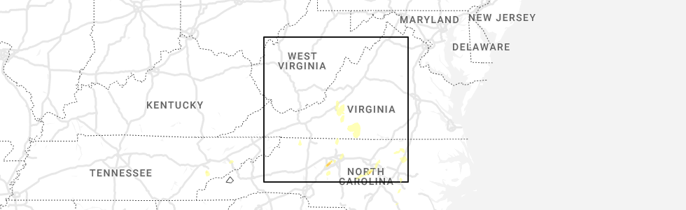
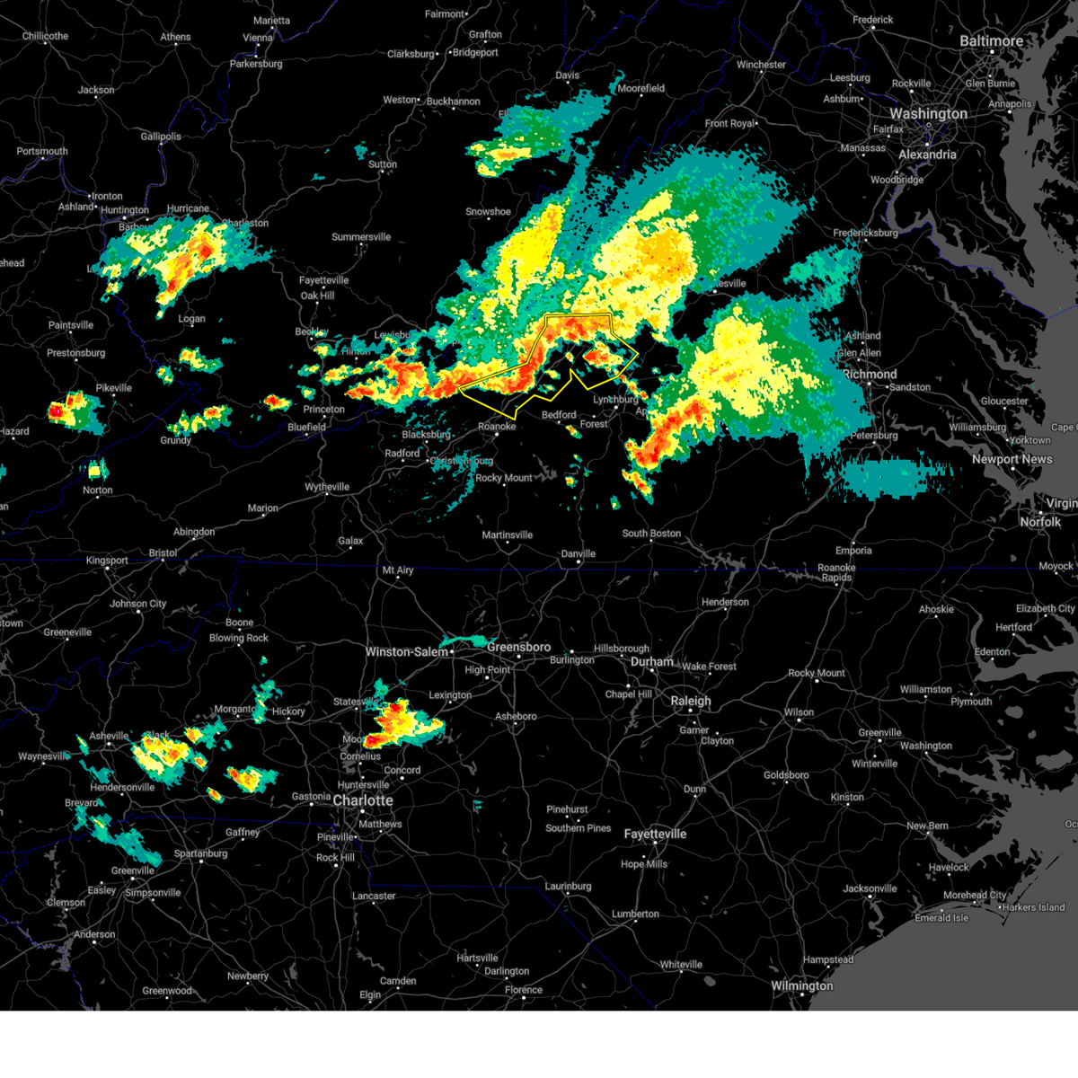
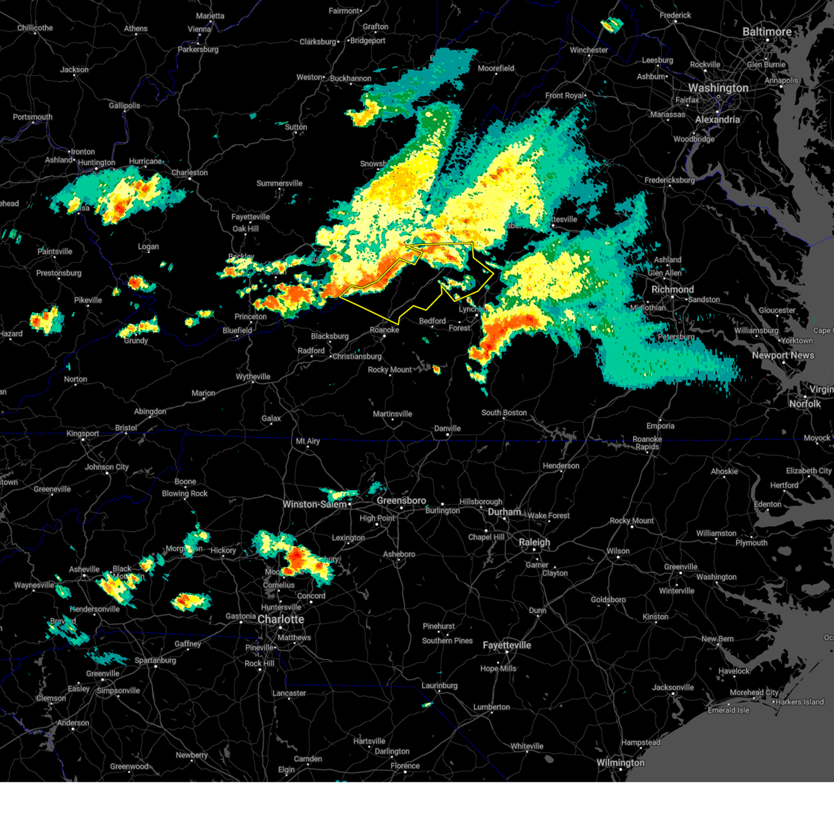
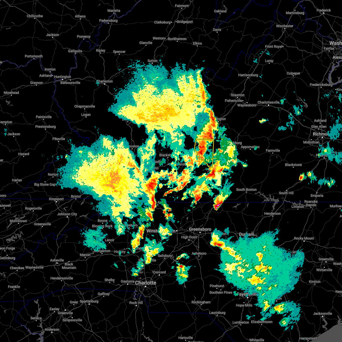
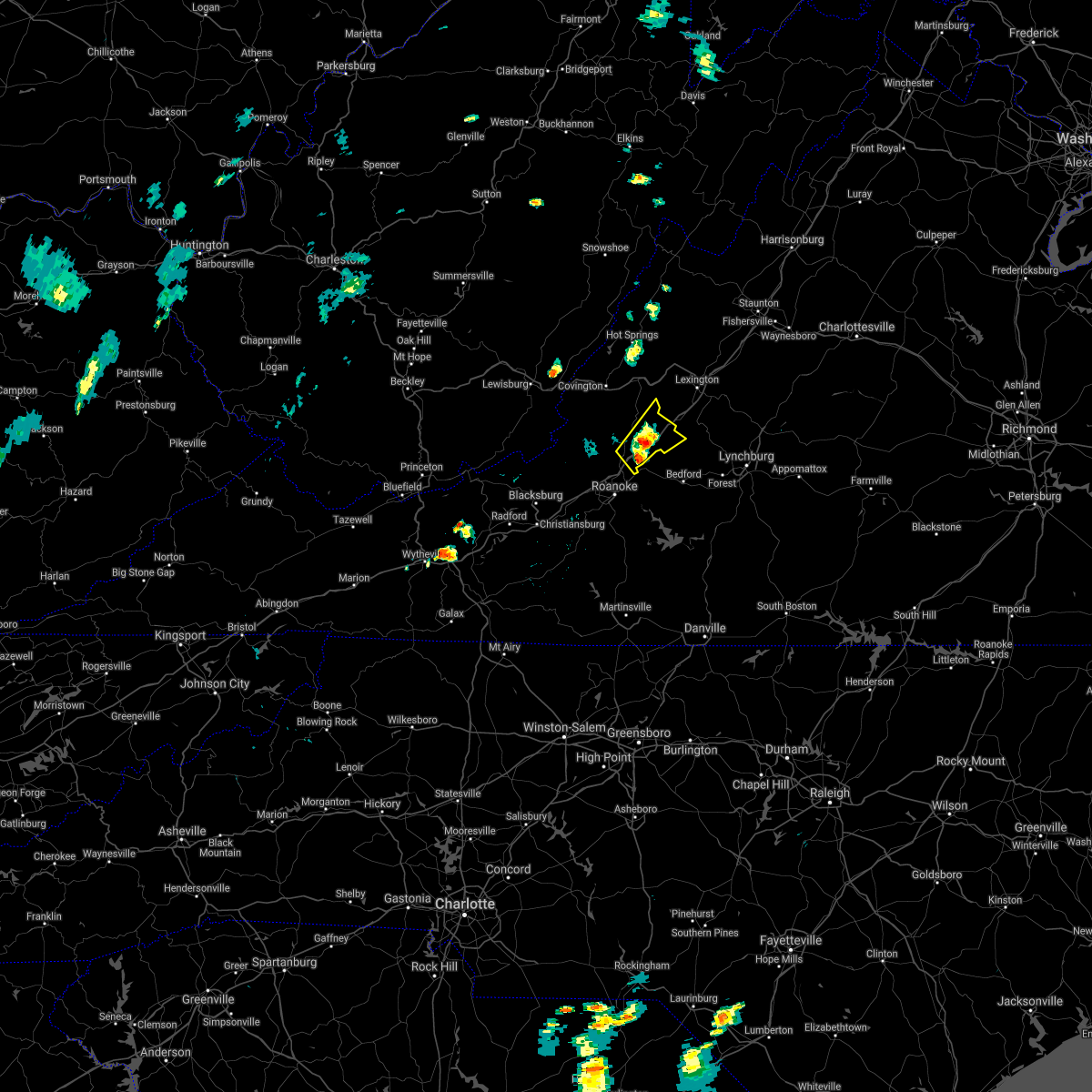
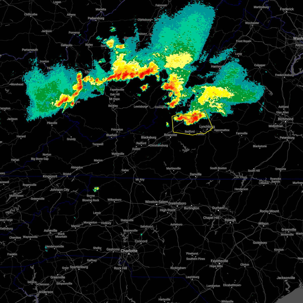
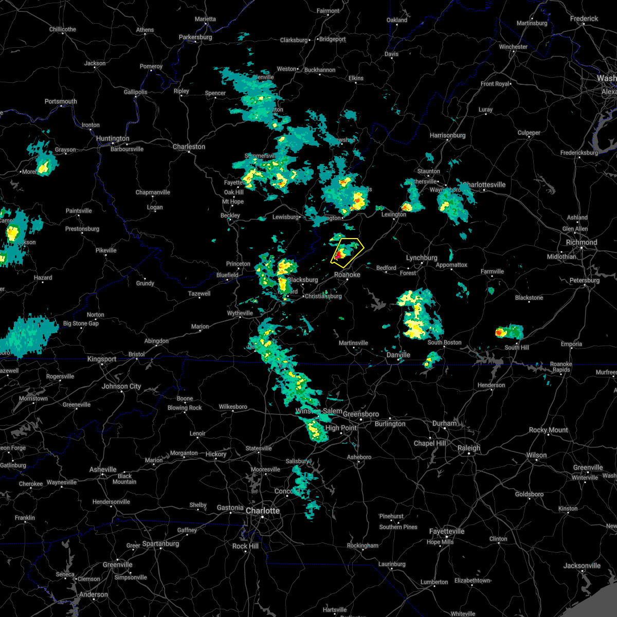
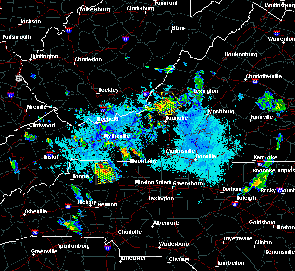
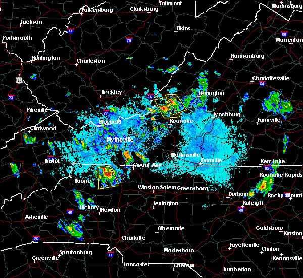
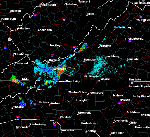
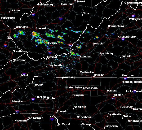
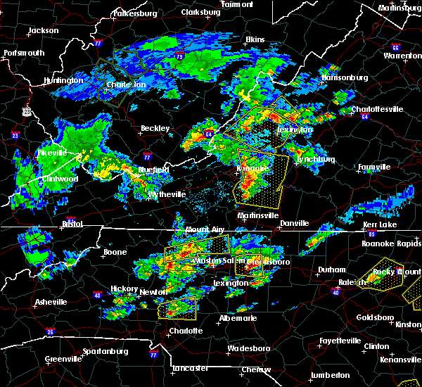
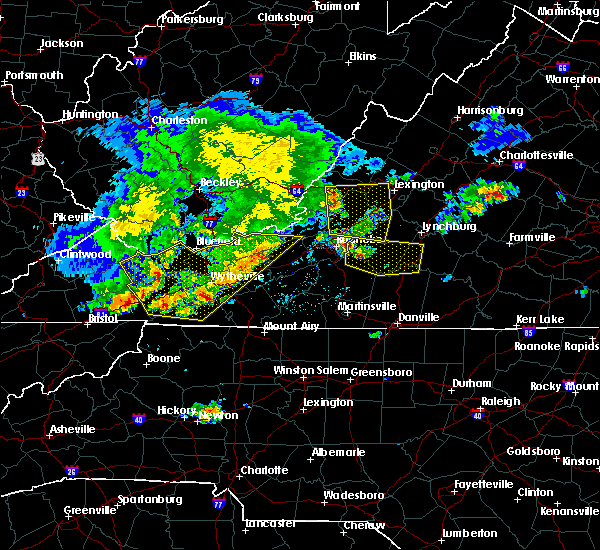
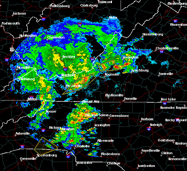
Hail Map for Fincastle, VA
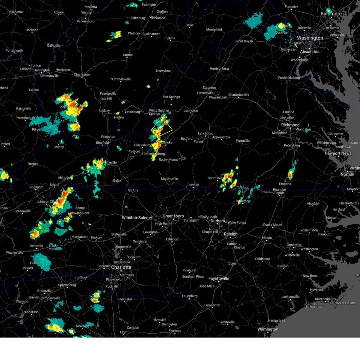
The Fincastle, VA area has had 2 reports of on-the-ground hail by trained spotters, and has been under severe weather warnings 14 times during the past 12 months. Doppler radar has detected hail at or near Fincastle, VA on 19 occasions.
| Name: | Fincastle, VA |
| Where Located: | 16 miles NNE of Roanoke, VA |
| Map: | Google Map for Fincastle, VA |
| Population: | 353 |
| Housing Units: | 143 |
| More Info: | Search Google for Fincastle, VA |
3
The Top Recent Hail Date for Fincastle, VA is Friday, April 14, 2023 (6th out of 19)
Hail and Wind Damage Spotted near Fincastle, VA
| Date / Time | Report Details |
|---|---|
| 9/7/2023 4:31 PM EDT |
 At 431 pm edt, a severe thunderstorm was located over new castle, moving northeast at 20 mph (radar indicated). Hazards include 60 mph wind gusts. Expect damage to roofs, siding, and trees. locations impacted include, new castle, oriskany, and fincastle. hail threat, radar indicated max hail size, <. 75 in wind threat, radar indicated max wind gust, 60 mph. At 431 pm edt, a severe thunderstorm was located over new castle, moving northeast at 20 mph (radar indicated). Hazards include 60 mph wind gusts. Expect damage to roofs, siding, and trees. locations impacted include, new castle, oriskany, and fincastle. hail threat, radar indicated max hail size, <. 75 in wind threat, radar indicated max wind gust, 60 mph.
|
| 9/7/2023 4:10 PM EDT |
 At 410 pm edt, a severe thunderstorm was located over abbott, or near new castle, moving northeast at 20 mph (radar indicated). Hazards include 60 mph wind gusts and quarter size hail. Hail damage to vehicles is expected. Expect wind damage to roofs, siding, and trees. At 410 pm edt, a severe thunderstorm was located over abbott, or near new castle, moving northeast at 20 mph (radar indicated). Hazards include 60 mph wind gusts and quarter size hail. Hail damage to vehicles is expected. Expect wind damage to roofs, siding, and trees.
|
| 7/28/2023 5:54 PM EDT |
 At 553 pm edt, severe thunderstorms were located along a line extending from 6 miles east of warm springs to near longdale furnace to near fincastle, moving east at 35 mph (radar indicated). Hazards include 60 mph wind gusts. expect damage to roofs, siding, and trees At 553 pm edt, severe thunderstorms were located along a line extending from 6 miles east of warm springs to near longdale furnace to near fincastle, moving east at 35 mph (radar indicated). Hazards include 60 mph wind gusts. expect damage to roofs, siding, and trees
|
| 7/28/2023 5:33 PM EDT |
 At 533 pm edt, severe thunderstorms were located along a line extending from new castle to near crockett springs to near claytor lake state park to allisonia, moving east at 50 mph (radar indicated). Hazards include 60 mph wind gusts. expect damage to roofs, siding, and trees At 533 pm edt, severe thunderstorms were located along a line extending from new castle to near crockett springs to near claytor lake state park to allisonia, moving east at 50 mph (radar indicated). Hazards include 60 mph wind gusts. expect damage to roofs, siding, and trees
|
| 7/17/2023 8:39 PM EDT |
 The severe thunderstorm warning for roanoke, southwestern botetourt and northwestern franklin counties, the city of salem and the city of roanoke will expire at 845 pm edt, the storms which prompted the warning have moved out of the area. therefore, the warning will be allowed to expire. The severe thunderstorm warning for roanoke, southwestern botetourt and northwestern franklin counties, the city of salem and the city of roanoke will expire at 845 pm edt, the storms which prompted the warning have moved out of the area. therefore, the warning will be allowed to expire.
|
| 7/17/2023 8:26 PM EDT |
 At 825 pm edt, severe thunderstorms were located along a line extending from near daleville to roanoke to near callaway, moving east at 30 mph (radar indicated). Hazards include 60 mph wind gusts. Expect damage to roofs, siding, and trees. locations impacted include, roanoke, salem, vinton, troutville, catawba, bent mountain, and fincastle. this includes the following locations the salem fairgrounds and roanoke regional airport. hail threat, radar indicated max hail size, <. 75 in wind threat, radar indicated max wind gust, 60 mph. At 825 pm edt, severe thunderstorms were located along a line extending from near daleville to roanoke to near callaway, moving east at 30 mph (radar indicated). Hazards include 60 mph wind gusts. Expect damage to roofs, siding, and trees. locations impacted include, roanoke, salem, vinton, troutville, catawba, bent mountain, and fincastle. this includes the following locations the salem fairgrounds and roanoke regional airport. hail threat, radar indicated max hail size, <. 75 in wind threat, radar indicated max wind gust, 60 mph.
|
| 7/17/2023 7:59 PM EDT |
 At 759 pm edt, severe thunderstorms were located along a line extending from near craig springs to near bradshaw to crockett springs, moving east at 30 mph (radar indicated). Hazards include 60 mph wind gusts. Expect damage to roofs, siding, and trees. locations impacted include, roanoke, salem, christiansburg, vinton, troutville, new castle, and pilot. this includes the following locations the salem fairgrounds and roanoke regional airport. hail threat, radar indicated max hail size, <. 75 in wind threat, radar indicated max wind gust, 60 mph. At 759 pm edt, severe thunderstorms were located along a line extending from near craig springs to near bradshaw to crockett springs, moving east at 30 mph (radar indicated). Hazards include 60 mph wind gusts. Expect damage to roofs, siding, and trees. locations impacted include, roanoke, salem, christiansburg, vinton, troutville, new castle, and pilot. this includes the following locations the salem fairgrounds and roanoke regional airport. hail threat, radar indicated max hail size, <. 75 in wind threat, radar indicated max wind gust, 60 mph.
|
| 7/17/2023 7:35 PM EDT |
 At 735 pm edt, severe thunderstorms were located along a line extending from waiteville to near blacksburg to radford, moving east at 30 mph (radar indicated). Hazards include 60 mph wind gusts. expect damage to roofs, siding, and trees At 735 pm edt, severe thunderstorms were located along a line extending from waiteville to near blacksburg to radford, moving east at 30 mph (radar indicated). Hazards include 60 mph wind gusts. expect damage to roofs, siding, and trees
|
| 7/13/2023 9:00 PM EDT |
 At 900 pm edt, severe thunderstorms were located along a line extending from near lexington to near springwood to near new castle, moving east at 45 mph (radar indicated). Hazards include 60 mph wind gusts and quarter size hail. Hail damage to vehicles is expected. expect wind damage to roofs, siding, and trees. locations impacted include, lexington, buena vista, buchanan, glasgow, troutville, new castle, and forks of buffalo. this includes the following location vmi. hail threat, radar indicated max hail size, 1. 00 in wind threat, radar indicated max wind gust, 60 mph. At 900 pm edt, severe thunderstorms were located along a line extending from near lexington to near springwood to near new castle, moving east at 45 mph (radar indicated). Hazards include 60 mph wind gusts and quarter size hail. Hail damage to vehicles is expected. expect wind damage to roofs, siding, and trees. locations impacted include, lexington, buena vista, buchanan, glasgow, troutville, new castle, and forks of buffalo. this includes the following location vmi. hail threat, radar indicated max hail size, 1. 00 in wind threat, radar indicated max wind gust, 60 mph.
|
| 7/13/2023 8:40 PM EDT |
 At 840 pm edt, severe thunderstorms were located along a line extending from near longdale furnace to near oriskany to near paint bank, moving east at 45 mph (radar indicated). Hazards include 60 mph wind gusts and quarter size hail. Hail damage to vehicles is expected. Expect wind damage to roofs, siding, and trees. At 840 pm edt, severe thunderstorms were located along a line extending from near longdale furnace to near oriskany to near paint bank, moving east at 45 mph (radar indicated). Hazards include 60 mph wind gusts and quarter size hail. Hail damage to vehicles is expected. Expect wind damage to roofs, siding, and trees.
|
| 7/13/2023 8:23 PM EDT |
 At 822 pm edt, severe thunderstorms were located along a line extending from buena vista to near new castle, moving east at 70 mph (radar indicated). Hazards include 70 mph wind gusts and quarter size hail. Hail damage to vehicles is expected. expect considerable tree damage. wind damage is also likely to mobile homes, roofs, and outbuildings. locations impacted include, alleghany, lexington, buena vista, covington, clifton forge, lewisburg, and white sulphur springs. this includes the following locations vmi and the west virginia state fairgrounds. thunderstorm damage threat, considerable hail threat, radar indicated max hail size, 1. 00 in wind threat, radar indicated max wind gust, 70 mph. At 822 pm edt, severe thunderstorms were located along a line extending from buena vista to near new castle, moving east at 70 mph (radar indicated). Hazards include 70 mph wind gusts and quarter size hail. Hail damage to vehicles is expected. expect considerable tree damage. wind damage is also likely to mobile homes, roofs, and outbuildings. locations impacted include, alleghany, lexington, buena vista, covington, clifton forge, lewisburg, and white sulphur springs. this includes the following locations vmi and the west virginia state fairgrounds. thunderstorm damage threat, considerable hail threat, radar indicated max hail size, 1. 00 in wind threat, radar indicated max wind gust, 70 mph.
|
| 7/13/2023 7:59 PM EDT |
 At 759 pm edt, severe thunderstorms were located along a line extending from near longdale furnace to near wolfcreek, moving east at 70 mph (radar indicated). Hazards include 60 mph wind gusts and quarter size hail. Hail damage to vehicles is expected. Expect wind damage to roofs, siding, and trees. At 759 pm edt, severe thunderstorms were located along a line extending from near longdale furnace to near wolfcreek, moving east at 70 mph (radar indicated). Hazards include 60 mph wind gusts and quarter size hail. Hail damage to vehicles is expected. Expect wind damage to roofs, siding, and trees.
|
| 8/5/2022 6:24 PM EDT |
 At 624 pm edt, severe thunderstorms were located along a line extending from near springwood to near cave spring, moving east at 20 mph (radar indicated). Hazards include 60 mph wind gusts. expect damage to roofs, siding, and trees At 624 pm edt, severe thunderstorms were located along a line extending from near springwood to near cave spring, moving east at 20 mph (radar indicated). Hazards include 60 mph wind gusts. expect damage to roofs, siding, and trees
|
| 7/23/2022 7:17 PM EDT | Tree down along muse roa in botetourt county VA, 0.7 miles NNW of Fincastle, VA |
| 7/23/2022 7:14 PM EDT | One tree down due to thunderstorm winds along the 300 block of muse roa in botetourt county VA, 1.3 miles NNW of Fincastle, VA |
| 7/12/2022 8:01 PM EDT |
 At 800 pm edt, severe thunderstorms were located along a line extending from near nace to walton, moving southeast at 30 mph (radar indicated). Hazards include 60 mph wind gusts and quarter size hail. Hail damage to vehicles is expected. expect wind damage to roofs, siding, and trees. locations impacted include, roanoke, blacksburg, salem, christiansburg, radford, pulaski, and vinton. hail threat, radar indicated max hail size, 1. 00 in wind threat, radar indicated max wind gust, 60 mph. At 800 pm edt, severe thunderstorms were located along a line extending from near nace to walton, moving southeast at 30 mph (radar indicated). Hazards include 60 mph wind gusts and quarter size hail. Hail damage to vehicles is expected. expect wind damage to roofs, siding, and trees. locations impacted include, roanoke, blacksburg, salem, christiansburg, radford, pulaski, and vinton. hail threat, radar indicated max hail size, 1. 00 in wind threat, radar indicated max wind gust, 60 mph.
|
| 7/12/2022 7:29 PM EDT |
 At 729 pm edt, severe thunderstorms were located along a line extending from eagle rock to oakvale, moving southeast at 20 mph (radar indicated). Hazards include 60 mph wind gusts and quarter size hail. Hail damage to vehicles is expected. Expect wind damage to roofs, siding, and trees. At 729 pm edt, severe thunderstorms were located along a line extending from eagle rock to oakvale, moving southeast at 20 mph (radar indicated). Hazards include 60 mph wind gusts and quarter size hail. Hail damage to vehicles is expected. Expect wind damage to roofs, siding, and trees.
|
| 6/17/2022 4:15 PM EDT |
 At 413 pm edt, severe thunderstorms were located along a line extending from vesuvius to near wirtz to near indian valley, moving southeast at 50 mph (radar indicated). Hazards include 70 mph wind gusts. Expect considerable tree damage. Damage is likely to mobile homes, roofs, and outbuildings. At 413 pm edt, severe thunderstorms were located along a line extending from vesuvius to near wirtz to near indian valley, moving southeast at 50 mph (radar indicated). Hazards include 70 mph wind gusts. Expect considerable tree damage. Damage is likely to mobile homes, roofs, and outbuildings.
|
| 6/17/2022 1:00 AM EDT | One tree down on poor farm roa in botetourt county VA, 2.4 miles SSW of Fincastle, VA |
| 6/17/2022 1:00 AM EDT |
 At 100 am edt, a severe thunderstorm was located over catawba, moving southeast at 25 mph (radar indicated). Hazards include 60 mph wind gusts. expect damage to roofs, siding, and trees At 100 am edt, a severe thunderstorm was located over catawba, moving southeast at 25 mph (radar indicated). Hazards include 60 mph wind gusts. expect damage to roofs, siding, and trees
|
| 6/16/2022 11:48 PM EDT |
 At 1148 pm edt, a severe thunderstorm was located over clifton forge, moving southeast at 30 mph (radar indicated). Hazards include 60 mph wind gusts. Expect damage to roofs, siding, and trees. locations impacted include, alleghany, covington, clifton forge, buchanan, glasgow, troutville, and new castle. hail threat, radar indicated max hail size, <. 75 in wind threat, radar indicated max wind gust, 60 mph. At 1148 pm edt, a severe thunderstorm was located over clifton forge, moving southeast at 30 mph (radar indicated). Hazards include 60 mph wind gusts. Expect damage to roofs, siding, and trees. locations impacted include, alleghany, covington, clifton forge, buchanan, glasgow, troutville, and new castle. hail threat, radar indicated max hail size, <. 75 in wind threat, radar indicated max wind gust, 60 mph.
|
| 6/16/2022 11:36 PM EDT |
 At 1136 pm edt, a severe thunderstorm was located near oriskany, moving southeast at 25 mph (radar indicated). Hazards include 60 mph wind gusts. expect damage to roofs, siding, and trees At 1136 pm edt, a severe thunderstorm was located near oriskany, moving southeast at 25 mph (radar indicated). Hazards include 60 mph wind gusts. expect damage to roofs, siding, and trees
|
| 6/14/2022 12:36 AM EDT |
 The severe thunderstorm warning for roanoke, east central pulaski, southeastern craig, northeastern floyd, bedford, botetourt, franklin and montgomery counties, the city of radford, the city of salem and the city of roanoke will expire at 1245 am edt, the storms which prompted the warning have weakened below severe limits, and no longer pose an immediate threat to life or property. therefore, the warning will be allowed to expire. however gusty winds are still possible with these thunderstorms. The severe thunderstorm warning for roanoke, east central pulaski, southeastern craig, northeastern floyd, bedford, botetourt, franklin and montgomery counties, the city of radford, the city of salem and the city of roanoke will expire at 1245 am edt, the storms which prompted the warning have weakened below severe limits, and no longer pose an immediate threat to life or property. therefore, the warning will be allowed to expire. however gusty winds are still possible with these thunderstorms.
|
| 6/14/2022 12:15 AM EDT |
 At 1214 am edt, severe thunderstorms were located along a line extending from near bent mountain to fairfield, moving southeast at 45 mph (radar indicated). Hazards include 60 mph wind gusts. Expect damage to roofs, siding, and trees. locations impacted include, roanoke, blacksburg, salem, christiansburg, radford, vinton, and bedford. this includes the following locations virginia tech, the salem fairgrounds, the national d-day memorial, and roanoke regional airport. hail threat, radar indicated max hail size, <. 75 in wind threat, radar indicated max wind gust, 60 mph. At 1214 am edt, severe thunderstorms were located along a line extending from near bent mountain to fairfield, moving southeast at 45 mph (radar indicated). Hazards include 60 mph wind gusts. Expect damage to roofs, siding, and trees. locations impacted include, roanoke, blacksburg, salem, christiansburg, radford, vinton, and bedford. this includes the following locations virginia tech, the salem fairgrounds, the national d-day memorial, and roanoke regional airport. hail threat, radar indicated max hail size, <. 75 in wind threat, radar indicated max wind gust, 60 mph.
|
| 6/13/2022 11:55 PM EDT |
 At 1155 pm edt, severe thunderstorms were located along a line extending from near shawsville to goshen, moving southeast at 45 mph (radar indicated). Hazards include 60 mph wind gusts. Expect damage to roofs, siding, and trees. locations impacted include, roanoke, blacksburg, salem, christiansburg, radford, vinton, and lexington. this includes the following locations virginia tech, vmi, the salem fairgrounds, the national d-day memorial, and roanoke regional airport. hail threat, radar indicated max hail size, <. 75 in wind threat, radar indicated max wind gust, 60 mph. At 1155 pm edt, severe thunderstorms were located along a line extending from near shawsville to goshen, moving southeast at 45 mph (radar indicated). Hazards include 60 mph wind gusts. Expect damage to roofs, siding, and trees. locations impacted include, roanoke, blacksburg, salem, christiansburg, radford, vinton, and lexington. this includes the following locations virginia tech, vmi, the salem fairgrounds, the national d-day memorial, and roanoke regional airport. hail threat, radar indicated max hail size, <. 75 in wind threat, radar indicated max wind gust, 60 mph.
|
| 6/13/2022 11:41 PM EDT |
 At 1140 pm edt, severe thunderstorms were located along a line extending from blacksburg to near millboro, moving southeast at 40 mph (radar indicated). Hazards include 70 mph wind gusts. Expect considerable tree damage. Damage is likely to mobile homes, roofs, and outbuildings. At 1140 pm edt, severe thunderstorms were located along a line extending from blacksburg to near millboro, moving southeast at 40 mph (radar indicated). Hazards include 70 mph wind gusts. Expect considerable tree damage. Damage is likely to mobile homes, roofs, and outbuildings.
|
| 5/6/2022 8:26 PM EDT |
 The severe thunderstorm warning for central alleghany and central botetourt counties in west central virginia and the city of covington will expire at 830 pm edt, the storms that prompted the warning are moving east out of the initial warned area. however, a new warning has been issued for areas further east including rockbridge bedford, and amherst until 915 pm edt. a tornado watch remains in effect until 1000 pm edt for central, south central, southwestern and west central virginia, and southeastern west virginia. The severe thunderstorm warning for central alleghany and central botetourt counties in west central virginia and the city of covington will expire at 830 pm edt, the storms that prompted the warning are moving east out of the initial warned area. however, a new warning has been issued for areas further east including rockbridge bedford, and amherst until 915 pm edt. a tornado watch remains in effect until 1000 pm edt for central, south central, southwestern and west central virginia, and southeastern west virginia.
|
| 5/6/2022 8:18 PM EDT |
 At 817 pm edt, severe thunderstorms were located along a line extending from buchanan to near stewartsville to near goodview, moving east at 35 mph (radar indicated). Hazards include 60 mph wind gusts. Expect damage to roofs, siding, and trees. locations impacted include, bedford, buchanan, troutville, stewartsville, montvale, moneta, and fincastle. hail threat, radar indicated max hail size, <. 75 in wind threat, radar indicated max wind gust, 60 mph. At 817 pm edt, severe thunderstorms were located along a line extending from buchanan to near stewartsville to near goodview, moving east at 35 mph (radar indicated). Hazards include 60 mph wind gusts. Expect damage to roofs, siding, and trees. locations impacted include, bedford, buchanan, troutville, stewartsville, montvale, moneta, and fincastle. hail threat, radar indicated max hail size, <. 75 in wind threat, radar indicated max wind gust, 60 mph.
|
| 5/6/2022 7:25 PM EDT |
 At 725 pm edt, severe thunderstorms were located along a line extending from near natural well to oriskany, moving northeast at 55 mph (radar indicated). Hazards include 60 mph wind gusts. expect damage to roofs, siding, and trees At 725 pm edt, severe thunderstorms were located along a line extending from near natural well to oriskany, moving northeast at 55 mph (radar indicated). Hazards include 60 mph wind gusts. expect damage to roofs, siding, and trees
|
| 7/26/2021 6:50 PM EDT |
 At 649 pm edt, a severe thunderstorm was located over fincastle, or near troutville, moving south at 15 mph (radar indicated). Hazards include 60 mph wind gusts. expect damage to roofs, siding, and trees At 649 pm edt, a severe thunderstorm was located over fincastle, or near troutville, moving south at 15 mph (radar indicated). Hazards include 60 mph wind gusts. expect damage to roofs, siding, and trees
|
| 7/26/2021 2:07 PM EDT |
 At 205 pm edt, a severe thunderstorm was located over catawba, moving southeast at 40 mph (radar indicated). Hazards include 60 mph wind gusts. expect damage to roofs, siding, and trees At 205 pm edt, a severe thunderstorm was located over catawba, moving southeast at 40 mph (radar indicated). Hazards include 60 mph wind gusts. expect damage to roofs, siding, and trees
|
| 7/17/2021 6:25 PM EDT |
 At 625 pm edt, severe thunderstorms were located along a line extending from near brownsburg to near daleville, moving southeast at 20 mph (radar indicated). Hazards include 60 mph wind gusts. expect damage to roofs, siding, and trees At 625 pm edt, severe thunderstorms were located along a line extending from near brownsburg to near daleville, moving southeast at 20 mph (radar indicated). Hazards include 60 mph wind gusts. expect damage to roofs, siding, and trees
|
| 7/13/2021 4:04 PM EDT |
 At 404 pm edt, a severe thunderstorm was located near troutville, moving northeast at 15 mph (radar indicated). Hazards include 60 mph wind gusts and quarter size hail. Hail damage to vehicles is expected. Expect wind damage to roofs, siding, and trees. At 404 pm edt, a severe thunderstorm was located near troutville, moving northeast at 15 mph (radar indicated). Hazards include 60 mph wind gusts and quarter size hail. Hail damage to vehicles is expected. Expect wind damage to roofs, siding, and trees.
|
| 6/13/2021 7:42 PM EDT |
 The severe thunderstorm warning for northern bedford, southeastern botetourt, and southwestern amherst counties and the city of lynchburg will expire at 745 pm edt, the storms which prompted the warning have moved out of the warned area. therefore, the warning will be allowed to expire. a severe thunderstorm watch remains in effect until 1000 pm edt for southwestern and west central virginia, and southeastern west virginia. when it is safe to do so, please send your reports of hail of any size, as well as reports of any wind damage, including downed trees or large limbs, to the national weather service by calling toll free at 1, 8 6 6, 2 1 5, 4 3 2 4. reports and pictures can also be shared on the national weather service blacksburg facebook page and on twitter. The severe thunderstorm warning for northern bedford, southeastern botetourt, and southwestern amherst counties and the city of lynchburg will expire at 745 pm edt, the storms which prompted the warning have moved out of the warned area. therefore, the warning will be allowed to expire. a severe thunderstorm watch remains in effect until 1000 pm edt for southwestern and west central virginia, and southeastern west virginia. when it is safe to do so, please send your reports of hail of any size, as well as reports of any wind damage, including downed trees or large limbs, to the national weather service by calling toll free at 1, 8 6 6, 2 1 5, 4 3 2 4. reports and pictures can also be shared on the national weather service blacksburg facebook page and on twitter.
|
| 6/13/2021 7:06 PM EDT |
 At 706 pm edt, severe thunderstorms were located along a line extending from near naola to near sedalia to near fincastle, moving south at 25 mph (radar indicated). Hazards include 60 mph wind gusts and quarter size hail. Hail damage to vehicles is expected. expect wind damage to roofs, siding, and trees. locations impacted include, lynchburg, bedford, buchanan, troutville, big island, montvale, and forest. This includes the following locations liberty university and the national d-day memorial. At 706 pm edt, severe thunderstorms were located along a line extending from near naola to near sedalia to near fincastle, moving south at 25 mph (radar indicated). Hazards include 60 mph wind gusts and quarter size hail. Hail damage to vehicles is expected. expect wind damage to roofs, siding, and trees. locations impacted include, lynchburg, bedford, buchanan, troutville, big island, montvale, and forest. This includes the following locations liberty university and the national d-day memorial.
|
| 6/13/2021 6:44 PM EDT |
 At 644 pm edt, severe thunderstorms were located along a line extending from forks of buffalo to near snowden to eagle rock, moving south at 10 mph (radar indicated). Hazards include 60 mph wind gusts and quarter size hail. Hail damage to vehicles is expected. Expect wind damage to roofs, siding, and trees. At 644 pm edt, severe thunderstorms were located along a line extending from forks of buffalo to near snowden to eagle rock, moving south at 10 mph (radar indicated). Hazards include 60 mph wind gusts and quarter size hail. Hail damage to vehicles is expected. Expect wind damage to roofs, siding, and trees.
|
| 6/10/2021 2:18 PM EDT |
 At 217 pm edt, severe thunderstorms were located along a line extending from near fincastle to near vinton to near bent mountain, moving east at 15 mph (radar indicated). Hazards include 60 mph wind gusts and quarter size hail. Hail damage to vehicles is expected. expect wind damage to roofs, siding, and trees. locations impacted include, roanoke, vinton, bedford, buchanan, troutville, boones mill, and stewartsville. This includes the following locations the national d-day memorial and roanoke regional airport. At 217 pm edt, severe thunderstorms were located along a line extending from near fincastle to near vinton to near bent mountain, moving east at 15 mph (radar indicated). Hazards include 60 mph wind gusts and quarter size hail. Hail damage to vehicles is expected. expect wind damage to roofs, siding, and trees. locations impacted include, roanoke, vinton, bedford, buchanan, troutville, boones mill, and stewartsville. This includes the following locations the national d-day memorial and roanoke regional airport.
|
| 6/10/2021 1:53 PM EDT |
 At 152 pm edt, severe thunderstorms were located along a line extending from near oriskany to near roanoke to near copper hill, moving east at 15 mph (radar indicated). Hazards include 60 mph wind gusts and quarter size hail. Hail damage to vehicles is expected. Expect wind damage to roofs, siding, and trees. At 152 pm edt, severe thunderstorms were located along a line extending from near oriskany to near roanoke to near copper hill, moving east at 15 mph (radar indicated). Hazards include 60 mph wind gusts and quarter size hail. Hail damage to vehicles is expected. Expect wind damage to roofs, siding, and trees.
|
| 5/4/2021 2:40 PM EDT |
 At 240 pm edt, a severe thunderstorm was located over cave spring, or near roanoke, moving northeast at 40 mph (radar indicated). Hazards include 60 mph wind gusts and quarter size hail. Hail damage to vehicles is expected. expect wind damage to roofs, siding, and trees. locations impacted include, roanoke, salem, vinton, troutville, boones mill, stewartsville, and moneta. This includes the following locations the salem fairgrounds and roanoke regional airport. At 240 pm edt, a severe thunderstorm was located over cave spring, or near roanoke, moving northeast at 40 mph (radar indicated). Hazards include 60 mph wind gusts and quarter size hail. Hail damage to vehicles is expected. expect wind damage to roofs, siding, and trees. locations impacted include, roanoke, salem, vinton, troutville, boones mill, stewartsville, and moneta. This includes the following locations the salem fairgrounds and roanoke regional airport.
|
| 5/4/2021 2:22 PM EDT |
 At 222 pm edt, a severe thunderstorm was located over shawsville, moving northeast at 30 mph (radar indicated). Hazards include 60 mph wind gusts and quarter size hail. Hail damage to vehicles is expected. Expect wind damage to roofs, siding, and trees. At 222 pm edt, a severe thunderstorm was located over shawsville, moving northeast at 30 mph (radar indicated). Hazards include 60 mph wind gusts and quarter size hail. Hail damage to vehicles is expected. Expect wind damage to roofs, siding, and trees.
|
| 4/8/2021 7:23 PM EDT |
 At 722 pm edt, a severe thunderstorm was located near daleville, moving northeast at 15 mph (radar indicated). Hazards include quarter size hail. damage to vehicles is expected At 722 pm edt, a severe thunderstorm was located near daleville, moving northeast at 15 mph (radar indicated). Hazards include quarter size hail. damage to vehicles is expected
|
| 8/1/2020 7:03 PM EDT |
 At 703 pm edt, a severe thunderstorm was located near fincastle, or near eagle rock, moving northeast at 15 mph (radar indicated). Hazards include 60 mph wind gusts. Expect damage to roofs, siding, and trees. Locations impacted include, buchanan, eagle rock, iron gate, fincastle, springwood, glen wilton, and natural bridge. At 703 pm edt, a severe thunderstorm was located near fincastle, or near eagle rock, moving northeast at 15 mph (radar indicated). Hazards include 60 mph wind gusts. Expect damage to roofs, siding, and trees. Locations impacted include, buchanan, eagle rock, iron gate, fincastle, springwood, glen wilton, and natural bridge.
|
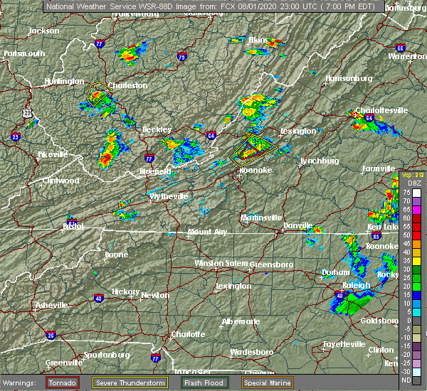
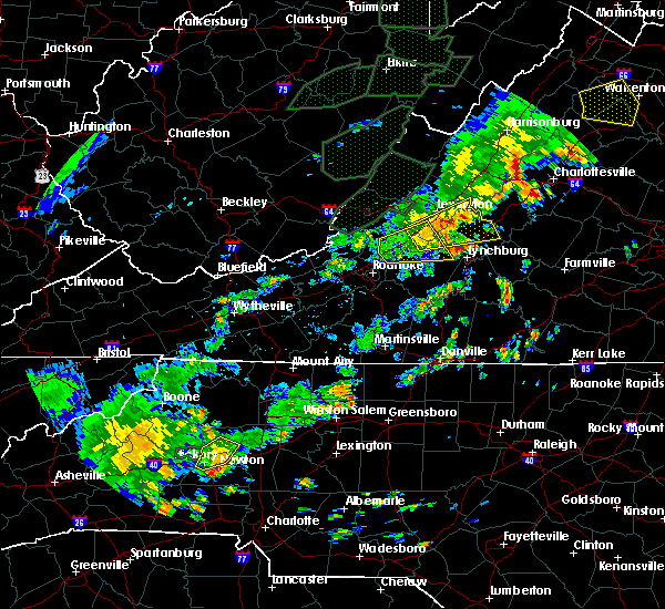
| 8/1/2020 6:59 PM EDT |
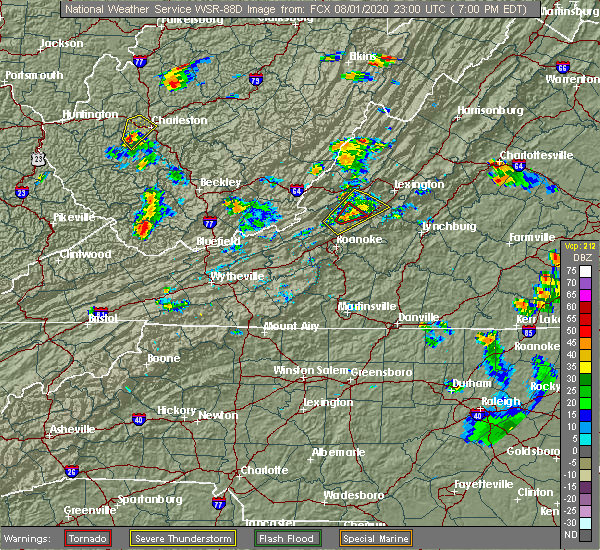 At 656 pm edt, a confirmed tornado was located over fincastle, or 7 miles north of troutville, moving northeast at 10 mph. video from social media showed a funnel cloud associated with this storm just east of haymakertown at 640 pm (public confirmed tornado). Hazards include damaging tornado. Flying debris will be dangerous to those caught without shelter. mobile homes will be damaged or destroyed. damage to roofs, windows, and vehicles will occur. tree damage is likely. Locations impacted include, eagle rock, fincastle, and springwood. At 656 pm edt, a confirmed tornado was located over fincastle, or 7 miles north of troutville, moving northeast at 10 mph. video from social media showed a funnel cloud associated with this storm just east of haymakertown at 640 pm (public confirmed tornado). Hazards include damaging tornado. Flying debris will be dangerous to those caught without shelter. mobile homes will be damaged or destroyed. damage to roofs, windows, and vehicles will occur. tree damage is likely. Locations impacted include, eagle rock, fincastle, and springwood.
|
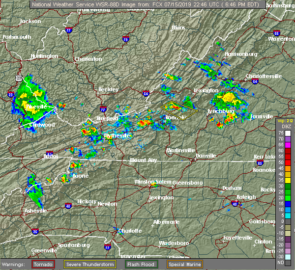
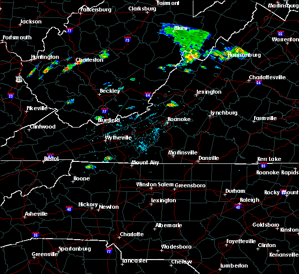
| 8/1/2020 6:46 PM EDT |
 At 646 pm edt, a confirmed tornado was located over fincastle, or near troutville, moving northeast at 10 mph (weather spotters confirmed tornado). Hazards include damaging tornado. Flying debris will be dangerous to those caught without shelter. mobile homes will be damaged or destroyed. damage to roofs, windows, and vehicles will occur. Tree damage is likely. At 646 pm edt, a confirmed tornado was located over fincastle, or near troutville, moving northeast at 10 mph (weather spotters confirmed tornado). Hazards include damaging tornado. Flying debris will be dangerous to those caught without shelter. mobile homes will be damaged or destroyed. damage to roofs, windows, and vehicles will occur. Tree damage is likely.
|
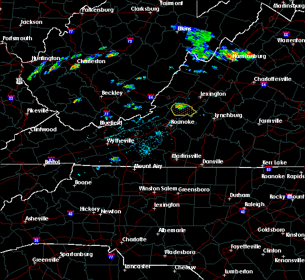
| 8/1/2020 6:35 PM EDT |
 At 635 pm edt, a severe thunderstorm was located near fincastle, or 7 miles northwest of troutville, moving northeast at 15 mph (radar indicated). Hazards include 60 mph wind gusts. expect damage to roofs, siding, and trees At 635 pm edt, a severe thunderstorm was located near fincastle, or 7 miles northwest of troutville, moving northeast at 15 mph (radar indicated). Hazards include 60 mph wind gusts. expect damage to roofs, siding, and trees
|
| 7/10/2020 7:08 PM EDT |
 At 707 pm edt, severe thunderstorms were located along a line extending from near gala to buchanan to near montvale, moving east at 20 mph (radar indicated). Hazards include 60 mph wind gusts and quarter size hail. Hail damage to vehicles is expected. expect wind damage to roofs, siding, and trees. Locations impacted include, buchanan, troutville, montvale, eagle rock, fincastle, lithia, and gala. At 707 pm edt, severe thunderstorms were located along a line extending from near gala to buchanan to near montvale, moving east at 20 mph (radar indicated). Hazards include 60 mph wind gusts and quarter size hail. Hail damage to vehicles is expected. expect wind damage to roofs, siding, and trees. Locations impacted include, buchanan, troutville, montvale, eagle rock, fincastle, lithia, and gala.
|
| 7/10/2020 6:37 PM EDT |
 At 637 pm edt, severe thunderstorms were located along a line extending from near covington to near stewartsville, moving northeast at 15 mph (radar indicated). Hazards include 60 mph wind gusts and quarter size hail. Hail damage to vehicles is expected. Expect wind damage to roofs, siding, and trees. At 637 pm edt, severe thunderstorms were located along a line extending from near covington to near stewartsville, moving northeast at 15 mph (radar indicated). Hazards include 60 mph wind gusts and quarter size hail. Hail damage to vehicles is expected. Expect wind damage to roofs, siding, and trees.
|
| 6/4/2020 3:41 PM EDT |
 At 341 pm edt, severe thunderstorms extended from 6 miles west of fincastle to near nace, moving northeast at 30 mph (radar indicated). Hazards include 60 mph wind gusts and quarter size hail. Hail damage to vehicles is expected. expect wind damage to roofs, siding, and trees. Locations impacted include, oriskany, fincastle, nace, springwood, and lithia. At 341 pm edt, severe thunderstorms extended from 6 miles west of fincastle to near nace, moving northeast at 30 mph (radar indicated). Hazards include 60 mph wind gusts and quarter size hail. Hail damage to vehicles is expected. expect wind damage to roofs, siding, and trees. Locations impacted include, oriskany, fincastle, nace, springwood, and lithia.
|
| 6/4/2020 3:27 PM EDT |
 At 325 pm edt, severe thunderstorms were located along a line extending from near new castle to laymantown, moving northeast at 30 mph (radar indicated). Hazards include 60 mph wind gusts and quarter size hail. Hail damage to vehicles is expected. Expect wind damage to roofs, siding, and trees. At 325 pm edt, severe thunderstorms were located along a line extending from near new castle to laymantown, moving northeast at 30 mph (radar indicated). Hazards include 60 mph wind gusts and quarter size hail. Hail damage to vehicles is expected. Expect wind damage to roofs, siding, and trees.
|
| 1/11/2020 10:14 PM EST |
 At 1013 pm est, severe thunderstorms were located along a line extending from natural bridge to near roanoke mountain, moving east at 60 mph (radar indicated). Hazards include 60 mph wind gusts. Expect damage to roofs, siding, and trees. locations impacted include, roanoke, salem, vinton, buchanan, troutville, stewartsville, and montvale. This includes the following locations the salem fairgrounds and roanoke regional airport. At 1013 pm est, severe thunderstorms were located along a line extending from natural bridge to near roanoke mountain, moving east at 60 mph (radar indicated). Hazards include 60 mph wind gusts. Expect damage to roofs, siding, and trees. locations impacted include, roanoke, salem, vinton, buchanan, troutville, stewartsville, and montvale. This includes the following locations the salem fairgrounds and roanoke regional airport.
|
| 1/11/2020 9:55 PM EST |
 At 954 pm est, severe thunderstorms were located along a line extending from near monterey to near sedalia, moving northeast at 60 mph (radar indicated). Hazards include 60 mph wind gusts. Expect damage to roofs, siding, and trees. locations impacted include, roanoke, salem, vinton, clifton forge, buchanan, troutville, and stewartsville. This includes the following locations the salem fairgrounds and roanoke regional airport. At 954 pm est, severe thunderstorms were located along a line extending from near monterey to near sedalia, moving northeast at 60 mph (radar indicated). Hazards include 60 mph wind gusts. Expect damage to roofs, siding, and trees. locations impacted include, roanoke, salem, vinton, clifton forge, buchanan, troutville, and stewartsville. This includes the following locations the salem fairgrounds and roanoke regional airport.
|
| 1/11/2020 9:26 PM EST |
 At 926 pm est, severe thunderstorms were located along a line extending from 7 miles east of marlinton to near vinton, moving northeast at 60 mph (radar indicated). Hazards include 60 mph wind gusts. expect damage to roofs, siding, and trees At 926 pm est, severe thunderstorms were located along a line extending from 7 miles east of marlinton to near vinton, moving northeast at 60 mph (radar indicated). Hazards include 60 mph wind gusts. expect damage to roofs, siding, and trees
|
| 9/30/2019 4:26 PM EDT |
 The severe thunderstorm warning for northeastern craig and southwestern botetourt counties will expire at 430 pm edt, the storm which prompted the warning has moved out of the area. therefore, the warning will be allowed to expire. when it is safe to do so, please send your reports of hail of any size, as well as reports of any wind damage, including downed trees or large limbs, to the national weather service by calling toll free at 1, 8 6 6, 2 1 5, 4 3 2 4. reports and pictures can also be shared on the national weather service blacksburg facebook page and on twitter. remember, a severe thunderstorm warning still remains in effect for southeastern craig, southwestern botetourt, and roanoke counties until 515 pm edt. The severe thunderstorm warning for northeastern craig and southwestern botetourt counties will expire at 430 pm edt, the storm which prompted the warning has moved out of the area. therefore, the warning will be allowed to expire. when it is safe to do so, please send your reports of hail of any size, as well as reports of any wind damage, including downed trees or large limbs, to the national weather service by calling toll free at 1, 8 6 6, 2 1 5, 4 3 2 4. reports and pictures can also be shared on the national weather service blacksburg facebook page and on twitter. remember, a severe thunderstorm warning still remains in effect for southeastern craig, southwestern botetourt, and roanoke counties until 515 pm edt.
|
| 9/30/2019 4:21 PM EDT |
 At 359 pm edt, a severe thunderstorm was located over oriskany, moving south at 30 mph (radar indicated). Hazards include 60 mph wind gusts and quarter size hail. Hail damage to vehicles is expected. expect wind damage to roofs, siding, and trees. Locations impacted include, eagle rock, oriskany, fincastle, and springwood. At 359 pm edt, a severe thunderstorm was located over oriskany, moving south at 30 mph (radar indicated). Hazards include 60 mph wind gusts and quarter size hail. Hail damage to vehicles is expected. expect wind damage to roofs, siding, and trees. Locations impacted include, eagle rock, oriskany, fincastle, and springwood.
|
| 9/30/2019 3:59 PM EDT |
 At 359 pm edt, a severe thunderstorm was located over oriskany, moving south at 30 mph (radar indicated). Hazards include 60 mph wind gusts and quarter size hail. Hail damage to vehicles is expected. expect wind damage to roofs, siding, and trees. Locations impacted include, eagle rock, oriskany, fincastle, and springwood. At 359 pm edt, a severe thunderstorm was located over oriskany, moving south at 30 mph (radar indicated). Hazards include 60 mph wind gusts and quarter size hail. Hail damage to vehicles is expected. expect wind damage to roofs, siding, and trees. Locations impacted include, eagle rock, oriskany, fincastle, and springwood.
|
| 9/30/2019 3:54 PM EDT |
 At 353 pm edt, a severe thunderstorm was located near oriskany, moving southeast at 25 mph (radar indicated). Hazards include 60 mph wind gusts and quarter size hail. Hail damage to vehicles is expected. expect wind damage to roofs, siding, and trees. Locations impacted include, troutville, oriskany, fincastle, nace, and daleville. At 353 pm edt, a severe thunderstorm was located near oriskany, moving southeast at 25 mph (radar indicated). Hazards include 60 mph wind gusts and quarter size hail. Hail damage to vehicles is expected. expect wind damage to roofs, siding, and trees. Locations impacted include, troutville, oriskany, fincastle, nace, and daleville.
|
| 9/30/2019 3:44 PM EDT |
 At 343 pm edt, a severe thunderstorm was located near covington, moving south at 20 mph (radar indicated). Hazards include 60 mph wind gusts and quarter size hail. Hail damage to vehicles is expected. expect wind damage to roofs, siding, and trees. Locations impacted include, covington, clifton forge, eagle rock, fincastle, low moor, springwood, and glen wilton. At 343 pm edt, a severe thunderstorm was located near covington, moving south at 20 mph (radar indicated). Hazards include 60 mph wind gusts and quarter size hail. Hail damage to vehicles is expected. expect wind damage to roofs, siding, and trees. Locations impacted include, covington, clifton forge, eagle rock, fincastle, low moor, springwood, and glen wilton.
|
| 9/30/2019 3:29 PM EDT |
 At 329 pm edt, a severe thunderstorm was located over jordan mines, moving southeast at 25 mph (radar indicated). Hazards include 60 mph wind gusts and quarter size hail. Hail damage to vehicles is expected. Expect wind damage to roofs, siding, and trees. At 329 pm edt, a severe thunderstorm was located over jordan mines, moving southeast at 25 mph (radar indicated). Hazards include 60 mph wind gusts and quarter size hail. Hail damage to vehicles is expected. Expect wind damage to roofs, siding, and trees.
|
| 9/30/2019 3:24 PM EDT |
 At 323 pm edt, a severe thunderstorm was located over low moor, or near clifton forge, moving southeast at 25 mph (radar indicated). Hazards include 60 mph wind gusts and quarter size hail. Hail damage to vehicles is expected. Expect wind damage to roofs, siding, and trees. At 323 pm edt, a severe thunderstorm was located over low moor, or near clifton forge, moving southeast at 25 mph (radar indicated). Hazards include 60 mph wind gusts and quarter size hail. Hail damage to vehicles is expected. Expect wind damage to roofs, siding, and trees.
|
| 9/14/2019 6:29 PM EDT |
 A severe thunderstorm warning remains in effect until 700 pm edt for east central craig and botetourt counties. at 629 pm edt, a severe thunderstorm was located over oriskany, moving southeast at 15 mph. hazard. 60 mph wind gusts and quarter size hail. source. Radar indicated. A severe thunderstorm warning remains in effect until 700 pm edt for east central craig and botetourt counties. at 629 pm edt, a severe thunderstorm was located over oriskany, moving southeast at 15 mph. hazard. 60 mph wind gusts and quarter size hail. source. Radar indicated.
|
| 9/14/2019 6:04 PM EDT |
 At 604 pm edt, a severe thunderstorm was located near jordan mines, moving southeast at 25 mph (radar indicated). Hazards include 60 mph wind gusts and quarter size hail. Hail damage to vehicles is expected. Expect wind damage to roofs, siding, and trees. At 604 pm edt, a severe thunderstorm was located near jordan mines, moving southeast at 25 mph (radar indicated). Hazards include 60 mph wind gusts and quarter size hail. Hail damage to vehicles is expected. Expect wind damage to roofs, siding, and trees.
|
| 8/22/2019 2:30 PM EDT |
 At 230 pm edt, severe thunderstorms were located along a line extending from arcadia to vinton to near terrys fork, moving east at 25 mph (radar indicated). Hazards include 60 mph wind gusts. Expect damage to roofs, siding, and trees. locations impacted include, roanoke, salem, vinton, bedford, and rocky mount. This includes the following locations the salem fairgrounds, the national d-day memorial, and roanoke regional airport. At 230 pm edt, severe thunderstorms were located along a line extending from arcadia to vinton to near terrys fork, moving east at 25 mph (radar indicated). Hazards include 60 mph wind gusts. Expect damage to roofs, siding, and trees. locations impacted include, roanoke, salem, vinton, bedford, and rocky mount. This includes the following locations the salem fairgrounds, the national d-day memorial, and roanoke regional airport.
|
| 8/22/2019 1:48 PM EDT |
 At 148 pm edt, severe thunderstorms were located along a line extending from near oriskany to near glenvar to childress, moving east at 20 mph (radar indicated). Hazards include 60 mph wind gusts. expect damage to roofs, siding, and trees At 148 pm edt, severe thunderstorms were located along a line extending from near oriskany to near glenvar to childress, moving east at 20 mph (radar indicated). Hazards include 60 mph wind gusts. expect damage to roofs, siding, and trees
|
| 8/22/2019 1:45 PM EDT | Sveral mostly small tree limbs down in the haymaker road area near fincastle and stone gap going up the mountain toward craig count in botetourt county VA, 5.8 miles ENE of Fincastle, VA |
| 8/22/2019 1:45 PM EDT | Several mostly small tree limbs down... but no trees dow in botetourt county VA, 5.8 miles ENE of Fincastle, VA |
| 8/22/2019 1:06 PM EDT |
 At 106 pm edt, a severe thunderstorm was located near potts creek, moving east at 25 mph (radar indicated). Hazards include 60 mph wind gusts and quarter size hail. Hail damage to vehicles is expected. Expect wind damage to roofs, siding, and trees. At 106 pm edt, a severe thunderstorm was located near potts creek, moving east at 25 mph (radar indicated). Hazards include 60 mph wind gusts and quarter size hail. Hail damage to vehicles is expected. Expect wind damage to roofs, siding, and trees.
|
| 8/9/2019 3:11 PM EDT |
 The severe thunderstorm warning for northeastern craig county in southwestern virginia and northwestern botetourt counties in west central virginia will expire at 315 pm edt, the storm which prompted the warning has moved out of the area. therefore, the warning will be allowed to expire. when it is safe to do so, please send your reports of hail of any size, as well as reports of any wind damage, including downed trees or large limbs, to the national weather service by calling toll free at 1, 8 6 6, 2 1 5, 4 3 2 4. reports and pictures can also be shared on the national weather service blacksburg facebook page and on twitter. remember, a severe thunderstorm warning still remains in effect for southwestern alleghany. The severe thunderstorm warning for northeastern craig county in southwestern virginia and northwestern botetourt counties in west central virginia will expire at 315 pm edt, the storm which prompted the warning has moved out of the area. therefore, the warning will be allowed to expire. when it is safe to do so, please send your reports of hail of any size, as well as reports of any wind damage, including downed trees or large limbs, to the national weather service by calling toll free at 1, 8 6 6, 2 1 5, 4 3 2 4. reports and pictures can also be shared on the national weather service blacksburg facebook page and on twitter. remember, a severe thunderstorm warning still remains in effect for southwestern alleghany.
|
| 8/9/2019 2:43 PM EDT |
 At 216 pm edt, a severe thunderstorm was located over alleghany, moving southeast at 30 mph (radar indicated). Hazards include 60 mph wind gusts. expect damage to roofs, siding, and trees At 216 pm edt, a severe thunderstorm was located over alleghany, moving southeast at 30 mph (radar indicated). Hazards include 60 mph wind gusts. expect damage to roofs, siding, and trees
|
| 8/9/2019 2:16 PM EDT |
 At 216 pm edt, a severe thunderstorm was located over alleghany, moving southeast at 30 mph (radar indicated). Hazards include 60 mph wind gusts. expect damage to roofs, siding, and trees At 216 pm edt, a severe thunderstorm was located over alleghany, moving southeast at 30 mph (radar indicated). Hazards include 60 mph wind gusts. expect damage to roofs, siding, and trees
|
| 7/31/2019 3:59 PM EDT | A couple of trees blown down onto power lines in the 1800 block of grove hill road. time estimated from rada in botetourt county VA, 2 miles ESE of Fincastle, VA |
| 7/15/2019 7:04 PM EDT | County dispatch reported a downed tree at 895 nace rd. timing estimated by rada in botetourt county VA, 4.8 miles NNW of Fincastle, VA |
| 7/15/2019 6:45 PM EDT |
 At 645 pm edt, a severe thunderstorm was located over buchanan, moving southeast at 20 mph (radar indicated). Hazards include 60 mph wind gusts and quarter size hail. Hail damage to vehicles is expected. Expect wind damage to roofs, siding, and trees. At 645 pm edt, a severe thunderstorm was located over buchanan, moving southeast at 20 mph (radar indicated). Hazards include 60 mph wind gusts and quarter size hail. Hail damage to vehicles is expected. Expect wind damage to roofs, siding, and trees.
|
| 7/11/2019 4:36 PM EDT |
 The severe thunderstorm warning for southwestern rockbridge, northern bedford and central botetourt counties will expire at 445 pm edt, the storm which prompted the warning has moved out of the area. therefore, the warning will be allowed to expire. when it is safe to do so, please send your reports of hail of any size, as well as reports of any wind damage, including downed trees or large limbs, to the national weather service by calling toll free at 1, 8 6 6, 2 1 5, 4 3 2 4. reports and pictures can also be shared on the national weather service blacksburg facebook page and on twitter. The severe thunderstorm warning for southwestern rockbridge, northern bedford and central botetourt counties will expire at 445 pm edt, the storm which prompted the warning has moved out of the area. therefore, the warning will be allowed to expire. when it is safe to do so, please send your reports of hail of any size, as well as reports of any wind damage, including downed trees or large limbs, to the national weather service by calling toll free at 1, 8 6 6, 2 1 5, 4 3 2 4. reports and pictures can also be shared on the national weather service blacksburg facebook page and on twitter.
|
| 7/11/2019 4:16 PM EDT |
 At 416 pm edt, a severe thunderstorm was located over arcadia, moving northeast at 35 mph (radar indicated). Hazards include 60 mph wind gusts. Expect damage to roofs, siding, and trees. Locations impacted include, buchanan, glasgow, troutville, montvale, and forest. At 416 pm edt, a severe thunderstorm was located over arcadia, moving northeast at 35 mph (radar indicated). Hazards include 60 mph wind gusts. Expect damage to roofs, siding, and trees. Locations impacted include, buchanan, glasgow, troutville, montvale, and forest.
|
| 7/11/2019 3:57 PM EDT |
 At 356 pm edt, a severe thunderstorm was located over lithia, moving east at 45 mph (radar indicated). Hazards include 60 mph wind gusts. expect damage to roofs, siding, and trees At 356 pm edt, a severe thunderstorm was located over lithia, moving east at 45 mph (radar indicated). Hazards include 60 mph wind gusts. expect damage to roofs, siding, and trees
|
| 7/11/2019 3:46 PM EDT | Three trees blown down near the intersection of old fincastle road and mount pleasant church road. time estimated from rada in botetourt county VA, 1.5 miles S of Fincastle, VA |
| 7/11/2019 3:45 PM EDT | Tree downed along mount pleasant church road near hawthorne hall roa in botetourt county VA, 2.2 miles S of Fincastle, VA |
| 6/24/2019 2:45 PM EDT |
 At 244 pm edt, a severe thunderstorm was located near fincastle, moving east at 15 mph (radar indicated). Hazards include 60 mph wind gusts and quarter size hail. Hail damage to vehicles is expected. expect wind damage to roofs, siding, and trees. Locations impacted include, buchanan, eagle rock, fincastle, arcadia, and springwood. At 244 pm edt, a severe thunderstorm was located near fincastle, moving east at 15 mph (radar indicated). Hazards include 60 mph wind gusts and quarter size hail. Hail damage to vehicles is expected. expect wind damage to roofs, siding, and trees. Locations impacted include, buchanan, eagle rock, fincastle, arcadia, and springwood.
|
| 6/24/2019 2:32 PM EDT |
 At 232 pm edt, a severe thunderstorm was located near oriskany, moving east at 15 mph (radar indicated). Hazards include 60 mph wind gusts and quarter size hail. Hail damage to vehicles is expected. Expect wind damage to roofs, siding, and trees. At 232 pm edt, a severe thunderstorm was located near oriskany, moving east at 15 mph (radar indicated). Hazards include 60 mph wind gusts and quarter size hail. Hail damage to vehicles is expected. Expect wind damage to roofs, siding, and trees.
|
| 5/31/2019 5:05 PM EDT |
 At 503 pm edt, severe thunderstorms were located along a line extending from near lithia to westlake corner to near sontag, moving east at 40 mph (radar indicated). Hazards include 60 mph wind gusts and half dollar size hail. Hail damage to vehicles is expected. expect wind damage to roofs, siding, and trees. locations impacted include, bedford, rocky mount, buchanan, troutville, and boones mill. This includes the following location the national d-day memorial. At 503 pm edt, severe thunderstorms were located along a line extending from near lithia to westlake corner to near sontag, moving east at 40 mph (radar indicated). Hazards include 60 mph wind gusts and half dollar size hail. Hail damage to vehicles is expected. expect wind damage to roofs, siding, and trees. locations impacted include, bedford, rocky mount, buchanan, troutville, and boones mill. This includes the following location the national d-day memorial.
|
| 5/31/2019 4:39 PM EDT |
 The national weather service in blacksburg has issued a * severe thunderstorm warning for. southern roanoke county in west central virginia. northwestern pittsylvania county in south central virginia. southern city of roanoke in west central virginia. bedford county in south central virginia. Southeastern. The national weather service in blacksburg has issued a * severe thunderstorm warning for. southern roanoke county in west central virginia. northwestern pittsylvania county in south central virginia. southern city of roanoke in west central virginia. bedford county in south central virginia. Southeastern.
|
| 5/31/2019 4:30 PM EDT |
 At 430 pm edt, severe thunderstorms were located along a line extending from near paint bank to bradshaw, moving east at 40 mph (radar indicated). Hazards include 60 mph wind gusts and quarter size hail. Hail damage to vehicles is expected. expect wind damage to roofs, siding, and trees. locations impacted include, roanoke, salem, vinton, troutville, and new castle. This includes the following locations the salem fairgrounds and roanoke regional airport. At 430 pm edt, severe thunderstorms were located along a line extending from near paint bank to bradshaw, moving east at 40 mph (radar indicated). Hazards include 60 mph wind gusts and quarter size hail. Hail damage to vehicles is expected. expect wind damage to roofs, siding, and trees. locations impacted include, roanoke, salem, vinton, troutville, and new castle. This includes the following locations the salem fairgrounds and roanoke regional airport.
|
| 5/31/2019 4:14 PM EDT |
 At 414 pm edt, severe thunderstorms were located along a line extending from near gap mills to near mc donalds mill, moving east at 40 mph (radar indicated). Hazards include 60 mph wind gusts and quarter size hail. Hail damage to vehicles is expected. expect wind damage to roofs, siding, and trees. locations impacted include, roanoke, blacksburg, salem, vinton, and troutville. This includes the following locations virginia tech, the salem fairgrounds, and roanoke regional airport. At 414 pm edt, severe thunderstorms were located along a line extending from near gap mills to near mc donalds mill, moving east at 40 mph (radar indicated). Hazards include 60 mph wind gusts and quarter size hail. Hail damage to vehicles is expected. expect wind damage to roofs, siding, and trees. locations impacted include, roanoke, blacksburg, salem, vinton, and troutville. This includes the following locations virginia tech, the salem fairgrounds, and roanoke regional airport.
|
| 5/31/2019 3:45 PM EDT |
 At 345 pm edt, severe thunderstorms were located along a line extending from near zenith to walton, moving east at 40 mph (radar indicated). Hazards include 60 mph wind gusts and quarter size hail. Hail damage to vehicles is expected. Expect wind damage to roofs, siding, and trees. At 345 pm edt, severe thunderstorms were located along a line extending from near zenith to walton, moving east at 40 mph (radar indicated). Hazards include 60 mph wind gusts and quarter size hail. Hail damage to vehicles is expected. Expect wind damage to roofs, siding, and trees.
|
| 5/29/2019 5:27 PM EDT |
 At 527 pm edt, severe thunderstorms were located along a line extending from covington to near eagle rock to near daleville, moving east at 45 mph (radar indicated). Hazards include 60 mph wind gusts. Expect damage to roofs, siding, and trees. Locations impacted include, bedford, covington, clifton forge, buchanan, and glasgow. At 527 pm edt, severe thunderstorms were located along a line extending from covington to near eagle rock to near daleville, moving east at 45 mph (radar indicated). Hazards include 60 mph wind gusts. Expect damage to roofs, siding, and trees. Locations impacted include, bedford, covington, clifton forge, buchanan, and glasgow.
|
| 5/29/2019 5:12 PM EDT |
 The severe thunderstorm warning for alleghany county in west central virginia, craig county in southwestern virginia, northwestern botetourt county in west central virginia, south central greenbrier and eastern monroe counties in southeastern west virginia and the city of covington will expire at 515 pm edt, the storms which prompted the warning have moved east so a new warning has been issued. a severe thunderstorm watch remains in effect until 800 pm edt for central, south central, southwestern and west central virginia, and southeastern west virginia. when it is safe to do so, please send your reports of hail of any size, as well as reports of any wind damage, including downed trees or large limbs, to the national weather service by calling toll free at 1, 8 6 6, 2 1 5, 4 3 2 4. reports and pictures can also be shared on the national weather service blacksburg facebook page and on twitter. The severe thunderstorm warning for alleghany county in west central virginia, craig county in southwestern virginia, northwestern botetourt county in west central virginia, south central greenbrier and eastern monroe counties in southeastern west virginia and the city of covington will expire at 515 pm edt, the storms which prompted the warning have moved east so a new warning has been issued. a severe thunderstorm watch remains in effect until 800 pm edt for central, south central, southwestern and west central virginia, and southeastern west virginia. when it is safe to do so, please send your reports of hail of any size, as well as reports of any wind damage, including downed trees or large limbs, to the national weather service by calling toll free at 1, 8 6 6, 2 1 5, 4 3 2 4. reports and pictures can also be shared on the national weather service blacksburg facebook page and on twitter.
|
| 5/29/2019 5:11 PM EDT |
 At 510 pm edt, severe thunderstorms were located along a line extending from near alleghany to near potts creek to near craig springs, moving east at 45 mph (radar indicated). Hazards include 60 mph wind gusts. expect damage to roofs, siding, and trees At 510 pm edt, severe thunderstorms were located along a line extending from near alleghany to near potts creek to near craig springs, moving east at 45 mph (radar indicated). Hazards include 60 mph wind gusts. expect damage to roofs, siding, and trees
|
| 5/29/2019 4:59 PM EDT |
 At 459 pm edt, severe thunderstorms were located along a line extending from fairlea to near gap mills to near lindside, moving east at 40 mph (radar indicated). Hazards include 60 mph wind gusts. Expect damage to roofs, siding, and trees. locations impacted include, alleghany, covington, clifton forge, lewisburg, and white sulphur springs. This includes the following location the west virginia state fairgrounds. At 459 pm edt, severe thunderstorms were located along a line extending from fairlea to near gap mills to near lindside, moving east at 40 mph (radar indicated). Hazards include 60 mph wind gusts. Expect damage to roofs, siding, and trees. locations impacted include, alleghany, covington, clifton forge, lewisburg, and white sulphur springs. This includes the following location the west virginia state fairgrounds.
|
| 5/29/2019 4:36 PM EDT |
 At 436 pm edt, severe thunderstorms were located along a line extending from near alderson to near wolfcreek to near elgood, moving east at 40 mph (radar indicated). Hazards include 60 mph wind gusts. expect damage to roofs, siding, and trees At 436 pm edt, severe thunderstorms were located along a line extending from near alderson to near wolfcreek to near elgood, moving east at 40 mph (radar indicated). Hazards include 60 mph wind gusts. expect damage to roofs, siding, and trees
|
| 4/14/2019 11:47 PM EDT |
 At 1147 pm edt, severe thunderstorms were located along a line extending from near glen wilton to near callaway, moving east at 40 mph (radar indicated). Hazards include 60 mph wind gusts. Expect damage to roofs, siding, and trees. locations impacted include, roanoke, salem, vinton, rocky mount, and clifton forge. this includes the following locations the salem fairgrounds and roanoke regional airport. A tornado watch remains in effect until 500 am edt for central, south central, southwestern and west central virginia. At 1147 pm edt, severe thunderstorms were located along a line extending from near glen wilton to near callaway, moving east at 40 mph (radar indicated). Hazards include 60 mph wind gusts. Expect damage to roofs, siding, and trees. locations impacted include, roanoke, salem, vinton, rocky mount, and clifton forge. this includes the following locations the salem fairgrounds and roanoke regional airport. A tornado watch remains in effect until 500 am edt for central, south central, southwestern and west central virginia.
|
| 4/14/2019 11:09 PM EDT |
 At 1108 pm edt, severe thunderstorms were located along a line extending from near jordan mines to near childress, moving east at 40 mph (radar indicated). Hazards include 60 mph wind gusts. expect damage to roofs, siding, and trees At 1108 pm edt, severe thunderstorms were located along a line extending from near jordan mines to near childress, moving east at 40 mph (radar indicated). Hazards include 60 mph wind gusts. expect damage to roofs, siding, and trees
|
| 4/8/2019 3:01 PM EDT |
 At 300 pm edt, a severe thunderstorm was located near oriskany, moving east at 30 mph (radar indicated). Hazards include 60 mph wind gusts and quarter size hail. Hail damage to vehicles is expected. expect wind damage to roofs, siding, and trees. Locations impacted include, buchanan, eagle rock, oriskany, fincastle, and arcadia. At 300 pm edt, a severe thunderstorm was located near oriskany, moving east at 30 mph (radar indicated). Hazards include 60 mph wind gusts and quarter size hail. Hail damage to vehicles is expected. expect wind damage to roofs, siding, and trees. Locations impacted include, buchanan, eagle rock, oriskany, fincastle, and arcadia.
|
| 4/8/2019 2:38 PM EDT |
 At 237 pm edt, a severe thunderstorm was located near abbott, moving east at 30 mph (radar indicated). Hazards include 60 mph wind gusts and quarter size hail. Hail damage to vehicles is expected. Expect wind damage to roofs, siding, and trees. At 237 pm edt, a severe thunderstorm was located near abbott, moving east at 30 mph (radar indicated). Hazards include 60 mph wind gusts and quarter size hail. Hail damage to vehicles is expected. Expect wind damage to roofs, siding, and trees.
|
| 6/9/2018 6:05 PM EDT |
 The severe thunderstorm warning for eastern roanoke, east central craig, west central bedford and southwestern botetourt counties and the city of roanoke will expire at 615 pm edt, the storm which prompted the warning has weakened below severe limits, and no longer poses an immediate threat to life or property. therefore, the warning will be allowed to expire. however heavy rain is still possible with this thunderstorm. when it is safe to do so, please send your reports of hail of any size, as well as reports of any wind damage, including downed trees or large limbs, to the national weather service by calling toll free at 1, 8 6 6, 2 1 5, 4 3 2 4. reports and pictures can also be shared on the national weather service blacksburg facebook page and on twitter. The severe thunderstorm warning for eastern roanoke, east central craig, west central bedford and southwestern botetourt counties and the city of roanoke will expire at 615 pm edt, the storm which prompted the warning has weakened below severe limits, and no longer poses an immediate threat to life or property. therefore, the warning will be allowed to expire. however heavy rain is still possible with this thunderstorm. when it is safe to do so, please send your reports of hail of any size, as well as reports of any wind damage, including downed trees or large limbs, to the national weather service by calling toll free at 1, 8 6 6, 2 1 5, 4 3 2 4. reports and pictures can also be shared on the national weather service blacksburg facebook page and on twitter.
|
| 6/9/2018 5:30 PM EDT |
 At 529 pm edt, a severe thunderstorm was located near daleville, moving southeast at 10 mph (radar indicated). Hazards include 60 mph wind gusts and quarter size hail. Hail damage to vehicles is expected. expect wind damage to roofs, siding, and trees. locations impacted include, roanoke, vinton, troutville, new castle, and stewartsville. This includes the following location roanoke regional airport. At 529 pm edt, a severe thunderstorm was located near daleville, moving southeast at 10 mph (radar indicated). Hazards include 60 mph wind gusts and quarter size hail. Hail damage to vehicles is expected. expect wind damage to roofs, siding, and trees. locations impacted include, roanoke, vinton, troutville, new castle, and stewartsville. This includes the following location roanoke regional airport.
|
| 6/9/2018 5:15 PM EDT |
 At 515 pm edt, a severe thunderstorm was located near new castle, moving southeast at 15 mph (radar indicated). Hazards include 60 mph wind gusts and quarter size hail. Hail damage to vehicles is expected. Expect wind damage to roofs, siding, and trees. At 515 pm edt, a severe thunderstorm was located near new castle, moving southeast at 15 mph (radar indicated). Hazards include 60 mph wind gusts and quarter size hail. Hail damage to vehicles is expected. Expect wind damage to roofs, siding, and trees.
|
| 6/1/2018 4:33 PM EDT | Trees down along springwood roa in botetourt county VA, 1.4 miles W of Fincastle, VA |
| 6/1/2018 4:32 PM EDT | Tree blown onto home at the corner of springwood and wheatland roa in botetourt county VA, 2.7 miles WSW of Fincastle, VA |
| 5/15/2018 2:58 PM EDT |
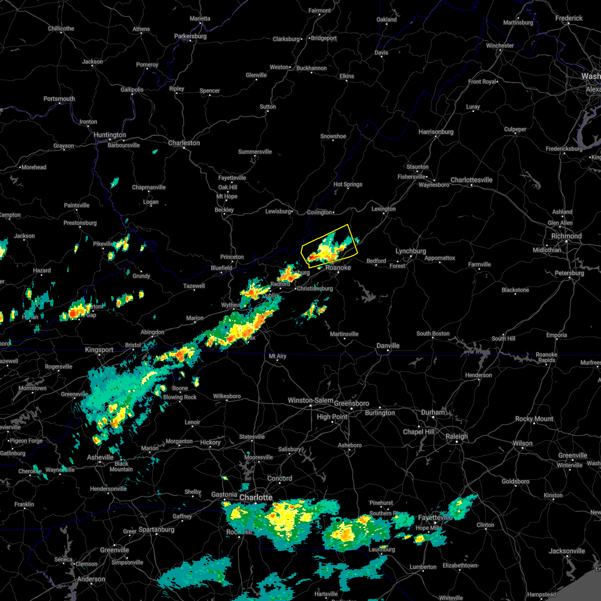 The severe thunderstorm warning for northwestern roanoke, craig and southwestern botetourt counties will expire at 300 pm edt, the storm which prompted the warning has weakened below severe limits, and no longer poses an immediate threat to life or property. therefore, the warning will be allowed to expire. when it is safe to do so, please send your reports of hail of any size, as well as reports of any wind damage, including downed trees or large limbs, to the national weather service by calling toll free at 1, 8 6 6, 2 1 5, 4 3 2 4. reports and pictures can also be shared on the national weather service blacksburg facebook page and on twitter. The severe thunderstorm warning for northwestern roanoke, craig and southwestern botetourt counties will expire at 300 pm edt, the storm which prompted the warning has weakened below severe limits, and no longer poses an immediate threat to life or property. therefore, the warning will be allowed to expire. when it is safe to do so, please send your reports of hail of any size, as well as reports of any wind damage, including downed trees or large limbs, to the national weather service by calling toll free at 1, 8 6 6, 2 1 5, 4 3 2 4. reports and pictures can also be shared on the national weather service blacksburg facebook page and on twitter.
|
| 5/15/2018 2:31 PM EDT |
 At 231 pm edt, a severe thunderstorm was located near new castle, moving east at 20 mph (radar indicated). Hazards include 60 mph wind gusts and quarter size hail. Hail damage to vehicles is expected. expect wind damage to roofs, siding, and trees. Locations impacted include, troutville, new castle, catawba, oriskany, and sinking creek. At 231 pm edt, a severe thunderstorm was located near new castle, moving east at 20 mph (radar indicated). Hazards include 60 mph wind gusts and quarter size hail. Hail damage to vehicles is expected. expect wind damage to roofs, siding, and trees. Locations impacted include, troutville, new castle, catawba, oriskany, and sinking creek.
|
| 5/15/2018 2:09 PM EDT |
 At 209 pm edt, a severe thunderstorm was located over abbott, moving east at 20 mph (radar indicated). Hazards include 60 mph wind gusts and quarter size hail. Hail damage to vehicles is expected. Expect wind damage to roofs, siding, and trees. At 209 pm edt, a severe thunderstorm was located over abbott, moving east at 20 mph (radar indicated). Hazards include 60 mph wind gusts and quarter size hail. Hail damage to vehicles is expected. Expect wind damage to roofs, siding, and trees.
|
| 4/15/2018 5:57 PM EDT |
 At 557 pm edt, severe thunderstorms were located along a line extending from fincastle to western smith mountain lake, moving northeast at 55 mph (radar indicated). Hazards include 60 mph wind gusts and quarter size hail. Hail damage to vehicles is expected. expect wind damage to roofs, siding, and trees. locations impacted include, roanoke, vinton, bedford, rocky mount, and buchanan. this includes the following location the national d-day memorial. A tornado watch remains in effect until 1100 pm edt for north central north carolina, and central, south central, southwestern and west central virginia. At 557 pm edt, severe thunderstorms were located along a line extending from fincastle to western smith mountain lake, moving northeast at 55 mph (radar indicated). Hazards include 60 mph wind gusts and quarter size hail. Hail damage to vehicles is expected. expect wind damage to roofs, siding, and trees. locations impacted include, roanoke, vinton, bedford, rocky mount, and buchanan. this includes the following location the national d-day memorial. A tornado watch remains in effect until 1100 pm edt for north central north carolina, and central, south central, southwestern and west central virginia.
|
| 4/15/2018 5:39 PM EDT |
 At 539 pm edt, severe thunderstorms were located along a line extending from near cave spring to sydnorsville, moving north at 50 mph (radar indicated). Hazards include 60 mph wind gusts and quarter size hail. Hail damage to vehicles is expected. expect wind damage to roofs, siding, and trees. locations impacted include, roanoke, salem, martinsville, vinton, and bedford. this includes the following locations the martinsville speedway, the salem fairgrounds, the national d-day memorial, martinsville airport, and roanoke regional airport. A tornado watch remains in effect until 1100 pm edt for north central north carolina, and central, south central, southwestern and west central virginia. At 539 pm edt, severe thunderstorms were located along a line extending from near cave spring to sydnorsville, moving north at 50 mph (radar indicated). Hazards include 60 mph wind gusts and quarter size hail. Hail damage to vehicles is expected. expect wind damage to roofs, siding, and trees. locations impacted include, roanoke, salem, martinsville, vinton, and bedford. this includes the following locations the martinsville speedway, the salem fairgrounds, the national d-day memorial, martinsville airport, and roanoke regional airport. A tornado watch remains in effect until 1100 pm edt for north central north carolina, and central, south central, southwestern and west central virginia.
|
| 4/15/2018 5:28 PM EDT |
 At 528 pm edt, severe thunderstorms were located along a line extending from near bent mountain to figsboro, moving northeast at 50 mph (radar indicated). Hazards include 60 mph wind gusts and quarter size hail. Hail damage to vehicles is expected. expect wind damage to roofs, siding, and trees. locations impacted include, roanoke, salem, martinsville, vinton, and bedford. this includes the following locations the martinsville speedway, the salem fairgrounds, the national d-day memorial, martinsville airport, and roanoke regional airport. A tornado watch remains in effect until 1100 pm edt for north central north carolina, and central, south central, southwestern and west central virginia. At 528 pm edt, severe thunderstorms were located along a line extending from near bent mountain to figsboro, moving northeast at 50 mph (radar indicated). Hazards include 60 mph wind gusts and quarter size hail. Hail damage to vehicles is expected. expect wind damage to roofs, siding, and trees. locations impacted include, roanoke, salem, martinsville, vinton, and bedford. this includes the following locations the martinsville speedway, the salem fairgrounds, the national d-day memorial, martinsville airport, and roanoke regional airport. A tornado watch remains in effect until 1100 pm edt for north central north carolina, and central, south central, southwestern and west central virginia.
|
| 4/15/2018 5:12 PM EDT |
 At 511 pm edt, severe thunderstorms were located along a line extending from near endicott to near price, moving north at 60 mph (radar indicated). Hazards include 60 mph wind gusts and quarter size hail. Hail damage to vehicles is expected. Expect wind damage to roofs, siding, and trees. At 511 pm edt, severe thunderstorms were located along a line extending from near endicott to near price, moving north at 60 mph (radar indicated). Hazards include 60 mph wind gusts and quarter size hail. Hail damage to vehicles is expected. Expect wind damage to roofs, siding, and trees.
|
| 4/15/2018 4:54 PM EDT |
 The severe thunderstorm warning for western roanoke, craig, southwestern botetourt, montgomery and southeastern monroe counties will expire at 500 pm edt, the storm which prompted the warning has weakened below severe limits, and no longer poses an immediate threat to life or property. therefore the warning will be allowed to expire. a tornado watch remains in effect until 700 pm edt for southwestern virginia. a tornado watch also remains in effect until 1100 pm edt for central, south central, southwestern and west central virginia. when it is safe to do so, please send your reports of hail of any size, as well as reports of any wind damage, including downed trees or large limbs, to the national weather service by calling toll free at 1, 8 6 6, 2 1 5, 4 3 2 4. reports and pictures can also be shared on the national weather service blacksburg facebook page and on twitter. The severe thunderstorm warning for western roanoke, craig, southwestern botetourt, montgomery and southeastern monroe counties will expire at 500 pm edt, the storm which prompted the warning has weakened below severe limits, and no longer poses an immediate threat to life or property. therefore the warning will be allowed to expire. a tornado watch remains in effect until 700 pm edt for southwestern virginia. a tornado watch also remains in effect until 1100 pm edt for central, south central, southwestern and west central virginia. when it is safe to do so, please send your reports of hail of any size, as well as reports of any wind damage, including downed trees or large limbs, to the national weather service by calling toll free at 1, 8 6 6, 2 1 5, 4 3 2 4. reports and pictures can also be shared on the national weather service blacksburg facebook page and on twitter.
|
| 4/15/2018 4:33 PM EDT |
 At 432 pm edt, a severe thunderstorm was located over sinking creek, moving north at 60 mph (radar indicated). Hazards include 60 mph wind gusts and quarter size hail. Hail damage to vehicles is expected. expect wind damage to roofs, siding, and trees. locations impacted include, blacksburg, christiansburg, troutville, new castle, and pilot. this includes the following location virginia tech. a tornado watch remains in effect until 700 pm edt for southwestern virginia. A tornado watch also remains in effect until 1100 pm edt for central, south central, southwestern and west central virginia. At 432 pm edt, a severe thunderstorm was located over sinking creek, moving north at 60 mph (radar indicated). Hazards include 60 mph wind gusts and quarter size hail. Hail damage to vehicles is expected. expect wind damage to roofs, siding, and trees. locations impacted include, blacksburg, christiansburg, troutville, new castle, and pilot. this includes the following location virginia tech. a tornado watch remains in effect until 700 pm edt for southwestern virginia. A tornado watch also remains in effect until 1100 pm edt for central, south central, southwestern and west central virginia.
|
| 4/15/2018 3:57 PM EDT |
 At 356 pm edt, a severe thunderstorm was located near copper valley, moving north at 60 mph (radar indicated). Hazards include 60 mph wind gusts and quarter size hail. Hail damage to vehicles is expected. Expect wind damage to roofs, siding, and trees. At 356 pm edt, a severe thunderstorm was located near copper valley, moving north at 60 mph (radar indicated). Hazards include 60 mph wind gusts and quarter size hail. Hail damage to vehicles is expected. Expect wind damage to roofs, siding, and trees.
|
| 10/23/2017 8:21 PM EDT |
 The severe thunderstorm warning for alleghany, bath, rockbridge, northern botetourt counties in west central virginia and east central greenbrier counties in southeastern west virginia, the city of covington and the city of lexington will expire at 830 pm edt, the storms which prompted the warning have weakened below severe limits, and have exited the warned area. therefore the warning will be allowed to expire. a tornado watch remains in effect until 200 am edt for central, south central, southwestern and west central virginia. when it is safe to do so, please send your reports of hail of any size, as well as reports of any wind damage, including downed trees or large limbs, to the national weather service by calling toll free at 1, 8 6 6, 2 1 5, 4 3 2 4. reports and pictures can also be shared on the national weather service blacksburg facebook page and on twitter. The severe thunderstorm warning for alleghany, bath, rockbridge, northern botetourt counties in west central virginia and east central greenbrier counties in southeastern west virginia, the city of covington and the city of lexington will expire at 830 pm edt, the storms which prompted the warning have weakened below severe limits, and have exited the warned area. therefore the warning will be allowed to expire. a tornado watch remains in effect until 200 am edt for central, south central, southwestern and west central virginia. when it is safe to do so, please send your reports of hail of any size, as well as reports of any wind damage, including downed trees or large limbs, to the national weather service by calling toll free at 1, 8 6 6, 2 1 5, 4 3 2 4. reports and pictures can also be shared on the national weather service blacksburg facebook page and on twitter.
|
| 10/23/2017 7:56 PM EDT |
 At 756 pm edt, severe thunderstorms were located along a line extending from 10 miles south of greenbank to near nimrod hall to 6 miles southwest of collierstown, moving northeast at 70 mph (radar indicated). Hazards include 60 mph wind gusts. Expect damage to roofs, siding, and trees. locations impacted include, lexington, covington, clifton forge, goshen, and millboro. A tornado watch remains in effect until 200 am edt for central, south central, southwestern and west central virginia. At 756 pm edt, severe thunderstorms were located along a line extending from 10 miles south of greenbank to near nimrod hall to 6 miles southwest of collierstown, moving northeast at 70 mph (radar indicated). Hazards include 60 mph wind gusts. Expect damage to roofs, siding, and trees. locations impacted include, lexington, covington, clifton forge, goshen, and millboro. A tornado watch remains in effect until 200 am edt for central, south central, southwestern and west central virginia.
|
| 10/23/2017 7:28 PM EDT |
 At 727 pm edt, severe thunderstorms were located along a line extending from near falling spring to near alleghany to near abbott, moving northeast at 70 mph (radar indicated). Hazards include 60 mph wind gusts and quarter size hail. Hail damage to vehicles is expected. Expect wind damage to roofs, siding, and trees. At 727 pm edt, severe thunderstorms were located along a line extending from near falling spring to near alleghany to near abbott, moving northeast at 70 mph (radar indicated). Hazards include 60 mph wind gusts and quarter size hail. Hail damage to vehicles is expected. Expect wind damage to roofs, siding, and trees.
|
| 9/5/2017 2:50 PM EDT | Tree down on a phone line near mt moriah r in botetourt county VA, 8 miles SSW of Fincastle, VA |
| 6/19/2017 3:05 PM EDT |
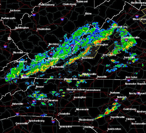 At 304 pm edt, severe thunderstorms were located along a line extending from 6 miles east of gala to fincastle, moving east at 30 mph (radar indicated). Hazards include 60 mph wind gusts. expect damage to roofs, siding, and trees At 304 pm edt, severe thunderstorms were located along a line extending from 6 miles east of gala to fincastle, moving east at 30 mph (radar indicated). Hazards include 60 mph wind gusts. expect damage to roofs, siding, and trees
|
| 5/20/2017 4:54 PM EDT |
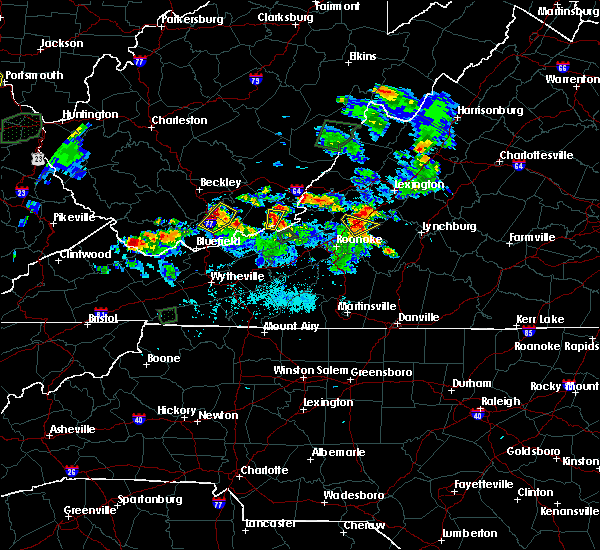 At 454 pm edt, severe thunderstorms were located along a line extending from near fincastle to near montvale, moving northeast at 20 mph (radar indicated). Hazards include 60 mph wind gusts and half dollar size hail. Minor damage to vehicles is possible. expect wind damage to trees and power lines. Locations impacted include, buchanan, fincastle, and lithia. At 454 pm edt, severe thunderstorms were located along a line extending from near fincastle to near montvale, moving northeast at 20 mph (radar indicated). Hazards include 60 mph wind gusts and half dollar size hail. Minor damage to vehicles is possible. expect wind damage to trees and power lines. Locations impacted include, buchanan, fincastle, and lithia.
|
| 5/20/2017 4:49 PM EDT | Tree down in botetourt county VA, 4.6 miles WNW of Fincastle, VA |
| 5/20/2017 4:40 PM EDT |
 At 439 pm edt, severe thunderstorms were located along a line extending from daleville to blue ridge, moving northeast at 20 mph (radar indicated). Hazards include 60 mph wind gusts and half dollar size hail. Minor damage to vehicles is possible. expect wind damage to trees and power lines. Locations impacted include, buchanan, troutville, montvale, fincastle, and nace. At 439 pm edt, severe thunderstorms were located along a line extending from daleville to blue ridge, moving northeast at 20 mph (radar indicated). Hazards include 60 mph wind gusts and half dollar size hail. Minor damage to vehicles is possible. expect wind damage to trees and power lines. Locations impacted include, buchanan, troutville, montvale, fincastle, and nace.
|
| 5/20/2017 4:24 PM EDT |
 At 424 pm edt, severe thunderstorms were located along a line extending from near hollins to laymantown, moving northeast at 15 mph (radar indicated). Hazards include ping pong ball size hail and 60 mph wind gusts. People and animals outdoors will be injured. expect hail damage to roofs, siding, windows, and vehicles. Expect wind damage to trees and power lines. At 424 pm edt, severe thunderstorms were located along a line extending from near hollins to laymantown, moving northeast at 15 mph (radar indicated). Hazards include ping pong ball size hail and 60 mph wind gusts. People and animals outdoors will be injured. expect hail damage to roofs, siding, windows, and vehicles. Expect wind damage to trees and power lines.
|
| 3/1/2017 12:22 PM EST |
 The severe thunderstorm warning for northwestern roanoke, southeastern craig, western botetourt and northeastern montgomery counties will expire at 1230 pm est, the storms which prompted the warning have moved out of the warned area. therefore, the warning will be allowed to expire. however heavy rain is still possible with these thunderstorms. a severe thunderstorm watch remains in effect until 500 pm est for central, south central, southwestern and west central virginia, and southeastern west virginia. when it is safe to do so, please send your reports of hail of any size, as well as reports of any wind damage, including downed trees or large limbs, to the national weather service by calling toll free at 1, 8 6 6, 2 1 5, 4 3 2 4. reports and pictures can also be shared on the national weather service blacksburg facebook page and on twitter. The severe thunderstorm warning for northwestern roanoke, southeastern craig, western botetourt and northeastern montgomery counties will expire at 1230 pm est, the storms which prompted the warning have moved out of the warned area. therefore, the warning will be allowed to expire. however heavy rain is still possible with these thunderstorms. a severe thunderstorm watch remains in effect until 500 pm est for central, south central, southwestern and west central virginia, and southeastern west virginia. when it is safe to do so, please send your reports of hail of any size, as well as reports of any wind damage, including downed trees or large limbs, to the national weather service by calling toll free at 1, 8 6 6, 2 1 5, 4 3 2 4. reports and pictures can also be shared on the national weather service blacksburg facebook page and on twitter.
|
| 3/1/2017 12:06 PM EST |
 At 1206 pm est, severe thunderstorms were located along a line extending from near fincastle to near new castle to near glenvar, moving east at 60 mph (radar indicated). Hazards include 60 mph wind gusts. Expect damage to roofs, siding, and trees. Locations impacted include, salem, catawba, eagle rock, shawsville, and fincastle. At 1206 pm est, severe thunderstorms were located along a line extending from near fincastle to near new castle to near glenvar, moving east at 60 mph (radar indicated). Hazards include 60 mph wind gusts. Expect damage to roofs, siding, and trees. Locations impacted include, salem, catawba, eagle rock, shawsville, and fincastle.
|
| 3/1/2017 11:57 AM EST |
 At 1156 am est, severe thunderstorms were located along a line extending from near yost to near collierstown to near new castle, moving east at 75 mph (radar indicated). Hazards include 60 mph wind gusts. expect damage to roofs, siding, and trees At 1156 am est, severe thunderstorms were located along a line extending from near yost to near collierstown to near new castle, moving east at 75 mph (radar indicated). Hazards include 60 mph wind gusts. expect damage to roofs, siding, and trees
|
| 3/1/2017 11:42 AM EST |
 At 1142 am est, severe thunderstorms were located along a line extending from paint bank to near waiteville to mountain lake, moving east at 65 mph (radar indicated). Hazards include 60 mph wind gusts. expect damage to roofs, siding, and trees At 1142 am est, severe thunderstorms were located along a line extending from paint bank to near waiteville to mountain lake, moving east at 65 mph (radar indicated). Hazards include 60 mph wind gusts. expect damage to roofs, siding, and trees
|
| 7/28/2016 9:42 PM EDT |
 At 942 pm edt, severe thunderstorms were located along a line extending from new castle to near catawba to elliston-lafayette, moving east at 40 mph (radar indicated). Hazards include 60 mph wind gusts. Expect damage to roofs. siding. and trees. locations impacted include, roanoke, salem, vinton, troutville, and new castle. This includes the following locations the salem fairgrounds and roanoke regional airport. At 942 pm edt, severe thunderstorms were located along a line extending from new castle to near catawba to elliston-lafayette, moving east at 40 mph (radar indicated). Hazards include 60 mph wind gusts. Expect damage to roofs. siding. and trees. locations impacted include, roanoke, salem, vinton, troutville, and new castle. This includes the following locations the salem fairgrounds and roanoke regional airport.
|
| 7/28/2016 9:29 PM EDT |
 At 929 pm edt, severe thunderstorms were located along a line extending from near paint bank to near mc donalds mill to near christiansburg, moving east at 35 mph (radar indicated). Hazards include 60 mph wind gusts. Expect damage to roofs. siding. and trees. locations impacted include, roanoke, blacksburg, salem, christiansburg, and vinton. This includes the following locations virginia tech, the salem fairgrounds, and roanoke regional airport. At 929 pm edt, severe thunderstorms were located along a line extending from near paint bank to near mc donalds mill to near christiansburg, moving east at 35 mph (radar indicated). Hazards include 60 mph wind gusts. Expect damage to roofs. siding. and trees. locations impacted include, roanoke, blacksburg, salem, christiansburg, and vinton. This includes the following locations virginia tech, the salem fairgrounds, and roanoke regional airport.
|
| 7/28/2016 9:19 PM EDT |
 At 919 pm edt, severe thunderstorms were located along a line extending from moncove lake state park to near blacksburg to near walton, moving east at 35 mph (radar indicated). Hazards include 60 mph wind gusts. Expect damage to roofs. siding. And trees. At 919 pm edt, severe thunderstorms were located along a line extending from moncove lake state park to near blacksburg to near walton, moving east at 35 mph (radar indicated). Hazards include 60 mph wind gusts. Expect damage to roofs. siding. And trees.
|
| 7/8/2016 5:19 PM EDT |
 At 517 pm edt, severe thunderstorms were located along a line extending from near eagle rock to near blue ridge to roanoke mountain, moving east at 40 mph (radar indicated. at 508 pm...a wind gust to 60 mph was reported the roanoke airport). Hazards include 60 mph wind gusts. Expect damage to roofs. siding. and trees. locations impacted include, roanoke, vinton, bedford, altavista, and buchanan. This includes the national d day memorial and roanoke regional airport. At 517 pm edt, severe thunderstorms were located along a line extending from near eagle rock to near blue ridge to roanoke mountain, moving east at 40 mph (radar indicated. at 508 pm...a wind gust to 60 mph was reported the roanoke airport). Hazards include 60 mph wind gusts. Expect damage to roofs. siding. and trees. locations impacted include, roanoke, vinton, bedford, altavista, and buchanan. This includes the national d day memorial and roanoke regional airport.
|
| 7/8/2016 4:57 PM EDT |
 At 456 pm edt, severe thunderstorms were located along a line extending from jordan mines to near new castle to glenvar, moving east at 40 mph (radar indicated). Hazards include 60 mph wind gusts. Expect damage to roofs. siding. And trees. At 456 pm edt, severe thunderstorms were located along a line extending from jordan mines to near new castle to glenvar, moving east at 40 mph (radar indicated). Hazards include 60 mph wind gusts. Expect damage to roofs. siding. And trees.
|
| 6/23/2016 2:13 PM EDT |
 At 212 pm edt, severe thunderstorms were located along a line extending from near buena vista to near arcadia to alleghany, moving east at 35 mph (radar indicated). Hazards include 60 mph wind gusts. Expect damage to roofs. siding. and trees. Locations impacted include, alleghany, buena vista, covington, buchanan, and glasgow. At 212 pm edt, severe thunderstorms were located along a line extending from near buena vista to near arcadia to alleghany, moving east at 35 mph (radar indicated). Hazards include 60 mph wind gusts. Expect damage to roofs. siding. and trees. Locations impacted include, alleghany, buena vista, covington, buchanan, and glasgow.
|
| 6/23/2016 1:59 PM EDT |
 At 158 pm edt, severe thunderstorms were located along a line extending from near lexington to near eagle rock to near greenbrier river trail, moving east at 35 mph (radar indicated). Hazards include 60 mph wind gusts. Expect damage to roofs. siding. and trees. locations impacted include, alleghany, lexington, buena vista, covington, and white sulphur springs. This includes vmi. At 158 pm edt, severe thunderstorms were located along a line extending from near lexington to near eagle rock to near greenbrier river trail, moving east at 35 mph (radar indicated). Hazards include 60 mph wind gusts. Expect damage to roofs. siding. and trees. locations impacted include, alleghany, lexington, buena vista, covington, and white sulphur springs. This includes vmi.
|
| 6/23/2016 1:48 PM EDT |
 At 147 pm edt, severe thunderstorms were located along a line extending from collierstown to near oriskany to lewisburg, moving southeast at 35 mph (radar indicated). Hazards include 60 mph wind gusts. Expect damage to roofs. siding. and trees. locations impacted include, alleghany, lexington, buena vista, covington, and clifton forge. This includes vmi and the west virginia state fairgrounds. At 147 pm edt, severe thunderstorms were located along a line extending from collierstown to near oriskany to lewisburg, moving southeast at 35 mph (radar indicated). Hazards include 60 mph wind gusts. Expect damage to roofs. siding. and trees. locations impacted include, alleghany, lexington, buena vista, covington, and clifton forge. This includes vmi and the west virginia state fairgrounds.
|
| 6/23/2016 1:36 PM EDT |
 At 135 pm edt, severe thunderstorms were located along a line extending from near douthat state park to near jordan mines to near asbury, moving east at 35 mph (radar indicated). Hazards include 60 mph wind gusts. Expect damage to roofs. siding. And trees. At 135 pm edt, severe thunderstorms were located along a line extending from near douthat state park to near jordan mines to near asbury, moving east at 35 mph (radar indicated). Hazards include 60 mph wind gusts. Expect damage to roofs. siding. And trees.
|
| 6/23/2016 9:20 AM EDT |
 At 919 am edt, severe thunderstorms were located along a line extending from near peaks of otter summit to near montvale to bent mountain, moving southeast at 50 mph. the primary threat for continued wind damage at this time is primarily in eastern roanoke county (radar indicated). Hazards include 60 mph wind gusts. Expect damage to roofs. siding. and trees. locations impacted include, roanoke, salem, vinton, lexington, and buena vista. This includes the following locations vmi, the salem fairgrounds, and roanoke regional airport. At 919 am edt, severe thunderstorms were located along a line extending from near peaks of otter summit to near montvale to bent mountain, moving southeast at 50 mph. the primary threat for continued wind damage at this time is primarily in eastern roanoke county (radar indicated). Hazards include 60 mph wind gusts. Expect damage to roofs. siding. and trees. locations impacted include, roanoke, salem, vinton, lexington, and buena vista. This includes the following locations vmi, the salem fairgrounds, and roanoke regional airport.
|
| 6/23/2016 8:50 AM EDT |
 At 850 am edt, severe thunderstorms were located along a line extending from near nimrod hall to oriskany to maggie, moving southeast at 65 mph (radar indicated). Hazards include 60 mph wind gusts. Expect damage to roofs. siding. And trees. At 850 am edt, severe thunderstorms were located along a line extending from near nimrod hall to oriskany to maggie, moving southeast at 65 mph (radar indicated). Hazards include 60 mph wind gusts. Expect damage to roofs. siding. And trees.
|
| 6/16/2016 8:09 PM EDT |
 At 808 pm edt, severe thunderstorms were located along a line extending from near stuarts draft to near lexington to covington, moving southeast at 45 mph (radar indicated). Hazards include 60 mph wind gusts and quarter size hail. Hail damage to vehicles is expected. expect wind damage to roofs, siding, and trees. locations impacted include, lexington, buena vista, covington, clifton forge, and buchanan. This includes vmi. At 808 pm edt, severe thunderstorms were located along a line extending from near stuarts draft to near lexington to covington, moving southeast at 45 mph (radar indicated). Hazards include 60 mph wind gusts and quarter size hail. Hail damage to vehicles is expected. expect wind damage to roofs, siding, and trees. locations impacted include, lexington, buena vista, covington, clifton forge, and buchanan. This includes vmi.
|
| 6/16/2016 7:50 PM EDT |
 At 749 pm edt, severe thunderstorms were located along a line extending from 11 miles east of bells valley to nimrod hall to alvon, moving southeast at 30 mph (radar indicated). Hazards include 60 mph wind gusts and quarter size hail. Hail damage to vehicles is expected. Expect wind damage to roofs, siding, and trees. At 749 pm edt, severe thunderstorms were located along a line extending from 11 miles east of bells valley to nimrod hall to alvon, moving southeast at 30 mph (radar indicated). Hazards include 60 mph wind gusts and quarter size hail. Hail damage to vehicles is expected. Expect wind damage to roofs, siding, and trees.
|
| 6/15/2016 6:19 PM EDT |
 At 619 pm edt, severe thunderstorms were located along a line extending from near oriskany to hollins to poages mill, moving east at 35 mph (radar indicated). Hazards include 60 mph wind gusts and quarter size hail. Hail damage to vehicles is expected. expect wind damage to roofs, siding, and trees. locations impacted include, roanoke, salem, vinton, troutville, and new castle. This includes the salem fairgrounds and roanoke regional airport. At 619 pm edt, severe thunderstorms were located along a line extending from near oriskany to hollins to poages mill, moving east at 35 mph (radar indicated). Hazards include 60 mph wind gusts and quarter size hail. Hail damage to vehicles is expected. expect wind damage to roofs, siding, and trees. locations impacted include, roanoke, salem, vinton, troutville, and new castle. This includes the salem fairgrounds and roanoke regional airport.
|
| 6/15/2016 6:08 PM EDT |
 At 607 pm edt, severe thunderstorms were located along a line extending from near new castle to near catawba to near elliston- lafayette, moving east at 35 mph. minor wind damage to trees have been reported with this storm (radar indicated and spotter confirmed). Hazards include 60 mph wind gusts and quarter size hail. Hail damage to vehicles is expected. expect wind damage to roofs, siding, and trees. locations impacted include, roanoke, salem, vinton, troutville, and new castle. This includes the salem fairgrounds and roanoke regional airport. At 607 pm edt, severe thunderstorms were located along a line extending from near new castle to near catawba to near elliston- lafayette, moving east at 35 mph. minor wind damage to trees have been reported with this storm (radar indicated and spotter confirmed). Hazards include 60 mph wind gusts and quarter size hail. Hail damage to vehicles is expected. expect wind damage to roofs, siding, and trees. locations impacted include, roanoke, salem, vinton, troutville, and new castle. This includes the salem fairgrounds and roanoke regional airport.
|
| 6/15/2016 5:51 PM EDT |
 At 550 pm edt, severe thunderstorms were located along a line extending from near craig springs to near bradshaw to near shawsville, moving east at 35 mph (radar indicated). Hazards include 60 mph wind gusts and quarter size hail. Hail damage to vehicles is expected. Expect wind damage to roofs, siding, and trees. At 550 pm edt, severe thunderstorms were located along a line extending from near craig springs to near bradshaw to near shawsville, moving east at 35 mph (radar indicated). Hazards include 60 mph wind gusts and quarter size hail. Hail damage to vehicles is expected. Expect wind damage to roofs, siding, and trees.
|
| 6/4/2016 3:36 PM EDT | 2 trees down on 500 and 600 block of old fincastle rd. vdot reporting to scene. time radar estimate in botetourt county VA, 2.2 miles S of Fincastle, VA |
| 6/4/2016 3:16 PM EDT |
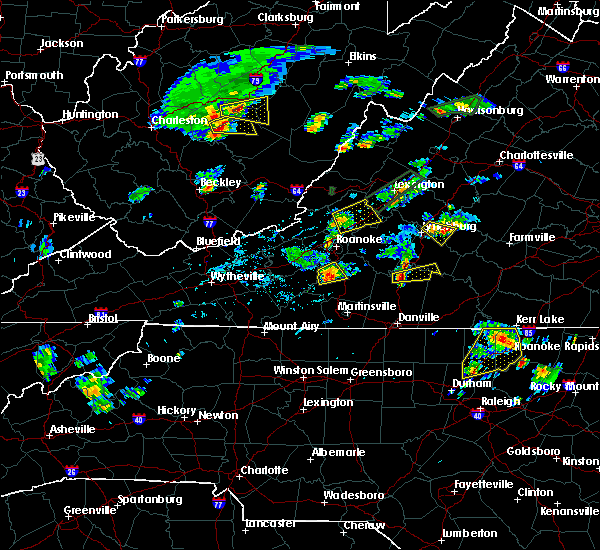 At 315 pm edt, a severe thunderstorm was located over fincastle, moving east at 25 mph (radar indicated). Hazards include 60 mph wind gusts and quarter size hail. Hail damage to vehicles is expected. Expect wind damage to roofs, siding, and trees. At 315 pm edt, a severe thunderstorm was located over fincastle, moving east at 25 mph (radar indicated). Hazards include 60 mph wind gusts and quarter size hail. Hail damage to vehicles is expected. Expect wind damage to roofs, siding, and trees.
|
| 5/2/2016 5:35 PM EDT | Quarter sized hail reported 4.9 miles WNW of Fincastle, VA, nickel to quarter size hail |
| 9/4/2015 4:56 PM EDT |
 At 455 pm edt, a severe thunderstorm was located over lithia, moving southwest at 30 mph. a second thunderstorm was located over roanoke moving southwest at 25 mph (radar indicated). Hazards include 60 mph wind gusts and quarter size hail. Hail damage to vehicles is expected. expect wind damage to roofs, siding and trees. locations impacted include, roanoke, salem, vinton, buchanan, and troutville. This includes the salem fairgrounds and roanoke regional airport. At 455 pm edt, a severe thunderstorm was located over lithia, moving southwest at 30 mph. a second thunderstorm was located over roanoke moving southwest at 25 mph (radar indicated). Hazards include 60 mph wind gusts and quarter size hail. Hail damage to vehicles is expected. expect wind damage to roofs, siding and trees. locations impacted include, roanoke, salem, vinton, buchanan, and troutville. This includes the salem fairgrounds and roanoke regional airport.
|
| 9/4/2015 4:41 PM EDT |
 At 441 pm edt, a severe thunderstorm was located over buchanan, moving southwest at 30 mph (radar indicated). Hazards include 60 mph wind gusts and quarter size hail. Hail damage to vehicles is expected. Expect wind damage to roofs, siding and trees. At 441 pm edt, a severe thunderstorm was located over buchanan, moving southwest at 30 mph (radar indicated). Hazards include 60 mph wind gusts and quarter size hail. Hail damage to vehicles is expected. Expect wind damage to roofs, siding and trees.
|
| 7/14/2015 8:32 PM EDT |
 At 831 pm edt, severe thunderstorms were located along a line extending from near brownsburg to eagle rock to newport, moving east at 55 mph (radar indicated). Hazards include 60 mph wind gusts. Expect damage to roofs. siding and trees. locations impacted include, lexington, covington, clifton forge, pearisburg, and narrows. This includes vmi. At 831 pm edt, severe thunderstorms were located along a line extending from near brownsburg to eagle rock to newport, moving east at 55 mph (radar indicated). Hazards include 60 mph wind gusts. Expect damage to roofs. siding and trees. locations impacted include, lexington, covington, clifton forge, pearisburg, and narrows. This includes vmi.
|
| 7/14/2015 8:18 PM EDT |
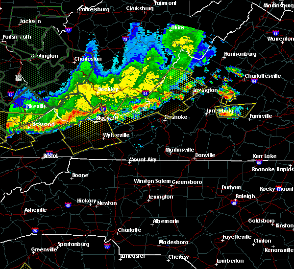 At 818 pm edt, severe thunderstorms were located along a line extending from near yost to near oriskany to kimballton, moving east at 45 mph (radar indicated). Hazards include 60 mph wind gusts. Expect damage to roofs. siding and trees. locations impacted include, lexington, covington, clifton forge, pearisburg, and narrows. This includes vmi. At 818 pm edt, severe thunderstorms were located along a line extending from near yost to near oriskany to kimballton, moving east at 45 mph (radar indicated). Hazards include 60 mph wind gusts. Expect damage to roofs. siding and trees. locations impacted include, lexington, covington, clifton forge, pearisburg, and narrows. This includes vmi.
|
| 7/14/2015 8:05 PM EDT |
 At 805 pm edt, severe thunderstorms were located along a line extending from near burnsville to near jordan mines to pembroke, moving east at 45 mph (radar indicated). Hazards include 60 mph wind gusts. Expect damage to roofs. siding and trees. locations impacted include, lexington, covington, clifton forge, pearisburg, and narrows. This includes vmi. At 805 pm edt, severe thunderstorms were located along a line extending from near burnsville to near jordan mines to pembroke, moving east at 45 mph (radar indicated). Hazards include 60 mph wind gusts. Expect damage to roofs. siding and trees. locations impacted include, lexington, covington, clifton forge, pearisburg, and narrows. This includes vmi.
|
| 7/14/2015 7:51 PM EDT |
 At 751 pm edt, severe thunderstorms were located along a line extending from 6 miles north of mountain grove to white sulphur springs to rich creek, moving southeast at 40 mph (radar indicated). Hazards include 60 mph wind gusts. Expect damage to roofs. Siding and trees. At 751 pm edt, severe thunderstorms were located along a line extending from 6 miles north of mountain grove to white sulphur springs to rich creek, moving southeast at 40 mph (radar indicated). Hazards include 60 mph wind gusts. Expect damage to roofs. Siding and trees.
|
| 7/13/2015 7:59 PM EDT |
 At 757 pm edt, severe thunderstorms were located along a line extending from near fincastle to copper hill to critz, moving east at 45 mph (radar indicated). Hazards include 60 mph wind gusts. Expect damage to roofs. Siding and trees. At 757 pm edt, severe thunderstorms were located along a line extending from near fincastle to copper hill to critz, moving east at 45 mph (radar indicated). Hazards include 60 mph wind gusts. Expect damage to roofs. Siding and trees.
|
| 6/30/2015 11:00 PM EDT |
 A severe thunderstorm warning remains in effect until 1115 pm edt for northeastern roanoke. southwestern rockbridge. botetourt and northwestern bedford counties. the northeastern city of salem and the city of roanoke. at 1059 pm edt. Severe thunderstorms were located along a line extending from near oriskany to near daleville to near roanoke. A severe thunderstorm warning remains in effect until 1115 pm edt for northeastern roanoke. southwestern rockbridge. botetourt and northwestern bedford counties. the northeastern city of salem and the city of roanoke. at 1059 pm edt. Severe thunderstorms were located along a line extending from near oriskany to near daleville to near roanoke.
|
| 6/30/2015 10:49 PM EDT |
 At 1048 pm edt, severe thunderstorms were located along a line extending from near oriskany to near catawba to near glenvar, moving east at 45 mph (radar indicated). Hazards include 60 mph wind gusts and quarter size hail. Hail damage to vehicles is expected. expect wind damage to roofs, siding and trees. locations impacted include, roanoke, salem, vinton, buchanan, and troutville. This includes the salem fairgrounds and roanoke regional airport. At 1048 pm edt, severe thunderstorms were located along a line extending from near oriskany to near catawba to near glenvar, moving east at 45 mph (radar indicated). Hazards include 60 mph wind gusts and quarter size hail. Hail damage to vehicles is expected. expect wind damage to roofs, siding and trees. locations impacted include, roanoke, salem, vinton, buchanan, and troutville. This includes the salem fairgrounds and roanoke regional airport.
|
| 6/30/2015 10:22 PM EDT |
 At 1021 pm edt, severe thunderstorms were located along a line extending from near paint bank to near simmonsville to near blacksburg, moving east at 40 mph (radar indicated). Hazards include 60 mph wind gusts and quarter size hail. Hail damage to vehicles is expected. Expect wind damage to roofs, siding and trees. At 1021 pm edt, severe thunderstorms were located along a line extending from near paint bank to near simmonsville to near blacksburg, moving east at 40 mph (radar indicated). Hazards include 60 mph wind gusts and quarter size hail. Hail damage to vehicles is expected. Expect wind damage to roofs, siding and trees.
|
| 6/29/2012 8:54 PM EDT | Trees and several large limbs blown dow in botetourt county VA, 1.1 miles WNW of Fincastle, VA |
| 6/29/2012 8:42 PM EDT | *** 12 inj *** hundreds of trees blown down countywide. power lines also blown down. less than 20 structures were damaged...mainly from winds blowing off roofing. trees in botetourt county VA, 0.2 miles ESE of Fincastle, VA |
| 1/1/0001 12:00 AM | A few large tree limbs were blown down in the community of fincastl in botetourt county VA, 0.2 miles ESE of Fincastle, VA |
| 1/1/0001 12:00 AM | Tree down on route 606 near border with botetourt count in craig county VA, 7.2 miles ESE of Fincastle, VA |
| 1/1/0001 12:00 AM | Quarter sized hail reported 5 miles SE of Fincastle, VA, hail up to quarter sized began 245 pm and lasted 10 minutes. |
| 1/1/0001 12:00 AM | Tree down on rt 613 slippery ford rd in botetourt county VA, 8.9 miles SE of Fincastle, VA |
| 1/1/0001 12:00 AM | A few reports of trees down in county in botetourt county VA, 0.2 miles ESE of Fincastle, VA |
Hail Maps for Fincastle, VA


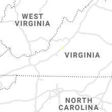


Connect with Interactive Hail Maps