

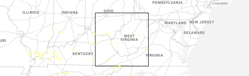
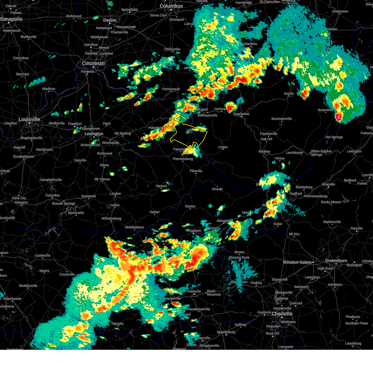
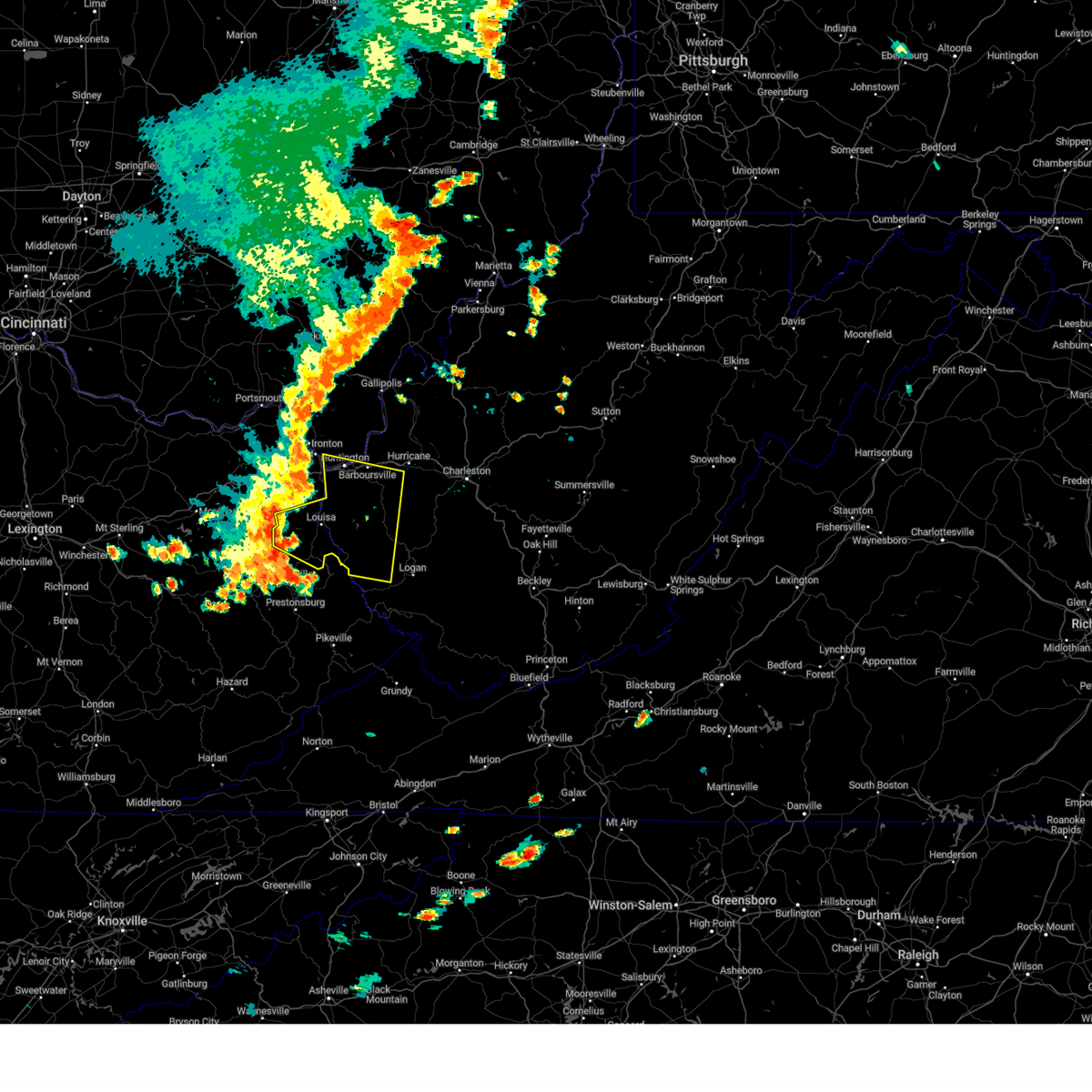
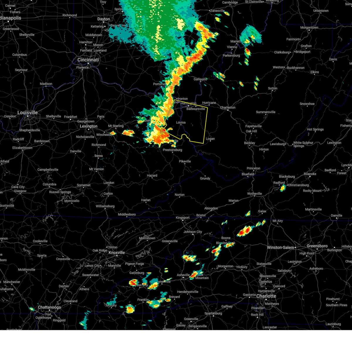
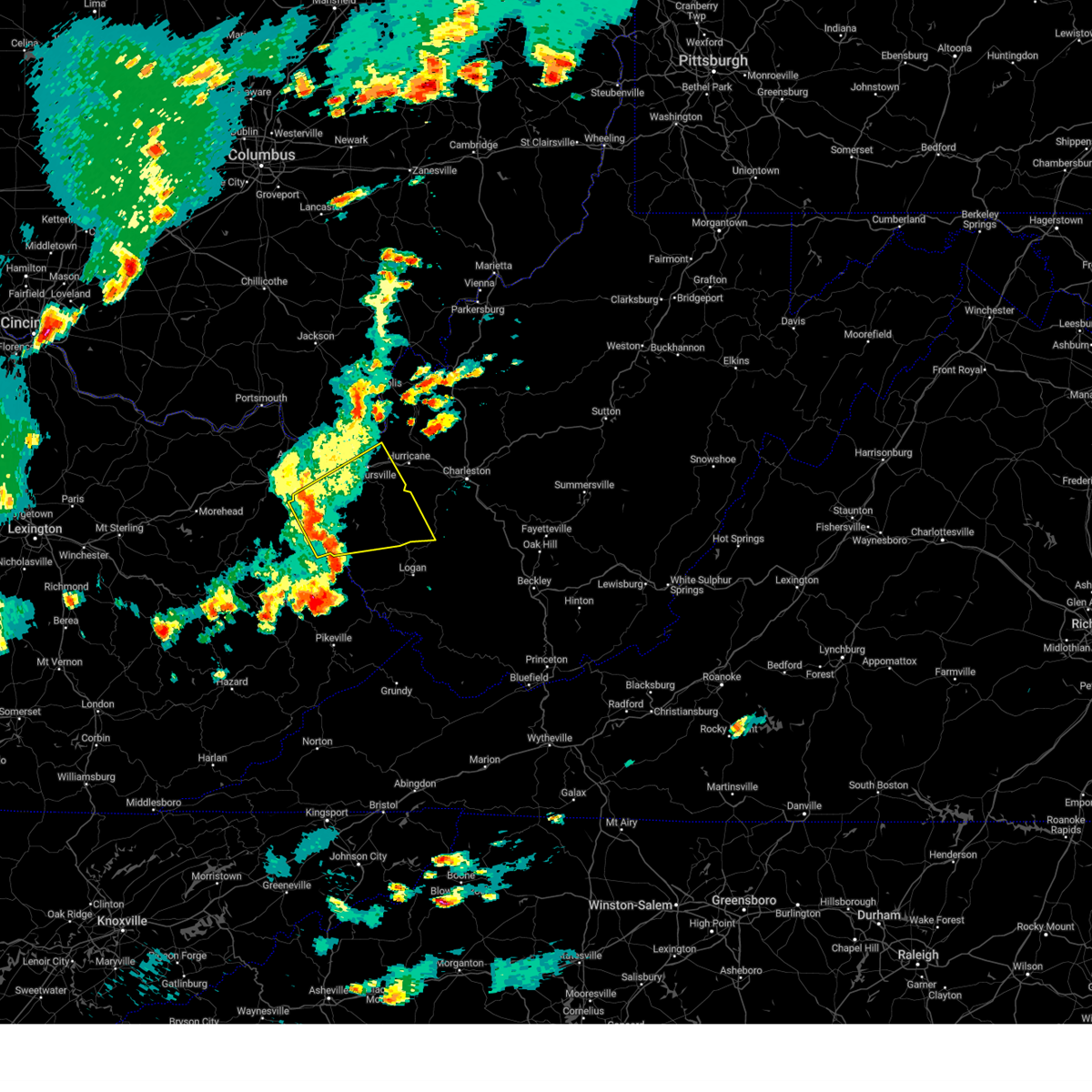
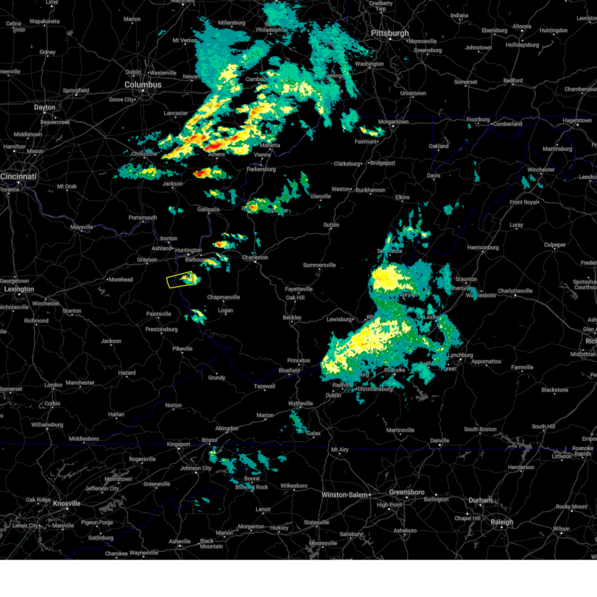
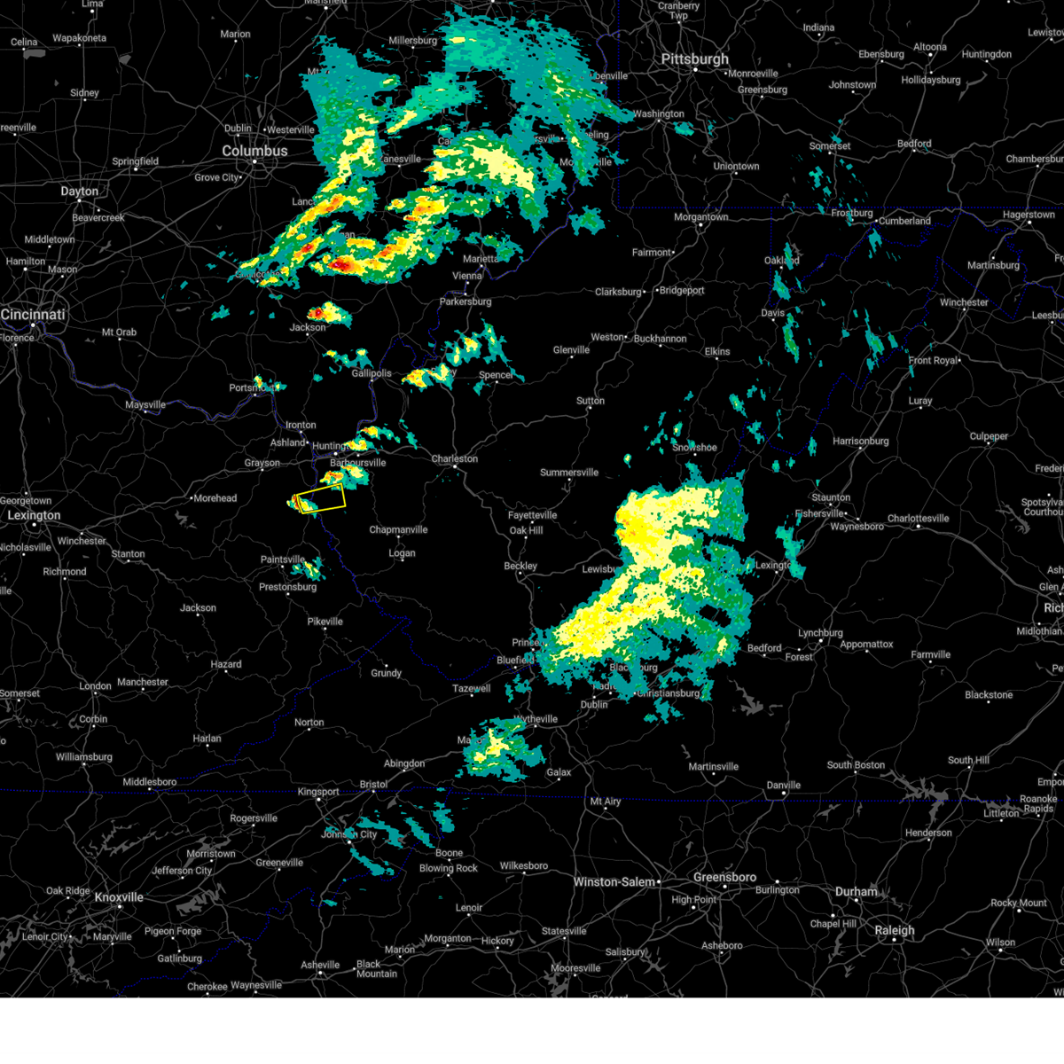
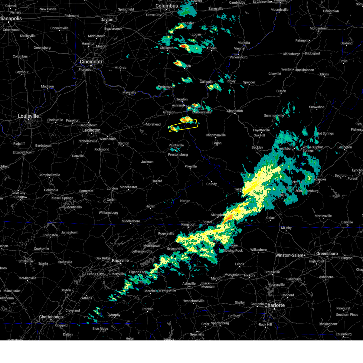
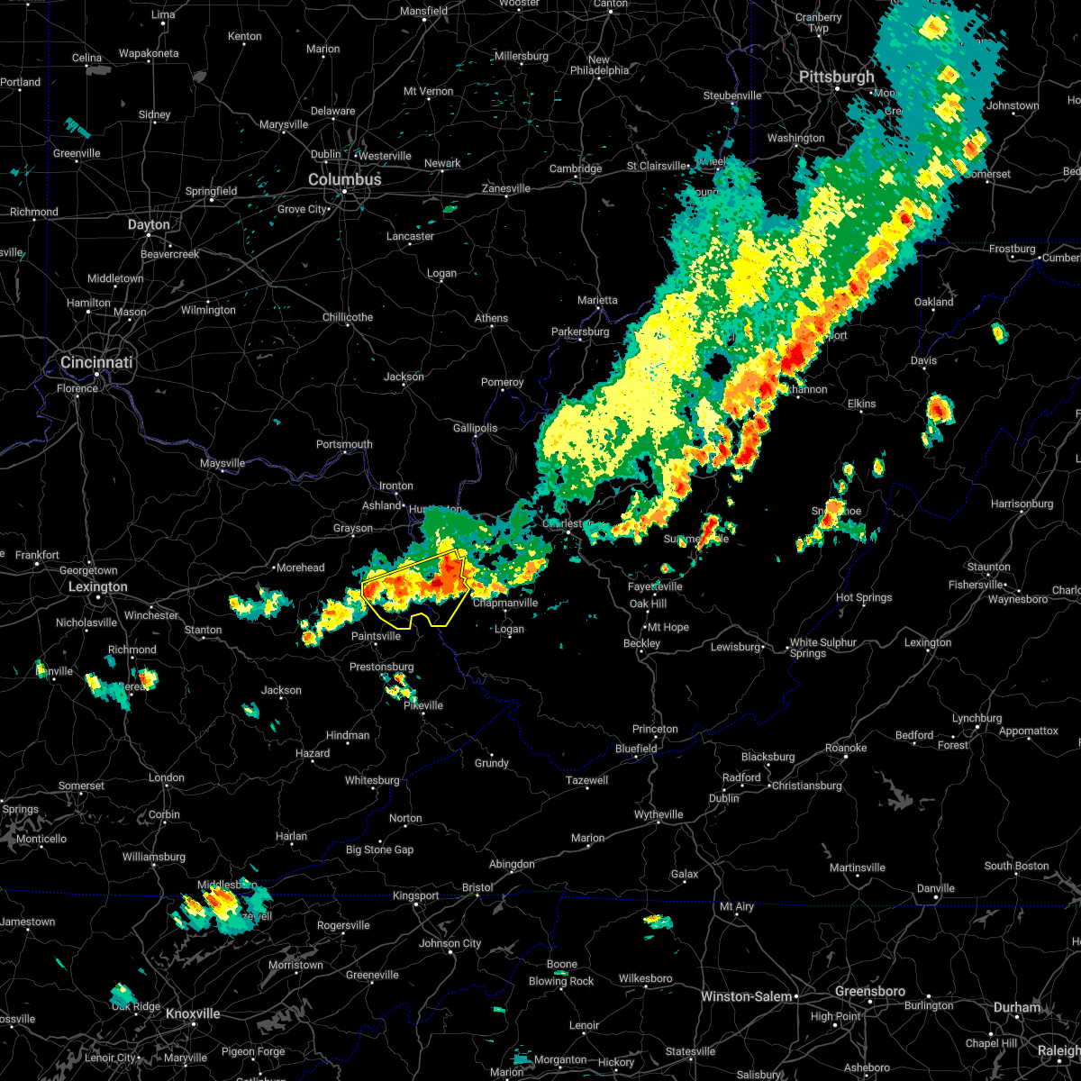
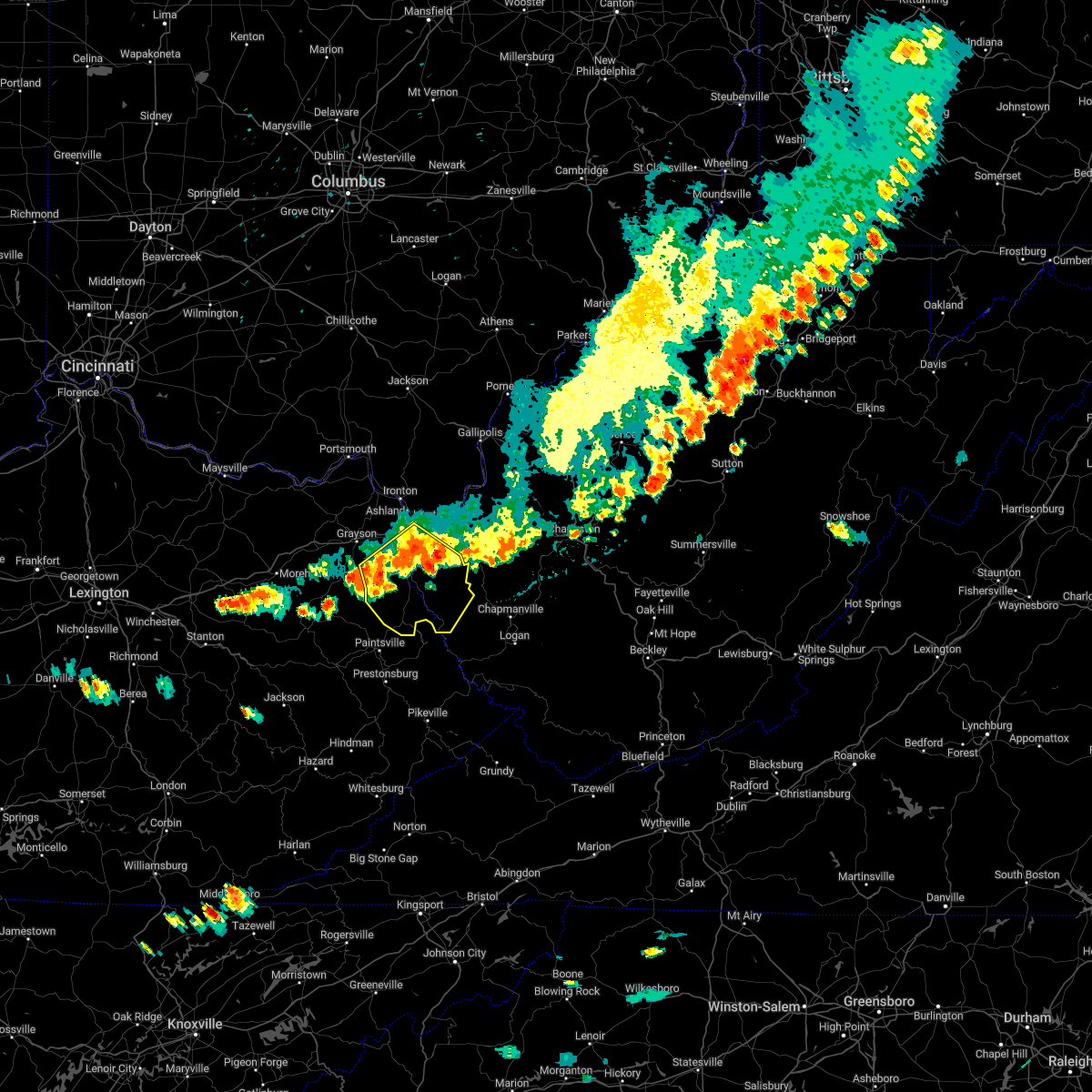
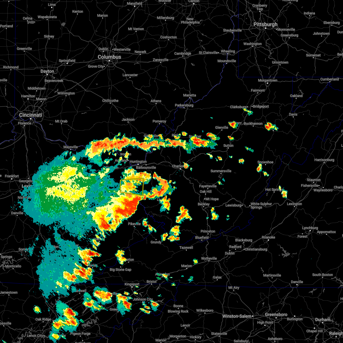
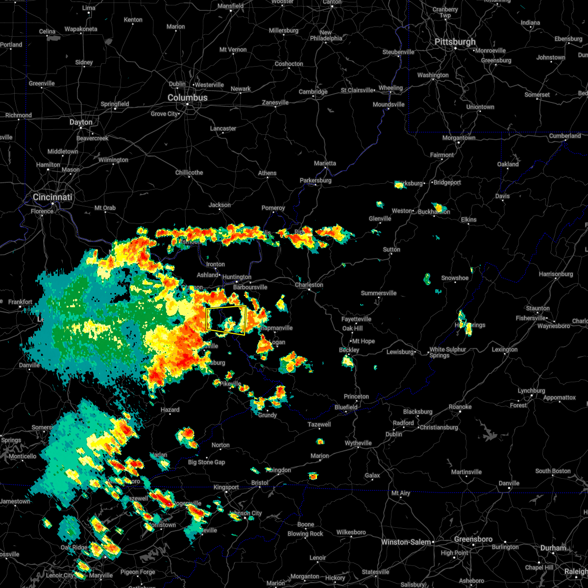
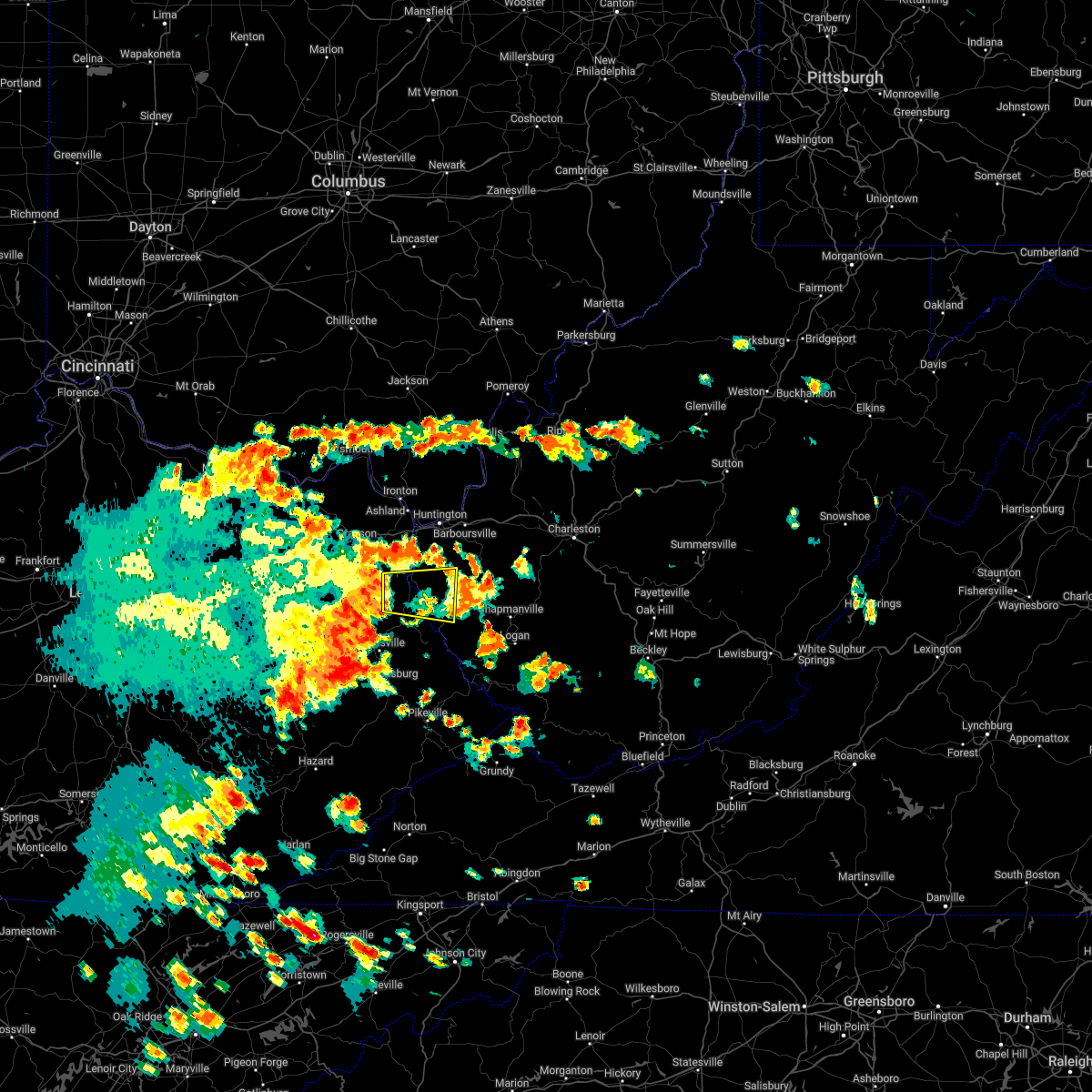
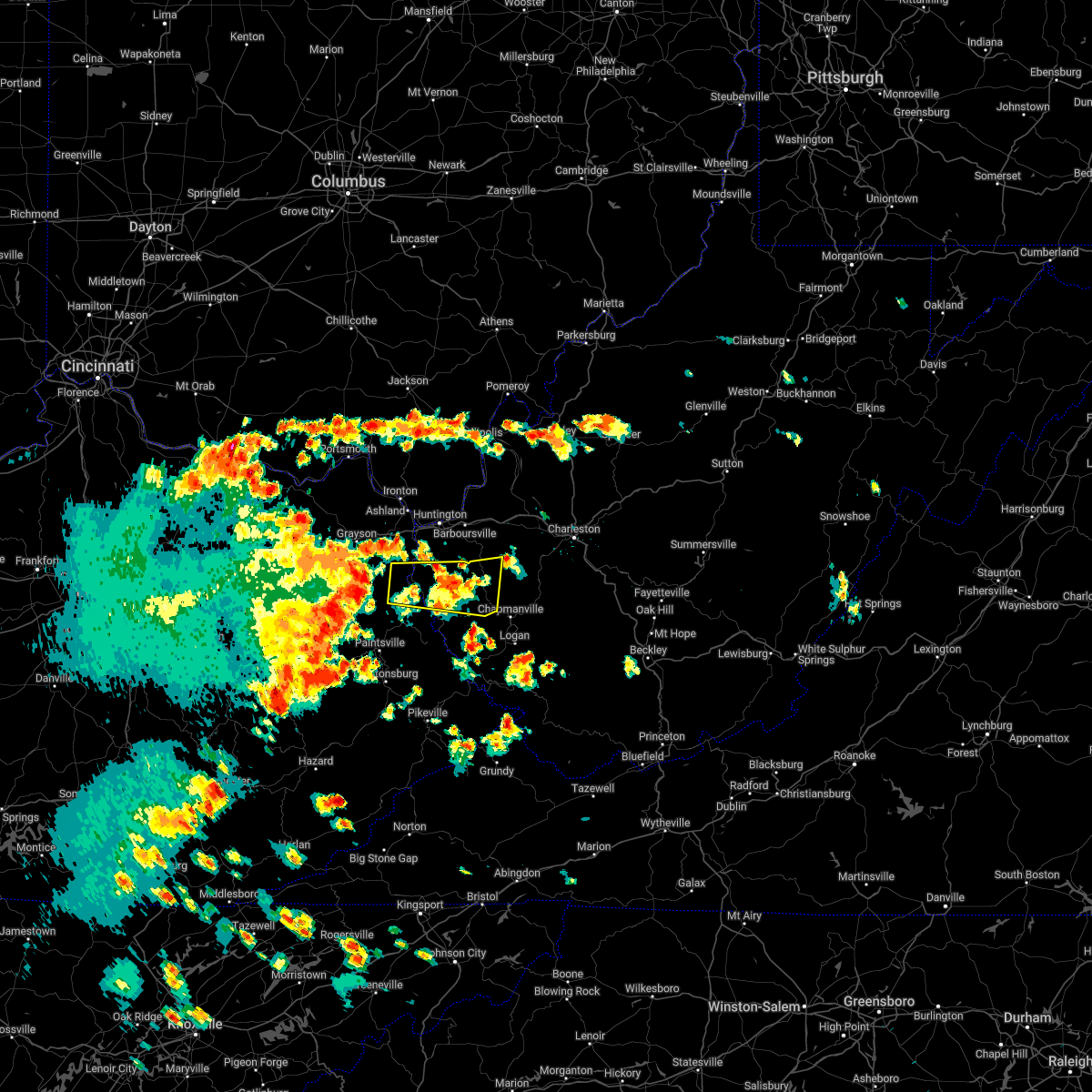
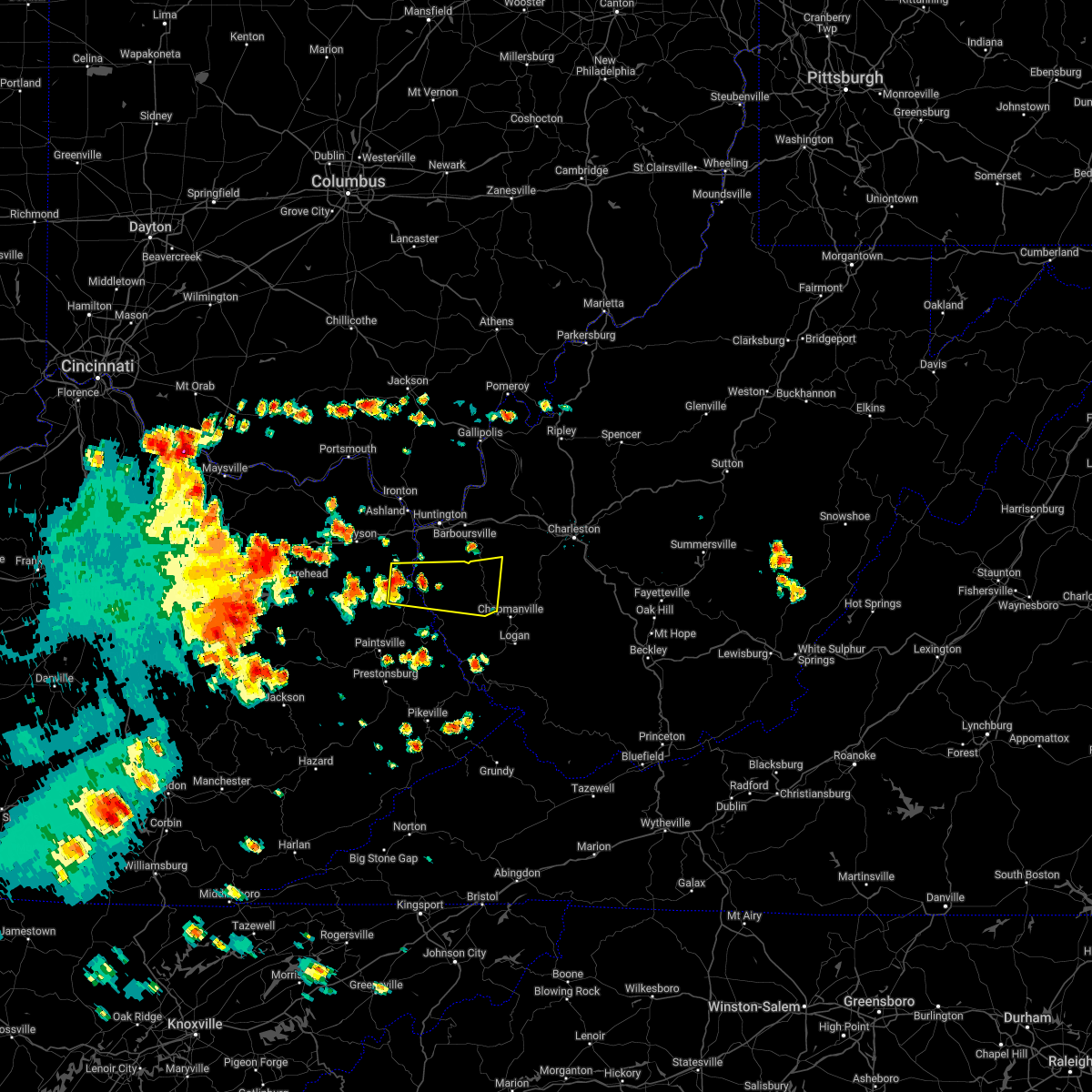
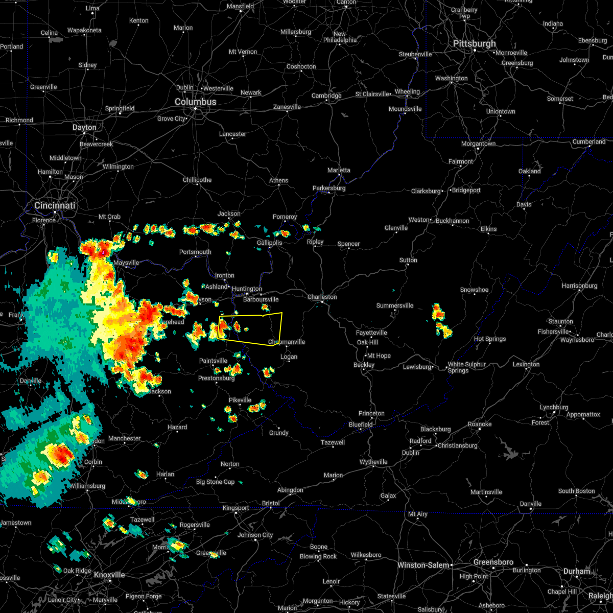
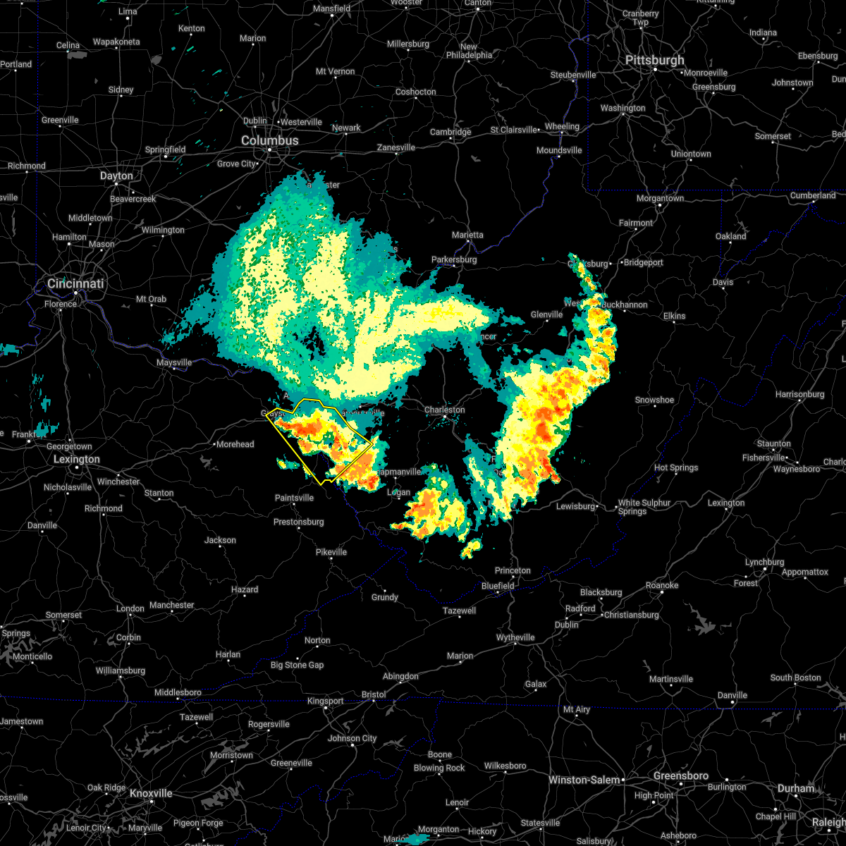
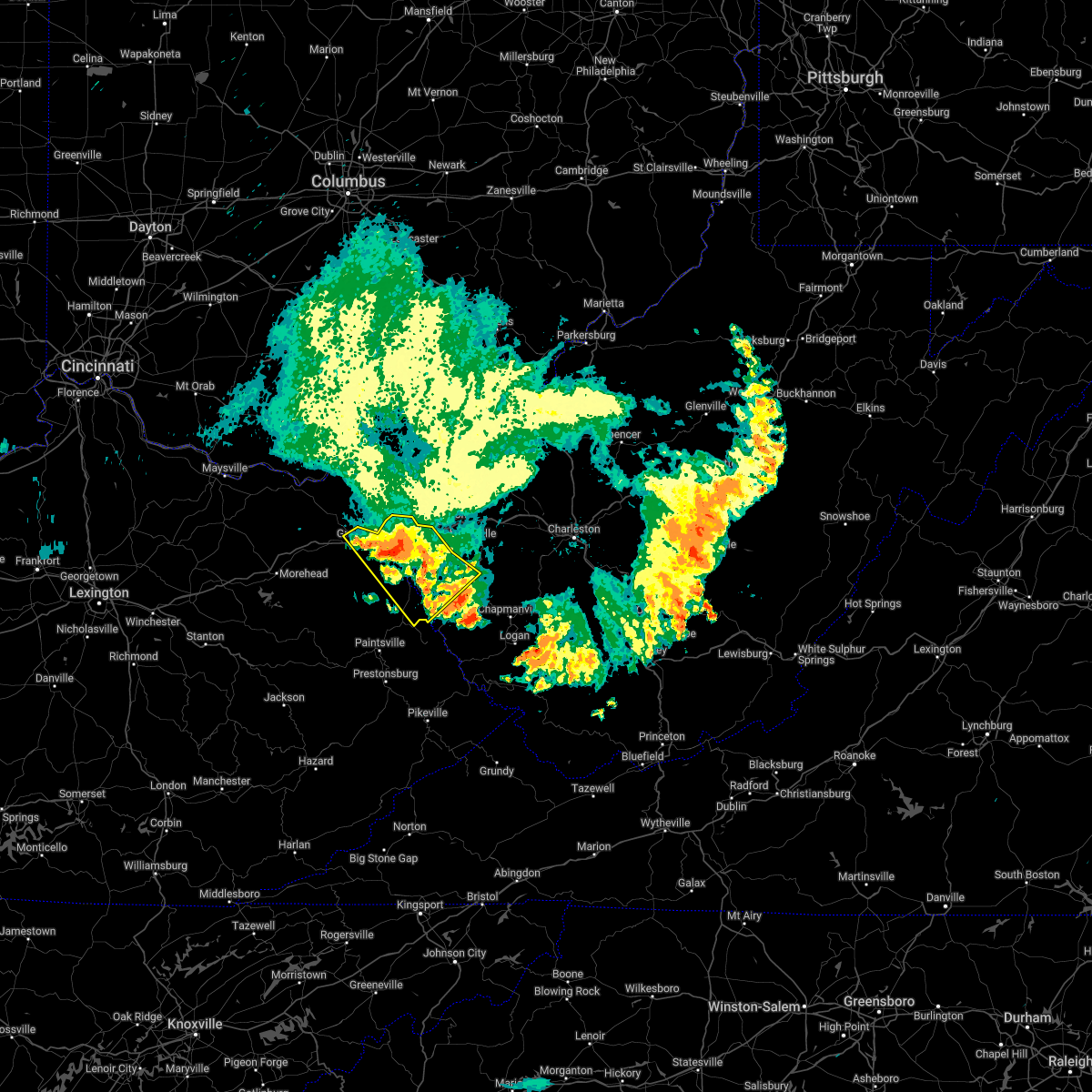
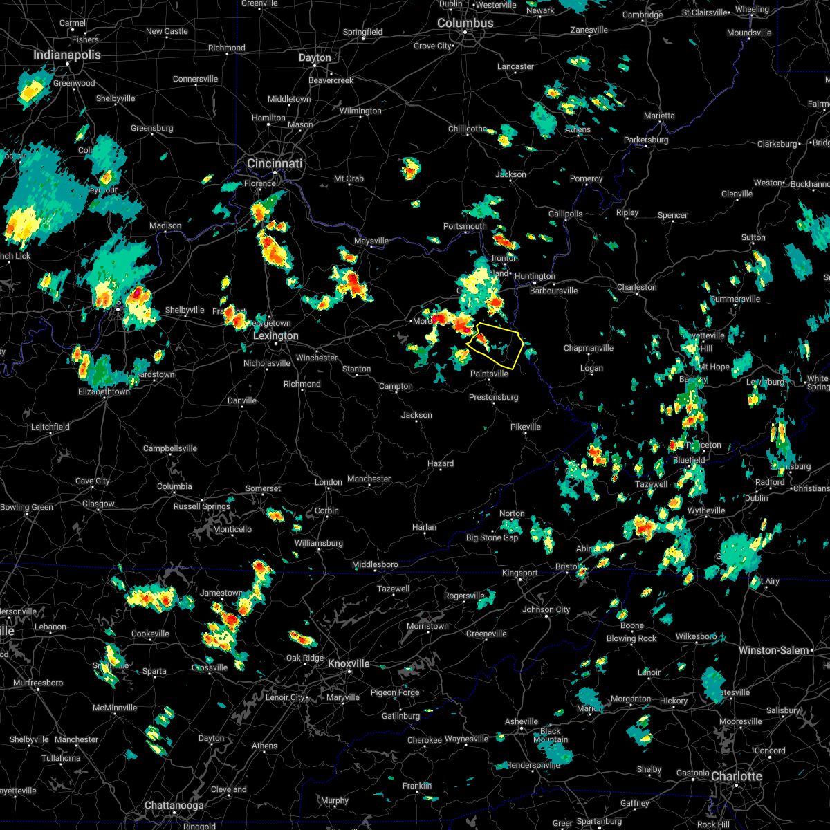
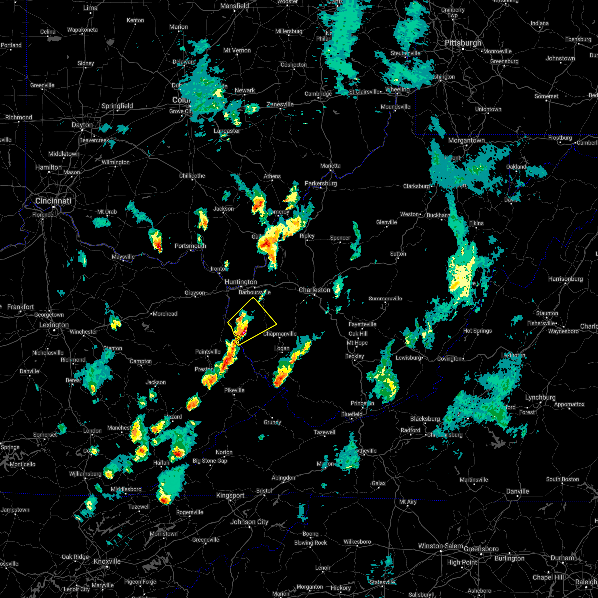
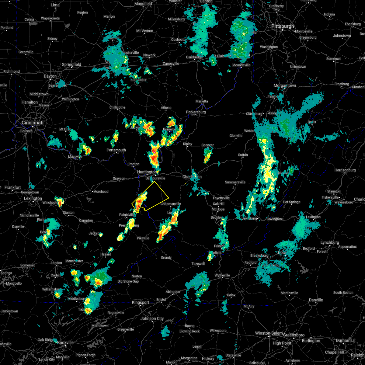
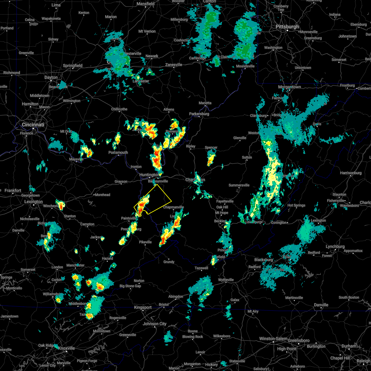
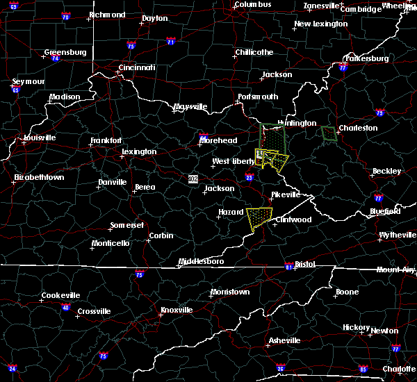
Hail Map for Fort Gay, WV
The Fort Gay, WV area has had 3 reports of on-the-ground hail by trained spotters, and has been under severe weather warnings 20 times during the past 12 months. Doppler radar has detected hail at or near Fort Gay, WV on 32 occasions.
| Name: | Fort Gay, WV |
| Where Located: | 54.5 miles WSW of Charleston, WV |
| Map: | Google Map for Fort Gay, WV |
| Population: | 705 |
| Housing Units: | 380 |
| More Info: | Search Google for Fort Gay, WV |
1
The Top Recent Hail Date for Fort Gay, WV is Friday, June 17, 2022 (4th out of 32)
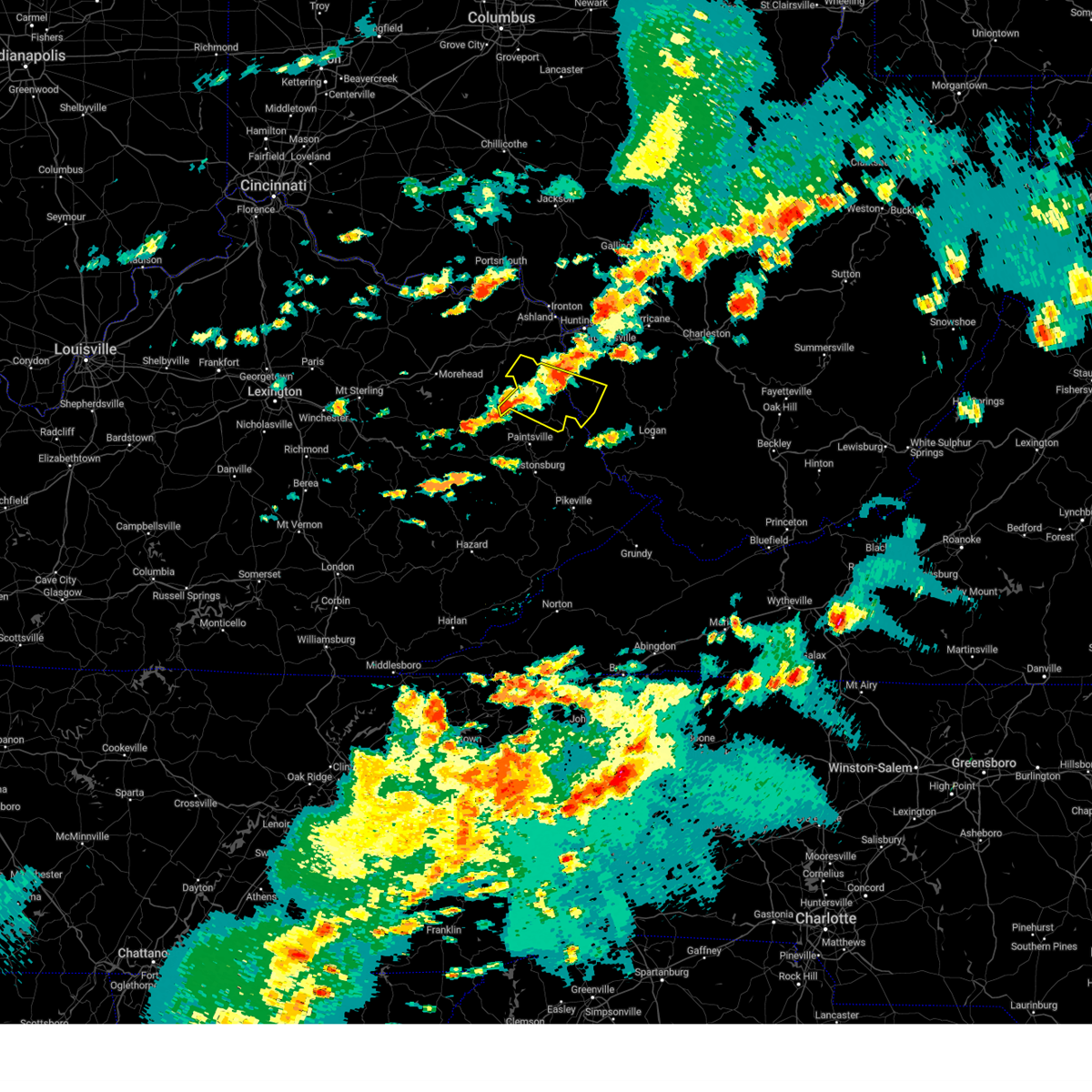
Hail and Wind Damage Spotted near Fort Gay, WV
| Date / Time | Report Details |
|---|---|
| 4/2/2024 10:53 AM EDT |
 the severe thunderstorm warning has been cancelled and is no longer in effect the severe thunderstorm warning has been cancelled and is no longer in effect
|
| 4/2/2024 10:53 AM EDT |
 At 1050 am edt, severe thunderstorms were located along a line extending from 10 miles north of ona to river, moving east at 60 mph (radar indicated). Hazards include 80 mph wind gusts and penny size hail. Flying debris will be dangerous to those caught without shelter. mobile homes will be heavily damaged. expect considerable damage to roofs, windows, and vehicles. extensive tree damage and power outages are likely. Locations impacted include, huntington, nitro, louisa, winfield, wayne, hamlin, proctorville, beech fork state park, hurricane, barboursville, milton, eleanor, buffalo, poca, fort gay, ranger, ona, culloden, harts, and gill. At 1050 am edt, severe thunderstorms were located along a line extending from 10 miles north of ona to river, moving east at 60 mph (radar indicated). Hazards include 80 mph wind gusts and penny size hail. Flying debris will be dangerous to those caught without shelter. mobile homes will be heavily damaged. expect considerable damage to roofs, windows, and vehicles. extensive tree damage and power outages are likely. Locations impacted include, huntington, nitro, louisa, winfield, wayne, hamlin, proctorville, beech fork state park, hurricane, barboursville, milton, eleanor, buffalo, poca, fort gay, ranger, ona, culloden, harts, and gill.
|
| 4/2/2024 10:36 AM EDT |
 At 1034 am edt, severe thunderstorms were located along a line extending from 9 miles north of proctorville to near barnetts creek, moving east at 70 mph. these are destructive storms for barboursville, louisa, winfield, milton, hurricane, chesapeake, and hamlin (radar indicated). Hazards include 80 mph wind gusts. Flying debris will be dangerous to those caught without shelter. mobile homes will be heavily damaged. expect considerable damage to roofs, windows, and vehicles. extensive tree damage and power outages are likely. Locations impacted include, huntington, nitro, louisa, winfield, wayne, hamlin, chesapeake, proctorville, blaine, beech fork state park, yatesville lake state park, hurricane, barboursville, kenova, milton, catlettsburg, eleanor, ceredo, buffalo, and poca. At 1034 am edt, severe thunderstorms were located along a line extending from 9 miles north of proctorville to near barnetts creek, moving east at 70 mph. these are destructive storms for barboursville, louisa, winfield, milton, hurricane, chesapeake, and hamlin (radar indicated). Hazards include 80 mph wind gusts. Flying debris will be dangerous to those caught without shelter. mobile homes will be heavily damaged. expect considerable damage to roofs, windows, and vehicles. extensive tree damage and power outages are likely. Locations impacted include, huntington, nitro, louisa, winfield, wayne, hamlin, chesapeake, proctorville, blaine, beech fork state park, yatesville lake state park, hurricane, barboursville, kenova, milton, catlettsburg, eleanor, ceredo, buffalo, and poca.
|
| 4/2/2024 10:36 AM EDT |
 the severe thunderstorm warning has been cancelled and is no longer in effect the severe thunderstorm warning has been cancelled and is no longer in effect
|
| 4/2/2024 10:22 AM EDT |
 Svrrlx the national weather service in charleston west virginia has issued a * severe thunderstorm warning for, boyd county in northeastern kentucky, lawrence county in northeastern kentucky, southeastern carter county in northeastern kentucky, south central gallia county in southeastern ohio, southeastern lawrence county in southeastern ohio, southwestern mason county in western west virginia, cabell county in central west virginia, northwestern mingo county in southern west virginia, putnam county in western west virginia, western lincoln county in central west virginia, wayne county in western west virginia, * until 1100 am edt. * at 1021 am edt, severe thunderstorms were located along a line extending from near lake vesuvius to logville, moving east at 65 mph (radar indicated). Hazards include 60 mph wind gusts. expect damage to roofs, siding, and trees Svrrlx the national weather service in charleston west virginia has issued a * severe thunderstorm warning for, boyd county in northeastern kentucky, lawrence county in northeastern kentucky, southeastern carter county in northeastern kentucky, south central gallia county in southeastern ohio, southeastern lawrence county in southeastern ohio, southwestern mason county in western west virginia, cabell county in central west virginia, northwestern mingo county in southern west virginia, putnam county in western west virginia, western lincoln county in central west virginia, wayne county in western west virginia, * until 1100 am edt. * at 1021 am edt, severe thunderstorms were located along a line extending from near lake vesuvius to logville, moving east at 65 mph (radar indicated). Hazards include 60 mph wind gusts. expect damage to roofs, siding, and trees
|
| 8/7/2023 3:15 PM EDT | Multiple trees down on fort gay roa in wayne county WV, 4.2 miles WSW of Fort Gay, WV |
| 8/7/2023 3:10 PM EDT |
 The severe thunderstorm warning for lawrence, southeastern carter and central wayne counties will expire at 315 pm edt, the storm which prompted the warning has moved out of the area. therefore, the warning will be allowed to expire. a tornado watch remains in effect until 600 pm edt for northeastern kentucky, and western west virginia. The severe thunderstorm warning for lawrence, southeastern carter and central wayne counties will expire at 315 pm edt, the storm which prompted the warning has moved out of the area. therefore, the warning will be allowed to expire. a tornado watch remains in effect until 600 pm edt for northeastern kentucky, and western west virginia.
|
| 8/7/2023 2:53 PM EDT |
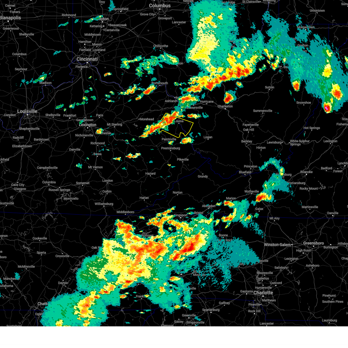 At 253 pm edt, a severe thunderstorm was located near webbville, or near yatesville lake state park, moving east at 70 mph (radar indicated). Hazards include 60 mph wind gusts and quarter size hail. Hail damage to vehicles is expected. expect wind damage to roofs, siding, and trees. Locations impacted include, louisa, blaine, yatesville lake state park, fort gay, webbville, denton, ulysses, charley, kiahsville, dunlow, martha, gallup, clifford, glenhayes, willard, houckville, fallsburg, and genoa. At 253 pm edt, a severe thunderstorm was located near webbville, or near yatesville lake state park, moving east at 70 mph (radar indicated). Hazards include 60 mph wind gusts and quarter size hail. Hail damage to vehicles is expected. expect wind damage to roofs, siding, and trees. Locations impacted include, louisa, blaine, yatesville lake state park, fort gay, webbville, denton, ulysses, charley, kiahsville, dunlow, martha, gallup, clifford, glenhayes, willard, houckville, fallsburg, and genoa.
|
| 8/7/2023 2:53 PM EDT |
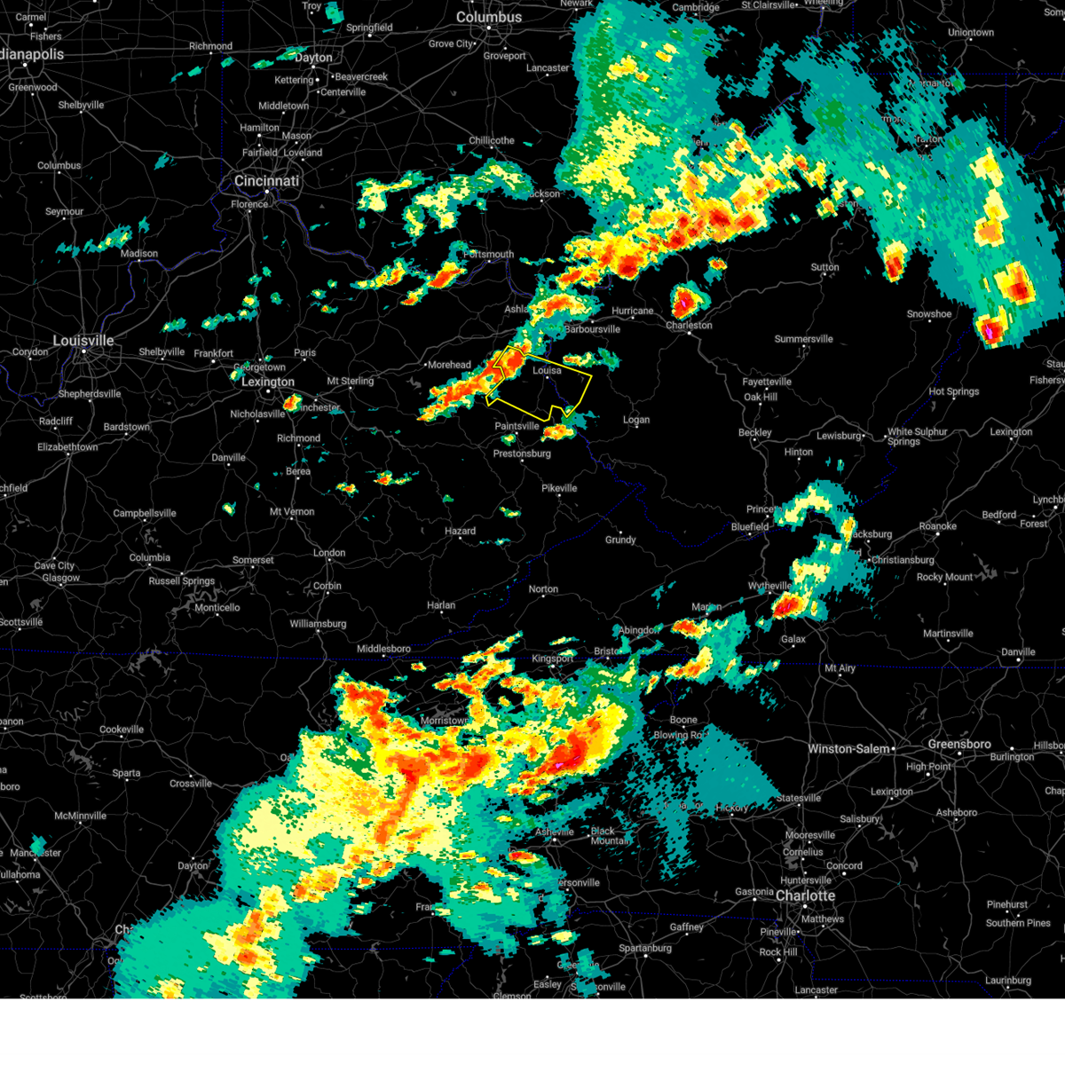 At 253 pm edt, a severe thunderstorm was located near webbville, or near yatesville lake state park, moving east at 70 mph (radar indicated). Hazards include 60 mph wind gusts and quarter size hail. Hail damage to vehicles is expected. expect wind damage to roofs, siding, and trees. Locations impacted include, louisa, blaine, yatesville lake state park, fort gay, webbville, denton, ulysses, charley, kiahsville, dunlow, martha, gallup, clifford, glenhayes, willard, houckville, fallsburg, and genoa. At 253 pm edt, a severe thunderstorm was located near webbville, or near yatesville lake state park, moving east at 70 mph (radar indicated). Hazards include 60 mph wind gusts and quarter size hail. Hail damage to vehicles is expected. expect wind damage to roofs, siding, and trees. Locations impacted include, louisa, blaine, yatesville lake state park, fort gay, webbville, denton, ulysses, charley, kiahsville, dunlow, martha, gallup, clifford, glenhayes, willard, houckville, fallsburg, and genoa.
|
| 8/7/2023 2:39 PM EDT |
 At 239 pm edt, a severe thunderstorm was located over newfoundland, or near sandy hook, moving east at 70 mph (radar indicated). Hazards include 60 mph wind gusts and quarter size hail. Hail damage to vehicles is expected. Expect wind damage to roofs, siding, and trees. At 239 pm edt, a severe thunderstorm was located over newfoundland, or near sandy hook, moving east at 70 mph (radar indicated). Hazards include 60 mph wind gusts and quarter size hail. Hail damage to vehicles is expected. Expect wind damage to roofs, siding, and trees.
|
| 7/28/2023 2:23 PM EDT |
 At 223 pm edt, a severe thunderstorm was located over east lynn lake, or near wayne, moving southeast at 50 mph (radar indicated). Hazards include 60 mph wind gusts and penny size hail. Expect damage to roofs, siding, and trees. locations impacted include, huntington, louisa, wayne, hamlin, chesapeake, proctorville, blaine, beech fork state park, yatesville lake state park, barboursville, kenova, ceredo, fort gay, ranger, harts, martha, gill, ulysses, east lynn lake, and charley. hail threat, radar indicated max hail size, 0. 75 in wind threat, radar indicated max wind gust, 60 mph. At 223 pm edt, a severe thunderstorm was located over east lynn lake, or near wayne, moving southeast at 50 mph (radar indicated). Hazards include 60 mph wind gusts and penny size hail. Expect damage to roofs, siding, and trees. locations impacted include, huntington, louisa, wayne, hamlin, chesapeake, proctorville, blaine, beech fork state park, yatesville lake state park, barboursville, kenova, ceredo, fort gay, ranger, harts, martha, gill, ulysses, east lynn lake, and charley. hail threat, radar indicated max hail size, 0. 75 in wind threat, radar indicated max wind gust, 60 mph.
|
| 7/28/2023 2:06 PM EDT |
 At 206 pm edt, a severe thunderstorm was located near durbin, or near yatesville lake state park, moving southeast at 50 mph (radar indicated). Hazards include 60 mph wind gusts and nickel size hail. expect damage to roofs, siding, and trees At 206 pm edt, a severe thunderstorm was located near durbin, or near yatesville lake state park, moving southeast at 50 mph (radar indicated). Hazards include 60 mph wind gusts and nickel size hail. expect damage to roofs, siding, and trees
|
| 7/2/2023 7:09 PM EDT | Several trees dow in wayne county WV, 2.1 miles S of Fort Gay, WV |
| 7/2/2023 7:06 PM EDT |
 At 705 pm edt, a severe thunderstorm was located over yatesville lake state park, moving northeast at 45 mph (radar indicated). Hazards include 60 mph wind gusts and nickel size hail. expect damage to roofs, siding, and trees At 705 pm edt, a severe thunderstorm was located over yatesville lake state park, moving northeast at 45 mph (radar indicated). Hazards include 60 mph wind gusts and nickel size hail. expect damage to roofs, siding, and trees
|
| 2/27/2023 5:55 PM EST |
 The severe thunderstorm warning for northeastern lawrence and west central wayne counties will expire at 600 pm est, the storm which prompted the warning has weakened below severe limits, and no longer poses an immediate threat to life or property. therefore, the warning will be allowed to expire. however gusty winds are still possible. time, mot, loc 2255z 064deg 155kt 3823 8241. The severe thunderstorm warning for northeastern lawrence and west central wayne counties will expire at 600 pm est, the storm which prompted the warning has weakened below severe limits, and no longer poses an immediate threat to life or property. therefore, the warning will be allowed to expire. however gusty winds are still possible. time, mot, loc 2255z 064deg 155kt 3823 8241.
|
| 2/27/2023 5:42 PM EST |
 At 542 pm est, a severe thunderstorm was located over yatesville lake state park, moving east at 55 mph (radar indicated). Hazards include 60 mph wind gusts. Expect damage to roofs, siding, and trees. locations impacted include, louisa, wayne, yatesville lake state park, fort gay, east lynn lake and fallsburg. hail threat, radar indicated max hail size, <. 75 in wind threat, radar indicated max wind gust, 60 mph. At 542 pm est, a severe thunderstorm was located over yatesville lake state park, moving east at 55 mph (radar indicated). Hazards include 60 mph wind gusts. Expect damage to roofs, siding, and trees. locations impacted include, louisa, wayne, yatesville lake state park, fort gay, east lynn lake and fallsburg. hail threat, radar indicated max hail size, <. 75 in wind threat, radar indicated max wind gust, 60 mph.
|
| 2/27/2023 5:29 PM EST |
 At 528 pm est, a severe thunderstorm was located near culver, or near blaine, moving east at 55 mph (radar indicated). Hazards include 60 mph wind gusts. expect damage to roofs, siding, and trees At 528 pm est, a severe thunderstorm was located near culver, or near blaine, moving east at 55 mph (radar indicated). Hazards include 60 mph wind gusts. expect damage to roofs, siding, and trees
|
| 7/23/2022 4:08 PM EDT |
 At 407 pm edt, a severe thunderstorm was located near east lynn lake, or near wayne, moving southeast at 25 mph (radar indicated). Hazards include 60 mph wind gusts and quarter size hail. Hail damage to vehicles is expected. expect wind damage to roofs, siding, and trees. locations impacted include, louisa, wayne, blaine, yatesville lake state park, fort gay, ulysses, east lynn lake, charley, kiahsville, dunlow, gallup, crum, clifford, glenhayes, houckville, east lynn and genoa. hail threat, radar indicated max hail size, 1. 00 in wind threat, radar indicated max wind gust, 60 mph. At 407 pm edt, a severe thunderstorm was located near east lynn lake, or near wayne, moving southeast at 25 mph (radar indicated). Hazards include 60 mph wind gusts and quarter size hail. Hail damage to vehicles is expected. expect wind damage to roofs, siding, and trees. locations impacted include, louisa, wayne, blaine, yatesville lake state park, fort gay, ulysses, east lynn lake, charley, kiahsville, dunlow, gallup, crum, clifford, glenhayes, houckville, east lynn and genoa. hail threat, radar indicated max hail size, 1. 00 in wind threat, radar indicated max wind gust, 60 mph.
|
| 7/23/2022 3:38 PM EDT |
 At 338 pm edt, a severe thunderstorm was located over durbin, or 7 miles northeast of yatesville lake state park, moving southeast at 25 mph (radar indicated). Hazards include 60 mph wind gusts and quarter size hail. Hail damage to vehicles is expected. Expect wind damage to roofs, siding, and trees. At 338 pm edt, a severe thunderstorm was located over durbin, or 7 miles northeast of yatesville lake state park, moving southeast at 25 mph (radar indicated). Hazards include 60 mph wind gusts and quarter size hail. Hail damage to vehicles is expected. Expect wind damage to roofs, siding, and trees.
|
| 6/17/2022 1:53 PM EDT |
 The severe thunderstorm warning for central lawrence and central wayne counties will expire at 200 pm edt, the storm which prompted the warning has weakened below severe limits, and has exited the warned area. therefore, the warning will be allowed to expire. however gusty winds are still possible with this thunderstorm. a severe thunderstorm watch remains in effect until 300 pm edt for northeastern kentucky. a severe thunderstorm watch also remains in effect until 500 pm edt for western west virginia. to report severe weather, contact your nearest law enforcement agency. they will relay your report to the national weather service charleston west virginia. The severe thunderstorm warning for central lawrence and central wayne counties will expire at 200 pm edt, the storm which prompted the warning has weakened below severe limits, and has exited the warned area. therefore, the warning will be allowed to expire. however gusty winds are still possible with this thunderstorm. a severe thunderstorm watch remains in effect until 300 pm edt for northeastern kentucky. a severe thunderstorm watch also remains in effect until 500 pm edt for western west virginia. to report severe weather, contact your nearest law enforcement agency. they will relay your report to the national weather service charleston west virginia.
|
| 6/17/2022 1:28 PM EDT |
 At 128 pm edt, a severe thunderstorm was located near yatesville lake state park, moving east at 35 mph (radar indicated). Hazards include 60 mph wind gusts. expect damage to roofs, siding, and trees At 128 pm edt, a severe thunderstorm was located near yatesville lake state park, moving east at 35 mph (radar indicated). Hazards include 60 mph wind gusts. expect damage to roofs, siding, and trees
|
| 6/17/2022 1:21 PM EDT |
 At 121 pm edt, a severe thunderstorm was located near ranger, or 12 miles southeast of wayne, moving east at 40 mph (radar indicated). Hazards include 60 mph wind gusts and penny size hail. Expect damage to roofs, siding, and trees. locations impacted include, louisa, wayne, yatesville lake state park, fort gay, ranger, gill, east lynn lake, kiahsville, dunlow, harts, branchland, fallsburg, east lynn, genoa, myra and glenhayes. hail threat, radar indicated max hail size, 0. 75 in wind threat, radar indicated max wind gust, 60 mph. At 121 pm edt, a severe thunderstorm was located near ranger, or 12 miles southeast of wayne, moving east at 40 mph (radar indicated). Hazards include 60 mph wind gusts and penny size hail. Expect damage to roofs, siding, and trees. locations impacted include, louisa, wayne, yatesville lake state park, fort gay, ranger, gill, east lynn lake, kiahsville, dunlow, harts, branchland, fallsburg, east lynn, genoa, myra and glenhayes. hail threat, radar indicated max hail size, 0. 75 in wind threat, radar indicated max wind gust, 60 mph.
|
| 6/17/2022 1:00 PM EDT | Heavily damaged roof of a home at 1856 fort gay road and across the street at new beginnings churc in wayne county WV, 6 miles WSW of Fort Gay, WV |
| 6/17/2022 12:49 PM EDT |
 At 1249 pm edt, a severe thunderstorm was located over yatesville lake state park, moving east at 40 mph (radar indicated). Hazards include 60 mph wind gusts and penny size hail. expect damage to roofs, siding, and trees At 1249 pm edt, a severe thunderstorm was located over yatesville lake state park, moving east at 40 mph (radar indicated). Hazards include 60 mph wind gusts and penny size hail. expect damage to roofs, siding, and trees
|
| 6/13/2022 10:23 PM EDT |
 The severe thunderstorm warning for boyd, central lawrence, southeastern carter, west central lincoln and wayne counties will expire at 1030 pm edt, the storm which prompted the warning has weakened below severe limits, and no longer poses an immediate threat to life or property. therefore, the warning will be allowed to expire. however gusty winds are still possible with this thunderstorm. a severe thunderstorm watch remains in effect until 100 am edt for northeastern kentucky, and central and western west virginia. The severe thunderstorm warning for boyd, central lawrence, southeastern carter, west central lincoln and wayne counties will expire at 1030 pm edt, the storm which prompted the warning has weakened below severe limits, and no longer poses an immediate threat to life or property. therefore, the warning will be allowed to expire. however gusty winds are still possible with this thunderstorm. a severe thunderstorm watch remains in effect until 100 am edt for northeastern kentucky, and central and western west virginia.
|
| 6/13/2022 10:15 PM EDT |
 At 1015 pm edt, a severe thunderstorm was located over centerville, or near wayne, moving southeast at 50 mph (radar indicated). Hazards include 60 mph wind gusts and penny size hail. Expect damage to roofs, siding, and trees. locations impacted include, huntington, ashland, grayson, louisa, wayne, beech fork state park, cannonsburg, yatesville lake state park, kenova, catlettsburg, ceredo, fort gay, princess, coalton, denton, burnaugh, rush, durbin, east lynn lake and centerville. hail threat, radar indicated max hail size, 0. 75 in wind threat, radar indicated max wind gust, 60 mph. At 1015 pm edt, a severe thunderstorm was located over centerville, or near wayne, moving southeast at 50 mph (radar indicated). Hazards include 60 mph wind gusts and penny size hail. Expect damage to roofs, siding, and trees. locations impacted include, huntington, ashland, grayson, louisa, wayne, beech fork state park, cannonsburg, yatesville lake state park, kenova, catlettsburg, ceredo, fort gay, princess, coalton, denton, burnaugh, rush, durbin, east lynn lake and centerville. hail threat, radar indicated max hail size, 0. 75 in wind threat, radar indicated max wind gust, 60 mph.
|
| 6/13/2022 9:55 PM EDT |
 At 954 pm edt, a severe thunderstorm was located over coalton, or near cannonsburg, moving southeast at 50 mph (radar indicated). Hazards include 60 mph wind gusts and penny size hail. expect damage to roofs, siding, and trees At 954 pm edt, a severe thunderstorm was located over coalton, or near cannonsburg, moving southeast at 50 mph (radar indicated). Hazards include 60 mph wind gusts and penny size hail. expect damage to roofs, siding, and trees
|
| 6/13/2022 9:01 PM EDT |
 The national weather service in charleston west virginia has issued a * severe thunderstorm warning for. southern boyd county in northeastern kentucky. lawrence county in northeastern kentucky. southeastern carter county in northeastern kentucky. Southwestern cabell county in central west virginia. The national weather service in charleston west virginia has issued a * severe thunderstorm warning for. southern boyd county in northeastern kentucky. lawrence county in northeastern kentucky. southeastern carter county in northeastern kentucky. Southwestern cabell county in central west virginia.
|
| 6/13/2022 8:42 PM EDT |
 At 842 pm edt, severe thunderstorms were located along a line extending from near naples to near grayson, moving east at 35 mph (radar indicated). Hazards include 60 mph wind gusts and penny size hail. Expect damage to roofs, siding, and trees. locations impacted include, huntington, ashland, grayson, louisa, wayne, beech fork state park, cannonsburg, yatesville lake state park, kenova, catlettsburg, ceredo, fort gay, princess, coalton, denton, burnaugh, naples, rush, durbin and centerville. hail threat, radar indicated max hail size, 0. 75 in wind threat, radar indicated max wind gust, 60 mph. At 842 pm edt, severe thunderstorms were located along a line extending from near naples to near grayson, moving east at 35 mph (radar indicated). Hazards include 60 mph wind gusts and penny size hail. Expect damage to roofs, siding, and trees. locations impacted include, huntington, ashland, grayson, louisa, wayne, beech fork state park, cannonsburg, yatesville lake state park, kenova, catlettsburg, ceredo, fort gay, princess, coalton, denton, burnaugh, naples, rush, durbin and centerville. hail threat, radar indicated max hail size, 0. 75 in wind threat, radar indicated max wind gust, 60 mph.
|
| 5/14/2022 3:42 PM EDT |
 At 341 pm edt, a severe thunderstorm was located near charley, or near blaine, moving southeast at 20 mph (radar indicated). Hazards include 60 mph wind gusts. Expect damage to roofs, siding, and trees. locations impacted include, louisa, blaine, ulysses, charley, houckville and gallup. hail threat, radar indicated max hail size, <. 75 in wind threat, radar indicated max wind gust, 60 mph. At 341 pm edt, a severe thunderstorm was located near charley, or near blaine, moving southeast at 20 mph (radar indicated). Hazards include 60 mph wind gusts. Expect damage to roofs, siding, and trees. locations impacted include, louisa, blaine, ulysses, charley, houckville and gallup. hail threat, radar indicated max hail size, <. 75 in wind threat, radar indicated max wind gust, 60 mph.
|
| 5/14/2022 3:19 PM EDT |
 At 319 pm edt, a severe thunderstorm was located over blaine, moving southeast at 20 mph (radar indicated). Hazards include 60 mph wind gusts and quarter size hail. Hail damage to vehicles is expected. Expect wind damage to roofs, siding, and trees. At 319 pm edt, a severe thunderstorm was located over blaine, moving southeast at 20 mph (radar indicated). Hazards include 60 mph wind gusts and quarter size hail. Hail damage to vehicles is expected. Expect wind damage to roofs, siding, and trees.
|
| 3/18/2021 3:34 PM EDT |
 At 333 pm edt, a severe thunderstorm was located near kiahsville, or 10 miles south of wayne, moving northeast at 30 mph (radar indicated). Hazards include 60 mph wind gusts and quarter size hail. Hail damage to vehicles is expected. expect wind damage to roofs, siding, and trees. Locations impacted include, wayne, fort gay, ranger, gill, kiahsville, dunlow, east lynn lake, harts, east lynn, genoa, glenhayes and branchland. At 333 pm edt, a severe thunderstorm was located near kiahsville, or 10 miles south of wayne, moving northeast at 30 mph (radar indicated). Hazards include 60 mph wind gusts and quarter size hail. Hail damage to vehicles is expected. expect wind damage to roofs, siding, and trees. Locations impacted include, wayne, fort gay, ranger, gill, kiahsville, dunlow, east lynn lake, harts, east lynn, genoa, glenhayes and branchland.
|
| 3/18/2021 3:20 PM EDT | Quarter sized hail reported 8.9 miles NNW of Fort Gay, WV, reported to be covering the ground. time estimated from radar. |
| 3/18/2021 3:11 PM EDT |
 At 311 pm edt, a severe thunderstorm was located near job, or 8 miles north of inez, moving northeast at 30 mph (radar indicated). Hazards include 60 mph wind gusts and quarter size hail. Hail damage to vehicles is expected. Expect wind damage to roofs, siding, and trees. At 311 pm edt, a severe thunderstorm was located near job, or 8 miles north of inez, moving northeast at 30 mph (radar indicated). Hazards include 60 mph wind gusts and quarter size hail. Hail damage to vehicles is expected. Expect wind damage to roofs, siding, and trees.
|
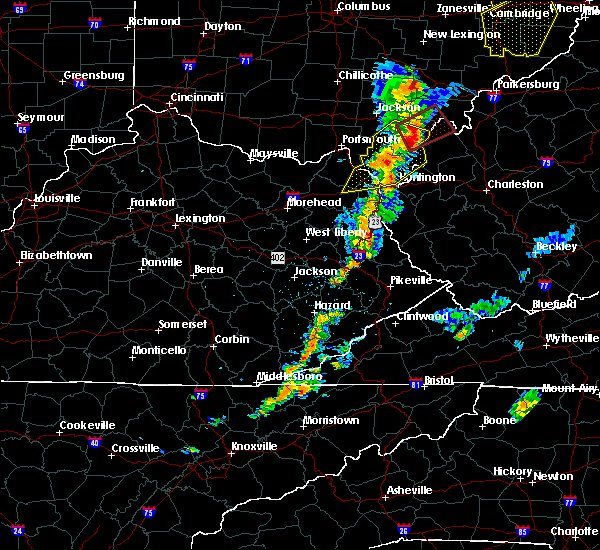
| 6/10/2020 9:09 PM EDT |
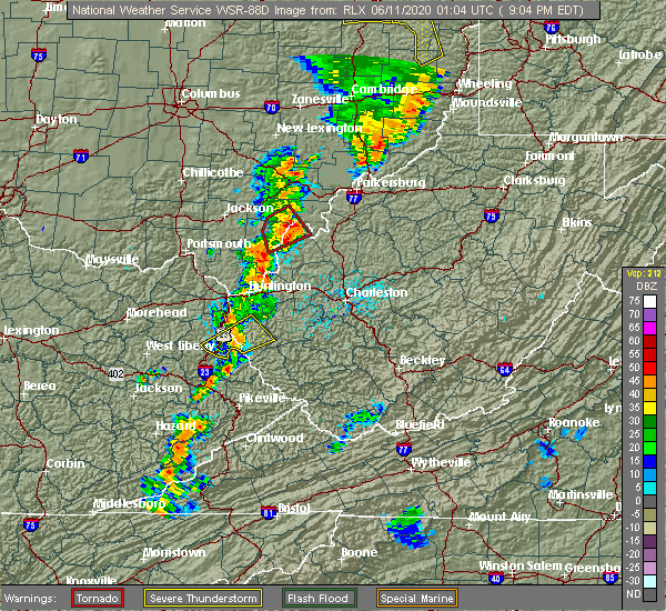 At 908 pm edt, a severe thunderstorm was located near east lynn lake, or 8 miles south of wayne, moving northeast at 45 mph (radar indicated). Hazards include 60 mph wind gusts. Expect damage to roofs, siding, and trees. Locations impacted include, fort gay, kiahsville, dunlow, east lynn lake, east lynn, genoa and glenhayes. At 908 pm edt, a severe thunderstorm was located near east lynn lake, or 8 miles south of wayne, moving northeast at 45 mph (radar indicated). Hazards include 60 mph wind gusts. Expect damage to roofs, siding, and trees. Locations impacted include, fort gay, kiahsville, dunlow, east lynn lake, east lynn, genoa and glenhayes.
|
| 6/10/2020 8:50 PM EDT | Two trees downed on highway #1690. two more trees downed on highway #203 in lawrence county KY, 0.2 miles ESE of Fort Gay, WV |
| 6/10/2020 8:47 PM EDT |
 At 846 pm edt, a severe thunderstorm was located over ulysses, or 10 miles northwest of inez, moving northeast at 45 mph (radar indicated). Hazards include 60 mph wind gusts. expect damage to roofs, siding, and trees At 846 pm edt, a severe thunderstorm was located over ulysses, or 10 miles northwest of inez, moving northeast at 45 mph (radar indicated). Hazards include 60 mph wind gusts. expect damage to roofs, siding, and trees
|
| 6/10/2020 8:29 PM EDT |
 At 829 pm edt, a severe thunderstorm was located near durbin, or 7 miles north of yatesville lake state park, moving northeast at 45 mph (radar indicated). Hazards include 60 mph wind gusts and nickel size hail. Expect damage to roofs, siding, and trees. Locations impacted include, huntington, louisa, wayne, blaine, beech fork state park, yatesville lake state park, cannonsburg, kenova, catlettsburg, ceredo, fort gay, webbville, burnaugh, martha, durbin, east lynn lake, centerville, south point, burlington and lockwood. At 829 pm edt, a severe thunderstorm was located near durbin, or 7 miles north of yatesville lake state park, moving northeast at 45 mph (radar indicated). Hazards include 60 mph wind gusts and nickel size hail. Expect damage to roofs, siding, and trees. Locations impacted include, huntington, louisa, wayne, blaine, beech fork state park, yatesville lake state park, cannonsburg, kenova, catlettsburg, ceredo, fort gay, webbville, burnaugh, martha, durbin, east lynn lake, centerville, south point, burlington and lockwood.
|
| 6/10/2020 8:05 PM EDT |
 At 804 pm edt, a severe thunderstorm was located near bruin, or near grayson lake state park, moving northeast at 45 mph (radar indicated). Hazards include 60 mph wind gusts and nickel size hail. expect damage to roofs, siding, and trees At 804 pm edt, a severe thunderstorm was located near bruin, or near grayson lake state park, moving northeast at 45 mph (radar indicated). Hazards include 60 mph wind gusts and nickel size hail. expect damage to roofs, siding, and trees
|
| 5/29/2020 2:00 PM EDT |
 At 200 pm edt, a severe thunderstorm was located near webbville, or 7 miles west of yatesville lake state park, moving east at 30 mph (radar indicated). Hazards include 60 mph wind gusts and quarter size hail. Hail damage to vehicles is expected. Expect wind damage to roofs, siding, and trees. At 200 pm edt, a severe thunderstorm was located near webbville, or 7 miles west of yatesville lake state park, moving east at 30 mph (radar indicated). Hazards include 60 mph wind gusts and quarter size hail. Hail damage to vehicles is expected. Expect wind damage to roofs, siding, and trees.
|
| 3/28/2020 12:43 AM EDT |
 At 1243 am edt, a severe thunderstorm was located near blaine, moving east at 40 mph (radar indicated). Hazards include 60 mph wind gusts and penny size hail. expect damage to roofs, siding, and trees At 1243 am edt, a severe thunderstorm was located near blaine, moving east at 40 mph (radar indicated). Hazards include 60 mph wind gusts and penny size hail. expect damage to roofs, siding, and trees
|
| 1/11/2020 3:45 PM EST |
 At 345 pm est, a severe thunderstorm was located over louisa, moving northeast at 55 mph (radar indicated). Hazards include 70 mph wind gusts. Expect considerable tree damage. Damage is likely to mobile homes, roofs, and outbuildings. At 345 pm est, a severe thunderstorm was located over louisa, moving northeast at 55 mph (radar indicated). Hazards include 70 mph wind gusts. Expect considerable tree damage. Damage is likely to mobile homes, roofs, and outbuildings.
|
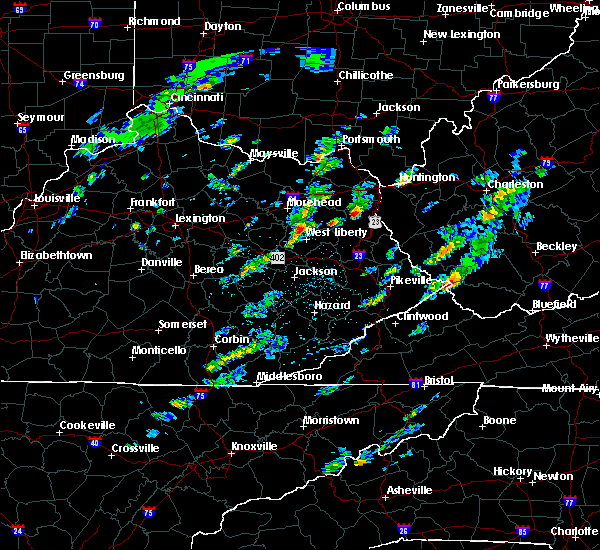
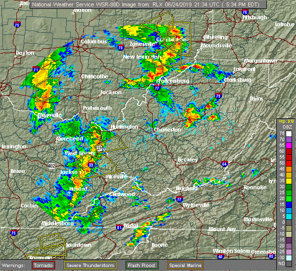
| 6/24/2019 5:35 PM EDT |
 At 534 pm edt, a severe thunderstorm was located over louisa, moving northeast at 50 mph (radar indicated). Hazards include 60 mph wind gusts. expect damage to roofs, siding, and trees At 534 pm edt, a severe thunderstorm was located over louisa, moving northeast at 50 mph (radar indicated). Hazards include 60 mph wind gusts. expect damage to roofs, siding, and trees
|
| 6/16/2019 9:06 PM EDT |
 At 905 pm edt, severe thunderstorms were located along a line extending from 7 miles south of gallipolis to near milton to near kiahsville to near charley, moving east at 40 mph (radar indicated). Hazards include 60 mph wind gusts and nickel size hail. Expect damage to roofs, siding, and trees. Locations impacted include, huntington, nitro, louisa, winfield, wayne, hamlin, proctorville, blaine, beech fork state park, yatesville lake state park, hurricane, barboursville, milton, eleanor, buffalo, poca, fort gay, ranger, harts and martha. At 905 pm edt, severe thunderstorms were located along a line extending from 7 miles south of gallipolis to near milton to near kiahsville to near charley, moving east at 40 mph (radar indicated). Hazards include 60 mph wind gusts and nickel size hail. Expect damage to roofs, siding, and trees. Locations impacted include, huntington, nitro, louisa, winfield, wayne, hamlin, proctorville, blaine, beech fork state park, yatesville lake state park, hurricane, barboursville, milton, eleanor, buffalo, poca, fort gay, ranger, harts and martha.
|
| 6/16/2019 8:42 PM EDT |
 At 840 pm edt, severe thunderstorms were located along a line extending from 11 miles northeast of lake vesuvius to near huntington to near fort gay to martha, moving east at 40 mph. this line of storms recently produced damage in ashland (radar indicated). Hazards include 60 mph wind gusts and quarter size hail. Hail damage to vehicles is expected. Expect wind damage to roofs, siding, and trees. At 840 pm edt, severe thunderstorms were located along a line extending from 11 miles northeast of lake vesuvius to near huntington to near fort gay to martha, moving east at 40 mph. this line of storms recently produced damage in ashland (radar indicated). Hazards include 60 mph wind gusts and quarter size hail. Hail damage to vehicles is expected. Expect wind damage to roofs, siding, and trees.
|
| 6/16/2019 8:22 PM EDT |
 At 822 pm edt, severe thunderstorms were located along a line extending from near franklin furnace to near cannonsburg to near martha, moving east at 30 mph (radar indicated). Hazards include 60 mph wind gusts and quarter size hail. Hail damage to vehicles is expected. expect wind damage to roofs, siding, and trees. Locations impacted include, huntington, ashland, ironton, grayson, louisa, coal grove, wayne, chesapeake, proctorville, blaine, beech fork state park, cannonsburg, lake vesuvius, yatesville lake state park, barboursville, kenova, catlettsburg, ceredo, fort gay and coalton. At 822 pm edt, severe thunderstorms were located along a line extending from near franklin furnace to near cannonsburg to near martha, moving east at 30 mph (radar indicated). Hazards include 60 mph wind gusts and quarter size hail. Hail damage to vehicles is expected. expect wind damage to roofs, siding, and trees. Locations impacted include, huntington, ashland, ironton, grayson, louisa, coal grove, wayne, chesapeake, proctorville, blaine, beech fork state park, cannonsburg, lake vesuvius, yatesville lake state park, barboursville, kenova, catlettsburg, ceredo, fort gay and coalton.
|
| 6/16/2019 7:59 PM EDT |
 At 759 pm edt, severe thunderstorms were located along a line extending from near letitia to near grayson to near little sandy, moving east at 30 mph (radar indicated). Hazards include 60 mph wind gusts and quarter size hail. Hail damage to vehicles is expected. Expect wind damage to roofs, siding, and trees. At 759 pm edt, severe thunderstorms were located along a line extending from near letitia to near grayson to near little sandy, moving east at 30 mph (radar indicated). Hazards include 60 mph wind gusts and quarter size hail. Hail damage to vehicles is expected. Expect wind damage to roofs, siding, and trees.
|
| 8/11/2018 4:56 PM EDT |
 The severe thunderstorm warning for central lawrence and west central wayne counties will expire at 500 pm edt, the storm which prompted the warning has weakened below severe limits. therefore, the warning will be allowed to expire. however, wind gusts of 30 to 40 mph are still possible in southeastern lawrence county ky. The severe thunderstorm warning for central lawrence and west central wayne counties will expire at 500 pm edt, the storm which prompted the warning has weakened below severe limits. therefore, the warning will be allowed to expire. however, wind gusts of 30 to 40 mph are still possible in southeastern lawrence county ky.
|
| 8/11/2018 4:33 PM EDT |
 At 432 pm edt, a severe thunderstorm was located over yatesville lake state park, moving southeast at 20 mph (radar indicated). Hazards include 60 mph wind gusts. Expect damage to roofs, siding, and trees. Locations impacted include, louisa, blaine, yatesville lake state park, fort gay, houckville, gallup and fallsburg. At 432 pm edt, a severe thunderstorm was located over yatesville lake state park, moving southeast at 20 mph (radar indicated). Hazards include 60 mph wind gusts. Expect damage to roofs, siding, and trees. Locations impacted include, louisa, blaine, yatesville lake state park, fort gay, houckville, gallup and fallsburg.
|
| 8/11/2018 4:08 PM EDT |
 At 408 pm edt, a severe thunderstorm was located over webbville, or 9 miles east of grayson lake state park, moving southeast at 20 mph (radar indicated). Hazards include 60 mph wind gusts and quarter size hail. Hail damage to vehicles is expected. Expect wind damage to roofs, siding, and trees. At 408 pm edt, a severe thunderstorm was located over webbville, or 9 miles east of grayson lake state park, moving southeast at 20 mph (radar indicated). Hazards include 60 mph wind gusts and quarter size hail. Hail damage to vehicles is expected. Expect wind damage to roofs, siding, and trees.
|
| 7/1/2018 10:14 PM EDT | A few trees down due to high wind along route 15 in wayne county WV, 7 miles W of Fort Gay, WV |
| 7/1/2018 8:06 PM EDT |
 The severe thunderstorm warning for southeastern lawrence and west central wayne counties will expire at 815 pm edt, the storm which prompted the warning has weakened below severe limits, and no longer poses an immediate threat to life or property. therefore, the warning will be allowed to expire. however gusty winds and heavy rain are still possible with this thunderstorm. The severe thunderstorm warning for southeastern lawrence and west central wayne counties will expire at 815 pm edt, the storm which prompted the warning has weakened below severe limits, and no longer poses an immediate threat to life or property. therefore, the warning will be allowed to expire. however gusty winds and heavy rain are still possible with this thunderstorm.
|
| 7/1/2018 7:39 PM EDT |
 At 739 pm edt, a severe thunderstorm was located near job, or 7 miles south of louisa, moving north at 5 mph (radar indicated). Hazards include 60 mph wind gusts. expect damage to roofs, siding, and trees At 739 pm edt, a severe thunderstorm was located near job, or 7 miles south of louisa, moving north at 5 mph (radar indicated). Hazards include 60 mph wind gusts. expect damage to roofs, siding, and trees
|
| 7/1/2018 6:30 PM EDT | A few trees down due to high wind along route 15 in wayne county WV, 7 miles W of Fort Gay, WV |
| 4/3/2018 11:52 PM EDT |
 At 1152 pm edt, a severe thunderstorm was located over blaine, moving northeast at 55 mph (radar indicated). Hazards include 60 mph wind gusts and penny size hail. Expect damage to roofs, siding, and trees. Locations impacted include, louisa, blaine, yatesville lake state park, fort gay, ulysses, charley, houckville, gallup, fallsburg, clifford, glenhayes and buchanan. At 1152 pm edt, a severe thunderstorm was located over blaine, moving northeast at 55 mph (radar indicated). Hazards include 60 mph wind gusts and penny size hail. Expect damage to roofs, siding, and trees. Locations impacted include, louisa, blaine, yatesville lake state park, fort gay, ulysses, charley, houckville, gallup, fallsburg, clifford, glenhayes and buchanan.
|
| 4/3/2018 11:37 PM EDT |
 The national weather service in charleston west virginia has issued a * severe thunderstorm warning for. lawrence county in northeastern kentucky. southwestern wayne county in western west virginia. Until midnight edt * at 1137 pm edt, a severe thunderstorm was located over moon, or 9. The national weather service in charleston west virginia has issued a * severe thunderstorm warning for. lawrence county in northeastern kentucky. southwestern wayne county in western west virginia. Until midnight edt * at 1137 pm edt, a severe thunderstorm was located over moon, or 9.
|
| 4/3/2018 11:37 PM EDT |
 At 1137 pm edt, a severe thunderstorm was located over moon, or 9 miles south of sandy hook, moving east at 55 mph (radar indicated). Hazards include 60 mph wind gusts and penny size hail. expect damage to roofs, siding, and trees At 1137 pm edt, a severe thunderstorm was located over moon, or 9 miles south of sandy hook, moving east at 55 mph (radar indicated). Hazards include 60 mph wind gusts and penny size hail. expect damage to roofs, siding, and trees
|
| 7/7/2017 9:02 PM EDT |
 At 902 pm edt, severe thunderstorms were located along a line extending from 6 miles west of ripley to near barboursville to webbville, moving southeast at 45 mph (radar indicated). Hazards include 60 mph wind gusts and nickel size hail. Expect damage to roofs, siding, and trees. locations impacted include, huntington, louisa, winfield, wayne, blaine, beech fork state park, grayson lake state park, yatesville lake state park, hurricane, barboursville, milton, eleanor, ceredo, buffalo, fort gay, webbville, ona, culloden, denton and burnaugh. this includes the following highways, interstate 77 in west virginia between mile markers 131 and 136. Interstate 64 in west virginia between mile markers 3 and 39. At 902 pm edt, severe thunderstorms were located along a line extending from 6 miles west of ripley to near barboursville to webbville, moving southeast at 45 mph (radar indicated). Hazards include 60 mph wind gusts and nickel size hail. Expect damage to roofs, siding, and trees. locations impacted include, huntington, louisa, winfield, wayne, blaine, beech fork state park, grayson lake state park, yatesville lake state park, hurricane, barboursville, milton, eleanor, ceredo, buffalo, fort gay, webbville, ona, culloden, denton and burnaugh. this includes the following highways, interstate 77 in west virginia between mile markers 131 and 136. Interstate 64 in west virginia between mile markers 3 and 39.
|
| 7/7/2017 8:46 PM EDT |
 At 846 pm edt, severe thunderstorms were located along a line extending from near racine to near rush, moving southeast at 35 mph (radar indicated). Hazards include 60 mph wind gusts and nickel size hail. expect damage to roofs, siding, and trees At 846 pm edt, severe thunderstorms were located along a line extending from near racine to near rush, moving southeast at 35 mph (radar indicated). Hazards include 60 mph wind gusts and nickel size hail. expect damage to roofs, siding, and trees
|
| 6/23/2017 11:05 PM EDT | Two separate trees down on route 52 and a mudslide on mill creek south of fort ga in wayne county WV, 0.4 miles W of Fort Gay, WV |
| 3/1/2017 9:39 AM EST |
 At 938 am est, severe thunderstorms were located along a line extending from near huntington to 6 miles west of dunlow, moving east at 55 mph (radar indicated). Hazards include 70 mph wind gusts and half dollar size hail. Hail damage to vehicles is expected. expect considerable tree damage. wind damage is also likely to mobile homes, roofs, and outbuildings. locations impacted include, huntington, louisa, wayne, chesapeake, proctorville, beech fork state park, barboursville, kenova, ceredo, fort gay, east lynn lake, centerville, dunlow, kiahsville, burlington, lavalette, glenhayes, pea ridge, east lynn and genoa. This includes interstate 64 in west virginia between mile markers 1 and 21. At 938 am est, severe thunderstorms were located along a line extending from near huntington to 6 miles west of dunlow, moving east at 55 mph (radar indicated). Hazards include 70 mph wind gusts and half dollar size hail. Hail damage to vehicles is expected. expect considerable tree damage. wind damage is also likely to mobile homes, roofs, and outbuildings. locations impacted include, huntington, louisa, wayne, chesapeake, proctorville, beech fork state park, barboursville, kenova, ceredo, fort gay, east lynn lake, centerville, dunlow, kiahsville, burlington, lavalette, glenhayes, pea ridge, east lynn and genoa. This includes interstate 64 in west virginia between mile markers 1 and 21.
|
| 3/1/2017 9:34 AM EST |
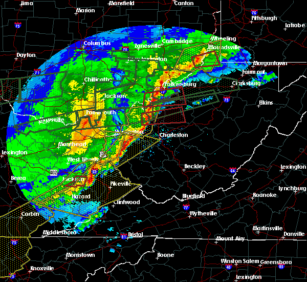 At 934 am est, severe thunderstorms were located along a line extending from near ceredo to near louisa, moving east at 55 mph (radar indicated). Hazards include 70 mph wind gusts and half dollar size hail. Hail damage to vehicles is expected. expect considerable tree damage. wind damage is also likely to mobile homes, roofs, and outbuildings. locations impacted include, huntington, ashland, louisa, coal grove, wayne, chesapeake, proctorville, beech fork state park, barboursville, kenova, ceredo, fort gay, east lynn lake, centerville, dunlow, kiahsville, south point, burlington, lavalette and glenhayes. This includes interstate 64 in west virginia between mile markers 1 and 21. At 934 am est, severe thunderstorms were located along a line extending from near ceredo to near louisa, moving east at 55 mph (radar indicated). Hazards include 70 mph wind gusts and half dollar size hail. Hail damage to vehicles is expected. expect considerable tree damage. wind damage is also likely to mobile homes, roofs, and outbuildings. locations impacted include, huntington, ashland, louisa, coal grove, wayne, chesapeake, proctorville, beech fork state park, barboursville, kenova, ceredo, fort gay, east lynn lake, centerville, dunlow, kiahsville, south point, burlington, lavalette and glenhayes. This includes interstate 64 in west virginia between mile markers 1 and 21.
|
| 3/1/2017 9:28 AM EST |
 At 927 am est, severe thunderstorms were located along a line extending from kenova to near charley, moving east at 55 mph (radar indicated). Hazards include 70 mph wind gusts and half dollar size hail. Hail damage to vehicles is expected. expect considerable tree damage. wind damage is also likely to mobile homes, roofs, and outbuildings. locations impacted include, huntington, ashland, louisa, coal grove, wayne, chesapeake, proctorville, blaine, beech fork state park, cannonsburg, yatesville lake state park, barboursville, kenova, catlettsburg, ceredo, fort gay, webbville, princess, coalton and burnaugh. this includes the following highways, interstate 64 in kentucky between mile markers 181 and 191. Interstate 64 in west virginia between mile markers 1 and 21. At 927 am est, severe thunderstorms were located along a line extending from kenova to near charley, moving east at 55 mph (radar indicated). Hazards include 70 mph wind gusts and half dollar size hail. Hail damage to vehicles is expected. expect considerable tree damage. wind damage is also likely to mobile homes, roofs, and outbuildings. locations impacted include, huntington, ashland, louisa, coal grove, wayne, chesapeake, proctorville, blaine, beech fork state park, cannonsburg, yatesville lake state park, barboursville, kenova, catlettsburg, ceredo, fort gay, webbville, princess, coalton and burnaugh. this includes the following highways, interstate 64 in kentucky between mile markers 181 and 191. Interstate 64 in west virginia between mile markers 1 and 21.
|
| 3/1/2017 9:01 AM EST |
 At 900 am est, severe thunderstorms were located along a line extending from near gesling to sandy hook, moving east at 55 mph (radar indicated). Hazards include 70 mph wind gusts and half dollar size hail. Hail damage to vehicles is expected. expect considerable tree damage. Wind damage is also likely to mobile homes, roofs, and outbuildings. At 900 am est, severe thunderstorms were located along a line extending from near gesling to sandy hook, moving east at 55 mph (radar indicated). Hazards include 70 mph wind gusts and half dollar size hail. Hail damage to vehicles is expected. expect considerable tree damage. Wind damage is also likely to mobile homes, roofs, and outbuildings.
|
| 3/1/2017 9:01 AM EST |
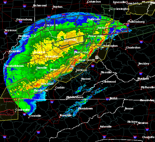 At 900 am est, severe thunderstorms were located along a line extending from near gesling to sandy hook, moving east at 55 mph (radar indicated). Hazards include 70 mph wind gusts and half dollar size hail. Hail damage to vehicles is expected. expect considerable tree damage. Wind damage is also likely to mobile homes, roofs, and outbuildings. At 900 am est, severe thunderstorms were located along a line extending from near gesling to sandy hook, moving east at 55 mph (radar indicated). Hazards include 70 mph wind gusts and half dollar size hail. Hail damage to vehicles is expected. expect considerable tree damage. Wind damage is also likely to mobile homes, roofs, and outbuildings.
|
| 8/16/2016 5:52 PM EDT |
 At 550 pm edt, a severe thunderstorm was located over louisa, moving east northeast at 30 mph (radar indicated). Hazards include 60 mph wind gusts and quarter size hail. Hail damage to vehicles is expected. Expect wind damage to roofs, siding, and trees. At 550 pm edt, a severe thunderstorm was located over louisa, moving east northeast at 30 mph (radar indicated). Hazards include 60 mph wind gusts and quarter size hail. Hail damage to vehicles is expected. Expect wind damage to roofs, siding, and trees.
|
| 8/16/2016 5:52 PM EDT |
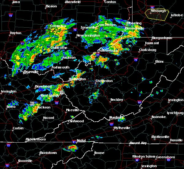 At 550 pm edt, a severe thunderstorm was located over louisa, moving east northeast at 30 mph (radar indicated). Hazards include 60 mph wind gusts and quarter size hail. Hail damage to vehicles is expected. Expect wind damage to roofs, siding, and trees. At 550 pm edt, a severe thunderstorm was located over louisa, moving east northeast at 30 mph (radar indicated). Hazards include 60 mph wind gusts and quarter size hail. Hail damage to vehicles is expected. Expect wind damage to roofs, siding, and trees.
|
| 7/4/2016 3:59 PM EDT |
 At 359 pm edt, a severe thunderstorm was located over fort gay, or over louisa, moving east at 45 mph (radar indicated). Hazards include 70 mph wind gusts. Expect considerable tree damage. damage is likely to mobile homes, roofs, and outbuildings. Locations impacted include, louisa, wayne, hamlin, beech fork state park, milton, fort gay, gill, east lynn lake, spurlockville, harts, dunlow, kiahsville, centerville, ranger, west hamlin, palermo, lavalette, glenhayes, branchland and salt rock. At 359 pm edt, a severe thunderstorm was located over fort gay, or over louisa, moving east at 45 mph (radar indicated). Hazards include 70 mph wind gusts. Expect considerable tree damage. damage is likely to mobile homes, roofs, and outbuildings. Locations impacted include, louisa, wayne, hamlin, beech fork state park, milton, fort gay, gill, east lynn lake, spurlockville, harts, dunlow, kiahsville, centerville, ranger, west hamlin, palermo, lavalette, glenhayes, branchland and salt rock.
|
| 7/4/2016 3:45 PM EDT |
 At 344 pm edt, a severe thunderstorm was located near blaine, moving east at 45 mph (radar indicated). Hazards include 60 mph wind gusts. Expect damage to roofs. siding. And trees. At 344 pm edt, a severe thunderstorm was located near blaine, moving east at 45 mph (radar indicated). Hazards include 60 mph wind gusts. Expect damage to roofs. siding. And trees.
|
| 6/23/2016 4:59 PM EDT |
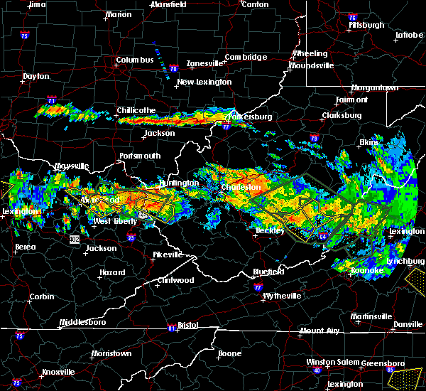 At 458 pm edt, a severe thunderstorm was located near wayne, moving southeast at 35 mph (radar indicated). Hazards include 60 mph wind gusts and quarter size hail. Hail damage to vehicles is expected. expect wind damage to roofs, siding, and trees. locations impacted include, louisa, wayne, fort gay, dunlow, kiahsville, east lynn lake, centerville, genoa and east lynn. A tornado watch remains in effect until 1000 pm edt for northeastern kentucky, and western and central west virginia. At 458 pm edt, a severe thunderstorm was located near wayne, moving southeast at 35 mph (radar indicated). Hazards include 60 mph wind gusts and quarter size hail. Hail damage to vehicles is expected. expect wind damage to roofs, siding, and trees. locations impacted include, louisa, wayne, fort gay, dunlow, kiahsville, east lynn lake, centerville, genoa and east lynn. A tornado watch remains in effect until 1000 pm edt for northeastern kentucky, and western and central west virginia.
|
| 6/23/2016 4:46 PM EDT |
 At 444 pm edt, a severe thunderstorm was located near burnaugh, or near yatesville lake state park, moving southeast at 35 mph (radar indicated). Hazards include 60 mph wind gusts and quarter size hail. Hail damage to vehicles is expected. Expect wind damage to roofs, siding, and trees. At 444 pm edt, a severe thunderstorm was located near burnaugh, or near yatesville lake state park, moving southeast at 35 mph (radar indicated). Hazards include 60 mph wind gusts and quarter size hail. Hail damage to vehicles is expected. Expect wind damage to roofs, siding, and trees.
|
| 6/23/2016 7:22 AM EDT |
 At 721 am edt, severe thunderstorms were located along a line extending from near milton to near culver, moving southeast at 45 mph (radar indicated). Hazards include 60 mph wind gusts. Expect damage to roofs. siding. and trees. locations impacted include, nitro, madison, louisa, wayne, hamlin, blaine, beech fork state park, yatesville lake state park, south charleston, st. Albans, hurricane, barboursville, milton, chapmanville, fort gay, durbin, ulysses, kiahsville, centerville and charley. At 721 am edt, severe thunderstorms were located along a line extending from near milton to near culver, moving southeast at 45 mph (radar indicated). Hazards include 60 mph wind gusts. Expect damage to roofs. siding. and trees. locations impacted include, nitro, madison, louisa, wayne, hamlin, blaine, beech fork state park, yatesville lake state park, south charleston, st. Albans, hurricane, barboursville, milton, chapmanville, fort gay, durbin, ulysses, kiahsville, centerville and charley.
|
| 6/23/2016 6:58 AM EDT |
 At 658 am edt, severe thunderstorms were located along a line extending from 14 miles east of lake vesuvius to near farley, moving southeast at 45 mph (radar indicated). Hazards include 60 mph wind gusts. Expect damage to roofs. siding. And trees. At 658 am edt, severe thunderstorms were located along a line extending from 14 miles east of lake vesuvius to near farley, moving southeast at 45 mph (radar indicated). Hazards include 60 mph wind gusts. Expect damage to roofs. siding. And trees.
|
| 6/23/2016 6:17 AM EDT |
 At 616 am edt, severe thunderstorms were located along a line extending from near jackson to 9 miles west of lucasville to near tollesboro, moving southeast at 50 mph (radar indicated). Hazards include 60 mph wind gusts. Expect damage to roofs. siding. And trees. At 616 am edt, severe thunderstorms were located along a line extending from near jackson to 9 miles west of lucasville to near tollesboro, moving southeast at 50 mph (radar indicated). Hazards include 60 mph wind gusts. Expect damage to roofs. siding. And trees.
|
| 6/21/2016 4:10 PM EDT |
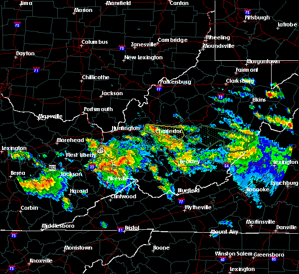 The severe thunderstorm warning for southeastern lawrence and southwestern wayne counties will expire at 415 pm edt, the storm which prompted the warning has weakened below severe limits, and no longer pose an immediate threat to life or property. therefore, the warning will be allowed to expire. however gusty winds and heavy rain are still possible with this thunderstorm. a severe thunderstorm watch remains in effect until 1000 pm edt for northeastern kentucky, and western west virginia. The severe thunderstorm warning for southeastern lawrence and southwestern wayne counties will expire at 415 pm edt, the storm which prompted the warning has weakened below severe limits, and no longer pose an immediate threat to life or property. therefore, the warning will be allowed to expire. however gusty winds and heavy rain are still possible with this thunderstorm. a severe thunderstorm watch remains in effect until 1000 pm edt for northeastern kentucky, and western west virginia.
|
| 6/21/2016 4:10 PM EDT | The severe thunderstorm warning for southeastern lawrence and southwestern wayne counties will expire at 415 pm edt, the storm which prompted the warning has weakened below severe limits, and no longer pose an immediate threat to life or property. therefore, the warning will be allowed to expire. however gusty winds and heavy rain are still possible with this thunderstorm. a severe thunderstorm watch remains in effect until 1000 pm edt for northeastern kentucky, and western west virginia. |
| 6/21/2016 3:51 PM EDT |
 At 351 pm edt, a severe thunderstorm was located near louisa, moving southeast at 30 mph (radar indicated). Hazards include 60 mph wind gusts and quarter size hail. Hail damage to vehicles is expected. expect wind damage to roofs, siding, and trees. Locations impacted include, louisa, fort gay, dunlow, gallup, glenhayes, clifford, crum and genoa. At 351 pm edt, a severe thunderstorm was located near louisa, moving southeast at 30 mph (radar indicated). Hazards include 60 mph wind gusts and quarter size hail. Hail damage to vehicles is expected. expect wind damage to roofs, siding, and trees. Locations impacted include, louisa, fort gay, dunlow, gallup, glenhayes, clifford, crum and genoa.
|
| 6/21/2016 3:51 PM EDT |
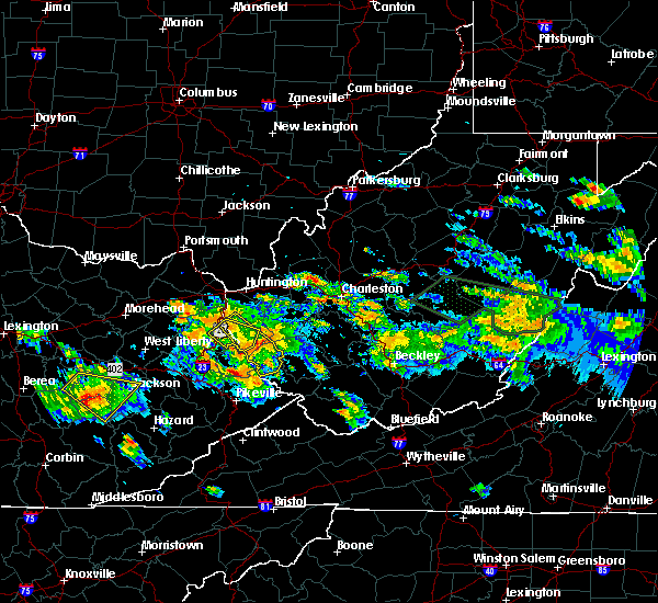 At 351 pm edt, a severe thunderstorm was located near louisa, moving southeast at 30 mph (radar indicated). Hazards include 60 mph wind gusts and quarter size hail. Hail damage to vehicles is expected. expect wind damage to roofs, siding, and trees. Locations impacted include, louisa, fort gay, dunlow, gallup, glenhayes, clifford, crum and genoa. At 351 pm edt, a severe thunderstorm was located near louisa, moving southeast at 30 mph (radar indicated). Hazards include 60 mph wind gusts and quarter size hail. Hail damage to vehicles is expected. expect wind damage to roofs, siding, and trees. Locations impacted include, louisa, fort gay, dunlow, gallup, glenhayes, clifford, crum and genoa.
|
| 6/21/2016 3:31 PM EDT |
 At 331 pm edt, a severe thunderstorm was located near yatesville lake state park, moving southeast at 30 mph (radar indicated). Hazards include ping pong ball size hail and 60 mph wind gusts. People and animals outdoors will be injured. expect hail damage to roofs, siding, windows, and vehicles. Expect wind damage to roofs, siding, and trees. At 331 pm edt, a severe thunderstorm was located near yatesville lake state park, moving southeast at 30 mph (radar indicated). Hazards include ping pong ball size hail and 60 mph wind gusts. People and animals outdoors will be injured. expect hail damage to roofs, siding, windows, and vehicles. Expect wind damage to roofs, siding, and trees.
|
| 6/21/2016 3:31 PM EDT |
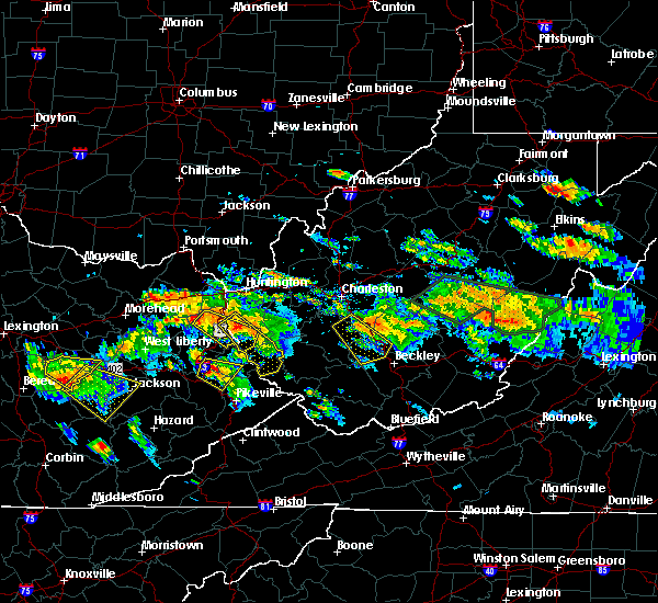 At 331 pm edt, a severe thunderstorm was located near yatesville lake state park, moving southeast at 30 mph (radar indicated). Hazards include ping pong ball size hail and 60 mph wind gusts. People and animals outdoors will be injured. expect hail damage to roofs, siding, windows, and vehicles. Expect wind damage to roofs, siding, and trees. At 331 pm edt, a severe thunderstorm was located near yatesville lake state park, moving southeast at 30 mph (radar indicated). Hazards include ping pong ball size hail and 60 mph wind gusts. People and animals outdoors will be injured. expect hail damage to roofs, siding, windows, and vehicles. Expect wind damage to roofs, siding, and trees.
|
| 6/21/2016 3:14 PM EDT |
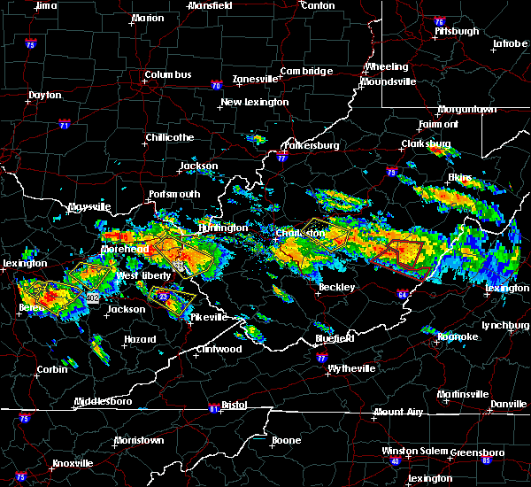 At 314 pm edt, a severe thunderstorm was located near fort gay, or near louisa, moving southeast at 30 mph (radar indicated). Hazards include 60 mph wind gusts and quarter size hail. Hail damage to vehicles is expected. Expect wind damage to roofs, siding, and trees. At 314 pm edt, a severe thunderstorm was located near fort gay, or near louisa, moving southeast at 30 mph (radar indicated). Hazards include 60 mph wind gusts and quarter size hail. Hail damage to vehicles is expected. Expect wind damage to roofs, siding, and trees.
|
| 6/21/2016 2:39 PM EDT |
 At 239 pm edt, a severe thunderstorm was located over oldtown, or 7 miles north of grayson, moving southeast at 35 mph (radar indicated). Hazards include two inch hail and 70 mph wind gusts. People and animals outdoors will be injured. expect hail damage to roofs, siding, windows, and vehicles. expect considerable tree damage. Wind damage is also likely to mobile homes, roofs, and outbuildings. At 239 pm edt, a severe thunderstorm was located over oldtown, or 7 miles north of grayson, moving southeast at 35 mph (radar indicated). Hazards include two inch hail and 70 mph wind gusts. People and animals outdoors will be injured. expect hail damage to roofs, siding, windows, and vehicles. expect considerable tree damage. Wind damage is also likely to mobile homes, roofs, and outbuildings.
|
| 5/1/2016 5:42 PM EDT |
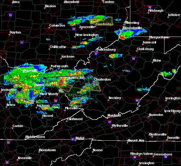 At 541 pm edt, a severe thunderstorm was located near burnaugh, or near yatesville lake state park, moving east at 35 mph (radar indicated). Hazards include 60 mph wind gusts and half dollar size hail. Hail damage to vehicles is expected. expect wind damage to roofs, siding, and trees. Locations impacted include, wayne, east lynn lake, burnaugh, durbin, centerville, buchanan, fallsburg, genoa and east lynn. At 541 pm edt, a severe thunderstorm was located near burnaugh, or near yatesville lake state park, moving east at 35 mph (radar indicated). Hazards include 60 mph wind gusts and half dollar size hail. Hail damage to vehicles is expected. expect wind damage to roofs, siding, and trees. Locations impacted include, wayne, east lynn lake, burnaugh, durbin, centerville, buchanan, fallsburg, genoa and east lynn.
|
| 5/1/2016 5:24 PM EDT |
 At 523 pm edt, a severe thunderstorm was located near denton, or 8 miles northwest of yatesville lake state park, moving southeast at 35 mph (radar indicated). Hazards include golf ball size hail and 60 mph wind gusts. People and animals outdoors will be injured. expect hail damage to roofs, siding, windows, and vehicles. Expect wind damage to roofs, siding, and trees. At 523 pm edt, a severe thunderstorm was located near denton, or 8 miles northwest of yatesville lake state park, moving southeast at 35 mph (radar indicated). Hazards include golf ball size hail and 60 mph wind gusts. People and animals outdoors will be injured. expect hail damage to roofs, siding, windows, and vehicles. Expect wind damage to roofs, siding, and trees.
|
| 5/1/2016 5:24 PM EDT |
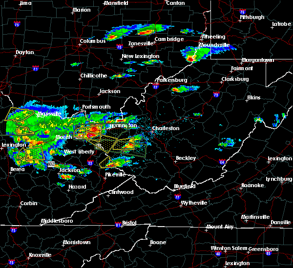 At 523 pm edt, a severe thunderstorm was located near denton, or 8 miles northwest of yatesville lake state park, moving southeast at 35 mph (radar indicated). Hazards include golf ball size hail and 60 mph wind gusts. People and animals outdoors will be injured. expect hail damage to roofs, siding, windows, and vehicles. Expect wind damage to roofs, siding, and trees. At 523 pm edt, a severe thunderstorm was located near denton, or 8 miles northwest of yatesville lake state park, moving southeast at 35 mph (radar indicated). Hazards include golf ball size hail and 60 mph wind gusts. People and animals outdoors will be injured. expect hail damage to roofs, siding, windows, and vehicles. Expect wind damage to roofs, siding, and trees.
|
| 5/1/2016 4:30 PM EDT |
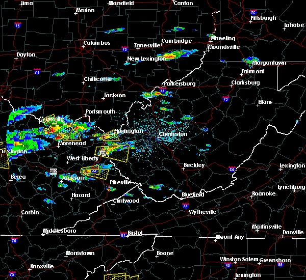 At 430 pm edt, a severe thunderstorm was located near fort gay, or near louisa, moving east at 20 mph (radar indicated). Hazards include 60 mph wind gusts and quarter size hail. Hail damage to vehicles is expected. expect wind damage to roofs, siding, and trees. Locations impacted include, louisa, fort gay, dunlow, kiahsville, east lynn lake, ranger, harts, glenhayes, clifford, wilsondale, genoa and east lynn. At 430 pm edt, a severe thunderstorm was located near fort gay, or near louisa, moving east at 20 mph (radar indicated). Hazards include 60 mph wind gusts and quarter size hail. Hail damage to vehicles is expected. expect wind damage to roofs, siding, and trees. Locations impacted include, louisa, fort gay, dunlow, kiahsville, east lynn lake, ranger, harts, glenhayes, clifford, wilsondale, genoa and east lynn.
|
| 5/1/2016 4:07 PM EDT |
 At 407 pm edt, a severe thunderstorm was located near louisa, moving east at 35 mph (radar indicated). Hazards include 60 mph wind gusts and quarter size hail. Hail damage to vehicles is expected. Expect wind damage to roofs, siding, and trees. At 407 pm edt, a severe thunderstorm was located near louisa, moving east at 35 mph (radar indicated). Hazards include 60 mph wind gusts and quarter size hail. Hail damage to vehicles is expected. Expect wind damage to roofs, siding, and trees.
|
| 5/1/2016 4:07 PM EDT |
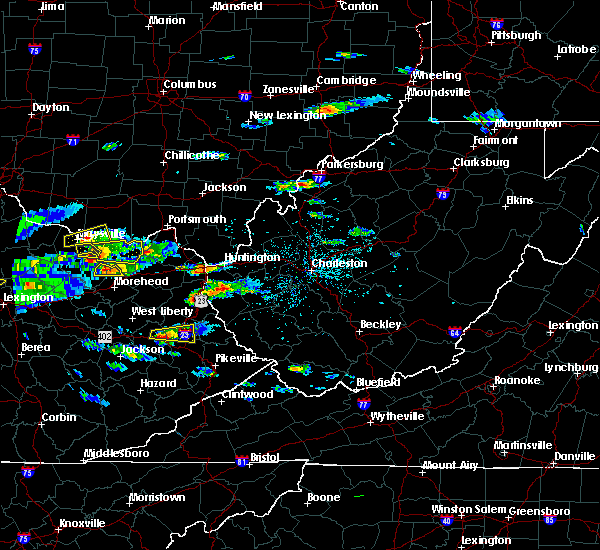 At 407 pm edt, a severe thunderstorm was located near louisa, moving east at 35 mph (radar indicated). Hazards include 60 mph wind gusts and quarter size hail. Hail damage to vehicles is expected. Expect wind damage to roofs, siding, and trees. At 407 pm edt, a severe thunderstorm was located near louisa, moving east at 35 mph (radar indicated). Hazards include 60 mph wind gusts and quarter size hail. Hail damage to vehicles is expected. Expect wind damage to roofs, siding, and trees.
|
| 5/1/2016 3:43 PM EDT | The severe thunderstorm warning for northern lawrence and west central wayne counties will expire at 345 pm edt, the storm which prompted the warning has weakened below severe limits, and no longer poses an immediate threat to life or property. therefore the warning will be allowed to expire. however small hail and heavy rain are still possible with this thunderstorm. |
| 5/1/2016 3:43 PM EDT | The severe thunderstorm warning for northern lawrence and west central wayne counties will expire at 345 pm edt, the storm which prompted the warning has weakened below severe limits, and no longer poses an immediate threat to life or property. therefore the warning will be allowed to expire. however small hail and heavy rain are still possible with this thunderstorm. |
| 5/1/2016 3:36 PM EDT |
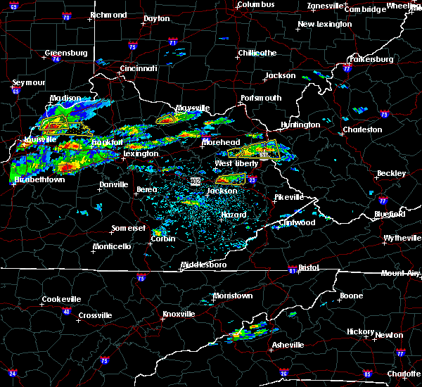 At 335 pm edt, a severe thunderstorm was located over wayne, moving east (radar indicated). Hazards include 60 mph wind gusts and quarter size hail. Hail damage to vehicles is expected. expect wind damage to roofs, siding, and trees. locations impacted include, louisa, yatesville lake state park, fort gay, webbville, centerville, buchanan, fallsburg, houckville and genoa. Time, mot, loc 1935z 248deg 201kt 3823 8249. At 335 pm edt, a severe thunderstorm was located over wayne, moving east (radar indicated). Hazards include 60 mph wind gusts and quarter size hail. Hail damage to vehicles is expected. expect wind damage to roofs, siding, and trees. locations impacted include, louisa, yatesville lake state park, fort gay, webbville, centerville, buchanan, fallsburg, houckville and genoa. Time, mot, loc 1935z 248deg 201kt 3823 8249.
|
| 5/1/2016 3:22 PM EDT |
 At 322 pm edt, a severe thunderstorm was located near webbville, or 7 miles northwest of blaine, moving east at 60 mph (radar indicated). Hazards include 60 mph wind gusts and quarter size hail. Hail damage to vehicles is expected. Expect wind damage to roofs, siding, and trees. At 322 pm edt, a severe thunderstorm was located near webbville, or 7 miles northwest of blaine, moving east at 60 mph (radar indicated). Hazards include 60 mph wind gusts and quarter size hail. Hail damage to vehicles is expected. Expect wind damage to roofs, siding, and trees.
|
| 5/1/2016 3:22 PM EDT |
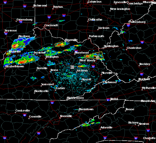 At 322 pm edt, a severe thunderstorm was located near webbville, or 7 miles northwest of blaine, moving east at 60 mph (radar indicated). Hazards include 60 mph wind gusts and quarter size hail. Hail damage to vehicles is expected. Expect wind damage to roofs, siding, and trees. At 322 pm edt, a severe thunderstorm was located near webbville, or 7 miles northwest of blaine, moving east at 60 mph (radar indicated). Hazards include 60 mph wind gusts and quarter size hail. Hail damage to vehicles is expected. Expect wind damage to roofs, siding, and trees.
|
| 7/14/2015 6:25 PM EDT |
 At 624 pm edt, doppler radar indicated a line of severe thunderstorms capable of producing damaging winds in excess of 60 mph. these storms were located along a line extending from near chesapeake to near ranger to near webbville, moving southeast at 35 mph. locations impacted include, madison, louisa, blaine, yatesville lake state park, oak hill, chesapeake, marmet, mount hope, belle, chapmanville, east bank, fort gay, wharton, ulysses, kiahsville, charley, east lynn lake, chief logan state, powellton and spurlockville. At 624 pm edt, doppler radar indicated a line of severe thunderstorms capable of producing damaging winds in excess of 60 mph. these storms were located along a line extending from near chesapeake to near ranger to near webbville, moving southeast at 35 mph. locations impacted include, madison, louisa, blaine, yatesville lake state park, oak hill, chesapeake, marmet, mount hope, belle, chapmanville, east bank, fort gay, wharton, ulysses, kiahsville, charley, east lynn lake, chief logan state, powellton and spurlockville.
|
| 7/14/2015 5:52 PM EDT |
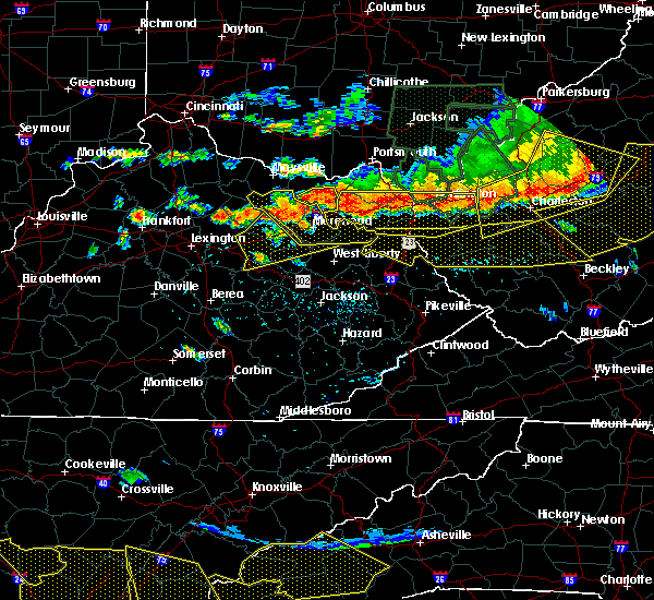 At 549 pm edt, doppler radar indicated a line of severe thunderstorms capable of producing damaging winds in excess of 60 mph. these storms were located along a line extending from culloden to princess to near olive hill, moving south at 35 mph. locations impacted include, huntington, ashland, grayson, louisa, coal grove, olive hill, wayne, hamlin, chesapeake, proctorville, beech fork state park, cannonsburg, carter caves state park, grayson lake state park, yatesville lake state park, barboursville, kenova, milton, catlettsburg and ceredo. At 549 pm edt, doppler radar indicated a line of severe thunderstorms capable of producing damaging winds in excess of 60 mph. these storms were located along a line extending from culloden to princess to near olive hill, moving south at 35 mph. locations impacted include, huntington, ashland, grayson, louisa, coal grove, olive hill, wayne, hamlin, chesapeake, proctorville, beech fork state park, cannonsburg, carter caves state park, grayson lake state park, yatesville lake state park, barboursville, kenova, milton, catlettsburg and ceredo.
|
| 7/14/2015 5:43 PM EDT |
 At 542 pm edt, doppler radar indicated a line of severe thunderstorms capable of producing damaging winds in excess of 70 mph. these storms were located along a line extending from near culloden to near catlettsburg to carter caves state park, and moving southeast at 60 mph. At 542 pm edt, doppler radar indicated a line of severe thunderstorms capable of producing damaging winds in excess of 70 mph. these storms were located along a line extending from near culloden to near catlettsburg to carter caves state park, and moving southeast at 60 mph.
|
| 7/14/2015 5:11 PM EDT |
 At 509 pm edt, doppler radar indicated a line of severe thunderstorms capable of producing damaging winds in excess of 60 mph. these storms were located along a line extending from south shore to near vanceburg to near manchester, and moving southeast at 55 mph. At 509 pm edt, doppler radar indicated a line of severe thunderstorms capable of producing damaging winds in excess of 60 mph. these storms were located along a line extending from south shore to near vanceburg to near manchester, and moving southeast at 55 mph.
|
| 7/13/2015 4:12 PM EDT |
 At 412 pm edt, doppler radar indicated a severe thunderstorm capable of producing damaging winds in excess of 60 mph. this storm was located near dunlow, or 14 miles south of wayne, moving southeast at 50 mph. locations impacted include, louisa, fort gay, charley, dunlow, ulysses, kiahsville, hode, gallup, clifford, glenhayes, wilsondale, crum and genoa. At 412 pm edt, doppler radar indicated a severe thunderstorm capable of producing damaging winds in excess of 60 mph. this storm was located near dunlow, or 14 miles south of wayne, moving southeast at 50 mph. locations impacted include, louisa, fort gay, charley, dunlow, ulysses, kiahsville, hode, gallup, clifford, glenhayes, wilsondale, crum and genoa.
|
| 7/13/2015 4:12 PM EDT |
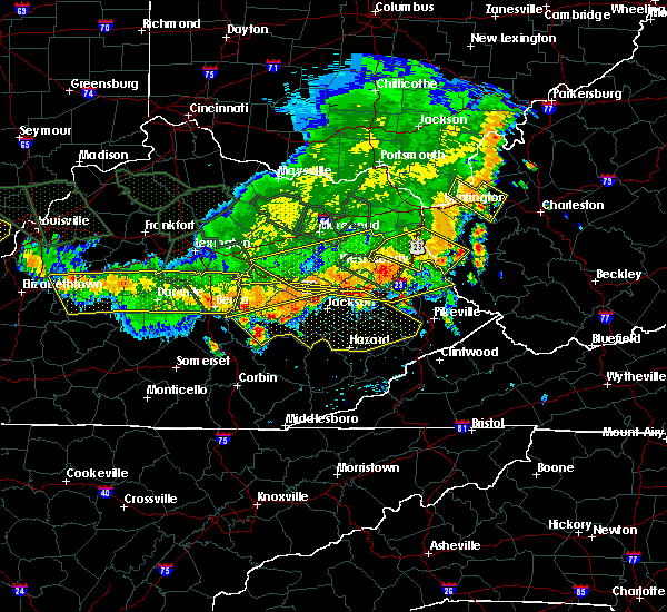 At 412 pm edt, doppler radar indicated a severe thunderstorm capable of producing damaging winds in excess of 60 mph. this storm was located near dunlow, or 14 miles south of wayne, moving southeast at 50 mph. locations impacted include, louisa, fort gay, charley, dunlow, ulysses, kiahsville, hode, gallup, clifford, glenhayes, wilsondale, crum and genoa. At 412 pm edt, doppler radar indicated a severe thunderstorm capable of producing damaging winds in excess of 60 mph. this storm was located near dunlow, or 14 miles south of wayne, moving southeast at 50 mph. locations impacted include, louisa, fort gay, charley, dunlow, ulysses, kiahsville, hode, gallup, clifford, glenhayes, wilsondale, crum and genoa.
|
| 7/13/2015 3:44 PM EDT |
 At 343 pm edt, doppler radar indicated a severe thunderstorm capable of producing damaging winds in excess of 60 mph. this storm was located near yatesville lake state park, and moving southeast at 50 mph. At 343 pm edt, doppler radar indicated a severe thunderstorm capable of producing damaging winds in excess of 60 mph. this storm was located near yatesville lake state park, and moving southeast at 50 mph.
|
| 6/25/2015 6:55 PM EDT |
 At 654 pm edt, doppler radar indicated a severe thunderstorm capable of producing large hail up to ping pong ball size and damaging winds in excess of 60 mph. this storm was located over yatesville lake state park, and moving southeast at 30 mph. At 654 pm edt, doppler radar indicated a severe thunderstorm capable of producing large hail up to ping pong ball size and damaging winds in excess of 60 mph. this storm was located over yatesville lake state park, and moving southeast at 30 mph.
|
| 6/25/2015 6:55 PM EDT |
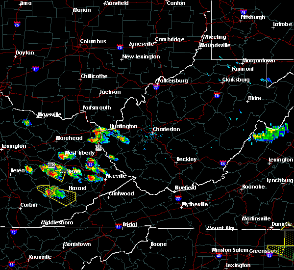 At 654 pm edt, doppler radar indicated a severe thunderstorm capable of producing large hail up to ping pong ball size and damaging winds in excess of 60 mph. this storm was located over yatesville lake state park, and moving southeast at 30 mph. At 654 pm edt, doppler radar indicated a severe thunderstorm capable of producing large hail up to ping pong ball size and damaging winds in excess of 60 mph. this storm was located over yatesville lake state park, and moving southeast at 30 mph.
|
| 6/18/2015 3:47 PM EDT | At 345 pm edt, doppler radar indicated a severe thunderstorm capable of producing quarter size hail and damaging winds in excess of 60 mph. this storm was located over kiahsville, or 9 miles south of wayne, moving east at 30 mph. locations impacted include, louisa, wayne, hamlin, blaine, beech fork state park, yatesville lake state park, chapmanville, fort gay, ulysses, kiahsville, centerville, ranger, charley, gill, east lynn lake, spurlockville, harts, martha, dunlow and burnaugh. additional strengthening thunderstorms were moving into western lawrence county which may also reach severe limits as them move east across the warned area. |
| 6/18/2015 3:47 PM EDT | At 345 pm edt, doppler radar indicated a severe thunderstorm capable of producing quarter size hail and damaging winds in excess of 60 mph. this storm was located over kiahsville, or 9 miles south of wayne, moving east at 30 mph. locations impacted include, louisa, wayne, hamlin, blaine, beech fork state park, yatesville lake state park, chapmanville, fort gay, ulysses, kiahsville, centerville, ranger, charley, gill, east lynn lake, spurlockville, harts, martha, dunlow and burnaugh. additional strengthening thunderstorms were moving into western lawrence county which may also reach severe limits as them move east across the warned area. |
| 6/18/2015 3:19 PM EDT | At 319 pm edt, doppler radar indicated a severe thunderstorm capable of producing quarter size hail and damaging winds in excess of 60 mph. this storm was located over louisa, and moving east at 30 mph. |
| 6/18/2015 3:19 PM EDT | At 319 pm edt, doppler radar indicated a severe thunderstorm capable of producing quarter size hail and damaging winds in excess of 60 mph. this storm was located over louisa, and moving east at 30 mph. |
| 6/8/2015 1:17 PM EDT |
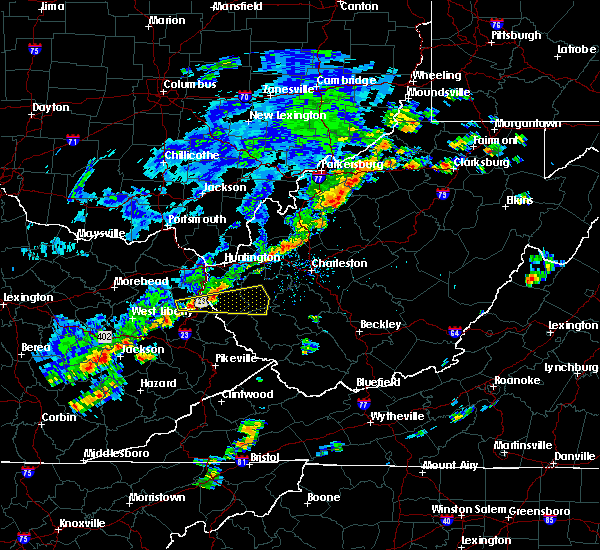 At 114 pm edt, doppler radar indicated a severe thunderstorm capable of producing damaging winds in excess of 60 mph. this storm was located near louisa, moving east at 45 mph. penny size hail may also accompany the damaging winds. in addition, at 1255 pm penny size hail and tree damage was reported 5 miles east northeast of blaine in lawrence county. locations impacted include, louisa, fort gay, gill, east lynn lake, harts, dunlow, kiahsville, ranger, palermo, gallup, clifford, glenhayes and genoa. At 114 pm edt, doppler radar indicated a severe thunderstorm capable of producing damaging winds in excess of 60 mph. this storm was located near louisa, moving east at 45 mph. penny size hail may also accompany the damaging winds. in addition, at 1255 pm penny size hail and tree damage was reported 5 miles east northeast of blaine in lawrence county. locations impacted include, louisa, fort gay, gill, east lynn lake, harts, dunlow, kiahsville, ranger, palermo, gallup, clifford, glenhayes and genoa.
|
| 6/8/2015 12:52 PM EDT |
 At 1251 pm edt, doppler radar indicated a severe thunderstorm capable of producing quarter size hail and damaging winds in excess of 60 mph. this storm was located over keaton, or near blaine, and moving east at 45 mph. At 1251 pm edt, doppler radar indicated a severe thunderstorm capable of producing quarter size hail and damaging winds in excess of 60 mph. this storm was located over keaton, or near blaine, and moving east at 45 mph.
|
| 6/8/2015 12:52 PM EDT |
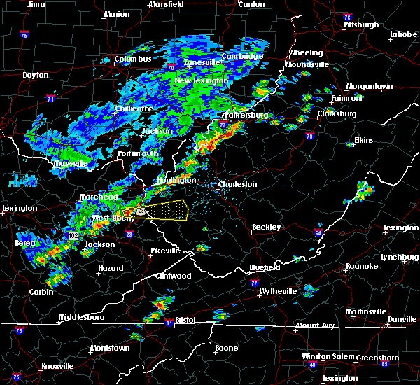 At 1251 pm edt, doppler radar indicated a severe thunderstorm capable of producing quarter size hail and damaging winds in excess of 60 mph. this storm was located over keaton, or near blaine, and moving east at 45 mph. At 1251 pm edt, doppler radar indicated a severe thunderstorm capable of producing quarter size hail and damaging winds in excess of 60 mph. this storm was located over keaton, or near blaine, and moving east at 45 mph.
|
| 5/11/2015 4:58 PM EDT | At 456 pm edt, national weather service doppler radar indicated a severe thunderstorm capable of producing quarter size hail, and damaging winds in excess of 60 mph. this storm was located near fort gay, or near louisa, moving northeast at 35 mph. * other locations in the warning include but are not limited to ona, east lynn lake, milton and barboursville. this will impact the following interstate, i-64 between mile markers 19 and 26 in west virginia. doppler radar has indicated some weak rotation within this storm. while not immediately likely, a tornado may still develop. if a tornado is spotted, act quickly and move to a place of safety in a sturdy structure, such as a basement or small interior room. a severe thunderstorm watch remains in effect until 1000 pm edt monday evening for central kentucky and southeast ohio and central west virginia. please report hail or strong wind to the national weather service by calling toll free, 800-401-9535, when you can do so safely. you may also report severe weather by posting your report to the charleston west virginia national weather service facebook page, or by using the twitter hashtag, nwsrlx. |
| 4/8/2015 3:01 PM EDT | A severe thunderstorm warning remains in effect until 315 pm edt for southern lawrence county in kentucky. and southern wayne county in west virginia. at 248 pm edt. a severe thunderstorm was reported capable of producing quarter size hail. and damaging winds in excess of 60 mph. This storm was located near blaine and near the johnson county. |
| 4/8/2015 3:01 PM EDT | A severe thunderstorm warning remains in effect until 315 pm edt for southern lawrence county in kentucky. and southern wayne county in west virginia. at 248 pm edt. a severe thunderstorm was reported capable of producing quarter size hail. and damaging winds in excess of 60 mph. This storm was located near blaine and near the johnson county. |
| 4/8/2015 2:36 PM EDT | A severe thunderstorm warning remains in effect until 315 pm edt for lawrence county in kentucky. and southern wayne county in west virginia. at 227 pm edt. national weather service doppler radar continued to indicate a severe thunderstorm capable of producing half dollar size hail. and damaging winds in excess of 60 mph. The strongest. |
| 4/8/2015 2:36 PM EDT | A severe thunderstorm warning remains in effect until 315 pm edt for lawrence county in kentucky. and southern wayne county in west virginia. at 227 pm edt. national weather service doppler radar continued to indicate a severe thunderstorm capable of producing half dollar size hail. and damaging winds in excess of 60 mph. The strongest. |
| 4/8/2015 2:13 PM EDT | The national weather service in charleston has issued a * severe thunderstorm warning for. lawrence county in kentucky. this includes the cities of. yatesville lake state park. louisa. blaine. Wayne county in west virginia. |
| 4/8/2015 2:13 PM EDT | The national weather service in charleston has issued a * severe thunderstorm warning for. lawrence county in kentucky. this includes the cities of. yatesville lake state park. louisa. blaine. Wayne county in west virginia. |
| 2/21/2014 1:24 AM EST | Multiple trees down in fort ga in wayne county WV, 0.4 miles W of Fort Gay, WV |
| 6/22/2012 2:38 PM EDT | Tree down near 2944 dontha in wayne county WV, 9.7 miles WNW of Fort Gay, WV |
| 1/1/0001 12:00 AM | Golf Ball sized hail reported 3.7 miles SW of Fort Gay, WV |
| 1/1/0001 12:00 AM | Golf Ball sized hail reported 0.4 miles W of Fort Gay, WV |
| 1/1/0001 12:00 AM | Tree down along rt 37. timed from rada in wayne county WV, 0.9 miles W of Fort Gay, WV |
Hail Maps for Fort Gay, WV


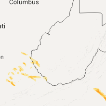


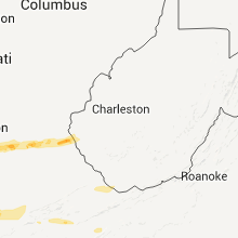
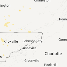
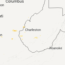


Connect with Interactive Hail Maps