

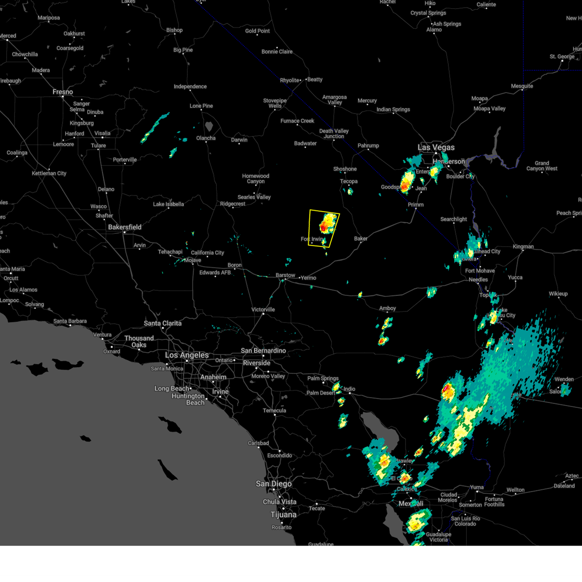
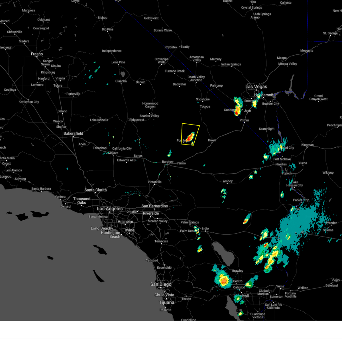
Hail Map for Fort Irwin, CA
The Fort Irwin, CA area has had 0 reports of on-the-ground hail by trained spotters, and has been under severe weather warnings 6 times during the past 12 months. Doppler radar has detected hail at or near Fort Irwin, CA on 3 occasions, including 1 occasion during the past year.
| Name: | Fort Irwin, CA |
| Where Located: | 79.3 miles N of Yucca Valley, CA |
| Map: | Google Map for Fort Irwin, CA |
| Population: | 8845 |
| Housing Units: | 2487 |
| More Info: | Search Google for Fort Irwin, CA |
0
The Top Recent Hail Date for Fort Irwin, CA is Friday, September 1, 2023 (3rd out of 3)

Hail and Wind Damage Spotted near Fort Irwin, CA
| Date / Time | Report Details |
|---|---|
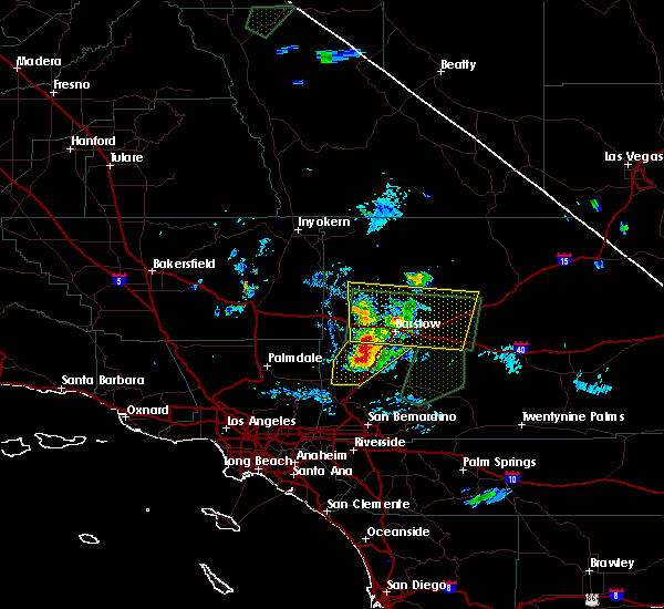
| 9/1/2023 3:11 PM PDT |
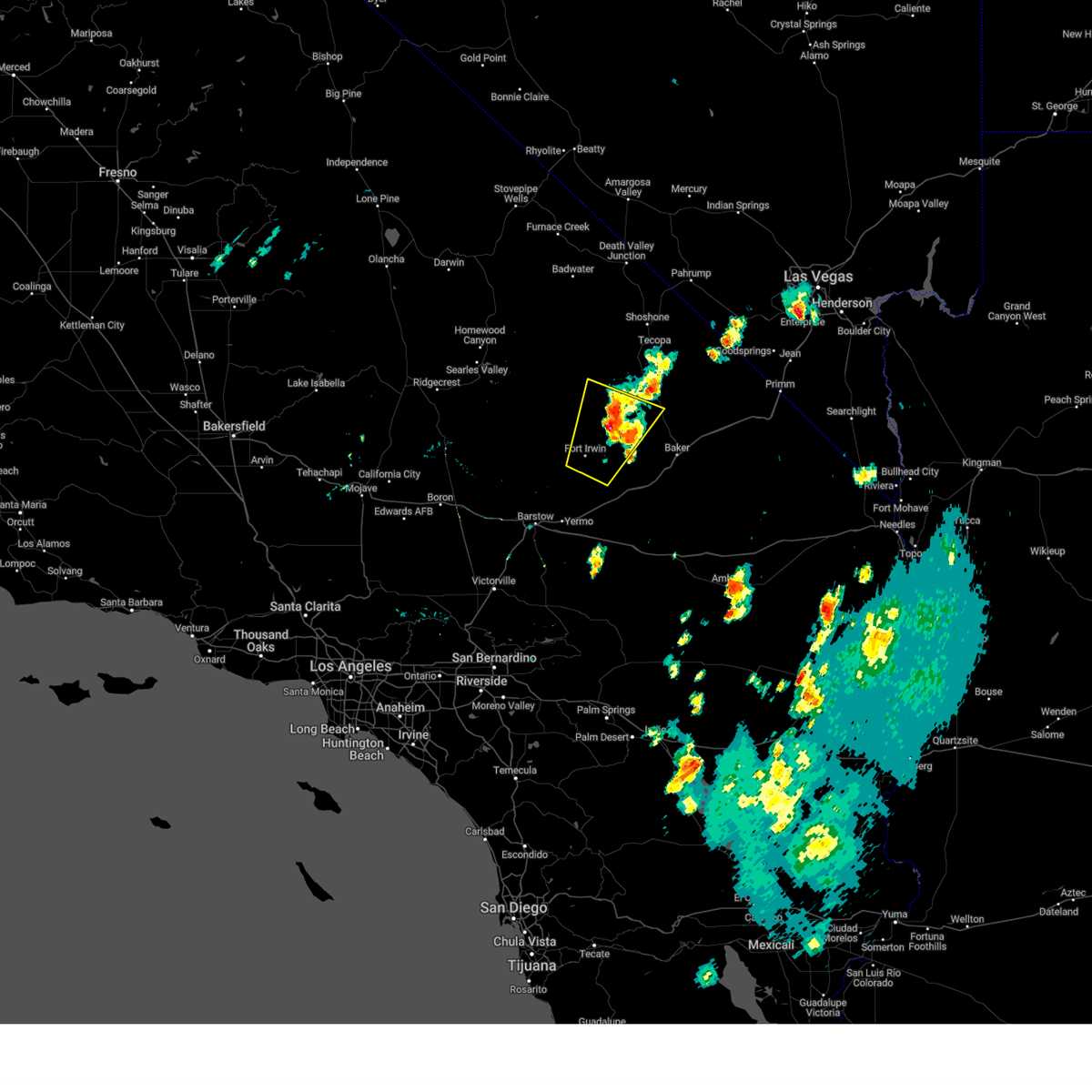 The severe thunderstorm warning for north central san bernardino county will expire at 315 pm pdt, the storm which prompted the warning has weakened below severe limits, and no longer poses an immediate threat to life or property. therefore, the warning will be allowed to expire. The severe thunderstorm warning for north central san bernardino county will expire at 315 pm pdt, the storm which prompted the warning has weakened below severe limits, and no longer poses an immediate threat to life or property. therefore, the warning will be allowed to expire.
|
| 9/1/2023 2:38 PM PDT |
 At 238 pm pdt, a severe thunderstorm was located near fort irwin, moving northeast at 10 mph (radar indicated). Hazards include 60 mph wind gusts. Expect damage to roofs and trees. locations impacted include, fort irwin and bicycle lake. this includes state route 127 in san bernardino county near mile marker 19. hail threat, radar indicated max hail size, <. 75 in wind threat, radar indicated max wind gust, 60 mph. At 238 pm pdt, a severe thunderstorm was located near fort irwin, moving northeast at 10 mph (radar indicated). Hazards include 60 mph wind gusts. Expect damage to roofs and trees. locations impacted include, fort irwin and bicycle lake. this includes state route 127 in san bernardino county near mile marker 19. hail threat, radar indicated max hail size, <. 75 in wind threat, radar indicated max wind gust, 60 mph.
|
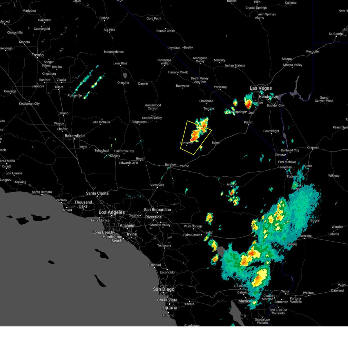
| 9/1/2023 2:23 PM PDT |
 At 222 pm pdt, a severe thunderstorm was located near fort irwin, moving northeast at 10 mph (radar indicated). Hazards include 60 mph wind gusts. expect damage to roofs and trees At 222 pm pdt, a severe thunderstorm was located near fort irwin, moving northeast at 10 mph (radar indicated). Hazards include 60 mph wind gusts. expect damage to roofs and trees
|
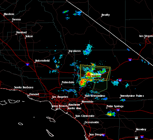
| 9/1/2023 2:06 PM PDT |
 The severe thunderstorm warning for north central san bernardino county will expire at 215 pm pdt, the storm which prompted the warning has weakened below severe limits, and no longer poses an immediate threat to life or property. therefore, the warning will be allowed to expire. however gusty winds and heavy rain are still possible with this thunderstorm. The severe thunderstorm warning for north central san bernardino county will expire at 215 pm pdt, the storm which prompted the warning has weakened below severe limits, and no longer poses an immediate threat to life or property. therefore, the warning will be allowed to expire. however gusty winds and heavy rain are still possible with this thunderstorm.
|
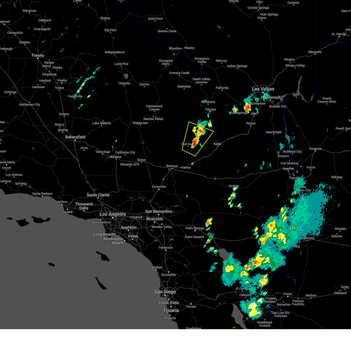
| 9/1/2023 1:52 PM PDT |
 At 152 pm pdt, a severe thunderstorm was located 10 miles northeast of fort irwin, moving north at 15 mph (radar indicated). Hazards include 70 mph wind gusts and quarter size hail. Hail damage to vehicles is expected. expect considerable tree damage. wind damage is also likely to mobile homes, roofs, and outbuildings. locations impacted include, fort irwin. thunderstorm damage threat, considerable hail threat, radar indicated max hail size, 1. 00 in wind threat, radar indicated max wind gust, 70 mph. At 152 pm pdt, a severe thunderstorm was located 10 miles northeast of fort irwin, moving north at 15 mph (radar indicated). Hazards include 70 mph wind gusts and quarter size hail. Hail damage to vehicles is expected. expect considerable tree damage. wind damage is also likely to mobile homes, roofs, and outbuildings. locations impacted include, fort irwin. thunderstorm damage threat, considerable hail threat, radar indicated max hail size, 1. 00 in wind threat, radar indicated max wind gust, 70 mph.
|
| 9/1/2023 1:37 PM PDT |
 At 136 pm pdt, a severe thunderstorm was located 7 miles northeast of fort irwin, moving north at 15 mph. this is a destructive storm for fort irwin and bicycle lake army airfield (radar indicated). Hazards include 80 mph wind gusts and quarter size hail. Flying debris will be dangerous to those caught without shelter. mobile homes will be heavily damaged. expect considerable damage to roofs, windows, and vehicles. Extensive tree damage and power outages are likely. At 136 pm pdt, a severe thunderstorm was located 7 miles northeast of fort irwin, moving north at 15 mph. this is a destructive storm for fort irwin and bicycle lake army airfield (radar indicated). Hazards include 80 mph wind gusts and quarter size hail. Flying debris will be dangerous to those caught without shelter. mobile homes will be heavily damaged. expect considerable damage to roofs, windows, and vehicles. Extensive tree damage and power outages are likely.
|
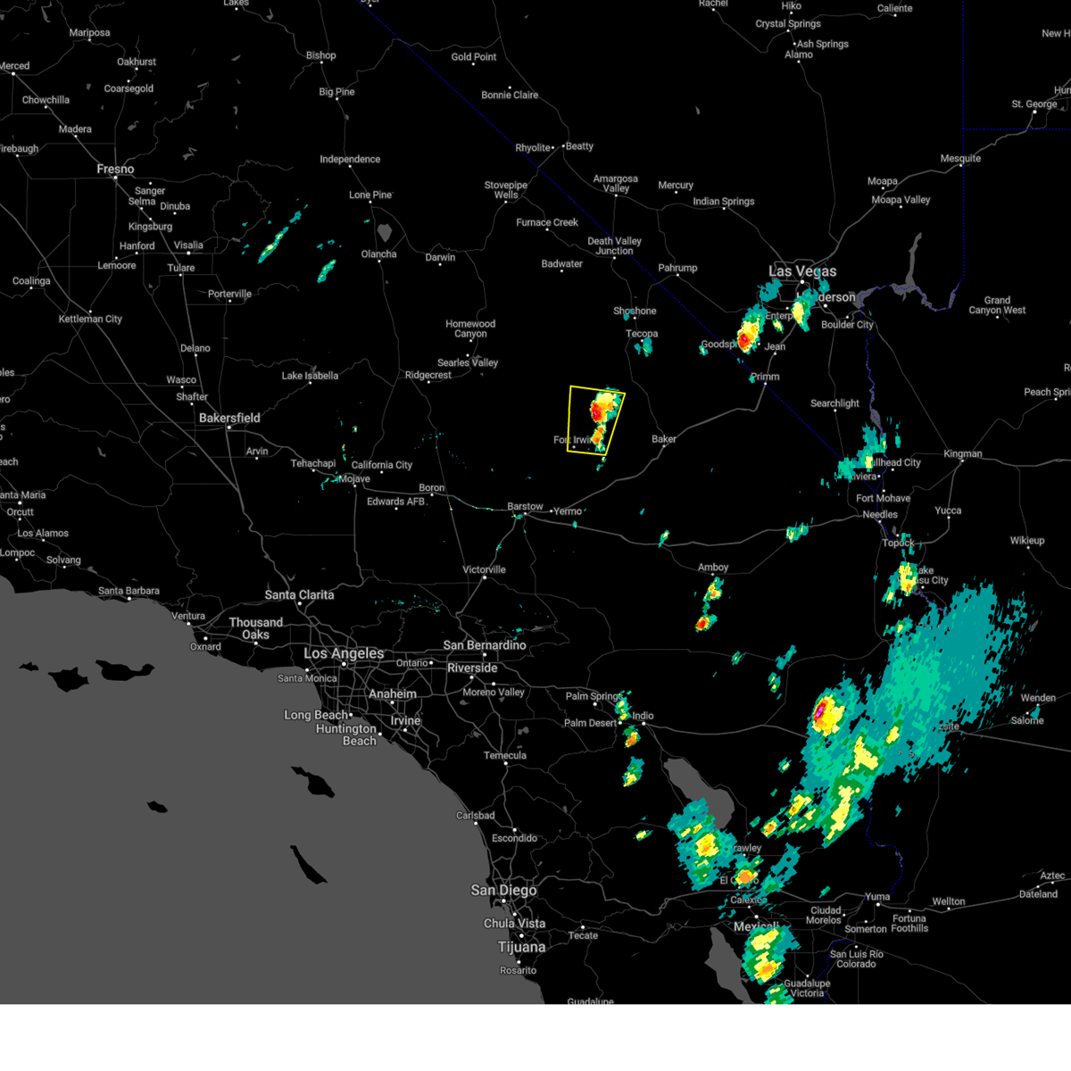
| 9/1/2023 1:25 PM PDT | The kbys awos reported a peak wind gust of 83 mph due to a nearby thunderstor in san bernardino county CA, 4 miles WSW of Fort Irwin, CA |
| 6/11/2023 4:55 PM PDT | At 1655 and 1657 pdt... the bys asos recorded thunderstorm wind gusts of 61 mp in san bernardino county CA, 4.8 miles WSW of Fort Irwin, CA |
| 7/31/2022 1:14 PM PDT | Bicycle lake asos reported 61 mph winds from nearby thunderstorm in san bernardino county CA, 4 miles WSW of Fort Irwin, CA |
| 7/1/2016 5:52 PM PDT |
 The severe thunderstorm warning for west central san bernardino county will expire at 600 pm pdt, the storm which prompted the warning has weakened below severe limits, and no longer poses an immediate threat to life or property. therefore the warning will be allowed to expire. however, additional storms were moving into the area from the west and will likely produce heavy rain and small hail. a flash flood warning remains in effect for the barstow area until 730 pm. The severe thunderstorm warning for west central san bernardino county will expire at 600 pm pdt, the storm which prompted the warning has weakened below severe limits, and no longer poses an immediate threat to life or property. therefore the warning will be allowed to expire. however, additional storms were moving into the area from the west and will likely produce heavy rain and small hail. a flash flood warning remains in effect for the barstow area until 730 pm.
|
| 7/1/2016 5:28 PM PDT |
 At 527 pm pdt, doppler radar indicated a severe thunderstorm capable of producing quarter size hail and damaging winds in excess of 60 mph. this storm was near barstow and moving slowly to the northeast. locations impacted include, barstow, daggett, i-15 between victorville and barstow, hwy 247 between lucerne valley and barstow, owl canyon campground, newberry springs, lenwood and nebo center. At 527 pm pdt, doppler radar indicated a severe thunderstorm capable of producing quarter size hail and damaging winds in excess of 60 mph. this storm was near barstow and moving slowly to the northeast. locations impacted include, barstow, daggett, i-15 between victorville and barstow, hwy 247 between lucerne valley and barstow, owl canyon campground, newberry springs, lenwood and nebo center.
|
| 7/1/2016 4:59 PM PDT |
 At 458 pm pdt, doppler radar indicated a severe thunderstorm capable of producing quarter size hail and damaging winds in excess of 60 mph. this storm was located 9 miles west of owl canyon campground, or 11 miles northwest of barstow, and moving north at 15 mph. this warning replaces the previous severe thunderstorm warning that was in effect for the area. At 458 pm pdt, doppler radar indicated a severe thunderstorm capable of producing quarter size hail and damaging winds in excess of 60 mph. this storm was located 9 miles west of owl canyon campground, or 11 miles northwest of barstow, and moving north at 15 mph. this warning replaces the previous severe thunderstorm warning that was in effect for the area.
|
| 7/29/2015 4:57 PM PDT | Bicycle lake airfield measured sustained winds from the east at 46 mph with a gust of 60 mp in san bernardino county CA, 4 miles WSW of Fort Irwin, CA |
| 7/18/2015 11:03 AM PDT | Storm damage reported in san bernardino county CA, 4 miles WSW of Fort Irwin, CA |
| 7/21/2013 12:25 AM PDT | Outflow from decaying thunderstorm near baker produced an east wind gust of 60 mp in san bernardino county CA, 4 miles WSW of Fort Irwin, CA |
| 9/11/2012 5:55 PM PDT | Storm damage reported in san bernardino county CA, 2.2 miles SSW of Fort Irwin, CA |
Hail Maps for Fort Irwin, CA


Connect with Interactive Hail Maps