

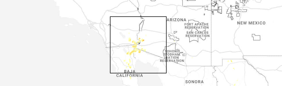
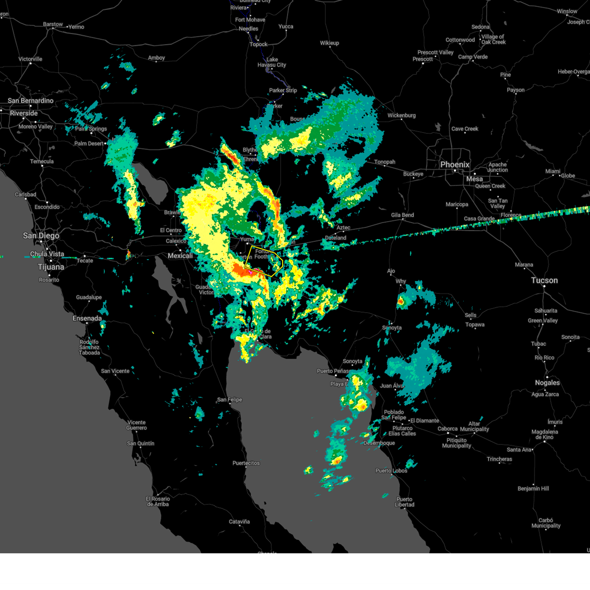
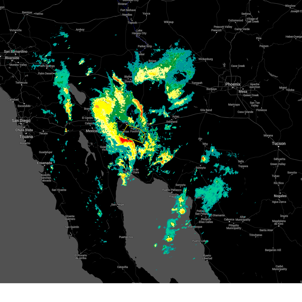
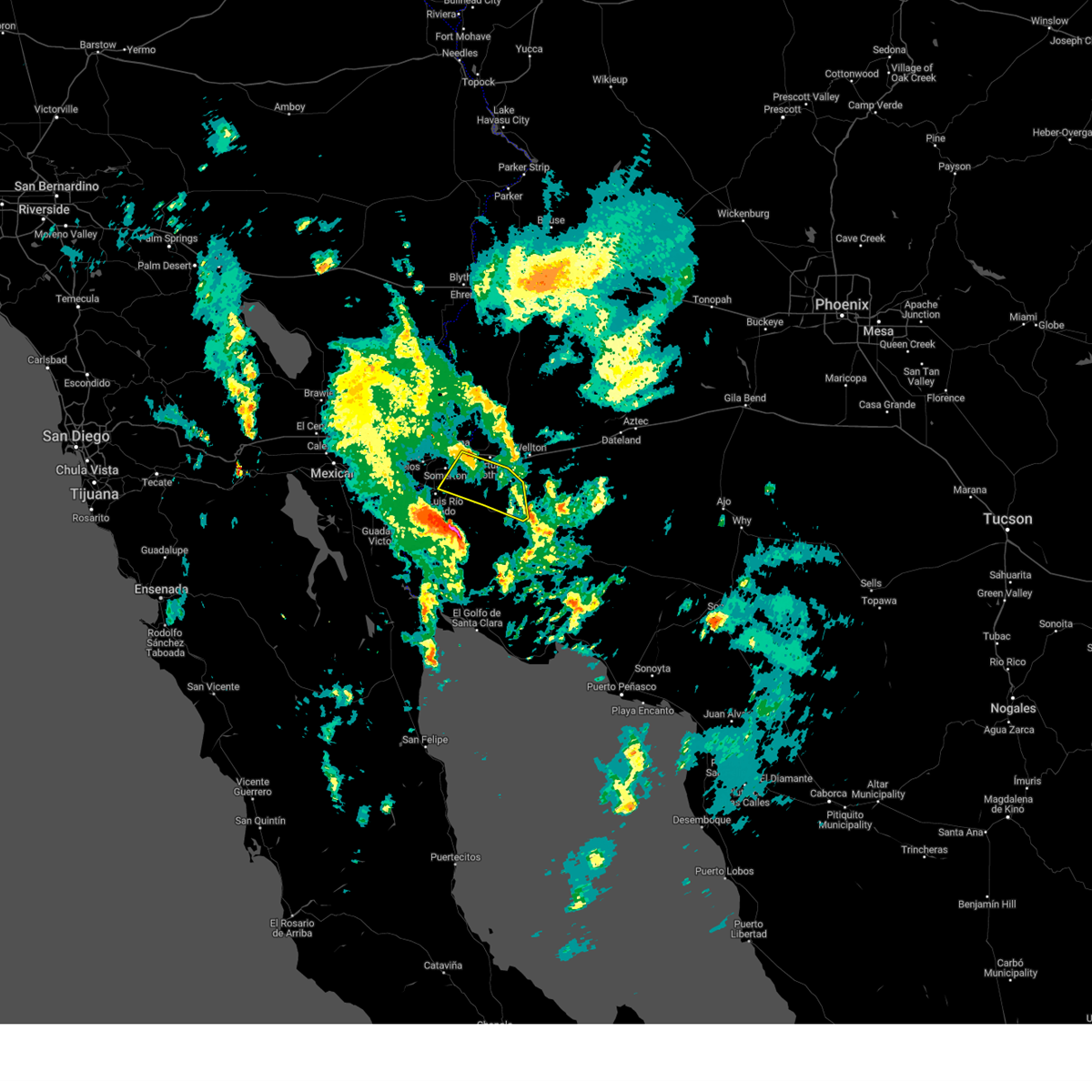
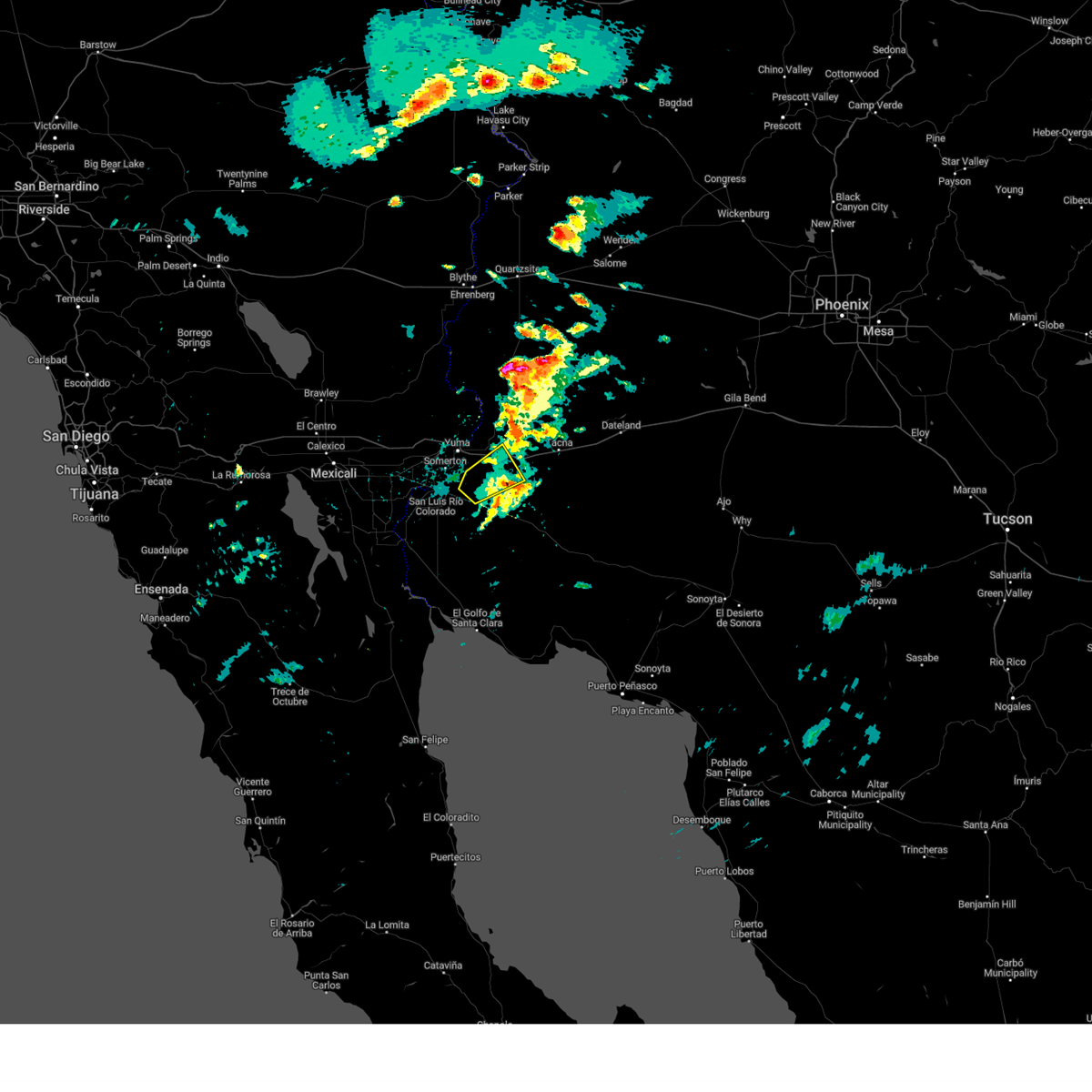
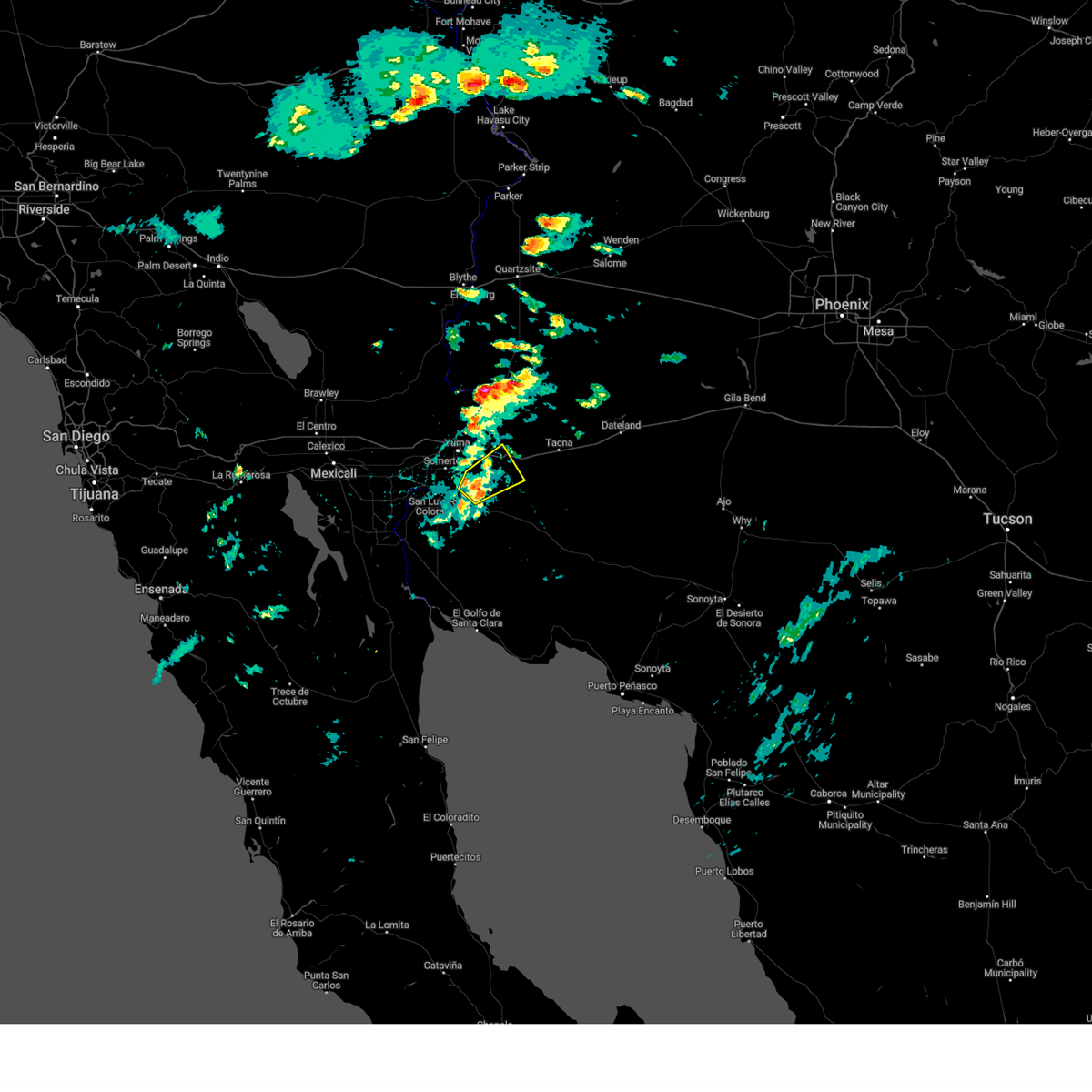
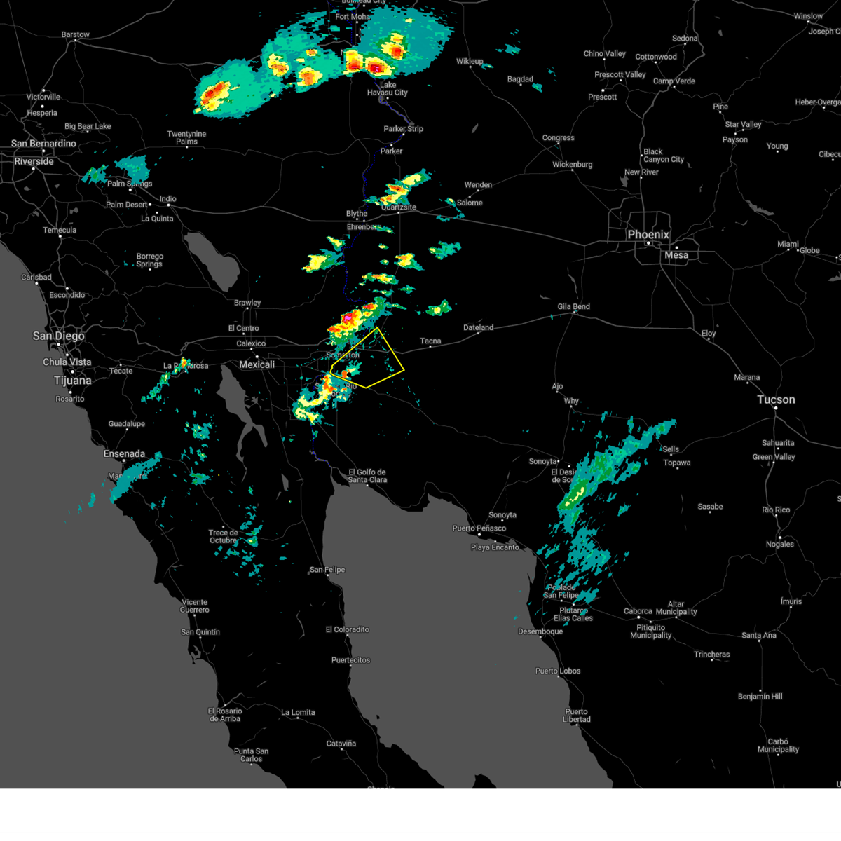
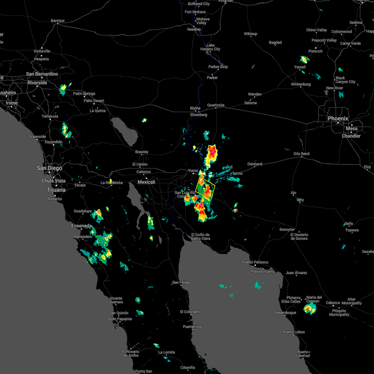
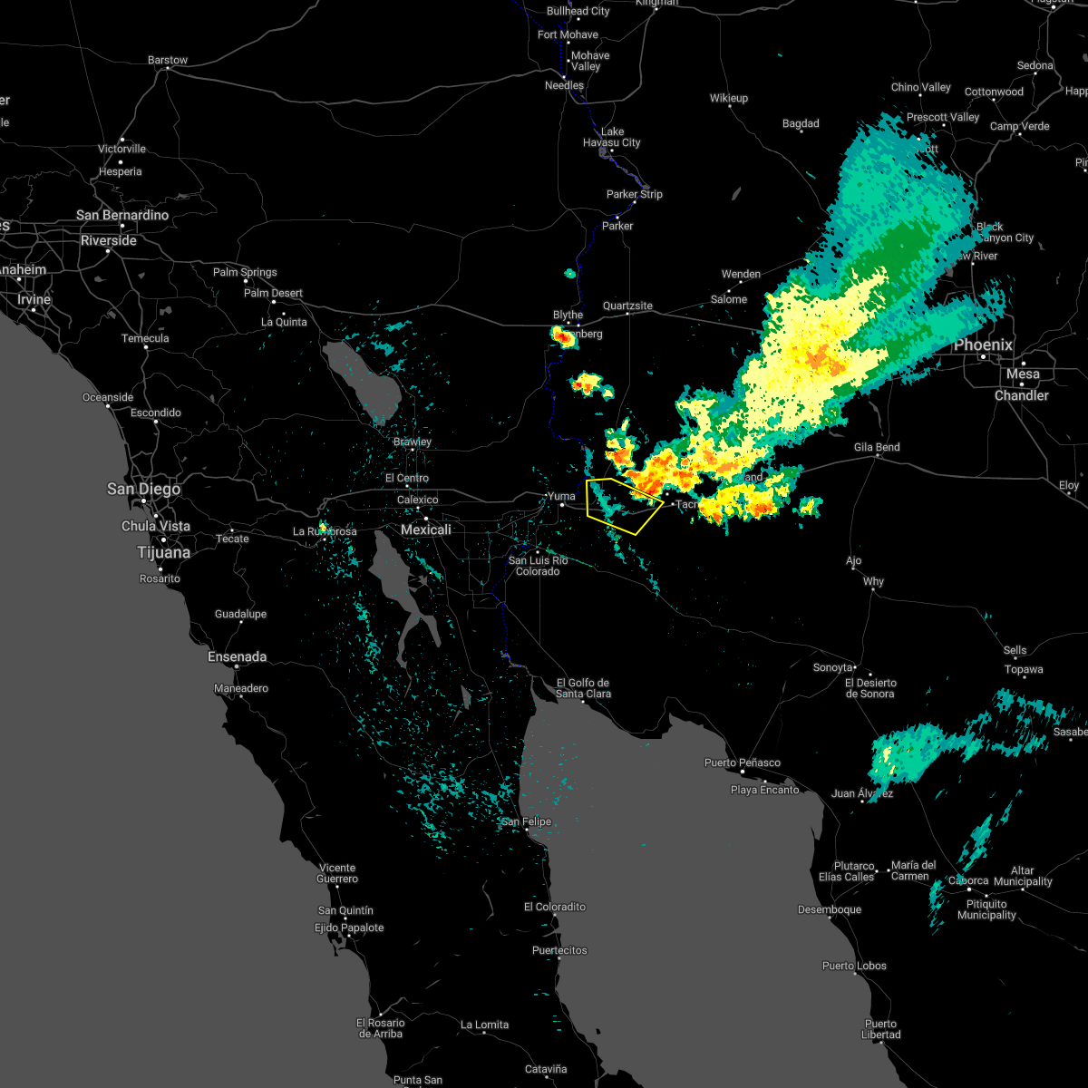
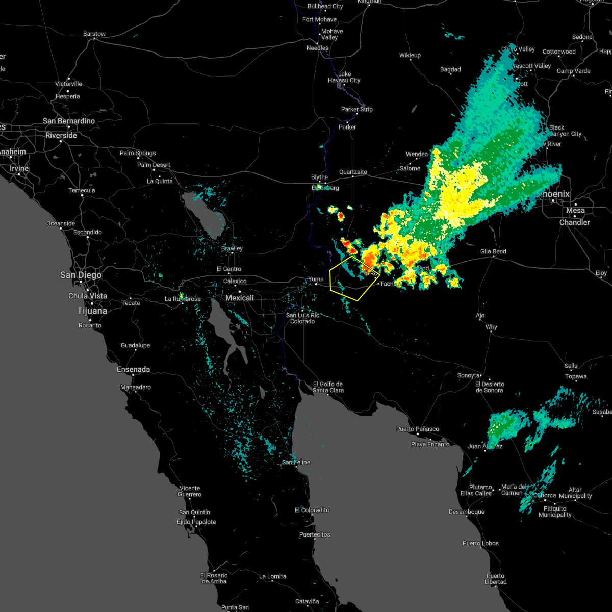
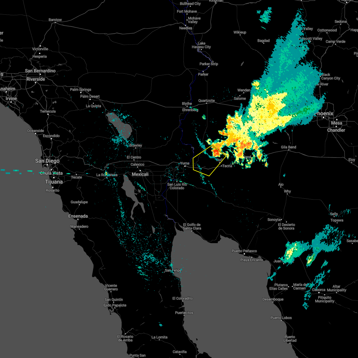
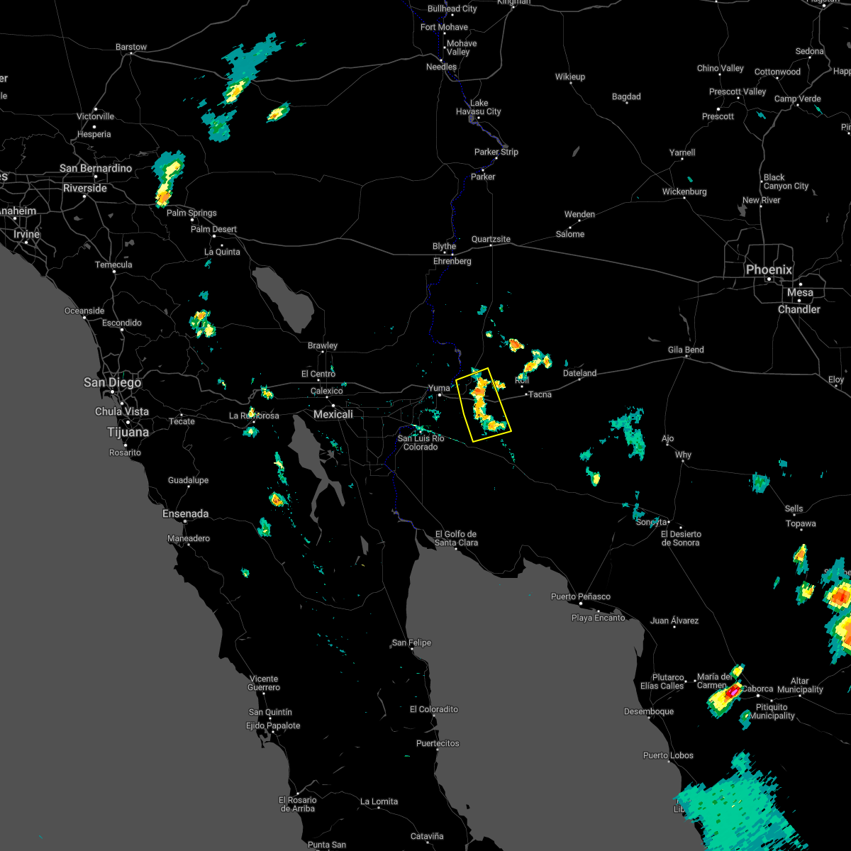
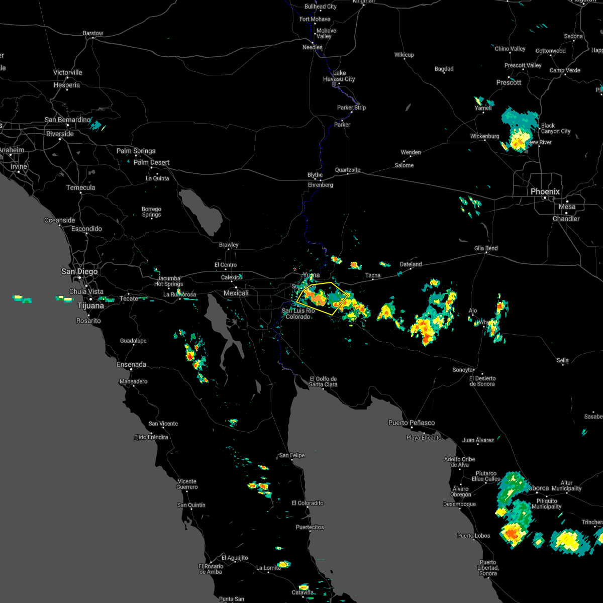
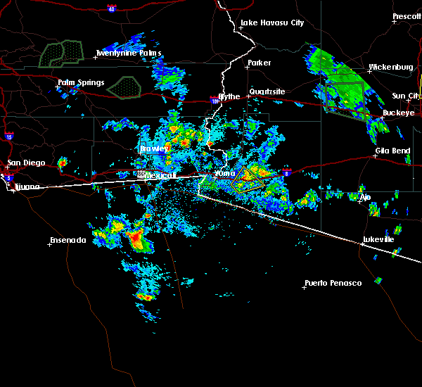
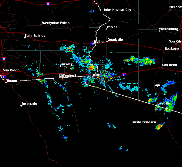
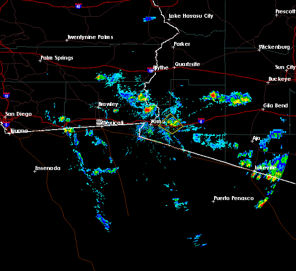
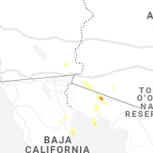
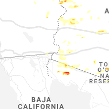
Hail Map for Fortuna Foothills, AZ
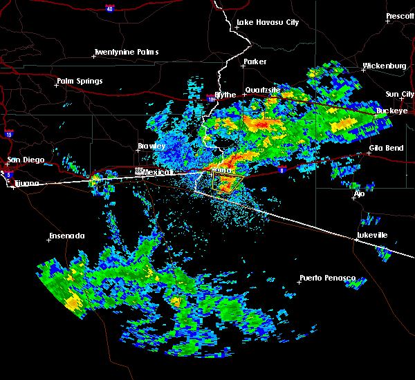
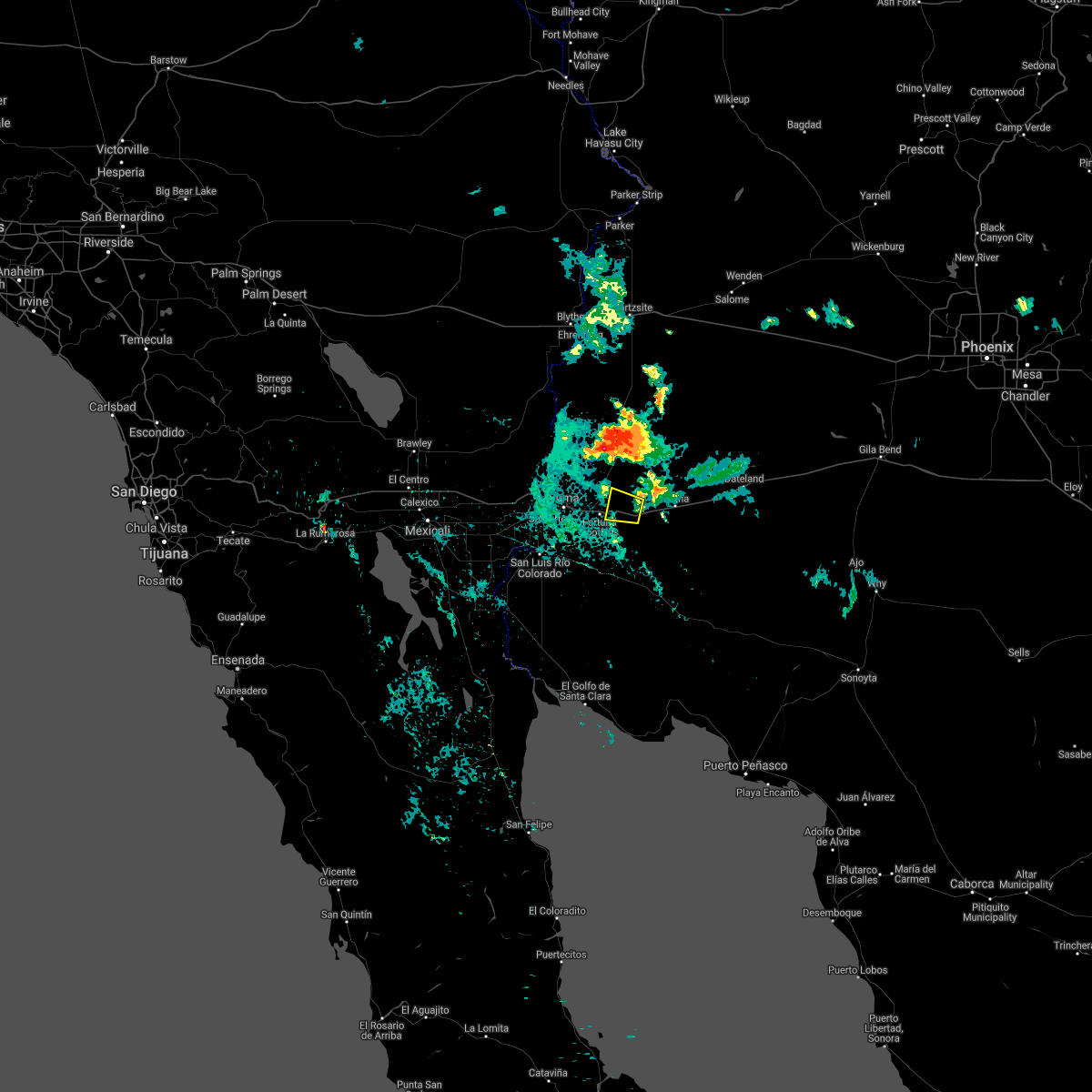
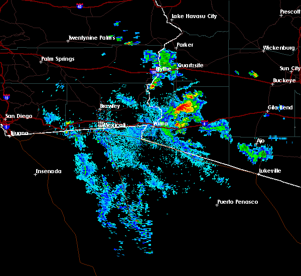
The Fortuna Foothills, AZ area has had 0 reports of on-the-ground hail by trained spotters, and has been under severe weather warnings 3 times during the past 12 months. Doppler radar has detected hail at or near Fortuna Foothills, AZ on 9 occasions.
| Name: | Fortuna Foothills, AZ |
| Where Located: | 12.8 miles E of Yuma, AZ |
| Map: | Google Map for Fortuna Foothills, AZ |
| Population: | 26265 |
| Housing Units: | 21642 |
| More Info: | Search Google for Fortuna Foothills, AZ |
1
The Top Recent Hail Date for Fortuna Foothills, AZ is Thursday, October 6, 2022 (3rd out of 9)
Hail and Wind Damage Spotted near Fortuna Foothills, AZ
| Date / Time | Report Details |
|---|---|
| 12/22/2023 3:03 PM MST |
 At 303 pm mst, severe thunderstorms were located along a line extending from 6 miles southwest of yuma to 11 miles south of fortuna foothills to 16 miles south of ligurta to 22 miles southwest of wellton, moving northeast at 30 mph (radar indicated). Hazards include 60 mph wind gusts and quarter size hail. Hail damage to vehicles is expected. expect wind damage to roofs, siding, and trees. locations impacted include, yuma and fortuna foothills. this includes az route 195 between mile markers 10 and 26. hail threat, radar indicated max hail size, 1. 00 in wind threat, radar indicated max wind gust, 60 mph. At 303 pm mst, severe thunderstorms were located along a line extending from 6 miles southwest of yuma to 11 miles south of fortuna foothills to 16 miles south of ligurta to 22 miles southwest of wellton, moving northeast at 30 mph (radar indicated). Hazards include 60 mph wind gusts and quarter size hail. Hail damage to vehicles is expected. expect wind damage to roofs, siding, and trees. locations impacted include, yuma and fortuna foothills. this includes az route 195 between mile markers 10 and 26. hail threat, radar indicated max hail size, 1. 00 in wind threat, radar indicated max wind gust, 60 mph.
|
| 12/22/2023 2:48 PM MST |
 At 248 pm mst, severe thunderstorms were located along a line extending from near san luis to 13 miles south of yuma to 21 miles south of fortuna foothills, moving northeast at 30 mph (radar indicated). Hazards include 60 mph wind gusts and quarter size hail. Hail damage to vehicles is expected. expect wind damage to roofs, siding, and trees. locations impacted include, yuma and fortuna foothills. This includes az route 195 between mile markers 5 and 26. At 248 pm mst, severe thunderstorms were located along a line extending from near san luis to 13 miles south of yuma to 21 miles south of fortuna foothills, moving northeast at 30 mph (radar indicated). Hazards include 60 mph wind gusts and quarter size hail. Hail damage to vehicles is expected. expect wind damage to roofs, siding, and trees. locations impacted include, yuma and fortuna foothills. This includes az route 195 between mile markers 5 and 26.
|
| 12/22/2023 2:30 PM MST |
 At 230 pm mst, severe thunderstorms were located along a line extending from 6 miles south of san luis to 17 miles southeast of gadsden to 23 miles south of yuma, moving northeast at 30 mph (radar indicated). Hazards include 60 mph wind gusts and quarter size hail. Hail damage to vehicles is expected. Expect wind damage to roofs, siding, and trees. At 230 pm mst, severe thunderstorms were located along a line extending from 6 miles south of san luis to 17 miles southeast of gadsden to 23 miles south of yuma, moving northeast at 30 mph (radar indicated). Hazards include 60 mph wind gusts and quarter size hail. Hail damage to vehicles is expected. Expect wind damage to roofs, siding, and trees.
|
| 3/15/2023 5:28 PM MST |
 The severe thunderstorm warning for west central yuma county will expire at 530 pm mst, the storm which prompted the warning has weakened below severe limits, and no longer poses an immediate threat to life or property. therefore, the warning will be allowed to expire. however gusty winds to 55 mph are still possible with this thunderstorm. The severe thunderstorm warning for west central yuma county will expire at 530 pm mst, the storm which prompted the warning has weakened below severe limits, and no longer poses an immediate threat to life or property. therefore, the warning will be allowed to expire. however gusty winds to 55 mph are still possible with this thunderstorm.
|
| 3/15/2023 5:09 PM MST |
 At 509 pm mst, a severe thunderstorm was located 9 miles southeast of yuma, moving east at 45 mph (radar indicated). Hazards include 60 mph wind gusts and penny size hail. Expect damage to roofs, siding, and trees. locations impacted include, yuma, fortuna foothills and ligurta. this includes the following highways, az interstate 8 between mile markers 14 and 22. az route 195 between mile markers 12 and 21. hail threat, radar indicated max hail size, 0. 75 in wind threat, radar indicated max wind gust, 60 mph. At 509 pm mst, a severe thunderstorm was located 9 miles southeast of yuma, moving east at 45 mph (radar indicated). Hazards include 60 mph wind gusts and penny size hail. Expect damage to roofs, siding, and trees. locations impacted include, yuma, fortuna foothills and ligurta. this includes the following highways, az interstate 8 between mile markers 14 and 22. az route 195 between mile markers 12 and 21. hail threat, radar indicated max hail size, 0. 75 in wind threat, radar indicated max wind gust, 60 mph.
|
| 3/15/2023 5:02 PM MST |
 At 502 pm mst, a severe thunderstorm was located 7 miles south of yuma, moving east at 45 mph (radar indicated). Hazards include 60 mph wind gusts and penny size hail. Expect damage to roofs, siding, and trees. locations impacted include, yuma, somerton, fortuna foothills, san luis, blaisdell, kinter, ligurta and araby. this includes the following highways, az interstate 8 between mile markers 5 and 22. az route 95 between mile markers 29 and 41. az route 195 between mile markers 5 and 26. hail threat, radar indicated max hail size, 0. 75 in wind threat, radar indicated max wind gust, 60 mph. At 502 pm mst, a severe thunderstorm was located 7 miles south of yuma, moving east at 45 mph (radar indicated). Hazards include 60 mph wind gusts and penny size hail. Expect damage to roofs, siding, and trees. locations impacted include, yuma, somerton, fortuna foothills, san luis, blaisdell, kinter, ligurta and araby. this includes the following highways, az interstate 8 between mile markers 5 and 22. az route 95 between mile markers 29 and 41. az route 195 between mile markers 5 and 26. hail threat, radar indicated max hail size, 0. 75 in wind threat, radar indicated max wind gust, 60 mph.
|
| 3/15/2023 4:51 PM MST |
 At 451 pm mst, a severe thunderstorm was located near san luis, or 7 miles southeast of gadsden, moving northeast at 40 mph (radar indicated). Hazards include 60 mph wind gusts and penny size hail. expect damage to roofs, siding, and trees At 451 pm mst, a severe thunderstorm was located near san luis, or 7 miles southeast of gadsden, moving northeast at 40 mph (radar indicated). Hazards include 60 mph wind gusts and penny size hail. expect damage to roofs, siding, and trees
|
| 10/15/2022 11:16 AM PDT |
 At 1116 am mst/1116 am pdt/, a severe thunderstorm was located near araby, or 9 miles northwest of fortuna foothills, moving northwest at 25 mph (radar indicated). Hazards include 60 mph wind gusts and quarter size hail. Hail damage to vehicles is expected. Expect wind damage to roofs, siding, and trees. At 1116 am mst/1116 am pdt/, a severe thunderstorm was located near araby, or 9 miles northwest of fortuna foothills, moving northwest at 25 mph (radar indicated). Hazards include 60 mph wind gusts and quarter size hail. Hail damage to vehicles is expected. Expect wind damage to roofs, siding, and trees.
|
| 10/6/2022 2:35 PM MST |
 At 234 pm mst/234 pm pdt/, a severe thunderstorm was located near somerton, moving northwest at 25 mph (radar indicated). Hazards include 60 mph wind gusts and quarter size hail. Hail damage to vehicles is expected. expect wind damage to roofs, siding, and trees. locations impacted include, yuma, somerton, gadsden, san luis, andrade, winterhaven and araby. this includes the following highways, az interstate 8 between mile markers 1 and 11. ca interstate 8 between mile markers 88 and 96. az route 95 between mile markers 29 and 31. hail threat, radar indicated max hail size, 1. 00 in wind threat, radar indicated max wind gust, 60 mph. At 234 pm mst/234 pm pdt/, a severe thunderstorm was located near somerton, moving northwest at 25 mph (radar indicated). Hazards include 60 mph wind gusts and quarter size hail. Hail damage to vehicles is expected. expect wind damage to roofs, siding, and trees. locations impacted include, yuma, somerton, gadsden, san luis, andrade, winterhaven and araby. this includes the following highways, az interstate 8 between mile markers 1 and 11. ca interstate 8 between mile markers 88 and 96. az route 95 between mile markers 29 and 31. hail threat, radar indicated max hail size, 1. 00 in wind threat, radar indicated max wind gust, 60 mph.
|
| 10/6/2022 2:23 PM MST |
 At 223 pm mst/223 pm pdt/, a severe thunderstorm was located 8 miles southeast of somerton, moving west at 20 mph (radar indicated). Hazards include 70 mph wind gusts and quarter size hail. Hail damage to vehicles is expected. expect considerable tree damage. wind damage is also likely to mobile homes, roofs, and outbuildings. locations impacted include, yuma, somerton, gadsden, fortuna foothills, san luis, andrade, winterhaven and araby. this includes the following highways, az interstate 8 between mile markers 1 and 11. ca interstate 8 between mile markers 88 and 96. az route 95 between mile markers 29 and 31. thunderstorm damage threat, considerable hail threat, radar indicated max hail size, 1. 00 in wind threat, radar indicated max wind gust, 70 mph. At 223 pm mst/223 pm pdt/, a severe thunderstorm was located 8 miles southeast of somerton, moving west at 20 mph (radar indicated). Hazards include 70 mph wind gusts and quarter size hail. Hail damage to vehicles is expected. expect considerable tree damage. wind damage is also likely to mobile homes, roofs, and outbuildings. locations impacted include, yuma, somerton, gadsden, fortuna foothills, san luis, andrade, winterhaven and araby. this includes the following highways, az interstate 8 between mile markers 1 and 11. ca interstate 8 between mile markers 88 and 96. az route 95 between mile markers 29 and 31. thunderstorm damage threat, considerable hail threat, radar indicated max hail size, 1. 00 in wind threat, radar indicated max wind gust, 70 mph.
|
| 10/6/2022 2:13 PM MST |
 At 213 pm mst/213 pm pdt/, a severe thunderstorm was located 10 miles southeast of san luis, or 12 miles southeast of somerton, moving northwest at 35 mph (radar indicated). Hazards include 60 mph wind gusts and quarter size hail. Hail damage to vehicles is expected. Expect wind damage to roofs, siding, and trees. At 213 pm mst/213 pm pdt/, a severe thunderstorm was located 10 miles southeast of san luis, or 12 miles southeast of somerton, moving northwest at 35 mph (radar indicated). Hazards include 60 mph wind gusts and quarter size hail. Hail damage to vehicles is expected. Expect wind damage to roofs, siding, and trees.
|
| 10/6/2022 2:02 PM MST |
 At 202 pm mst, a severe thunderstorm was located 12 miles south of fortuna foothills, moving northwest at 10 mph (radar indicated). Hazards include 60 mph wind gusts and quarter size hail. Hail damage to vehicles is expected. expect wind damage to roofs, siding, and trees. locations impacted include, yuma. this includes az route 195 between mile markers 14 and 15. hail threat, radar indicated max hail size, 1. 00 in wind threat, radar indicated max wind gust, 60 mph. At 202 pm mst, a severe thunderstorm was located 12 miles south of fortuna foothills, moving northwest at 10 mph (radar indicated). Hazards include 60 mph wind gusts and quarter size hail. Hail damage to vehicles is expected. expect wind damage to roofs, siding, and trees. locations impacted include, yuma. this includes az route 195 between mile markers 14 and 15. hail threat, radar indicated max hail size, 1. 00 in wind threat, radar indicated max wind gust, 60 mph.
|
| 10/6/2022 1:47 PM MST |
 At 146 pm mst, a severe thunderstorm was located 15 miles south of fortuna foothills, moving west at 10 mph (radar indicated). Hazards include 60 mph wind gusts and quarter size hail. Hail damage to vehicles is expected. expect wind damage to roofs, siding, and trees. locations impacted include, yuma. this includes az route 195 between mile markers 14 and 15. hail threat, radar indicated max hail size, 1. 00 in wind threat, radar indicated max wind gust, 60 mph. At 146 pm mst, a severe thunderstorm was located 15 miles south of fortuna foothills, moving west at 10 mph (radar indicated). Hazards include 60 mph wind gusts and quarter size hail. Hail damage to vehicles is expected. expect wind damage to roofs, siding, and trees. locations impacted include, yuma. this includes az route 195 between mile markers 14 and 15. hail threat, radar indicated max hail size, 1. 00 in wind threat, radar indicated max wind gust, 60 mph.
|
| 10/6/2022 1:37 PM MST |
 At 137 pm mst, a severe thunderstorm was located 14 miles south of fortuna foothills, moving west at 10 mph (radar indicated). Hazards include 60 mph wind gusts and quarter size hail. Hail damage to vehicles is expected. Expect wind damage to roofs, siding, and trees. At 137 pm mst, a severe thunderstorm was located 14 miles south of fortuna foothills, moving west at 10 mph (radar indicated). Hazards include 60 mph wind gusts and quarter size hail. Hail damage to vehicles is expected. Expect wind damage to roofs, siding, and trees.
|
| 9/23/2022 4:27 PM MST |
 At 426 pm mst/426 pm pdt/, a severe thunderstorm was located over winterhaven, or near yuma, and is nearly stationary (radar indicated). Hazards include 60 mph wind gusts. expect damage to roofs, siding, and trees At 426 pm mst/426 pm pdt/, a severe thunderstorm was located over winterhaven, or near yuma, and is nearly stationary (radar indicated). Hazards include 60 mph wind gusts. expect damage to roofs, siding, and trees
|
| 8/22/2022 1:50 AM MST | At 150 am mst/150 am pdt/, severe thunderstorms were located along a line extending from araby to near winterhaven to near algodones dunes, and are nearly stationary (radar indicated). Hazards include 60 mph wind gusts. Expect damage to roofs, siding, and trees. locations impacted include, yuma, somerton, gadsden, fortuna foothills, san luis, blaisdell, algodones dunes, kinter, andrade, winterhaven and araby. this includes the following highways, az interstate 8 between mile markers 1 and 17. ca interstate 8 between mile markers 78 and 96. az route 95 between mile markers 29 and 56. hail threat, radar indicated max hail size, <. 75 in wind threat, radar indicated max wind gust, 60 mph. |
| 8/22/2022 1:50 AM MST | At 150 am mst/150 am pdt/, severe thunderstorms were located along a line extending from araby to near winterhaven to near algodones dunes, and are nearly stationary (radar indicated). Hazards include 60 mph wind gusts. Expect damage to roofs, siding, and trees. locations impacted include, yuma, somerton, gadsden, fortuna foothills, san luis, blaisdell, algodones dunes, kinter, andrade, winterhaven and araby. this includes the following highways, az interstate 8 between mile markers 1 and 17. ca interstate 8 between mile markers 78 and 96. az route 95 between mile markers 29 and 56. hail threat, radar indicated max hail size, <. 75 in wind threat, radar indicated max wind gust, 60 mph. |
| 8/22/2022 1:27 AM MST | At 127 am mst/127 am pdt/, severe thunderstorms were located along a line extending from near kinter to near winterhaven to near algodones dunes, moving southwest at 30 mph (radar indicated). Hazards include 60 mph wind gusts. expect damage to roofs, siding, and trees |
| 8/22/2022 1:27 AM MST | At 127 am mst/127 am pdt/, severe thunderstorms were located along a line extending from near kinter to near winterhaven to near algodones dunes, moving southwest at 30 mph (radar indicated). Hazards include 60 mph wind gusts. expect damage to roofs, siding, and trees |
| 8/22/2022 1:11 AM PDT | At 109 am mst/109 am pdt/, severe thunderstorms were located along a line extending from 21 miles northeast of brawley to 22 miles north of gordon`s well to 17 miles north of algodones dunes to near martinez lake, moving southwest at 25 mph (radar indicated). Hazards include 70 mph wind gusts. Expect considerable tree damage. damage is likely to mobile homes, roofs, and outbuildings. locations impacted include, yuma, somerton, martinez lake, gadsden, fortuna foothills, wellton, gordon`s well, algodones dunes, kinter, andrade, winterhaven, araby, yuma proving ground, blaisdell and ligurta. this includes the following highways, az interstate 8 between mile markers 1 and 32. ca interstate 8 between mile markers 55 and 96. az route 95 between mile markers 29 and 79. thunderstorm damage threat, considerable hail threat, radar indicated max hail size, <. 75 in wind threat, radar indicated max wind gust, 70 mph. |
| 8/22/2022 1:11 AM PDT | At 109 am mst/109 am pdt/, severe thunderstorms were located along a line extending from 21 miles northeast of brawley to 22 miles north of gordon`s well to 17 miles north of algodones dunes to near martinez lake, moving southwest at 25 mph (radar indicated). Hazards include 70 mph wind gusts. Expect considerable tree damage. damage is likely to mobile homes, roofs, and outbuildings. locations impacted include, yuma, somerton, martinez lake, gadsden, fortuna foothills, wellton, gordon`s well, algodones dunes, kinter, andrade, winterhaven, araby, yuma proving ground, blaisdell and ligurta. this includes the following highways, az interstate 8 between mile markers 1 and 32. ca interstate 8 between mile markers 55 and 96. az route 95 between mile markers 29 and 79. thunderstorm damage threat, considerable hail threat, radar indicated max hail size, <. 75 in wind threat, radar indicated max wind gust, 70 mph. |
| 8/22/2022 12:44 AM PDT | At 1243 am mst/1243 am pdt/, severe thunderstorms were located along a line extending from 22 miles west of palo verde to 12 miles south of cibola to 7 miles east of yuma proving ground, moving southwest at 30 mph (radar indicated). Hazards include 70 mph wind gusts. Expect considerable tree damage. damage is likely to mobile homes, roofs, and outbuildings. locations impacted include, yuma, somerton, martinez lake, gadsden, fortuna foothills, wellton, cibola, palo verde, gordon`s well, algodones dunes, kinter, andrade, winterhaven, araby and yuma proving ground. this includes the following highways, az interstate 8 between mile markers 1 and 32. ca interstate 8 between mile markers 55 and 96. az route 95 between mile markers 29 and 90. thunderstorm damage threat, considerable hail threat, radar indicated max hail size, <. 75 in wind threat, radar indicated max wind gust, 70 mph. |
| 8/22/2022 12:44 AM PDT | At 1243 am mst/1243 am pdt/, severe thunderstorms were located along a line extending from 22 miles west of palo verde to 12 miles south of cibola to 7 miles east of yuma proving ground, moving southwest at 30 mph (radar indicated). Hazards include 70 mph wind gusts. Expect considerable tree damage. damage is likely to mobile homes, roofs, and outbuildings. locations impacted include, yuma, somerton, martinez lake, gadsden, fortuna foothills, wellton, cibola, palo verde, gordon`s well, algodones dunes, kinter, andrade, winterhaven, araby and yuma proving ground. this includes the following highways, az interstate 8 between mile markers 1 and 32. ca interstate 8 between mile markers 55 and 96. az route 95 between mile markers 29 and 90. thunderstorm damage threat, considerable hail threat, radar indicated max hail size, <. 75 in wind threat, radar indicated max wind gust, 70 mph. |
| 8/22/2022 12:34 AM PDT | At 1234 am mst/1234 am pdt/, severe thunderstorms were located along a line extending from 20 miles west of palo verde to 9 miles south of cibola to 11 miles northeast of yuma proving ground, moving southwest at 30 mph (radar indicated). Hazards include 70 mph wind gusts. Expect considerable tree damage. Damage is likely to mobile homes, roofs, and outbuildings. |
| 8/22/2022 12:34 AM PDT | At 1234 am mst/1234 am pdt/, severe thunderstorms were located along a line extending from 20 miles west of palo verde to 9 miles south of cibola to 11 miles northeast of yuma proving ground, moving southwest at 30 mph (radar indicated). Hazards include 70 mph wind gusts. Expect considerable tree damage. Damage is likely to mobile homes, roofs, and outbuildings. |
| 8/19/2022 10:54 PM MST |
 The severe thunderstorm warning for central yuma county will expire at 1100 pm mst, the storm which prompted the warning has weakened below severe limits, and no longer poses an immediate threat to life or property. therefore, the warning will be allowed to expire. however gusty winds and heavy rain are still possible with this thunderstorm. The severe thunderstorm warning for central yuma county will expire at 1100 pm mst, the storm which prompted the warning has weakened below severe limits, and no longer poses an immediate threat to life or property. therefore, the warning will be allowed to expire. however gusty winds and heavy rain are still possible with this thunderstorm.
|
| 8/19/2022 10:47 PM MST |
 At 1047 pm mst, a severe thunderstorm was located near ligurta, or 7 miles northeast of fortuna foothills, moving southwest at 30 mph (radar indicated). Hazards include 60 mph wind gusts. Expect damage to roofs, siding, and trees. locations impacted include, fortuna foothills, wellton, blaisdell, ligurta and kinter. this includes the following highways, az interstate 8 between mile markers 11 and 36. az route 95 between mile markers 33 and 44. hail threat, radar indicated max hail size, <. 75 in wind threat, radar indicated max wind gust, 60 mph. At 1047 pm mst, a severe thunderstorm was located near ligurta, or 7 miles northeast of fortuna foothills, moving southwest at 30 mph (radar indicated). Hazards include 60 mph wind gusts. Expect damage to roofs, siding, and trees. locations impacted include, fortuna foothills, wellton, blaisdell, ligurta and kinter. this includes the following highways, az interstate 8 between mile markers 11 and 36. az route 95 between mile markers 33 and 44. hail threat, radar indicated max hail size, <. 75 in wind threat, radar indicated max wind gust, 60 mph.
|
| 8/19/2022 10:31 PM MST |
 At 1031 pm mst, a severe thunderstorm was located 9 miles north of wellton, or 15 miles northeast of fortuna foothills, moving southwest at 30 mph (radar indicated). Hazards include 60 mph wind gusts. Expect damage to roofs, siding, and trees. locations impacted include, fortuna foothills, wellton, blaisdell, ligurta, kinter and roll. this includes the following highways, az interstate 8 between mile markers 11 and 36. az route 95 between mile markers 33 and 49. hail threat, radar indicated max hail size, <. 75 in wind threat, radar indicated max wind gust, 60 mph. At 1031 pm mst, a severe thunderstorm was located 9 miles north of wellton, or 15 miles northeast of fortuna foothills, moving southwest at 30 mph (radar indicated). Hazards include 60 mph wind gusts. Expect damage to roofs, siding, and trees. locations impacted include, fortuna foothills, wellton, blaisdell, ligurta, kinter and roll. this includes the following highways, az interstate 8 between mile markers 11 and 36. az route 95 between mile markers 33 and 49. hail threat, radar indicated max hail size, <. 75 in wind threat, radar indicated max wind gust, 60 mph.
|
| 8/19/2022 10:19 PM MST |
 At 1019 pm mst, a severe thunderstorm was located 12 miles north of wellton, or 22 miles east of martinez lake, moving southwest at 30 mph (radar indicated). Hazards include 60 mph wind gusts. expect damage to roofs, siding, and trees At 1019 pm mst, a severe thunderstorm was located 12 miles north of wellton, or 22 miles east of martinez lake, moving southwest at 30 mph (radar indicated). Hazards include 60 mph wind gusts. expect damage to roofs, siding, and trees
|
| 8/16/2022 6:12 PM MST |
 The severe thunderstorm warning for west central yuma county will expire at 615 pm mst, the storms which prompted the warning have weakened below severe limits, and no longer pose an immediate threat to life or property. therefore, the warning will be allowed to expire. however gusty winds and heavy rain are still possible with these thunderstorms. to report severe weather, contact your nearest law enforcement agency. they will relay your report to the national weather service phoenix. The severe thunderstorm warning for west central yuma county will expire at 615 pm mst, the storms which prompted the warning have weakened below severe limits, and no longer pose an immediate threat to life or property. therefore, the warning will be allowed to expire. however gusty winds and heavy rain are still possible with these thunderstorms. to report severe weather, contact your nearest law enforcement agency. they will relay your report to the national weather service phoenix.
|
| 8/16/2022 5:42 PM MST |
 At 542 pm mst, severe thunderstorms were located along a line extending from near kinter to near ligurta to 13 miles southeast of fortuna foothills, and are nearly stationary (radar indicated). Hazards include 60 mph wind gusts. expect damage to roofs, siding, and trees At 542 pm mst, severe thunderstorms were located along a line extending from near kinter to near ligurta to 13 miles southeast of fortuna foothills, and are nearly stationary (radar indicated). Hazards include 60 mph wind gusts. expect damage to roofs, siding, and trees
|
| 8/11/2021 2:46 PM MST |
 At 245 pm mst, a severe thunderstorm was located near san luis, or 7 miles south of somerton, moving west at 10 mph (radar indicated). Hazards include 60 mph wind gusts. ares of dense blowing dust and sand. Expect damage to roofs, siding, and trees. dangerous driving conditions. locations impacted include, yuma, somerton, fortuna foothills and san luis. This includes az route 195 between mile markers 5 and 26. At 245 pm mst, a severe thunderstorm was located near san luis, or 7 miles south of somerton, moving west at 10 mph (radar indicated). Hazards include 60 mph wind gusts. ares of dense blowing dust and sand. Expect damage to roofs, siding, and trees. dangerous driving conditions. locations impacted include, yuma, somerton, fortuna foothills and san luis. This includes az route 195 between mile markers 5 and 26.
|
| 8/11/2021 2:17 PM MST |
 At 215 pm mst, a severe thunderstorm was located 9 miles southeast of somerton, moving west at 10 mph (radar indicated). Hazards include 60 mph wind gusts. ares of dense blowing dust and sand. Expect damage to roofs, siding, and trees. Dangerous driving conditions. At 215 pm mst, a severe thunderstorm was located 9 miles southeast of somerton, moving west at 10 mph (radar indicated). Hazards include 60 mph wind gusts. ares of dense blowing dust and sand. Expect damage to roofs, siding, and trees. Dangerous driving conditions.
|
| 9/30/2018 1:40 PM MST |
 The severe thunderstorm warning for west central yuma county will expire at 145 pm mst, the storm which prompted the warning has weakened below severe limits, and no longer poses an immediate threat to life or property. therefore, the warning will be allowed to expire. however gusty winds and heavy rain are still possible with this thunderstorm. The severe thunderstorm warning for west central yuma county will expire at 145 pm mst, the storm which prompted the warning has weakened below severe limits, and no longer poses an immediate threat to life or property. therefore, the warning will be allowed to expire. however gusty winds and heavy rain are still possible with this thunderstorm.
|
| 9/30/2018 1:22 PM MST |
 At 122 pm mst, a severe thunderstorm was located 7 miles southwest of fortuna foothills, moving north at 20 mph (radar indicated). Hazards include 60 mph wind gusts. expect damage to roofs, siding, and trees At 122 pm mst, a severe thunderstorm was located 7 miles southwest of fortuna foothills, moving north at 20 mph (radar indicated). Hazards include 60 mph wind gusts. expect damage to roofs, siding, and trees
|
| 9/30/2018 12:58 PM PDT |
 At 1258 pm mst/1258 pm pdt/, a severe thunderstorm was located over yuma, moving north at 20 mph (radar indicated). Hazards include 60 mph wind gusts. expect damage to roofs, siding, and trees At 1258 pm mst/1258 pm pdt/, a severe thunderstorm was located over yuma, moving north at 20 mph (radar indicated). Hazards include 60 mph wind gusts. expect damage to roofs, siding, and trees
|
| 7/9/2018 8:36 PM MST |
 At 835 pm mst/835 pm pdt/, severe thunderstorms were located along a line extending from 7 miles southwest of martinez lake to 7 miles south of araby to 16 miles south of ligurta, moving southwest at 45 mph (radar indicated). Hazards include 60 mph wind gusts. Expect damage to roofs, siding, and trees. locations impacted include, yuma, somerton, fortuna foothills, wellton, blaisdell, kinter, ligurta, winterhaven and araby. this includes the following highways, az interstate 8 between mile markers 1 and 32. ca interstate 8 between mile markers 91 and 96. Az route 95 between mile markers 29 and 56. At 835 pm mst/835 pm pdt/, severe thunderstorms were located along a line extending from 7 miles southwest of martinez lake to 7 miles south of araby to 16 miles south of ligurta, moving southwest at 45 mph (radar indicated). Hazards include 60 mph wind gusts. Expect damage to roofs, siding, and trees. locations impacted include, yuma, somerton, fortuna foothills, wellton, blaisdell, kinter, ligurta, winterhaven and araby. this includes the following highways, az interstate 8 between mile markers 1 and 32. ca interstate 8 between mile markers 91 and 96. Az route 95 between mile markers 29 and 56.
|
| 7/9/2018 8:08 PM MST |
 At 808 pm mst/808 pm pdt/, severe thunderstorms were located along a line extending from 9 miles southeast of yuma proving ground to near ligurta to 9 miles south of tacna, moving southwest at 45 mph (radar indicated). Hazards include 60 mph wind gusts. expect damage to roofs, siding, and trees At 808 pm mst/808 pm pdt/, severe thunderstorms were located along a line extending from 9 miles southeast of yuma proving ground to near ligurta to 9 miles south of tacna, moving southwest at 45 mph (radar indicated). Hazards include 60 mph wind gusts. expect damage to roofs, siding, and trees
|
| 9/7/2017 8:26 PM MST |
 The severe thunderstorm warning for central yuma county will expire at 830 pm mst, the severe thunderstorm which prompted the warning has weakened and is no longer near severe levels. therefore, the warning will be allowed to expire. The severe thunderstorm warning for central yuma county will expire at 830 pm mst, the severe thunderstorm which prompted the warning has weakened and is no longer near severe levels. therefore, the warning will be allowed to expire.
|
| 9/7/2017 7:52 PM MST |
 At 751 pm mst, a severe thunderstorm was located near ligurta, or 10 miles east of fortuna foothills, moving west at 35 mph (radar indicated). Hazards include 60 mph wind gusts and small to moderate hail. dense blowing dust is also possible. expect damage to roofs, siding, and trees At 751 pm mst, a severe thunderstorm was located near ligurta, or 10 miles east of fortuna foothills, moving west at 35 mph (radar indicated). Hazards include 60 mph wind gusts and small to moderate hail. dense blowing dust is also possible. expect damage to roofs, siding, and trees
|
| 8/3/2017 4:18 PM MST |
 At 418 pm mst, a severe thunderstorm was located near ligurta, or 7 miles southeast of fortuna foothills, moving northeast at 15 mph (radar indicated). Hazards include 60 mph wind gusts and penny size hail. expect damage to roofs, siding, and trees At 418 pm mst, a severe thunderstorm was located near ligurta, or 7 miles southeast of fortuna foothills, moving northeast at 15 mph (radar indicated). Hazards include 60 mph wind gusts and penny size hail. expect damage to roofs, siding, and trees
|
| 8/19/2016 6:35 PM MST |
 The severe thunderstorm warning for west central yuma county will expire at 645 pm mst, the storm which prompted the warning has weakened below severe limits, and no longer poses an immediate threat to life or property. therefore the warning will be allowed to expire. The severe thunderstorm warning for west central yuma county will expire at 645 pm mst, the storm which prompted the warning has weakened below severe limits, and no longer poses an immediate threat to life or property. therefore the warning will be allowed to expire.
|
| 8/19/2016 6:24 PM MST |
 At 624 pm mst, doppler radar indicated a severe thunderstorm capable of producing damaging winds in excess of 60 mph. this storm was located near ligurta, or 8 miles northeast of fortuna foothills, moving northwest at 5 mph. locations impacted include, fortuna foothills, wellton, blaisdell and ligurta. At 624 pm mst, doppler radar indicated a severe thunderstorm capable of producing damaging winds in excess of 60 mph. this storm was located near ligurta, or 8 miles northeast of fortuna foothills, moving northwest at 5 mph. locations impacted include, fortuna foothills, wellton, blaisdell and ligurta.
|
| 8/19/2016 6:14 PM MST |
 At 613 pm mst, doppler radar indicated a severe thunderstorm capable of producing damaging winds in excess of 60 mph. this storm was located over ligurta, or 8 miles east of fortuna foothills, and moving northwest at 5 mph. At 613 pm mst, doppler radar indicated a severe thunderstorm capable of producing damaging winds in excess of 60 mph. this storm was located over ligurta, or 8 miles east of fortuna foothills, and moving northwest at 5 mph.
|
| 8/11/2014 6:05 PM MST | Thunderstorm winds measured 60mph...gusts 65mph. patio roof damage in yuma county AZ, 0.9 miles ESE of Fortuna Foothills, AZ |
| 8/11/2014 6:05 PM MST | Extensive damage to trailers caused by strong thunderstorm wind in yuma county AZ, 0.9 miles NNE of Fortuna Foothills, AZ |
| 9/9/2012 5:15 PM MST | Interstate 8 closed from ave 3e to foothills blvd due to downed power line in yuma county AZ, 0.9 miles NNE of Fortuna Foothills, AZ |
| 8/12/2012 4:28 PM MST | 6 power poles down near county 6th street and ave 18e in yuma county AZ, 6.4 miles SW of Fortuna Foothills, AZ |
| 1/1/0001 12:00 AM | Box truck blown in yuma county AZ, 4 miles SSE of Fortuna Foothills, AZ |
| 1/1/0001 12:00 AM | Numerous awnings damaged and torn from houses along with shutters. winds estimated to be 55 mp in yuma county AZ, 0.3 miles NE of Fortuna Foothills, AZ |
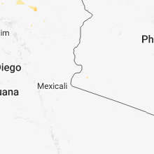
Hail Maps for Fortuna Foothills, AZ


Connect with Interactive Hail Maps