

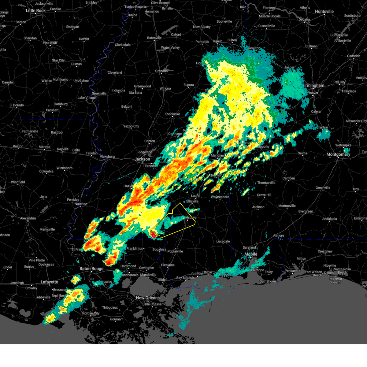
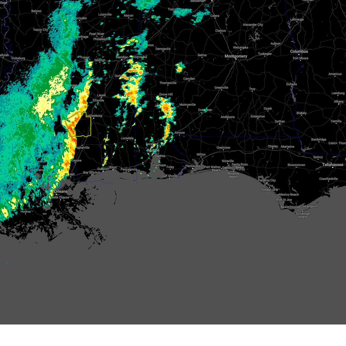
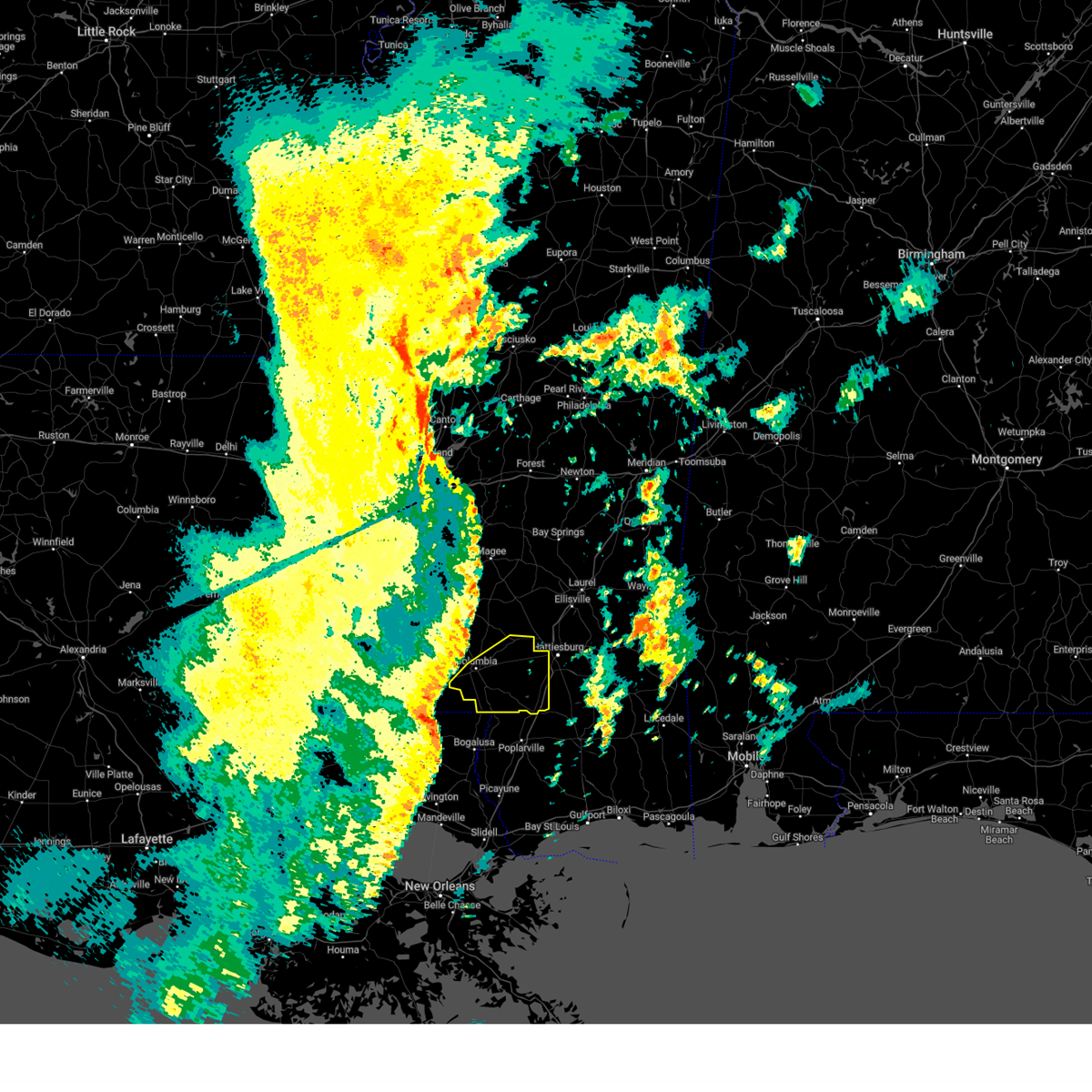
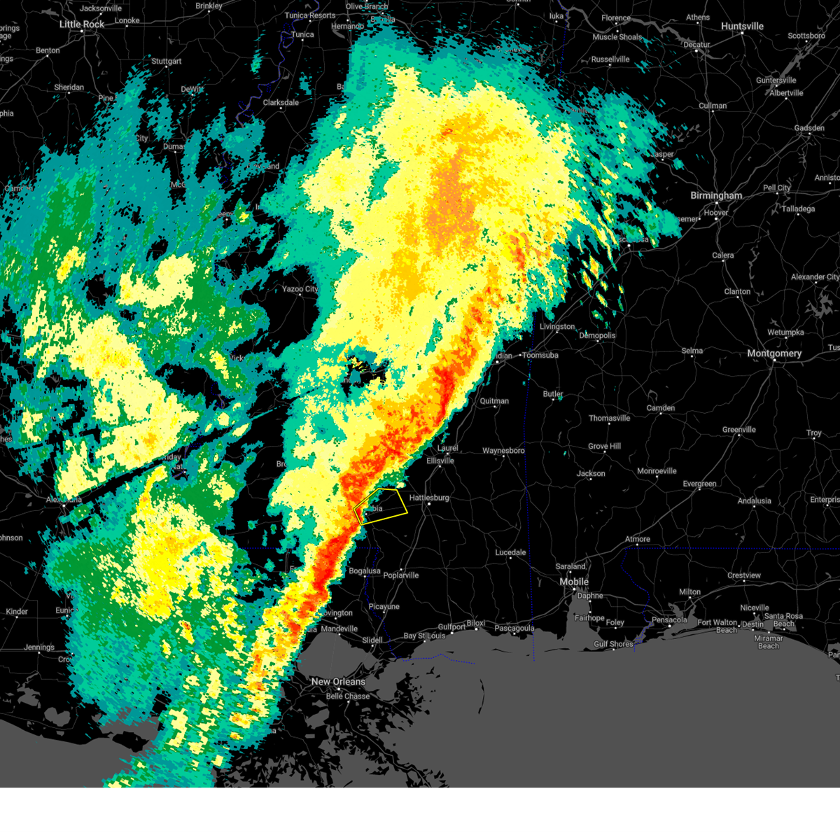
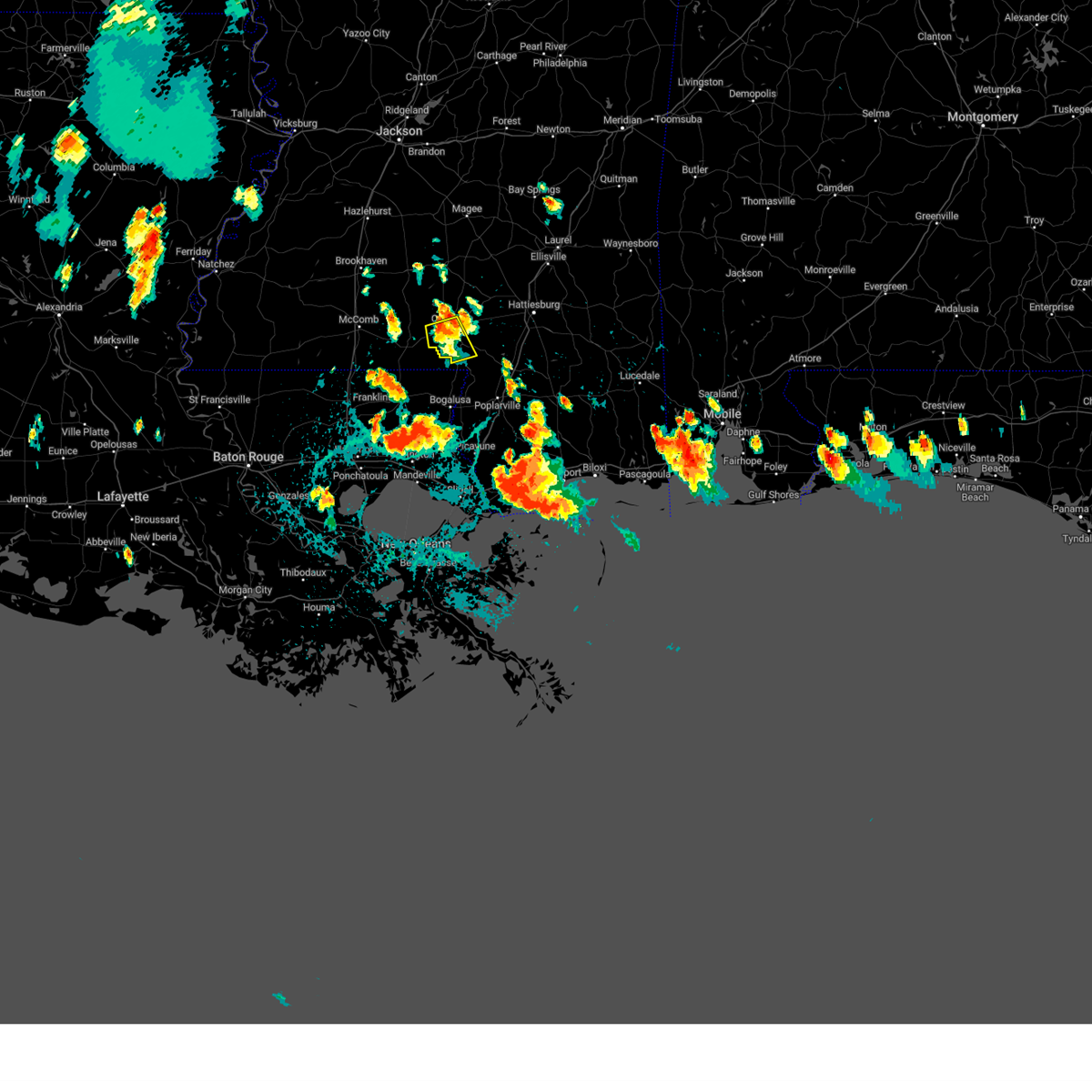
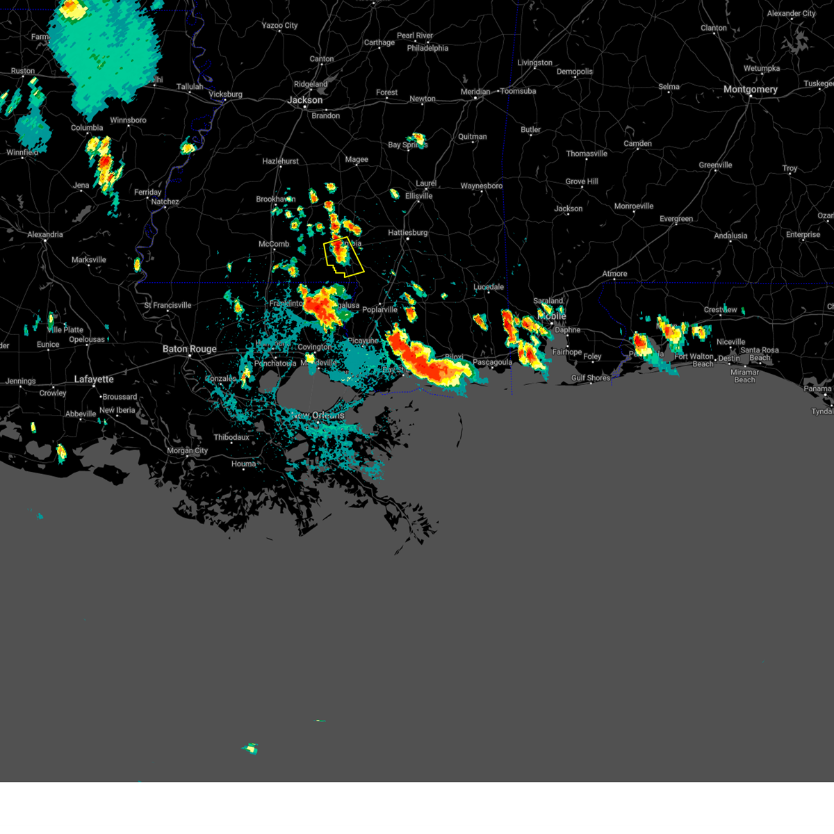
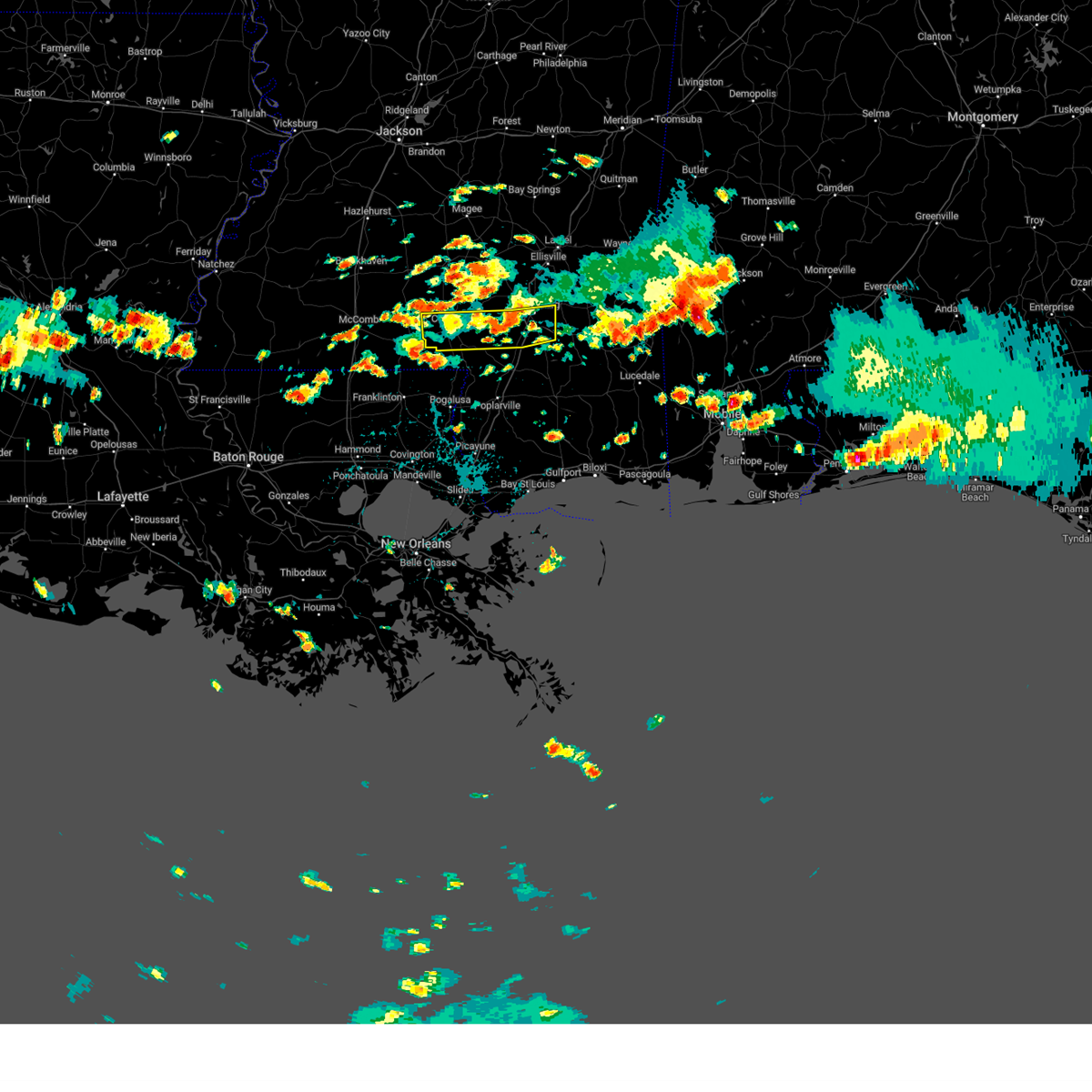
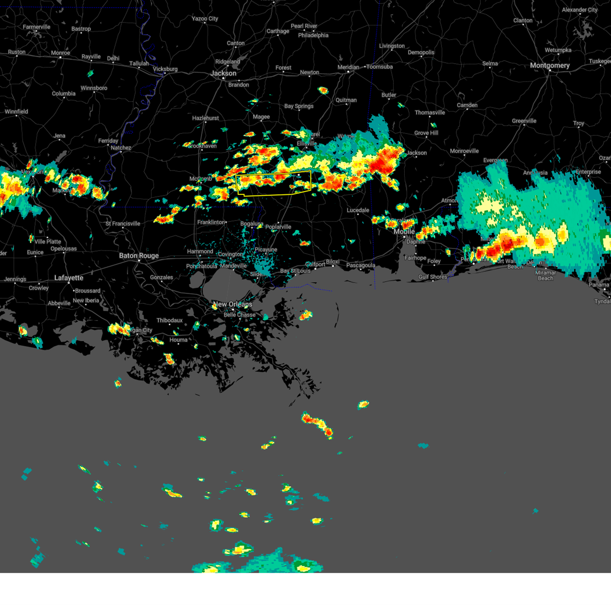
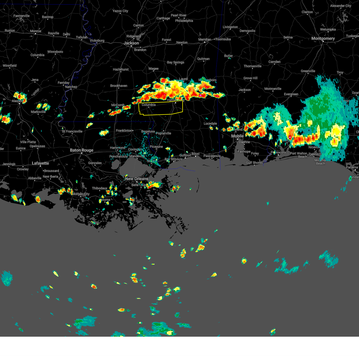
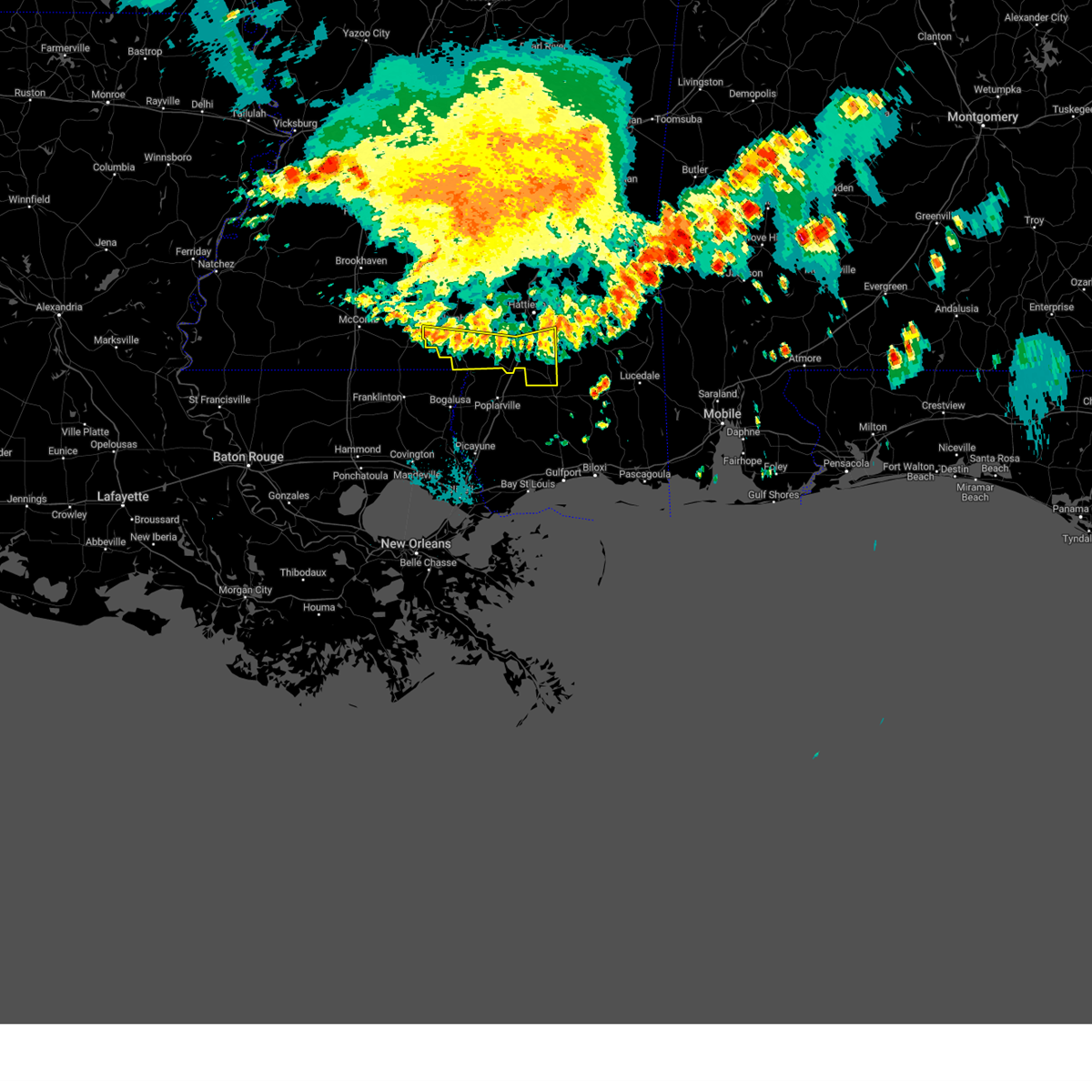
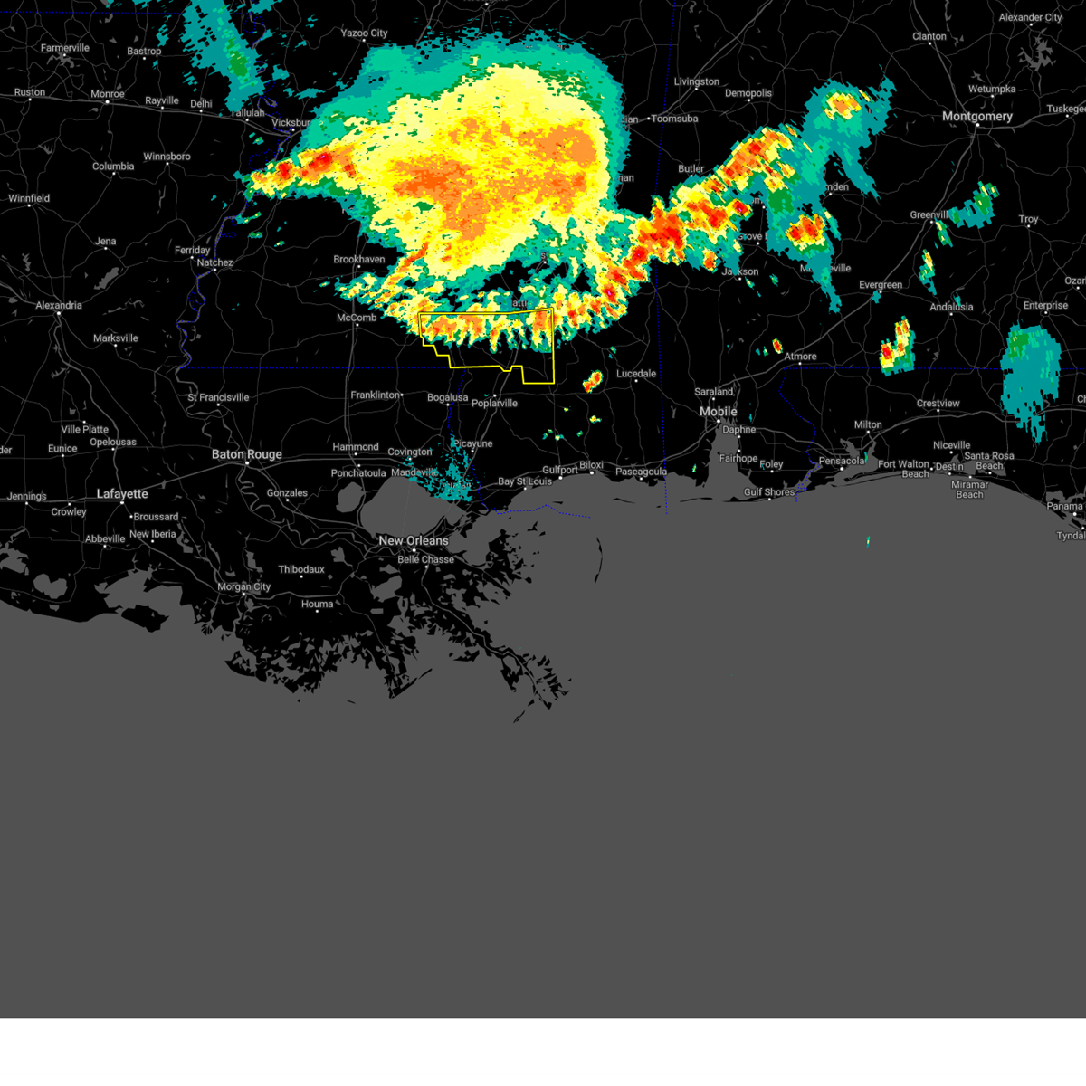
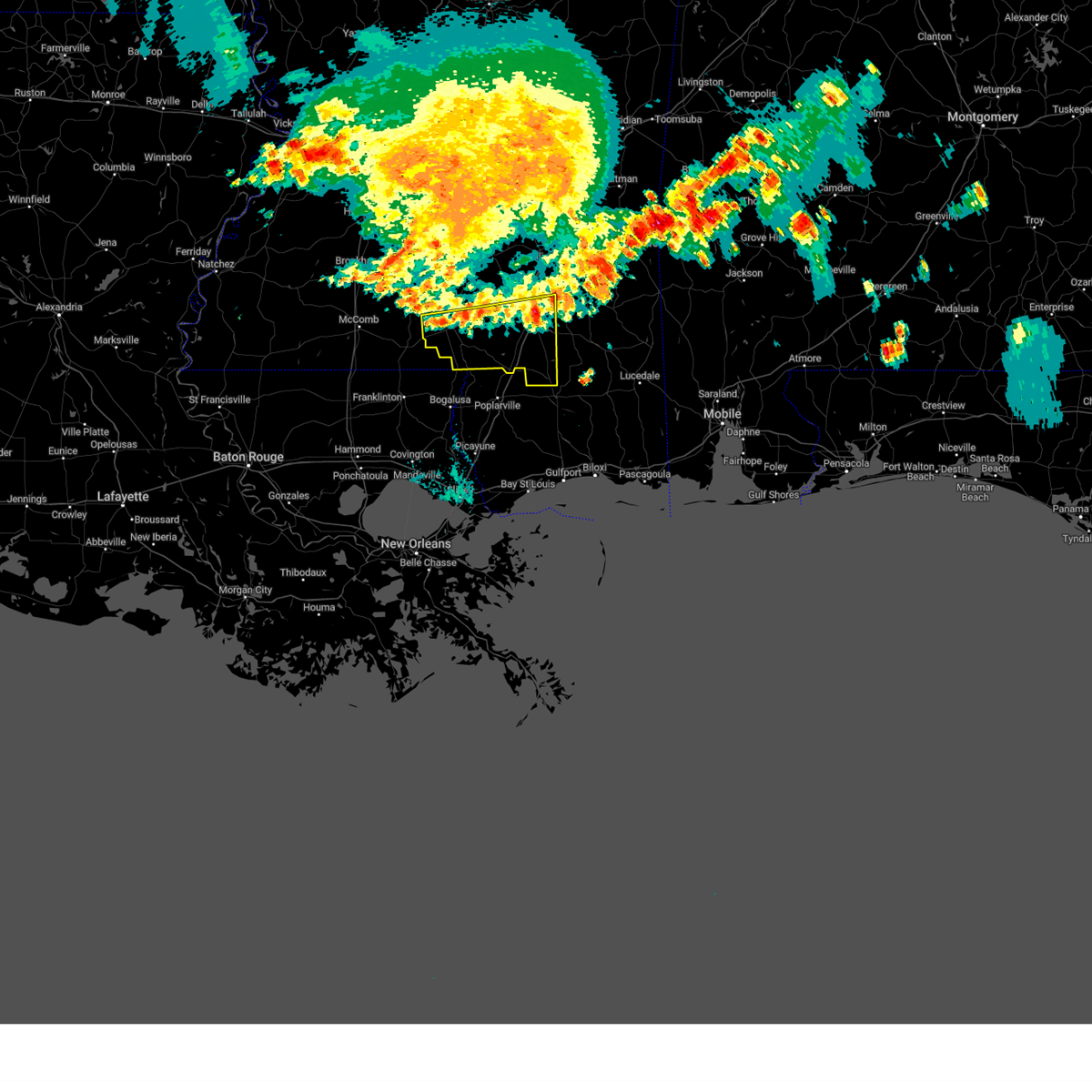
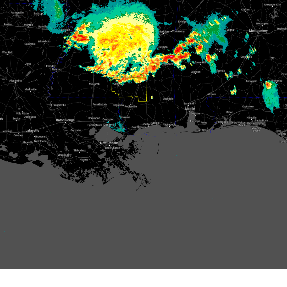
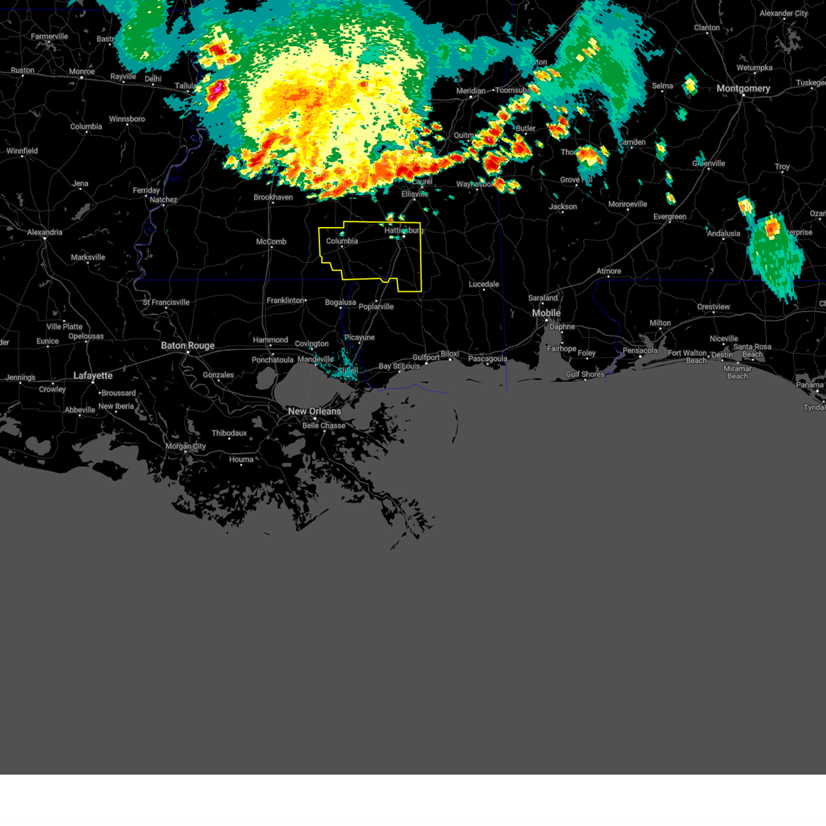
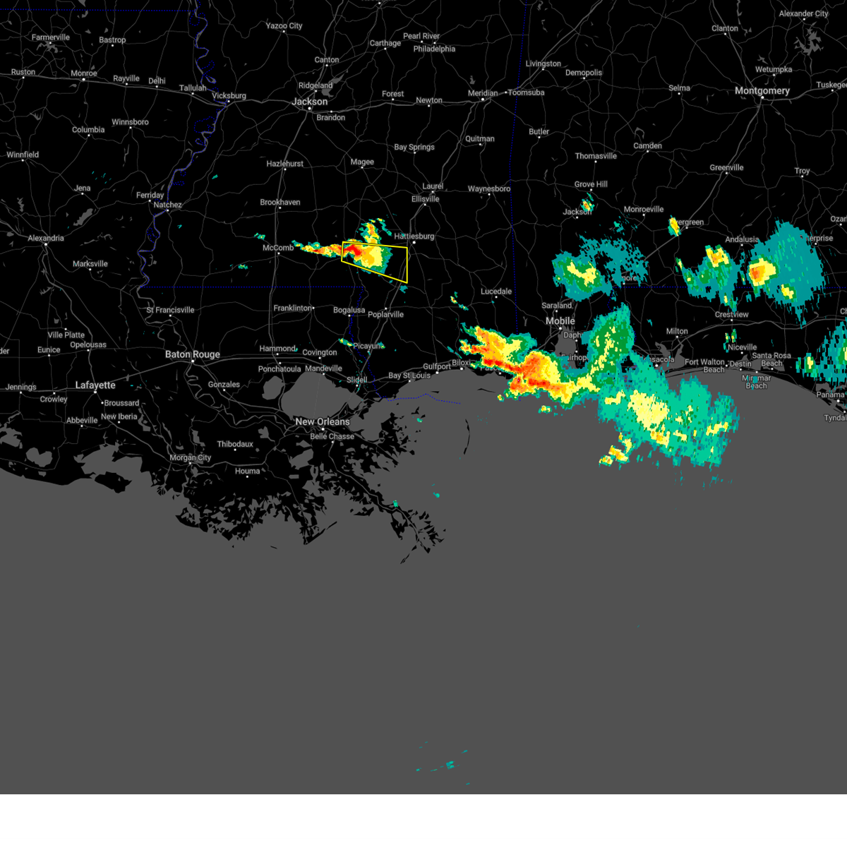
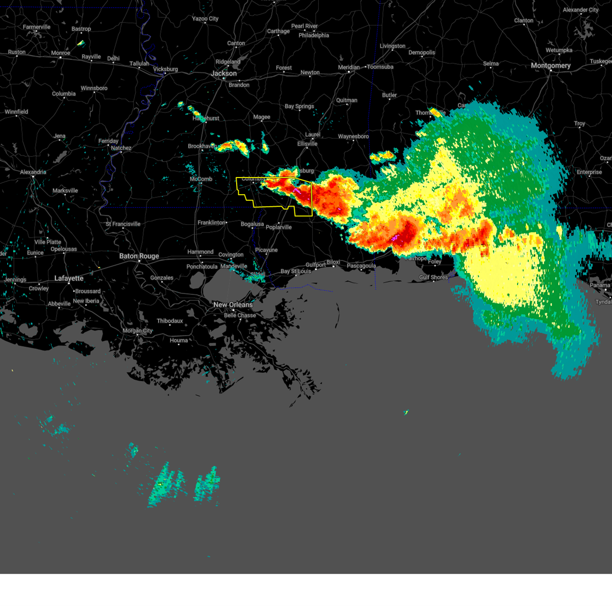
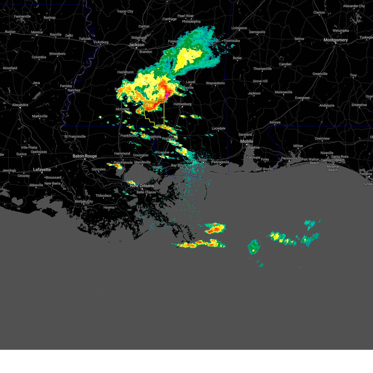
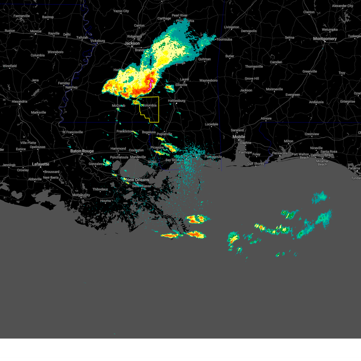
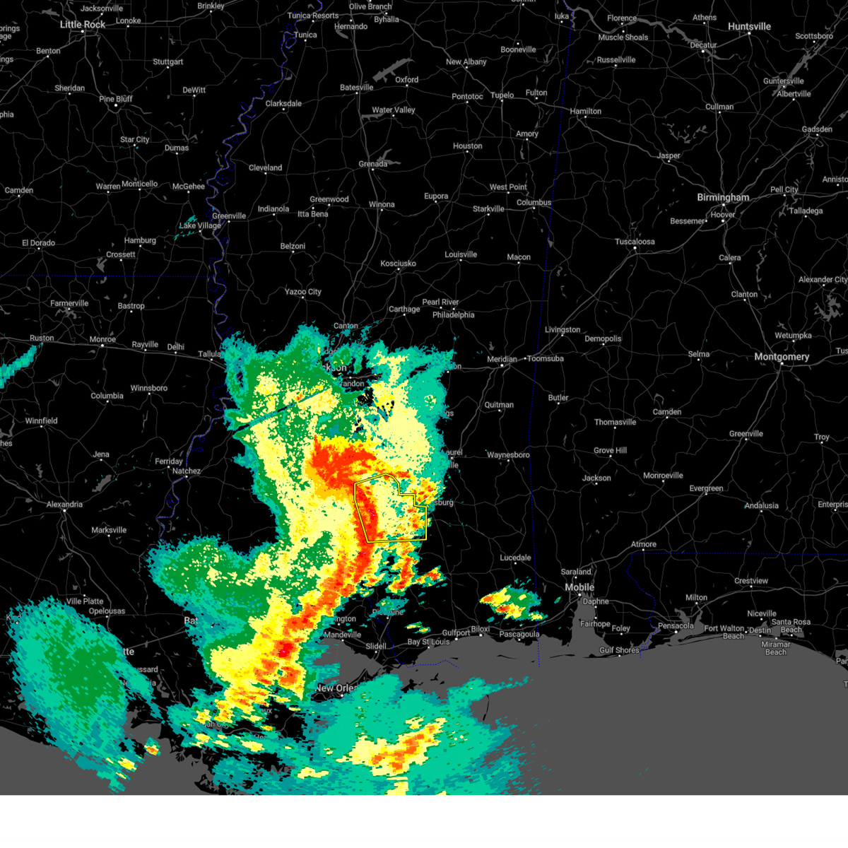
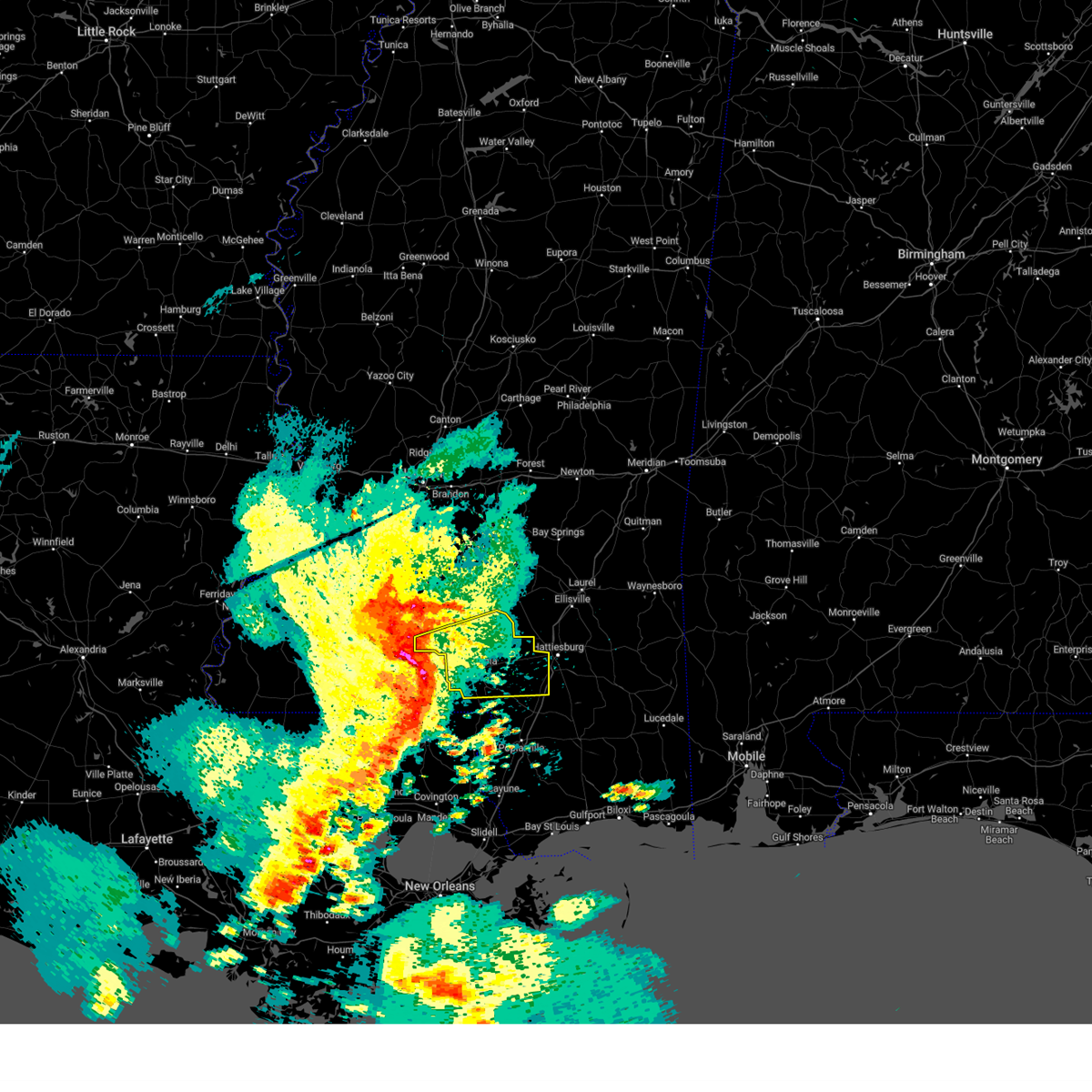
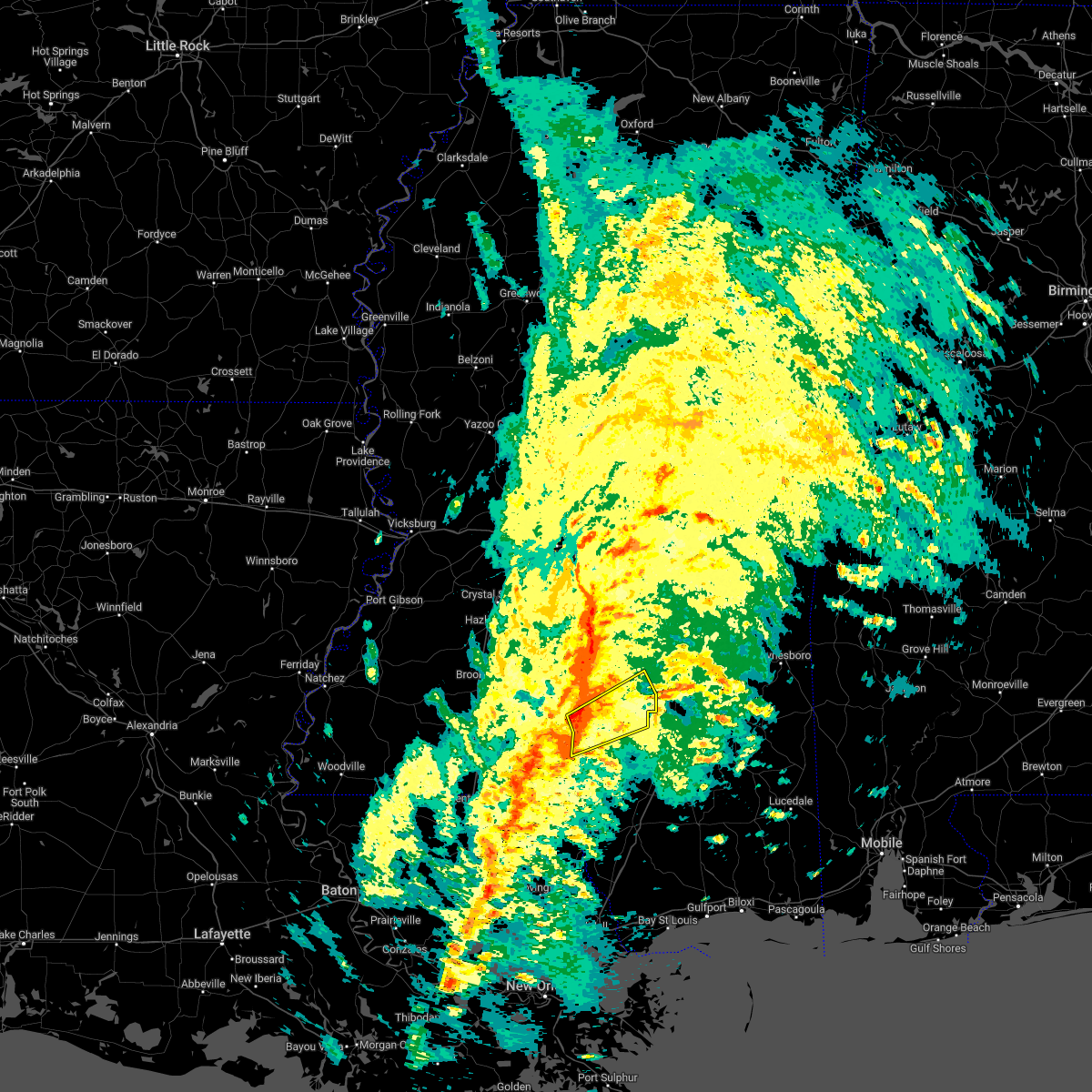
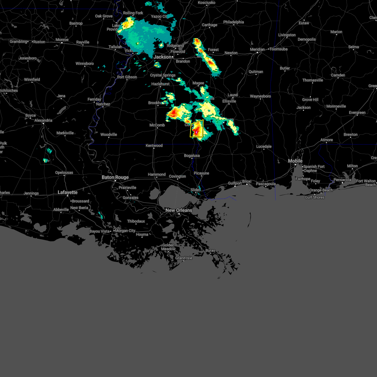
Hail Map for Foxworth, MS
The Foxworth, MS area has had 10 reports of on-the-ground hail by trained spotters, and has been under severe weather warnings 31 times during the past 12 months. Doppler radar has detected hail at or near Foxworth, MS on 32 occasions, including 6 occasions during the past year.
| Name: | Foxworth, MS |
| Where Located: | 75.2 miles SSE of Jackson, MS |
| Map: | Google Map for Foxworth, MS |
| Population: | 603 |
| Housing Units: | 266 |
| More Info: | Search Google for Foxworth, MS |
5
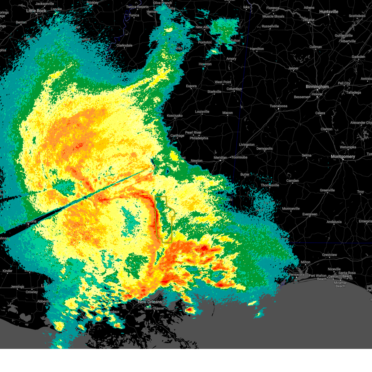
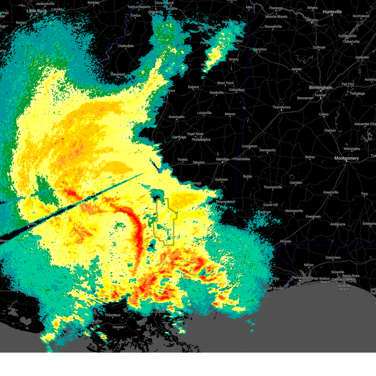
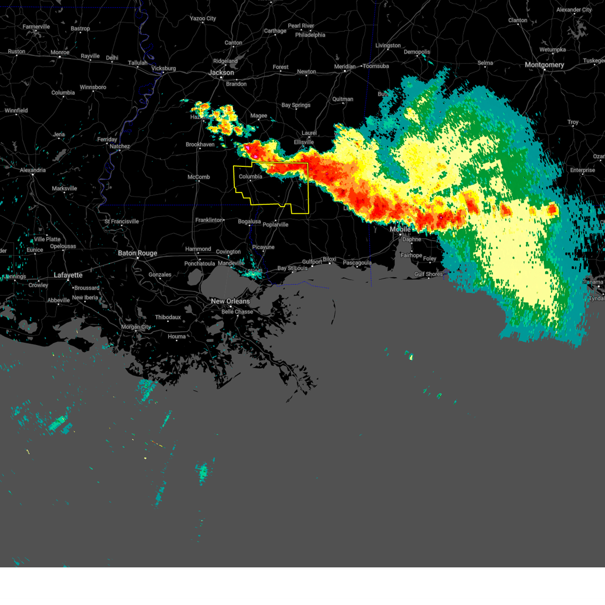
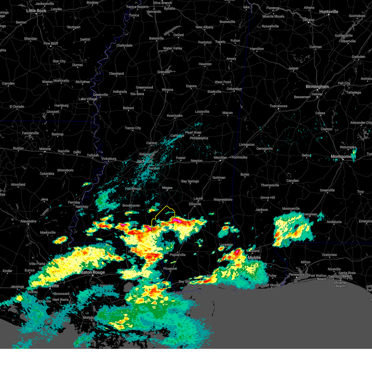
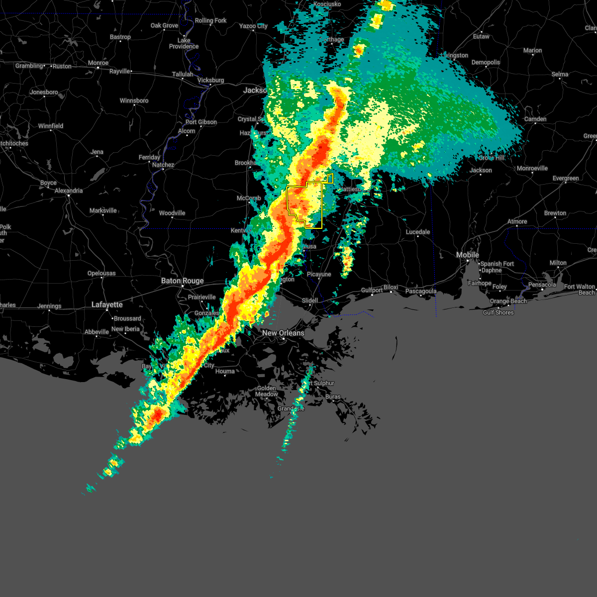
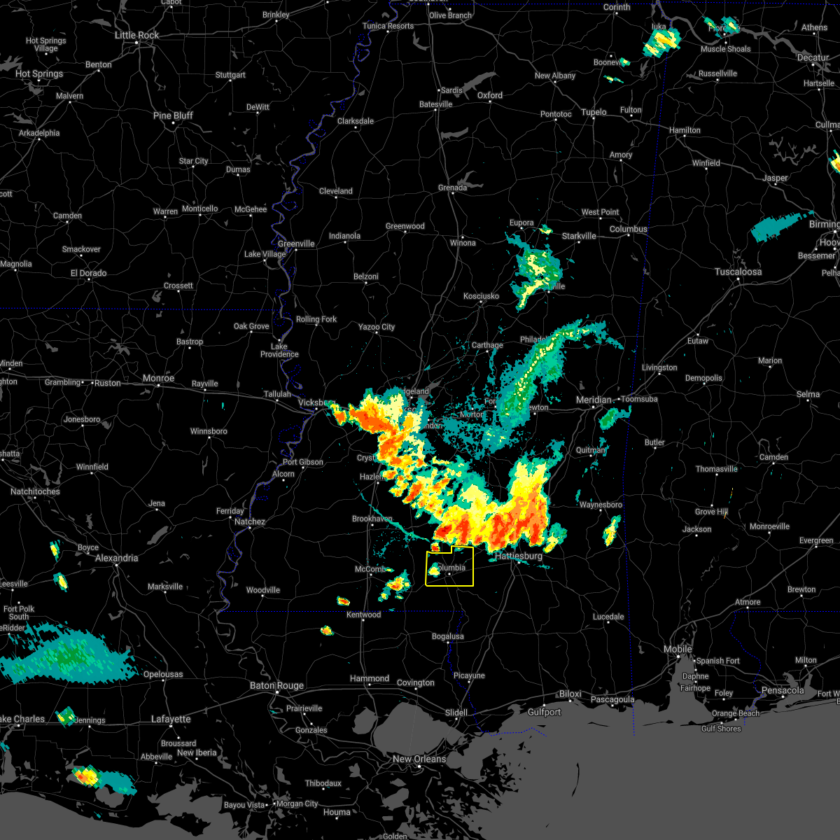
The Top Recent Hail Date for Foxworth, MS is Sunday, February 11, 2024 (2nd out of 32)

Hail and Wind Damage Spotted near Foxworth, MS
| Date / Time | Report Details |
|---|---|
| 4/10/2024 9:53 AM CDT |
 At 953 am cdt, severe thunderstorms were located along a line extending from near prentiss to near sandy hook, moving northeast at 60 mph (radar indicated). Hazards include 60 mph wind gusts. Expect damage to roofs, siding, and trees. These severe storms will be near, bassfield, melba, improve, pine burr, clem, and carson around 1000 am cdt. At 953 am cdt, severe thunderstorms were located along a line extending from near prentiss to near sandy hook, moving northeast at 60 mph (radar indicated). Hazards include 60 mph wind gusts. Expect damage to roofs, siding, and trees. These severe storms will be near, bassfield, melba, improve, pine burr, clem, and carson around 1000 am cdt.
|
| 4/10/2024 9:48 AM CDT | Tree fell on car along ten mile creek roa in marion county MS, 5.6 miles NNE of Foxworth, MS |
| 4/10/2024 9:27 AM CDT |
 Svrjan the national weather service in jackson has issued a * severe thunderstorm warning for, marion county in south central mississippi, jefferson davis county in south central mississippi, * until 1030 am cdt. * at 926 am cdt, severe thunderstorms were located along a line extending from near east lincoln to near franklinton, moving east at 55 mph (radar indicated). Hazards include 60 mph wind gusts. Expect damage to roofs, siding, and trees. severe thunderstorms will be near, kokomo around 935 am cdt. holly springs around 940 am cdt. columbia, pickwick, goss, progress, morgantown, society hill, and sandy hook around 945 am cdt. prentiss and bunker hill around 950 am cdt. bassfield, pine burr, and carson around 955 am cdt. improve around 1000 am cdt. Melba around 1005 am cdt. Svrjan the national weather service in jackson has issued a * severe thunderstorm warning for, marion county in south central mississippi, jefferson davis county in south central mississippi, * until 1030 am cdt. * at 926 am cdt, severe thunderstorms were located along a line extending from near east lincoln to near franklinton, moving east at 55 mph (radar indicated). Hazards include 60 mph wind gusts. Expect damage to roofs, siding, and trees. severe thunderstorms will be near, kokomo around 935 am cdt. holly springs around 940 am cdt. columbia, pickwick, goss, progress, morgantown, society hill, and sandy hook around 945 am cdt. prentiss and bunker hill around 950 am cdt. bassfield, pine burr, and carson around 955 am cdt. improve around 1000 am cdt. Melba around 1005 am cdt.
|
| 2/11/2024 11:58 PM CST |
 At 1157 pm cst, a severe thunderstorm was located near bunker hill, or near columbia, moving northeast at 60 mph (radar indicated). Hazards include golf ball size hail and 60 mph wind gusts. People and animals outdoors will be injured. expect hail damage to roofs, siding, windows, and vehicles. expect wind damage to roofs, siding, and trees. this severe storm will be near, improve around 1205 am cst. thunderstorm damage threat, considerable hail threat, radar indicated max hail size, 1. 75 in wind threat, radar indicated max wind gust, 60 mph. At 1157 pm cst, a severe thunderstorm was located near bunker hill, or near columbia, moving northeast at 60 mph (radar indicated). Hazards include golf ball size hail and 60 mph wind gusts. People and animals outdoors will be injured. expect hail damage to roofs, siding, windows, and vehicles. expect wind damage to roofs, siding, and trees. this severe storm will be near, improve around 1205 am cst. thunderstorm damage threat, considerable hail threat, radar indicated max hail size, 1. 75 in wind threat, radar indicated max wind gust, 60 mph.
|
| 2/11/2024 11:55 PM CST | Golf Ball sized hail reported 1.6 miles S of Foxworth, MS, ping pong to golfball size hail near foxworth. |
| 2/11/2024 11:43 PM CST |
 At 1143 pm cst, a severe thunderstorm was located over kokomo, or 13 miles west of columbia, moving northeast at 60 mph (radar indicated). Hazards include ping pong ball size hail and 60 mph wind gusts. People and animals outdoors will be injured. expect hail damage to roofs, siding, windows, and vehicles. expect wind damage to roofs, siding, and trees. this severe thunderstorm will be near, columbia, goss, holly springs, and morgantown around 1150 pm cst. bunker hill around 1155 pm cst. improve around 1200 am cst. hail threat, radar indicated max hail size, 1. 50 in wind threat, radar indicated max wind gust, 60 mph. At 1143 pm cst, a severe thunderstorm was located over kokomo, or 13 miles west of columbia, moving northeast at 60 mph (radar indicated). Hazards include ping pong ball size hail and 60 mph wind gusts. People and animals outdoors will be injured. expect hail damage to roofs, siding, windows, and vehicles. expect wind damage to roofs, siding, and trees. this severe thunderstorm will be near, columbia, goss, holly springs, and morgantown around 1150 pm cst. bunker hill around 1155 pm cst. improve around 1200 am cst. hail threat, radar indicated max hail size, 1. 50 in wind threat, radar indicated max wind gust, 60 mph.
|
| 2/11/2024 10:45 PM CST | Golf Ball sized hail reported 8.1 miles N of Foxworth, MS, report via social media. quarter to golfball size hail near sandy hook. |
| 2/11/2024 10:42 PM CST |
 At 1042 pm cst, a severe thunderstorm was located near dexter, or 13 miles southwest of columbia, moving northeast at 60 mph (radar indicated). Hazards include golf ball size hail and 60 mph wind gusts. People and animals outdoors will be injured. expect hail damage to roofs, siding, windows, and vehicles. expect wind damage to roofs, siding, and trees. this severe thunderstorm will be near, columbia, pickwick, and pine burr around 1050 pm cst. improve around 1100 pm cst. hattiesburg around 1105 pm cst. oak grove and sumrall around 1110 pm cst. west hattiesburg, rawls springs, and sanford around 1115 pm cst. eastabuchie around 1120 pm cst. thunderstorm damage threat, considerable hail threat, radar indicated max hail size, 1. 75 in wind threat, radar indicated max wind gust, 60 mph. At 1042 pm cst, a severe thunderstorm was located near dexter, or 13 miles southwest of columbia, moving northeast at 60 mph (radar indicated). Hazards include golf ball size hail and 60 mph wind gusts. People and animals outdoors will be injured. expect hail damage to roofs, siding, windows, and vehicles. expect wind damage to roofs, siding, and trees. this severe thunderstorm will be near, columbia, pickwick, and pine burr around 1050 pm cst. improve around 1100 pm cst. hattiesburg around 1105 pm cst. oak grove and sumrall around 1110 pm cst. west hattiesburg, rawls springs, and sanford around 1115 pm cst. eastabuchie around 1120 pm cst. thunderstorm damage threat, considerable hail threat, radar indicated max hail size, 1. 75 in wind threat, radar indicated max wind gust, 60 mph.
|
| 1/25/2024 10:18 AM CST |
 At 1018 am cst, a severe thunderstorm was located over purvis, moving east at 60 mph (radar indicated). Hazards include 60 mph wind gusts. Expect damage to roofs, siding, and trees. this severe thunderstorm will remain over mainly rural areas of eastern marion and lamar counties. hail threat, radar indicated max hail size, <. 75 in wind threat, radar indicated max wind gust, 60 mph. At 1018 am cst, a severe thunderstorm was located over purvis, moving east at 60 mph (radar indicated). Hazards include 60 mph wind gusts. Expect damage to roofs, siding, and trees. this severe thunderstorm will remain over mainly rural areas of eastern marion and lamar counties. hail threat, radar indicated max hail size, <. 75 in wind threat, radar indicated max wind gust, 60 mph.
|
| 1/25/2024 9:41 AM CST |
 At 941 am cst, a severe thunderstorm was located 8 miles northeast of franklinton, moving east at 60 mph (radar indicated). Hazards include 60 mph wind gusts. Expect damage to roofs, siding, and trees. this severe thunderstorm will be near, sandy hook around 950 am cst. pickwick around 955 am cst. baxterville and pine burr around 1000 am cst. hattiesburg, purvis, and pine ridge around 1015 am cst. hail threat, radar indicated max hail size, <. 75 in wind threat, radar indicated max wind gust, 60 mph. At 941 am cst, a severe thunderstorm was located 8 miles northeast of franklinton, moving east at 60 mph (radar indicated). Hazards include 60 mph wind gusts. Expect damage to roofs, siding, and trees. this severe thunderstorm will be near, sandy hook around 950 am cst. pickwick around 955 am cst. baxterville and pine burr around 1000 am cst. hattiesburg, purvis, and pine ridge around 1015 am cst. hail threat, radar indicated max hail size, <. 75 in wind threat, radar indicated max wind gust, 60 mph.
|
| 1/24/2024 11:49 AM CST |
 At 1149 am cst, a severe thunderstorm was located over columbia, moving northeast at 35 mph (radar indicated). Hazards include 60 mph wind gusts. Expect damage to roofs, siding, and trees. This severe thunderstorm will be near, columbia, improve, and bunker hill around 1155 am cst. At 1149 am cst, a severe thunderstorm was located over columbia, moving northeast at 35 mph (radar indicated). Hazards include 60 mph wind gusts. Expect damage to roofs, siding, and trees. This severe thunderstorm will be near, columbia, improve, and bunker hill around 1155 am cst.
|
| 9/7/2023 3:59 PM CDT |
 At 359 pm cdt, a severe thunderstorm was located near pickwick, or near columbia, moving south at 10 mph (radar indicated). Hazards include 60 mph wind gusts and quarter size hail. Hail damage to vehicles is expected. expect wind damage to roofs, siding, and trees. this severe storm will be near, pickwick around 405 pm cdt. hail threat, radar indicated max hail size, 1. 00 in wind threat, radar indicated max wind gust, 60 mph. At 359 pm cdt, a severe thunderstorm was located near pickwick, or near columbia, moving south at 10 mph (radar indicated). Hazards include 60 mph wind gusts and quarter size hail. Hail damage to vehicles is expected. expect wind damage to roofs, siding, and trees. this severe storm will be near, pickwick around 405 pm cdt. hail threat, radar indicated max hail size, 1. 00 in wind threat, radar indicated max wind gust, 60 mph.
|
| 9/7/2023 3:52 PM CDT | Multiple trees were blown down across highway 58 in marion county MS, 1.2 miles ENE of Foxworth, MS |
| 9/7/2023 3:31 PM CDT |
 At 331 pm cdt, a severe thunderstorm was located near morgantown, or near columbia, moving south at 10 mph (radar indicated). Hazards include 60 mph wind gusts and quarter size hail. Hail damage to vehicles is expected. expect wind damage to roofs, siding, and trees. this severe thunderstorm will be near, columbia and kokomo around 335 pm cdt. hail threat, radar indicated max hail size, 1. 00 in wind threat, radar indicated max wind gust, 60 mph. At 331 pm cdt, a severe thunderstorm was located near morgantown, or near columbia, moving south at 10 mph (radar indicated). Hazards include 60 mph wind gusts and quarter size hail. Hail damage to vehicles is expected. expect wind damage to roofs, siding, and trees. this severe thunderstorm will be near, columbia and kokomo around 335 pm cdt. hail threat, radar indicated max hail size, 1. 00 in wind threat, radar indicated max wind gust, 60 mph.
|
| 9/7/2023 3:29 PM CDT | A tree was blown down and a roof was damaged on new hope church roa in marion county MS, 7.9 miles NNE of Foxworth, MS |
| 9/7/2023 3:23 PM CDT | A tree was blown onto highway 587 near racetrack roa in marion county MS, 1.6 miles S of Foxworth, MS |
| 7/22/2023 2:42 PM CDT |
 The severe thunderstorm warning for central marion, northeastern forrest and central lamar counties will expire at 245 pm cdt, the storms which prompted the warning have weakened below severe limits, and no longer pose an immediate threat to life or property. therefore, the warning will be allowed to expire. however gusty winds are still possible with these thunderstorms. a severe thunderstorm watch remains in effect until 900 pm cdt for south central and southeastern mississippi. The severe thunderstorm warning for central marion, northeastern forrest and central lamar counties will expire at 245 pm cdt, the storms which prompted the warning have weakened below severe limits, and no longer pose an immediate threat to life or property. therefore, the warning will be allowed to expire. however gusty winds are still possible with these thunderstorms. a severe thunderstorm watch remains in effect until 900 pm cdt for south central and southeastern mississippi.
|
| 7/22/2023 2:30 PM CDT |
 At 230 pm cdt, severe thunderstorms were located along a line extending from west hattiesburg to 6 miles west of pine ridge to near kokomo, moving southeast at 20 mph (radar indicated). Hazards include 60 mph wind gusts and nickel size hail. Expect damage to roofs, siding, and trees. these severe storms will be near, hattiesburg, west hattiesburg and oak grove around 235 pm cdt. petal around 245 pm cdt. pine ridge and sunrise around 250 pm cdt. purvis around 300 pm cdt. mclaurin and pine burr around 310 pm cdt. hail threat, radar indicated max hail size, 0. 88 in wind threat, radar indicated max wind gust, 60 mph. At 230 pm cdt, severe thunderstorms were located along a line extending from west hattiesburg to 6 miles west of pine ridge to near kokomo, moving southeast at 20 mph (radar indicated). Hazards include 60 mph wind gusts and nickel size hail. Expect damage to roofs, siding, and trees. these severe storms will be near, hattiesburg, west hattiesburg and oak grove around 235 pm cdt. petal around 245 pm cdt. pine ridge and sunrise around 250 pm cdt. purvis around 300 pm cdt. mclaurin and pine burr around 310 pm cdt. hail threat, radar indicated max hail size, 0. 88 in wind threat, radar indicated max wind gust, 60 mph.
|
| 7/22/2023 1:44 PM CDT |
 At 144 pm cdt, severe thunderstorms were located along a line extending from near ovett to near oak grove to morgantown, moving southeast at 15 mph (radar indicated). Hazards include 60 mph wind gusts and nickel size hail. Expect damage to roofs, siding, and trees. severe thunderstorms will be near, hattiesburg and west hattiesburg around 155 pm cdt. oak grove around 200 pm cdt. pine ridge around 215 pm cdt. purvis and pickwick around 230 pm cdt. pine burr around 240 pm cdt. hail threat, radar indicated max hail size, 0. 88 in wind threat, radar indicated max wind gust, 60 mph. At 144 pm cdt, severe thunderstorms were located along a line extending from near ovett to near oak grove to morgantown, moving southeast at 15 mph (radar indicated). Hazards include 60 mph wind gusts and nickel size hail. Expect damage to roofs, siding, and trees. severe thunderstorms will be near, hattiesburg and west hattiesburg around 155 pm cdt. oak grove around 200 pm cdt. pine ridge around 215 pm cdt. purvis and pickwick around 230 pm cdt. pine burr around 240 pm cdt. hail threat, radar indicated max hail size, 0. 88 in wind threat, radar indicated max wind gust, 60 mph.
|
| 6/26/2023 1:15 AM CDT |
 At 115 am cdt, severe thunderstorms were located along a line extending from near brooklyn to near rock hill to near sandy hook, moving southeast at 55 mph (radar indicated). Hazards include 60 mph wind gusts. Expect damage to roofs, siding, and trees. these severe storms will be near, maxie and brooklyn around 120 am cdt. hail threat, radar indicated max hail size, <. 75 in wind threat, radar indicated max wind gust, 60 mph. At 115 am cdt, severe thunderstorms were located along a line extending from near brooklyn to near rock hill to near sandy hook, moving southeast at 55 mph (radar indicated). Hazards include 60 mph wind gusts. Expect damage to roofs, siding, and trees. these severe storms will be near, maxie and brooklyn around 120 am cdt. hail threat, radar indicated max hail size, <. 75 in wind threat, radar indicated max wind gust, 60 mph.
|
| 6/26/2023 1:07 AM CDT |
 At 107 am cdt, severe thunderstorms were located along a line extending from near brooklyn to near rock hill to sandy hook, moving southeast at 40 mph (radar indicated). Hazards include 60 mph wind gusts. Expect damage to roofs, siding, and trees. these severe storms will be near, brooklyn and rock hill around 110 am cdt. maxie around 120 am cdt. hail threat, radar indicated max hail size, <. 75 in wind threat, radar indicated max wind gust, 60 mph. At 107 am cdt, severe thunderstorms were located along a line extending from near brooklyn to near rock hill to sandy hook, moving southeast at 40 mph (radar indicated). Hazards include 60 mph wind gusts. Expect damage to roofs, siding, and trees. these severe storms will be near, brooklyn and rock hill around 110 am cdt. maxie around 120 am cdt. hail threat, radar indicated max hail size, <. 75 in wind threat, radar indicated max wind gust, 60 mph.
|
| 6/26/2023 12:57 AM CDT |
 At 1257 am cdt, severe thunderstorms were located along a line extending from near mclaurin to purvis to near dexter, moving southeast at 55 mph (radar indicated). Hazards include 60 mph wind gusts. Expect damage to roofs, siding, and trees. these severe storms will be near, purvis, lumberton and mclaurin around 100 am cdt. rock hill around 105 am cdt. brooklyn around 110 am cdt. maxie around 115 am cdt. hail threat, radar indicated max hail size, <. 75 in wind threat, radar indicated max wind gust, 60 mph. At 1257 am cdt, severe thunderstorms were located along a line extending from near mclaurin to purvis to near dexter, moving southeast at 55 mph (radar indicated). Hazards include 60 mph wind gusts. Expect damage to roofs, siding, and trees. these severe storms will be near, purvis, lumberton and mclaurin around 100 am cdt. rock hill around 105 am cdt. brooklyn around 110 am cdt. maxie around 115 am cdt. hail threat, radar indicated max hail size, <. 75 in wind threat, radar indicated max wind gust, 60 mph.
|
| 6/26/2023 12:42 AM CDT |
 At 1242 am cdt, severe thunderstorms were located along a line extending from near ovett to petal to near pine ridge to near morgantown, moving southeast at 45 mph (radar indicated). Hazards include 60 mph wind gusts. Expect damage to roofs, siding, and trees. these severe storms will be near, sunrise and pine ridge around 1250 am cdt. purvis around 1255 am cdt. mclaurin around 100 am cdt. lumberton, sandy hook and rock hill around 105 am cdt. brooklyn around 110 am cdt. hail threat, radar indicated max hail size, <. 75 in wind threat, radar indicated max wind gust, 60 mph. At 1242 am cdt, severe thunderstorms were located along a line extending from near ovett to petal to near pine ridge to near morgantown, moving southeast at 45 mph (radar indicated). Hazards include 60 mph wind gusts. Expect damage to roofs, siding, and trees. these severe storms will be near, sunrise and pine ridge around 1250 am cdt. purvis around 1255 am cdt. mclaurin around 100 am cdt. lumberton, sandy hook and rock hill around 105 am cdt. brooklyn around 110 am cdt. hail threat, radar indicated max hail size, <. 75 in wind threat, radar indicated max wind gust, 60 mph.
|
| 6/26/2023 12:18 AM CDT |
 At 1217 am cdt, severe thunderstorms were located along a line extending from sandersville to ellisville to near sanford to near society hill, moving southeast at 55 mph (radar indicated). Hazards include 60 mph wind gusts. Expect damage to roofs, siding, and trees. severe thunderstorms will be near, rawls springs around 1225 am cdt. west hattiesburg and oak grove around 1230 am cdt. petal, sunrise and macedonia around 1235 am cdt. hattiesburg, pine ridge and mclaurin around 1245 am cdt. purvis around 1250 am cdt. rock hill around 100 am cdt. brooklyn around 105 am cdt. maxie around 110 am cdt. hail threat, radar indicated max hail size, <. 75 in wind threat, radar indicated max wind gust, 60 mph. At 1217 am cdt, severe thunderstorms were located along a line extending from sandersville to ellisville to near sanford to near society hill, moving southeast at 55 mph (radar indicated). Hazards include 60 mph wind gusts. Expect damage to roofs, siding, and trees. severe thunderstorms will be near, rawls springs around 1225 am cdt. west hattiesburg and oak grove around 1230 am cdt. petal, sunrise and macedonia around 1235 am cdt. hattiesburg, pine ridge and mclaurin around 1245 am cdt. purvis around 1250 am cdt. rock hill around 100 am cdt. brooklyn around 105 am cdt. maxie around 110 am cdt. hail threat, radar indicated max hail size, <. 75 in wind threat, radar indicated max wind gust, 60 mph.
|
| 6/19/2023 8:36 AM CDT |
 At 836 am cdt, a severe thunderstorm was located over columbia, moving east at 25 mph (radar indicated). Hazards include 60 mph wind gusts and quarter size hail. Hail damage to vehicles is expected. expect wind damage to roofs, siding, and trees. this severe thunderstorm will be near, columbia around 840 am cdt. pine burr around 900 am cdt. hattiesburg around 930 am cdt. oak grove and pine ridge around 935 am cdt. Purvis around 940 am cdt. At 836 am cdt, a severe thunderstorm was located over columbia, moving east at 25 mph (radar indicated). Hazards include 60 mph wind gusts and quarter size hail. Hail damage to vehicles is expected. expect wind damage to roofs, siding, and trees. this severe thunderstorm will be near, columbia around 840 am cdt. pine burr around 900 am cdt. hattiesburg around 930 am cdt. oak grove and pine ridge around 935 am cdt. Purvis around 940 am cdt.
|
| 6/17/2023 12:18 AM CDT |
 At 1217 am cdt, severe thunderstorms were located along a line extending from near columbia to near purvis to 7 miles east of brooklyn, moving south at 30 mph (radar indicated). Hazards include 60 mph wind gusts and quarter size hail. Hail damage to vehicles is expected. expect wind damage to roofs, siding, and trees. these severe storms will be near, rock hill around 1230 am cdt. lumberton around 1235 am cdt. sandy hook around 1245 am cdt. hail threat, radar indicated max hail size, 1. 00 in wind threat, radar indicated max wind gust, 60 mph. At 1217 am cdt, severe thunderstorms were located along a line extending from near columbia to near purvis to 7 miles east of brooklyn, moving south at 30 mph (radar indicated). Hazards include 60 mph wind gusts and quarter size hail. Hail damage to vehicles is expected. expect wind damage to roofs, siding, and trees. these severe storms will be near, rock hill around 1230 am cdt. lumberton around 1235 am cdt. sandy hook around 1245 am cdt. hail threat, radar indicated max hail size, 1. 00 in wind threat, radar indicated max wind gust, 60 mph.
|
| 6/16/2023 11:46 PM CDT |
 At 1146 pm cdt, severe thunderstorms were located along a line extending from near oak vale to near sumrall to near macedonia, moving southeast at 35 mph (radar indicated). Hazards include 60 mph wind gusts. Expect damage to roofs, siding, and trees. these severe storms will be near, petal, sunrise and macedonia around 1150 pm cdt. hattiesburg, west hattiesburg and oak grove around 1155 pm cdt. pine ridge and mclaurin around 1205 am cdt. columbia and purvis around 1210 am cdt. pickwick around 1220 am cdt. lumberton and rock hill around 1225 am cdt. pine burr around 1230 am cdt. sandy hook around 1235 am cdt. hail threat, radar indicated max hail size, <. 75 in wind threat, radar indicated max wind gust, 60 mph. At 1146 pm cdt, severe thunderstorms were located along a line extending from near oak vale to near sumrall to near macedonia, moving southeast at 35 mph (radar indicated). Hazards include 60 mph wind gusts. Expect damage to roofs, siding, and trees. these severe storms will be near, petal, sunrise and macedonia around 1150 pm cdt. hattiesburg, west hattiesburg and oak grove around 1155 pm cdt. pine ridge and mclaurin around 1205 am cdt. columbia and purvis around 1210 am cdt. pickwick around 1220 am cdt. lumberton and rock hill around 1225 am cdt. pine burr around 1230 am cdt. sandy hook around 1235 am cdt. hail threat, radar indicated max hail size, <. 75 in wind threat, radar indicated max wind gust, 60 mph.
|
| 6/16/2023 11:18 PM CDT |
 At 1117 pm cdt, severe thunderstorms were located along a line extending from bassfield to sanford to 6 miles west of ovett, moving south at 30 mph (radar indicated). Hazards include 60 mph wind gusts and quarter size hail. Hail damage to vehicles is expected. expect wind damage to roofs, siding, and trees. severe thunderstorms will be near, macedonia around 1130 pm cdt. rawls springs and sunrise around 1135 pm cdt. hattiesburg, petal, west hattiesburg and improve around 1140 pm cdt. oak grove around 1145 pm cdt. pine ridge around 1155 pm cdt. purvis around 1200 am cdt. pine burr and mclaurin around 1205 am cdt. baxterville and rock hill around 1215 am cdt. hail threat, radar indicated max hail size, 1. 00 in wind threat, radar indicated max wind gust, 60 mph. At 1117 pm cdt, severe thunderstorms were located along a line extending from bassfield to sanford to 6 miles west of ovett, moving south at 30 mph (radar indicated). Hazards include 60 mph wind gusts and quarter size hail. Hail damage to vehicles is expected. expect wind damage to roofs, siding, and trees. severe thunderstorms will be near, macedonia around 1130 pm cdt. rawls springs and sunrise around 1135 pm cdt. hattiesburg, petal, west hattiesburg and improve around 1140 pm cdt. oak grove around 1145 pm cdt. pine ridge around 1155 pm cdt. purvis around 1200 am cdt. pine burr and mclaurin around 1205 am cdt. baxterville and rock hill around 1215 am cdt. hail threat, radar indicated max hail size, 1. 00 in wind threat, radar indicated max wind gust, 60 mph.
|
| 6/14/2023 6:55 PM CDT |
 At 654 pm cdt, a severe thunderstorm was located near improve, or near columbia, moving southeast at 55 mph (radar indicated). Hazards include tennis ball size hail and 70 mph wind gusts. People and animals outdoors will be injured. expect hail damage to roofs, siding, windows, and vehicles. expect considerable tree damage. wind damage is also likely to mobile homes, roofs, and outbuildings. this severe storm will be near, baxterville around 705 pm cdt. pine ridge around 710 pm cdt. purvis around 715 pm cdt. thunderstorm damage threat, considerable hail threat, radar indicated max hail size, 2. 50 in wind threat, radar indicated max wind gust, 70 mph. At 654 pm cdt, a severe thunderstorm was located near improve, or near columbia, moving southeast at 55 mph (radar indicated). Hazards include tennis ball size hail and 70 mph wind gusts. People and animals outdoors will be injured. expect hail damage to roofs, siding, windows, and vehicles. expect considerable tree damage. wind damage is also likely to mobile homes, roofs, and outbuildings. this severe storm will be near, baxterville around 705 pm cdt. pine ridge around 710 pm cdt. purvis around 715 pm cdt. thunderstorm damage threat, considerable hail threat, radar indicated max hail size, 2. 50 in wind threat, radar indicated max wind gust, 70 mph.
|
| 6/14/2023 6:27 PM CDT |
 At 627 pm cdt, a severe thunderstorm was located near progress, or 8 miles southwest of prentiss, moving east at 55 mph (radar indicated). Hazards include ping pong ball size hail and 60 mph wind gusts. People and animals outdoors will be injured. expect hail damage to roofs, siding, windows, and vehicles. expect wind damage to roofs, siding, and trees. this severe thunderstorm will be near, society hill and carson around 635 pm cdt. bassfield and bunker hill around 640 pm cdt. improve around 645 pm cdt. melba around 650 pm cdt. sumrall around 655 pm cdt. hattiesburg and oak grove around 705 pm cdt. west hattiesburg around 710 pm cdt. hail threat, radar indicated max hail size, 1. 50 in wind threat, radar indicated max wind gust, 60 mph. At 627 pm cdt, a severe thunderstorm was located near progress, or 8 miles southwest of prentiss, moving east at 55 mph (radar indicated). Hazards include ping pong ball size hail and 60 mph wind gusts. People and animals outdoors will be injured. expect hail damage to roofs, siding, windows, and vehicles. expect wind damage to roofs, siding, and trees. this severe thunderstorm will be near, society hill and carson around 635 pm cdt. bassfield and bunker hill around 640 pm cdt. improve around 645 pm cdt. melba around 650 pm cdt. sumrall around 655 pm cdt. hattiesburg and oak grove around 705 pm cdt. west hattiesburg around 710 pm cdt. hail threat, radar indicated max hail size, 1. 50 in wind threat, radar indicated max wind gust, 60 mph.
|
| 5/11/2023 6:03 PM CDT |
 At 603 pm cdt, severe thunderstorms were located along a line extending from sanford to improve, moving northeast at 15 mph (radar indicated). Hazards include quarter size hail. Damage to vehicles is expected. locations impacted include, columbia, sumrall, sanford, morgantown, goss, holly springs, society hill, bunker hill, improve and melba. hail threat, radar indicated max hail size, 1. 00 in wind threat, radar indicated max wind gust, <50 mph. At 603 pm cdt, severe thunderstorms were located along a line extending from sanford to improve, moving northeast at 15 mph (radar indicated). Hazards include quarter size hail. Damage to vehicles is expected. locations impacted include, columbia, sumrall, sanford, morgantown, goss, holly springs, society hill, bunker hill, improve and melba. hail threat, radar indicated max hail size, 1. 00 in wind threat, radar indicated max wind gust, <50 mph.
|
| 5/11/2023 5:45 PM CDT |
 At 545 pm cdt, severe thunderstorms were located along a line extending from near sanford to near columbia, moving northeast at 20 mph (radar indicated). Hazards include quarter size hail. Damage to vehicles is expected. locations impacted include, columbia, sumrall, seminary, bassfield, kokomo, morgantown, goss, holly springs, bunker hill, sanford, society hill, improve, melba and carson. hail threat, radar indicated max hail size, 1. 00 in wind threat, radar indicated max wind gust, <50 mph. At 545 pm cdt, severe thunderstorms were located along a line extending from near sanford to near columbia, moving northeast at 20 mph (radar indicated). Hazards include quarter size hail. Damage to vehicles is expected. locations impacted include, columbia, sumrall, seminary, bassfield, kokomo, morgantown, goss, holly springs, bunker hill, sanford, society hill, improve, melba and carson. hail threat, radar indicated max hail size, 1. 00 in wind threat, radar indicated max wind gust, <50 mph.
|
| 5/11/2023 5:20 PM CDT |
 At 519 pm cdt, severe thunderstorms were located along a line extending from near seminary to near bunker hill to near kokomo, moving northeast at 20 mph (radar indicated). Hazards include quarter size hail. damage to vehicles is expected At 519 pm cdt, severe thunderstorms were located along a line extending from near seminary to near bunker hill to near kokomo, moving northeast at 20 mph (radar indicated). Hazards include quarter size hail. damage to vehicles is expected
|
| 5/5/2023 3:18 PM CDT |
 At 318 pm cdt, a severe thunderstorm was located over pine burr, or 9 miles southeast of columbia, moving southeast at 40 mph (radar indicated). Hazards include 60 mph wind gusts and quarter size hail. Hail damage to vehicles is expected. expect wind damage to roofs, siding, and trees. this severe thunderstorm will remain over mainly rural areas of marion county. hail threat, radar indicated max hail size, 1. 00 in wind threat, radar indicated max wind gust, 60 mph. At 318 pm cdt, a severe thunderstorm was located over pine burr, or 9 miles southeast of columbia, moving southeast at 40 mph (radar indicated). Hazards include 60 mph wind gusts and quarter size hail. Hail damage to vehicles is expected. expect wind damage to roofs, siding, and trees. this severe thunderstorm will remain over mainly rural areas of marion county. hail threat, radar indicated max hail size, 1. 00 in wind threat, radar indicated max wind gust, 60 mph.
|
| 5/5/2023 2:55 PM CDT |
 At 255 pm cdt, a severe thunderstorm was located over morgantown, or near columbia, moving southeast at 40 mph (radar indicated). Hazards include 70 mph wind gusts and quarter size hail. Hail damage to vehicles is expected. expect considerable tree damage. wind damage is also likely to mobile homes, roofs, and outbuildings. this severe storm will be near, columbia around 305 pm cdt. pickwick around 310 pm cdt. pine burr around 320 pm cdt. thunderstorm damage threat, considerable hail threat, radar indicated max hail size, 1. 00 in wind threat, radar indicated max wind gust, 70 mph. At 255 pm cdt, a severe thunderstorm was located over morgantown, or near columbia, moving southeast at 40 mph (radar indicated). Hazards include 70 mph wind gusts and quarter size hail. Hail damage to vehicles is expected. expect considerable tree damage. wind damage is also likely to mobile homes, roofs, and outbuildings. this severe storm will be near, columbia around 305 pm cdt. pickwick around 310 pm cdt. pine burr around 320 pm cdt. thunderstorm damage threat, considerable hail threat, radar indicated max hail size, 1. 00 in wind threat, radar indicated max wind gust, 70 mph.
|
| 5/5/2023 2:36 PM CDT |
 At 236 pm cdt, a severe thunderstorm was located over tilton, or 8 miles southeast of monticello, moving southeast at 40 mph (radar indicated). Hazards include 70 mph wind gusts and quarter size hail. Hail damage to vehicles is expected. expect considerable tree damage. wind damage is also likely to mobile homes, roofs, and outbuildings. this severe thunderstorm will be near, society hill and holly springs around 250 pm cdt. morgantown, goss and bunker hill around 255 pm cdt. columbia around 305 pm cdt. pickwick around 310 pm cdt. pine burr around 320 pm cdt. thunderstorm damage threat, considerable hail threat, radar indicated max hail size, 1. 00 in wind threat, radar indicated max wind gust, 70 mph. At 236 pm cdt, a severe thunderstorm was located over tilton, or 8 miles southeast of monticello, moving southeast at 40 mph (radar indicated). Hazards include 70 mph wind gusts and quarter size hail. Hail damage to vehicles is expected. expect considerable tree damage. wind damage is also likely to mobile homes, roofs, and outbuildings. this severe thunderstorm will be near, society hill and holly springs around 250 pm cdt. morgantown, goss and bunker hill around 255 pm cdt. columbia around 305 pm cdt. pickwick around 310 pm cdt. pine burr around 320 pm cdt. thunderstorm damage threat, considerable hail threat, radar indicated max hail size, 1. 00 in wind threat, radar indicated max wind gust, 70 mph.
|
| 4/15/2023 12:35 PM CDT |
 At 1234 pm cdt, a severe thunderstorm was located over improve, or 8 miles northeast of columbia, moving east at 55 mph (radar indicated). Hazards include 60 mph wind gusts and penny size hail. Expect damage to roofs, siding, and trees. this severe storm will be near, sumrall around 1245 pm cdt. hattiesburg around 1250 pm cdt. west hattiesburg and oak grove around 1255 pm cdt. other locations impacted by this severe thunderstorm include bassfield. hail threat, radar indicated max hail size, 0. 75 in wind threat, radar indicated max wind gust, 60 mph. At 1234 pm cdt, a severe thunderstorm was located over improve, or 8 miles northeast of columbia, moving east at 55 mph (radar indicated). Hazards include 60 mph wind gusts and penny size hail. Expect damage to roofs, siding, and trees. this severe storm will be near, sumrall around 1245 pm cdt. hattiesburg around 1250 pm cdt. west hattiesburg and oak grove around 1255 pm cdt. other locations impacted by this severe thunderstorm include bassfield. hail threat, radar indicated max hail size, 0. 75 in wind threat, radar indicated max wind gust, 60 mph.
|
| 4/15/2023 12:13 PM CDT | Quarter sized hail reported 6.3 miles NNE of Foxworth, MS, pretty good sized hail reported. |
| 4/15/2023 12:13 PM CDT | Tree downe in marion county MS, 6.4 miles ENE of Foxworth, MS |
| 4/15/2023 12:11 PM CDT |
 At 1210 pm cdt, a severe thunderstorm was located over kokomo, moving east at 65 mph (radar indicated). Hazards include 60 mph wind gusts and penny size hail. Expect damage to roofs, siding, and trees. this severe thunderstorm will be near, columbia, morgantown and goss around 1220 pm cdt. bunker hill around 1225 pm cdt. improve around 1230 pm cdt. hattiesburg and sumrall around 1240 pm cdt. oak grove around 1245 pm cdt. west hattiesburg around 1250 pm cdt. other locations impacted by this severe thunderstorm include bassfield. hail threat, radar indicated max hail size, 0. 75 in wind threat, radar indicated max wind gust, 60 mph. At 1210 pm cdt, a severe thunderstorm was located over kokomo, moving east at 65 mph (radar indicated). Hazards include 60 mph wind gusts and penny size hail. Expect damage to roofs, siding, and trees. this severe thunderstorm will be near, columbia, morgantown and goss around 1220 pm cdt. bunker hill around 1225 pm cdt. improve around 1230 pm cdt. hattiesburg and sumrall around 1240 pm cdt. oak grove around 1245 pm cdt. west hattiesburg around 1250 pm cdt. other locations impacted by this severe thunderstorm include bassfield. hail threat, radar indicated max hail size, 0. 75 in wind threat, radar indicated max wind gust, 60 mph.
|
| 3/28/2023 7:40 AM CDT |
 At 740 am cdt, a severe thunderstorm was located over goss, or 7 miles northwest of columbia, moving northeast at 30 mph (radar indicated). Hazards include 60 mph wind gusts and quarter size hail. Hail damage to vehicles is expected. expect wind damage to roofs, siding, and trees. this severe storm will be near, bunker hill around 750 am cdt. melba around 810 am cdt. other locations impacted by this severe thunderstorm include bassfield. hail threat, radar indicated max hail size, 1. 00 in wind threat, radar indicated max wind gust, 60 mph. At 740 am cdt, a severe thunderstorm was located over goss, or 7 miles northwest of columbia, moving northeast at 30 mph (radar indicated). Hazards include 60 mph wind gusts and quarter size hail. Hail damage to vehicles is expected. expect wind damage to roofs, siding, and trees. this severe storm will be near, bunker hill around 750 am cdt. melba around 810 am cdt. other locations impacted by this severe thunderstorm include bassfield. hail threat, radar indicated max hail size, 1. 00 in wind threat, radar indicated max wind gust, 60 mph.
|
| 3/28/2023 7:21 AM CDT |
 At 720 am cdt, a severe thunderstorm was located near holly springs, or near kokomo, moving northeast at 30 mph (radar indicated). Hazards include 60 mph wind gusts and half dollar size hail. Hail damage to vehicles is expected. expect wind damage to roofs, siding, and trees. this severe thunderstorm will be near, holly springs around 730 am cdt. morgantown around 735 am cdt. columbia and goss around 740 am cdt. society hill around 745 am cdt. bunker hill around 750 am cdt. melba around 810 am cdt. other locations impacted by this severe thunderstorm include bassfield. hail threat, radar indicated max hail size, 1. 25 in wind threat, radar indicated max wind gust, 60 mph. At 720 am cdt, a severe thunderstorm was located near holly springs, or near kokomo, moving northeast at 30 mph (radar indicated). Hazards include 60 mph wind gusts and half dollar size hail. Hail damage to vehicles is expected. expect wind damage to roofs, siding, and trees. this severe thunderstorm will be near, holly springs around 730 am cdt. morgantown around 735 am cdt. columbia and goss around 740 am cdt. society hill around 745 am cdt. bunker hill around 750 am cdt. melba around 810 am cdt. other locations impacted by this severe thunderstorm include bassfield. hail threat, radar indicated max hail size, 1. 25 in wind threat, radar indicated max wind gust, 60 mph.
|
| 3/28/2023 6:45 AM CDT |
 At 645 am cdt, a severe thunderstorm was located near columbia, moving northeast at 30 mph (radar indicated). Hazards include 60 mph wind gusts and half dollar size hail. Hail damage to vehicles is expected. expect wind damage to roofs, siding, and trees. this severe thunderstorm will be near, columbia around 650 am cdt. improve around 710 am cdt. hail threat, radar indicated max hail size, 1. 25 in wind threat, radar indicated max wind gust, 60 mph. At 645 am cdt, a severe thunderstorm was located near columbia, moving northeast at 30 mph (radar indicated). Hazards include 60 mph wind gusts and half dollar size hail. Hail damage to vehicles is expected. expect wind damage to roofs, siding, and trees. this severe thunderstorm will be near, columbia around 650 am cdt. improve around 710 am cdt. hail threat, radar indicated max hail size, 1. 25 in wind threat, radar indicated max wind gust, 60 mph.
|
| 1/24/2023 10:09 PM CST |
 The severe thunderstorm warning for northeastern marion, southeastern covington, northwestern lamar and southeastern jefferson davis counties will expire at 1015 pm cst, the storm which prompted the warning has weakened below severe limits, and no longer poses an immediate threat to life or property. therefore, the warning will be allowed to expire. a tornado watch remains in effect until 500 am cst for south central and southeastern mississippi. to report severe weather, contact your nearest law enforcement agency. they will relay your report to the national weather service jackson. The severe thunderstorm warning for northeastern marion, southeastern covington, northwestern lamar and southeastern jefferson davis counties will expire at 1015 pm cst, the storm which prompted the warning has weakened below severe limits, and no longer poses an immediate threat to life or property. therefore, the warning will be allowed to expire. a tornado watch remains in effect until 500 am cst for south central and southeastern mississippi. to report severe weather, contact your nearest law enforcement agency. they will relay your report to the national weather service jackson.
|
| 1/24/2023 9:50 PM CST |
 At 950 pm cst, a severe thunderstorm was located near goss, or near columbia, moving northeast at 50 mph (radar indicated). Hazards include 60 mph wind gusts. Expect damage to roofs, siding, and trees. locations impacted include, columbia, sumrall, sanford, goss, society hill, bunker hill, improve, melba, seminary and bassfield. hail threat, radar indicated max hail size, <. 75 in wind threat, radar indicated max wind gust, 60 mph. At 950 pm cst, a severe thunderstorm was located near goss, or near columbia, moving northeast at 50 mph (radar indicated). Hazards include 60 mph wind gusts. Expect damage to roofs, siding, and trees. locations impacted include, columbia, sumrall, sanford, goss, society hill, bunker hill, improve, melba, seminary and bassfield. hail threat, radar indicated max hail size, <. 75 in wind threat, radar indicated max wind gust, 60 mph.
|
| 1/24/2023 9:34 PM CST |
 At 934 pm cst, a severe thunderstorm was located near kokomo, moving northeast at 60 mph (radar indicated). Hazards include 60 mph wind gusts. expect damage to roofs, siding, and trees At 934 pm cst, a severe thunderstorm was located near kokomo, moving northeast at 60 mph (radar indicated). Hazards include 60 mph wind gusts. expect damage to roofs, siding, and trees
|
| 1/3/2023 5:45 PM CST | Wind damage reported to transformer at substatio in marion county MS, 0.8 miles NW of Foxworth, MS |
| 1/3/2023 5:43 PM CST |
 At 542 pm cst, a severe thunderstorm capable of producing a tornado was located near morgantown, or near kokomo, moving northeast at 30 mph (radar indicated rotation). Hazards include tornado. Flying debris will be dangerous to those caught without shelter. mobile homes will be damaged or destroyed. damage to roofs, windows, and vehicles will occur. tree damage is likely. this dangerous storm will be near, columbia around 550 pm cst. bunker hill around 605 pm cst. Improve around 615 pm cst. At 542 pm cst, a severe thunderstorm capable of producing a tornado was located near morgantown, or near kokomo, moving northeast at 30 mph (radar indicated rotation). Hazards include tornado. Flying debris will be dangerous to those caught without shelter. mobile homes will be damaged or destroyed. damage to roofs, windows, and vehicles will occur. tree damage is likely. this dangerous storm will be near, columbia around 550 pm cst. bunker hill around 605 pm cst. Improve around 615 pm cst.
|
| 12/14/2022 12:54 PM CST |
 At 1254 pm cst, a severe thunderstorm capable of producing a tornado was located over dexter, or 9 miles south of kokomo, moving northeast at 45 mph (radar indicated rotation). Hazards include tornado. Flying debris will be dangerous to those caught without shelter. mobile homes will be damaged or destroyed. damage to roofs, windows, and vehicles will occur. tree damage is likely. this dangerous storm will be near, pickwick around 105 pm cst. columbia around 115 pm cst. Improve and bunker hill around 125 pm cst. At 1254 pm cst, a severe thunderstorm capable of producing a tornado was located over dexter, or 9 miles south of kokomo, moving northeast at 45 mph (radar indicated rotation). Hazards include tornado. Flying debris will be dangerous to those caught without shelter. mobile homes will be damaged or destroyed. damage to roofs, windows, and vehicles will occur. tree damage is likely. this dangerous storm will be near, pickwick around 105 pm cst. columbia around 115 pm cst. Improve and bunker hill around 125 pm cst.
|
| 12/14/2022 11:53 AM CST |
 At 1153 am cst, a severe thunderstorm capable of producing a tornado was located near kokomo, moving northeast at 40 mph (radar indicated rotation). Hazards include tornado. Flying debris will be dangerous to those caught without shelter. mobile homes will be damaged or destroyed. damage to roofs, windows, and vehicles will occur. tree damage is likely. this dangerous storm will be near, columbia and holly springs around 1210 pm cst. morgantown around 1215 pm cst. goss and society hill around 1220 pm cst. bunker hill and improve around 1225 pm cst. carson around 1235 pm cst. melba around 1240 pm cst. Other locations impacted by this tornadic thunderstorm include bassfield. At 1153 am cst, a severe thunderstorm capable of producing a tornado was located near kokomo, moving northeast at 40 mph (radar indicated rotation). Hazards include tornado. Flying debris will be dangerous to those caught without shelter. mobile homes will be damaged or destroyed. damage to roofs, windows, and vehicles will occur. tree damage is likely. this dangerous storm will be near, columbia and holly springs around 1210 pm cst. morgantown around 1215 pm cst. goss and society hill around 1220 pm cst. bunker hill and improve around 1225 pm cst. carson around 1235 pm cst. melba around 1240 pm cst. Other locations impacted by this tornadic thunderstorm include bassfield.
|
| 11/30/2022 1:56 AM CST |
 At 155 am cst, a tornado was reported near pickwick, or near columbia, moving east at 45 mph (radar confirmed tornado). Hazards include damaging tornado. Flying debris will be dangerous to those caught without shelter. mobile homes will be damaged or destroyed. damage to roofs, windows, and vehicles will occur. tree damage is likely. this tornadic storm will be near, pinebur around 200 am cst. hattiesburg, purvis and pine ridge around 225 am cst. West hattiesburg and oak grove around 230 am cst. At 155 am cst, a tornado was reported near pickwick, or near columbia, moving east at 45 mph (radar confirmed tornado). Hazards include damaging tornado. Flying debris will be dangerous to those caught without shelter. mobile homes will be damaged or destroyed. damage to roofs, windows, and vehicles will occur. tree damage is likely. this tornadic storm will be near, pinebur around 200 am cst. hattiesburg, purvis and pine ridge around 225 am cst. West hattiesburg and oak grove around 230 am cst.
|
| 11/30/2022 1:26 AM CST |
 At 126 am cst, a severe thunderstorm was located near salem, or near kokomo, moving east at 50 mph (radar indicated). Hazards include 60 mph wind gusts and quarter size hail. Hail damage to vehicles is expected. expect wind damage to roofs, siding, and trees. this severe thunderstorm will be near, kokomo around 130 am cst. holly springs around 135 am cst. columbia, morgantown and goss around 140 am cst. improve around 155 am cst. hail threat, radar indicated max hail size, 1. 00 in wind threat, radar indicated max wind gust, 60 mph. At 126 am cst, a severe thunderstorm was located near salem, or near kokomo, moving east at 50 mph (radar indicated). Hazards include 60 mph wind gusts and quarter size hail. Hail damage to vehicles is expected. expect wind damage to roofs, siding, and trees. this severe thunderstorm will be near, kokomo around 130 am cst. holly springs around 135 am cst. columbia, morgantown and goss around 140 am cst. improve around 155 am cst. hail threat, radar indicated max hail size, 1. 00 in wind threat, radar indicated max wind gust, 60 mph.
|
| 6/10/2022 2:07 PM CDT |
 At 206 pm cdt, severe thunderstorms were located along a line extending from near mill creek to near hattiesburg to near pickwick, moving southeast at 35 mph (radar indicated. several trees were downed in jones county with these storms). Hazards include 60 mph wind gusts and half dollar size hail. Hail damage to vehicles is expected. expect wind damage to roofs, siding, and trees. these severe storms will be near, petal, sunrise and mill creek around 210 pm cdt. mclaurin around 220 pm cdt. hail threat, radar indicated max hail size, 1. 25 in wind threat, observed max wind gust, 60 mph. At 206 pm cdt, severe thunderstorms were located along a line extending from near mill creek to near hattiesburg to near pickwick, moving southeast at 35 mph (radar indicated. several trees were downed in jones county with these storms). Hazards include 60 mph wind gusts and half dollar size hail. Hail damage to vehicles is expected. expect wind damage to roofs, siding, and trees. these severe storms will be near, petal, sunrise and mill creek around 210 pm cdt. mclaurin around 220 pm cdt. hail threat, radar indicated max hail size, 1. 25 in wind threat, observed max wind gust, 60 mph.
|
| 6/10/2022 1:53 PM CDT |
 At 153 pm cdt, severe thunderstorms were located along a line extending from near tuckers crossing to 7 miles west of oak grove, moving east at 45 mph (radar indicated). Hazards include 60 mph wind gusts and half dollar size hail. Hail damage to vehicles is expected. expect wind damage to roofs, siding, and trees. these severe storms will be near, mill creek and tuckers crossing around 200 pm cdt. petal around 215 pm cdt. sunrise and mclaurin around 220 pm cdt. hail threat, radar indicated max hail size, 1. 25 in wind threat, radar indicated max wind gust, 60 mph. At 153 pm cdt, severe thunderstorms were located along a line extending from near tuckers crossing to 7 miles west of oak grove, moving east at 45 mph (radar indicated). Hazards include 60 mph wind gusts and half dollar size hail. Hail damage to vehicles is expected. expect wind damage to roofs, siding, and trees. these severe storms will be near, mill creek and tuckers crossing around 200 pm cdt. petal around 215 pm cdt. sunrise and mclaurin around 220 pm cdt. hail threat, radar indicated max hail size, 1. 25 in wind threat, radar indicated max wind gust, 60 mph.
|
| 6/10/2022 1:24 PM CDT |
 At 124 pm cdt, severe thunderstorms were located along a line extending from collins to morgantown, moving southeast at 35 mph (radar indicated). Hazards include 60 mph wind gusts. Expect damage to roofs, siding, and trees. severe thunderstorms will be near, pickwick around 140 pm cdt. sanford around 145 pm cdt. pinebur around 150 pm cdt. moselle and rawls springs around 155 pm cdt. eastabuchie around 200 pm cdt. petal and baxterville around 205 pm cdt. macedonia and sunrise around 210 pm cdt. lumberton around 220 pm cdt. other locations impacted by these severe thunderstorms include seminary and soso. hail threat, radar indicated max hail size, <. 75 in wind threat, radar indicated max wind gust, 60 mph. At 124 pm cdt, severe thunderstorms were located along a line extending from collins to morgantown, moving southeast at 35 mph (radar indicated). Hazards include 60 mph wind gusts. Expect damage to roofs, siding, and trees. severe thunderstorms will be near, pickwick around 140 pm cdt. sanford around 145 pm cdt. pinebur around 150 pm cdt. moselle and rawls springs around 155 pm cdt. eastabuchie around 200 pm cdt. petal and baxterville around 205 pm cdt. macedonia and sunrise around 210 pm cdt. lumberton around 220 pm cdt. other locations impacted by these severe thunderstorms include seminary and soso. hail threat, radar indicated max hail size, <. 75 in wind threat, radar indicated max wind gust, 60 mph.
|
| 4/17/2022 8:30 PM CDT |
 At 830 pm cdt, a severe thunderstorm was located over brooklyn, or 13 miles north of wiggins, moving southeast at 60 mph (radar indicated). Hazards include 70 mph wind gusts and quarter size hail. Hail damage to vehicles is expected. expect considerable tree damage. wind damage is also likely to mobile homes, roofs, and outbuildings. this severe thunderstorm will remain over mainly rural areas of marion, forrest and lamar counties, including the following locations, corinth. thunderstorm damage threat, considerable hail threat, radar indicated max hail size, 1. 00 in wind threat, radar indicated max wind gust, 70 mph. At 830 pm cdt, a severe thunderstorm was located over brooklyn, or 13 miles north of wiggins, moving southeast at 60 mph (radar indicated). Hazards include 70 mph wind gusts and quarter size hail. Hail damage to vehicles is expected. expect considerable tree damage. wind damage is also likely to mobile homes, roofs, and outbuildings. this severe thunderstorm will remain over mainly rural areas of marion, forrest and lamar counties, including the following locations, corinth. thunderstorm damage threat, considerable hail threat, radar indicated max hail size, 1. 00 in wind threat, radar indicated max wind gust, 70 mph.
|
| 4/17/2022 7:56 PM CDT |
 At 755 pm cdt, a severe thunderstorm was located near sumrall, or 14 miles west of west hattiesburg, moving southeast at 60 mph (radar indicated). Hazards include 70 mph wind gusts and quarter size hail. Hail damage to vehicles is expected. expect considerable tree damage. wind damage is also likely to mobile homes, roofs, and outbuildings. this severe thunderstorm will be near, hattiesburg around 805 pm cdt. west hattiesburg, oak grove and pine ridge around 810 pm cdt. purvis around 815 pm cdt. rock hill and mclaurin around 825 pm cdt. brooklyn around 830 pm cdt. maxie around 835 pm cdt. other locations impacted by this severe thunderstorm include corinth. thunderstorm damage threat, considerable hail threat, radar indicated max hail size, 1. 00 in wind threat, radar indicated max wind gust, 70 mph. At 755 pm cdt, a severe thunderstorm was located near sumrall, or 14 miles west of west hattiesburg, moving southeast at 60 mph (radar indicated). Hazards include 70 mph wind gusts and quarter size hail. Hail damage to vehicles is expected. expect considerable tree damage. wind damage is also likely to mobile homes, roofs, and outbuildings. this severe thunderstorm will be near, hattiesburg around 805 pm cdt. west hattiesburg, oak grove and pine ridge around 810 pm cdt. purvis around 815 pm cdt. rock hill and mclaurin around 825 pm cdt. brooklyn around 830 pm cdt. maxie around 835 pm cdt. other locations impacted by this severe thunderstorm include corinth. thunderstorm damage threat, considerable hail threat, radar indicated max hail size, 1. 00 in wind threat, radar indicated max wind gust, 70 mph.
|
| 4/15/2022 4:48 PM CDT |
 At 447 pm cdt, a severe thunderstorm was located near pickwick, or near columbia, moving east at 25 mph (radar indicated. at 443 pm cdt, half dollar size hail was reported near foxworth). Hazards include ping pong ball size hail and 60 mph wind gusts. People and animals outdoors will be injured. expect hail damage to roofs, siding, windows, and vehicles. expect wind damage to roofs, siding, and trees. this severe storm will be near, pinebur around 505 pm cdt. hail threat, observed max hail size, 1. 50 in wind threat, radar indicated max wind gust, 60 mph. At 447 pm cdt, a severe thunderstorm was located near pickwick, or near columbia, moving east at 25 mph (radar indicated. at 443 pm cdt, half dollar size hail was reported near foxworth). Hazards include ping pong ball size hail and 60 mph wind gusts. People and animals outdoors will be injured. expect hail damage to roofs, siding, windows, and vehicles. expect wind damage to roofs, siding, and trees. this severe storm will be near, pinebur around 505 pm cdt. hail threat, observed max hail size, 1. 50 in wind threat, radar indicated max wind gust, 60 mph.
|
| 4/15/2022 4:33 PM CDT | Golf Ball sized hail reported 0.7 miles WSW of Foxworth, MS, hail nearly golf ball sized reported in foxworth. |
| 4/15/2022 4:18 PM CDT | Golf Ball sized hail reported 8.1 miles ENE of Foxworth, MS, golf ball sized hail reported in the kokomo community. |
| 4/15/2022 4:18 PM CDT |
 At 418 pm cdt, a severe thunderstorm was located over kokomo, moving east at 25 mph (radar indicated). Hazards include golf ball size hail and 60 mph wind gusts. People and animals outdoors will be injured. expect hail damage to roofs, siding, windows, and vehicles. expect wind damage to roofs, siding, and trees. this severe storm will be near, pickwick around 435 pm cdt. columbia around 440 pm cdt. pinebur around 450 pm cdt. improve around 455 pm cdt. thunderstorm damage threat, considerable hail threat, radar indicated max hail size, 1. 75 in wind threat, radar indicated max wind gust, 60 mph. At 418 pm cdt, a severe thunderstorm was located over kokomo, moving east at 25 mph (radar indicated). Hazards include golf ball size hail and 60 mph wind gusts. People and animals outdoors will be injured. expect hail damage to roofs, siding, windows, and vehicles. expect wind damage to roofs, siding, and trees. this severe storm will be near, pickwick around 435 pm cdt. columbia around 440 pm cdt. pinebur around 450 pm cdt. improve around 455 pm cdt. thunderstorm damage threat, considerable hail threat, radar indicated max hail size, 1. 75 in wind threat, radar indicated max wind gust, 60 mph.
|
| 4/15/2022 4:12 PM CDT |
 At 411 pm cdt, a severe thunderstorm was located over kokomo, moving east at 30 mph (radar indicated). Hazards include 60 mph wind gusts and quarter size hail. Hail damage to vehicles is expected. expect wind damage to roofs, siding, and trees. this severe thunderstorm will be near, kokomo around 415 pm cdt. pickwick around 435 pm cdt. columbia around 440 pm cdt. pinebur and improve around 455 pm cdt. hail threat, radar indicated max hail size, 1. 00 in wind threat, radar indicated max wind gust, 60 mph. At 411 pm cdt, a severe thunderstorm was located over kokomo, moving east at 30 mph (radar indicated). Hazards include 60 mph wind gusts and quarter size hail. Hail damage to vehicles is expected. expect wind damage to roofs, siding, and trees. this severe thunderstorm will be near, kokomo around 415 pm cdt. pickwick around 435 pm cdt. columbia around 440 pm cdt. pinebur and improve around 455 pm cdt. hail threat, radar indicated max hail size, 1. 00 in wind threat, radar indicated max wind gust, 60 mph.
|
| 4/13/2022 9:03 PM CDT |
 At 902 pm cdt, a severe thunderstorm was located near oak grove, or near west hattiesburg, moving east at 50 mph (radar indicated). Hazards include 60 mph wind gusts. Expect damage to roofs, siding, and trees. this severe thunderstorm will be near, hattiesburg around 910 pm cdt. petal around 915 pm cdt. sunrise around 920 pm cdt. mclaurin around 925 pm cdt. hail threat, radar indicated max hail size, <. 75 in wind threat, radar indicated max wind gust, 60 mph. At 902 pm cdt, a severe thunderstorm was located near oak grove, or near west hattiesburg, moving east at 50 mph (radar indicated). Hazards include 60 mph wind gusts. Expect damage to roofs, siding, and trees. this severe thunderstorm will be near, hattiesburg around 910 pm cdt. petal around 915 pm cdt. sunrise around 920 pm cdt. mclaurin around 925 pm cdt. hail threat, radar indicated max hail size, <. 75 in wind threat, radar indicated max wind gust, 60 mph.
|
| 3/30/2022 7:37 PM CDT |
 The severe thunderstorm warning for marion and south central covington counties will expire at 745 pm cdt, the storm which prompted the warning has moved out of the area. therefore, the warning will be allowed to expire. a tornado watch remains in effect until 900 pm cdt for south central and southeastern mississippi. to report severe weather, contact your nearest law enforcement agency. they will relay your report to the national weather service jackson. The severe thunderstorm warning for marion and south central covington counties will expire at 745 pm cdt, the storm which prompted the warning has moved out of the area. therefore, the warning will be allowed to expire. a tornado watch remains in effect until 900 pm cdt for south central and southeastern mississippi. to report severe weather, contact your nearest law enforcement agency. they will relay your report to the national weather service jackson.
|
| 3/30/2022 7:12 PM CDT |
 At 711 pm cdt, a severe thunderstorm capable of producing a tornado was located over pickwick, or 7 miles north of sandy hook, moving northeast at 50 mph (radar indicated rotation). Hazards include tornado. Flying debris will be dangerous to those caught without shelter. mobile homes will be damaged or destroyed. damage to roofs, windows, and vehicles will occur. tree damage is likely. this dangerous storm will be near, columbia around 715 pm cdt. pinebur around 720 pm cdt. improve around 730 pm cdt. hattiesburg and sumrall around 740 pm cdt. west hattiesburg and oak grove around 745 pm cdt. Rawls springs around 750 pm cdt. At 711 pm cdt, a severe thunderstorm capable of producing a tornado was located over pickwick, or 7 miles north of sandy hook, moving northeast at 50 mph (radar indicated rotation). Hazards include tornado. Flying debris will be dangerous to those caught without shelter. mobile homes will be damaged or destroyed. damage to roofs, windows, and vehicles will occur. tree damage is likely. this dangerous storm will be near, columbia around 715 pm cdt. pinebur around 720 pm cdt. improve around 730 pm cdt. hattiesburg and sumrall around 740 pm cdt. west hattiesburg and oak grove around 745 pm cdt. Rawls springs around 750 pm cdt.
|
| 3/30/2022 6:54 PM CDT |
 At 653 pm cdt, a severe thunderstorm was located near kokomo, moving northeast at 40 mph (radar indicated). Hazards include 60 mph wind gusts. Expect damage to roofs, siding, and trees. this severe thunderstorm will be near, pickwick and morgantown around 710 pm cdt. columbia around 715 pm cdt. Improve around 730 pm cdt. At 653 pm cdt, a severe thunderstorm was located near kokomo, moving northeast at 40 mph (radar indicated). Hazards include 60 mph wind gusts. Expect damage to roofs, siding, and trees. this severe thunderstorm will be near, pickwick and morgantown around 710 pm cdt. columbia around 715 pm cdt. Improve around 730 pm cdt.
|
| 6/13/2021 6:06 PM CDT |
 At 605 pm cdt, severe thunderstorms were located along a line extending from near pineburr to near lumberton to 7 miles southwest of maxie, moving south at 40 mph (emergency management. at 602 pm, forrest county emergency management reported numerous trees downed across forrest county. additional reports of downed trees have been received from lamar county). Hazards include 60 mph wind gusts. Expect damage to roofs, siding, and trees. Locations impacted include, columbia, sandy hook, lumberton, pinebur, brooklyn, maxie, pickwick, rock hill and baxterville. At 605 pm cdt, severe thunderstorms were located along a line extending from near pineburr to near lumberton to 7 miles southwest of maxie, moving south at 40 mph (emergency management. at 602 pm, forrest county emergency management reported numerous trees downed across forrest county. additional reports of downed trees have been received from lamar county). Hazards include 60 mph wind gusts. Expect damage to roofs, siding, and trees. Locations impacted include, columbia, sandy hook, lumberton, pinebur, brooklyn, maxie, pickwick, rock hill and baxterville.
|
| 6/13/2021 5:40 PM CDT |
 At 539 pm cdt, severe thunderstorms were located along a line extending from near improve to 6 miles northwest of purvis to mclaurin, moving south at 35 mph (emergency management. at 532 pm, forrest county emergency management reported several trees down in the city of petal). Hazards include 60 mph wind gusts and quarter size hail. Hail damage to vehicles is expected. Expect wind damage to roofs, siding, and trees. At 539 pm cdt, severe thunderstorms were located along a line extending from near improve to 6 miles northwest of purvis to mclaurin, moving south at 35 mph (emergency management. at 532 pm, forrest county emergency management reported several trees down in the city of petal). Hazards include 60 mph wind gusts and quarter size hail. Hail damage to vehicles is expected. Expect wind damage to roofs, siding, and trees.
|
| 5/4/2021 4:47 PM CDT |
 At 447 pm cdt, severe thunderstorms were located along a line extending from 6 miles northeast of mill creek to near pinebur, moving southeast at 45 mph (radar indicated). Hazards include 70 mph wind gusts and nickel size hail. Expect considerable tree damage. damage is likely to mobile homes, roofs, and outbuildings. these severe thunderstorms will remain over mainly rural areas of southeastern marion and northwestern lamar counties. A tornado watch remains in effect until 1000 pm cdt for south central and southeastern mississippi. At 447 pm cdt, severe thunderstorms were located along a line extending from 6 miles northeast of mill creek to near pinebur, moving southeast at 45 mph (radar indicated). Hazards include 70 mph wind gusts and nickel size hail. Expect considerable tree damage. damage is likely to mobile homes, roofs, and outbuildings. these severe thunderstorms will remain over mainly rural areas of southeastern marion and northwestern lamar counties. A tornado watch remains in effect until 1000 pm cdt for south central and southeastern mississippi.
|
| 5/4/2021 4:24 PM CDT |
 At 424 pm cdt, severe thunderstorms were located along a line extending from near moss to near morgantown, moving southeast at 45 mph (radar indicated). Hazards include 70 mph wind gusts and nickel size hail. Expect considerable tree damage. damage is likely to mobile homes, roofs, and outbuildings. these severe storms will be near, sandersville around 430 pm cdt. other locations impacted by these severe thunderstorms include bassfield and seminary. A tornado watch remains in effect until 1000 pm cdt for south central, southeastern and east central mississippi. At 424 pm cdt, severe thunderstorms were located along a line extending from near moss to near morgantown, moving southeast at 45 mph (radar indicated). Hazards include 70 mph wind gusts and nickel size hail. Expect considerable tree damage. damage is likely to mobile homes, roofs, and outbuildings. these severe storms will be near, sandersville around 430 pm cdt. other locations impacted by these severe thunderstorms include bassfield and seminary. A tornado watch remains in effect until 1000 pm cdt for south central, southeastern and east central mississippi.
|
| 5/4/2021 3:58 PM CDT |
 At 357 pm cdt, severe thunderstorms were located along a line extending from near bay springs to near topeka, moving southeast at 45 mph (radar indicated). Hazards include 70 mph wind gusts and nickel size hail. Expect considerable tree damage. damage is likely to mobile homes, roofs, and outbuildings. these severe storms will be near, society hill around 415 pm cdt. morgantown, goss, moss and bunker hill around 420 pm cdt. columbia around 425 pm cdt. sandersville and improve around 430 pm cdt. other locations impacted by these severe thunderstorms include seminary, silver creek, bassfield and soso. A tornado watch remains in effect until 1000 pm cdt for south central, central, southeastern and east central mississippi. At 357 pm cdt, severe thunderstorms were located along a line extending from near bay springs to near topeka, moving southeast at 45 mph (radar indicated). Hazards include 70 mph wind gusts and nickel size hail. Expect considerable tree damage. damage is likely to mobile homes, roofs, and outbuildings. these severe storms will be near, society hill around 415 pm cdt. morgantown, goss, moss and bunker hill around 420 pm cdt. columbia around 425 pm cdt. sandersville and improve around 430 pm cdt. other locations impacted by these severe thunderstorms include seminary, silver creek, bassfield and soso. A tornado watch remains in effect until 1000 pm cdt for south central, central, southeastern and east central mississippi.
|
| 5/4/2021 3:38 PM CDT |
 At 338 pm cdt, severe thunderstorms were located along a line extending from near raleigh to east lincoln, moving southeast at 40 mph (radar indicated). Hazards include 70 mph wind gusts and nickel size hail. Expect considerable tree damage. damage is likely to mobile homes, roofs, and outbuildings. severe thunderstorms will be near, robinwood around 355 pm cdt. tilton and oak vale around 405 pm cdt. holly springs around 410 pm cdt. morgantown, goss, moss and society hill around 415 pm cdt. bunker hill around 420 pm cdt. columbia around 425 pm cdt. sandersville and improve around 430 pm cdt. other locations impacted by these severe thunderstorms include seminary, silver creek, bassfield and soso. A tornado watch remains in effect until 1000 pm cdt for south central, central, southeastern and east central mississippi. At 338 pm cdt, severe thunderstorms were located along a line extending from near raleigh to east lincoln, moving southeast at 40 mph (radar indicated). Hazards include 70 mph wind gusts and nickel size hail. Expect considerable tree damage. damage is likely to mobile homes, roofs, and outbuildings. severe thunderstorms will be near, robinwood around 355 pm cdt. tilton and oak vale around 405 pm cdt. holly springs around 410 pm cdt. morgantown, goss, moss and society hill around 415 pm cdt. bunker hill around 420 pm cdt. columbia around 425 pm cdt. sandersville and improve around 430 pm cdt. other locations impacted by these severe thunderstorms include seminary, silver creek, bassfield and soso. A tornado watch remains in effect until 1000 pm cdt for south central, central, southeastern and east central mississippi.
|
| 4/10/2021 12:45 AM CDT |
 At 1244 am cdt, a severe thunderstorm capable of producing a tornado was located over columbia, moving east at 40 mph (radar indicated rotation). Hazards include tornado and quarter size hail. Flying debris will be dangerous to those caught without shelter. mobile homes will be damaged or destroyed. damage to roofs, windows, and vehicles will occur. tree damage is likely. This dangerous storm will be near, improve around 100 am cdt. At 1244 am cdt, a severe thunderstorm capable of producing a tornado was located over columbia, moving east at 40 mph (radar indicated rotation). Hazards include tornado and quarter size hail. Flying debris will be dangerous to those caught without shelter. mobile homes will be damaged or destroyed. damage to roofs, windows, and vehicles will occur. tree damage is likely. This dangerous storm will be near, improve around 100 am cdt.
|
| 4/10/2021 12:31 AM CDT |
 At 1231 am cdt, a severe thunderstorm capable of producing a tornado was located over holly springs, or 7 miles north of kokomo, moving east at 50 mph (radar indicated rotation). Hazards include tornado and quarter size hail. Flying debris will be dangerous to those caught without shelter. mobile homes will be damaged or destroyed. damage to roofs, windows, and vehicles will occur. tree damage is likely. this dangerous storm will be near, morgantown, goss and society hill around 1240 am cdt. columbia and bunker hill around 1245 am cdt. improve around 1255 am cdt. Sumrall around 105 am cdt. At 1231 am cdt, a severe thunderstorm capable of producing a tornado was located over holly springs, or 7 miles north of kokomo, moving east at 50 mph (radar indicated rotation). Hazards include tornado and quarter size hail. Flying debris will be dangerous to those caught without shelter. mobile homes will be damaged or destroyed. damage to roofs, windows, and vehicles will occur. tree damage is likely. this dangerous storm will be near, morgantown, goss and society hill around 1240 am cdt. columbia and bunker hill around 1245 am cdt. improve around 1255 am cdt. Sumrall around 105 am cdt.
|
| 3/17/2021 6:01 PM CDT |
 At 600 pm cdt, severe thunderstorms were located along a line extending from prentiss to near goss, moving northeast at 60 mph (radar indicated). Hazards include 60 mph wind gusts. Expect damage to roofs, siding, and trees. these severe storms will be near, prentiss and carson around 605 pm cdt. clem around 610 pm cdt. melba around 615 pm cdt. other locations impacted by these severe thunderstorms include bassfield. A tornado watch remains in effect until 700 pm cdt for south central and southeastern mississippi. At 600 pm cdt, severe thunderstorms were located along a line extending from prentiss to near goss, moving northeast at 60 mph (radar indicated). Hazards include 60 mph wind gusts. Expect damage to roofs, siding, and trees. these severe storms will be near, prentiss and carson around 605 pm cdt. clem around 610 pm cdt. melba around 615 pm cdt. other locations impacted by these severe thunderstorms include bassfield. A tornado watch remains in effect until 700 pm cdt for south central and southeastern mississippi.
|
| 3/17/2021 5:45 PM CDT |
 At 544 pm cdt, severe thunderstorms were located along a line extending from near robinwood to kokomo, moving northeast at 65 mph (radar indicated). Hazards include 60 mph wind gusts. Expect damage to roofs, siding, and trees. severe thunderstorms will be near, columbia, arm, morgantown and oak vale around 550 pm cdt. progress and goss around 555 pm cdt. prentiss, improve, bunker hill and carson around 600 pm cdt. clem and melba around 610 pm cdt. other locations impacted by these severe thunderstorms include bassfield, new hebron and silver creek. A tornado watch remains in effect until 700 pm cdt for south central and southeastern mississippi. At 544 pm cdt, severe thunderstorms were located along a line extending from near robinwood to kokomo, moving northeast at 65 mph (radar indicated). Hazards include 60 mph wind gusts. Expect damage to roofs, siding, and trees. severe thunderstorms will be near, columbia, arm, morgantown and oak vale around 550 pm cdt. progress and goss around 555 pm cdt. prentiss, improve, bunker hill and carson around 600 pm cdt. clem and melba around 610 pm cdt. other locations impacted by these severe thunderstorms include bassfield, new hebron and silver creek. A tornado watch remains in effect until 700 pm cdt for south central and southeastern mississippi.
|
| 8/16/2020 7:44 PM CDT | Tree down on hwy 58 in marion county MS, 3.7 miles S of Foxworth, MS |
| 8/16/2020 7:25 PM CDT |
 At 725 pm cdt, severe thunderstorms were located along a line extending from near carson to progress, moving south at 30 mph (radar indicated). Hazards include 60 mph wind gusts and quarter size hail. Hail damage to vehicles is expected. expect wind damage to roofs, siding, and trees. severe thunderstorms will be near, bunker hill around 745 pm cdt. goss and improve around 750 pm cdt. holly springs and morgantown around 755 pm cdt. columbia around 805 pm cdt. Kokomo around 810 pm cdt. At 725 pm cdt, severe thunderstorms were located along a line extending from near carson to progress, moving south at 30 mph (radar indicated). Hazards include 60 mph wind gusts and quarter size hail. Hail damage to vehicles is expected. expect wind damage to roofs, siding, and trees. severe thunderstorms will be near, bunker hill around 745 pm cdt. goss and improve around 750 pm cdt. holly springs and morgantown around 755 pm cdt. columbia around 805 pm cdt. Kokomo around 810 pm cdt.
|
| 7/8/2020 3:00 PM CDT | Power line down near new hope rd and kokomo r in marion county MS, 5.5 miles NNW of Foxworth, MS |
| 6/25/2020 6:06 PM CDT |
 The severe thunderstorm warning for marion, covington, lamar and jefferson davis counties will expire at 615 pm cdt, the storms which prompted the warning have moved out of the area. therefore, the warning will be allowed to expire. however, gusty winds are still possible with these thunderstorms. The severe thunderstorm warning for marion, covington, lamar and jefferson davis counties will expire at 615 pm cdt, the storms which prompted the warning have moved out of the area. therefore, the warning will be allowed to expire. however, gusty winds are still possible with these thunderstorms.
|
| 6/25/2020 5:01 PM CDT |
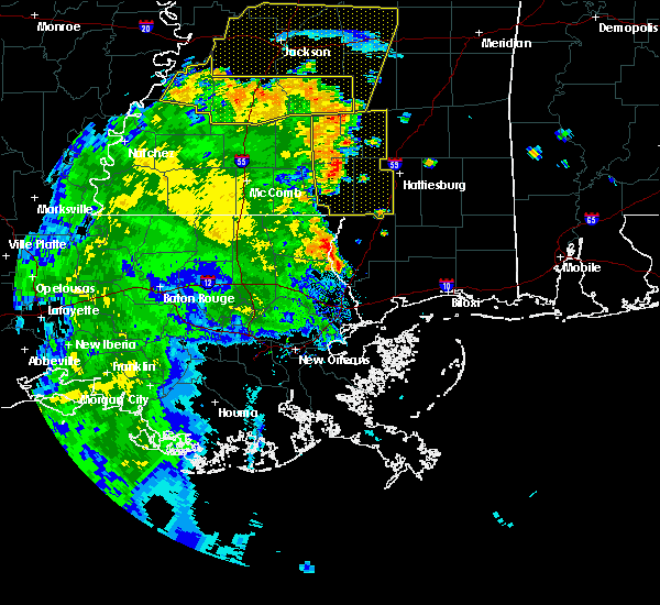 At 501 pm cdt, severe thunderstorms were located along a line extending from near mount olive to near pinebur, moving east at 30 mph (radar indicated). Hazards include 60 mph wind gusts. Expect damage to roofs, siding, and trees. severe thunderstorms will be near, mount olive around 505 pm cdt. hattiesburg and pine ridge around 535 pm cdt. oak grove around 540 pm cdt. west hattiesburg around 550 pm cdt. Other locations impacted by these severe thunderstorms include bassfield and seminary. At 501 pm cdt, severe thunderstorms were located along a line extending from near mount olive to near pinebur, moving east at 30 mph (radar indicated). Hazards include 60 mph wind gusts. Expect damage to roofs, siding, and trees. severe thunderstorms will be near, mount olive around 505 pm cdt. hattiesburg and pine ridge around 535 pm cdt. oak grove around 540 pm cdt. west hattiesburg around 550 pm cdt. Other locations impacted by these severe thunderstorms include bassfield and seminary.
|
| 6/5/2020 8:01 PM CDT |
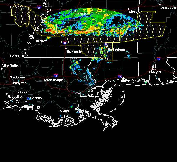 At 801 pm cdt, severe thunderstorms were located along a line extending from near tuckers crossing to near melba to near monticello, moving south at 35 mph (radar indicated). Hazards include 60 mph wind gusts. Expect damage to roofs, siding, and trees. severe thunderstorms will be near, sumrall around 815 pm cdt. improve around 825 pm cdt. pinebur around 850 pm cdt. Baxterville around 855 pm cdt. At 801 pm cdt, severe thunderstorms were located along a line extending from near tuckers crossing to near melba to near monticello, moving south at 35 mph (radar indicated). Hazards include 60 mph wind gusts. Expect damage to roofs, siding, and trees. severe thunderstorms will be near, sumrall around 815 pm cdt. improve around 825 pm cdt. pinebur around 850 pm cdt. Baxterville around 855 pm cdt.
|
| 5/27/2020 4:41 PM CDT | Quarter sized hail reported 5.2 miles SE of Foxworth, MS |
| 5/27/2020 4:34 PM CDT |
 At 434 pm cdt, a severe thunderstorm was located over morgantown, or near columbia, moving north at 25 mph (radar indicated). Hazards include 60 mph wind gusts and quarter size hail. Hail damage to vehicles is expected. expect wind damage to roofs, siding, and trees. this severe storm will be near, goss around 445 pm cdt. Bunker hill around 455 pm cdt. At 434 pm cdt, a severe thunderstorm was located over morgantown, or near columbia, moving north at 25 mph (radar indicated). Hazards include 60 mph wind gusts and quarter size hail. Hail damage to vehicles is expected. expect wind damage to roofs, siding, and trees. this severe storm will be near, goss around 445 pm cdt. Bunker hill around 455 pm cdt.
|
| 5/27/2020 4:25 PM CDT |
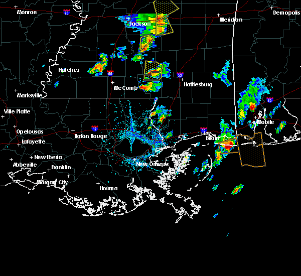 At 425 pm cdt, a severe thunderstorm was located near morgantown, or near columbia, moving north at 25 mph (radar indicated). Hazards include 60 mph wind gusts and quarter size hail. Hail damage to vehicles is expected. expect wind damage to roofs, siding, and trees. this severe thunderstorm will be near, columbia around 430 pm cdt. holly springs and morgantown around 435 pm cdt. goss around 445 pm cdt. Bunker hill around 450 pm cdt. At 425 pm cdt, a severe thunderstorm was located near morgantown, or near columbia, moving north at 25 mph (radar indicated). Hazards include 60 mph wind gusts and quarter size hail. Hail damage to vehicles is expected. expect wind damage to roofs, siding, and trees. this severe thunderstorm will be near, columbia around 430 pm cdt. holly springs and morgantown around 435 pm cdt. goss around 445 pm cdt. Bunker hill around 450 pm cdt.
|
| 5/27/2020 3:57 PM CDT |
 At 357 pm cdt, a severe thunderstorm was located over columbia, moving north at 20 mph (radar indicated). Hazards include 60 mph wind gusts and quarter size hail. Hail damage to vehicles is expected. expect wind damage to roofs, siding, and trees. this severe thunderstorm will be near, morgantown around 405 pm cdt. goss around 410 pm cdt. improve around 415 pm cdt. Bunker hill around 420 pm cdt. At 357 pm cdt, a severe thunderstorm was located over columbia, moving north at 20 mph (radar indicated). Hazards include 60 mph wind gusts and quarter size hail. Hail damage to vehicles is expected. expect wind damage to roofs, siding, and trees. this severe thunderstorm will be near, morgantown around 405 pm cdt. goss around 410 pm cdt. improve around 415 pm cdt. Bunker hill around 420 pm cdt.
|
| 4/23/2020 3:45 AM CDT |
 At 345 am cdt, a severe thunderstorm was located near salem, or 11 miles west of kokomo, moving east at 60 mph (radar indicated). Hazards include 60 mph wind gusts and quarter size hail. Hail damage to vehicles is expected. expect wind damage to roofs, siding, and trees. this severe thunderstorm will be near, holly springs and morgantown around 400 am cdt. columbia, goss and society hill around 405 am cdt. bunker hill around 410 am cdt. improve around 415 am cdt. melba around 420 am cdt. sumrall around 425 am cdt. hattiesburg around 430 am cdt. other locations impacted by this severe thunderstorm include bassfield. A tornado watch remains in effect until 700 am cdt for south central and southeastern mississippi. At 345 am cdt, a severe thunderstorm was located near salem, or 11 miles west of kokomo, moving east at 60 mph (radar indicated). Hazards include 60 mph wind gusts and quarter size hail. Hail damage to vehicles is expected. expect wind damage to roofs, siding, and trees. this severe thunderstorm will be near, holly springs and morgantown around 400 am cdt. columbia, goss and society hill around 405 am cdt. bunker hill around 410 am cdt. improve around 415 am cdt. melba around 420 am cdt. sumrall around 425 am cdt. hattiesburg around 430 am cdt. other locations impacted by this severe thunderstorm include bassfield. A tornado watch remains in effect until 700 am cdt for south central and southeastern mississippi.
|
| 4/19/2020 7:23 PM CDT |
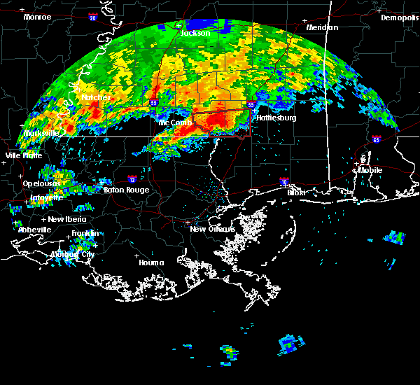 At 722 pm cdt, a confirmed large and extremely dangerous tornado was located near pickwick, or near sandy hook, moving east at 45 mph. this is a particularly dangerous situation. take cover now! (radar confirmed tornado). Hazards include damaging tornado. You are in a life-threatening situation. flying debris may be deadly to those caught without shelter. mobile homes will be destroyed. considerable damage to homes, businesses, and vehicles is likely and complete destruction is possible. the tornado will be near, pinebur around 730 pm cdt. baxterville around 740 pm cdt. Purvis and pine ridge around 750 pm cdt. At 722 pm cdt, a confirmed large and extremely dangerous tornado was located near pickwick, or near sandy hook, moving east at 45 mph. this is a particularly dangerous situation. take cover now! (radar confirmed tornado). Hazards include damaging tornado. You are in a life-threatening situation. flying debris may be deadly to those caught without shelter. mobile homes will be destroyed. considerable damage to homes, businesses, and vehicles is likely and complete destruction is possible. the tornado will be near, pinebur around 730 pm cdt. baxterville around 740 pm cdt. Purvis and pine ridge around 750 pm cdt.
|
| 4/19/2020 7:16 PM CDT |
 At 715 pm cdt, a confirmed large and extremely dangerous tornado was located near pickwick, or near sandy hook, moving east at 40 mph. this is a particularly dangerous situation. take cover now! (radar confirmed tornado). Hazards include damaging tornado. You are in a life-threatening situation. flying debris may be deadly to those caught without shelter. mobile homes will be destroyed. considerable damage to homes, businesses, and vehicles is likely and complete destruction is possible. the tornado will be near, sandy hook around 720 pm cdt. pinebur around 730 pm cdt. baxterville around 740 pm cdt. Purvis and pine ridge around 745 pm cdt. At 715 pm cdt, a confirmed large and extremely dangerous tornado was located near pickwick, or near sandy hook, moving east at 40 mph. this is a particularly dangerous situation. take cover now! (radar confirmed tornado). Hazards include damaging tornado. You are in a life-threatening situation. flying debris may be deadly to those caught without shelter. mobile homes will be destroyed. considerable damage to homes, businesses, and vehicles is likely and complete destruction is possible. the tornado will be near, sandy hook around 720 pm cdt. pinebur around 730 pm cdt. baxterville around 740 pm cdt. Purvis and pine ridge around 745 pm cdt.
|
| 4/19/2020 7:10 PM CDT |
 At 709 pm cdt, a large and extremely dangerous tornado was located over dexter, or 7 miles south of kokomo, moving east at 50 mph. this is a particularly dangerous situation. take cover now! (radar indicated rotation). Hazards include damaging tornado. You are in a life-threatening situation. flying debris may be deadly to those caught without shelter. mobile homes will be destroyed. considerable damage to homes, businesses, and vehicles is likely and complete destruction is possible. the tornado will be near, sandy hook and pickwick around 720 pm cdt. pinebur around 730 pm cdt. baxterville around 735 pm cdt. Purvis and pine ridge around 745 pm cdt. At 709 pm cdt, a large and extremely dangerous tornado was located over dexter, or 7 miles south of kokomo, moving east at 50 mph. this is a particularly dangerous situation. take cover now! (radar indicated rotation). Hazards include damaging tornado. You are in a life-threatening situation. flying debris may be deadly to those caught without shelter. mobile homes will be destroyed. considerable damage to homes, businesses, and vehicles is likely and complete destruction is possible. the tornado will be near, sandy hook and pickwick around 720 pm cdt. pinebur around 730 pm cdt. baxterville around 735 pm cdt. Purvis and pine ridge around 745 pm cdt.
|
| 4/19/2020 6:55 PM CDT |
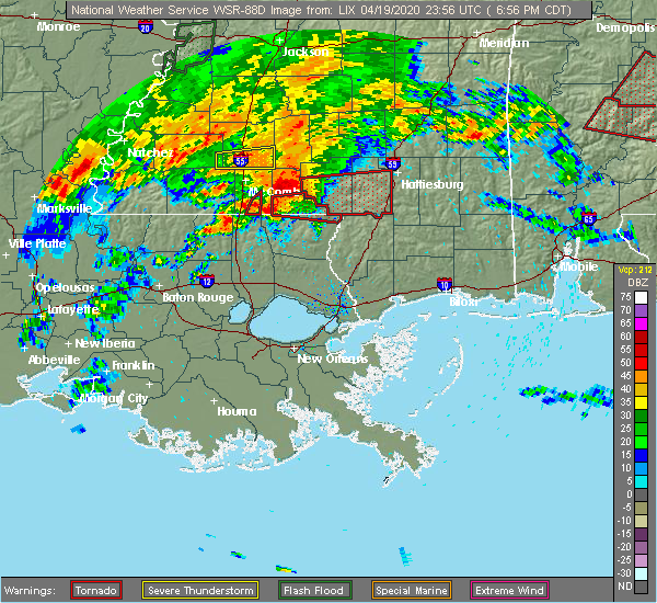 At 654 pm cdt, a severe thunderstorm capable of producing a tornado was located over tylertown, or 11 miles southwest of kokomo, moving east at 55 mph (radar indicated rotation). Hazards include tornado and ping pong ball size hail. Flying debris will be dangerous to those caught without shelter. mobile homes will be damaged or destroyed. damage to roofs, windows, and vehicles will occur. tree damage is likely. this dangerous storm will be near, kokomo around 705 pm cdt. columbia, sandy hook and pickwick around 715 pm cdt. pinebur around 720 pm cdt. baxterville around 730 pm cdt. hattiesburg, purvis, pine ridge and oak grove around 740 pm cdt. West hattiesburg around 745 pm cdt. At 654 pm cdt, a severe thunderstorm capable of producing a tornado was located over tylertown, or 11 miles southwest of kokomo, moving east at 55 mph (radar indicated rotation). Hazards include tornado and ping pong ball size hail. Flying debris will be dangerous to those caught without shelter. mobile homes will be damaged or destroyed. damage to roofs, windows, and vehicles will occur. tree damage is likely. this dangerous storm will be near, kokomo around 705 pm cdt. columbia, sandy hook and pickwick around 715 pm cdt. pinebur around 720 pm cdt. baxterville around 730 pm cdt. hattiesburg, purvis, pine ridge and oak grove around 740 pm cdt. West hattiesburg around 745 pm cdt.
|
| 2/5/2020 11:26 PM CST |
 At 1126 pm cst, a severe thunderstorm was located over holly springs, or near kokomo, moving northeast at 60 mph (radar indicated). Hazards include 60 mph wind gusts and quarter size hail. Hail damage to vehicles is expected. expect wind damage to roofs, siding, and trees. this severe storm will be near, columbia and morgantown around 1130 pm cst. goss and society hill around 1135 pm cst. bunker hill around 1140 pm cst. improve around 1145 pm cst. melba around 1150 pm cst. other locations impacted by this severe thunderstorm include bassfield. A tornado watch remains in effect until midnight cst for south central and southeastern mississippi. At 1126 pm cst, a severe thunderstorm was located over holly springs, or near kokomo, moving northeast at 60 mph (radar indicated). Hazards include 60 mph wind gusts and quarter size hail. Hail damage to vehicles is expected. expect wind damage to roofs, siding, and trees. this severe storm will be near, columbia and morgantown around 1130 pm cst. goss and society hill around 1135 pm cst. bunker hill around 1140 pm cst. improve around 1145 pm cst. melba around 1150 pm cst. other locations impacted by this severe thunderstorm include bassfield. A tornado watch remains in effect until midnight cst for south central and southeastern mississippi.
|
| 2/5/2020 11:21 PM CST |
 At 1121 pm cst, a severe thunderstorm was located near salem, or near kokomo, moving northeast at 60 mph (radar indicated). Hazards include 60 mph wind gusts and quarter size hail. Hail damage to vehicles is expected. expect wind damage to roofs, siding, and trees. this severe thunderstorm will be near, holly springs and morgantown around 1130 pm cst. goss and society hill around 1135 pm cst. bunker hill around 1140 pm cst. improve around 1145 pm cst. melba around 1150 pm cst. other locations impacted by this severe thunderstorm include bassfield. A tornado watch remains in effect until midnight cst for south central and southeastern mississippi. At 1121 pm cst, a severe thunderstorm was located near salem, or near kokomo, moving northeast at 60 mph (radar indicated). Hazards include 60 mph wind gusts and quarter size hail. Hail damage to vehicles is expected. expect wind damage to roofs, siding, and trees. this severe thunderstorm will be near, holly springs and morgantown around 1130 pm cst. goss and society hill around 1135 pm cst. bunker hill around 1140 pm cst. improve around 1145 pm cst. melba around 1150 pm cst. other locations impacted by this severe thunderstorm include bassfield. A tornado watch remains in effect until midnight cst for south central and southeastern mississippi.
|
| 2/5/2020 4:06 PM CST |
 At 406 pm cst, a severe thunderstorm was located near kokomo, moving northeast at 65 mph (radar indicated). Hazards include 70 mph wind gusts and quarter size hail. Hail damage to vehicles is expected. expect considerable tree damage. wind damage is also likely to mobile homes, roofs, and outbuildings. this severe storm will be near, columbia around 410 pm cst. goss around 415 pm cst. improve and bunker hill around 420 pm cst. melba around 425 pm cst. sumrall around 430 pm cst. other locations impacted by this severe thunderstorm include bassfield and seminary. A tornado watch remains in effect until 600 pm cst for south central and southeastern mississippi. At 406 pm cst, a severe thunderstorm was located near kokomo, moving northeast at 65 mph (radar indicated). Hazards include 70 mph wind gusts and quarter size hail. Hail damage to vehicles is expected. expect considerable tree damage. wind damage is also likely to mobile homes, roofs, and outbuildings. this severe storm will be near, columbia around 410 pm cst. goss around 415 pm cst. improve and bunker hill around 420 pm cst. melba around 425 pm cst. sumrall around 430 pm cst. other locations impacted by this severe thunderstorm include bassfield and seminary. A tornado watch remains in effect until 600 pm cst for south central and southeastern mississippi.
|
| 2/5/2020 4:03 PM CST | Metal roofing ripped off of hom in marion county MS, 7.5 miles ENE of Foxworth, MS |
| 2/5/2020 3:59 PM CST |
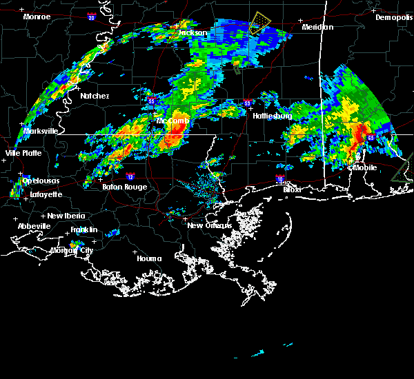 At 358 pm cst, a severe thunderstorm was located near kokomo, moving northeast at 65 mph (radar indicated). Hazards include 60 mph wind gusts and quarter size hail. Hail damage to vehicles is expected. expect wind damage to roofs, siding, and trees. this severe thunderstorm will be near, columbia, holly springs and morgantown around 410 pm cst. goss around 415 pm cst. improve and bunker hill around 420 pm cst. sumrall and melba around 430 pm cst. sanford around 440 pm cst. other locations impacted by this severe thunderstorm include bassfield and seminary. A tornado watch remains in effect until 600 pm cst for south central and southeastern mississippi. At 358 pm cst, a severe thunderstorm was located near kokomo, moving northeast at 65 mph (radar indicated). Hazards include 60 mph wind gusts and quarter size hail. Hail damage to vehicles is expected. expect wind damage to roofs, siding, and trees. this severe thunderstorm will be near, columbia, holly springs and morgantown around 410 pm cst. goss around 415 pm cst. improve and bunker hill around 420 pm cst. sumrall and melba around 430 pm cst. sanford around 440 pm cst. other locations impacted by this severe thunderstorm include bassfield and seminary. A tornado watch remains in effect until 600 pm cst for south central and southeastern mississippi.
|
| 1/11/2020 9:21 AM CST |
 At 920 am cst, severe thunderstorms were located along a line extending from near lone star to near pickwick, moving east at 40 mph (radar indicated). Hazards include 60 mph wind gusts. Expect damage to roofs, siding, and trees. severe thunderstorms will be near, collins around 935 am cst. baxterville around 940 am cst. hattiesburg and pine ridge around 955 am cst. other locations impacted by these severe thunderstorms include bassfield and seminary. A tornado watch remains in effect until 400 pm cst for south central and southeastern mississippi. At 920 am cst, severe thunderstorms were located along a line extending from near lone star to near pickwick, moving east at 40 mph (radar indicated). Hazards include 60 mph wind gusts. Expect damage to roofs, siding, and trees. severe thunderstorms will be near, collins around 935 am cst. baxterville around 940 am cst. hattiesburg and pine ridge around 955 am cst. other locations impacted by these severe thunderstorms include bassfield and seminary. A tornado watch remains in effect until 400 pm cst for south central and southeastern mississippi.
|
| 12/16/2019 4:47 PM CST |
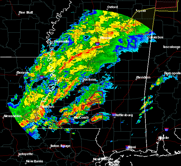 At 447 pm cst, a confirmed large and extremely dangerous tornado was located over columbia, moving northeast at 40 mph. this is a particularly dangerous situation. take cover now! (weather spotters confirmed tornado). Hazards include damaging tornado. You are in a life-threatening situation. flying debris may be deadly to those caught without shelter. mobile homes will be destroyed. considerable damage to homes, businesses, and vehicles is likely and complete destruction is possible. the tornado will be near, bunker hill around 500 pm cst. Improve around 505 pm cst. At 447 pm cst, a confirmed large and extremely dangerous tornado was located over columbia, moving northeast at 40 mph. this is a particularly dangerous situation. take cover now! (weather spotters confirmed tornado). Hazards include damaging tornado. You are in a life-threatening situation. flying debris may be deadly to those caught without shelter. mobile homes will be destroyed. considerable damage to homes, businesses, and vehicles is likely and complete destruction is possible. the tornado will be near, bunker hill around 500 pm cst. Improve around 505 pm cst.
|
| 12/16/2019 4:46 PM CST |
 At 446 pm cst, a confirmed large and extremely dangerous tornado was located over columbia, moving northeast at 35 mph. this is a particularly dangerous situation. take cover now! (radar confirmed tornado). Hazards include damaging tornado. You are in a life-threatening situation. flying debris may be deadly to those caught without shelter. mobile homes will be destroyed. considerable damage to homes, businesses, and vehicles is likely and complete destruction is possible. the tornado will be near, columbia around 450 pm cst. Improve and bunker hill around 505 pm cst. At 446 pm cst, a confirmed large and extremely dangerous tornado was located over columbia, moving northeast at 35 mph. this is a particularly dangerous situation. take cover now! (radar confirmed tornado). Hazards include damaging tornado. You are in a life-threatening situation. flying debris may be deadly to those caught without shelter. mobile homes will be destroyed. considerable damage to homes, businesses, and vehicles is likely and complete destruction is possible. the tornado will be near, columbia around 450 pm cst. Improve and bunker hill around 505 pm cst.
|
| 12/16/2019 4:42 PM CST |
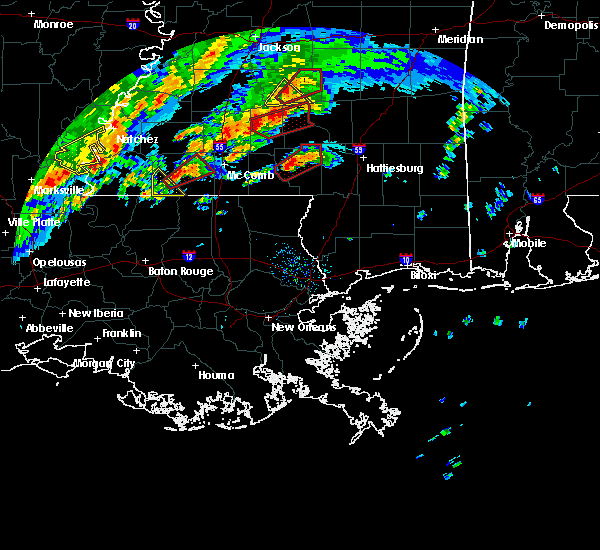 At 442 pm cst, a confirmed tornado was located near columbia, moving northeast at 35 mph (radar confirmed tornado). Hazards include damaging tornado and golf ball size hail. Flying debris will be dangerous to those caught without shelter. mobile homes will be damaged or destroyed. damage to roofs, windows, and vehicles will occur. tree damage is likely. this tornado will be near, columbia and morgantown around 450 pm cst. bunker hill around 505 pm cst. Improve around 510 pm cst. At 442 pm cst, a confirmed tornado was located near columbia, moving northeast at 35 mph (radar confirmed tornado). Hazards include damaging tornado and golf ball size hail. Flying debris will be dangerous to those caught without shelter. mobile homes will be damaged or destroyed. damage to roofs, windows, and vehicles will occur. tree damage is likely. this tornado will be near, columbia and morgantown around 450 pm cst. bunker hill around 505 pm cst. Improve around 510 pm cst.
|
| 12/16/2019 4:20 PM CST |
 At 420 pm cst, a severe thunderstorm capable of producing a tornado was located near dexter, or 7 miles southwest of kokomo, moving northeast at 35 mph (radar indicated rotation). Hazards include tornado and golf ball size hail. Flying debris will be dangerous to those caught without shelter. mobile homes will be damaged or destroyed. damage to roofs, windows, and vehicles will occur. tree damage is likely. this dangerous storm will be near, kokomo around 430 pm cst. pickwick around 440 pm cst. columbia and morgantown around 450 pm cst. bunker hill around 505 pm cst. Improve around 510 pm cst. At 420 pm cst, a severe thunderstorm capable of producing a tornado was located near dexter, or 7 miles southwest of kokomo, moving northeast at 35 mph (radar indicated rotation). Hazards include tornado and golf ball size hail. Flying debris will be dangerous to those caught without shelter. mobile homes will be damaged or destroyed. damage to roofs, windows, and vehicles will occur. tree damage is likely. this dangerous storm will be near, kokomo around 430 pm cst. pickwick around 440 pm cst. columbia and morgantown around 450 pm cst. bunker hill around 505 pm cst. Improve around 510 pm cst.
|
| 7/14/2019 12:37 PM CDT |
 At 1237 pm cdt, a severe thunderstorm was located over tilton, or 16 miles north of kokomo, moving north at 45 mph (radar indicated). Hazards include 60 mph wind gusts. Expect damage to roofs, siding, and trees. this severe thunderstorm will be near, progress around 1245 pm cdt. monticello around 1250 pm cdt. wanilla around 1255 pm cdt. sontag around 100 pm cdt. oma around 105 pm cdt. rockport and shivers around 110 pm cdt. union around 115 pm cdt. harrisville and hopewell around 125 pm cdt. other locations impacted by this severe thunderstorm include new hebron, d`lo, silver creek, bassfield, braxton and georgetown. A tornado watch remains in effect until 700 pm cdt for central and south central mississippi. At 1237 pm cdt, a severe thunderstorm was located over tilton, or 16 miles north of kokomo, moving north at 45 mph (radar indicated). Hazards include 60 mph wind gusts. Expect damage to roofs, siding, and trees. this severe thunderstorm will be near, progress around 1245 pm cdt. monticello around 1250 pm cdt. wanilla around 1255 pm cdt. sontag around 100 pm cdt. oma around 105 pm cdt. rockport and shivers around 110 pm cdt. union around 115 pm cdt. harrisville and hopewell around 125 pm cdt. other locations impacted by this severe thunderstorm include new hebron, d`lo, silver creek, bassfield, braxton and georgetown. A tornado watch remains in effect until 700 pm cdt for central and south central mississippi.
|
| 5/9/2019 1:00 PM CDT |
 A severe thunderstorm warning remains in effect until 130 pm cdt for marion. forrest. covington. lamar and jones counties. at 100 pm cdt, severe thunderstorms were located along a line extending from near taylorsville to near melba to near pickwick, and are nearly stationary. hazard. 60 mph wind gusts and half dollar size hail. A severe thunderstorm warning remains in effect until 130 pm cdt for marion. forrest. covington. lamar and jones counties. at 100 pm cdt, severe thunderstorms were located along a line extending from near taylorsville to near melba to near pickwick, and are nearly stationary. hazard. 60 mph wind gusts and half dollar size hail.
|
| 5/9/2019 12:32 PM CDT |
 The national weather service in jackson has issued a * severe thunderstorm warning for. marion county in south central mississippi. forrest county in southeastern mississippi. covington county in southeastern mississippi. Lamar county in southeastern mississippi. The national weather service in jackson has issued a * severe thunderstorm warning for. marion county in south central mississippi. forrest county in southeastern mississippi. covington county in southeastern mississippi. Lamar county in southeastern mississippi.
|
| 4/18/2019 7:29 PM CDT |
 At 728 pm cdt, severe thunderstorms were located along a line extending from near bunker hill to near dexter, moving northeast at 55 mph (radar indicated). Hazards include 60 mph wind gusts. Expect damage to roofs, siding, and trees. severe thunderstorms will be near, sumrall around 740 pm cdt. pinebur around 745 pm cdt. baxterville around 750 pm cdt. hattiesburg, purvis, oak grove and pine ridge around 805 pm cdt. West hattiesburg around 810 pm cdt. At 728 pm cdt, severe thunderstorms were located along a line extending from near bunker hill to near dexter, moving northeast at 55 mph (radar indicated). Hazards include 60 mph wind gusts. Expect damage to roofs, siding, and trees. severe thunderstorms will be near, sumrall around 740 pm cdt. pinebur around 745 pm cdt. baxterville around 750 pm cdt. hattiesburg, purvis, oak grove and pine ridge around 805 pm cdt. West hattiesburg around 810 pm cdt.
|
| 4/18/2019 3:59 PM CDT |
 At 359 pm cdt, severe thunderstorms were located along a line extending from near melba to near dexter, moving east at 30 mph (radar indicated). Hazards include 60 mph wind gusts. Expect damage to roofs, siding, and trees. locations impacted include, hattiesburg, columbia, sandy hook, sumrall, pinebur, pickwick, improve and melba. A tornado watch remains in effect until 900 pm cdt for south central and southeastern mississippi. At 359 pm cdt, severe thunderstorms were located along a line extending from near melba to near dexter, moving east at 30 mph (radar indicated). Hazards include 60 mph wind gusts. Expect damage to roofs, siding, and trees. locations impacted include, hattiesburg, columbia, sandy hook, sumrall, pinebur, pickwick, improve and melba. A tornado watch remains in effect until 900 pm cdt for south central and southeastern mississippi.
|
| 4/18/2019 3:41 PM CDT |
 At 341 pm cdt, severe thunderstorms were located along a line extending from 6 miles southeast of lone star to holly springs to 7 miles northeast of mount herman, moving east at 20 mph (radar indicated). Hazards include 60 mph wind gusts. expect damage to roofs, siding, and trees At 341 pm cdt, severe thunderstorms were located along a line extending from 6 miles southeast of lone star to holly springs to 7 miles northeast of mount herman, moving east at 20 mph (radar indicated). Hazards include 60 mph wind gusts. expect damage to roofs, siding, and trees
|
| 4/18/2019 3:31 PM CDT |
 At 330 pm cdt, severe thunderstorms were located along a line extending from near mount olive to near carson to near holly springs, moving east at 35 mph (radar indicated). Hazards include 60 mph wind gusts. Expect damage to roofs, siding, and trees. these severe storms will be near, columbia and melba around 345 pm cdt. other locations impacted by these severe thunderstorms include bassfield. A tornado watch remains in effect until 900 pm cdt for south central and southeastern mississippi. At 330 pm cdt, severe thunderstorms were located along a line extending from near mount olive to near carson to near holly springs, moving east at 35 mph (radar indicated). Hazards include 60 mph wind gusts. Expect damage to roofs, siding, and trees. these severe storms will be near, columbia and melba around 345 pm cdt. other locations impacted by these severe thunderstorms include bassfield. A tornado watch remains in effect until 900 pm cdt for south central and southeastern mississippi.
|
| 4/18/2019 2:30 PM CDT |
 At 229 pm cdt, severe thunderstorms were located along a line extending from near wesson to near bogue chitto to magnolia, moving east at 40 mph. a tornado warning remains in effect for much of lawrence county as well (radar indicated). Hazards include 60 mph wind gusts. Expect damage to roofs, siding, and trees. severe thunderstorms will be near, sontag around 235 pm cdt. oma and topeka around 245 pm cdt. jayess around 255 pm cdt. monticello and robinwood around 300 pm cdt. arm around 305 pm cdt. holly springs and progress around 310 pm cdt. morgantown and tilton around 315 pm cdt. prentiss, goss and oak vale around 320 pm cdt. other locations impacted by these severe thunderstorms include bassfield, new hebron and silver creek. a tornado watch remains in effect until 700 pm cdt for central and south central mississippi. A tornado watch also remains in effect until 900 pm cdt for south central and southeastern mississippi. At 229 pm cdt, severe thunderstorms were located along a line extending from near wesson to near bogue chitto to magnolia, moving east at 40 mph. a tornado warning remains in effect for much of lawrence county as well (radar indicated). Hazards include 60 mph wind gusts. Expect damage to roofs, siding, and trees. severe thunderstorms will be near, sontag around 235 pm cdt. oma and topeka around 245 pm cdt. jayess around 255 pm cdt. monticello and robinwood around 300 pm cdt. arm around 305 pm cdt. holly springs and progress around 310 pm cdt. morgantown and tilton around 315 pm cdt. prentiss, goss and oak vale around 320 pm cdt. other locations impacted by these severe thunderstorms include bassfield, new hebron and silver creek. a tornado watch remains in effect until 700 pm cdt for central and south central mississippi. A tornado watch also remains in effect until 900 pm cdt for south central and southeastern mississippi.
|
| 3/3/2019 11:04 AM CST |
 At 1104 am cst, severe thunderstorms were located along a line extending from near sanford to near goss, moving east at 45 mph (radar indicated). Hazards include 60 mph wind gusts. Expect damage to roofs, siding, and trees. severe thunderstorms will be near, sanford around 1110 am cst. moselle and melba around 1120 am cst. laurel, ellisville and sumrall around 1130 am cst. hattiesburg and tuckers crossing around 1135 am cst. ovett and oak grove around 1140 am cst. west hattiesburg and rawls springs around 1145 am cst. eastabuchie around 1150 am cst. petal and sunrise around 1155 am cst. other locations impacted by these severe thunderstorms include seminary and corinth. A tornado watch remains in effect until 600 pm cst for south central and southeastern mississippi. At 1104 am cst, severe thunderstorms were located along a line extending from near sanford to near goss, moving east at 45 mph (radar indicated). Hazards include 60 mph wind gusts. Expect damage to roofs, siding, and trees. severe thunderstorms will be near, sanford around 1110 am cst. moselle and melba around 1120 am cst. laurel, ellisville and sumrall around 1130 am cst. hattiesburg and tuckers crossing around 1135 am cst. ovett and oak grove around 1140 am cst. west hattiesburg and rawls springs around 1145 am cst. eastabuchie around 1150 am cst. petal and sunrise around 1155 am cst. other locations impacted by these severe thunderstorms include seminary and corinth. A tornado watch remains in effect until 600 pm cst for south central and southeastern mississippi.
|
| 1/19/2019 9:51 AM CST |
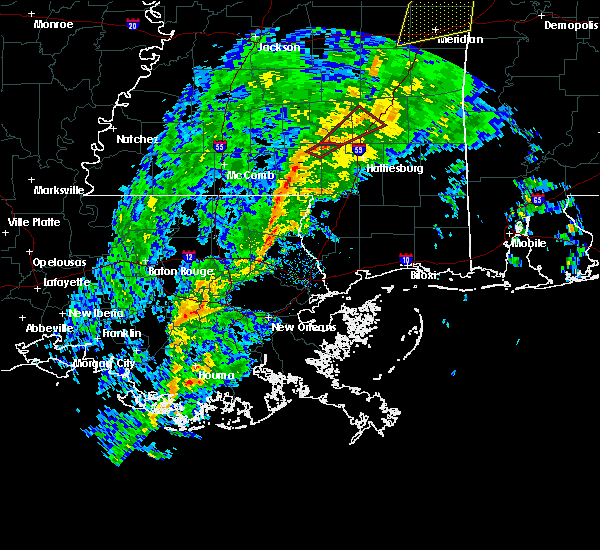 At 951 am cst, severe thunderstorms were located along a line extending from near improve to 6 miles southwest of sandy hook, moving east at 45 mph (radar indicated). Hazards include 60 mph wind gusts. Expect damage to roofs, siding, and trees. severe thunderstorms will be near, improve and bunker hill around 955 am cst. sumrall around 1005 am cst. pinebur around 1010 am cst. baxterville around 1015 am cst. west hattiesburg and rawls springs around 1020 am cst. lumberton around 1025 am cst. purvis around 1030 am cst. A tornado watch remains in effect until 100 pm cst for south central and southeastern mississippi. At 951 am cst, severe thunderstorms were located along a line extending from near improve to 6 miles southwest of sandy hook, moving east at 45 mph (radar indicated). Hazards include 60 mph wind gusts. Expect damage to roofs, siding, and trees. severe thunderstorms will be near, improve and bunker hill around 955 am cst. sumrall around 1005 am cst. pinebur around 1010 am cst. baxterville around 1015 am cst. west hattiesburg and rawls springs around 1020 am cst. lumberton around 1025 am cst. purvis around 1030 am cst. A tornado watch remains in effect until 100 pm cst for south central and southeastern mississippi.
|
| 1/19/2019 9:23 AM CST |
 At 923 am cst, a severe thunderstorm capable of producing a tornado was located near columbia, moving northeast at 45 mph (radar indicated rotation). Hazards include tornado. Flying debris will be dangerous to those caught without shelter. mobile homes will be damaged or destroyed. damage to roofs, windows, and vehicles will occur. tree damage is likely. this dangerous storm will be near, bunker hill around 940 am cst. improve around 945 am cst. Sumrall around 955 am cst. At 923 am cst, a severe thunderstorm capable of producing a tornado was located near columbia, moving northeast at 45 mph (radar indicated rotation). Hazards include tornado. Flying debris will be dangerous to those caught without shelter. mobile homes will be damaged or destroyed. damage to roofs, windows, and vehicles will occur. tree damage is likely. this dangerous storm will be near, bunker hill around 940 am cst. improve around 945 am cst. Sumrall around 955 am cst.
|
| 1/19/2019 9:12 AM CST |
 At 912 am cst, a severe thunderstorm capable of producing a tornado was located near kokomo, moving northeast at 45 mph (radar indicated rotation). Hazards include tornado. Flying debris will be dangerous to those caught without shelter. mobile homes will be damaged or destroyed. damage to roofs, windows, and vehicles will occur. tree damage is likely. this dangerous storm will be near, kokomo around 915 am cst. pickwick around 920 am cst. morgantown around 925 am cst. columbia around 930 am cst. bunker hill around 940 am cst. improve around 945 am cst. Sumrall around 955 am cst. At 912 am cst, a severe thunderstorm capable of producing a tornado was located near kokomo, moving northeast at 45 mph (radar indicated rotation). Hazards include tornado. Flying debris will be dangerous to those caught without shelter. mobile homes will be damaged or destroyed. damage to roofs, windows, and vehicles will occur. tree damage is likely. this dangerous storm will be near, kokomo around 915 am cst. pickwick around 920 am cst. morgantown around 925 am cst. columbia around 930 am cst. bunker hill around 940 am cst. improve around 945 am cst. Sumrall around 955 am cst.
|
| 11/1/2018 4:23 AM CDT |
 At 422 am cdt, severe thunderstorms were located along a line extending from tilton to near dexter, moving east at 30 mph (radar indicated). Hazards include 60 mph wind gusts. Expect damage to roofs, siding, and trees. severe thunderstorms will be near, morgantown around 430 am cdt. goss around 435 am cdt. sandy hook and bunker hill around 445 am cdt. improve around 455 am cdt. A tornado watch remains in effect until 700 am cdt for south central and southeastern mississippi. At 422 am cdt, severe thunderstorms were located along a line extending from tilton to near dexter, moving east at 30 mph (radar indicated). Hazards include 60 mph wind gusts. Expect damage to roofs, siding, and trees. severe thunderstorms will be near, morgantown around 430 am cdt. goss around 435 am cdt. sandy hook and bunker hill around 445 am cdt. improve around 455 am cdt. A tornado watch remains in effect until 700 am cdt for south central and southeastern mississippi.
|
| 8/7/2018 6:20 PM CDT |
 At 620 pm cdt, a severe thunderstorm was located over morgantown, or near columbia, moving northwest at 15 mph (radar indicated). Hazards include 60 mph wind gusts and penny size hail. Expect damage to roofs, siding, and trees. this severe storm will be near, morgantown around 630 pm cdt. Holly springs and goss around 640 pm cdt. At 620 pm cdt, a severe thunderstorm was located over morgantown, or near columbia, moving northwest at 15 mph (radar indicated). Hazards include 60 mph wind gusts and penny size hail. Expect damage to roofs, siding, and trees. this severe storm will be near, morgantown around 630 pm cdt. Holly springs and goss around 640 pm cdt.
|
| 8/7/2018 6:07 PM CDT |
 At 607 pm cdt, a severe thunderstorm was located near columbia, moving northwest at 15 mph (radar indicated). Hazards include 60 mph wind gusts and penny size hail. Expect damage to roofs, siding, and trees. this severe thunderstorm will be near, morgantown around 630 pm cdt. Holly springs and goss around 640 pm cdt. At 607 pm cdt, a severe thunderstorm was located near columbia, moving northwest at 15 mph (radar indicated). Hazards include 60 mph wind gusts and penny size hail. Expect damage to roofs, siding, and trees. this severe thunderstorm will be near, morgantown around 630 pm cdt. Holly springs and goss around 640 pm cdt.
|
| 7/7/2018 6:12 PM CDT |
 At 612 pm cdt, a severe thunderstorm was located over holly springs, or near kokomo, moving west at 20 mph (radar indicated). Hazards include 60 mph wind gusts and quarter size hail. Hail damage to vehicles is expected. expect wind damage to roofs, siding, and trees. this severe thunderstorm will be near, kokomo around 620 pm cdt. Jayess around 655 pm cdt. At 612 pm cdt, a severe thunderstorm was located over holly springs, or near kokomo, moving west at 20 mph (radar indicated). Hazards include 60 mph wind gusts and quarter size hail. Hail damage to vehicles is expected. expect wind damage to roofs, siding, and trees. this severe thunderstorm will be near, kokomo around 620 pm cdt. Jayess around 655 pm cdt.
|
| 7/2/2018 4:24 PM CDT |
 The severe thunderstorm warning for southeastern marion county will expire at 430 pm cdt, the storm which prompted the warning has moved out of the area. therefore, the warning will be allowed to expire. however gusty winds are still possible with this thunderstorm. The severe thunderstorm warning for southeastern marion county will expire at 430 pm cdt, the storm which prompted the warning has moved out of the area. therefore, the warning will be allowed to expire. however gusty winds are still possible with this thunderstorm.
|
| 7/2/2018 4:09 PM CDT |
 At 408 pm cdt, a severe thunderstorm was located near pickwick, or near columbia, moving south at 20 mph (radar indicated). Hazards include 60 mph wind gusts. Expect damage to roofs, siding, and trees. this severe storm will be near, pinebur around 415 pm cdt. Pickwick around 420 pm cdt. At 408 pm cdt, a severe thunderstorm was located near pickwick, or near columbia, moving south at 20 mph (radar indicated). Hazards include 60 mph wind gusts. Expect damage to roofs, siding, and trees. this severe storm will be near, pinebur around 415 pm cdt. Pickwick around 420 pm cdt.
|
| 7/2/2018 3:45 PM CDT |
 A severe thunderstorm warning remains in effect until 430 pm cdt for northeastern marion county. at 345 pm cdt, a severe thunderstorm was located near columbia, moving south at 25 mph. hazard. 60 mph wind gusts. source. Radar indicated. A severe thunderstorm warning remains in effect until 430 pm cdt for northeastern marion county. at 345 pm cdt, a severe thunderstorm was located near columbia, moving south at 25 mph. hazard. 60 mph wind gusts. source. Radar indicated.
|
| 7/2/2018 3:42 PM CDT | Tree downed at ms hwy 586 at sumbax r in marion county MS, 2.3 miles E of Foxworth, MS |
| 7/2/2018 3:40 PM CDT | Tree downed on old morgantown r in marion county MS, 0.7 miles WSW of Foxworth, MS |
| 7/2/2018 3:36 PM CDT |
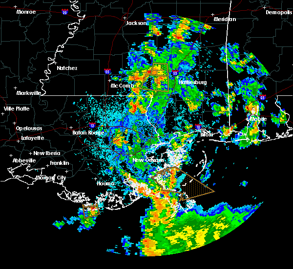 At 335 pm cdt, a severe thunderstorm was located over improve, or 12 miles northeast of columbia, moving south at 20 mph (radar indicated). Hazards include 60 mph wind gusts. Expect damage to roofs, siding, and trees. this severe thunderstorm will be near, pinebur around 425 pm cdt. Baxterville around 430 pm cdt. At 335 pm cdt, a severe thunderstorm was located over improve, or 12 miles northeast of columbia, moving south at 20 mph (radar indicated). Hazards include 60 mph wind gusts. Expect damage to roofs, siding, and trees. this severe thunderstorm will be near, pinebur around 425 pm cdt. Baxterville around 430 pm cdt.
|
| 5/26/2018 4:59 PM CDT |
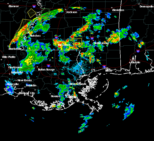 The national weather service in jackson has issued a * severe thunderstorm warning for. central marion county in south central mississippi. until 545 pm cdt. At 459 pm cdt, a severe thunderstorm was located over columbia, moving north at 15 mph. The national weather service in jackson has issued a * severe thunderstorm warning for. central marion county in south central mississippi. until 545 pm cdt. At 459 pm cdt, a severe thunderstorm was located over columbia, moving north at 15 mph.
|
| 4/14/2018 9:07 AM CDT |
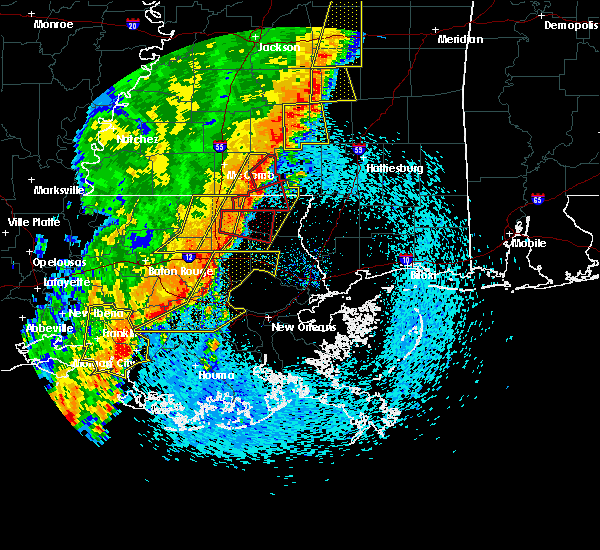 At 907 am cdt, a severe thunderstorm was located near salem, or near kokomo, moving east at 30 mph (radar indicated). Hazards include 60 mph wind gusts. Expect damage to roofs, siding, and trees. this severe thunderstorm will be near, holly springs around 920 am cdt. morgantown around 925 am cdt. goss around 930 am cdt. columbia around 935 am cdt. bunker hill around 945 am cdt. improve around 955 am cdt. A tornado watch remains in effect until 200 pm cdt for south central and southeastern mississippi. At 907 am cdt, a severe thunderstorm was located near salem, or near kokomo, moving east at 30 mph (radar indicated). Hazards include 60 mph wind gusts. Expect damage to roofs, siding, and trees. this severe thunderstorm will be near, holly springs around 920 am cdt. morgantown around 925 am cdt. goss around 930 am cdt. columbia around 935 am cdt. bunker hill around 945 am cdt. improve around 955 am cdt. A tornado watch remains in effect until 200 pm cdt for south central and southeastern mississippi.
|
| 6/16/2017 9:55 PM CDT | Tree across hwy 58 in marion county MS, 1.2 miles ENE of Foxworth, MS |
| 6/16/2017 9:45 PM CDT |
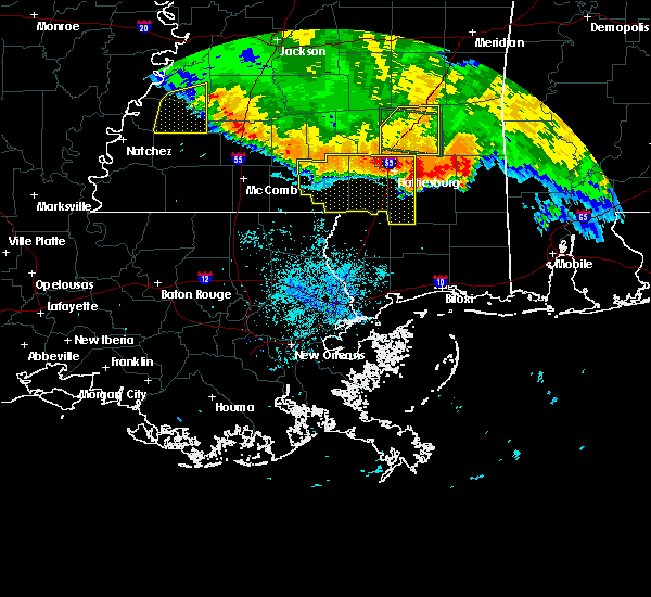 At 945 pm cdt, severe thunderstorms were located along a line extending from hattiesburg to columbia, moving south at 50 mph (radar indicated). Hazards include 70 mph wind gusts. Expect considerable tree damage. damage is likely to mobile homes, roofs, and outbuildings. these severe storms will be near, sunrise around 950 pm cdt. mclaurin, pickwick and pinebur around 955 pm cdt. rock hill around 1000 pm cdt. sandy hook and brooklyn around 1005 pm cdt. maxie around 1015 pm cdt. Other locations impacted by these severe thunderstorms include corinth. At 945 pm cdt, severe thunderstorms were located along a line extending from hattiesburg to columbia, moving south at 50 mph (radar indicated). Hazards include 70 mph wind gusts. Expect considerable tree damage. damage is likely to mobile homes, roofs, and outbuildings. these severe storms will be near, sunrise around 950 pm cdt. mclaurin, pickwick and pinebur around 955 pm cdt. rock hill around 1000 pm cdt. sandy hook and brooklyn around 1005 pm cdt. maxie around 1015 pm cdt. Other locations impacted by these severe thunderstorms include corinth.
|
| 6/16/2017 9:33 PM CDT |
 At 932 pm cdt, severe thunderstorms were located along a line extending from near moselle to near society hill, moving southeast at 50 mph (radar indicated). Hazards include 70 mph wind gusts. Expect considerable tree damage. damage is likely to mobile homes, roofs, and outbuildings. these severe storms will be near, west hattiesburg and rawls springs around 940 pm cdt. petal and macedonia around 945 pm cdt. sunrise around 950 pm cdt. pickwick around 955 pm cdt. sandy hook, pinebur and mclaurin around 1000 pm cdt. baxterville around 1005 pm cdt. Other locations impacted by these severe thunderstorms include corinth. At 932 pm cdt, severe thunderstorms were located along a line extending from near moselle to near society hill, moving southeast at 50 mph (radar indicated). Hazards include 70 mph wind gusts. Expect considerable tree damage. damage is likely to mobile homes, roofs, and outbuildings. these severe storms will be near, west hattiesburg and rawls springs around 940 pm cdt. petal and macedonia around 945 pm cdt. sunrise around 950 pm cdt. pickwick around 955 pm cdt. sandy hook, pinebur and mclaurin around 1000 pm cdt. baxterville around 1005 pm cdt. Other locations impacted by these severe thunderstorms include corinth.
|
| 6/16/2017 9:13 PM CDT |
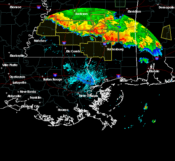 At 913 pm cdt, severe thunderstorms were located along a line extending from collins to near monticello, moving south at 55 mph (radar indicated). Hazards include 70 mph wind gusts. Expect considerable tree damage. damage is likely to mobile homes, roofs, and outbuildings. severe thunderstorms will be near, sumrall around 930 pm cdt. holly springs and morgantown around 935 pm cdt. west hattiesburg and rawls springs around 940 pm cdt. hattiesburg, kokomo and oak grove around 945 pm cdt. pine ridge around 950 pm cdt. purvis around 955 pm cdt. rock hill around 1000 pm cdt. lumberton around 1005 pm cdt. Other locations impacted by these severe thunderstorms include corinth. At 913 pm cdt, severe thunderstorms were located along a line extending from collins to near monticello, moving south at 55 mph (radar indicated). Hazards include 70 mph wind gusts. Expect considerable tree damage. damage is likely to mobile homes, roofs, and outbuildings. severe thunderstorms will be near, sumrall around 930 pm cdt. holly springs and morgantown around 935 pm cdt. west hattiesburg and rawls springs around 940 pm cdt. hattiesburg, kokomo and oak grove around 945 pm cdt. pine ridge around 950 pm cdt. purvis around 955 pm cdt. rock hill around 1000 pm cdt. lumberton around 1005 pm cdt. Other locations impacted by these severe thunderstorms include corinth.
|
| 4/30/2017 10:37 AM CDT |
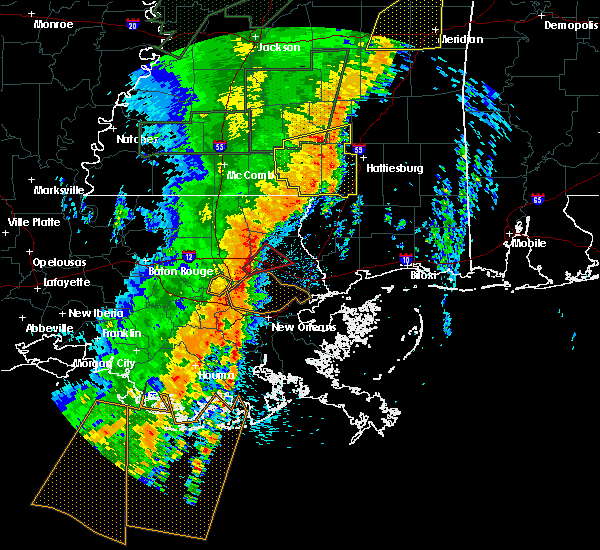 At 1037 am cdt, severe thunderstorms were located along a line extending from seminary to bellevue to 6 miles east of sandy hook, moving east at 45 mph (radar indicated). Hazards include 60 mph wind gusts. Expect damage to roofs, siding, and trees. locations impacted include, hattiesburg, columbia, kokomo, sandy hook, west hattiesburg, holly springs, purvis, lumberton, sumrall, morgantown, goss, bunker hill, pickwick, sanford, pineburr, society hill, improve, baxterville, melba and seminary. A tornado watch remains in effect until 300 pm cdt for south central and southeastern mississippi. At 1037 am cdt, severe thunderstorms were located along a line extending from seminary to bellevue to 6 miles east of sandy hook, moving east at 45 mph (radar indicated). Hazards include 60 mph wind gusts. Expect damage to roofs, siding, and trees. locations impacted include, hattiesburg, columbia, kokomo, sandy hook, west hattiesburg, holly springs, purvis, lumberton, sumrall, morgantown, goss, bunker hill, pickwick, sanford, pineburr, society hill, improve, baxterville, melba and seminary. A tornado watch remains in effect until 300 pm cdt for south central and southeastern mississippi.
|
| 4/30/2017 9:50 AM CDT |
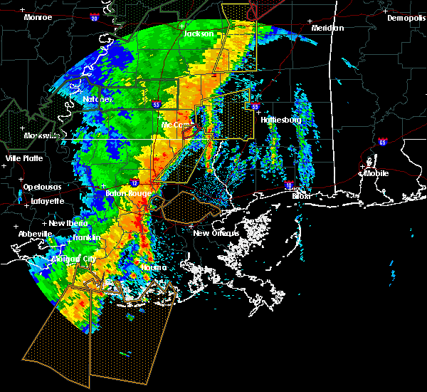 At 949 am cdt, severe thunderstorms were located along a line extending from near salem to near dexter, moving east at 45 mph (radar indicated). Hazards include 60 mph wind gusts. Expect damage to roofs, siding, and trees. severe thunderstorms will be near, holly springs around 1000 am cdt. goss and morgantown around 1005 am cdt. sandy hook, society hill and pickwick around 1010 am cdt. bunker hill around 1015 am cdt. pinebur and improve around 1020 am cdt. baxterville around 1025 am cdt. melba around 1030 am cdt. sumrall around 1035 am cdt. other locations impacted by these severe thunderstorms include bassfield and seminary. A tornado watch remains in effect until 300 pm cdt for south central and southeastern mississippi. At 949 am cdt, severe thunderstorms were located along a line extending from near salem to near dexter, moving east at 45 mph (radar indicated). Hazards include 60 mph wind gusts. Expect damage to roofs, siding, and trees. severe thunderstorms will be near, holly springs around 1000 am cdt. goss and morgantown around 1005 am cdt. sandy hook, society hill and pickwick around 1010 am cdt. bunker hill around 1015 am cdt. pinebur and improve around 1020 am cdt. baxterville around 1025 am cdt. melba around 1030 am cdt. sumrall around 1035 am cdt. other locations impacted by these severe thunderstorms include bassfield and seminary. A tornado watch remains in effect until 300 pm cdt for south central and southeastern mississippi.
|
| 4/3/2017 3:46 AM CDT |
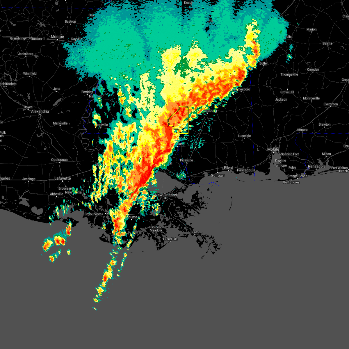 At 345 am cdt, a severe thunderstorm was located near columbia, moving east at 45 mph (radar indicated). Hazards include 60 mph wind gusts and penny size hail. Expect damage to roofs, siding, and trees. this severe storm will be near, improve around 350 am cdt. A tornado watch remains in effect until 900 am cdt for south central and southeastern mississippi. At 345 am cdt, a severe thunderstorm was located near columbia, moving east at 45 mph (radar indicated). Hazards include 60 mph wind gusts and penny size hail. Expect damage to roofs, siding, and trees. this severe storm will be near, improve around 350 am cdt. A tornado watch remains in effect until 900 am cdt for south central and southeastern mississippi.
|
| 4/3/2017 3:23 AM CDT |
 At 323 am cdt, a severe thunderstorm was located near kokomo, moving east at 45 mph (radar indicated). Hazards include 60 mph wind gusts and penny size hail. Expect damage to roofs, siding, and trees. this severe thunderstorm will be near, holly springs around 330 am cdt. morgantown around 335 am cdt. columbia and goss around 340 am cdt. bunker hill around 345 am cdt. improve around 350 am cdt. A tornado watch remains in effect until 900 am cdt for south central and southeastern mississippi. At 323 am cdt, a severe thunderstorm was located near kokomo, moving east at 45 mph (radar indicated). Hazards include 60 mph wind gusts and penny size hail. Expect damage to roofs, siding, and trees. this severe thunderstorm will be near, holly springs around 330 am cdt. morgantown around 335 am cdt. columbia and goss around 340 am cdt. bunker hill around 345 am cdt. improve around 350 am cdt. A tornado watch remains in effect until 900 am cdt for south central and southeastern mississippi.
|
| 1/21/2017 3:38 AM CST |
 At 337 am cst, severe thunderstorms were located along a line extending from near progress to holly springs to near tylertown, moving east at 45 mph (radar indicated). Hazards include 60 mph wind gusts and quarter size hail. Hail damage to vehicles is expected. expect wind damage to roofs, siding, and trees. severe thunderstorms will be near, holly springs and progress around 340 am cst. columbia, carson, goss, morgantown and society hill around 345 am cst. bunker hill around 355 am cst. sandy hook, pickwick and improve around 400 am cst. melba around 405 am cst. pinebur around 410 am cst. other locations impacted by these severe thunderstorms include bassfield. A tornado watch remains in effect until 700 am cst for south central and southeastern mississippi. At 337 am cst, severe thunderstorms were located along a line extending from near progress to holly springs to near tylertown, moving east at 45 mph (radar indicated). Hazards include 60 mph wind gusts and quarter size hail. Hail damage to vehicles is expected. expect wind damage to roofs, siding, and trees. severe thunderstorms will be near, holly springs and progress around 340 am cst. columbia, carson, goss, morgantown and society hill around 345 am cst. bunker hill around 355 am cst. sandy hook, pickwick and improve around 400 am cst. melba around 405 am cst. pinebur around 410 am cst. other locations impacted by these severe thunderstorms include bassfield. A tornado watch remains in effect until 700 am cst for south central and southeastern mississippi.
|
| 1/21/2017 2:57 AM CST |
 At 256 am cst, a severe thunderstorm capable of producing a tornado was located near sandy hook, moving northeast at 65 mph (radar indicated rotation). Hazards include tornado and quarter size hail. Flying debris will be dangerous to those caught without shelter. mobile homes will be damaged or destroyed. damage to roofs, windows, and vehicles will occur. tree damage is likely. this dangerous storm will be near, sandy hook and pickwick around 305 am cst. pinebur around 310 am cst. hattiesburg around 325 am cst. West hattiesburg, sumrall and oak grove around 330 am cst. At 256 am cst, a severe thunderstorm capable of producing a tornado was located near sandy hook, moving northeast at 65 mph (radar indicated rotation). Hazards include tornado and quarter size hail. Flying debris will be dangerous to those caught without shelter. mobile homes will be damaged or destroyed. damage to roofs, windows, and vehicles will occur. tree damage is likely. this dangerous storm will be near, sandy hook and pickwick around 305 am cst. pinebur around 310 am cst. hattiesburg around 325 am cst. West hattiesburg, sumrall and oak grove around 330 am cst.
|
| 1/2/2017 2:25 PM CST | Trees down on 10 mile creek road including one on a home. power line down as wel in marion county MS, 5.3 miles N of Foxworth, MS |
| 1/2/2017 2:25 PM CST |
 At 224 pm cst, a severe thunderstorm was located near columbia, moving northeast at 55 mph (radar indicated). Hazards include 60 mph wind gusts and quarter size hail. Hail damage to vehicles is expected. expect wind damage to roofs, siding, and trees. this severe thunderstorm will be near, bunker hill around 235 pm cst. improve around 240 pm cst. A tornado watch remains in effect until 800 pm cst for south central and southeastern mississippi. At 224 pm cst, a severe thunderstorm was located near columbia, moving northeast at 55 mph (radar indicated). Hazards include 60 mph wind gusts and quarter size hail. Hail damage to vehicles is expected. expect wind damage to roofs, siding, and trees. this severe thunderstorm will be near, bunker hill around 235 pm cst. improve around 240 pm cst. A tornado watch remains in effect until 800 pm cst for south central and southeastern mississippi.
|
| 8/6/2016 7:22 PM CDT |
 At 722 pm cdt, a severe thunderstorm was located over morgantown, or near columbia, moving south at 20 mph (radar indicated). Hazards include 60 mph wind gusts. Expect damage to roofs. siding. and trees. this severe storm will be near, columbia around 730 pm cdt. kokomo around 735 pm cdt. pickwick around 755 pm cdt. Sandy hook around 800 pm cdt. At 722 pm cdt, a severe thunderstorm was located over morgantown, or near columbia, moving south at 20 mph (radar indicated). Hazards include 60 mph wind gusts. Expect damage to roofs. siding. and trees. this severe storm will be near, columbia around 730 pm cdt. kokomo around 735 pm cdt. pickwick around 755 pm cdt. Sandy hook around 800 pm cdt.
|
| 8/6/2016 6:55 PM CDT |
 At 655 pm cdt, severe thunderstorms were located along a line extending from society hill to near topeka to near jayess, moving south at 30 mph (radar indicated). Hazards include 60 mph wind gusts. Expect damage to roofs. siding. and trees. severe thunderstorms will be near, goss around 700 pm cdt. holly springs around 705 pm cdt. morgantown around 710 pm cdt. columbia around 720 pm cdt. kokomo around 725 pm cdt. pickwick around 735 pm cdt. Sandy hook around 750 pm cdt. At 655 pm cdt, severe thunderstorms were located along a line extending from society hill to near topeka to near jayess, moving south at 30 mph (radar indicated). Hazards include 60 mph wind gusts. Expect damage to roofs. siding. and trees. severe thunderstorms will be near, goss around 700 pm cdt. holly springs around 705 pm cdt. morgantown around 710 pm cdt. columbia around 720 pm cdt. kokomo around 725 pm cdt. pickwick around 735 pm cdt. Sandy hook around 750 pm cdt.
|
| 3/17/2016 5:36 PM CDT |
 At 536 pm cdt, a severe thunderstorm was located over columbia, or 8 miles northwest of sandy hook, moving southeast at 35 mph (radar indicated). Hazards include 60 mph wind gusts and penny size hail. Expect damage to roofs. Siding and trees. At 536 pm cdt, a severe thunderstorm was located over columbia, or 8 miles northwest of sandy hook, moving southeast at 35 mph (radar indicated). Hazards include 60 mph wind gusts and penny size hail. Expect damage to roofs. Siding and trees.
|
| 3/17/2016 10:54 AM CDT |
 At 1053 am cdt, a severe thunderstorm was located near columbia, moving east at 25 mph (emergency manager). Hazards include golf ball size hail. People and animals outdoors will be injured. expect damage to roofs, siding, windows and vehicles. This severe storm will be near, pinebur around 1105 am cdt. At 1053 am cdt, a severe thunderstorm was located near columbia, moving east at 25 mph (emergency manager). Hazards include golf ball size hail. People and animals outdoors will be injured. expect damage to roofs, siding, windows and vehicles. This severe storm will be near, pinebur around 1105 am cdt.
|
| 3/17/2016 10:48 AM CDT | Tennis Ball sized hail reported 1.5 miles SW of Foxworth, MS, in foxworth |
| 3/17/2016 10:45 AM CDT |
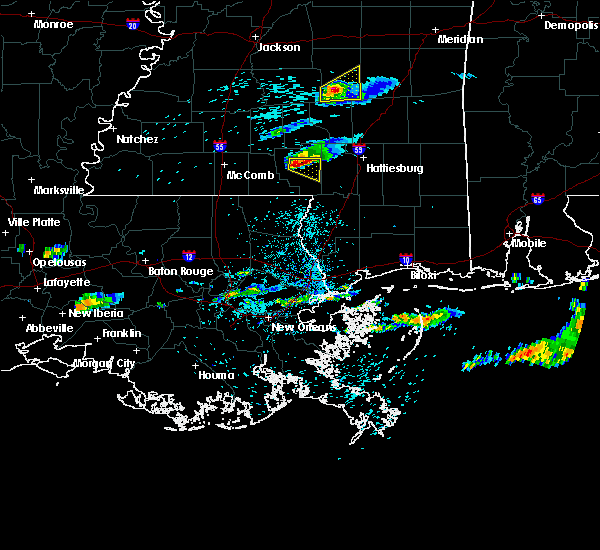 At 1045 am cdt, a severe thunderstorm was located over columbia, moving east at 25 mph (trained weather spotters). Hazards include golf ball size hail. People and animals outdoors will be injured. expect damage to roofs, siding, windows and vehicles. This severe storm will be near, pinebur around 1105 am cdt. At 1045 am cdt, a severe thunderstorm was located over columbia, moving east at 25 mph (trained weather spotters). Hazards include golf ball size hail. People and animals outdoors will be injured. expect damage to roofs, siding, windows and vehicles. This severe storm will be near, pinebur around 1105 am cdt.
|
| 3/17/2016 10:33 AM CDT |
 At 1033 am cdt, a severe thunderstorm was located over morgantown, or near columbia, moving east at 25 mph. this is a very dangerous storm (trained weather spotters). Hazards include baseball size hail. People and animals outdoors will be severely injured. expect shattered windows, extensive damage to roofs, siding and vehicles. this severe storm will be near, columbia around 1045 am cdt. Pinebur around 1110 am cdt. At 1033 am cdt, a severe thunderstorm was located over morgantown, or near columbia, moving east at 25 mph. this is a very dangerous storm (trained weather spotters). Hazards include baseball size hail. People and animals outdoors will be severely injured. expect shattered windows, extensive damage to roofs, siding and vehicles. this severe storm will be near, columbia around 1045 am cdt. Pinebur around 1110 am cdt.
|
| 3/17/2016 10:30 AM CDT | Golf Ball sized hail reported 5.5 miles SSE of Foxworth, MS |
| 3/17/2016 10:10 AM CDT |
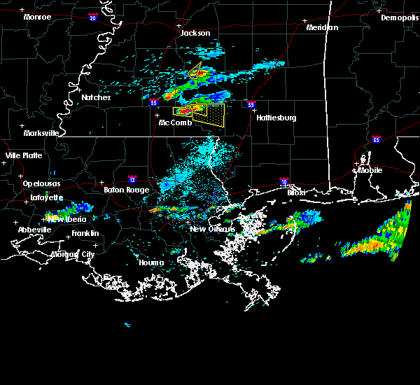 At 1010 am cdt, a severe thunderstorm was located near holly springs, or 8 miles northwest of kokomo, moving east at 25 mph (radar indicated). Hazards include golf ball size hail. People and animals outdoors will be injured. expect damage to roofs, siding, windows and vehicles. this severe thunderstorm will be near, kokomo and holly springs around 1020 am cdt. morgantown around 1030 am cdt. goss around 1035 am cdt. columbia and bunker hill around 1045 am cdt. Improve around 1100 am cdt. At 1010 am cdt, a severe thunderstorm was located near holly springs, or 8 miles northwest of kokomo, moving east at 25 mph (radar indicated). Hazards include golf ball size hail. People and animals outdoors will be injured. expect damage to roofs, siding, windows and vehicles. this severe thunderstorm will be near, kokomo and holly springs around 1020 am cdt. morgantown around 1030 am cdt. goss around 1035 am cdt. columbia and bunker hill around 1045 am cdt. Improve around 1100 am cdt.
|
| 2/23/2016 2:04 PM CST |
 At 204 pm cst, a severe thunderstorm was located near baxterville, or 15 miles southwest of west hattiesburg, moving north at 50 mph (radar indicated). Hazards include 60 mph wind gusts. Expect damage to roofs. siding and trees. this severe storm will be near, hattiesburg around 215 pm cst. west hattiesburg and oak grove around 220 pm cst. Sumrall around 225 pm cst. At 204 pm cst, a severe thunderstorm was located near baxterville, or 15 miles southwest of west hattiesburg, moving north at 50 mph (radar indicated). Hazards include 60 mph wind gusts. Expect damage to roofs. siding and trees. this severe storm will be near, hattiesburg around 215 pm cst. west hattiesburg and oak grove around 220 pm cst. Sumrall around 225 pm cst.
|
| 2/23/2016 1:49 PM CST |
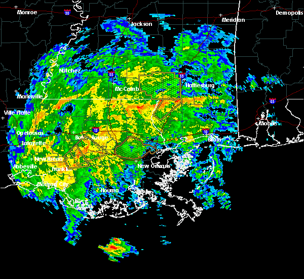 At 148 pm cst, a severe thunderstorm was located 8 miles south of baxterville, or 9 miles north of poplarville, moving northeast at 40 mph (radar indicated). Hazards include 60 mph wind gusts. Expect damage to roofs. siding and trees. this severe thunderstorm will be near, lumberton and baxterville around 200 pm cst. purvis and pine ridge around 215 pm cst. hattiesburg and oak grove around 225 pm cst. West hattiesburg around 230 pm cst. At 148 pm cst, a severe thunderstorm was located 8 miles south of baxterville, or 9 miles north of poplarville, moving northeast at 40 mph (radar indicated). Hazards include 60 mph wind gusts. Expect damage to roofs. siding and trees. this severe thunderstorm will be near, lumberton and baxterville around 200 pm cst. purvis and pine ridge around 215 pm cst. hattiesburg and oak grove around 225 pm cst. West hattiesburg around 230 pm cst.
|
| 2/15/2016 1:47 PM CST |
 At 147 pm cst, a severe thunderstorm capable of producing a tornado was located near pinebur, or 8 miles north of sandy hook, moving east at 45 mph (radar indicated rotation). Hazards include tornado. Flying debris will be dangerous to those caught without shelter. mobile homes will be damaged or destroyed. damage to roofs, windows and vehicles will occur. tree damage is likely. This tornadic thunderstorm will remain over mainly rural areas of southeastern marion county. At 147 pm cst, a severe thunderstorm capable of producing a tornado was located near pinebur, or 8 miles north of sandy hook, moving east at 45 mph (radar indicated rotation). Hazards include tornado. Flying debris will be dangerous to those caught without shelter. mobile homes will be damaged or destroyed. damage to roofs, windows and vehicles will occur. tree damage is likely. This tornadic thunderstorm will remain over mainly rural areas of southeastern marion county.
|
| 2/15/2016 1:25 PM CST |
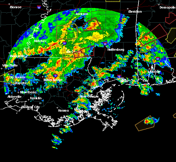 At 125 pm cst, a severe thunderstorm capable of producing a tornado was located near dexter, or 7 miles south of kokomo, moving east at 45 mph (radar indicated rotation). Hazards include tornado. Flying debris will be dangerous to those caught without shelter. mobile homes will be damaged or destroyed. damage to roofs, windows and vehicles will occur. tree damage is likely. this dangerous storm will be near, kokomo around 130 pm cst. pickwick around 140 pm cst. columbia around 145 pm cst. Pinebur around 155 pm cst. At 125 pm cst, a severe thunderstorm capable of producing a tornado was located near dexter, or 7 miles south of kokomo, moving east at 45 mph (radar indicated rotation). Hazards include tornado. Flying debris will be dangerous to those caught without shelter. mobile homes will be damaged or destroyed. damage to roofs, windows and vehicles will occur. tree damage is likely. this dangerous storm will be near, kokomo around 130 pm cst. pickwick around 140 pm cst. columbia around 145 pm cst. Pinebur around 155 pm cst.
|
| 1/21/2016 6:28 PM CST | At 628 pm cst, a severe thunderstorm was located over columbia, moving northeast at 25 mph (radar indicated). Hazards include 60 mph wind gusts and quarter size hail. Hail damage to vehicles is expected. expect wind damage to roofs, siding and trees. this severe thunderstorm will be near, bunker hill around 640 pm cst. improve around 650 pm cst. A tornado watch remains in effect until 1000 pm cst for southeastern mississippi. |
| 12/28/2015 4:32 AM CST |
 At 432 am cst, a severe thunderstorm was located near tylertown, or near kokomo, moving north at 60 mph (radar indicated). Hazards include 60 mph wind gusts. Expect damage to roofs. siding and trees. this severe thunderstorm will be near, holly springs around 445 am cst. morgantown and goss around 450 am cst. oak vale, tilton and society hill around 455 am cst. arm around 500 am cst. progress and carson around 505 am cst. prentiss around 510 am cst. clem around 515 am cst. other locations impacted by this severe thunderstorm include bassfield, silver creek and new hebron. A tornado watch remains in effect until 800 am cst for southeastern mississippi. At 432 am cst, a severe thunderstorm was located near tylertown, or near kokomo, moving north at 60 mph (radar indicated). Hazards include 60 mph wind gusts. Expect damage to roofs. siding and trees. this severe thunderstorm will be near, holly springs around 445 am cst. morgantown and goss around 450 am cst. oak vale, tilton and society hill around 455 am cst. arm around 500 am cst. progress and carson around 505 am cst. prentiss around 510 am cst. clem around 515 am cst. other locations impacted by this severe thunderstorm include bassfield, silver creek and new hebron. A tornado watch remains in effect until 800 am cst for southeastern mississippi.
|
| 10/31/2015 3:37 PM CDT |
 At 309 pm cdt, severe thunderstorms were located along a line extending from society hill to near kokomo to 6 miles south of tylertown, moving east at 20 mph (radar indicated). Hazards include 60 mph wind gusts. Expect damage to roofs. siding and trees. severe thunderstorms will be near, holly springs and goss around 315 pm cdt. bunker hill and morgantown around 325 pm cdt. columbia around 330 pm cdt. sandy hook, pickwick and improve around 400 pm cdt. pinebur around 425 pm cdt. A tornado watch remains in effect until 700 pm cdt for southeastern mississippi. At 309 pm cdt, severe thunderstorms were located along a line extending from society hill to near kokomo to 6 miles south of tylertown, moving east at 20 mph (radar indicated). Hazards include 60 mph wind gusts. Expect damage to roofs. siding and trees. severe thunderstorms will be near, holly springs and goss around 315 pm cdt. bunker hill and morgantown around 325 pm cdt. columbia around 330 pm cdt. sandy hook, pickwick and improve around 400 pm cdt. pinebur around 425 pm cdt. A tornado watch remains in effect until 700 pm cdt for southeastern mississippi.
|
| 10/31/2015 3:35 PM CDT |
 At 335 pm cdt, a severe thunderstorm capable of producing a tornado was located north of columbia, moving northeast at 35 mph (radar indicated rotation). Hazards include tornado. Flying debris will be dangerous to those caught without shelter. mobile homes will be damaged or destroyed. damage to roofs, windows and vehicles will occur. tree damage is likely. this dangerous storm will be near, bunker hill around 345 pm cdt. Improve around 350 pm cdt. At 335 pm cdt, a severe thunderstorm capable of producing a tornado was located north of columbia, moving northeast at 35 mph (radar indicated rotation). Hazards include tornado. Flying debris will be dangerous to those caught without shelter. mobile homes will be damaged or destroyed. damage to roofs, windows and vehicles will occur. tree damage is likely. this dangerous storm will be near, bunker hill around 345 pm cdt. Improve around 350 pm cdt.
|
| 10/31/2015 3:29 PM CDT | Multiple homes damaged and trees downed along new hope rd in marion county MS, 8.8 miles N of Foxworth, MS |
| 10/31/2015 3:12 PM CDT |
 At 311 pm cdt, a severe thunderstorm capable of producing a tornado was located over kokomo, moving northeast at 35 mph (radar indicated rotation). Hazards include tornado. Flying debris will be dangerous to those caught without shelter. mobile homes will be damaged or destroyed. damage to roofs, windows and vehicles will occur. tree damage is likely. this dangerous storm will be near, kokomo around 315 pm cdt. holly springs around 325 pm cdt. morgantown around 330 pm cdt. columbia around 335 pm cdt. goss around 340 pm cdt. bunker hill around 345 pm cdt. Improve around 350 pm cdt. At 311 pm cdt, a severe thunderstorm capable of producing a tornado was located over kokomo, moving northeast at 35 mph (radar indicated rotation). Hazards include tornado. Flying debris will be dangerous to those caught without shelter. mobile homes will be damaged or destroyed. damage to roofs, windows and vehicles will occur. tree damage is likely. this dangerous storm will be near, kokomo around 315 pm cdt. holly springs around 325 pm cdt. morgantown around 330 pm cdt. columbia around 335 pm cdt. goss around 340 pm cdt. bunker hill around 345 pm cdt. Improve around 350 pm cdt.
|
| 10/31/2015 3:10 PM CDT |
 At 309 pm cdt, severe thunderstorms were located along a line extending from society hill to near kokomo to 6 miles south of tylertown, moving east at 20 mph (radar indicated). Hazards include 60 mph wind gusts. Expect damage to roofs. siding and trees. severe thunderstorms will be near, holly springs and goss around 315 pm cdt. bunker hill and morgantown around 325 pm cdt. columbia around 330 pm cdt. sandy hook, pickwick and improve around 400 pm cdt. pinebur around 425 pm cdt. A tornado watch remains in effect until 700 pm cdt for southeastern mississippi. At 309 pm cdt, severe thunderstorms were located along a line extending from society hill to near kokomo to 6 miles south of tylertown, moving east at 20 mph (radar indicated). Hazards include 60 mph wind gusts. Expect damage to roofs. siding and trees. severe thunderstorms will be near, holly springs and goss around 315 pm cdt. bunker hill and morgantown around 325 pm cdt. columbia around 330 pm cdt. sandy hook, pickwick and improve around 400 pm cdt. pinebur around 425 pm cdt. A tornado watch remains in effect until 700 pm cdt for southeastern mississippi.
|
| 8/10/2015 6:49 PM CDT |
 At 649 pm cdt, a severe thunderstorm was located over oak vale, or 14 miles northwest of columbia, moving southeast at 30 mph (radar indicated). Hazards include 60 mph wind gusts. Expect damage to roofs. siding and trees. this severe thunderstorm will be near, holly springs around 700 pm cdt. goss, bunker hill and morgantown around 705 pm cdt. Columbia and improve around 720 pm cdt. At 649 pm cdt, a severe thunderstorm was located over oak vale, or 14 miles northwest of columbia, moving southeast at 30 mph (radar indicated). Hazards include 60 mph wind gusts. Expect damage to roofs. siding and trees. this severe thunderstorm will be near, holly springs around 700 pm cdt. goss, bunker hill and morgantown around 705 pm cdt. Columbia and improve around 720 pm cdt.
|
| 7/30/2015 1:31 PM CDT |
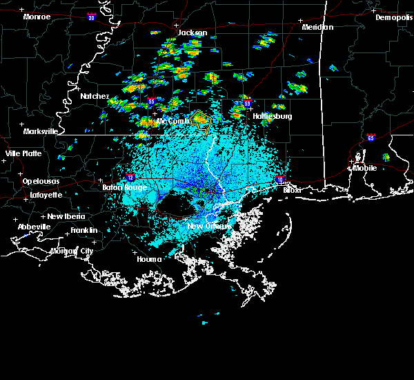 At 131 pm cdt, a severe thunderstorm was located near pickwick, or near columbia, moving southwest at 20 mph (radar indicated). Hazards include 60 mph wind gusts and quarter size hail. Hail damage to vehicles is expected. expect wind damage to roofs, siding and trees. This severe thunderstorm will be near, kokomo around 140 pm cdt. At 131 pm cdt, a severe thunderstorm was located near pickwick, or near columbia, moving southwest at 20 mph (radar indicated). Hazards include 60 mph wind gusts and quarter size hail. Hail damage to vehicles is expected. expect wind damage to roofs, siding and trees. This severe thunderstorm will be near, kokomo around 140 pm cdt.
|
| 7/5/2015 1:57 PM CDT |
 At 156 pm cdt, severe thunderstorms were located along a line extending from near mclaurin to near kokomo, moving east at 25 mph (radar indicated). Hazards include 60 mph wind gusts and quarter size hail. Hail damage to vehicles is expected. Expect wind damage to roofs, siding and trees. At 156 pm cdt, severe thunderstorms were located along a line extending from near mclaurin to near kokomo, moving east at 25 mph (radar indicated). Hazards include 60 mph wind gusts and quarter size hail. Hail damage to vehicles is expected. Expect wind damage to roofs, siding and trees.
|
| 7/5/2015 1:42 PM CDT |
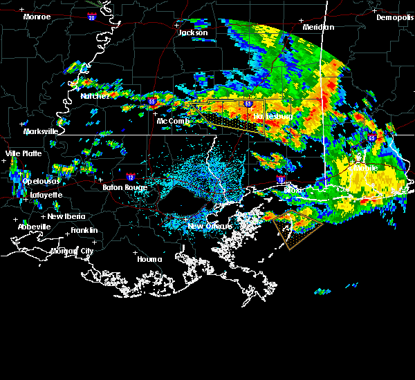 At 141 pm cdt, severe thunderstorms were located along a line extending from near columbia to mclaurin, moving southeast at 30 mph (radar indicated). Hazards include 60 mph wind gusts and quarter size hail. Hail damage to vehicles is expected. expect wind damage to roofs, siding and trees. Locations impacted include, hattiesburg, petal, columbia, west hattiesburg, purvis, brooklyn, sunrise, rock hill, morgantown, pinebur, mclaurin, improve and rawls springs. At 141 pm cdt, severe thunderstorms were located along a line extending from near columbia to mclaurin, moving southeast at 30 mph (radar indicated). Hazards include 60 mph wind gusts and quarter size hail. Hail damage to vehicles is expected. expect wind damage to roofs, siding and trees. Locations impacted include, hattiesburg, petal, columbia, west hattiesburg, purvis, brooklyn, sunrise, rock hill, morgantown, pinebur, mclaurin, improve and rawls springs.
|
| 7/5/2015 1:22 PM CDT |
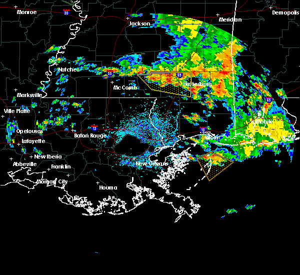 At 122 pm cdt, severe thunderstorms were located along a line extending from near improve to near petal, moving east at 30 mph (radar indicated). Hazards include 60 mph wind gusts and quarter size hail. Hail damage to vehicles is expected. Expect wind damage to roofs, siding and trees. At 122 pm cdt, severe thunderstorms were located along a line extending from near improve to near petal, moving east at 30 mph (radar indicated). Hazards include 60 mph wind gusts and quarter size hail. Hail damage to vehicles is expected. Expect wind damage to roofs, siding and trees.
|
| 5/27/2015 12:48 PM CDT | At 1247 pm cdt, a severe thunderstorm was located over robinwood, or 22 miles east of brookhaven. another severe storm was located just south of jayess. both storms were moving northeast at 25 mph (radar indicated). Hazards include 60 mph wind gusts. Expect damage to roofs. siding and trees. Locations impacted include, kokomo, holly springs, monticello, prentiss, wanilla, jayess, arm, goss, progress, topeka, society hill, oak vale, robinwood, morgantown, tilton and silver creek. |
| 5/27/2015 12:26 PM CDT | At 1225 pm cdt, a cluster of severe thunderstorms was located near jayess, or 12 miles northwest of kokomo, moving northeast at 25 mph (radar indicated). Hazards include 60 mph wind gusts. Expect damage to roofs. siding and trees. this severe thunderstorm will be near, topeka around 1235 pm cdt. Tilton around 1245 pm cdt. |
| 3/18/2013 9:20 PM CDT | Golf Ball sized hail reported 5.2 miles NNE of Foxworth, MS, reported via facebook |
| 3/18/2013 9:20 PM CDT | Quarter sized hail reported 1.2 miles N of Foxworth, MS, pea to quarter size hail near foxworth off of stringer-bullock rd |
| 12/10/2012 8:25 AM CST | The roof of a house was damaged near pounds rd and pickwick rd. possible tornad in marion county MS, 6.7 miles N of Foxworth, MS |
| 12/10/2012 8:25 AM CST | Trees downed along pounds road in marion county MS, 6.7 miles N of Foxworth, MS |
| 6/11/2012 10:55 PM CDT | Power lines were downed at ms highway 35 and old jamestown road near foxworth in marion county MS, 2.9 miles NNW of Foxworth, MS |
| 1/1/0001 12:00 AM | Trees down around kokom in marion county MS, 7.5 miles ENE of Foxworth, MS |
| 1/1/0001 12:00 AM | Large tree down blocking hwy 3 in marion county MS, 1.3 miles WNW of Foxworth, MS |
| 1/1/0001 12:00 AM | Large tree down blocking hwy 35. this tree also landed on a car...no injurie in marion county MS, 1.3 miles WNW of Foxworth, MS |
Hail Maps for Foxworth, MS


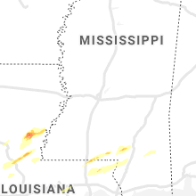


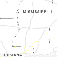


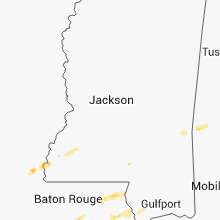


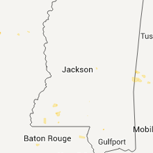

Connect with Interactive Hail Maps